Tag Archives: Toronto

Ontario Place

July 15, 2018

Ontario Place was a jewel on the Toronto waterfront for 40 years before declining attendance caused the government to shut it down in October 2011 for the last time.  Plans were immediately announced that major renovations were planned and the park would re-open in time for Canada 150 in July 2017.  This didn’t happen and a change of provincial governments threatens to derail the project further.  I decided to take a walk around the park and see what is going on these days.

IMG_5271

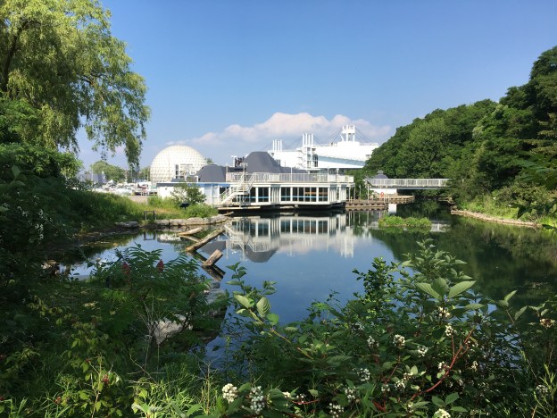
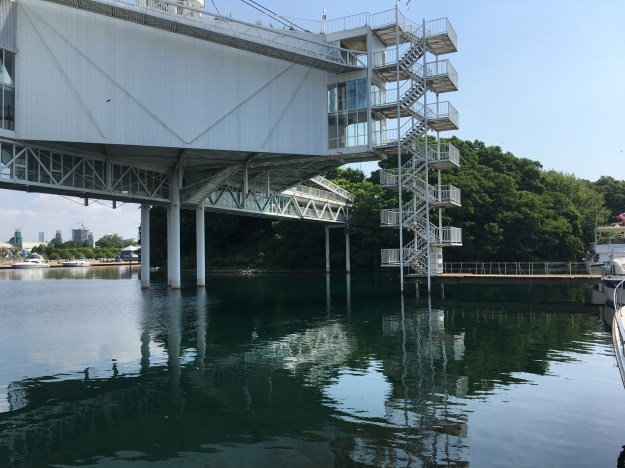
Ontario Place was designed by Toronto architect Eberhard Zeidler.  A large part of the concept for Ontario Place came from the idea to have large display pods built over the water.  The idea likely was inspired by Expo 67 where Pods were built over the Saint Lawrence River in Montreal.  Three artificial islands were created in the harbour that are connected to the mainland by three bridges.  The central bridge connects to the set of pods which make up the middle island.  The five elevated pods are interconnected as they stand above Lake Ontario.  Each pod is a three story structure that encloses 743 square metres of space.  Originally used for multimedia exhibitions, they were intended to be flexible and accommodate other uses over the years.

IMG_5275

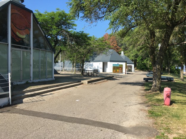
This is the seventh season that Ontario Place has been largely abandoned although it does appear to be open as I was not challenged by the staff I passed on the bridge.  The entire time that I spent walking through the park I met less than twenty other people.  It truly felt like walking through a ghost town.

IMG_5278

In the 1980’s over 3 million people per year visited the park but by 2010 the number was down to only 10% of that.  The log flume on the west island was always sure to soak the riders, a welcome treat on a hot day.

IMG_5286

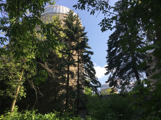
The park was in a continual state of development with new attractions being added as the years went by.  The original pods were not the raving success that was envisioned but the idea of showcasing the northern part of the province was seen as a way of potentially attracting professionals to relocate north where there was a shortage of people.  In 1980 silos were constructed that resemble farm silos that stand across rural Ontario.  The wildlife displays didn’t do as well as expected and the silos were eventually converted into additional rides.

IMG_5290

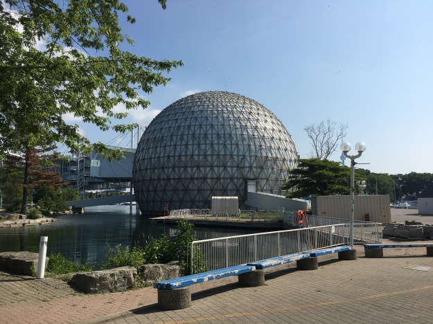
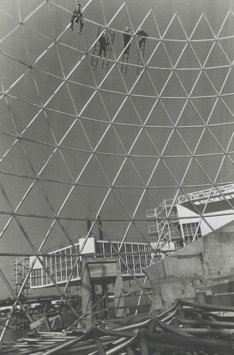
The Cinesphere showcased the world’s first permanent IMAX projector on a screen that was 24 metres wide and 18 metres high.  The dome is 35 metres wide and when it opened in 1971 it became the icon of Ontario Place.  It was so successful that there was a regular line-up to get in.  On a school trip we saw a movie called Snow Day in which it felt like we were in a school bus running out of control on snowy roads.  A good choice for kids who had arrived via school bus.  Cinesphere was closed in 2012 along with the rest of the park but in 2014 the dome was given a cultural heritage designation.  As of 2017 the theater is open again on a full time basis with state of the art equipment.

IMG_5299

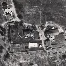
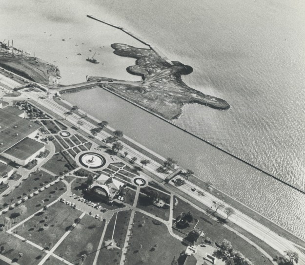
March of 1969 saw the first activity in the building of Ontario Place and it opened just over two years later on May 22, 1971.  Construction of the Cinesphere and the pods is seen in this 1970 photograph from the Toronto Archives.

20120201constructionview

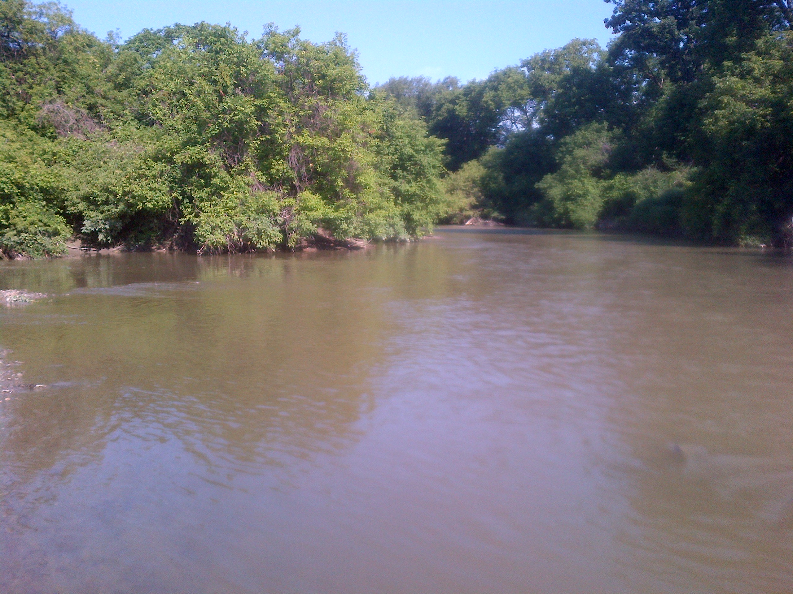
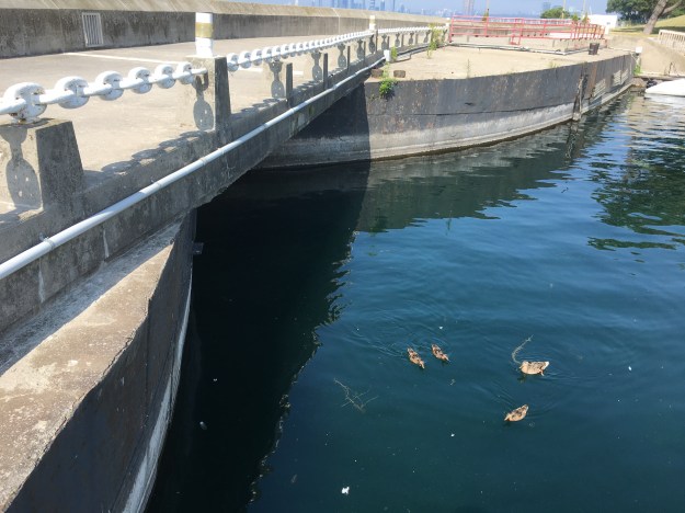
The design called for display pods suspended over the water to display the scientific and technological wonders of Ontario.  Constructing the pods over open water became an engineering problem and the costs mounted to the point of consuming the budget.  To reduce the costs a protective break wall was designed using three obsolete lake freighters.  They were sunk and filled with concrete to create a safe harbour for a marina.  The ships can be walked out to the end where one of the bridges is open for exploration.  The three ships anchors are also preserved on the third ship.  The picture below shows the outline of two of the ships where they meet.

IMG_5302

The 1970 photo below shows the three ships, reported to be the The Shaw, The Houghton and The Victorious in their positions with the west island being formed out of lake fill.

Ships

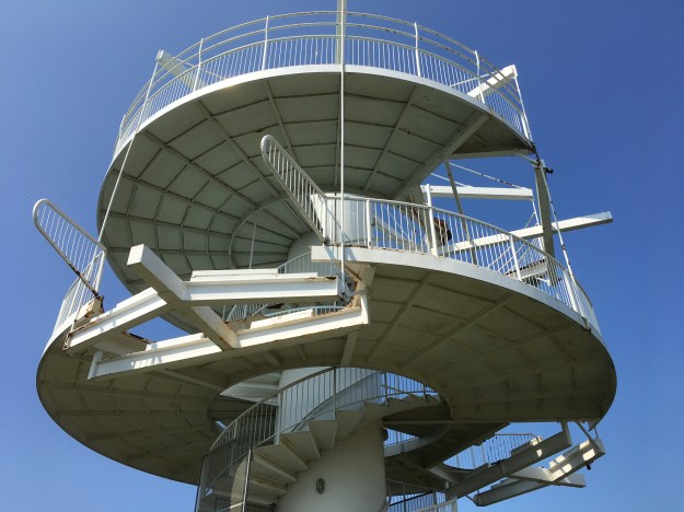
The pods are now underutilized and the iconic sets of stairs on the outside are peeling and no longer ring with the sounds of crowds filled with laughter.

IMG_5321

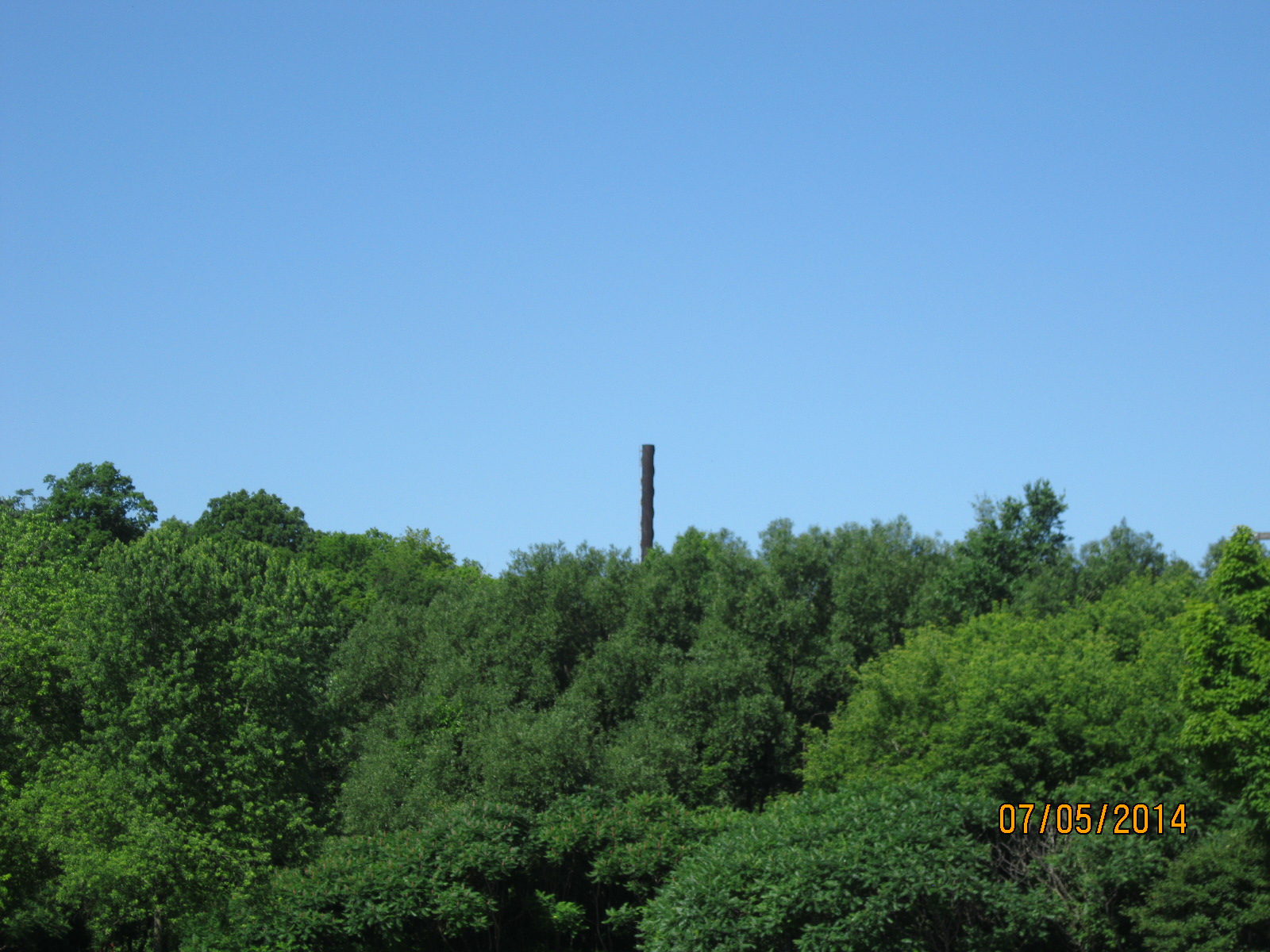
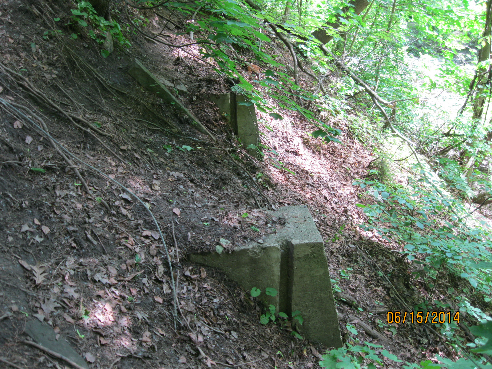
The water park covered much of the east island and went under the name Soak City.  A series of coloured water slides was installed in the 1990’s and was a popular attraction until the park closed.  The slides remained in place until May of 2016 when they were disassembled to prevent a potential injury to people who insisted on climbing up and even rollerblading down them.  Today the central support tower is all that’s left except for a few abutments to mark the site of the water park.

IMG_5341

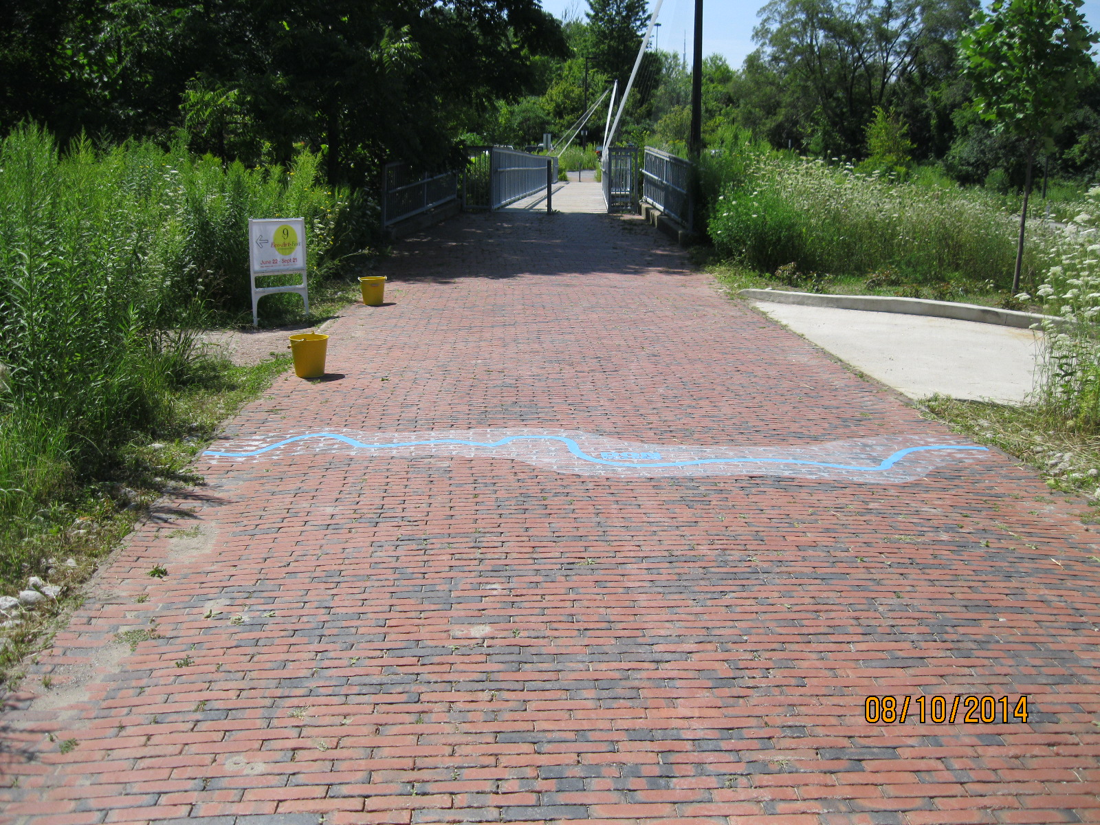
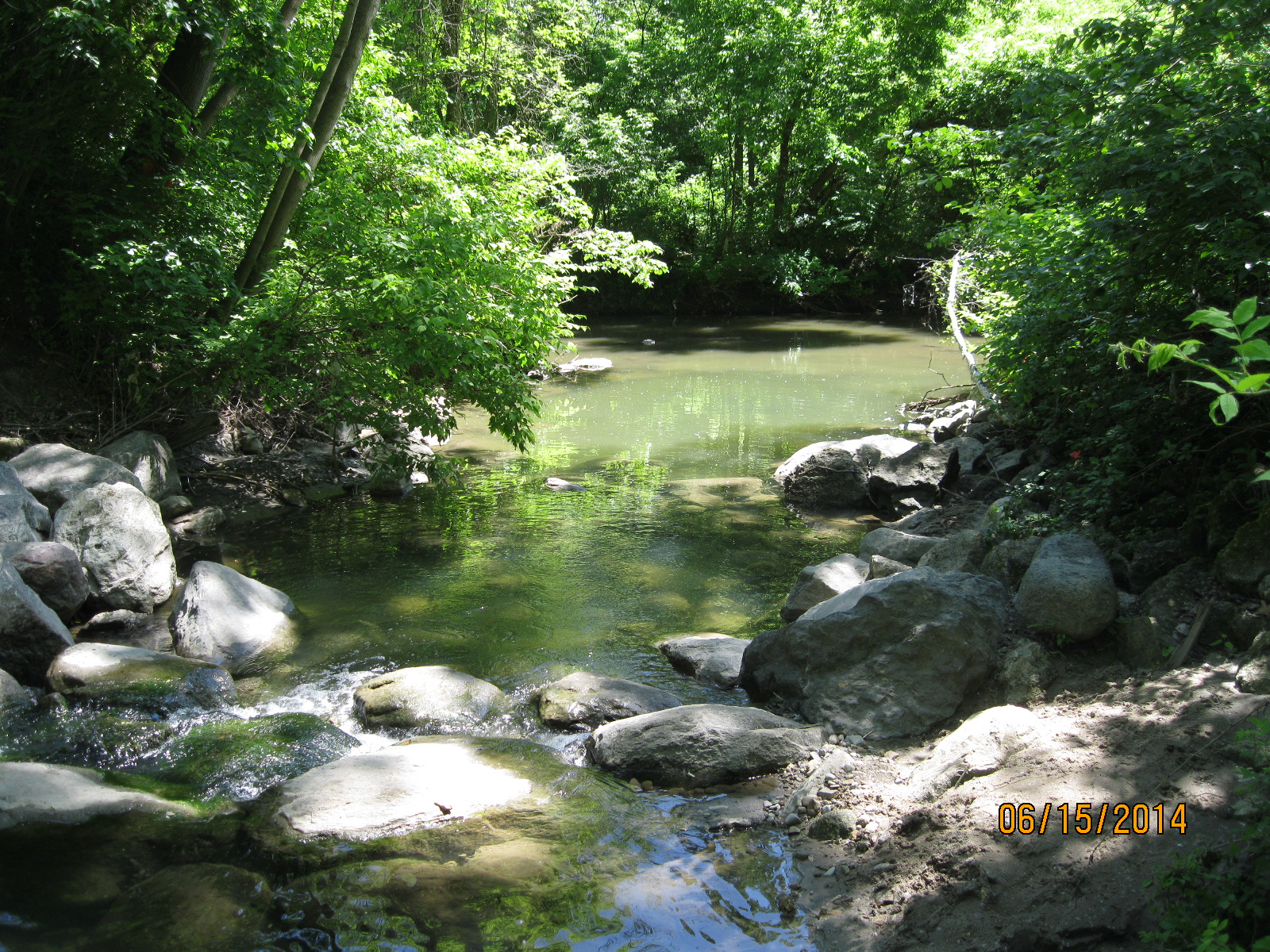
Trillium Park, containing the William G.  Davis Trail is the first part of Ontario Place to get a completely new lease on life.  This area was formerly a 7.5 acre parking lot.  Today it has been converted into a lush green space with a 1.3 kilometre trail named after Bill Davis who was premier in Ontario in 1971 when Ontario Place first opened.  The trail passes through an artificial ravine and contains the Moccasin Marker.  The carvings on either side of the ravine are intended to remind us of those who were here before us.

IMG_5350

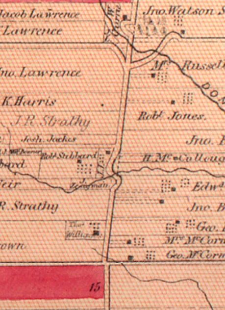
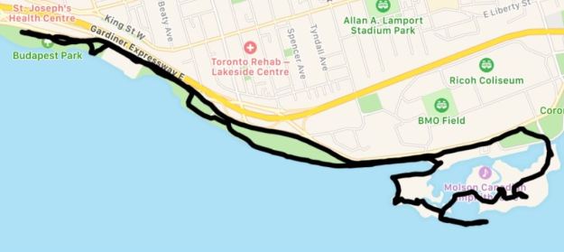
I picked a good time to visit as the Indy was on and parts of Lakeshore Avenue were closed for the race.  I decided to park at Budapest Park and walk part of the Martin Goodman Trail to reach Ontario Place.  I used the Bruce Trail App to track my walk which came out to 10.4 kilometres.  By parking at Ontario Place you can explore the area with three or four kilometres worth of walking.   Be sure to make the walk along along the three sunken ships that is represented by the tail extending out into the lake on the map below.

Ontario Place

Having visited the park in 1972 or 1973 with my aunt and uncle, both of whom have passed on, I have fond memories of an Ontario Place that was vibrant and full of people.  It’s sad to see what has become of our waterfront park especially when there is no clear timeline for completion of the renovations.

As a parting thought, would you have wanted this job building the Cinesphere?

Cinesphere

Google Maps Link: Ontario Place

For additional places to explore visit our recent Greatest Treks 3 post.

Like us at http://www.facebook.com/hikingthegta

Follow us at http://www.hikingthegta.com

Middle Road Bridge

Saturday August 16, 2014

It was 15 degrees and perfect for a hike.  We parked on 43rd street beside the Etobicoke creek.  43rd Street is only a short stub north of Lakeshore today.  In 1954 it extended to the lake and, along with Island rd., contained houses on both sides of the creek near the lake.  A trailer park existed at the time on the west bank of the river between Lakeshore Road and the railroad tracks.  Seven people were killed and numerous houses washed into lake in October 1954 when hurricane Hazel hit Toronto.

Visible from Lakeshore are a triple set of tracks, now used by GO Transit as well as many CN freight trains.  When the Grand Trunk Railroad (GT) was built in the 1850’s it was two tracks wide.  The bridge in the photo below was built in 1856.  When the GT was incorporated into the Canadian National (CN) in 1923 a third track was added.  In the photo below the older track is sitting on the large cut stone blocks while the newer addition on the left is constructed on poured concrete which had become popular around 1900.

IMG_2913

Coca Cola was invented in 1886 in Atlanta by a pharmacist, Dr. John Pemberton. Originally it was sold as a syrup that was mixed in the pharmacy and sold at the counter by the glass.  in 1915 the distinctive “hobble-skirt” bottle was created.  Selling for 5 cents it contained a 6 oz serving.  Pepsi was created in 1893 and stole a share of the market by selling 12 oz bottles also for 5 cents.  The coke bottle below was made in 1959.

IMG_3011

A brickyard was opened in Port Credit in 1891 on the west side of the Credit River.  The business expanded and soon a scarcity of labour resulted in the use of immigrants to work in the brick yard.  Bunk houses were built to provide homes for the workers.  By the 1920’s the business was operating at a loss and it was closed down.  That means that the brick in the picture below is likely over 100 years old.

IMG_2916

The brick yards as they looked in 1907.

Brickyards

When hiking in the woods in August it is necessary to carry a small stick in front of your face to keep from eating spider webs.  The Cross Orbweaver is one of the more common ones, although it is not native to North America.  Females wrap their eggs in a protective sac of silk.  There are between 100 and 800 eggs in a single egg sac.  We found an egg sac that had just hatched.  The picture below shows a “daddy-long-legs” spider which has been captured and left for food for the little babies.  Note the tiny dots below the egg sac which are the emerging young.

IMG_2944

Just north of the tracks is the first old dam on the creek.  This dam has retaining walls which extend all the way to the edge of the ravine on both sides of the creek.  This is a good example of an old dam as you can clearly see the slots in the river bottom to hold the boards that would retain the water for the mill pond.

IMG_2926

Delco radios are standard on GM products.  In the 1960’s it was common to have only an AM radio in your new vehicle.  FM radio, CD players and MP3 inputs were all many years in the future.  We found an old AM radio with 5 preset channel function.  Having 5 preset stations was a luxury at the time as you didn’t have to try to tune the dial while driving (let alone dial your cell phone).

IMG_2958

The Etobicoke creek was calm and clear.  The west bank of the creek is a shale cliff which is slowly being eroded away from below.  Shale is formed from fine particles of sand that is deposited in slow moving water.

IMG_2961

The second dam across the Etobicoke creek.  Unfortunately, I haven’t found much information about the early miller families on the creek.

IMG_2971

Today was a day for hot water tanks.  We found two of them along the way.  One would wonder why someone would carry one of these out here to dispose of it.  Most likely these are remnants of the mess left when Hurricane Hazel ripped homes apart and washed them away.

IMG_2984

Along the way we noticed that there was a white line on the pathway.  Walking trails normally don’t have divider lines and so we suspected that this may have been used as a road at one time.  A few minutes later the roadway was lined with the remnants of a old parking lot on either side of the road.

IMG_2992

A couple of minutes later we saw the arch of an old bridge poking through the trees.  It turns out that this is called Middle Road Bridge and it was built in 1909.  It stands on the foundations of an older bridge.  Originally designed to carry people and horses it quickly became too small in the days of the automobile as it was 1 lane only.  It is the first example in Canada and only the second in North America of a reinforced concrete arch bridge.  The Middle Road was a major connection between York and Peel counties. Middle Road got it’s name from the fact that it ran in the middle between Lakeshore Blvd and Dundas Street. Prior to the Queen Elizabeth Way being completed in the late 1930’s this was a major 4 lane road running as far as Hamilton.  The portion of the old road which we had seen south of the bridge has been re-named Sherway Drive but it appears to be suffering from neglect as well.  The bridge is protected by two historical societies.  One end by Toronto and the other by Mississauga.  The cover photo shows the bridge from the western elevation.

IMG_2994

Like us at http://www.facebook.com/hikingthegta

Follow us at http://www.hikingthegta.com


Todmorden Mills

Sunday August 10, 2014

It was sunny and warm, a beautiful day for a hike.  I parked at the top end of Pottery Road in the Loblaws parking lot.  I also hiked along the old abandoned roadway of Pottery Road but that will have to be described separately due to length.

When Governor Simcoe arrived in 1793 to build his town of York (Toronto) he needed a large supply of sawn lumber.  The only other mill at the time was the King’s Mill (now Old Mill) on the Humber River.  As it was a government run mill it was unreliable and went through many changes of millers due to crazy rules that made it impossible to recoup your investment.  Simcoe brought Isaiah and Aaron Skinner in and granted them 200 acres of land in the Don River valley.  They built a sawmill in 1794 and a grist mill in 1795.  The Skinners sold the mills to Parshall Terry in 1798 and when he drowned in 1808 the mills passed to Timothy Skinner who ran them until he was killed in the war of 1812.

Terry built the older portion of the Terry House, that part at the back which was made of logs.  The front part with the two chimneys was a later addition.  Taxes were levied on the number of chimneys you had, so having three fireplaces was a luxury.

IMG_2838

This picture shows the back end of the paper mill.  The mill race ran down the left side of the mill and this is where the mill wheel would have been.  The tall chimney was added about 1900.  In the cover photo the chimney is contrasted with the urban towers of Toronto in the distance.

IMG_2817

In 1822 Colin Skinner came into a partnership with the idea of chasing a bounty for being the first paper mill in Upper Canada.  They didn’t win the bounty but did become the first mill to install paper making machinery.  Eventually the paper mills spread into three locations and became a major industry in early Toronto.  When the mills closed down they were used for awhile to stable the horses from the brick works.  Later they were the home of Whitewood’s Riding Stable.  The word “White” remains on the side of the old mill.  Also, note the old mill stone mounted on the lawn just outside the door.

IMG_2844

When the Don Valley parkway was built the Don River was re-routed so that the large curve that used to pass through Todmorden and power the mills was cut off by the berm of the highway.  The river was straightened to run along side the railway line.  The part that used to flow under the bridge still has water in it and backs up from the river down stream when there is flooding, providing some flood control.  The picture below is taken from the bridge looking east.

IMG_2829

In 1821 the mills were sold to Thomas Helliwell Sr. and John Eastwood.  Helliwell Sr. came from Todmorden in England and it is because of him that the name of Don Mills was changed to Todmorden Mills.  One of the first things Helliwell did was erect this building as the brewery and distillery.

IMG_2833

Thomas Helliwell Jr. built this house in 1837 out of bricks made from clay he dug out of the hillside behind the house.  The bricks were not baked but only sun dried and so they would crumble easily.  For this reason a protective coating of stucco was applied.

IMG_2840

The portion of the house at the rear has the notable characteristic of no windows breaking the roof line that suggests it was originally a log home.  The two story brick and stucco addition on the front was likely framed and then veneered with bricks and stucco.

IMG_2839

The old flag pole still stands on the front lawn of the Terry House.  Note the wooden cradle mount at the bottom of the pole.

IMG_2841

When Thomas Taylor died in 1880 the mills were handed over to George Taylor’s son’s who added the Don Valley Pressed Brickworks to their empire in 1891 just across the river from Todmorden.  The Don Valley Brickworks produced many of the bricks for the construction of Late Victorian Toronto.  Broken or defective bricks were dumped in the valley all around Todmorden.  The road leading to the bridge over the former Don River is made of bricks but is itself built on several feel of broken bricks.  The blue line on the bricks in the picture below shows the one time bank of the don River.

IMG_2830

A little up stream is old Todmorden dam.  This is a very quiet place to just sit and contemplate the people who made this city out of the woods around them.

IMG_2812

The Don Station was built by the Canadian Pacific Railway in 1896 near Queen Street and the Don River.  Between 1969 and 2008 it was on display at Todmorden before being moved to it’s new home in Roundhouse Park.

Google Maps Link: Todmorden Mills

Like us at http://www.facebook.com/hikingthegta

Follow us at http://www.hikingthegta.com

Claireville

Saturday Aug. 3, 2014

It was cool, at least to start with, at only 17 degrees.  We parked in the Humberwoods Community Centre and hiked north on the west side of the Humber.  Just south of Finch Avenue is a little park that has been developed as a bird flyway.  There are dozens of nests and things to attract birds and this is a great little park for bird watchers.  In the picture below are a couple of the many odd shaped nesting places that have been constructed there.

IMG_2715

The groundhog is a member of the Marmot family and is a type of ground squirrel.  They are one of the few species that enter true hibernation and they sleep until March or April. In the wild in Ontario they are always sleeping on groundhog day, and therefore, actually never see their own shadow.  After mating in the spring the pair stays together until the young are about to be born in April or May.  The male then leaves the burrow and the parenting to the female.  She gives birth to between 2 and 6 hairless blind kits. The young groundhog below was scared of us but didn’t try to run away.

IMG_2720

It was early in the morning and the dew sparkled on the spider webs.

IMG_2728

When the 427 was built plans were already in place to expand the highway by adding lanes between the North/South lanes.  As we went under the highway we could see the supports for the expansion that were built at the same time as the rest of the bridge.

IMG_2740

Claireville Dam was one of the flood control dams built in response to the damage caused by Hurricane Hazel.  in 1959 The Plan For Flood Control and Water Conservation was released.  Since 1960 over 40,000 acres of land has been acquired and 3 of the originally proposed 15 dams have been built.  Claireville dam was the first one, built in 1964.  The dam allows the Conservation Authority to collect water from heavy rains and release it slowly after the storm has passed.

IMG_2748

Indian Line started off as an Indian trail along the shore of the Humber river.  When the land survey was made it was part of the border between Peel County and York County. When hwy 427 was extended north it became part of an off and on ramp to the highway. In 1992 when the highway was further extended it was closed off and abandoned.  Parts of it now form hwy 50 north of Steeles ave.  Indian Line campground used to be accessed from just south of the river off of this road but is now accessed off of Finch Ave.  The picture below looks up the old roadway to the bridge that crosses the CN tracks.  When this bridge was built in the 1960’s this was an important road and it was made wide enough for 4 lanes to be opened one day.

IMG_2771

Claireville was a community that started in 1850 on the estate of Jean du Petit Pont de la Haye at the intersection of Steeles and Indian Line.  He named the town after his daughter Claire.  A third road ran diagonal through the property and was originally known as Claireville Road because that was the location of the toll booth along the road.  Early roads in Ontario were known for their mud (an early nick-name for Toronto was “Muddy York”) and were covered over in planks as soon as possible.  Plank roads required continuous maintenance and this was paid for through tolls collected by the road keeper. A horse and rider would pay 1/2 pence and 20 hogs or sheep cost 1/2 pence.  A wagon was 1 pence if drawn by a single horse but 1 1/2 pence if drawn by two.  When the Claireville road was planked a toll house was established.  Of all the houses which once stood in this town only a few remain.  There is a white two story house which remains and this was originally the toll house.  Since the 1950’s the town has declined and is now mainly an industrial neighbourhood.  The picture below shows the town as it was in 1947.

Claire 2

This picture has nothing to do with this hike but is a follow-up to last week’s move.  As I was cleaning the apartment I swept deep under a baseboard heater and out popped a little round black disc.  At first it didn’t look like anything but I could see that there was some writing on it.  I placed it in Coke for a few minutes to remove some of the gunge on it.  King Christian 7 ruled Denmark from 1668 to 1808.  The 1 Skilling Danske coin I found is in poor condition but still has a value of about $10.  Thank You to the previous tenant in my unit who lost this coin.  Don’t worry, it has found a good home in my collection.  It is interesting to me that Toronto was founded in 1796 at which time this coin was already 25 years old.  I find a lot of older things out hiking, but the oldest one so far was right under my heater for the past 8 years!

IMG_2714


Hinder Property

July 26, 2014

Moving day, but still time for a short hike before we have to get serious about hiking between the apartment and the truck.  It was a cooler day and overcast.  We parked in Bathurst Park on the West Don River.

We hiked south along the river into an area known as the Hinder Property.  An extensive mountain bike trail runs through the area making use of fallen trees and boardwalks.

IMG_2677

As we hiked along the side of the Don river we found this sewer cover which commemorates a point in history for the City of North York.  The Township of North York (NYT on this cover) was incorporated on June 13, 1922 out of the rural northern parts of York County.  It became the Borough of North York in 1967 meaning that there are not too many covers made after this one that would say NYT.  North York was incorporated as a city on Valentines day 1979, leading to it’s solgan “City with a Heart”.

IMG_2681

Near this we found another cover that was nearly buried in leaves and soil.  This one is unlike any I’ve ever seen before.

IMG_2685

As mentioned in an earlier post, the province of Ontario was well known for it’s brick buildings.  Some bricks are made with three round holes that reduce the amount of clay required and improve the speed of drying.  A lot of early brick buildings are originally wooden buildings that have been veneered in brick.  The holes are then used to tie the brick skin to the building using metal straps.  This brick is unique in it’s patterned holes.

IMG_2688

Pop began to be sold in cans in the 1930’s.  The can went through several changes, an early significant one being the inclusion of a liner to protect the contents from tasting like the can.  Originally a can opener was required to pierce a hole in the top.  In 1959 the invention of a pull tab eliminated the need of an opener but created a litter problem.  This was solved in the 1970’s by the push tab where a small raised blister was pushed into the can to open it.  This exposed the finger to sharp edges and was eliminated with the “sta-tab” that continues to be popular today.  7-Up was released just two weeks before the stock market crash in 1929.  There was 7 main ingredients in the original recipe, including the mood stabilizing drug lithium citrate.  Originally it was a patented medicine marketed as a cure for hang-overs.  Unlike bottles, cans were never dated and so coming up with a date can be tricky.  In this case we can define this can as 1975, the year in which the marketing slogan was “The Un-Cola.”

IMG_2694

Climbing the hill to the clearing above brought us face to face with a dragon.  This is part of a large memorial being erected in North York Cemetery.

IMG_2701

As we arrived back at the car we passed through a double row of trees that mark an old lane way.  That was our clue to head home and start hiking the lane way into the house where my wife and I were moving.

IMG_2712

Summerlea Park

Saturday July 12, 2014

It was another in a string of warm and sunny Saturdays.  It wasn’t very long before we were feeling the effects of the heat and humidity.  The Humber river has a west branch which meets up with the main river in Summerlea park.  We parked both vehicles here and took a brief excursion to the confluence of the two.  The water was high and dirty.

IMG-20140712-00244

There is a stretch of rocky shoreline here where we found two excellent examples of Crinoid fossils.  Crinoids are marine animals of which about 600 species exist today.  They have a mouth surrounded by feeding arms.  The arms have a mucous that captures food particles as they float past.  The picture below is a species that lives near Indonesia today.

Crinoids

The two crinoid examples below are the best we have seen so far.  The segments of the feeding arms have been particularily well preserved.

IMG-20140712-00240

We also found a very small piece of pottery about the right size to hold a small candle.

IMG-20140712-00238

We left one vehicle parked here and moved to the corner of Finch and Islington where we parked the other in Irene Risk Park.  We wanted to look for Rowntree Mills after which the park on the east side of the Humber, just north of here, is named.  We didn’t find the mill because we got side tracked and actually never looked for it.  Along the side of the ravine there is a deep set of woods with multiple steel artifacts.  As we wondered through here we saw deer in front of us. We followed their trail and ended up on the side of the hill again.

Dairy farmers used to sell their milk to local creameries and cheese factories.  They collected the milk in 17 gallon milk churns which were left on a platform at the end of the laneway.  In the 1930’s a smaller 10 gallon churn was introduced.  Creameries collected the milk and packaged it in glass bottles which were delivered directly to the home well into the 1950’s. With the improvement in processing and delivery of dairy products a lot of smaller dairy operations were bought out and closed.   A 1925 list of cheese factories and creameries in Canada lists 1600 in Ontario alone.  By 1998 there were only 270 in all of Canada.  We found the old milk churn in the cover photo which was imprinted with “Canada Dairy” “Oakland” “Toronto”.  In the 1925 directory Oakland Dairy Limited is listed as registration #419 at 108 Nassau Street, near Spadina and College.

IMG-20140712-00274

It seems like every week we are finding parts of old washing machines.  This is the wringer hood from a Kenmore Visi-Matic wringer washer.  Kenmore was the store brand sold by Sears.  Like the Thor and General Electric we found earlier, this one is from the 1950’s. There doesn’t appear to be a good reason for so many washing machines to be spread out along the Humber River valley.  Jim Gifford in his book “Hurricane Hazel” published a photograph of a washing machine that had been swept out of a home and deposited along the flood plain.  While that may explain the Thor machine, the GE and Kenmore were found well up the side of the ravine.

IMG-20140712-00278

This washing machine sold for $149.95 in 1954.

Fall 1954 944_96

The side of the ravines in Toronto are strewn with old bricks.  Some of them have a story to tell.  In 1913 the Ontario Government found clay and shale deposits on land it owned in Mimico and opened the Toronto Brick and Tile Company using labour from the Toronto Central Prison which had opened in 1874.  The plant could produce over 2 million bricks per year which were used on government buildings providing a cheap source of construction materials.  During WWII the site was converted into POW Camp 22 and housed German marines and U-boat men.  In 1969 it was closed after pressure from labour unions claiming the factory was taking jobs away from their members.  The Mimico brick below was either made by a prison inmate or a prisoner of war.

Toronto-20140712-00292

As we made our way south along the hillside we got boxed in between two fences.  There is a large assortment of old metal objects along here including an old bbq, an engine, old oil containers and car horn.  We also found an old bottle from the late 1860’s or 1870’s. Bottles from this era are dated by the seam on the side.  On this one the seam only extends to the bottom of the neck and the lip on the top was added later.

Toronto-20140712-00295

It looks like Rowntree Mills will have to wait for another day.


Pine Point Park

Saturday July 5, 2014

We parked in the Pine Point arena parking lot and walked down the hill to the river. During the winter months the long steep run makes this one of the best toboggan hills in the city.  It was 19 degrees and sunny when we set out.  The trail runs under the 401 into a small park that extends to the Weston Golf and Country Club.

Crawford-Jones Memorial Park is named after Jim Crawford and Herb Jones.  Jim Crawford was a police officer and Herb Jones a contractor in 1954.  On the night of Hurricane Hazel they took a small boat along the Humber River and rescued dozens of people stranded in their homes.  The picture below is taken from the park on the east side of the river looking at the stack on the steam plant on Resources Road.  There is a spiral staircase running up the outside of the tower.

IMG_2514

Along the edge of the river we saw a couple of dead Crayfish.  Crayfish are fresh water lobsters and live in places where the water does not freeze to the bottom in the winter.   They don’t tolerate polluted water which suggests that the Humber is pretty clean these days.  This was a larger specimen, about 10 cm long, but is missing one claw.

IMG_2506

Most of the parks we hike have evidence of a local coyote but we rarely see one.  Coyotes are related to the wolf and have become very successful in urban areas.  Coyotes hunt a variety of small animals and will even eat a crayfish if the opportunity presents itself.  The tracks below were found along the edge of the river.

IMG_2523

North of the 401 we followed the embankment on the side of the ravine.  This area is known as Pine Point Park.  Part way along we found a 1963 Pepsi bottle in an area where a lot of old bricks had been dumped.  Among several manufacturers we found Milton Bricks.  In 1877 when the Credit Valley Railway passed through the area of Milton they found a lot of clay and shale. Lot 1 Concession 1 of Esquesing Township belonged to Duncan Robertson and a large amount of Medina Shale was found here.  His son, David, started Milton Pressed Brick and Sewer Company.  Their bricks were pressed before baking and were a much higher quality brick than much of their competition.  By 1901 they were considered to be the best bricks available on the continent.  They employed 200 people at their peak but closed in 1974.  Ontario is unique in the large amount of it’s buildings which are made of bricks. In 1931 27% of Ontario buildings were built of brick while only 6% of Quebec buildings were and 2% or less in other provinces.  Ontario was rich in clay and had a huge export market for lumber which led to this trend in construction in the province.

IMG_2536

By the early 1900’s Milton Brick was publishing a catalog of beautiful brick fireplace designs that could be ordered.

fireplaces00miltuoft_0001


A little further along we found the half buried artifact that is in the cover photo.  We excavated enough to determine that it is an old hand crank broadcast seed spreader.  It is rusted right through and likely dates to the 1930’s.

IMG_2543

As we were starting downhill to make our way back we found and old set of wooden stairs on the side of the hill.  Beside here in the little ravine we found the wringer from an old General Electric washing machine. Edison General Electric Company was founded in 1889 by American inventor Thomas Edison.  Edison is credited with inventing the long lasting light bulb, phonographs and the motion picture camera among his 1,093 patents.  This washing machine likely dates from the 1940’s or early 1950’s.  Clothes would have been taken out of the washer and pressed between the two rollers to squeeze the water out of them.  This machine had a quick release handle, seen open on the right hand end, to let you get your hand out when it got caught in the rollers.  Earlier versions didn’t have this safety feature and were nick-named “manglers” for obvious reasons.

IMG_2556

The hillside trails are fully overgrown and its quite possible to walk within a few feet of something interesting and never see it.  The woods and fields are full of colour and purple is now prominent.  Asters, thistles, bellflowers and violets abound.

IMG_2519


Wilket Creek

Sunday June 22, 2014

It was sunny and 25 degrees, a gorgeous Sunday afternoon.  I parked on Bridle Path and entered the gardens from there. The upper part of the gardens is an arboretum full of many varieties of mature trees.  The main trail will lead you down the bluff and into the Wilket Creek valley.  Wilket Creek was known as Milne Creek for the first 150 years of settlement.  Here, the creek has been dammed to create a small mill pond as seen in the cover photo.  A miniature water wheel has been recreated below the dam. This is an example of an “overshot” wheel where the water would be dropped into the buckets from above to turn the wheel.  Inside the mill, the drive shaft that the wheel is turning provides power to turn the gears and pulleys that run the factory.

IMG_2365

Alexander Milne and his family first settled on this property in 1817.  He built a three story mill and a small community grew around it.  The mill stood on the east side of the creek an the top floor was used as a saw mill while the lower two floors were a woolen mill. The wooden wheel in the Milne mill was an overshot wheel, 18 feet in diameter.  When the water level became inconsistent at Milne Creek, the Milnes moved to their property on the West Don River at Lawrence.  Here the town of Milneford Mills was re-established.  Two building survive from this era.  One is described separately in a post called “Milneford Mills”.  The second has been moved back to Edwards Gardens.  One of the buildings in Milneford Mills was a wagon shop.  The large door on the end of the upper floor in the picture below is typical of wagon shops where painting and drying were done upstairs.  A temporary ramp would allow access to the door.

IMG_2361

When the Milnes moved the property was left to turn into a weed patch.  In 1944 Rupert E.Edwards purchased the property with the intention of making a country estate.  Very soon the city was closing in on all sides and Edwards sold everything to the city for a public gardens.

Leaving Edwards Gardens you enter Wilket Creek Park.  As I walked along the west side of the river I found that there were a lot of small rivulets that cut steep channels through the hillside.  I kept having to go back down to the river to get around the valleys.  Fortunately there are several sets of “stairs” running up the sides of the hills made of tree roots.  In the picture below the trail runs between the large trees and climbs a point of land which is over 100 feet high.  These hill sides have been kept clean by the groundskeepers, but I did find a 1976 nonreturnable Pepsi bottle.

IMG_2379

Along the way the main path follows the creek crossing it on several bridges.  Just north of the fourth bridge up from the mouth of the creek lies the ruins of an old dam.  The centre piece has been broken out.  Erosion was a constant enemy of the settlers who built dams on the rivers.  Early wooden and earth dams often had to be rebuilt or repaired every spring.  Wilket Creek is prone to flooding and the one end of this dam has been washed clean so that water now flows around it.

IMG_2374

This may have been the mill race for this dam but I suspect that it is the original creek bed and that the old mill race has been taken over by the creek.

IMG_2377

The remains of another dam stand near the first foot bridge up from the mouth of Wilket Creek at the West Don River.  This one, like many others, was likely destroyed by the conservation authority as part of flood control measures implemented after Hurricane Hazel.  It has been difficult to find any information on these other millers in the Wilket Creek watershed.

IMG_2405

At one point along the top of the hill I began to follow a set of deer tracks through the woods.  It wasn’t too long before a young buck stepped out of the woods and posed for a few pictures.  I normally see the tail ends of deer as they try to get away but this one was looking me straight in the eye.  I had no way of knowing if he was used to being fed by humans or was thinking about trying out his new antlers.  He followed me through the woods until I found a place to get out onto Leslie Street.

White Tailed deer bucks grow a new set of antlers every year, beginning in the spring.  The antlers generally grow larger every year until the animal reaches it’s prime at 5-7 years of age.  Antlers can grow up to an inch per day and are covered with a tissue known as velvet during the growth period.  In late summer the antlers calcify, becoming hard and losing their velvet.  The antlers come in handy in the fall when the males fight for supremacy and the attention of the females.  At the start of winter when mating season is complete they lose their antlers.

IMG_2389

Having circled the deer I found a way back into the trees.  The trail makes its way along the crest of the ravine until it reaches Sunnybrook Park and the West Don River.

Wilket Creek empties into  the West Don River in a rather unspectacular way just beside the roadway into the park.

IMG_2402

St. John’s Cemetery On The Humber

Saturday June 21, 2014

Summer officially started at 6:51 am.  So we did too!  It was a beautiful morning.  As I arrived on Emmett Road I saw a white tailed deer walk off of the soccer field (World Cup fever has taken over everywhere) and cross the road right in front of me.  She stopped and waited until I had my camera almost ready before disappearing into the woods.  We parked in the parking lot on Emmett and entered the woods on the east side of the river. This property was originally granted to John Dennis who died in 1832 in Toronto’s cholera epidemic.  His grandson, Henry Dennis, ran a saw mill on this site after 1851 but we saw no traces of it.

We walked north along the east side of the river planning to cover lots 1 through 5 between Eglinton and Lawrence Ave.  A tall smoke stack on the eastern hill marks the site of West Park Healthcare Centre.  It was opened in 1904 as the Toronto Free Hospital For Consumptive Poor.  Consumption is an older term for Tuberculosis or TB.  The hospital was generally known as Weston Sanitorium or “The San”.  The first effective treatment for TB was Streptomycin in the mid-1940’s.  It was given by injection or intravenous and became the cure for “the white plague”.

Close to the river, near the old hospital there is a large area of bottles in the woods.  There are dozens of little medication bottles for injections.  The smallest one in the middle of the picture below is dated 1948 and the slightly larger one on the right is 1945.  I have seen many medicine bottles shaped like the long rectangular bottle but none of them curved at the bottom like this one. It has HSP for hospital imprinted on the bottom and the shape may be for hanging it for IV purposes.  Glass containers were first used in the mid 1940’s for IV and were initially packed by the hospital pharmacy as this one likely was. Later, they were packed by major companies and then plastic replaced glass containers in the 1970’s.  Any or all of these three bottles could have contained Streptomycin for treating the TB patients in the hospital.

IMG_2291

In the woods between the bottles and the hospital on the hill lie the remains of some old buildings from the farmstead on the former John Dennis property.  John Dennis was a United Empire Loyalist and it was 40 acres of his property on which the hospital was built. The picture below is the front entrance porch for the house.

IMG_2296

A few feet away there are several of these long cement structures which appear to be part of the fence line.

IMG_2299

This is a view from 1962 in which the house can be seen on the right with it’s little square front entrance porch and the fence line near the bottom.

Weston 1962

Along the water’s edge we found many fossils including Crinoids and this Brachiopod fossil.

IMG_2302

As you walk along the east side of the river you will come to a larger water fall.  The east wall extends all the way from the river to the base of the ravine.  If you climb the ravine on the trail at the end of this wall you will find St. John’s Cemetery On the Humber.

John Denison came to York (Toronto) in 1796 and lived with Governor Simcoe at Castle Frank which was the first dwelling built by a white man in York.  In 1798 he purchased lots 3 and 4 on the Humber river.  The Denison men established themselves by serving in the war of 1812 and the rebellion of 1837.

While living in York, John had lost his infant daughter Elizabeth.  She was buried in the garden at Castle Frank because there was no burial ground in the town of York.  When he established himself on the Humber he had her moved to a plot of ground overlooking the river.  Elizabeth’s untimely death accounted for what surely must have been one of the first modern burials in Toronto. This cemetery is still in service and has been used exclusively for family members related to John Denison and the family of his wife Sophia Taylor.

IMG_2323

John and Sophia Denison are buried beside their daughter.

IMG_2326

In 1930 a chapel was erected by the Denison family in memory of George Taylor Denison (1816-1873).  The grounds crew gave us a rare opportunity for someone other than family to see inside the chapel.

IMG_2330

The smoke stack from the Sanitorium as seen from the Eglinton Street bridge.

IMG_2356

Google Maps Link: West Park Health Centre

Like us at http://www.facebook.com/hikingthegta

Follow us at http://www.hikingthegta.com

Burke Brook

Sunday June 15, 2014

It was sunny and over 20 degrees.  I parked on Rosewell avenue and crossed the school playground.  Burke Brook flows under the playground and exits into an open channel just inside the woods at the east end of the baseball diamond.  This little section of the trail crosses the brook on a footbridge.  The ravine has been filled in at Duplex Ave which creates a steep climb up over the road.  The stretch of brook between Duplex and Yonge street is all underground.

One of the city workers who cleaned up the mess of fallen trees that littered the parks after last December’s ice storm turned this log into a bench.

IMG_2247

Burke Brook crosses Yonge street underground where it enters Alexander Muir Gardens.

Alexander Muir was born in Scotland in 1830.  He died in Toronto in 1906 after serving as a teacher in several Toronto area schools.  In October 1867 Muir wrote The Maple Leaf Forever to commemorate Confederation.   It was Canada’s National Song but was not adopted by the french who had written O Canada in french in 1880.  In 1980 we adopted O Canada for our official National Anthem.  A large garden was built in his honour in 1933 on Yonge St, just north of Lawton Blvd.  It was moved to this location in 1952 to facilitate construction of the Yonge street subway.  The garden has a wide variety of trees and flowers and many looping paths and trails that make it an ideal place to get lost for awhile.

IMG_2287

Just past the Alexander Muir gardens the brook flows out of its underground channel into the open.  It was lined with cut stone in 1964 to make a deep channel to prevent erosion. As the photo below shows, the water has little respect for the efforts of man.  The erosion extends out on both sides of the original stonework.  I was amazed at how much soil has been removed by such a small flow of water.

IMG_2253

The brook passes through Blythwood Ravine and then into Sherwood Park.  The Carolinian Forest in the park contains White Pine, Eastern Hemlock, American Beech, Red and White Oak and Sugar Maples that are over 150 years old.  Along the way there is a lot of groundwater discharge and the hillsides are seeping with water.  A long stretch of the trail is covered with a boardwalk that seems to contain one too many stairs.

IMG_2259

Just before you reach Bayview Avenue there are four concrete abutments about 10 feet up the hill on the north side of the valley.  They are somehow related to an old road alignment that brought Bayview down into the valley to cross Burke Brook.  It then climbed the hill behind what is now Sunnydene Crescent.

IMG_2264

Bayview Avenue (1st Line East) runs up the middle of the historical Atlas map below.  The jog in the road (and the actual road allowance) are seen in the centre of the map.  Bayview Ave makes a little “s” curve where it crosses Burke Brook.  The road allowance has been drawn in by the mapmaker with dotted lines.  Between 1947 and 1953 the ravine had a large culvert installed and then a berm was built to fill in the valley to straighten out the road and make it almost level.

Bayview 1887

When you cross Bayview Ave to go back down to the bottom of the ravine you will find the descent is one of the steepest slopes on any trail in the GTA.  For this reason, the settlers chose to run the road west along the hillside as it angled toward the bottom of the ravine and then back up on an angle on the other side.

You are now in the ravine below Sunnybrook Hospital.  This property belonged to Joseph Kilgour who made his fortune as head of Canada Paper Company.  He owned a large estate which his wife donated to the city in 1928 as a public park called Sunnybrook Park. Sunnybrook Veterans Hospital, built on the corner of the property, was opened in 1946 to help deal with the influx of veterans following the second world war.  It is likely that the straightening of the road was done to improve access to the hospital from the south.

A building from the 1950’s now stands abandoned in the woods near the hospital.  This appears to have been an electrical generating building that has since become obsolete.

IMG_2285

Turning to your right when you reach the main trail in Sunnybrook Park will bring you to the mouth of Burke Brook where it empties into the West Don River.

IMG_2274

Google Maps Link: Burke Brook

Like us at http://www.facebook.com/hikingthegta

Follow us at http://www.hikingthegta.com