Category Archives: Eramosa River

Eden Mills – Back To The Garden

Saturday Nov. 28, 2015

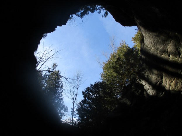
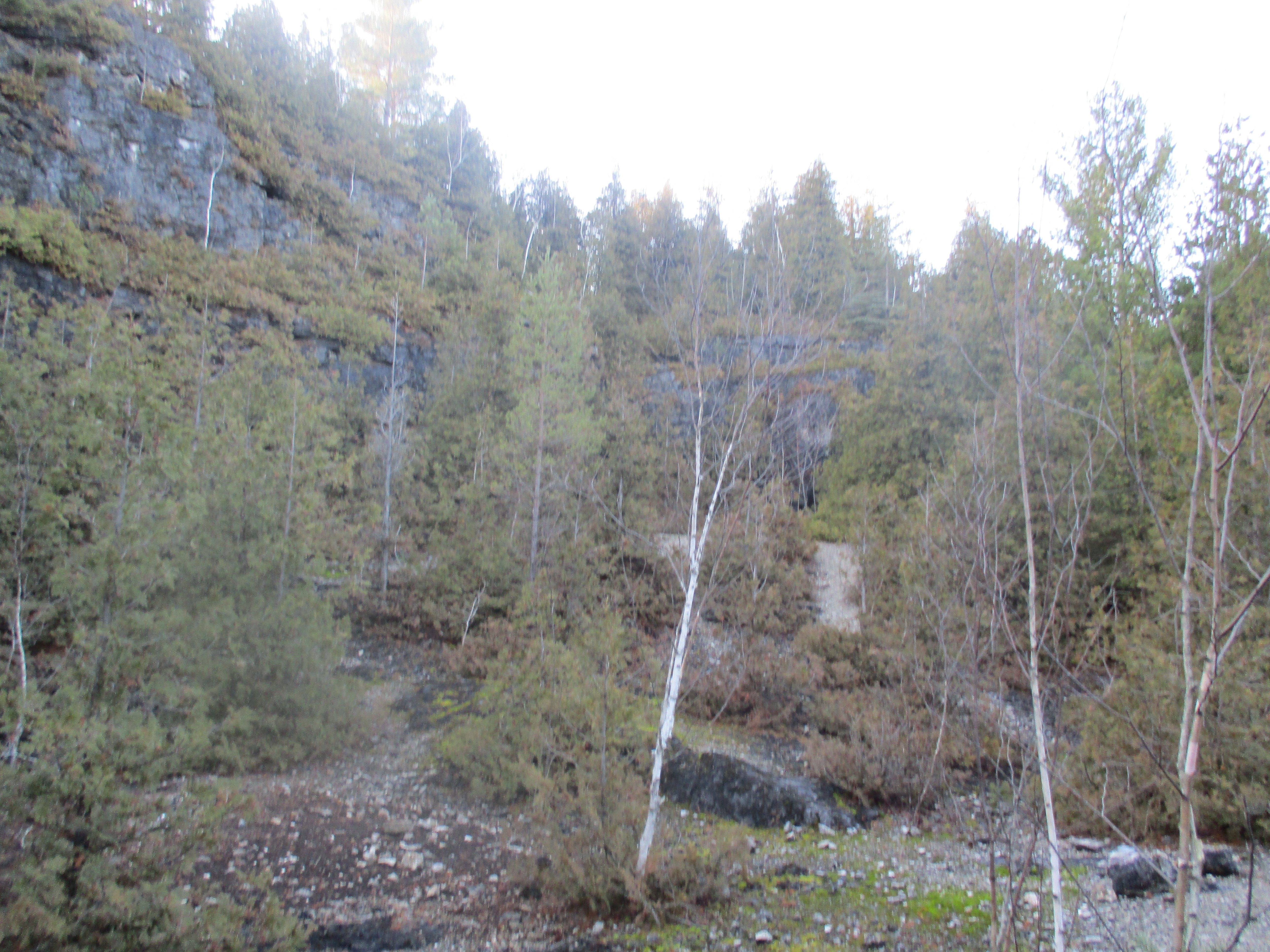
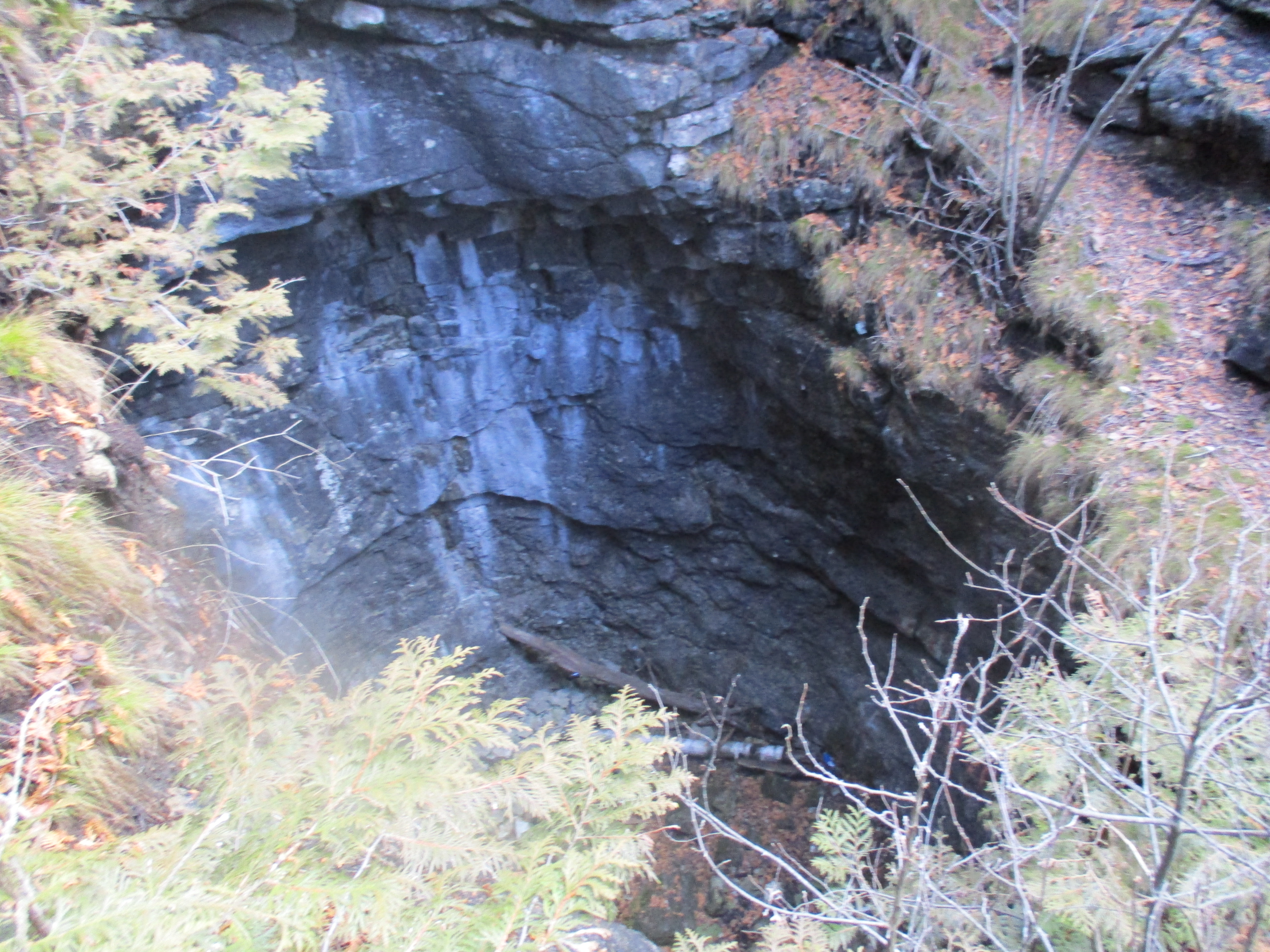
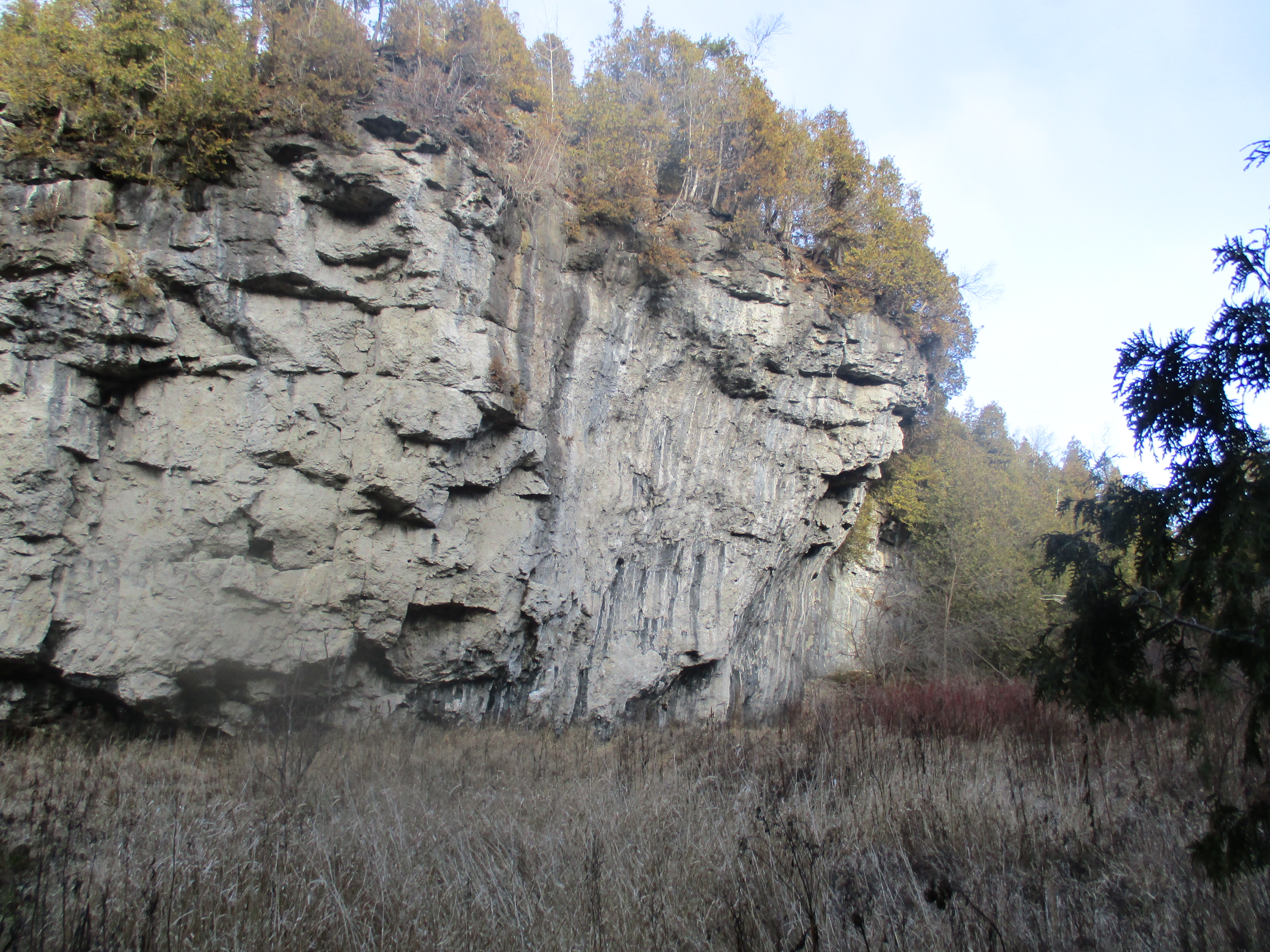
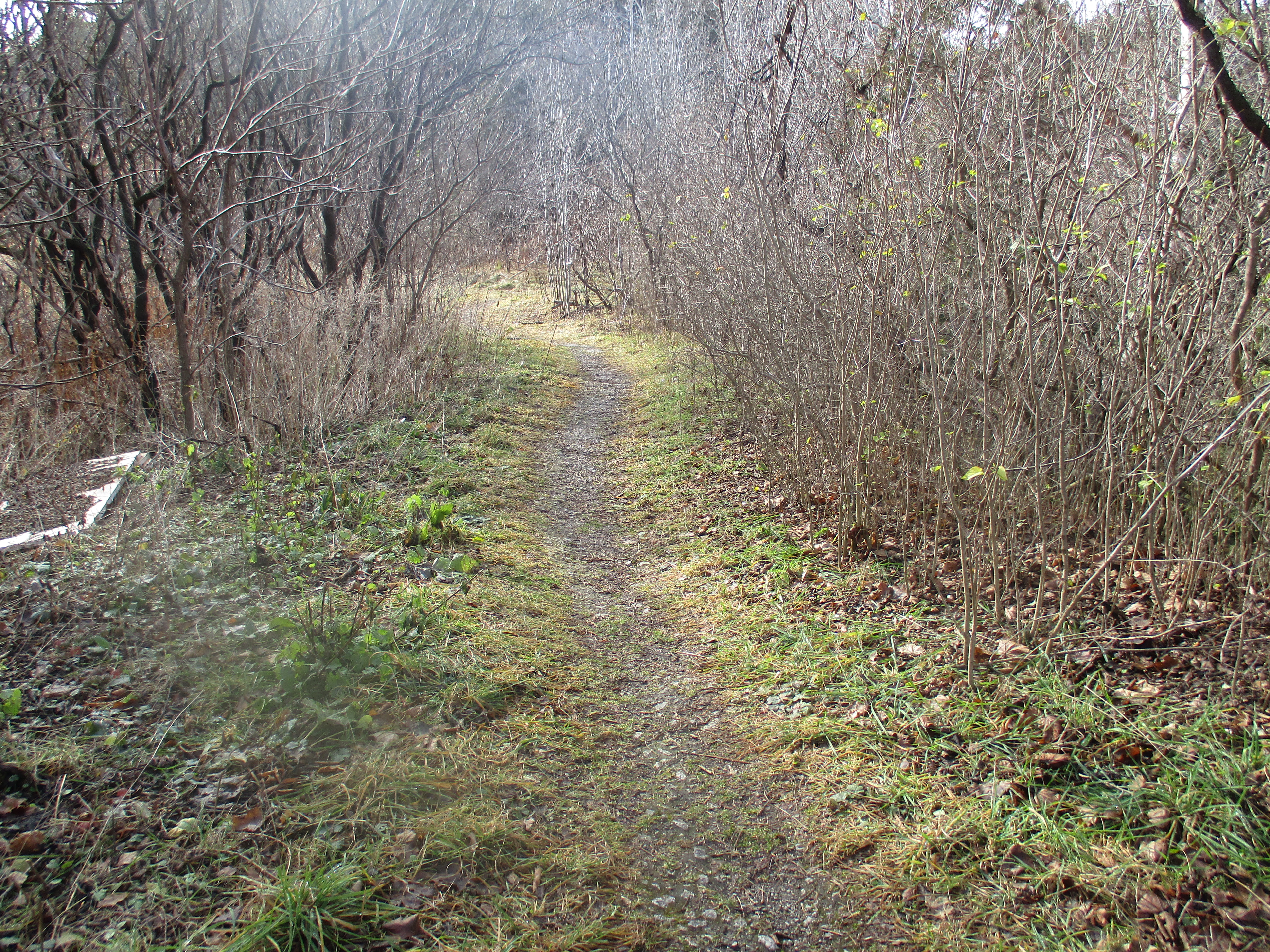
The historic village of Eden Mills is home to 350 people who share the dream to become North America’s first carbon neutral village.  Starting on Nov. 7, 2007, Eden Mills set themselves the ambitious goal of balancing the amount of CO2 that the village emits with the amount it absorbs. Having hiked to The Devil’s Well in the morning we decided to take a short detour on the way home and check out the village. We parked in the parking lot for the community hall and explored a little.

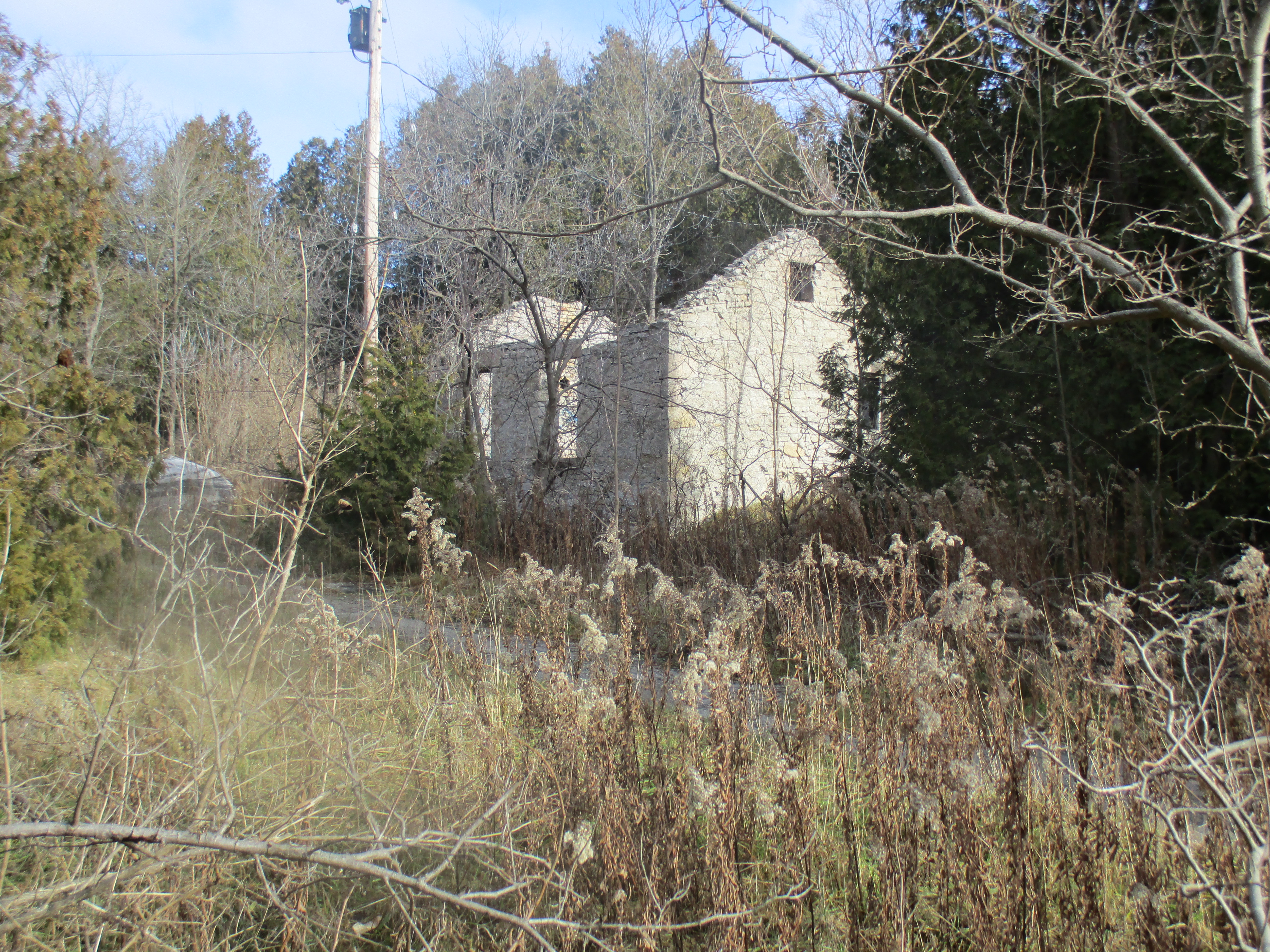
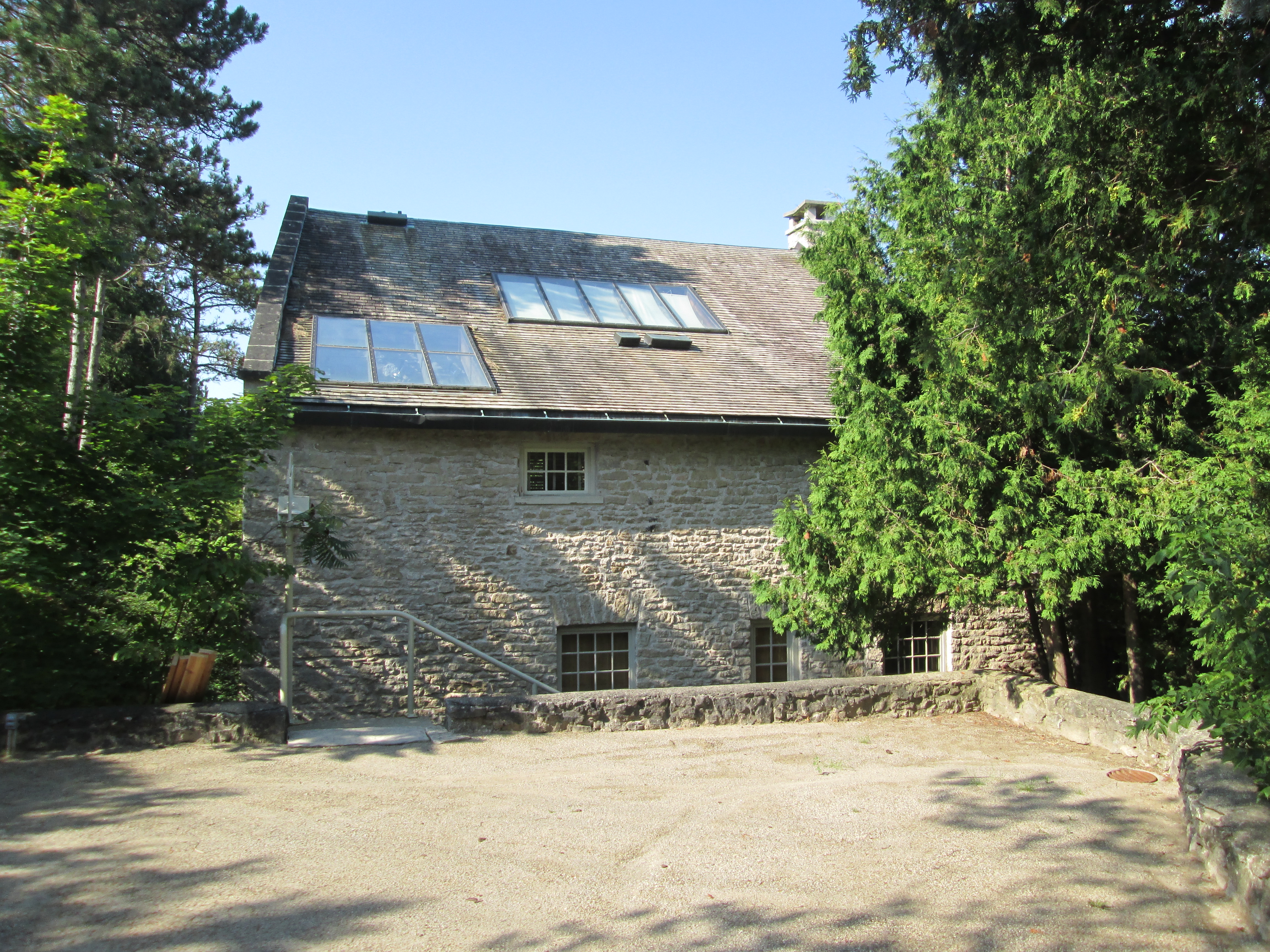
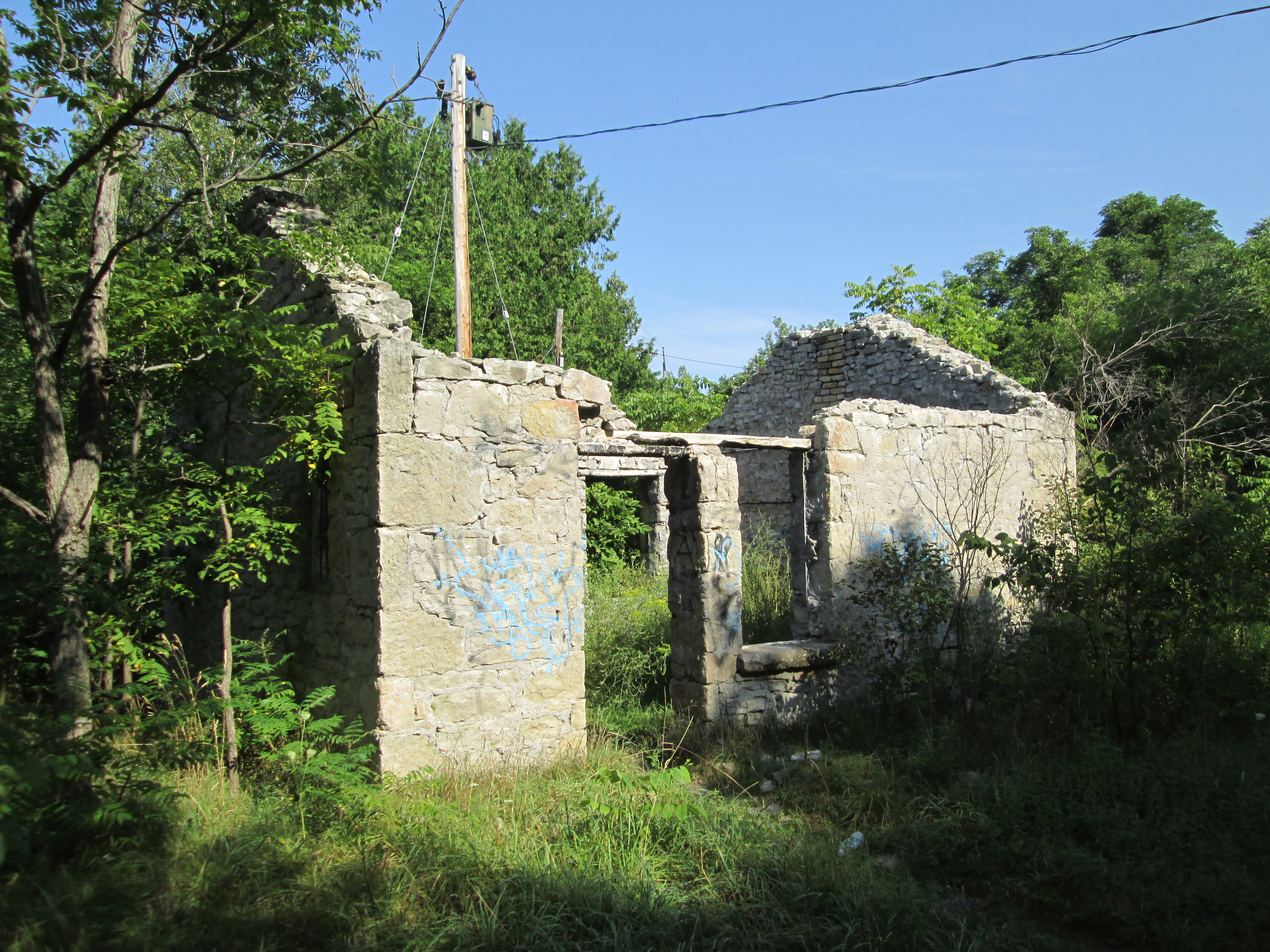
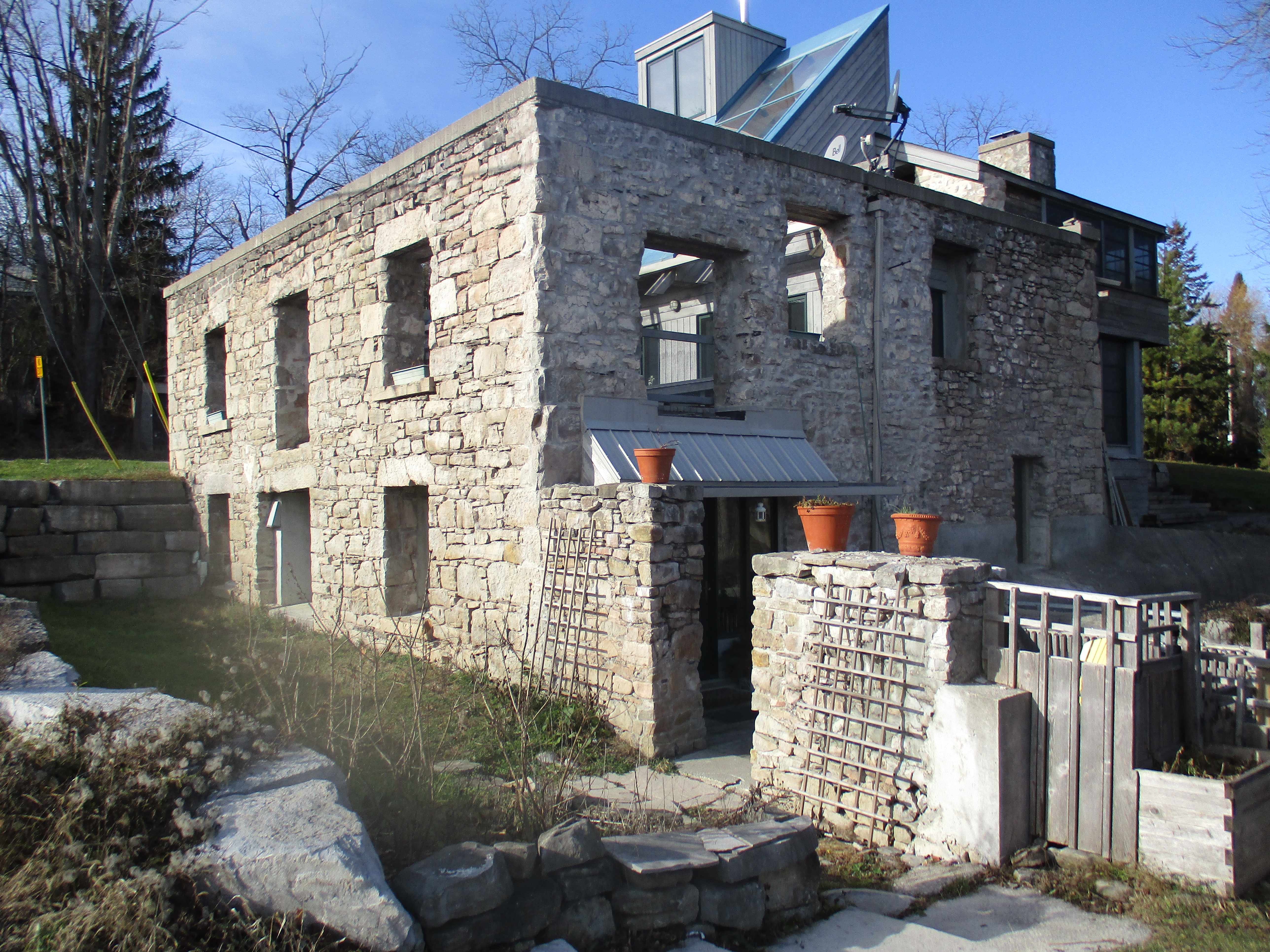
The original inhabitants of the area were the Neutral Confederacy.  They were a group of North American natives who lived up to their name by trading with both the Hurons and Iroquois, two tribes who were at war with each other.  Their territory covered much of what is now Southern Ontario with their numbers reaching toward 40,000 prior to the onset of Europeans who came with their diseases that the natives had no immunity to.  The Neutral may well have been the builders of the Longhouses at Crawford Lake.  The Neutrals lived in harmony with nature much more like the Garden of Eden than the later town which bears it’s name.  With the arrival of three mills on the Eramosa river starting in 1842 the town of Eden Mills was born.  Founded by David Kribbs it was originally known as Kribbs Mills.  Both saw and grist mills were built and they went through many owners in the first few years.  We see paintings of quiet mill ponds with scenic mills and a peaceful community in the countryside.  In reality mills were noisy and usually polluted land, air and water.  The local rivers were used to dispose of saw dust and other waste.  The mills themselves were responsible for making the place less like Eden than the name suggests.  The former Kribbs grist mill stands on the side of the Eramosa river.

IMG_1770

When the community began their carbon neutral project they started by determining the baseline for their carbon footprint in January 2008.  With the help of University of Guelph students they set up measurements to be able to quantify their success and provide evidence of their claims.  The 2007 figure of 4,708 tonnes of annual emissions presented the village with a huge challenge. The good news was that over half of the annual emissions were being stored by the local forest. Plans were made to plant certain species of trees that sequester carbon better than others. Sugar Maples absorb four times more CO2 than white spruce or pine trees of a similar age. Over 40,000 trees have now been planted to supplement the existing forest cover.

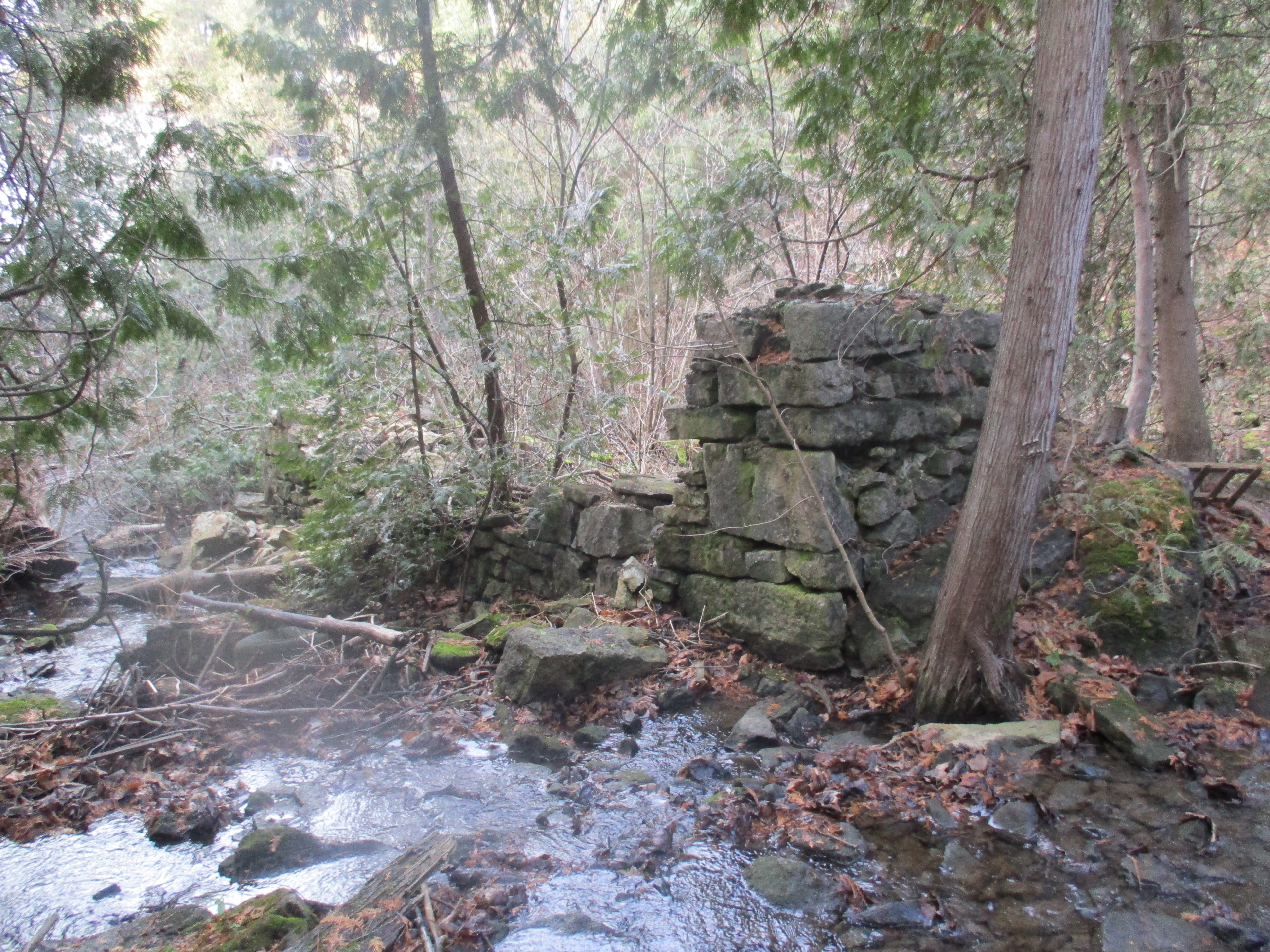
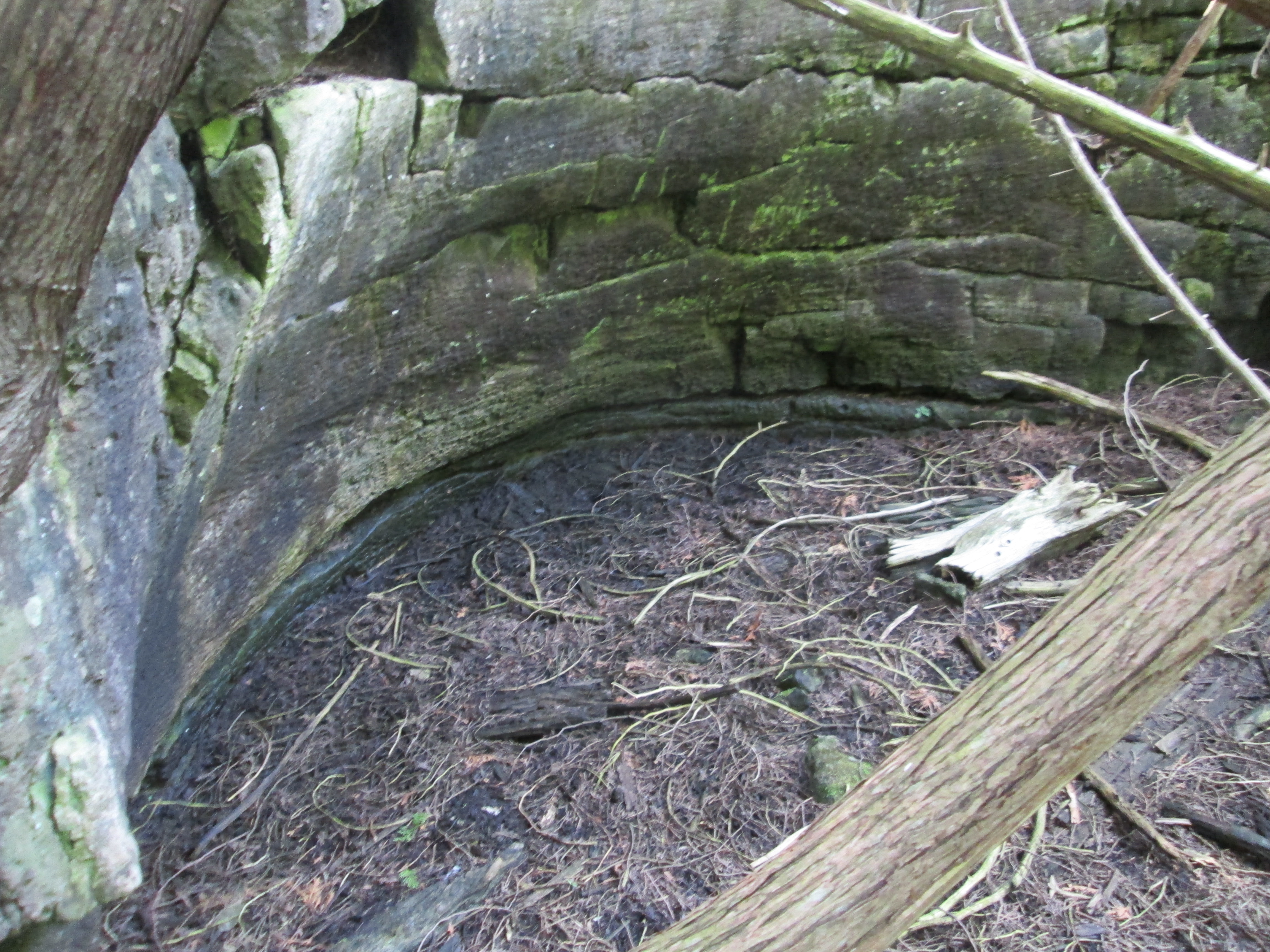
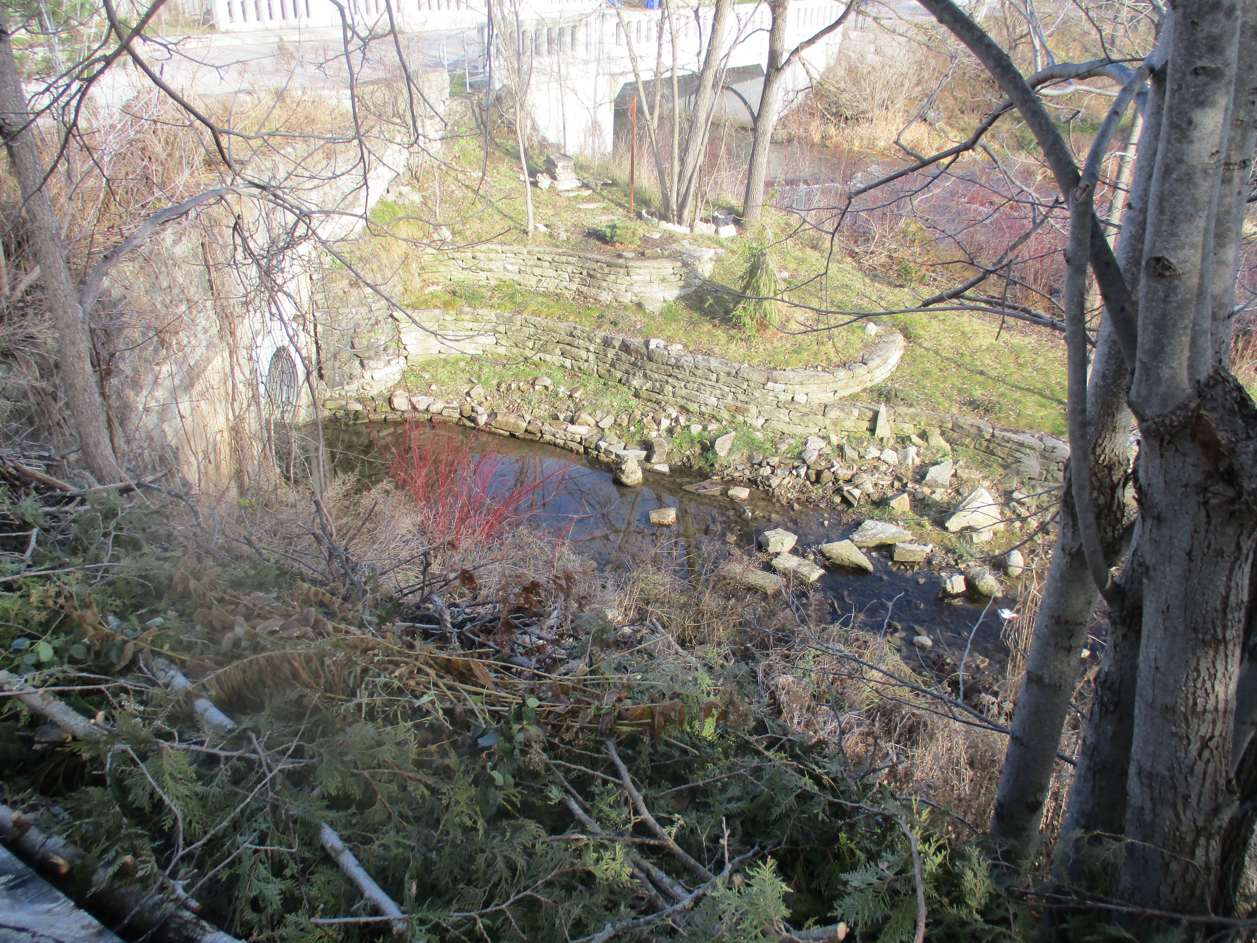
The picture below shows the tail race for the grist mill which passes under the roadway and returns the water back to the river. It is made of a circle of cut stone with the landscaping being designed to match.

IMG_1773

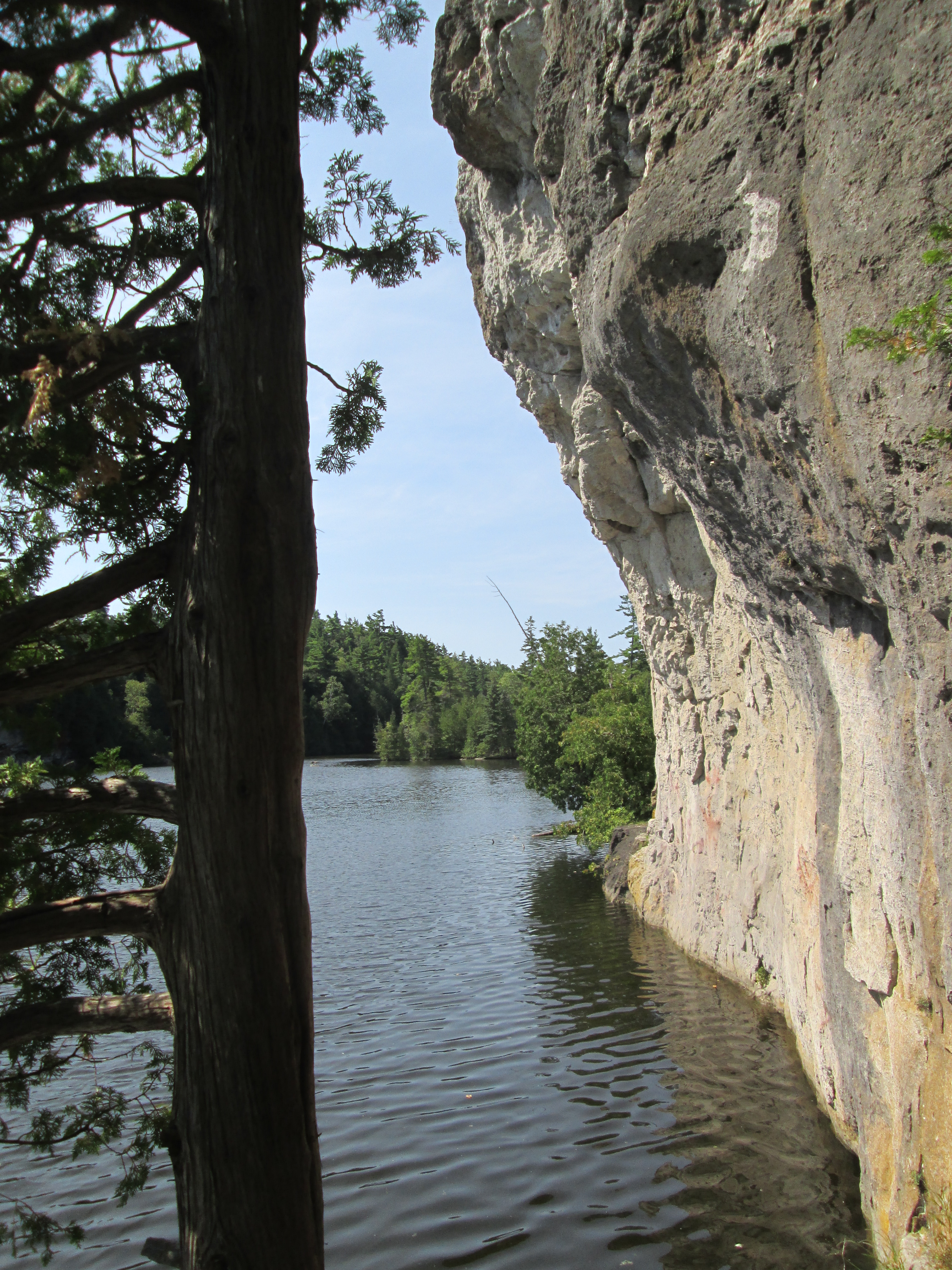
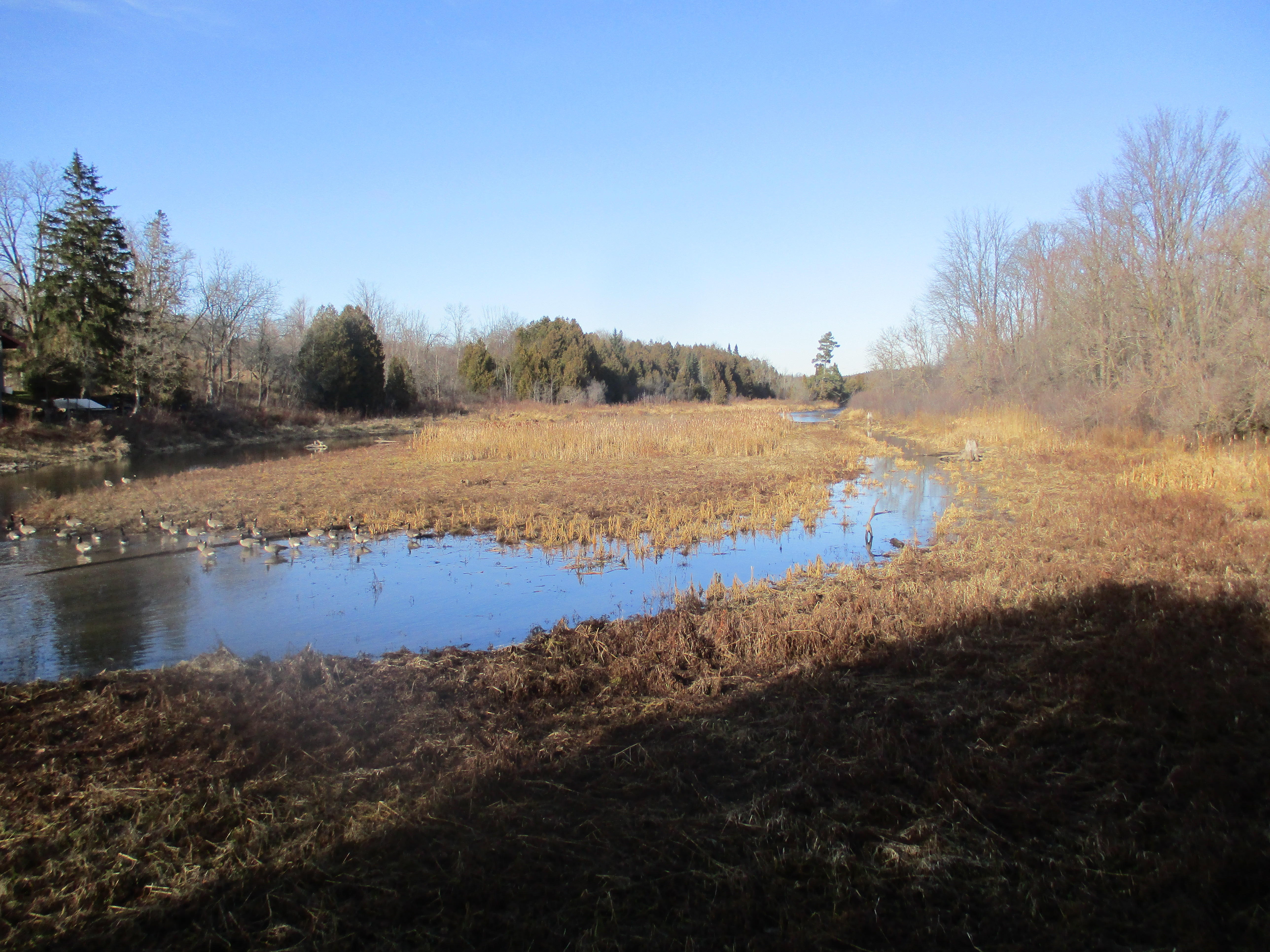
The Eden Mills pond has been drained but it creates a scenic playground in the heart of town.  It is managed and maintained by the Eden Mills Millpond Conservation Association Inc. which is a registered charity started in 1990.

IMG_1760

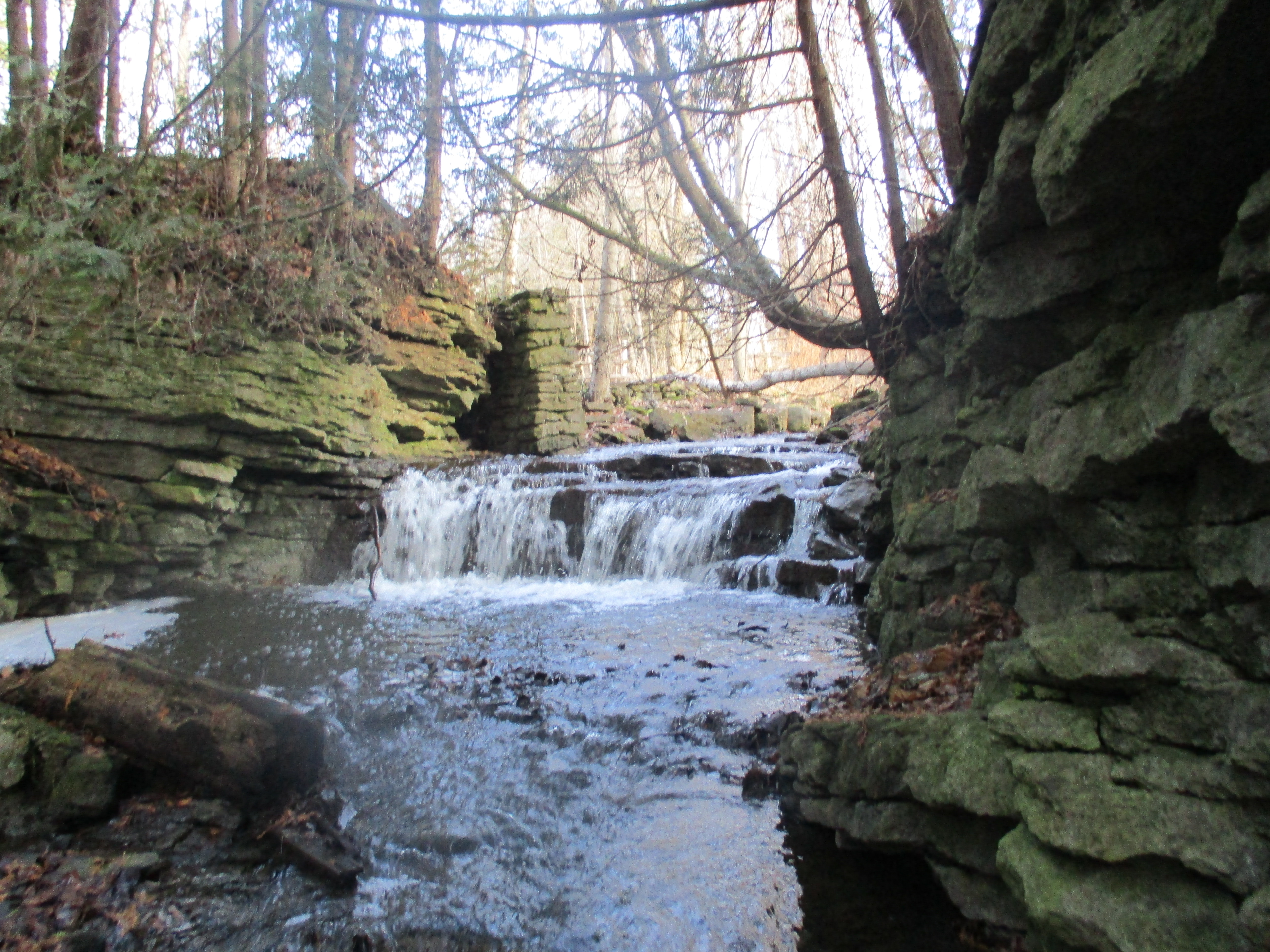
The dam walls and other structures were restored by a group of volunteers who devoted hundreds of hours of labour to complete the work.  This group has also been the inspiration for the current carbon neutral initiative.  A set of wooden steps can be seen at the left in the picture below that have been fixed to the far end of the concrete dam.  They lead down to the summer swimming area of the mill pond.  The pond also supplied water for the saw mill through a head race that was fed from where the spillway is seen as a cut-out section on the dam.

IMG_1759

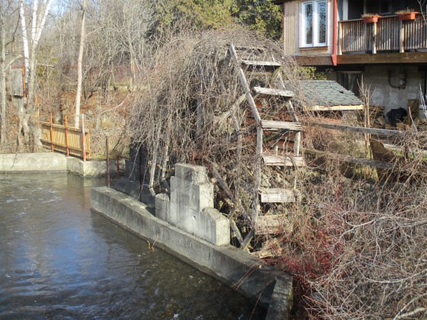
A wooden water wheel is shown in the cover photo and below.  It hasn’t been used in awhile as the overgrowth of vines shows.  This wheel spins in a counter-clockwise direction and is known as a breastshot wheel.  The wooden buckets had water dropped in them at a point near the centre line of the wheel’s edge or just above it.  Breastshot wheels are not as efficient as overshot wheels but were commonly used where high volumes of water flow were available.

IMG_1767

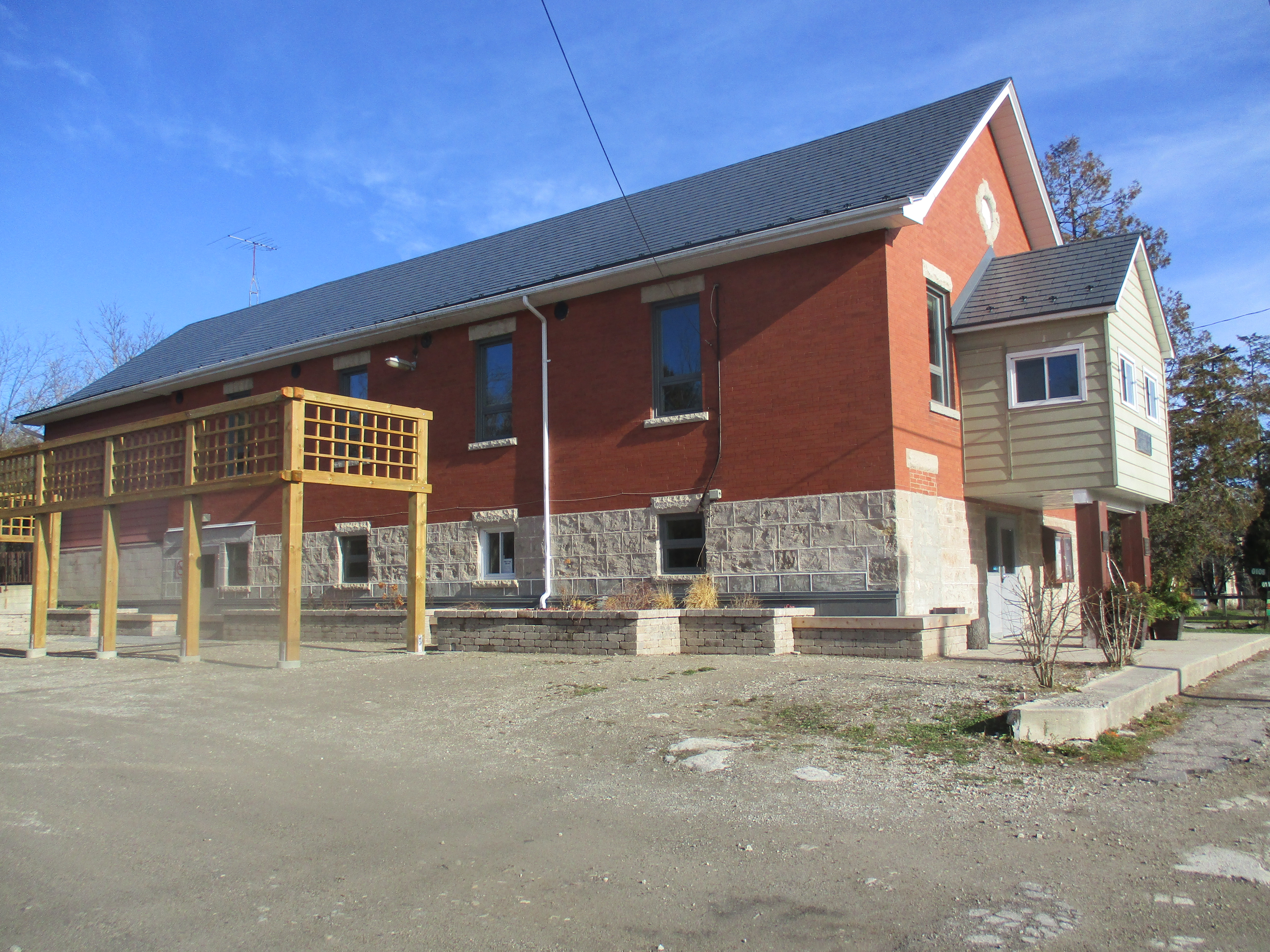
The community hall stands beside the mills.  The original building was built in 1893 but burned down in 1917.  It was immediately rebuilt and has now become a good example of the steps taken toward reducing the carbon footprint of the village.  Following a series of upgrades in 2013, it was estimated that the carbon impact of the hall would be reduced by 63%.  They installed a new metal roof and insulated the ceiling.  The windows were replaced with triple glazed Low-E argon windows for increased energy efficiency.  One of the propane furnaces was replaced with an air-to-air heat pump and two heat recovery ventilators were added.

IMG_1762

Individual households participate in biannual surveys to help track the progress of the village in reducing, replacing and absorbing CO2.  As of Dec. 1, 2013, they have achieved 75% of the target to become carbon neutral.  Another one of the main objectives was to ensure they all had fun while working on this project.  By all accounts, they have been successful at this too!

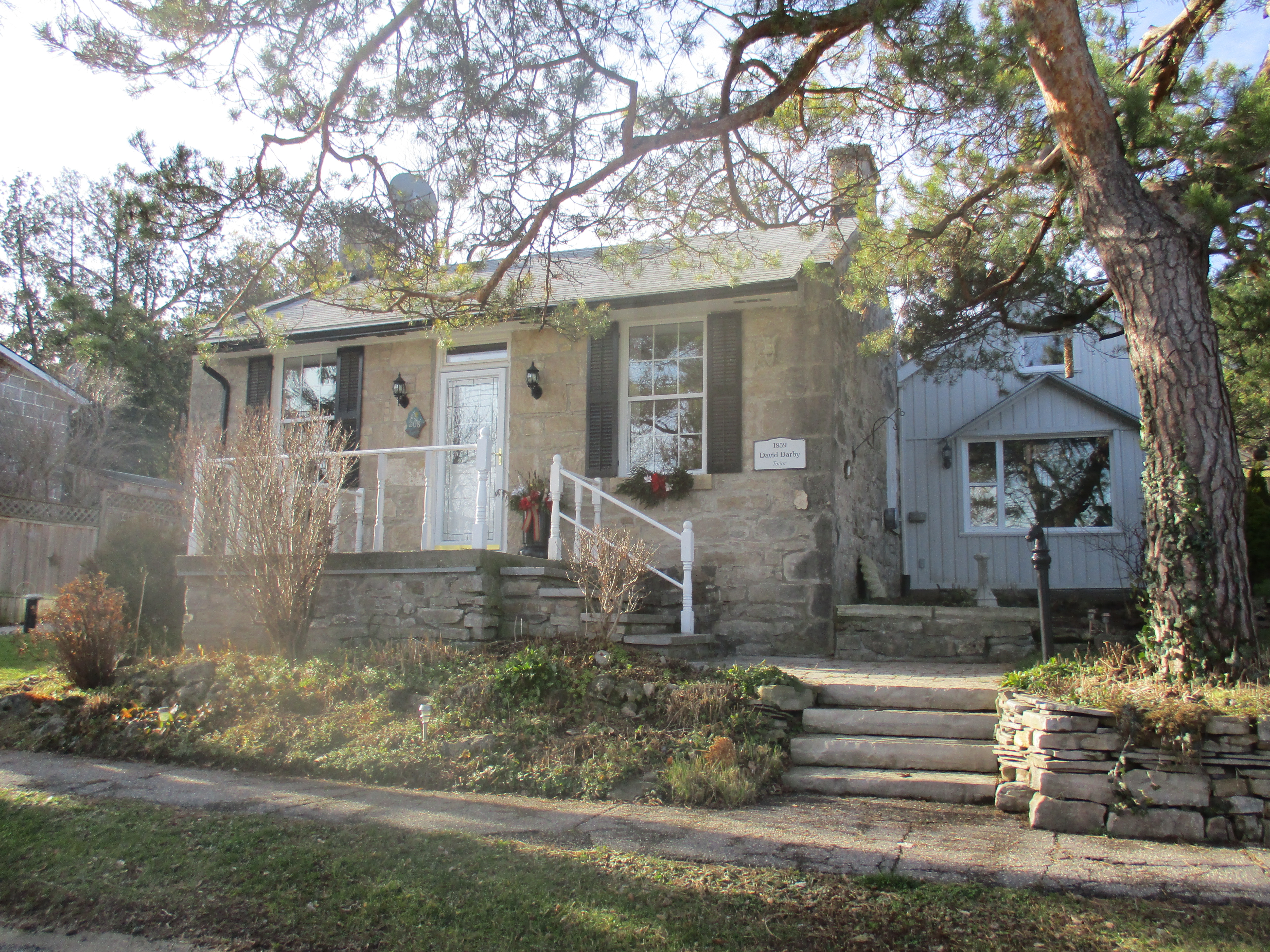
The Niagara Escarpment provides an abundance of stone for building materials and the older buildings in Eden Mills are made from cut stone blocks.  David Darby was the town tailor making and mending clothes for the community.  Darby built this stone house in 1859 showing that his trade came early to the village of Eden Mills, just as it did in the Garden of Eden.

IMG_1776

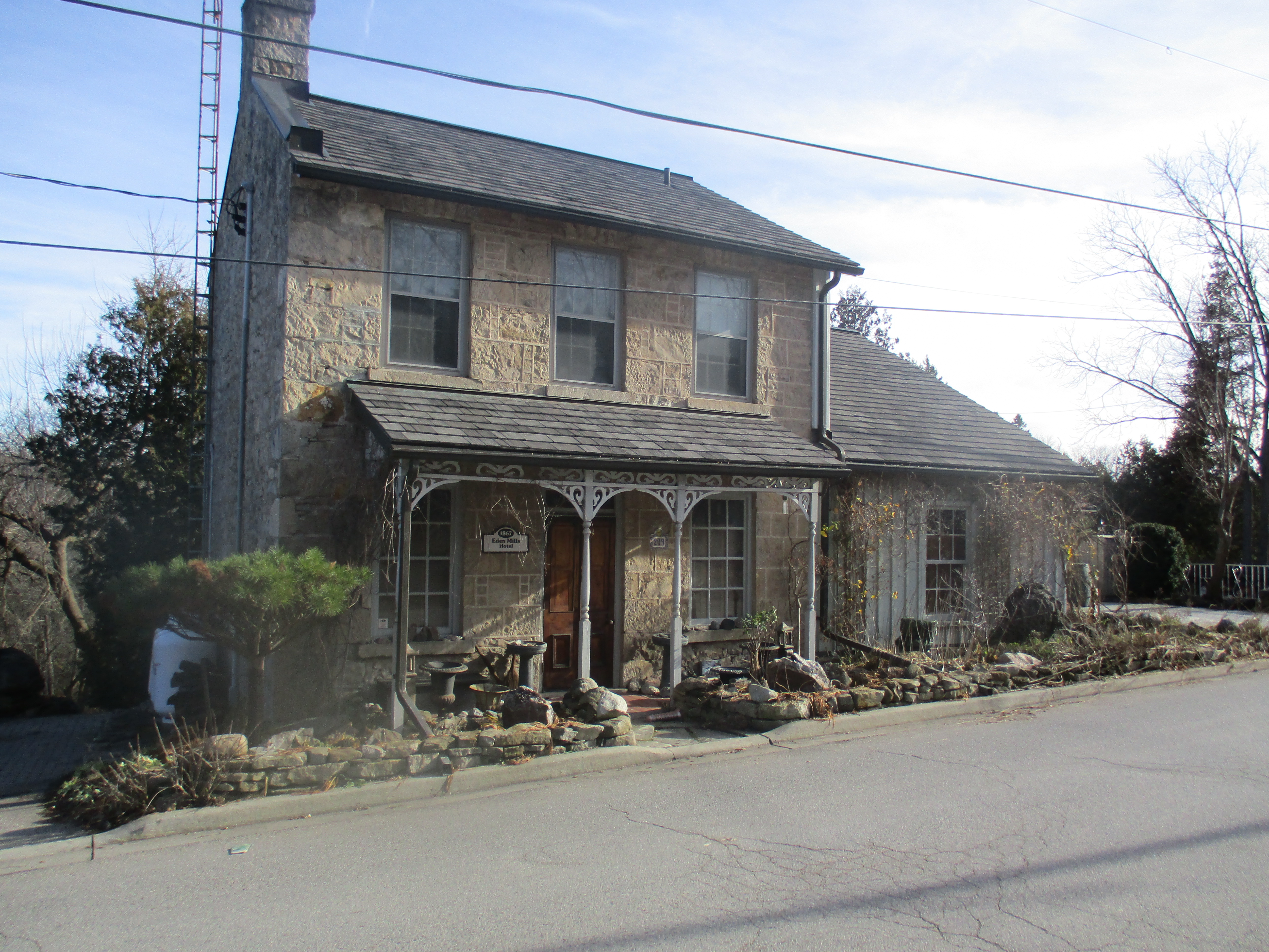
Built in the year of Confederation the Eden Mills Hotel is another example of local stone architecture.

IMG_1775

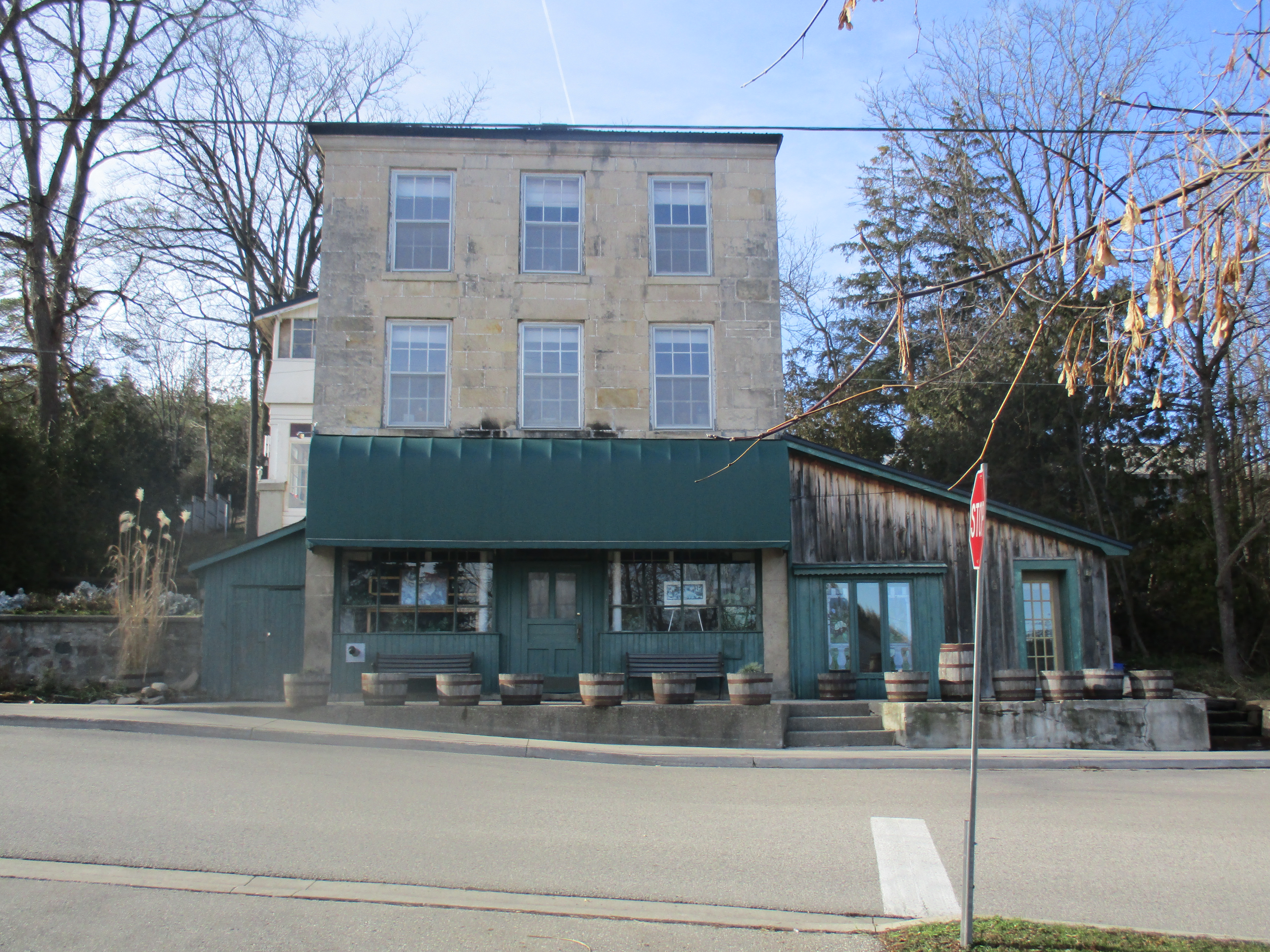
The General store is the only three-story building in the village.

IMG_1774

As the village of Eden Mills works toward being the first carbon neutral village in North America they are also becoming more and more like the garden from which their name is taken.

More information can be found at http://www.goingcarbonneutral.ca/

Google Maps link: Eden Mills

Like us at http://www.facebook.com/hikingthegta

Follow us at http://www.hikingthegta.com

The Devil’s Well

Saturday Nov. 28, 2015

If you drive in the GTA chances are you already think you have the world’s biggest pothole in your neighbourhood.  In reality, you likely do.  Represented as the world’s largest intact glacial pothole, The Devil’s Well has been submitted for inclusion in The Guinness Book Of World Records.  Intrigued, we decided to visit and so we parked in the Lion’s Club parking lot on Main Street in Rockwood and entered the park on Valley Road (see note).  Valley Road crosses the Eramosa River on an old concrete bridge from where it used to lead past mill worker’s cottages to the site of the Harris Woolen Mill.

Another trail leads you into an old quarry.  Here, the Rockwood Quarry extracted 10 metres of amabel dolomite and operated a small lime plant.  The quarry was closed in the 1960’s and is being taken back by cedar trees.  The floor of the quarry has several surveillance pipes drilled into the bedrock.  The older ones have been filled in with rocks while newer ones are locked.

IMG_1644

We followed well used trails as we made our way from the old quarry to the site of the giant pothole known as The Devil’s Well. It’s possible to walk full circle around the top of the pothole but there is no way to climb down into it due to it’s barrel shape.  The pothole is 13.1 metres deep and is 6.4 metres wide just below the rim at the top.  The bottom tapers down to 4.9 metres.  To get inside we would have to find another way down.

IMG_1657

We descended to the level of Richardson Creek hoping to find a way into the ravine that contains The Devil’s Well.  We had noted a couple of steel anchors in the rock face along the top of the ridge.  From the bottom we were able to see that there are dozens of rock climbing aids left screwed into the 25 metre cliff.  The pothole has only been cut a little over half way through this rock wall and cannot be accessed from down here.

IMG_1679

We spent a few moments exploring Richardson Creek while we were there.  It runs for less than a km from highway 7 to the Eramosa River but this is just enough to feature this picturesque little cascade waterfall.  Standing above the falls, to the left in this picture, are the remains of an old cut stone dam.

IMG_1690

Just below the dam stand two walls of an old stone building, most likely a saw mill that once used the mill pond just upstream.  The 1877 County Atlas shows the mill pond on Richardson Creek but does not denote a mill.  Likely the mill was already abandoned by that time as frequently happened when local wood supplies were exhausted.

IMG_1688

Much of the Niagara Escarpment is made of dolostone and limestone which contain high amounts of calcium and magnesium carbonates.  These can disolve in the mild acid content of most natural water.  The sinkholes, caves, springs and fissures created by this process are known as karst.  Karst topography is a common feature in our recent escarpment hikes.  Some geological studies of The Devil’s Well suggest that karst led to the forming of empty pockets within the rocks.  The rapid flow of melt water from the retreat of the Wisconsinan ice sheet created rivers along the margins and under the glacier.  Just as modern industrial processes use high pressure water and an abrasive additive to cut through steel and granite, the force of this water acting with small rocks carved out six obvious potholes along a fissure in this piece of the escarpment.  As five of these potholes enlarged they coalesced to create a short ravine with worn sides and smooth concave pockets to mark the remnants of the potholes.  The sixth pothole stands intact at the eastern end of this chain.  This intact pothole has come to be known as The Devil’s Well and is claimed to have the largest volume of any existing complete pothole in the world. We ended up using a nearby cedar tree for support as we climbed down into this ravine to get to the potholes.  This and other parts of the hike are not for novice hikers and should never to be attempted alone.  The view below is from standing in pothole number four, looking into number five with The Devil’s Well just beyond the rear wall and accessible through it.

IMG_1703

The wall to the pothole has not collapsed like the preceding ones, leaving an intact pothole behind it. There is a small crack at the bottom where you can enter from pothole #5.  The cover photo shows the view looking up out of the inside of the Devil’s Well where the trees above give an idea of the perspective.  This view is from the inside of The Devil’s Well looking back at the entrance.

IMG_1712

I did some very rough calculations to get an idea of the volume of this pothole.  This is only possible as an estimate due to the fact that it is wider in the middle than at the top and not exactly round either.  Most potholes are eroded in a slight barrel shape with the overhang quite noticeable from inside the Devil’s Well, as can be seen in the photo below.  If the city were to fill in the potholes in my neighbourhood they could fill hundreds with a single dump truck.  It seems that they should send a couple dozen trucks if they wanted to fill in this giant pothole.

IMG_1721

The surrounding property has been used for homes for mill workers at the Harris Woolen Mills as well as for a quarry operation following the time when it was an original land grant. Before the days of modern garbage collection people recycled most things.  Glass and metal that was deemed useless would be dumped on a corner of the property that wasn’t being used. This was often in a ravine or on the edge of a swamp.  Many partial antique medicine bottles and other broken glass jars can be found in several of these sites in the park.

IMG_1729

Richardson Creek empties into the Eromosa River which winds it’s way through the limestone bluffs in the Rockwood Conservation Area.

IMG_1732

The quarry was closed in the 1960’s and the Old Quarry Road has been left carry a foot path.

IMG_1733

The remains of a burned out building guard the site of the old quarry.

IMG_1737

So the next time your tire drops in that pothole on your way to work, just remember, it really is just a very small one compared to the glacial pothole known as The Devil’s Well.

Note:  This area is posted as no trespassing.  Most land owners are happy to talk about the heritage on their property and I have rarely been denied the ability to take some pictures and preserve the local history.  The biggest concern is usually that people will follow who won’t ask permission and the property owner may choose to prosecute.  Please always govern yourself accordingly.

Like us at http://www.facebook.com/hikingthegta

Rockwood Woolen Mill

Sunday August 16, 2015

This hike explored the Rockwood grist mill, an abandoned house, the Harris & Co. Rockwood Woolen Mill and some glacial potholes.  I parked in the Lion’s Club park on Main Street near the river.  The first settler to the Rockwood area was John Harris.  He arrived in 1821 and built a small house and a saw mill.  Before long other mills were added including flour, stave, woolen and grist mills. Henry Strange was the Deputy Surveyor for the area and he opened a lime quarry which was used for the stone for the early mills.  The early name for the community was Strange’s Mills.

The grist mill was built on the side of the Eramosa River just east of main street.  It is made of local limestone and has been converted into a private residence.  The dam and mill pond remain intact but are now marked as private property.

IMG_7437

Valley road leads into the park from the grist mill along the north side of the river and passes this small burned-out building.  A trail from here leads to The Devil’s Well.

IMG_7441

John Harris built the first mills and this attracted further settlement and spurred the development of other mills and trades.  John and his wife Jane had six sons and adopted one daughter.  In 1867 his three oldest sons and one son-in-law joined together to start a woolen mill.  Under the name of Rockwood Woolen Mills they developed a reputation for quality products.  They advertised in the local papers for people to bring their fleece to the mill and trade it for their woven products.  They sold blankets and sheets as well as underwear and tweeds.  They also sold bleached cotton and yarn which they claimed to be “full weight and fair inspection”.  The picture below and the cover photo show the remaining ruins in the park.

IMG_7495

The original woolen mill on this site was built from wood and burned down in 1880.  It was replaced in 1884 with a structure made from stone.  The tower has date stones to commemorate both the original construction in 1867 and the replacement building from 1884. The ruins of the mill have been stabilized by adding a layer of concrete along the upper edge of every wall.  This prevents the stone from being removed by weather and vandals and will help preserve the structure for future generations to marvel at.

IMG_7502

The mill was powered by various means over it’s history.  Originally it was powered by water which was diverted from the river to power the turbines.  The arch below contains the raceway from the original turbine power system.  The original stone bridge structure across the raceway now supports a new pedestrian and vehicular bridge. Later the mill was converted to steam and finally to electrical power before it closed.

IMG_7513

The mill reached it’s production peak during the First World War when it had to operate 24 hours per day to produce thousands of army blankets for the military.  Due to intense competition from other mills the business was closed in 1925.  The Harris family then converted the site into a park to showcase the local scenery and the glacial potholes.  The park was called Hi-Pot-Lo Park and was a popular destination for awhile. The park was acquired by the conservation authority in 1959 and converted into Rockwood Conservation Area.  The mill was destroyed by fire in 1965 and was reduced to the ruins that remain today.  This picture shows the Rockwood Woolen Mill as it appeared in 1890.  The company kept adding little out buildings which gave the complex it’s disorganized sprawl.

IMG_7479

This Great Blue Heron was catching small fish along the side of the Eramosa River.  In the picture below it has a fish in sight which was in it’s belly seconds later.

IMG_7552

There are over 200 glacial potholes in the Rockwood Conservation Area and another hundred scattered around the nearby area.  These potholes are believed to have formed during the melting phase of the most recent ice age.  Water containing fist sized rocks was caught in a swirling action that eroded these large circular cut-outs.  Along the pothole trail there are many complete and semi-circular potholes.

IMG_7497

Painted turtles have four distinct subspecies that can be identified by the markings on their shells.  The eastern has aligned plates and southern has red markings on the top shell which allows us to determine that this is not one of either of those.  The midland has a grey patch on the bottom shell while the western has a red pattern below.  This specimen was a little too far out in the river for me to flip over to identify which one it was.

IMG_7520

Some of the glacial potholes extend to 200 feet deep including one called the Devil’s Kettle.  This spot along the river shows where the rock has been worn away in a large circle above and below the present waterline.

IMG_7515

As you drive down Guelph Line toward the 401 you cross the former right of way for the Guelph Suburban Railway (1917-1931) one of several Radial Railways stemming from Toronto in the early 1900’s. This spring we investigated a set of decaying, century old, bridge abutments from the railway over the Silverthorne grist mill tail race.  We then followed the right of way through Eldorado Park, it’s entertainment enterprise.  At Limehouse we saw the pilings for the trestle that used to cross the mill pond. This portion of the railway was purchased by the Halton County Radial Railway for the purpose of opening a railway museum.  This museum is a great place to visit as it houses many historic rail cars and features a ride on the rails.  At the roadside is this car from the London & Port Stanley railway.  It operated as an electric railway from 1913-1957.

IMG_7577

A listing of the reader-selected top 15 hikes can be found here.

Google Maps Link: Rockwood Conservation Area

Like us at http://www.facebook.com/hikingthegta

Follow us at http://www.hikingthegta.com