Monthly Archives: April 2016

The Battle Of York – Apr. 27, 1813

Apr. 27, 2016

Fourteen American warships were sighted east of York (Toronto) on the evening of April 26th, 1813.  The invasion of York was about to begin.  The first year of the war of 1812-1814 had gone badly for the Americans as they lost all the major battles.  After waiting out the winter they needed a quick victory to boost moral and set the tone for the coming season of war.  It was known that York was poorly defended with only 750 men and 12 canons and therefore it made a suitable target.  April 22nd was set for the attack and 1750 men and 85 canons were gathered at Sacketts Harbour on the American side of the lake.  April weather is unpredictable and the fleet didn’t set sail until the 25th.

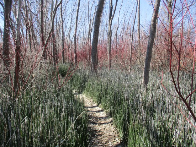
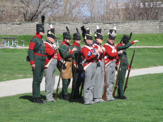
On the morning of April 27th the fleet moved to the west of town and it was believed that the landing would take place at a clearing where the old French Fort Rouille had stood. The wind blew the fleet past the planned landing site and they were forced to come ashore at a clearing near where the Palais Royale stands today, 2 kilometers west of the fort.  The first to encounter the Americans when they landed around 8:00 am were the Mississauga and Ojibway natives, about 100 in total, who were able to pick off some invaders while still in their rowboats. They were trained to fight in the woods but soon were over powered and had to fall back. The picture below shows the staff of Fort York wearing the military uniforms of 1813. Interesting among the typical red coats of the British military are the green coats of the Glengarry Light Infantry Fencibles.  This Canadian unit was present at the fort and was second to encounter the landing, temporarily forcing the Americans off the beach.

IMG_1132

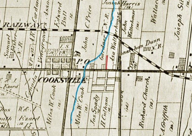
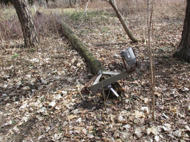
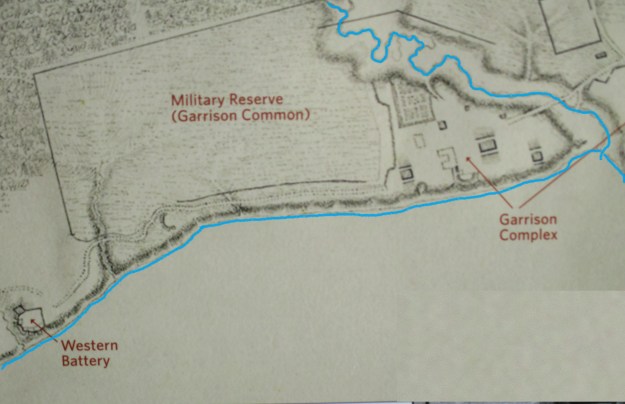
As the landing continued in strength, British General Roger Hale Sheaffe’s option was to fall back through the site of the modern CNE to the Western Battery where 2 of his canon were stationed.  The battery was likely located under the present Automotive Building in the CNE but was taken out of the battle by an explosion just as the Americans were advancing on it.  A spark fell in a barrel of gun powder which blew up killing or wounding 30.  It also knocked out one of the canons, similar to the one featured in the cover photo. In the archive map below I have coloured in Garrison Creek which ran along the north and east side of the fort as well as the historic shoreline.  The fact that the fort was surrounded on three sides with water made it easier to predict the landing and advance of the Americans.

IMG_1203

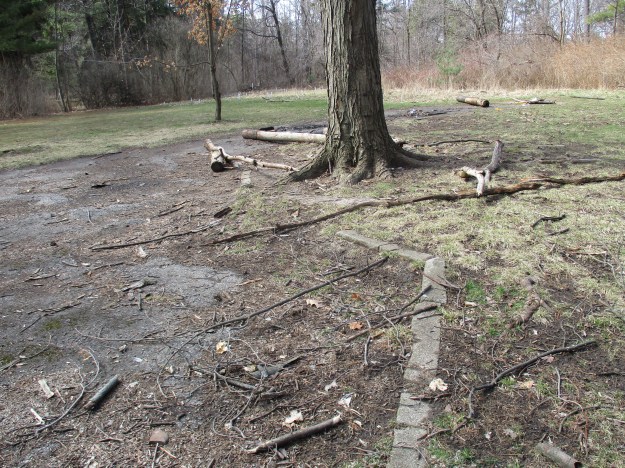
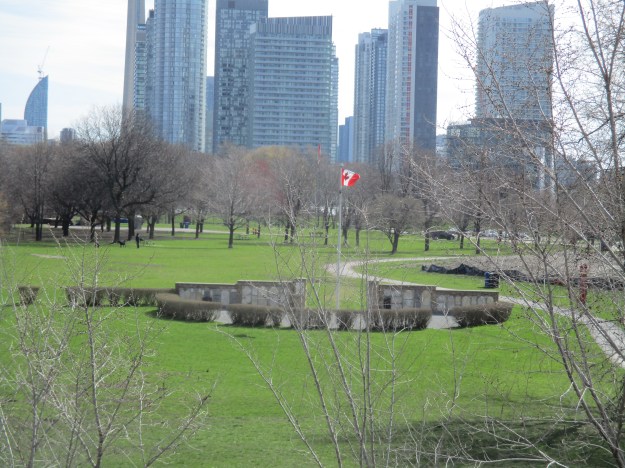
The troops continued to harass the advancing forces as they retreated across the garrison common at the west end of Fort York.  The picture below is taken from Strachan Avenue and shows the site of one of the downtown Military Burying Grounds.  Fort York is between here and the condos that now dominate the background in all directions.

IMG_1123

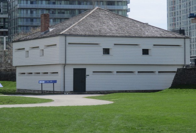
The final place of retreat for the soldier when the fort is breached was the block house. These structures were the first to be built when the War of 1812 broke out and were made of thick square timber walls with weather boards on the outside. They provided shelter from bullets, shells and small artillery fire.  Soldiers inside could fire back at invaders through the slits on two floors.

IMG_1179

The battle was lost and General Sheaffe decided that he should save his regulars to fight another day and ordered them to retreat to help protect Kingston. The Americans were building war ships at Sacketts Harbour and it had been decided to build a warship in York. The Sir Isaac Brock was to be the second largest ship on Lake Ontario with 200 men and 24 guns.  It was intended to give Britain naval supremacy on the lake but it could do the same for the Americans if it fell into their hands.  The British made the tactical decision to destroy the nearly completed warship and the powder magazine.  The Sir Isaac Brock was set fire near the harbour and the government stores kept there were also destroyed.

The grand magazine was located near the waterfront, just below Government House.  The underground storage contained at least 200 barrels of gun powder, and some say up to 500, plus all the cartridges, round shot and shells the British had in reserve.  The magazine was dug under the bluff along the shore  of the lake and when it exploded it blew out toward the Americans as they marched in from the Western Battery.  The shock wave knocked at least 200 soldiers down and then they were pelted with stone and all the shot from the magazine.  American General Zebulon Pike was among those struck with flying debris and mortally wounded.  The print below is from 1815 and depicts the wounding of General Pike.

IMG_1139

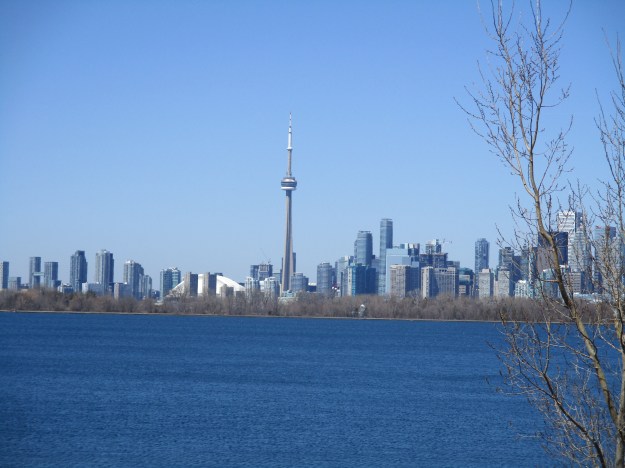
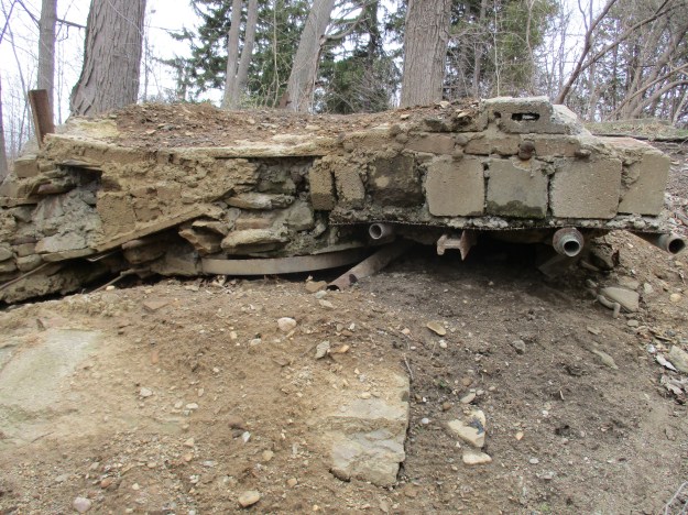
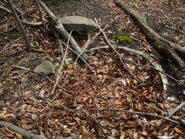
The grand magazine was located just outside of the present fort walls.  The tree in the middle of the picture is on the inside of the wall approximately where the explosion took place.  The site was excavated recently and signs of its past were uncovered in the form of mortar and stonework.  In 1813 the water came up where the Gardner runs just south of Fort York.  (The city actually proposed moving Fort York down to the modern waterfront to allow the Gardner to be built where this National Historic Site stands.)

IMG_1194

With the British in retreat a surrender treaty was drafted that required all arms and public stores to be surrendered.  The militia were sent home and not allowed to fight again for the rest of the war unless they were released in an exchange.  All the captured officers were taken prisoner.  John Strachan, the first Anglican Bishop of Toronto, assumed leadership on behalf of the 700 citizens of York.  He later went on to be one of the leaders of the Family Compact who ruled the colony.  Rebellion in 1837 against this conservative control helped lead to government reforms.  The Bank of Upper Canada was a target for William Lyon Mackenzie and the government hid it’s money under the officer’s quarters at Fort York.  The little windowless room is known as the “money room”.

IMG_1165

The Americans occupied the town of York until May 8th when they retreated.  Holding onto York had never been part of the plan and with British territory on the east and west it would have presented too great of a strain on resources.  The Americans reported 55 killed and 265 wounded, mostly in the explosion of the magazine.  The British totals are debated but including the militia and natives it is thought to be 82 killed and another 393 wounded, captured or missing.

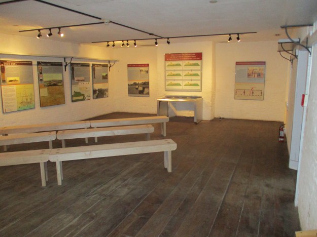
The barracks at Fort York were built in 1815 when the fort was rebuilt and expanded. Originally the room shown below was home to 32 soldiers, soldiers wives and children.  As time went on the numbers were reduced until it was split into several separate rooms for each family.

IMG_1143

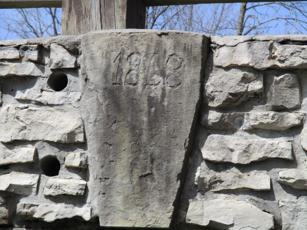
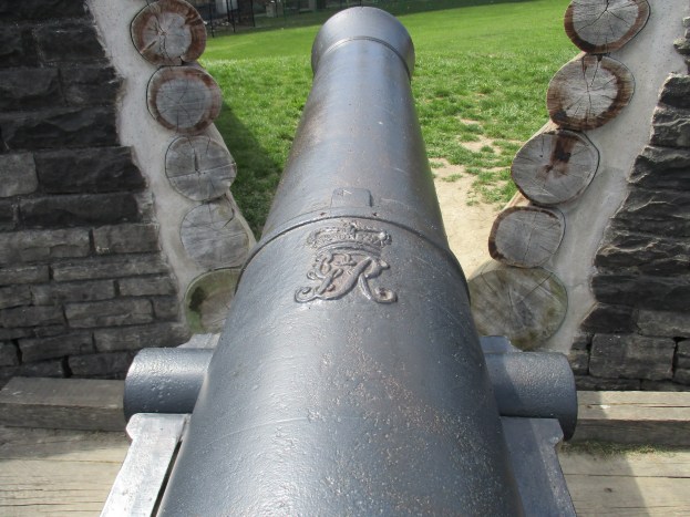
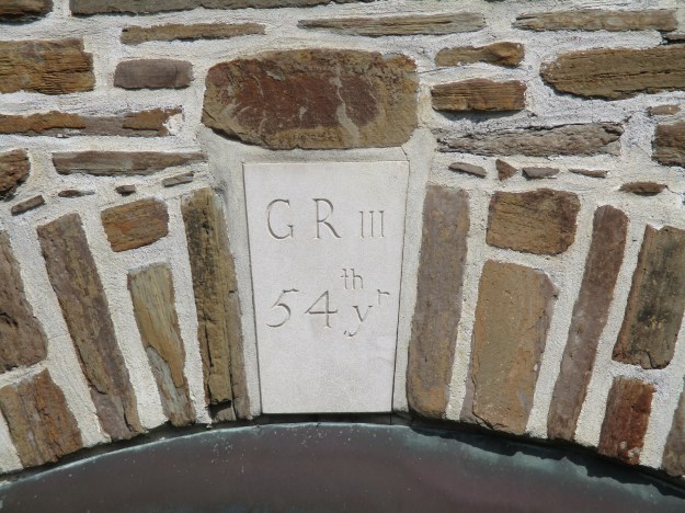
After the war was over a new powder magazine was built not far from where the previous one had been detonated.  The date stone has been replaced with a replica while the original is preserved in the museum at the fort. The initials stand for Georgius Rex III (King George 3rd) and the 54th year of his reign (25 Oct. 1813 to 24 Oct. 1814).

IMG_1170

It’s been 203 years, as of 2016, since this battle but we should pause and reflect on those who gave everything to defend our town.  It’s also 200 years since Fort York completed it’s restorations after the war, taking on it’s current form.

Like us at http://www.facebook.com/hikingthegta

Leslie Street Spit

Saturday April 17, 2016

The Leslie Street Spit technically isn’t a spit at all because it isn’t natural.  The entire spit was created from landfill and dredging from the harbour in Toronto, starting in 1959 and continuing today.  When the St. Lawrence Seaway was completed in 1959 it was thought that Toronto would see a large increase in shipping and more harbour facilities would be required.  An outer harbour was to be created by building an east headland extending into Lake Ontario.  Construction continued but by 1973 it was obvious there would never be a need for more harbour space.  It was decided to use the spit to create a park named Tommy Thompson Park.  The park is only open on weekends and holidays because it is an active construction site with dump trucks passing in both directions.  Tommy Thompson will be remembered as Metropolitan Toronto’s first Commissioner of Parks.  He is responsible for removing the houses and turning Toronto Islands into a park.

The map below is taken from the Tommy Thompson Park Master Plan and shows the growth and structure of the spit.  Some filling was completed on the shore of the outer harbour in 1956-1958 before construction of the headland began in 1959.  The long thin outer harbour east headland was constructed in sections each year until 1975 when it reached it’s current length.  In 1973 and 1974 the land mass was greatly increased when the outer harbour and the Keating Channel were dredged.  From 1979 through 1985 an endikement was built on the lakeside of the spit to create three new controlled cells for dumping material dredged from the harbour.  Between 1956 and 1991 there were 4,366,469 truck loads of material dumped here to create the spit as it existed at that time.  The spit was built to protect the harbour and islands from deposits of sand that originate from the Scarborough Bluffs.

Spit

Much of the landfill came from demolished buildings as can be seen in the picture below. This shot is taken from the water’s edge looking at a cross section of the spit which is all old bricks and broken concrete.  The waves quickly break down the old concrete and bricks and create the gravel beaches that are seen in places along the lake side of the spit.  Along the 1965 and 1966 sections of the lake side beach there is extensive twisted metal rebar that has been left as the concrete eroded away.

IMG_0967

One of the long term goals of the park project has been to create sustainable wildlife habitats.  Many of the species that are found here have been planted naturally.  Pets are banned from the park so that the plants and wild animals can survive without undue competition.  Two snake hibernaculums have been created on the spit for snakes to be able to survive the winter.  The picture below shows a stretch of old road bed which has been brought to the spit and dumped in a strategic manner to create relief, cover and an irregular outline.  Snakes and other wild life have moved in and begun to breed on the spit. There are, for instance, six species of snakes that have been identified in the park. The most common of these is the eastern garter snake while the eastern milk snake can often be seen as well.  The northern and midland brown snakes, the northern water snake and the northern red-bellied snake are much less common and spend very little time out in the open.

IMG_0937

The park is one of the best places in the city to view birds.  There are reported sightings of 290 species of birds on the spit with 40 of them breeding here.  The Double Crested Cormorant first arrived in the park in 1990.  The Star reported in May 2009 that the colony had reached 30,000 birds and that they were stripping trees to build their nests.  As seen below the nests are made up of anything, including pieces of plastic bags.  The cover photo shows part of one of the nesting colonies and reveals hundreds of birds in just a few trees.  A careful look in the water in the foreground of the cover photo will reveal a pair of white swans.

IMG_1048

Many of the trees on the spit have been damaged by beaver who are one of twenty-two mammals that call it home.  Volunteers have begun to wrap the base of surviving trees in the area of the ponds with wire mesh to keep the beavers from destroying them.  A beaver lodge, like the one below, is designed to make it almost impossible for predators to get in. The animals swim into their homes through an entrance below the water line.  Inside there are usually two chambers or dens.  In the first one they dry off while the second one is the living quarters.

IMG_1035

Special habitats were created for fish and birds by bringing in stumps and posts and sinking them in ponds and marshes.

IMG_0998

Along with the main paved trail, which is an extension of Leslie Street, the park features several kilometers of other trails like this one which winds through the horsetails and dogwoods.

IMG_0993

In 1977 Gijsbertus Adrianus Panhuise of the Netherlands was granted a patent on the first kitesurfing equipment.  Kitesurfing allows the participant to reach speeds of up to 55 knots (over 100 km/hr) and part of the thrill of the sport is in jumping.  The man in the picture below was racing between the spit and the Toronto Islands and leaping in the air.  He is in the middle of a 360 degree flip and his kite is just out of site above the picture.

IMG_0979

The point of the spit that reaches farthest into the lake is known as Vicki Keith Point. Vicki is a Canadian athlete who used her swimming skills to raise over $800,000 for children’s charities.  In the summer of 1988 she swam all 5 Great Lakes.  During her career she swam the 52 kilometers across Lake Ontario 5 times.  The tip of the spit was her usual point of departure or arrival.  This lighthouse stands on Vicki Keith Point.

IMG_1058

One of the bricks that is laying on the beach near the lighthouse has the letters TPB on it. This stands for Toronto Pressed Brick and it was manufactured at the Don Valley Brick Works between 1882 and 1909.

IMG_1056

The view from the Leslie Street Spit looking back toward Toronto makes it appear that the city has a shoreline which is covered with trees.  These trees are actually on the Toronto Islands.

IMG_1061

The Spit has an enormous amount of flora and fauna that has settled there since the artificial strip of land was created.  Checklists are available for all types of enthusiasts on the Tommy Thompson Park website including an inclusive list of birds that have been identified here.

Google Maps link: Leslie Street Spit

Like us at http://www.facebook.com/hikingthegta


Borer’s Falls

Saturday April, 9, 2016

Borer’s Falls is where Borer’s Creek plunges over the side of the Niagara Escarpment but the creek also boasts a lower falls that is one third as high as well as two extensive sets of cascade falls.  The main water falls is also sometimes known as Rock Chapel Falls.

The Borer’s Rock Chapel heritage lands are one of 6 sets of lands in the “Cootes to Escarpment” Park System.  This set of properties represent the only wild life corridor between the Niagara Escarpment and Lake Ontario that isn’t cut by a 400 series highway which restricts land migration of animals.  These properties have been registered as having 1852 species of flora and fauna and are also known as Environmentally Sensitive Areas because surveys have identified over 50 species that are at risk, threatened or of special concern.  The view below looks across the valley toward Hamilton with the heritage lands in the foreground.  The Royal Botanical Gardens and Cootes Paradise are along the shore of Hamilton Bay.

IMG_0858

The park system also includes a 10 kilometer section of the escarpment which includes a property to the east of Borer’s Creek called the Berry Tract after the land owner.  Between the Rock Chapel Trail and the Bruce Trail near the cliff face is an unused field which is returning to a forested condition.  The undergrowth is a massive tangle of raspberry vines as can be seen below. In a few months this section of woods could be renamed the berry tract.

IMG_0853

The map below is part of the interpretive display in the park.  The red line marks the approximate route of the hike that leads to the bottom of Borer’s Creek and back up to the bottom of Borer’s Falls.

IMG_0847a

There are two lookout points as you hike along the Bruce Trail heading away from Borer’s Creek and the falls.  Part way down the side of the ravine an old trail makes it’s way to the bottom as it leads back toward the creek.

IMG_0861

The Borer’s creek gorge has been cut through the escarpment by rushing water as the ice retreated about 12,000 years ago.  The ravine has steep sides but also makes a steep descent down the side of the escarpment.  This causes the creek to have a series of cascade waterfalls that stretches all the way from the ravine floor back up to the base of Borer’s Falls.

IMG_0885

Lower Borer’s Falls is not visible from any of the look out points but is well worth the excursion to reach it.  When the creek is in full flow there is a 5 meter wide curtain waterfall here that is 3 meters tall.  Adjacent to the waterfall is an exposed section of red Queenston Shale. This is the bedrock of the Niagara Escarpment and it sits just below the harder Whirlpool Formation.  At the lower falls the softer Queenston Shale is eroded away leaving the Whirlpool Formation overhanging.  The layer of lighter Queenston Shale at the top of this formation is due to an oxidation process when the escarpment was beginning to form.

IMG_0881

Life is tenacious and the pine tree on the side of the ravine in the picture below has fully enveloped the large rock in it’s root system.  When the tree eventually falls it will pull this rock down into Borer’s Creek.  The Niagara Escarpment Ancient Tree Atlas Project began in 1998 to survey the ravines and cliff faces of the escarpment to identify trees that had survived the clear-cutting practices of the early lumber industry.  Cedar trees were recorded in the Borer’s Creek ravine that were 400 years old.  Unlike this tree, they tend to be small in spite of their age.  The creek is named after the Borer family who operated the local saw mill for a century.  The small size of these ancient cedars likely kept them from being fed through this mill which supported the community of Rock Chapel.

IMG_0869

Above the lower falls the creek has another extensive section of cascade falls. Throughout here the creek bed is littered with broken chunks of dolomite stone.

IMG_0873

Borer’s Falls turned out to be a big disappointment as can be seen in the picture below. Just kidding, but there is a small water fall near Rock Chapel Road that looks like it is usually dry but might contain a significant flow during storms.

IMG_0887

The view as you approach Borer’s Falls includes a cross section of the layers that form the escarpment.  These are described in greater detail in the story on The Devil’s Punch Bowl. Ascending the cliff face at the falls is impossible because of the alternating layers of hard dolostone and softer shale which have been under cut.  The cliff face is stepped outward as it goes upward.  This waterfall is classified as a ribbon plunge because of the width of 5 meters compared to the height of 15 meters and the deep plunge pool at the bottom.

IMG_0891

This picture is looking down into the plunge pool of Borer’s Falls and it’s cold enough this morning that the mist from the falls has frosted the lower formations of the escarpment and the talus around the bottom.  Be careful if you choose to climb on the talus as it is made of loose rock that has fallen from the cliff face.  It can shift suddenly, contains hidden holes and may be slippery with moss. From this point your only option is to turn back.  There is a spot just beside the falls where it may be possible to climb when the rock face is dry.  A solid rope tied at the top at this point would make for easy access to the base of the falls and back up to the road.

IMG_0899

After retracing the route back to the Rock Chapel Road the trail rejoins the Bruce Trail. The bridge over Borer’s Creek provides a nice view of the crest of the falls.  You can also get right to the edge of the falls where you can look down the 15 meters to the creek flowing into the distance.

IMG_0912

The bridge contains a date stone from 1868.  The shape of this stone marks it as a keystone which would have been used to lock the apex of an arch.  An arch cannot be self supporting until the keystone is added as it applies force to lock all the other stones in place.

IMG_0914

This is the most common view of the falls and often adorns old post cards.  This photo is taken from the viewing platform near the falls.

IMG_0906

Borer’s Falls was a really enjoyable hike through the ravine and along the creek.  Also in the same area are Websters and Tews Falls as well as the Great Falls in Smokey Hollow.

Google Maps Link: Borer’s Falls

Like us at http://www.facebook.com/hikingthegta


Given Road – Mississauga

Saturday Apr. 2, 2016

Given Road in Mississauga is an example of a public road that was created on private property and then given over to the community for general use.  Until 1971 it extended across the former Credit Valley Railway (now Canadian Pacific Railway) tracks to serve an orchard of over 700 trees that spread along both sides of Cooksville Creek.  Central Parkway and Mississauga Valley Boulevard were built between 1971 and 1973 through this orchard and the surrounding farmland.  A new residential community was created north of the CPR tracks and the road was closed just south of them.

When the county was surveyed it was laid out in a series of 1000 acre rectangles that contained five 200 acre lots or ten 100 acre half-lots each.  Road allowances or concessions were required around the four sides of the rectangle.  Land owners occasionally built a road other than those required by the survey and these often were called given roads.  There is a given road running north off of Dundas Street near Cooksville which is marked in red on the county atlas below.  Given Road was later extended north of the railway tracks.  The lot of land on the west of the given road was owned by Gardner and has the Cooksville Creek flowing through it.  Today part of this lot is known as R. Jones Park.  The little church shown on the extreme right along Dundas is the Union Church in the ghost town of Dixie.

Given Road

The name Walterhouse appears on the east side of Given Road and represents an early and prominent name in the Cooksville area.  William Walterhouse arrived around 1809 and by 1877 the county atlas shows several properties owned by various family members.  Lewis and then Frank Walterhouse operated the Cooksville blacksmith shop.  The Gardner family, which owned the property on the west side of Given Road, were also prominent in the area.  Until 1862 the crossroad community at Britannia Road and Hurontario Street was known as Gardner’s Clearing.

Where the road is now closed there is parking and an entrance to the park.  This entrance is the lane way to a house that was removed around the same time as the road was closed. Today the site can be identified by a series of yucca plants that are growing in the woods. Yucca plants don’t grow wild in Ontario and are indications of former gardens.  The dried leaves of the plant have a low ignition temperature and are ideal for starting fires if using just friction.

IMG_0760

The foundations for the house remain on the embankment looking out over the creek. Along with the house foundations are several old railway ties and this makeshift looking artifact.  It is made of old railway rails, bricks, concrete blocks, stone, old pipes and a steel wheel.

IMG_0797

The house can be seen at the lower right in this 1969 aerial photograph.

house 1

The row of trees in the cover photograph ran between the first and second house south of the railway tracks.  There was a set of semi-circular drive ways that stood in front of the house.  Today only the pavement and the curbs remain while the site of the house is now a field.

IMG_0765

The aerial photo below shows the house and the curved lane ways on the lower left.

house 2

It was a day for snakes to be out looking for sunshine to warm them.  Garter snakes hibernate in dens that can house up to 8,000 snakes.  They are also known to travel extended distances to reach one of these dens for the winter.  It is common for other snake species to join them in the den.  Given the large number of snakes encountered in this small park it is likely that there is a den along Cooksville Creek.  Garter snakes range in size from about 55-137 centimeters.

IMG_0768

The Dekay’s Brown Snake is one of the species that is known to hibernate with garter snakes.  Dekay’s are somewhat smaller than garter snakes ranging from about 25 to 50 centimeters long.  This one is well disguised as it is laying in the leaves hoping for some sunshine to warm it up.  Snakes are ectothermic which means that they get heat from their environment rather than being endothermic and generating it internally like we do. This specimen was lying dormant waiting for the sun to come out so it could bask in it and heat itself up.  Ectothermic creatures are vulnerable while sunning or, in this case, while conserving energy waiting for the sun to come out.

IMG_0776

Cooksville Creek is a small stream that runs for about 16 kilometers from near Bristol Road and Hurontario Street to where it flows into Lake Ontario.

IMG_0840

South along Cooksville Creek are the remains of a third house.  Along with the foundations for this house are the remains of several out buildings.  One unique remnant of this former home is the rare double wells.  A close look at the picture below reveals that there are two filled in wells which stood side by side.  The concrete cover to one of these wells is laying in the woods near here.

IMG_0815

A lamp post for a former set of athletic fields lies decaying in the woods.  This post has been cut off with a chain saw but a second one nearby remains intact.

IMG_0819

The Credit Valley Railroad arrived in Cooksville in 1871 with a station in town.  The rail line crossed Cooksville Creek on a trestle with stone piers.  The original pier was repaired with concrete at the top when the rail corridor was double tracked and a new concrete pier built beside the cut stone original.

IMG_0842

Given Road has seen a lot of changes over the years and the remnants of past uses are scattered throughout the woods but the secret of who built the road and why they gave it in the first place remains hidden.

Google Maps link: Given Road

Like us at http://www.facebook.com/hikingthegta