Monthly Archives: August 2021

Milliken Park

Sunday, August 29, 2021

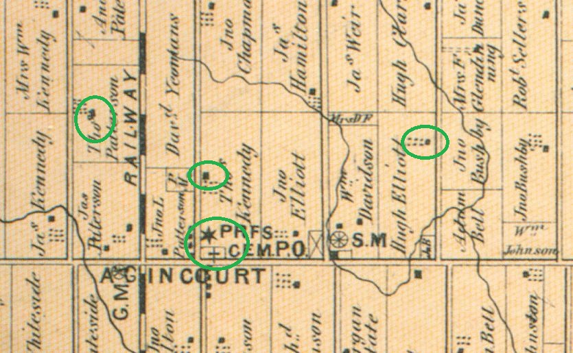
Suburbia spread over the farms of Scarborough following World War 2 moving from Ellesmere Road to Sheppard Avenue and then Finch Avenue. By the 1980s the farms between Finch Avenue and Steeles Avenue were under development. As part of a development proposal it is common for the city to request the creation of parks in exchange for increased density. Milliken Park was created in one of these deals. Milliken was a farming community that formed on both sides of Steeles Avenue in the Kennedy Road area, beginning in 1798. South of Steeles was part of Scarborough while the north side was in Markham. Since the two townships had been surveyed separately there was a misalignment between McCowan Road on either side of Steeles and the city wanted to take advantage of the developers to have them realign the intersection.

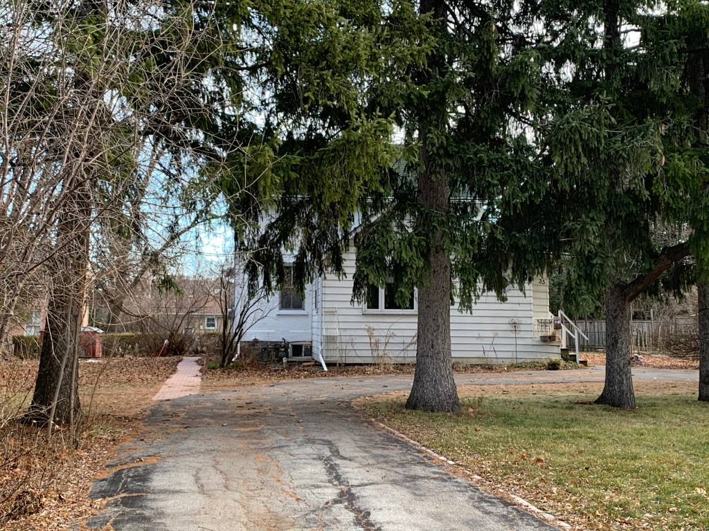
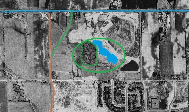
The former farm of Alfred Myles occupied Lot 22 in Concession 5 and had a tributary of Highland Creek flowing through it. Modern flood control techniques include the creation of ponds to collect run-off from spring melting and heavy rainstorms. These ponds are usually engineered to help purify the water before allowing it to flow into the local watershed. The Toronto Archives aerial image below shows the Myles farm in 1983. The blue line is Steeles Avenue and the brown one is McCowan Road. The green line on the left will become the current alignment of McCowan Road so that it meets with its Markham counterpart. The green oval encloses the newly created pond and the existing woodlot beside it. Subdivisions are just starting to encroach from the south.

The picture above shows the property under development as a park but it wouldn’t have its official opening until ten years later in 1993. During this time the pond would be dug and the earth they removed would be piled up in little hills around the pond. To the south of the pond a larger hill would be raised. Trees and grass were planted and in the north west part of the park extensive gardens were laid out. These have become the backdrop for many wedding pictures.

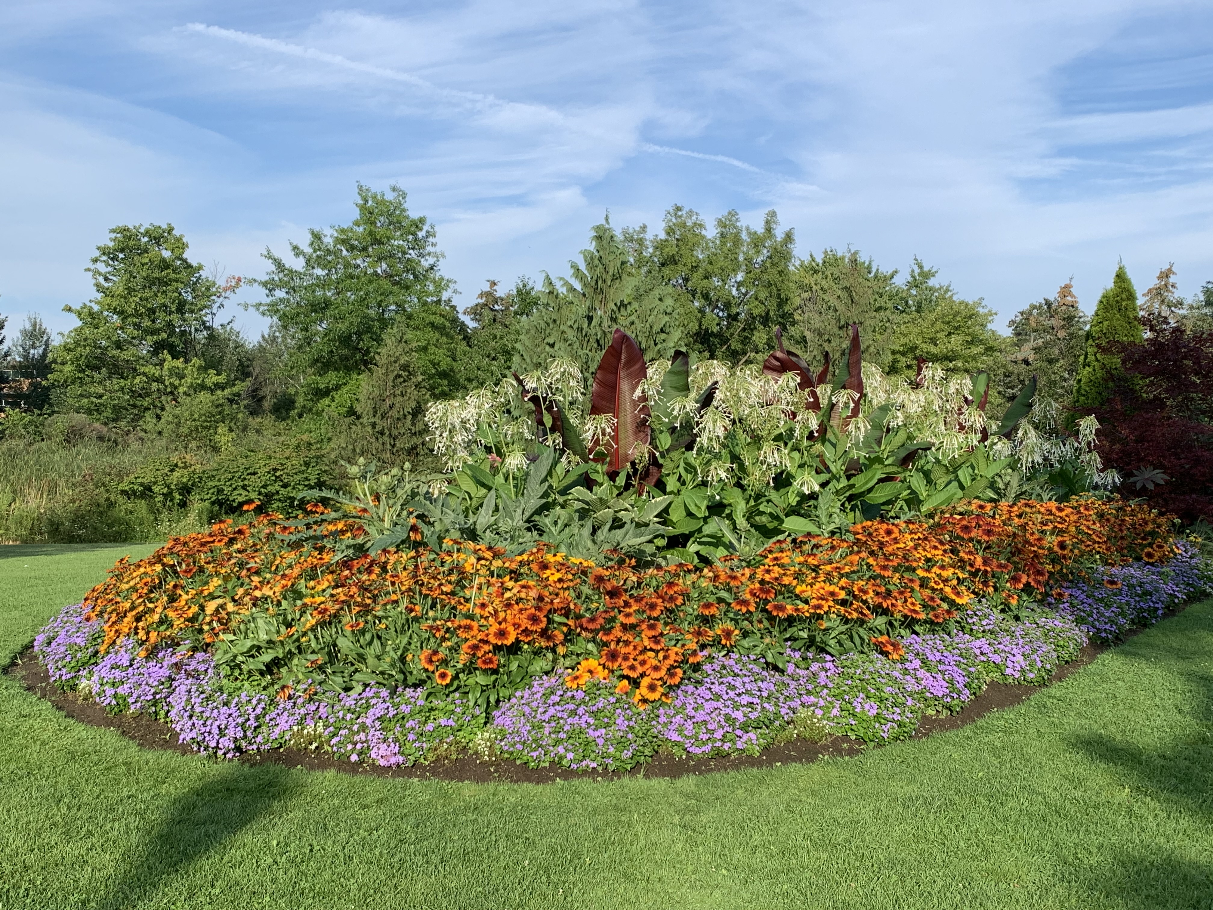
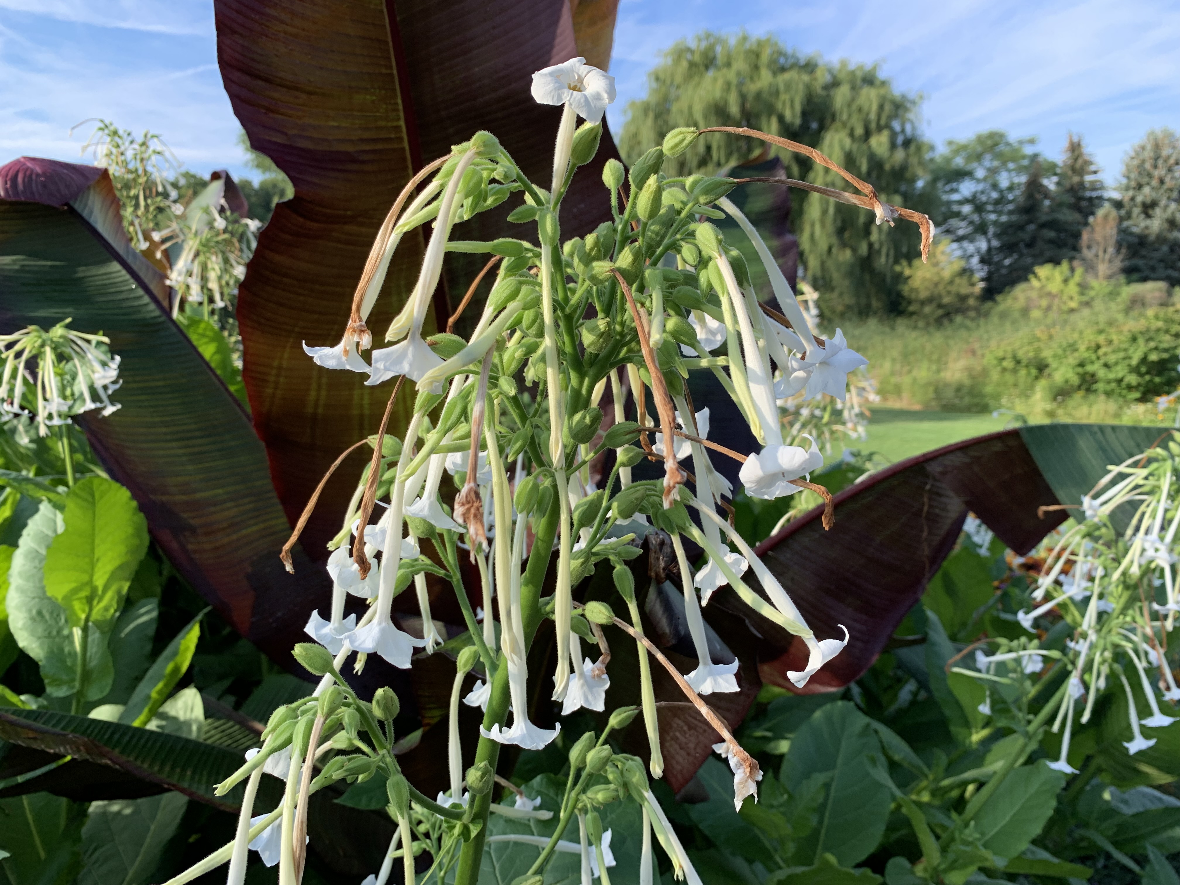
The larger plants in the middle of some flower gardens in the park are a type of flowering tobacco. Known as Jasmine Tobacco or Sweet Tobacco it is grown as an ornamental plant and isn’t cultivated for smoking purposes.

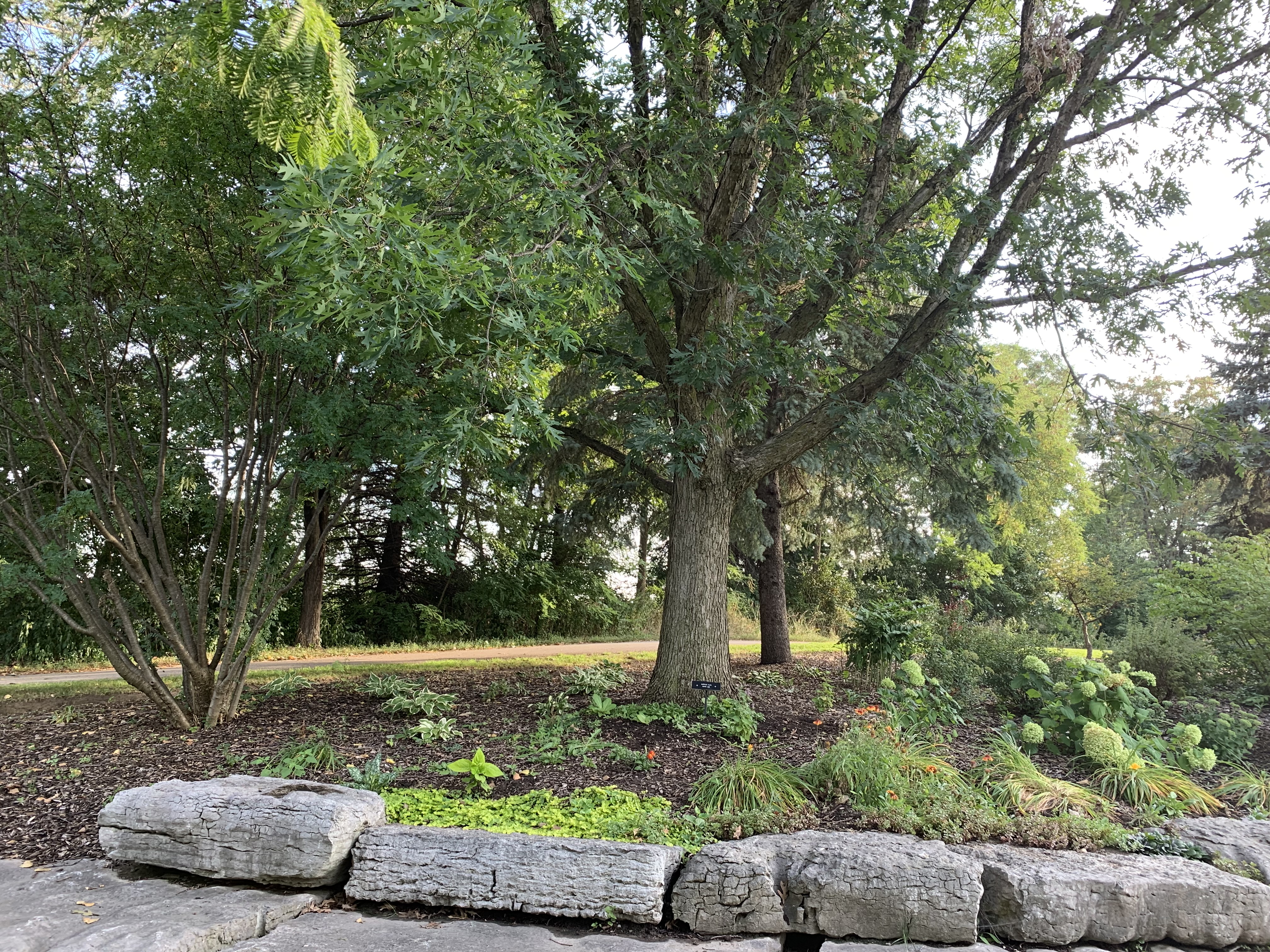
Throughout the park various trees have been identified with name plates to help people learn the types of trees that surround us everyday. The tree in the picture below is a White Oak which gets its name from the pale colour of the wood.

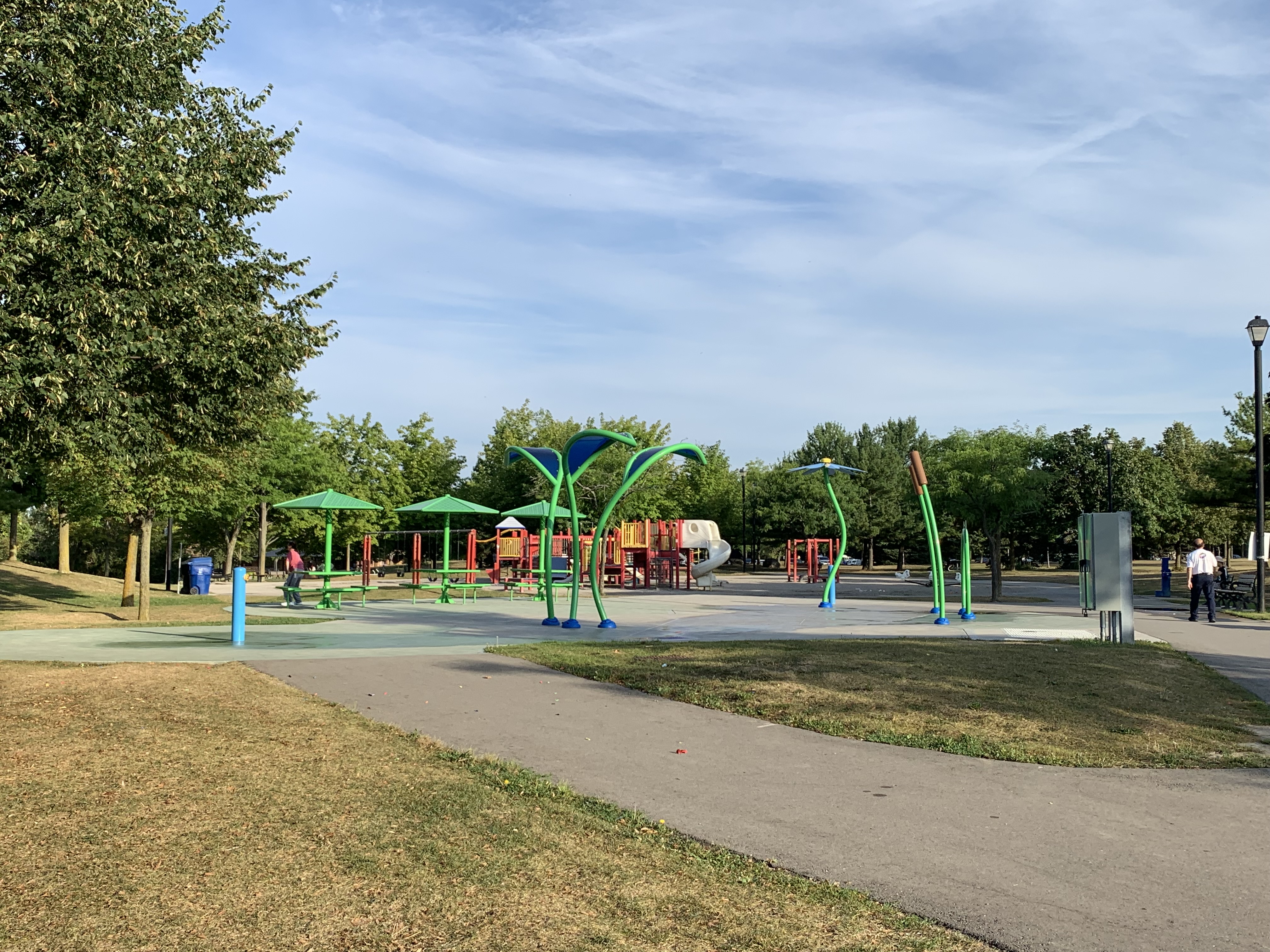
There’s a splash pad and an extensive set of playground slides and swings to keep the little ones entertained. Picnic and bbq areas can also be found scattered around the park and fireworks are displayed every July 1 for Canada Day when there isn’t a pandemic going on.

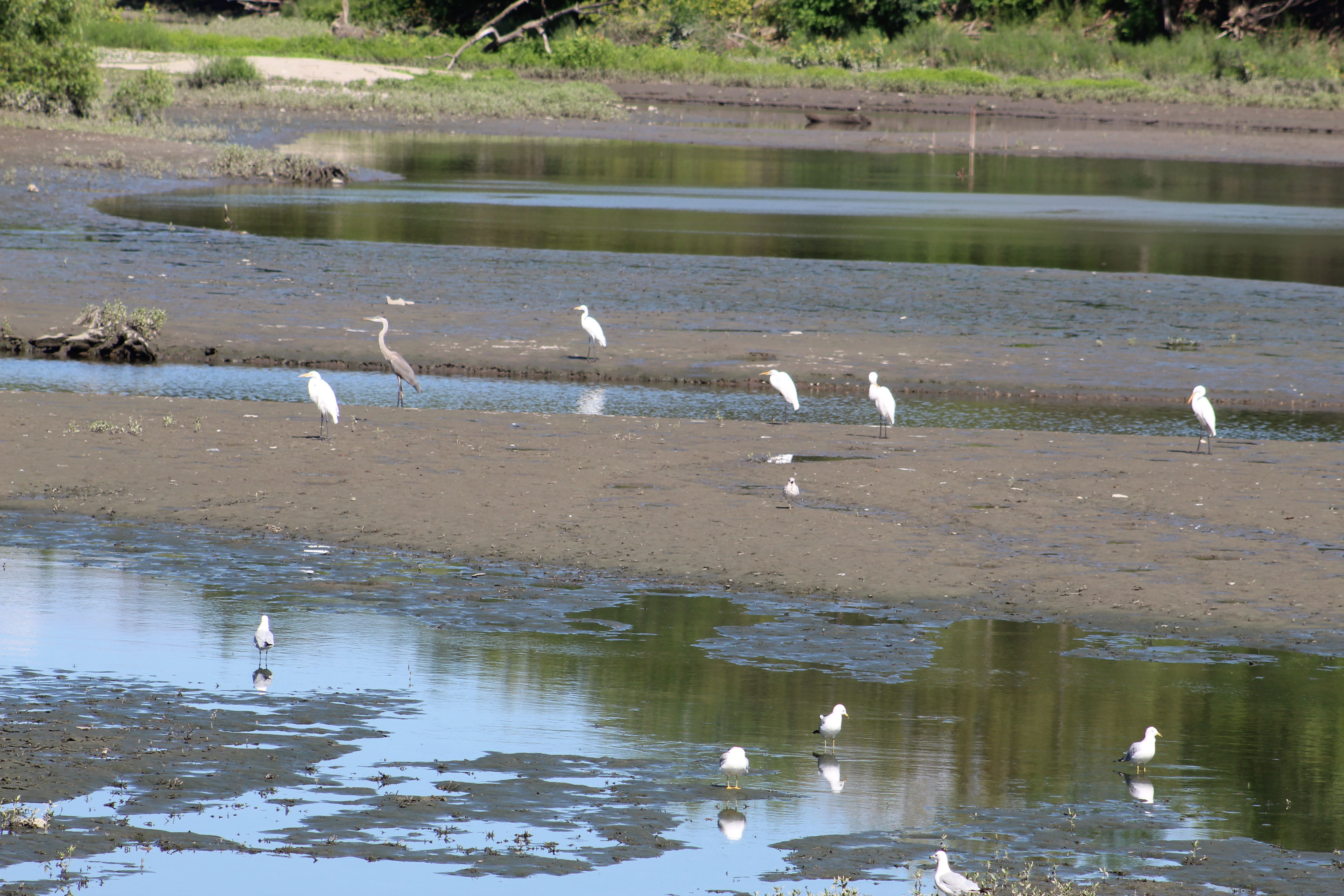
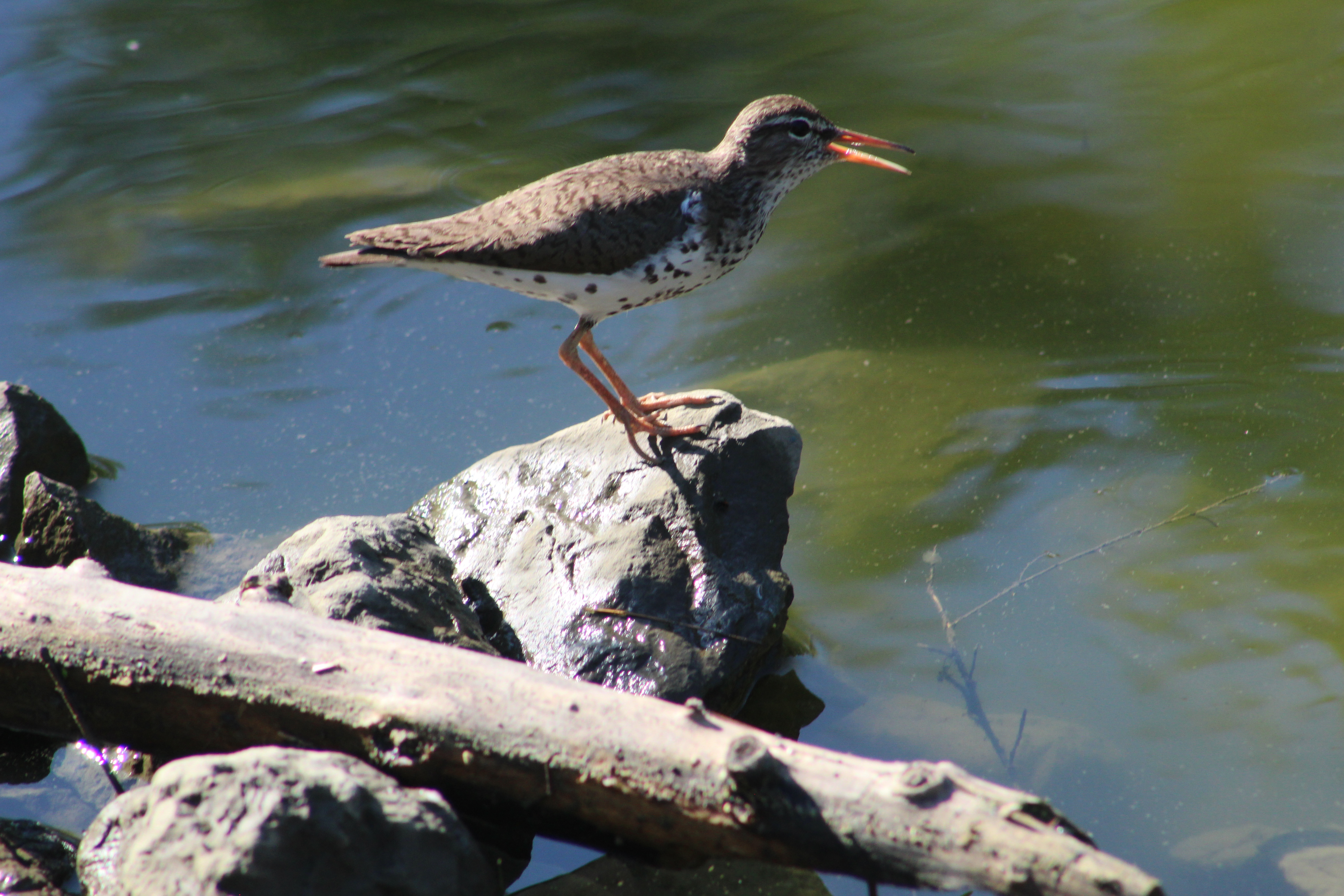
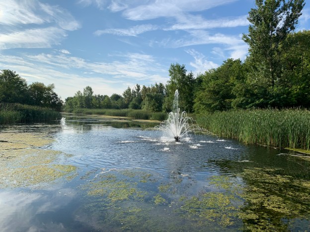
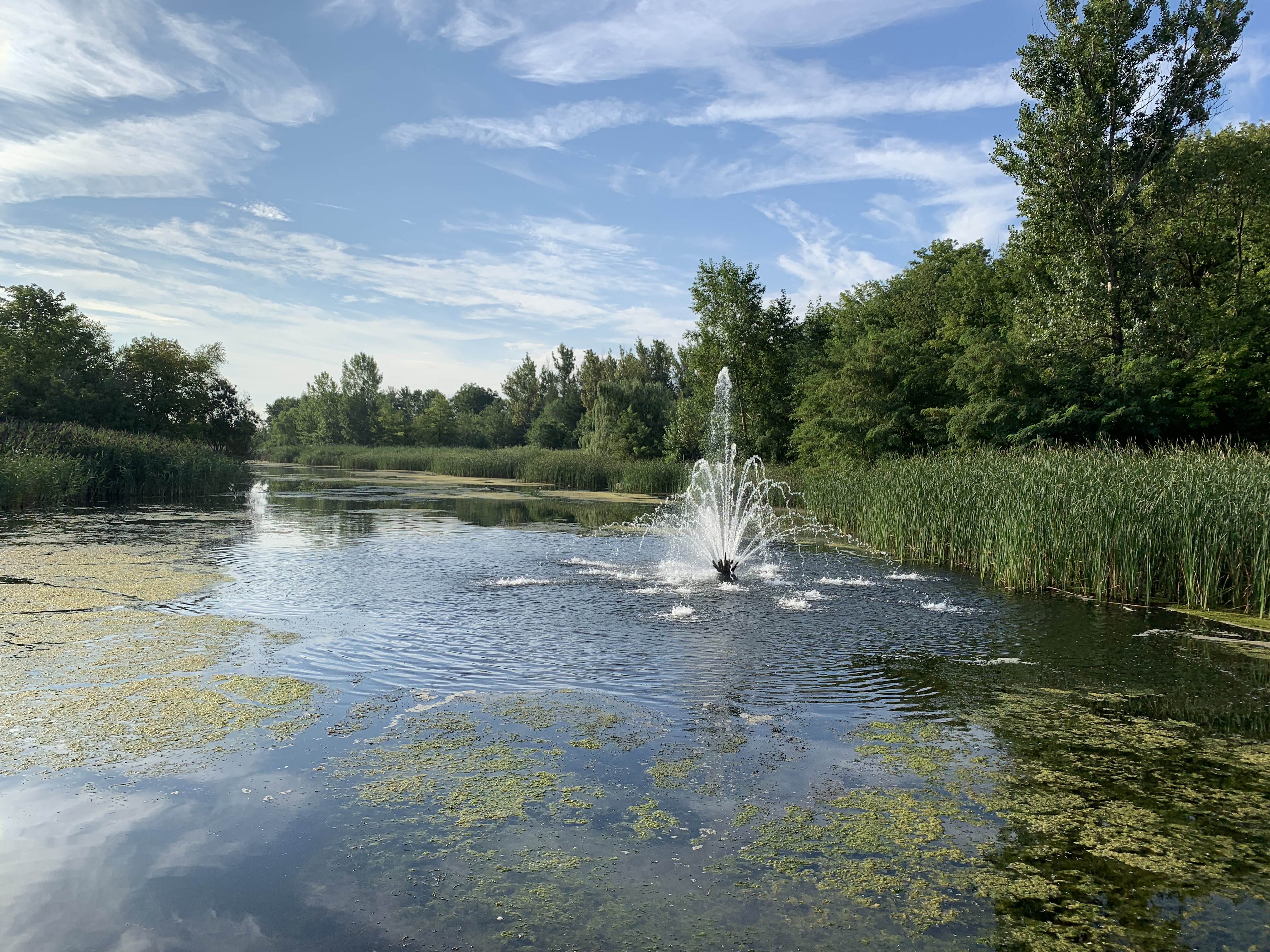
The pond is the central piece of the park. A paved pathway makes its way around the pond and there’s a short boardwalk and viewing platform. The pond also serves to hold storm water while pollutants from the surrounding subdivisions settle. The water is then released into Highland Creek without carrying these chemicals into Lake Ontario.

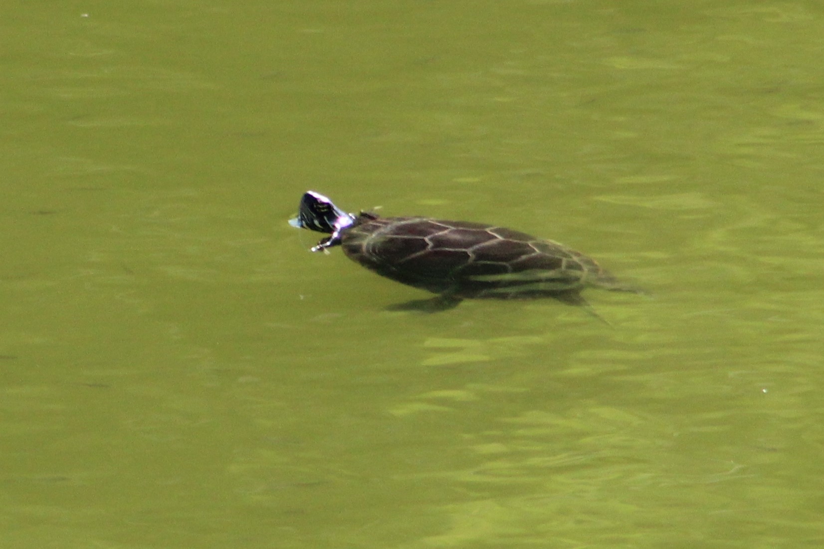
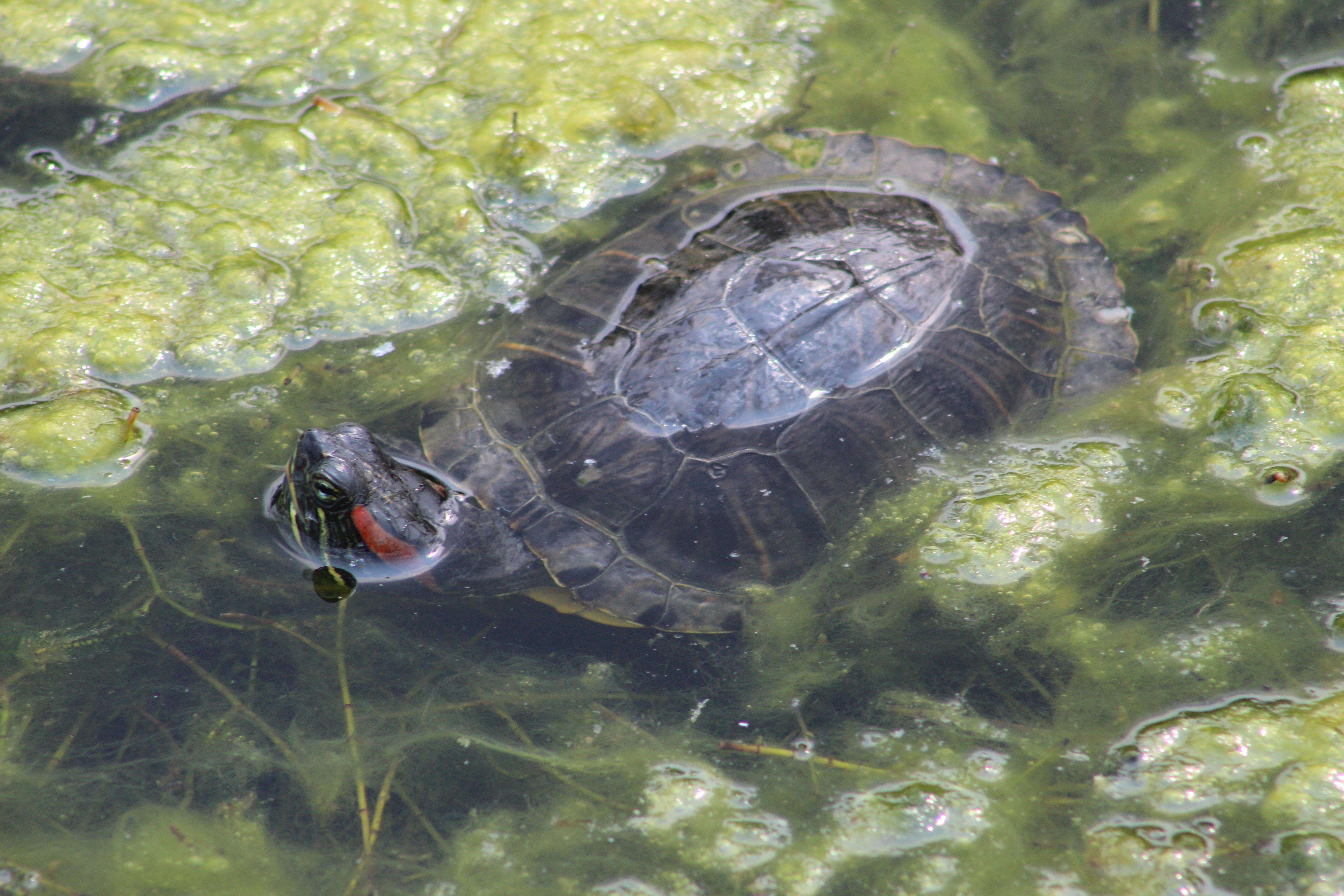
Several Red-eared Sliders are living in the pond. These turtles are native to Florida and the Lower Mississippi River but have become the most common turtle to be sold as an aquarium pet. Red-eared Sliders that live past the first couple of years can be expected to survive for 30 years and this is longer than some people are prepared to keep them. So, thinking it doesn’t matter, they release them into local ponds like the one at Milliken Park. They then outcompete the native turtles for food and nesting sites. Often the native Painted Turtles become exterminated in the process.

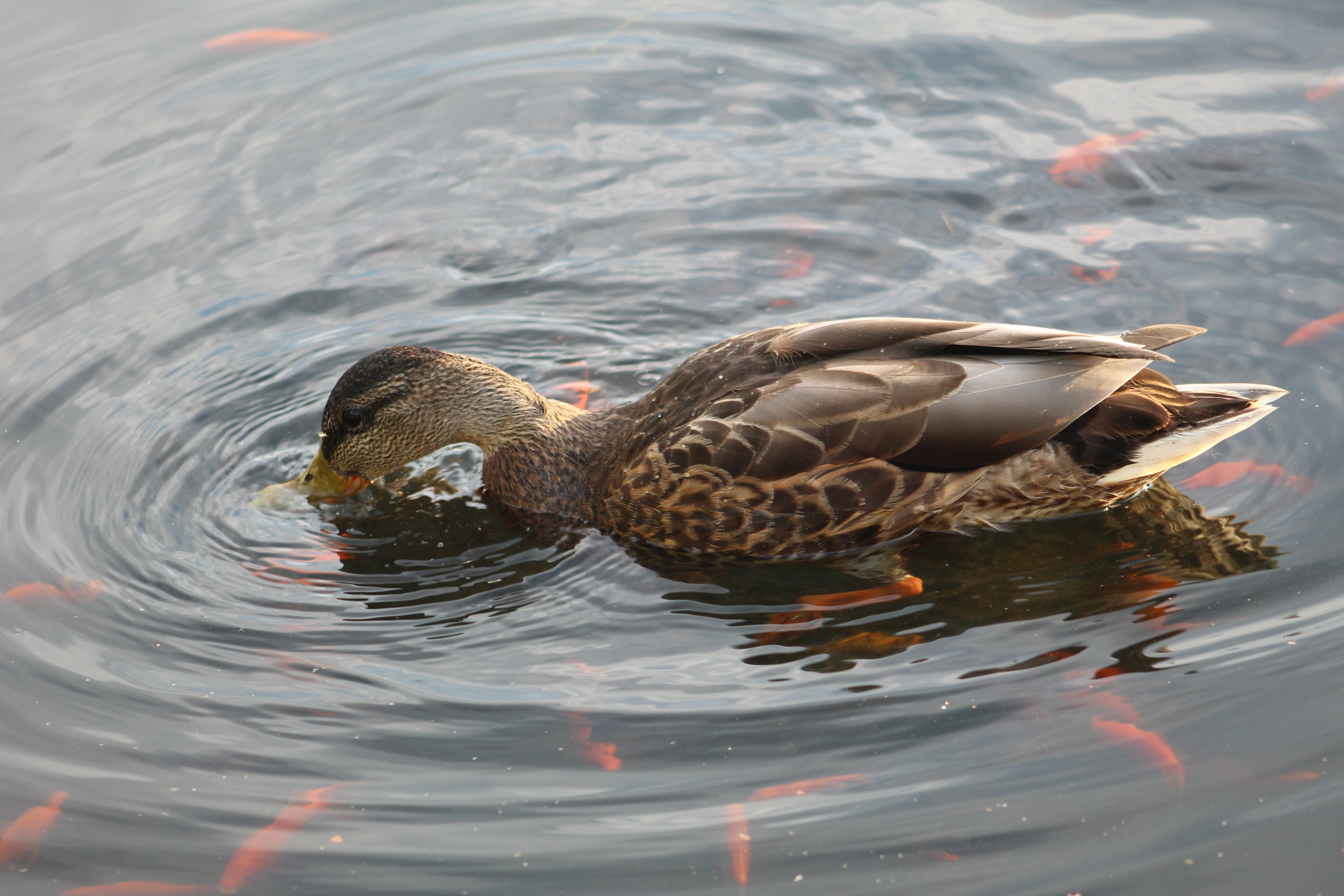
Goldfish that are released into the wild can grow to very large size because they adapt to the size of their environment. The Toronto Region Conservation Authority reports catching ones that weigh a kilogram when they’re doing their fish surveys. A few goldfish released into a pond like Milliken Pond can increase to the thousands in just a few years because they are very prolific. There’s certainly thousands of them in Milliken Pond.

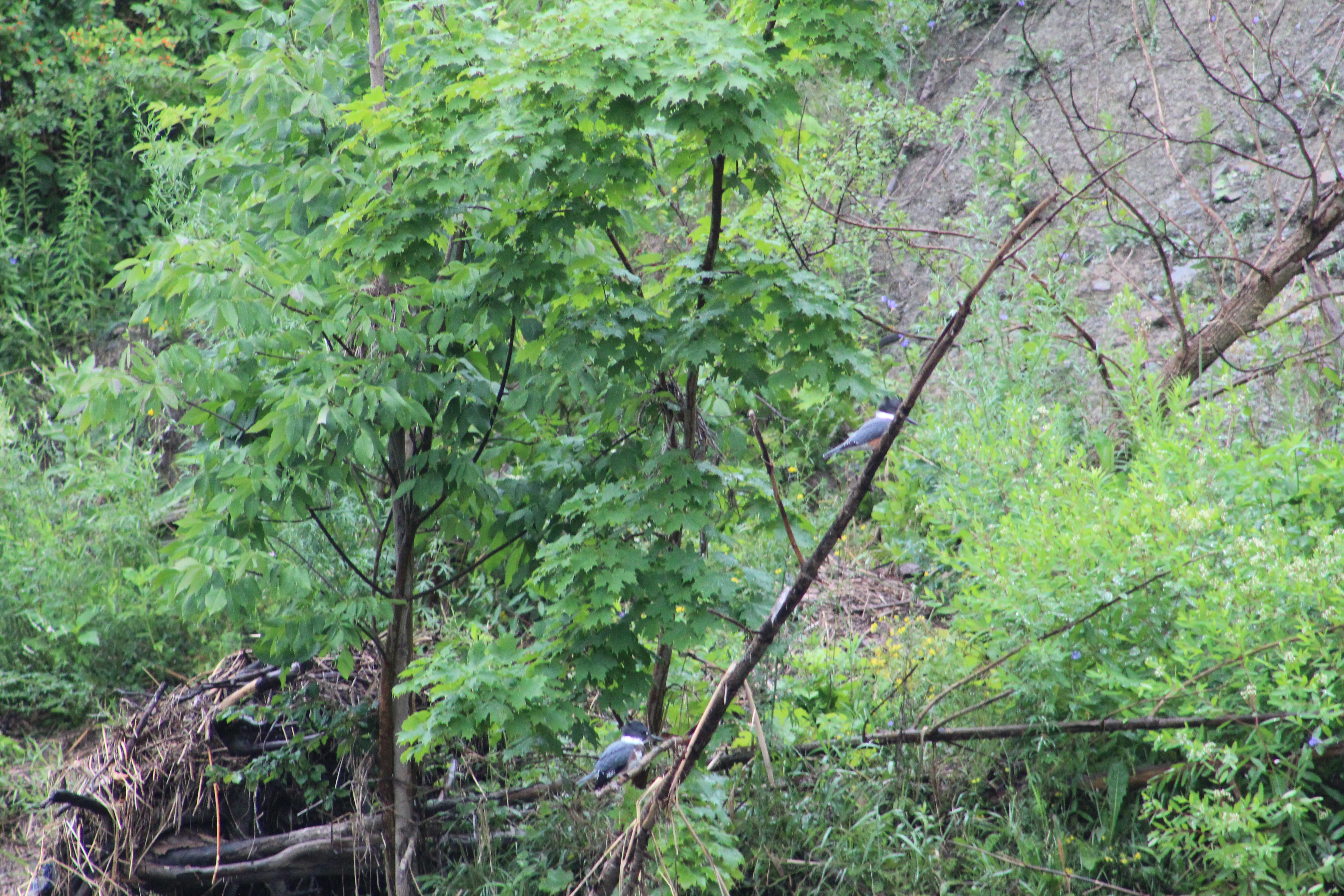
The pond is ringed with cattails which are a natural way to purify water. Since the pond is designed to remove contaminants from the surrounding drain water, these plants have been allowed to grow all the way around the pond. They naturally absorb chemicals, including phosphorus, out of the water and store it in the plant fiber. This allows the water released from the pond to have less of these chemicals in it. The willow tree, with the long light green hanging branches, in the picture below has a Great Blue Heron standing on the top branch.

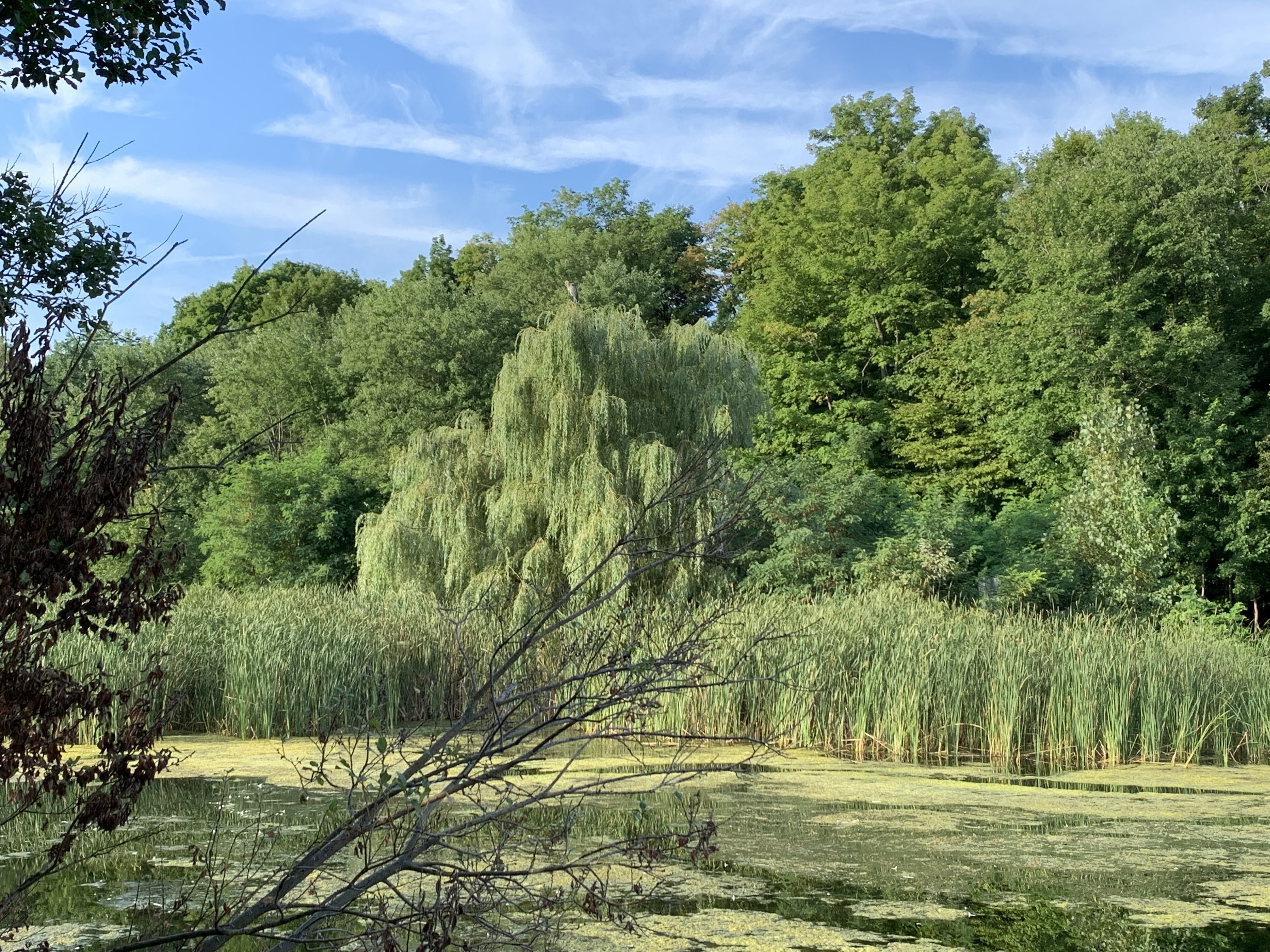
Great Blue Herons are quite common in Ontario and their numbers are increasing. There were over 1,600 colonies throughout Ontario in 1976 and this had almost doubled by 1991 with a 55% increase in the number of nesting pairs over that same period. Their numbers continued to climb over the past three decades and now you can find one or more on almost every river and pond in the GTA. This one was casually preening its feathers and has a couple stuck in its mouth in the picture below.

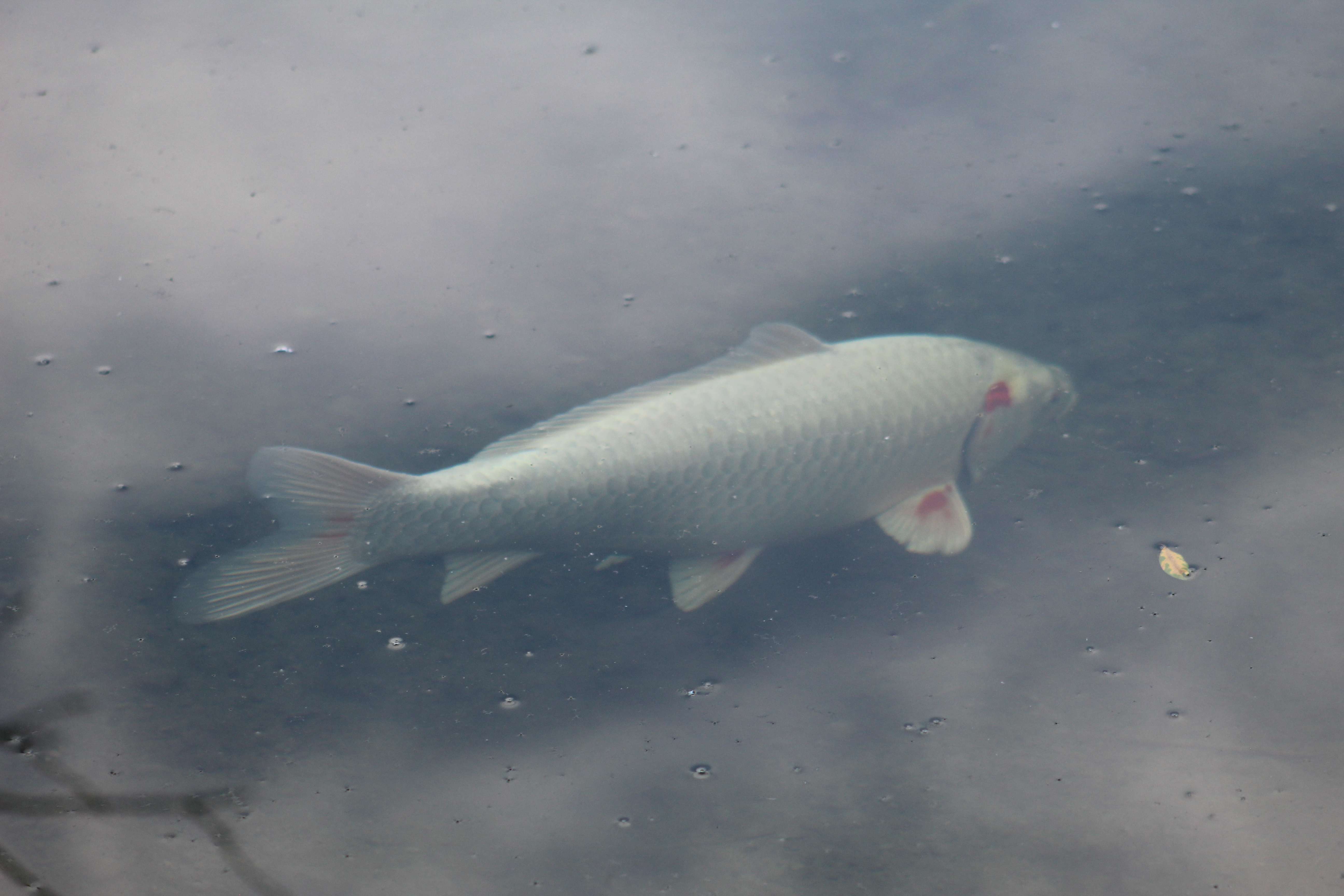
There’s at least one large white Japanese Koi Carp in the pond. These fish can live for 35 years, grow to 35 inches in length and reach 35 pounds in weight. This one was likely about 18 inches long.

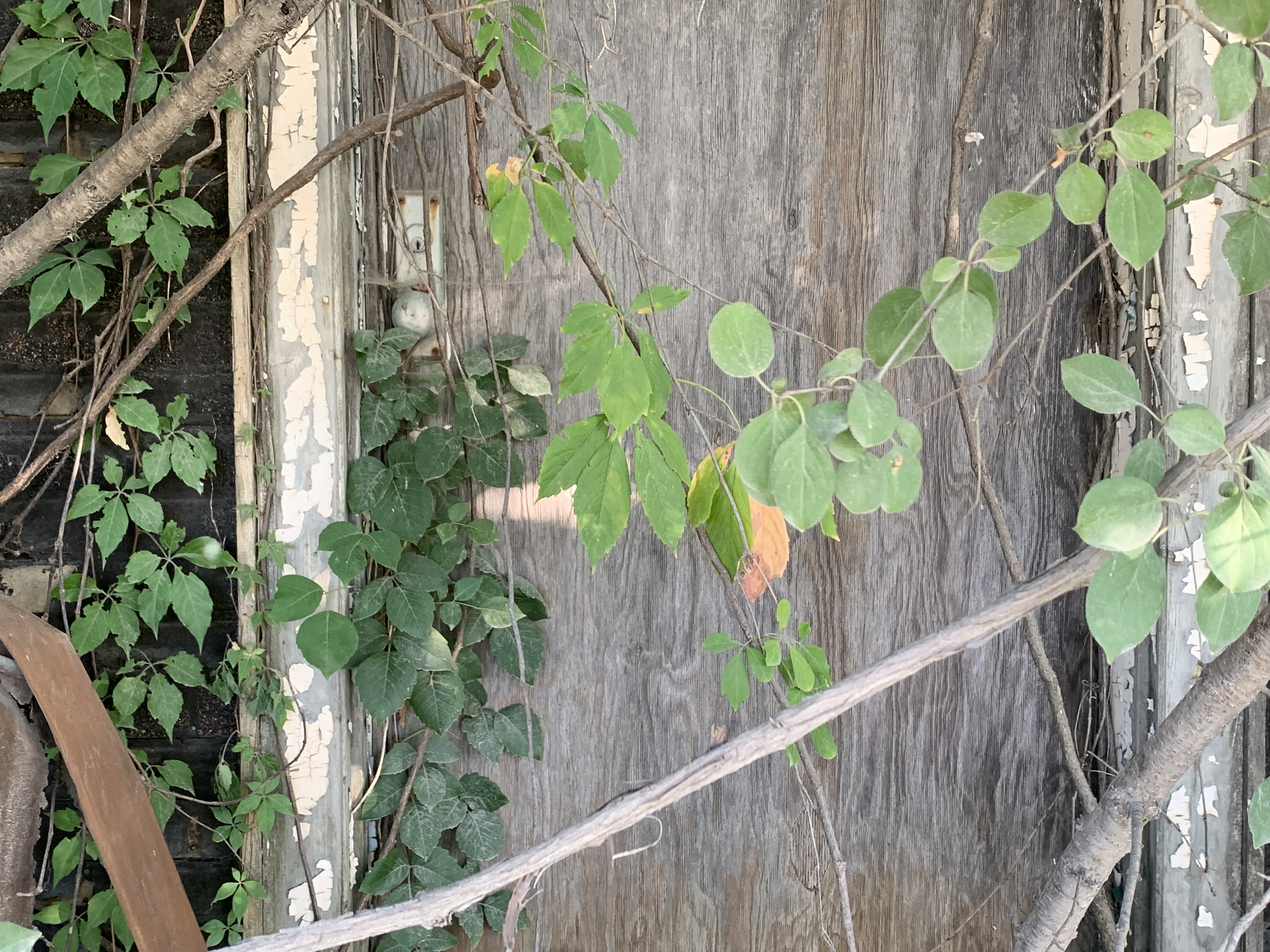
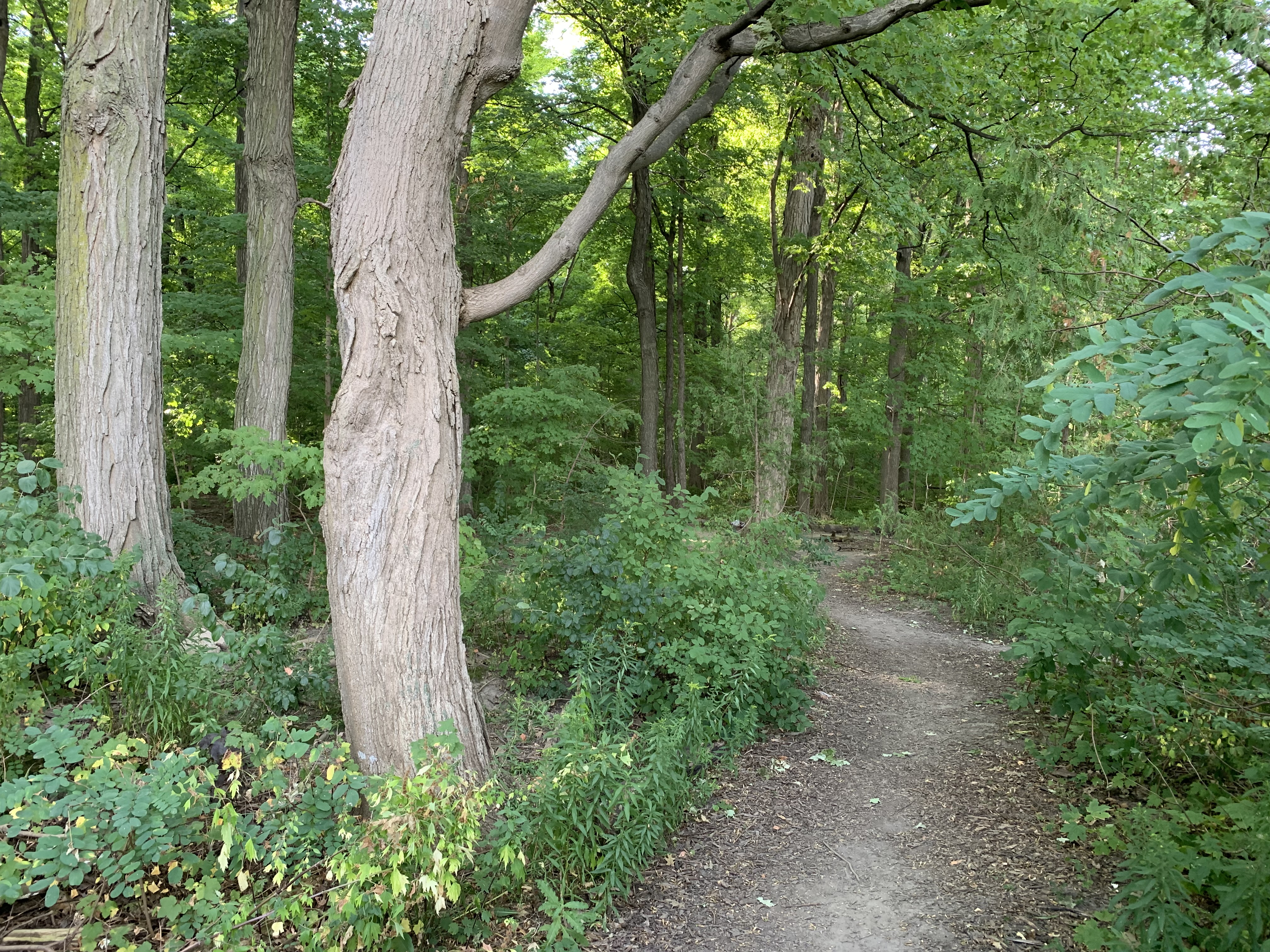
Land grants in Scarborough were 200 acres, usually completely covered with ancient forests. To earn patent, or ownership, of the land 5 acres had to be cleared and fenced. When that was done the surrounding forest be cut and the land prepared for farming. Over the years farmers would clear most of the property but almost everyone left a stand of trees from which they could cut firewood, fence posts and perhaps collect some maple sap for making syrup in the spring. The wood lot on Alfred Myles property is on the west side of the pond and has a series of trails that provide some much needed shade on hot summer days.

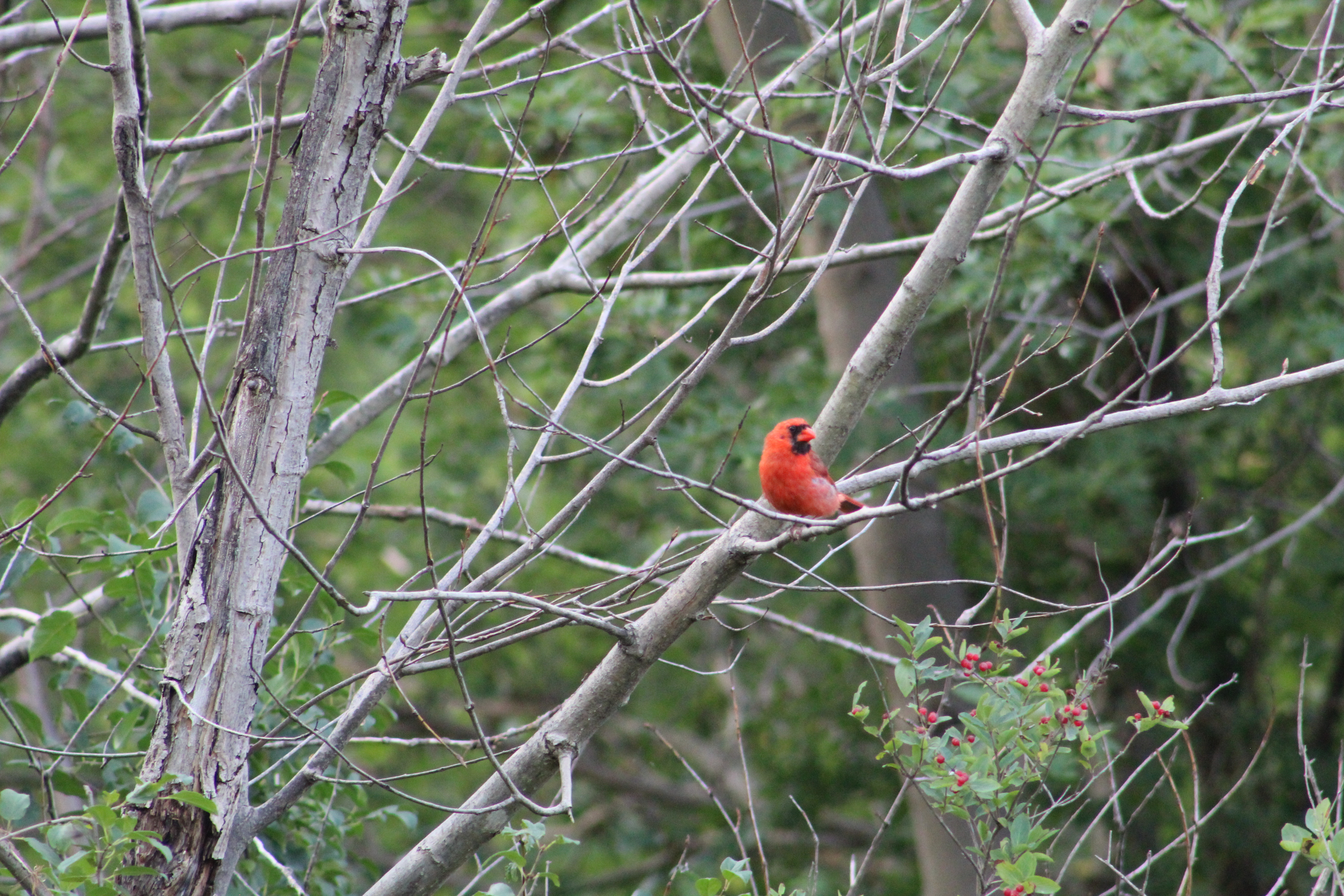
The park is home to many small mammals including black and red squirrels, chipmunks, and of course Eastern Cottontail Rabbits. These are perhaps the most common of the five rabbit and hare species that are native to Southern Ontario.

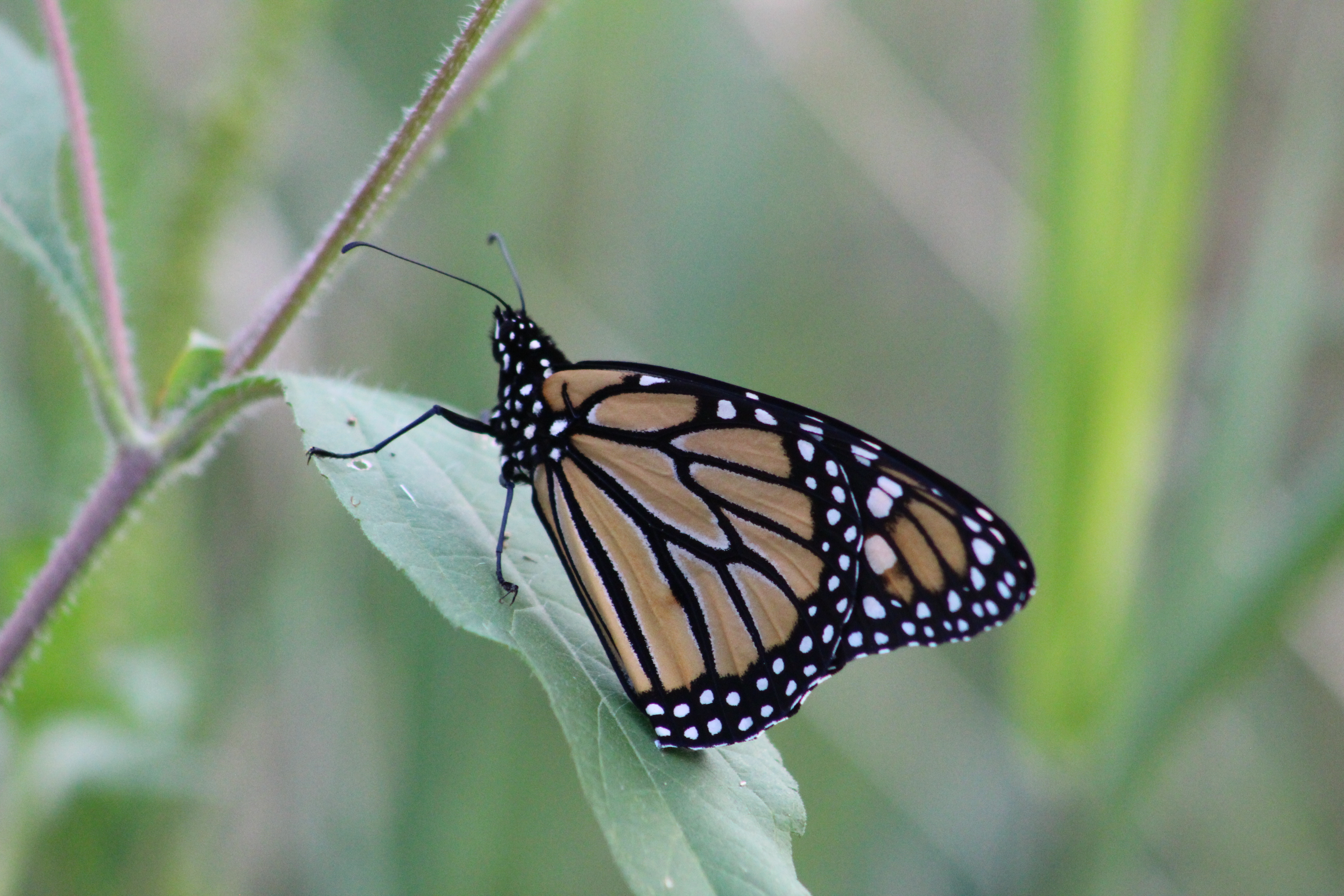
Monarch butterfly numbers are estimated based on the size of area in Mexico where they spend the winter. To have a sustainable population an overwinter area of 6 hectares is considered necessary. This past winter the butterflies only occupied slightly more than 2 hectares of the site. This means that there will likely be a lot fewer Monarchs to view this year. The one below appears to be still sleeping on this early Sunday morning.

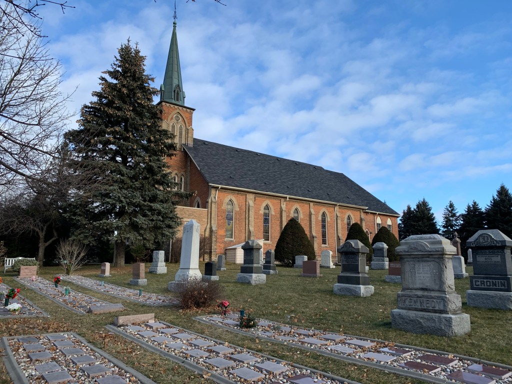
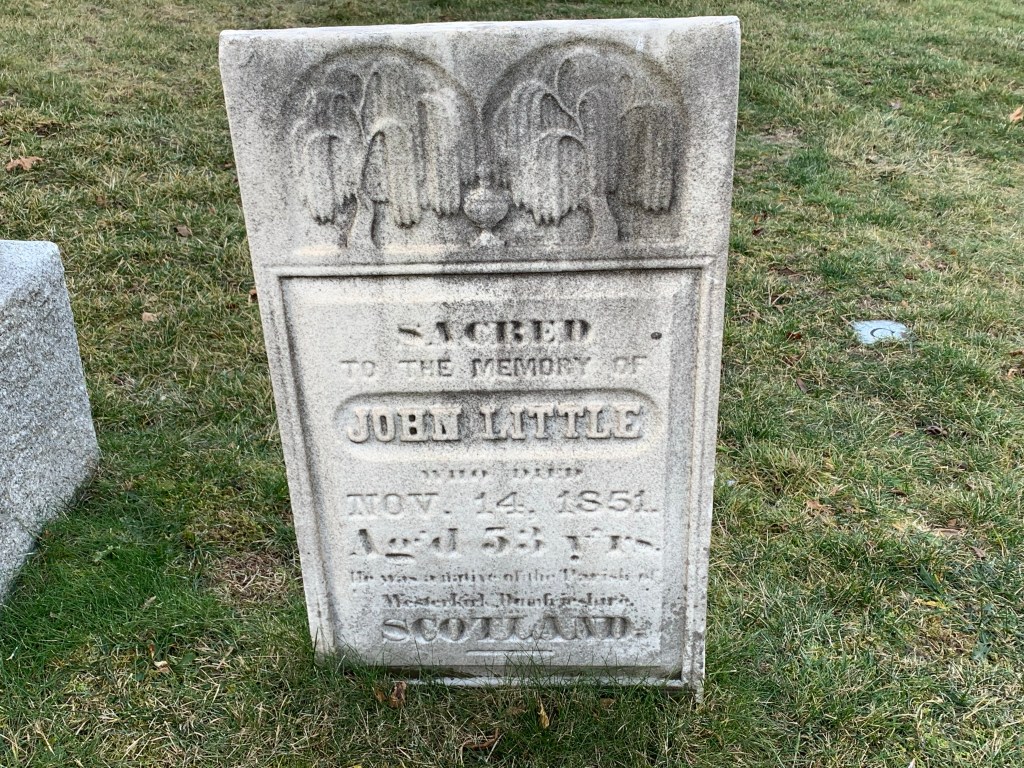
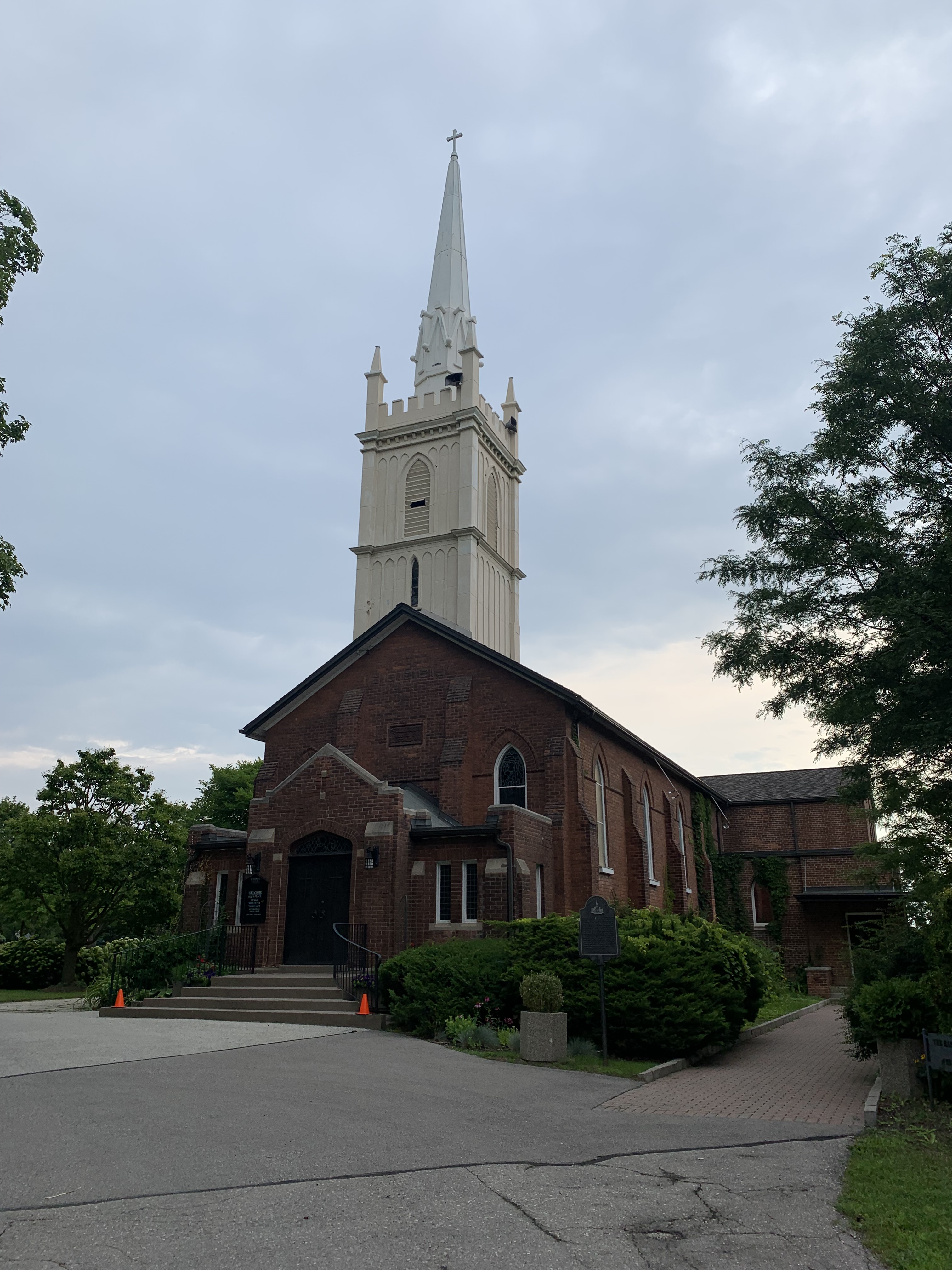
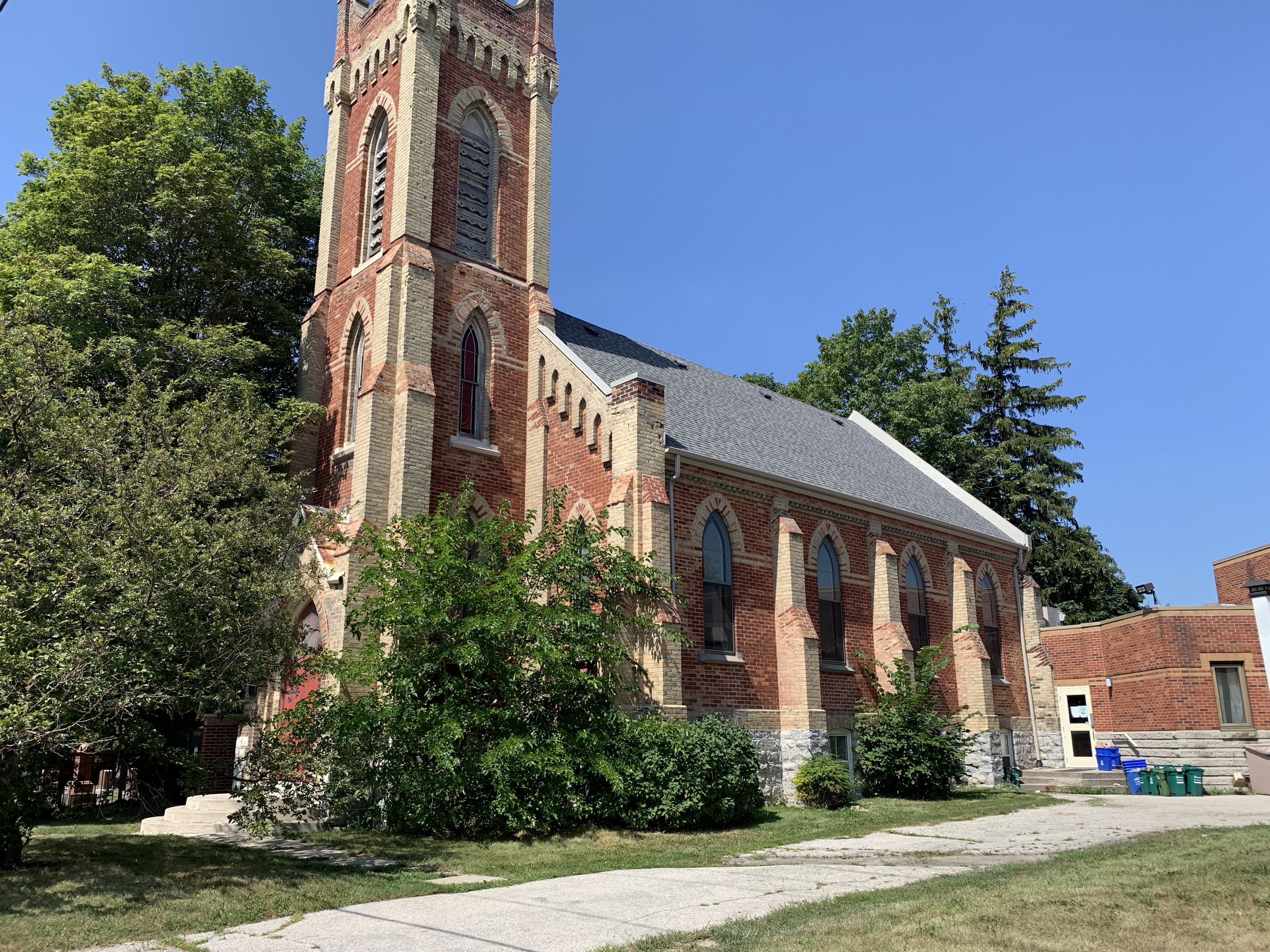
As for the community of Milliken after which the park is named, there isn’t much left. The most visible reminder is Ebenezer United Church at the corner of Brimley Road. The 1877 county atlas for Scarborough Township shows a Methodist Church on the south side of Steeles while the one for Markham Township places it on the north side of the road as it is today. This happened because 1878 was the year the congregation decided to replace their original building with with this brick one constructed in the gothic revival style. They worshiped in the first church while they erected the new one across the road.

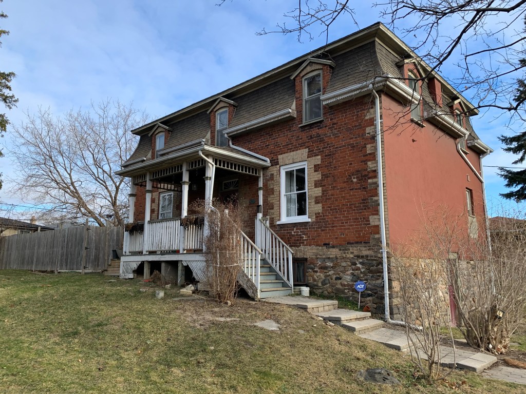
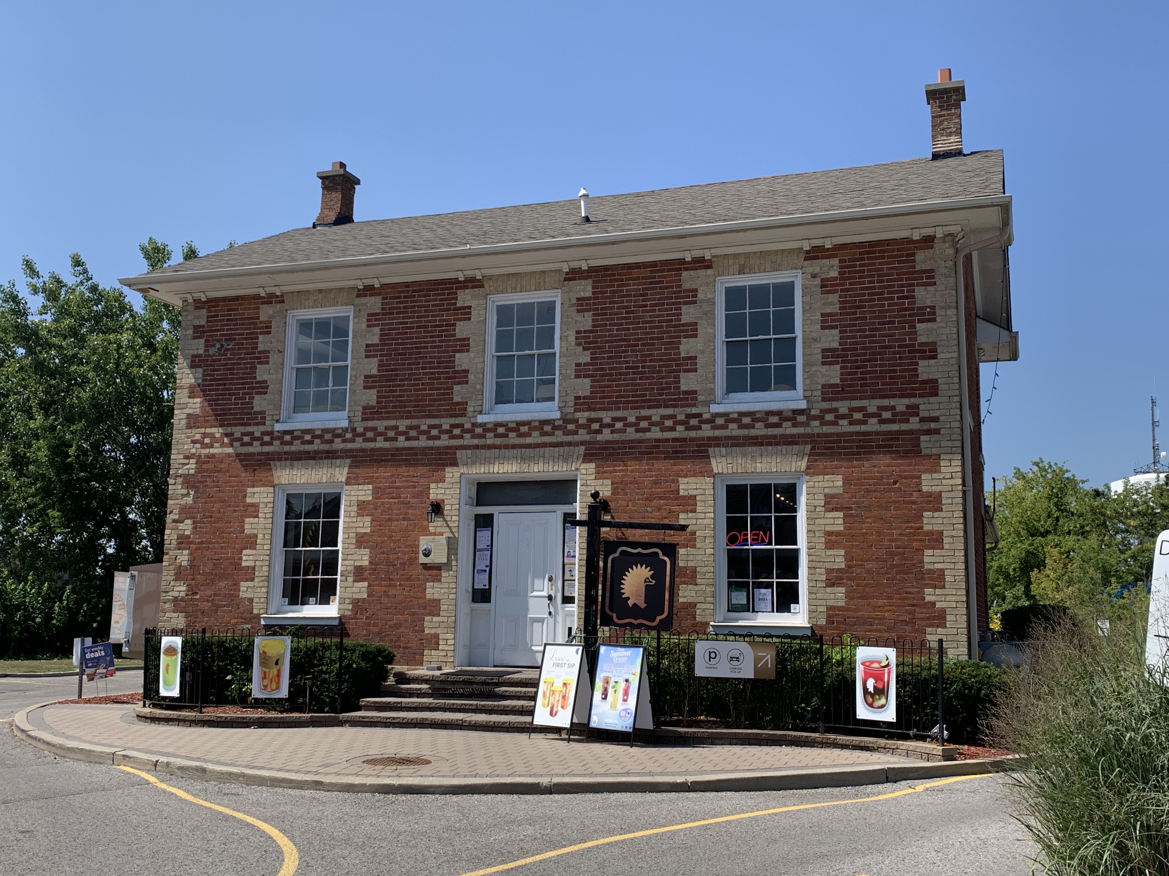
Benjamin Milliken II was the son of the founder of Milliken and he built this home in 1855. However, it’s technically in the ghost town of Haggerman’s Corners. And that, as they say, is a different story. One that we haven’t written yet.

Milliken Park has extensive paved trails, interesting wildlife and is the perfect place for friends and family to spend a relaxing afternoon.

Google Maps Link: Milliken Park

Like us at http://www.facebook.com/hikingthetga

Follow us at http://www.hikingthegta.com

Also look for us on Instagram

Toronto Dry Dock Company Ltd.

August 22, 2021

When Toronto was founded (as York) it was located where it was because it had one of the best sheltered harbours on Lake Ontario. The ship building industry got started early and the nearly completed Sir Isaac Brock warship was a prime motivation for the Battle of York. When the Americans invaded on April 27, 1813 the British burned the ship rather than have it fall into enemy hands. Since that time there have been hundreds of boats and ships built by the dozens of companies that have come and gone. The straightening of the Lower Don in the 1880s followed by the transformation of Ashbridges Bay into The Port Lands after the turn of the century created further opportunities for industry. The Toronto Dry Dock Company Ltd. was one of those new enterprises.

The aerial photograph below is from 1957 and was taken from the Toronto Archives. It shows the straightened Don River making a hard 90 degree turn into the Keating Channel. The buildings of the Toronto Dry Dock Company Ltd and Toronto Ship Building line the south side of the channel with the existing buildings circled in green. At the edge of the channel a ship is currently sitting in dry dock (also circled).

One of the earliest and most successful manufacturers of steam engines and ships was Polson Iron Works. They produced around 150 vessels and were intended to occupy Polson’s Pier in the newly created Port Lands but didn’t move there because of the First World War and then they suffered bankruptcy in 1919. Meanwhile, The Toronto Dry Dock Company and its co-owned Toronto Ship Building Company established themselves along side the Keating Channel. Three of their former buildings can be seen in the picture below.

While Polson was busy pumping out minesweepers for the military, the newly founded Dry Dock and Ship Building enterprise got a contract to build cargo ships for the military. War Ontario and War Toronto were their first two ships. Their facilities faced the Keating Channel with access to Lake Ontario and the Great Lakes but they also faced Villiers Road where a railway spur gave them access to the rest of the province.

The building at 170 Villiers served as the front office of the business, greeting customers from the street side, rather than the rear which looked out over the work yard.

The side of the building facing Villiers Street was a lot more inviting in 1954 when this Toronto Public Library photo was taken.

The business would continue until 1964 when it would become part of Port Weller Dry Docks. Following their demise, the property was sold to the Toronto Port Authority. Today, the windows are all boarded over and the front of the building is grown over in ivy.

However, the front door is still there, secretly waiting for dry dock customers who never arrive.

When Toronto Dry Dock Company Ltd. received its charter in 1917 as a vessel repair yards, C.S. Boone was the first president. It was an off-shoot of C.S. Boone Dredging & Construction, of which he was also the president. They started business with a floating dry dock that was 160 feet long that was tethered to the concrete wall in front of the office building.

However, they soon found that it wasn’t large enough for many of the vessels they could have worked on. In 1920 they purchased another dry dock which was sitting in Montreal. It had been used during the war to re-assemble ships that had been taken apart and floated through various canals to the St. Lawrence River so that they could be added to the war effort. The dry dock was towed to Toronto where it was added to the existing one. This gave the yards the ability to work on the biggest ships on the Great Lakes. The building below was used to build and repair large boilers and steam engines. It has been the unfortunate victim of someone who doesn’t know how to spell “scarface” and chose to display it in ten foot letters.

When The Don Narrows were created by straightening the Lower Don River one of the objectives was to create shipping to service the industries along the river. Instead, the 90 degree turn into the Keating Channel led to serious silting problems and the larger ships were often unable to reach the dry docks for repairs. By the early 1940s Henry J. Dixon had become the principal owner and he started Toronto Towing and Salvage Ltd. and moved away from the dry dock business. Villiers Street was formerly serviced by a rail line that ran down the middle of the street and it provides the vantage point for the picture below.

Over the years the company had bought up scrap vessels and salvaged a large number of parts which they used in repair of other ships. When the company went into liquidation in January 1964 a lot of the left over items were sold for scrap metal. The buildings became part of the Toronto Harbour Commission properties but the dock facilities on the Keating Channel in front of the third building have been left to deteriorate.

Fortunately, not everything in the yard was sold for scrap. The Marine Museum of Upper Canada had been opened in Stanley Barracks on the CNE grounds in 1957 and a large number of local marine artifacts were donated to the museum. In 2000 the museum, now known as Toronto Maritime Museum, was relocated to Pier 4 in Queens Quay West. In 2008 the museum was closed and all the artifacts have been in storage ever since.

The first two ships built in the yards were sisters named War of Ontario and War of Toronto. Both were completed in 1918 in time for the last of the Great War in Europe. The picture below is part of the Bowling Green State University collection and shows the wooden hull of the War of Toronto as it was being launched into the Keating Channel.

The island Ferry “Sam McBride” was built in 1939 by Toronto Dry Dock Limited and remains in service to Toronto Islands today. Sam McBride was born in Toronto in 1866 and was mayor from 1928-1929 and again in 1936. He passed away before completing his second term. This image is taken from Wikipedia.

Toronto needs a new home for our Marine Museum and these few remaining buildings could be the perfect place for it. It would be a sort of homecoming for many of the artifacts and historic vessels could be tied up along the Keating Channel for museum guests to explore.

Related articles: The Battle of York, The Don Narrows, The Port Lands

Google Maps Link: 170 Villiers Road

Like us at http://www.facebook.com/hikingthegta

Follow us at http://www.hikingthegta.com

Also look for us on Instagram

Agincourt – Ghost Towns of the GTA

August 15, 2021

Agincourt remained a small community until 1858 when John Hill was finally successful in getting a post office for his general store at the crossroads of todays Brimley Road and Sheppard Avenue East. The name Agincourt was taken from a town in northern France where a decisive battle was fought in 1415 during The Hundred Years War between Britain and France. The earlier name for the community had been “Hero Town” and that didn’t seem appropriate for the new post office name. The town grew slowly with Hill’s General Store and Post Office being accompanied by Milnes Sawmill and a temperance hall along with a growing number of homes.

Thomas Paterson was one of the founders of Agincourt and started to raise a family in a small log cabin on the east side of todays Kennedy Road. As the family grew, three of his sons built nearly identical homes each taking up a section of the family farm. Thomas Jr. had the middle plot and his home is the lone survivor today. The house was built prior to 1850 and is one of the oldest brick houses remaining in Scarborough. The pictures in this article were taken in December 2020 which is why there are no leaves on the trees.

Hugh Elliot built this house around 1848 and it was expanded with a second floor around 1860. The new roofline is second empire and is the best surviving example of a style that was once quite popular in Scarborough. This house has been given an historical designation and is located on McCowan Road on a property that has been owned by developers since 1981. It has been kept in good maintenance and will be incorporated into a future development.

The house at 33 Murray was built in 1888 by the Kennedy Family who lived there until 1912 when the farm was sold to John Harris. The most interesting family to own the house was perhaps the most recent. Bill White bought the home in 1951 and became known as the first black man to run as a federal election candidate. His years of service led to him being designated as an Officer of the Order of Canada.

2656 Midland was built in 1863 and was originally the manse for the Knox Presbyterian Church. The church was founded in 1848 but this was the first home that they built for the use of the minister. Stylistically, the home reflects elements of the Regency Cottage design with the side porch likely being added at a later date.

The house at 20 Lockie Avenue was the latest farm house in the family of Thomas Archibald Paterson. Thomas Paterson had settled on the farm in 1820 and four generations of men with the same name occupied the farm until the 1950s. This Edwardian style home was built after 1900 and has a rare 3-bay configuration on the traditional four-square design.

School Section 14 was created in 1913 to serve the growing population around Agincourt. Three acres of land were donated by the Paterson Family and the school was constructed at a cost of $12,000. When it opened in 1914 it had 48 students and 2 teachers. By 1921 there were 107 students and still only 2 teachers.

Knox Free Presbyterian Church was founded in 1848 and quickly outgrew its original wood frame building. Forty members attended the first service on June 25 of that year. By 1872 a new sanctuary was required and as the picture below shows, an addition was made to the back as the church continued to grow. They have served the community as Knox United Church since 1925.

The original pioneer cemetery has grown into the Knox United Cemetery. The earliest burial was recorded in 1836, a dozen years before the founding of the church. The next oldest is 1848 perhaps one of the earliest services held in the new church.

Across the street from the church on the south west corner is a large lot that has been proposed as a site for townhomes and a new park. It was formerly a Lumber King Home Centre and then a flea market. The gas station that once occupied the corner of the property has been removed.

14 Allanford Road is a Second Empire home known as Lynn Bank and is designated as a heritage property. Built into the side of a small rise of land it has three floors with the mansard roof providing extra headroom to the bedrooms on the upper floor.

The community of Agincourt has become swallowed up in Scarborough’s ever expanding urban sprawl but the remnants of the early community still survive.

Google Maps Link: Agincourt

Like us at http://www.facebook.com/hikingthegta

Follow us at http://www.hikingthegta.com

Also look for us on Instagram

The Flood Control Pond at G. Ross Lord Park

Sunday, August 8, 2021

G Ross Lord Park is one of our favourite places as followers of our Facebook page will know. We post wildlife and nature photos from there almost every week and the variety of creatures is outstanding. This post focusses on the flood control pond and the surrounding woods and grasslands and pays particular attention to the wide variety of birds that can be found there. The County Atlas from 1877 shows that there were two dams on the West Don River in the area that is now G Ross Lord Park. The lower pond supplied water to a saw mill and it is this flood plain that was used to create the flood control pond in G Ross Lord Park.

Following Hurricane Hazel in 1954 it was decided that flood control measures would be implemented to control the release of water to downstream areas. A dam was built on the West Don River near Dufferin and Finch that would be capable of holding five and a half million cubic metres of water. The G Ross Lord Dam was completed in 1973 and the flood control pond can rise by as much as five metres following a major rain event or during spring thaws.

It has been common over recent summers to see a pair of Herons and an Egret at the pond. This year there has been up to 14 Egret and 4 Heron at the same time. There’s five Egrets and one Heron in the picture below.

This aerial photo comes from the Toronto Archives and shows the site in 1971 before the flood control pond was created. The blue shows where the West Don River used to flow around a wide ridge of land and reveals that the hydro towers were originally located on land.

The dam flooded a large area of land that expands dramatically after every heavy rain event. A soon as the rain has stopped the dam is opened to allow the water to slowly drain away to create room for the next rain storm.

Although this is a man made pond it was formed around a river and has become home to a wide range of wildlife. The baby Painted Turtle featured below is native to the area but the Red-eared Slider I saw last year is a domestic pet that has been dumped in the pond. Over the years I have often seen a large Snapping Turtle just up-stream from the pond.

Earlier this year I was lucky enough to see a pair of Peregrine Falcons land on the mud flats when the pond was at a low point. There are a few nesting pairs around Toronto but most of them are in the area of Lake Superior.

There are often people fishing in the pond where they catch Brown Bullhead, Carp, Pumpkinseed and White Suckers. The Herons, Egrets and Cormorants live here in large numbers because of the easy fishing when the water level is lower. The Heron in the picture below has just speared a young sucker.

Cedar Waxwings live in the forests surrounding the flood control pond. They like to sit on branches and fly out over the water to snatch insects out of the air. There are several different types of damselflies and dragonflies that hover over the pond and make great snacks for the birds.

It’s common to see both Red-tailed Hawks and Copper’s Hawks in the area around the pond. The Cooper’s Hawk in the picture below is one of a pair that is nesting in the trees on the north side of the pond.

The image below shows the pond looking toward the east when the water is at it’s lowest level. When flooded, it can rise well into the trees on the other side as well as covering the place where this picture was taken.

Woodpeckers are very common in the park and there are at least three different species that feed off the bugs in the trees that have died from being flooded around the pond’s edge. The large Pileated Woodpecker is less common than the Downey and Hairy ones that can be found on almost every visit. The picture below shows a male Downey Woodpecker.

Spotted Sandpipers are shore birds that can be found all around the edges of the pond where they compete with Killdeer for the small insects and minnows that live there.

Over the years I have watched a pair of Belted Kingfishers working the river just upstream from the flood control pond. This year, they appear to have moved downstream to the pond where they can be heard before they are seen. Kingfishers are one of the chattiest birds and seldom fly without filling the air with their loud rattling scolding noises. They will sit on a branch until they see a fish under the water and they will dive at great speeds into the water to come up with their lunch. Both the male and female can be seen in the picture below.

The grasslands and new growth forests along the edge of the flood control pond have become home to a wide variety of songbirds. Various warblers share the trees with American Goldfinch and make for a nice splash of colour.

It’s alost certain that every visit to the flood control pond will be rewarded with the sight of Cardinals. These beautiful birds mate for life and can be seen and heard all year around.

When people think of bird watching in the Toronto area they often think of Tommy Thompson Park which is known for the wide variety of birds that can be seen there. If you live in the northern part of the city you may find that G. Ross Lord Park is more convenient and also has an amazing variety of birds.

Google Maps Link : G Ross Lord Park

Like at at http://www.facebook.com/hikingthegta

Follow us at http://www.hikigthegta.com

Also look for us on Instagram

Pioneers of the GTA – William Thomas Architect

Saturday, August 7, 2021

William Thomas was one of the pioneer architects in Toronto and his work in the 1840s and 1850s has had a lasting effect on the city with several of his buildings still standing. William was born in Suffolk, England, in 1799 and developed his skills designing several buildings in Gloucestershire, Birmingham and Leamington. When a depression came to the building industry in 1843 he packed up and moved to Toronto. William Thomas designed many buildings which have been demolished but the ones that remain represent a fabulous cross section of society. From the rich to the poor and from saints to sinners, everyone enjoyed the benefit of William’s work.

1844 – St. George’s Church 4600 Dundas Street in Etobicoke. This was one of Thomas’ first projects after arriving in Canada and this Anglican church is still serving the community, although currently restricted to on-line services. The brickwork above the vestibule states that the building was erected in 1844 and restored 1894.

1845 – The Commercial Bank of Midland, Toronto now in BCE Place. This building was started in 1843 shortly after Thomas arrived in Canada and was completed two years later. It was intended to be the bank’s prestigious entry into the Toronto market but it didn’t survive more than 25 years before the bank closed down. The building was used by various other businesses until 1969 when it was vacated. It was taken apart and reassembled in the concourse of BCE place. The picture below is from 1880 and taken from the Toronto Archives.

1848 – St. Michael’s Church 65 Bond Street. This was the second Catholic Church in the community after St. Paul’s, which had been built in 1822. Excavation of the cathedral had begun in 1845 and it was consecrated in September 1848. The congregation made its mark by being instrumental in the founding of St. Michael’s Hospital.

1848 – House of Industry 87 Elm Street. This building was Toronto’s answer to the poor house. In an era before social services people who were destitute often had nowhere to turn. After moving into this building designed by Thomas, the House of Industry began providing food, shelter and fuel to the needy. In 1947 it was converted into a senior’s residence because this population sector were now the ones most often in need.

1848 – Oakham House 63 Gould Street William Thomas designed this house as his own residence and used part of it as an office as well. The gothic revival house in yellow brick at the left was his home. Thomas had the red brick addition completed as an office for his architecture firm. The house is now part of Ryerson University and is used by students as a pub and cafe.

1850 – St. Lawrence Hall 157 King Street was built in 1850 as part of St. Lawrence Market. Inside, it is divided into three main rooms and was the first major event space in the city. The hall was used for concerts, balls, receptions and lectures featuring many prominent Canadians including George Brown and Thomas D’Arcy McGee. It had been in decline for a number of years until it was declared a national historic site in 1967 and then restored as a Centennial project.

1853 – Brock’s Monument Queeston Heights. Thomas was commissioned to build a second monument to War of 1812 hero Isaac Brock who died at the Battle of Queenston Heights. The original monument had been destroyed in 1840 in a bomb attack and it was replaced with the present 56 metre tall one which opened to the public in 1859.

1856 – Don Jail 550 Gerrard Street East. The Don Jail was the 4th jail to be built since the founding of York and the original portion of the jail served until 1977. An east wing was built in 1958 and closed in 2013 and then demolished the following year. This is Thomas’ most infamous building as it has been the site of 26 hangings and countless murders and suicides over the years. It has recently been rehabilitated and incorporated into Bridgepoint Hospital.

William Thomas passed away in 1860 after only a decade and a half in Toronto but he has left a lasting legacy in his architecture.

Like us at http://www.facebook.com/hikingthegta

Follow us at http://www.hikingthegta.com

Also look for us on Instagram