Monthly Archives: March 2018

Maple Syrup Festival At Kortright

Saturday, March 24, 2018

The Kortright Centre for Conservation opened in 1979 as a 325 hectare park and education centre.  The conservation area is named after Dr. Francis Kortright who lived from 1887-1972.  He was an avid conservationist who was a member of the Toronto Sportsman’s Association and served as the president in 1948.  It was at this time that he initiated the Toronto Sportsman’s Show which raises money for conservation activities.

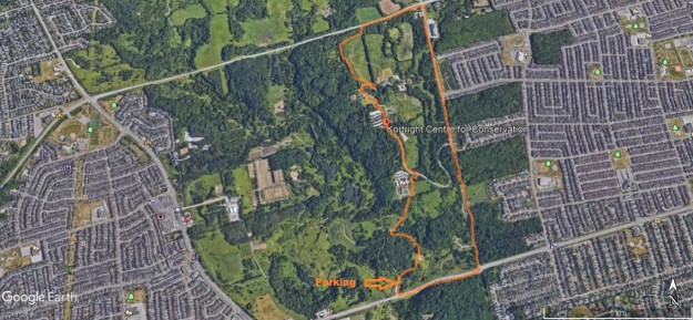
We parked in the free parking lot on Rutherford Road just west of Pine Valley Drive near the Humber River.  It is possible to hike on minor trails and arrive at Kortright Centre but you will still need to pay for entrance to the sugar festival.  Our TRCA and CVC parks pass includes entrance to the park and festival.  We roughly followed the orange trail marked on this capture from Google Earth.

Kortright

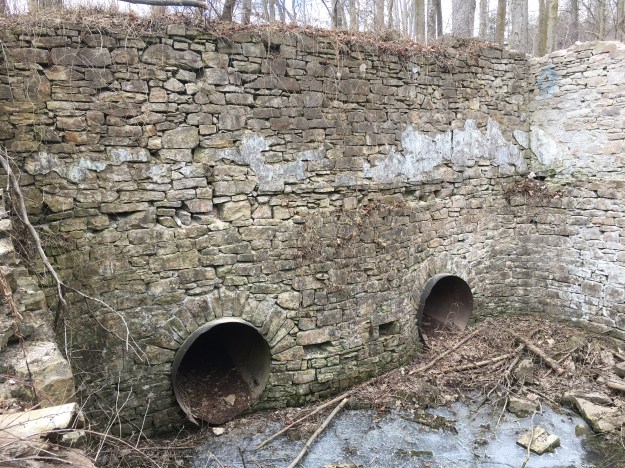
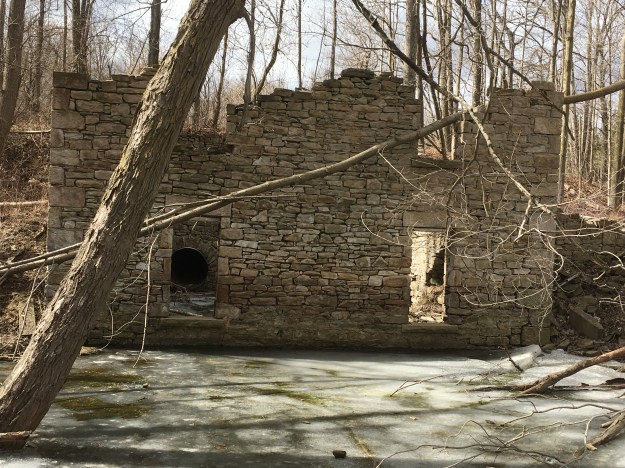
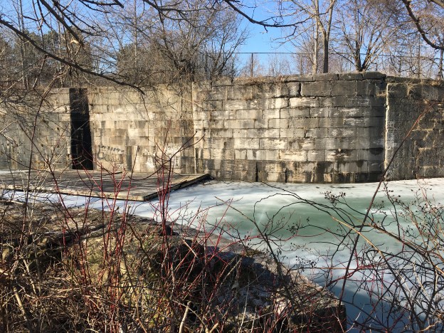
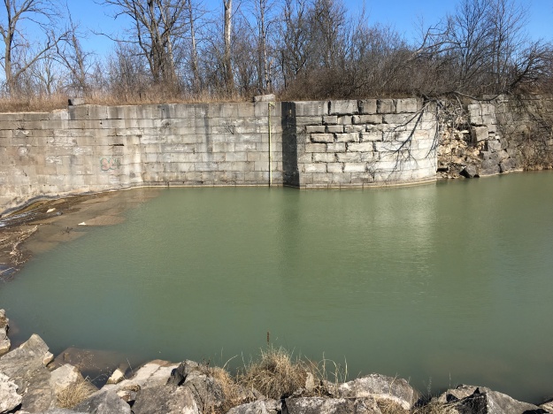
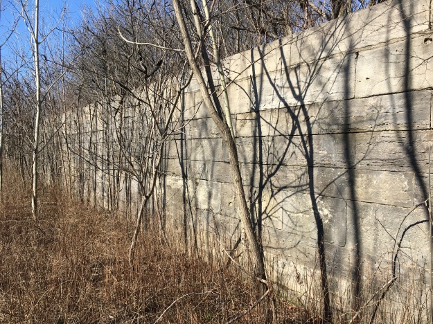
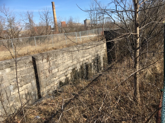
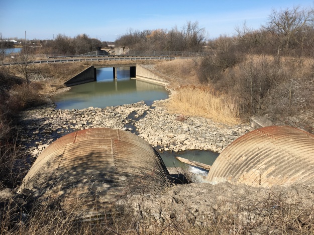
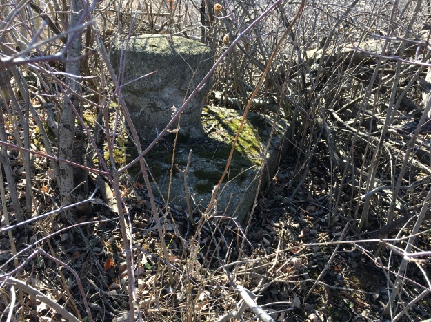
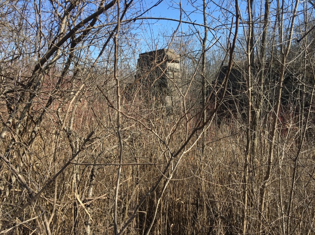
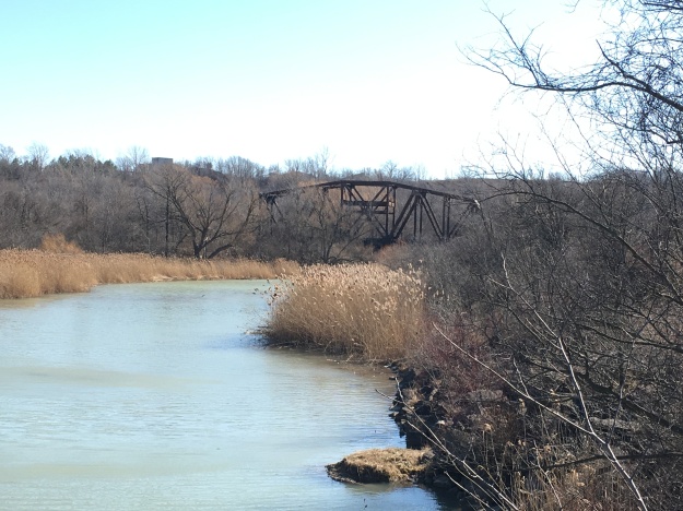
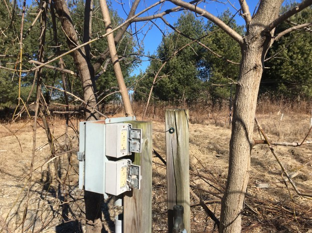
As we approached the park from the west we passed through an area that appears to have had a campground at one time.  There are several of these hook-ups for water and electricity hiding in the trees.

IMG_3407

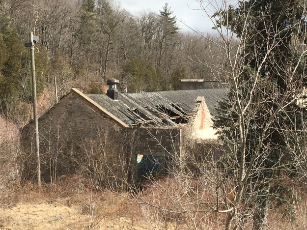
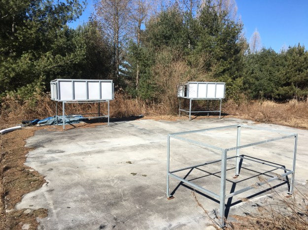
Three concrete pads are set up with the remains of a series of metal animal houses.  We followed the trail from here toward Pine Valley Drive.  Along the way you may hear the call of an owl

IMG_3409

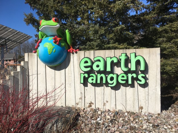
The Earth Rangers are a Canadian group aimed at teaching conservation practices to youth.  They were founded in 2004 in Woodbridge to teach students in the GTA.  They have since expanded to a nation wide operation.  Their LEED gold certified building at Kortright Centre is home to Animal Ambassadors.  They now house over 40 animals including red foxes and ring-tailed lemurs.  Their collection of birds includes bald eagles and kestrels.

IMG_3421

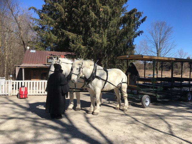
The main attraction at Kortright in March is their Maple Syrup Festival, one of several in TRCA parks across the GTA.  The park has two main forested areas with pine trees forming the north and east portions while maple trees are found in the south and west parts.  Wagon rides are available for those who would like to see the park in relative luxury.

IMG_3425

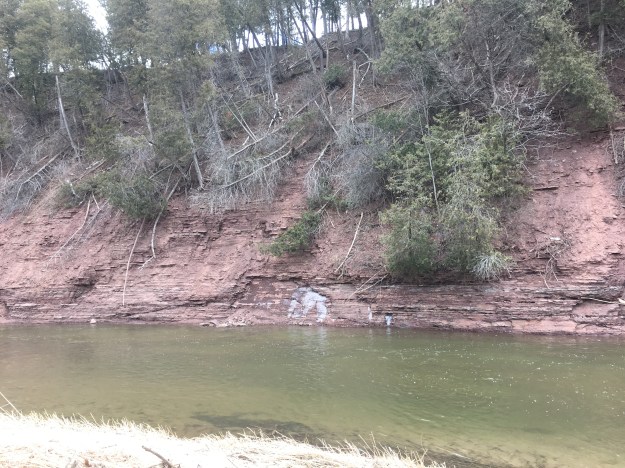
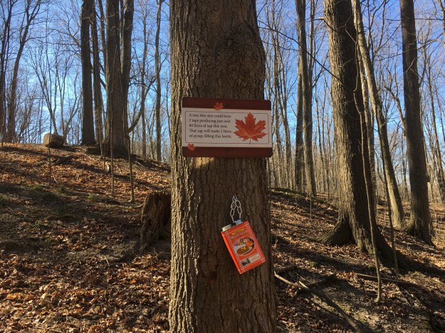
The trail from the visitor centre to the ravine floor follows an old trail that was used by the native people who had an encampment along the East Humber River.  Many artifacts have been recovered from a village that has been excavated.  The river valley provided an access route for goods travelling north and south on The Carrying Place Trail.  Today, the park has provided signage along the trail to teach the basics of maple syrup production to visitors.  The two litre tin for syrup that is attached to this tree indicates the amount of finished product that a tree this size can produce.

IMG_3432

Maple syrup was being produced by the natives when the Europeans arrived in North America.  By the 1680’s collecting maple sap and boiling it into maple syrup had become a spring industry.  It was very labour intensive collecting the buckets of sap and carrying them to the sugar shack for processing.  Families would pull their children out of school for the month of March to help on the farm.

IMG_3436

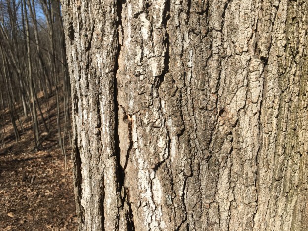
Trees would be tapped when they were around 30 to 40 years old and would continue to produce for the next 60 or 70 years.  Holes in the tree are quickly healed and can be seen for years after.

IMG_3427

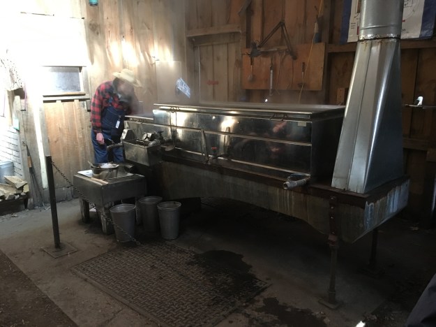
At the sugar shack wood was stock piled to keep the kettles of sap boiling.  The shacks also provided some small shelter from the weather and a place to rest during the cooking process.

IMG_3442

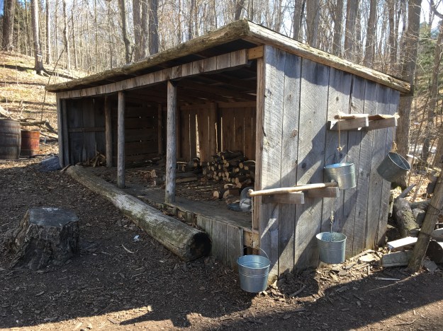
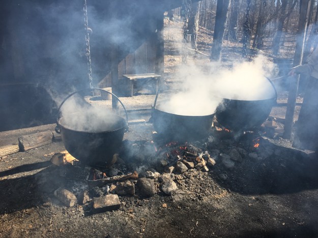
Prior to the 1850’s a series of three kettles were used.  The larger kettle contained the raw sap and it was left to boil for 8 hours.  The condensing sap was then transferred to the middle kettle for another 8 hours.  It would be finished in the third kettle after another 8 hours.  Innovations began after this time starting with larger, flat bottomed pans that increased the surface area available for evaporation.

IMG_3443

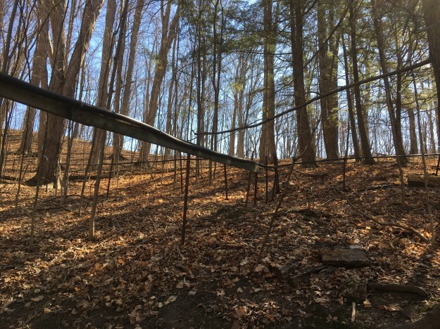
In the 1970’s a system of collecting sap using plastic tubes was developed.  It allows individual trees to  be tapped in one or more places and the slow drip of sap is fed into increasing diameter pipes until it reaches the sugar shack.  In the shack it is stored in a large vat while it waits to be evaporated into maple syrup.

IMG_3446

Today’s evaporators have flues in the bottom which increase the surface area of the pan that is used for boiling.  This further reduces the processing time which can be as little as 3 to 5 hours.

IMG_3447

Kortright Centre has many trails and there will need to be another expedition one day to investigate them.

Google Maps Link: Kortight Centre For Conservation

Like us at http://www.facebook.com/hikingthegta

Follow us at http://www.hikingthegta.com

Cemetery Bridge

Sunday, March 18, 2018

When Mount Pleasant Cemetery opened in 1876 it was comprised of the entire 200 acres of lot 19, just north of present day St. Clair Avenue.  The cemetery developed eastward from Yonge Street and we examined the history and some of the monuments and mausoleums in the earliest sections.  They can be found in our post entitled Mount Pleasant Cemetery.  The undeveloped end of the cemetery would be cut twice for transportation routes.  In 1915 The government bought the rights to a strip that would cut the cemetery in two halves.  To commemorate this, the new extension to Jarvis Street was named Mount Pleasant Road.  It had previously been severed for the right of way for a commuter railway line.  The 1877 County Atlas below does not show either the new road or railway.  Yellow Creek has been drawn in the atlas as being in a ravine as it passes through the cemetery, which is outlined in green.  Mud Creek rises out of a steep ravine and flows across the cemetery on a much shallower one.  I’ve marked the railway line in orange.  As a side note, the Davisville Post Office shown on the map still exists as a Starbucks on the corner of Yonge and Davisville.

Cemetery Map (2)

With an economic boom going on in Toronto a plan was developed to sell lands north of the developed city and service them with a commuter railway to be known as the Belt Line Railway.  When it was revealed that the proposed railway would follow Mud Creek and then pass through the cemetery the plan was opposed by the The Toronto General Burying Grounds Trustees.  Moore Park Station was proposed for just south of the cemetery at the top of the ravine and it was designed as the grand masterpiece of the railway.  The Trustees were eventually convinced that the proposal would help establish the cemetery as a Victorian country garden destination and it would gain in the end.

The housing boom didn’t happen due to an economic crash and the railway only operated for a little over two years.  The first passenger train ran on July 30, 1892 and by November 17, 1894 the service was shut down.  The former right of way for the Belt Line Railway was a prime piece of real estate and Toronto City Planning Commissioner Tracy Lemay had a plan for a high speed expressway that would link the Lakeshore with Mount Pleasant Road.  This was part of a larger plan of roadways that was never fully implemented.  Fearing that they would be cut off from the east end of their property the trustees commissioned a bridge over the railway right of way.

IMG_3464

The expressway was never built and the cemetery ended up with a bridge over a shallow depression.  The bridge stood from 1929 until the early 1970’s when it was demolished because it had deteriorated.  Like everything else in the cemetery, the former bridge also has become a monument.  The west abutment has been left as a reminder of the bridge. In a way, it is a testament to a failed railway enterprise and an expressway that was never more than a dream. The concrete is adorned with a symbol of vines and grapes.  The vines represent continuity while the grapes are a Christian emblem that remembers The Last Supper.

IMG_3467

The top of the abutment has been turned into an area for quiet reflection behind the cemetery offices.

IMG_3469

The insides of the bridge are adorned with painted images of the cross.  The cemetery was started as a secular one and it seems interesting that the symbolism is Christian within about 50 years of the opening.

IMG_3472

The original guard rails on the approach to the bridge have been removed.

IMG_3473

This areal photo taken in 1947 and found on The Toronto Archives shows the bridge.

bridge

A plaque on the inside of the bridge pays respect to those who were involved in the plan to stay ahead of the city planners.

IMG_3471

Google Maps Link: Mount Pleasant Cemetery

Like us at http://www.facebook.com/hikingthegta

Follow us at http://www.hikingthegta.com

Mount Pleasant Cemetery

Sunday March 18, 2018

Mount Pleasant Cemetery was created to provide a burial alternative for those who didn’t belong to one of the local churches that had their own cemetery in the churchyard.  The cemetery was laid out like a country garden and has become a prime place for joggers and dog walkers but it has a unique history and some interesting architecture. To start my visit I parked on Yonge Street near the main entrance to the cemetery.  My first objective was to make a side trip to St. Michael’s Cemetery, which is just south of St. Clair Avenue.  This Catholic cemetery contains an interesting piece of architecture that has been removed from Mount Pleasant Cemetery.

St. Micheal’s Cemetery opened in 1855 and is the oldest surviving Catholic cemetery in the city.  Until the mid-20th century graves were dug by hand and no interments were made during the winter.  Bodies were stored in a mortuary until the spring when burial could take place.  These buildings were often octagonal, this being determined the ideal shape for maximum storage, and took on the nickname “Dead House”.  The gates were locked and so I couldn’t get close to the vault which was designed by Joseph Sheard who would later serve as mayor in 1871-1872.

IMG_3304

In the first part of the 19th century, York (Toronto) had no place for secular people to be buried.  Rebel leader William Lyon MacKenzie was instrumental in persuading the government to enact legislation to create a secular burial ground.  On January 26, 1826 The York General Burying Grounds Trust was established and they bought a plot of land at Yonge and Bloor for their cemetery.  It went by several names including The Potter’s Field.  Burials took place between 1826 and 1855 when it was closed and the bodies removed over the next 25 years.

The Vale of Avoca is the name given to the bridge that crosses Yellow Creek on St. Clair Avenue, just east of Yonge Street.  It is also the name of the ravine which can be entered beside the bridge.  This is the route I chose to access Mount Pleasant Cemetery.  Walking north you’ll pass the remains of an old saw mill and follow the path through a cut in the berm that marks the old mill pond.  This is where Yellow Creek emerges from a large concrete storm pipe.  It was buried in the 1950’s under ten metres of soil excavated during construction of the Yonge Subway Line.  Although one of the oldest sections of the cemetery, the earliest burials here appear to be from the 1970’s and 1980’s.  The picture below shows the emergence of Yellow Creek from beneath Mount Pleasant Cemetery.

IMG_3307

In 1855 the re-named Toronto General Burying Grounds Trust purchased a plot of land near Riverdale to establish a new cemetery known as The Necropolis.  Many of those interred at The Potter’s Field were moved to The Necropolis.  The Necropolis stood on the ridge overlooking the Rosedale Ravine, an industrial hub of the era.  One of the businesses below was a glue factory that made visiting the cemetery a smelly affair.  The Trust sold the cemetery to the city and in 1873 went in search of a new site for their cemetery.

They bought all 200 acres of Lot 19, Concession 3 for their new cemetery, well to the north of the city at that time.  Since the 1830’s a trend toward building garden-like cemeteries outside of major cities had been in fashion.  It was decided to hire H. A. Englehardt to design the cemetery based on his work in Port Hope and Belleville.  The location was ideal because it contained both Yellow Creek and Mud Creek whose ravines created a rolling landscape.  Roads were laid in asymetrical curving patterns. The new cemetery officially opened on November 4, 1876 and now is the final resting place of over 180,000 people.

IMG_3346

Yellow Creek was dammed to create a series of ponds that had swans in them at one point.  The ponds lasted until the depression of the 1930’s made funding for their maintenance unattainable and the ponds were filled in.  Later both Yellow Creek and Mud Creek ravines filled with subway diggings.  Englehardt collected tree specimens from all over the world with the intention of creating an arboretum at the cemetery.  His desire to have the trees labeled for the education of visitors has been carried on today.

IMG_3342

One of the first Mausoleums you will come to after entering the cemetery from this angle is also one of the first ones built after the cemetery opened.  S. A. Oliver had opened his general merchant business on Queen Street West in 1852 and he built it into a major retailer of produce for the young city.  Oliver retired in 1872 and passed away in 1878.

IMG_3316

The most elegant family mausoleum in the cemetery belongs to the Massey Family.  It was completed in 1894 and houses many members of the city’s most prominent industrial family.

IMG_3345

Timothy Eaton was born in Ireland in 1836 and came to Canada in 1854.  After moving around working in stores in several small communities, Eaton moved to Toronto in 1868 to open his own dry goods store.  Eaton revolutionized retail with mail order catalogues in 1884 and store owned manufacturing.  By 1907 Eaton’s was largest retailer in the Dominion.  This same year, Timothy died from pneumonia and was buried in the newly built family mausoleum in Mount Pleasant Cemetery.  17 other members of the Eaton family have been buried in this mausoleum.

IMG_3349

Captain James Fluke was born in Ireland in 1824 and came to Canada West in 1829. Fluke became a miller operating both grist and saw mills as well as an inn. He was a captain in the militia, 3rd Company, Cartwright Volunteers, 45th Battalion, West Durham Regiment. Fluke died in April 1894 and was buried at Mount Pleasant Cemetery. His wife, Charlotte, had this mausoleum built for him and he was later moved into it. She was buried there in 1929.

IMG_3327

William Barker was born in Manitoba in 1894.  During the First World War, Barker shot down 50 enemy planes earning him the Military Cross and Bars and the Distinguished Service Order.  He is also one of less than 100 people awarded the Victoria Cross, Canada’s highest military honour.  He died in 1930 when a test plane crashed and he is buried in the large public mausoleum at the cemetery.

IMG_3347

William Lyon Mackenzie King was Canada longest serving Prime Minister, holding the office for a total of 21 years.  His grandfather was William Lyon Mackenzie, the leader of the 1837 rebellion.  Both of Mackenzie King’s parents are also laid to rest in this plot as part of a total of nine people buried here.

IMG_3334

The cemetery has many monuments including this elegant one to the members of the Freemasons.  Today the area around the monument continues to be used to bury those members of the craft of Freemasons who pass away in the city.  The mason tools of square and compass adorn the ball on the top of the monument.

IMG_3329

Thousands of people enjoy the solitude of the cemetery every day to jog, walk their dogs or simply take in the quiet and the grand monuments to those who have gone before.

Google Maps Link: Mount Pleasant Cemetery

Follow us at http://www.facebook.com/hikingthegta

Like us at http://www.hikingthegta.com

Credit Valley Footpath

Saturday, March 10, 2018

The Credit Valley Footpath is a 5.3 kilometre side trail that is part of the larger Bruce Trail system. It runs along the side of the Credit River through Georgetown providing access between two early industrial sites of the community.  At the time of the historical atlas in 1877 the paper mills existed and their mill pond was drawn into the atlas.  The mills themselves are not identified as they are part of the larger urban area of Georgetown.  The Dynamo was yet to be constructed and is shown with a red star on the map below.  We followed the green trail on the map which marks the Credit Valley Footpath.

Footpath

Parking for the trail can be found along Maple Avenue near River Street.  This will place you beside the historic Barber Paper Mills.  Their history is told in detail in an earlier blog post which can be found here.  The buildings were listed as heritage sites in 2008 but over the years there has been no real effort to preserve them.  The roofs are caving in and the walls are crumbling.  A recent proposal to restore and re-purpose the buildings has fallen through and the National Trust for Canada has listed the buildings as among the most endangered heritage sites in the country.

IMG_3078

The footpath passes under a newer railway bridge about a kilometre downstream.  The original bridge was nicknamed The Iron Bridge and was built in 1855 for the Grand Trunk Railway.  The concrete piers on the modern bridge were built in 2010 and were dressed to look like cut stone blocks.  The very last pier on the west end is actually cut stone blocks and dates to the the second bridge across the valley.

IMG_3084

The Credit Valley Footpath through this section makes a couple of 40-metre climbs up the side the the Credit River Valley and fortunately, there has been a few steps put in to help.  Sections of this trail should be considered as difficult and should be walked with the assistance of a walking stick.

IMG_3093

Traveller’s Joy, also known as Old Man’s Beard, is a member of the buttercup family.  The feathered seed pods have survived the winter on the vine and will be distributed in the spring to spread the plant to new sites.  The flowers attract bees and other pollinators and are a food source for certain moths.  Traditional medicine has made use of the plant for its anti-inflammatory properties.

IMG_3089

The Barber Dynamo was built to provide electric power to the paper mills.  It is located a couple of kilometres downstream and was the first remote generation of electrical power for industrial uses in North America.  When we visited the Dynamo in 2015 there were a number of trees that had been partially chewed through by local beaver.  They were in danger of falling on the Dynamo and further demolishing it.  Hiking the GTA brought the situation to the attention of the Credit Valley Conservation Authority who sent people in to cut the trees.  All but one of them was successfully dropped away from the building.  It can be seen leaning through a second story window frame.

IMG_3094

Water was fed into the Dynamo through a large pipe called a penstock.  It split in two with the water turning two turbines that were suspended from the second floor.  A line can be seen along the wall that marks the location of the former floor.  The cover photo shows the inside of the north wall which has started to crumble and is in danger of collapse.  Efforts are being made to have the site declared as historically significant which may allow the Credit Valley Conservation Authority to gain the funding needed to restore the wall to prevent further deterioration of the structure.

IMG_3104

Just beyond the Dynamo the river cuts through a red shale embankment.  This Queenston Shale is the same layer that forms the base of the Niagara Escarpment.  The exposed section near Cheltenham has become a major attraction and is set to re-open with a new boardwalk in the near future.  The erosion along this section of The Credit River has brought many  of the trees tumbling down the embankment.

IMG_3107

As you walk back toward the Dynamo you can see the penstock through the ground floor window.  There are two windows just below the current water level that returned the water to the tail race after it had turned the turbines to run the generators.

IMG_3117

As you arrive back at the Barber Paper Mills you can see the roof on the building that housed the main paper rolling equipment is caving in.  The tool shop in the foreground has lost its roof a long time ago.

IMG_3118

This is a good hike for those interested in the local history as well as a few challenging climbs.

Links to the more detailed stories:  The Barber Paper Mills and The Barber Dynamo

Google Maps Link: Credit Valley Footpath

Like us at http://www.facebook.com/hikingthegta

Follow us at http://www.hikingthegta.com

The First Three Welland Canals

Tuesday, February 27, 2018

One lesson that was learned in the war of 1812-1814 was the need to move men and goods quickly and a period of road and canal building began.  The British had largely controlled the Great Lakes during the conflict but Niagara Falls prevented movement between the lakes.  In spite of this, the first canal built between the two lakes was a private enterprise.  The government would build the next three Welland Canals culminating in the current Welland Shipping Canal.  The first three canals have been abandoned but sections of each still remain, although active preservation does not appear to be happening.   This picture of lock 15 on the third canal shows the partial collapse and deterioration of everything up to the gate recesses.

IMG_2966

To look at some of the remnants, I made a day trip and planned four stops (to which links will be provided).  The first stop was in St. Catherines to see the second lock on the third canal.  Then to Welland Vale where the first and second canals diverted routes shortly, leaving evidence of both.  Mountain Locks Park along Bradley Street contains a series of second canal locks.  Finally South of Glendale Avenue is a series of third canal locks and the Merritton Tunnel.  Rather than tell this story in the sequence of the visit it is being arranged in the sequence of the three canals.

Shipping on the Great Lakes was confined to Lake Ontario because goods on the Upper Great Lakes had to be portaged around Niagara Falls.  Lake Erie was 325 feet higher than Lake Ontario.  In 1818 a mill operator named William Hamilton Merritt proposed to divert water from the Welland River past his mill in Welland Vale to supplement the water flow of 12 Mile Creek.  The idea was abandoned but just a month later he came up with the proposal that led to the building of the first Welland Canal.  The Welland Canal Company was founded in 1824 to build the 40 kilometre canal.  The channel was dug 24 feet wide and 8 feet deep and 40 wooden locks were built each capable of lifting a boat between 6 and 11 feet.  The picture below shows a section of the first canal in Welland Vale.

IMG_2926

The first canal was operated between 1829 and 1844 but it was clear from the beginning that the wooden locks were too small and required too much maintenance.  In 1841 the government took over operation of the canal and started work on rebuilding it  The path of the canal followed the first one so closely that most of the first canal was lost.  There is a 1 kilometre stretch of the first canal in Mountain Locks Park that was left intact and one wooden lock, number 24, can still be found in that park.  The locks on the second canal were built of stone and to slightly larger dimensions than their wooden counterparts.  The channel was dug 36 feet wide and 9 feet deep with locks that were 150 feet long.  The picture below shows the one of the locks on the second canal at Welland Vale.  The height of the lock has been reduced and the stone work has been completely removed from one side of 12 Mile Creek to improve water flow and reduce flooding.

IMG_2930

The first and second canals climbed the escarpment in a series of locks that now form Mountain Locks Park.  Lock 19 of the second canal no longer has water flowing through it and this picture was taken from inside the lock

IMG_2941

Lock 24 of the second canal is typical of the locks that climb the escarpment as boats moved toward Thorold.  The creek flows deep in the bottom of these locks.  The second canal was used from 1845 until 1935 even though a third canal came into operation in 1932.

IMG_2943

A third, larger canal was started with a new, straighter route in 1872.  It was designed to carry the larger ships that were plying the Great Lakes by this time.  The third canal was completed in 1887.  Lock number two can be found in Jaycee Gardens Park in St. Catharines.

IMG_2911

There is a 50 foot towpath that extends out into Martindale Pond at the second lock that allowed the ships to be towed through the lock.  Towpaths allowed ships to be towed out of the lock by a team of horses until a point where they would have room to sail again. Towpaths were no longer needed when ships were equipped with engines. A concrete pole on the end, and another near the beginning of the towpath mark a later addition of electricity to power the lock.    This relieved a lot of physical labour that was involved in operating the canal gates and was an advancement made on the third canal that wasn’t available on the first two.  The gates from the lock can be seen half submerged beside the towpath.

IMG_2919

Lock 13 has had two large culverts placed in it to support Glendale Avenue.  From this vantage point, lock number 12 on the third canal can be seen.  Locks 13 through 18 can be found by following the river south.

IMG_2948

As ships were being raised or lowered in the locks they needed to tie themselves to bollards located along either side of the lock.  Many of these old concrete bollards can be found along the canals.

IMG_2956

When the third canal was abandoned in favour of the new fourth canal, the gates were left in place.  These have all fallen into the locks.  One of the improvements in the third canal was the lining of the bottom of the locks with wood to protect the bottom of the ships as they passed through.

IMG_2960

Locks on the third canal were 270 feet long and could lift a boat from 12 to 16 feet.  The locks were 45 feet wide and a minimum of 14 feet deep.  The picture below shows the lift in lock 15.

IMG_2971

One of the innovations of the third canal was the inclusion of the water control system in the lock stonework.  The walls of the locks were recessed so that the gates could swing back to allow clear passage of boats.  The small openings behind the gates allowed water to be flooded into the locks.

IMG_2975

Along the west side of each lock a series of control ponds was built that allowed the locks to be flooded when boats were passing through. Stone sluice gates were used to control the flow of water from the ponds into the locks.  The picture below is taken from inside one of the control ponds looking at the sluice gates.

IMG_2963

Between locks 16 and 17 there is an old swing bridge for the railway.  It was completed in 1915 and allowed the railway tunnel beside lock 18 to be closed to rail traffic.

IMG_2972

The swing bridge was designed to move out of the way of oncoming ship traffic.  It hasn’t been moved since the canal closed in 1935 and the tracks on the top side have been replaced in such a way that it couldn’t move even if those gears are not seized.

IMG_3004

The Grand Trunk Railway needed to build a tunnel to allow the train to pass under the third canal.  The Grand Trunk Tunnel was completed in 1876 and is discussed in more detail in this separate post.

IMG_2981

The Fourth Welland Canal was opened in 1932 with only 8 locks and a much straighter route.  Very quickly a fifth canal was proposed that would have had only one super-lock.  This 1950’s dream was never built.

There are many interesting places to explore along the old abandoned canals and a return trip would definitely be in order.

Google Map Links: Port Colborne, Welland Vale Road, Thorold

Like us at http://www.facebook.com/hikingthegta

Follow us at http://www.hikingthegta.com