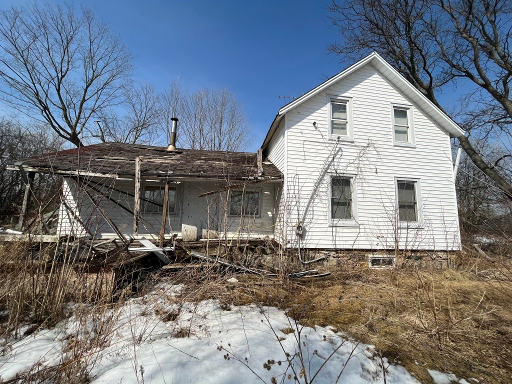
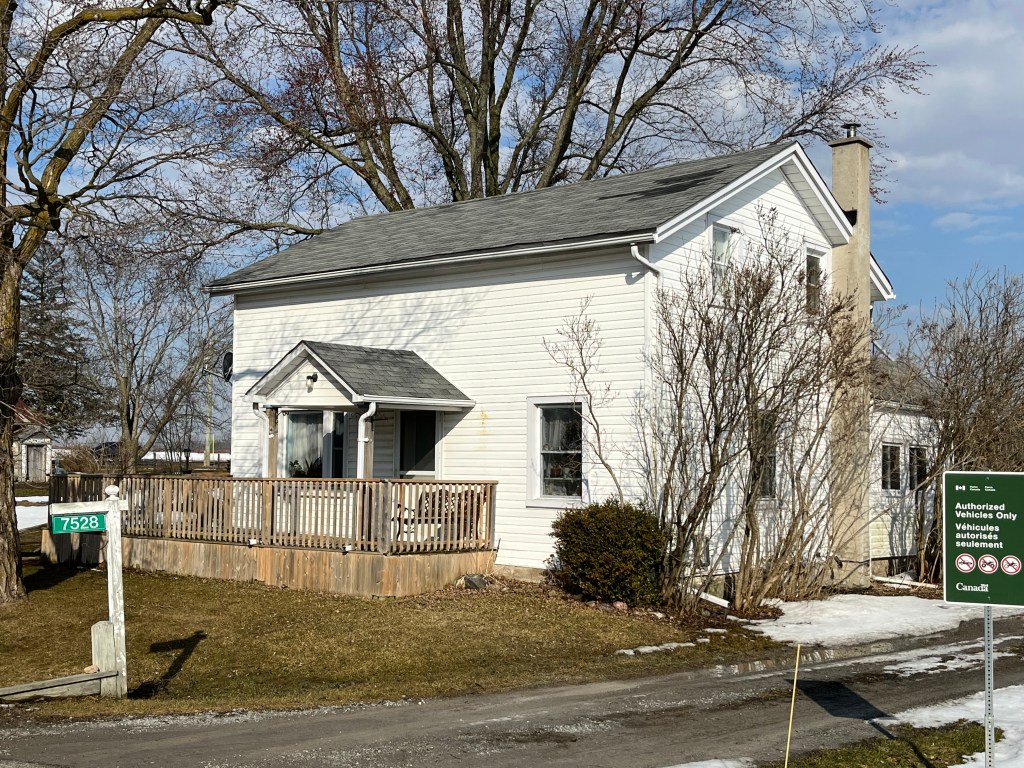
Category Archives: Ghost Town

Erindale – Ghost Towns of the GTA

January 27, 2024

Erindale isn’t a ghost town in the traditional sense because it is now part of the larger city of Mississauga. However the older homes that remain scattered through the area provide a ghost of the town that once was. Over the years we have written eight other blogs which focus on various aspects of the local history of Erindale and links to all of these can be found at the end of this post.

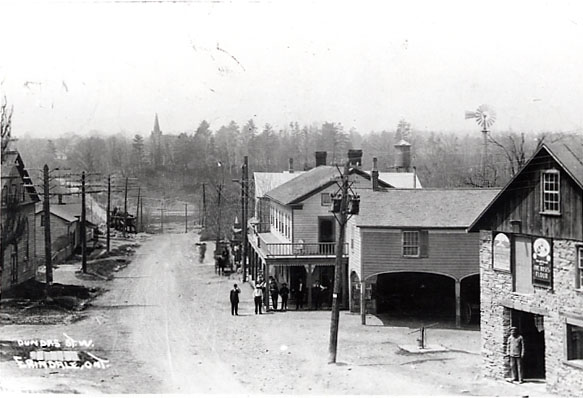
Erindale began in 1825 and was originally known as Toronto. It went through several name changes being known as Credit, then Springfield and finally Springfield-on-the-Credit. In 1900 it took the name of Erindale after a local estate owned by Reverend James Magrath. The town was a major stop on the journey along Dundas Street between Hamilton and York (Toronto). It started to decline after 1855 when the railway bypassed it but saw a revival in 1879 when the Credit Valley Railway built a station nearby. A fire in 1919 destroyed much of the town but several buildings were rebuilt.

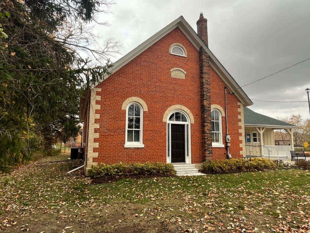
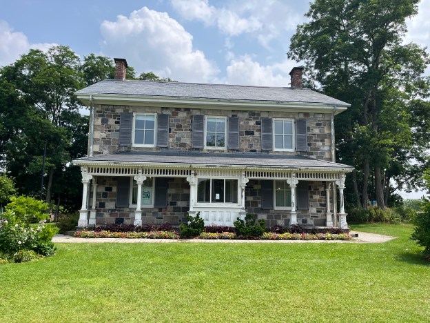
The Grange was built sometime around 1828 for Sir John Beverly Robinson who was the first Chief Justice of Upper Canada.  He was also considered to be the leader of the Family Compact which controlled the government leading to The rebellion of 1837.  The regency styled house with it’s ornate windows was indicative of the status of it’s owner.  Robinson only owned the house until 1833 when it began a rapid change of ownership until around 1910 having seen up to ten owners during this time. Then the Adamson family took up residence here and they stayed until 1973. Sometime during the Adamson years the outside of the home was given an exterior layer, or veneer, of brick from the local Cooksville Brickyards.  The building was given to the city of Mississauga by the land developers and used by the Boy Scouts until 2004.  It has now had it’s bricks removed and been fully restored to it’s original splendor.  The Heritage Resource Centre of Heritage Mississauga is now the occupant of this home.
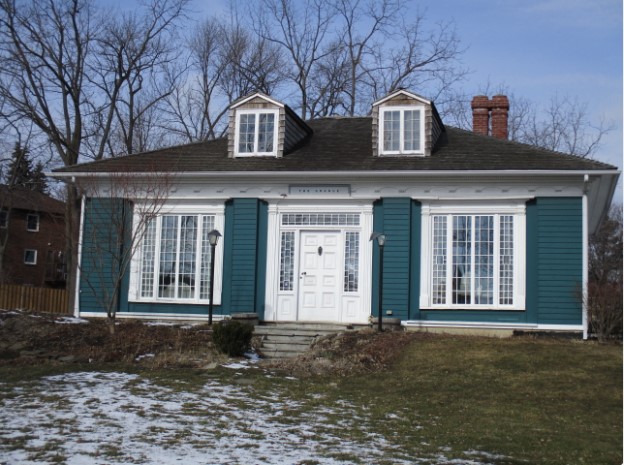
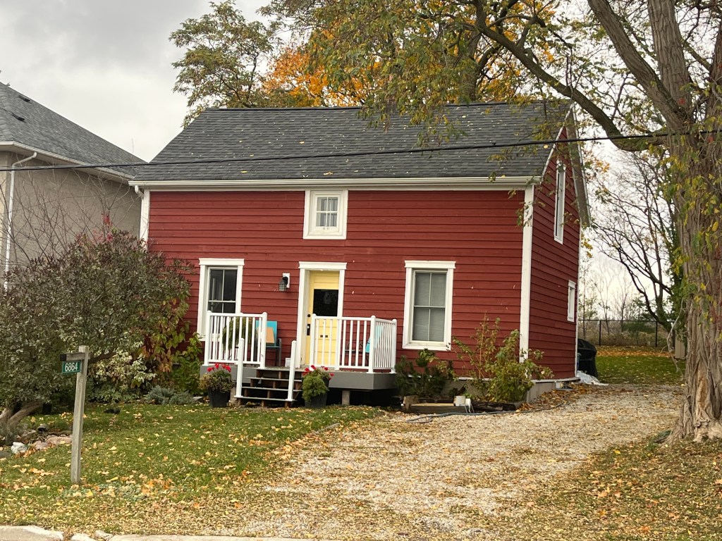
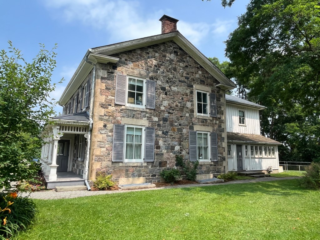
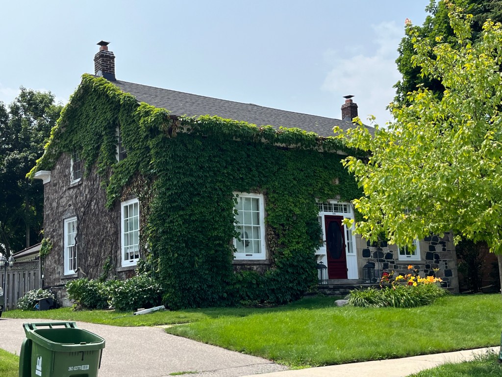
It is generally believed that the house below is the oldest surviving building in the main area of the village. It was likely built between 1835 and 1845 by a local miller named Ira Van Valkenburgh. It may also have been built by the local carpenter named John Blair. Tradition has it that a store was once located in the house.

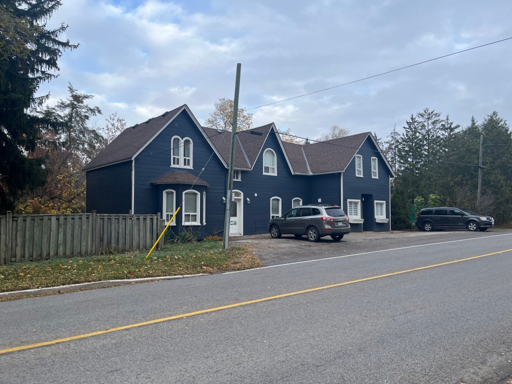
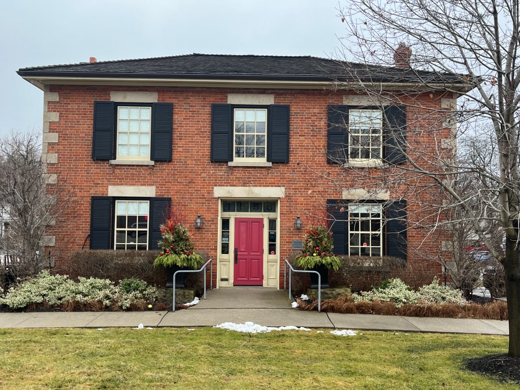
The Anglican Rectory was built in 1861 on the site of a former inn that had burned down. The Georgian Style manse was sold in 1960 and converted to commercial uses.
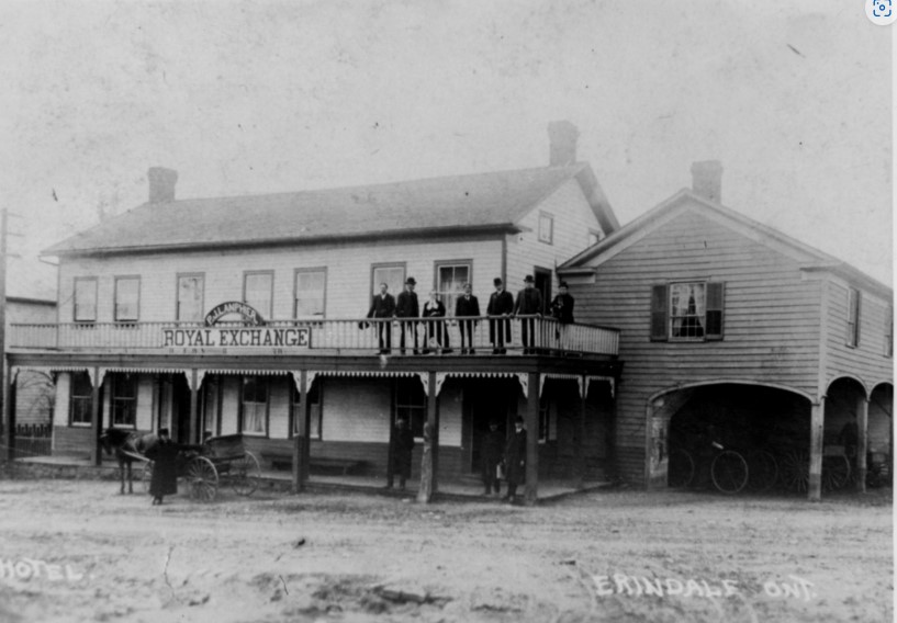
The Royal Exchange Hotel was built sometime between 1819 and 1822, although some sources say 1828, and was once known as the Halfway House. The hotel may have been 100 years old in May of 1919 when it was destroyed by the village fire and never replaced.
In 1877 the Methodist congregation commissioned a new church building as they had been meeting in the room above the Royal Exchange Hotel. The adherents felt that they should no longer meet above a building where alcohol was being sold. Somewhere around 1921 the church lost its spire and in 1925 it became the United Church. When a new building was consecrated in 1964 the building was sold to a Presbyterian congregation. This is ironic as the Presbyterians had rejected a merger with the Congregationalists and the Methodists that saw the creation of the United Church. Local residents each donated $100 and the spire was replaced in 2010.

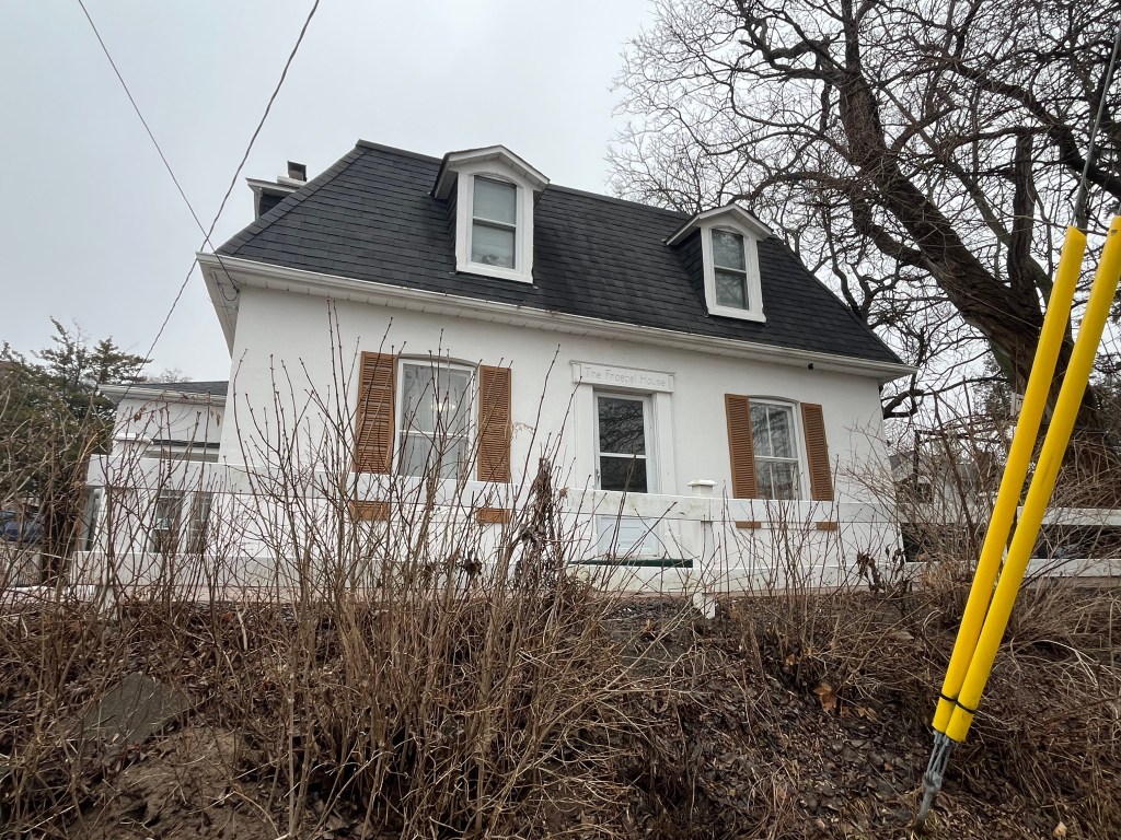
Emmerson Taylor was the owner of the Royal Exchange Hotel and also owned a saw mill, knitting mill and a fanning mill. This last structure produced furniture and grandfather clocks. He donated the land for the Methodist Church and had this house built around 1875 to 1878. The transom over the front door identifies the home as the Froebel House.
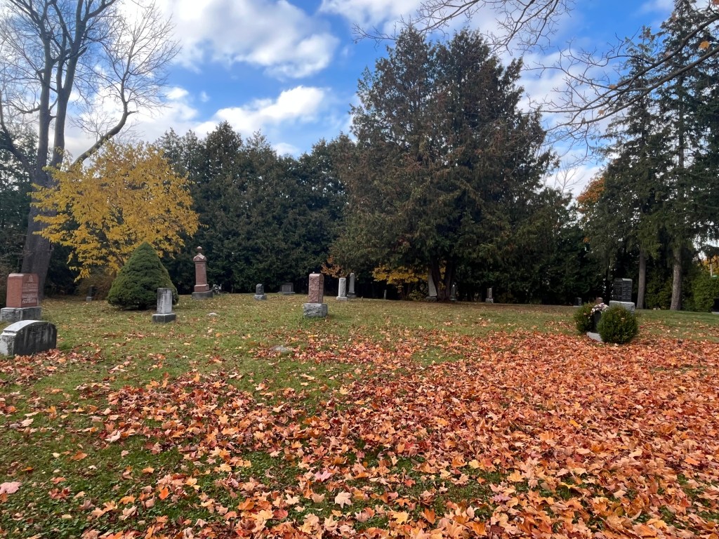
St. Peter’s Church history begins as a home church in 1825 in the home of Colonel Peter Adamson. Construction of a white frame church began in 1826 and it was consecrated in 1828. This building lasted until 1887 when it was torn down and replaced with the present stone church. The church tower was added in 1910. A basement was hewn out under the church in 1934 to be used for the church school.
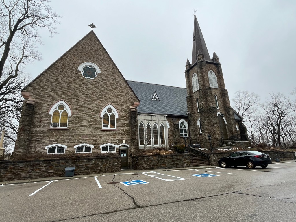
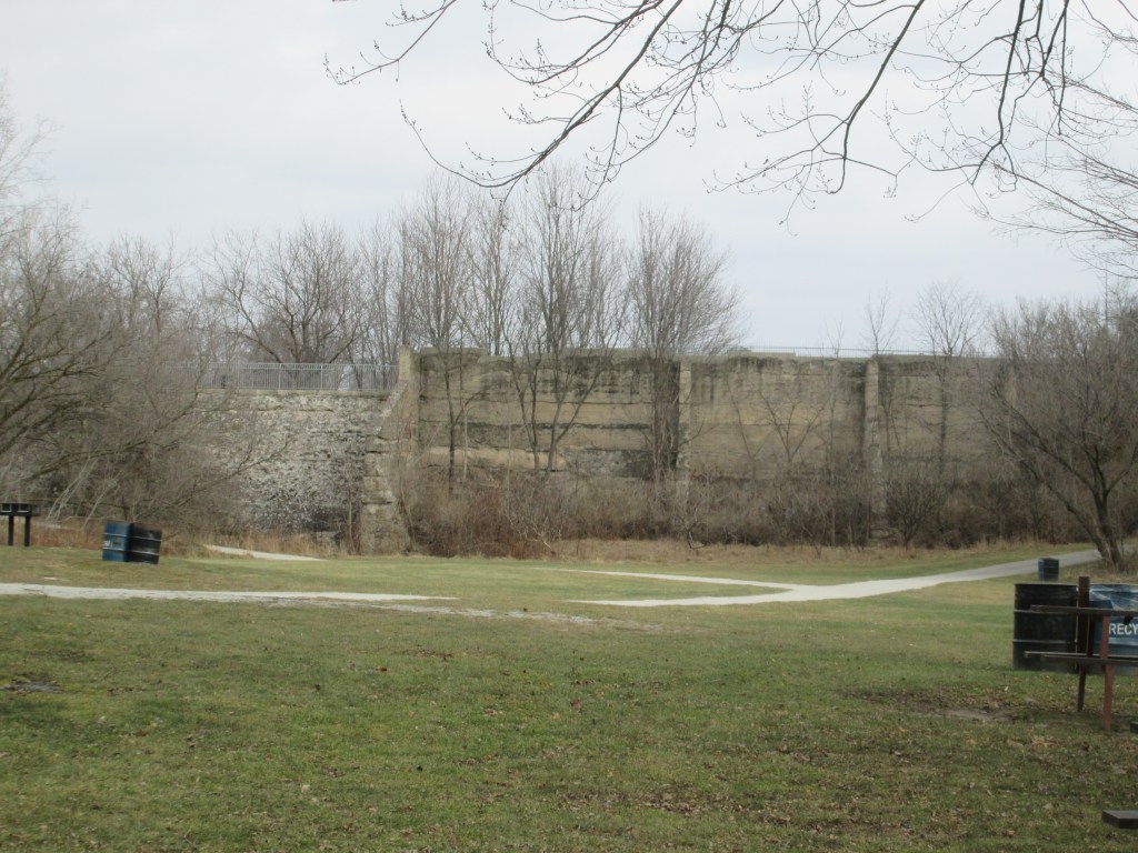
Erindale Park has a long history and at one time was known as Erindale Lake. In 1902 Erindale Light and Power Company was formed to construct an hydro electric generating plant on the Credit River at Erindale.  This large scale engineering project ran into several delays during construction and didn’t begin producing power until 1910.  A dam was constructed across the valley flooding it and creating the 125 acre Lake Erindale.  A power generating plant was built on the south end of town at the bottom of Proudfoot Street.  A tunnel was constructed to connect the two.  The power plant operated from 1910 until 1923 supplying power to Erindale and New Toronto. It was closed when Ontario Hydro began to supply the area with power from Niagara Falls.  In 1941 the lake was drained and the dam was blown up.  Between 1961 and 1965 the former lake bottom was used as a sanitary landfill.  It has since been covered over with clean soil and Erindale Park has been created.
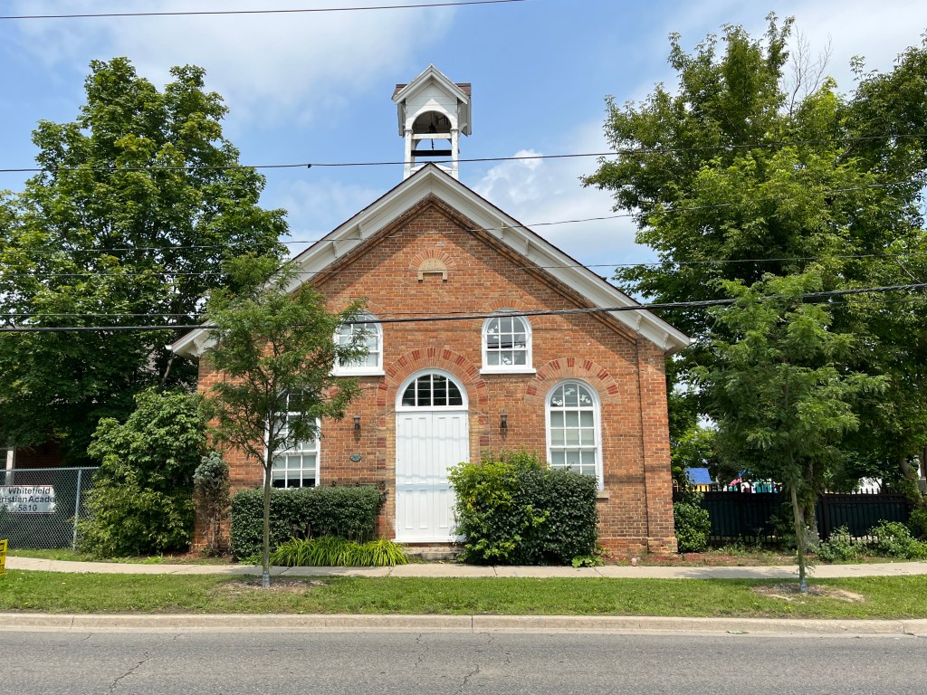
Erindale was served by School Section #4 and has had several buildings over the years. The bell from the 1872 school has been preserved and is now housed in the 1922 replacement building. This beautiful structure was built in the Colonial Revival and Neo-Classical style of architecture. It became the Springbank Community Centre in 1957 and is now part of the University of Toronto Mississauga.

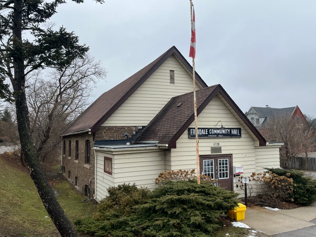
In 1919 a fire destroyed several of the older buildings on the core of the town including the Parish Hall, Post Office and the Royal Exchange Hotel. A new community Hall was constructed and has operated under a board of directors for almost 100 years. It can still be rented for private functions.
The historical community of Erindale can still be experienced via a walking tour. Heritage Mississauga has provided the details for one and a brochure can be accessed at this link: Erindale Tour. There’s a considerable amount of history in this area and you can read more in the various stories listed below.

Related stories: Winding Lane Bird Sanctuary, J. H. Pinchin Apple And Turkey Farms, Erindale Hydro Electric Dam, Erindale Powerhouse,UTM Nature Trail, Ghastly Tales Of Sawmill Valley Creek, Erindale Orchards, Credit River At Erindale

Google Maps Link: Erindale

Like us at http://www.facebook.com/hikingthegta

Follow us at http://www.hikingthegta.com

Also, look for us on Instagram
Lost Villages of the St. Lawrence River

January 6, 2024

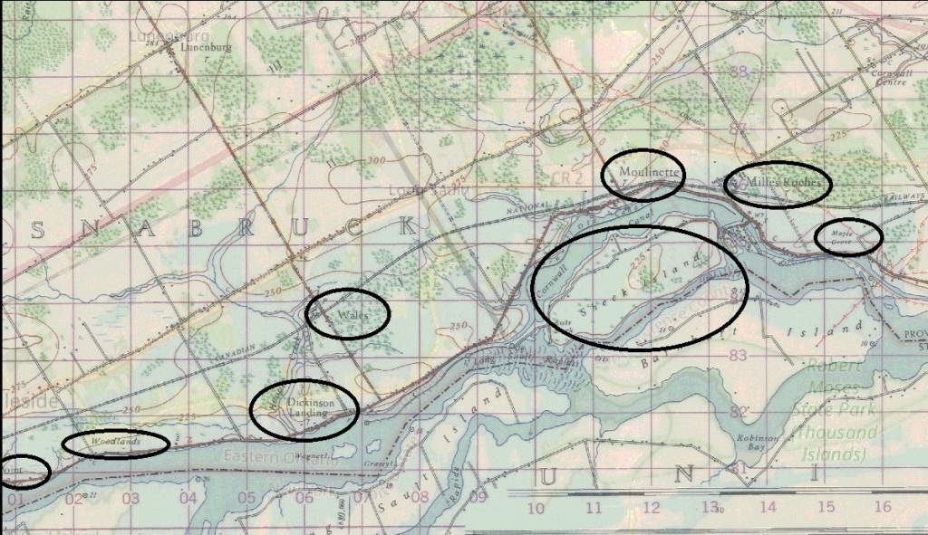
In July of 1958 nine villages and an inhabited island along the Canadian shoreline of the St. Lawrence River were flooded during the construction of the St. Lawrence Seaway and the Moses-Saunders Power Dam. 1,200 acres of reserves belonging to the Mohawks and Akwesane as well as 15,000 acres of traditional hunting grounds were also flooded. The indigenous peoples were not consulted or compensated and only in the last couple of decades has any attempt been made to correct this travesty. 6,500 residents of 6 villages and 3 hamlets were forced off their lands and given market value for their holdings. Unfortunately, the market values were already depressed due to the impending flooding. The lost villages were Aultsville, Dickinson’s Landing, Farran’s Point, Maple Grove, Mille Roches, Moulinette, Santa Cruz, Sheeks Island, Wales and Woodlands. Some of these can be seen in the map below taken from Wikipedia which shows the area prior to the flooding. We have often written about the ghost towns and lost villages of the GTA but this post focusses on some lost villages in Eastern Ontario that I visited on a business trip in September.

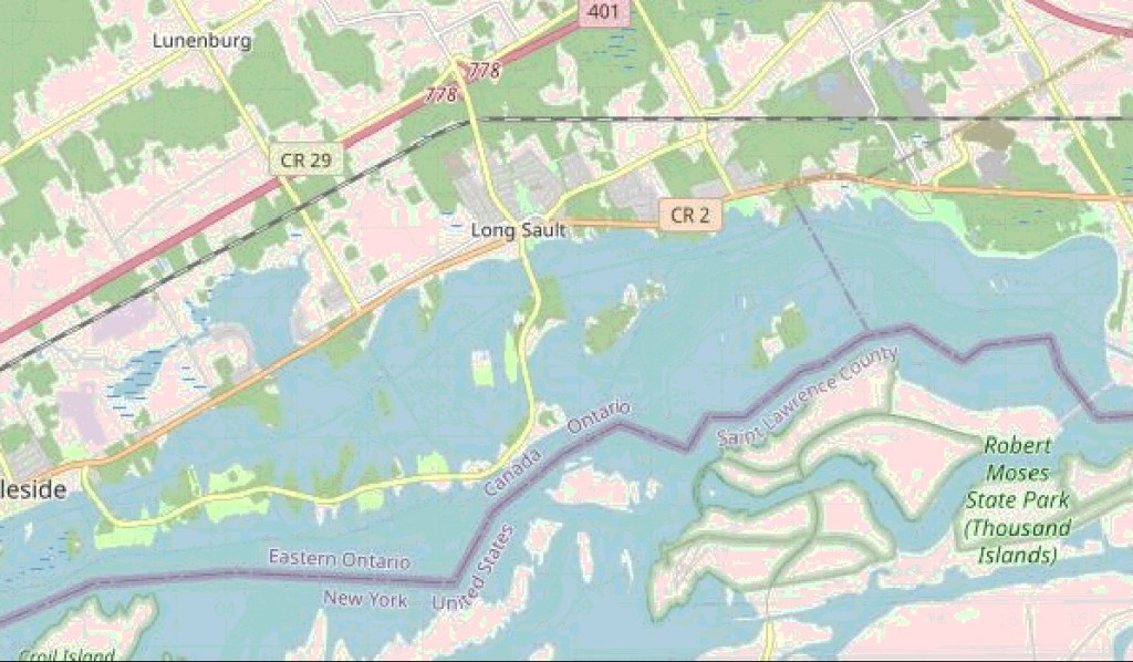
58,000 acres were flooded beginning on July 1, 1958 when 27 tonnes of explosives were used to destroy the cofferdam that was used during the construction of the power dam near Cornwall. The image below shows the same area as the one above as it exists following the flooding.

The story of the flooding has its origins as far back as 1871 when the Treaty of Washington made the St. Lawrence River the dividing line between Canada and the USA and allowed for shared use of the river for shipping purposes. In 1895 the Deep Waters Commission was established to explore additional navigation opportunities including the St. Lawrence Seaway. Political issues prevented progress from being made and by 1951 the Canadian Government decided to proceed alone on the construction of the seaway. This got the USA out of their deadlock and in 1952 the Seaway Project was approved by both countries. Construction began on August 19, 1954 resulting in the flooding in 1958. When the lost villages were evacuated the buildings were demolished and some of the bricks and stones were salvaged to be used in the planned memorial. Grave markers were taken up to be relocated in a memorial wall that was built near the site of Upper Canada Village and some of the buildings were moved there.

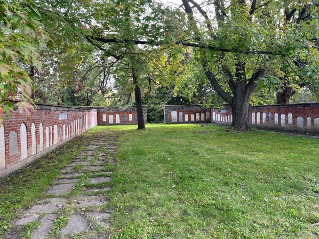
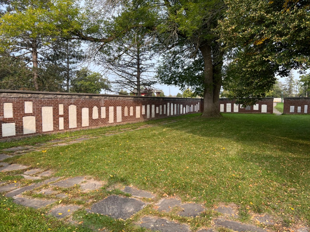
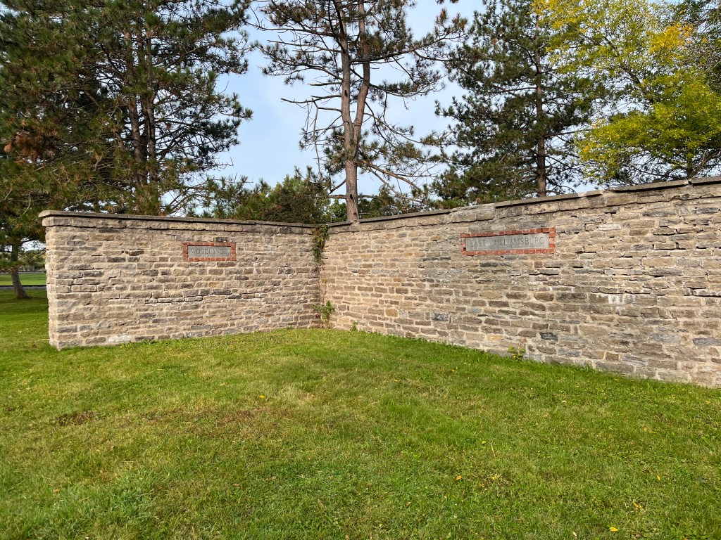
The Pioneer Memorial is laid out by community with a stone marker indicating each of the towns represented. This image shows the wall for Aultsville and Farran Point.

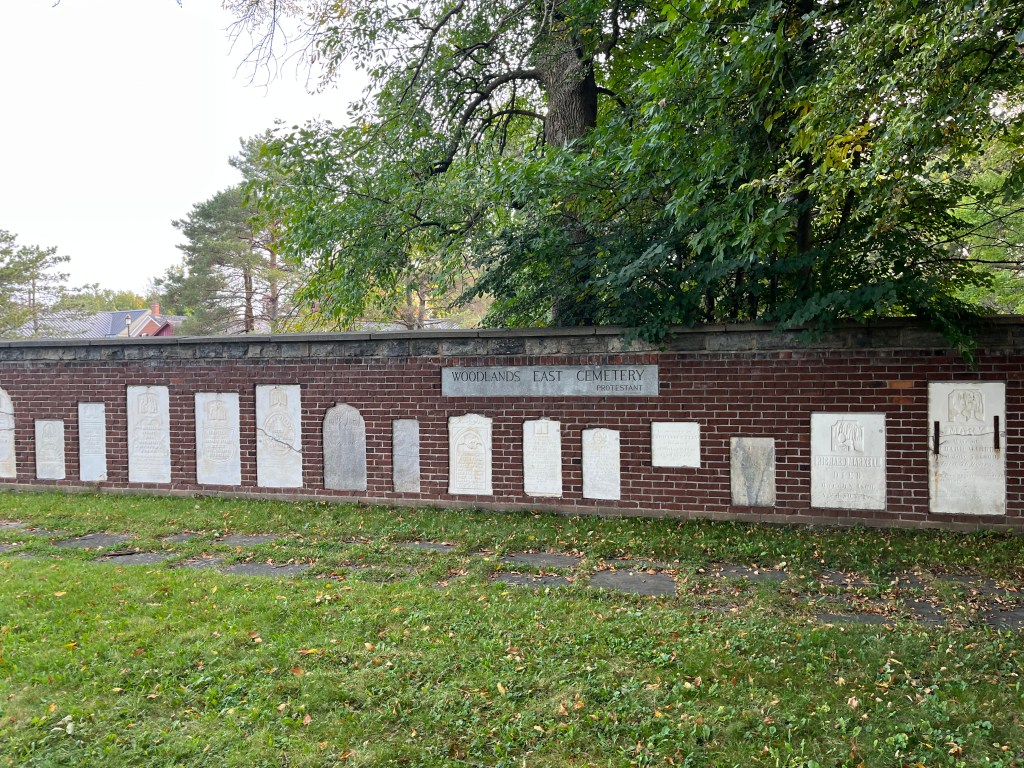
Woodlands East Protestant Cemetery is represented in the wall pictured below.

Not all of the people buried in the various flooded cemeteries have been represented in the memorial gardens because some stones graves were marked with wooden memorials or stones that were badly broken or deteriorated. One example of a salvaged memorial is seen in the picture below showing the marker for G. C Farran who died on April 3, 1849. They had been born in 1770. Their remains now lie below the St. Lawrence River in one of the flooded towns.

The plaque below is located near the site of the memorial gardens and tells of the building of the walls and gardens. It mentions eight villages but there are nine villages plus the residents of Sheeks Island that are covered in the online histories of the area.

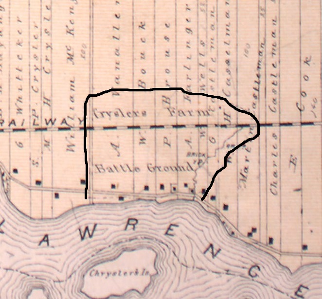
Crysler’s Farm was the site of a battle in the War of 1812. The battle took place on November 11, 1813 and the American forces were defeated but not without losses on both sides. The actual site of the battlefield is now submerged under the St. Lawrence River but it has been memorialized on a new site near Upper Canada Village. We’ve previously written about this battle in our post The Battle of Crysler’s Farm. The image below was taken from the 1877 County Atlas and shows the original battle ground.

The Long Sault Parkway is a 10.1 kilometre drive that connects several islands that were created during the flooding. Along the route homage is paid to many of these lost villages and the drive is said to be very scenic. It’s on our bucket list for a future visit to the area.

Related Stories: The Battle of Crysler’s Farm

Google Maps link: Pioneer Memorial

Like us at http://www.facebook.com/hikingthegta

Follow us at http://www.hikingthegta.com

Also, look for us on Instagram
Box Grove – Ghost Towns of the GTA

November 4, 2023

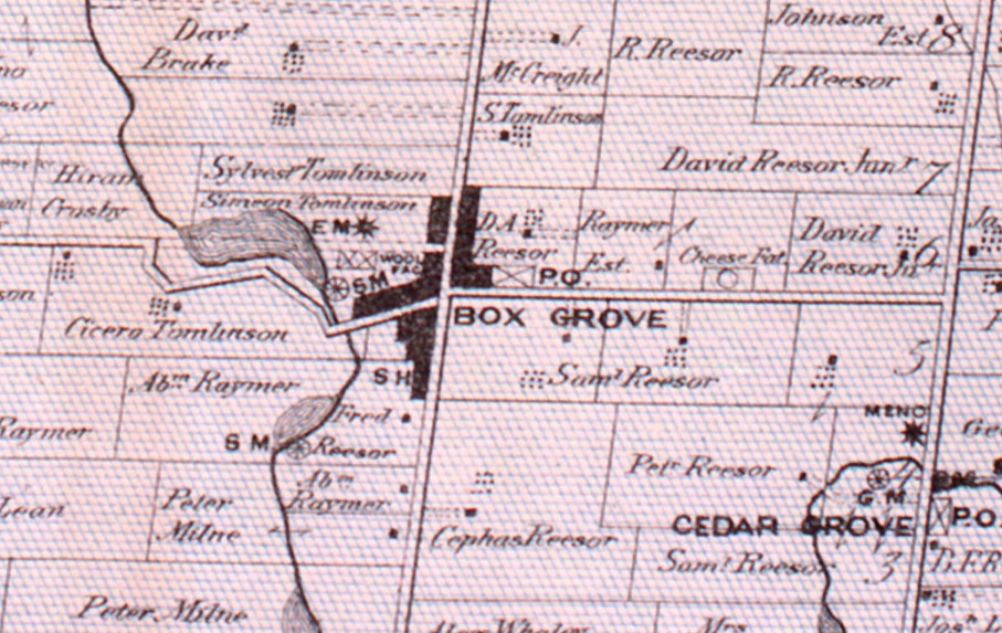
Families started to arrive in the area of present day 14th Avenue and 9th Line near Markham as early as 1815. The Tomlinson and Beebe families were among the first to move there and begin to develop farms and mills. In 1850 they put forth a plan to develop the community by selling lots for residential use. The lots were either 100 or 250 feet wide by 250 feet deep. This was intended to provide housing for the workers in the saw mill, woollen mill and shoddy mills. A shoddy mill reclaimed used fabrics to make paper or mattress stuffing materials. The community was known as Sparta or Sparty Wharf and was the last point on the Little Rouge River that could be easily navigated. The development soon let to the arrival of three hotels and taverns, a cheese factory, a blacksmith and two axe makers. The image below is taken from the 1877 County Atlas and shows the community in relation to nearby Cedar Grove.

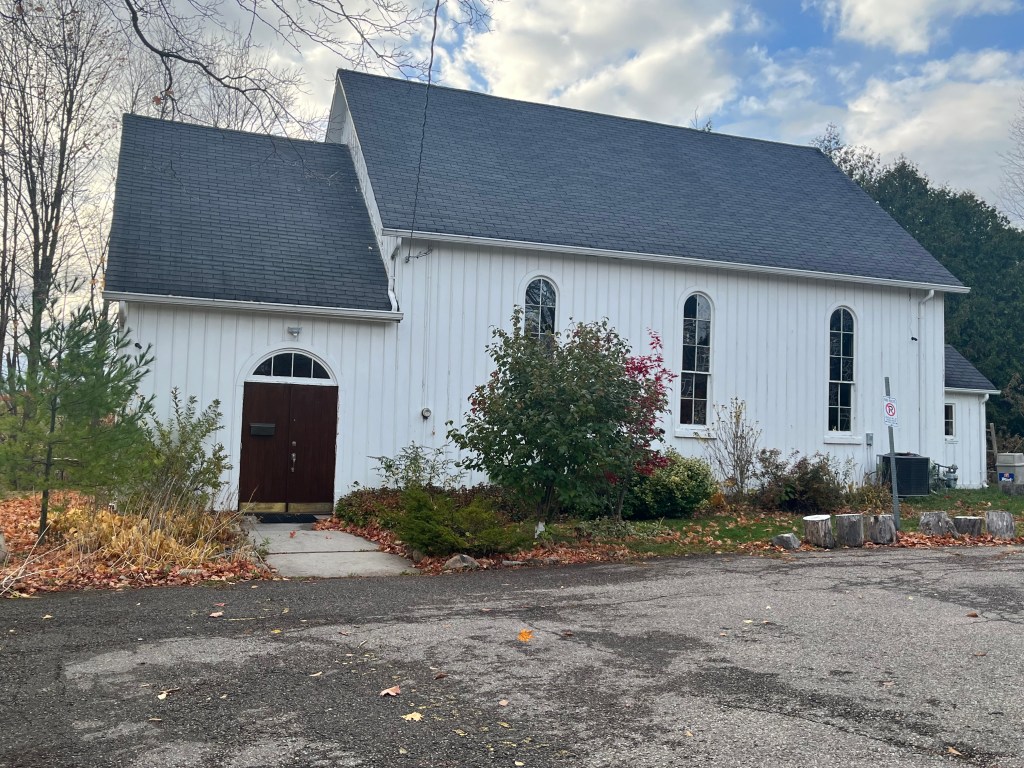
In 1850 The Episcopal Methodists had built a small church in the town and continued to worship there until 1877 when their new building became available. They continued as a Methodist Church until 1925 when they became the Box Grove United Church. In 2004 the church congregation voted to join the Zion United Church in nearby Cedar Grove. The building was vacated and then bought by the Full Gospel Assembly of God in 2006 who continue to meet there on Sundays.

A half acre of land was set aside for the Methodist cemetery in 1850 and many of the town settlers are buried here.

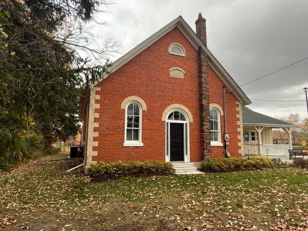
From the County Atlas above you can see that the school is shown across the street from the present structure. This small frame structure had become too small and needed to be updated. School Section #18 was replaced with this red brick structure in 1877, the same year the county atlas was produced. This new schoolhouse was used until the 1960s when new buildings were opened and most of the one room schools in Ontario were closed. Today the old school serves as a community hall and can be rented for various functions such as parties and wedding celebrations.

In 1867, the year of Confederation, they were awarded a post office and the town name was changed to Box Grove. The post office was in the general store which was located in the building seen below.

With three taverns and a population of 150 the town had a bit of a reputation for being rowdy. The Mennonite families on surrounding properties were not pleased and soon opened a Temperance Hall. All of the original industry disappeared and only the homes remained along with the school and church. There are still quite a few mid to late 19th century houses lining the streets around the original intersection. The one pictured below is a typical one and a half story worker cottage.

The house below was originally built in 1880 using a roughcast stucco surface applied to lathing. It has since been covered over with wooden siding. It was built on the Reesor Family farm on the east end of town and may have housed the person who operated their cheese factory. The house was modified at some point adding the western wing and making the home into an L shaped building. When the farms around Box Grove were redeveloped for housing the home was moved to make way for stormwater ponds.

One of the few homes in Box Grove to still display its original brick veneer with buff coloured accents stands on the eastern edge of the original town.

In the past few decades the area has been developed with new housing but the older ones can be picked out as you walk or drive through the neighbourhood.

In 1950 Nelson Morgan Davis, one of the richest men in the country, created a golf course in Box Grove which he called the Box Grove Golf Course. It was private and he was the only member. It was eventually developed into a 27 hole course with 9 holes in the valley and a challenging 18 hole course on the tableland above. It is said that he built the course after being hit in the head by a golf ball while playing at Rosedale Golf Club. Arnold Palmer was invited to play a round of golf with Davis and he later said that the course was one of the hardest he had ever played. Davis sold the golf course to IBM in 1967 netting a cool $2 million for it. IBM kept the course for the entertainment of its employees who could play a round of golf for $5.00. In 1997 IBM sold the golf course to Minto Developments who built a residential subdivision on the upper course while the City of Markham now operates a nine hole course in the river valley called Markham Green.

The Little Rouge River was dammed to create a mill pond to store water to power the mills that provided early industry in the community. The mills were all lost to flooding or to fires but the mill pond remains and is now the centre attraction for the Old Mill Pond Park which is just one of the parks in and around town. The town also features some hiking trails along the river.

Box Grove has been swallowed up by modern developments but there’s still quite a number of early residences hiding along 9th line and along 14th avenue.

Related Stories: Cedar Grove, The Reesor Family

Google Maps Link: Box Grove

Like us at http://www.facebook.com/hikingthegta

Follow us at http://www.hikingthegta.com

Also, look for us on Instagram
Malvern – Ghost Towns of the GTA

July 30, 2023

The former community of Malvern has disappeared under a massive railyard and multiple industrial buildings. There are still a few houses remaining that once stood on the outskirts of the town. Prior to 1850 the hamlet was known as Malcom’s Corners because John and Robert Malcom operated the Speed the Plough Inn and had a harness shop at the intersection of modern Sheppard Avenue and Markham Road. Senator David Reesor thought the community had the potential to become the capital of Scarborough Township and in 1857 he set out a plan to sell 50 foot by 150 foot lots for housing. He chose the name Malvern after a town in England where the water was said to cure the sick. Locals had told Reesor that the waters around Malvern would also cure the sick. He also planned for a grammar school, a fair grounds and a large community hall. The hall was built in 1860 and named Mammoth Hall. When it burned down in 1879 it was soon rebuilt. Unfortunately, an arson burned it down in 1988 and it was lost forever.

The map below is a section of the 1877 County Atlas and shows the location of the various properties that are pictured in this post. Three stone houses belonging to Weir, Stirling and Neilson and the school. Also circled is the Primitive Methodist Church that is pictured as an historical photograph.

For years there were two general stores that were operated by a series of men starting with Duncan Malcom. The village also had a blacksmith, a wagon shop, two hotels and a large woolen mill as well as a saw mill. One hotel was Thompsons Temperance Hotel and General Store and it contained the post office from 1865 until 1929 when the building was lost to a fire. The post office then moved to Cowans General Store in 1930 and remained there until 1956. The other hotel was the Standard Hotel where one could purchase an alcoholic drink that wasn’t available in the Temperance Hotel.

One of the prominent houses was the Neilson House which was built in 1856 and remains on Neilson Road today, serving as a community centre. It was partially destroyed by two fires in the 1970s but was restored and opened as the community centre in 1988. The cover photo shows this beautiful stone house from the front.

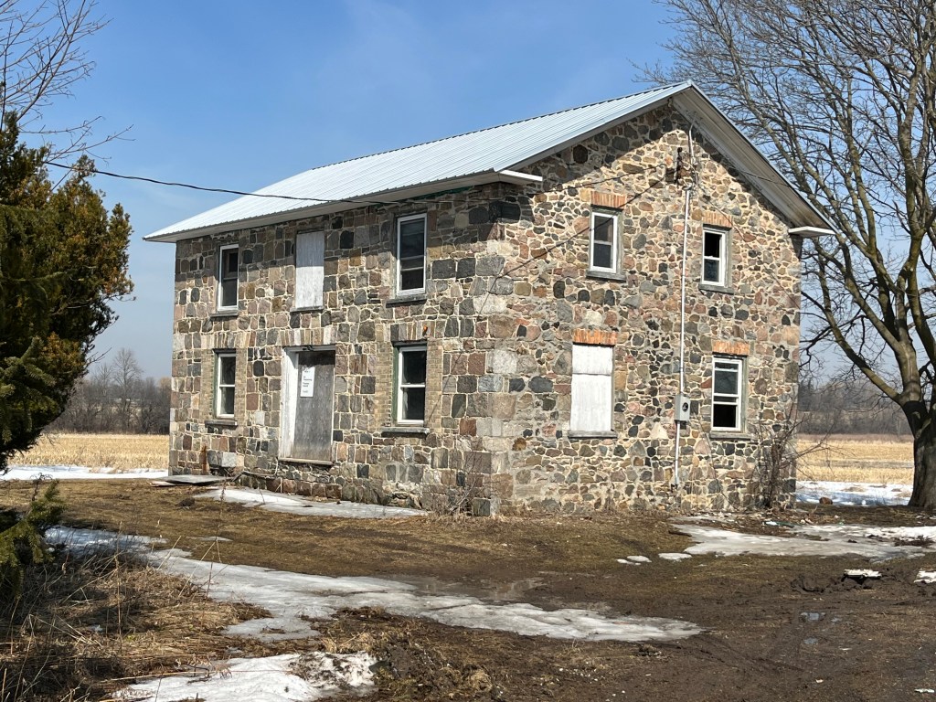
Malvern was a thriving farm community through the 1880s but when the railway bypassed it in favour of Agincourt that community prospered and Malvern went into decline. The Canadian Northern Railway built a station there in 1911 but it went bankrupt in 1917 and was taken over by the Canadian National Railway. Passenger traffic ceased in 1926 and the community stagnated until the 1950s when the Canadian Housing and Mortgage Company expropriated large tracts of land to build a housing development. One of the houses that was spared demolition was the James Stirling house which was built in 1860. This is another of the field stone houses that used to be found in the community.

James Weir came to Scarborough in 1833 from Scotland and worked against the Mackenzie rebels in the 1837 Rebellion. He settled on this lot in 1840 and became a successful farmer, livestock importer and ploughman. Eventually he became one of the wealthiest landowners in Scarborough and erected this home made of fieldstone in 1861. The lintels above the windows and quoins on the corners are made of Kingston Limestone. The house used to stand in the middle of the property but in 1975 it was moved about 400 yards west to its present location.

The door on James Weir’s house is the most decorative part of the structure. It has side lights and windows in the transom above the door. It is also one of only a few historic houses that I have photographed that has a name plate and date stone, in this case just above the door. James Weir, 1861.

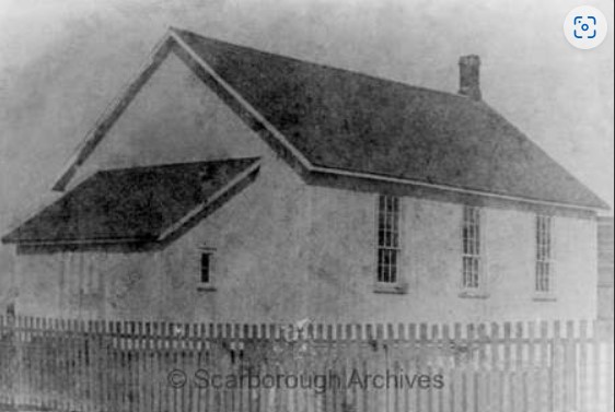
Malvern had a single church which was built in 1864 by the Primitive Methodist congregation. The building was demolished in the 1970s although some pieces of wainscotting and flooring were reused in the Scarborough Historical Museum. A small cemetery was located beside it and this still survives on the east side of Markham Road just north of Sheppard Avenue. The image below is from the Scarborough Historical Society website.

A log school house served the community from 1847 to 1851 when it was replaced with a small frame school which was built on the Stirling Farm. Alexander Muir got his start teaching in the log school house and his story can be found in our post on Burke Brook. The school was replaced again in 1872 by a one room brick school which still stands at the corner of Finch Avenue and Neilson Road.

The image below was taken from the Scarborough Historical Society and shows the school when it was surrounded by open farmland.

Whypers Boot and Harness Shop was relocated to Markham Museum where it is on display along with about 30 other historical buildings. Today the former community of Malvern is a thriving part of the uban sprawl of Scarborough and is commemorated in the names of streets, malls and the public library.

Related Stories: Markham Museum, Burke Brook, Agincourt

Google Maps link: Malvern

Like us at http://www.facebook.com/hikingthegta

Follow us at http://www.hikingthegta.com

Also, look for us on Instagram
Cashel – Ghost Towns of the GTA

April 2, 2023

The township of Markham was once dotted with small communities at many of the crossroads. One of these was the hamlet of Cashel which was a little north of the town of Markham. Originally called Crosby’s Corners and then later Fenwick Corners, it took on the name Cashel in 1851 when it got its first post office. In 1866 it was a thriving community of about 100 people that included a sawmill, tavern, shoemaker, tailer, blacksmith, broom maker, 2 inns and a Masonic Temple. One of these inns still stands at the intersection of modern Kennedy Road and Elgin Mills Road but most of the other businesses have disappeared. There are still a number of houses that survive from this era but most are empty, waiting while the farm land around them is developed for housing. One of the most prominent sites in the former community is now home to the Markham Fairgrounds, across the street from the Peach United Church featured below.

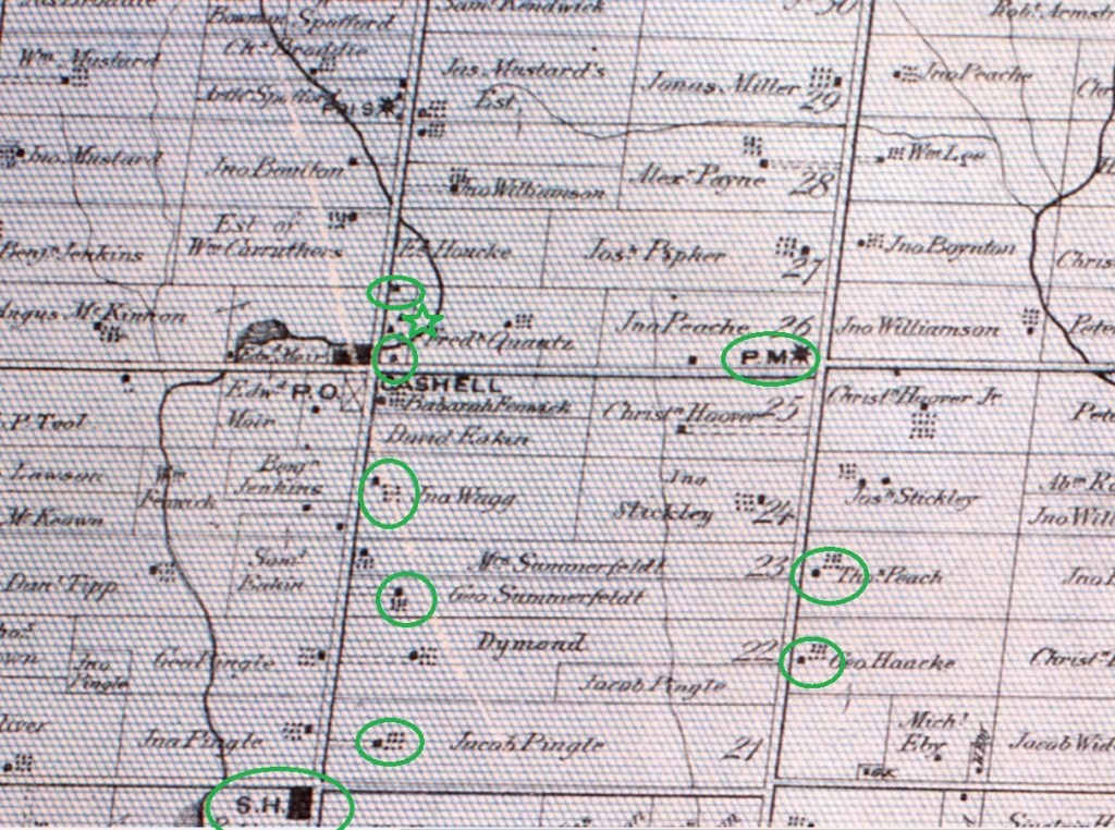
The 1877 County Atlas shows the location of some of the remaining buildings, including the ones featured in the story below. Just north of the intersection is a green star which marks the location of the Presbyterian cemetery. By the time of the atlas below, the church was no longer there.

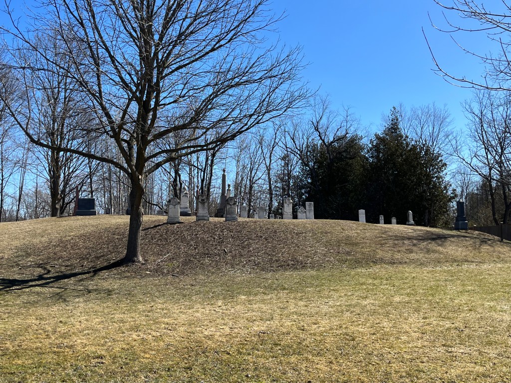
St. Helen’s Presbyterian Church developed a graveyard in 1827 behind the building. The church operated until about 1865 and then was left without a congregation. The cemetery is now known as Cashel Cemetery and since the church has been demolished the cemetery is maintained by the City of Markham. Many of the township’s earliest settlers were buried in this cemetery.

The original school house was built in 1837 and by 1850 there were about 40 students in attendance in the one room building. School Section 11 of Markham was replaced in 1862 with a new brick building with two front doors. One for the boys and one for the girls. At some point a veranda was added to the front and one of the doors was sealed off. The building was restored when the surrounding land was developed for a plaza and the veranda was removed.

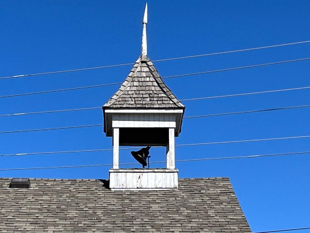
The school still has the bell that once called students into classes but it appears to be stuck in an unusual position. It looks as if it is in permanent action, calling students who never actually show up anymore.

One of the two inns in town is still standing but is now a private residence. The inn was constructed in 1835 and was initially named Llandon Plains Hotel. For awhile it served as the Cashel store and post office and in recent years was Bates Roadhouse Antiques.

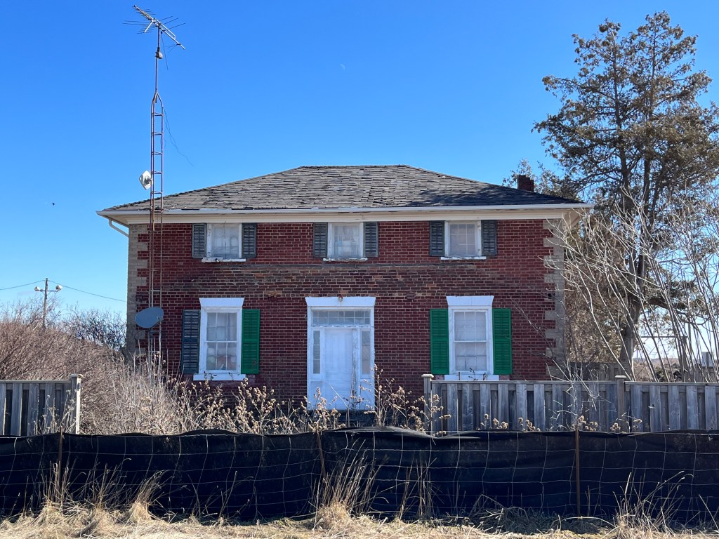
The original settlers named Pingle sold their farm in 1881 to Samuel and Mary Wilson. Their son Homer took over running the farm in 1890 and became the owner in 1894. Around 1900 he had a new brick farmhouse built on the property where he lived until he sold to John Preston “JP” Carr in 1926. The Carrs had a son Albert who took over the farm in 1950.

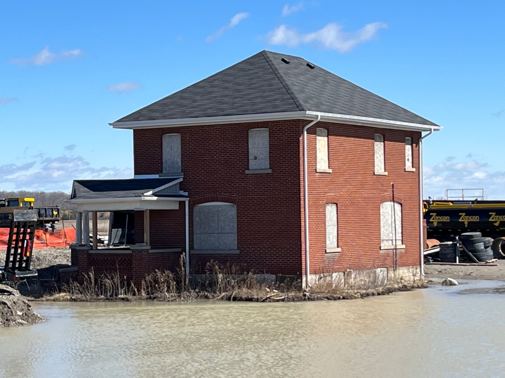
When JP Carr retired from farming in 1950 he had a small cottage built in the front yard of the earlier farm house. He lived here with his wife Florence.

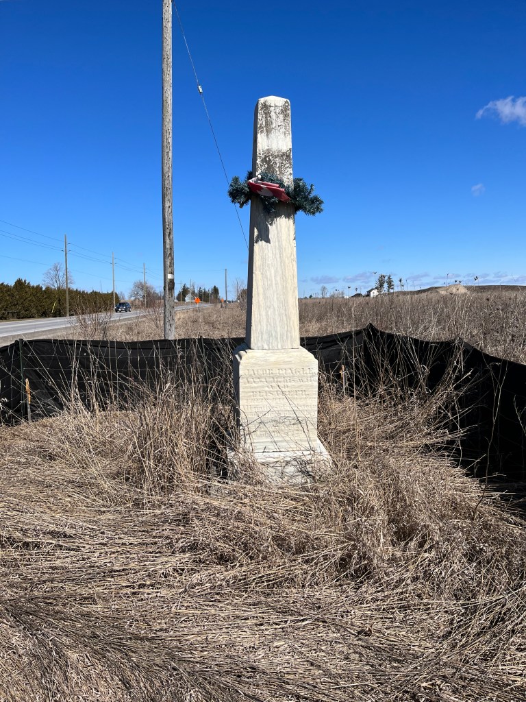
Located near the end of the driveway is a single stone marker which indicates the grave site of Joachim and Anna Marie Pingle and their daughter. They were original members of the Berczy Settlers who came to Markham in 1794. None of the Pingle family buildings remain on the lot but the cemetery is a reminder of the family. It’s likely that the current marker replaced three individual ones from earlier.

This regency style house was built in 1856 by George Henry Summerfeldt Sr., the son of John Henry Summerfeldt, one of the Berczy settlers. The house remained in the family for three generations and is now listed as part of Markham’s heritage inventory. Like the other houses shown in this post, it sits on farm land which is being developed for housing. The homes appear to be in the process of being salvaged and hopefully restored.

The Wegg farm was originally patented to Jacob Pingle but was sold to John Wegg in 1874. When Arthur Wegg, son of John, passed the farm on to his son in 1922 he had a four-square Edwardian home built for his retirement. The house was later owned by a restauranteur and then operated as a country market. Since 2013 it has been waiting for the development of the property into residential uses.

William Bergen lived in Cashel at the time of the 1861 census. He was employed as a general labourer but also had his own broom and basket making business. The simple house he built for his family was originally a single story in 1863 when it was built. Some time later in the 19th century it had a second story added to it.

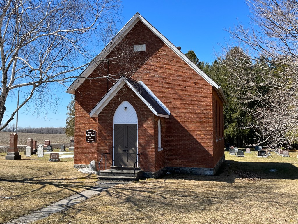
Peach’s United Church started as a Methodist Church and was constructed in 1890 on land donated by Thomas Peach. The brick building currently on the site replaced a wooden structure which was erected in 1847. The Methodists formed the United Church in 1925 along with some of the Presbyterian churches and some Congregationalists. Peach’s United Church stopped holding services about 50 years ago but the cemetery is still active. The Peach house was built in 1845 and is circled on the map just south of the church and it is still occupied. Unfortunately, there are a lot of trees in front of the house and I couldn’t get a decent picture of it.

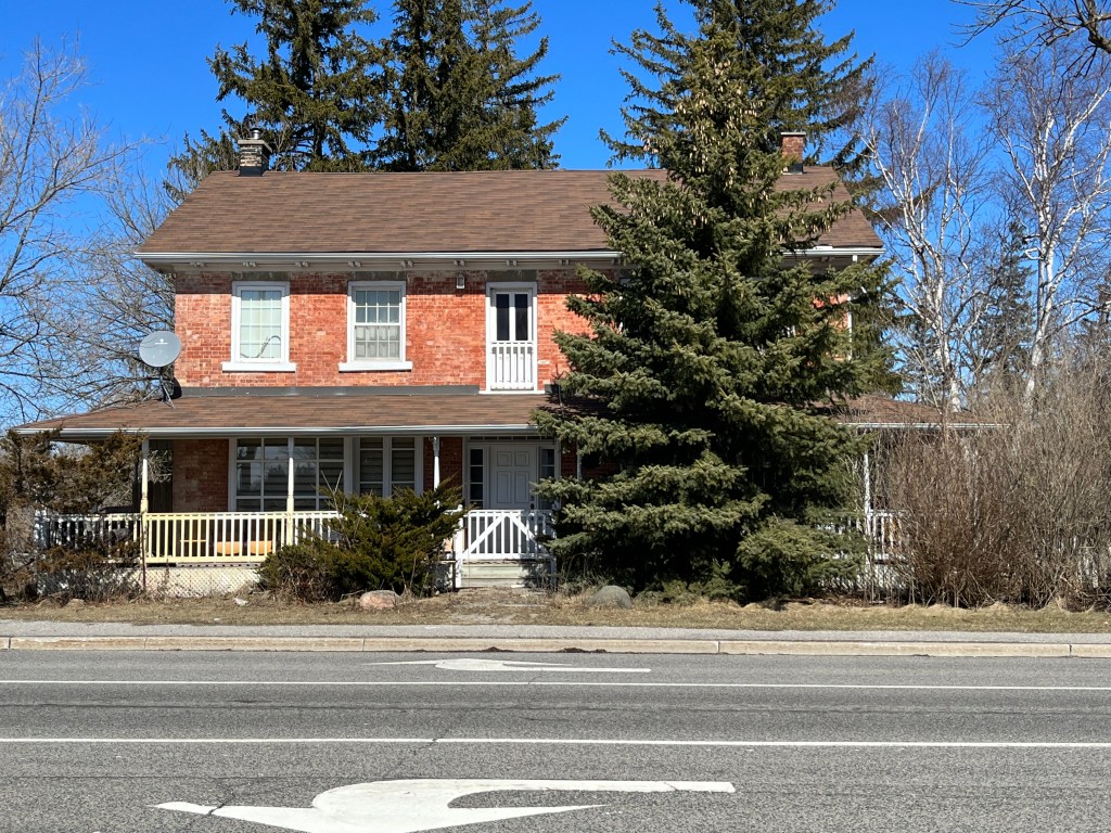
The George Haacke house was built in 1955 and was used by three generations of the family until it was sold to John Wilmot Warriner in 1902. The property was farmed until 2014 although it has been owned by a developer since 2011. The two story, five bay house was quite large compared to contemporary cottages of the same era. A nail board along the front wall indicates that the house used to have a much larger front veranda which was replaced with the smaller one at some point in time.

Markham seems to have done a very good job of designating, and then protecting, their historic buildings. One of the most unique things is the creation of Markham Heritage Estates where historic buildings can be relocated and lived in. At least one home from Cashel has been moved to this site near the Markham Museum.

Related stories: Markham Heritage Estates, Markham Museum

Google Maps Link: Cashel

Like us at http://www.facebook.com/hikingthegta

Follow us at http://www.hikinghtegta.com

Also, look for us on Instagram

Milliken – Ghost Towns of the GTA

Sunday, March 12, 2023

The community of Milliken was located at the intersection of Steeles Avenue and Kennedy Road. Part of it was in Scarborough and part in Markham as Steeles Avenue is the dividing line between the two townships. The area was first settled by Europeans in 1798 and Norman Milliken arrived around 1807 and set up a saw mill and lumber business. It was known as Milliken Corners and got a post office in 1858 when it became a postal village. The post office was located just west of the present United Church.

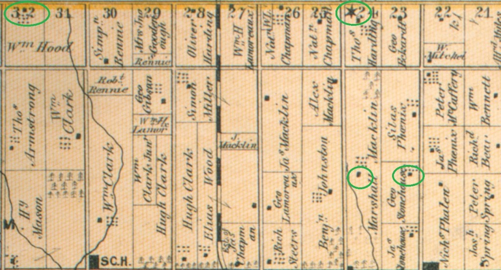
The map below was taken from the 1878 county atlas and shows the Scarborough portion of Milliken. The homes of William Hood, Marshal Macklin and George Stonehouse are circled in green as is the original location for the Methodist Church. These will be covered in more detail below as they are the remnants of the original community.

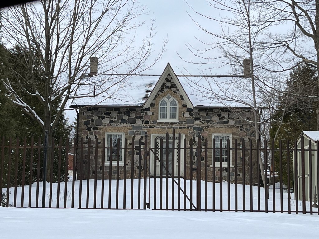
The Stonehouse-Lawrence house was built in 1871 and formerly fronted onto McCowan road although this is now the back yard of the home. When the farm was developed for housing access was cut off from McCowan which became a four-lane road. Delburn Drive was cut through the back yard and now this is the main entrance and driveway for the home.

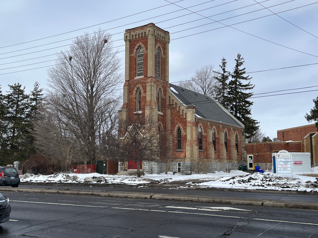
The most visible reminder of Milliken is Ebenezer United Church at the corner of Brimley Road. The 1878 county atlas for Scarborough Township shows a Methodist Church on the south side of Steeles while the one for Markham Township places it on the north side of the road as it is today. This happened because 1878 was the year the congregation decided to replace their original building with with this brick one constructed in the gothic revival style. They worshiped in the first church while they erected the new one across the road.

Marshall and Mary Macklin purchased their lot facing Brimley Road in 1830. The stone house was completed in 1851 and was used to raise their family which included 17 children. A small creek used to run between the house and Brimley but it was replaced with a drainage ditch many years ago. The house remained in the Macklin family for over a century.

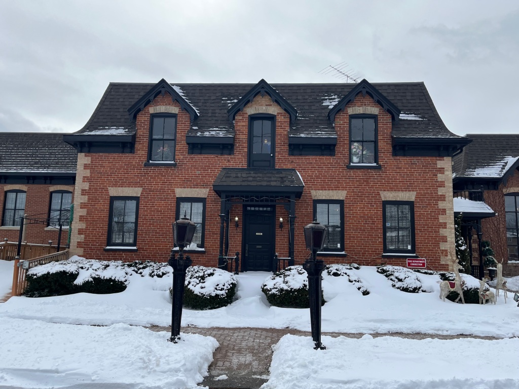
William Hood emigrated from Scotland in 1831 with his wife, mother and two young sons. In 1839 they purchased a farm lot in Scarborough and in 1850 they built a one-story brick farm house in the Georgian style. The original five-bay house was very symmetrical with a plain central doorway and transom window above it to let in some light to the main hallway. As the family grew a second story was added to the home along with a Second Empire style of roof.

William’s youngest son, Thomas inherited the property in 1892 and remained there for the next ten years with his family. William Francis Gough bought the estate in 1920 and he and his wife renamed it Devonsleigh after their homestead in England. They farmed the land until 1954 and lived in the house until 1966. In 1982 the home was renovated and enlarged again and preserved as Devonsleigh Place. For awhile it was used as a steakhouse. Today the 170 year old home is used as Casa Imperial, an upscale Chinese Restaurant.

The map below was taken from the Markham County Atlas of 1878 and shows that portion of Milliken. Circled in green are the homes of Benjamin Milliken II which was owned by William Milliken at the time, William Macklin house and the site of Ebenezer Primitive Methodist Church.

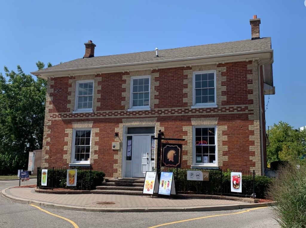
Benjamin Milliken II was the son of the founder of Milliken and he built this home in 1855. It now stands behind the Dairy Queen near Hagerman’s Corners and is used as Milliken Pub.

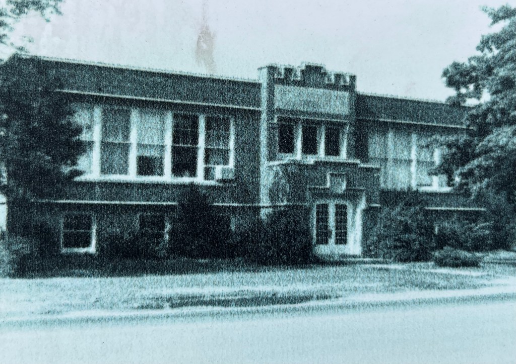
The first school to serve the community of Milliken Corners was established in 1838 not far from the school pictured below. Initially the school had 26 students under the teaching of William Galloway. When newer schools were opened a little north in Haggerman’s Corners and south at L’Amoreaux students were transferred to these schools. In 1929 two acres of land were sold for $600 by L. E. Morgan to the school board for the construction of a public school. The cost of the school, including the land and all of the furnishings was $28,000. Milliken Public School was known as a union school because it served students from both Scarborough and Markham townships. The school operated until 1968 when newer schools were built and it was closed. The building was then used by the Richmond College of Liberal Arts and then Scarborough Christian High School. The picture below shows how the school looked in 1977.

In 2010 the building was demolished except for the front facade which was incorporated in the Milliken Centre development.

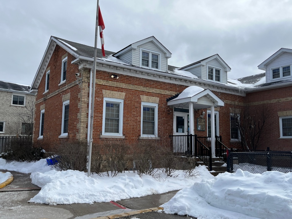
The William Macklin house was built in 1840 at 2501 McCowan Road and has since been expanded and now houses a daycare. Recently it has been designated as 2501 Dennison Road as the laneway is now accessed from this street rather than McCowan.

Milliken Corners and Milliken Mills were rural communities but in the 1970s and 1980s were swallowed up by development, leaving only these few traces of the former farming communities.

Related stories: Milliken Park, Haggerman Corners

Google Maps Link: Milliken

Like us at http://www.facebook.com/hikingthegta

Follow us at http://www.hikingthegta.com

Also, look for us on Instagram
Altona – Ghost Towns of the GTA

Sunday, December 4, 2022

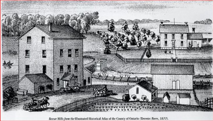
Altona was founded in the early 1800s by Mennonites of Swiss-German descent who had emigrated from Pennsylvania. They named their community after Altona in Germany, a town which is now part of Hamburg, Germany. It remained a small farming community until 1850 when Abraham Reesor built the first saw and grist mills in the area. Abraham was the son of Peter Reesor who was one of the early pioneers in the GTA. A school was built in 1834 and the community seemed to peak around 1856 at about 256 people. By 1869 the census showed only 200 residents and by 1910 it was down to only 100 people. This was often the fate of hamlets that were bypassed by the railways. The image below shows the Reesor mill as pictured in the 1877 County Atlas.

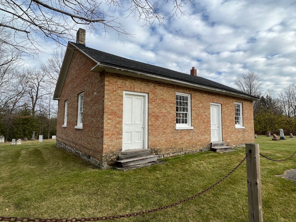
A couple of churches, the school and a hotel complimented the general store and provided for the spiritual and physical needs of the residents. A Mennonite Meeting House was built in 1852 and is one of the few buildings left in the community.

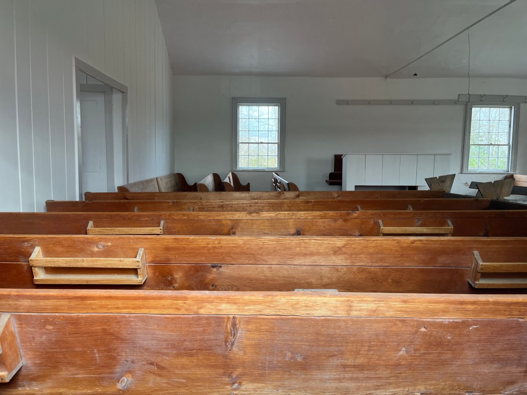
Through the window the simple pews can be seen as well as the pulpit. There is no ornamentation in the church and no stained glass in the windows. The Mennonites met here until September 15, 1974, after which regular services ceased.

The oldest grave marker in the cemetery is dated to 1835 and precedes the building of the meeting house. The early members of the community are interred here, including the Reesors, Nighswander, Widemans, Hoovers and Stouffers.

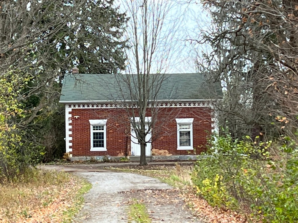
When the Federal government decided to build a second international airport for the GTA, a large area of flat land in Pickering was chosen. Altona was seen to be just below an approach to one of the runways and flights were envisioned coming in over the town at about 300 feet above. The town was essentially expropriated, and all the property owners were bought out. This small Georgian Style Cottage has survived and is distinguished by its elaborate two-tone brick work.

We gave more details about the proposed airport in our previous post on Brougham and so we won’t go through all of that again here. Several of the homes in Altona are still occupied but if the airport ever gets off the ground they may well be demolished.

The story and a half home with a front gable and gothic pointed arch front window was perhaps the most common style of architecture in Ontario in the years leading up to Confederation. There are a couple of them still remaining in Altona, but for how long?

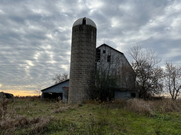
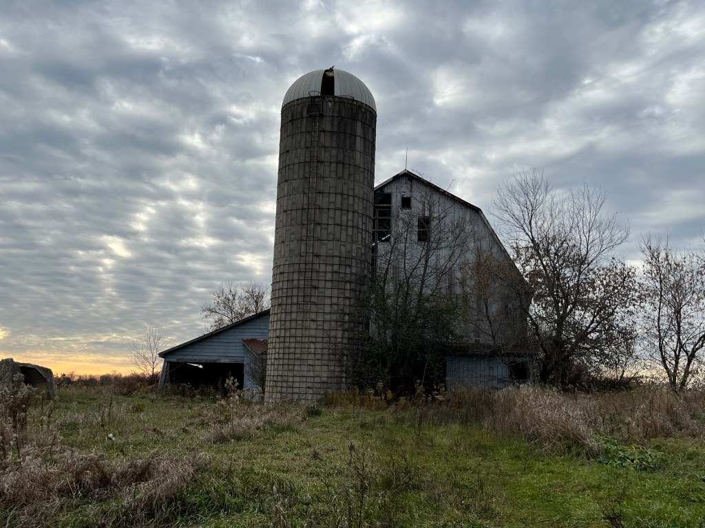
The house of William Rhoddick has been demolished but the barn and silo remain. It has been 50 years since the land was expropriated and current assessments suggest that there will never be an actual need for this airport to be built. It’s sad that the legacy of the people who cleared the land and worked so hard to make a living has been lost and soon may be completely forgotten. I wonder how they would feel if they could see what has happened to the fruit of their labours.

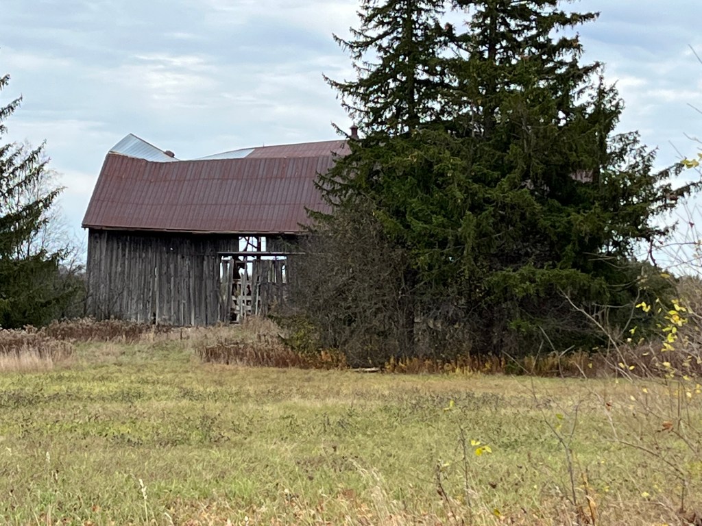
With so many of the buildings in the hamlet in a continuous state of disrepair there is an ongoing threat due to nature. The powers of wind, rain and snow are slowly demolishing several of the buildings that haven’t already been intentionally destroyed.

The community has become one of empty laneways that lead to former houses that were either torn down or fell victim to arson and vandalism. The Barkey House was built by one of the early pioneers who was also a Mennonite preacher who served at the meeting house. The home was eventually sold to the Mitchell family who owned it until it was expropriated in 1972. The house made the news in 2012 when it was discovered that someone had built a confinement room in the basement with the intention of kidnapping a woman and keeping her there. The home burned down a couple of weeks after the discovery in a fire which was deemed as suspicious.

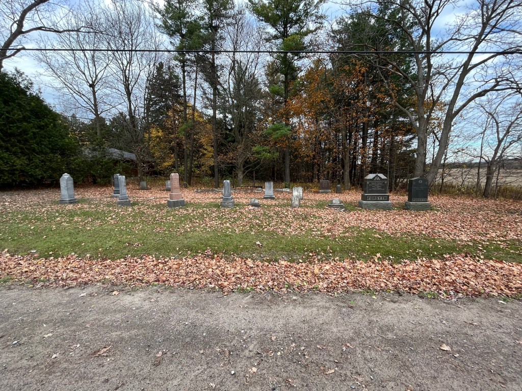
Just up the road from Altona is a small family cemetery on the former Forsyth property which is the final resting place for many of the early members of that family. The Forsyth Family Cemetery has a small area at the rear where several of the earliest markers have been gathered together and laid in a horizontal cement cairn to preserve them.

The fate of the remaining buildings in Altona is very much “up in the air” as it depends on the eventual outcome of the Pickering Airport.

Related stories: The Reesors – Pioneers of the GTA, Brougham – Ghost Towns of the GTA

Google Maps Link: Altona

Like us at http://www.facebook.com/hikingthegta

Follow us at http://www.hikingthegta.com

Also, look for us on Instagram
Edgeley – Ghost Towns of the GTA

Sunday, November 20, 2022

The community of Edgely was centered around the modern intersection of Jane Street and Highway 7. The first Europeans to settle in the area arrived around 1800 from Somerset, Pennsylvania. The northeast corner of the intersection had a hotel while the southeast corner had the general store which also had the post office from 1872 to 1960. A steam driven shingle mill was located on the northwest corner. A cider mill was located just south of the general store which produced cider, apple jelly and apple butter until it closed around 1900. Along with a community hall, there was also a blacksmith, dressmaker, a shoe maker, a wagon shop, a casket maker and two slaughterhouses.

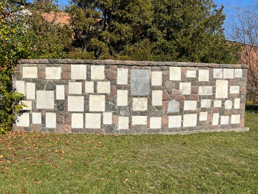
In 1823 an acre of land was deeded to the Mennonite congregation in the Edgeley area for use as a cemetery and Meeting House. Jacob Smith Sr. (originally Schmitt) granted the land which currently is the most tangible evidence of the former community. After the Meeting House was moved to Black Creek Pioneer Village in 1976 the cemetery wasn’t maintained and by 1985 many of the earliest stones were in disrepair. The city of Vaughan gathered them together into a cairn to protect them from further deterioration.

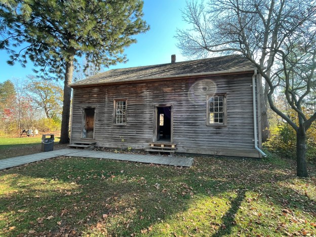
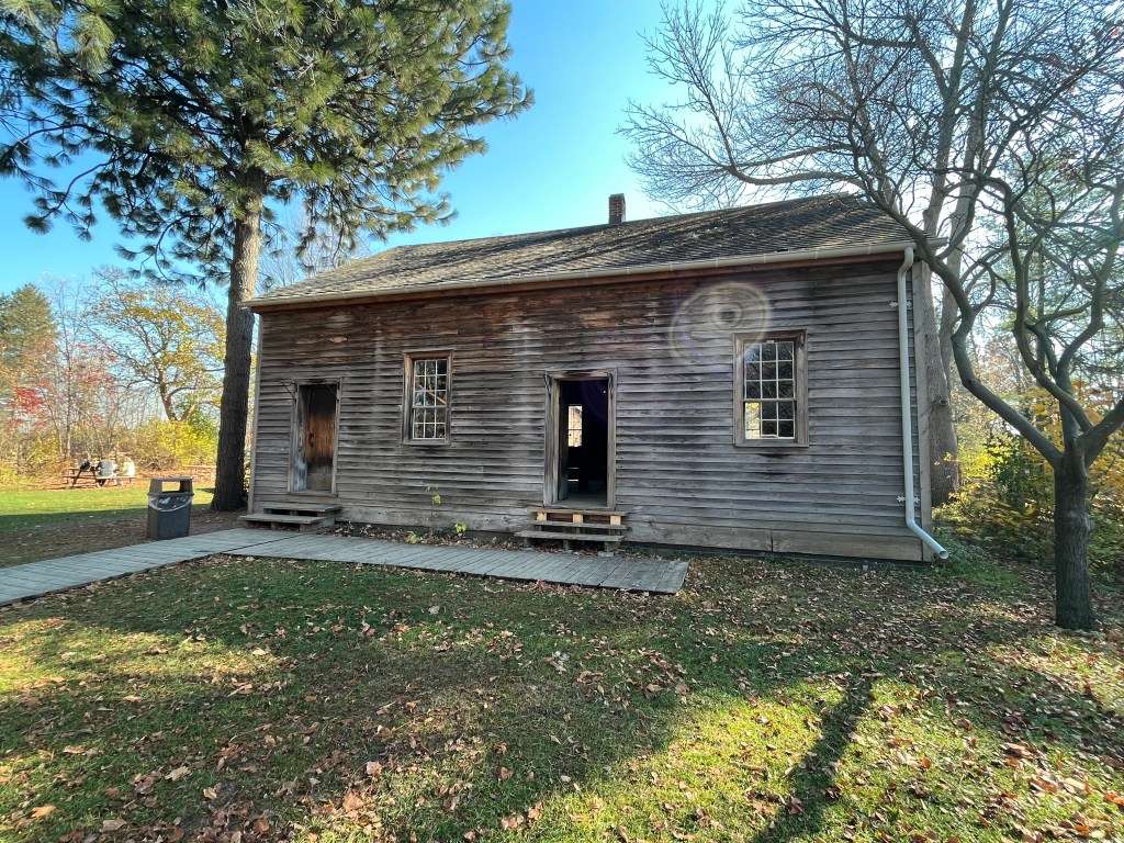
The Meeting House was built in 1824 and clad with horizontal board siding. It was used for 99 years before being closed in 1923. It was operational again for a brief period between 1963 and 1976 after which it was moved to Black Creek Pioneer Village. It is the oldest surviving log Meeting House in Ontario and was built out of first growth white pine that was cut in the area of Edgely. Services were only held in the church every fourth Sunday because the pastor was shared with other Meeting Houses in the area.

The benches and wood stove inside the meetinghouse are original to the building. As per Mennonite custom, none of the wood was painted. The work was done by hand and even the nails that were used were forged by the local blacksmith. The total cost of the building, not including the stove was $221.

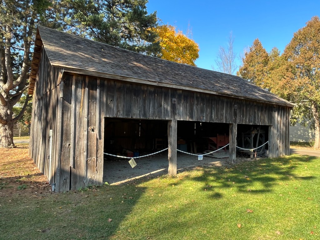
The drive shed was built around 1860 and used to store carriages while the Mennonites were attending services at the meeting house.

An archive photo from about 1900 shows the Meeting House, also known as Schmitt Meeting House, along with the original drive shed. This shed was replaced in 1916.

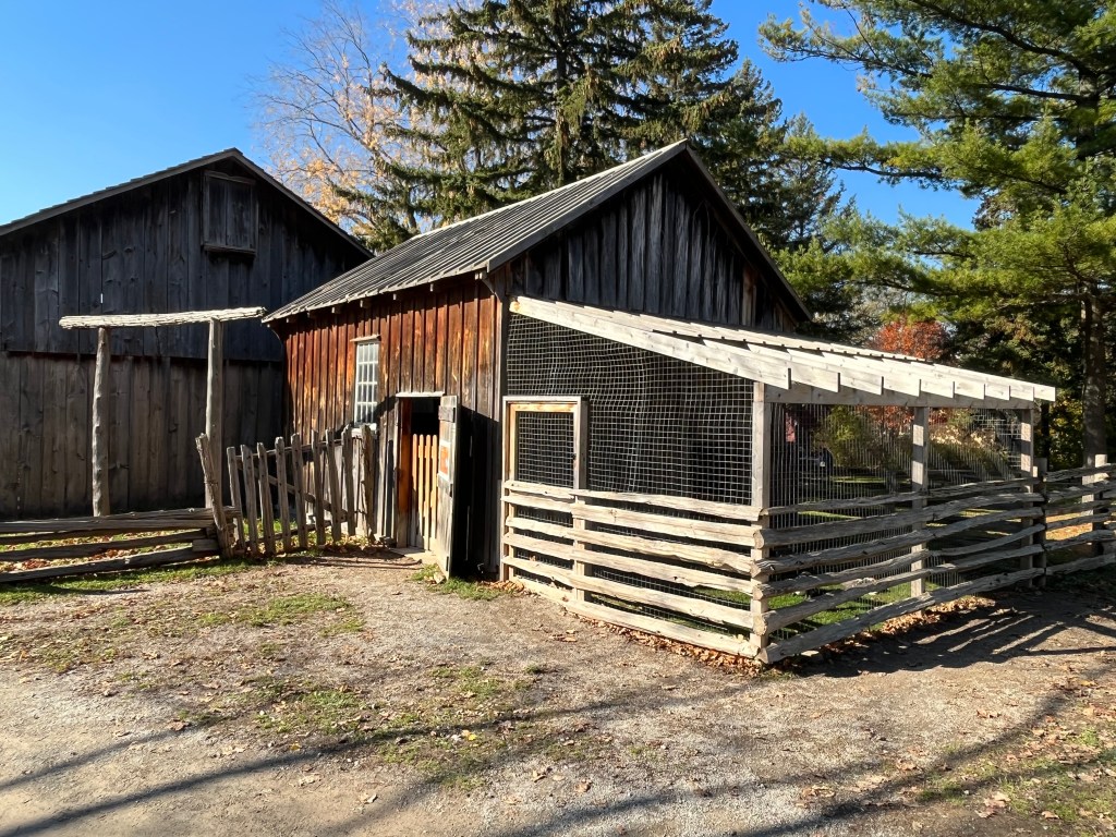
Edgley had two buildings that were used by the local farmers to butcher their livestock. It is a timber frame structure that is clad with board and batten siding. When it was built in 1860 there was no easy way to store large quantities of meat and so the local farmers would work together. One animal would be butchered, and the meat shared. When it came time to prepare another animal it would be provided by a different farmer. Once refrigeration became available this practice was no longer needed and in 1970 the building was moved to Black Creek Pioneer Village and opened as a rabbit hutch.

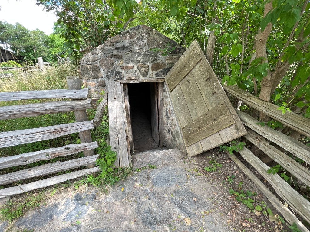
Most homes and farms had at least one apple tree and some had a full orchard. The fruit was harvested in the fall and stored for the winter to provide food for the family. Edgely had at least one of these storage cellars and it has been preserved by moving it to Black Creek Pioneer Village. The cellar was dismantled and moved to the village over a 65-day period. Two sets of wooden doors were used to help insulate the interior so that the fruit would be better preserved.

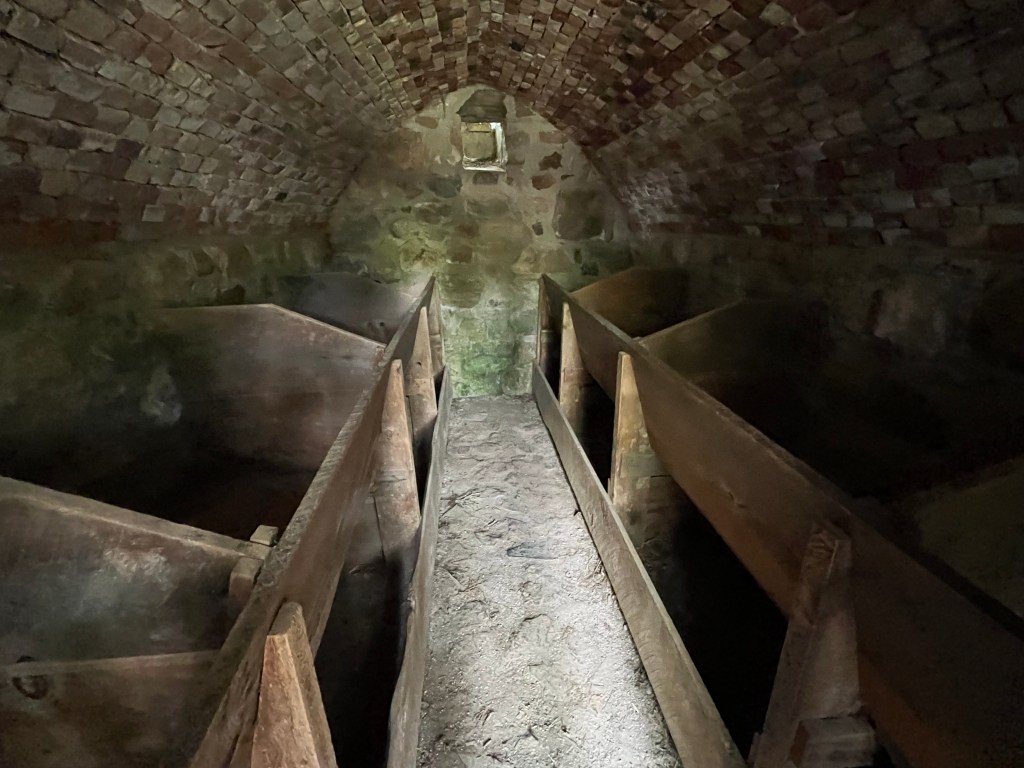
Inside, the storage cellar is just eight feet long and seven feet wide. The fruit or root vegetables were placed in the wooden bins and covered with layers of straw for better insulation and to increase the storage life. The small vent at the back of the building could be opened or closed in order to regulate the temperature inside.

A single house remains from the community, and it is located just south of the cemetery on Jane Street. This style of architecture is known as Edwardian and was built sometime between 1901 and 1910. It is also sometimes referred to as “four-square” because of the four windows on the front of the house.

The former community of Edgely has been almost completely erased from the landscape and is being replaced by high-rise condos. Fortunately, the cemetery is still there to mark the hamlet and a few buildings are being preserved at Black Creek Pioneer Village.

Related Stories: Ghost Towns of York Region, Black Creek Pioneer Village, Elizabeth Stong, Pioneer Cemetery Cairns

Google Maps Link: Edgeley

Like us at http://www.facebook.com/hikingthegta

Follow us at http://www.hikimgthegta.com

Also, look for us on Instagram
Forest of Cars

August 21, 2022

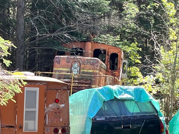
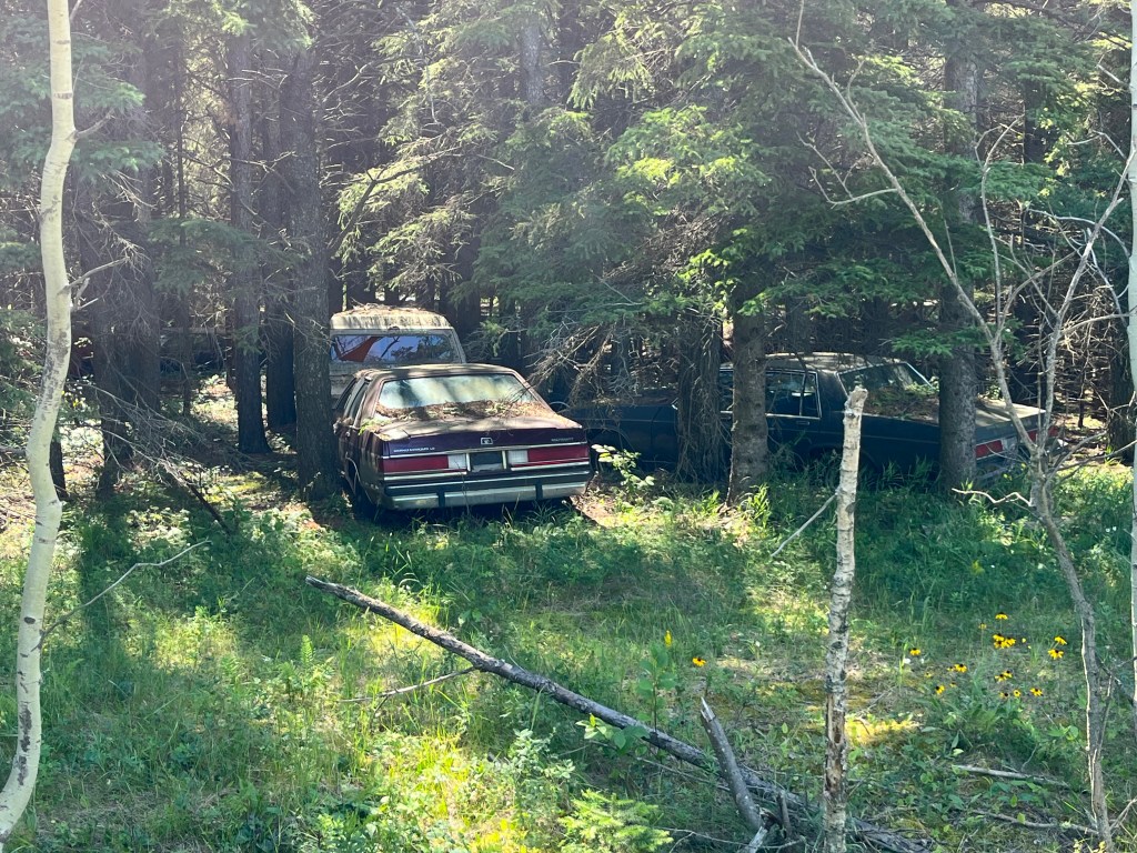
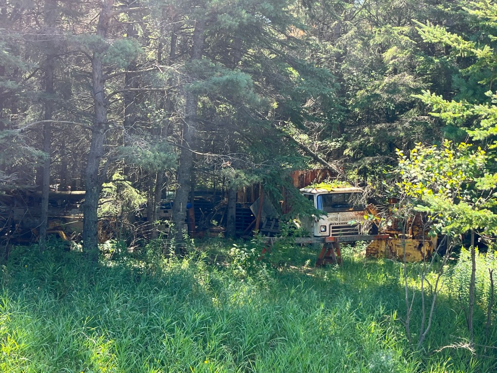
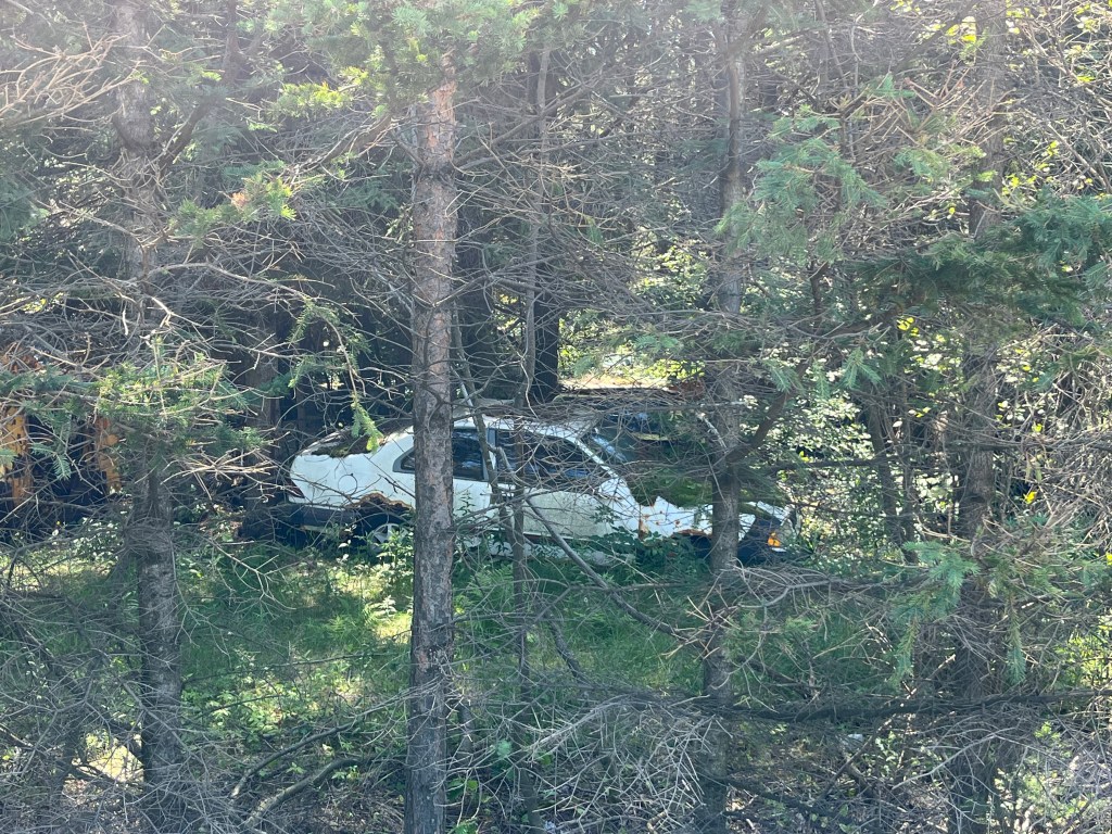
While on a business trip near Thunder Bay back in April I noticed a forest which appeared to be full of abandoned cars. I decided on my return trip this past week to check it out. Unfortunately the place is marked as No Trespassing and the owner could not be seen to try to get permission to go in and have a look around. I had to settle for a few pictures that I took as I walked along the front of the property. The image below is taken from Google Earth and shows the cars, trucks and buses that can be seen on the open areas as well as three buildings in various states of collapse. On the right hand side of the image is Oliver Road from which the images in this post were taken.

One of my clients has their business a few kilometers away from this location and so I asked them what they knew about the property. It seems that the owner had collected the vehicles over a period of years and refused to sell any of them or even let people buy spare parts to repair their own vehicles or classic cars.

Another local person told me a story of trespassers encountering the owner who showed his displeasure by brandishing a gun! There’s also a story about the original owner passing away and someone new taking over the property.

Most of the cars near Oliver road appear to be forty or fifty years old but who knows what might be located deeper into the forest. The view from Google Earth suggests that there could be some real treasures waiting to be discovered.

There doesn’t appear to be anything online about the property or the owner although I plan to keep looking to see what can be found.

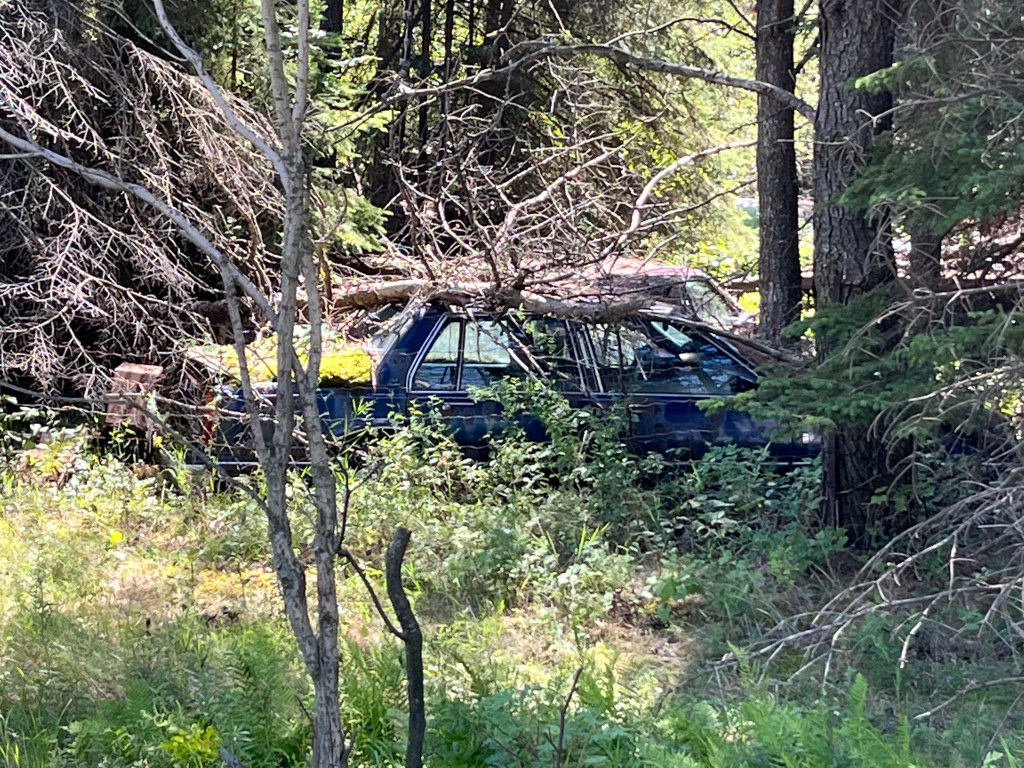
The cars, vans and trucks seem to have been parked in an open area and the woods have taken over again making it almost impossible to be able to get a vehicle out, even if you wanted to.

This Cadillac has had a tree fall on top of it. I would imagine that there are likely several cars on the property that have suffered similar damage over the years.

The next time I’m in the area will likely be in November when the leaves are off of the trees but it might not make a huge difference because most of the forest is made up of evergreen trees.

I have been given the offer of meeting another classic car collector a few sideroads over when I visit next time. Perhaps he will know more about this mysterious forest of cars. If this is the case, he may also be able to put me in touch with the owner.

With luck, maybe I can make arrangements to go exploring during my spring visit to the area. That could prove to be very interesting indeed.

It would appear that there are hundreds, perhaps a couple of thousand vehicles in this forest. Someday I hope to bring you more pictures and the complete history of this forest full of cars.

Google Maps Link: Murillo Car Forest

Like us at http://www.facebook.com/hikingthegta

Follow us at http://www.hikingthegta.com

Also, look for us in Instagram
Mongolia – Ghost Towns of the GTA

Sunday, April 3, 2022

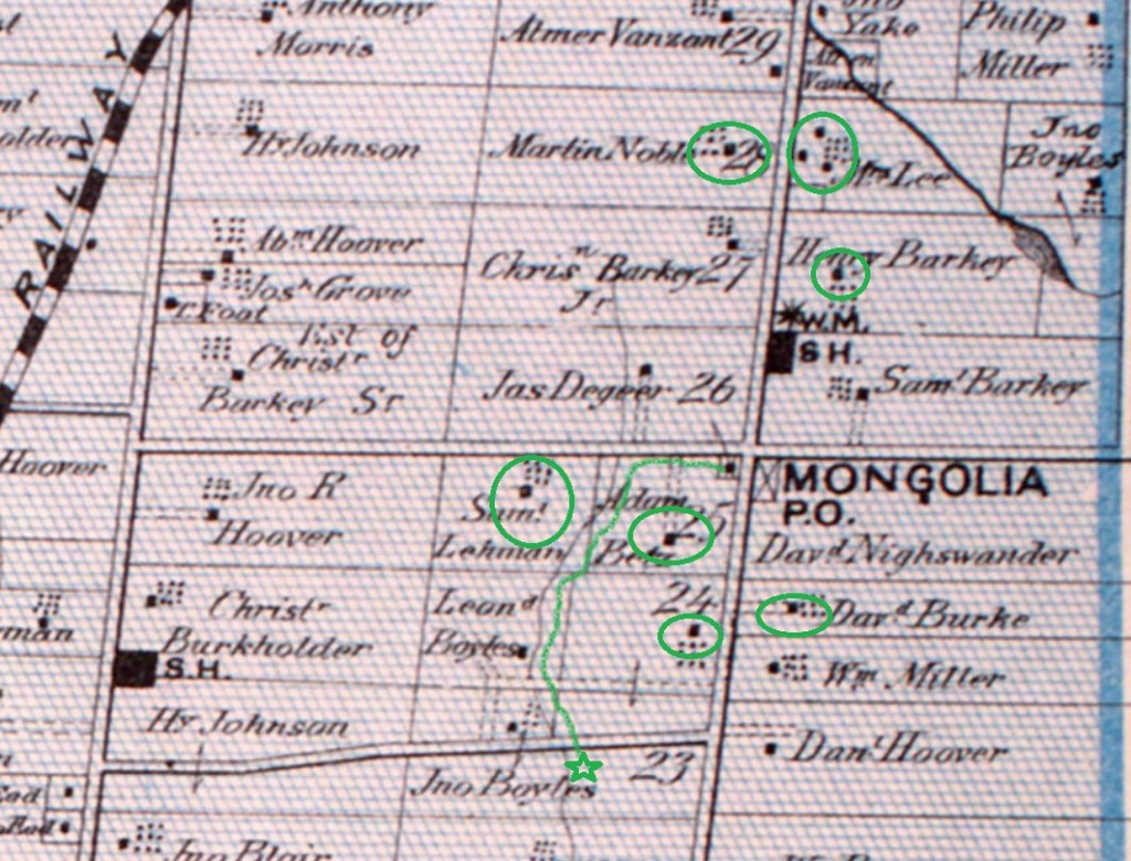
Mongolia was a community that grew around the modern intersection of Elgin Mills Road and Reesor Road. Peter De Guere arrived in 1801 and took the north west corner on lot 26. The adjoining lots were soon taken up as people cleared land for farming. As the community grew it got a tavern in 1841 and took on the name California Corners. It was never more than a farming community with a school, Methodist Church, and a Temperance Hall beside the blacksmiths shop. The rural atmosphere was lost in 1972 when the federal government decided that the flat land north of Pickering would make a good site for a future airport. They expropriated the entire town and then never built the airport. Studies show it won’t ever be needed and slowly the government is giving sections of the airport lands to help create Rouge National Urban Park. This is a far better use for the land, although it could still be productive farm land again. To explore and record what remains before it is lost we parked at the trail parking lot on the south east corner of the intersection. From there you can walk up or down Reesor Road to view the old homes or follow the trail to the historic Boyles Pioneer Cemetery. We did both. The 1877 county atlas section below shows many of the homes that still remain as well as the trail to the cemetery, which is marked with a star.

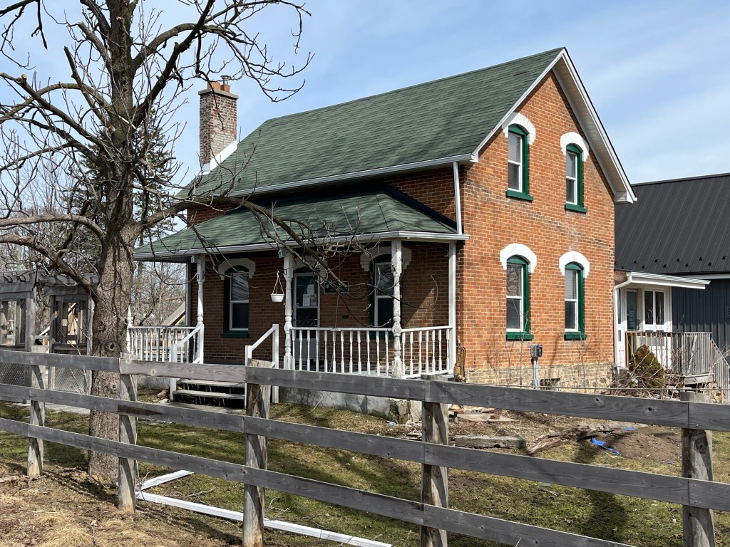
It was in 1853 that James Holden bought the corner of David Nightswanders property and the following year he opened a general store which he operated until 1861. When Nightswander got a post office for the town in 1864 he was told the name California Corners could not be used and so Mongolia was chosen from a list of approved names. A house was added beside the store in about 1870 but the store and post office burned down in 1920, leaving just the house behind. It is now being used as an information centre for Rouge National Urban Park and is one of the few homes from Mongolia that is still in great condition.

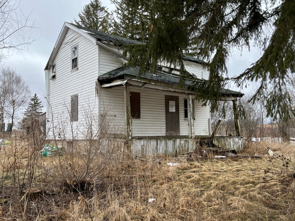
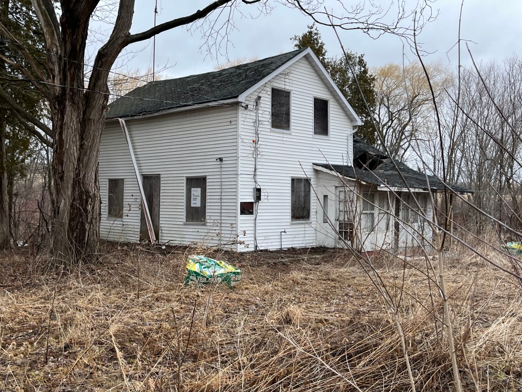
Martin Noble built this farm house in1840 and like several other older homes in the community it has been covered in white siding. I wonder if it was built of field stone like so many of the local homes were in the mid 1800s. I think we’ll be able to find out soon as the roof is caving in on this home in spite of it being on the heritage listing for Markham. Mongolia appears to be falling victim to neglect like so many of the heritage properties in the Pickering Airport Lands. It’s interesting that a designated home can’t have unapproved alterations because they can detract from the heritage properties that set it aside for preservation. However, there’s no provision in the listing to require a property to be maintained even though lack of maintenance is seriously detracting from the heritage value of these buildings.

The fields and forests around Mongolia are littered with the neglected dreams of the former inhabitants. Many out buildings, barns and drive sheds remain as well as several abandoned cars and at least a couple of boats. Now that this section of the former airport lands has been designated as part of Rouge National Urban Park it may be that some of this will be demolished while the rest is left to vanish into the new forest as it regrows across the farm fields.

The James Collins house was built in 1850 and was also subjected to white siding which likely hides a lovely brick or stone home on its stone foundation. The entire back side of this house is missing the roof and it won’t be long before this heritage designated home is lost forever.

The drive shed on the property is still in very good condition even though it may have been 50 years since the farm was active.

Another heritage property is the David Burke house from 1850. This home still looks pretty solid but has had all the interior walls stripped down to just the framing. One noticeable alteration to the home is the ground floor windows which have been replaced with smaller ones. Buff coloured bricks have been used to fill in the openings around the smaller windows which hides the alteration from a casual glance.

The Adam Betz house stands on the south west corner lot as it has done since 1851. Another one of the white siding victims in town, it stands an a thick stone foundation that may indicate another beautiful stone house.

Henry Barkey took over the North East corner of the intersection from Jacob Barkey in 1832 and lived near the centre of the lot. In 1860 a blacksmith shop was built near the corner of the intersection and was rented by George Calvert who appears in the 1861 census and the following couple as well.

The tenant in the house next door was usually the blacksmith although after the blacksmith shop closed it was rented to various people until it was taken over for the airport. It still appears to be lived in under a rental arrangement with the government.

School section #22 originally occupied a frame building on the east side of Reesor Road but in 1882 a new brick school house was opened across the street. When the school was closed the building was renovated and continues to serve as a residence.

There is a new trail that leads west from the parking lot and then turns south. It currently runs for only a little more than a kilometre but will eventually connect to a new parking lot on Major Mackenzie Drive. If you keep your eyes open you will find a 1965 Plymouth Fury which has obviously been parked here for quite some time. The Fury model was first released for the 1956 model year and was updated to its fourth generation for 1965.

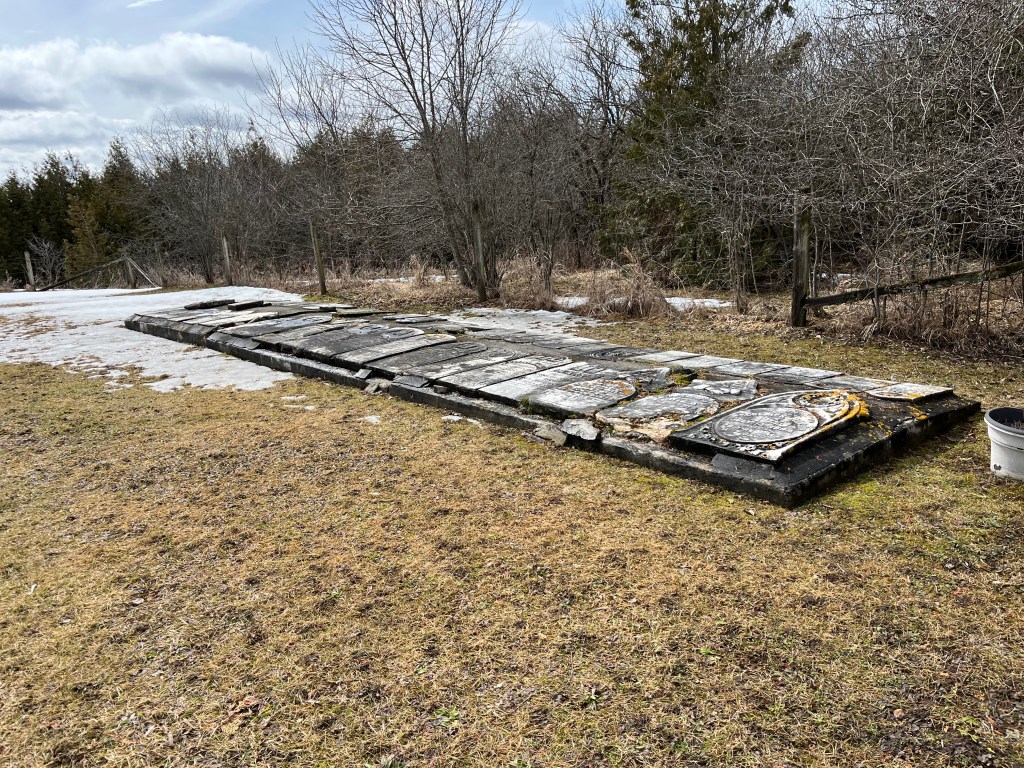
The Methodist church stood north of the main intersection but its burial grounds were on the property of John Boyles. Located on a small plateau overlooking the river, it stands about 400 meters from the road. The stones have been gathered up and placed into an unusual ground level cairn with the stones lying flat. They may be more subject to the weather than they would be in a more common vertical presentation. There are at least 47 burials commemorated in this cairn and one additional one from 2002 that has a grave marker beside it. Please note that the trail ends before the cemetery and it is not part of the trail. If you choose to visit, please do so respectfully.

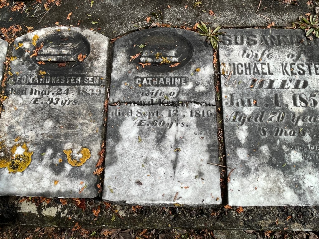
The gravestones in this cairn mark the lives of many of the early families in the area. John Boyles was the property owner and he died June 23, 1885 at the age of 91 and is buried here. Catherine Kester died on Sept. 12, 1816 in her 60th year and her headstone is one of the earliest that I’ve photographed anywhere in the GTA.

We previously looked at Brougham, which is another one of the Pickering Airport Lands ghost towns, which has also been left to rot and be demolished. Mongolia has a lot of heritage designated buildings that won’t be around in another ten years because they’re already becoming structurally unsound.

Related stories: For more information about the Pickering Airport check out our post Brougham – Ghost Towns of the GTA.
Google Maps Link: Mongolia

Like us at http://www.facebook.com/hikingthegta

Follow us at http://www.hikingthegta

Also, look for us on Instagram