Sat. Jan. 3, 2014
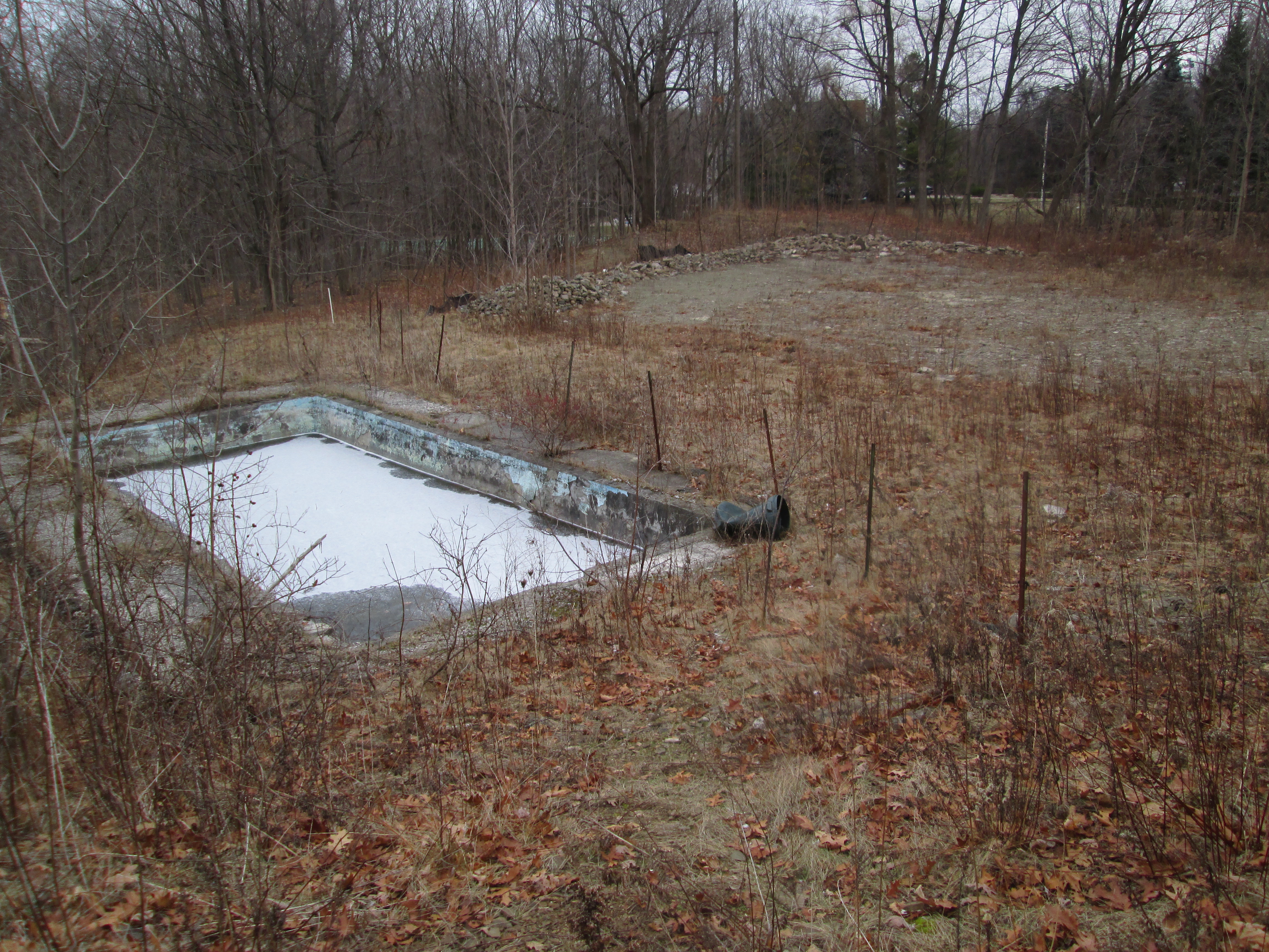
The day started off nice at -2 but was predicted to have a storm starting around noon. We parked one more time in Erindale Park. The plan was to enter the west side of the Credit River just south of the Sawmill Valley Creek’s confluence with the Credit. We wanted to try and get to a point across the river from the Erindale Power Plant that we had been seeking when we hiked the Credit River at Erindale on January first. We walked down the edge of Sawmill Valley Creek and turned south along the west side of the Credit River. Almost immediately we came to the foundations of an old building which we identified as a house when we found the swimming pool in the back yard.
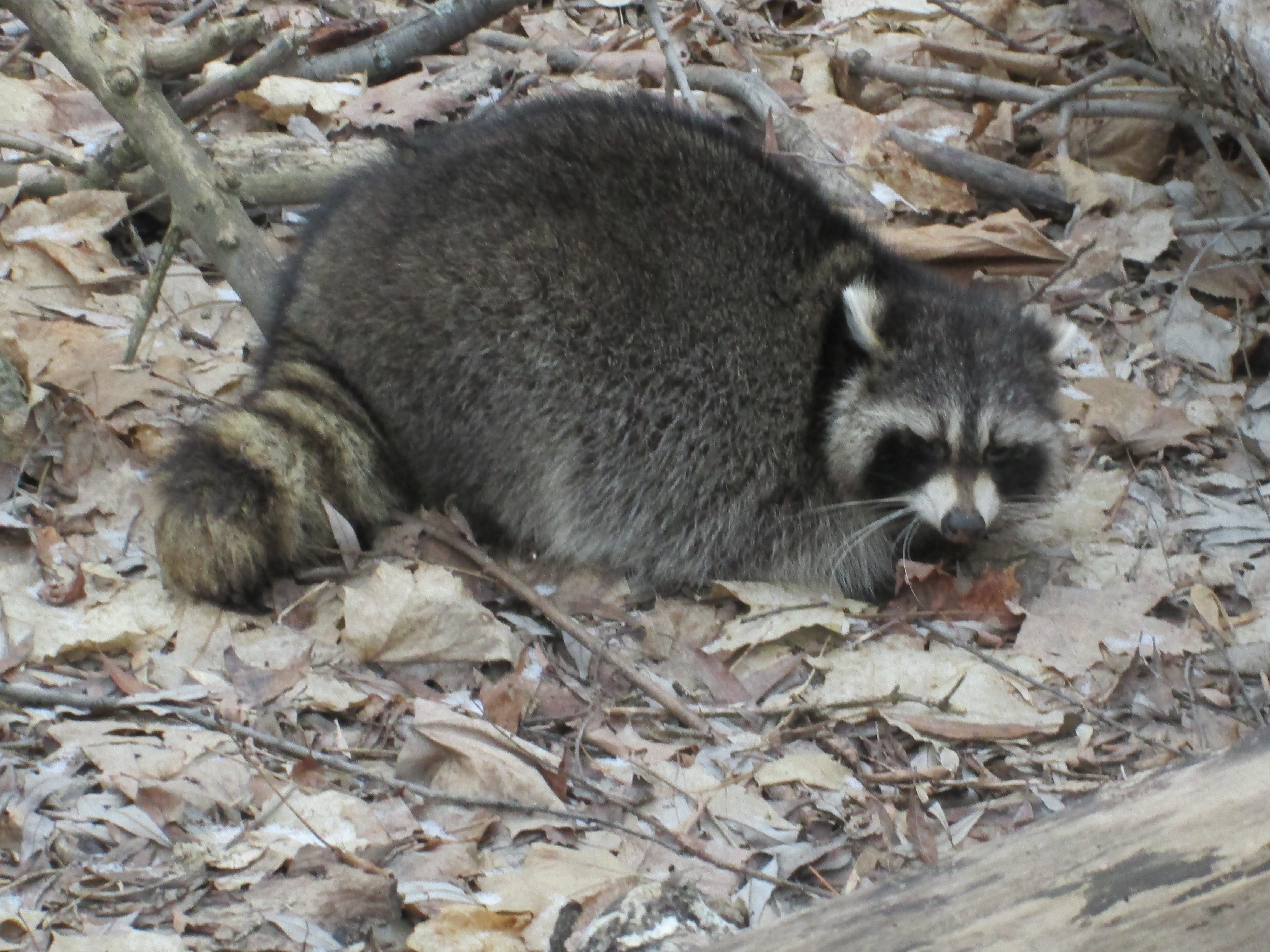
Keeping to the river side of the fence line, we made our way along the river. Soon we were past the point where we were stopped two days earlier by the shale cliffs on the east bank of the river. Presently we found a raccoon who, contrary to their normal nocturnal habits, was sitting on the ground in broad daylight. Suspecting that he was ill we acted with caution but there was no aggression. In captivity a raccoon can live for up to 20 years but the normal life expectancy of a raccoon in the wild is less than 3 years. Ones like this that aren’t in peak condition can become dinner to the local coyote helping to keep that number low.
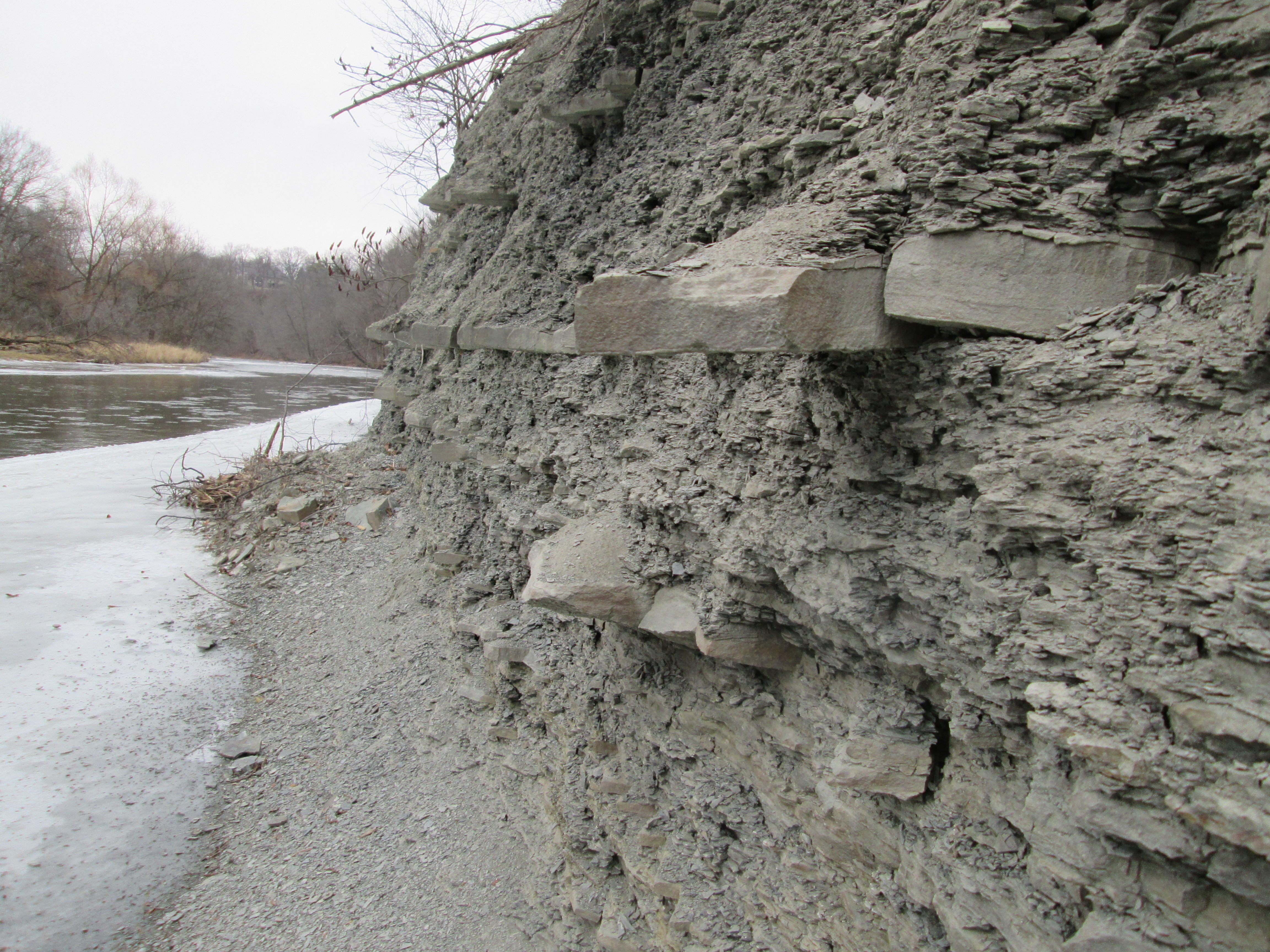
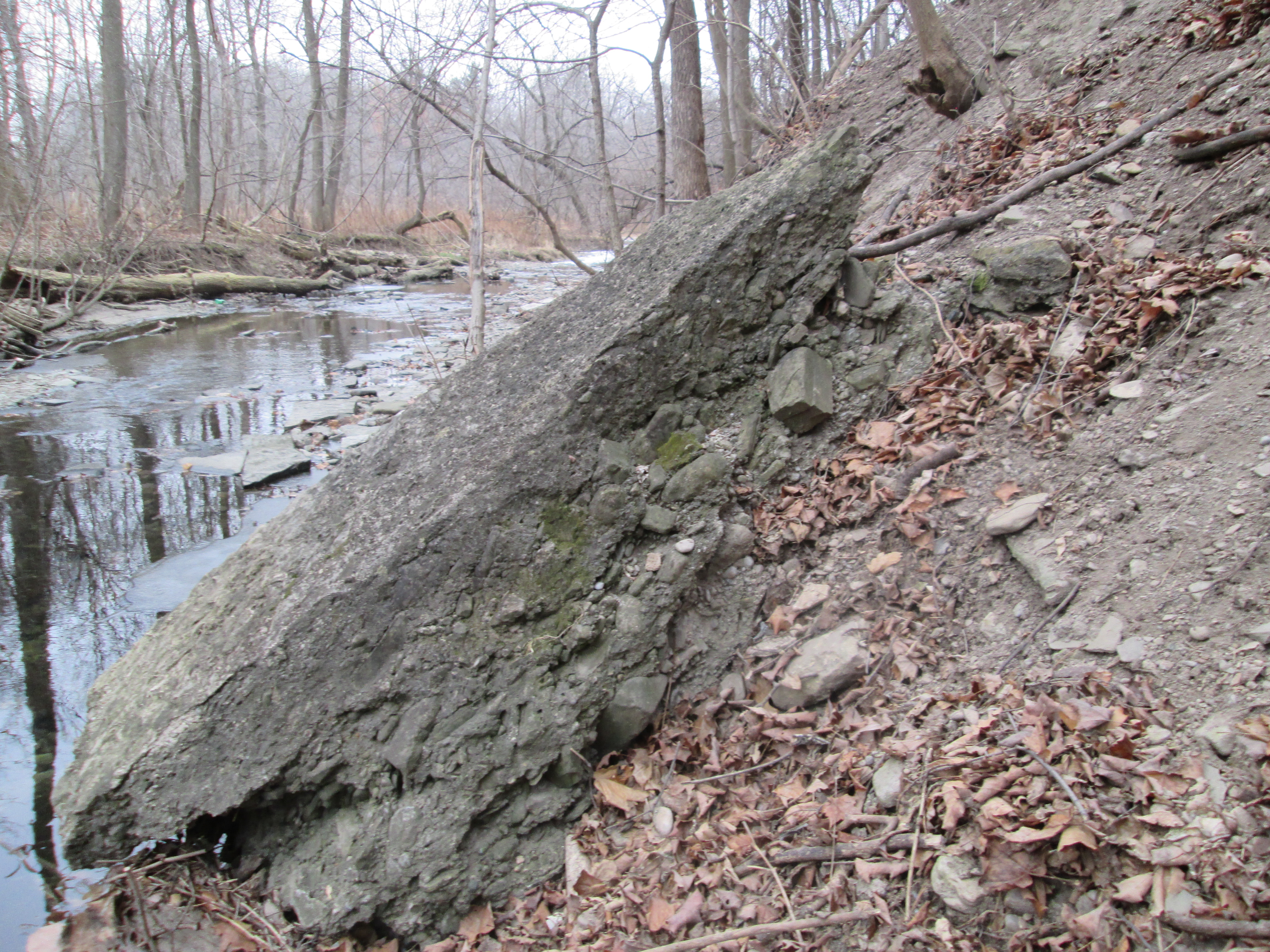
As we approached the bend in the river we started to see that the shale banks farther along would pose a problem like the one we experienced a couple of days earlier. At the bend in the river we found the mouth of a small stream and so we followed it west toward Mississauga Road.
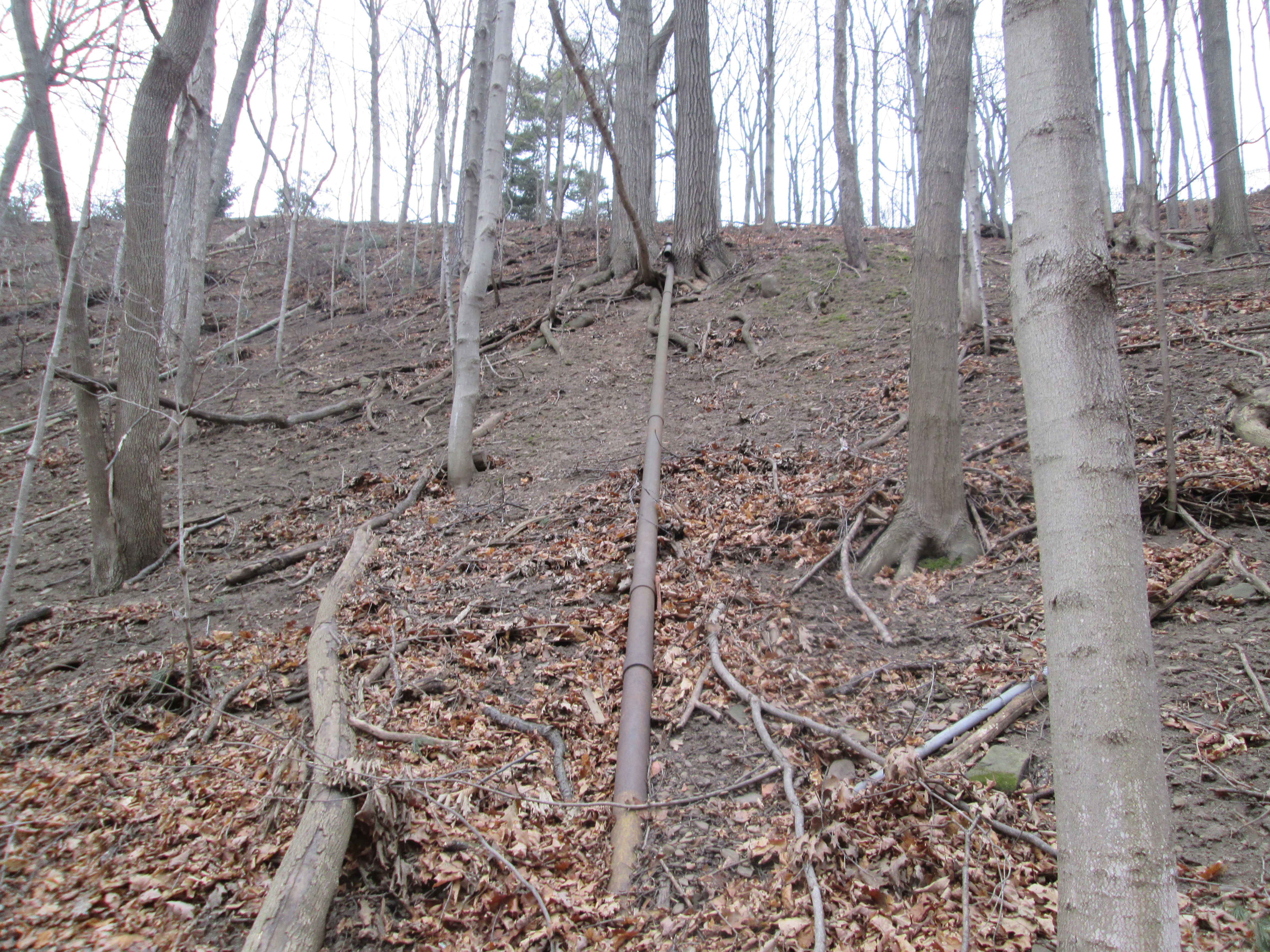
A little way upstream we started to find extensive sections of old pipe along with concrete foundations in the creek.
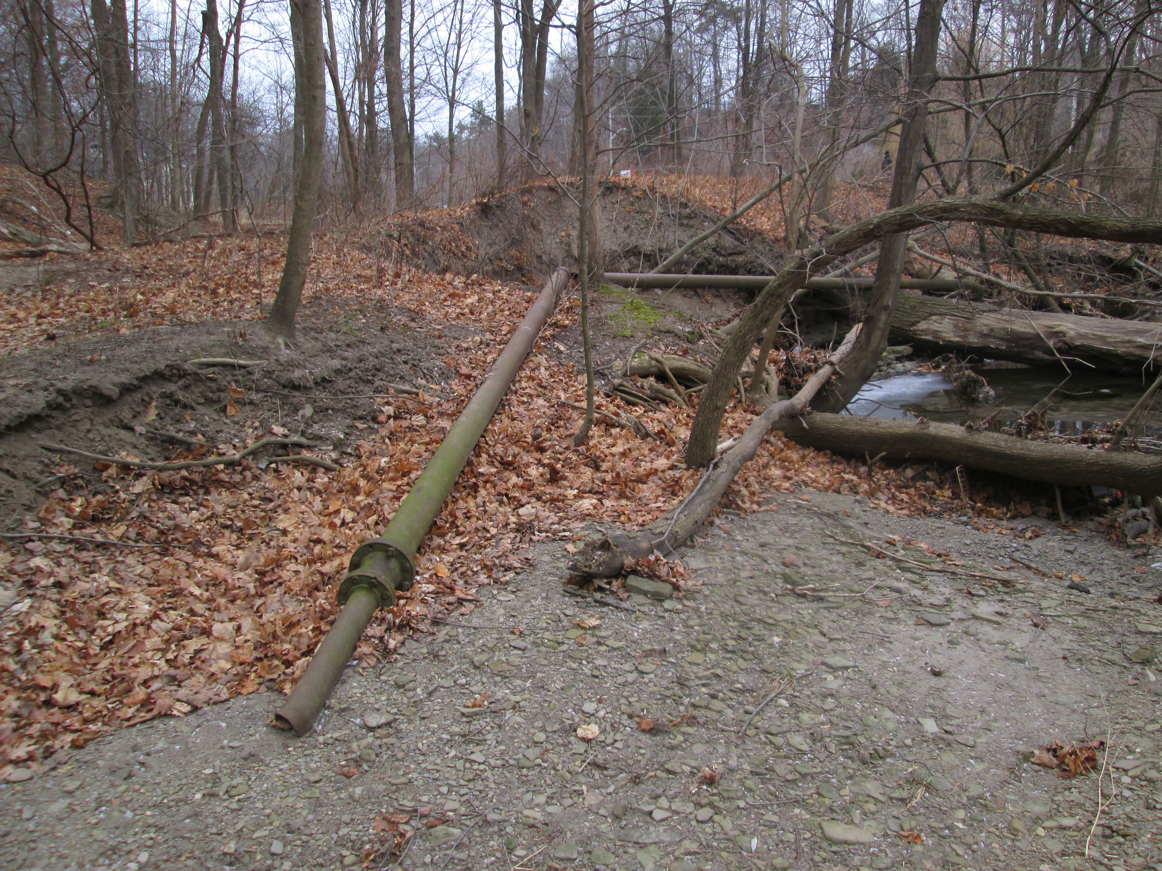
As we contemplated what their original purpose had been we noticed two people working in the woods with a Bobcat cleaning up fallen trees. The man approached us and we had an opportunity to ask about the pipes. He shared with us that the area above the ravine had been an extensive orchard and in the 1930’s a pump house had been built to irrigate the orchards. He also told us that the creek was named Loyalist Creek. Pipes still run up the side of the hill on the south of Loyalist Creek toward orchards that were already gone by the 1960’s.
We crossed Loyalist Creek and made our way as far along the shale cliffs as was reasonable and then turned back. The shale along here has layers of thick harder stone that stick out like rows of broken teeth.
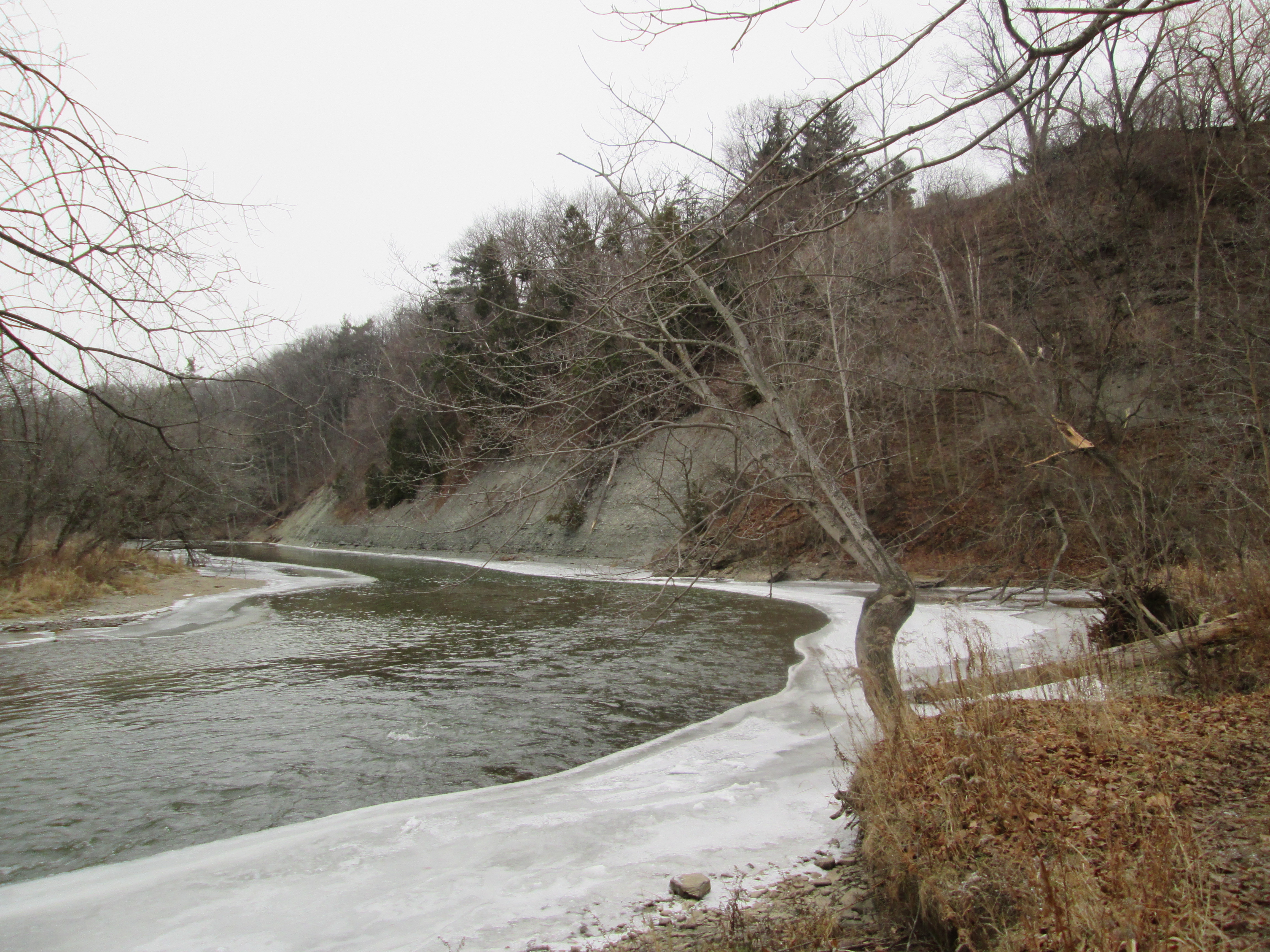
Right at the mouth of Loyalist Creek are several pieces of old concrete. We met the gentleman a second time and he had actually never noticed them. It is likely that a dam was placed at the mouth of Loyalist Creek to retain a pond of water for consistent irrigation of the orchards during dry seasons. As we were leaving we encountered the Bobcat operator who was quick to inform us that we were on private property, a fact that her husband had already failed to mention twice. When we got to Mississauga Road we discovered that the property was very well marked with No Trespassing signs. We had missed them by entering along Sawmill Valley Creek. This is one hike that you can’t try yourself. The old concrete at the mouth of the Loyalist Creek is shown in the photo below.
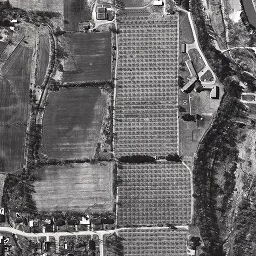
Returning home it was time to do some research to see what could be learned. I discovered that the 1880 Historical Atlas shows extensive apple farms around Erindale including the farm of Thomas Hammond. In the 1971 aerial photo below, the Hammond farm has a large orchard that by quick calculation contains over 900 trees. They appear as the straight rows of little dots. The Hammond farm house appears just to the left of the orchard at the top of the picture. It was designated as a heritage building in 1991 and so a quick follow-up appeared to be in order. The area was sold for development shortly after this picture and by 1976 houses had replaced the orchards.
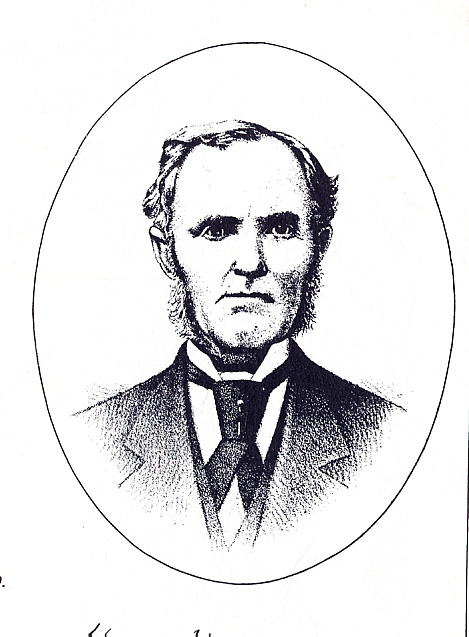
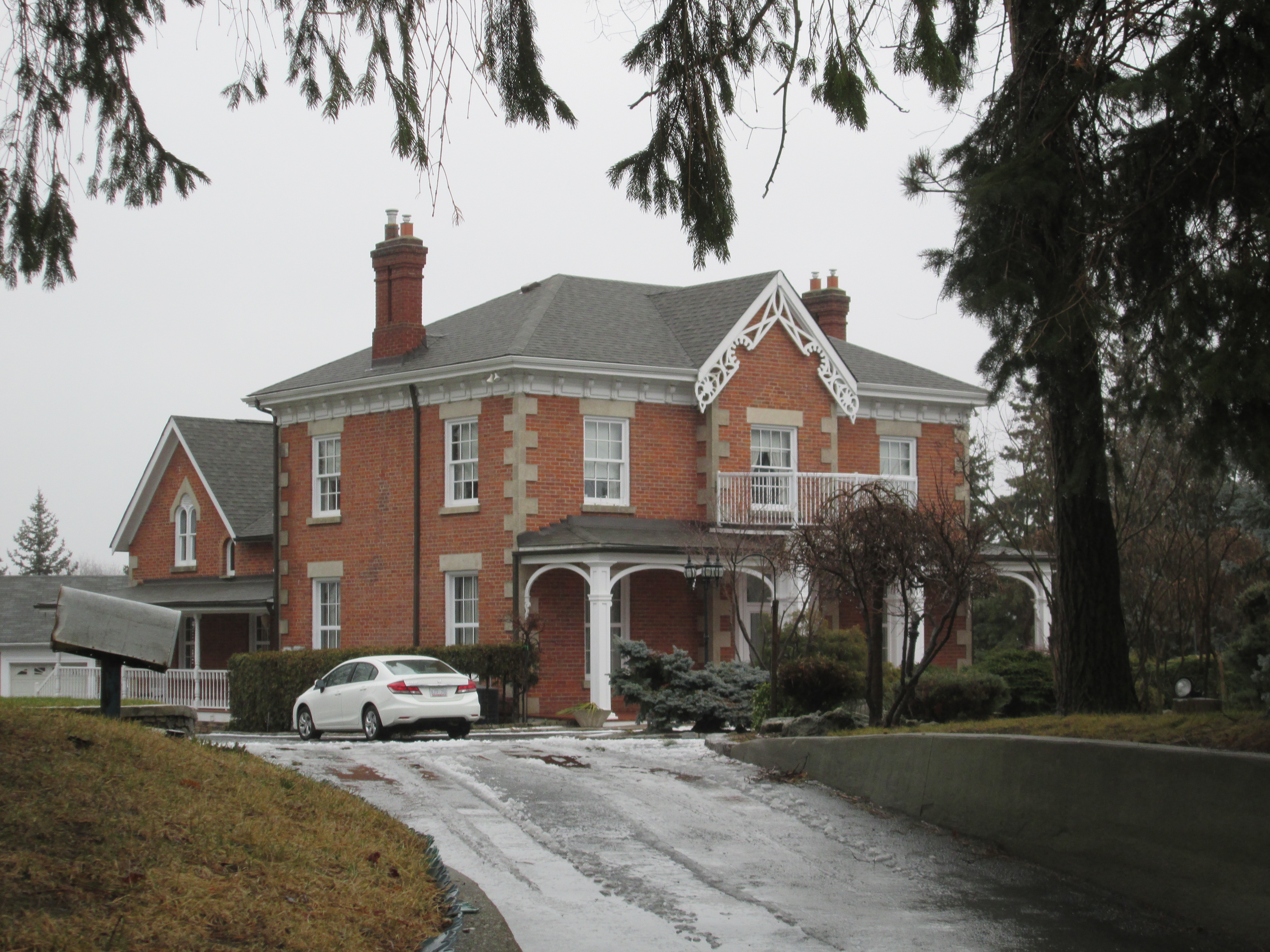
(Sunday, Jan. 4) We returned and parked near the old Hammond house which was built by Oliver Hammond. Oliver was born in 1812 and is featured in the cover photo. Oliver built his house in 1866 and it currently sits on a large property tucked in the middle of the subdivision which was his farm’s final crop. Loyalist Creek flows through the property close to the house. A developer’s proposal suggests that the open space around the house will soon hold 7 new homes. Hammond’s house will become just an odd old house, looking out of place, amid the modern homes on a small cul-de-sac.
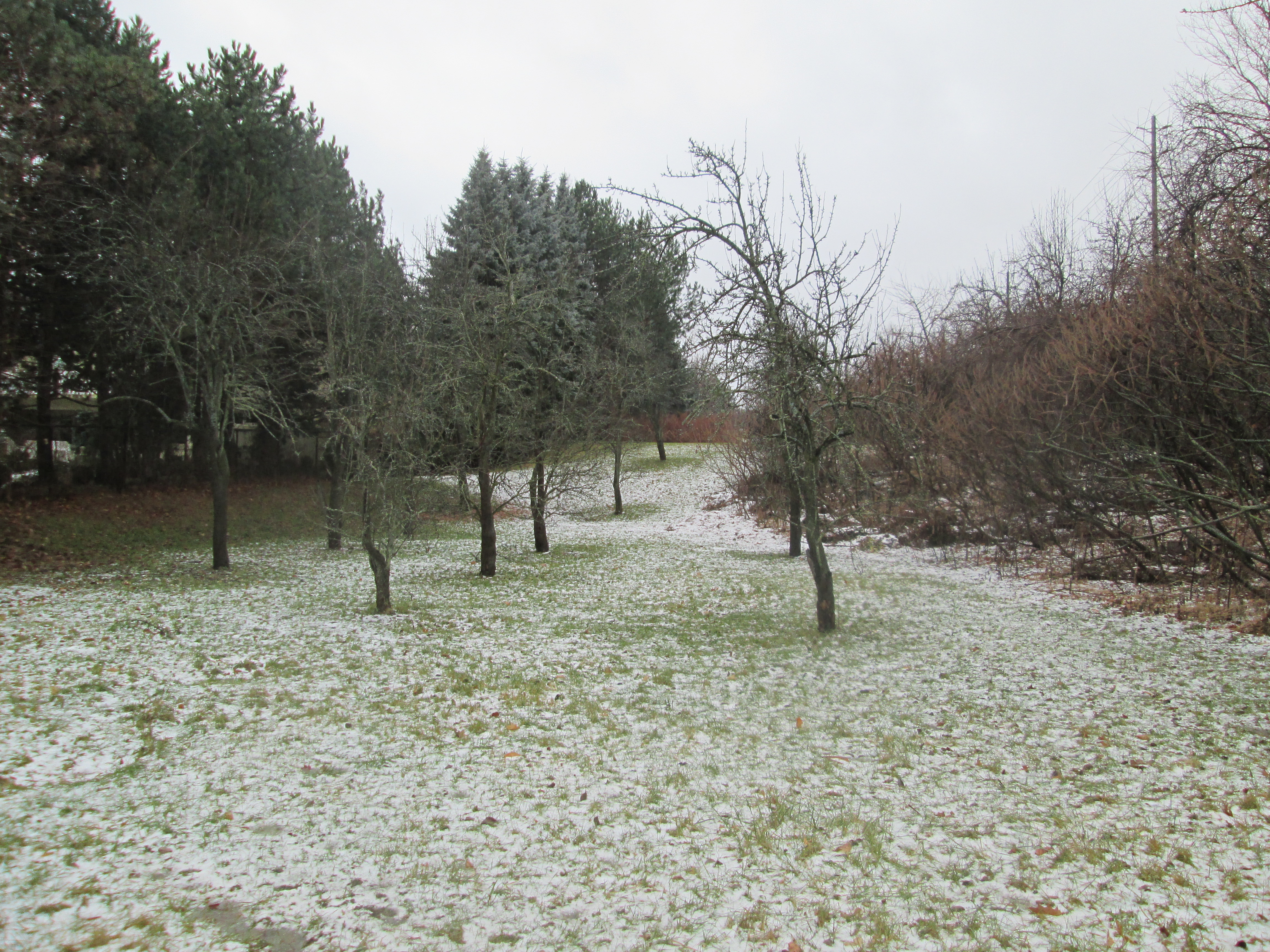
All that remains of the orchards is three rows of old trees in the park along the side of Lincoln Green Close. It seems like these trees might still produce fruit in spite of their age. Apple trees are not native to North America but were introduced by the French around 1606. The McIntosh apple is named after John McIntosh who discovered a sapling on his farm in Upper Canada in 1811 and cultivated the tree which produced an exceptional fruit. By the early 1900’s the McIntosh was the most commonly cultivated apple in North America. This was due to the fact that it was good for both eating and cooking. I’m not sure what kind of trees these are but they were planted around the right time to be McIntosh.
The old Erindale Power Station remains elusive, but there is always future explorations to be made.
Like us at http://www.facebook.com/hikingthegta
Follow us at http://www.hikingthegta.com

Pingback: J. H. Pinchin Apple and Turkey Farms | Hiking the GTA
Pingback: Winding Lane Bird Sanctuary | Hiking the GTA
Pingback: Erindale Powerhouse | Hiking the GTA
this was such a treat to find. I grew up in the subdivision that was Erindale the Hammond land. My neighbours still had 3 apple trees on their lot from the original orchard. As I kid I spent many a fun afternoon exploring the riverbanks of Erindale Park and the surrounding area.
Pingback: Downsview Park | Hiking the GTA
Pingback: Erindale – Ghost Towns of the GTA | Hiking the GTA