Category Archives: Rouge River

Milne Dam Conservation Area 2022

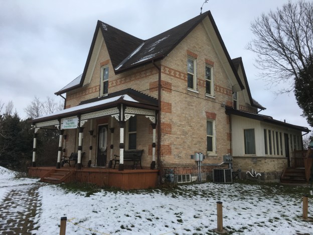
Milne Dam Conservation Area is a 305 acre park in Markham which we have visited a few times. There are two previous blogs which talk about the park and the new bridges that were added across the Rouge River near the dam. We won’t be repeating very much of the information from those two stories and links to them can be found at the end of this blog.

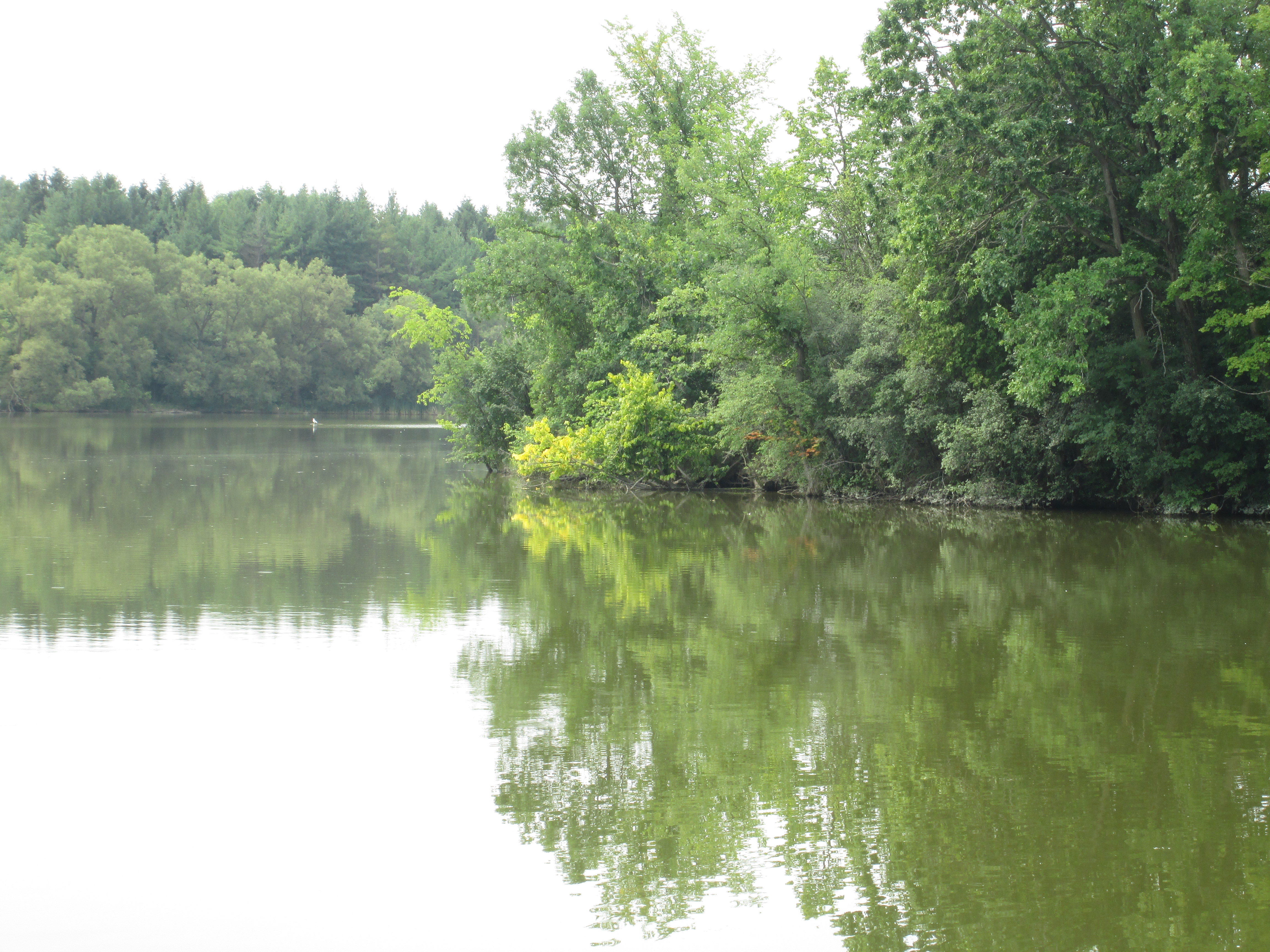
The east end of the lake has become overgrown with lily pads this summer. Although the pads appear to float on the surface they are actually on long stems that grow from the bottom of the lake. The top side is flat but on the bottom of the leaves they have a series of tubes that are connected to openings on the top of the pad called stomas. Up to two litres of air are transported each day from the top of the pad to the root system using these tubes. Lily pads provide protection for small fish and also a safe place for frogs to sit and hide from underwater predators and catch flies and other insects.

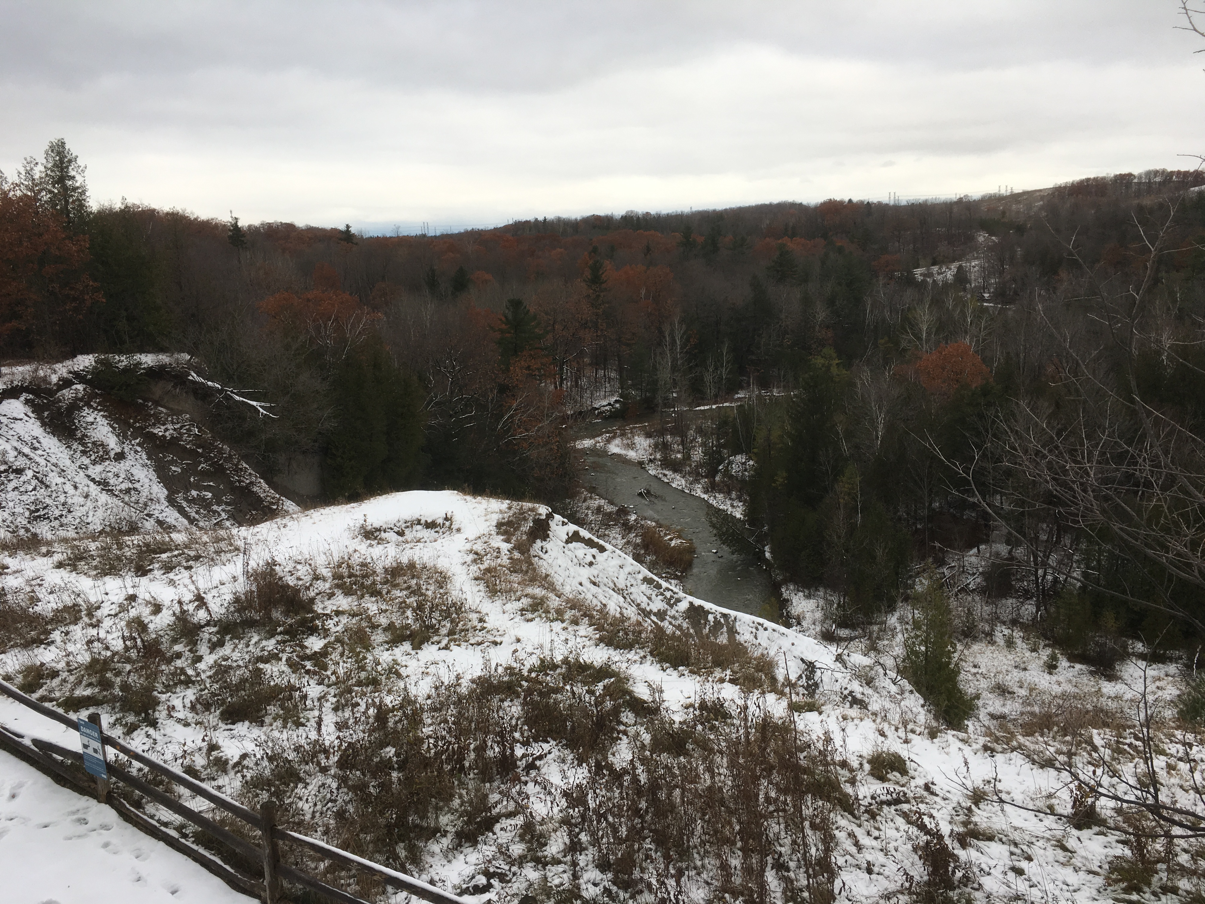
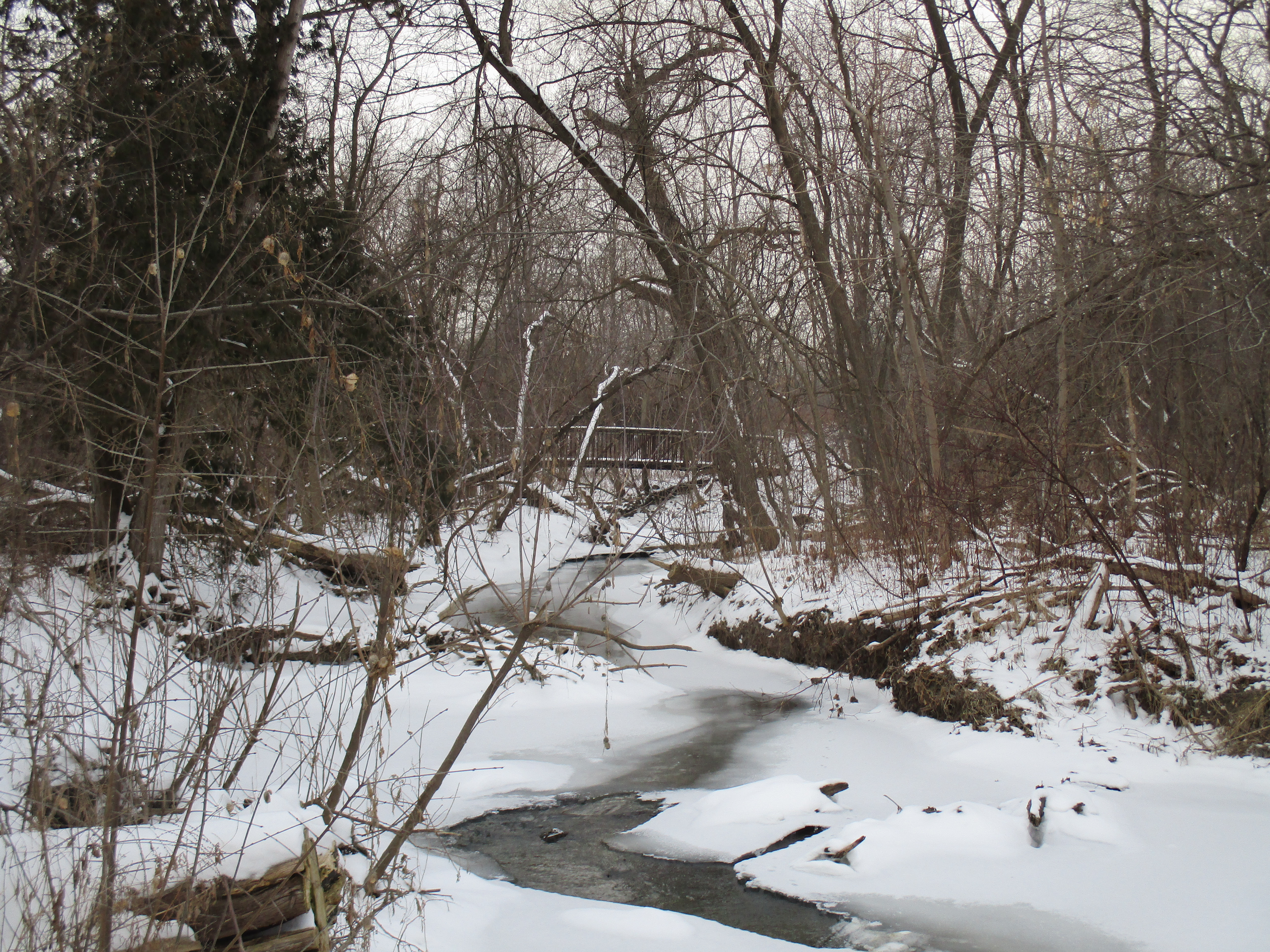
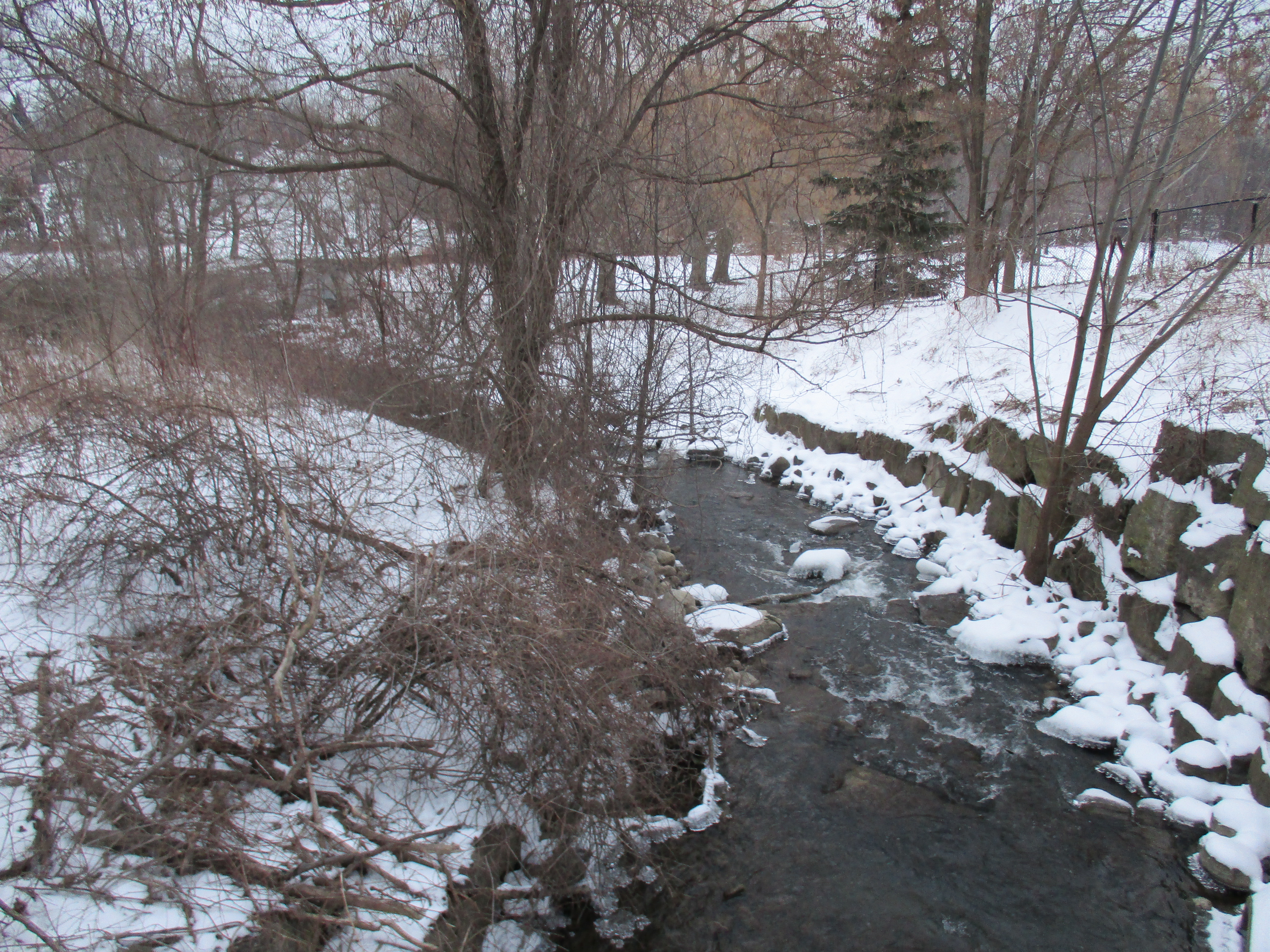
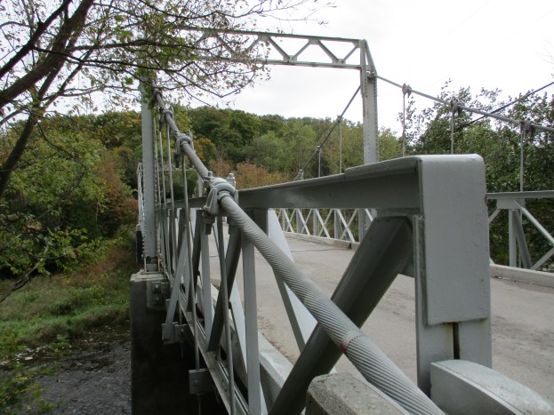
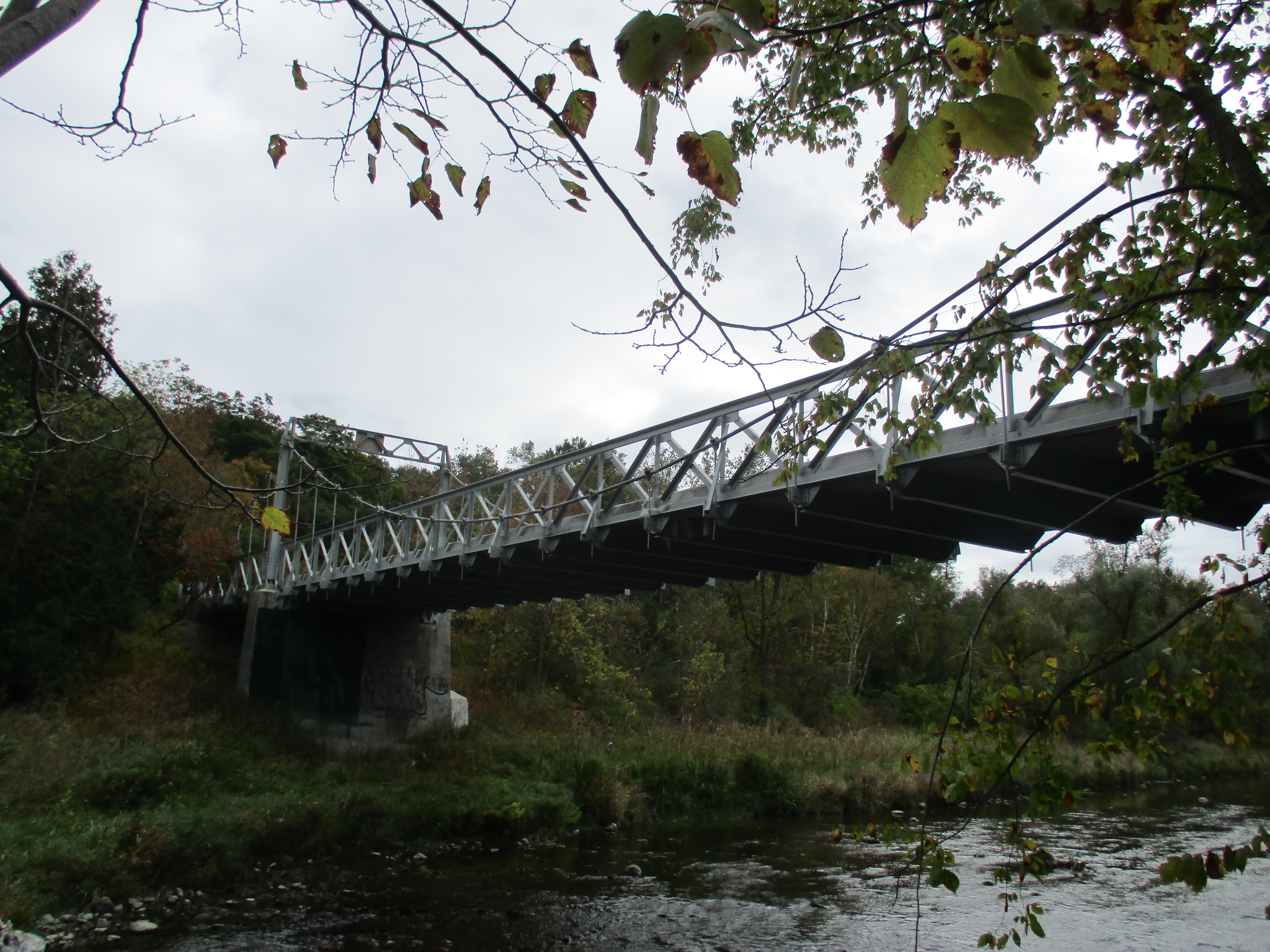
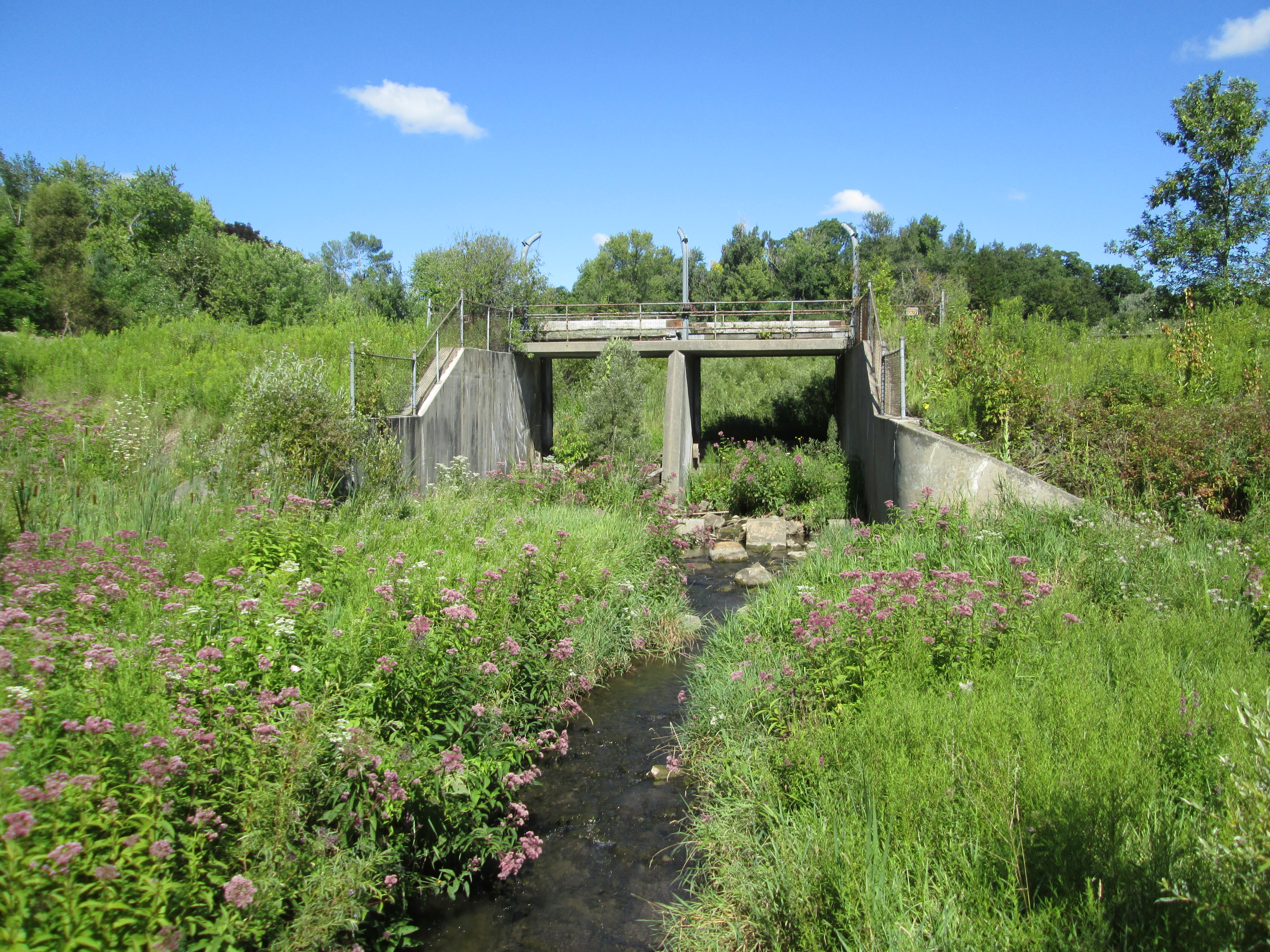
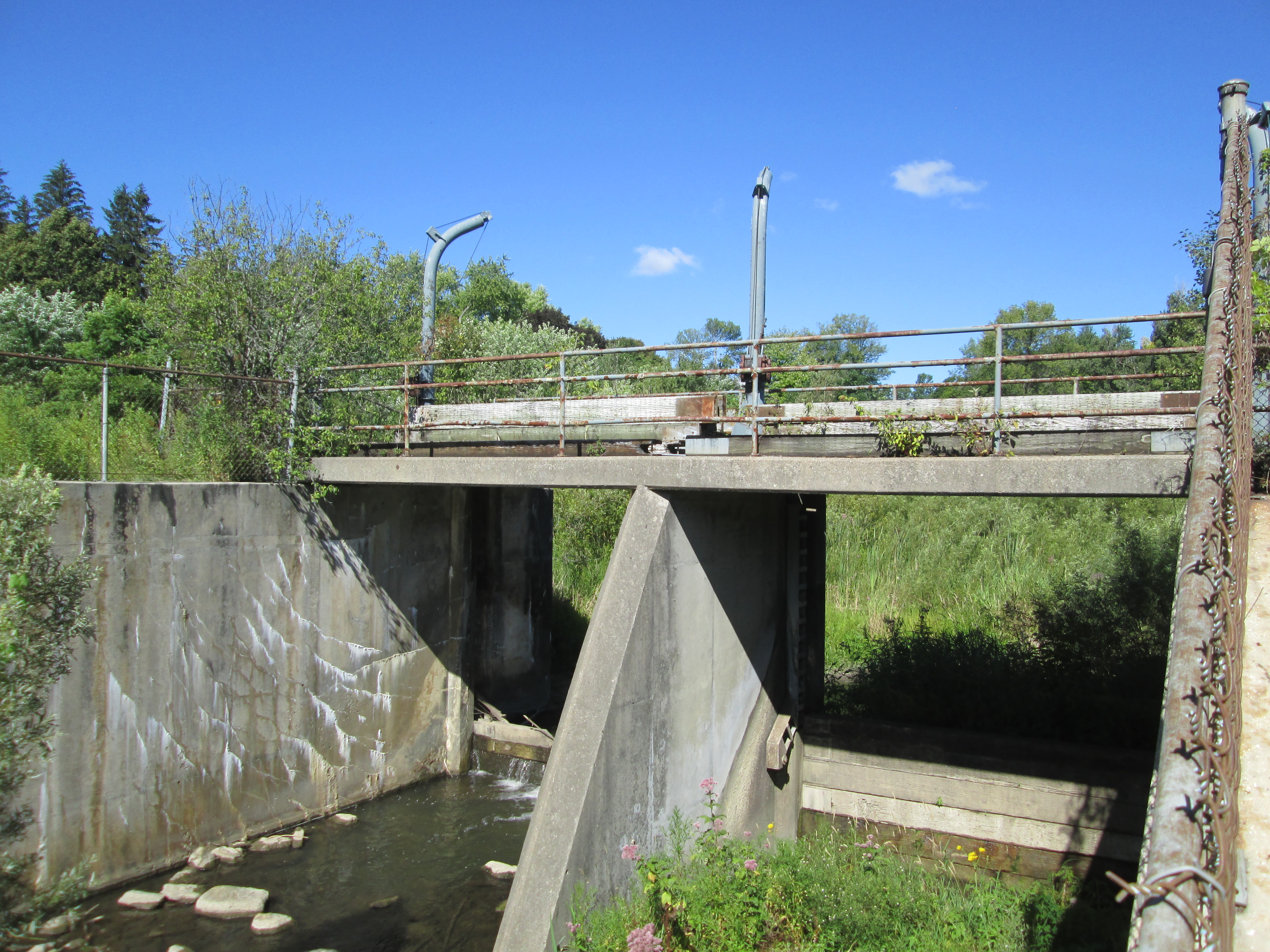
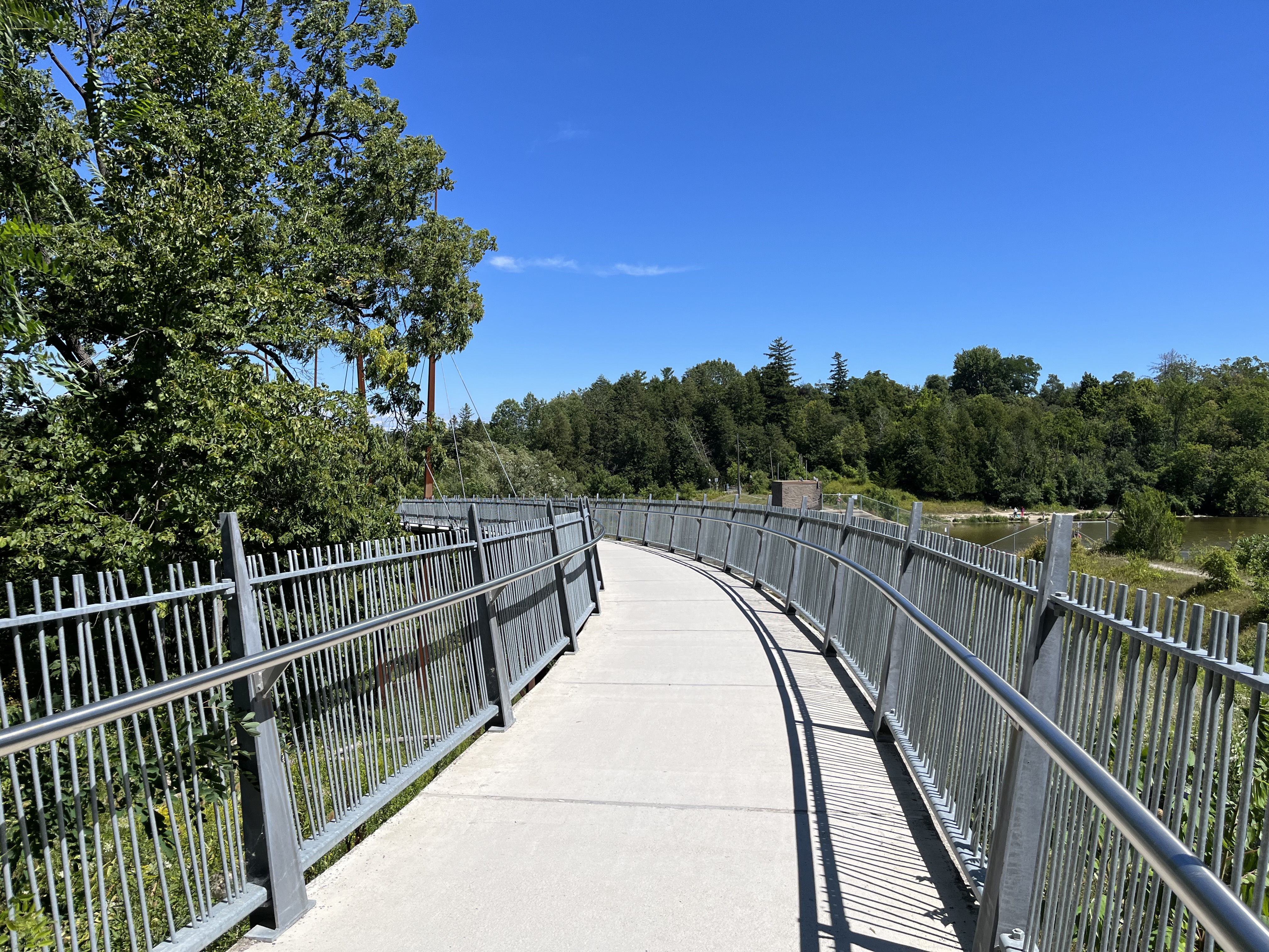
Before you reach the dam you come to the newly constructed Milne Creek Bridge.  It is 42 metres long and helps connect the Markham Rouge Valley Trail which begins in Unionville at Toogood Pond.  The new bridges in the Milne Dam Conservation Area were officially opened on September 21, 2019.  The first three phases of the 15 kilometre trail are completed with the final phase currently under construction.

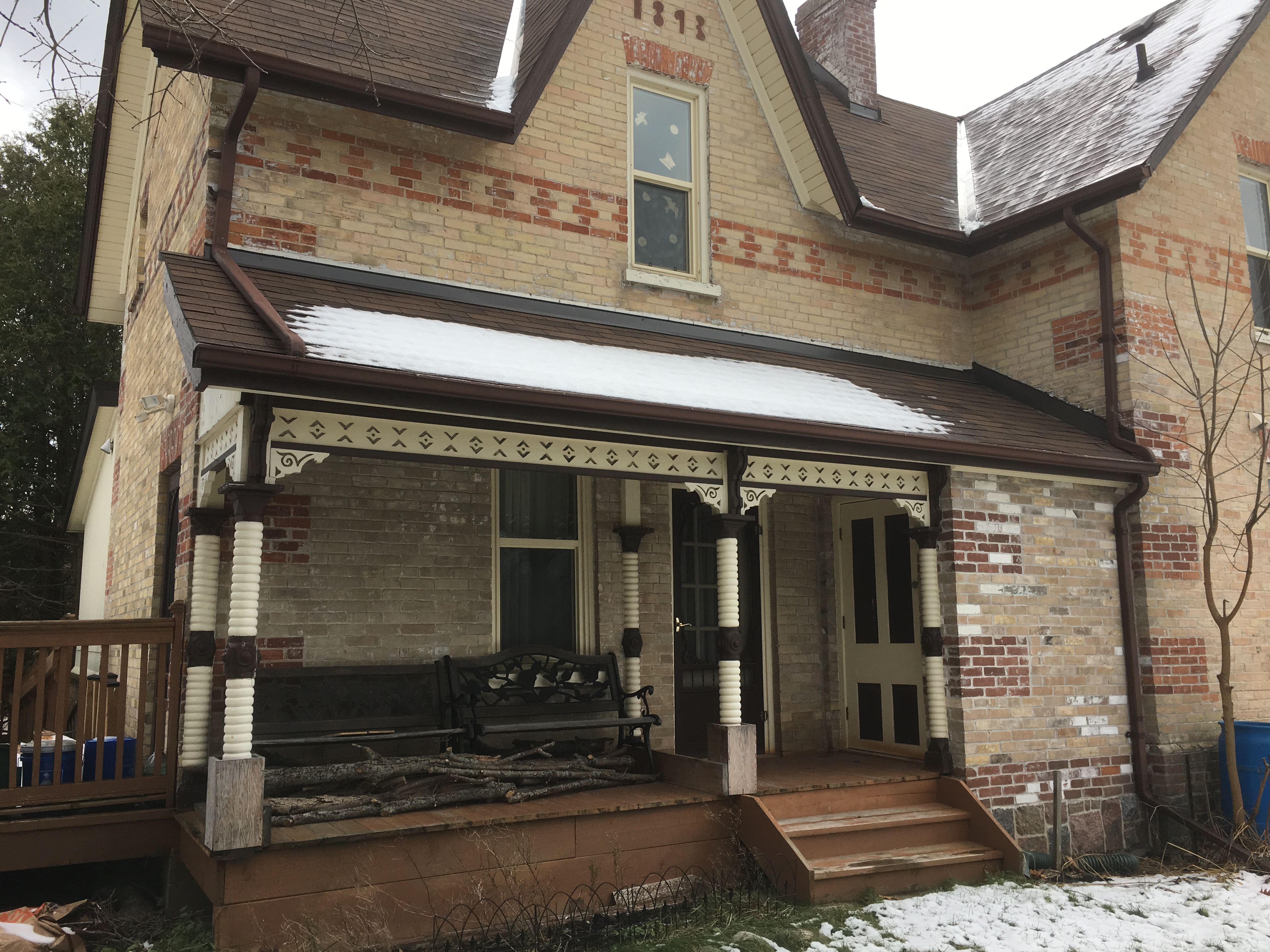
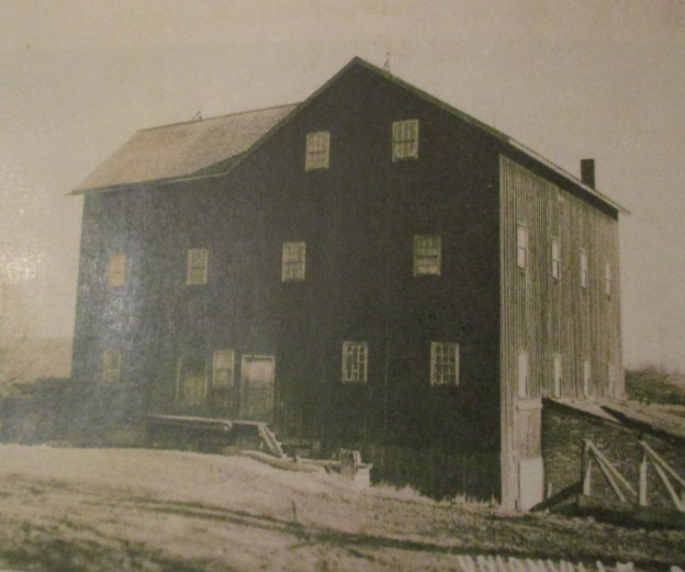
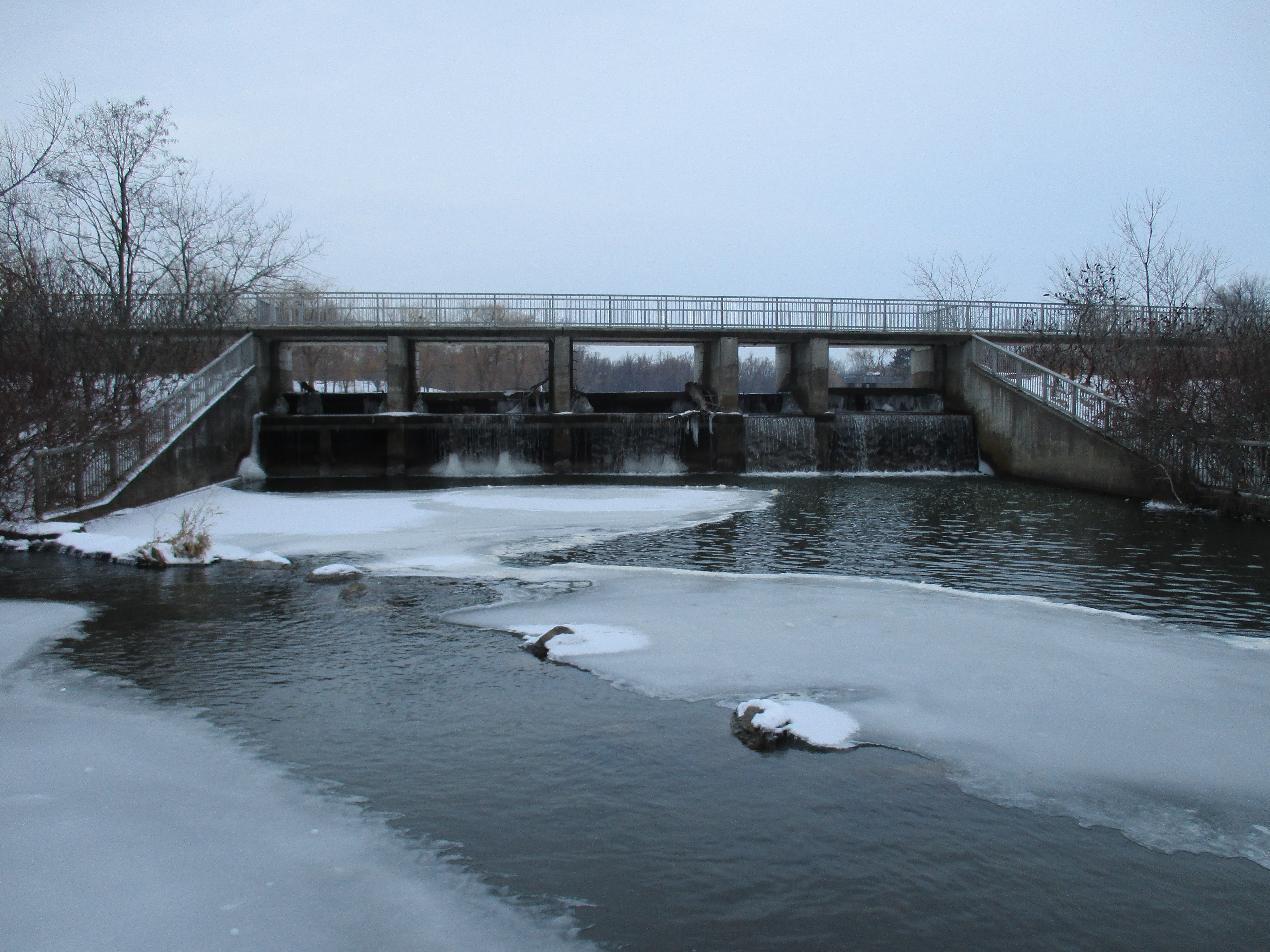
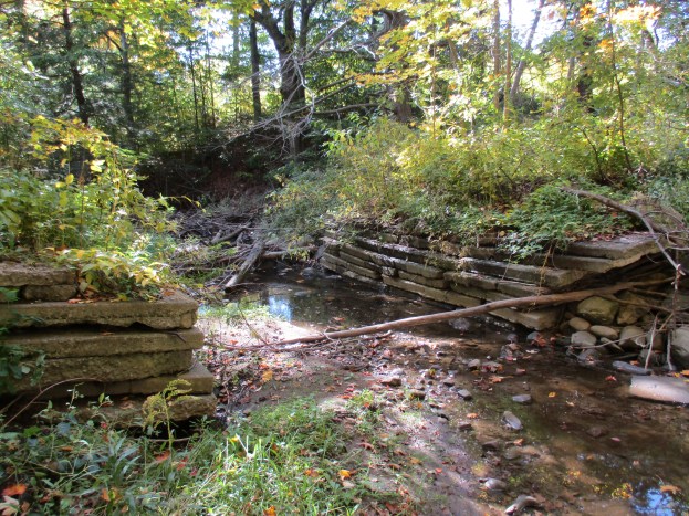
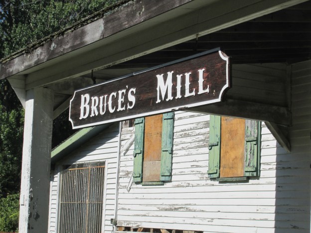
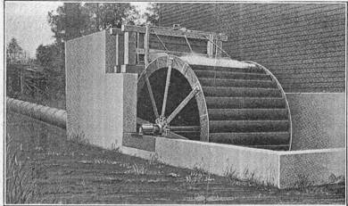
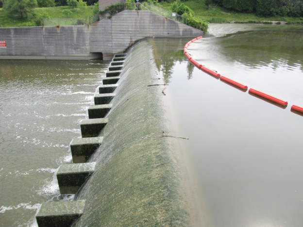
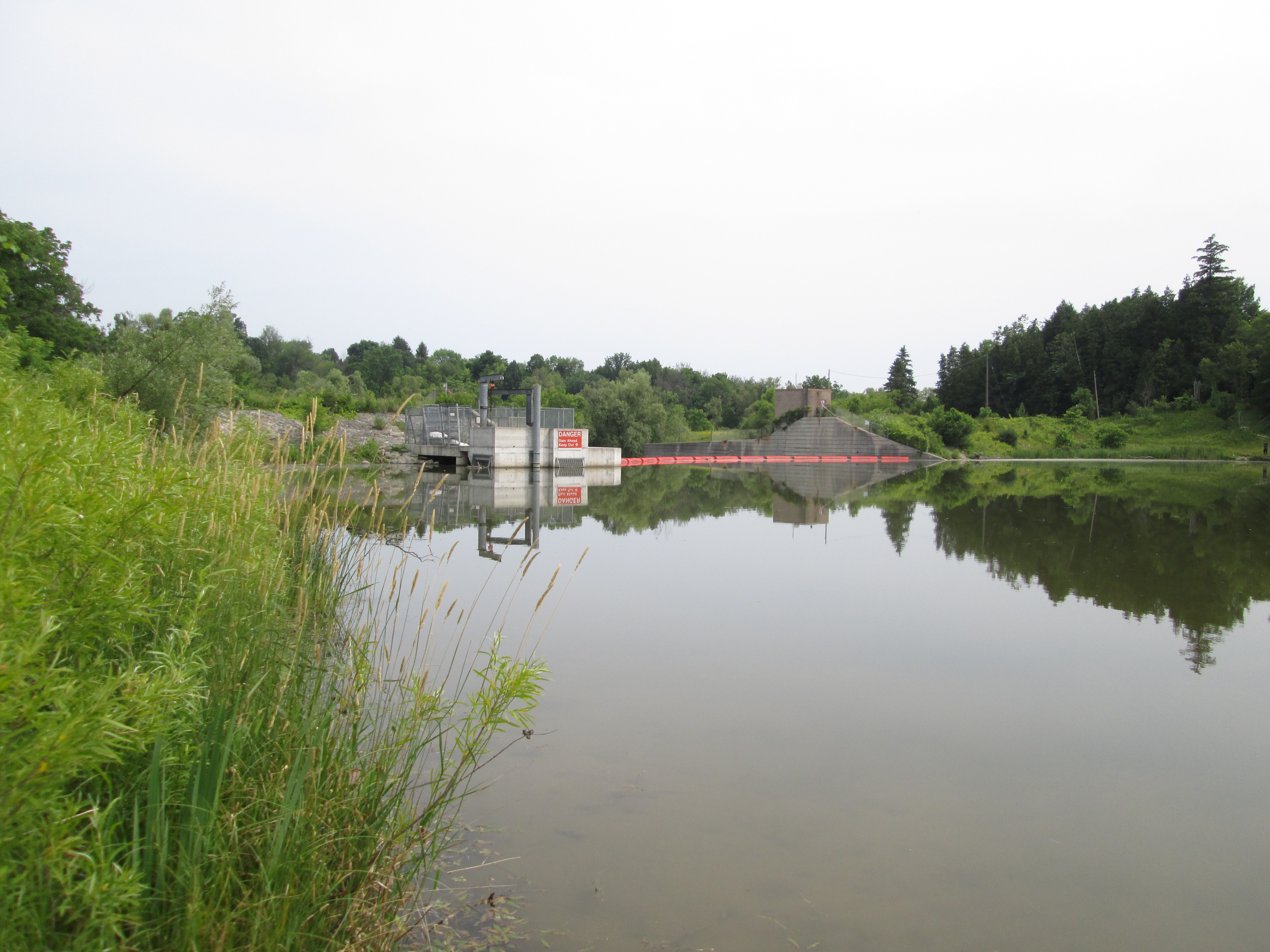
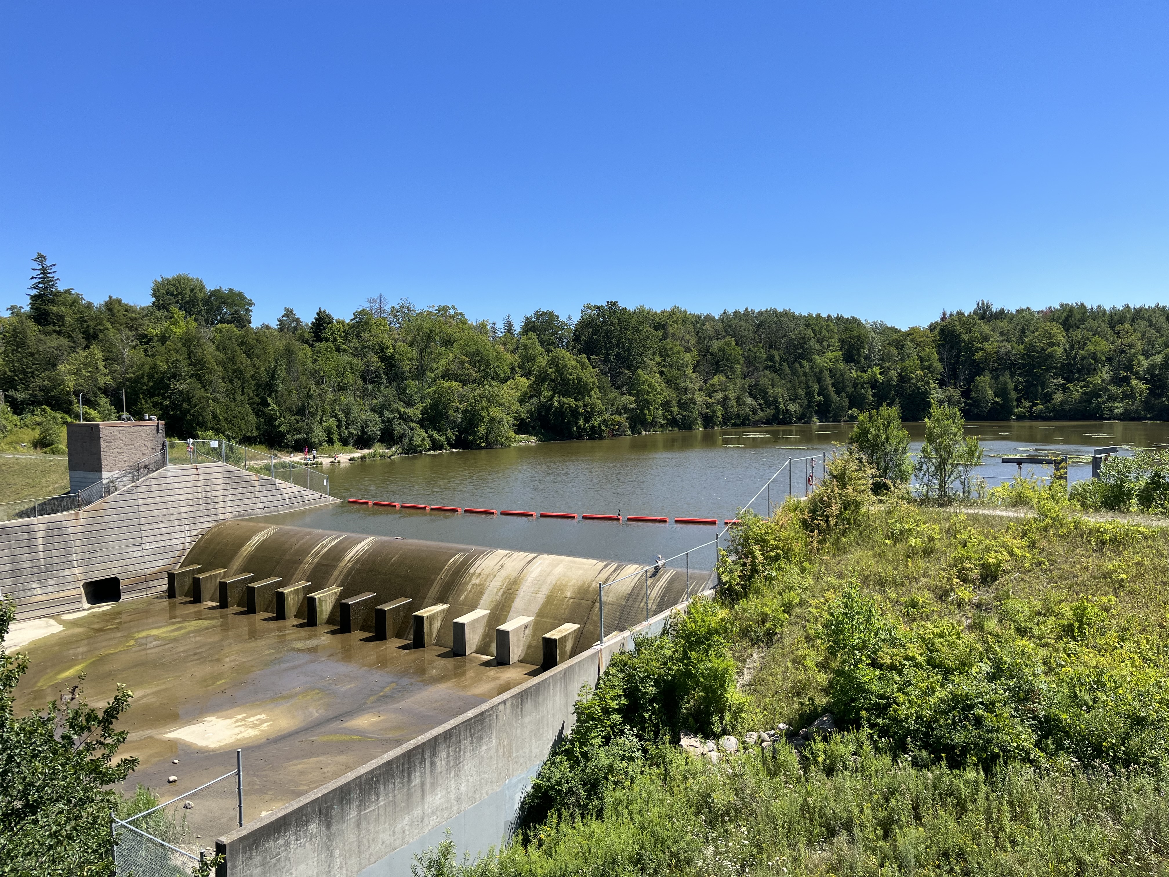
The first concrete and steel dam in Canada was built by Archie Milne on the Rouge River in 1911. It replaced a mill dam that had been located on the site since 1820. In the 1950s the dam and surrounding lands were bought by the Metropolitan Toronto and Region Conservation Authority who created Milne Dam Conservation Area using the dam to help with flood control on the Rouge River.

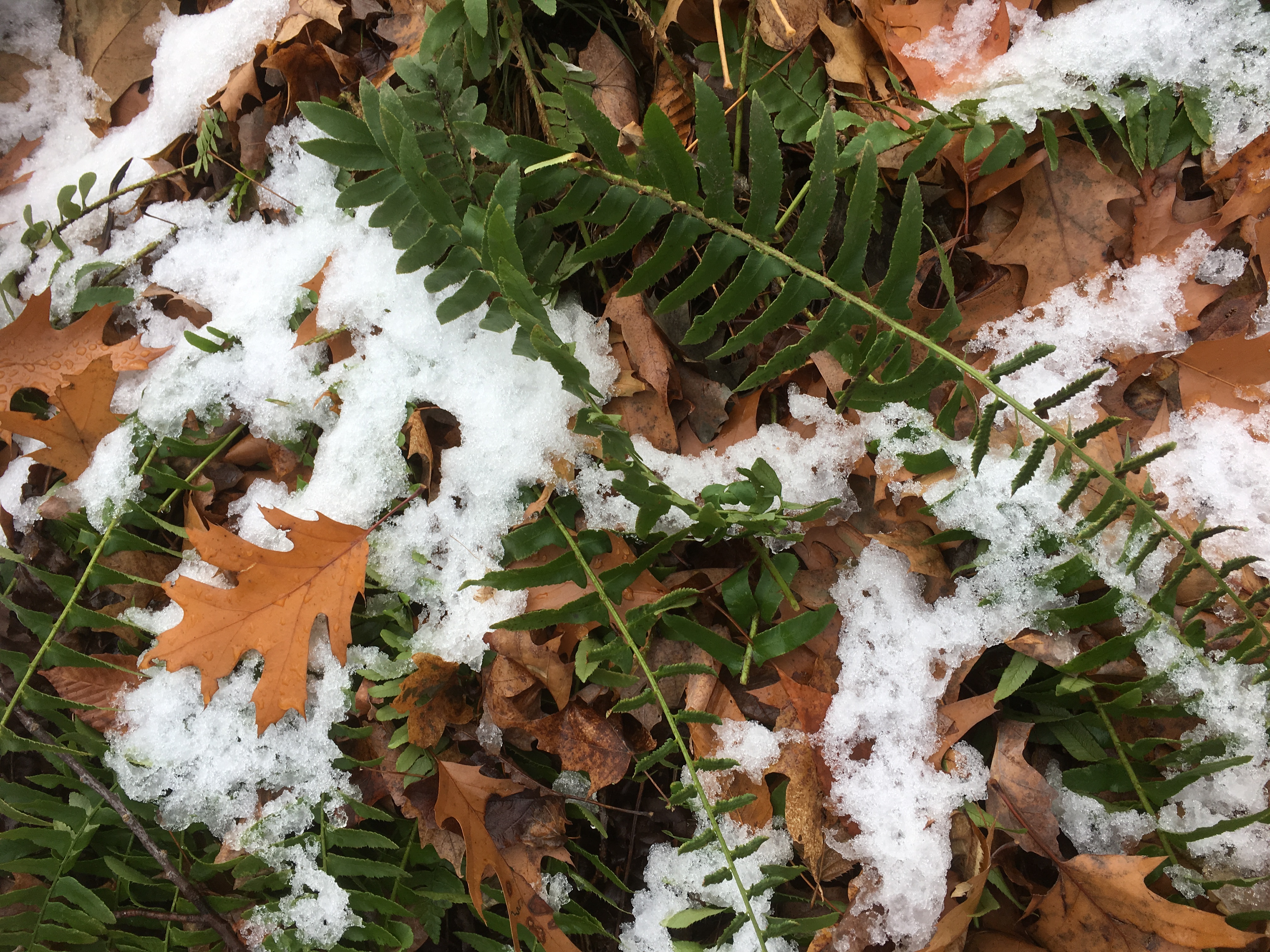
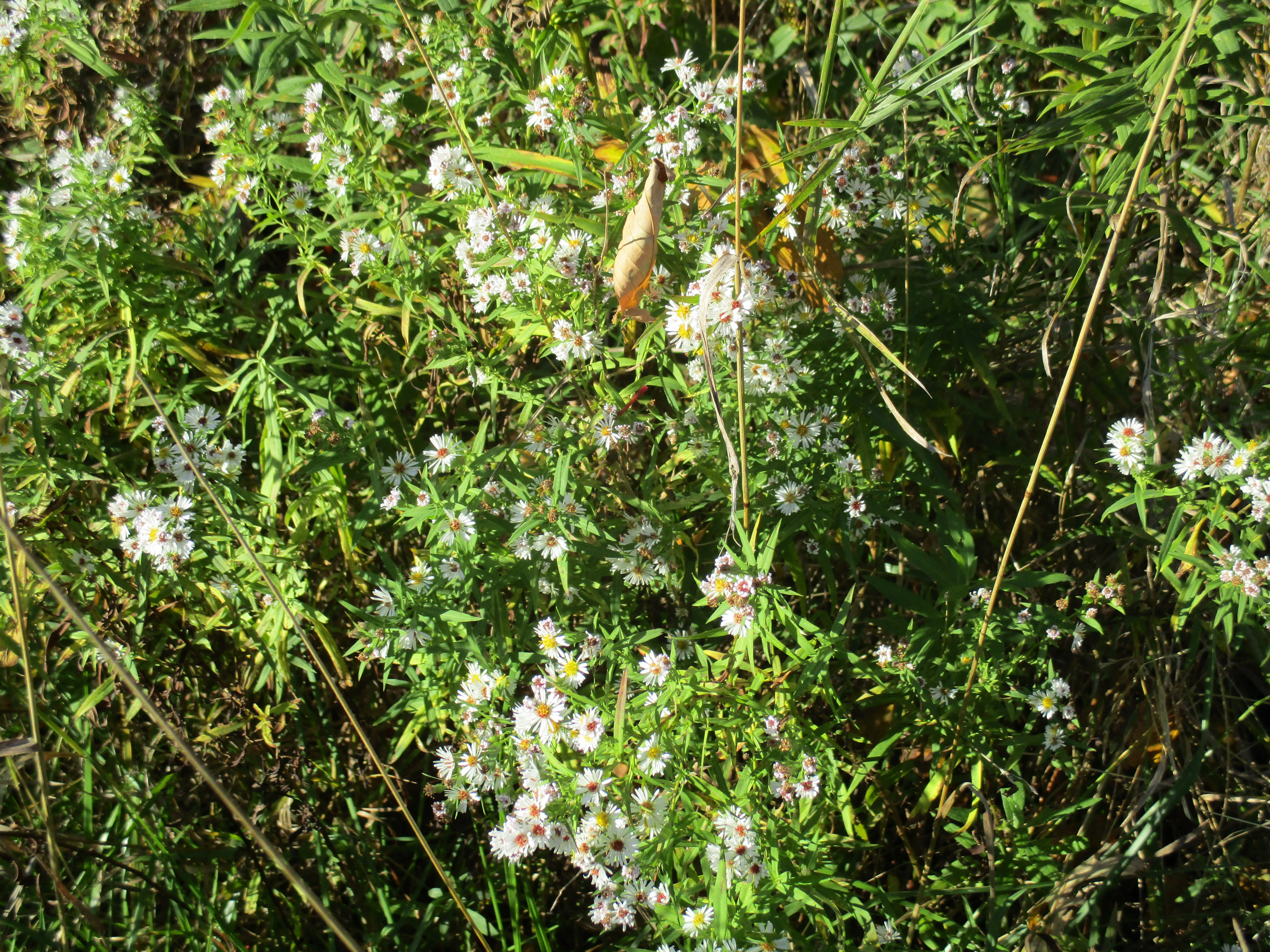
Canada Thistle is also known as Creeping Thistle and in spite of its name is not native to Canada. It was likely imported from the Mediterranean area by early settlers. Residents of New England blamed the emergence of the thistle on French Canadian traders and therefore gave it the name Canada Thistle. It grows both by seeds that are carried on the wind and by horizontal roots that spread below ground. It grows in open areas and likes lots of direct sunlight and can be found growing amongst crops such as canola, wheat and barley where it reduces the cash value of the crops. It tends to attract pollinators like bees and butterflies so therefore it has some benefits as well.

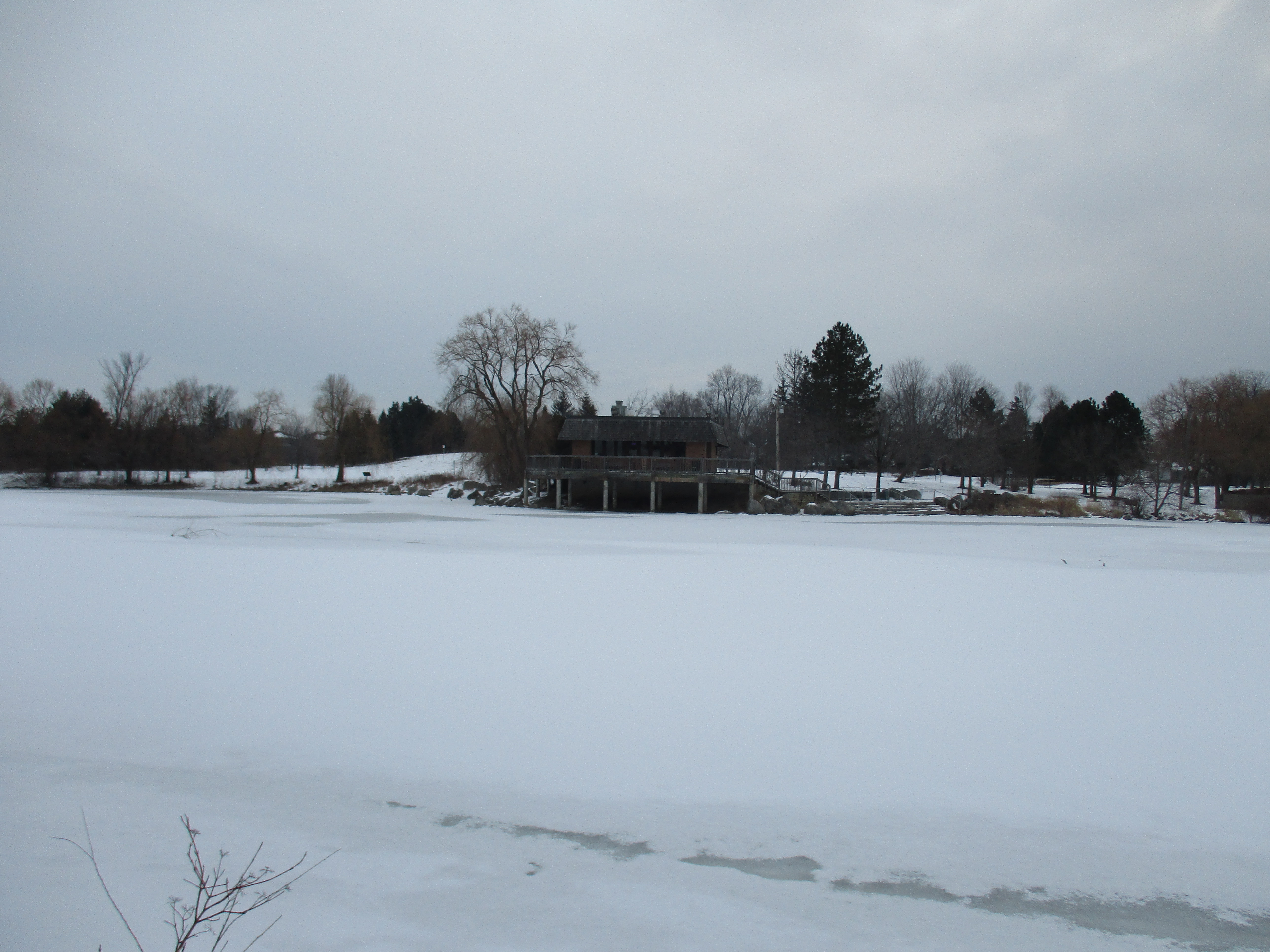
There is a small trail at the west end of the lake that leads down to the river where a floating walkway allows you to cross to the other side and into Camp Chimo. There is no entry fee for people who walk in to Camp Chimo and it can also be accessed from McCowan Road.

For a small fee families and youth can take basic canoe training and safety lessons at the camp.

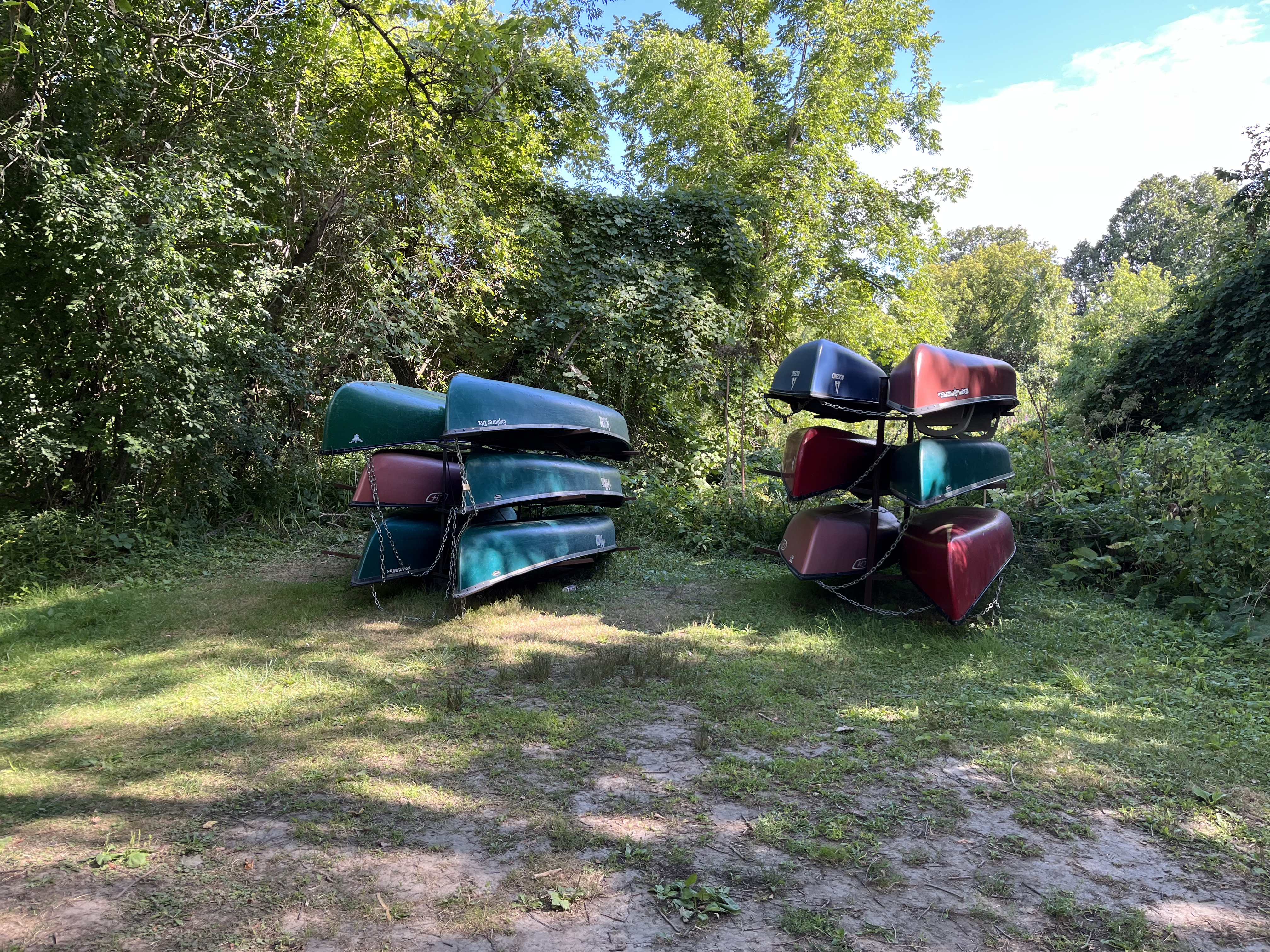
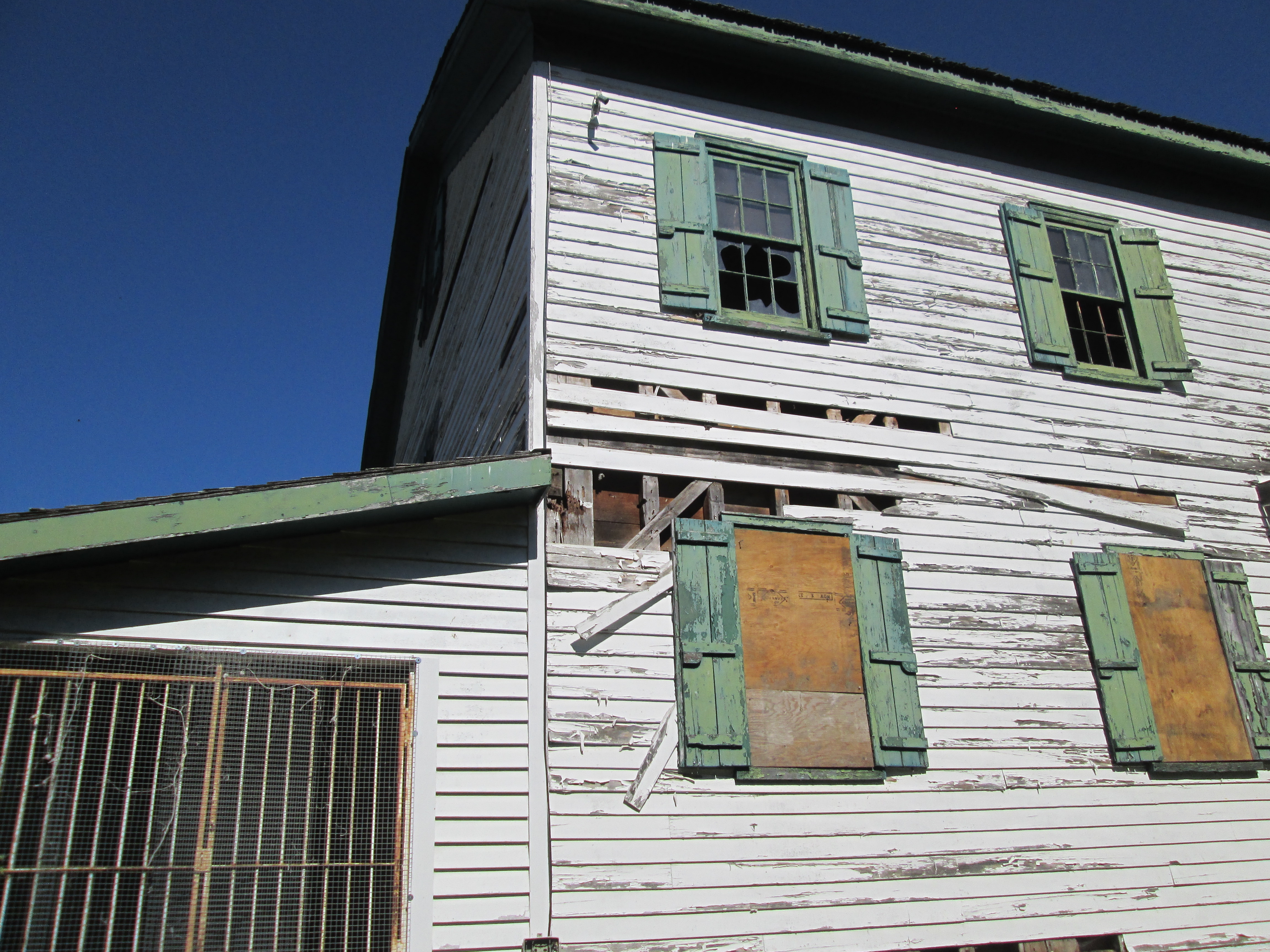
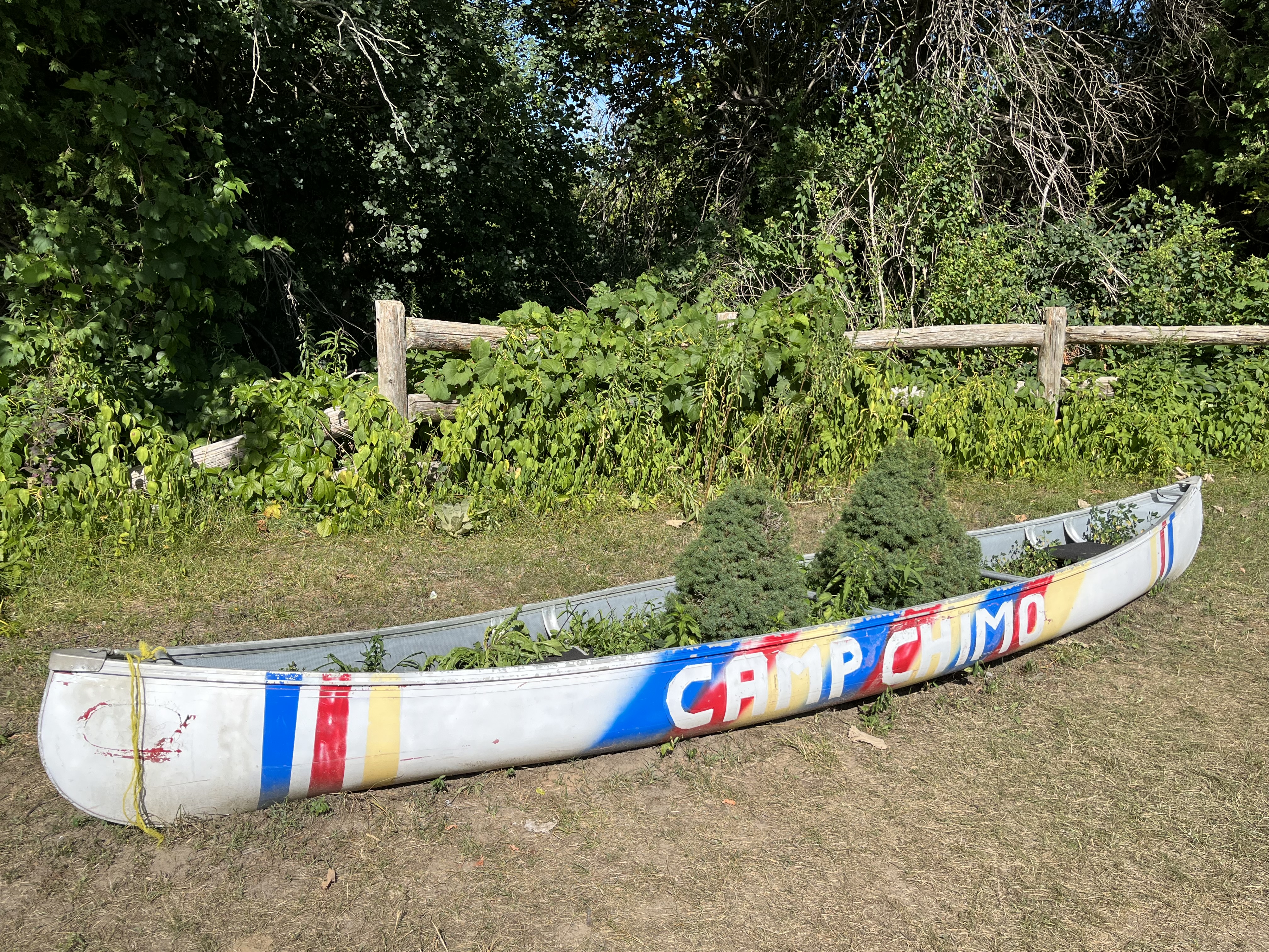
Camp Chimo is a day camp for children that operates on the south side of the lake. They have archery, a climbing wall, a large bonfire pit and plenty of activities for the children to participate in.

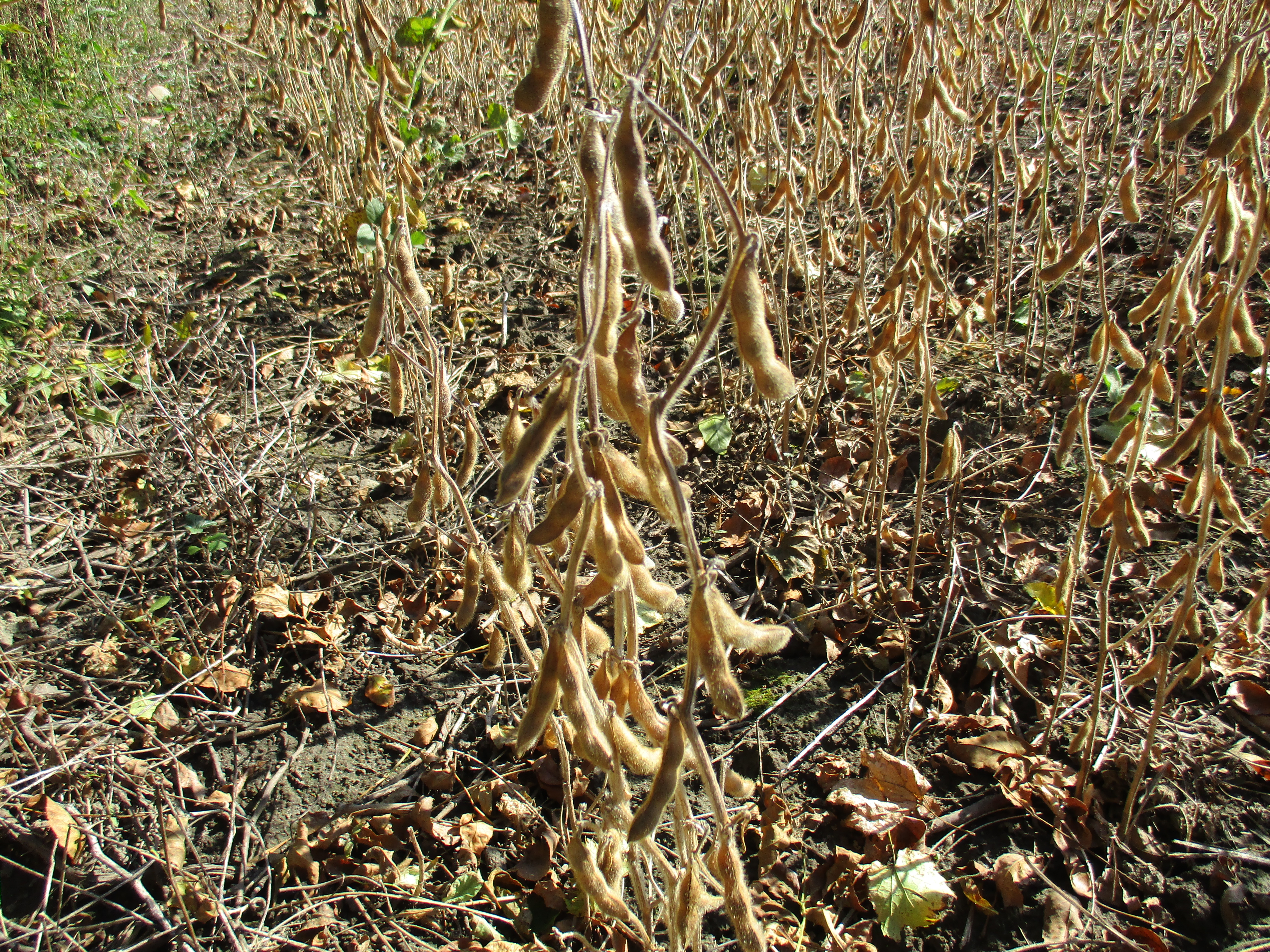
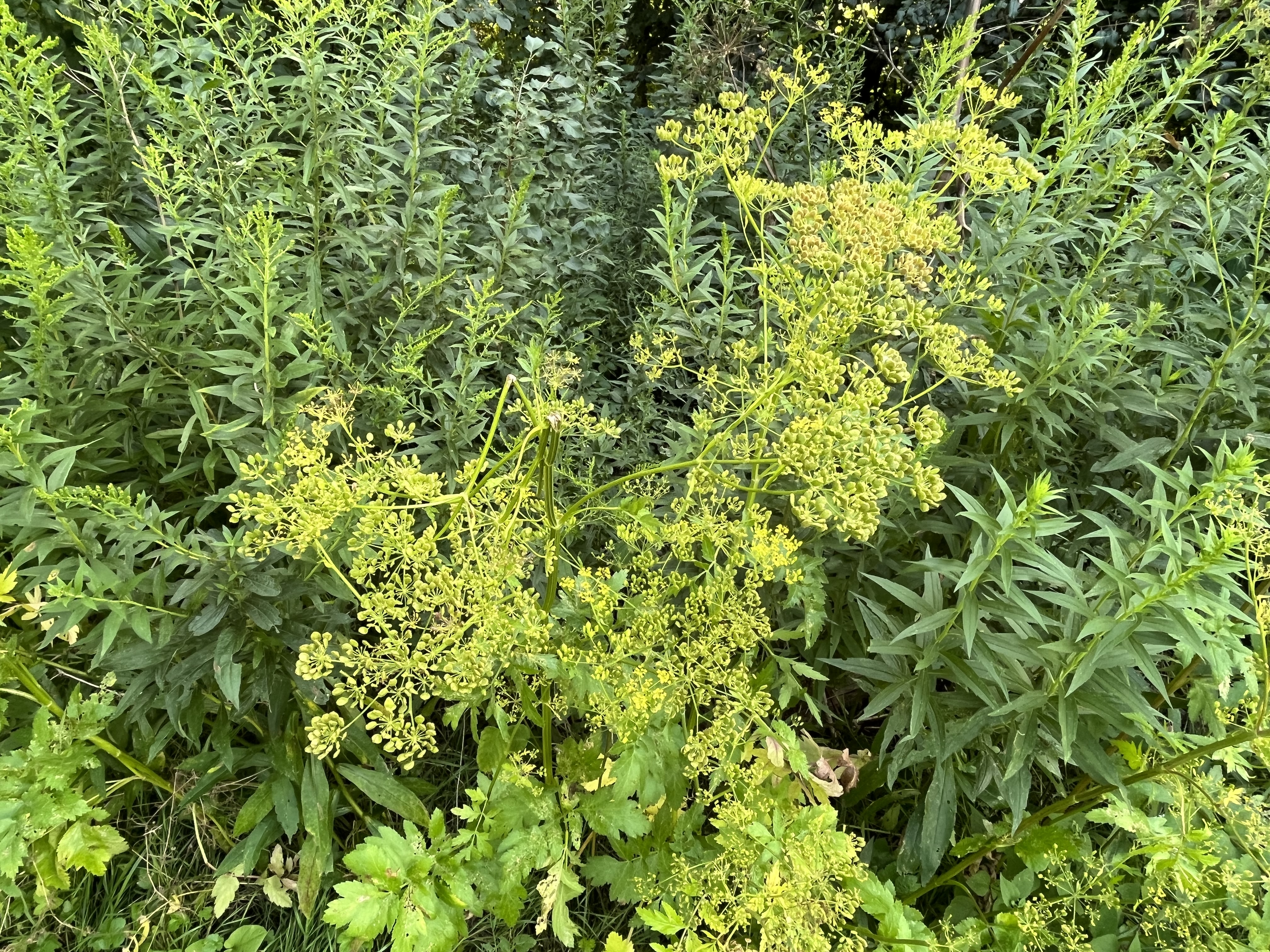
Surprisingly, the children’s day camp is full of dense stands of wild parsnip. This toxic plant isn’t native to North America and was likely brough in by people who grew it for its edible root. Unfortunately, it has spread in the wild and can choke out native plants. The stems, leaves and flowers contain chemicals that make the skin more sensitive to sunlight and can cause burns and severe dermatitis. While the City of Markham cannot possibly eradicate the weed, they should try to control it in a day camp for children.

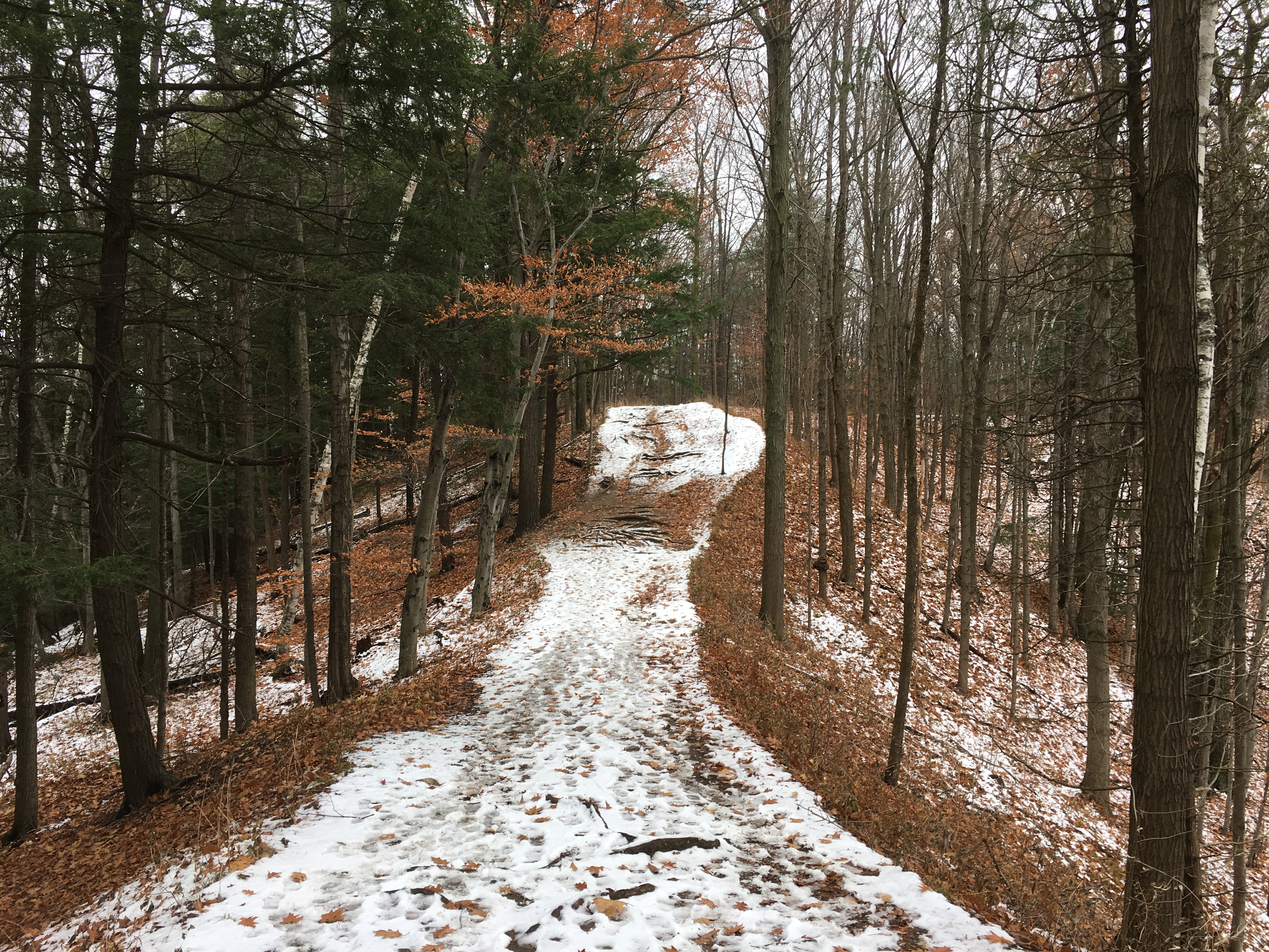
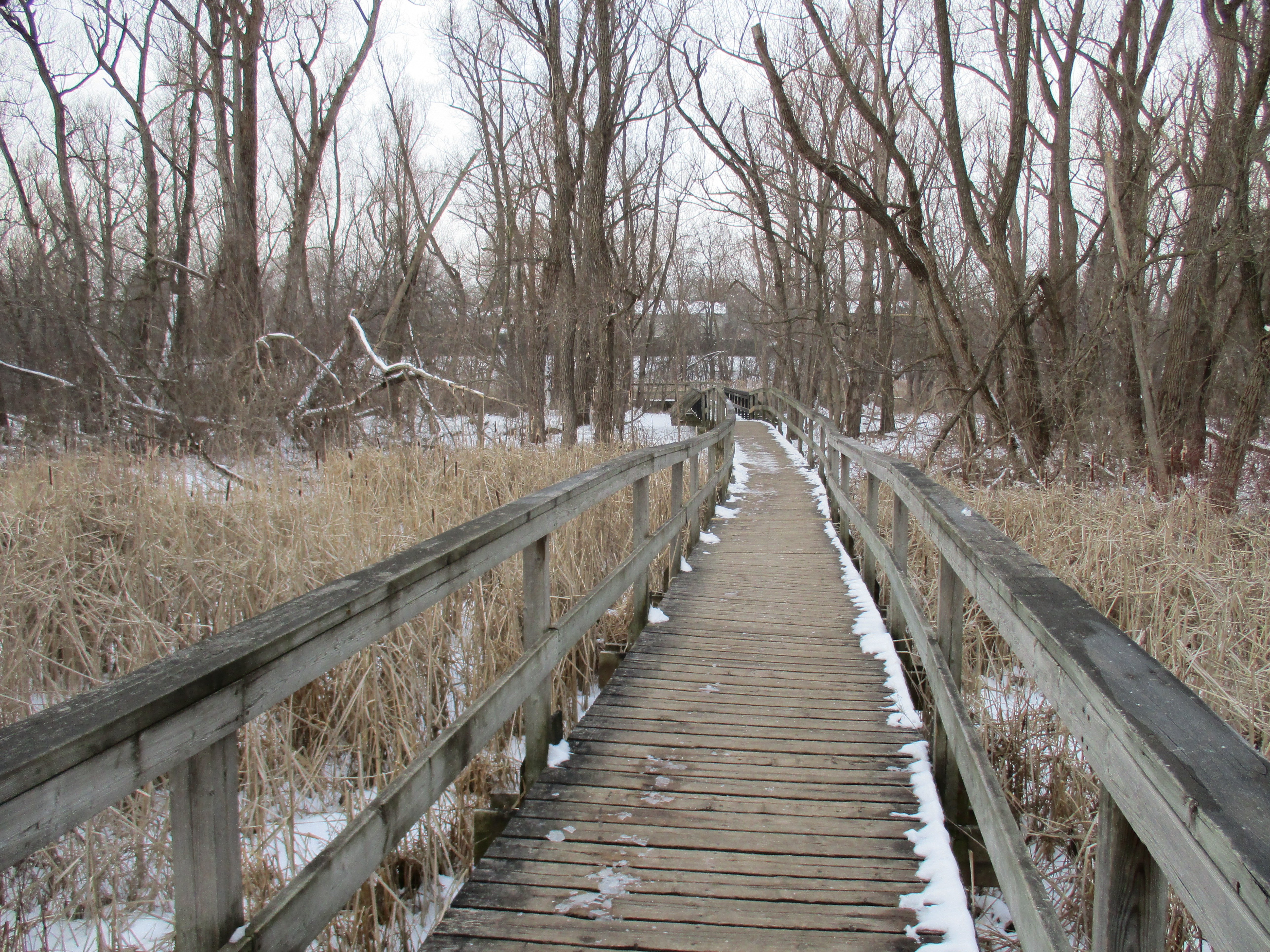
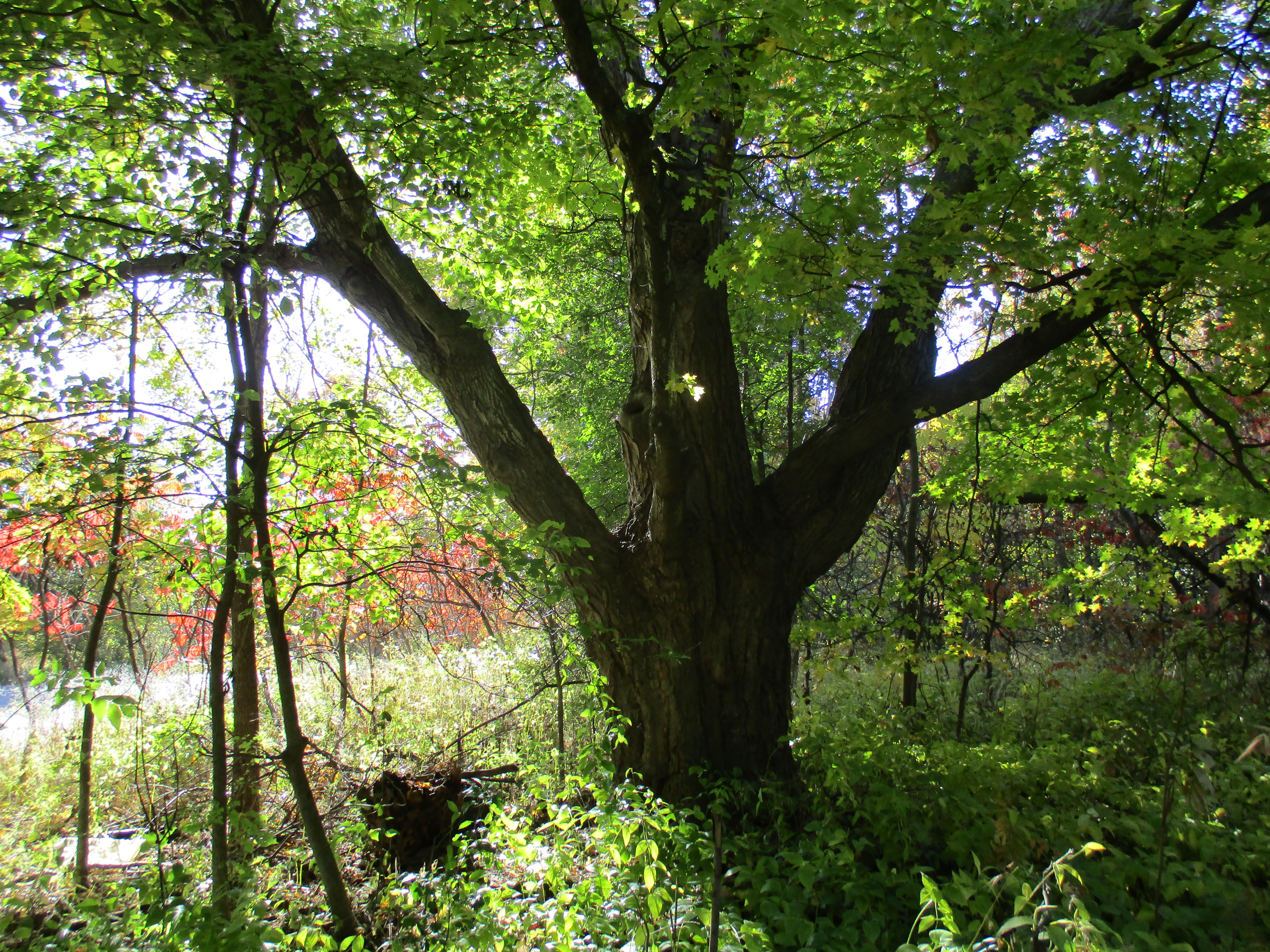
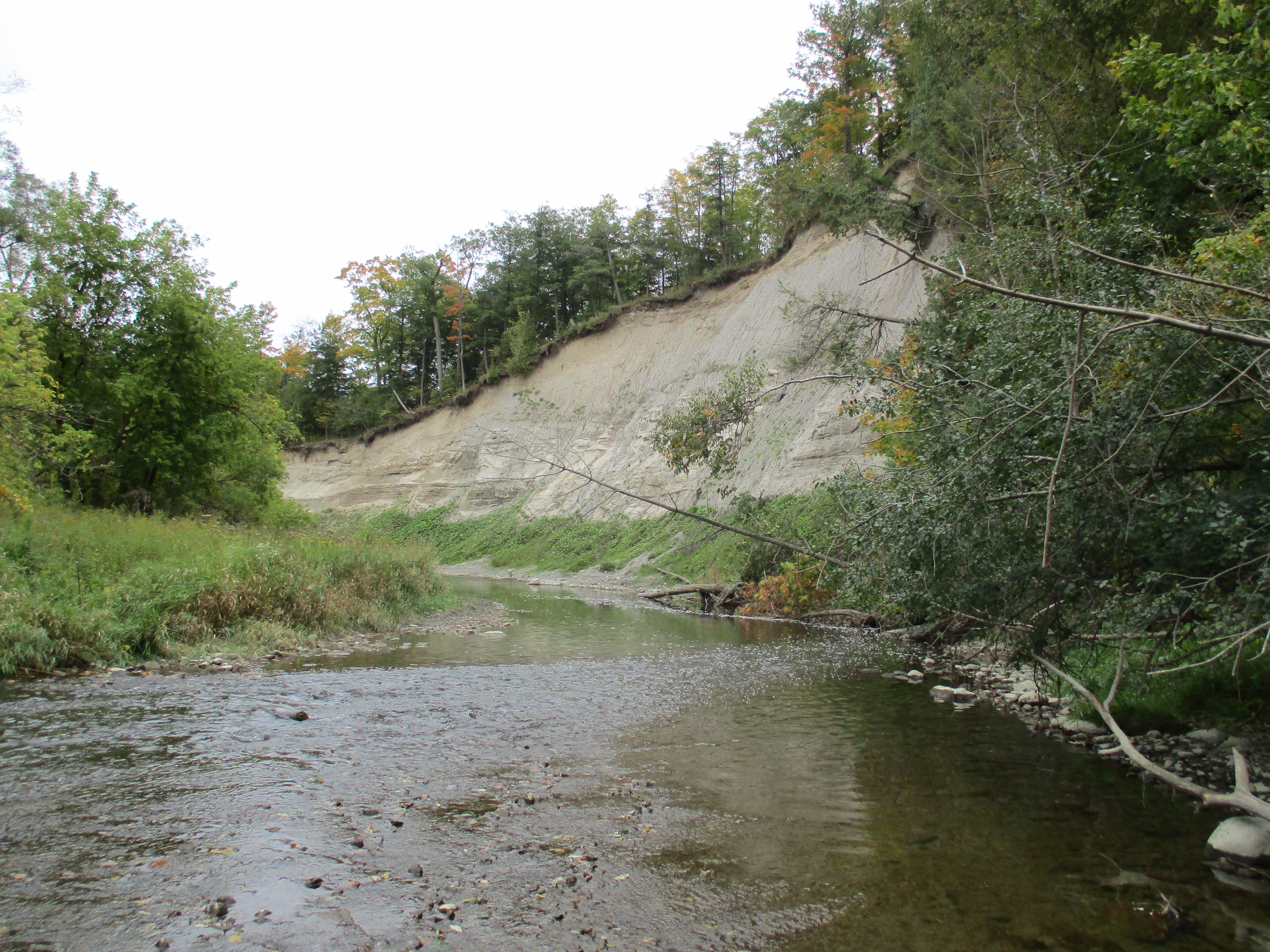
There is a nature trail on the south side of the lake which is a 5.3 kilometer loop that will bring you back to the summer camp. It is an easy trail and is suitable for all skill levels of hikers but is not accessible for handicapped people. It can also be followed to the far end of the lake and then, using the bridge by the dam, it can be turned into a longer loop back through Milne Dam Park.

Milne Dam Conservation Area has a nominal entrance fee of $4.50 per person on the weekends and holidays but is free during the week. It is well worth the entry fee because it is usually not crowded and there’s lots of picnic tables and several kilometers of trails to walk on.

Related stories: Milne Dam Conservation Area, Milne Dam Bridge

Google Maps Link: Milne Dam Park

Like us at http://www.facebook.com/hikingthegta

Follow us at http://www.hikingthegta.com

Also, look for us on Instagram

Rouge National Urban Park – Vista Trail

Saturday, November 17, 2018

Rouge National Urban Park continues to grow with new properties being added to the park this fall. The park is currently about 63 square kilometres but will expand to include over 79 square kilometres when it is complete.  There are over 12 kilometres of trails at the moment but this too is set to increase.  The Vista Trail is a 1.0 kilometre loop with a 0.6 kilomtre tail that takes you out to Twyn Rivers Road near The Mast Trail and Maxwell’s Mill.  We accessed the trail from Zoo Road where we were able to park.  The historical atlas below has been rotated 90 degrees to make it easier to read and to fit better.  The Vista Trail has been drawn in black between the Little Rouge and Big Rouge.  The original location of the Pearse House has also been circled for reference.

Pearce (2)

In the 1830’s three Pearse brothers names James, John and George left England and moved to Toronto.  James Pearse bought 200 acres at the intersection of today’s Meadowvale Road and Old Finch Avenue.  The family grew and the 1869 farm house was enlarged until in 1893 it was rebuilt around them as they continued to live in the house.  The brick veneer was decorated with ornate patterns and the picture below shows the date above the upstairs window.  When the property was purchased for use as a new zoo in the early 1970’s The house was moved to the present location and restored for use as the visitor centre for Rouge Park.  The coating of plain white paint that had been added over the years was removed to reveal the brickwork below.

IMG_8698


Ontario Power Generation has been in partnership with the park since 2010 and was responsible for building a viewing platform along the trail.  Rouge National Urban Park has over 1700 different species of plants, animals and fungi including all eight native species of bats.

IMG_8657

From the top of the viewing platform you have a great view down to the Little Rouge.  The vista from here would have been quite different a couple of weeks ago when the fall colours were still out.  Today, you can pick out the oak trees easily due to the brown leaves that still cling to the trees.

IMG_8655

The Vista Trail is well named because you get a view as you make your way along the ever narrowing strip of land.  The slope on the right drops away toward the Rouge River while the one on the left leads to the Little Rouge.

IMG_8662

Ferns growing along the side of the trail provide a splash of green among the dead leaves and snow.  Christmas Ferns are evergreen and for that reason are often grown in winter gardens.

IMG_8672

Having reached Twyn Rivers Road we made our way back up the hill to the point where the loop splits.  This time we took the trail to the left keeping closer to the Rouge River.  We find some odd things in the woods most weeks but one of the more unusual ones is the skeleton of a transport truck.

IMG_8680

It would appear that there are many more explorations to be made in Rouge National Urban Park.  Here again are the links to the Mast Trail and Maxwell’s Mill.

Google Maps Link: Vista Trail

Like us at http://www.facebook.com/hikingthegta

Follow us at http://www.hikingthegta.com

Toronto Zoo

Tuesday, September 28, 2018

One hundred years ago people in this city had two options if they wanted to take their children to see wild animals from around the world. The zoo at High Park was smaller then the Riverdale Zoo but both presented some interesting collections.  These two Victorian zoos paid little attention to the habitat in which the animals were housed. The picture below is from the Toronto Archives and shows the polar bear display at Riverdale. The empty cage and concrete pool do not reflect a natural setting and was likely stressful to the animals.

A private citizen’s brief in 1963 made the proposal to build a new zoo which resulted in a recommendation for a location in Don Mills.  This site is now E. T. Seton Park and a location was selected in Scarborough on the Rouge River.  A master plan was created in 1969 and construction began in 1970.  On August 15, 1974 The Metropolitan Toronto Zoo was opened.  It greatly expanded the 7.4 acres of Riverdale Zoo being 100 times the size at 710 acres.  Care was taken to enhance the living conditions for the animals as well as the public’s viewing pleasure.  The hippopotamuses have a nice pond to cool off in and living quarters that are far more comfortable than the polar bear exhibit at Riverdale shown above.

The zoo participates in several breeding programs with other accredited zoos.  Animals that are considered to be endangered in the wild are bred and where possible, the offspring are released back into the wild.  There are several species of wild cats at the zoo and I tried to see all of them.  The clouded leopard is considered vulnerable and there are only about 10,000 of them remaining worldwide.  The tail is very long with some males having up to three feet of tail.  The canine teeth are also very long being 1.4 inches and the longest in any modern feline.  They are considered to be the modern saber-tooth cats for this reason.

Sulawesi Babirusa is considered to be a pig but scientist say that it may be more closely related to the hippopotamus.  The name comes from the Malay words Bibi meaning pig and Rusa meaning deer because the tusks are said to look like antlers.  The tusks continue to grow for the 10 years the animal lives in the wild.  Specimens in zoos can live up to 20 years and if the tusks are not broken or ground down they will eventually grow to the point where they pierce the skull.  Zoo workers have to keep them trimmed.

The zoo is home to snakes from all around the world including pythons and cobras.  They have participated in programs to help protect the Eastern Massasauga Rattlesnake which is considered vulnerable to extinction.  The population is in decline due to decreasing habitat and loss of genetic diversity in isolated populations.  The snake cannot be moved from one population centre to another as transplanted snakes tend to die.  The zoo now works on genetic diversity in the species through breeding programs at the zoo.

The zoo is divided into seven sections arranged by the geographic region that the animals are native to.  There are both indoor and outdoor displays with some animals having the ability to move indoors or out at will.  Many of the species that come from hot climates have now been at the zoo long enough that the current animals were born here and are somewhat used to our winters.  The bats made me think of all the vampire shows that are popular these days.  I think the red lighting was used to good effect in making the bats look creepy.

The zoo tries to be educational and to inspire city children to have a love and respect for wild animals.  The information displays for each animal usually speak of the status of the animal in the wild was well as any threats to survival.  Practical examples are given of ways in which we can help protect the species we share the world with.  For example, the Sumatran Tiger is threatened by loss of habitat.  This habitat is being destroyed for the harvesting of palm oil.  Therefore we are being encouraged not to buy products that contain palm oil unless it is certified as coming from sustainable sources.  As part of the educational program they sometimes have displays of skeletons.  This hippopotamus skeleton shows just how scary those teeth can be.

Cheetahs are the fastest land animals but are considered vulnerable as far as conservation status is concerned with only about 7,100 animal in the wild.  They have a very high infant mortality rate with some estimates being that only 4.8% of cubs survive until they are weaned.  Three quarters of those killed as infants fall prey to lions.

It was interesting to watch how the animals reacted to their human keepers.  I was beside the lynx when the keeper arrived to feed him and clean up his droppings.  The lynx had been sitting in the shade when he heard the keeper’s keys in the lock.  He moved closer to the door and then sat down to watch.  The keeper entered the cage and replaced the old food with fresh meat.  The lynx watched this but did not go straight for the food, instead waiting for the keeper to leave and return with a shovel and rake.  It waited while the man cleaned up the piles of droppings in the enclosure and left again.  It then moved over to the feeding platform and began to eat.  The keeper never spoke to the animal but it was clear that he was unafraid of being attacked.

There is always some debate about keeping wild animals in captivity.  Some will say that wild is wild and there is no responsible way to keep them in captivity.  I personally think the animals in the zoo are comfortable, well fed and taken care of.  They typically have longer life spans than those in the wild and are free from predators and illnesses.  The specimens at the Toronto Zoo appear quite relaxed and happy if this otter is any example.

The zoo has over ten kilometres of trails that wind past the enclosures for over 5000 specimens.  It is the largest in Canada and one of the biggest in the world.  It is constantly going through improvements and expansions of the displays.  In the near future the Canadian section is scheduled to be moved from the Rouge Valley back up onto the table lands above.

The zoo is a place that needs more than a few hours to explore and fully appreciate.  At $41 for parking and single admission it is a little expensive but by becoming a member or adopting an animal you can get free admittance.

Google Maps link: Toronto Zoo

Like us at http://www.facebook.com/hikingthegta

Follow us at http://www.hikingthegta.com

Union Mills – Unionville

Saturday March 4, 2016

When millwright Ira White arrived at the north end of what would become Unionville in 1839 he recognized the east half of lot 13 in the 5th concession to be an ideal site to harness the water power of Bruce Creek.  He built a sawmill first and then set about cutting the wood for the grist mill he built where the creek crosses Main Street in Unionville.  This street was originally the winding lane to the mill but soon became lined with homes and businesses as the community grew around the mills.  It is believed that White named his mills Union Mills when Upper and Lower Canada were united in 1841.  When a name was needed for the post office Unionville was selected.  An archive photo of the mill is seen in the cover picture.  The area along the main street has now been declared as a cultural heritage district because of it’s unique collection of heritage buildings that demonstrate many architectural styles from log houses to condos.

Toogood pond was named after Arthur Toogood who owned the property prior to the town of Markham buying it in 1980.  We parked on Main Street in the public lot across the street from the original site of Union Mills and walked along Bruce Creek toward the dam.  An early name for the mill pond was Willow Pond and the reason for this can still be seen today in the old willow trees that line the sides of Toogood Pond.

IMG_0174

On the east side of Toogood Pond is a pavilion with restrooms that are open and heated at this time of year.  There is also a viewing deck and restaurant.  This picture is taken from the fishing platform that is built out into the pond on the west shore.

IMG_0177

William Berczy led a group of about 67 families of Pennsylvanian German settlers into the woods north of Toronto and founded what would become Markham.  They completed 15 miles of Yonge Street between Eglinton Avenue and Elgin Mills and one of his group was Philip Eckardt.  Berczy Creek flows into Toogood Pond and is named after Berczy.  The trail criss-crosses the creek several times before reaching 16th Avenue which runs along the south side of lot 16.  One of the bridges across the creek can be seen in the picture below. By walking east on 16th avenue for 1 kilometer you will come to Bruce Creek which leads back to the pond.  A little side detour to Kennedy Road will bring you to a surprising log home and pioneer cemetery.

IMG_0186

The oldest surviving home in the community of Unionville is known as the Philip Eckardt Log House. Lot 17 in the 6th concession was first granted to Frederick Westphalen in 1794, when he arrived with Berczy, and he received his crown patent in 1803.  In order to receive the full ownership of the property a settler had to complete some basic requirements including the clearing of 5 acres of land, the construction of a home at least sixteen by twenty feet and the opening of the road allowance along the property.  Therefore, there was a log house on the property before Philip Echkardt arrived in 1808 and it is very likely that the home credited to him was already there when he purchased the lot.  The house was used to host Lieutenant Governor Simcoe when he visited the area.  It has been altered several times over it’s 200 year life and siding has been added over the original log construction.

IMG_0072

After following Bruce Creek south from 16th Avenue you return to the top of Toogood Pond.  This pond has two creeks that flow into it and supports a large wetland.  A long wooden boardwalk has been constructed that crosses both Berczy Creek and Bruce Creek.

IMG_0196

The original wooden crib dam at the bottom of the mill pond has been replaced with the modern concrete 5 sluice gate construction.

IMG_0166

To allow the passage of fish around the Toogood Pond dam a fishway has been constructed. Fish can make their way up this little stream along the west side of the dam.  At the top they have to make a small jump to get into the pond.

IMG_0173

One of the reasons for the unique style of the buildings in historic Unionville is the 140 years that the Planing Mill produced the wood and gingerbread for local tradesmen.  The original planing mill was built in 1840 by William Eaken and operated until severely damaged in 1978.  The building was destroyed by a fire in 1983 but replaced with this modern structure in 1987.

IMG_0022

The Stiver Brothers grain mill is the last remaining one of its kind in Markham and a style of building more commonly seen along the railway lines in the prairies.  Unionville was the centre of a rural farming community and around 1900 grain elevators began to appear beside the railway station.  in 1916 Charles and Francis Stiver repaired a grain elevator beside the train station that had been damaged by fire.  The Stiver Coal and Seed company was in the business both of buying and selling seeds.  They provided seed for planting as well as animal feed.  Originally the chopping work needed to make the animal feed was done at the Union Mills.  When they were destroyed in a fire in 1934 the Stiver brothers added a feed mill to their operations.  The Stiver Brothers closed the business in 1968 and by 1993 the building was empty and deteriorating.  It has recently been restored and was opened again in 2014 as a cultural centre.

IMG_0008

John Noble Raymer came to Markham township in 1809 and his cheese factory is believed to be one of the first in Upper Canada.  John operated a family farm but in 1866 he traveled to Evans Mill, New York to study the art of cheese making.  When he returned he opened a cheese factory on the family farm.  It was so successful that he decided to expand with a second factory in Unionville.  He purchased a half acre property on the east side of main street just above the Union Mills.  In 1870 he built and opened his cheese factory in Unionville.  After he died of smallpox in 1874 the business carried on until 1878 when it was closed and the building sold.  The front wing and porch were added when it was converted into a home.

IMG_0041

The Crown Inn is the oldest surviving inn in the community and it is also on the east side of Main Street just above the site of the Union Mills.  It was built around 1860 by a man named William Size who lived with his parents in the Union House which was an inn across the street.  He operated his hotel in direct competition with his parents. One of the first hotel keepers here was Avery Bishop whose great-grandson was Billy Bishop a World War One flying ace.  The Toronto Island Airport is named after Billy Bishop.

IMG_0040

The Union Mills may be gone but the mill pond and historic community it spawned remain almost untouched by time.

Google Maps link: Toogood Pond Unionville

Like us at http://www.facebook.com/hikingthegta

Abandoned Passmore Avenue

Sunday October 11, 2015

Passmore Avenue was never completed as a continuous road but today it has become even more fragmented.  I set out on Sunday afternoon to hike through the sections which had once been opened and are now closed (marked in green on the map below).  Passmore Avenue , also known as the 5th Concession, ran from The Scarborough – Pickering Townline to where the 404 now lies. Parts of it are still open under other names, including Gordon Baker Drive which lies on the old roadway. From Kennedy Road to Midland it still bears the name of Passmore Avenue. At Markham Road there are still sections running both east and west known as Passmore Avenue.

Steeles Avenue runs across the top of the 1877 historical atlas pictured below.  Passmore Avenue runs one lot below except where the line is dotted indicating that the road allowance was never opened.  The Rouge River cuts through the centre of the map between lots 12 and 13 (numbered along the top).  Between lots 10 and 11 runs Littles Road (yellow) which has also been recently closed.  It is shown extending one lot beyond Passmore Avenue but the southern portion has been closed so long the farmer has taken it back as part of the field.  The area east between here and the Rouge River is now Cedar Brae Golf and Country Club.

passmore (1)

This picture looks from the end of Littles Road along Passmore Avenue toward the golf course.

IMG_0579

In the field just before the golf club are the remains of a race track for horses.  It was built in 1966 and within 20 years it was gone.  From the ground little can be seen except the remains of the barn and the foundations of some out buildings.  The last three structures on the property were removed in 2002.  This picture is taken from standing on the racetrack looking north to where it curves left just before the trees at the horizon.  The outline of the oval track is still clearly visible from Google Earth.

IMG_0589

Passmore Avenue used to run east from Littles road.  On the county atlas there is a road which runs between lots 8 and 9 and divides John Sewells properties.  Today we call this Sewells Road (orange) and where it crosses the Rouge River on the map is the site of Toronto’s only suspension bridge.  The section of abandoned  Passmore Avenue (green) between Littles and Sewells roads has become fully overgrown.  It is little more than a strip of trees one chain wide (66 feet) along the end of the farmer’s field.

IMG_0592

I have walked through this section several times over the years and always find old pop bottles along here.  Today I found a 1962 Pepsi bottle but the condition was poor and I already have a better example.  Like all closed roads they seem to attract people with garbage.  There are the parts of an old truck scattered along the old road allowance.  The steering wheel is seen in the picture below.

IMG_0596

White asters bloom in places along the roadway.  These examples are smaller in size than their purple cousins that are common at this time of year.

IMG_0604

Motorists driving down Sewells Road would never see where Passmore Avenue emerges from the woods.  Two large trees stand guard over either corner of the former roadway and it’s intersection with Sewells Road.  The tree featured below is the southern of the two and has seen the transition from horses to model T’s and now to only the occasional hiker.

IMG_0609

The section of road along lots 7 and 8 was never opened but lot 7 was one of several owned by the Reesor family who lend their name to Reesor Road (pink).  I returned to the car and moved it to Gordon Murison Lane (red) which runs between lots 4 and 5 and leads to William Murison’s farm on the county atlas.  At the curve it joins Passmore Avenue and I parked where the maintained road ended.  I spoke briefly with the people who live in the old Murison home and they feel that the old roadway is now private property but have not posted it as such.  I walked from here through to the town line which is on the right side of the atlas pictured above.  The road allowance from the Murison’s through to Beare Road (brown) is a regularly used trail with the eastern section servicing a few houses.

IMG_0616

The final section between Beare Road and Town Line (grey) is almost impassible.  Dog Strangling Vine has taken over the most of the old road allowance.  This invasive weed wasn’t here when I last hiked this section in 2011.  I decided to make my way along the edge of the roadway because walking through the vines at this time of year helps spread the seeds.  Soybeans are being grown in the adjacent field.  Per acre, soybean produces more protein than most other land uses.  Some studies suggest that men who eat a lot of soy products may have a lower sperm count and it is not recommended for those hoping to conceive.

IMG_0623

Orange Crush was sold in small brown bottles following World War two until 1958 when the new clear Marilyn Monroe bottles were introduced.  These brown bottles were described as able to “protect the fresh fruit flavor from the harmful effects of light.”  I found a bottle that was, unfortunately, missing the bottom.  The applied colour label was badly faded on the side that was facing down (shown) and completely missing on the exposed side.

IMG_0630

When it was new the Orange Crush bottle would have  looked like the one I have on my desk at work. From left to right a 1970 no return 7-Up, 1860’s Minard’s Linament, 1906 Milk of Magnesia, 1949 Orange Crush, 1953 Pepsi, 1880’s perfume sampler, 1956 Coke, 1860’s Pitcher’s Castoria and a 1984 Labbatt Blue bottle complete this picture.

IMG_0724

A pair of abutments is all that remains where Passmore Avenue crossed Petticoat Creek.  There isn’t much water in here at the moment but at times there must be a fair bit.  The short span of the bridge can be seen in the cover photo.

IMG_0640

Passmore Avenue never ran the full length of Scarborough Township and several sections have since been closed.  Those sections make for an interesting hike where I always see something new each time I explore.

Like us at http://www.facebook.com/hikingthegta


Toronto’s Only Suspension Bridge

Sunday Oct. 5, 2015

The Rouge River flows between two historically significant bridges in Scarborough.  I decided to try to hike the river from one to the other.  I parked on Sewells Road a little north of the suspension bridge.  It was a nice fall day with temperatures in the “no bug” zone of 12 degrees.

Frank Barber (1878-1945) was a civil engineer who designed several bridges in Toronto including the Middle Road Bridge (1909) and the bridge at the Old Mill (1916) both of which were visited in previous posts.  In 1912 he designed the suspension bridge across the Rouge River on Sewells Road.  At the time, Toronto was expanding and access to new parts of the city was restricted by the deep ravines of the Humber, Don and Rouge Rivers.  This was one of the early bridges to provide a permanent crossing to the river in this area.

Suspension bridges are normally a solution for major waterways or wide valleys but this one is just 160 feet long. The bridge deck is concrete suspended 13 feet above the river by two cables securely anchored into the ground on either end. The cables are seen in detail in the cover photo.  These cables bear the load of the bridge which is suspended on hangers or vertical rods.  Barber completed the bridge in 1912 and it was restored in 1981.  It is one of only a few suspension bridges in Ontario and the only one in Toronto.  It is also one of 15 bridges listed as heritage properties by the city.

IMG_0527

Under the bridge is the distinctive nest of  the organ pipe mud dauber wasp.  This is an unusual wasp in that the male stands guard at the nest while the female gathers food.  One of the main food sources is spiders.  The wasps are about an inch long and as such are the largest of their species.

IMG_0533

Also under the bridge is the Google logo which is a rare example of graffiti that can actually be read.

IMG_0531

Rough Cockleburs grow along the side of the Rouge River.  This member of the aster family doesn’t have the usual wind blown seeds.  Instead, it spreads through seeds that grow inside of oval heads that are covered with spines.  They get caught in animal fur and clothing and can be carried long distances.  The cocklebur is also related to the sunflower and daisy and has been used for it’s anti-inflammatory and antimicrobial properties.

IMG_0537

I had chosen to try to follow the west side of the Rouge because a thirty foot sand bank on the east side of the river can be seen from the road.  As you get closer you can see that there are hundreds of Sand Martin holes along the edge of the cliff.  These birds dig winding holes into the side of the sandbank where they are difficult for predators to reach.  There is a large breeding colony living in this embankment.

IMG_0540

After disturbing a Great Blue Heron and traversing a mess of poisonous wild parsnips I discovered that there is an even taller sand bank on the west side.  It may be possible to pass on the edge of the river, but not when hiking alone.  The strip along the water’s edge is made of material that has fallen down the face of the sand bank and may not be very stable in spite of the thin vegetation growing on it.

IMG_0544

My attempt to make my way downstream to the second local bridge of interest wasn’t successful and so I moved my car to the Rouge Park Finch Meander Area parking lot.  Near the parking on Old Finch Avenue is a tree with a large number of artist conks growing on it.  They can be picked and the white underside scratched to produce pictures or writing which turns brown as the conk dries.  The surface then becomes hard and the artwork is permanent.

IMG_0559

On October 15, 1954 Hurricane Hazel landed in Ontario bringing heavy rain and strong winds and taking 81 lives in it’s wake. Rivers across the GTA flooded and bridges were destroyed or damaged on every major waterway.  Sections of the city were isolated and traffic flow was severely affected.  To get people moving again the army was called in to help build temporary bailey bridges.  Only one of these remains in service in Scarborough and it is the one on Old Finch Avenue.  It is 130 feet long and, along with the wood piers in the middle, was constructed by the 2nd Field Engineer Regiment in just 3 days.

IMG_0561

Like us at http://www.facebook.com/hikingthegta

Bruce’s Mill

Sunday Aug. 9, 2015

It was one of those perfect summer afternoons.  The skies were sunny and it was 21 degrees without humidity.  I decided to visit Bruce’s Mill Conservation Area to check out the remains of the 160 year old grist mill in the park.

Situated in the headwaters for the Rouge River, Whitchurch Township became the home of many German settlers.  In order to be able patent a land grant, and gain full rights of ownership, a settler had to meet certain requirements.  They had to build a home of at least sixteen by twenty feet and occupy or rent it within three years.  Five acres of land had to be cleared and surrounded by a fence.  The road allowance along the property had to be cleared and maintained, free of stumps.  After taking the oaths to the crown one would then own their land grant, usually 100 acres.  On the 1877 historical atlas map below the fifth concession is marked with “V” at the top of the page.  Stouffville Road runs across the top of the map (under the blue line). Thomas Lewis owned lot 35 and below that on lot 34 is a pond on property belonging to Robert Bruce.  It is marked with a GM for Grist Mill and a water wheel symbol.  This is the location of Bruce’s Mill.

Bruce's Mill

Casper Sherk built the first grist mill on this site in 1829 and he may have been the settler who first owned the land grant.  On the map above a road has been built below the mill running between modern Warden and Kennedy Roads.  This road is not part of the normal grid of the land survey and is therefore a “given road” built to allow customers access to the mill.  Sherk built an earthern berm and a wooden dam to create the mill pond.  The berm remains but the dam has been replaced sometime after 1900 with the modern concrete one with it’s dual sluice gates.  In the picture below the grasses hide the berm which is equal in height to the concrete structure.

IMG_7307

In 1842 William and Robert Bruce bought the mill and some adjoining property and changed the name of the mill to Carrick Mills in honour of their home in Scotland.  The sluice gates at the mill are still remarkably complete.  Wooden slats remain in both sluice openings and extra’s are carefully stacked on top.  Three hoists are standing on top as if waiting to lower the boards back in and stop the flow of water.  In the past the mill pond was used for swimming and fishing but it is currently filling up with wetland plants, creating a bird and butterfly watcher’s paradise.

IMG_7286

The present mill, as seen below and in the cover photo, was built in 1858 using wood from the original mill in the storage area at the north end of the building.  There are wooden boards on the ground under the front awning to cover a hole where grain was off loaded into the mill.  A similar system was used at the Marchmont Grist Mill.

IMG_7280

The Bruce’s built a two and a half story mill of wood construction on a stone foundation.  Glass was expensive and larger pieces were easily broken so smaller panes were typically used.  This mill has two sets of 3 over 3 windows in each opening.  The wire mesh on the right hand side in the picture below protects the water wheel and the tail race from intruders.  The mill is in a state of disrepair as boards drop off of the sides and windows are broken.  A hole in the roof is letting water into the building.

IMG_7275

Initially water was brought from the mill pond to power the water wheel by means of a wooden flume.  Later this was replaced with a penstock or round metal pipe.  The concrete structure in the picture below supported the penstock as it came out of the mill pond.

IMG_7293

Bruce’s mill has a twelve foot diameter steel water wheel.  Most water wheels were made of wood and were perhaps 40 inches rather than the nine foot wide Fitz Undershot Waterwheel installed at the mill.  Samuel Fitz began building waterwheels in Hanover Pennsylvania in 1840. In 1852 they began construction of steel waterwheels which became the mainstay of their business. Steel wheels last much longer than wooden ones and can be used in the winter when ice clings to the porous wood making a wooden wheel inoperable.

IMG_7304

In their online marketing materials the Fitz Waterwheel Co. presents a picture of the waterwheel at Bruce’s Mills.  The external building that now houses the waterwheel had not been added at that time.  Also, notice the penstock running along the ground where it is bringing water from the mill pond to the wheel.  The pressure from the penstock turns the wheel from the bottom, making it a rare undershot wheel.

Fitz Wheel at Bruce

The Toronto Region Conservation Authority bought the property in 1961 and the mill was closed in 1962.  Bruce’s Mill was one of the last operating mills in Ontario to close.  The TRCA has operated the site as Bruce’s Mill Conservation Area since 1965.  Walking garlic, also known as crow garlic or stag garlic, is not native to North America.  Farmers consider it to be a noxious weed because cows that graze on it can have a garlic odour to their beef and dairy products.  It has a sharp aftertaste not present with cultivated garlic.

IMG_7241

Treetop Trekking is a new sport that is increasing in popularity.  In 2002 the first park in Canada was established in Rawdon Quebec.  With four parks in Quebec the company expanded into Ontario where it now has four additional parks.  The park in Bruce’s Mills Conservation Area opened in 2013 and contains a 700 foot zip line.  In the picture below a person in blue can be seen near the centre of the picture zipping above the butterfly gardens on the aptly named Monarch Zipline.

IMG_7337

A look at the rear of Bruce’s mill as it slowly falls apart.  It would be a grand place to restore and use for weddings and other functions.

IMG_7287

Check out the most popular hikes in this special feature.

Like us at http://www.facebook.com/hikingthegta

Follow us at http://www.hikingthegta.com


Milne Dam Conservation Area

Sunday July 12, 2015

It was 25 degrees and partly cloudy.  Having hiked small portions of the Rouge River in the past I decided it was time to feature some part of it in a blog.  I drove to the founding place for the town of Markham to investigate the Milne Dam.  I parked just off of Highway 7 near Milne Lane, a lane way that once led to the Milne property and dam.

William Berczy was born in 1744 and came to Upper Canada with Lieutenant Governor John Graves Simcoe and basically co-founded York (Toronto).  With a group of German settlers he cleared part of the town site for York as well as building a powder magazine for the Queens Rangers to help protect the town.  His men then cleared Yonge Street from Eglinton to Elgin Mills, a span of 15 miles.  With 64 families Berczy then settled in Markham Township in an area which came to be known as German Mills.  The settlement didn’t thrive but Berczy did and his son Charles became Toronto’s first postmaster.

Alexander and Peter Milne built a dam and a mill on The Rouge River in the 1820’s.  The business prospered and soon there was a woolen mill, fueling mill, ashery and general store. Soon a community named Markham was growing along Markham road to the north of the mills.  The Milnes were also responsible for building mills in the area of Edwards Gardens and in Milne Hollow.  In 1911 Archie Milne, grandson of Peter, built the first concrete arc dam in Canada.  It was washed out in a flood in 1929 but replaced right away.  When it was washed out in the flood of Hurricane Hazel in 1954 it wasn’t replaced.  The Toronto Region conservation Authority bought the property in the 1950’s when they began to acquire the lands in the city’s floodplains.  They replaced the dam in 1973 as part of a master flood control plan and created Milne Dam Conservation Area.

The cover photo shows the side view of the dam where the water falls over the rim and onto the diversion weir at the bottom.  From there it flows to another small dam before being released through a spillway into the open river again.  The picture below is from down stream looking back up at the ten foot dam.  The Milne Fishway can be seen at water level on the right.

IMG_6532

The photo below shows the view up into the fish ladder.  The Milne fishway was constructed in 2001 and opened in 2005 at a cost of over $1 million.  Prior to that, the dam had presented a migration obstacle for fish but now another 45 km of the Rouge River was opened to migration. Records show that Rainbow Trout, Brown Trout, Smallmouth Bass and 10 other species have used the ladder to reach upstream.  During periods of migration, such as spring time, a cage is placed on the top end of the fishway.  This allows the removal of undesirable species such as sea lampreys.  Sea lampreys attach themselves to fish with a suction cup-like mouth and feed on them until they die. The Milne dam is the final barrier to lampreys to keep them out of the upper Rouge River.

IMG_6540

The Toronto region has been subject to flooding from the earliest days of it’s founding.  The first written records of floods start in 1797.  The first major destruction was caused by 5 inches of rain that fell in 24 hours in 1878 and washed out mills, bridges and dams.  Other floods happened over the next 66 years until 1954 when Hurricane Hazel hit.  With a death toll of 81 people it was time to get serious about flood control.  15 dams and flood control ponds were planned of which only three were built so far.  Claireville dam in 1964, G. Ross Lord dam in 1973 and Milne Dam in 1973.  The view below is from above the dam looking out across the smooth surface of the Milne Reservior behind the dam.  The orange floats collect debris and prevent it from going over the dam.

IMG_6545

These mushrooms look like Fly Agaric which is a psychoactive drug capable of producing hallucinations.  It actually more closely resembles Amanita Crenulata, of the same family, which is highly poisonous. The ring around the stipe tends to be a single fuzzy ring rather than several concentric rings. These mushrooms are the type that are typically shown, although most often red, in pictures featuring elves and fairies.  In a strange twist, children’s books are filled with pictures of poisonous or hallucinogenic mushrooms.

IMG_6591

There are some real quiet places along the side of the reservoir where you can sit and watch the fish jump in the air.  As I sat on a log, and roasted in the heat, the yellow tree branch hanging over the water reminded me to enjoy summer while its here because its over far too soon.

IMG_6557

With lots of wetlands and woodlands the park is home to a wide variety of wildlife.  It’s excellent for migratory birds and I caught a great blue heron in flight along the far shore in the picture below.

IMG_6573

The black raspberry has a distinct taste from it’s red cousin but they were juicy and plentiful. Not to mention how good they taste when put on top of rich french vanilla ice cream.

IMG_6565

Where the Rouge River crosses under Markham road stands one of the early businesses in Markham.  Archibald Barker bought this piece of property in 1844 and took out a mortgage in 1852 which likely indicates the date the house was built. The building was constructed to house a store on the south half and the Barker residence on the north half.  Aside from running the store, Barker was a notary public and ran the Rouge Mills.  This building stood near the mill complex and may have provided a place for workers to purchase supplies.

IMG_6525

Markham has plenty of history waiting to be investigated in future posts but the Milne Dam Conservation Area is a great place to visit and as I only hiked around one corner of the 305 acre park I’m certain to be back.

Visit us at http://www.facebook.com/hikingthegta