Saturday, November 19, 2016
Rouge Park was created in 1995 and covers over 12,000 acres of the Rouge River watershed. There are current plans to make it Canada’s first National Park in an urban area. It has been home to resorts, cottages, and campers since the 1800’s. Throughout the park are signs of the historical uses that the native people had for the land as well as the early settlers in the area. One such place is the early grist mill that was built on the Little Rouge Creek.
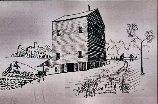
There is a large parking lot on Twyn Rivers Drive near the concrete arch bridge. Directly across the street from the parking lot are four stone pillars which mark the gates for the former Maxwell Mill. The remains of the mill are on the curve in the road between there and the Little Rouge Creek. The property originally belonged to David and Mary Thompson who sold it to James Maxwell. The Maxwell grist mill served Pickering and area beginning in the mid-1850’s. A sketch from 1855 shows Maxwell’s Mill as it looked at the time.
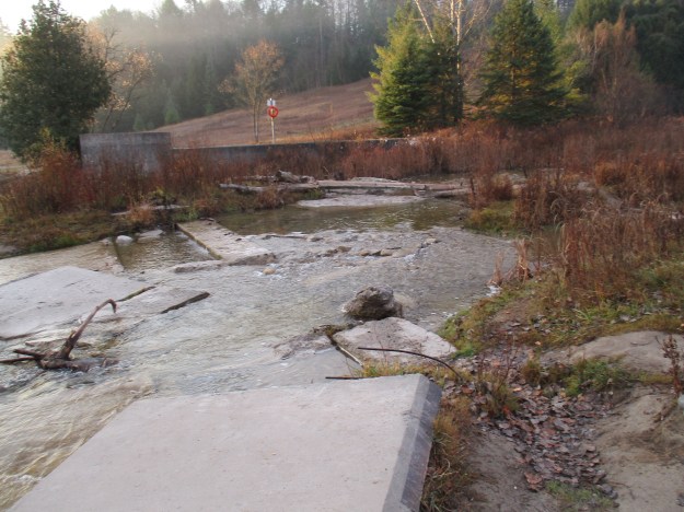
In 1929 a flood destroyed the mill pond dam and put an end to water-powered milling at this site. The remains of the dam can still be seen on either side of the creek near the parking lot. Access to both sides is available for those who wish to cross the bridge and follow the trail along the other side. Extensive concrete walls can be found along the sides of the creek and concrete also is supporting the berm that once held the mill pond.
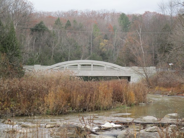
The Maxwell Bridge where Twyn Rivers Drive crosses the Little Rouge Creek has been named a heritage property by the city of Toronto. It is listed as a concrete rainbow through arch, fixed bridge. A through arch bridge typically has a portion of the arch below the road deck so that it appears the road passes through the arch. This bridge does not have an obvious portion of the arch below the road deck.
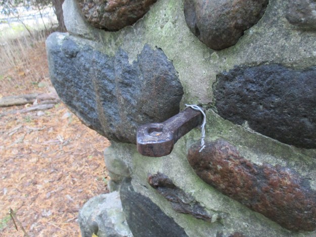
Four of these stone pillars formed the gates for the mill. Wood straps can still be seen on the pillar to the left. A matching pair stands on the right, just out of this picture.

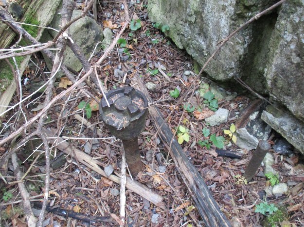
Close examination of the inner pillar reveals a forged steel rod with an “eye” hook on the end that once supported the gate.
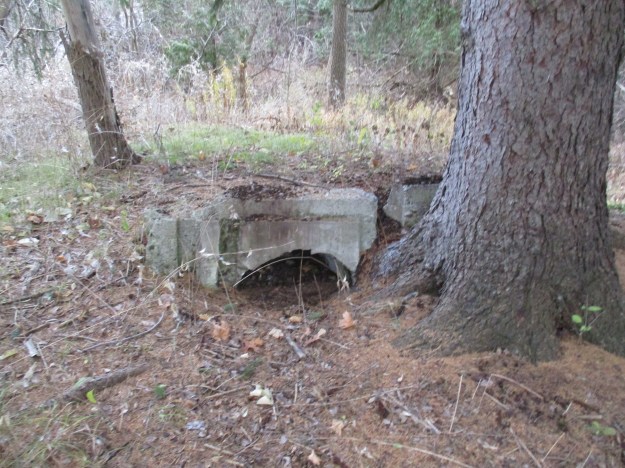
The same storm that destroyed the mill dam in 1929 also filled the sluice up with silt. Since it was abandoned it has been further damaged by the large tree that is now growing beside it. The concrete of the sluice has been cracked as the tree pushed it out of the way.
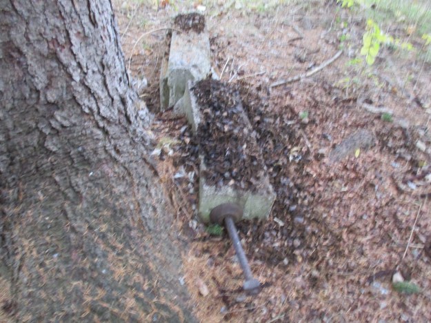
From the back of the sluice, you can see how little nature thinks of the concrete structure. The crank that was used to control the flow of water toward the water wheel can still be seen.
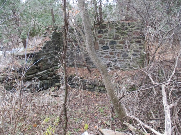
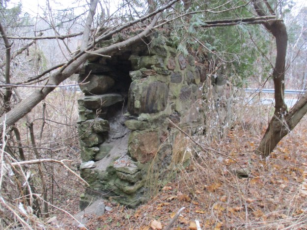
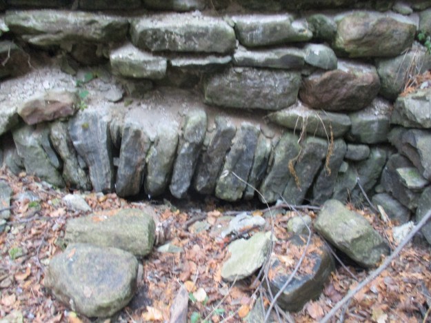
After its days as a mill were finished the building served several purposes. In 1923 Clarence Purcell bought the farm around the mill to run as a hobby farm. He also used it to raise his ponies. At one time the main floor of the mill was converted to house ten pig pens. Grist mills were noisy places filled with vibration from the turning mill stones. In order to protect the building from damage, there were often two separate foundations. In the case of Maxwell’s Mill the stone foundation walls were double thickness. The picture below shows a cross section of one of the foundation walls.
In 1954 Hurricane Hazel caused even more damage to the mill. By this time the animals had been removed and the space was being used for storage. In the early 1970’s a fire destroyed the mill and left only the stone walls remaining. The Toronto Region Conservation Authority bought the property after this as part of their flood prevention program following the hurricane. Sticking out of the ground near the old water-wheel housing is the end of this drive shaft. This may have been attached to the turbines which replaced the water-wheel as the technology improved and water levels fell in the river. Turbines could provide more power with less water.
The remains of the mill were listed as a heritage property in 2009. After supplying energy to turn the water wheel, and later the turbine, the water was released back into the tail race through this opening in the wall. The tail race then returned the water to the river.
In the woods just behind Maxwell’s Mill are the remains of an old vehicle. This one is going to take a little more work to fix up than some of the ones seen on the tv show Counting Cars.

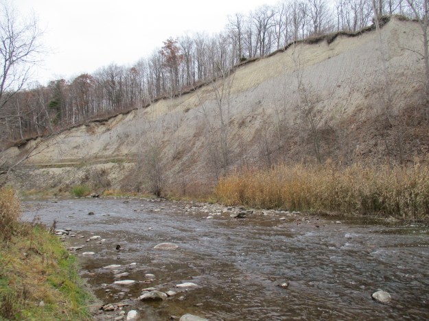
From the Little Rouge Creek to the Rouge River is a short walk along the Twyn Rivers Road. The bridge over The Rouge River has also been listed on Toronto’s inventory of historic structures. It is a metal Warren Truss Pony bridge made of 5 panels riveted together. Just before the river passes under the road there is a large embankment on the east side of the river. Two horizontal stripes of darker stone can be seen along the left-hand side of the picture. While taking this picture I was surprised to smell rotting fish. Near my feet was the remains of a salmon that had come upstream to spawn and die.
Rouge Park has much left to be explored. Two previous posts looked at parts of the park. Toronto’s Only Suspension Bridge and Abandoned Passmore Avenue provide additional reading about sites in the park.
Google Maps link: Maxwell’s Mill
Like us at http://www.facebook.com/hikingthegta
Follow us at http://www.hikingthegta.com

Pingback: Rouge National Urban Park – Mast Trail | Hiking the GTA
Pingback: Rouge National Urban Park – Vista Trail | Hiking the GTA
Pingback: Rouge National Urban Park – Beare Hill Park | Hiking the GTA
Pingback: Glen Rouge Campground | Hiking the GTA
Pingback: Scenes From Rouge National Urban Park – Twyn Rivers Drive & Orchard Trail | Scenes From A City
Pingback: Markham Museum | Hiking the GTA