Monthly Archives: February 2021

Dufferin Grove Park

Friday February 26, 2021

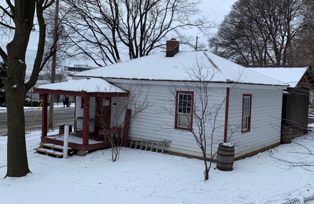
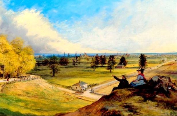
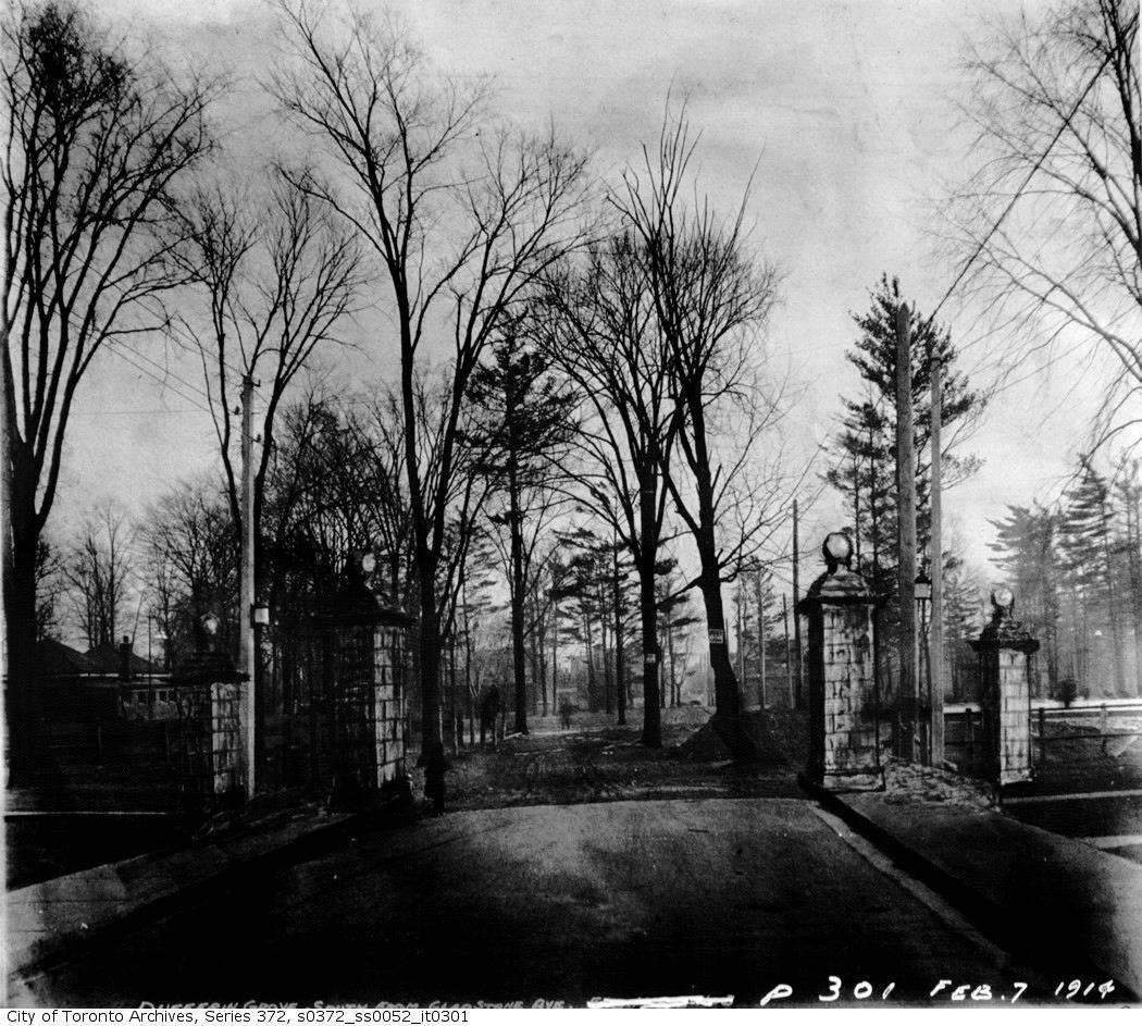
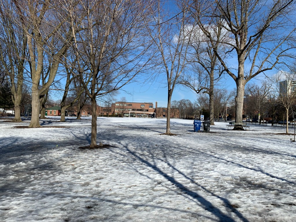
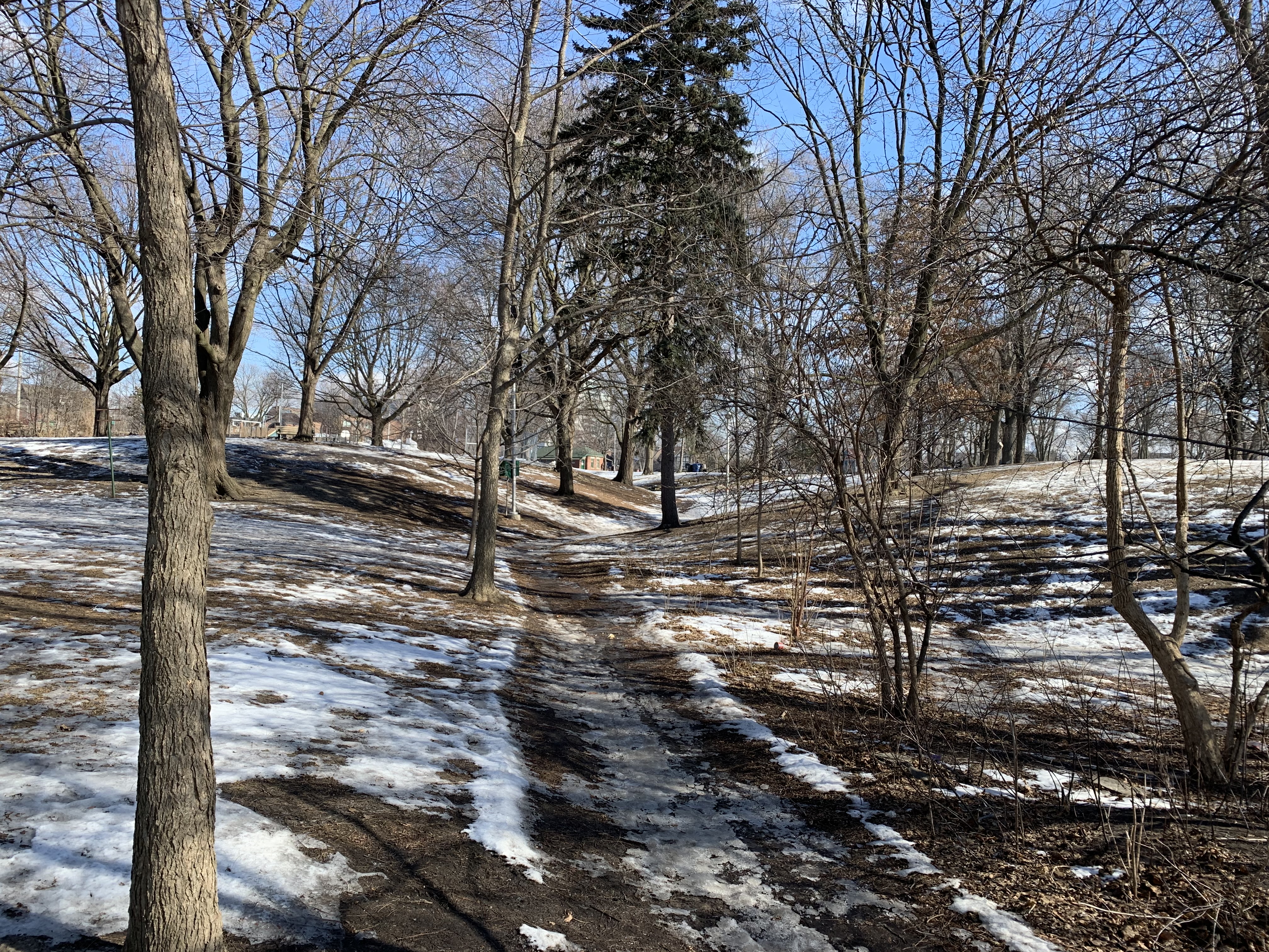
I had a rare Friday off of work and found myself near one of the local parks that I had not explored previously. Dufferin Grove Park is on Dufferin Street just south of Bloor Street and is one of the older parks in the city and contains some carved stones that date back to 1876. Parking is limited on local side streets but I found some without any problem. The archive picture below is from February 1914.

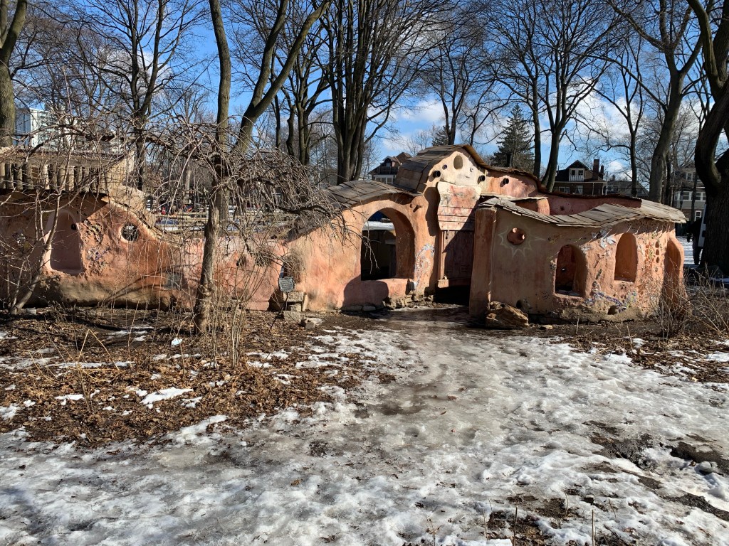
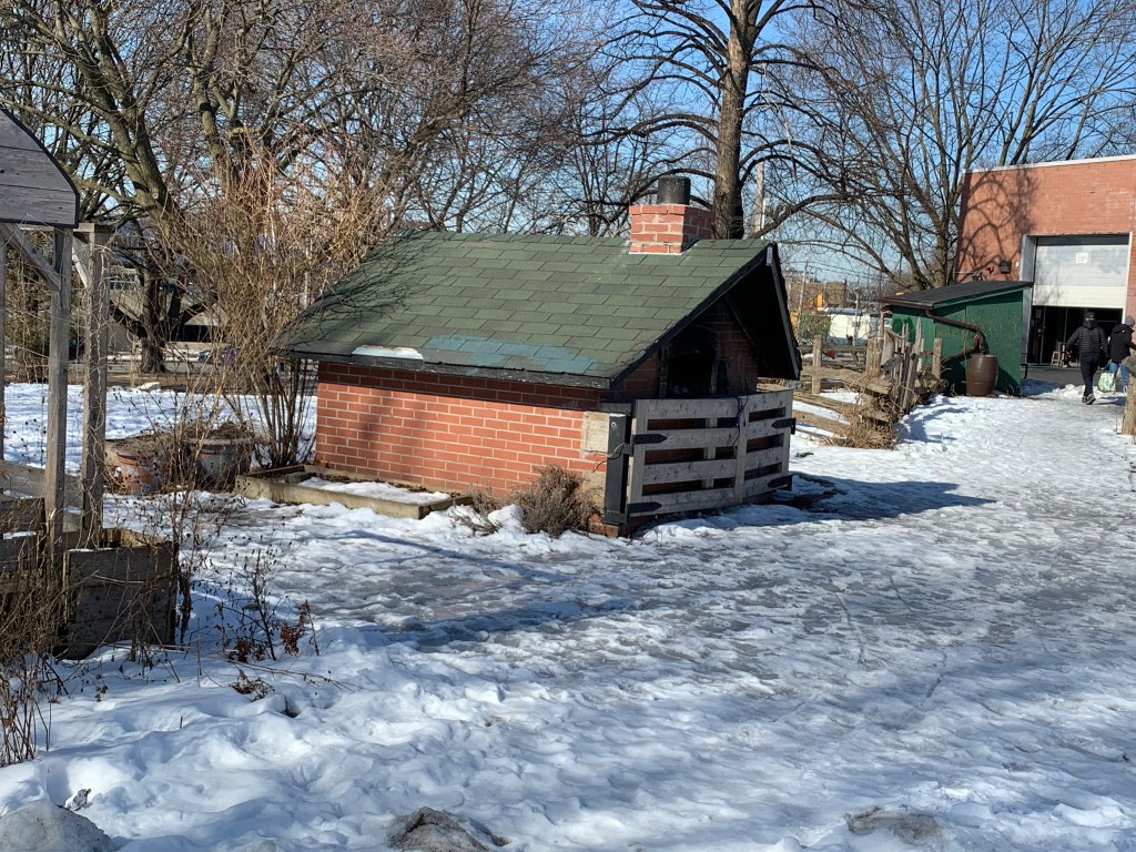
The Cob Courtyard was built as a food preparation area and has a kind of “Flintstones” look to it. It is currently undergoing some restoration work to repair the deterioration that it has suffered over the years.

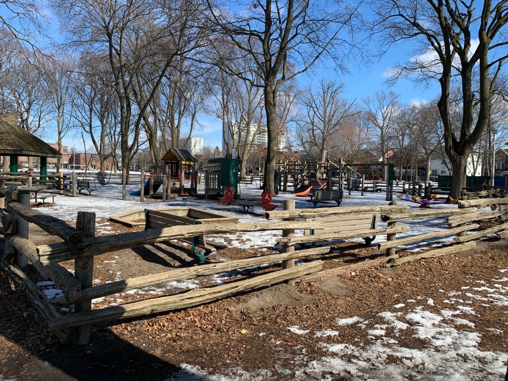
The local children have one of the best playgrounds in the city. There’s an enclosed playground with all the traditional slides and things to climb on. There’s also a large sandpit for little ones to play in with their toy trucks and diggers.

The park had a few parents with small children but for a Friday morning it was quite empty. I can imagine that Thursdays in the summer when the farmer’s market is on the park is quite busy. The snow that had fallen had been baked into ice which was tricky to walk on. In a few places there were even deep pools that people had walked over and broken through. The city was trying to pump water out of the deep one that had formed in the wading pool near the children’s playground.

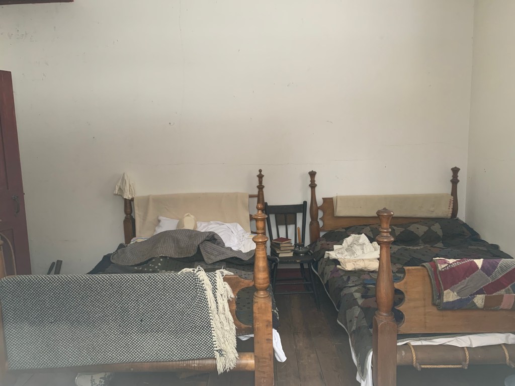
There’s a small clubhouse in the north end but its days are numbered. There is a City of Toronto proposal to update the ice rink and clubhouse with a $3.5 Million replacement. It has gone through all the consulting and planning phases over the last three years. Construction should have started in 2020 but has been put on hold by the pandemic.

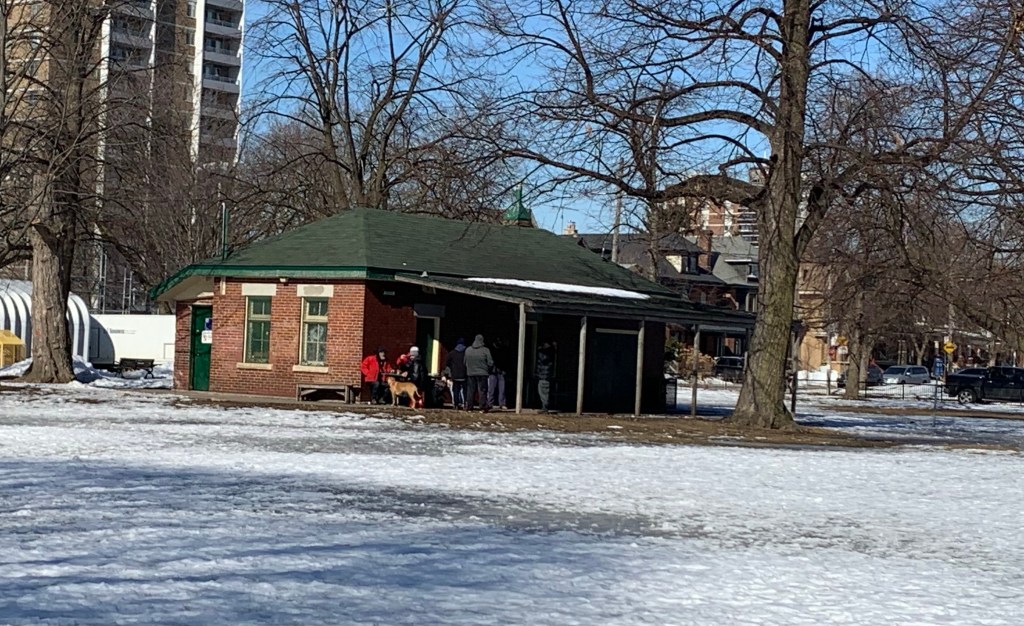
The park has a surprising number of amenities, some of which you don’t find in most places. The pizza ovens being a prime example. The revised clubhouse is expected to include a kitchen area.

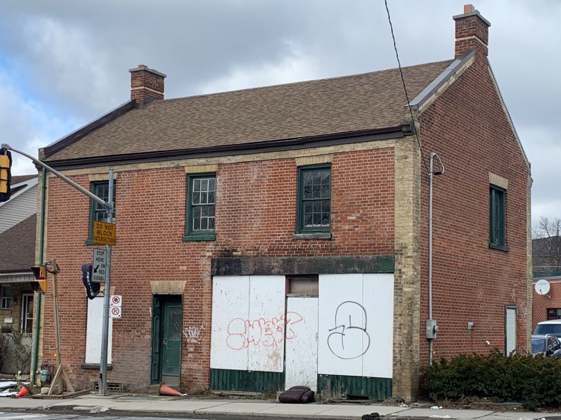
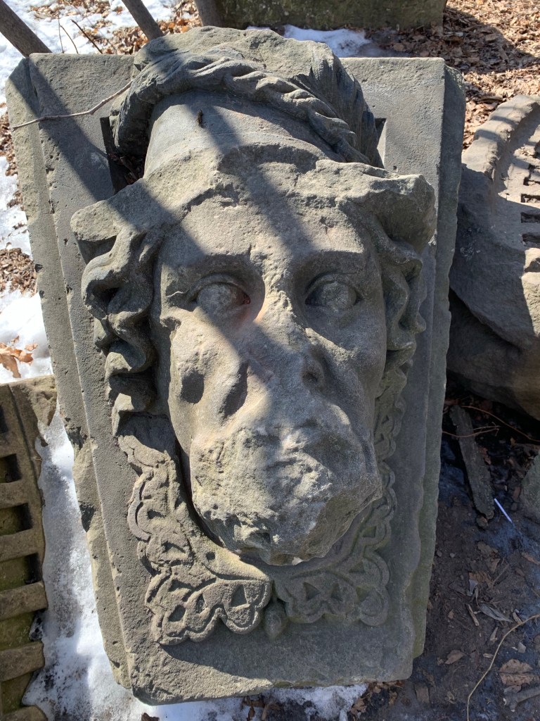
The fifth Customs House in Toronto (or York) was built in 1876 and demolished in 1919, just over 100 years ago. All of them were located at Yonge and Front Streets. The archive picture below shows the building prior to demolition you can see stone faces that were carved into the keystone in the arches over the windows.

When the building was demolished the faces were repurposed into the upper façade of the Colonial Theatre which was later known as the Bay Theatre. It was demolished in 1965 and the faces were preserved with the idea that they would be incorporated into Simpson Tower which was being built on the site. Instead they ended up in High Park where they were setup in a circle near Colborne Lodge. They stayed here until 1991 when the city decided to remove them because they had become a party spot. In 1998 they were incorporated into an artwork in Dufferin Grove Park called Marsh Fountain.

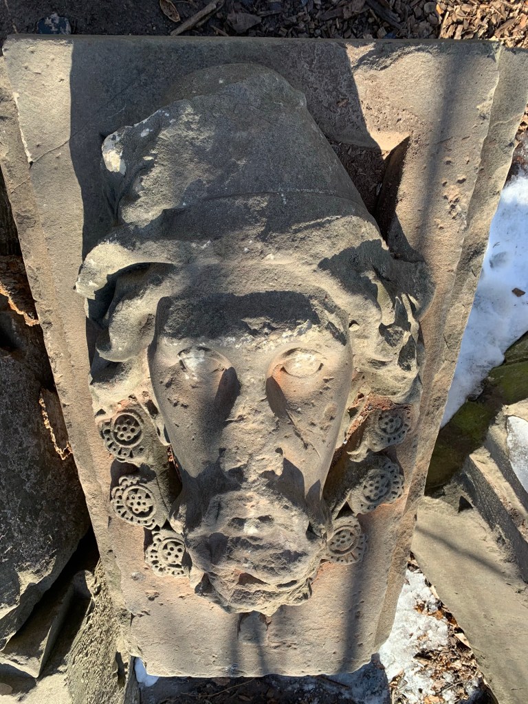
The faces may represent people who were famous in that era. It is said that the faces may be those of John Cabot, Samuel de Champlain, and Mercury the god of commerce.

The park rises to a crest beside Dufferin Street and then is relatively flat stretching out to the soccer fields. There are plenty of mature trees even though there is no woodlot in the park. There’s even a Sakura Cherry Tree to provide some colour in the spring when the blossoms are out.

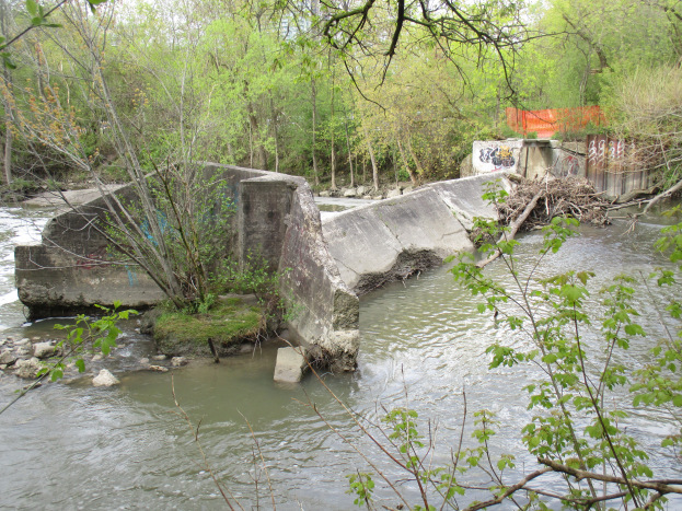
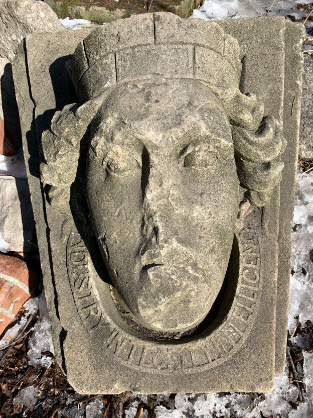
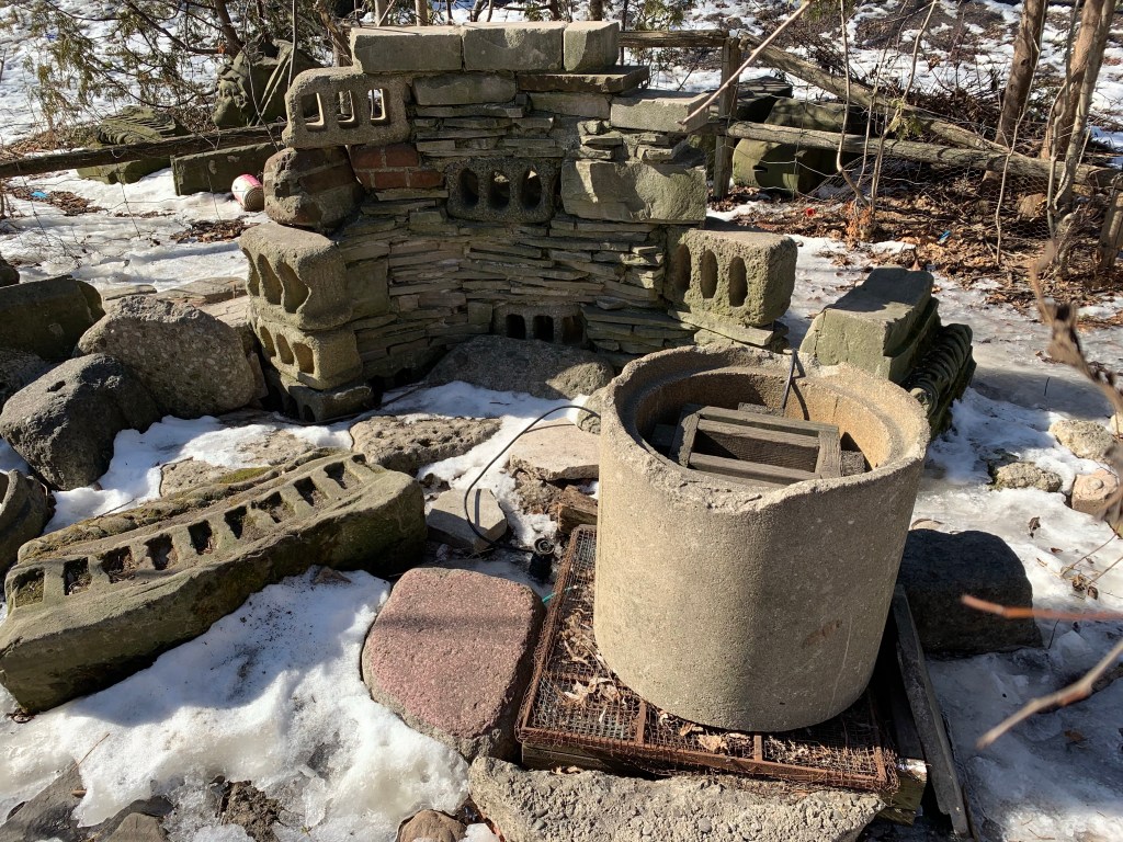
There is a second group of faces a little farther south along the side of Dufferin Street in the park. They can be found by looking for the fire pit where there is a little remembrance gardens to Garrison Creek and its tributary Dennison Creek which runs under the park. The concrete and bricks for the fire place appear to mostly be pieces of old buildings that have been brought here.

At the pit is a face of a lady with the only original (not vandals) inscription on it. The woman represents the city of Toronto and the old motto of the city of Toronto written below. “Industry, Intelligence, Integrity”.

Dufferin Grove Park is more than the average community park when it comes to amenities and also has some interesting historical artifacts to fire the imagination of the curious.

Google Maps link: Dufferin Grove Park

Like us at http://www.facebook.com/hikingthegta

Follow us at http://www.hikingthegta.com

Also look for us on Instagram

Ghost Towns of Toronto

Sunday, February 21, 2021

Within the present boundaries of the City of Toronto lie the sites and remains of all the small communities that used to surround the city when it was much smaller. Some of these places have very nearly disappeared but if you know where to look there is still a ghost of the community that once was. This blog collects 12 of the ones that we have visited and arranges them in alphabetical order. Each has a picture that represents the community as well as a brief description. The link for each will take you to a feature article on the community which has the local history as well as pictures of any surviving architectural features. At the end of each feature article is a google maps link in case you should wish to explore for yourself someday. Future companion blogs in this series will cover the ghost towns of the Regions of Peel, Halton, and York, excluding Toronto.

Armadale sat at the intersection of Steeles Avenue and Markham Road. It bordered with Markham which is on the north side of Steeles Avenue. Today there are five historic houses as well as the oldest continually serving Free Methodist Church in Canada. It was built in 1880 and its cemetery and parsonage still survive as reminders of a simpler past.

Claireville was started in 1850 and became a toll stop on the Albion Plank Road. It grew to 175 people but today has fallen back to just a few houses in an industrial park. It is flanked by a section of Indian Line which has been cut off and abandoned.

The town of Downsview was named after a home that was called Downs View. It was built in 1844 by a Justice of the Peace who sometimes locked up the convicts in the cells in his basement. The town is mostly gone now but the 1860 Methodist Church still stands.

The town of Eglinton has been completely absorbed into Toronto but there’s still a few clues to the community that grew at Yonge and Eglinton. The second school was built in the 1890’s and that has been absorbed into John Fisher School.

Jacob Fisher got a land grant in 1797 at Dufferin and Steeles where mills attracted a small community who built a Presbyterian Church in 1856. That church building survives at Black Creek Pioneer Village but the rest of the community of Fisherville has vanished.

Flynntown is marked by the remains of its milling industries. There are rough hewn logs that are the remainders of an early saw mill and a much later set of concrete weirs that are the remains of the dam across the Don River.

Lambton Mills grew up on both sides of the Humber River and several early homes and the hotel still survive. Lambton House was built in 1848.

By 1837 the community of Norway had grown to about 80 people centred on the toll station on Kingston Road at Woodbine. A few older buildings still line Kingston Road but the most obvious reminder of the community is the Norway Anglican Church which was built in 1893.

The town of Oriole was a thriving industrial site with seven mills and a brickyard on The Don River at Sheppard and Leslie. Road expansions have eliminated most of the physical history but one of the old dams still survives.

The town of Richview has disappeared under the intersection of highway 401 and 427 and their various on ramps. All that remains is the cemetery which is surrounded by the highways and can only be accessed off of Eglinton Avenue.

A couple of churches survive to mark the old community of Wexford. St. Judes, pictured below, was built in 1848.

York Mills grew up around several mills on the Don River where it crossed Yonge Street. Several older homes have survived as has the York Mills Hotel which was built in 1857.

Toronto had small communities that sprouted up at nearly every cross roads on the edges of town. The march of progress has wiped most of these places off the map but small hints are there to remind us of these little bits of our past.

Like us at http://www.facebook.com/hikingthegta

Follow us at http://www.hikingthegta.com

Also look for us on Instagram

Bradley Museum and Watersedge Park

February 14, 2021

Bradley Museum is a collection of pioneer buildings situated near the waterfront in Mississauga. The Bradley house stands on its original property and the Anchorage has been moved from a neighbouring one. I went there on December 29, 2020 while on Christmas break from work to walk around the buildings and appreciate their architecture. While I was there I walked the narrow greenbelt down to Lake Ontario at Watersedge Park.

The oldest home in the collection is a Regency Cottage that was built in the early 1820’s near Lakeshore Road and Southdown Road. In 1838 it was purchased by a retired British Navy Commander named John Skynner. He is quoted as having referred to the home as being his anchorage and it became known as The Anchorage. After the home had been lived in as a private residence by various people, in 1953 Jim Davidson sold it to the National Sewer Pipe Company who used it as their offices until 1977. It was moved to the Bradley Museum in 1978 but wasn’t restored until 1991. The National Sewer Pipe Company is responsible for the red beach at Lakeside Park. Mississauga has another beautiful example of a Regency Cottage, this one from 1838. The Grange has considerably more detail in the doorcase windows with intricate side lights and transom.

Lewis and Elizabeth Bradley arrived in 1830 from Savannah Georgia and built this small three bay story and a half house. It had become common to limit houses to a story and a half because a full two stories was taxed at a higher rate. This house features a roof style known as “salt box” because one side of the roof was longer than the other. Bradley House was occupied by the family until 1846 when Lewis died and Elizabeth sold the home. The British American Oil Company (now SUNCOR) eventually bought the property and planned to demolish the house in 1959. It was saved and moved a short distance farther from the lake where it was restored and opened as a museum in 1967.

The log cabin on site is actually the newest of the three homes, having been built around 1850 near Mono Mills, Ontario. In 1967 the 4th Port Credit Scouts and Rovers moved it to the mouth of The Credit River and it seemed safe from neglect or demolition. This didn’t turn out to be the case as it was eventually slated for demolition again. The Bradley Museum got involved and added it to their small collection of buildings. It was rebuilt and opened to the public on December 15, 2007.

The drive shed was built on the site in 1973 from materials moved from a farm in Chingaucousy Township. The shed is typical of thousands that would have stood on farms and in church lots across the province. This one came from the Carberry farm and has the usual post and beam construction. Another great example of a drive shed in its original location can be seen at the Cober Dunkard Church in Vaughan.

Several typical artifacts are stored inside the drive shed including this old buggy.

The barn was added to the collection in 1977 made of old planks from a barn that was located on the south east corner of Burnhamthorpe Road and Erin Mills Parkway. Architecture for domestic rather than public use which is average is referred to as being the local vernacular. This barn is Ontario vernacular although on a smaller scale than many of the late 19th and early 20th century barns. One of the most common styles of barns was known as the Gambrel-roofed Barn, named after its roof style where each side had two separate pitches. The extension at the front of the roof is known as a hay sling and it allowed feed to be lifted up to the loft through a larger door. Gambrel-roofed houses are even less common, which is probably why I always thought the house I spent ten years of my youth at in Hillsburgh looked like a barn.

The image below shows the basic design of the Gambrel-roofed Barn. Livestock would be kept in the bottom while the loft would be used for hay or fodder. An earthen ramp would provide access to the loft from one side of the barn. Often the silo and this mound are the two remaining clues that mark the former site of a barn.

Heading toward the lake you can follow a main trail or one that runs a little closer to the fence on the edge of the SUNCOR oil tank farm. I followed the fence line but most of the tanks in the first row along the fence have been removed over the last few years. There’s hardly anywhere that you can even get a glimpse of one, even in winter. I imagine in summer it must be almost as if this big industrial tank farm wasn’t there.

Meadowwood Park connects Bradley Museum to Lake Ontario at Watersedge Park. Meadowwood Tennis Club maintains three courts here and there’s also a unmaintained rink. I wonder if the rink is just out of use for 2020 or if it has been awhile since it was maintained?

It’s only a short walk to Watersedge Park and certainly worth it. Although small, the park does have a beach with some excellent views including the Toronto Skyline.

On a calm day the water here is quite colourful because of the different composition of the lake bottom near the shore. The small shells of Zebra Mussels cover parts of the beach and create a brighter patch in the water off shore. They were introduced to the lake in the 1980’s and since then have developed huge colonies. This beach is also considered to be one of the best places in Mississauga to catch a great sunset.

I would imagine that this area is likely busy much of the time but on this day I was by myself on the trail. This is a short walk and if you’re looking for more you can also take the trail that leads to Rattray Marsh. There’s boardwalks and lots of wildlife, including white-tailed deer, that can be seen at the marsh.

I’m looking forward to the time when I’ll be able to return and have a look inside the restored homes at Bradley Museum but for now it was nice to enjoy them even from the outside.

For more on the Boy Scouts see our feature Camp of the Crooked Creek. Additional pictures of a drive shed in its original function can found in the Cober Dunkard Church. The red shingle beach is at Lakeside Park. The intricate Regency Cottage is called The Grange. Additional local hiking can be enjoyed at Rattray Marsh.

Google Maps Link: Bradley Museum

Like us at http://www.facebook.com/hikingthegta

Follow us at http://www.hikingthegta.com

Also look for us in Instagram

The Tollkeeper

Jan. 31, 2021

Davenport Road follows the bottom of the scarp that marks the old shoreline of Glacial Lake Iroquois. The Native Peoples who lived here for centuries had a portage trail that went between The Don River and The Humber River and connected to The Carrying Place Trail. Europeans found it convenient to use the same trail and it continues on its original route. John McGill built the first home accessed from the trail in 1797 and named it Davenport after Major Davenport who served at Fort York. It stood on the top of the scarp on the north east side of present Davenport and Bathurst.

In 1833 thirteen kilometres of Davenport Road was paved with planks. Five small cottages were built by the plank road company to house the men who were hired to collect the tolls. The tollkeeper lived with his family in the cottage which was situated directly beside the road. Known as Toll Gate #3, the little three room cottage that was built for the tollkeeper at Davenport Road and Bathurst Street was only 20 feet by 30 feet in size. It is listed as being the twelfth oldest residence remaining in Toronto and some sources claim it to be the oldest tollkeeper’s cottage in Canada, perhaps the only one. It is listed on Wikipedia as being built between 1827 and 1830 but this would seem to predate the planking of the road making this date too early. It is more likely to be 1832 or 1833. The space between the two posts in front of the house in the picture below represents the width of the road but the boards that represent the toll gate have unfortunately been knocked to the ground.

The inside was originally heated by a single fireplace which was later replaced with a pot-bellied stove. This meant that only the main room was heated. The two bedrooms would have been pretty cold on a winters night. During the 1860’s John Bullmin and his wife Elizabeth took up the position at the toll gate. They lived in this house with their seven children. One bedroom was used by John and Elizabeth while the other was used by the four daughters who slept two to a bed. The three boys slept in the main room and enjoyed the benefits of the fireplace, if not the comforts of a bed.

In 1851 the fees for using the plank road were based on the mode of transportation and the amount of livestock you had with you. A simple pedestrian paid no fees but if they had a horse it was two pence. A wagon pulled by a mule was 3 pence which went up to 6 pence if it was pulled by two horses. A pedestrian leading 20 cows or sheep would pay 1 pence. The toll keeper had to keep meticulous records to get their small percentage and the record books from this tollkeeper’s home still survive. These toll rates were likely unchanged a decade later when the Bullmin family arrived. John left his wife and children to perform household chores, fetch water from the Taddle Creek and collect the tolls while he worked 6.5 hectares of land to supplement their income. His wife used to churn and sell about 50 lbs. of butter per year from the family cows.

When roadside tolls were abandoned in 1896 the government placed road maintenance under the care of the municipalities. John Bullmin died in 1867 and is buried in The Necropolis while his wife survived him until 1912. The cottage became obsolete in 1896 and was sold to someone who moved it near Howland and Bathurst as a private home. A newer addition later obscured the original cottage and by the 1990’s it was in danger of demolition for a high rise development. A neighbour who recalled the story of the little cottage was instrumental in its being sold to a heritage group for a dollar. The TTC allowed them to move it to the Wynchwood Streetcar Barns where it was restored over a six year period. In 2002 it was moved to a small park kitty-corner to its original location. The house opened as a museum on July 1, 2003 with a small addition on the back for an interpretive centre.

The painting below is from 1875 and is by Arthur Cox. The vantage point is the top of the old escarpment looking toward the south east. The area below the hill is still farmland at the time and the church spires in Yorkville can be seen in the distance. The cottage sits with the front porch on the very edge of the road and the toll gate stretching across Bathurst. This picture was taken from taylorhistory.com.

There are a few other hints to our toll road systems of the past that can still be found throughout the city. In 1841 John Grubb founded the Weston Plank Road Company to improve his local roads by covering them with a layer of thick wooden planks. A few years later he also formed the Albion Plank Road Company. The building that the Weston Plank Road Company operated out of was built in 1846 and still sits on its original location about a kilometre south of the 401 on Weston Road.

The Gore and Vaughan Plank Road Company was established in 1855 to build a plank road along Dufferin Street. The road was to be built of local wood and various saw mills were engaged along the route to cut and prepare the planks. The picture below shows one exposed end of the plank road along with one of the steel spikes that held it together.  The planks were sixteen feet long and held together with spikes over two feet long though this section of the road.

Davenport Road is unique because it existed long before the time of the Europeans and still retains the Tollkeeper’s Cottage as a reminder of its era as a plank road.

Further reading and more pictures: The Gore and Vaughan Plank Road and Elm Bank and The Necropolis

Google Maps Link: The Tollkeeper’s Park

Like us at http://www.facebook.com/hikingthegta

Follow us at http://www.hikingthegta.com

Also look for us on Instagram