Tag Archives: Lambton Mills

Ghost Towns of Toronto

Sunday, February 21, 2021

Within the present boundaries of the City of Toronto lie the sites and remains of all the small communities that used to surround the city when it was much smaller. Some of these places have very nearly disappeared but if you know where to look there is still a ghost of the community that once was. This blog collects 12 of the ones that we have visited and arranges them in alphabetical order. Each has a picture that represents the community as well as a brief description. The link for each will take you to a feature article on the community which has the local history as well as pictures of any surviving architectural features. At the end of each feature article is a google maps link in case you should wish to explore for yourself someday. Future companion blogs in this series will cover the ghost towns of the Regions of Peel, Halton, and York, excluding Toronto.

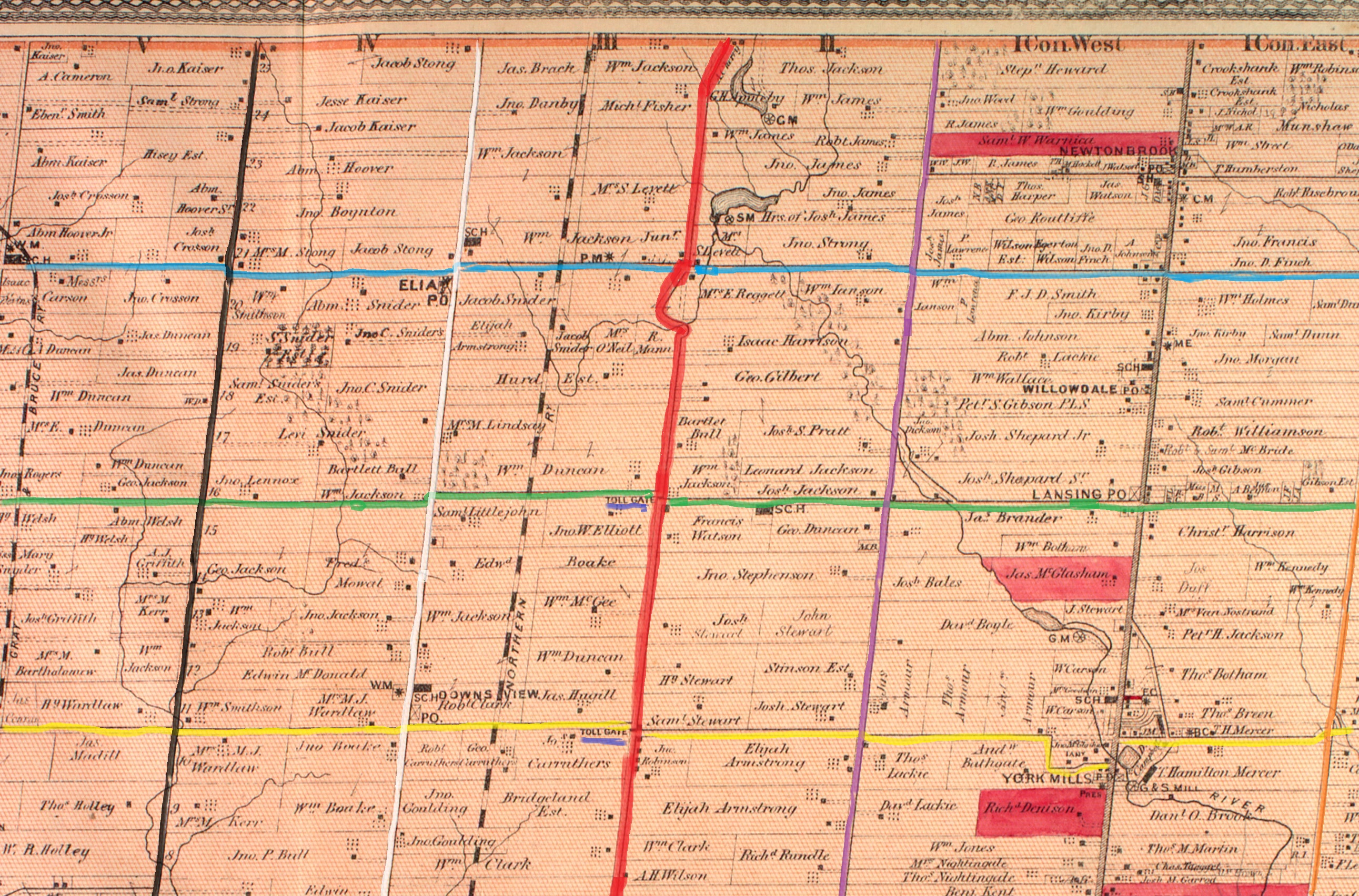
Armadale sat at the intersection of Steeles Avenue and Markham Road. It bordered with Markham which is on the north side of Steeles Avenue. Today there are five historic houses as well as the oldest continually serving Free Methodist Church in Canada. It was built in 1880 and its cemetery and parsonage still survive as reminders of a simpler past.

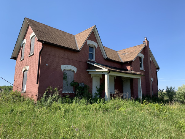
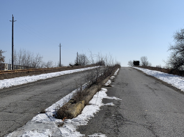
Claireville was started in 1850 and became a toll stop on the Albion Plank Road. It grew to 175 people but today has fallen back to just a few houses in an industrial park. It is flanked by a section of Indian Line which has been cut off and abandoned.

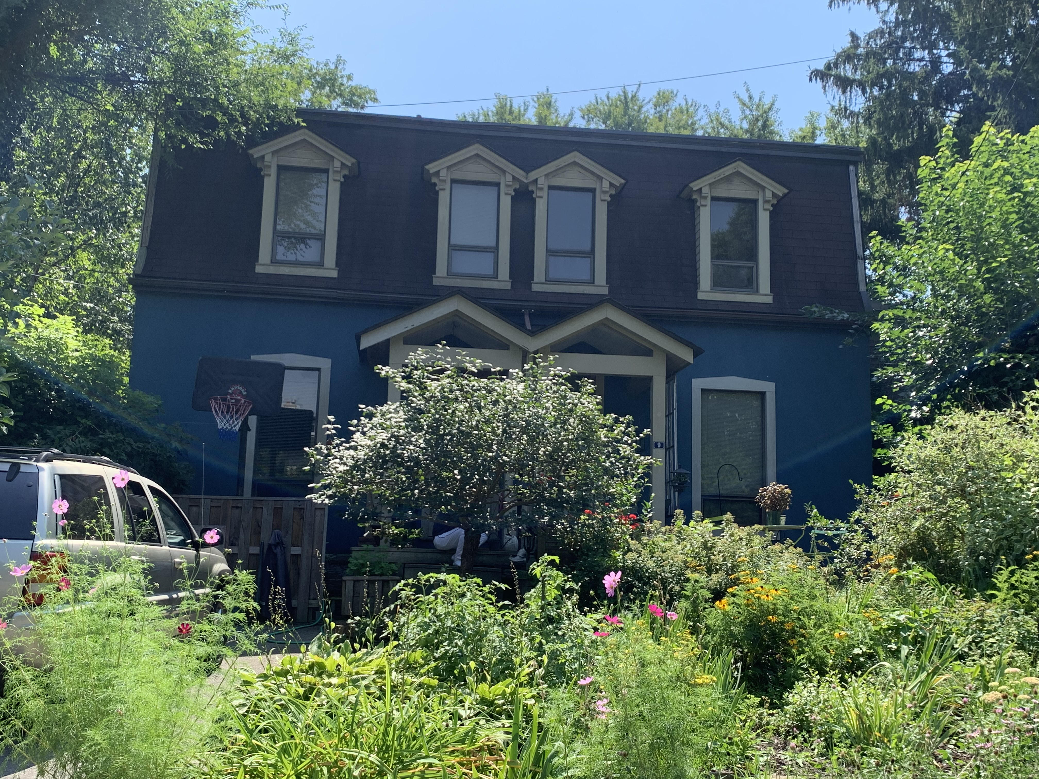
The town of Downsview was named after a home that was called Downs View. It was built in 1844 by a Justice of the Peace who sometimes locked up the convicts in the cells in his basement. The town is mostly gone now but the 1860 Methodist Church still stands.

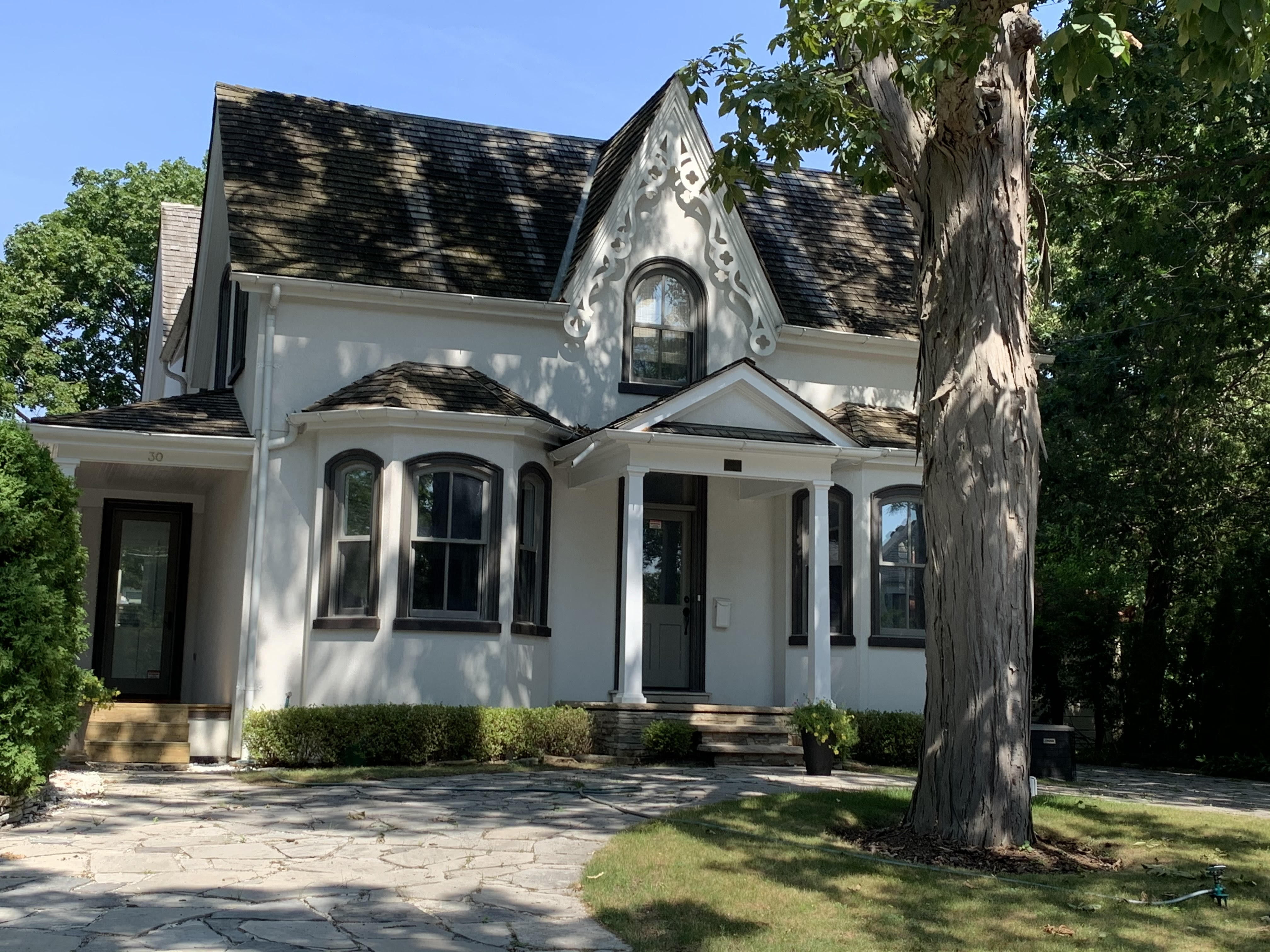
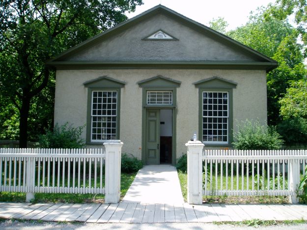
The town of Eglinton has been completely absorbed into Toronto but there’s still a few clues to the community that grew at Yonge and Eglinton. The second school was built in the 1890’s and that has been absorbed into John Fisher School.

Jacob Fisher got a land grant in 1797 at Dufferin and Steeles where mills attracted a small community who built a Presbyterian Church in 1856. That church building survives at Black Creek Pioneer Village but the rest of the community of Fisherville has vanished.

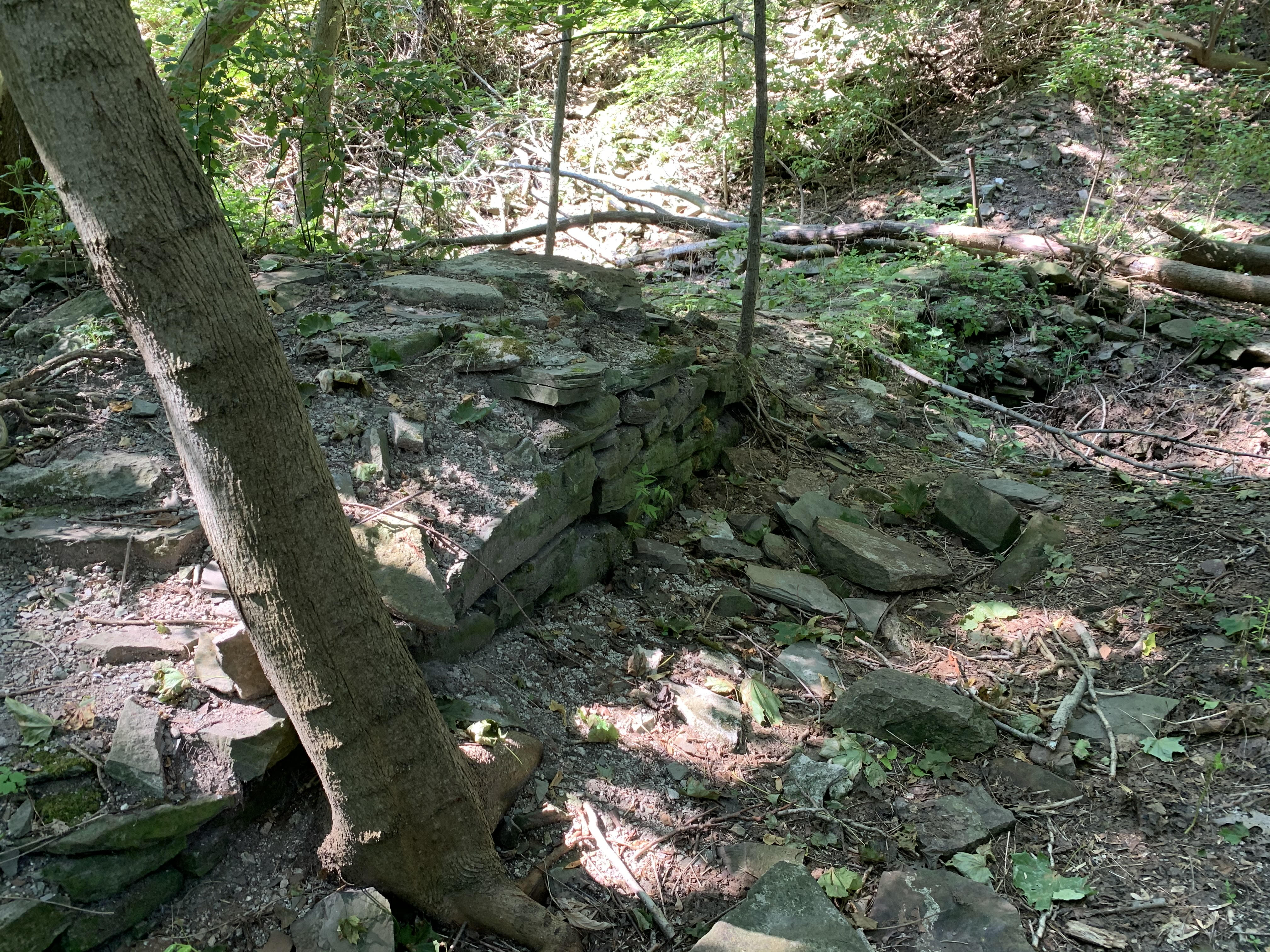
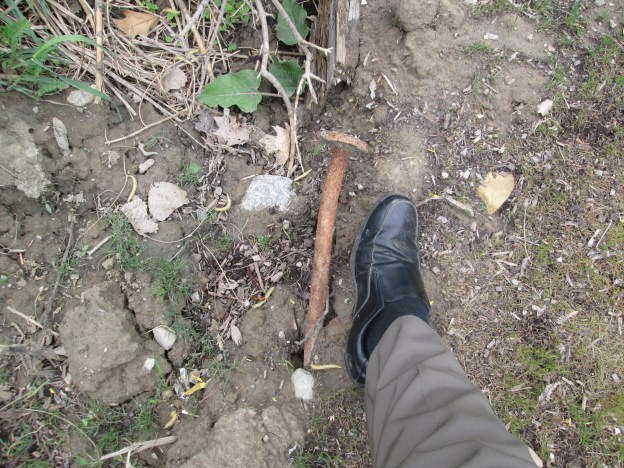
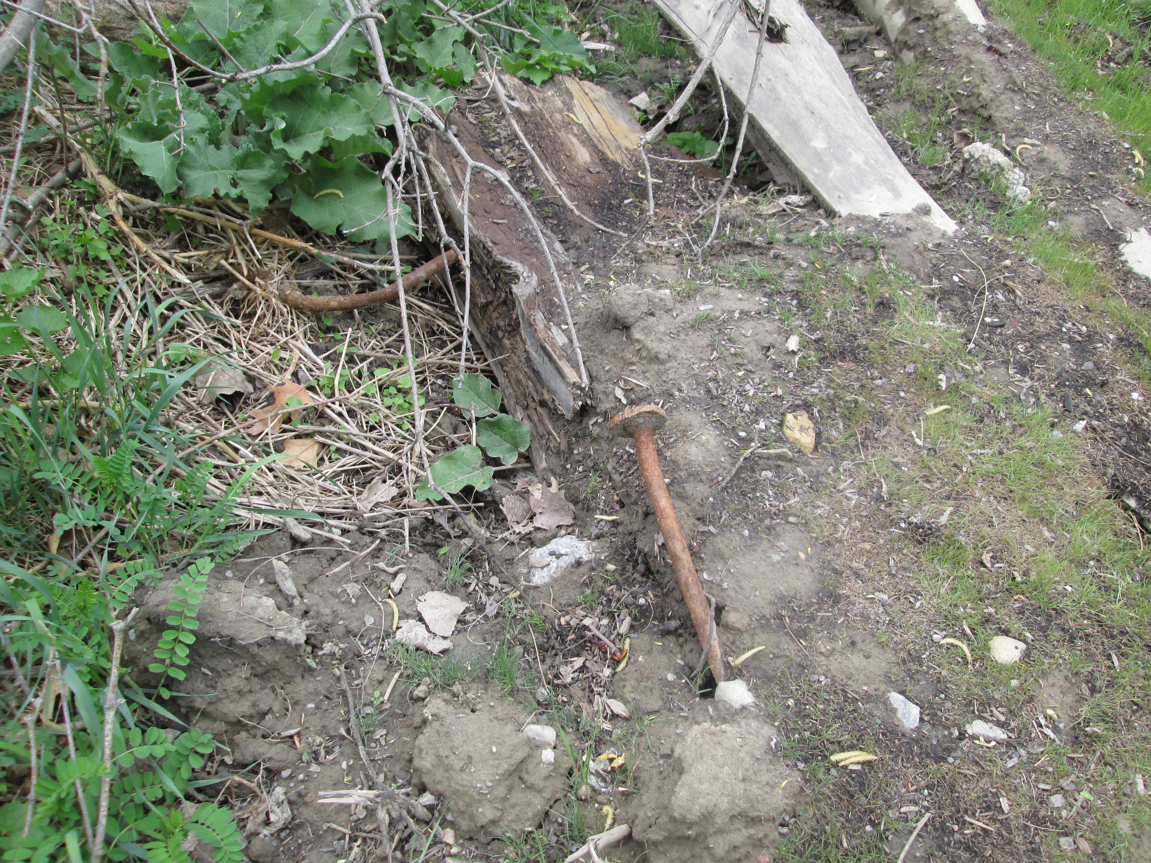
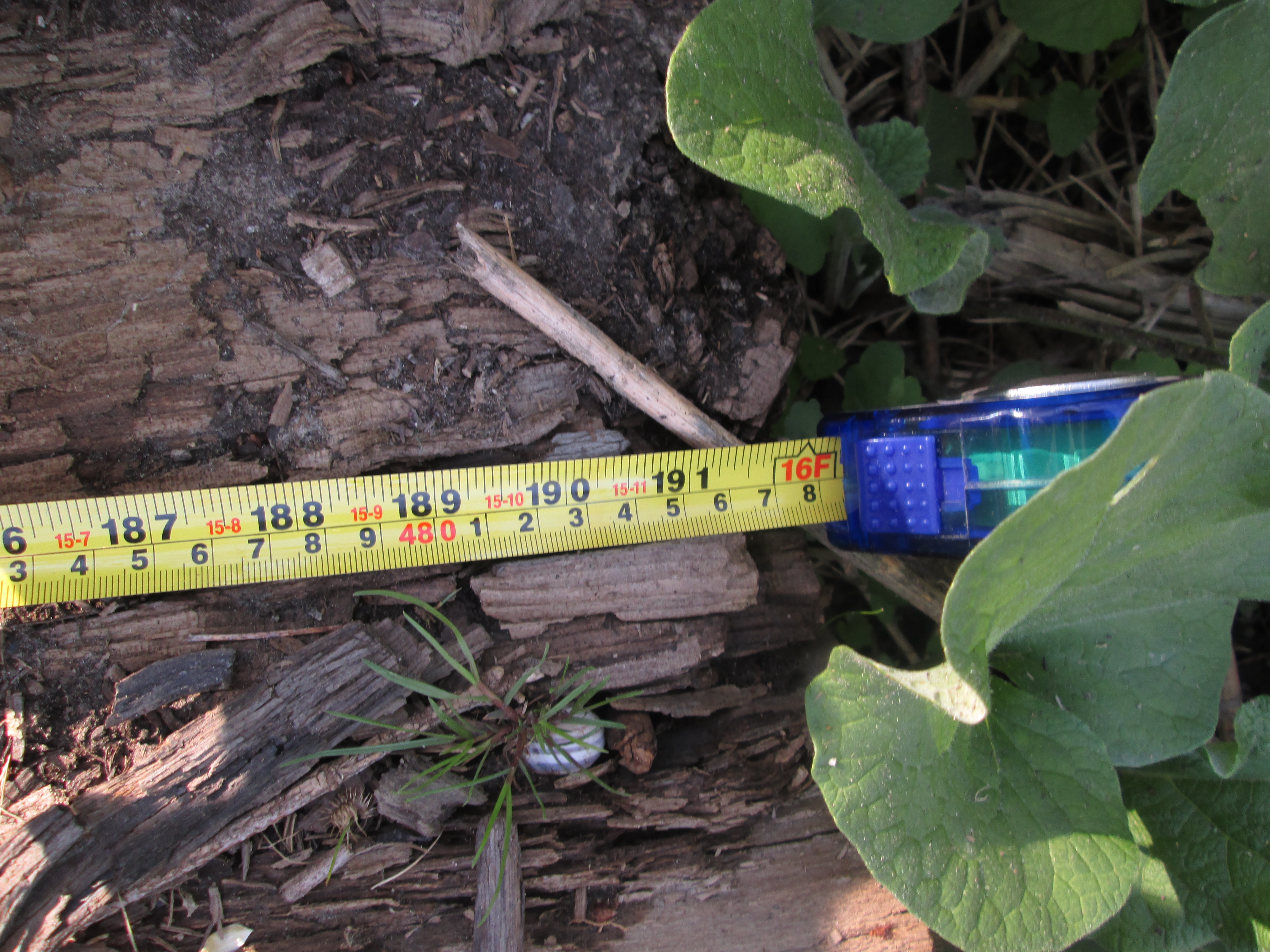
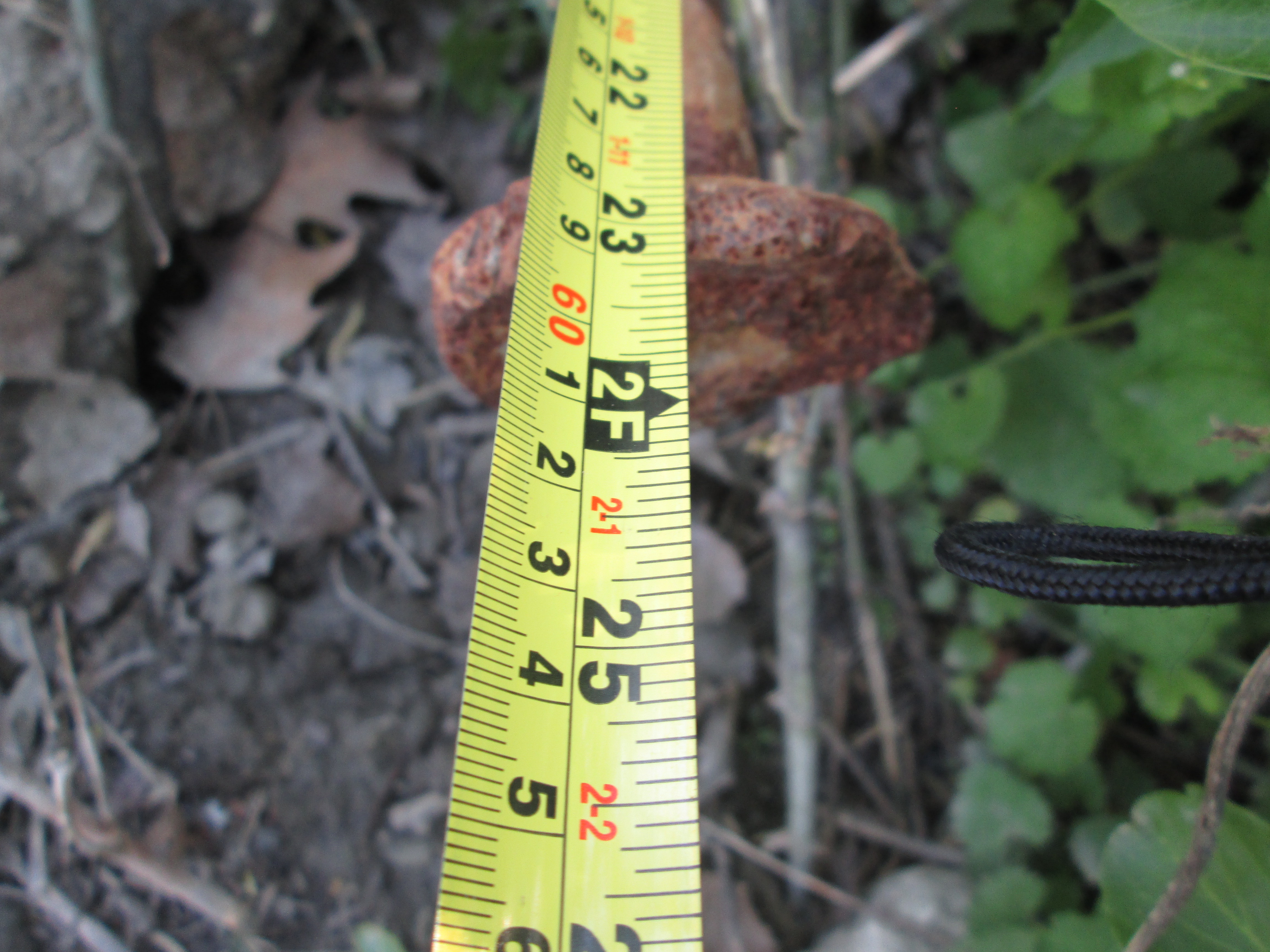
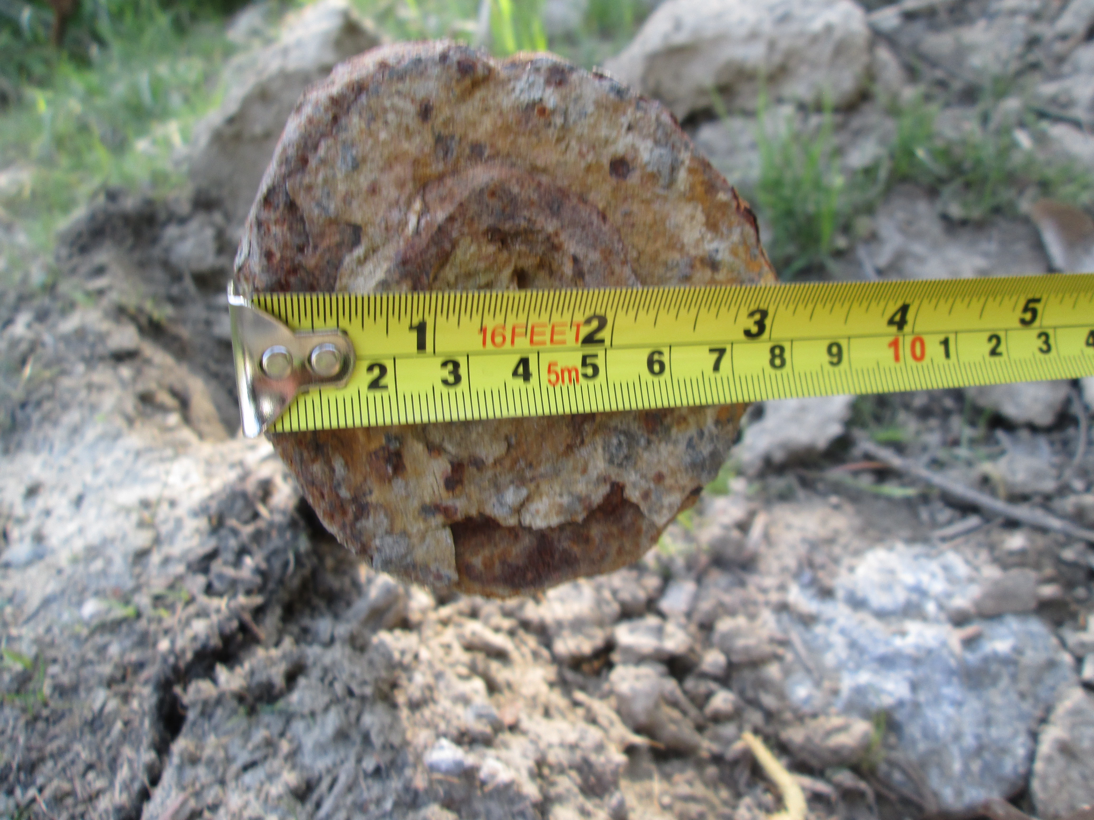
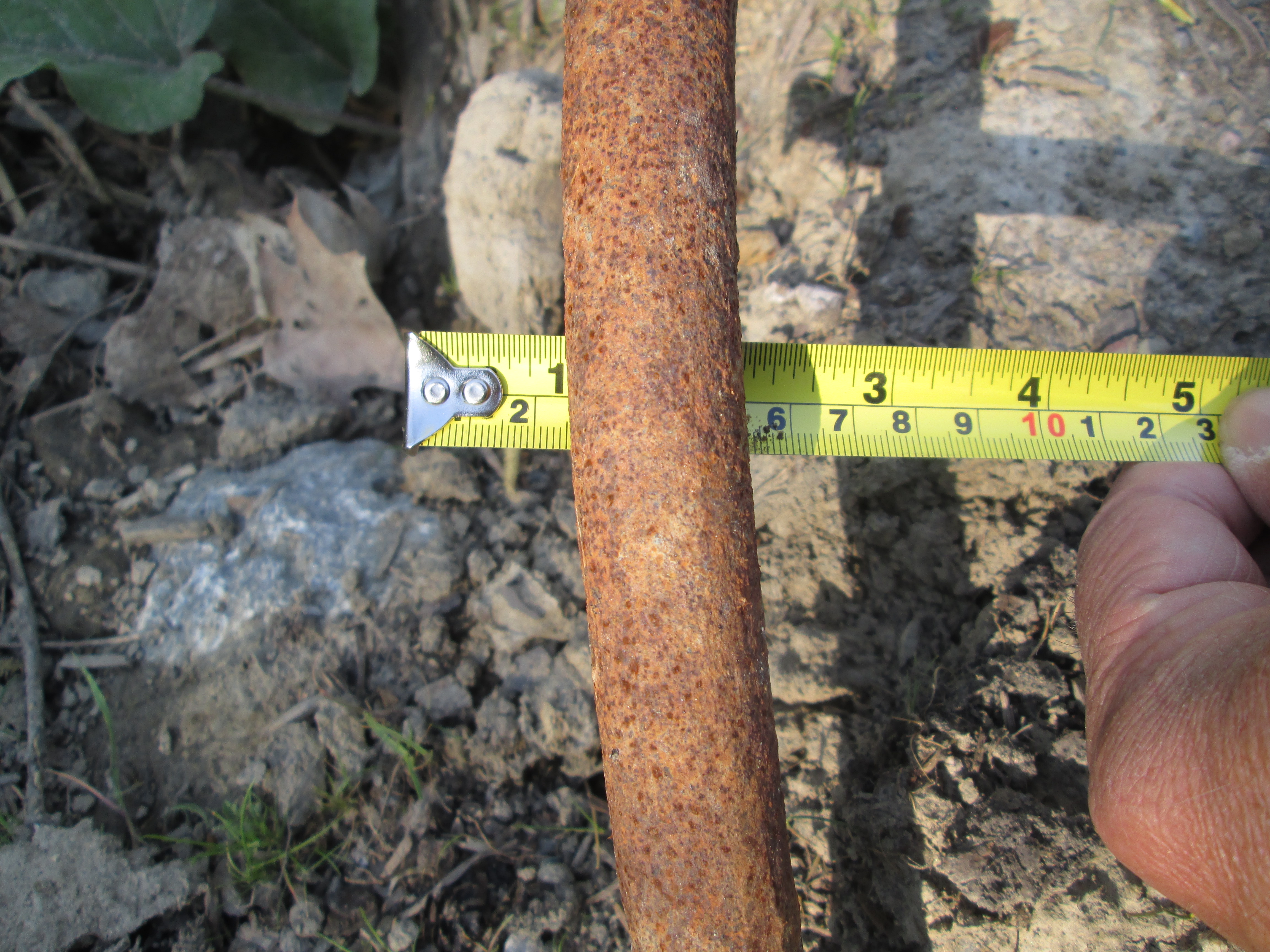
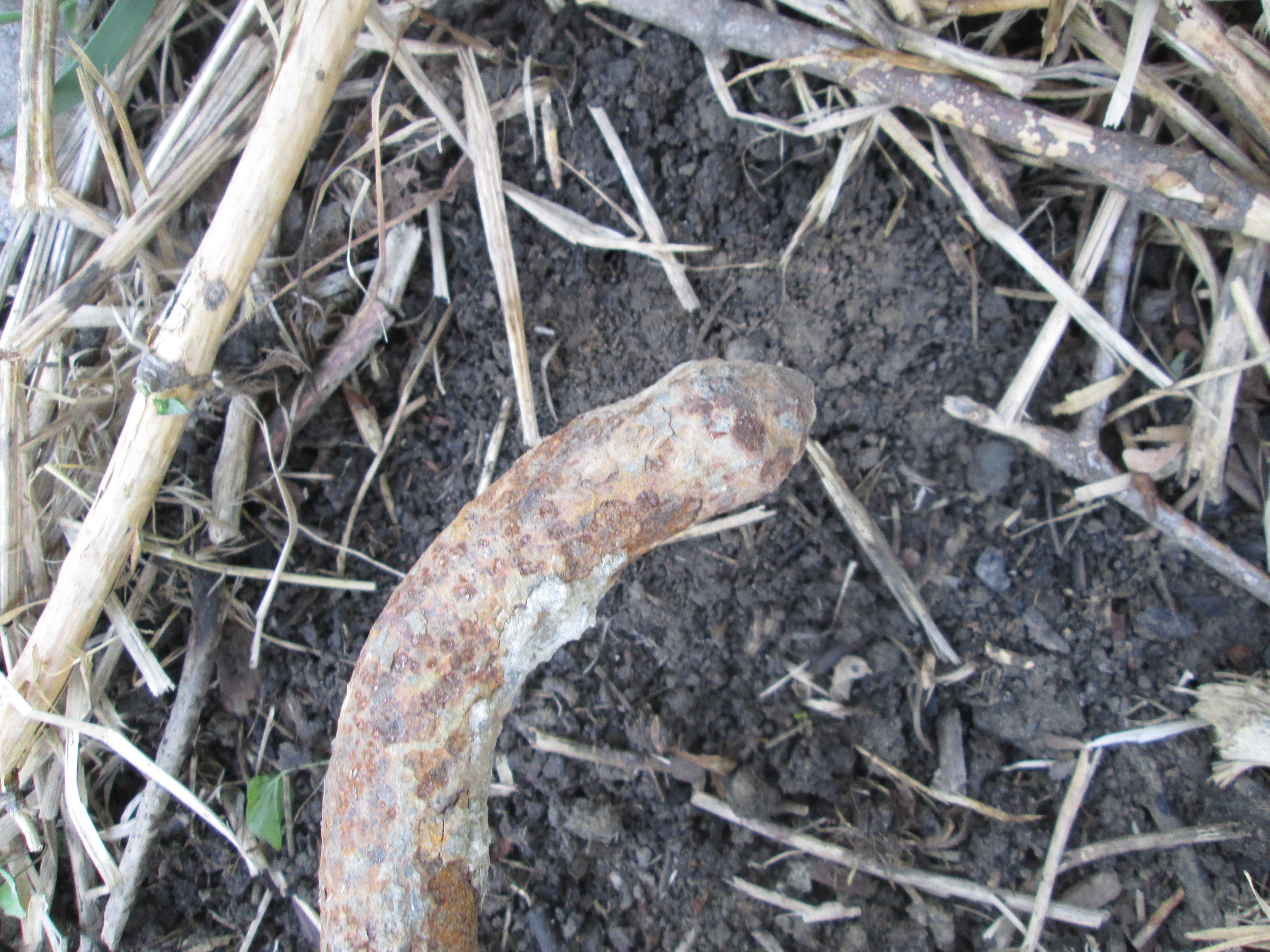
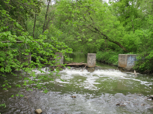
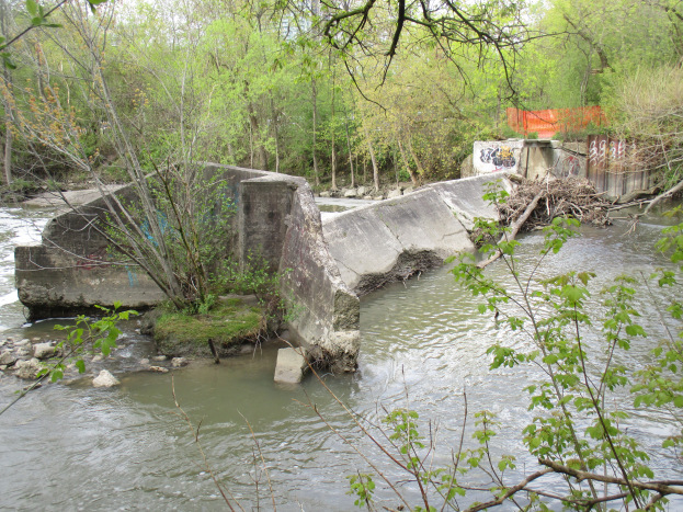
Flynntown is marked by the remains of its milling industries. There are rough hewn logs that are the remainders of an early saw mill and a much later set of concrete weirs that are the remains of the dam across the Don River.

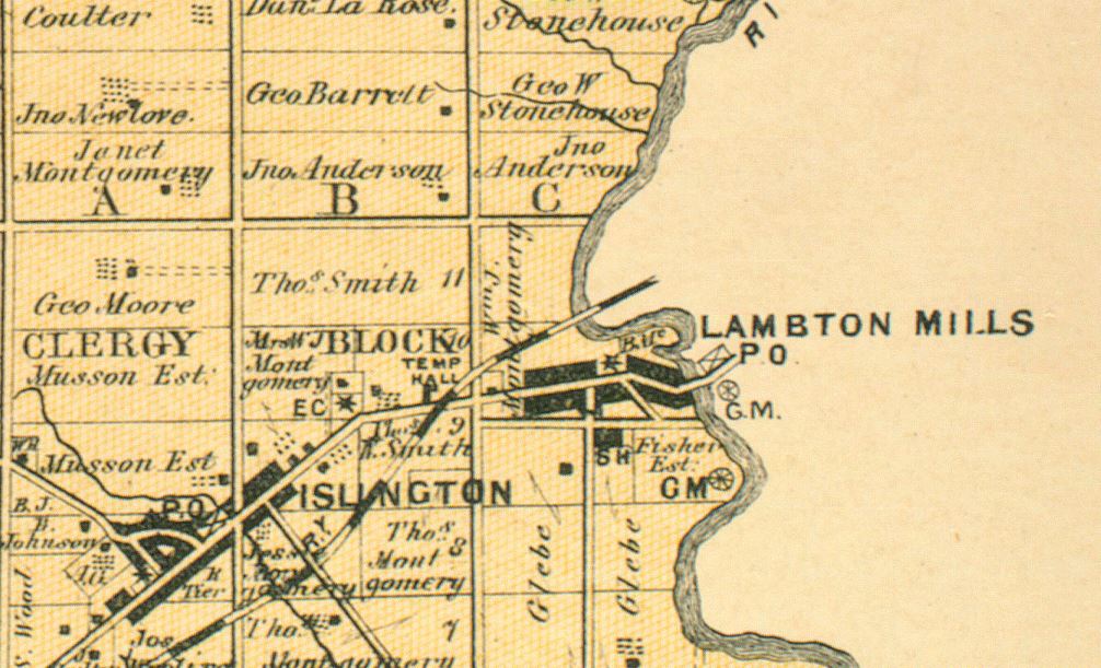
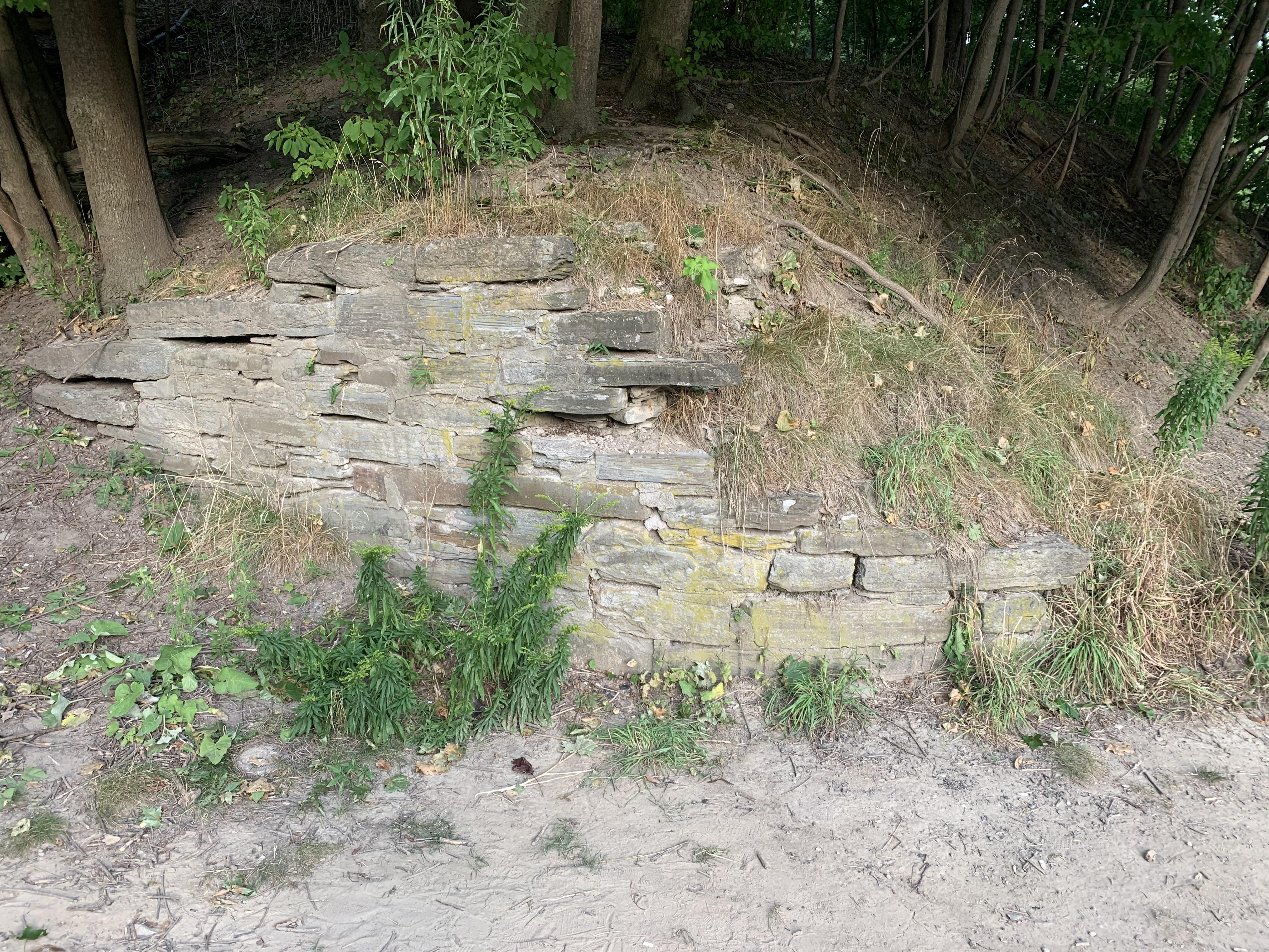
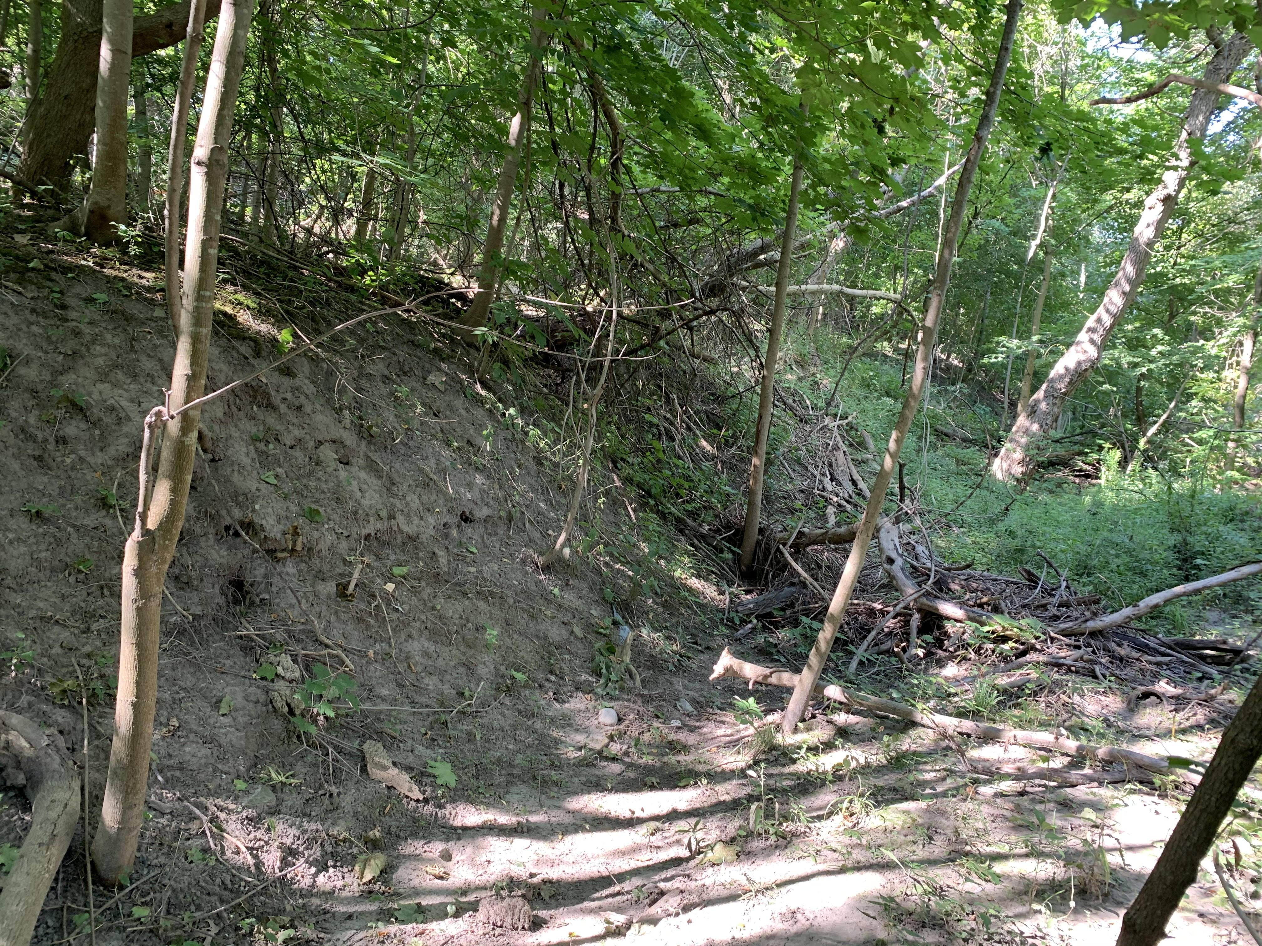
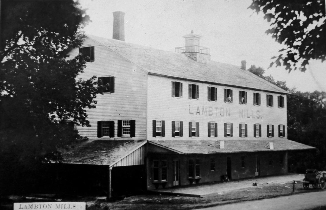
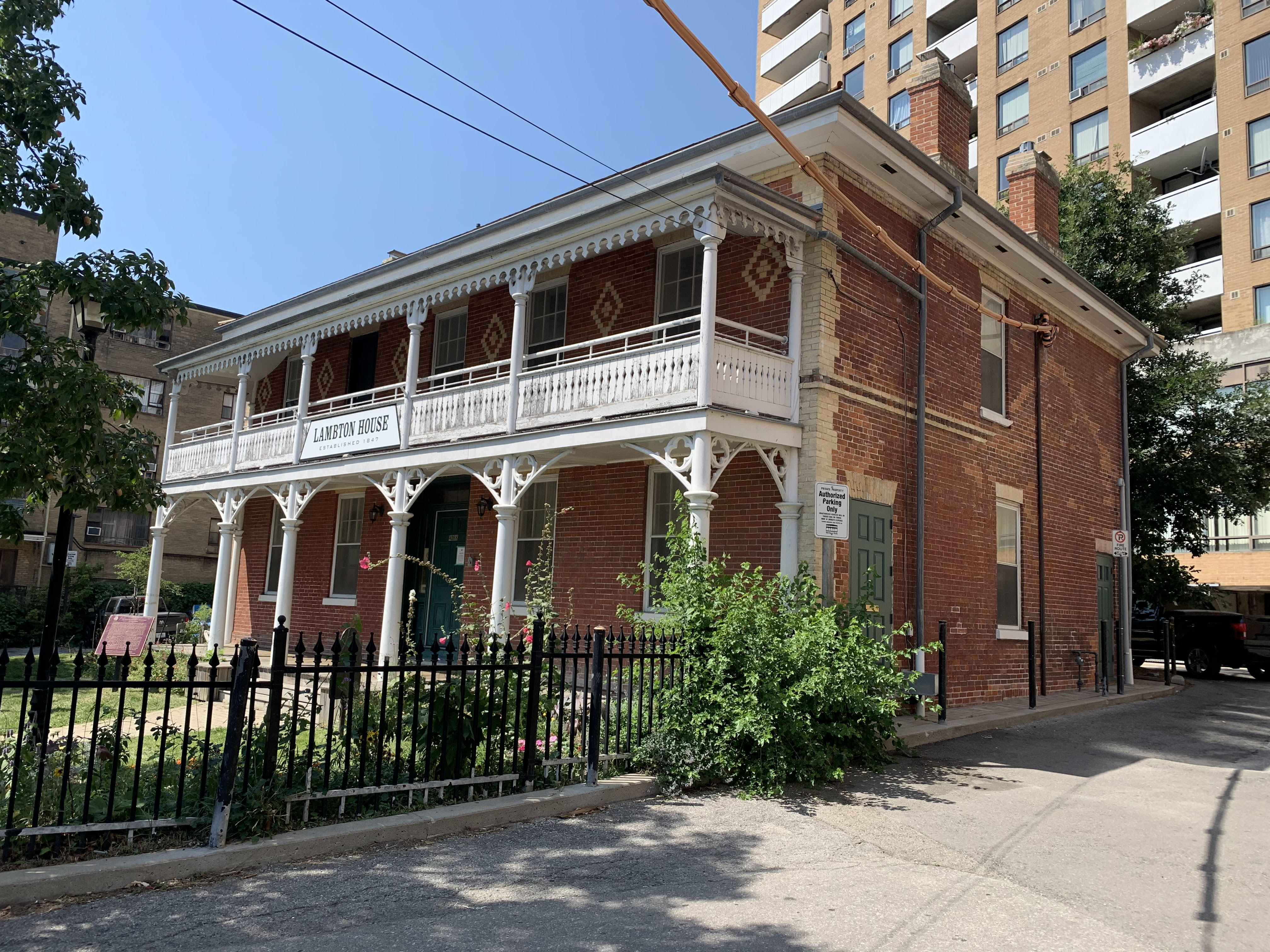
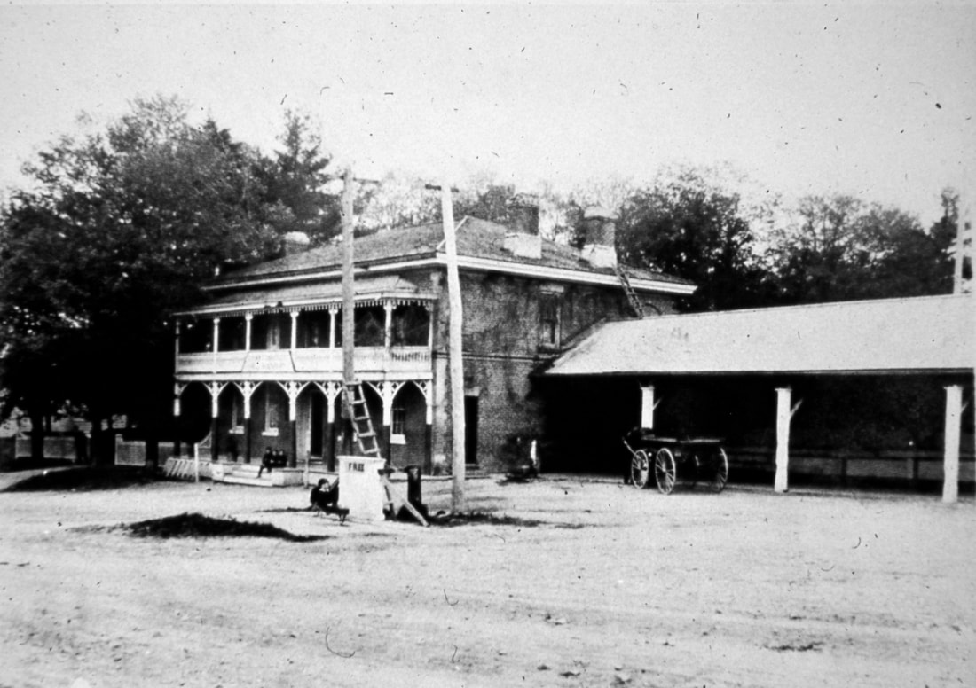
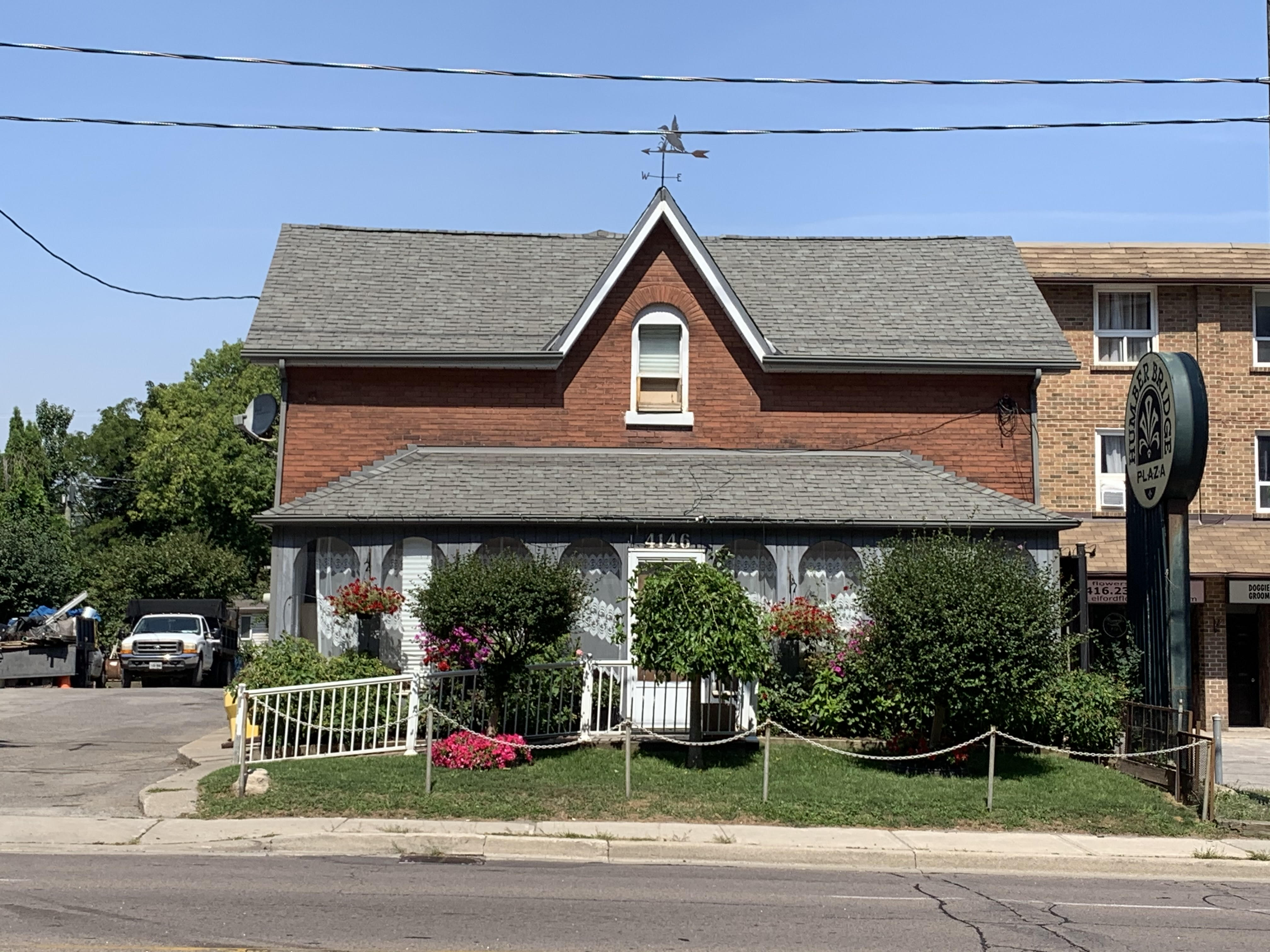
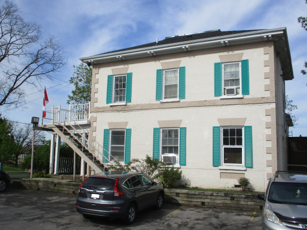
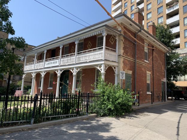
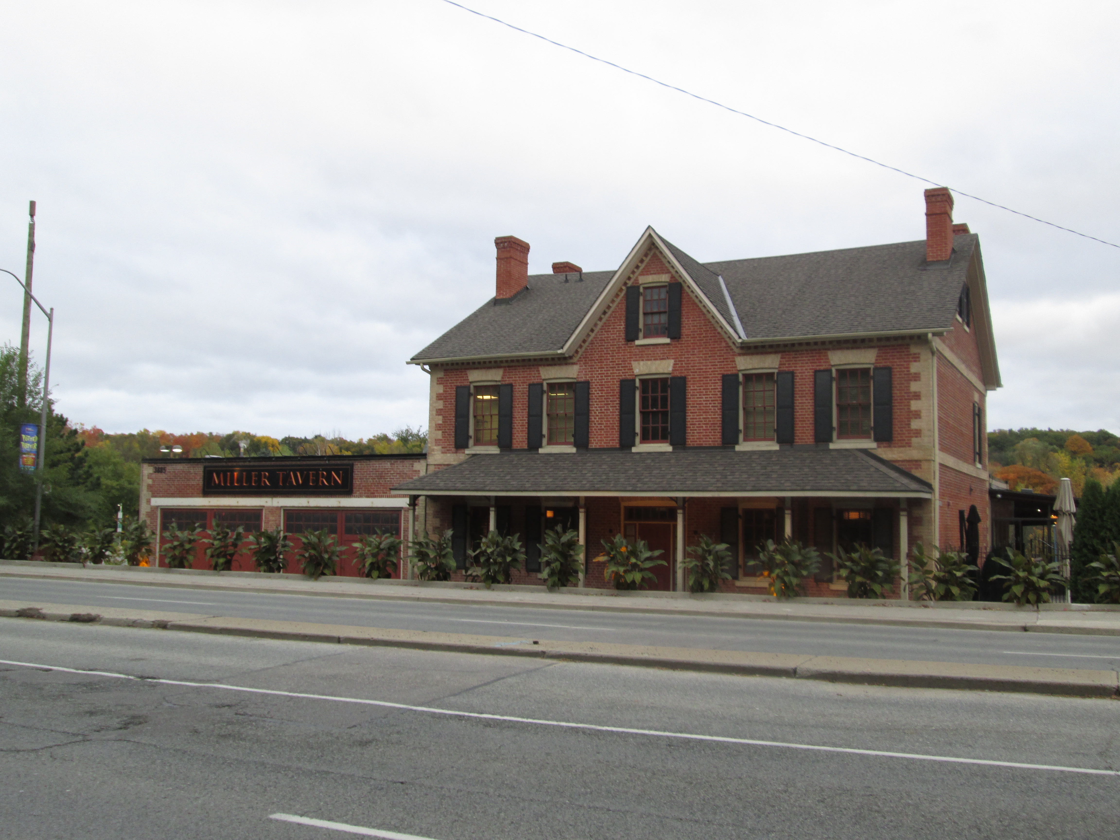
Lambton Mills grew up on both sides of the Humber River and several early homes and the hotel still survive. Lambton House was built in 1848.

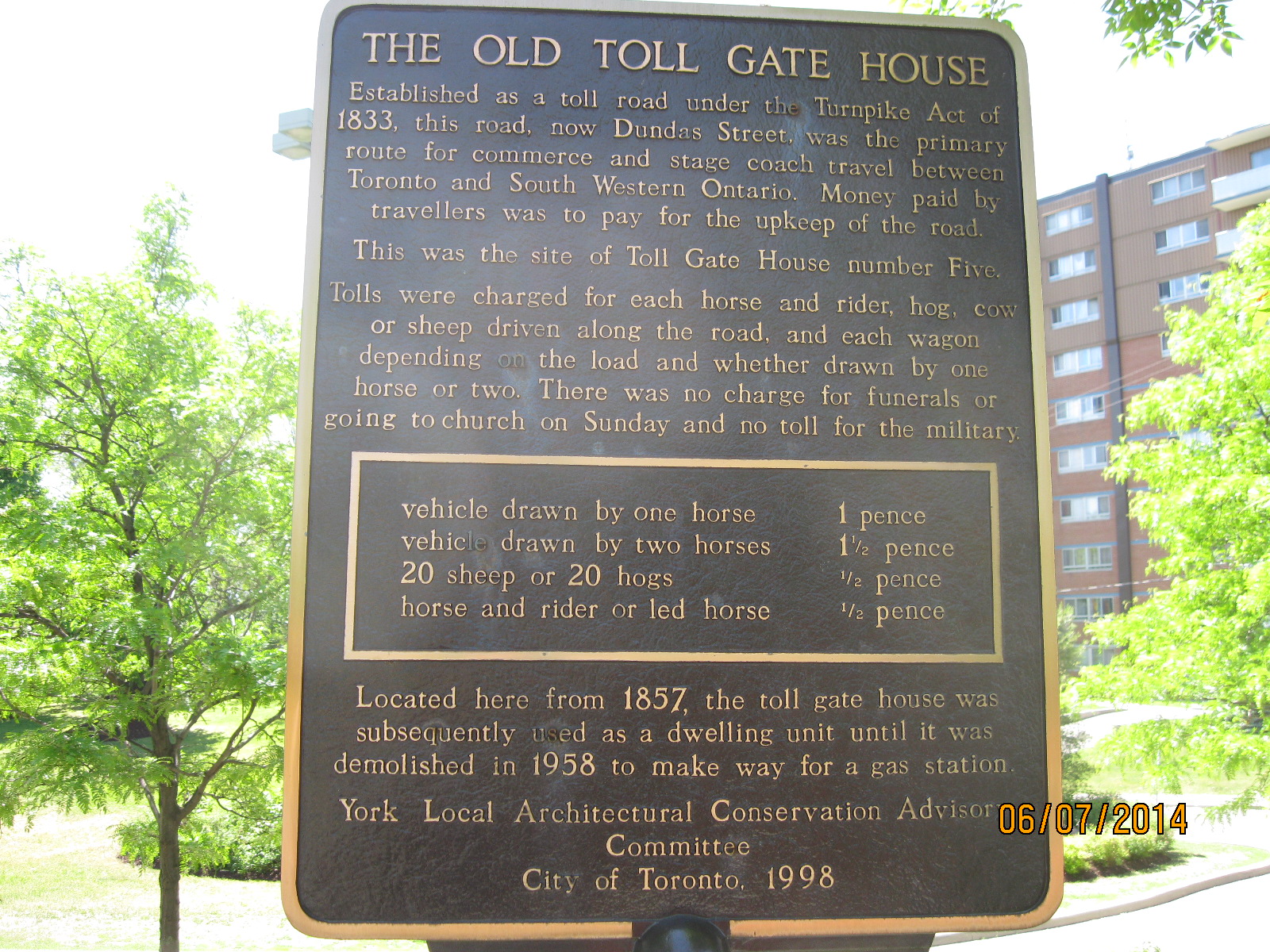
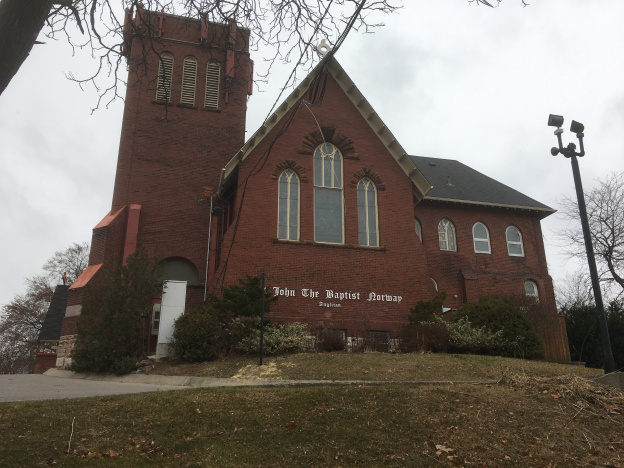
By 1837 the community of Norway had grown to about 80 people centred on the toll station on Kingston Road at Woodbine. A few older buildings still line Kingston Road but the most obvious reminder of the community is the Norway Anglican Church which was built in 1893.

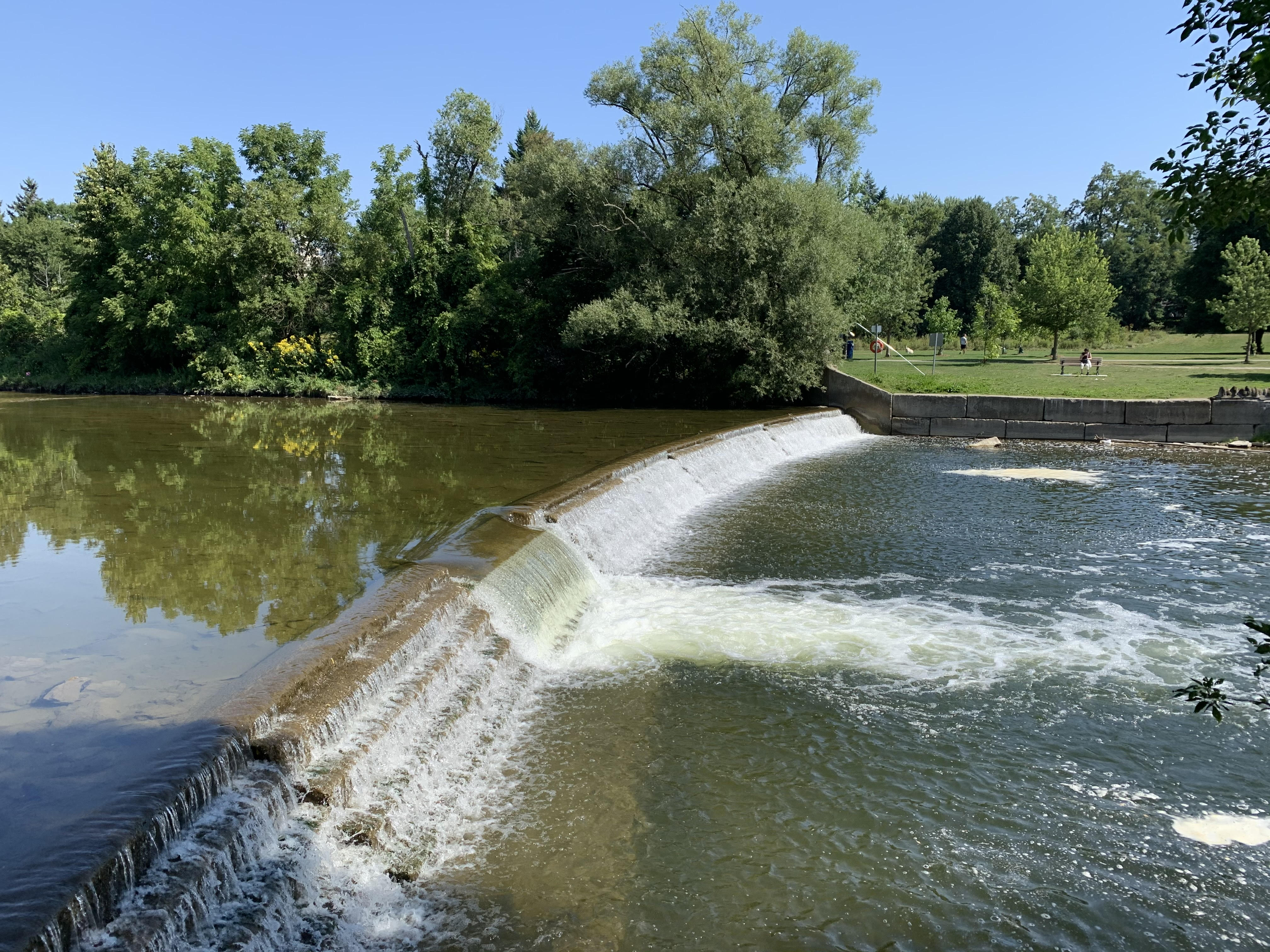
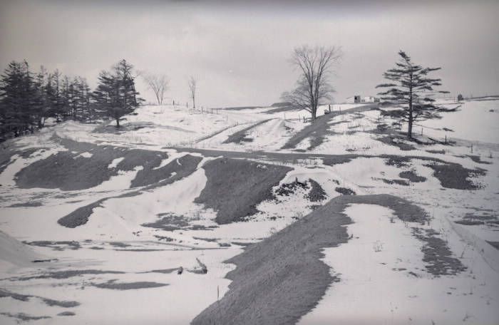
The town of Oriole was a thriving industrial site with seven mills and a brickyard on The Don River at Sheppard and Leslie. Road expansions have eliminated most of the physical history but one of the old dams still survives.

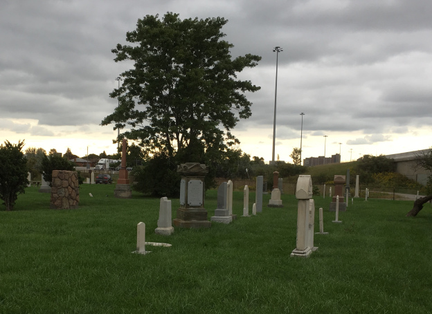
The town of Richview has disappeared under the intersection of highway 401 and 427 and their various on ramps. All that remains is the cemetery which is surrounded by the highways and can only be accessed off of Eglinton Avenue.

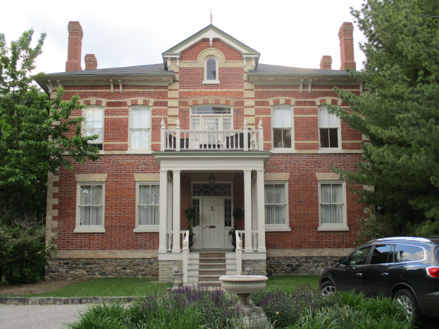
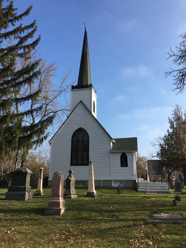
A couple of churches survive to mark the old community of Wexford. St. Judes, pictured below, was built in 1848.

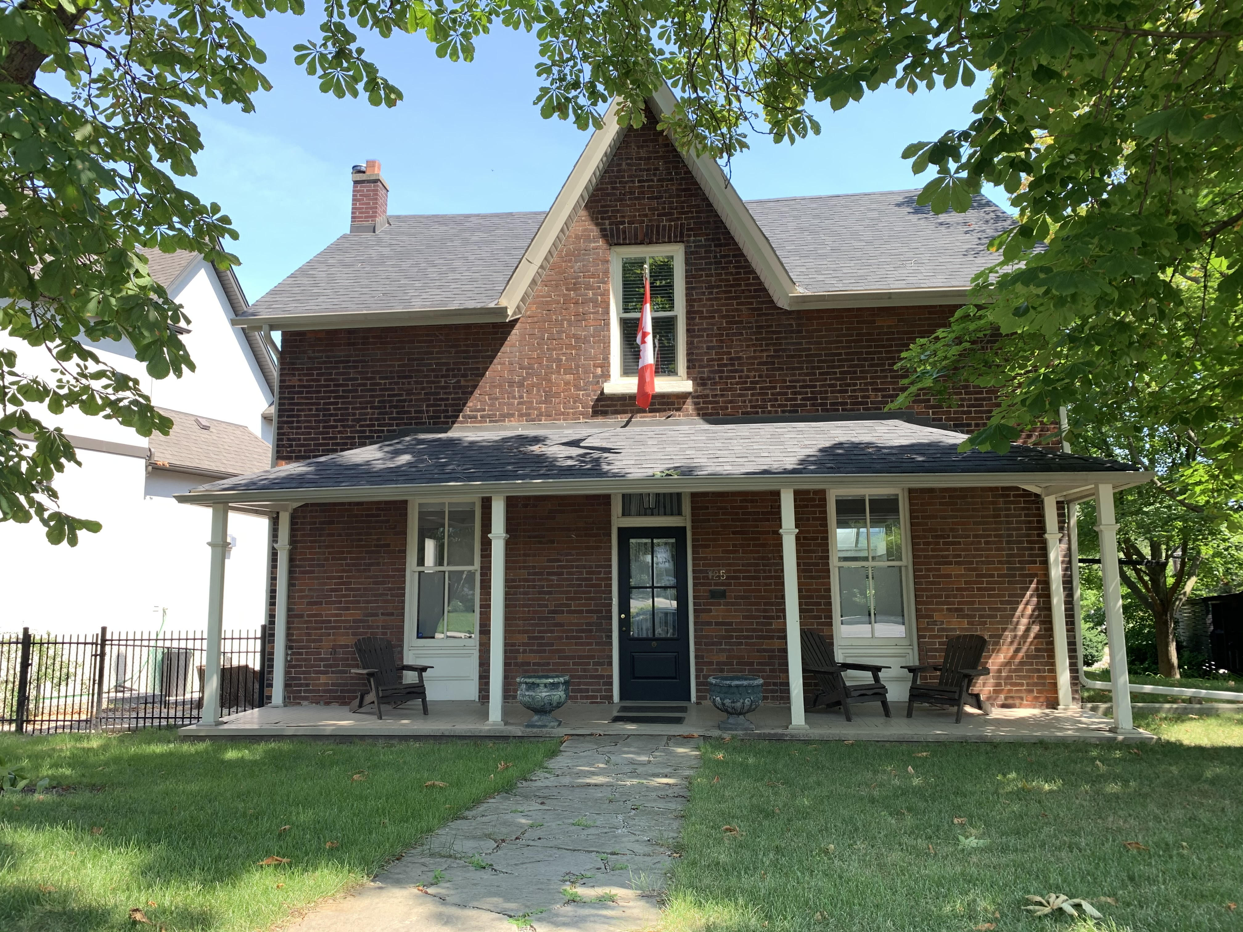
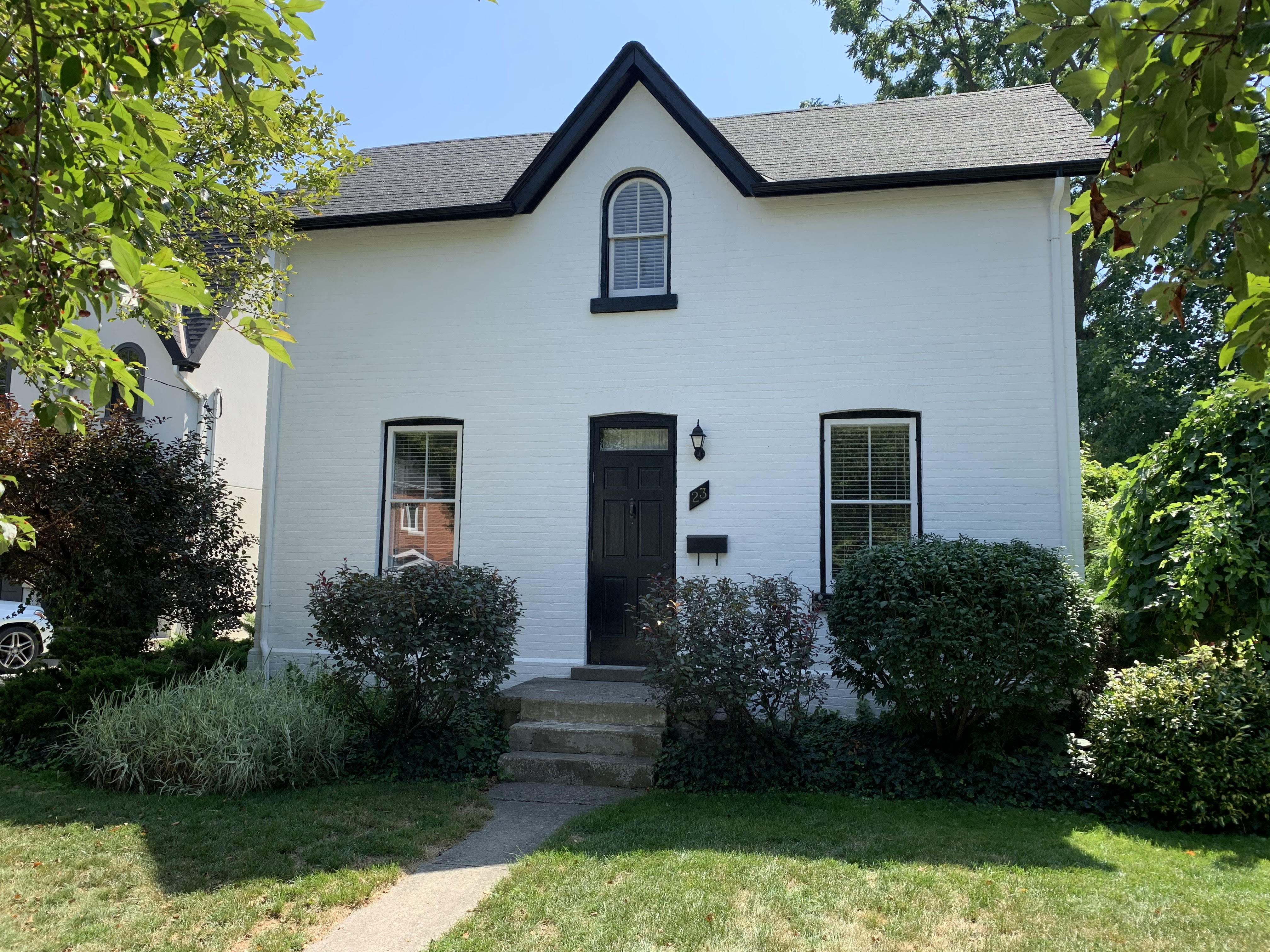
York Mills grew up around several mills on the Don River where it crossed Yonge Street. Several older homes have survived as has the York Mills Hotel which was built in 1857.

Toronto had small communities that sprouted up at nearly every cross roads on the edges of town. The march of progress has wiped most of these places off the map but small hints are there to remind us of these little bits of our past.

Like us at http://www.facebook.com/hikingthegta

Follow us at http://www.hikingthegta.com

Also look for us on Instagram

Lambton Mills – Ghost Towns of the GTA

Saturday, August 22, 2020

Lambton Mills has changed considerably since the days when it was a mill town on the Humber River, half in Toronto and half in Etobicoke.  It isn’t a ghost town in the classic sense because so many people still live there but the ghost of the pioneer community is still evident.  To explore we parked in the small lot on the west side of the Humber River at the end of Old Dundas Street.

Lambton

Dundas Street used to cross the Humber River on an iron bridge set on stone abutments.  When the new high level bridge was built Dundas Street was realigned and Old Dundas Street lost its bridge.  The old stone abutments have have been collapsing and there isn’t much left on the west side of the river.

unnamed (15)

Lambton Mills grew up around several mills and soon became home to blacksmiths, inn keepers and many mill workers.  North of Old Dundas Street you can still find the remains of the earthen berm that was part of the early mill dam in town.

unnamed (20)

The archive photo below shows the large mill that William Pearce Howland built on the south side of Dundas Street.  Howland went on to be one of the Fathers of Confederation and then served as the second Lieutenant Governor of Ontario.

image1123_orig

A short walk south along the river brings you to the remains of an earlier dam.  This helps to mark the site of another mill.

unnamed (19)

Millwood Mills was built by Thomas Fisher on the west side of the river and south of Dundas Street.  It is shown on the historical atlas as G.M. for grist mill on the Fisher Estate.  The two story mill burned down in 1847 and was replaced with a five story building.  After Fisher’s death in 1874 the mill passed to his son who operated it for four more years before passing away himself.  In 1880 the mill was converted to steam and became eventually became a rope manufacturer named Canada Woolen Mills.  After a fire in 1901 it was permanently abandoned and now exists as a set of stone foundations in the trees.

unnamed (21)


Lambton House was operated as a hotel on the Dundas Road beginning in 1848 as a rest stop and watering hole for travelers and horses alike.  It served as a hotel for 140 years until closing in 1988.  The property has changed a lot over the years and high rise apartments now stand all around the hotel and on the former site of the mill.  The building itself has also changed over the years.  Looking above the rear door on the east end of the building you can see where there is a set of lines that form an upside down V below the roof line.  Lines like this can often be seen on older homes where a former porch has been removed.  In the case of Lambton House, the pioneer equivalent of a garage was attached at the back of the hotel.

unnamed (11)

The photo below from the Etobicoke Historical Society shows the hotel as it appeared a century ago.  The rear entrance on the side led directly to the drive shed where the horses sheltered.  It certainly is a more attractive hotel without the apartment buildings in the background.

Lambton House

Thomas Colton owned one of the two blacksmith shops on Dundas on the west side of the river.  It was here that he built his story and a half family home complete with a rounded window in the front gable.

unnamed (14)

The Methodist congregation in Lambton Mills needed a new church building and local architect Meade Creech designed and built one for them in 1877.  The first services being held on March 3, 1878 in the new brick building with Gothic architecture and a large rose petal window above the main entrance.  The congregation joined the United Church in 1925 and soon needed a new building.  The old one was sold and a new retail addition was put on the front and it was turned into a store.  The city of Toronto has over 4,500 properties on their heritage register.  This means that they cannot be altered without city council approval.  There’s another 11,700 properties that are heritage listed which means that although they have been recognized as having heritage value they are basically unprotected.  Developers must give the city 60 days notice of their intention to demolish a listed building.   From the vacant lot that now exists where the church used to be it seems those 60 days have passed already.

unnamed (12)

The house at 30 Government Road was built in 1870 for Harry Phillips who was the postmaster for the town.  This little house has a rounded arch window in the upper gable that is typical of Lambton Mills and a feature of Italinate architecture.  The four leaf clover motif in the bargeboard on the gable is also typical of the era.

unnamed (13)

John Berry took over running Millwood Mills in 1890 and two years later he built his house at 125 Kingsway.  The mill failed and in 1894 he moved to Quebec to run a textile mill there.  He returned to Lambton Mills in 1914 and became treasurer of Etobicoke in 1918.  He served as treasurer for twenty years, walking to Islington every day because he never owned a car.

unnamed (16)

A pair of historic homes stand at 7 and 9 Government Road where mill workers lived during the mid-1800’s.

unnamed (17)

Another historic home stands at 23 Government Road.  This simple one and a half story house has the Lambton Mills vernacular gable window with a rounded arch.

unnamed (18)

Lambton Mills has been totally surrounded with development but there’s still a large number of historic buildings on the west side of the Humber River.  A walk through the area reveals many old gems complete with beautiful gardens.

Also see our feature Old Mill to Lambton Mills as well as the story of Millwood Mills

Google Maps Link: Lambton Mills

Like us at http://www.facebook.com/hikingthegta

Follow us at http://www.hikingthegta.com

Also look for us on Instagram

Gore and Vaughan Plank Road

Jan. 14, 2016 featuring pictures from May 13, 2015.

The early roads in York County were laid out in a grid by the original survey with five 200 acre lots in each box. Augustus Jones surveyed York Township in 1796 and he made Yonge Street (grey) the north-south marker.  Going west (left on the map below) were 1st line west, second line west, etc.  Today we call them Bathurst (purple), Dufferin (red), Keele (white), Jane (black) and so on.  Eglinton was the east-west marker and known as Base Line.  The side roads going north were the 5th, 10th, 15th, 20th and 25th named after the lot number they ran along.  The lot numbers are shown on the map below along side of Jane St.  Today we call these roads Lawrence, York Mills (yellow), Sheppard (green), Finch (blue) and Steeles (orange). This grid of roads connected all the little farming and milling communities in the township and is still imprinted on the city today.  The 1877 county atlas section below has been coloured to illustrate this.

plank road

Settlers were granted 200 acres which came with several conditions. One of the mandatory tasks a pioneer faced was the clearing and maintaining of the road allowance along the edge of their property. They had to clear an area which amounted to 1 acre of land for public road allowance. They were also responsible to spend a certain amount of time working on road maintenance each year. This would include pulling stumps and filling in holes and swampy areas. The settlers had a full day’s work on the homestead and often the road repair was overlooked and people would be fined for not complying. The system led to some very messy roads where people got stuck 3 seasons of the year and bounced over ruts the other one.

The solution was to cover some of the roads in cut boards or planks. The Gore and Vaughan Plank Road Company was established in 1855 to build a plank road along Dufferin Street. The road was to be built of local wood and various saw mills were engaged along the route to cut and prepare the planks. The picture below shows one exposed end of the plank road along with one of the steel spikes that held it together.  The same spike is shown in relation to my shoe in the cover photo.

IMG_4328

Where Dufferin street, shown in red on the map above, crossed the ravine for Dufferin Creek the descent was very steep.  The solution for the pioneers was to run the road on a curve down the side of the ravine.  This shows on the map just below the blue line of Finch Ave.  The planks for the Gore and Vaughan Plank road were sixteen inches wide by 8 inches thick and sixteen feet long.  The picture below shows the length of one of the boards.

IMG_4341

For durability the planks were laid up and nailed through to create a roadbed that was sixteen inches thick.  Planks were held together with four foot long spikes that were driven in two feet apart in opposing directions.  The picture below shows the head of the spike on the left and the point of the spike on the right.  The tape measure is laying on the seam between two planks.

IMG_4355

In this spot there is almost 2 feet of spike sticking out of the plank where the exposed boards have rotted away.

IMG_4357

The spikes used in the plank road construction have a 3 inch diameter head on them and were over 4 feet in length.

IMG_4338

The body of the spike is 1 inch in diameter.

IMG_4340

The picture below shows the business end of the spike.

IMG_4349

The plank road was expensive to maintain as new wood was continually replacing worn and rotten boards.  The solution was to assess a toll for the use of the road.  Toll stations were set up at various places along the plank road.  On the map above there are two.  One is at Finch (yellow) and the other at Sheppard (green).  They are marked on the map and underlined in blue.  Yonge Street was also planked with a toll station at Hoggs Hollow.  The picture below was taken on Dundas Street near Lambton Mills and shows a representative toll charged for using a maintained road.

IMG_2133

Times changed and crushed gravel and asphalt replaced plank roads.  Dufferin was paved and where it crossed Dufferin Creek on a long curve it was straightened out.  The curved section in the ravine was left to rot or to be buried by flooding.  When the trunk sewer along Dufferin Creek required repair work in 2014 a portion of the plank road was exposed again. Hiking the GTA found these remains and gave a brief description in Dufferin Creek in May 2015. This post allows for  greater detail and more pictures to be presented of this 160 year old part of our transportation heritage.  The archive photo below from 1954 shows the old roadbed as seen from the modern Dufferin Street.

Dufferin 1

Google maps link:

https://www.google.ca/maps/@43.7658222,-79.4749897,14z

Like us at http://www.facebook.com/hikingthegta