A recent trip to Eastern Ontario gave me the opportunity to visit Prescott to find some lunch and take a break from driving for a hour or so. I used my time to wander along the Heritage River Trail and see some of the local history of the waterfront. Prescott was named after General Robert Prescott who was the Governor of Canada from 1796 to 1799. Col. Edward Jessup had received a large land grant for his loyalty and service during the American Revolutionary War and in 1810 laid out the streets for a new town on the side of the St. Lawrence River. Within a decade the town had grown to about 50 houses and had several businesses including stores and taverns.
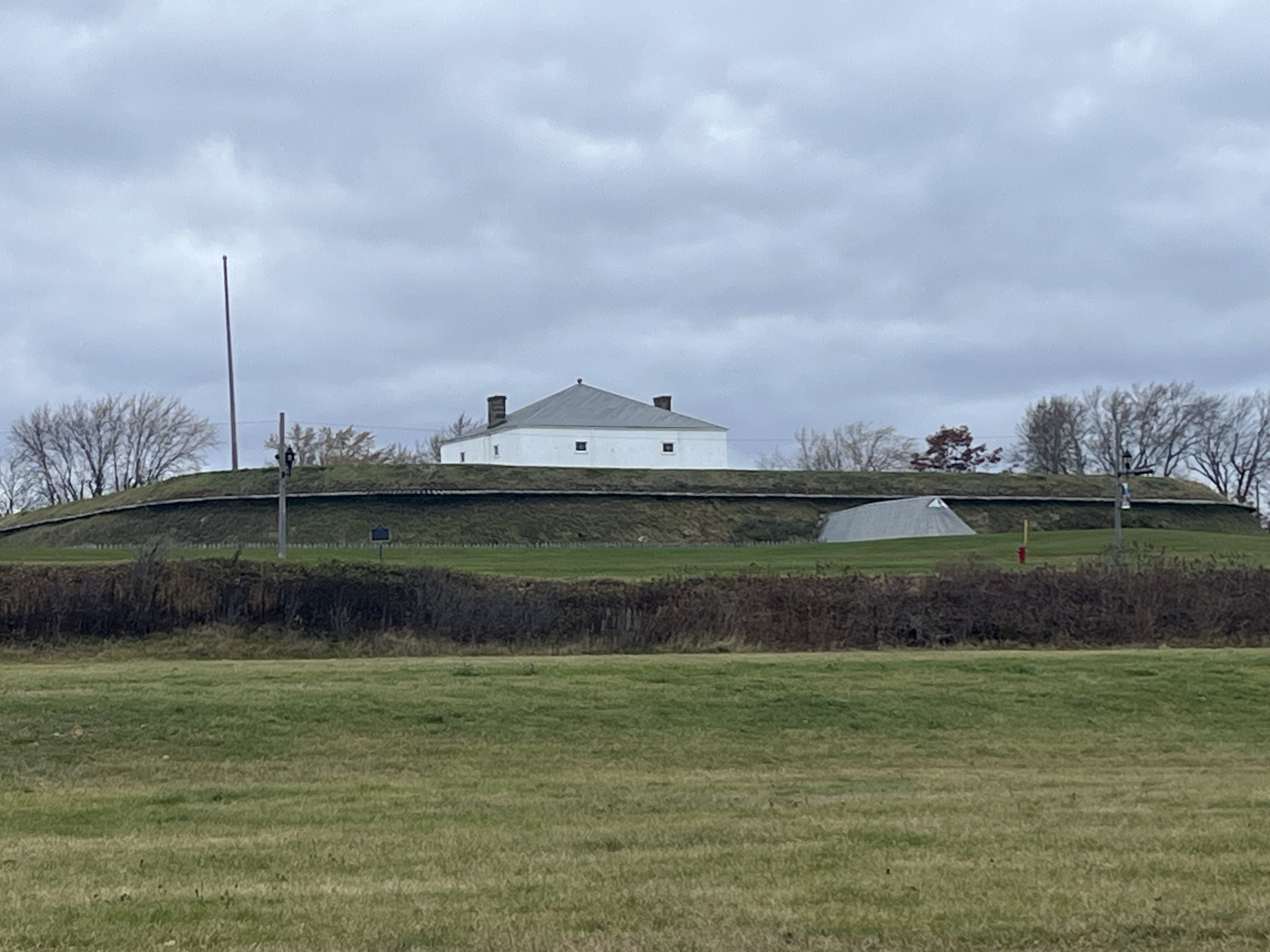
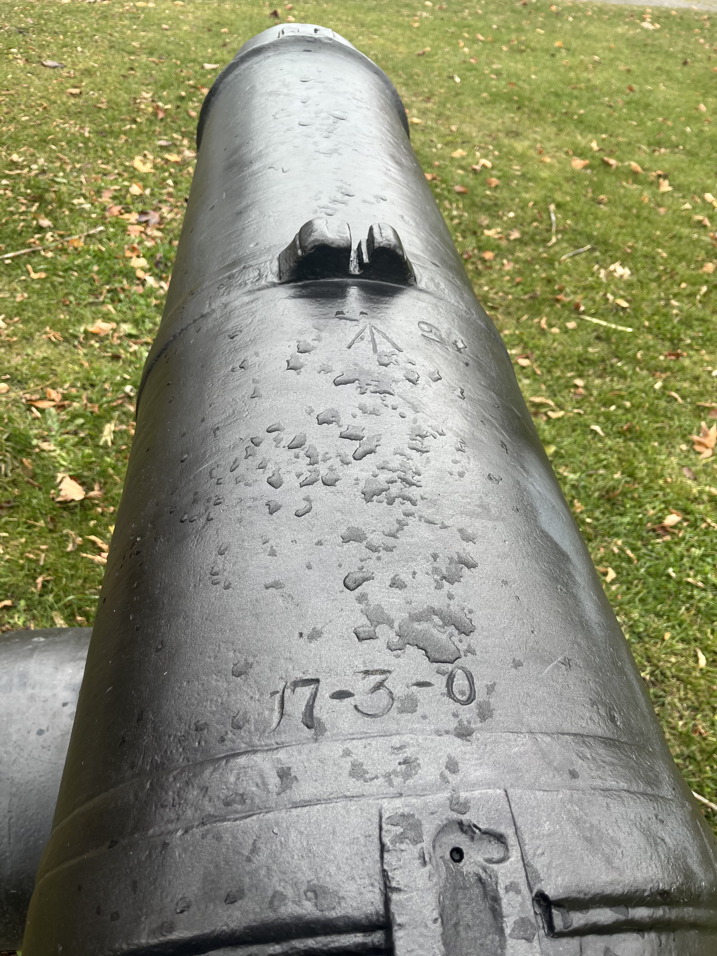
Just two years later the War of 1812 broke out and part of the town was reclaimed by the Government to build Fort Wellington. It was commissioned in 1813 to guard the Galop Rapids in the St. Lawrence. Following the war it was abandoned by the British but officially remained the property of the British Board of Ordinance. It was used by the Canadian Militia until 1923 when it was handed over to the Dominion Parks Commission, which was later renamed Parks Canada. It has been a National Historic Site since 1920. This fort will be an interesting place to explore on a future visit to the area.
The population of Prescott had grown to about 1700 by 1834 and it became the site of the Battle of the Windmill during the Rebellion of 1837.
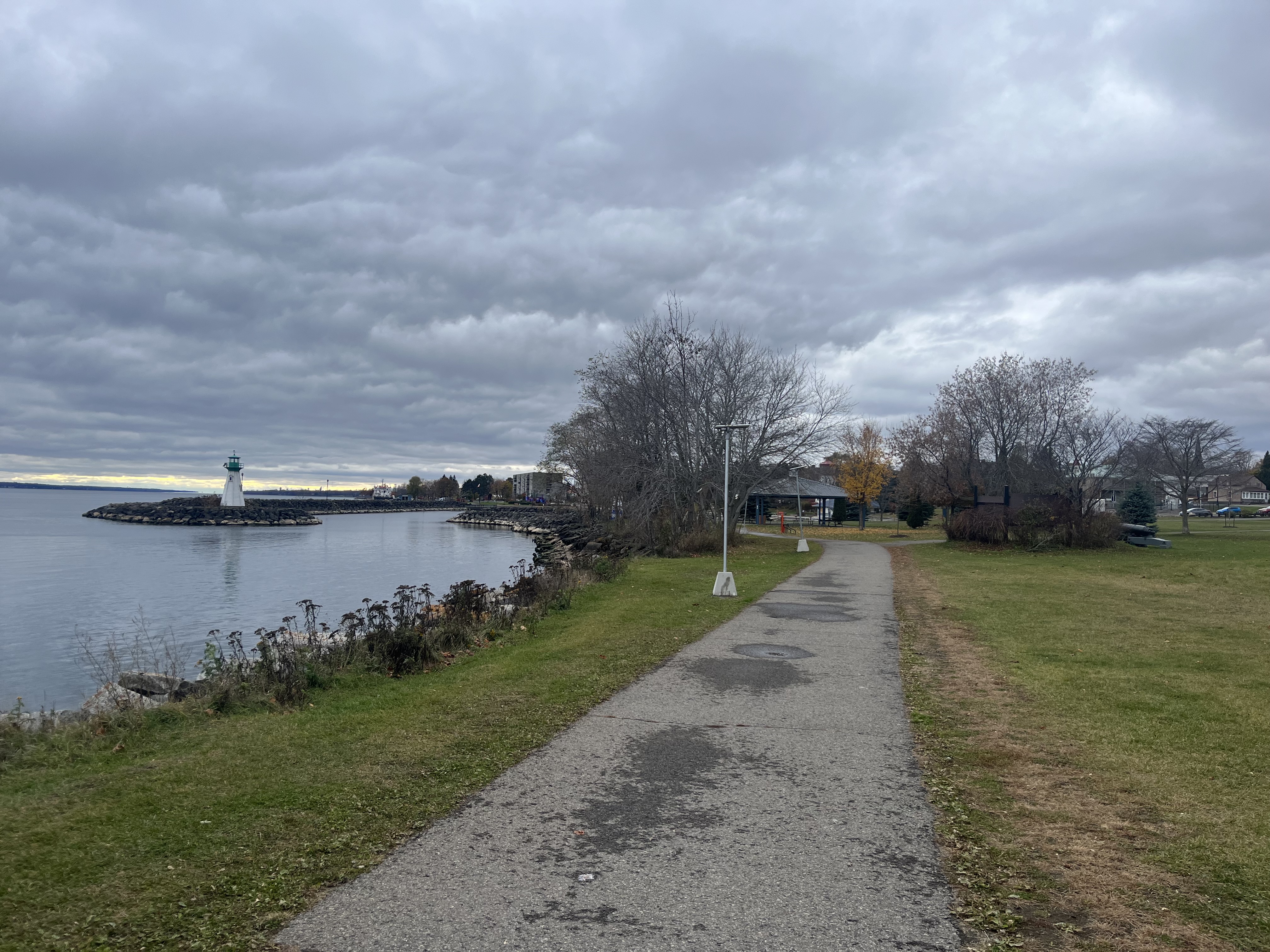
A railway was established from Prescott to Ottawa in 1854 and soon the waterfront was a hub of railway activity. A roundhouse, railway station and ferry terminal were added soon afterwards. The town became the centre of a major ferry link to the United States. The Canadian Pacific Railway continued operations at Prescott until the 1970s when things were shut down. The piers from the railway terminal are still located in the water and can be seen below and in the cover photo,
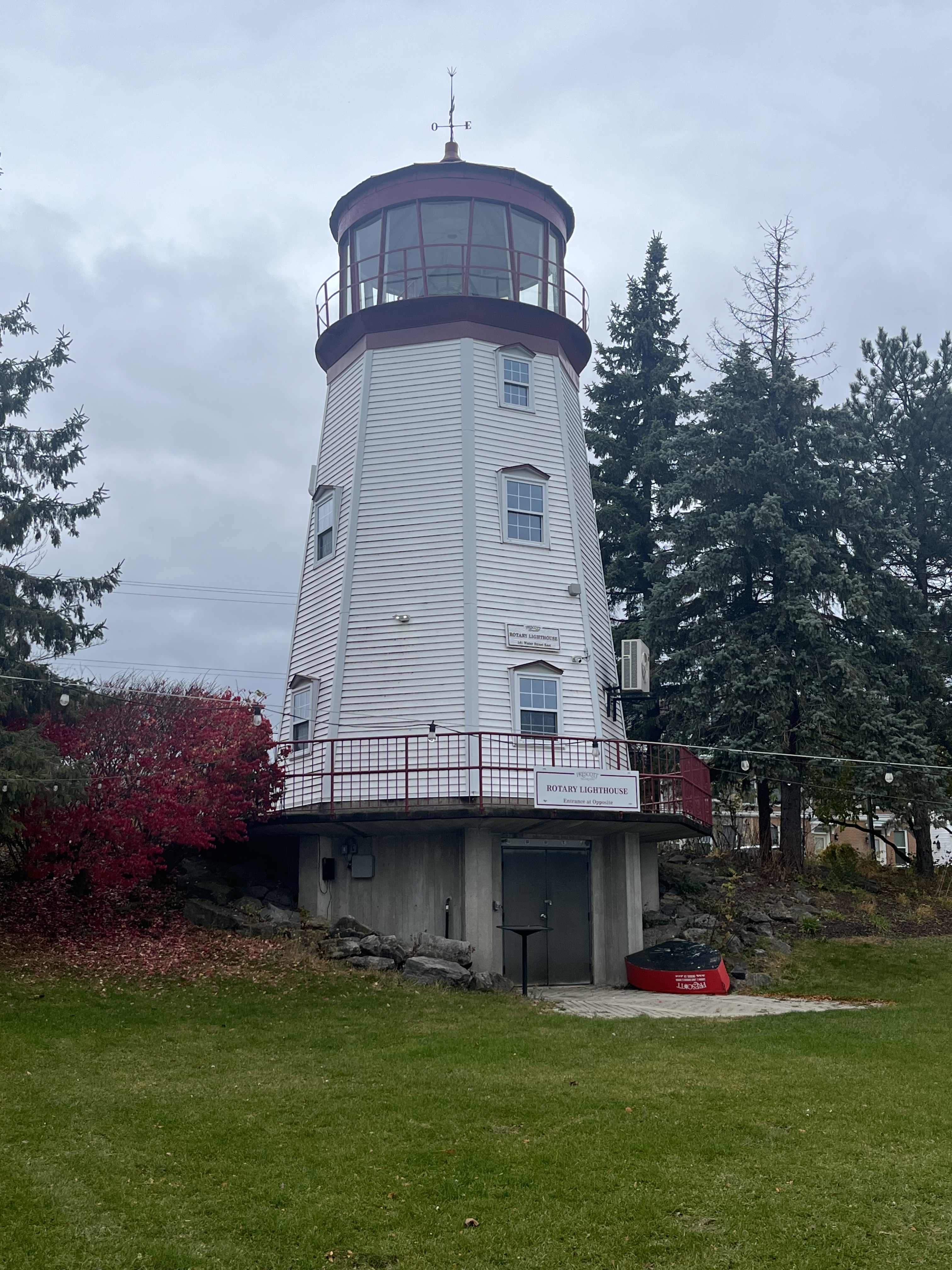
A building made of red bricks was built in 1900 by the Imperial Starch Company and it served as a lighthouse. Between 1903 and 1985 it was known as The Dominion Lighthouse Company. The building was used for the production of war materials during the Second World War and then occupied by the Coast Guard from 1962 until 1985. After the Coast Guard moved out, the building was demolished in 1986. The large lantern room housed a Fresnel Lens and the room and lens were saved from demolition. A Fresnel Lens is compact compared to a conventional lens and reduces the amount of materials used by having a series of concentric surfaces. The lens had been used to train lighthouse keepers and it was installed on top of a new tower that the Rotary Club built in 1989.
The Great Lakes Waterfront Trail runs along the St. Lawrence River as part of its 3600 kilometer span but the section through Prescott is also known as the Heritage River Trail due to all the history that is located along the route through town.
Prescott has many historic building as well as Fort Wellington and I look forward to checking out more of them during a future work trip to the area.
Grain elevators are used to store grain between when it is harvested and when it is sent to the point of use. They have been around in North America since 1842 when they were developed to store grain being transported via the Erie Canal. Some elevators are very large and communal in their function while some are also used for milling or personal applications on farms. In this post we share pictures we have taken of some of them in Ontario and Manitoba.
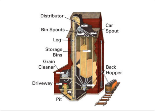
Elevators were made with a sturdy wooden crib built of 2 by 8 boards that then had 2 by 6 inch ones stacked up to form the walls and internal bins. The outside would be covered with a wooden veneer which was originally painted red if along a CPR line. Wheat can weigh up to 60 pounds per bushel which means that a 25,000 bushel elevator could have 1.5 million pounds (680,000 kgs) of weight in it. This puts a lot of lateral pressure on the walls. Eventually, elevators that would hold 60,000 bushels were constructed. All elevators, regardless of size, had three basic elements. The elevator, the driveway and the office/engine room. A truck or wagon of grain would be driven onto a scale and weighed and the grain sampled to see what quality it was. It would then be dumped through the floor into the pit where it would be taken up the leg and poured into the correct storage bin. The empty truck would then be weighed again and the amount of grain deposited would be calculated from the weight difference. When it was time to load a train the appropriate grain would be pumped into the back hopper and then down a spout into the waiting boxcar. The illustration below was taken from The Canadian Encyclopedia and shows the inner workings of a grain elevator.
The first grain elevator on the Canadian prairies was developed in Niverville, Manitoba in 1879 and was basically a grain silo. The more traditional shape started to appear in 1881 in the form of 25,000 bushel elevators. The CPR began to offer free land along their rail lines to allow the construction of standard size elevators. While on a recent business trip to Manitoba I was able to photograph the two grain elevators that appear next in this article.
The United Grain Growers had built a grain elevator in Elie, Manitoba in 1928 which has since been demolished. A larger grain elevator was built just west of town in 1986 with a capacity of 3,750 tons. In 1998 the Manitoba Pool and Alberta Pool merged creating Agricore. The elevator was then closed in 2002 but has since been bought by some local farmers who continue to use it. Unlike the majority of elevators, this one has no direct rail access.
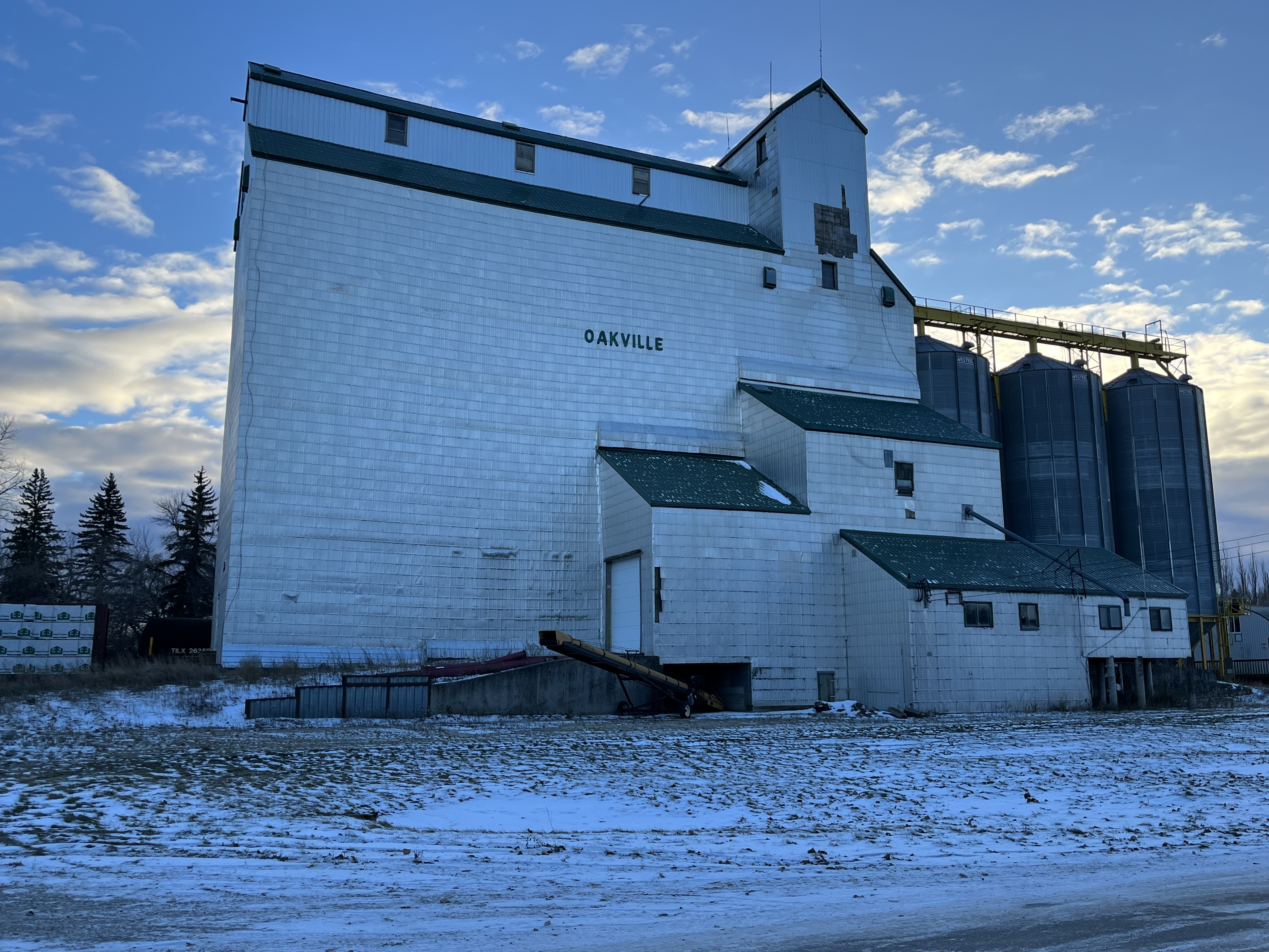
A little west of Elie is the town of Oakville, Manitoba. When their 1928 Pool B elevator burned down in December 1973 it was replaced with the present wooden structure. This building was completed between 1974 and 1975 and had a capacity of 162,000 bushels. It was expanded in 1990 by adding the three steel tanks on the west end that brought the capacity up to 204,000 bushels. When the merger happened in 1998 its days were numbered. It was closed in January 2001 as a temporary cost cutting measure by Agricore and permanently closed in November 2001. Like the elevator in Elie, it is now operated for private grain storage. It can be found at this map link.
The CPR built a line through Pontypool, Ontario in the 1880s which opened up the Toronto market to local farmers. In 1894 a grain elevator was built and before long there were two elevators serving the community of about 600 residents. Both of these were gone by 1918 and a new one was constructed for the local farmers to store their barley, oats and wheat before shipping it to market. As transportation systems improved the elevator became less important and by the 1970s it was closed. It can be found at this map link.
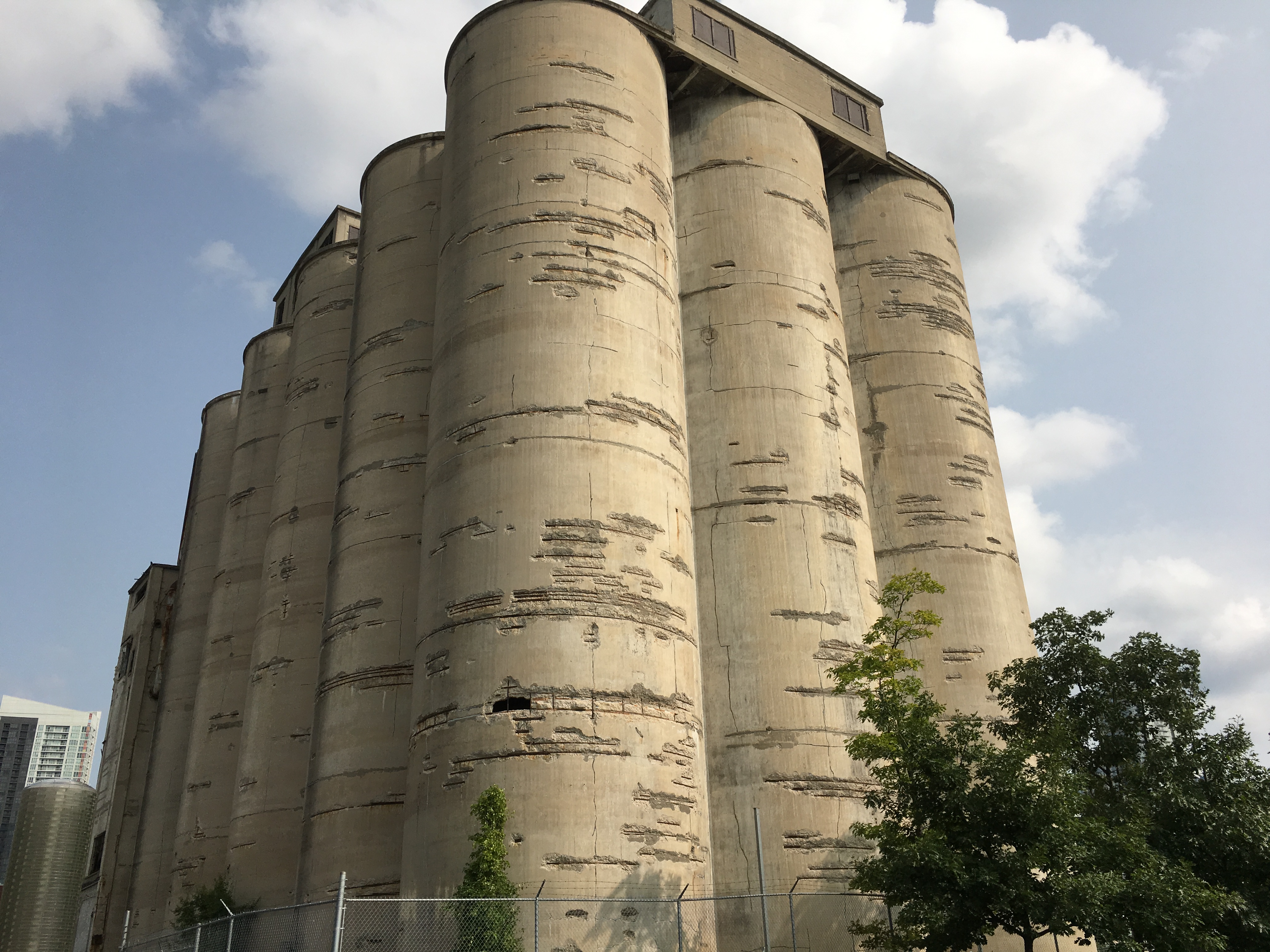
The Canada Malting Company located a set of concrete silos at the foot of Bathurst Street in 1928. Storage silos had disappeared from the city because they were made of wood and had a lifespan of about ten years due to the fact that they were severe fire hazards. The Canada Malting Company used concrete silos to store barley in before it was turned into malt. The original silos near the lake were 120 feet tall and more storage was added in 1944 in the form of 150-foot tall silos. These grain silos can be found at this map link.
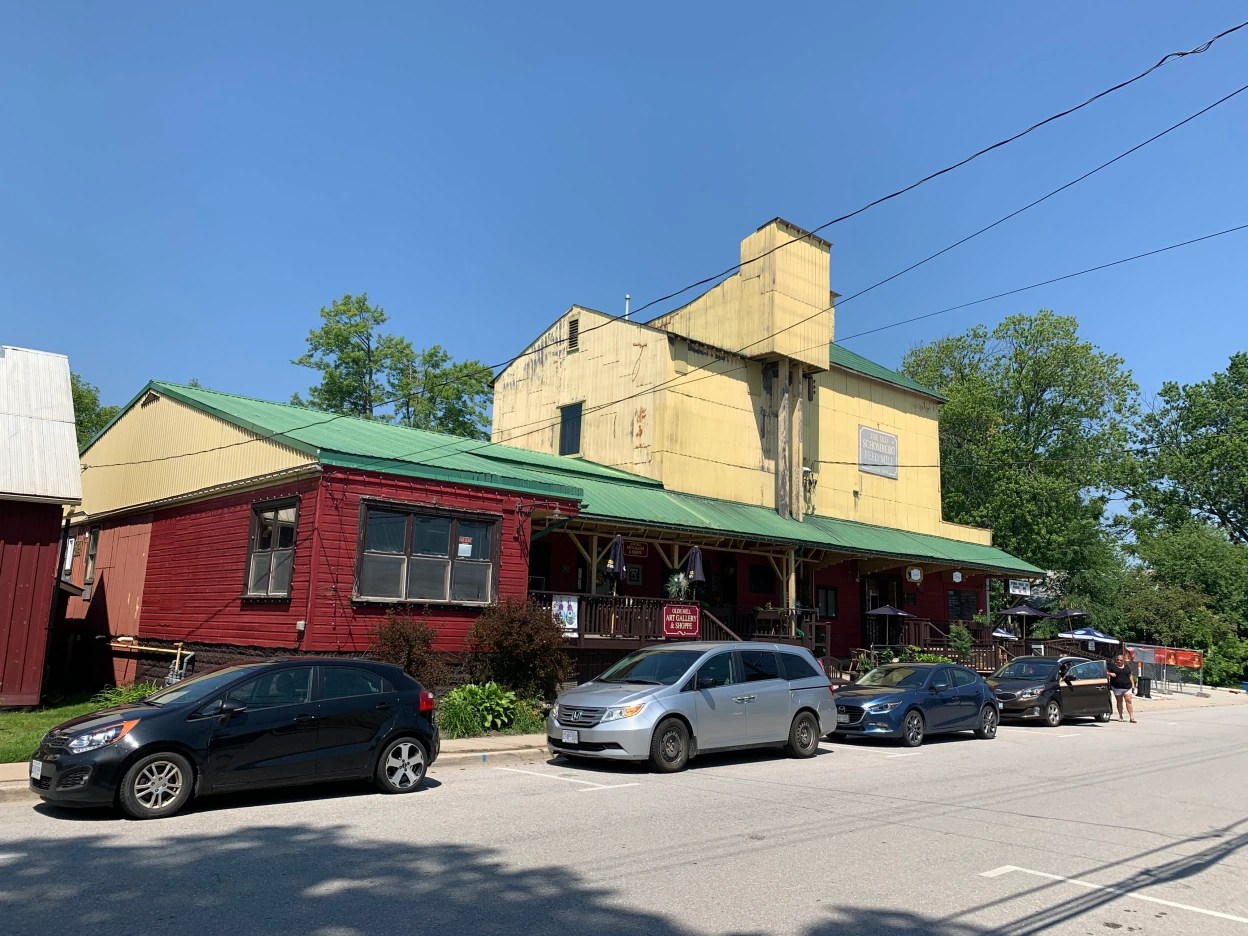
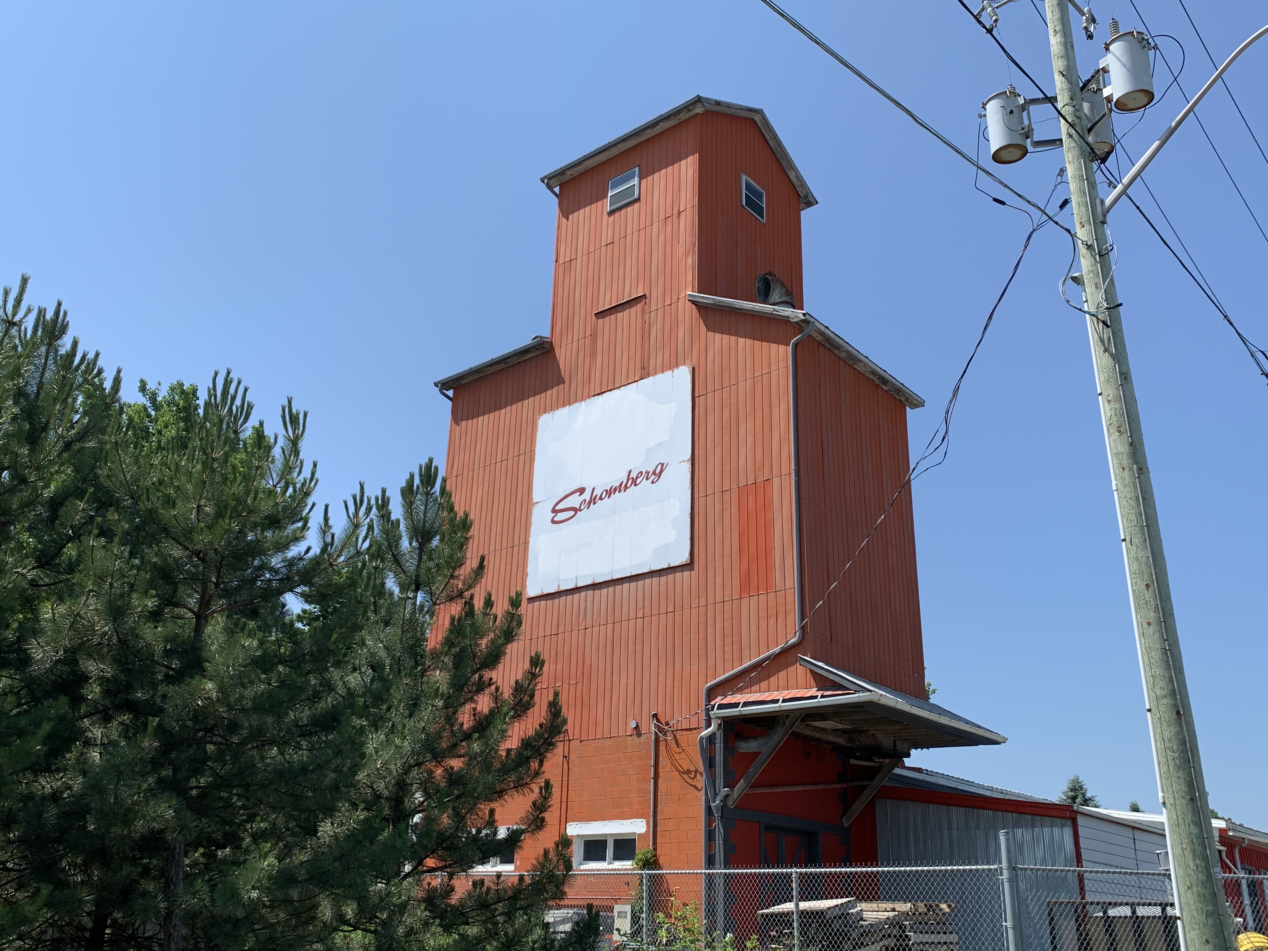
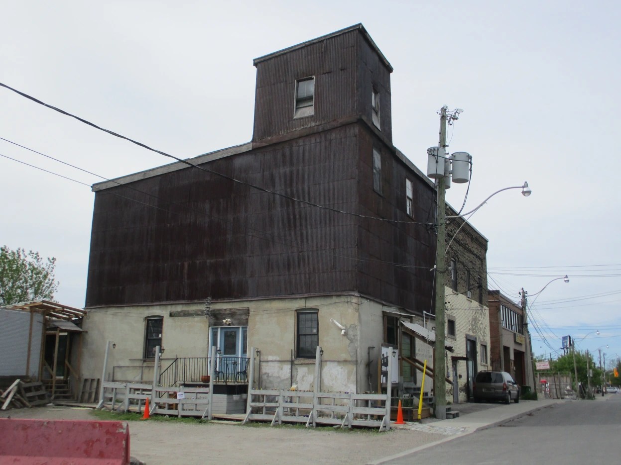
There are two grain elevators in the town of Schomberg, Ontario. In 1884 Anderson Tegart built the Schomberg Feed Mill on Main Street where it had direct access to the railway. It operated until 1927 before it shut down. Since that time it has housed a variety of businesses including The Scruffy Duck Restaurant which is still in business. This elevator can be found at this map link.
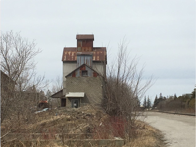
An orange grain elevator stands on the side of Highway 9 close to Highway 27 that used to have the Shur-Gain symbol on the side. Shur-Gain was introduced in 1937 as a brand name by Canada Packers. They provided feed for animals and livestock. Today there appears to be renovations going on at the old feed mill. This elevator can be found at the following map link.
I have driven through Consecon in Prince Edward Ontario several times on recent business trips and kept looking at the old grain elevator that stands beside the Millennium Trail on the old Price Edward County Railway. Yesterday I stopped to take pictures of the structure. The Consecon grist mill was built in 1808 and spurred development of the community. After several rebuilds it was purchased by Richard Baldwin in 1949. He built the grain storage building beside the tracks the same year. When rail service ended through town in 1985 the building was abandoned. It can be found at this map link.
Nashville, Ontario grew as a railway town centered on the railway station. Soon a saw mill and a grain elevator stood near the railway. Milling grain creates a lot of dust which becomes a fire hazard. Many grist mills and grain elevators were destroyed by fire and this was the fate of the original grain elevator in Nashville. The first elevator burned on July 15, 1919 while a second one was destroyed in 1927. A new grain elevator was built in Nashville in 1930 and still stands beside the tracks. We featured it in our post on Abandoned Kirby Road and it can be found at this map link.
A grain elevator still exists within the city of Toronto on Dawes Road. When it comes to research on the internet it is easy to find conflicting information. Construction dates range to as early as the 1850s with 1890 also being a prominent date. The city’s land use maps suggest 1906. The land developers have to present a historic context in their proposals and they also claim it to be a 1906 wooden crib grain elevator and feed mill. The use of construction materials would suggest that the 1906 date is correct as the first-floor cement would not have come into popular use until after 1900. This elevator can be found at the following map link.
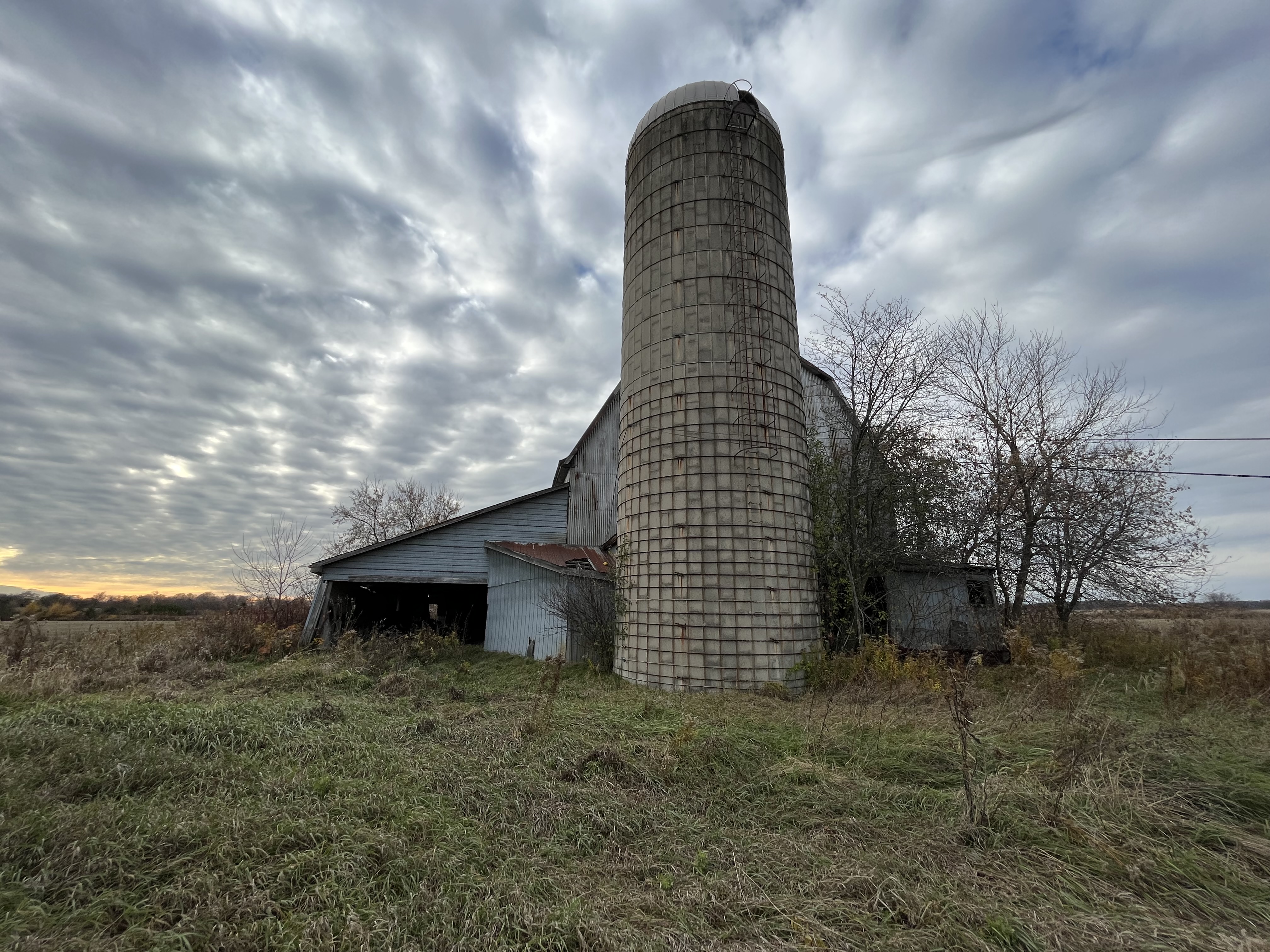
At one time almost every farm in Ontario had a silo beside the barn. Many of the barns have vanished but the concrete silos still dot the rural landscape. These were essentially private grain elevators that were used to store grain for feeding livestock.
Grain elevators come in many different shapes and sizes but they are slowing disappearing from the landscape.
Starting in the 1920’s the wealthy of Toronto were building mansions in the area of Bayview Avenue and Lawrence Avenue. This was a rural setting at the time which featured the Don River for fishing and large lots with plenty of places to ride their horses. We’ve covered a number of these in past issues of our blog and they can be found in the links at the end of this post.
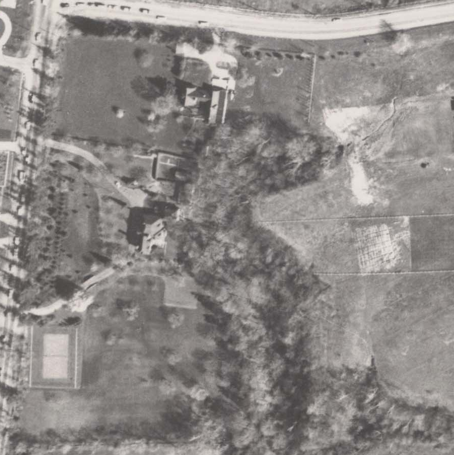
Today we’re looking at Stonedene which sat on Bayview just south of Post Road. It dates to the end of the 1920’s, reportedly built in 1929. The image below from the Toronto Archives aerial photograph collection shows the property as it was in 1957. Post road runs along the top of the picture and Bayview Avenue along the left hand side. The mansion can be seen near the middle of the image, set at the apex of a curved driveway.
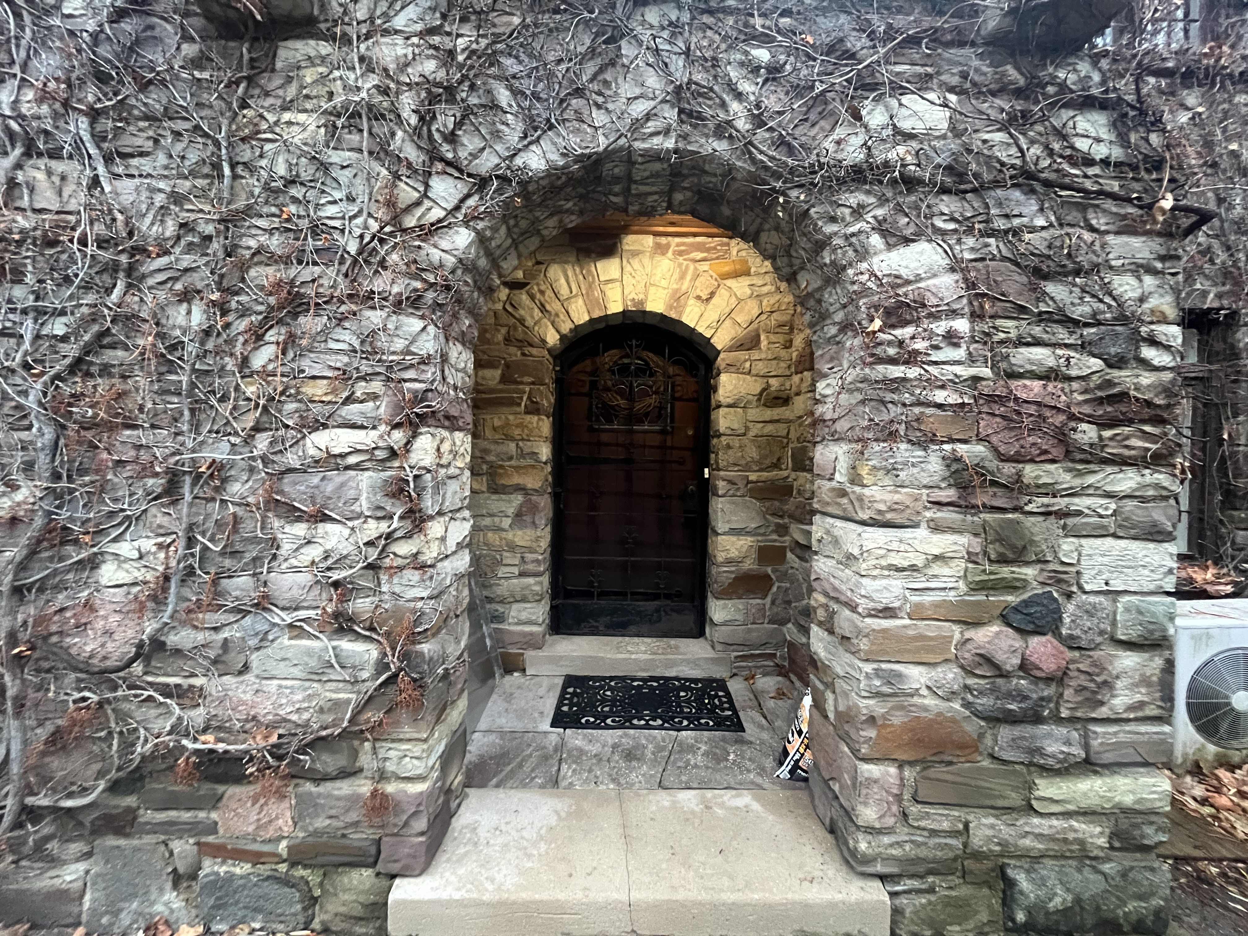
Living up to its name of Stonedene, even the gates are made of stone and the fence that once separated it from the road was supported on several stone pillars. The main entrance has the name Stonedene carved into it and the stone pillars still line Bayview Avenue.
The home was built in 1929 according to city records and was originally constructed for Captain Harry Lynne Plummer and his wife Joyce. Plummer served in the First World War as a member of the 4th Canadian Mounted Rifles and as a Captain in the Canadian Railway Troops.
By 1949 it had been sold to General Albert Bruce Matthews and his wife Victoria. Matthews served in the Second World War as a member of the 1st Canadian Infantry Division. He was promoted several times during the war and as General Officer Commanding the 2nd Canadian Infantry Division he took part in the liberation of northern parts of the Netherlands. After the war he became chairman of Massey Ferguson and was President of the Liberal Party of Canada during the 1950s and 1960s.
The home was sold in 1976 to the Ontario Mission of the Deaf and converted into administration offices. It has a front door that reminds me of the entrance to a castle.
A structure sits on the front lawn that looks like a stone chair or throne.
The back of the chair has a date stone which reads 1925 which is in conflict with the official date of the mansion.
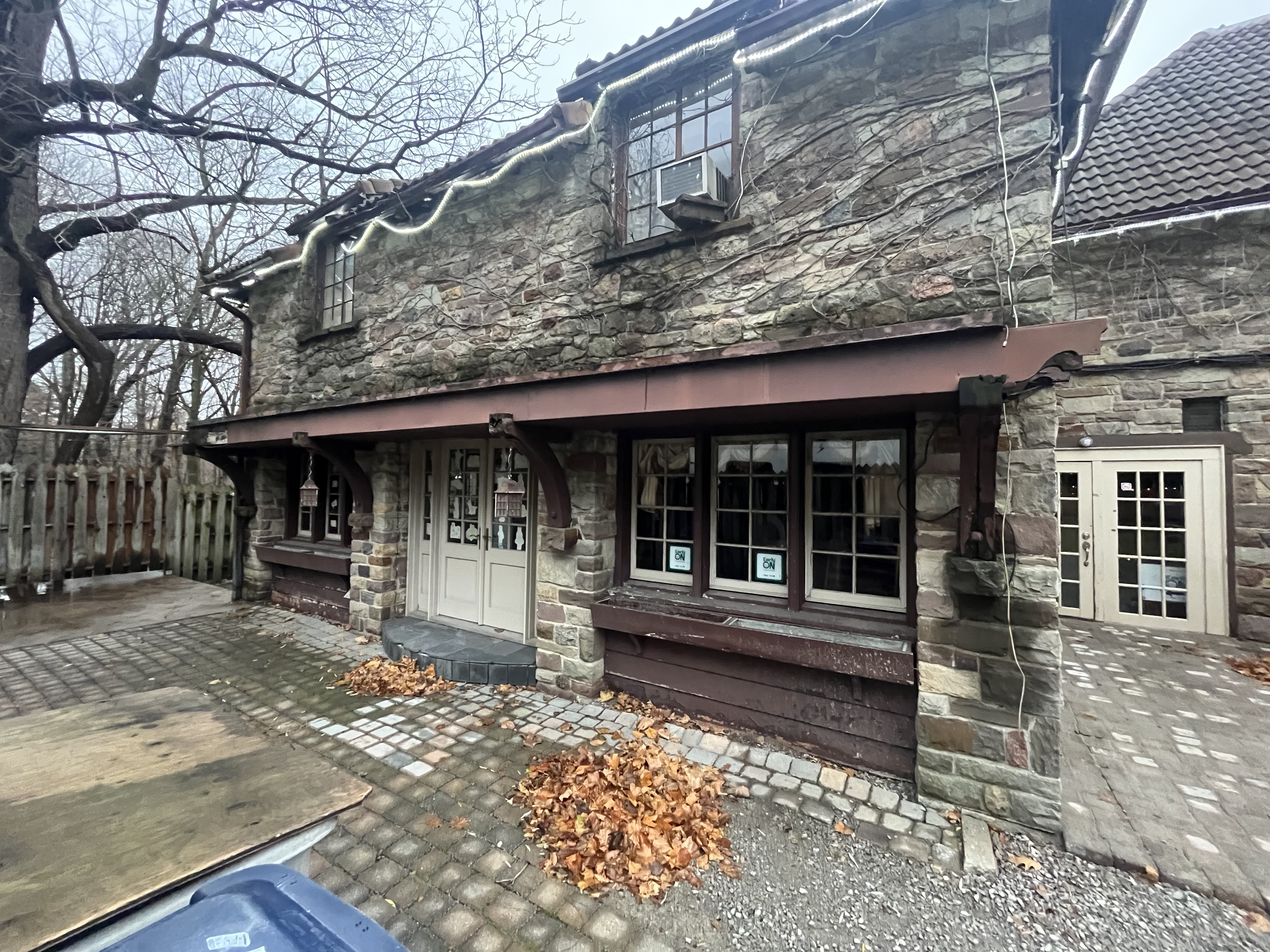
Everything about the home is grand including the side entrance which has an ornate double door with sidelights.
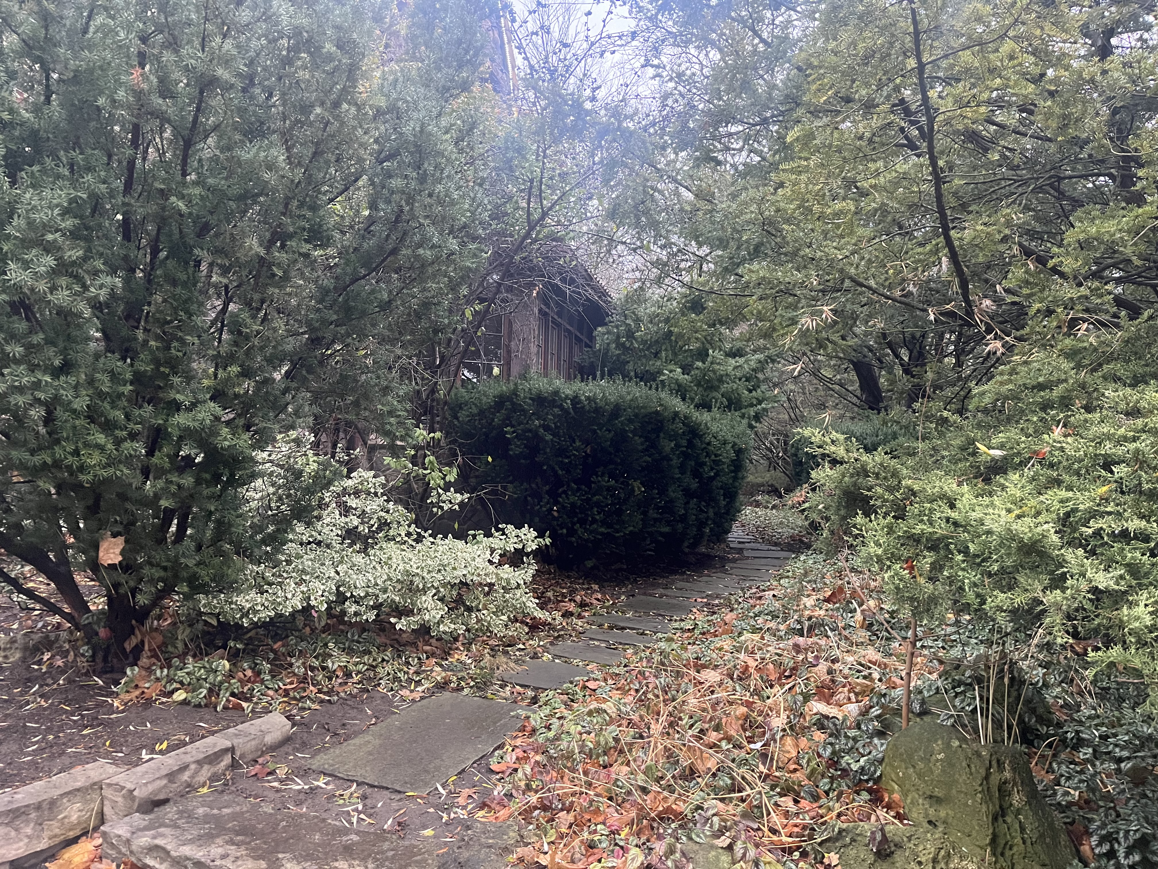
The gardens around the south side of the house have become a little overgrown but add to the character of the mansion.
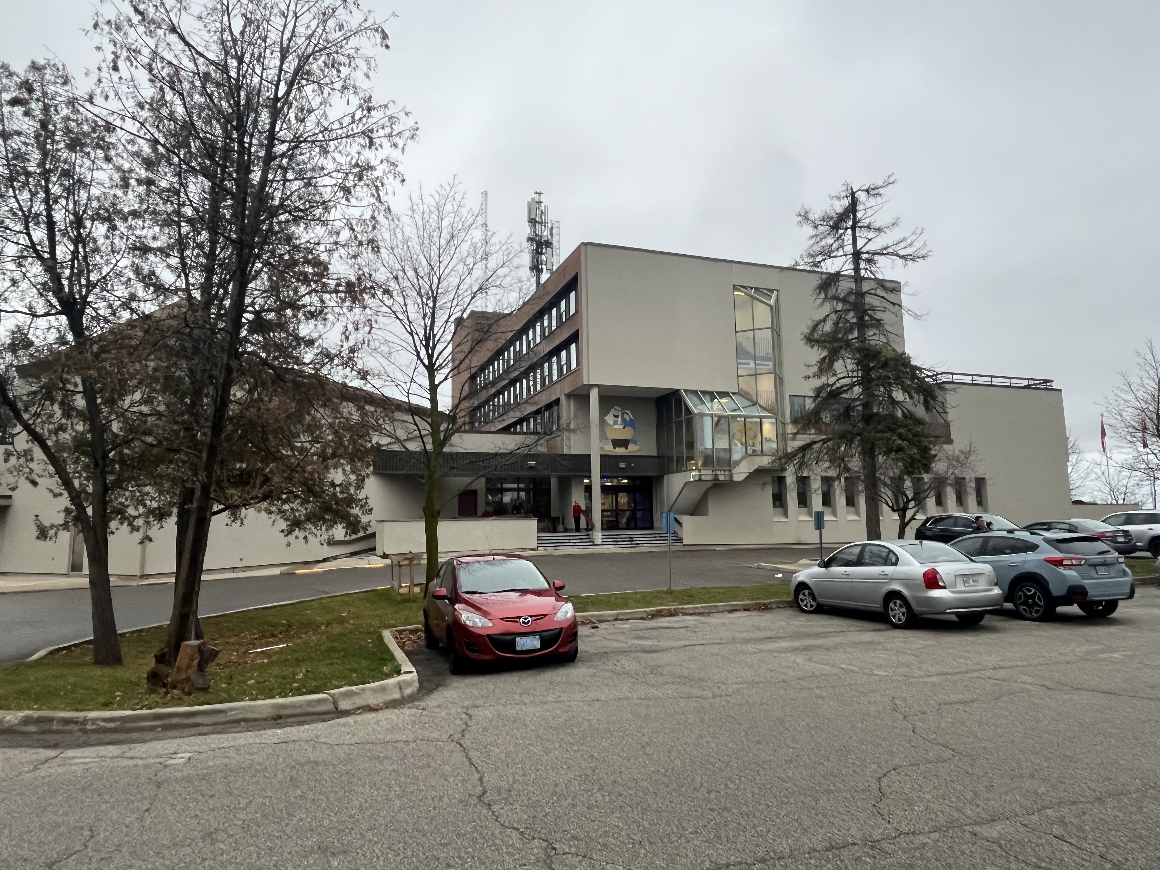
Ontario Premier William Davis laid the date stone for the Bob Rumball Community Centre for the Deaf on April 5, 1979. This multi purpose building is used to provide services for all ages of the hearing impaired. There are youth services as well as seniors programs and sign language courses. It was conceived by Bob Rumball who played football for the Toronto Argonauts and Ottawa Roughriders. He got financial support from Conn Smythe and Harold Ballard of the Toronto Maple Leafs.
The historic photograph at the top shows all the freshly planted trees on the front lawn which today provide a forest that hides the house from the road. The mansion was given a restoration in 1996 when the administration offices were moved upstairs. The lower floor is now an event centre and can be booked for weddings.
Stonedene is a great example of the wealthy estates that were built in the area in the late 1920s by Toronto’s millionaires. Many of these still exist and can be viewed in the links below.