
Friday, May 8, 2020
A century ago the property that is home to Sunnybrook Hospital and Sunnybrook Park was a working farm and country estate for one of Toronto’s wealthy elite. Joseph Kilgour was partners in the Canada Paper Company and made his fortune from flat-bottomed paper bags like the grocery bags some of us remember from our childhood. With the COVID-19 lockdown still underway I went for another walk through the park with an eye to locating the remnants of his legacy.
Joseph purchased several parcels of land to comprise the farm and estate he intended to create. He added to the buildings on the old Burke farm to create Sunnybrook Farm where he raised horses and cattle. Then he went to the top of the Burke Brook ravine and built a grand country estate that he named York Lodge. At that time there were less trees and Kilgour had a grand view across the valley and his farm. The picture below was captured from the City of Toronto archives collection of photos, this one was taken in 1964. I’ve marked the roadways on the old estate in green and the waterways in blue. I entered the ravine from Bayview avenue and followed the trail along the top of the ravine on the south side of the brook and made my way toward the original gates to the property.
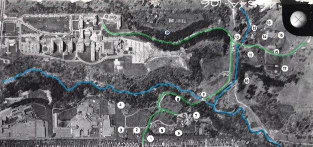
There were originally two sets of gates, one on Bayview directly across from the end of Blythwood Avenue. This set led directly to Sunnybrook Farm and was removed when the hospital was built in the mid-1940s. The second set can be found at the end of Sutherland Drive and it led directly to York Lodge. The pair of stone gates feature ornate wrought iron lamp posts which must have looked quite spectacular to guests arriving for an afternoon fox hunt or social gathering.
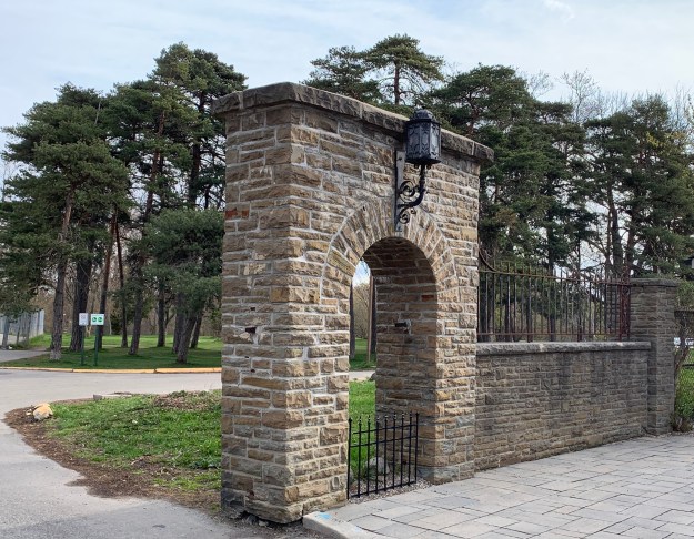
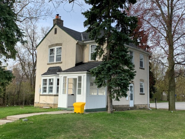
The only remaining building from the York Lodge estate is the gatehouse. It stands just inside the gates and is identified as number two on the map. Along with the gates, it was listed on the Toronto Heritage Register in 2005.
There were four summer cottages on the estate but they have all been demolished. The picture below is from the Toronto Archives and shows one of them. They’re marked 3-6 on the map above.

When Alice donated the property to the city she kept ownership of York Lodge and continued to live there until 1930. She sold it to another prominent Toronto business man named David Dunkelman. He was the president of Tip Top Taylors. Dunkelman only kept it for 6 years before selling it to Captain James Flanigan. In 1943 Flanigan converted it into a military hospital renaming it Divadale after his daughter Diva. In 1953 it was converted into a convalescent home for veterans but was demolished around 1980. This archive photo is credited to John Chuckman and gives us a look at the outside of York Lodge after the name was changed. It is marked as number 7 on our map.

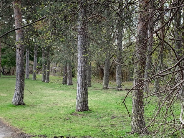
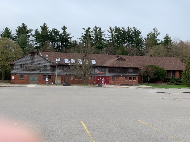
Lydhurst Hospital was constructed on the property in 1978 but some of the roadways and landscaping can still be found as well as rows of mature trees planted in straight lines.
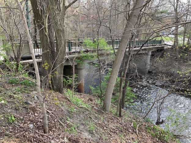
The lane way is shown as number 8 on the old photo above. It led down the hill from York Lodge to Sunnybrook Farm and connected with the other lane way off of Bayview Avenue. At the bottom of the hill the lane crossed Burke Brook at the point just before the brook enters into the Don River. Burke Brook takes its name from Edward Burke who owned the 200 acre farm in 1860.

The Burke Brook bridge is architecturally interesting because of the wings on either side of the abutments. When the water level is just right you can see a small waterfall through the centre of the bridge. The off-leash dog park can be seen in the background. It seems strange now that there are no dogs playing and chasing each other in the park. This bridge is number 9 on the map above. Near this bridge is a circular well or pumping station that we featured in last weeks companion post Staying Close To Home.

The bridge over the Don River is more typical of one used by regular traffic. This bridge was closed to vehicles when the farm was donated to the city as a park and is number 10 on the map. Alice Kilgour decreed that the park should remain free of charge for the citizens to use and that no road should be allowed to pass from Bayview through to Leslie Street.
The 1964 photo above shows a building identified as number 11. This structure no longer exists but number 12 still stands, tucked in overlooking the river and bridge. These homes were built for the use of various farm and estate workers.
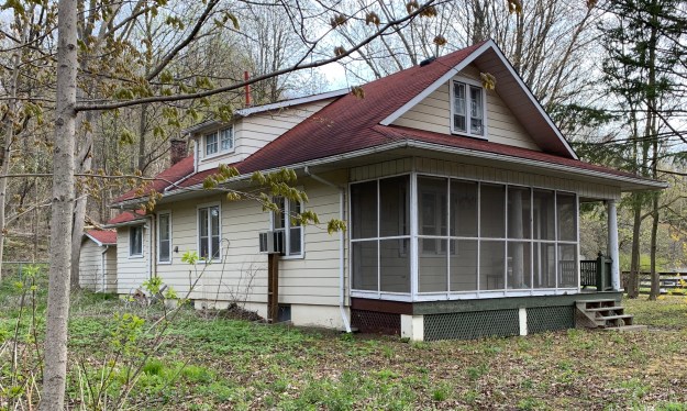
The house identified as 13 on the map was tucked in behind the horse barn and is another of the farm worker homes that were deeded to the city along with the land.
A very ornate barn with two silos is shown as number 14 on the map. Unfortunately it was destroyed in a fire on May 21, 2018 killing 16 horses that were housed inside. Another 13 horses were moved to another barn and were saved. This barn was home to the Toronto Police horses for many years until they were relocated to the CNE grounds. The picture below was taken from our Sunnybrook Park post.

This picture was taken from the space where the barn formerly stood, now a vacant field with no trace of the barn or silo. The outer fence for the horse paddock can be seen in the photo above as well as in the distance below. Across the way is a second barn from Sunnybrook Farms where the cows and other farm animals were kept. Horses that were rescued from the fire were moved over to this barn, labelled as 15 above.

Kilgour erected one of the first indoor riding riding arenas in Canada which is shown as item 16.
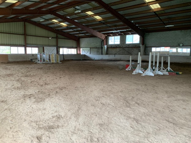
One other building in the compound, number 17, currently houses washrooms and has an equipment shed in the one end.
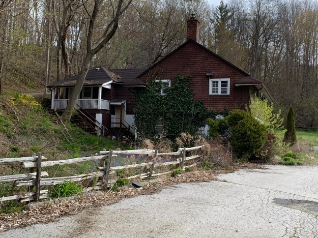
Building number 18 caught my attention because it looks like an older style of farm house. This house is not listed on the heritage register but I wonder if it may have been erected by the Burke family before Joseph Kilgour bought their homestead farm to create his dream estate. I had planned to walk right up and get a better view but the sign on the tree gave me reason to reevaluate that plan.

On the valley floor near the Don River is a large patch of Mayapples. The plants with two leaves are the only ones that will produce buds and that appears to be the case for most of these plants. The bud pictured below will open into a single flower that will later produce the lone fruit on this plant.

The lane way back to Bayview is marked as 19 on the map and now leads to the rear of Sunnybrook Hospital. To the north of the hospital are three other country estates that were built by the wealthy so they could escape the city. The stories and pictures of these former estates can found in our previous post entitled Bayview Estates.
Although it has been nearly a century since the property was given over to the city a surprising number of artifacts remain from the days of Joseph and Alice Kilgour.
Google Maps Link: Sunnybrook Hospital and Park
Like us at http://www.facebook.com/hikingthegta
Follow us at http://www.hikingthegta.com
Also look for us on Instagram

The off leash dog park was (on May 8, 2020) and is still closed due to the COVID-19 lockdown of park amenities.
I lived at the end of Sutherland – 509 Sutherland Drive – right across from the York Lodge Gates. As a kid, I snuck into Divadale Estates and often walked the road down to Sunnybrook Park. I rode at the riding stables when it was first opened. It was first called Central Don Stables and opened in 1968. I always crossed the Burke Creek to go to Central Don, or would follow the road up to Sunnybrook Hospital to have mashed potatos and gravy with the veterans in the cafeteria. The barn with the silos was originally a cow barn, and then became the stables. The white stables with multiple windows was the original Metropolitan Mounted Police Stables and they shared the riding ring with Central Don. The building across the parking lot in my time was called the Snack Bar and housed a little restaurant that made the best croissants. We had always been told that it was the original indoor riding ring. There was also a house across from the Police Barn that the first Inspector – Inspector Johnson and his family resided in. Your account is not quite accurate when it says the barn with the silos was the police barn. It was the one across the ring. Great memories for me. Later on, after Lyndhurst Hospital was built, both my mom and sister worked there for a number of years.
Thanks for sharing such a detailed account of your times around the area. I also really appreciate the information about the original use for the barns. I’ll be able to update my story and make it more accurate. Thanks again!
So nice to hear of these fond memories about York Lodge.
I didn’t realize all that was going on, only that I often rode my bike through the grounds. You may remember me, I lived on the corner at Glenvale and your mom paid me 25¢ a week to walk you to kindergarten.
I do recall you being very interested and n horses when you were a teen.
Bonnie (Reicker) St Onge
Hello,
I think your date is wrong of when the Divadale health centre was torn down, I was in there in the
early 1970’s, as a school kid we would climb in the side window to the left. The hardwood floors had curled, there were large cabinets built into the walls with a french style doors on them. It had massive fire places big enough you could throw a skid on the fire. The kitchen had large stainless
steel tables and counter tops. There was a circular rod iron staircase and the pool was built into the hill side with glass doors overlooking the ravine and there were stone statues still in place. As a kid the house was very spooky, I took my parents up to see it and it had been torn down and was rubble. My father had told be it was for veterans after the war. Dad has since passed but
they have lived in Don Mills since 1952.
I got that date from an article in Leaside Life magazine. https://leasidelife.com/divadale-drive/
I believe you are right. I was born in 1954, lived right outside the gates and have clear memories of the pool and the statues and sneaking into the building. I also remember some veterans that lived in the little cottages.
So it had to be later than 1960.
Colleen, you are right. I got the date of 1960 from an article listed above. However, I went back through the city archives and looked at the aerial photography. I can see York Lodge in the 1977 pictures but not in the 1981. Therefore it was demolished in between and perhaps the article should have read 1980 instead of 1960. Thanks for this.
My paternal grandmother was a British Home Child who arrived 1910 and after spending a short time in Hazelbrae in Peterborough (the Barnardo receiving home) she was placed as a domestic in nearby Millbrook. Her eventual placement location was noted to be Toronto but I’ve been unable to determine when she arrived in the Toronto area. I have found her on the 1911 Canada census in Millbrook and in Toronto for 1921, after her marriage. She was 15 on arrival to Canada. Yesterday I located her in 1916 Toronto employed by Eatons. Her placements would have continued until she was 21, which occurred in April 1916, though Barnardo’s had her as a year older in their records. Proof of her Eatons employment confirms one family story that she was a shirtmaker there. We also were told that she worked for the Tip Top Tailors family, probably as a domestic placement in their residence, though she was an apprenticed dressmaker in Wales before being sent to Canada, so there’s the possibility she may have worked in their business location. Is anyone aware of a business or private family archive that could help me fill in more blanks? Any advice or information would be appreciated.
Pingback: Stonedean Estate | Hiking the GTA