Monthly Archives: May 2020

Ramsden Park – Yorkville Brickworks

Sunday, May 24, 2020

When Yonge Street was originally surveyed in 1796 the area where it crossed Castle Frank Brook was particularly challenging because the road cut through soft clay.  This part of the road would remain a mess until it was planked and turned into a toll road.  The clay here was low in iron and attracted brick makers as early as 1835 because it produced a soft yellow brick.  Various families of brick makers worked the clay deposits including that of John Shepard, William Townsley and Leonard Pears.

After the clay deposits were exhausted in the 1890’s the brick works closed and the lot was used for a time as a garbage dump for the city of Toronto.  In 1904 it was selected to become a new city park and some landscaping was done over the garbage dump.  It was named Ramsden Park after a city councilor.  In order to check it out I parked in the lot just off of Yonge Street at Pears Avenue.  The contours of the park reveal the shape of the former pit where the clay was extracted for the bricks.

IMG_2996

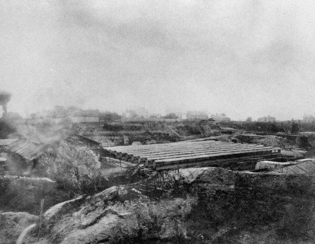
This archive picture was taken in the 1880s and shows the brick hacks where the bricks were stacked to dry before being fired in the kilns.  Early maps of the site show the brick hacks to be in the central plateau of the modern park.
pictures-r-4848

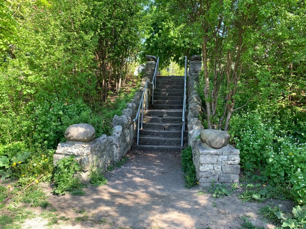
There are multiple places where people can enter the park and they all involve some kind of stairs or sloping pathway.
IMG_3002 (1)

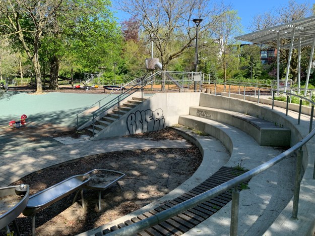
Ramsden Park has been undergoing a revitalization project for the past several years and is currently in it’s third and final phase.  The upper plateau has been completed and includes a new off leash dog area.  The childrens playground has also been given new pathways, lighting and play structures.
IMG_3006

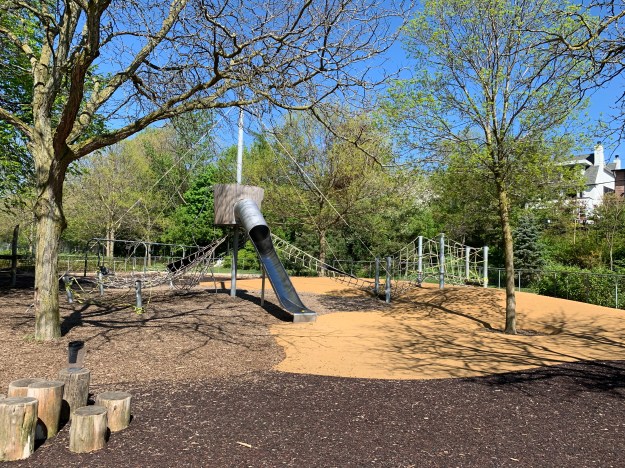
This giant barrel and slide looks like the kids will be able to have a lot of fun when the park amenities open again.
IMG_3008

This picture was taken from one of the historical information plaques that have been placed in the park.  This one shows the workers stacking bricks inside one of the clamp kilns that were used to fire bricks on the site.  The bricks were stacked in a specific pattern and arches were left open along the bottom of the stacks.  Fuel would be burned in these arches for a week to fire the bricks.

IMG_3010

Western Redbud was blooming along the northern side of the park near Gibson Avenue.  This shrub has magenta flowers which attract bees and other pollinators, including hummingbirds.

IMG_3016

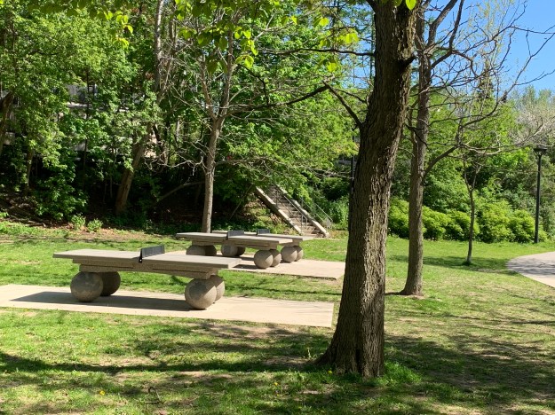
Ramsden Park has very little open space considering the actual size of the park and it has no woodlot because at one time it was an open pit.  It has many amenities that fill the space up including a ball diamond, tennis courts, basketball courts, ice rinks and table tennis.
IMG_3020

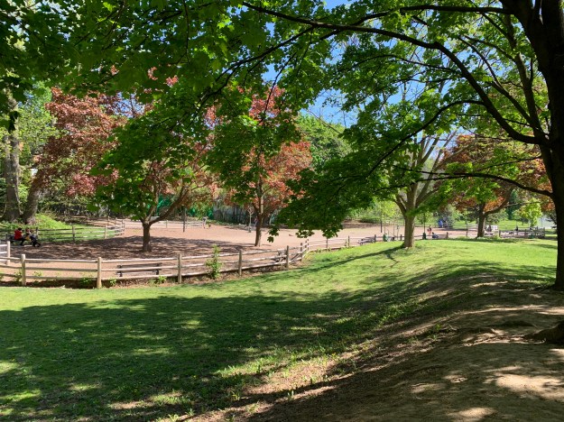
The dog park has been restored and sits where the brick hacks once stood.
IMG_3025

Stage three of the Ramsden Park revitaliztion project is well underway with a set of stairs and a wheelchair accessible ramp being built from Hillsboro Street into the park.  This is scheduled to be completed this summer, wrapping up a five year project.

IMG_3030

The Sheppard family had the earliest brickyard and the one that lasted the longest before the clay deposit ran out.  Various generations of the Sheppard family built homes in the area to house the workers in the brickyards.  Belmont Street contains many examples including the set of row houses numbered 4-12 which were built in 1889 by the Sheppards and have heritage designation because of their association with the brickyards.

IMG_3075

The row houses above were likely made from the light yellow bricks made on site.  Unfortunately, it has been painted but a little farther along Belmont are some examples that still show the colours and patterns of the brick work.

IMG_3076

Castle Frank Brook was an idyllic place in the 1800’s before the brick industry and the growth of the city around it caused it to become polluted.  Before long the city decided to put the brook into a sewer pipe and bury it underground.  The archive photo below shows how nice it used to be when children could go wading in the water.

IMG_3029 (1)

Ramsden Park is one of the oldest and largest parks in the main part of the city and with the addition of the historic information boards throughout the park it will showcase its history for years to come.

Google Maps Link: Ramsden Park

Like us at http://www.facebook.com/hikingthegta

Follow us at http://www.hikingthegta.com

Look for us on Instagram

Teston – Ghost Towns of the GTA

Sunday, May 24, 2020

The first person to emigrate from England and build a home in the future Teston was named Thane and for a short time the village was named Thanesville.  When the post office was opened in 1868 the name was changed to Teston.  Below is a clip from the 1877 County Atlas which shows the hamlet including the post office and wagon shop which belonged to Joseph Lund.  With the restrictions on parks and trails being lifted for the first time since the pandemic had begun two months earlier it seemed like the trails would likely be busy and the wildlife scarce.  Therefore we decided to leave the trails for a little longer and be safe.  Teston isn’t far from my work and so I was able to explore it over the course of two sunny lunch breaks this past week.

Teston 1877

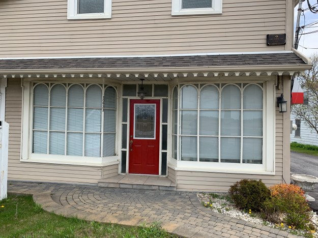
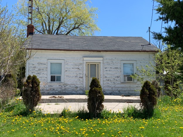
Lot 27, Concession 4 was originally deeded to Kings College who sold it to John Hadwen in 1865.  On December 26th that year Joseph Lund bought 2 acres in the south west corner of the lot.  Lund’s General Store was built in 1870, as the story goes, after Joseph decided that Mr. Wilson was charging too much for coal oil at the only store in the hamlet.  For this reason the store had the nick name “Spite Store”.  The building also served as a residence with the plain door on the north end leading to the home while the more ornate door on the south led to the mercantile section.

IMG_2841

Joseph Lund was quite the entrepreneur who also owned a wagon making shop and a blacksmiths forge.  In 1868 he announced that he had gone into the undertaking business and was able to provide a handsome hearse and black horses.  The store was built from vertical wooden planks that were later covered over with red insulbrick.  More recently the structure has been covered over with siding.  Fortunately, the beautiful store windows and door remain and are key to the listing of the property on the heritage register.

IMG_2697

Around 1810 a group of Methodists broke away from the Wesleyan Methodist Church and founded the Primitive Methodists.  They practiced a simpler form of worship in simple churches where they kept themselves free of liturgy, thinking themselves to practice a purer form of Christianity.  Joseph Lund was a Primitive Methodist and was instrumental in the founding of Hope Primitive Methodist Church on Keele Street.  Lund would have driven his horse and carriage past the only other church in town, The Wesleyan Methodist, each week on his way to worship.

IMG_2795

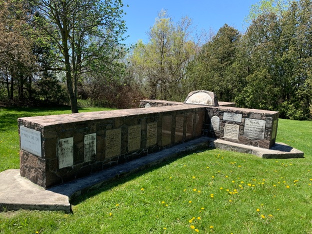
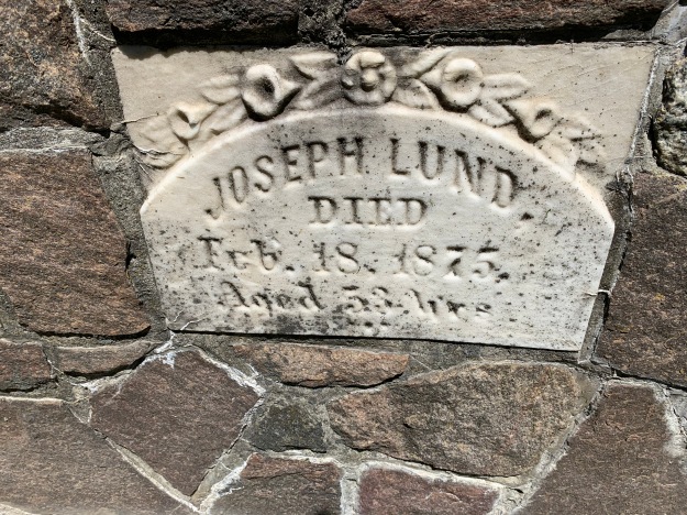
The Primitive Methodists started worship in the Teston area in 1840 and built their chapel in 1870.  By 1965 the chapel was gone and the cemetery in disarray.  The community gathered all the tomb stones together into a central display in the shape of a large cross.  Joseph Lund died in 1875 and was buried in the Hope Primitive Methodist church cemetery.

IMG_2761 (1)

The Wesleyan Methodists had been meeting in the community since 1811 on property supplied by Isaac Murray.  The first chapel was built on the south side of Teston Side road about half way between Jane Street and Keele Street.  It was known as Hadwen Chapel after the first pastor to serve there.  A new chapel was built in 1872 on another property belonging to Murray.  The old chapel was eventually demolished with only a single stone marking the site.  The earliest settlers lie in unmarked graves beneath this field.

IMG_2798

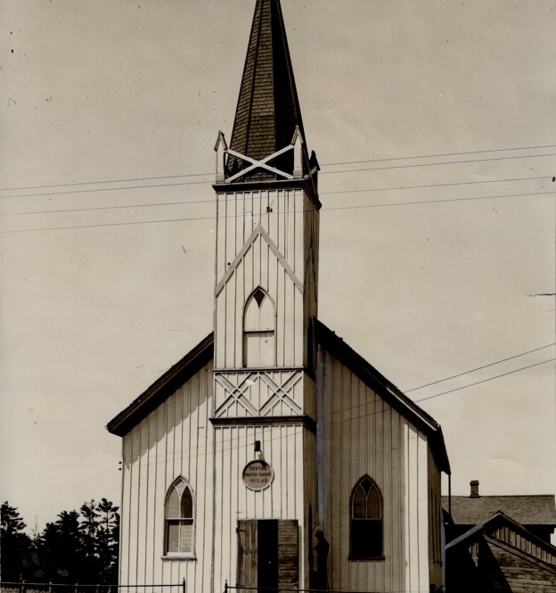
When Abraham Iredell and his team surveyed Vaughan Township in the summer of 1795 there was a slight misalignment of the east-west roads which resulted in a correction at each of the north-south crossroads.  Isaac Murray owned the property on the west side of Jane where the survey correction for Teston Road was.  It was here that they built the second Wesleyan Church in the community.  The photo below shows the church with the entrance completely rebuilt without the tower, although a small part of the spire appears to have been preserved on the roof top.  This picture is undated but the photo credit goes to Barry Wallace.  The cover photo is dated 1932 and is available in the Baldwin Collection at the Toronto Reference Library.  In 2005 it was decided to expand Teston Road to five lanes and take the jog out at Jane Street.  This meant that the church would have to be moved to make way.  Attempts to save the already unstable church failed and it was demolished instead.  Today, the site lies directly below Teston Road.

Teston United Church

During the 2005 work to widen the road an old Native Peoples Ossuary was discovered.  It was later reburied by members of the First Nations where it sits beneath an unmarked stone.  There are hundreds of these old burial sites across the GTA and many of them have been disturbed by work crews.  One example is the Taber Hill Ossuary in Scarborough which was uncovered during construction for the 401.

IMG_2796

The short main street of Teston hasn’t changed much since it the atlas was drawn.  Most of the original homes still line the east side of the street, including the home of the first resident.  Two Georgian Style homes stand at the south end of the street and one of them is a likely candidate for this original home.

IMG_2828 (1)

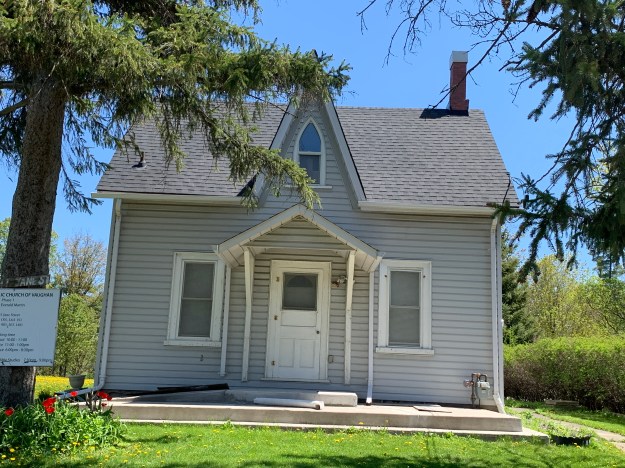
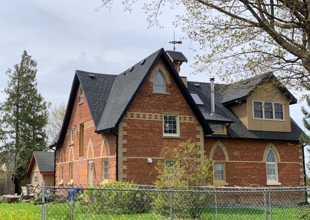
There are also several homes that were built in the gothic revival including the one at 10891 Jane Street.  While all the old church buildings have been removed, this old house as taken on the role of Bethel Apostolic Church of Vaughan.

IMG_2834

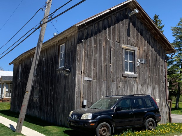
The next building beside the church is an old barn, possibly the original wagon shop.

IMG_2837

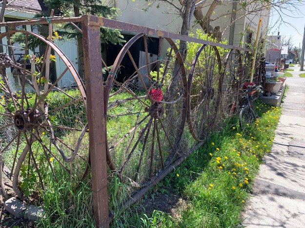
One of the most unique fences we’ve seen has to be this one made of old steel wagon wheels.

IMG_2848

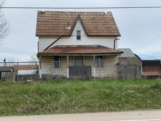
The county atlas shows two homes on the property of Arthur Noble.  One of them was this gothic style house that now appears to be deserted.

IMG_2690

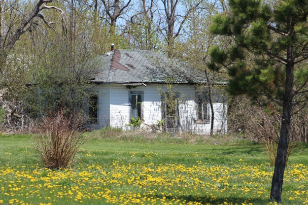
The house on Teston Road that was shown on the 1877 County Atlas as Mrs. Stevenson is one of several simple Georgian style homes in the community.  It sits abandoned in an encroaching woodlot on the side of Teston Road.

IMG_9970

The Wesleyan Methodist church shown on the upper left corner of the county atlas above was on the corner of modern Weston Road and Kirby Road.  Also shown beside it is the school.  Apparently it was known as Bryson’s School.  It has been converted into an interesting looking home.  I wonder why they chose to remove so many of the gothic windows with their pointed arches?

IMG_2689

The historic homes in Teston are a little drab because every one of them has been covered over with siding.  On one hand I applaud his salesmanship but I really wish he hadn’t been so successful and that we could still see the original craftsmanship and brickwork on these homes.

Also see our posts on the nearby ghost towns of Sherwood and Maple.

Google Maps Link: Teston

Like us at http://www.facebook.com/hikingthegta

Follow us at http://www.hikingthegta.com

Look for us on Instagram
York Lodge

Friday, May 8, 2020

A century ago the property that is home to Sunnybrook Hospital and Sunnybrook Park was a working farm and country estate for one of Toronto’s wealthy elite.  Joseph Kilgour was partners in the Canada Paper Company and made his fortune from flat-bottomed paper bags like the grocery bags some of us remember from our childhood.  With the COVID-19 lockdown still underway I went for another walk through the park with an eye to locating the remnants of his legacy.

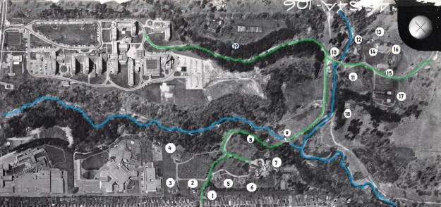
Joseph purchased several parcels of land to comprise the farm and estate he intended to create.  He added to the buildings on the old Burke farm to create Sunnybrook Farm where he raised horses and cattle.  Then he went to the top of the Burke Brook ravine and built a grand country estate that he named York Lodge.  At that time there were less trees and Kilgour had a grand view across the valley and his farm.  The picture below was captured from the City of Toronto archives collection of photos, this one was taken in 1964.  I’ve marked the roadways on the old estate in green and the waterways in blue.  I entered the ravine from Bayview avenue and followed the trail along the top of the ravine on the south side of the brook and made my way toward the original gates to the property.

1964

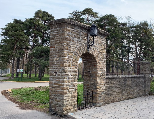
There were originally two sets of gates, one on Bayview directly across from the end of Blythwood Avenue.  This set led directly to Sunnybrook Farm and was removed when the hospital was built in the mid-1940s.  The second set can be found at the end of Sutherland Drive and it led directly to York Lodge.  The pair of stone gates feature ornate wrought iron lamp posts which must have looked quite spectacular to guests arriving for an afternoon fox hunt or social gathering.

IMG_2494

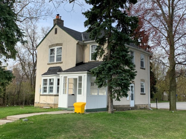
The only remaining building from the York Lodge estate is the gatehouse.  It stands just inside the gates and is identified as number two on the map.  Along with the gates, it was listed on the Toronto Heritage Register in 2005.

IMG_2496

There were four summer cottages on the estate but they have all been demolished.  The picture below is from the Toronto Archives and shows one of them.  They’re marked 3-6 on the map above.

Kilgour cottage

When Alice donated the property to the city she kept ownership of York Lodge and continued to live there until 1930.  She sold it to another prominent Toronto business man named David Dunkelman.  He was the president of Tip Top Taylors.  Dunkelman only kept it for 6 years before selling it to Captain James Flanigan.  In 1943 Flanigan converted it into a military hospital renaming it Divadale after his daughter Diva.  In 1953 it was converted into a convalescent home for veterans but was demolished around 1980.  This archive photo is credited to John Chuckman and gives us a look at the outside of York Lodge after the name was changed.  It is marked as number 7 on our map.

Divadale

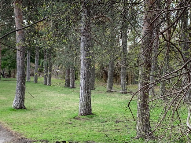
Lydhurst Hospital was constructed on the property in 1978 but some of the roadways and landscaping can still be found as well as rows of mature trees planted in straight lines.

IMG_2499

The lane way is shown as number 8 on the old photo above.  It led down the hill from York Lodge to Sunnybrook Farm and connected with the other lane way off of Bayview Avenue.  At the bottom of the hill the lane crossed Burke Brook at the point just before the brook enters into the Don River.  Burke Brook takes its name from Edward Burke who owned the 200 acre farm in 1860.

IMG_2515 (1)

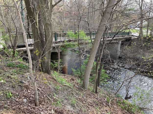
The Burke Brook bridge is architecturally interesting because of the wings on either side of the abutments.  When the water level is just right you can see a small waterfall through the centre of the bridge.  The off-leash dog park can be seen in the background.  It seems strange now that there are no dogs playing and chasing each other in the park.  This bridge is number 9 on the map above.  Near this bridge is a circular well or pumping station that we featured in last weeks companion post Staying Close To Home.

IMG_2509

The bridge over the Don River is more typical of one used by regular traffic.  This bridge was closed to vehicles when the farm was donated to the city as a park and is number 10 on the map.  Alice Kilgour decreed that the park should remain free of charge for the citizens to use and that no road should be allowed to pass from Bayview through to Leslie Street.

IMG_2516

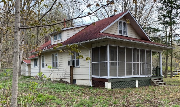
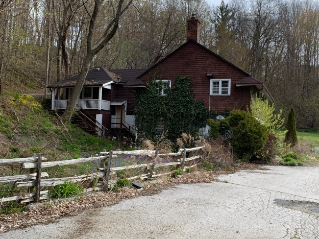
The 1964 photo above shows a building identified as number 11.  This structure no longer exists but number 12 still stands, tucked in overlooking the river and bridge.  These homes were built for the use of various farm and estate workers.

IMG_2518

The house identified as 13 on the map was tucked in behind the horse barn and is another of the farm worker homes that were deeded to the city along with the land.

IMG_2520

A very ornate barn with two silos is shown as number 14 on the map.  Unfortunately it was destroyed in a fire on May 21, 2018 killing 16 horses that were housed inside.  Another 13 horses were moved to another barn and were saved.  This barn was home to the Toronto Police horses for many years until they were relocated to the CNE grounds.  The picture below was taken from our Sunnybrook Park post.

img_0303 (1)

This picture was taken from the space where the barn formerly stood, now a vacant field with no trace of the barn or silo.  The outer fence for the horse paddock can be seen in the photo above as well as in the distance below.  Across the way is a second barn from Sunnybrook Farms where the cows and other farm animals were kept.  Horses that were rescued from the fire were moved over to this barn, labelled as 15 above.

IMG_2523

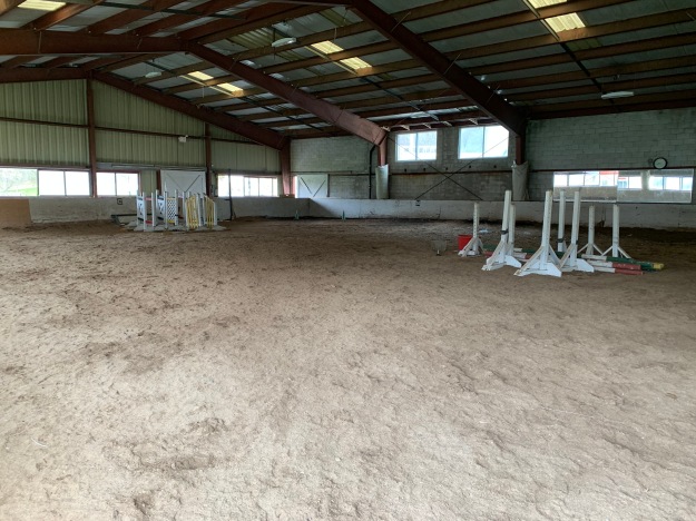
Kilgour erected one of the first indoor riding riding arenas in Canada which is shown as item 16.

IMG_2529

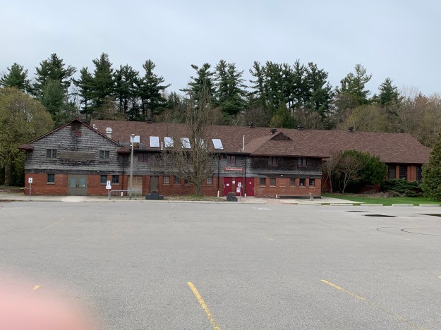
One other building in the compound, number 17, currently houses washrooms and has an equipment shed in the one end.

IMG_2533

Building number 18 caught my attention because it looks like an older style of farm house.  This house is not listed on the heritage register but I wonder if it may have been erected by the Burke family before Joseph Kilgour bought their homestead farm to create his dream estate.  I had planned to walk right up and get a better view but the sign on the tree gave me reason to reevaluate that plan.

IMG_2534

On the valley floor near the Don River is a large patch of Mayapples.  The plants with two leaves are the only ones that will produce buds and that appears to be the case for most of these plants.  The bud pictured below will open into a single flower that will later produce the lone fruit on this plant.

IMG_2546

The lane way back to Bayview is marked as 19 on the map and now leads to the rear of Sunnybrook Hospital.  To the north of the hospital are three other country estates that were built by the wealthy so they could escape the city.  The stories and pictures of these former estates can found in our previous post entitled Bayview Estates.

IMG_2548 (1)

Although it has been nearly a century since the property was given over to the city a surprising number of artifacts remain from the days of Joseph and Alice Kilgour.

Google Maps Link: Sunnybrook Hospital and Park

Like us at http://www.facebook.com/hikingthegta

Follow us at http://www.hikingthegta.com

Also look for us on Instagram

Staying Close To Home

Sunday, May 3, 2020

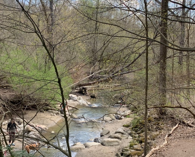
In keeping with the request to limit travel I decided to take advantage of the nice weather and walk through the Burke Brook ravine to The Don River and back.  Years of exploring different places each weekend has left me with the impression that my local park was boring.  That certainly wasn’t true.  One section of the trail along Burke Brook in Sherwood Park is an off-leash dog area and is currently closed due to COVID-19.  This forced me to walk along Blythwood Avenue until I reached Bayview.  From just south of there I could enter the ravine near the old Bayview Transformer House.   I stopped to see the deterioration that had occurred since my last visit.  With all the windows broken, the weather has been able to get inside and the ceiling is almost gone.

IMG_2399

White Fawn Lily are a variation of the yellow Trout Lily.  These plants are also known as Adder’s Tongue and Dog’s-tooth Violet.  Yellow Trout Lily are very common throughout the GTA but the white ones are a rare find.

IMG_2466

Twice I thought I heard something in the leaves but couldn’t identify a source for the sound.  Moments later I crested a small rise to see a Garter Snake crossing the trail.  It stopped to say “Hello” and then was gone under the leaves.

IMG_9823

There is a well used trail along the valley floor that follows Burke Brook and the upper trail is used mostly by cyclists.  For this reason you need to be cautious as there are places where allowing a bike to pass is tricky.  There’s also a couple of steep sections that are impassible when muddy.  The section pictured below has a knotted rope to help people get up the slope.

IMG_2417

White Trillium are the Provincial Flower for Ontario.  Along the trail I found a small patch of three.  At this time of year I usually follow the progress of the red ones in G Ross Lord Park.  These are less common than the white ones, but there are between 3 and 5 red flowers in one spot and 2 in another.  On occasion, the white flowers may have a green stripe down the middle of each petal.  This is caused by a virus and the size of the stripe will increase until the plant is no longer able to produce proper flowers and seeds.

IMG_2419

I returned to the trail in the valley which has a boardwalk through sections where water is weeping out of the ground.  There were a few people on the trail but when parks are only used by the locals, it is fairly easy to respect social distancing guidelines.  We’ll see how it goes when they ease the restrictions and everyone rushes out to the trails the first nice weekend.  I hope people won’t be careless and cause the parks to be closed again.

IMG_2421

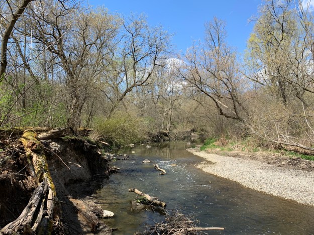
Burke Brook enters the Don River near another off-leash dog park which is currently closed.  It is possible to get to the mouth of the brook but other people were already enjoying it so I chose to go another way.

IMG_2423

Near the mouth of Burke Brook I found the remains of of a concrete circle, possibly a well except that had been lined with wood.  I decided that it had probably been part of the landscaping for the home of Joseph and Alice Kilgour.  The donation of their 200 acre estate had allowed the creation of Sunnybrook Park and provided the land for Sunnybrook Hospital.  Later, as I did a little research, I discovered that there just might be enough interesting stuff around to tell their story.  It looks like another neighbourhood walk is in order.

IMG_2425

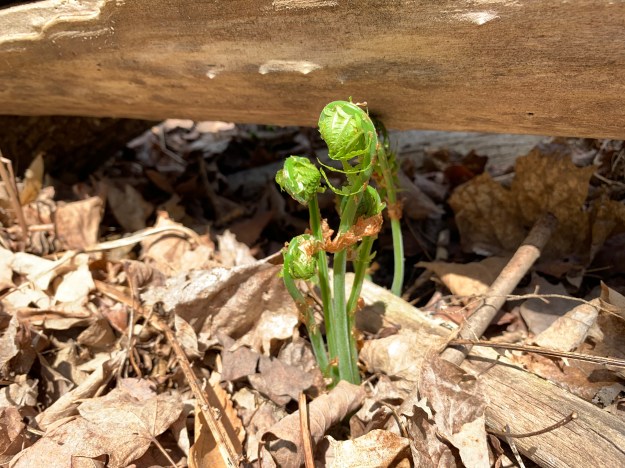
There were many Ostrich Ferns throughout the area, just beginning to open.  At this point of their development people often refer to them as Fiddlehead Ferns because their shape is similar to the end of a fiddle.  Later when they are fully open they resemble Ostrich plumes, from which they take their name.  It is when they are very young that people pick them to enjoy the annual delicacy of fresh fiddleheads.

IMG_2427

Bloodroot is a member of the poppy family and is one of the earlier spring flowers.  There is a single leaf and flower that emerge on separate stems but with the leaf completely wrapping around the flower bud.  The red sap from the roots of the plant was traditionally used as a dye for clothing and baskets.  It was also used by the native peoples as an insect repellent.

IMG_2430

You can follow the Don River northward until you come to Glendon Forest.  This section of the river is usually home to a heron and several families of cardinals.  I didn’t see any and decided not to wander too far into Glendon Forest as that is another entire adventure on its own.

IMG_2432

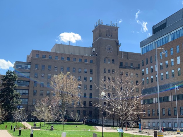
The original driveway leading to the Kilgour properties still leads back up the hill toward Sunnybrook Health Sciences Centre.  It was here that the first presumptive case of COVID-19 in Ontario was recorded.  I walked by and realized that behind these walls are hundreds of true heroes.  This blog is dedicated to everyone who works in this series of hospital buildings and all other front line workers, everywhere.

IMG_2434

All of this was within walking distance of my home.  What is waiting near you?

Click here for our previous story on Sunnybrook Park.

Google Maps Link: Sunnybrook Park

Like us at http://www.facebook.com/hikingthegta

Follow us at http://www.hikingthegta.com

Look for us on Instagram

Butterflies of the GTA

Sunday, May 3, 2020

There are over 100 species of butterflies that are found in Ontario and as you hike throughout the GTA you have an opportunity to see many of them.  With the COVID-19 lock down still underway we thought for our fifth Corona-blog it might be interesting to take a look some of the butterflies we’ve manged to get pictures of.  We hope you enjoy the pictures while we wait for the parks and trails to open again.

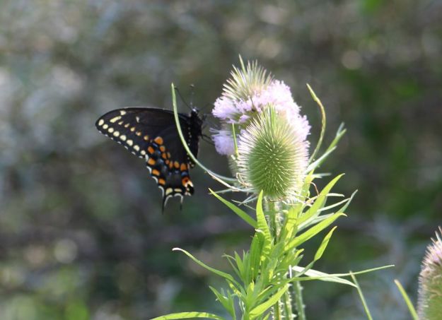
There are over 550 species of Swallowtail butterflies worldwide but we see only a few of them in Ontario.  Black Swallowtail have two broods each year with the first one emerging from their over-wintering in mid-May.  A second brood emerges in mid-July and flies throughout August.
Black Swallowtail

The Spicebush Swallowtail has large blue iridescent spots on the hind wings.  This butterfly is less common in the GTA but can be seen regularly in Point Peele and at The Pinery.

Swallowtail

Eastern Tiger Swallowtail is one of my favourite butterflies and it is fairly common in the GTA.  It also has two distinct broods per year.

EasternTiger Swallowtail

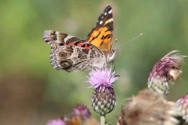
The Painted Lady is also featured on the cover photo of this post and has a complex pattern on the under wing.  It looks similar to the American Lady which is more common in Ontario.

Painted Lady

American Lady butterflies have less colour on the under wing than the Painted Lady featured above.  It has two large eye spots on the bottom of the hind wing.

AmericanLady

Red Admiral are dark in colour with a bright orange band across the wings.  They are one of the more common butterflies in the GTA.

Red Admiral

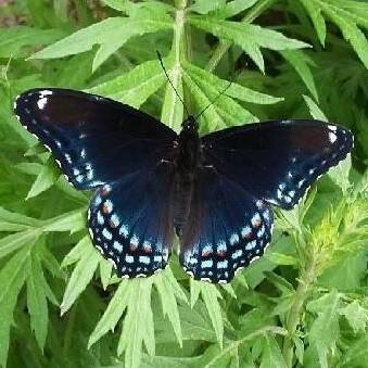
White Admiral are deep blue to purple with a broad white band across the wings.

White Admiral

White Admiral under wings have considerably more red than the upper side of the wing.

White Admiral underwing

Great Spangled Fritillary is one of the largest fritillary butterflies in Canada. The underside of the wing will have a silver band along the edge of the wing.

Great Spangled Fritillary

Little Wood Satyr have four large eye spots on the wings, two on the front wing and two on the hind wing.

Little Wood Satyr

The Red Spotted Purple is a subspecies of the White Admiral.

Red Spotted Purple

Monarch Caterpillars become the butterflies that are perhaps the most recognizable to a lot of people.  The caterpillar can be found on milkweed which is the primary food.

Monarch caterpillar

Male Monarch butterflies have two little black dots on the hind wings that contain a scent to attract the females.

Male monarch

Female Monarch butterflies lack the black dots.

Female Monarch

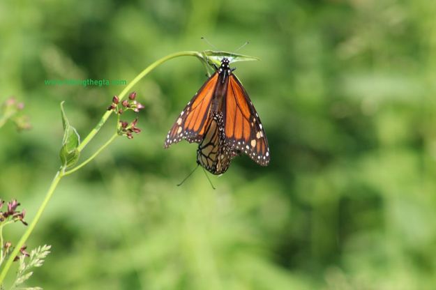
The picture below shows a pair of Monarchs mating.  The mating process can last for up to 16 hours. It usually starts one afternoon and can last until the following morning.

Mating

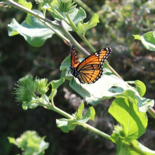
Viceroy  butterflies look very similar to Monarchs except that they have a black band along the edge of the wing.

Viceroy

Mourning Cloak butterflies are one of the first ones to be seen in the spring.  They over winter among the dead leaves on the ground and emerge when the weather warms up.

Mourning Cloak

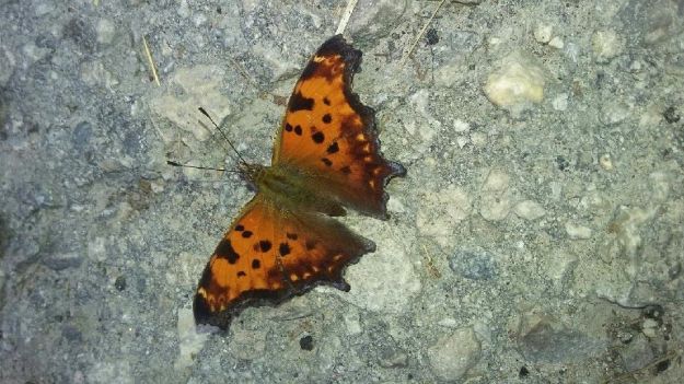
Gray Comma butterflies are interesting because the underside of the wings looks just like a dead leaf.  They can be well disguised when they want to be.

grey coma

The Question Mark  looks similar to the Gray Comma but doesn’t have the deep section between the front and rear wings.

Question Mark

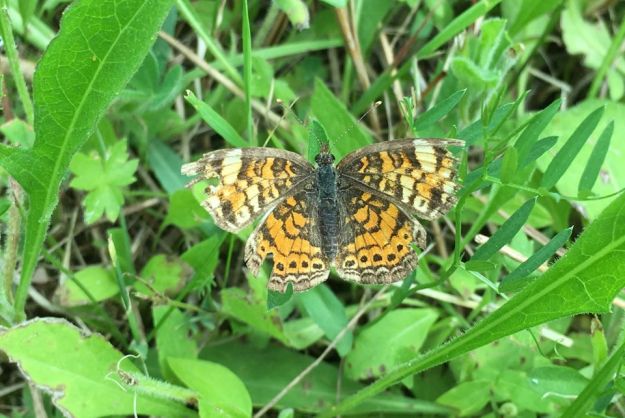
Pearl Crescent butterflies have several similar species but can be distinguished by the fine black lines that cross the orange sections of the wings.  A row of black dots lines the outer edge of the rear wing.

Pearl Crecent

Silver Spotted Skipper are the largest of the native skippers.  The males can be very aggressive in defending their little territory, chasing everything else away.

Silver Spotted Skimmer

Clouded Sulphur butterflies are one of the most common yellow butterflies in Ontario.  They seldom sit with their wings open so getting a shot of the upper wing requires luck and good timing.

Clouded sulphur

The Appalachian Brown is very similar to the Eyed Brown.  The line on the under wing that separates the darker area from the lighter has gentle curves rather than being zigzagged like on the Eyed Brown

Appalatian BRown

Milbert’s Tortoishell butterflies have three broods per season and are one of the distinct species in our area as there are no similar looking ones.  The bright orange band on the wings is complemented by red spots on the front wings.

Milberts Toitose Shell

Getting pictures of butterflies can be time consuming because they don’t always sit still and wait for you to get a good shot.  Patience is the virtue that will come in most handy.

Google Maps Link: look anywhere

Like us at http://www.facebook.com/hikingthegta

Follow us at http://www.hikingthegta.com

Look for us on Instagram