Category Archives: Canal

Burlington Canal

Saturday, April 27, 2019

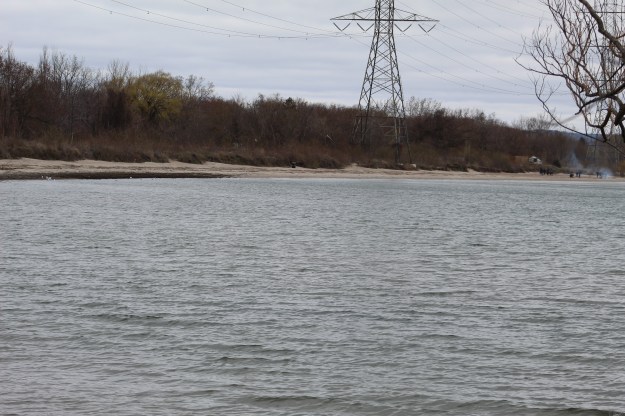
The western end of Lake Ontario has a baymouth barrier formed of sand carried from the Scarborough Bluffs by the longshore drift of the lake.  It shelters Burlington Bay and became the site of a canal proposal in 1823.  James Crooks was instrumental in getting the idea going and had been the man behind the first paper mill in Upper Canada.  Work on the canal began in 1826 and was completed in 1832.  We decided to go and check out this early engineering project for ourselves.  There is plenty of free parking just south of the Burlington Lift Bridge and from there we enjoyed walking along Hamilton beach.  After crossing the lift bridge the beach becomes Burlington Beach although high water levels in the lake are causing the sand strip to disappear.

IMG_3406

When the canal was cut through the sandbar it was recognized that piers would need to extend into the lake to calm the waters in the canal and prevent it from silting up with sand.  Wooden piers were installed but these kept being damaged in the winter storms.  In 1830 it was decided to replace the wood piers with stone ones.  Large stones were brought up from the bottom of the lake by stone hookers.  These were then taken and thrown into wooden cribs to build more permanent piers.  The story is told of Jem Horner whose leg got crushed between a scow and one of the cribs.  Apparently his fellow workers carried him up the beach a ways and dumped him in an old building before returning to work.  Jem was later found in agony and a doctor had to amputate his leg.  Jem later died but they say his one legged ghost still walks the beach strip looking for his leg and also for revenge.

IMG_0037

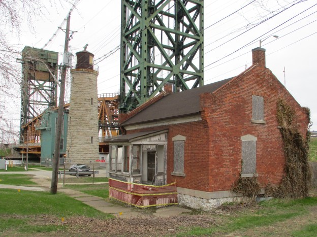
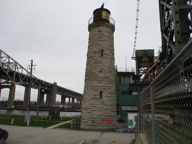
The lighthouse keepers house was built of wood and constructed in 1838 beside the wooden lighthouse and the wooden ferryman’s house.  A passing steamer caught the piers and wooden structures on fire in 1856 and they were all destroyed.  This one and a half story cottage was built to replace it.  Originally it faced the canal but was moved a short distance to the present location around 1900.

IMG_0022

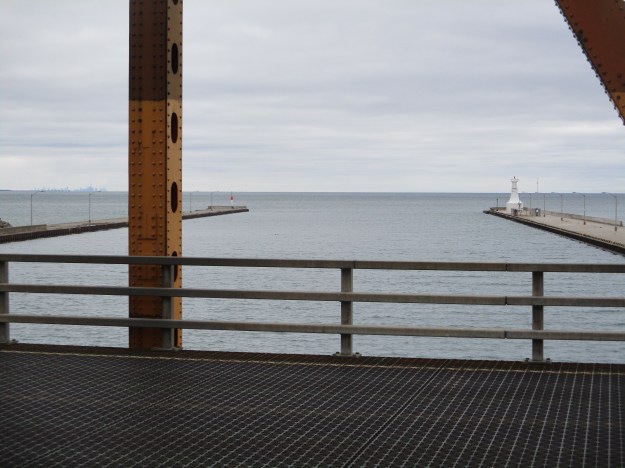
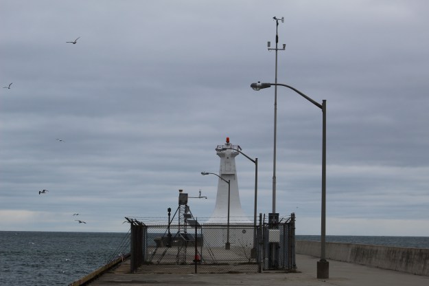
in 1838 a wooden lighthouse was built to help guide ships into the canal.  When it was lost to the fire of 1856 a new lighthouse was commissioned.  It was built in 1858 and stands 55 feet tall.  Built of white dolomite it was in service until 1961 when it was decommissioned having become redundant.  When the new lift bridge was built in 1962 the lighthouse was obscured from the lake.  There is a concrete light on the east end of the south pier that was built in 1909 to guide ships into the canal.

IMG_0011

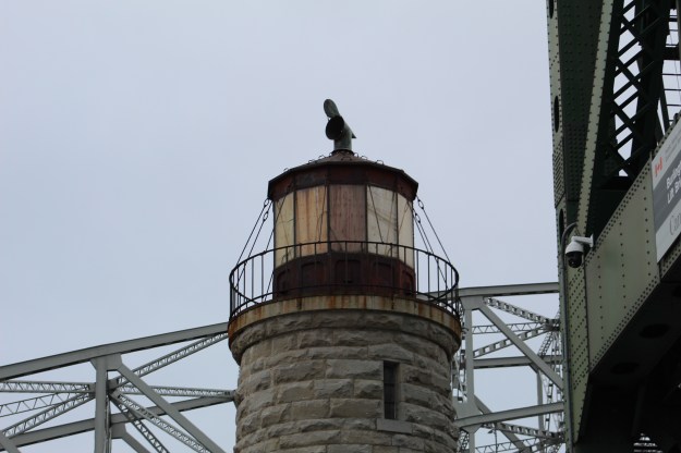
It originally had a pair of oil lamps which the lighthouse keeper had to tend daily.  They were later replaced with a third order Fresnel lense.  This lense has been removed and placed in storage for the day when the lighthouse is restored.

IMG_3344

The long-tailed duck breeds in the arctic and will migrate into Southern Ontario for the winter months.  The long-tailed spends a higher percent of time under water than any other duck.  When it is foraging it can spend four times as long submerged as it does on the surface.  It is also one of the deepest diving ducks being able to go 60 metres to forage.  A banded one was once tracked for 17 years in Alaska.

IMG_3381

Environment Canada maintains an automated weather reporting station on the south pier.  The 1909 pier light can be seen in the background.

IMG_3387

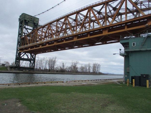
Two bridges can be seen with the lift bridge in the foreground.  The Burlington Bay James N. Allan Skyway bridge was built in two phases.  The steel arch span was built in 1958 while a concrete span was added in 1985.

IMG_0032

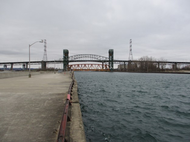
The lift bridge is the fifth movable bridge to cross the canal since it opened.  It is 116 metres long and weighs almost 2,000 tons.  Originally the bridge carried two lanes of traffic and a set of tracks for the Hamilton-Northwestern Railway but in 1982 the tracks were removed so that four lanes of traffic can cross the bridge.  It lifts about 4,000 times per year and we were on it when it was about to rise.  You have to get off ASAP as you are not allowed to go along for the ride.  The bridge lifts 33.5 metres but they have to make sure it is all the way up before the ships start to enter the canal. If there is a malfunction and the bridge drops the larger ships may need a mile to come to a stop.

IMG_0052

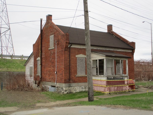
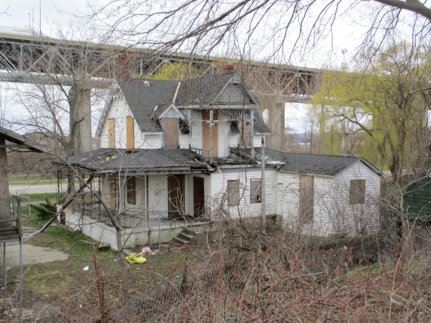
The house that stands at 900 Lakeshore Court in Burlington was the first house built on the beach strip north of the canal.  George Frederick Jelfs had emigrated to Hamilton in 1871 had been appointed the police magistrate for Hamilton in 1893.  Two years later he had this house built for a summer home.  In 1907 Jelfs was instrumental in keeping Hamilton from annexing the strip of beach north of the canal.  The City of Burlington is now thinking about taking over this property and now it appears to have had a recent fire.  This could be a case of another heritage home bites the dust.

IMG_0044

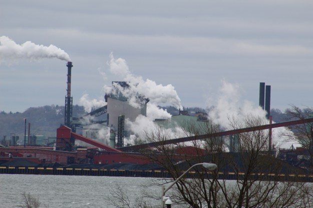
The opening of the canal had a direct impact on the growth of Hamilton.  With a sheltered bay for a harbour heavy industry began to line the shores of the lake.  Of the 6,500 vessels that pass through the canal each year about 1,000 of them are cargo ships.

IMG_3444

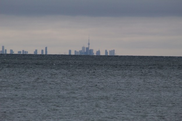
From the Hamilton Beach you get a view of the city of Toronto that makes it look like it is built out on top of the water.

IMG_3279

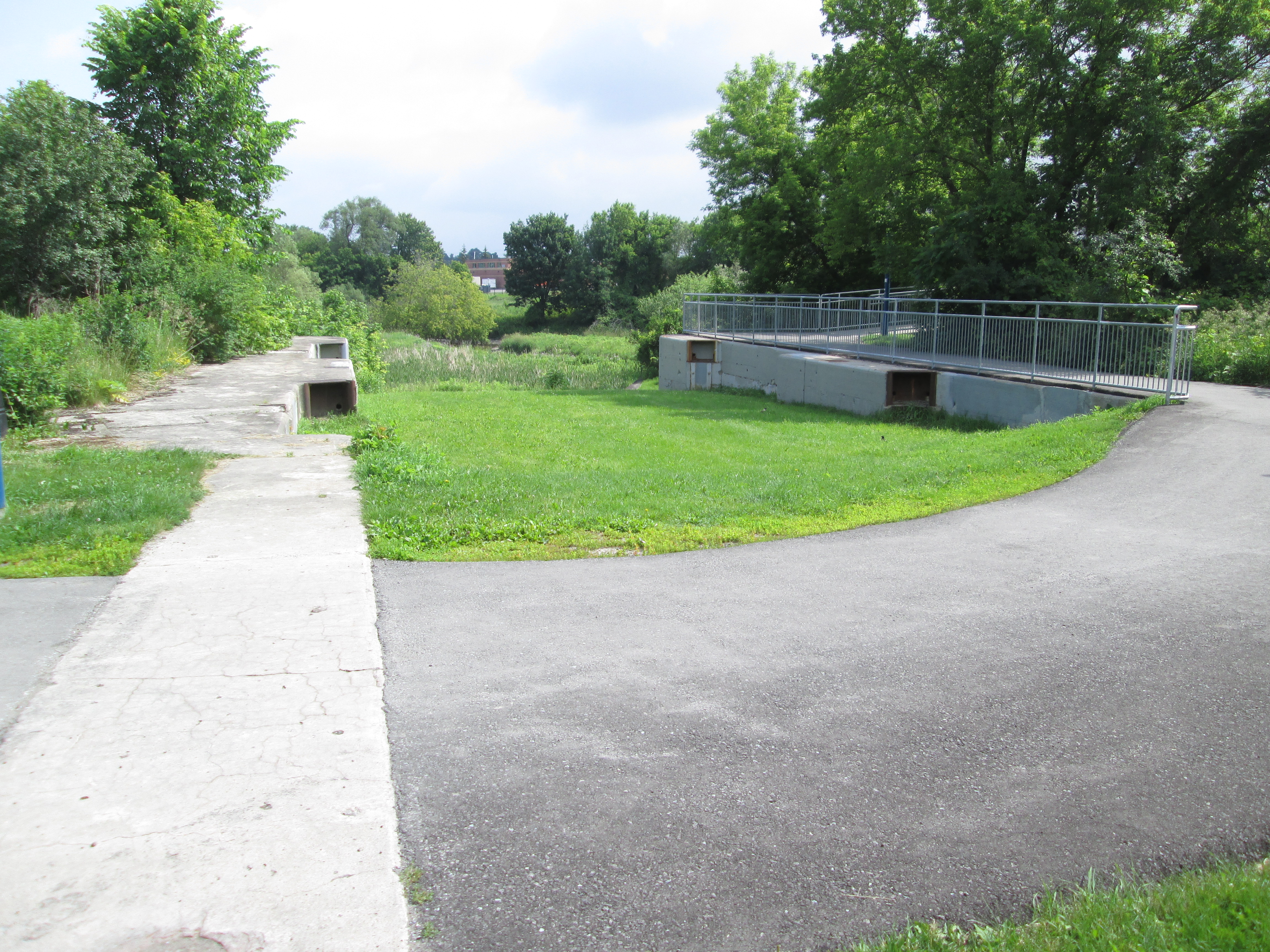
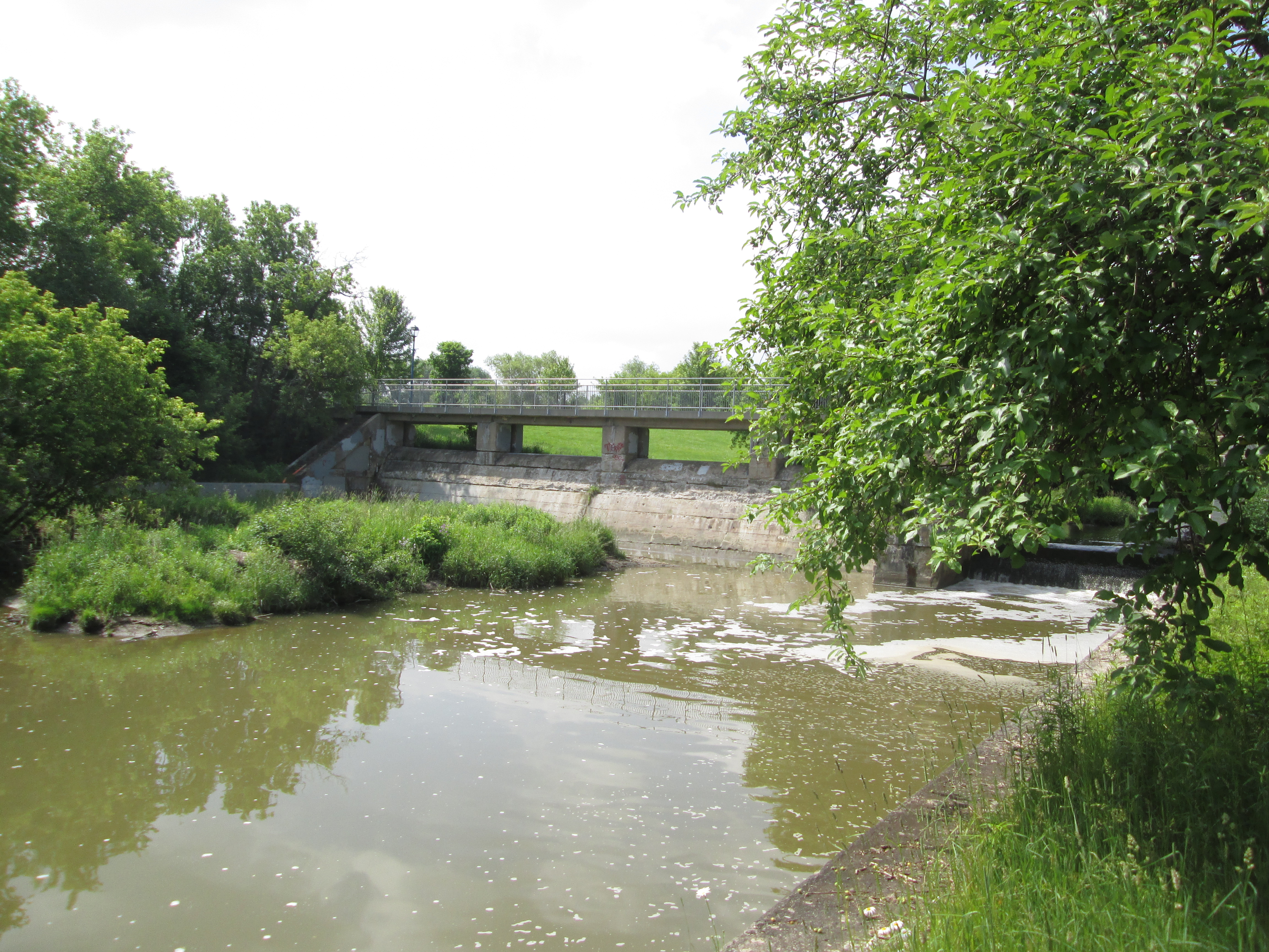
The beach looks like a great place to spend a hot summer day enjoying the water and the the breeze off the lake.  The whole area is also accessible by the Waterfront Trail which passes along the entire length of the sandbar.

Check out a review of the twenty most popular posts from our first five years at this link. Back Tracks – Five Years of Trails

Google Maps Link: Burlington Canal

Like s at http://www.facebook.com/hikingthegta

Follow us at http://www.hikingthegta.com

Newmarket Ghost Canal

Sunday June 21, 2015

It was the first day of summer and although the sky was threatening rain it wasn’t actually supposed to happen.  I decided to check out the remains of the partially constructed Newmarket Canal.  I parked in the conservation parking lot off of Green Lane near the second concession.  The East Holland River crosses here and heads north out of
Newmarket.  I walked about 15 minutes south of Green Lane to where the third lock on the abandoned canal was built to start my investigation of the canal.

The idea of building a canal to link Lake Ontario and Lake Simcoe had it’s beginnings in the 1820’s.  Following the War of 1812 greater consideration was given to the moving of goods and people and a period of canal building began.  The first Welland canal opened in 1829, the Rideau in 1832 and Trent-Severn in 1833.  An idea was brought forward to link Lake Ontario near Toronto with Lake Simcoe and then Georgian Bay.  The project never got past the drawing board however and was abandoned until Rowland Burr resurrected it in the 1850’s.  In 1857 he had some success and the government commissioned the Lake Ontario and Georgian Bay Canal.  The idea was to use the Humber and Holland Rivers to reach Cook’s Bay on Lake Simcoe. With all the dredging and locks that would have been required the cost became too great and the idea was put on the shelf.

William Mulock was born in 1844 and was a member of parliament from 1882 until 1905. Serving as the MP for Newmarket, Mulock revived the idea in response to his constituent’s requests to do something about rising railway prices.  Mulock envisioned the canal extending only as far as Newmarket with a possible future extension to Aurora.  In 1904 Mulock proposed the canal which began construction in 1906.  The first section from Lake Simcoe to Holland Landing would require no locks but there would be three locks between there and Newmarket. The third lock was intended to lift boats 11 feet but as can be seen below has been filled in and is now part of Bayview Park.

IMG_5801

The dam has also been partially filled in as the first three sections are near ground level behind the dam. A sluice gate allows the river to bypass the old lock.

IMG_5805

Black Raspberries grow along the sides of the trail between lock number three and Green Lane. It looks like there will be a nice crop coming soon for those who live in the area.

IMG_5815

Four swing bridges were constructed of which only the one near Green Lane remains.  This one was built on the Kelley Farm and was locally known as the Kelley Bridge.  The blue swing mechanism can be seen under the new pedestrian bridge in the picture below.  The bridge would have swung across to rest on the concrete support to make way for a ship to pass through the canal.

IMG_5790

The gears that ran the swing bridge remain in place although the bridge was never used in that manner.  It was used as a stationary steel truss bridge to carry Green Lane over the Holland River until 2002 when it was replaced with the newly widened road and bridge.  The earlier truss bridge was removed in 2004 for safety reasons and the swing bridge works painted to help preserve them.

IMG_5795

The paved path works its way up the west side but I chose the less used dirt path on the east. The trail leads to a hydro corridor and then through a marsh.  I kept following a set of human footprints that led me across two small streams and through a field onto an abandoned piece of roadway.  From there I could see the second lock.  Great Blue Heron seem to like the river and local marshes.  I saw at least three different ones as I made my way along the river.

IMG_5868

A red car hood has been tossed off of the bridge on the second concession and into the East Holland River.  A tree is taking advantage and growing inside the car part.

IMG_5842

Lock number two was the tallest of the three rising 26 feet.   An old concrete bridge still spans the river on the second line but it was added after the canal was abandoned and a swing bridge was no longer required.  This is now an abandoned bridge across an older abandoned canal lock.  Rogers Reservoir was intended to contain some of the water required to operate the canal and the canal walls extend well beyond the actual lock here to form the sides of the reservoir.

IMG_5850

The trail continues into Holland Landing where lock number one stands abandoned.  It’s lift was 16 feet and is the only one of the three locks that the river still runs through.  Holland Landing has it’s own collection of historic buildings including an 1870 court house and two churches from the 1840’s.  It’s interesting to ponder what might have become of the village if it had been home to one of the locks on a functioning canal system.

IMG_5908

The project ran way over budget and construction was about 2/3 complete in 1911 when the Federal Government changed after 15 years of Wilfrid Laurier’s Liberals to Robert Borden’s Conservatives.  Construction was stopped while the new government reviewed the project, ultimately determining that there simply wasn’t enough water to make it work.  Calculations showed it would take over 2 weeks to fill the locks and so the project was abandoned.  No further work was done until 1924 when a crew was sent around to make the locks safe.  The picture below of the first lock shows the mounting position for the swing bridge for Old Yonge Street which has since been removed.

IMG_5887

Although his proposal for a canal to Newmarket ended in disaster, earning the nickname “Mulock’s Madness”, he managed to have a very successful career after leaving politics.  He worked in the justice system serving as Chief Justice of The Supreme Court of Ontario from 1923 until 1936.  He passed away in his 100th year having earned his own nickname, “The Grand Old Man of Canada”, and a street name in Newmarket.

A story published in Newmarket Today on Feb. 9, 2019 contains considerable detail much of it setting the record straight on some fake facts that can be found on the internet.  Included among them is the idea that there was insufficient water to operate the canal.  Richard MacLeod is an expert on Newmarket history (The History Hound) and his article can be found here.

Like us at http://www.facebook.com/hikingthegta