On a business trip to Peterborough in July I had a few minutes to stop and watch the operation of Lock 21 on the Trent-Severn Waterway. The waterway is 386 kilometres long and was first travelled by a European in 1615 when Jacques Cartier explored the region using long standing indigenous routes.
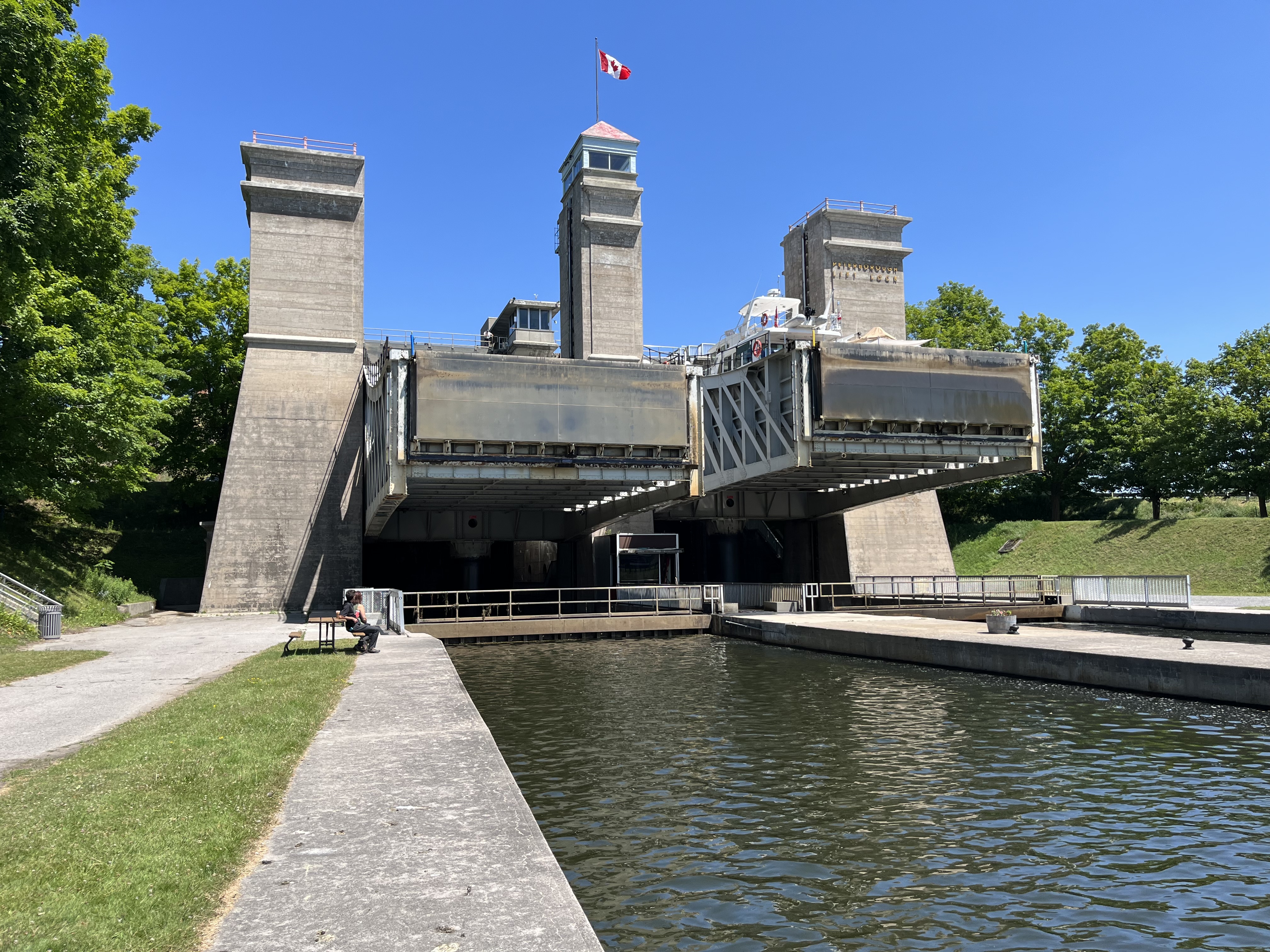
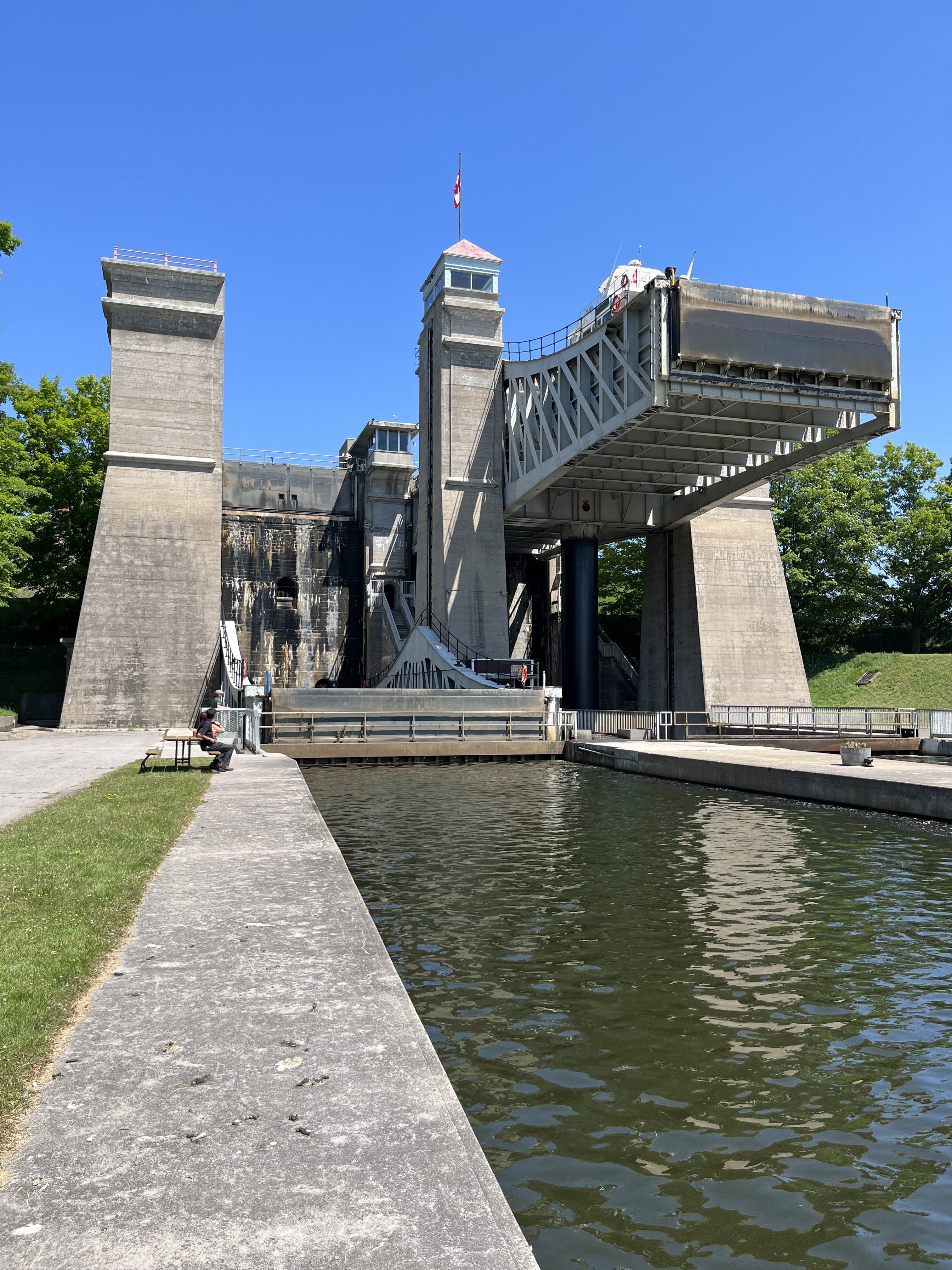
The canal was originally surveyed as a military route with the first lock being built in 1833 as part of a commercial venture. Three more locks were under construction in 1837 when the Rebellion broke out. It was determined that the canal would have too many locks to be used for rapid troop movements and so the three locks were completed, and progress was suspended. With the canal incomplete and no outlet to a major lake it was connected to other travel routes by toll roads, plank roads and eventually by railways. The image below shows the side view of the lift lock in Peterborough,
It was restarted in the late 1880s by the government of Sir John A. Macdonald, but little progress was made, and it was generally used as a political tool to get votes from the communities along the route. In the late 1890s it was undertaken with a new commitment, and it reached Peterborough and Lake Simcoe in 1904. The First World War slowed progress again and it didn’t reach Trenton until 1918 and Georgian Bay in 1920. By this time the ships had grown too big for the canal system and railways were carrying most of the commercial traffic. It became a pleasure route and eventually would be declared a National Historic Site of Canada and be used as a linear park. The image below shows the lift lock with the left hand side elevated and the right side being loaded for the next lift.
When it was completed in 1904 it was the highest hydraulic boat lift in the world and the largest concrete structure in the world. The vertical lift was 65 feet (20 metres) while most conventional locks had a lift of 7 feet (2.3 metres). The system consists of two identical caissons that sit at the level of the river at their lowest point. They each sit on a 7.5 metre diameter ram. In the picture below the lift is half completed and the two caissons can be seen beside each other.
When the lift reaches the top, it stops 12 inches below the water level in the upper reach. The gate is opened and water flows in to equalize with the level of the river in the upper reach. This causes the upper caisson to increase in weight so that it is 1844 short tons compared to the lower one which has 1700 tons of water in it. When the system is ready to reverse the valve between the two rams is opened and the extra weight in the upper caisson pushed the ram of the lower caisson up until the positions are reversed. The system requires no external power as the weight of the water is enough to operate the system.
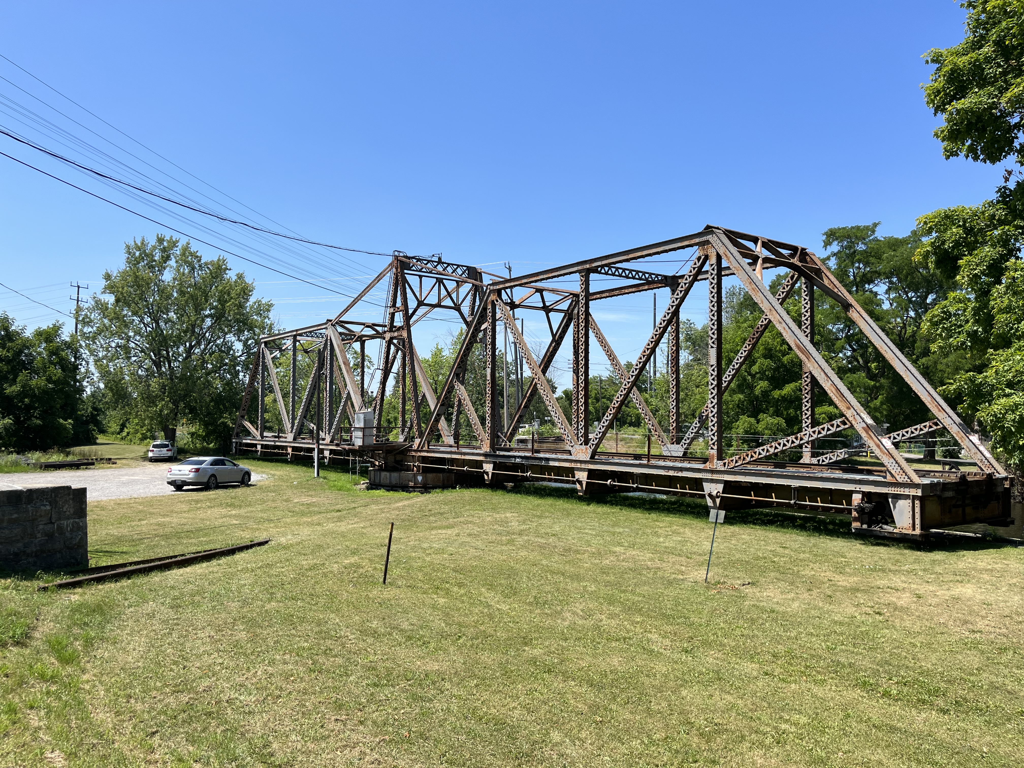
Just below the lock is a swing bridge that allows the Canadian Pacific Railway to cross the river. When not in use by the railway it is moved out of the way of boat traffic on the river.
The Peterborough Lift lock was declared a National Historical Site in 1979.
The Metropolitan Street Railway Company of Toronto was incorporated on March 2, 1877 and began service with animals pulling railcars up Yonge Street in 1885. On Sep. 1, 1890 electrical power was used for the first time, however, this didn’t last. Animal power was re-instituted within a few weeks and left in use until May 1891 when the electric service was resumed. In 1893 the name was simplified to Metropolitan Street Railway Company and then in 1897 to simply Metropolitan Railway Company. On October 26, 1896 the contract to build the 16 kilometer line from Hoggs Hollow to Richmond Hill was given to a Pittsburgh company who had only 24 days to complete the task. Three hundred men worked in 3 crews and finished with three hours to spare. The first train rolled into Richmond Hill on November 19th with the official opening coming on January 27, 1897. Service was extended to Aurora and Newmarket by 1899 and the Metropolitan continued until Nov. 1, 1904.
On Nov. 1, 1904 the Toronto Railway Company acquired the line and it became the Toronto & York Radial Railway. The City of Toronto bought the line in August 1922 and between January 1927 and March 16, 1930 it was operated by the TTC. When service was suspended the municipalities got involved and contracted the TTC to run it for them. On October 9, 1948 they were finally forced to admit that the service had been made obsolete by the personal automobile.
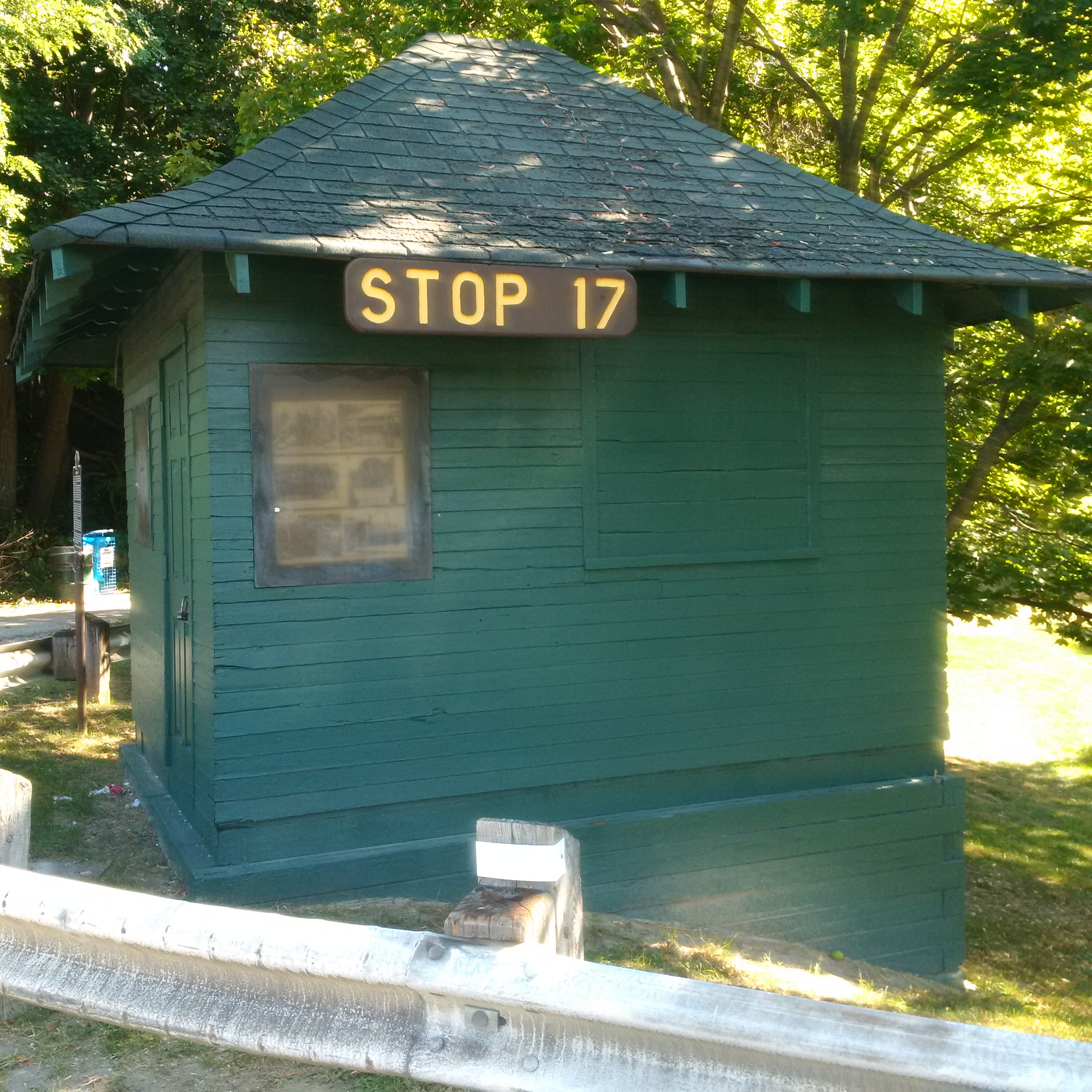
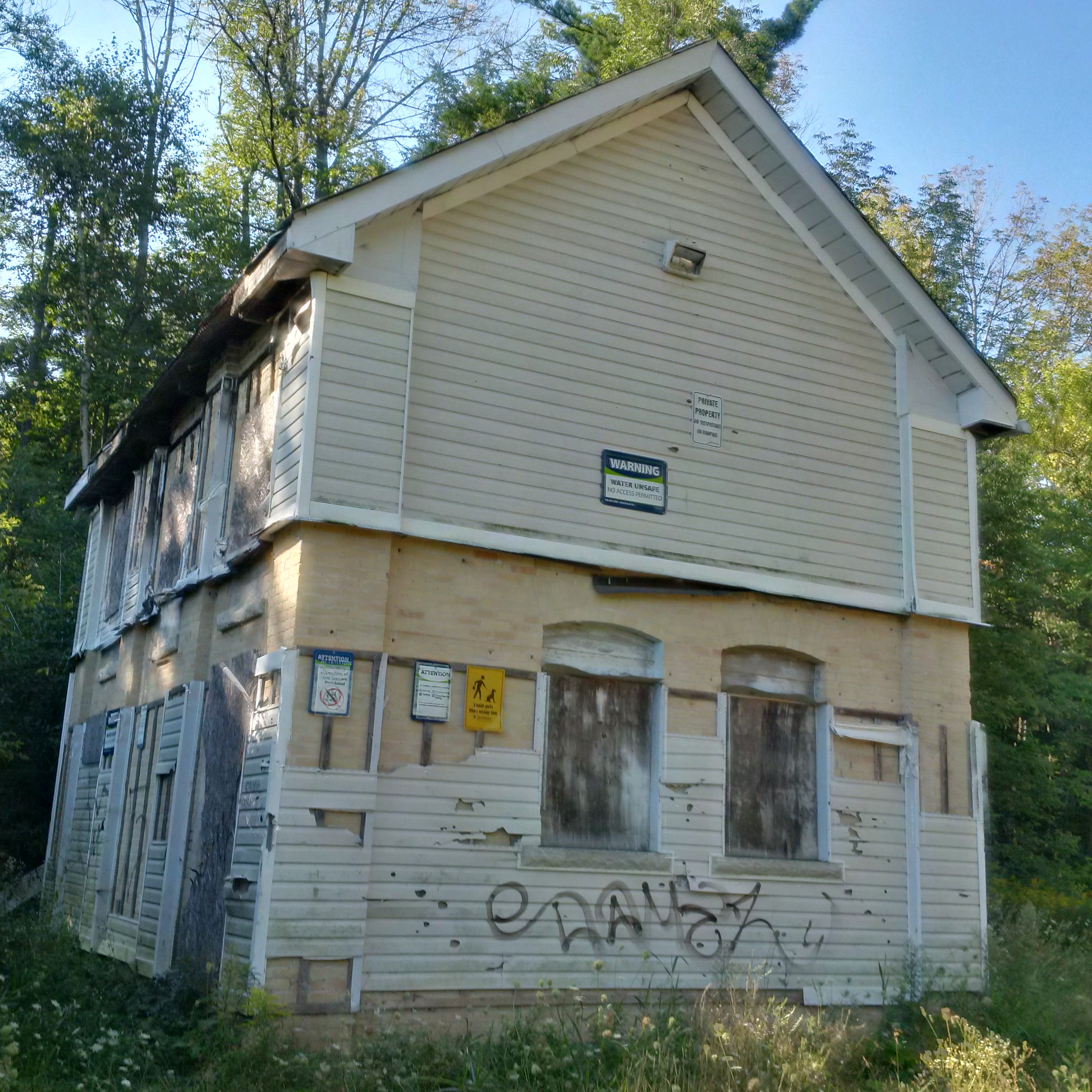
To accommodate passengers and freight the railway created a series of stops and constructed a variety of waiting rooms and stations. The picture below shows one of the simple waiting rooms, this one originally on the west side of Yonge Street at Royal Orchard Boulevard in Thornhill. It has been restored and moved just south to Cricklewood Park. Other, more substantial stations survive, having been converted to other uses. Queensville and Willow Beach Stations are now private residences. Keswick is a law office while Sutton has been converted to use as a real estate office.
The railway expanded north from Richmond Hill and in 1899 it built a generating station at Bond Lake. The stonework for the boilers and furnaces remains on site but they are getting overgrown and there are well established trees in the rows between the furnaces. The substation was built from brick but by the mid 1950’s it had been covered over with aluminum siding and was in use as a private residence. It has since been abandoned and has two large holes in the roof. Unlike other artifacts from the rail line there appears to be no interest in preserving this one. There are many more pictures of this site that were presented in a pictorial called Electric Railway Generating Plant.
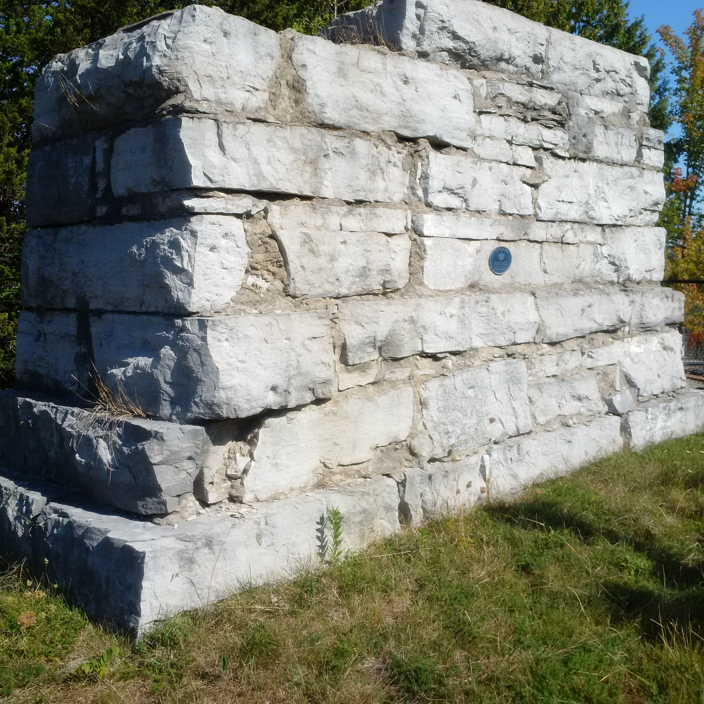
A former bridge abutment in Aurora marks the original route of the railway into town. It is located just east of Yonge Street off of Industrial Parkway. It was built in 1899 to support a trestle across the Grand Trunk Railway (GTR). The 9 foot column of limestone blocks was abandoned in 1922 when the trestle was removed. The radial line was relocated next to the Yonge Street underpass for the GTR.
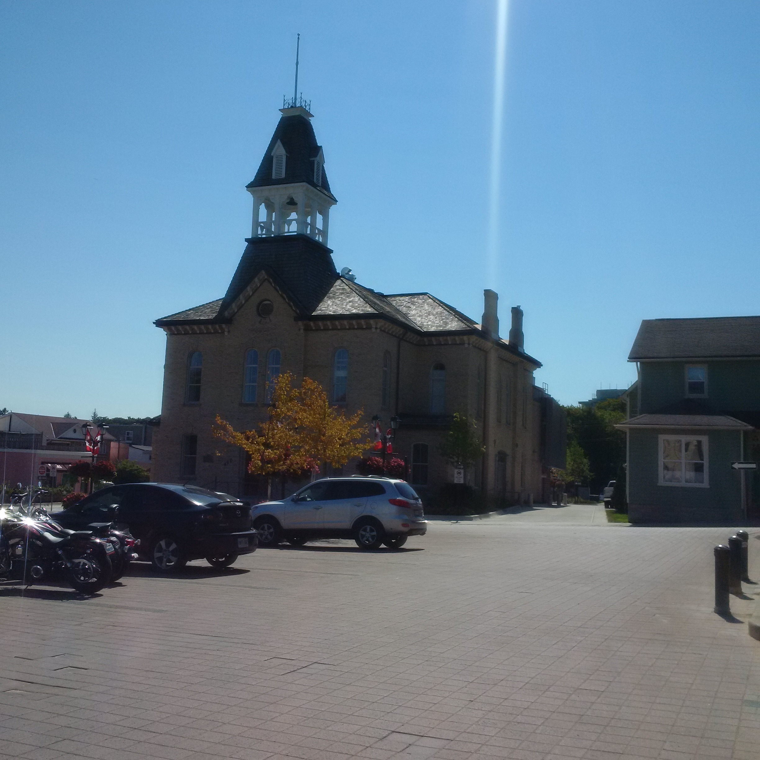
Newmarket was becoming the economic centre for a large area and in 1883 they decided to build a new town hall. The Italianate Style building housed a successful farmer’s market on the first floor and the town offices on the upper one. The train entered Newmarket along the side of the town hall and had it’s station and freight sheds where the parking lot is across the street.
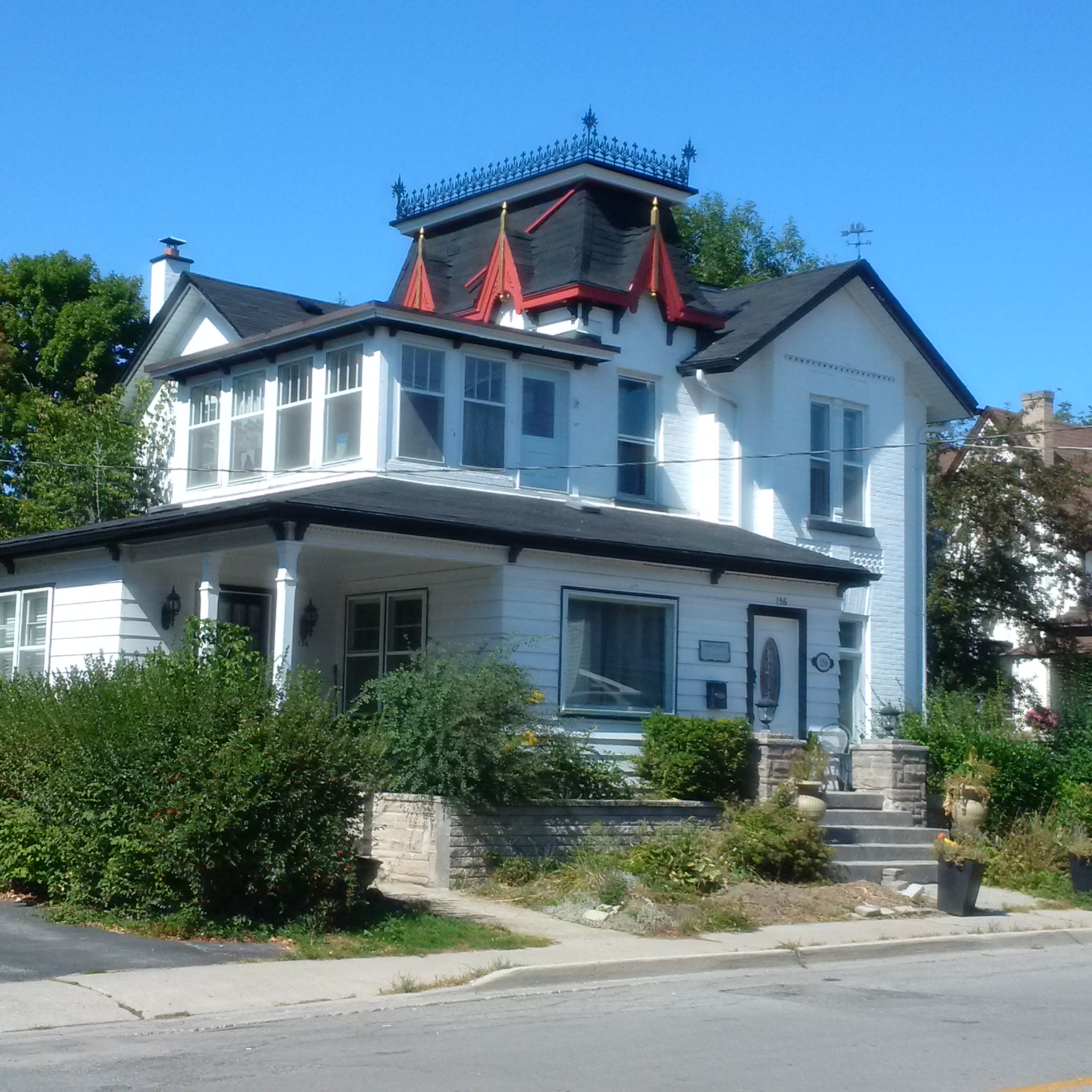
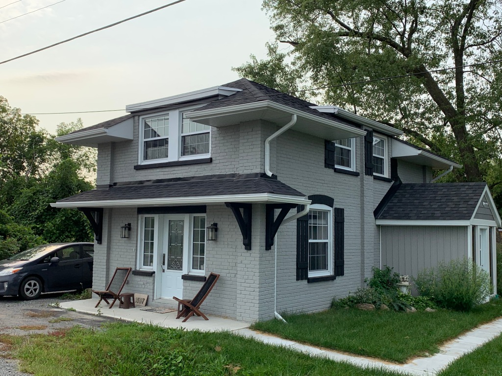
The railway made it’s way north toward Queen Street via Raglan but it’s not possible to walk through there anymore. You can go to Church Street where you will see the house pictured below. The Newmarket Historical Society has done a great job of identifying homes in the old town core and placing a plaque showing the original owner, their occupation and the date of the home. This Late Victorian home was built in 1894 for a painter named Ernest E. Groome.
The tracks followed Queen Street across Main Street to the GTR tracks where it departed from the street on it’s own trestle. The abutment still remains on the side of the tracks along with a smaller one that can be seen through the arch.
In 1909 the railway built the parabolic arch bridge that still spans the Holland River. It was one of the first concrete arches built in Canada and supported the trestle that crossed the river here and the GTR tracks above. It spans the river at 15 meters wide and rises 7 meters above it. Newmarket also has the very unique remains of an abandoned canal that proposed to connect the city with Lake Simcoe using the Holland River. When this portion of the railway was abandoned in 1930 the trestle was demolished. The arch has been recognized for it’s historic value and is being preserved by the city and the South Lake Simcoe Conservation Authority giving the city a second unique piece of transportation history. The arch is also featured in the cover photo.
By 1850 there were over 9,000 miles of railway track in the United States and only 60 in Canada. On October 15, 1851 a sod turning ceremony was held in Toronto to mark the start of the city’s railway era. The Ontario, Simcoe and Lake Huron Union Company made it’s first business run on May 16, 1853 going as far as Machell’s Corners (Aurora), 30 miles north of the city. Construction continued north in 1853 reaching Allendale later that year. After a series of mergers the GTR acquired this line in 1888. By 1900 passenger and freight traffic was still increasing and so a new station was built. It is a simple one story wood frame structure with wood cladding. The style is Queen Anne Revival that was popular between 1880 and 1910.
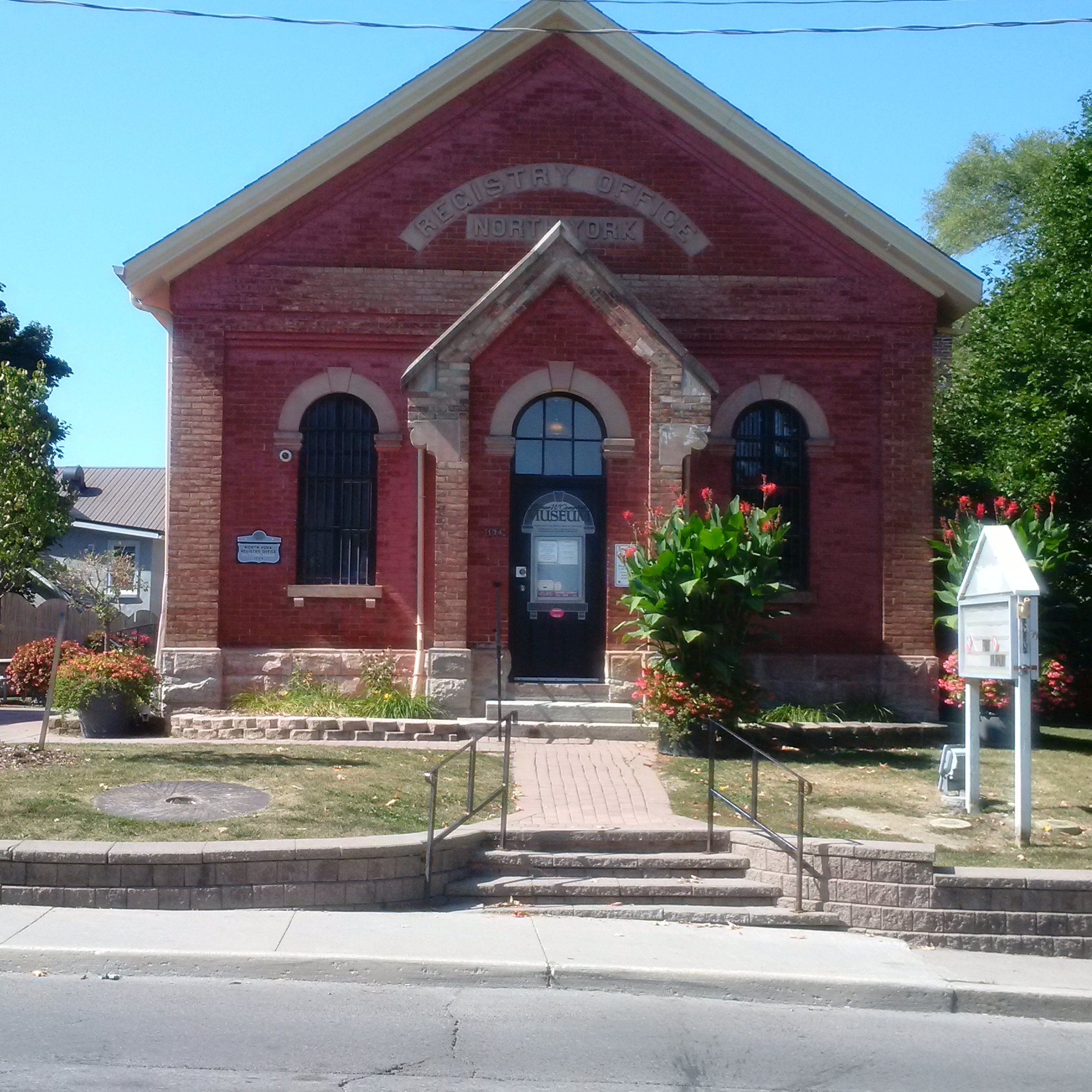
The North York Registry Office was built in Newmarket in 1884 to replace an 1863 building that sat on the lot to the immediate south. The building was designed to house the records of land titles, births, deaths and marriages in the County of York, except for the Toronto jurisdiction. It was intended to hold the county records for a period of 50 years. In the end it served until 1980, just shy of a century. It was built in a style that was mandated by the Ontario Department of Public Works in 1868. Today it houses a museum.
Feb. 14, 2017
A fire at Yonge and St. Clair destroyed the Badminton and Racquet Club building in one of the biggest fires in recent history. Until 1920 this had been the site of the car barns for the railway. The TTC was consolidating assets and the building was found to be redundant. There were seven courts laid out in the old car barns and it is said that tracks could still be seen buried in the floor of the racquet club.
October 14, 2021
Another generating station was located at the corner of Kennedy Road and Metro Road. It has since been converted into a private residence.
The Toronto & York Radial Railway built its terminus in Sutton in 1908. The station master and his family lived on the upper floor while the lower one served as the station. Radial service began in Sutton on January 1, 1909 and continued until March 16, 1930. The building was then purchased by the Hydro Electric Power Commission who used it as an office until 1970. It currently serves as home to a real estate brokerage. The beautiful brickwork has been covered over with bland siding but otherwise it remains in good shape with a bay window that no longer looks out over railway tracks.
There are still a couple of artifacts from the railway line that have not been documented. These include the Queensville Station which survives as a private residence.
Hiking the GTA was able to visit 86 different places in 2015 where we were able to see some truly amazing things. Each season has it’s own beauty and there are always things to be discovered. Over the course of the year more people became aware of the stories we were publishing and readership increased dramatically. Therefore a David Letterman “Top Ten” list would really only focus on the more recent stories. For that reason we present a review of the year 2015 by looking at the most popular post from each month. A brief outline of the story, a picture from it and a link are provided below. Thanks to everyone who read one of our stories this past year. I hope some of you were able to get out and enjoy some of these sites yourself because they are all interesting in their own way. Plus, you never know what wild life you’ll encounter.
Graydon Hall was released on January 10th. It visits a former millionaire’s estate finding plenty of evidence of it’s past usage. The abandoned pump houses featured below are part of the former irrigation system.
The Arsenal Lands was released on Feb. 7th. The abandoned water tower and rifle inspection building along with the former rifle range made this an interesting hike. One of the baffles from the rifle range is featured below.
Military Burying Grounds was published on March 22 and re-posted for Remembrance Day. This hike visits the two nearly forgotten places where our early military dead are buried in downtown Toronto.
Originally published on April 19th and recently given a Throwback Thursday release Guildwood Park where the inn is currently being restored. The post looks at the Guild Inn and it’s history along with several preserved pieces of early Toronto architecture.
May saw the release of Dufferin Creek which featured the remains of a 150 year old plank road that ran up Dufferin Street near Finch Avenue. It is related to Garbage Park which was a post featured in The Toronto Star. The spikes in the planks from the old road are 2 inches thick and 3 feet long.
The first day of summer saw the release of our most popular post of all time. The Newmarket Ghost Canal features the remains of the nearly completed but long abandoned attempt to link Newmarket to Lake Simcoe by a canal.
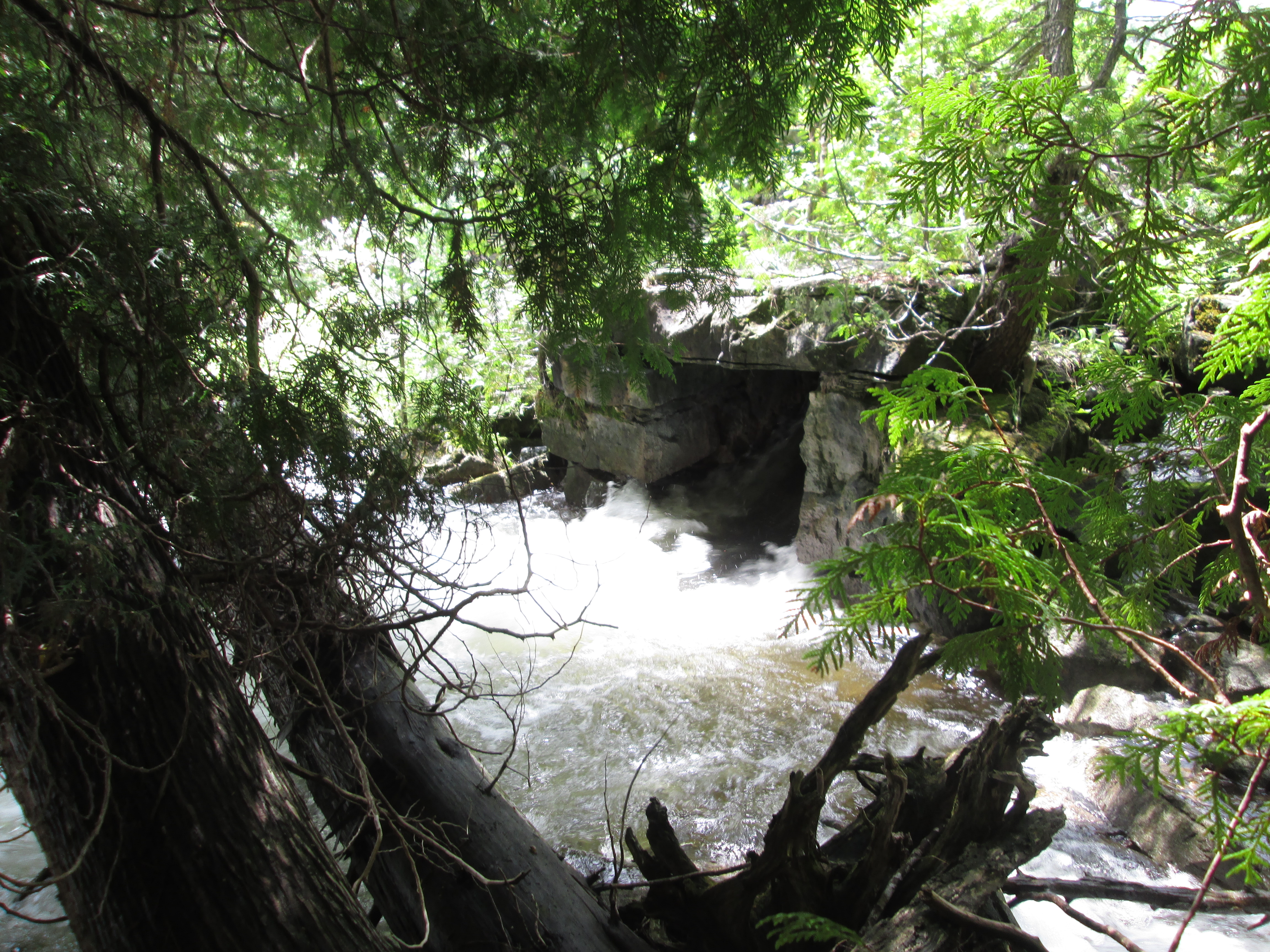
In July we completed our first 100 posts on Hiking the GTA and issued a review called Greatest Treks. One of the most interesting hikes of the month was The Stonecutter’s Dam. We visited an old dam near the Forks of the Credit which is made of blocks of cut stone. It also sports a rare stone penstock as seen below.
On August 15th we checked out Kerosene Castle in Oakville. The castle was built by Richard Shaw who was refining coal into kerosene in a factory across the street on Sixteen Mile Creek. Until it blew up, that is! When we got looking at the pictures we saw that one of them appears to have a large face in the oriel window. It doesn’t show up in any other pictures we took that day.
September 12th we visited the Ghost Town of Sixteen Hollow to see what remains of the formerly thriving mill village on Sixteen Mile Creek. There is plenty of history here but all that remains of the original village is the church and the some newer bridge structures.
October featured a discovery related to the Caledon Aerial Tramway which made for an interesting hike. On the 24th we found the 2 inch steel cable on The Cox Property. The underground chamber for the cable is seen below.
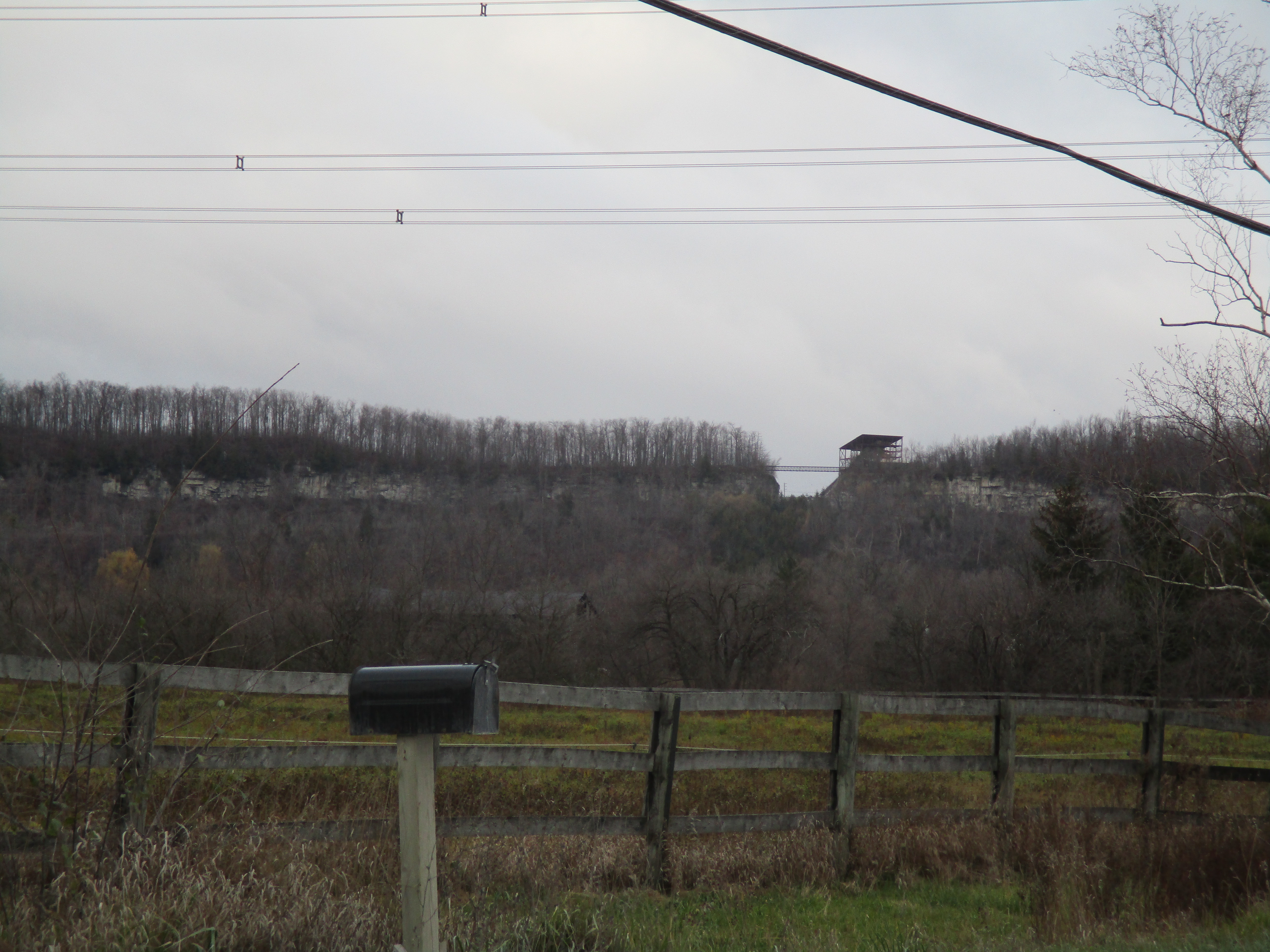
in 1962 a quarry blasted a gap in the escarpment near Milton. We visited The Gap on Nov. 14th in a hike that went on to become the second most popular story so far.
December was a busy time but it was an interesting month of hiking as well. We were back in Oakville on Sixteen Mile Creek on Dec. 13th when we visited The Vandalized Memorial to Taras Shevchenko. The museum was burned down, the monuments stolen and the site abandoned.
Thanks again for reading Hiking the GTA in 2015 and we hope you all have a great 2016 and enjoy the trails! We’re looking forward to many great hikes this year ourselves.
It was the first day of summer and although the sky was threatening rain it wasn’t actually supposed to happen. I decided to check out the remains of the partially constructed Newmarket Canal. I parked in the conservation parking lot off of Green Lane near the second concession. The East Holland River crosses here and heads north out of
Newmarket. I walked about 15 minutes south of Green Lane to where the third lock on the abandoned canal was built to start my investigation of the canal.
The idea of building a canal to link Lake Ontario and Lake Simcoe had it’s beginnings in the 1820’s. Following the War of 1812 greater consideration was given to the moving of goods and people and a period of canal building began. The first Welland canal opened in 1829, the Rideau in 1832 and Trent-Severn in 1833. An idea was brought forward to link Lake Ontario near Toronto with Lake Simcoe and then Georgian Bay. The project never got past the drawing board however and was abandoned until Rowland Burr resurrected it in the 1850’s. In 1857 he had some success and the government commissioned the Lake Ontario and Georgian Bay Canal. The idea was to use the Humber and Holland Rivers to reach Cook’s Bay on Lake Simcoe. With all the dredging and locks that would have been required the cost became too great and the idea was put on the shelf.
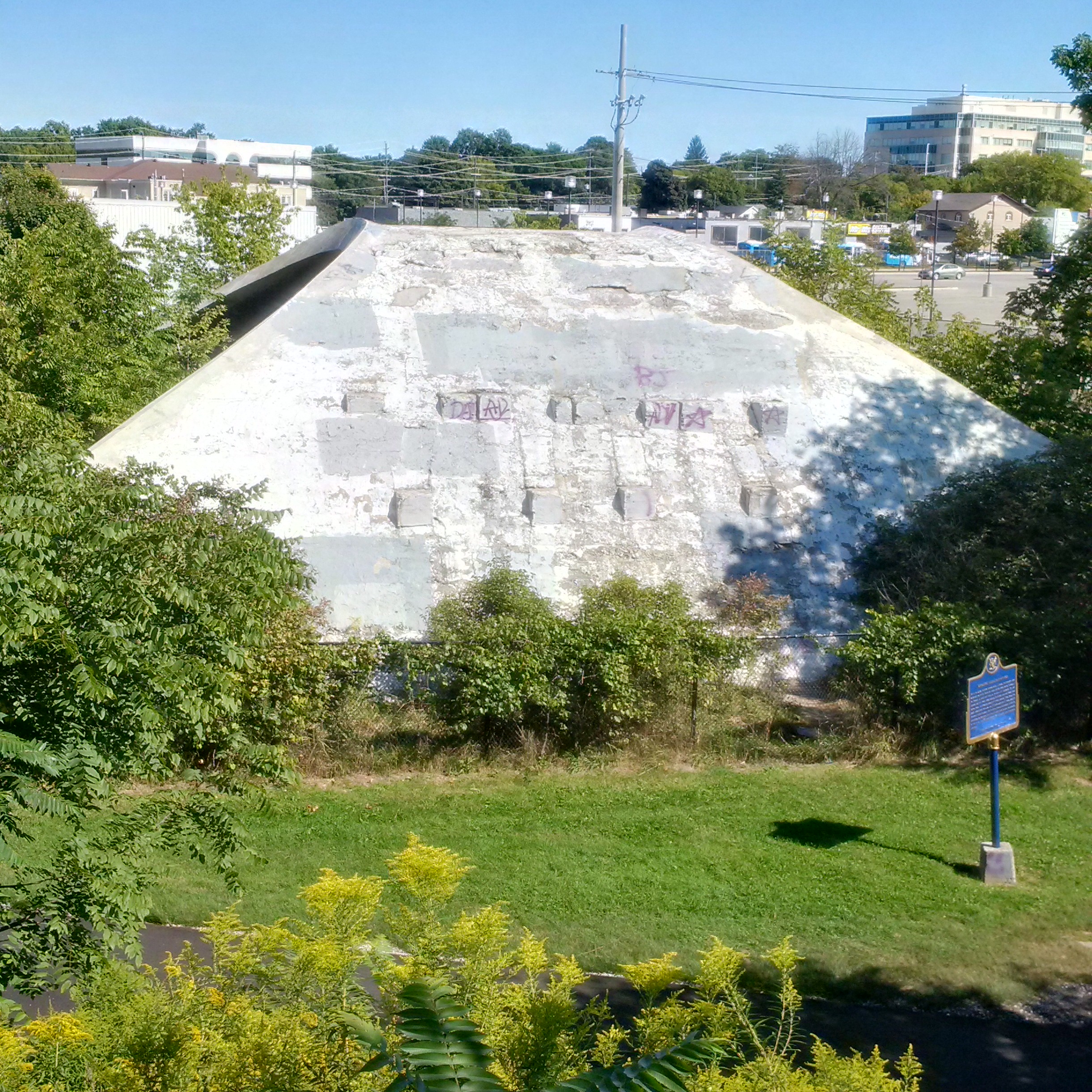
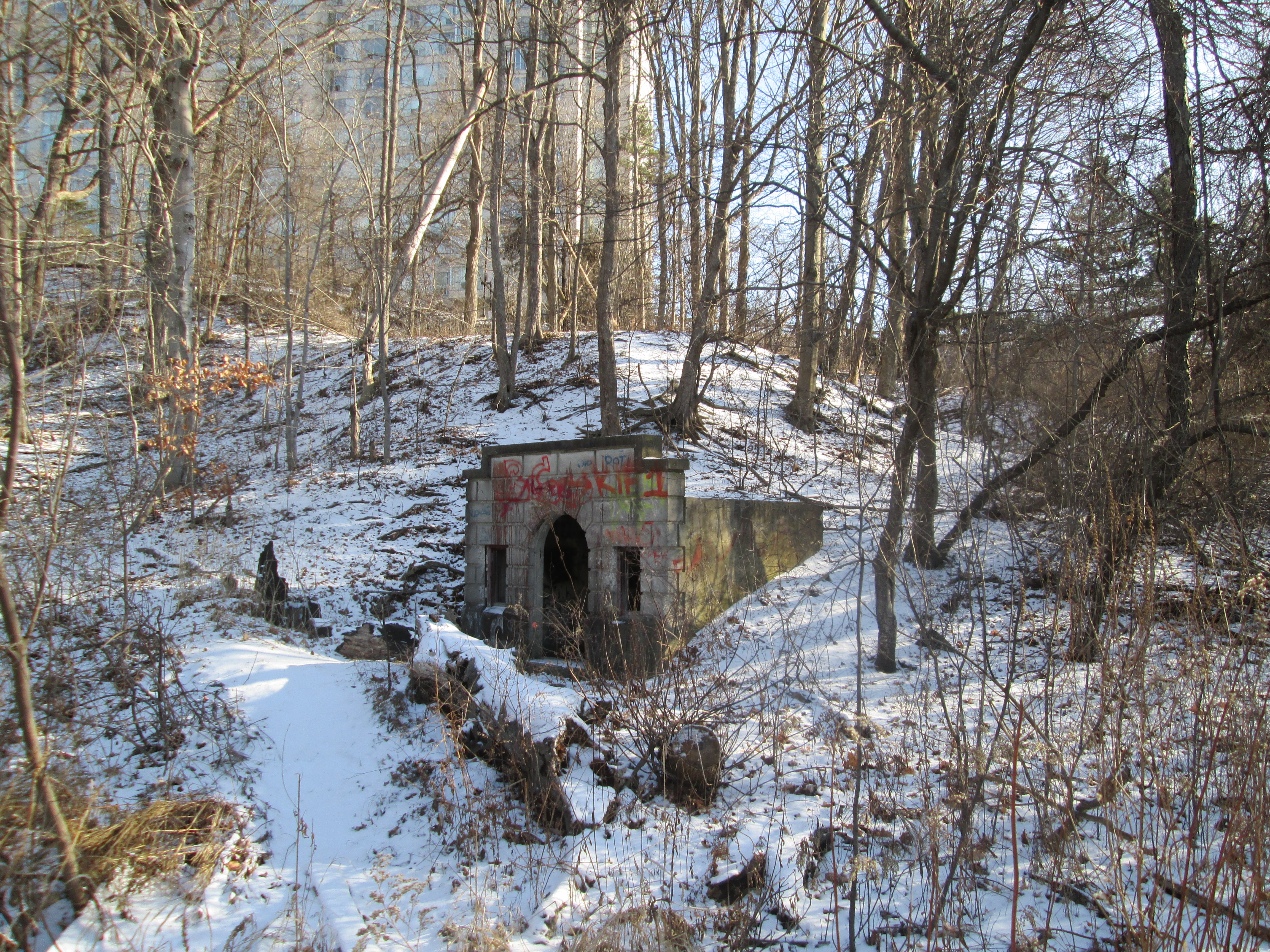
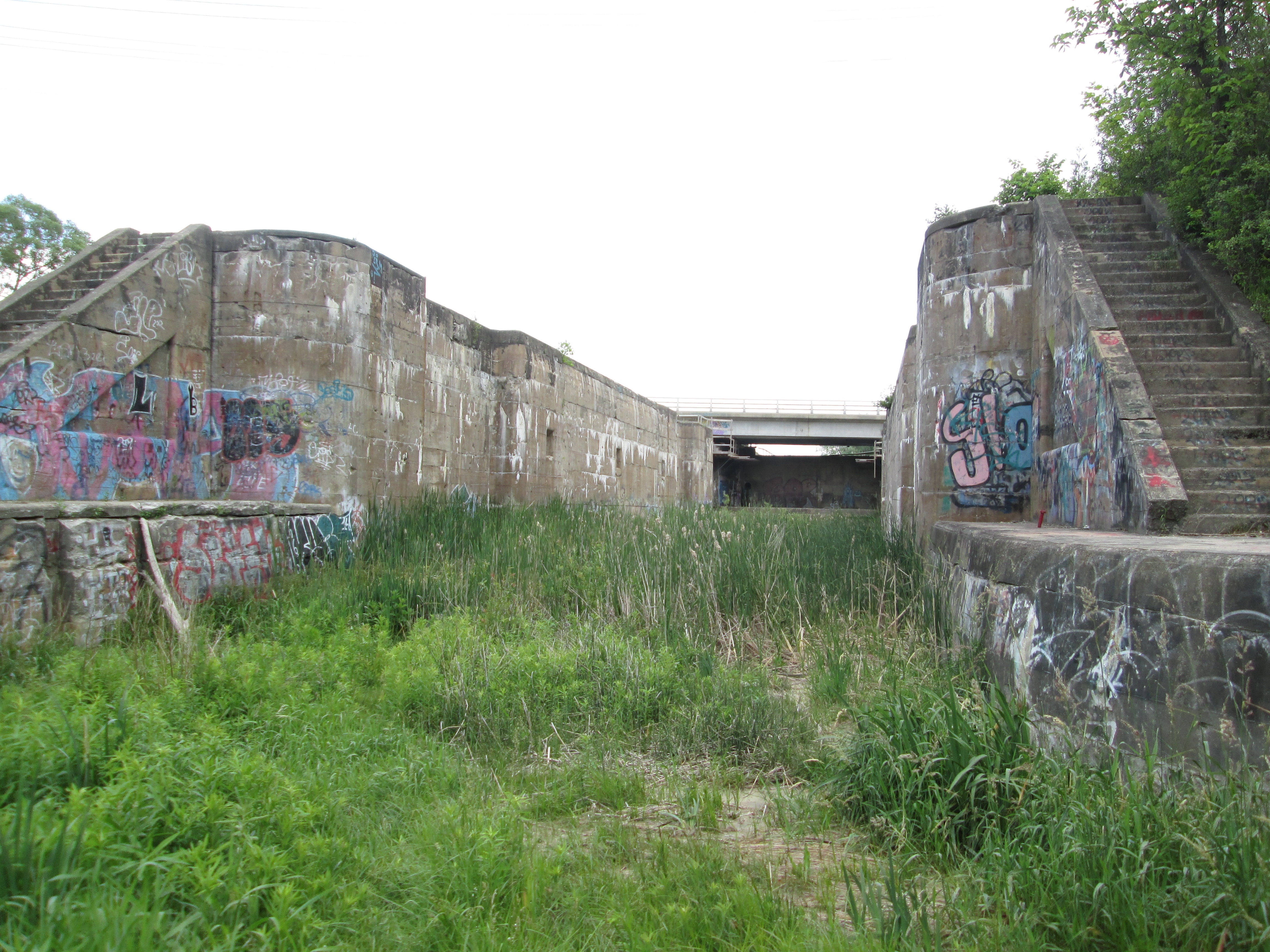
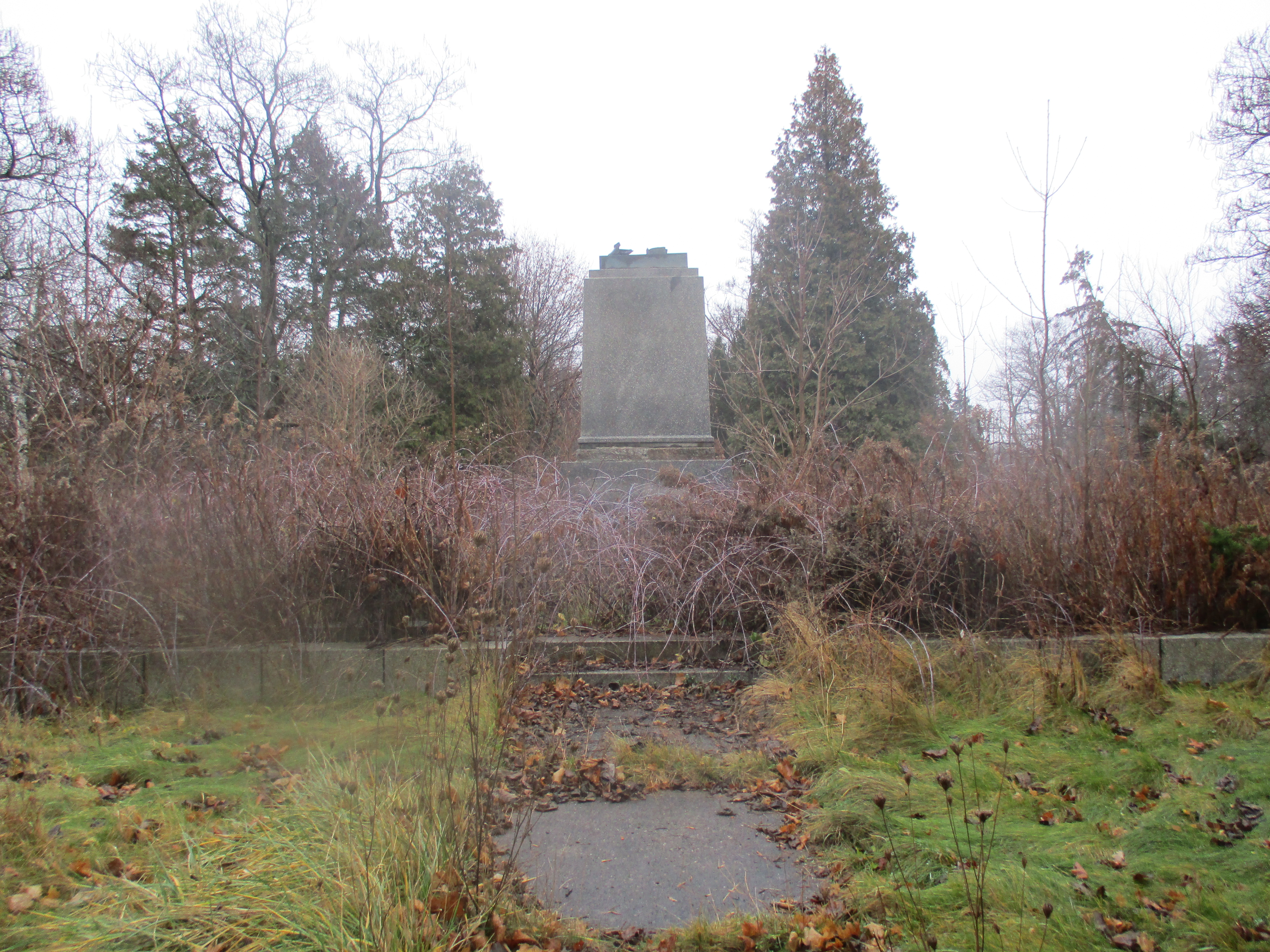
William Mulock was born in 1844 and was a member of parliament from 1882 until 1905. Serving as the MP for Newmarket, Mulock revived the idea in response to his constituent’s requests to do something about rising railway prices. Mulock envisioned the canal extending only as far as Newmarket with a possible future extension to Aurora. In 1904 Mulock proposed the canal which began construction in 1906. The first section from Lake Simcoe to Holland Landing would require no locks but there would be three locks between there and Newmarket. The third lock was intended to lift boats 11 feet but as can be seen below has been filled in and is now part of Bayview Park.
The dam has also been partially filled in as the first three sections are near ground level behind the dam. A sluice gate allows the river to bypass the old lock.
Black Raspberries grow along the sides of the trail between lock number three and Green Lane. It looks like there will be a nice crop coming soon for those who live in the area.
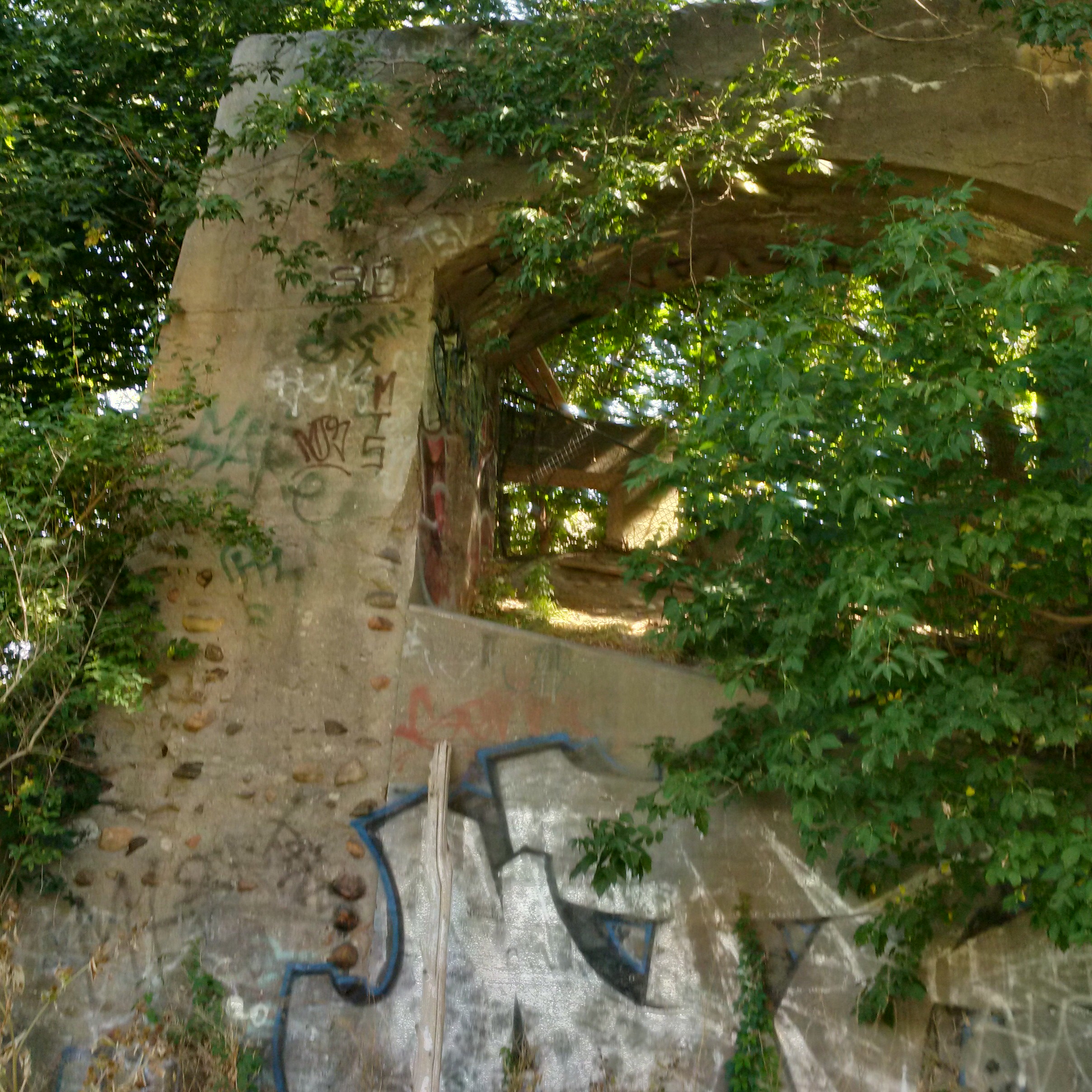
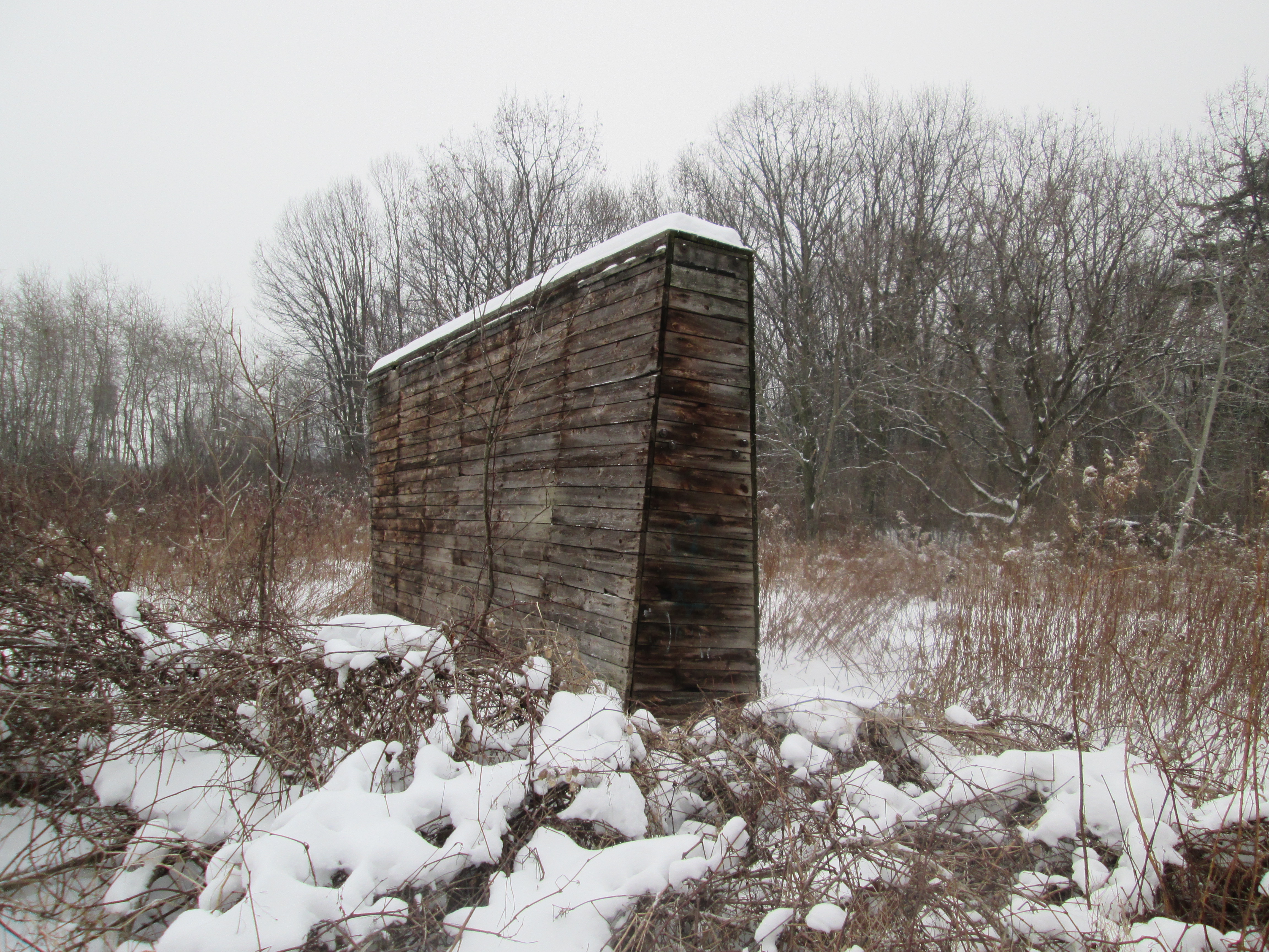
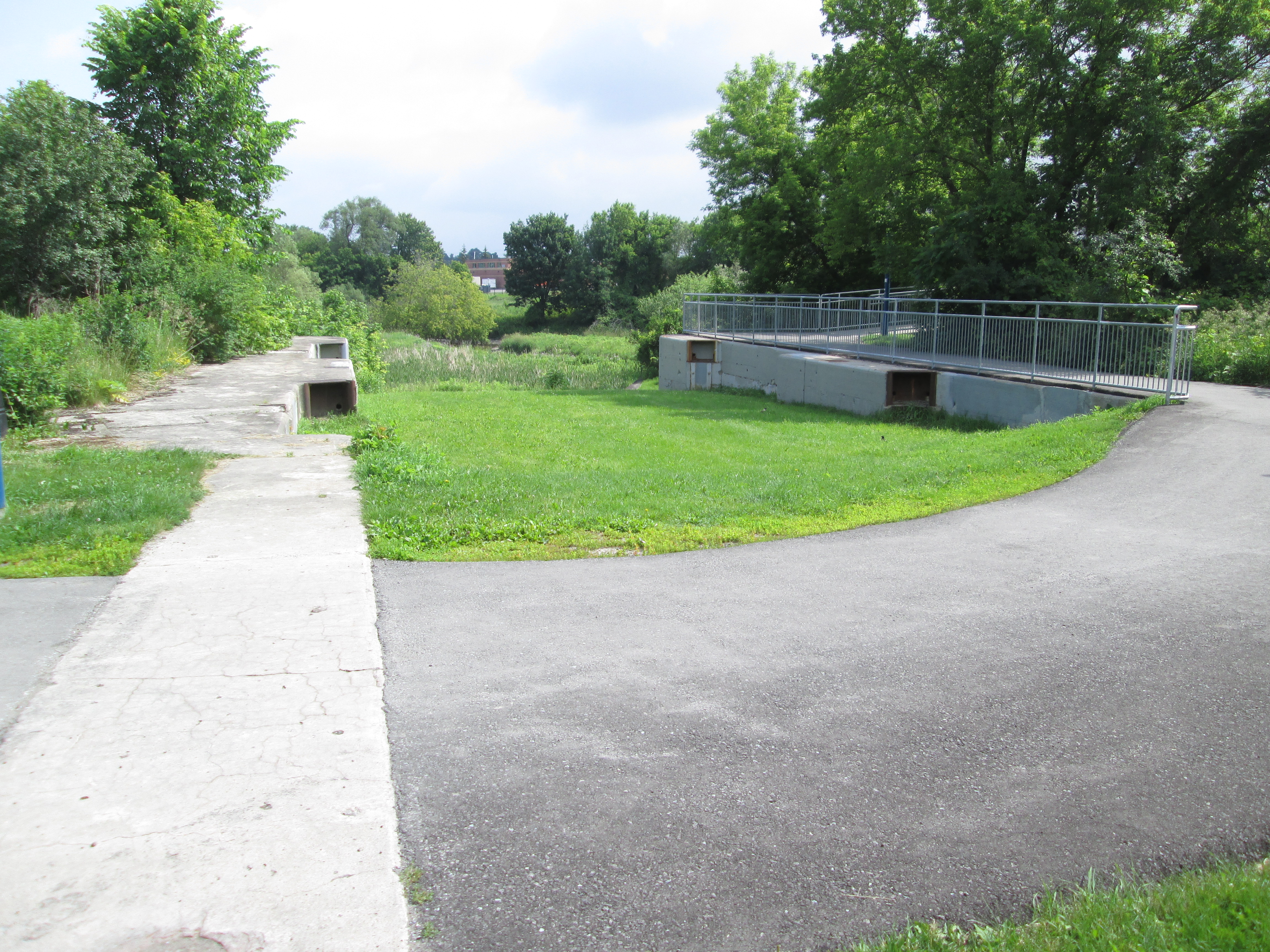
Four swing bridges were constructed of which only the one near Green Lane remains. This one was built on the Kelley Farm and was locally known as the Kelley Bridge. The blue swing mechanism can be seen under the new pedestrian bridge in the picture below. The bridge would have swung across to rest on the concrete support to make way for a ship to pass through the canal.
The gears that ran the swing bridge remain in place although the bridge was never used in that manner. It was used as a stationary steel truss bridge to carry Green Lane over the Holland River until 2002 when it was replaced with the newly widened road and bridge. The earlier truss bridge was removed in 2004 for safety reasons and the swing bridge works painted to help preserve them.
The paved path works its way up the west side but I chose the less used dirt path on the east. The trail leads to a hydro corridor and then through a marsh. I kept following a set of human footprints that led me across two small streams and through a field onto an abandoned piece of roadway. From there I could see the second lock. Great Blue Heron seem to like the river and local marshes. I saw at least three different ones as I made my way along the river.
A red car hood has been tossed off of the bridge on the second concession and into the East Holland River. A tree is taking advantage and growing inside the car part.
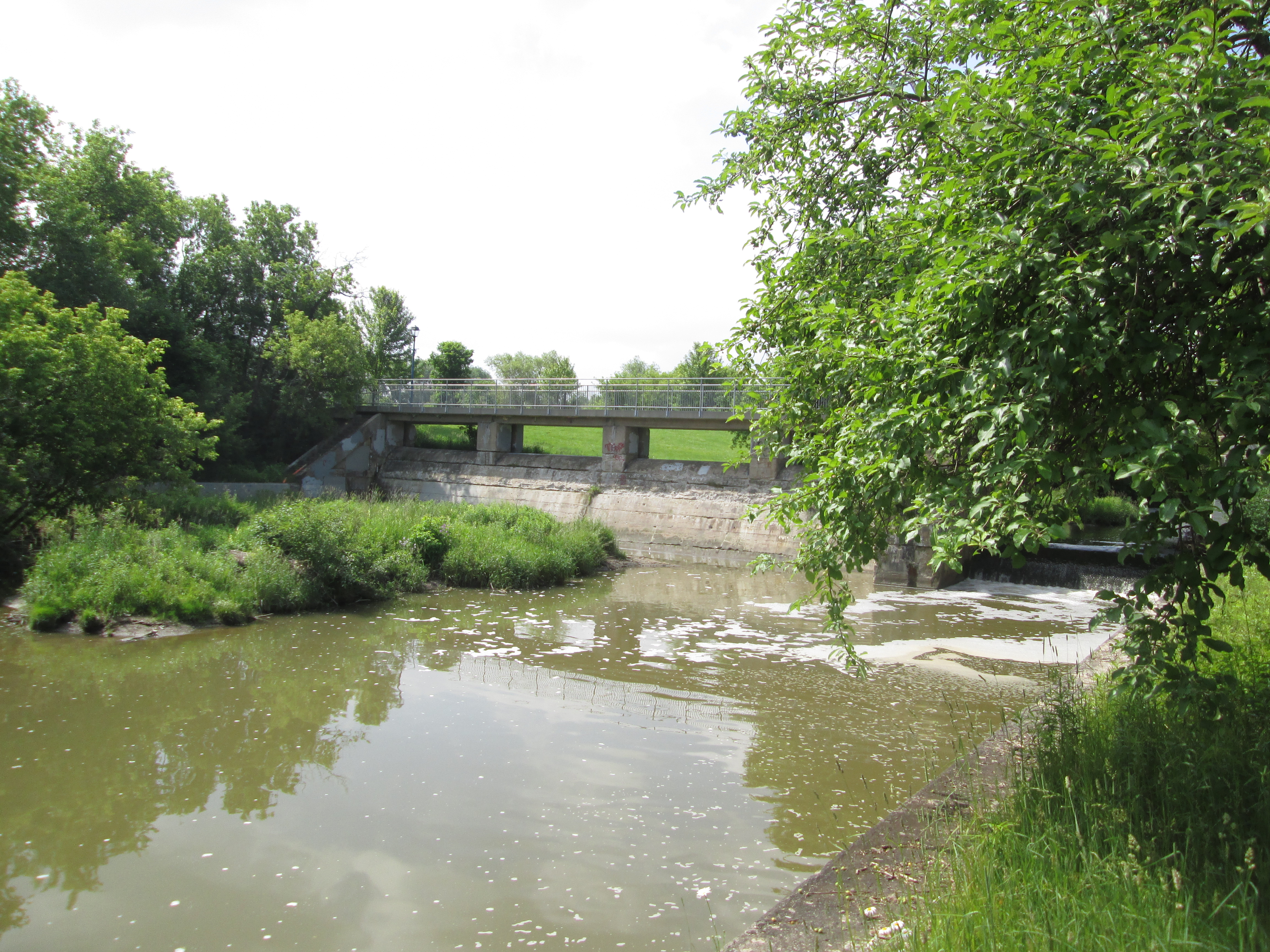
Lock number two was the tallest of the three rising 26 feet. An old concrete bridge still spans the river on the second line but it was added after the canal was abandoned and a swing bridge was no longer required. This is now an abandoned bridge across an older abandoned canal lock. Rogers Reservoir was intended to contain some of the water required to operate the canal and the canal walls extend well beyond the actual lock here to form the sides of the reservoir.
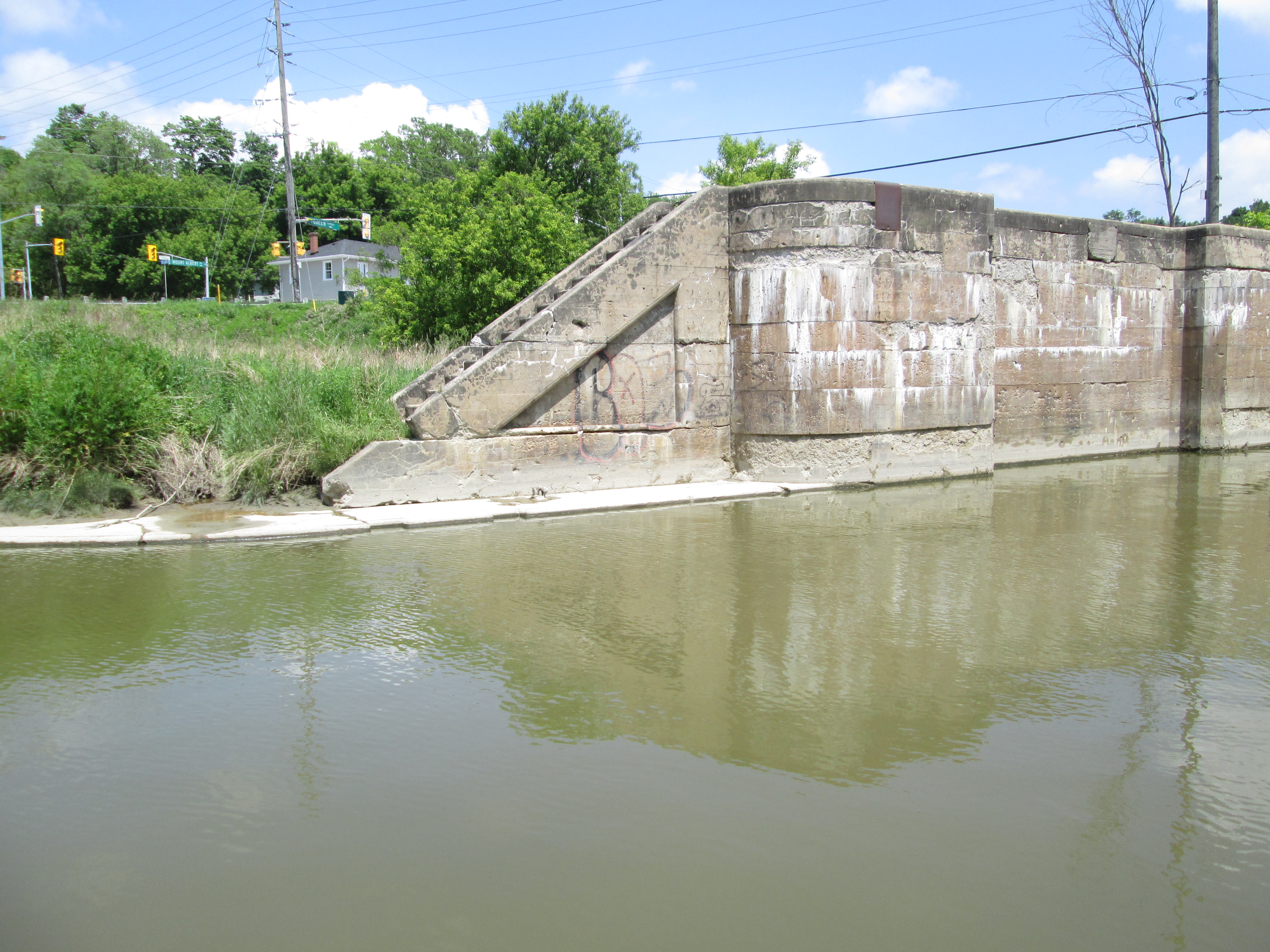
The trail continues into Holland Landing where lock number one stands abandoned. It’s lift was 16 feet and is the only one of the three locks that the river still runs through. Holland Landing has it’s own collection of historic buildings including an 1870 court house and two churches from the 1840’s. It’s interesting to ponder what might have become of the village if it had been home to one of the locks on a functioning canal system.
The project ran way over budget and construction was about 2/3 complete in 1911 when the Federal Government changed after 15 years of Wilfrid Laurier’s Liberals to Robert Borden’s Conservatives. Construction was stopped while the new government reviewed the project, ultimately determining that there simply wasn’t enough water to make it work. Calculations showed it would take over 2 weeks to fill the locks and so the project was abandoned. No further work was done until 1924 when a crew was sent around to make the locks safe. The picture below of the first lock shows the mounting position for the swing bridge for Old Yonge Street which has since been removed.
Although his proposal for a canal to Newmarket ended in disaster, earning the nickname “Mulock’s Madness”, he managed to have a very successful career after leaving politics. He worked in the justice system serving as Chief Justice of The Supreme Court of Ontario from 1923 until 1936. He passed away in his 100th year having earned his own nickname, “The Grand Old Man of Canada”, and a street name in Newmarket.
A story published in Newmarket Today on Feb. 9, 2019 contains considerable detail much of it setting the record straight on some fake facts that can be found on the internet. Included among them is the idea that there was insufficient water to operate the canal. Richard MacLeod is an expert on Newmarket history (The History Hound) and his article can be found here.