Tag Archives: Stonecutter’s Dam

The Crows Nest Side Trail

May 18, 2019

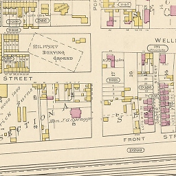
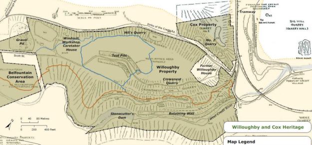
The Forks of the Credit has a lot of interesting history, much of which can be easily accessed from The Bruce Trail or one of several side trails in the area.  Parking is very limited along the side of Forks of the Credit Road near Dominion Street.  Our intention was to cover both the Trimble Side Trail and the Crow’s Nest Side Trail as well as having another look at the Stonecutter’s Dam.  The map below comes from the Belfountain Conservation Area Management Plan and shows the Trimble Trail in brown and the Crow’s Nest Trail in Blue.  It also shows the location of many of the historical features of the Willoughby Property.

Stonecutter

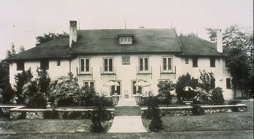
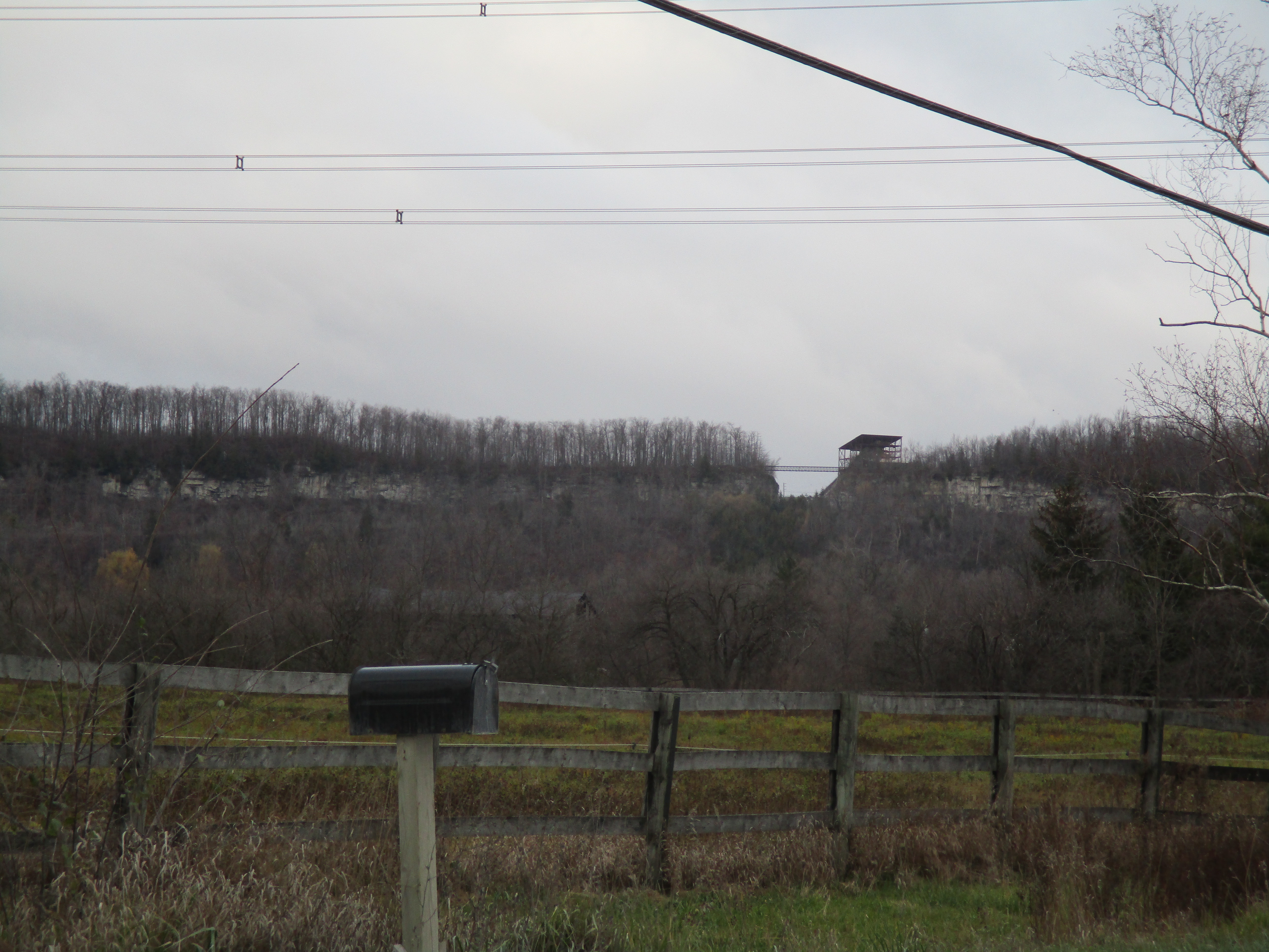
We saw several people going down the road on skateboards with a vehicle following them to take them back to the top for another joy ride down the hill and around the hairpin turn.  The Trimble Trail enters the Willoughby Property beside the river.  There is a great deal of local history on the property which had been explored and described in our previous post called Stonecutter’s Dam.  Therefore we won’t go into much of that detail again here.  From the vantage of the trail you can see the curving trestle of the Credit Valley Railway that was instrumental in developing the market for the sandstone that was being quarried in this area.  We looked at that trestle and an old lime kiln ring in our post on The Devil’s Pulpit.

IMG_3793

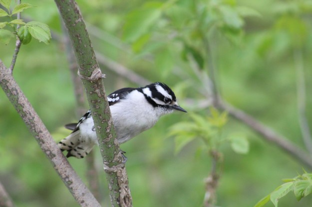
One of the ways to tell a Downey Woodpecker from the slightly larger Hairy Woodpecker is by the size of their bill.  A Downey Woodpecker bill is small and thin and only about half as long as the head of the bird.  The Hairy Woodpecker has a thicker bill that is at least as long as its head.  The Downey pictured below is a female bird as it lacks the characteristic red marking on the head that is unique to the male.

IMG_4196

Jack-in-the-pulpit is one of the longest lived perennial plants as the corm can survive for up to 100 years.  The plant contains oxides in the form of raphides that cause a burning sensation if ingested.  Under magnification they resemble tiny shards of glass.  One folklore tale suggest certain native people would poison meat with the cut up corm of the plant and leave it for their enemies to find and consume.

IMG_4227


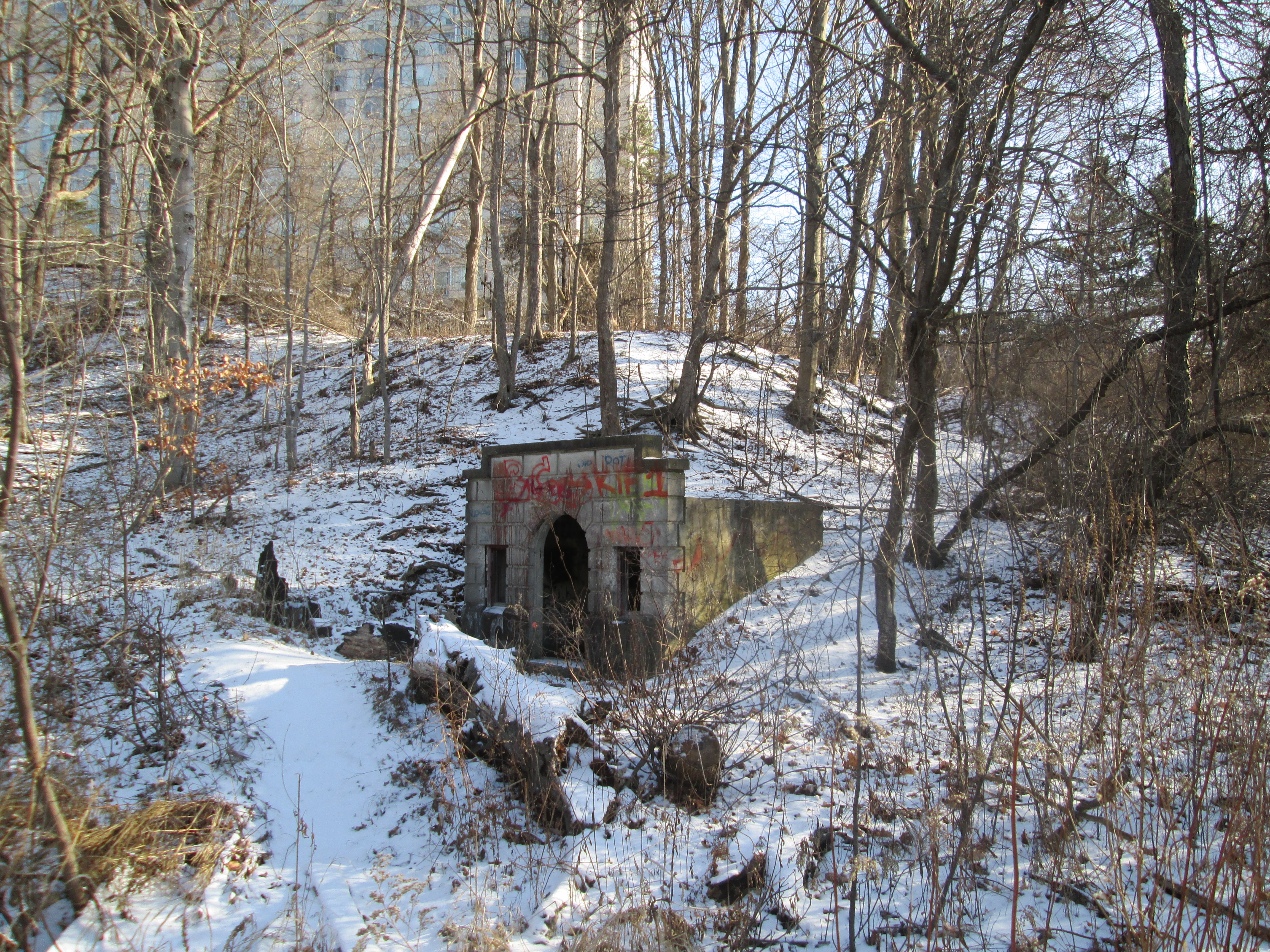
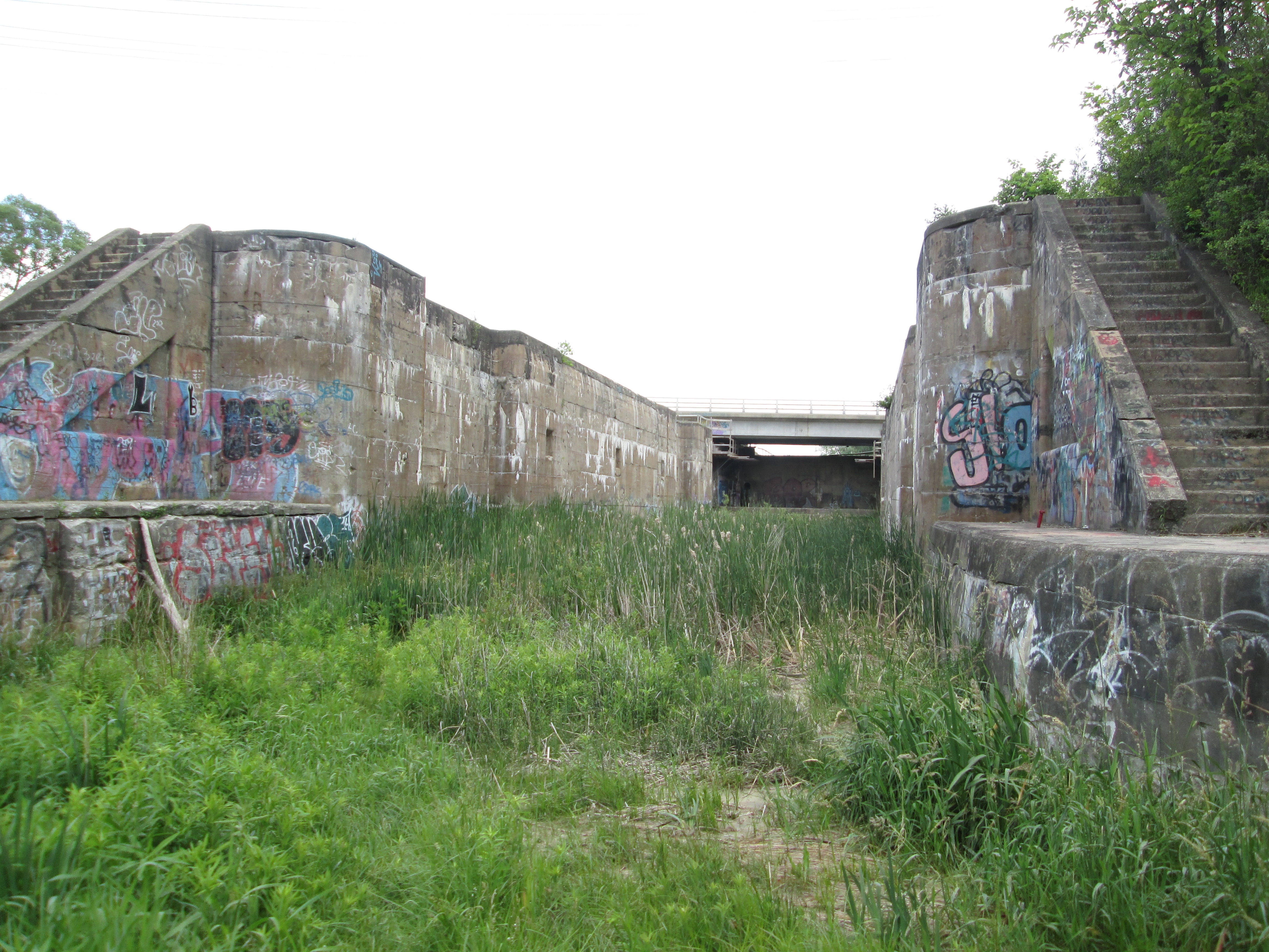
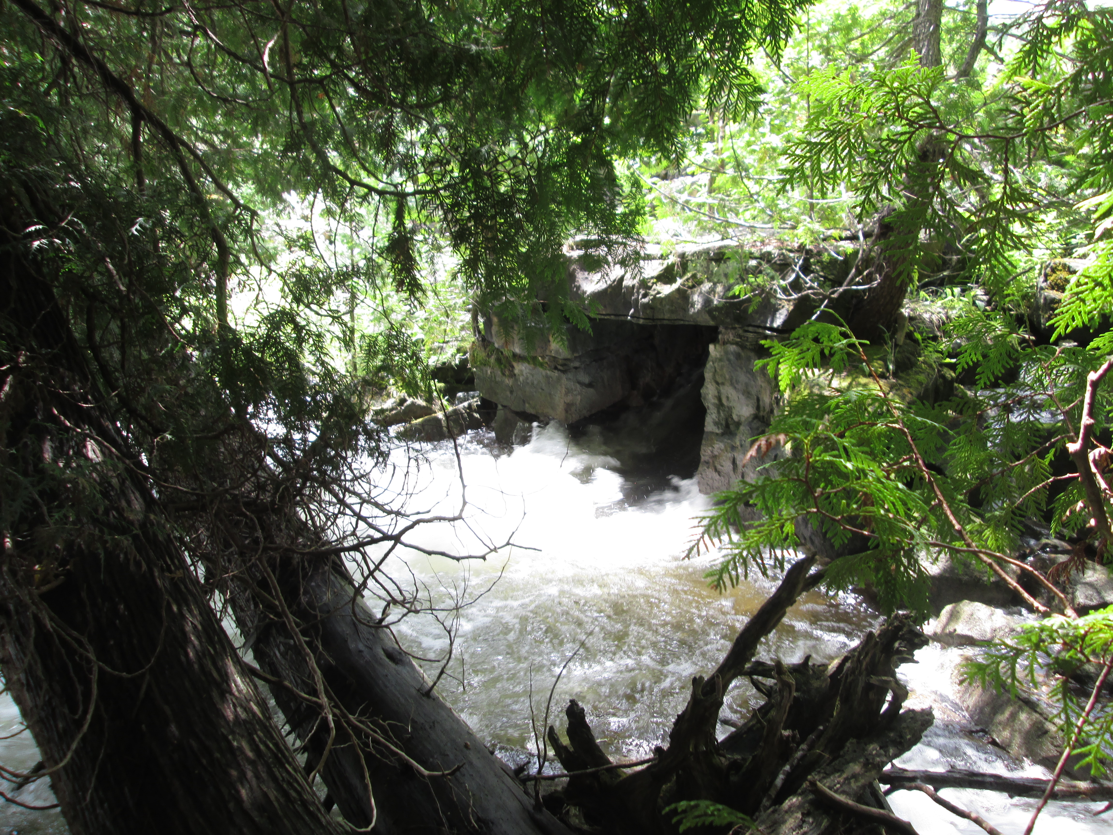
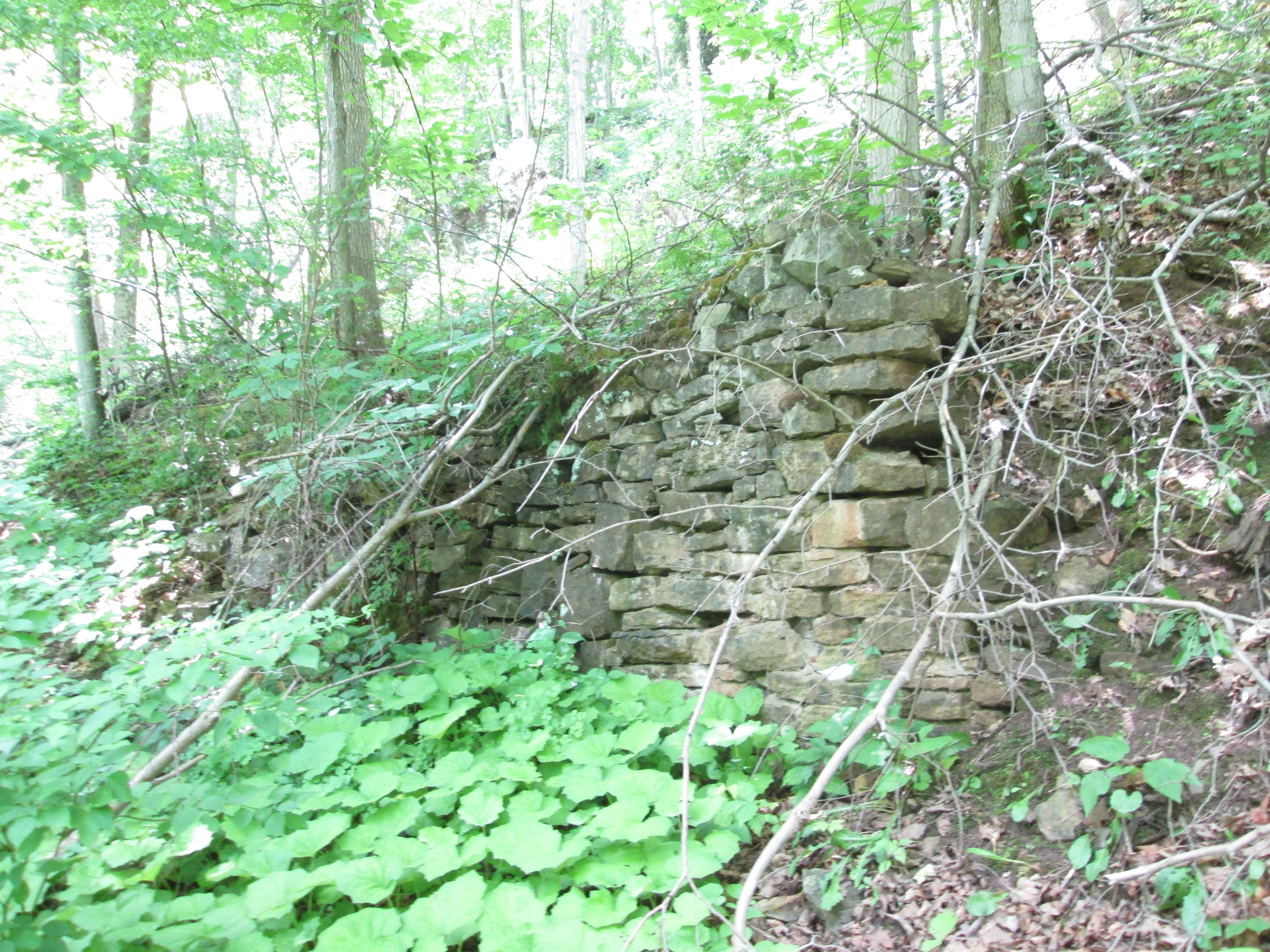
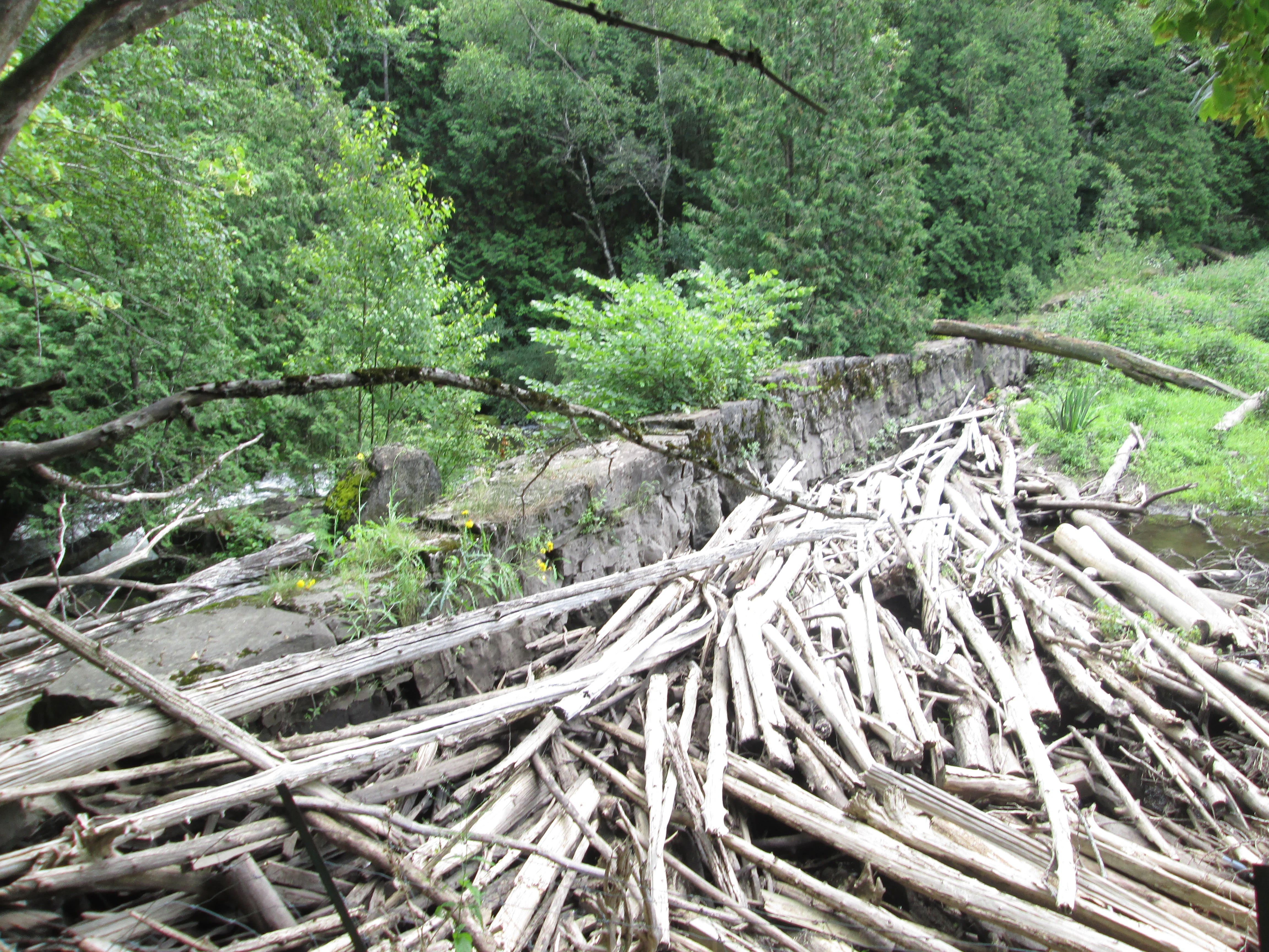
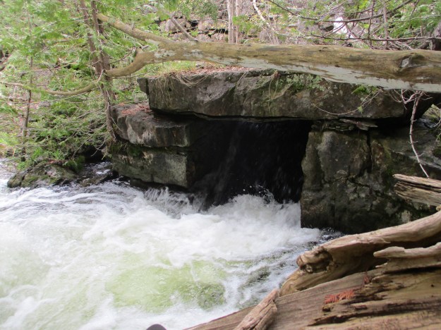
At one time there were literally hundreds of dams strung across the rivers and creeks in the GTA.  Early ones were often wood cribs filled with rocks and required annual repairs that were often quite dangerous.  Earthen berms were built across the floodplains and later concrete dams were constructed.  Through disasters like Hurricane Hazel and then flood control projects most of these have been removed.  Perhaps the oldest surviving dam is a masonry one on the West Credit River that has come to be known as The Stonecutter’s Dam.  The area was known for quarries and this resource was put to good use here as this bit of workmanship has outlasted many newer dams.

IMG_3796

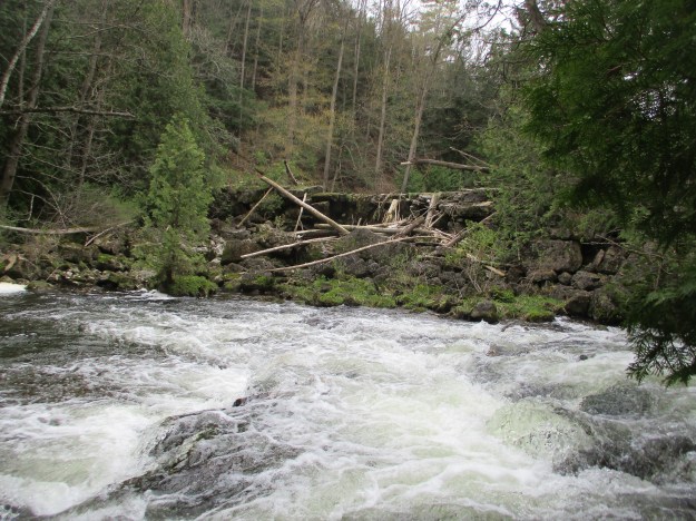
The penstock was also made of blocks of cut stone and has been churning away for decades since it last supplied power to a local industry.  There remains no plans to restore this dam and it has become inaccessible due to erosion along the end.  It is now posted to keep people from finding their way onto it.  More pictures of the dam can be seen in our earlier post The Stonecutter’s Dam.

IMG_3798


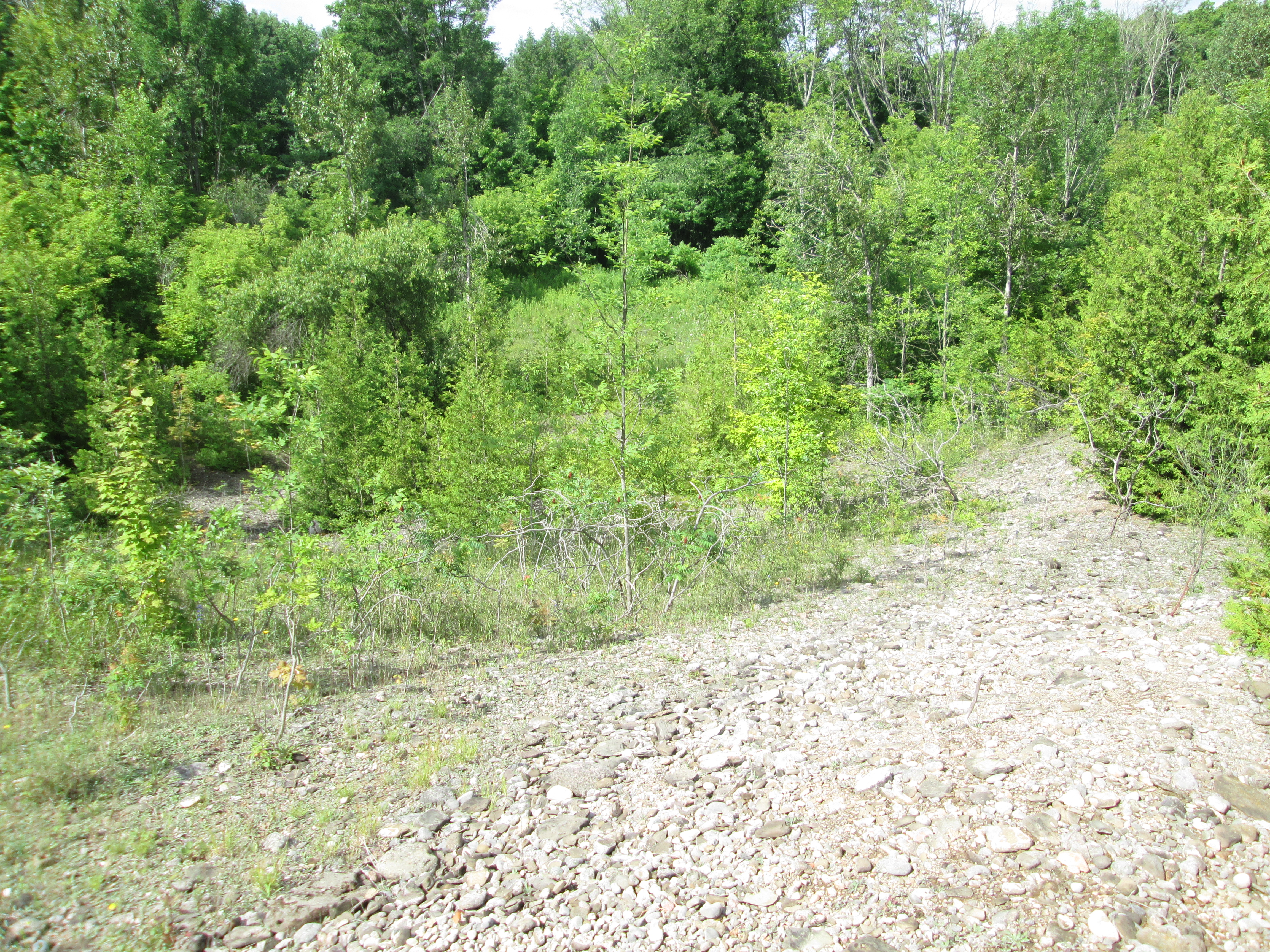
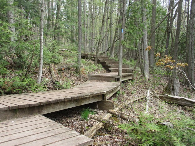
The Crow’s Nest Side Trail is a 1.1 kilometre loop that takes you around some test pits from the old quarry but avoids the original site.  It leads off the Trimble Trail on a boardwalk but soon turns into a dirt path.

IMG_3807

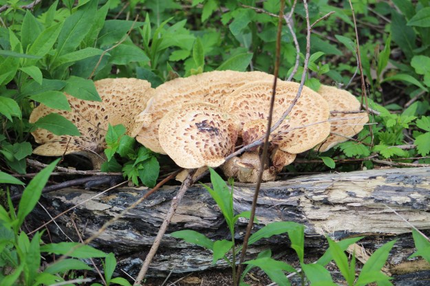
Dryad’s Saddle can grow to be up to 12 inches across and can be found from May until about November.  They are considered edible and we found places where people had recently harvested them.  Also known as Pheasant’s Back the soft edge parts of the cap can be sauteed and eaten.

IMG_4205

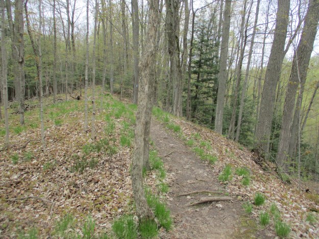
The trails were remarkably empty considering how nice the day was.  That is usually a good thing if you are hoping to see the local wildlife.  The Trimble Trail had people coming and going from the conservation area but the Crows Nest Trail was deserted.

IMG_3815

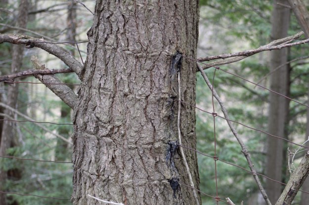
A fence line separates the Crows Nest Trail from a steep drop onto Forks of the Credit Road.  In many places this fence has become secured to the trees which have grown around it.  The picture below shows one of the trees with a fence roughly in the middle of the tree.

IMG_4079

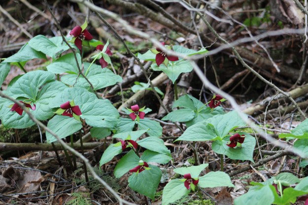
There were white trilliums scattered throughout the woods but the red ones were somewhat more elusive.  Finally we came across a large patch of them as we approached Belfountain Conservation Area.  The red trillium does not have any nectar and so isn’t pollinated by the same assortment of bees and insects that visit the white ones.  They rely on flies that are attracted by the smell of rotting meat that is given ff by the leaves.  On close inspection the six stamen in the centre of the flower are different to the nectar bearing ones on the white flowers.

IMG_4072

We checked out a small trail beside the bridge and found that it led to an apiary.  With our bee colonies in severe decline we decided not to interfere in any way.  Although the trail may have gone further we didn’t.  Instead we made our way back to the car.

IMG_4102

The Willoughby Property is interesting because of the wealth of history that it holds.  It is the type of place that you can still find new things with subsequent visits.

Google Maps Link: Crow’s Nest Trail

Check out the top 20 posts from the first five years of Hiking the GTA at this link:

Back Tracks – The First Five Years

Like us at http://www.facebook.com/hikingthegta

Follow us at http://www.hikingthegta.com


Hiking The GTA – A 2015 Monthly Review

January 1, 2016

Hiking the GTA was able to visit 86 different places in 2015 where we were able to see some truly amazing things.  Each season has it’s own beauty and there are always things to be discovered. Over the course of the year more people became aware of the stories we were publishing and readership increased dramatically.  Therefore a David Letterman “Top Ten” list would really only focus on the more recent stories.  For that reason we present a review of the year 2015 by looking at the most popular post from each month.  A brief outline of the story, a picture from it and a link are provided below.  Thanks to everyone who read one of our stories this past year.  I hope some of you were able to get out and enjoy some of these sites yourself because they are all interesting in their own way.  Plus, you never know what wild life you’ll encounter.

Graydon Hall was released on January 10th.  It visits a former millionaire’s estate finding plenty of evidence of it’s past usage.  The abandoned pump houses featured below are part of the former irrigation system.

IMG_1977

The Arsenal Lands was released on Feb. 7th.  The abandoned water tower and rifle inspection building along with the former rifle range made this an interesting hike.  One of the baffles from the rifle range is featured below.

IMG_2300

Military Burying Grounds was published on March 22 and re-posted for Remembrance Day. This hike visits the two nearly forgotten places where our early military dead are buried in downtown Toronto.

Military

Originally published on April 19th and recently given a Throwback Thursday release Guildwood Park where the inn is currently being restored.  The post looks at the Guild Inn and it’s history along with several preserved pieces of early Toronto architecture.

Guildwood Inn original

May saw the release of Dufferin Creek which featured the remains of a 150 year old plank road that ran up Dufferin Street near Finch Avenue.  It is related to Garbage Park which was a post featured in The Toronto Star.  The spikes in the planks from the old road are 2 inches thick and 3 feet long.

IMG_3603

The first day of summer saw the release of our most popular post of all time.  The Newmarket Ghost Canal features the remains of the nearly completed but long abandoned attempt to link Newmarket to Lake Simcoe by a canal.

IMG_5850

In July we completed our first 100 posts on Hiking the GTA and issued a review called Greatest Treks.  One of the most interesting hikes of the month was The Stonecutter’s Dam.  We visited an old dam near the Forks of the Credit which is made of blocks of cut stone.  It also sports a rare stone penstock as seen below.

IMG_6710

On August 15th we checked out Kerosene Castle in Oakville.  The castle was built by Richard Shaw who was refining coal into kerosene in a factory across the street on Sixteen Mile Creek. Until it blew up, that is!  When we got looking at the pictures we saw that one of them appears to have a large face in the oriel window.  It doesn’t show up in any other pictures we took that day.

IMG_7400 face

September 12th we visited the Ghost Town of Sixteen Hollow to see what remains of the formerly thriving mill village on Sixteen Mile Creek.  There is plenty of history here but all that remains of the original village is the church and the some newer bridge structures.

Sixteen Hollow 2

October featured a discovery related to the Caledon Aerial Tramway which made for an interesting hike.  On the 24th we found the 2 inch steel cable on The Cox Property. The underground chamber for the cable is seen below.

IMG_0897

in 1962 a quarry blasted a gap in the escarpment near Milton.  We visited The Gap on Nov. 14th in a hike that went on to become the second most popular story so far.

IMG_1300

December was a busy time but it was an interesting month of hiking as well.  We were back in Oakville on Sixteen Mile Creek on Dec. 13th when we visited The Vandalized Memorial to Taras Shevchenko.  The museum was burned down, the monuments stolen and the site abandoned.

IMG_1912

Thanks again for reading Hiking the GTA in 2015 and we hope you all have a great 2016 and enjoy the trails!  We’re looking forward to many great hikes this year ourselves.

Like us at http://www.facebook.com/hikingthegta

Forks Of The Credit – The Stonecutter’s Dam

Saturday July 18, 2015

It was the hottest, stickiest day so far this year.  It was already 22 degrees, feeling like 30 at 9:00 in the morning.  By the time we got back to the car the humidity was making it feel like 39 degrees.  You need to carry a lot of water on days like this to avoid dehydration and possible heat stroke.

Peel County was surveyed in 1818-1819 with settlement starting the following year.  Settlers found a rugged terrain that was difficult to farm.  Lot 9 concession 4 was typical of the area and included a stretch of the escarpment where the Credit River cascades through a ravine.  The property didn’t suit farming but there was plenty of Queenston shale and limestone as well as gravel deposits.  It would be used for quarry purposes from the mid 1800’s until the 1930’s.  In 1986 the Ontario Heritage Foundation acquired the property in a combined purchase and donation from Bert Willoughby. Now known as the Willboughby Property it is west of the Devil’s Pulpit which we visited last week. Historical research conducted in 1988 identified several items of cultural heritage significance, a few of which are presented below.

We parked on the end of Scott street and entered the park near the old gravel pit.  As we entered the laneway to the former caretaker’s house we found a single yellow daylily.  These plants usually grow in small clusters so finding a single flower is unusual.  They get their name from the fact that the flowers only last for a single day.  They bloom overnight or in the morning and wither up the following night.  A new flower may grow on the same stem and if the flower is cut off it will continue to bloom for several days.  They come in many brilliant colours with this one having brown stamen which are the male parts and a yellow carpel, or female part.  This example is known as a lemon lily.

IMG_6624

At the west end of the property a  gravel pit operated until the 1930’s.  Nearby stood a barn and workshop as well as the caretaker’s house and a windmill.  The gravel pit has started to grow over with trees as can be seen in the picture below.  We found evidence of the other structures but they appear to have all been removed.

IMG_6631

As you follow the trail along you will come to the Crow’s Nest side trail.  To the left this trail runs past the Hillis Quarry overlooking the Forks road.  To the right it runs past Crows Nest Quarry and several smaller pits where limestone and sandstone were cut from the hill side.  We took the side of the trail along the Hillis Quarry which eventually loops back toward the river.  Along here an old pump house stands.

IMG_6672

Behind the pump house stand two old bridge abutments made from blocks of cut stone.  These supported a siding from the Credit Valley Railway (CVR) that ran to the quarries.  The cut stone from these quarries was used to build some of the grandest buildings in Ontario in the late 1800’s.

IMG_6687

What we call Old City Hall in Toronto was actually the third city hall.  It was completed in 1899 using 1,360 train car loads of cut stone.  The grey stone came from the Credit River Valley and may have crossed the bridge shown in the previous picture.  The brown stone was brought from New Brunswick.  The picture below shows the water colour that was created to promote the idea of building a new city hall.

oldhall3

The CVR retaining wall along the siding is part of the built or human heritage on the property. With the rails pulled up and trees growing on the former rail bed this almost appears to be a random wall built in the woods.  The retaining wall is yet another example of the use of cut stone on the property.

IMG_6691

The rail siding to the quarries on the Willoughby property joined the CVR near the train station. The train station sat in the clearing at the hairpin turn on the Forks of the Credit road.

IMG_6693

The Willoughby dam is about 100 metres upstream from the Forks of the Credit road along a Bruce Trail blue side trail in the bottom of the valley.  With a rise of 1.5 metres it is a migratory obstacle to all but jumping species of fish such as salmon and trout.

IMG_6705

Along the side of the river we found a recently hatched nest of Eastern Snapping Turtle eggs. This turtle is considered to be of Special Concern in Canada.  The empty shells look like little curled up strips of paper running down into the hole.

IMG_6633

Up river from the concrete dam is a mid 1800’s structure made of blocks of cut stone.  The stonecutter’s dam has a unique stone penstock that can be seen in the cover photo.  The penstock is a stone tunnel extending from the downstream side of the dam.  The intake in the wall of the dam was higher than the exit causing the water to fall through the penstock to deliver energy to turn a turbine or water wheel.  The picture below shows the back side of the dam where a large amount of wood has been washed up over the years.  Many dams were washed out in the major floods of 1878 and 1954 but the stonecutter’s dam has survived. When the Willoughby property was acquired and a conservation plan was developed the restoration of this dam and it’s associated mill structures was reviewed but unfortunately dismissed.

IMG_6717

The mill pond behind the stonecutter’s dam is filling up with silt and weeds.  The dam was considered to be impassable to migratory fish but a single salmon was recently caught upstream and this suggests that some can go through (or get tossed over by fishermen).

IMG_6719

If you follow the trail past the dam you will have to continue into Belfountain. The Willoughby property has been used for farming, quarrying and has now been turned into a park that hides it’s abundant history among the new growth forest.

The Black-Crowned Heron in the picture below was photographed a couple of days earlier but this bird was auditioning for a spot in the blog by posing for pictures.  This stocky little heron stands up to two feet tall and can weigh two pounds.  Unlike the great blue heron, night herons do not have long necks and legs.

IMG_6600

The Forks of the Credit contains ample space for future explorations of it’s natural beauty and historical artifacts.

Visit us at http://www.facebook.com/hikingthegta