Tag Archives: Forks of the Credit

Bruce Trail – Olde Base to The Forks

Saturday, October 20, 2018

In a previous post we had looked at The Devil’s Pulpit having approached from the Forks of the Credit road.  Thinking that the fall colours might still hold some charm we decided to hike to the pulpit from the south.  When possible, we like to hike longer sections of the Bruce Trail using two cars.  We met on the Forks of the Credit Road near the end of Chisholm Street where we left one car.  We drove east to McLaughlin Road and then two concessions south through the historic community of Inglewood to Olde Base Line.  There is parking for a few cars west of here where Chinguacousey Road dead-ends.  The Bruce Trail roughly follows the old road allowance north from here.  It was an ideal morning for a hike in the woods with the sun shining and the smell of fall in the air.

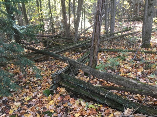
The remains of an old split rail fence snake their way through the woods.  These fences were often the first method a farmer employed to divide his fields.  They were easy to build and could be made from material cut from the property.  They also provided the farmer with the option to reconfigure his fields, changing the size and shape of them quite easily. Their biggest drawback came in the amount of land that was used in their construction.  In later years when farming techniques improved and productivity was sought from the greatest amount of land possible.  The wooden snake fence was often replaced with flat wire fencing.
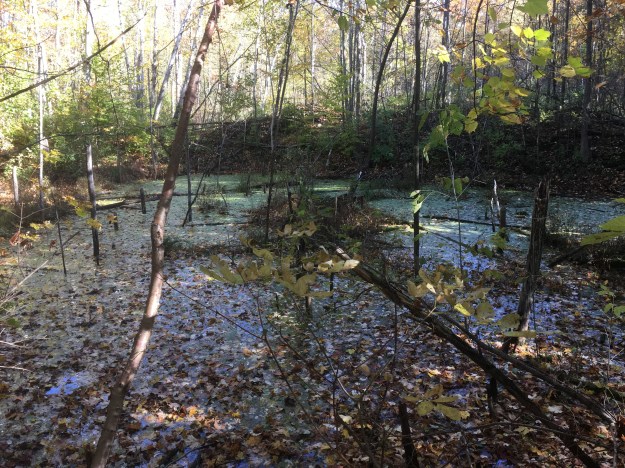
There are several ponds along the side of the trail that appear to have formerly been aggregate extraction sites.  Many of these former quarries along the Niagara Escarpment are now flooded and have become important wildlife habitats.  Mother nature reclaims her own.
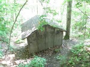
Original property owners found that land grants along the top of the Niagara Escarpment were often not the best farmland.   The climax forests provided an initial resource in wood but this was soon exhausted.  Many land owners then sought to make money off the natural resources on the escarpment.  Transportation costs meant that many small quarries could no longer be profitable when local road building projects were completed and the market moved farther from the quarry.  Other uses for the property then had to be developed.  Grants have been offered at various times over the years for property that is reforested.  The production of maple syrup can turn a forest into a profit centre for a few weeks each spring and there are remains of sugar shacks in the woods.

Eventually the trail emerges onto a small section of Chinguacousey Road that provides access to one of these aggregate extraction sites.  Deforest Brothers Quarries is licenced to operate a quarry that is just over 10 hectares in size.  They are allowed to extract up to 20,000 tonnes of material per year.  How ironic that the Deforest Brothers have been cutting down trees to reveal their product.

The trail follows the Grange Side Road west for one concession until it reaches the third line, now known as Creditview Road. Once again, the Bruce Trail heads north along the old right of way for the road.  The road was never completed through to connect with the Forks of the Credit Road because the Devil’s Pulpit lies in the way.

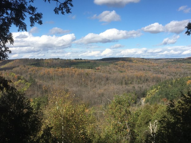
The fall colours are still quite vivid on some of the trees but most of them are past their prime.

White Baneberry grows in a small patch along the trail.  Birds will eat the berries and the seeds pass through their digestive system and are deposited somewhere else to start a new plant.  Toxins in the seeds are known to have a sedative effect on the human heart muscle and ingestion can lead to cardiac arrest and possibly death.

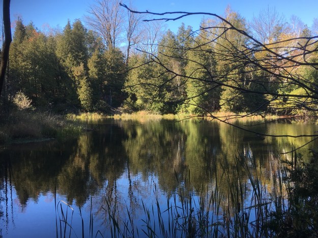
This beautiful pond is one of several along this stretch of the trail.
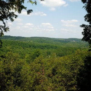
When you reach the top of The Devil’s Pulpit the view is quite spectacular at any time of the year.

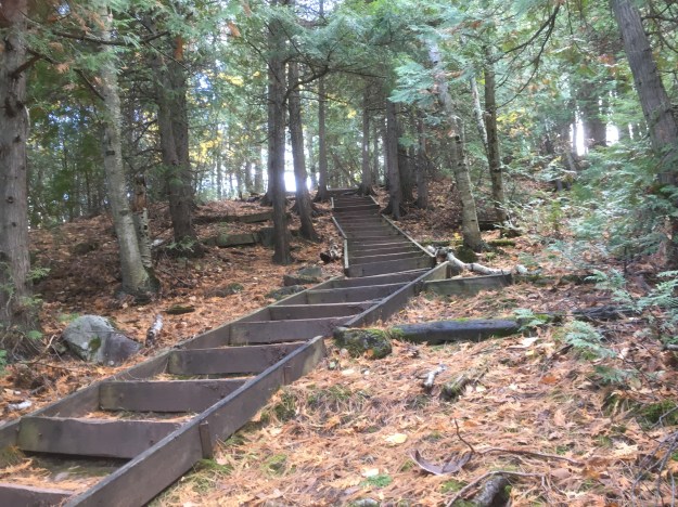
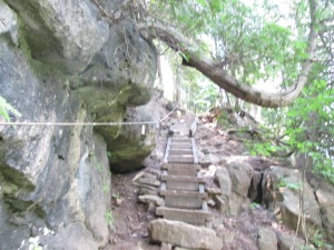
Stairs and a guide wire help you up or down the side of the escarpment.

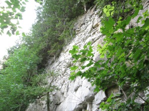
The rock face at The Devil’s Pulpit must have been an interesting place to work every day.  Workplace standards have changed considerably in the last 150 years.
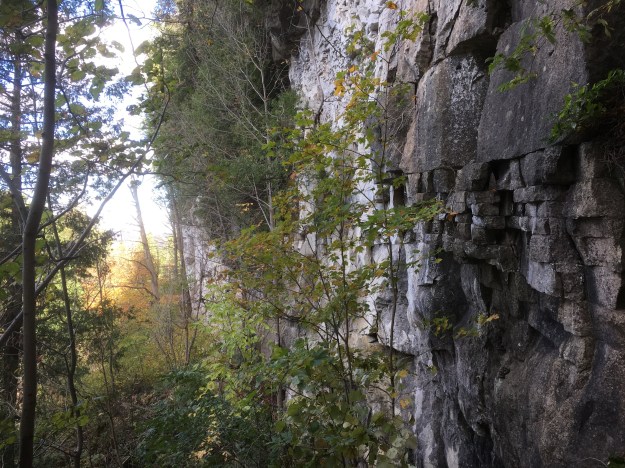
The trail continues to descend and passes the Ring Kiln Side Trail that leads to the Hoffman Lime Kilns.  This 0.6 kilometre trail leads to a dozen set kilns built in a ring for the burning of limestone.  As the trail descends to the former Credit Valley Railway it uses another set of stairs.
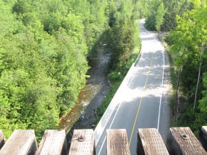
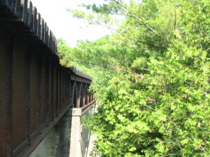
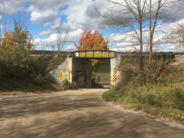
On the way back to the car near Olde Base Line we decided to check out the one-lane rail bridge where the CVR was built over The Grange Sideroad.
We encountered very few people for such a nice fall day on the Bruce Trail.

Google Maps link: Forks of the Credit

Like us at http://www.facebook.com/hikingthegta

Follow us at http://www.hikingthegta.com
Forks of the Credit – Caledon Ski Club

Saturday Aug. 1, 2015

It started off much cooler than the last couple of weeks at only 17 degrees as we returned to the Forks of the Credit.  Once again we parked near Dominion Road, this time in search of an old tramway associated with two of the quarries around the Forks of the Credit.  Research suggested that it may have passed across the CVR tracks and reached between Quarry no. 2 on the Cox Property and the Big Hill Quarry on the east side of Dominion Road.

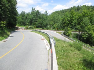
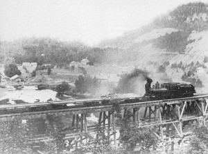
We set off along Forks of the Credit road and passed under the rail bridge.  As featured in the Devil’s Pulpit post, this bridge was the longest curved wooden trestle bridge in Ontario at the time of it’s construction.  Safety concerns led to it being filled in to form a more stable berm.  Of the 1,146 feet of trestle only the three sections crossing the road and river were left open.  The picture below looks up at the 85 foot high bridge and north to the berm it rests upon.  Inside this berm hides the original wooden trestle that was basically buried alive.  Special rail cars were loaded with gravel excavated locally and pulled out onto the trestle.  The gravel would pour through the trestle until it filled up the space to the rails above making this what is known as a fill trestle.

IMG_6967

In the valley stands one of the original 33 homes from the village of Forks of the Credit.  Not much remains of the little village that grew up around the quarry industry.
IMG_7040

The first bridge over the Credit River was replaced with a newer one near the bottom of the hairpin curve.  Near this second bridge over the Credit stands the former Post Office and General Store.
IMG_7037

The Credit Valley Railway station stood in the small open space near the hairpin turn.

IMG_6987

On the crest of the next curve stands the Cox house after which this piece of property is named. As far as the township is concerned this is also part of the Willoughby Property which features the unique and barely accessible Stonecutter’s Dam.  While the Willoughby Property has several maintained trails the Cox Property is being managed with a “hands off” approach.

IMG_6985

The spider in the centre of this web is quite possibly an orchard orb weaver spider although there are several different varieties.  She was sitting out taking in the sunshine and watching for breakfast to come along.

IMG_7004

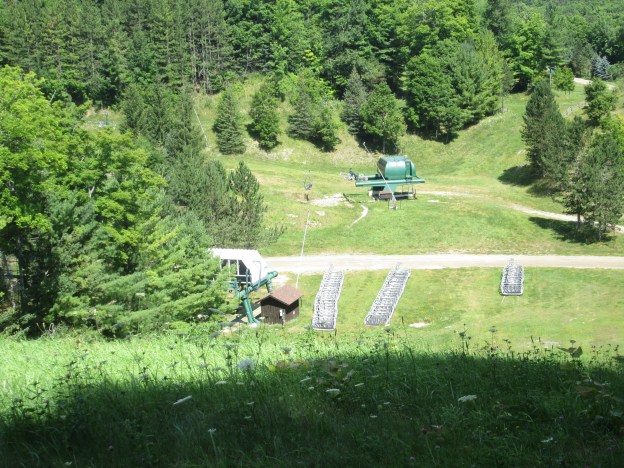
Just north of the former railway station was a brick manufacturing plant that we weren’t able to locate in the heavy undergrowth.  We got onto a yellow marked trail that eventually led us to the Caledon Ski Club.  The Toronto Ski Club was formed in 1924 near Richmond Hill and by 1930 had 2000 members. They started expansion including in the Collingwood and  Caledon areas. In 1934 they hosted the Ontario Ski championships with some of the racing taking place in Caledon.  The picture below shows the top of one of the ski lifts while the cover photo shows the bottom of the lift.

IMG_7019

Svend Jepson had won a silver medal for Denmark in gymnastics at the Olympics before emigrating to Canada.  He bought a property on the top of the escarpment overlooking the Forks of the Credit.  He cut a ski run down the side of the hill and by the 1930’s he was running a sort of ski resort on his property.  People would come to Inglewood by train where he would pick them up and bring them to his home.  He charged $2 for a bed and breakfast and the use of his 600 foot ski runs.  By the late 1930’s the Toronto Ski Club was moving it’s competitive racing to Collingwood and the runs in Caledon reverted to their natural state.  In 1957 Jepson’s daughter Helen bought the property next door.  Her and her husband used the two properties to start the Caledon Ski Club.

IMG_7017

In December 1961 a new location was purchased on lot 11 where the slopes were twice as tall and there was challenging rocks to ski around.  A roadway was cleared to the site and a parking lot was cleared.  Soon some runs were cut and the first nylon tow rope was installed.  Caledon Ski Club now has 23 runs and 8 lifts.  The picture below shows one of the ponds where water is collected for use in snow making for the following season.

IMG_7033

From the Dominion Street bridge the actual forks of the Credit can be seen where the East Branch meets up with the main Credit River.  We walked up Dominion Road to Brimstone were a small community of quarry workers lived.  Just before the town is a place where a mudslide in 2005 closed part of the roadway.  A series of concrete blocks has been installed to prevent further damage but a clear strip of hillside reveals the site of the landslide.  Near the village of Brimstone the two inch cable of the aerial tramway used to cross the valley.  The picture below shows the actual Forks of the Credit.

IMG_7042

Along the east Credit river patches of Blue Vervain grow.  These slender purple spikes blossom from the bottom to the top.  The plant has been used for centuries as a pain reliever and stimulant.  It is also known to relieve headache and rheumatism.

IMG_7050

The ski tramways we found were not the aerial tramways were were looking for but not being found isn’t the same as not being there.  Some places need to be explored in the spring or fall when there is no vegetation to hide the relics.  Or, perhaps someone who has been there will read this and comment.

Visit us at http://www.facebook.com/hikingthegta

Forks Of The Credit – The Stonecutter’s Dam

Saturday July 18, 2015

It was the hottest, stickiest day so far this year.  It was already 22 degrees, feeling like 30 at 9:00 in the morning.  By the time we got back to the car the humidity was making it feel like 39 degrees.  You need to carry a lot of water on days like this to avoid dehydration and possible heat stroke.

Peel County was surveyed in 1818-1819 with settlement starting the following year.  Settlers found a rugged terrain that was difficult to farm.  Lot 9 concession 4 was typical of the area and included a stretch of the escarpment where the Credit River cascades through a ravine.  The property didn’t suit farming but there was plenty of Queenston shale and limestone as well as gravel deposits.  It would be used for quarry purposes from the mid 1800’s until the 1930’s.  In 1986 the Ontario Heritage Foundation acquired the property in a combined purchase and donation from Bert Willoughby. Now known as the Willboughby Property it is west of the Devil’s Pulpit which we visited last week. Historical research conducted in 1988 identified several items of cultural heritage significance, a few of which are presented below.

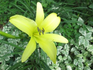
We parked on the end of Scott street and entered the park near the old gravel pit.  As we entered the laneway to the former caretaker’s house we found a single yellow daylily.  These plants usually grow in small clusters so finding a single flower is unusual.  They get their name from the fact that the flowers only last for a single day.  They bloom overnight or in the morning and wither up the following night.  A new flower may grow on the same stem and if the flower is cut off it will continue to bloom for several days.  They come in many brilliant colours with this one having brown stamen which are the male parts and a yellow carpel, or female part.  This example is known as a lemon lily.

IMG_6624

At the west end of the property a  gravel pit operated until the 1930’s.  Nearby stood a barn and workshop as well as the caretaker’s house and a windmill.  The gravel pit has started to grow over with trees as can be seen in the picture below.  We found evidence of the other structures but they appear to have all been removed.

IMG_6631

As you follow the trail along you will come to the Crow’s Nest side trail.  To the left this trail runs past the Hillis Quarry overlooking the Forks road.  To the right it runs past Crows Nest Quarry and several smaller pits where limestone and sandstone were cut from the hill side.  We took the side of the trail along the Hillis Quarry which eventually loops back toward the river.  Along here an old pump house stands.

IMG_6672

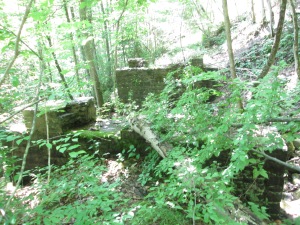
Behind the pump house stand two old bridge abutments made from blocks of cut stone.  These supported a siding from the Credit Valley Railway (CVR) that ran to the quarries.  The cut stone from these quarries was used to build some of the grandest buildings in Ontario in the late 1800’s.

IMG_6687

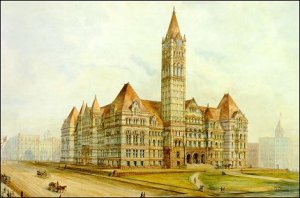
What we call Old City Hall in Toronto was actually the third city hall.  It was completed in 1899 using 1,360 train car loads of cut stone.  The grey stone came from the Credit River Valley and may have crossed the bridge shown in the previous picture.  The brown stone was brought from New Brunswick.  The picture below shows the water colour that was created to promote the idea of building a new city hall.

oldhall3

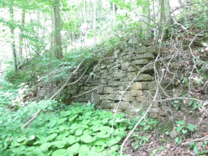
The CVR retaining wall along the siding is part of the built or human heritage on the property. With the rails pulled up and trees growing on the former rail bed this almost appears to be a random wall built in the woods.  The retaining wall is yet another example of the use of cut stone on the property.

IMG_6691

The rail siding to the quarries on the Willoughby property joined the CVR near the train station. The train station sat in the clearing at the hairpin turn on the Forks of the Credit road.

IMG_6693

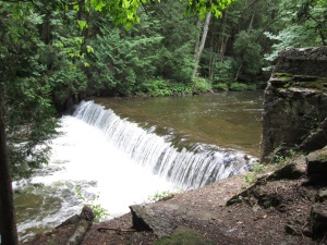
The Willoughby dam is about 100 metres upstream from the Forks of the Credit road along a Bruce Trail blue side trail in the bottom of the valley.  With a rise of 1.5 metres it is a migratory obstacle to all but jumping species of fish such as salmon and trout.

IMG_6705

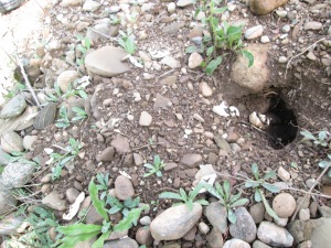
Along the side of the river we found a recently hatched nest of Eastern Snapping Turtle eggs. This turtle is considered to be of Special Concern in Canada.  The empty shells look like little curled up strips of paper running down into the hole.

IMG_6633

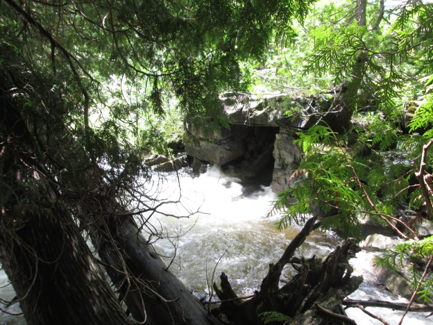
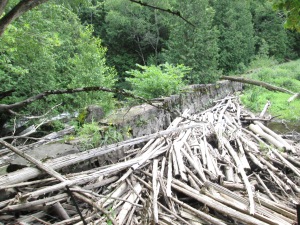
Up river from the concrete dam is a mid 1800’s structure made of blocks of cut stone.  The stonecutter’s dam has a unique stone penstock that can be seen in the cover photo.  The penstock is a stone tunnel extending from the downstream side of the dam.  The intake in the wall of the dam was higher than the exit causing the water to fall through the penstock to deliver energy to turn a turbine or water wheel.  The picture below shows the back side of the dam where a large amount of wood has been washed up over the years.  Many dams were washed out in the major floods of 1878 and 1954 but the stonecutter’s dam has survived. When the Willoughby property was acquired and a conservation plan was developed the restoration of this dam and it’s associated mill structures was reviewed but unfortunately dismissed.

IMG_6717

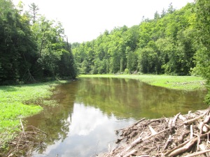
The mill pond behind the stonecutter’s dam is filling up with silt and weeds.  The dam was considered to be impassable to migratory fish but a single salmon was recently caught upstream and this suggests that some can go through (or get tossed over by fishermen).

IMG_6719

If you follow the trail past the dam you will have to continue into Belfountain. The Willoughby property has been used for farming, quarrying and has now been turned into a park that hides it’s abundant history among the new growth forest.

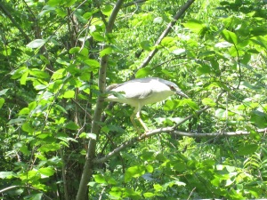
The Black-Crowned Heron in the picture below was photographed a couple of days earlier but this bird was auditioning for a spot in the blog by posing for pictures.  This stocky little heron stands up to two feet tall and can weigh two pounds.  Unlike the great blue heron, night herons do not have long necks and legs.

IMG_6600

The Forks of the Credit contains ample space for future explorations of it’s natural beauty and historical artifacts.

Visit us at http://www.facebook.com/hikingthegta

The Devil’s Pulpit

Saturday July 11, 2015

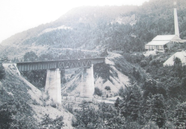
It was 23 degrees and sunny without a cloud in the sky.  We parked along the side of the Credit River just before Dominion Road.  The cover photo shows the area of the Forks of the Credit trestle around 1900.  We set out to investigate the remnants of several elements of this picture. We visited the trestle, the kilns where the chimney is and the white rock face on the cliff wall above and to the left of the kiln known as The Devil’s Pulpit.

This area was surveyed in 1819-1820 with the earliest settlement being at the site of present day Belfountain at the top of the escarpment.  With the coming of the Credit Valley Railway (CVR) the area of the Forks of the Credit became an industrial hub focused on the quarry industry.

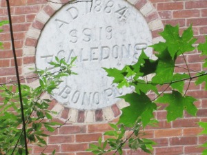
At its peak Forks of the Credit had 33 houses, a store, a hotel and a brick school with a Mechanic’s Institute.  Mechanic’s Institutes were places where adults could access the use of books.  Often funded by industrialists with the intention of having better access to educated employees these preceded and often turned into public libraries.  The school still stands on Chisholme Street which is roughly where the third line would have passed had the hill not been so steep.  The picture below shows the date stone indicating that this was Caledon School Section 19 and it was built in 1884.  The date stone also reads Pro Bono Publico or For The Public Good.

IMG_6480

Medina or Whirlpool sandstone was noted in an 1863 geological survey however there was no easy way to get it from quarry to potential market.  The CVR was established in 1872 and one of the key objectives in it’s charter was to provide a link between the aggregate resources in the Credit Valley and the markets in Toronto and Hamilton.  It came through the area in 1879 and ignited an industry that would prosper for 20 years.  The CVR built a 1,146 foot wooden trestle, 85 feet high to cross the valley.  At the time it was the longest curved trestle in Ontario but safety concerns led to much of it being filled in by dumping gravel through the trestle.  The archive photo below shows the trestle before being filled in with the Devil’s Pulpit in the background.  Compare this with the cover photo after infilling.

forkstrestleold

Only three spans over the Credit River and the Forks of the Credit Road remain open with the balance of the old wooden structure now hidden below a berm of gravel.

IMG_6381

The original wooden trestle was replaced with concrete support and three steel spans in the early 1900’s. The centre span has steel truss work as can be seen in the picture below, taken from the south abutment, and is also seen in the cover photo.

IMG_6390

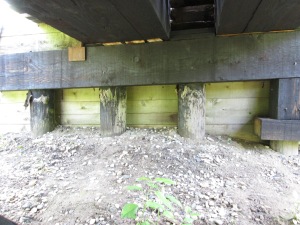
Portions of the original round wood trestle still support the tracks on both abutments.

IMG_6384

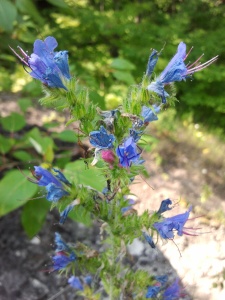
Vipers Bugloss or Blueweed grows in barren places and we found a few plants growing in the rocks beside the trestle.  The leaves, especially those closest to the root, can be infused in a tea. This tea is reported to alleviate headaches, fevers and inflammatory pains.  it is also said to give a general feeling of well being, relieving melancholy.

SAMSUNG

Turkey Vultures are carrion eaters and are the most common of North American vultures.  Like other North American vultures they are not closely related to the European vultures they resemble.  Convergent evolution is the term used to explain two series of random mutations that come out with the same results.  A hundred or more turkey vultures were riding the air currents above the river and the picture below shows just a few of them.

IMG_6408

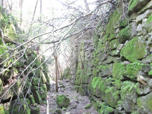
Between the trestle and the top of Chisholme street a siding used to run from the main CVR line to the Hoffman lime kilns.  Twelve draw kilns were built in a ring 30 metres long and 15 metres wide.  The whole set-up was enclosed in a sheltering building.  Several quarries operated in the Forks of the Credit in the late 1800’s supplying cut stone for buildings such as the Legislative Assembly of Ontario building at Queens Park in Toronto.  A layer of Dolostone covered this sandstone and Hoffman built the lime kilns in 1896 to take advantage of this resource.  Moss covers the walls of the pathway between the stone kilns.

IMG_6462

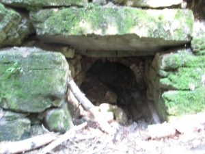
Each of the 12 draw kilns were loaded and burned individually and with separate heat control. The kilns were started in a sequence such that there were always some being loaded, some in mid cycle and some being emptied of cooled down lime. The picture below shows inside of one kilns with it’s fire brick lining.  Similar kilns can be found at Limehouse.

IMG_6455

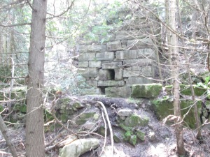
The chimney stood 30 metres tall to exhaust the smoke and heat from the kilns but only the lower few metres remain standing.

IMG_6450

The Bruce Trail works its way up the side of the escarpment past discarded boulders and small run off streams.  After climbing a little farther you come to an open quarry face of what was known as The Forks Quarries and now is referred to as The Devil’s Pulpit.

IMG_6495

As you reach the upper portion of the 100 meter climb a series of stone and wooden stairs have been provided.  A steel cable is anchored into the rocks for added safety.

IMG_6496

The view from atop the Devil’s Pulpit is quite spectacular at any time of the year but especially so in the fall when the leaves are changing.  A small white strip near the centre of the picture below, and about a third of the way up, is the railway and is almost lost in the valley below but gives perspective to the distance that can be seen from up here.  It can be seen when the picture is expanded.

Devils Pulpit

The climb to the top of the escarpment is a lot of work but it is well worth it.  The Bruce Trail continues out along the right of way for the third line but we went back down the hill.  The descent is easier and quicker than the ascent but be sure to watch your footing.  You don’t want to get back down too quickly!

Google Maps Link: Forks of the Credit

Like us at http://www.facebook.com/hikingthegta