Tag Archives: lime kiln

Hole In The Wall

Saturday, February 6, 2020

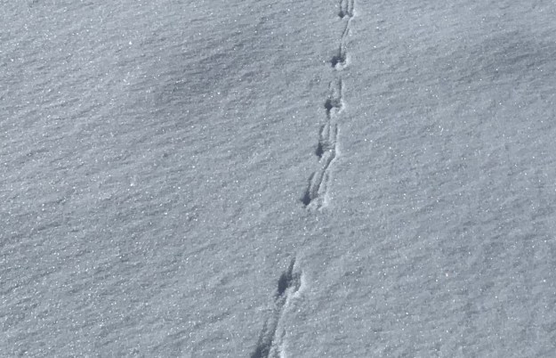
Saturday proved to be one of the coldest hike days of the year so far and we determined not to set ourselves up for too long of an excursion.  Arriving with two cars, we parked one beside the town hall in Limehouse.  The second car we moved to the point where the Bruce Trail crosses the 4th Line.  With fresh snow on the ground, it is always interesting to see the tracks of the animals we share the trails with.  This small set of tracks includes drag marks from the tail of the mouse that made them.
IMG_0633

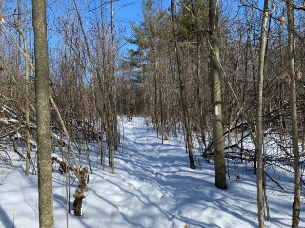
The Bruce Trail is a resource that many people seem to ignore in the winter months but each season has its own special beauty.  We saw very few other people until we reached the Limehouse Conservation Area, where dog walkers were taking advantage of the sunny day.
IMG_0639 (1)

The first school in Limehouse was one room made of log construction.  It was replaced in 1862 with a one room stone building.  When the lime industry was prosperous the town grew fast so that by 1876 there were three hotels and three general stores.  That year, 4,130 tons of lime and lumber was shipped from the railway station in town.  A second floor was added to the school in 1875 but it was only used until 1890 when it was closed.  The room was opened again in 1954 and remained in use until 1962 when the school was replaced with a new one.  Today the building serves as a private residence.

IMG_0636

Eastern gray squirrels can move quickly when they are caught by surprise and are capable of clearing surprisingly large distances with each leap.

Resized_20200208_121253

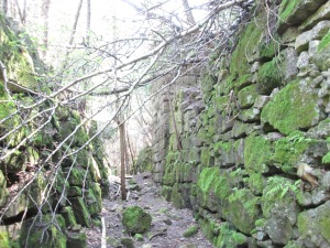
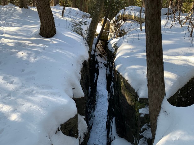
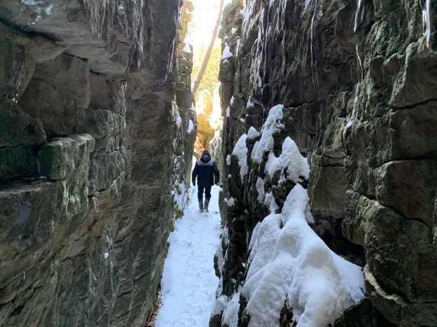
Acidic water breaks down carbonate rocks such as limestone by dissolving them.  This process is known as karst and is common throughout the Niagara Escarpment.  For more detailed information and pictures of this please visit our post on Eramosa Karst.  At Limehouse the Bruce Trail passes through a section of karst known as The Hole In The Wall.  Stairs allow you to access the bottom of these cracks in the limestone.
IMG_0645

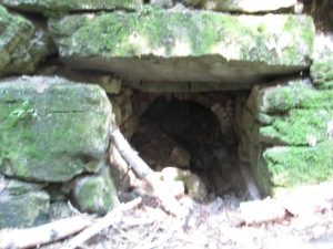
The cover photo shows the depth of the karst at Limehouse.  Small caves throughout the area are some of the most accessible caves in Southern Ontario.

IMG_0652

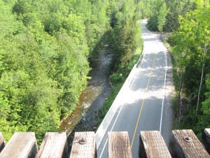
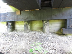
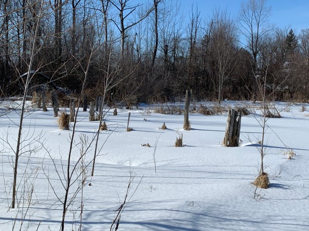
In 1917 the Toronto Suburban Electric Railway arrived in Limehouse with a stop on the 5th line at the foot of what is locally known as Gibraltar Hill.  The stop was convenient because it was located between the school and the heart of town.  The old line can still be traced from Georgetown through to Guelph by looking at Google Earth.  The rail line passed through the middle of the mill pond on a trestle.  Three rows of pilings for the trestle can still be seen crossing the drained pond.
IMG_0659

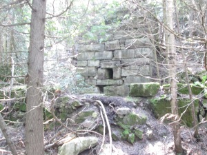
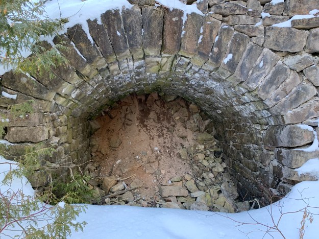
The lime mill was built by John Newton who took the burnt lumps of limestone and ground them into powder.  This was then “slaked” with water and mixed with sand and cow hair.  The resulting mixture was used as mortar in construction.  The mill ruins and the remains of the stone arch from the tail race are all that is left.  These have been deteriorating from people climbing on them and the arch has lost several rows of stones.  They have now been protected behind a recently installed fence.

IMG_0660

The big innovation in lime kilns came with the creation of the draw kiln.  The draw kiln at Limehouse was 16 metres high when it was completed in the 1860s.  It has since collapsed considerably in spite of restoration efforts.  Several of these kilns can be found scattered across the Ontario landscape, including two near complete ones at Kelso.

IMG_0668

The earliest kilns were set kilns where the limestone was placed in the kiln and packed in with wood.  Burning would take days and then it would be allowed to cool down before being unloaded.  There is a strip of seven set kilns that were built in the 1840s.
IMG_0670

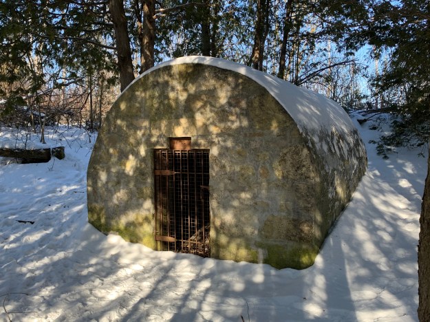
The powder house was added in the 1850’s to provide storage for the blasting powder that was used to break up the larger chunks of limestone.  Blasting was discontinued around 1917 as the quarry had expanded to the point where the local residents feared the explosions would damage their homes.
IMG_0675

Limehouse is one of our favourite places to explore because there is so much history that has been retained.  Fortunately, the local historical society is actively working on preservation of the kilns.

Read our other Limehouse blogs: Limehouse and The Bruce Trial – Limehouse

Google Maps Link: Limehouse

Like us at http://www.facebook.com/hikingthegta

Follow us at http://www.hikingthegta.com

Look for us on Instagram
Kelso’s Kilns

Saturday, Nov. 7, 2015

Near Kelso are several abandoned lime production facilities that preserve part of our industrial heritage regarding the extraction and processing of construction materials.  We decided to look for evidence of two of these plants that operated between the south side of the Credit Valley Railway (CVR) and the edge of the escarpment.  We parked on Kelso Road and set off to make our way to the foot of the escarpment with our eyes set on the vertical cliff face that shows up in archive photos of the kilns.

The area around Milton has always been known for aggregate extraction and the production of lime, limestone and bricks.  It was settled beginning in 1819 by Scottish immigrants to the extent that the area became known as the Scotch Block.  In 1844 Alexander Robertson settled in the area of Milton and began raising his 8 children.  His son, David, started Milton Pressed Brick and Sewer Company as seen in Pine Point Park.  Another son, Duncan started the Robertson Lime Company in the 1880’s on a strip of land between Kelso Road and the escarpment.  The company was operated by him and then his son Donald until 1929 when they sold the business to Gypsum Lime and Alabaster Limited.  Robertson built his company on the embankment along side the CVR (now CPR).  Original stone construction and later concrete additions and repairs remain near track level while the remains of kilns stand slightly uphill.

IMG_1196

Gypsum Lime and Alabaster Limited sold to Dominion Tar (Domtar) in 1959 and they closed the facility a few years later.  Two concrete silos stood on the west end of the structure joined by a bridge across the top.  Birch trees are growing in and around the structures, which look like a giant pair of sunglasses.  These were possibly used in the production of quick lime by adding water to the burnt lime from the kilns.

IMG_1191

The picture below is credited to Robert Sandusky and is from 1957.  It shows the Gypsum Lime and Alabaster Limited facility in the background.  The three lime kilns are in operation and one of the two silos can be seen on the right.  The location of this bridge on Sixteen Mile Creek is now lost under Lake Kelso.

1957 lime kilns

The view from near the foundations of the Robertson Lime Company.  Lake Kelso can be seen between here and the 401.  A dam and flood control facility for Sixteen Mile Creek created this lake in 1962.  It was a mostly cloudy day which gave way to light rain toward the end of our hike. There is still some colour left in the trees but mostly in the willows and oak trees.

IMG_1180

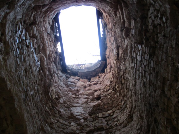
We ended up on the wrong side of the fence and had to walk down the tracks to Appleby Line. This isn’t recommended.  From here we made our way south and found an entrance behind the site of the Christie lime kilns.  David Christie built two draw kilns each 55 feet tall on the site. The first was completed in 1883 and the second in 1886.  The cover photo shows the view up inside one of these kilns.

IMG_1226

The picture below shows the furnace where the wood was burnt to provide heat to break down the limestone.  Temperatures in the oven could reach as high as 1800 degrees F.  The person who filled the furnace was known as a fireman and he made $1.00 per day.  He had to load about 8 cord of wood into the two kilns each day.  The four quarry workers each made $1.25 daily.  The foreman was paid $400 per year.  Workers got Sunday off and many of them attended the church building on the corner of the Christie Homestead.  It has since been converted into a house.

IMG_1220

Chunks of limestone were moved from the quarry behind the kilns to the kiln site.  From here they were dumped into the top of the kiln to be burnt into lime.  The picture below shows the top abutment for the bridge that carried the limestone to the kiln.  There are still pieces of the log supports in the holes in the side of the abutment.

IMG_1227

The archive photo below shows the Christie Kilns in 1911.  Notice the bridge running from the top of the kiln to the embankment behind. The supports and trusses for the bridge can be seen behind the kiln.

Christie Lime Kilns

A small tramway was installed to bring limestone to the kilns and it was opened in July 1922.  Rock could be brought from the quarry to the kiln in under 2 minutes via a steel rope half the size of the one we found on The Cox Property.  This was a marked improvement over the previous method using horses to haul the stone to the kiln.  The horses were suitably impressed too!

IMG_1207

Between the two draw kilns and slightly to the rear are the remains of a third kiln.  This kiln is shorter and of a different construction.  This set kiln was used by loading limestone in and packing firewood around it.  The method was slow and required a cool down period before the product could be removed.  This kiln was likely abandoned when the draw kilns were installed.

IMG_1230

There is a footbridge to get across the CPR tracks and so we took it back into the park.  From here we could see the vertical cliff face that we had been close to after exploring the Robertson Lime Company foundations.

IMG_1290

Growing along the side of Kelso Road are some wild grapes.  Care should be taken to ensure that you are in fact looking at wild grapes and not moonseed, which is poisonous.  One way to tell is to look at the seed shape which predictably looks like a moon in the moonseed plant.

IMG_1293

Google Maps Link: Kelso

Like us at http://www.facebook.com/hikingthegta

Follow us at http://www.hikingthegta.com

The Devil’s Pulpit

Saturday July 11, 2015

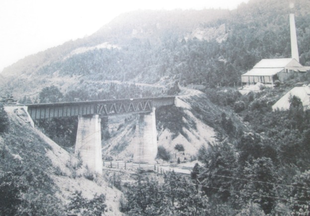
It was 23 degrees and sunny without a cloud in the sky.  We parked along the side of the Credit River just before Dominion Road.  The cover photo shows the area of the Forks of the Credit trestle around 1900.  We set out to investigate the remnants of several elements of this picture. We visited the trestle, the kilns where the chimney is and the white rock face on the cliff wall above and to the left of the kiln known as The Devil’s Pulpit.

This area was surveyed in 1819-1820 with the earliest settlement being at the site of present day Belfountain at the top of the escarpment.  With the coming of the Credit Valley Railway (CVR) the area of the Forks of the Credit became an industrial hub focused on the quarry industry.

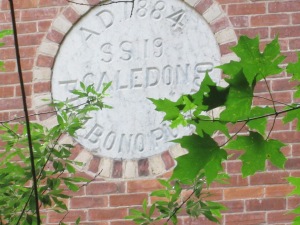
At its peak Forks of the Credit had 33 houses, a store, a hotel and a brick school with a Mechanic’s Institute.  Mechanic’s Institutes were places where adults could access the use of books.  Often funded by industrialists with the intention of having better access to educated employees these preceded and often turned into public libraries.  The school still stands on Chisholme Street which is roughly where the third line would have passed had the hill not been so steep.  The picture below shows the date stone indicating that this was Caledon School Section 19 and it was built in 1884.  The date stone also reads Pro Bono Publico or For The Public Good.

IMG_6480

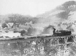
Medina or Whirlpool sandstone was noted in an 1863 geological survey however there was no easy way to get it from quarry to potential market.  The CVR was established in 1872 and one of the key objectives in it’s charter was to provide a link between the aggregate resources in the Credit Valley and the markets in Toronto and Hamilton.  It came through the area in 1879 and ignited an industry that would prosper for 20 years.  The CVR built a 1,146 foot wooden trestle, 85 feet high to cross the valley.  At the time it was the longest curved trestle in Ontario but safety concerns led to much of it being filled in by dumping gravel through the trestle.  The archive photo below shows the trestle before being filled in with the Devil’s Pulpit in the background.  Compare this with the cover photo after infilling.

forkstrestleold

Only three spans over the Credit River and the Forks of the Credit Road remain open with the balance of the old wooden structure now hidden below a berm of gravel.

IMG_6381

The original wooden trestle was replaced with concrete support and three steel spans in the early 1900’s. The centre span has steel truss work as can be seen in the picture below, taken from the south abutment, and is also seen in the cover photo.

IMG_6390

Portions of the original round wood trestle still support the tracks on both abutments.

IMG_6384

Vipers Bugloss or Blueweed grows in barren places and we found a few plants growing in the rocks beside the trestle.  The leaves, especially those closest to the root, can be infused in a tea. This tea is reported to alleviate headaches, fevers and inflammatory pains.  it is also said to give a general feeling of well being, relieving melancholy.

SAMSUNG

Turkey Vultures are carrion eaters and are the most common of North American vultures.  Like other North American vultures they are not closely related to the European vultures they resemble.  Convergent evolution is the term used to explain two series of random mutations that come out with the same results.  A hundred or more turkey vultures were riding the air currents above the river and the picture below shows just a few of them.

IMG_6408

Between the trestle and the top of Chisholme street a siding used to run from the main CVR line to the Hoffman lime kilns.  Twelve draw kilns were built in a ring 30 metres long and 15 metres wide.  The whole set-up was enclosed in a sheltering building.  Several quarries operated in the Forks of the Credit in the late 1800’s supplying cut stone for buildings such as the Legislative Assembly of Ontario building at Queens Park in Toronto.  A layer of Dolostone covered this sandstone and Hoffman built the lime kilns in 1896 to take advantage of this resource.  Moss covers the walls of the pathway between the stone kilns.

IMG_6462

Each of the 12 draw kilns were loaded and burned individually and with separate heat control. The kilns were started in a sequence such that there were always some being loaded, some in mid cycle and some being emptied of cooled down lime. The picture below shows inside of one kilns with it’s fire brick lining.  Similar kilns can be found at Limehouse.

IMG_6455

The chimney stood 30 metres tall to exhaust the smoke and heat from the kilns but only the lower few metres remain standing.

IMG_6450

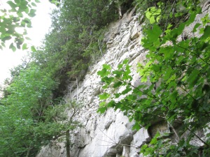
The Bruce Trail works its way up the side of the escarpment past discarded boulders and small run off streams.  After climbing a little farther you come to an open quarry face of what was known as The Forks Quarries and now is referred to as The Devil’s Pulpit.

IMG_6495

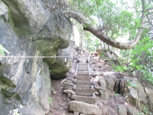
As you reach the upper portion of the 100 meter climb a series of stone and wooden stairs have been provided.  A steel cable is anchored into the rocks for added safety.

IMG_6496

The view from atop the Devil’s Pulpit is quite spectacular at any time of the year but especially so in the fall when the leaves are changing.  A small white strip near the centre of the picture below, and about a third of the way up, is the railway and is almost lost in the valley below but gives perspective to the distance that can be seen from up here.  It can be seen when the picture is expanded.

Devils Pulpit

The climb to the top of the escarpment is a lot of work but it is well worth it.  The Bruce Trail continues out along the right of way for the third line but we went back down the hill.  The descent is easier and quicker than the ascent but be sure to watch your footing.  You don’t want to get back down too quickly!

Google Maps Link: Forks of the Credit

Like us at http://www.facebook.com/hikingthegta