Tag Archives: wild grapes

Guelph Radial Trail – Acton East

Saturday August 27, 2016

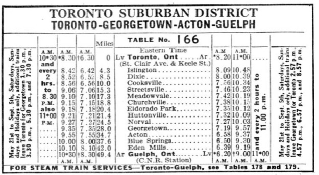
The Toronto Suburban Railway (TSR) line was closed in 1931 but parts of it have been resurrected as the Guelph Radial Trail.  Much of the trail runs on the old railway right of way but large parts are also on trails granted by local landowners.  Hiking the GTA has crossed paths with the TSR several times during our wanderings in and around the GTA. The TSR schedule shown below illustrates the two hour trip from Guelph to Toronto.

tsr

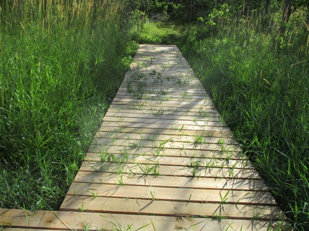
Access to the trail can be made off of the corner of 25 and 25 just south of the town of Acton.  Side Road 25 has some parking just before the intersection with Regional Road 25.  A previous hike starting on Mill Street in Acton led onto the Guelph Radial Trail and ended at 25 and 25 and so a continuation east from there seemed to be in order.

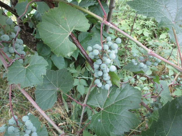
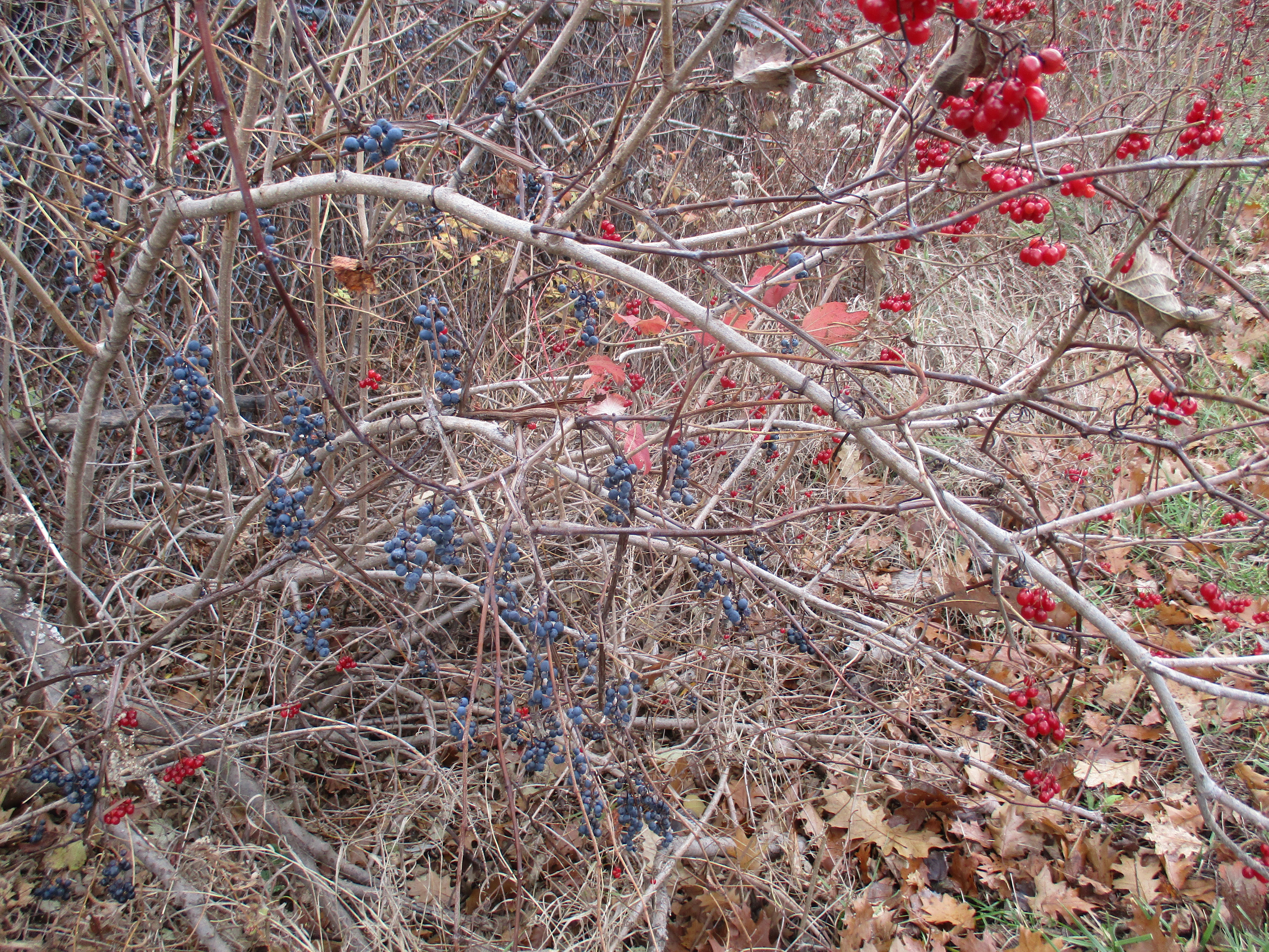
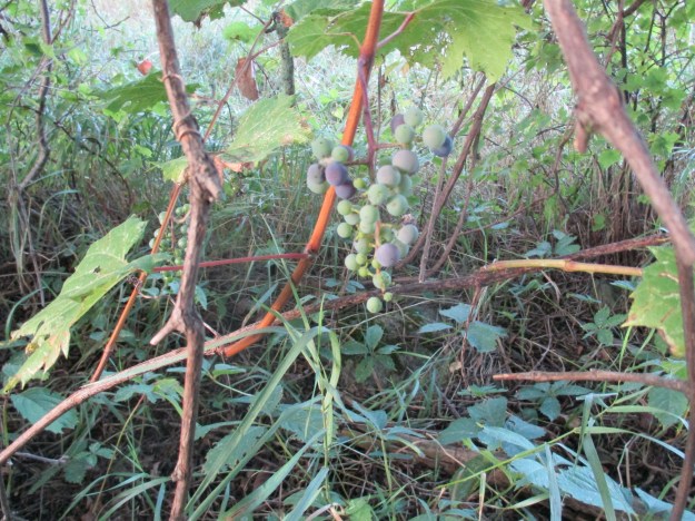
The trail follows the fence line east across the field.  The wild grapes are ripening in clusters where the vines are taking over the bushes and trees.  Wild grape, unlike moonseed, has climbing tendrils.  They can be seen in the picture below wrapped around one of the branches to the left of the cluster.  If in doubt on the identification of wild grapes versus the poisonous moonseed you should eat a leaf.  Grape leaves will taste like grapes.

IMG_3139

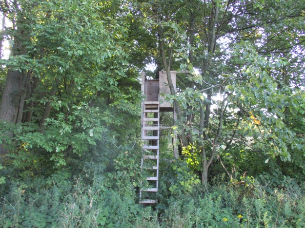
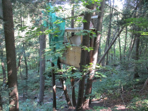
At the back corner of the field the trail turns and enters the woods.  There is some kind of a hunter’s blind built into the trees where it can look into two fields.  It is not uncommon to find some sort of fort or tree house on an exploration but this time there was far more wooden structures than is normal.  There were two of these blinds in different fields.

IMG_3145

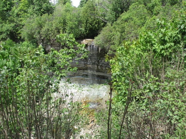
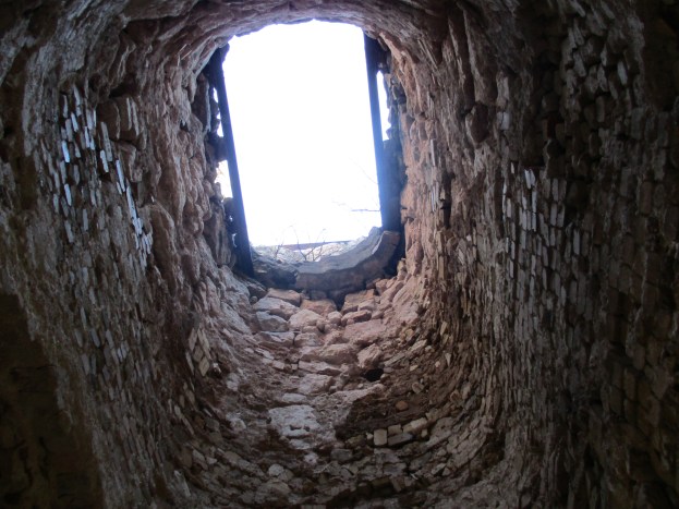
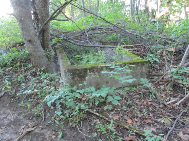
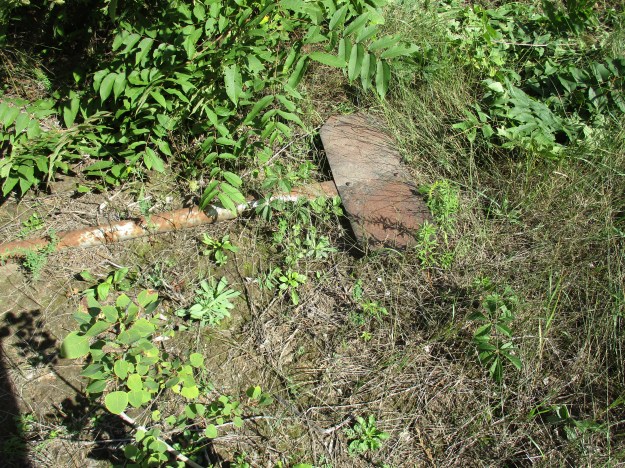
At the foot of this one is an old rectangular structure made of concrete.  Livestock needed water and farmers had to provide large amounts for cows and horses.  They had several options, including creating a pond by damming a creek on the property.  Some landowners were lucky enough to have a spring which could feed into a watering trough.  Others would install windmills to drive the pump needed to bring water from a well to a trough.   There are a couple of pipes on the ground beside this abandoned trough that brought water from somewhere else on the farm.

IMG_3150

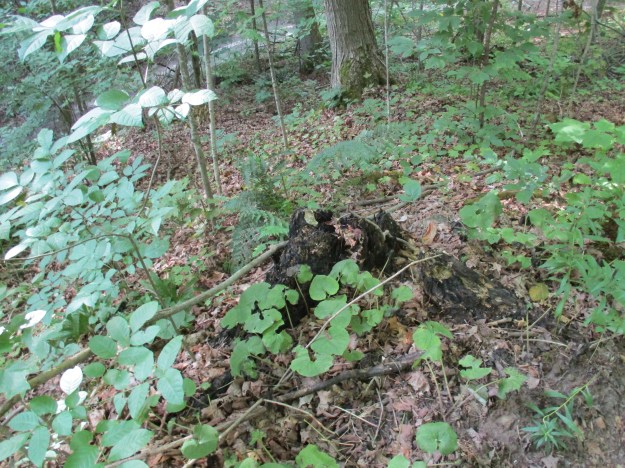
The trail leads through an area of young growth trees.  The forest floor through here is covered with large stumps of burnt trees.  Canada has about 10 percent of the world’s forest cover.  Each year in Canada about 8,300 fires burn and they consume an average of 2.3 million hectares annually.  These fires are essential to forest renewal because they release nutrients that are trapped in the plant matter on the forest floor.  They also open up the forest canopy so that light reaches the floor and gives new growth an opportunity to get started.  Older, often diseased, trees are cleared out giving the forest a chance to grow new healthy ones.  The cones of the jack pine tree don’t open and release their seeds until they are heated in a fire.  They actually require a fire to reproduce, and the older ones get out of the way!

IMG_3156

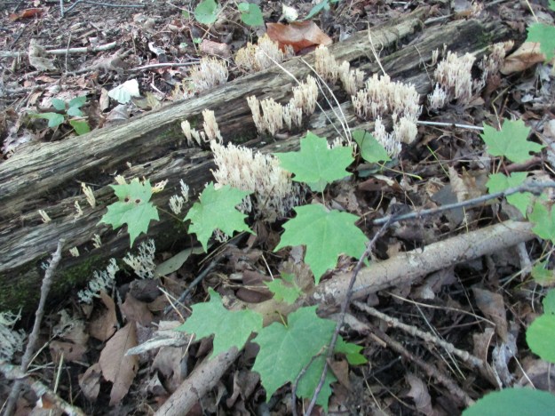
Crown Coral fungus is a member of a group of fungi species which, though not related, are grouped together as coral fungi.  The crown coral, or crown-tipped coral, is distinguished by the little crown shaped tips on the end of the fruit bodies.  They tend to grow on decaying wood and have a peppery taste that disappears when cooked.

IMG_3172

A hand-painted sign announced that we had found a tree fort but it’s possible we would have identified it even without the sign.  This two story tree fort had been covered with tarps but they have since started to come loose.  The steps to climb up into the fort, as well as the height of the rooms suggest that this was not built to be used by children but rather by teenagers.

IMG_3175

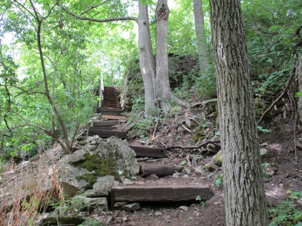
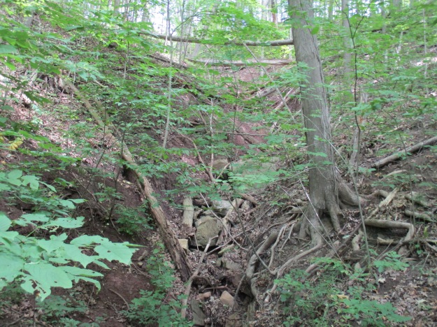
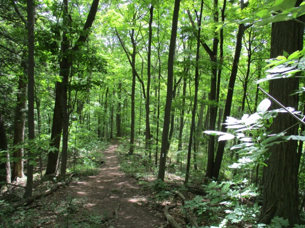
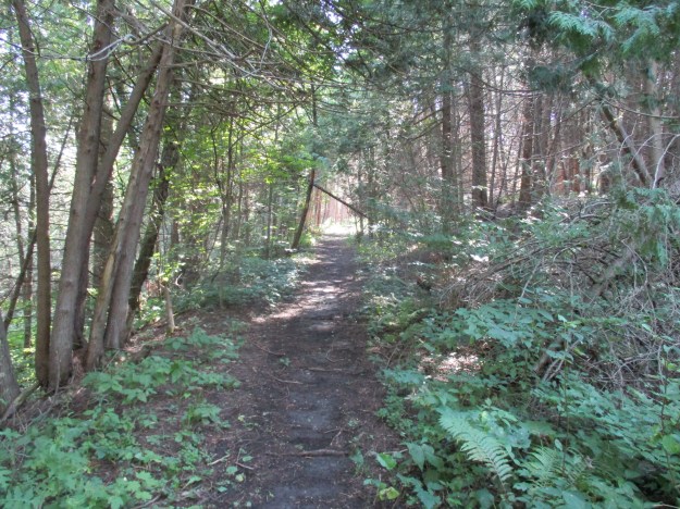
The trail runs along the south side of a small creek until it meets up with the abandoned rail line.  The trail follows the railway corridor to the right but it needed to be investigated a short ways to the left.  The berm is very obvious even though it has been covered with forest on both sides.  The berm rises above the surrounding fields which are also over grown with forest through here.

IMG_3185

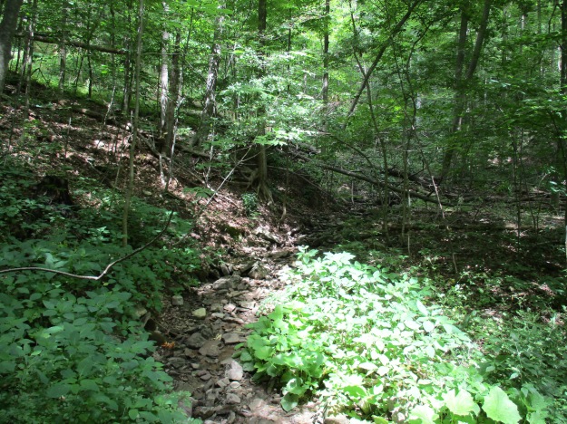
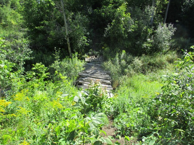
The railway crossed the creek on a short trestle which has been replaced with an improvised foot bridge in the bottom of the creek ravine.  Just beyond the creek crossing the berm runs through an open field and is clearly visible in Google Earth shots.

IMG_3187

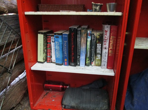
After following the railway for a short distance it was time to return to the trail and follow it out to where it intersects with the third line.  Along the side of the trail is the most fully realized tree house I have ever seen.  It has several rooms some with sitting or sleeping provisions. It can be seen from the rail berm and is featured in the cover photo.  It even includes a library, complete with Ghost Rider, a book by Rush drummer Neil Peart.  A note welcomes everyone to use the place provided they take care of it.

IMG_3199

At the third line the abandoned railway ran parallel to the active line and a short distance in from the road lies what appears to be an old railroad sign.

IMG_3204

The Guelph Radial Trail runs for 33 kilometers and is best enjoyed with two vehicles parked on different sideroads.  This allows you to go twice as far because you don’t have to back track like was done here.

Artifacts from the Toronto Suburban Railway that have been featured in previous posts include:

Google Maps Link: Acton

Like us at http://www.facebook.com/hikingthegta

Follow us at http://www.hikingthegta.com

Berry and Bruce to Borer’s

July 9, 2016

The Royal Botanical Gardens (RBG) obtained permission from King George V in 1930 to use “Royal” in their name.  Thomas Baker McQuesten who was an early environmentalist  created the gardens during the Great Depression as a make work project to provide work for unemployed men.  Since then the RGB has grown to include a series of properties that connect the Niagara Escarpment to Lake Ontario in a continuous greenbelt that includes the historic Cootes Paradise.  They have 2300 acres of environmentally sensitive lands that are home to two of Canada’s most endangered tree species, one of which is found only in the park. In 1941 they received a provincial mandate to develop a program that would focus on conservation, education, horticulture and science.  The RBG is a National Historic Site which encompasses much of the map below.

Berry

One of the properties owned by the RGB is known as the Berry Tract.  After parking on Valley Road the Berry Tract is on the east side of the road.  In the 1877 County Atlas shown below the properties are owned by John Hayes and William Simpson.  These former pioneer land grants have been abandoned as farms and left to return to a more natural condition.  Notice that the land owners in the lower right corner are the Rasberry  families.  They owned the properties adjacent to Cootes Paradise.

Rockchapel (3)

Black Raspberries grow in abundance on the Berry Tract.  The ones in the picture below are starting to ripen and are only slightly smaller than usual.  Most of the berries seen on other bushes are small and dry.  A little rain at the right time might have made a big difference.

IMG_2602

The Thornapple Trail is a 3.4 kilometer loop that runs through the Berry Tract.  Near the start of the trail the boardwalk is being over run by wetland grasses.  The trail runs through a small orchard which was planted in the 1930’s.  Apple and pear trees were cultivated here until the 1960’s when the land was bought for conservation purposes.  The apples and pears attract white tailed deer in the fall who come to enjoy a piece of fresh fruit.

IMG_2594

The wild grapes are doing quite well as the picture below shows.  Canada Moonseed looks similar to wild grapes but has poisonous fruit.  Moonseed does not have the tendrils that grape vines use to climb.  Grape tendrils often grow opposite to a leaf and have a forked end.  Moonseed fruit has a moon shaped seed and leaves that attach to the stem just in from the edge unlike grape leaves that attach at the edge.  Another distinguishing feature of grapes is that the leaves taste like grapes.

IMG_2611

The Bruce Trail runs for 890 kilometers from Queenston to Tobermory but the idea originated with Raymond Lowes of Saskatchewan.  Ray moved to Hamilton where he became interested in the Hamilton Naturalists Club.  In the winter of 1959 he began to dream of a trail winding along the escarpment.  He proposed to the idea to famous artist Robert Bateman suggesting a trail from one end of the escarpment to the other.  On Sept. 23, 1960 the first Bruce Trail Committee meeting was held and by 1963 the trail was established with regional clubs obtaining landowner permission and building various sections.  The trail is named after Bruce County which it runs through as well as the Bruce Peninsula where it terminates.  Bruce County was named after James Bruce who was Governor General of the Province of Canada between 1847 and 1854.  Today the trail has annual visits numbering 400,000 and the Bruce Trail Association stewards over 5,000 acres of escarpment protecting it from development.  There are also over 400 kilometers of side trails marked with blue slashes.  Crossing Valley Road the Bruce Trail leads past several of the 100 waterfalls in the Hamilton Area.  There is a little cluster of five waterfalls near the trail.  Unfortunately Patterson East and West Cascade, Valley Falls and Upper and Lower Hopkins Cascade are all dry on this day.

IMG_2612

Another dry waterfall.  A trip in the spring when the meltwater has swollen the streams would show these waterfalls off at their best.

IMG_2614

On hot summer days the shade of the Bruce Trail can be a welcome relief to the direct sunlight.  The cover photo shows a set of stairs along the trail to Borer’s Falls.

IMG_2619

On April 9th we visited Borer’s Falls and at that time we climbed up from the bottom to see the Lower Borer’s falls as well.  John Borer owned the property with the falls on it at the time of the county atlas above.  The falls drop 15 meters over the side of the escarpment where it powered the Borer family sawmill for almost 100 years.  This sawmill supported the community of Rock Chapel.

IMG_2645

Goldenrod Gall Fly eggs were laid into the stems of the young plants during the two weeks that the adult fly lived.  Although called a fly it really doesn’t fly that well and mostly just walks up and down the stems of goldenrod plants.  In about 10 days the larva will hatch and begin to feast on the inside of the plant’s stock.  It’s saliva causes the plant to grow a large ball, or gall, in which the insect lives.  The gall fly can’t live without goldenrod and there are two species of wasps that rely on the goldenrod gall fly for their survival.  They seek out the galls and deposit their eggs into the gall.  When the wasp larva hatch they eat the gall fly larva which means that in effect there are three species fully reliant on the goldenrod for survival.

IMG_2604

This male white tailed deer, known as a buck, was standing along the trail near the little community of Rock Chapel.  In 1822 a small frame church was built there by the Episcopal Methodists. Later the Wesleyan Methodists took over and they built a new church in 1876 on Rock Chapel Road which is shown on the county atlas.

IMG_2649

Google Maps link: Berry Tract

Like us at http://www.facebook.com/hikingthegta

Follow us at http://www.hikingthegta.com

Kelso’s Kilns

Saturday, Nov. 7, 2015

Near Kelso are several abandoned lime production facilities that preserve part of our industrial heritage regarding the extraction and processing of construction materials.  We decided to look for evidence of two of these plants that operated between the south side of the Credit Valley Railway (CVR) and the edge of the escarpment.  We parked on Kelso Road and set off to make our way to the foot of the escarpment with our eyes set on the vertical cliff face that shows up in archive photos of the kilns.

The area around Milton has always been known for aggregate extraction and the production of lime, limestone and bricks.  It was settled beginning in 1819 by Scottish immigrants to the extent that the area became known as the Scotch Block.  In 1844 Alexander Robertson settled in the area of Milton and began raising his 8 children.  His son, David, started Milton Pressed Brick and Sewer Company as seen in Pine Point Park.  Another son, Duncan started the Robertson Lime Company in the 1880’s on a strip of land between Kelso Road and the escarpment.  The company was operated by him and then his son Donald until 1929 when they sold the business to Gypsum Lime and Alabaster Limited.  Robertson built his company on the embankment along side the CVR (now CPR).  Original stone construction and later concrete additions and repairs remain near track level while the remains of kilns stand slightly uphill.

IMG_1196

Gypsum Lime and Alabaster Limited sold to Dominion Tar (Domtar) in 1959 and they closed the facility a few years later.  Two concrete silos stood on the west end of the structure joined by a bridge across the top.  Birch trees are growing in and around the structures, which look like a giant pair of sunglasses.  These were possibly used in the production of quick lime by adding water to the burnt lime from the kilns.

IMG_1191

The picture below is credited to Robert Sandusky and is from 1957.  It shows the Gypsum Lime and Alabaster Limited facility in the background.  The three lime kilns are in operation and one of the two silos can be seen on the right.  The location of this bridge on Sixteen Mile Creek is now lost under Lake Kelso.

1957 lime kilns

The view from near the foundations of the Robertson Lime Company.  Lake Kelso can be seen between here and the 401.  A dam and flood control facility for Sixteen Mile Creek created this lake in 1962.  It was a mostly cloudy day which gave way to light rain toward the end of our hike. There is still some colour left in the trees but mostly in the willows and oak trees.

IMG_1180

We ended up on the wrong side of the fence and had to walk down the tracks to Appleby Line. This isn’t recommended.  From here we made our way south and found an entrance behind the site of the Christie lime kilns.  David Christie built two draw kilns each 55 feet tall on the site. The first was completed in 1883 and the second in 1886.  The cover photo shows the view up inside one of these kilns.

IMG_1226

The picture below shows the furnace where the wood was burnt to provide heat to break down the limestone.  Temperatures in the oven could reach as high as 1800 degrees F.  The person who filled the furnace was known as a fireman and he made $1.00 per day.  He had to load about 8 cord of wood into the two kilns each day.  The four quarry workers each made $1.25 daily.  The foreman was paid $400 per year.  Workers got Sunday off and many of them attended the church building on the corner of the Christie Homestead.  It has since been converted into a house.

IMG_1220

Chunks of limestone were moved from the quarry behind the kilns to the kiln site.  From here they were dumped into the top of the kiln to be burnt into lime.  The picture below shows the top abutment for the bridge that carried the limestone to the kiln.  There are still pieces of the log supports in the holes in the side of the abutment.

IMG_1227

The archive photo below shows the Christie Kilns in 1911.  Notice the bridge running from the top of the kiln to the embankment behind. The supports and trusses for the bridge can be seen behind the kiln.

Christie Lime Kilns

A small tramway was installed to bring limestone to the kilns and it was opened in July 1922.  Rock could be brought from the quarry to the kiln in under 2 minutes via a steel rope half the size of the one we found on The Cox Property.  This was a marked improvement over the previous method using horses to haul the stone to the kiln.  The horses were suitably impressed too!

IMG_1207

Between the two draw kilns and slightly to the rear are the remains of a third kiln.  This kiln is shorter and of a different construction.  This set kiln was used by loading limestone in and packing firewood around it.  The method was slow and required a cool down period before the product could be removed.  This kiln was likely abandoned when the draw kilns were installed.

IMG_1230

There is a footbridge to get across the CPR tracks and so we took it back into the park.  From here we could see the vertical cliff face that we had been close to after exploring the Robertson Lime Company foundations.

IMG_1290

Growing along the side of Kelso Road are some wild grapes.  Care should be taken to ensure that you are in fact looking at wild grapes and not moonseed, which is poisonous.  One way to tell is to look at the seed shape which predictably looks like a moon in the moonseed plant.

IMG_1293

Google Maps Link: Kelso

Like us at http://www.facebook.com/hikingthegta

Follow us at http://www.hikingthegta.com