Tag Archives: goldenrod

Berry and Bruce to Borer’s

July 9, 2016

The Royal Botanical Gardens (RBG) obtained permission from King George V in 1930 to use “Royal” in their name.  Thomas Baker McQuesten who was an early environmentalist  created the gardens during the Great Depression as a make work project to provide work for unemployed men.  Since then the RGB has grown to include a series of properties that connect the Niagara Escarpment to Lake Ontario in a continuous greenbelt that includes the historic Cootes Paradise.  They have 2300 acres of environmentally sensitive lands that are home to two of Canada’s most endangered tree species, one of which is found only in the park. In 1941 they received a provincial mandate to develop a program that would focus on conservation, education, horticulture and science.  The RBG is a National Historic Site which encompasses much of the map below.

Berry

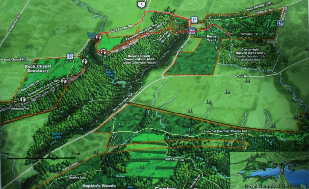
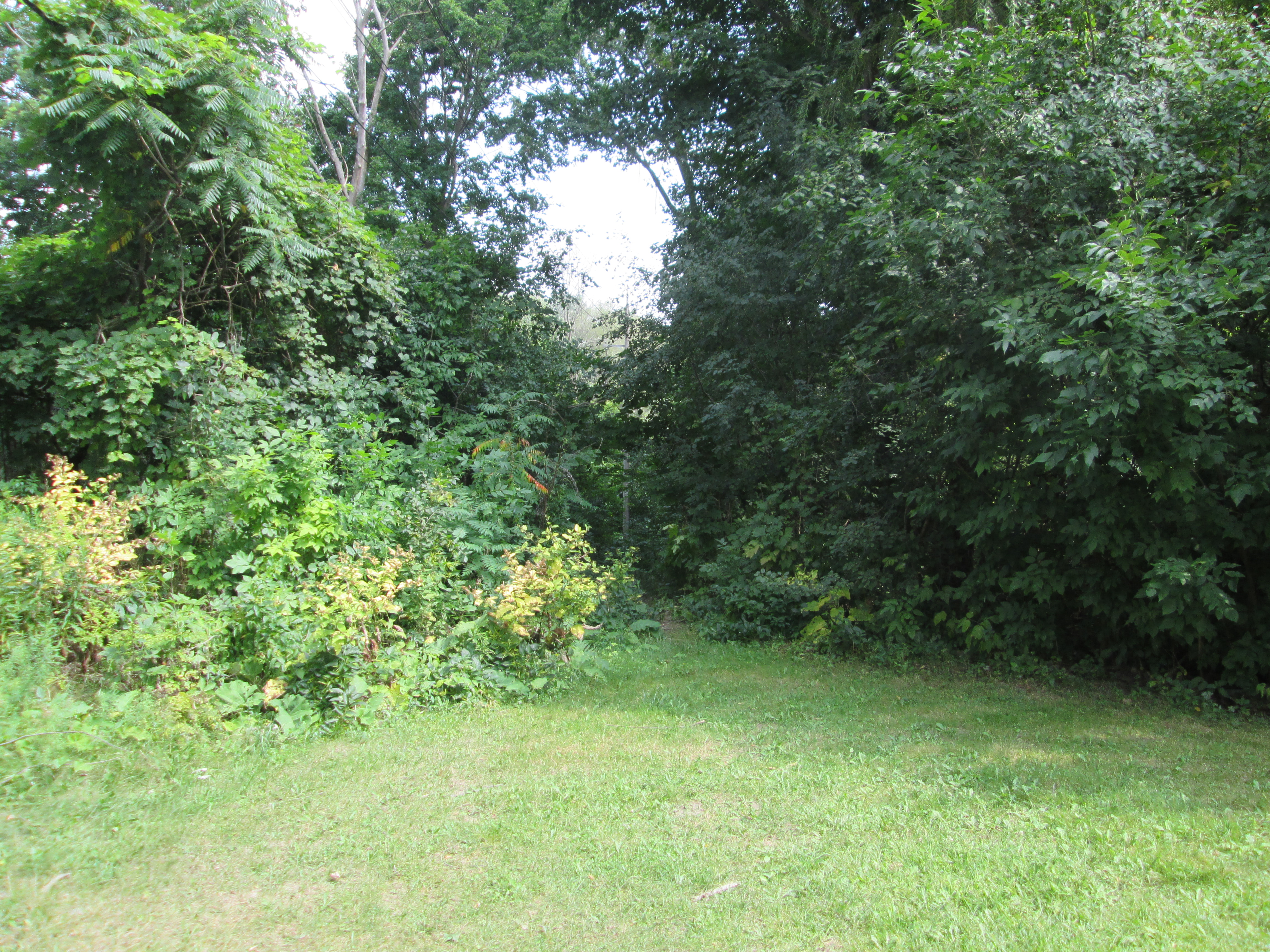
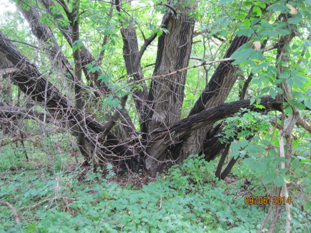
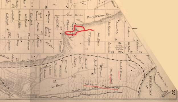
One of the properties owned by the RGB is known as the Berry Tract.  After parking on Valley Road the Berry Tract is on the east side of the road.  In the 1877 County Atlas shown below the properties are owned by John Hayes and William Simpson.  These former pioneer land grants have been abandoned as farms and left to return to a more natural condition.  Notice that the land owners in the lower right corner are the Rasberry  families.  They owned the properties adjacent to Cootes Paradise.

Rockchapel (3)

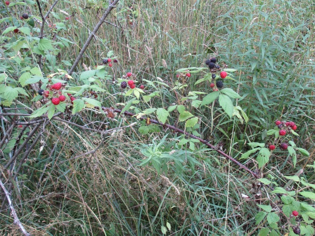
Black Raspberries grow in abundance on the Berry Tract.  The ones in the picture below are starting to ripen and are only slightly smaller than usual.  Most of the berries seen on other bushes are small and dry.  A little rain at the right time might have made a big difference.

IMG_2602

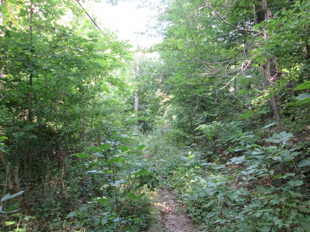
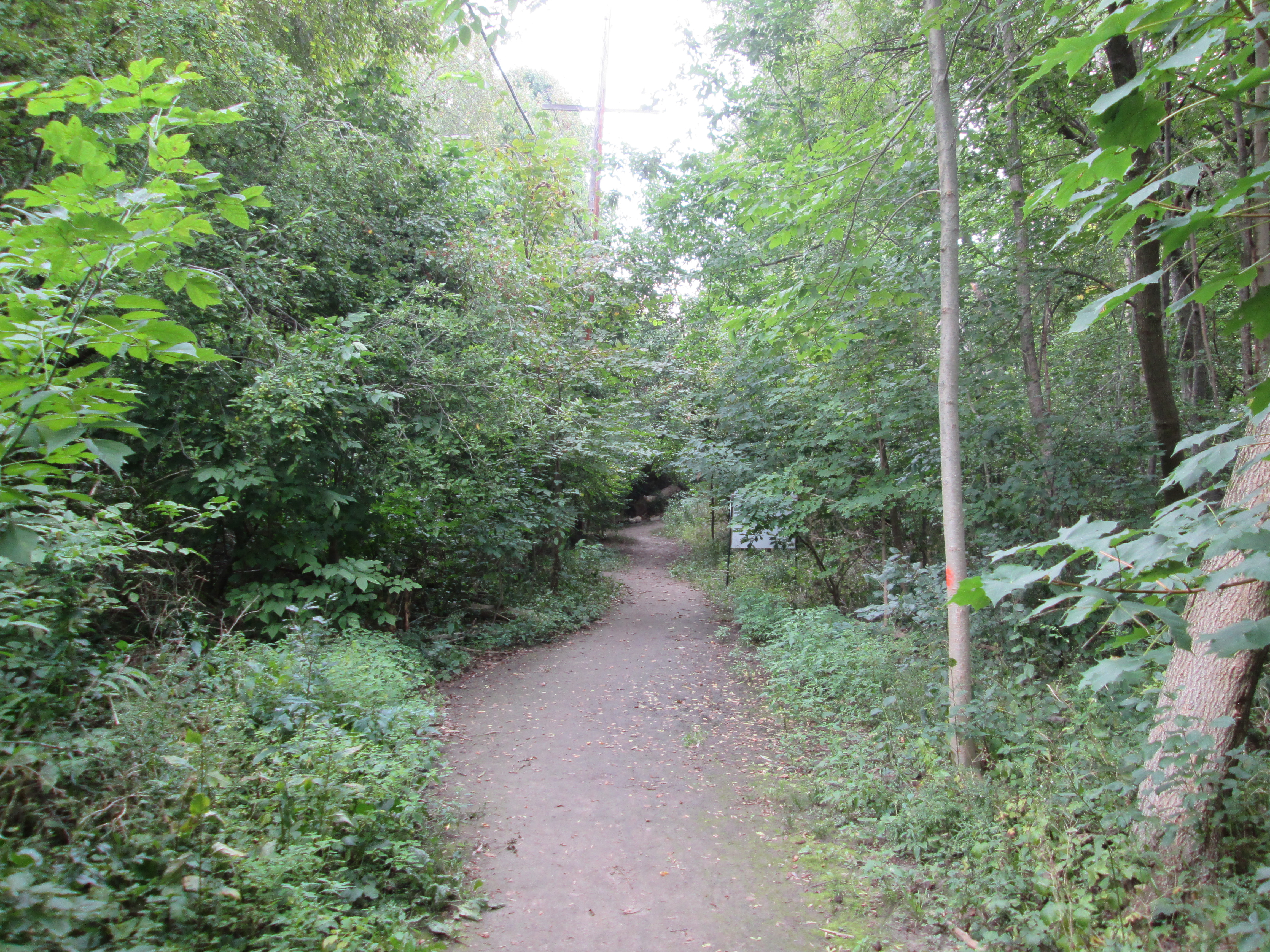
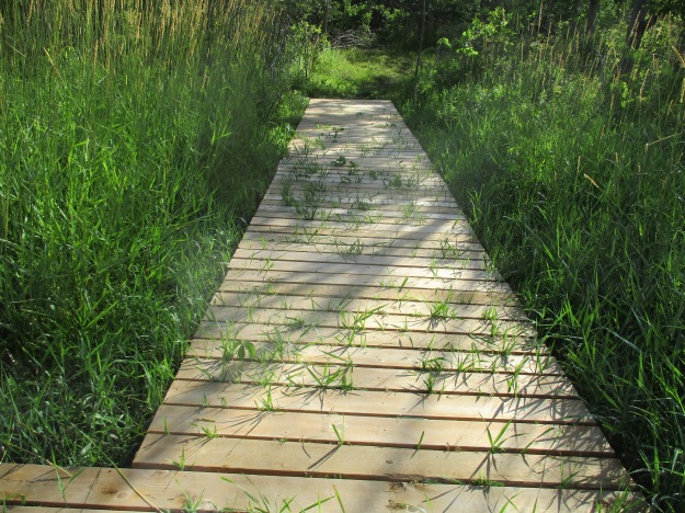
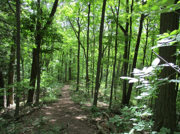
The Thornapple Trail is a 3.4 kilometer loop that runs through the Berry Tract.  Near the start of the trail the boardwalk is being over run by wetland grasses.  The trail runs through a small orchard which was planted in the 1930’s.  Apple and pear trees were cultivated here until the 1960’s when the land was bought for conservation purposes.  The apples and pears attract white tailed deer in the fall who come to enjoy a piece of fresh fruit.

IMG_2594

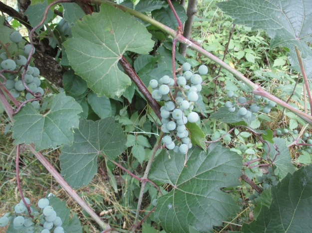
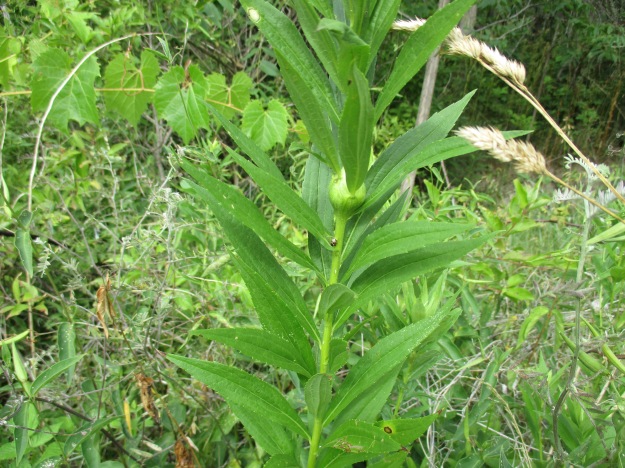
The wild grapes are doing quite well as the picture below shows.  Canada Moonseed looks similar to wild grapes but has poisonous fruit.  Moonseed does not have the tendrils that grape vines use to climb.  Grape tendrils often grow opposite to a leaf and have a forked end.  Moonseed fruit has a moon shaped seed and leaves that attach to the stem just in from the edge unlike grape leaves that attach at the edge.  Another distinguishing feature of grapes is that the leaves taste like grapes.

IMG_2611

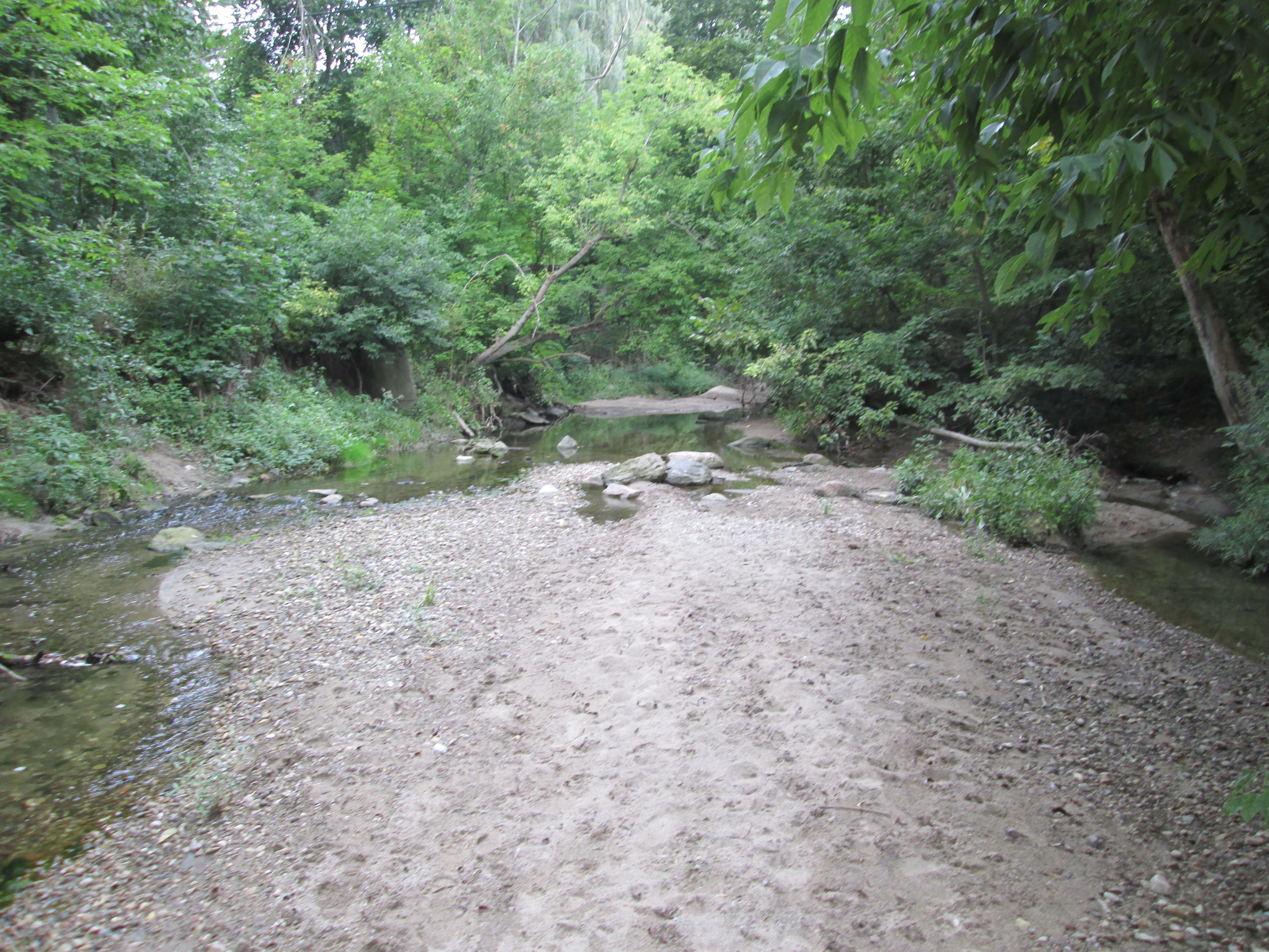
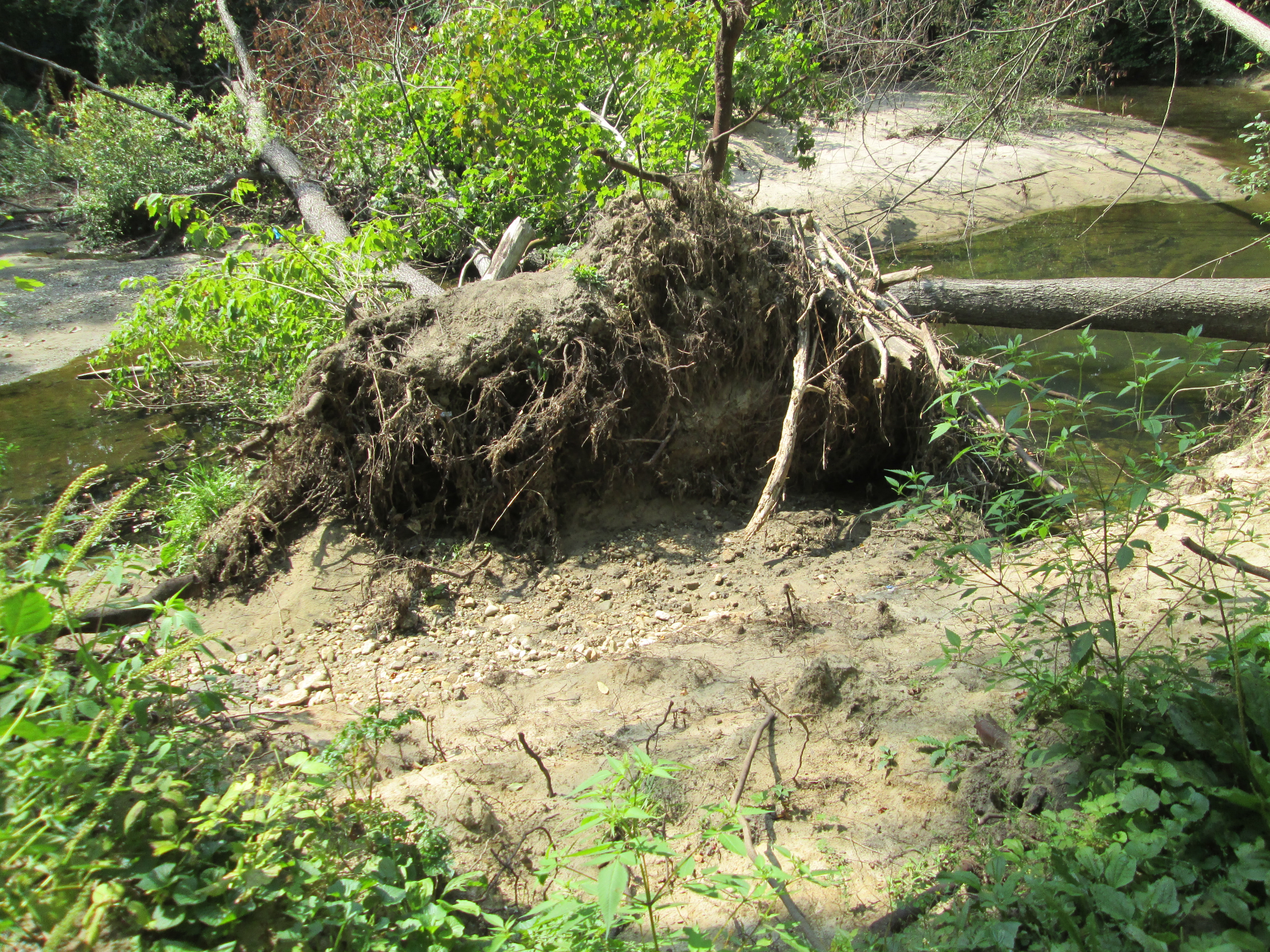
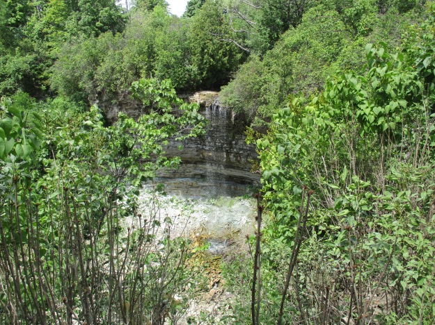
The Bruce Trail runs for 890 kilometers from Queenston to Tobermory but the idea originated with Raymond Lowes of Saskatchewan.  Ray moved to Hamilton where he became interested in the Hamilton Naturalists Club.  In the winter of 1959 he began to dream of a trail winding along the escarpment.  He proposed to the idea to famous artist Robert Bateman suggesting a trail from one end of the escarpment to the other.  On Sept. 23, 1960 the first Bruce Trail Committee meeting was held and by 1963 the trail was established with regional clubs obtaining landowner permission and building various sections.  The trail is named after Bruce County which it runs through as well as the Bruce Peninsula where it terminates.  Bruce County was named after James Bruce who was Governor General of the Province of Canada between 1847 and 1854.  Today the trail has annual visits numbering 400,000 and the Bruce Trail Association stewards over 5,000 acres of escarpment protecting it from development.  There are also over 400 kilometers of side trails marked with blue slashes.  Crossing Valley Road the Bruce Trail leads past several of the 100 waterfalls in the Hamilton Area.  There is a little cluster of five waterfalls near the trail.  Unfortunately Patterson East and West Cascade, Valley Falls and Upper and Lower Hopkins Cascade are all dry on this day.

IMG_2612

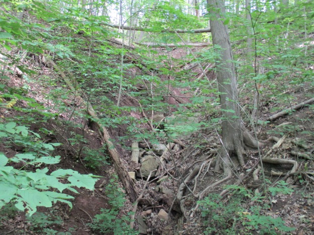
Another dry waterfall.  A trip in the spring when the meltwater has swollen the streams would show these waterfalls off at their best.

IMG_2614

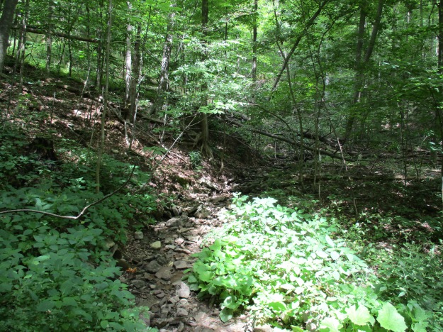
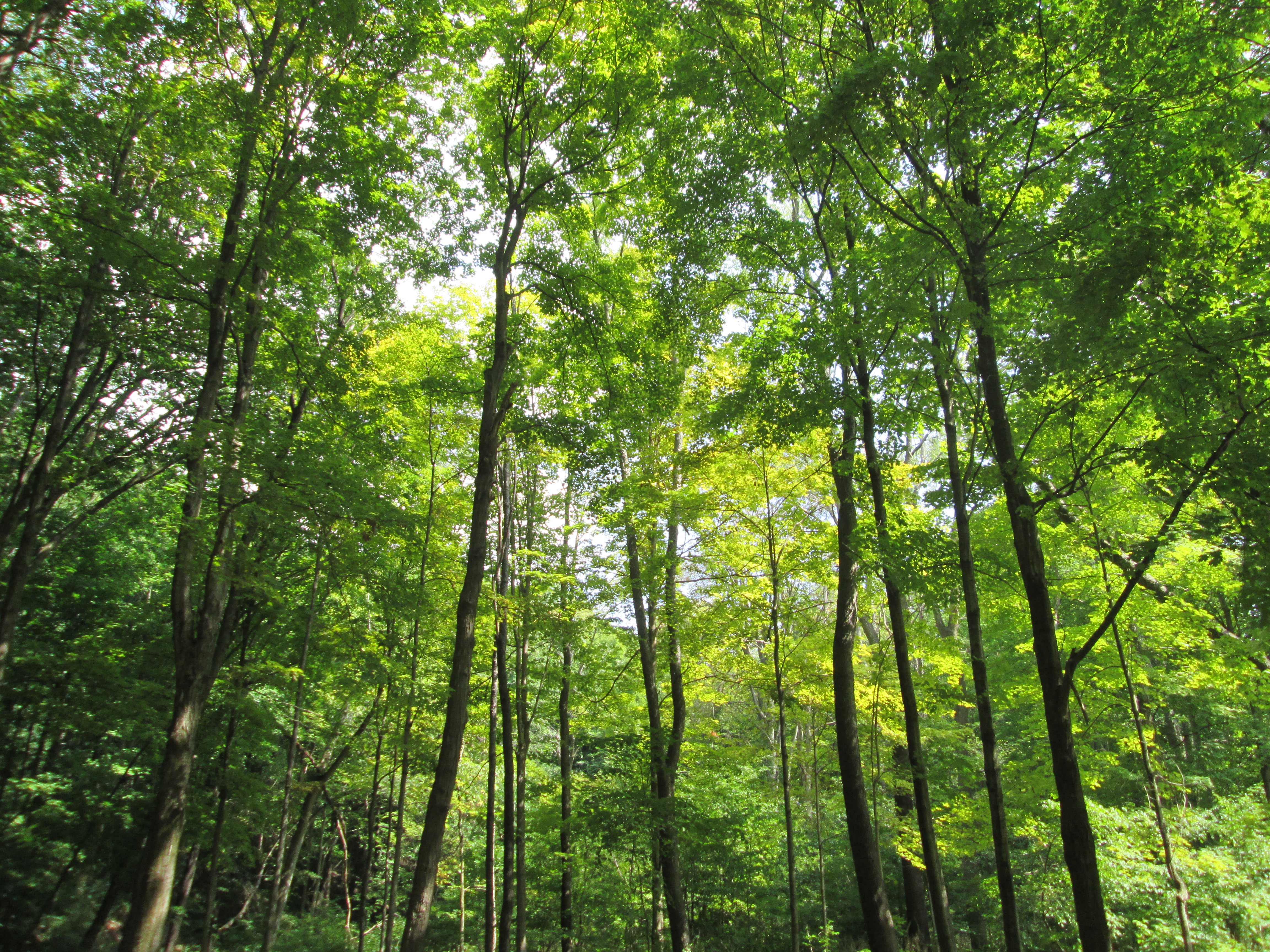
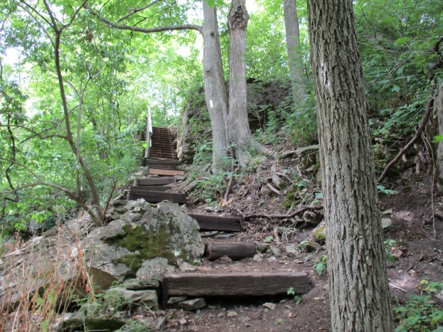
On hot summer days the shade of the Bruce Trail can be a welcome relief to the direct sunlight.  The cover photo shows a set of stairs along the trail to Borer’s Falls.

IMG_2619

On April 9th we visited Borer’s Falls and at that time we climbed up from the bottom to see the Lower Borer’s falls as well.  John Borer owned the property with the falls on it at the time of the county atlas above.  The falls drop 15 meters over the side of the escarpment where it powered the Borer family sawmill for almost 100 years.  This sawmill supported the community of Rock Chapel.

IMG_2645

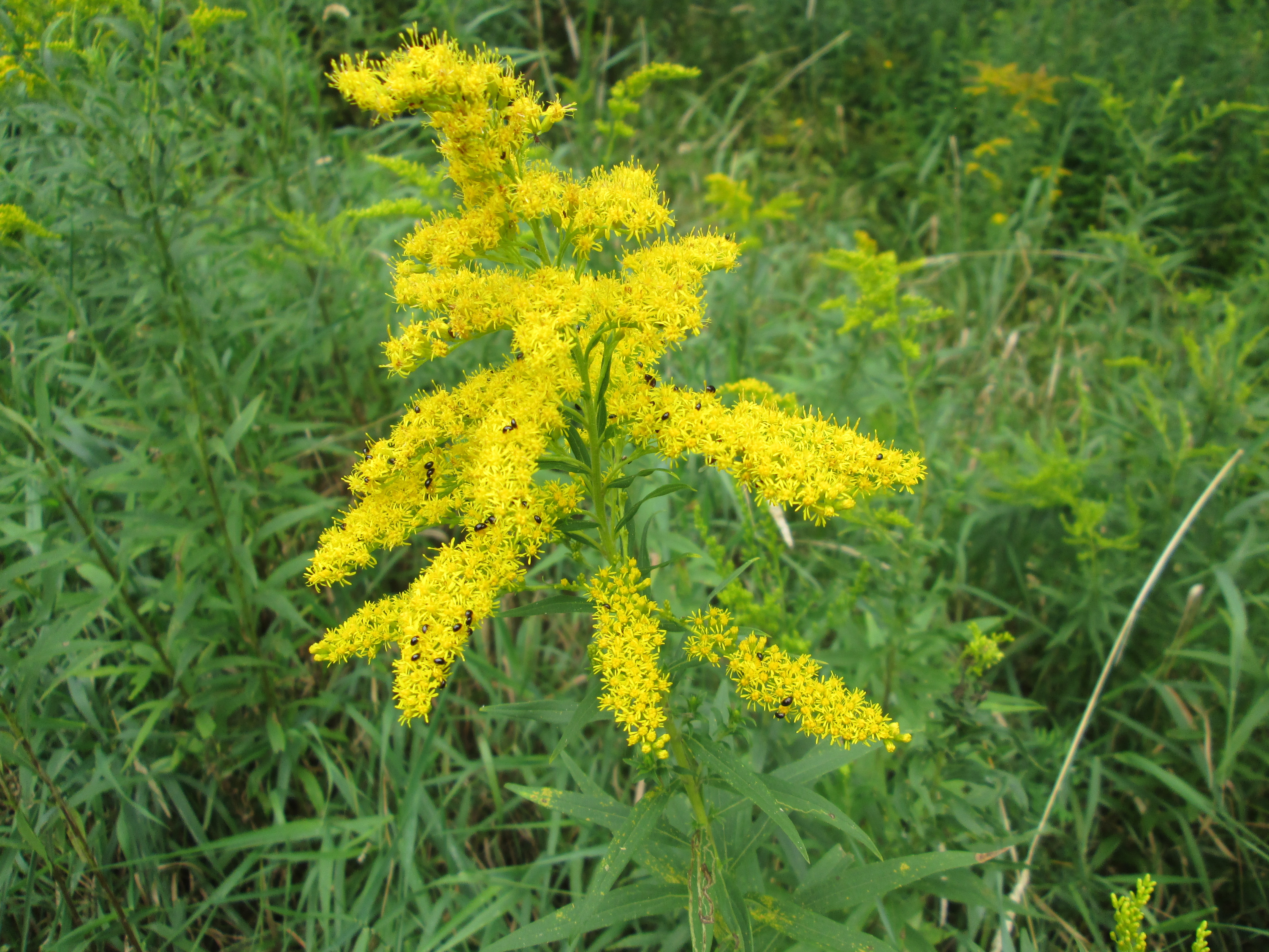
Goldenrod Gall Fly eggs were laid into the stems of the young plants during the two weeks that the adult fly lived.  Although called a fly it really doesn’t fly that well and mostly just walks up and down the stems of goldenrod plants.  In about 10 days the larva will hatch and begin to feast on the inside of the plant’s stock.  It’s saliva causes the plant to grow a large ball, or gall, in which the insect lives.  The gall fly can’t live without goldenrod and there are two species of wasps that rely on the goldenrod gall fly for their survival.  They seek out the galls and deposit their eggs into the gall.  When the wasp larva hatch they eat the gall fly larva which means that in effect there are three species fully reliant on the goldenrod for survival.

IMG_2604

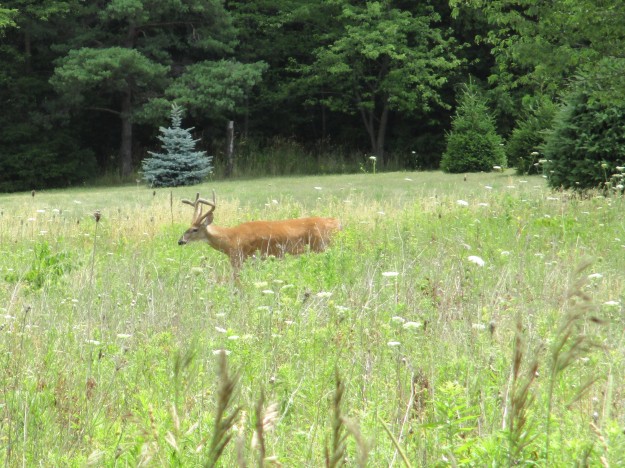
This male white tailed deer, known as a buck, was standing along the trail near the little community of Rock Chapel.  In 1822 a small frame church was built there by the Episcopal Methodists. Later the Wesleyan Methodists took over and they built a new church in 1876 on Rock Chapel Road which is shown on the county atlas.

IMG_2649

Google Maps link: Berry Tract

Like us at http://www.facebook.com/hikingthegta

Follow us at http://www.hikingthegta.com

Old Post Road

Sunday August 30, 2015

Post Road runs through the most affluent neighbourhood in Canada and ends in it’s first planned community.  Between the two, the road is broken by Wilket Creek where there is no bridge crossing.  I had time for a short hike while my wife was sleeping off a stomach illness.

At the start of the 20th century the area of Bayview and Lawrence was becoming home to some of Toronto’s wealthiest people.  They started to build grand estates complete with horse stables for their riding pleasure.  We previously looked at some of these old homes in Bayview Estates.  In 1929 the bridge over the West Don River at Lawrence Avenue was rebuilt but the area north of it was still rolling farm land.  The area we now call The Bridle Path was marked by horse trails and was seen as a good place for an exclusive enclave of grand homes because of it’s limited road access.  In 1937 E. P. Taylor, who had designed Canada’s first planned community in Don Mills, bought a large plot of land north of the Bridle Path for his estate.  His wife named it Windfields and today it is owned by the Canadian Film Centre.  The park behind the estate is known as Windfields park.  George Black was partners with Taylor and he built the home on Park Lane Circle where he raised Conrad Black.  To keep the neighbourhood to the wealthy a North York by-law was passed requiring single family homes on a minimum two acre lot size. The streets in the neighbourhood take their names from horse racing and Post Road is the most northerly road in the Bridle Path and thus represents the post position, or starting position for the community.

Post road runs for about 700 metres east from Bayview Avenue through an area where there are only half a dozen homes.  This picture looks from where the paved portion of Post Road ends, east toward Wilket Creek.  You can park here for free.  The cover photo is taken from part way down the old roadway where a hydro line is visible passing through the new growth.

IMG_7927

There is only a little trail left of the roadway where it descends the hill toward the creek.  As is common with many closed portions of road there is always someone who thinks they should be used as dumps.  The west end of Post Road has it’s little caches of trashes.  I found a vinegar bottle from 1958 indicating that the trash was dumped after the development of the area had been well under way.  Canada Vinegars Limited was once the largest manufacturer of vinegar in North America.  They were located at 112 Duke street (now Adelaide) not to far from Toronto’s first post office.

IMG_7722

At the bottom of the hill there is no sign of any bridge remains.  Aerial photos from 1947 show the roadway but there was already no bridge here at that time.  This picture looks north up the creek bed.  On the left side there is a sewer access dated 1980 indicating that the overgrowth on the roadway is only 35 years old because heavy equipment was through here at that time.

IMG_7930

With the water level very low in the creek I was able to cross onto the east side.  The trail on this side is much more open and well used.  It appears that lacking personal gyms and pools for exercise, the inhabitants of the poorer side of Post Road resort to using the park more than their rich counterparts on the other end of the road.

IMG_7933

There are signs of former activity along Wilket Creek as you make your way north along the waterway.  There are several concrete formations that may have been related to mill dams or possibly to flood control.

IMG_7940

The creek bed and surrounding flood plains are composed of a lot of sand and the sides of the creek are in constant erosion.  There are fallen trees all along the creek including this one which has fallen over but continues to have green leaves on it.

IMG_7943

Goldenrod is starting to come into it’s bright golden flowers.  These flowers are essential to the bug community and you will see a wide variety of bees, beetles and assorted other insects on them.  This example is playing host to a colony of ebony bugs.

IMG_7834

Much of the floodplain for Wilket Creek is filled with new growth trees and is a quiet area to hike where I saw very little wildlife.  The trail leads to Banbury Park and Windfields Park.

IMG_7944

Post Road is split in the middle by Wilket Creek and there is no bridge to link the wealthiest properties on the west side with the planned community of Don Mills on the east side.  You stay on your side, and I’ll stay on mine!

Our top 15 stories as selected by readers.

Google maps link: Post Road

Like us at http://www.facebook.com/hikingthegta

Follow us at http://www.hikingthegta.com

Riverside Park Streetsville

Saturday Sept. 6, 2014

It was a cool morning following a night of rain.  We decided that there was time for a short hike. Parking on Riverside Place we walked the path down to the east bank of the Credit River.  We thought we just might find evidence of Timothy Street’s mill, after which the town of Streetsville was named.  Streetsville has retained it’s small town feel even as it has been surrounded by the city of Mississauga.  In 1953 two of the first suburbs in Canada were built near Streetsville.  The one on the north east was called Riverside and opened in 1955.  The park at the bottom of the hill along the river may have contained the mill pond.  The tree in the cover shot is a massive black willow that stands near the side of an old mill race.  It is likely over 100 years old and witness to many changes in the river valley.

We watched a female downy woodpecker looking for lunch on a dead tree.  The downy is the smallest woodpecker in Ontario.  The males can be distinguished from the females by the red cap on the back of the head.  The downy and the hairy woodpecker look almost identical, yet they come from different genera.  Downy woodpeckers average about 6 inches while the hairy is normally around 15 inches in size.  They have the same markings except the white feathers on the tails.  Being unrelated they cannot inter-breed raising the question as to why they look so much alike.  Scientists use the term “convergent evolution” to describe two apparent random sets of independent mutations that, against all odds, somehow produced the same result.

IMG_3189

The Goldenrod Gall Fly is a small brownish fly that lives it’s entire life cycle around the plant.  In the spring the male will wait on a plant for the female to arrive so he can dance for her.  After mating she deposits her eggs directly into the stem of the young goldenrod plant.  The eggs hatch in about 10 days, roughly the same time as the adult completes it’s two week life cycle and dies.  The larva live their whole lives inside the plant where they chew a nest.  Their saliva causes the plant to grow a gall around the larva, up to the size of a golf ball.  Just before winter the larva will chew an escape tunnel out almost to the outer skin.  Then it converts most of its body fluid to glycol, a substance like anti-freeze, and sets down for the winter.  In the spring the larva wakes up and molts into the pupa from which the adult fly will hatch.  The adult will escape through the tunnel it dug the fall before.  When it reaches the end of the tunnel it inflates special pouches in it’s head to “blow apart” the skin of the gall.  The male fly then begins its two week life cycle on the outside.  Goldenrod galls are easy to find but it is rare to see two galls on a single plant.

IMG_3196

Wild cucumbers grow along the edges of Toronto’s rivers and streams.  They are related to cucumbers, squash and other gourds but unlike other members of it’s family, are not edible. The fruit will contain 4 seeds which drop out of the bottom after the pod has ripened.  The plant dies each fall and re-grows in the spring from the seeds of the year before.

IMG_3200

Milkweeds produce a pod which contains hundreds of little seeds.  These little seeds each have a silky tassle which allows them to be blown by the wind to aid distribution.  Milkweed is essential to the life cycle of monarch butterflies.  They lay their eggs on the plant and the emerging caterpillars eat it.  Monarch butterflies travel 4,800 km to Mexico to winter every year. In the winter of 2013-2014 only 44% of the butterflies arrived compared to the year before.  In order to improve the future of these butterflies the David Suzuki Foundation has a program promoting the planting of milkweed in Toronto.

IMG_3203

We found the old Streetsville mill but it was on the other side of the Credit River.  Exploration awaits…

IMG_3219