Monthly Archives: August 2019

West Don Parkland

August 31, 2019

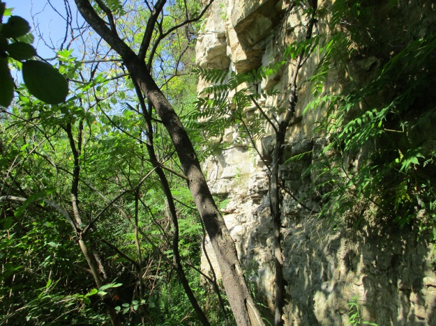
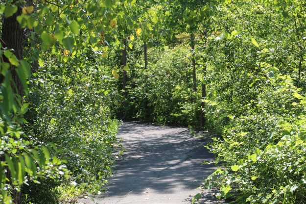
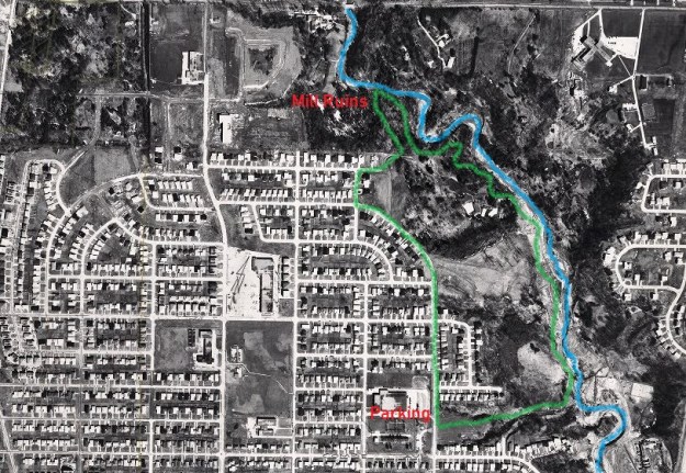
It was a perfect temperature for hiking and also for mosquitoes.  We decided to visit the West Don Parklands to explore the west side of the river and found parking on Maxwell Street where there is access under the power corridor.  We followed the West Don River north until we came to private property and were forced to turn back.  The picture below is a capture from the Toronto Archives of a 1960 aerial photograph of the area we explored.  Our trail has been roughly traced in green while the river is coloured in blue.

West Don

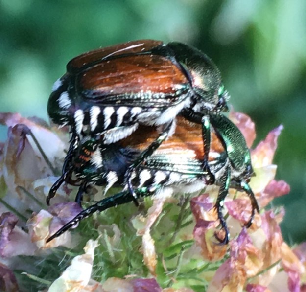
Japanese Beetles were plentiful in the field under the meadow that runs under the hydro corridor.  They are native to the islands of Japan and were first found in the United States in 1916 and in Canada in 1939.  Since then they have spread throughout North America.  The adults eat large amounts of foliage and severely damage over 250 different host plants that they feed on.  Although there are treatment programs designed to reduce the impact of these beetles the picture below gives a good indication of why they continue to thrive.

IMG_1642

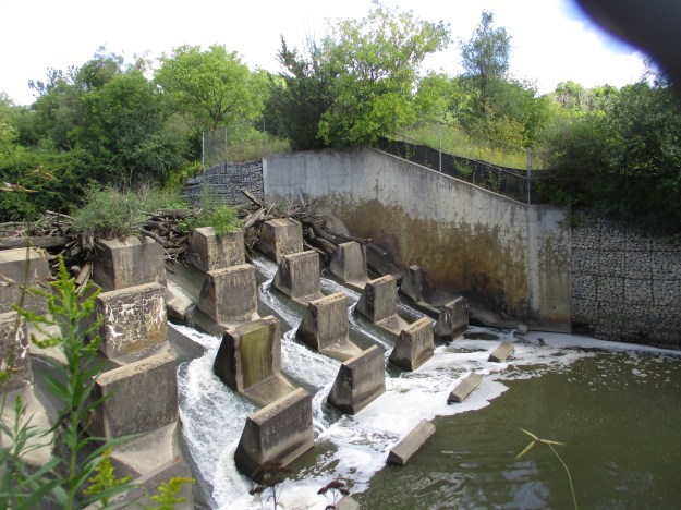
At the bottom of the hill the West Don River flows over a small concrete dam and through a dissipator.  It is interesting to see the water that flows over the top of the dam and onto the concrete piers hitting them with considerable force and yet arriving at the bottom in a calm pool having dissipated all of the energy it gained through the drop.  The top of this dam has become clogged with branches and logs that have floated down stream and become caught up in the first row of piers.  Some of it has been there so long that it is silted up and vegetation is growing on the top.

IMG_6422

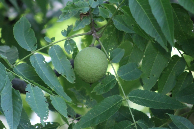
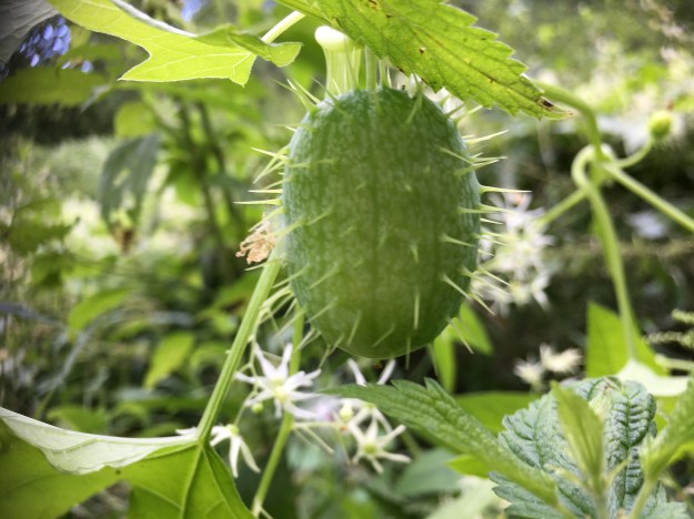
The valley floor has become overgrown with dog strangling vines and wild cucumber vines.  The wild cucumber is native to Africa but has become naturalized in the New World.  Unlike the dog strangling vine, the wild cucumber does not choke out and kill the vegetation that it grows along with.  The fruit are cultivated and eaten in many places such as Brazil where it is used in a meat and vegetable stew.

IMG_1644

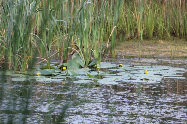
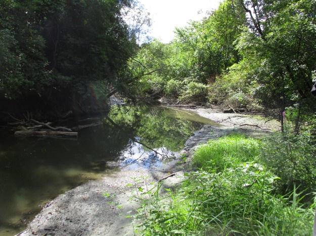
The West Don River was running slow and at a very low level.  Just to the north of here G. Ross Lord Dam and Reservoir are used to collect storm water and release it slowly to prevent flooding in the lower reaches of the river.  Therefore, even after a heavy rainfall this section of the river will see a minimal rise in water levels.

IMG_6441

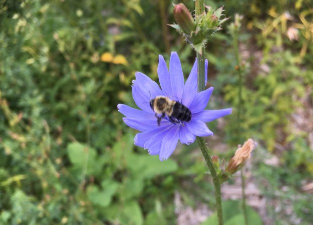
The chicory appears to have had a very good year and the plants and flowers were plentiful.  Chicory has been used for years as an alternative or additive to coffee.  Chicory is used during times of shortage such as The Depression and Second World War by mixing it up to 60% with 40% coffee.  It gives the coffee a slightly woody flavour.  Tender leaves can also be collected and added directly to salads.

IMG_1659

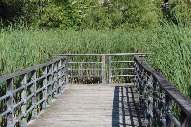
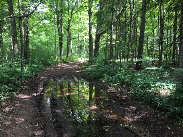
We came to a sign that said that if you find the log bridge to be impassable you should return and take an alternate side trail.  This naturally prompted us to go and have a look to see if the bridge was impassable.  It wasn’t in very good shape but we did manage to cross carefully.

IMG_6437

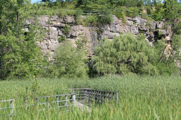
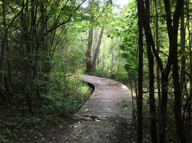
Once you clear the bridge there is an extended boardwalk that is not in perfect shape but is safe if you watch for the occasional broken board.

IMG_1664

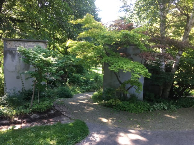
The trail follows the river and leads to the Forest Valley Outdoor Education Centre which is operated by the Toronto District School Board.  The centre plays host to over 17,000 students each year from 170 different schools who come here to learn about and develop an appreciation for nature.  After you pass the buildings on this site you can follow the trail along the river which leads to a place where a pedestrian bridge once crossed the river.

IMG_6451

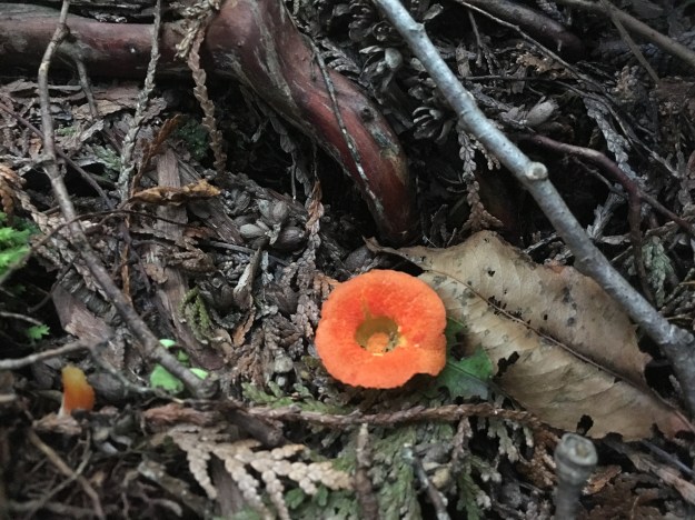
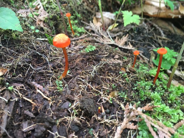
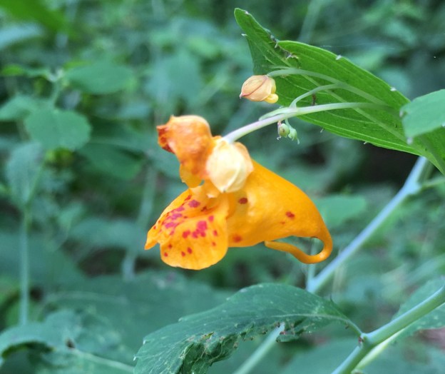
Orange Jewelweed has been used in traditional medicine for years as a remedy for poison ivy exposure.  The juice from the flower and leaves can be applied to skin that has been exposed to poison ivy and it has been proven effective at preventing a rash from forming.  The one caution is that some people are known to be allergic to jewelweed and can have an even more severe reaction to this plant than the one they may have had to the poison ivy.

IMG_1667

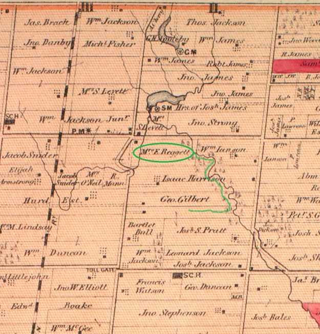
In the 1877 county atlas the property at the south east corner of modern Dufferin and Finch is shown as belonging to Mrs. E Reggett.  To the west of her property Dufferin street ran north on the Gore and Vaughan Plank Road of which there are still remnants in the valley where Dufferin is shown making its curve.  They can be seen at this link.  Interpretive signage in the park indicates that a grist mill was operated in this location but it wasn’t shown on the county atlas, indicating it was a later construction.

reggett

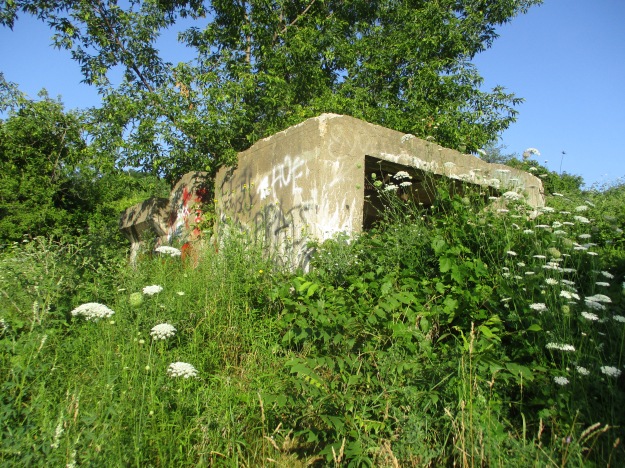
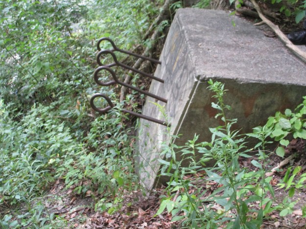
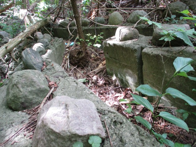
A little farther along the river we came to the location of the former Reggett grist mill.    The ruins themselves appear to be on a fairly small scale for an actual grist mill.  They are also made out of poured concrete which shows that they were built some time after 1900.  The mill has been gone for a long time but the ruins on the river can be seen in photographs that predate the construction of the outdoor education centre.  This suggests that they were not built as part of an educational display but were the actual Reggett mill ruins.

IMG_6473

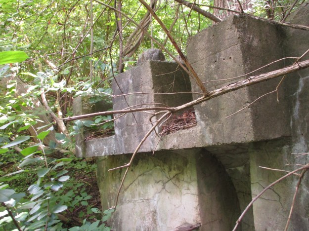
Two steel brackets extend out of the concrete to mount the water wheel on.  The recess for the wheel is only a couple of feet in diameter which suggests that this was a very small wheel and was not used to generate significant power.

IMG_6472

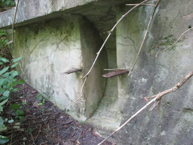
The water was directed over the wheel or off to the side by moving a board from one channel to another in the head race.  Today the whole system is crumbling and a tree is starting to grow at the fork in the channel.

IMG_6477

We chose to follow the driveway from the education centre back to the road where we could make our way back to the car.  This is an interesting park and it would be cool to see what lies on the east side of the river.  Perhaps one day…

Google Maps Link: West Don Parklands

Like us at http://www.facebook.com/hikingthegta

Follow us at http://www.hikingthegta.com

Canada’s Walk Of Fame

Sunday, July 28, 2019

The idea for a walk of fame originated in 1996 as a Toronto Walk of Fame.  It got started in 1998 with the first batch of inductees.  Since then a new group has been added every year and the names are displayed along King Street and Simcoe Street.  Stars honour Canadians in the areas of Arts and Entertainment, Business, Philanthropy, Science and Technology as well as Sports and Athletics.  The plaque below was placed to honour the start of our Walk of Fame.  It is placed in front of the main entrance to the Royal Alexandra Theatre.

IMG_5765

Ed Mirvish has a star right in front of the Royal Alexandria Theater.  It is the only one that is dated and it says July 10, 1996.  This is the date the walk of fame was conceived and a full two years before the first group of inductees were celebrated in 1998.  Edwin Mirvish was also known as “Honest Ed” and one of his accomplishments was the development of Honest Ed’s discount store.  Ed passed away in 2007 but the star that commemorates him is set directly in front of the Royal Alexandra Theatre.

IMG_5766

The Royal Alexandra theatre was built in 1907 and has been owned and operated by Ed Mirvish since 1963.  It s named after a Danish Princess who was the great-grandmother of Queen Elizabeth II.  It was given the Letters Patent by King Edward VII giving it an official Royal designation.  It s believed to be the only surviving Royal theatre in North America.

IMG_5775

Rush are Canada’s most successful band when it comes to international sales.  They stand third behind The Beatles and Rolling Stones for the most Gold and Platinum album designations.

IMG_5660

Joni Mitchell is considered to be one of the best singer-songwriters to come out of Canada.  Her 1971 album Blue is the highest rated album by a female artist on the Billboard Top Albums of All Time coming in at number 30.

IMG_5757

The Guess Who were inducted in 2001 and their star names five of the forty people who have played in the band since it was formed in 1965.  Burton Cummings, Randy Bachman, Gary Peterson, Donnie McDougal and Bill Wallace were in the band in 2001, doing a series of reunion shows.  The irony is that the five of them never played together in the band prior to the reunion.  This lineup played before an estimated 450,000 crowd at the Toronto Sars Benefit Concert on July 30, 2003.

IMG_5734

Canada’s Walk of Fame is intended to give us our own version of the one in Hollywood and several of our stars are found in both places.  The stars in the Canadian walk are all damaged around the edges and several have been cracked or broken.  Our stars are subject to the extremes of Canadian weather.  They are salted in the winter and then run over and scraped by the sidewalk plows.  Some of the stars have already been replaced and many more are in need of repairs.  There is talk of finding an alternative method of displaying them, perhaps mounted in a wall along the sidewalk where they would be up and out of the way.

IMG_5695

There are currently 173 stars in the Canadian Walk of Fame with new inductees being added in November.

Google Maps Link: Royal Alexandria Theatre

Like us at http://www.facebook.com/hikingthegta

Follow us at http://www.hikingthegta.com

Rosetta McClain Gardens 2019

Sunday, August 11, 2019

Rosetta McClain Gardens sits atop the Scarborough Bluffs and although it was once a private garden it is now open to the public for everyone to enjoy.  We have previously visited the gardens but having seen the pictures of hummingbirds on the Friends of Rosetta McClain Gardens Facebook page it seemed like a good idea to stop by again.  Our earlier visit contains more details about the history of the property and so it will be linked at the end of this post rather than repeating all of that here.

Monarch butterfly caterpillars go through five distinct stages of growth, molting after each one.  Each stage is known as an instar and the first stage is translucent.  By the third stage it grows longer tentacles and has the familiar yellow, white and black banding.  This caterpillar below is a third stage instar and in the next two stages it will have white patches on the legs.  The fifth instar will be 2000 times the weight of the first one.  The caterpillar then molts into a chrysalis from which the butterfly will emerge in 8-15 days.  Caterpillars that are seen in late August are the generation that will fly south for the winter.

IMG_1470 (1)

Hummingbirds are the smallest family of birds with the bee hummingbird weighing just 2 grams.  They get their name from the noise their wings make during flight while they beat between 12 and 80 times per second.  Due to their high metabolism they consume energy at a substantial rate.  To preserve body mass, every night they enter a state of torpor that is similar to hibernation.  Even in their state of torpor they lose up to 10% of their body mass every night.

IMG_6168

The gardens feature several of the ten species of coneflowers.  The coneflower is formally known as echinacea and has long been used for its immunological effects.  There are studies which show that it can be effective in treating and preventing respiratory infections related to the common cold.  The cone flower is being pollinated by a black swallowtail butterfly.

IMG_6178

Dryad’s Saddle is a large polypore that can grow as large as 12 inches across.  These young ones are just getting started.  They are edible but can be very tough so people will eat the small ones or cut off the outer edges of the cap on larger ones.  This mushroom is also known as Pheasant’s Back.

IMG_1420

The underside of butterfly wings often displays a much different pattern than the top side of the wing.  The Painted Lady below tends to be found in areas where there are thistles as the larvae feed on thistles and burdocks.

IMG_6193

The remains of the McClain house add an interesting atmosphere to the gardens.  Most of the roof is gone as are parts of the walls but what is left makes for some unusual photographs.

IMG_6162

The view from the top of the Scarborough Bluffs out across Lake Ontario often reveals pleasure boats near shore and the smaller shadows on the horizon of the larger ships.

IMG_6186

Rosetta McClain Gardens is one of the best places in the city to photograph birds, flowers and butterflies.  The story of the gardens can be found in our earlier post which is available at this link.

Google Maps Link: Rosetta McClain Gardens

Like us at http://www.facebook.com/hikingthegta

Follow us at http://www.hikingthegta.com

Kerncliff Park

Saturday, August 3, 2019

Nelson Quarry operated a limestone quarry on Kerns Road in Burlington until 1981.  After it closed it became the site of an ongoing rehabilitation program.  The city of Burlington purchased the old quarry with the intention of creating their first environmental park which eventually opened in 2005.  We decided to check it out and found that there is free parking on both sides of Kerns Road.  The lot on the south side of the road has an interesting concrete artifact near where we parked.  This was likely associated with the quarry across the road.

IMG_5878

The old quarry covers about 40 acres and is now the site of a provincially significant area of natural and scientific interest.  The quarry exposes a transitional layer between the dolomite of the Lockport Formation and the limestone of the Amabel Formation.

IMG_5440

The Ian Reid Side Trail is 1.4 kilometres long and allows people to traverse the wetlands on an elevated boardwalk.  It is named after a long time supporter of the Bruce Trail and a former Bruce Trail Association president.

IMG_5898

The boardwalk has a small observation platform in the middle of the wetlands.  Bullrushes have grown tall enough that it is hard to see the frogs and other wildlife that have made the former quarry home.

IMG_5899

The floor of the old quarry is remarkably flat considering it was created by blasting the limestone off the surface.

IMG_5901

Guard rails have been added along the top of the rock face to protect people who are hiking on the Bruce Trail which runs along the crest.  One of the characteristics of the quarry that made extraction attractive at this site is the relatively thin layer of soil on top of the limestone.  This layer is known as overburden and any place where it is more than two metres thick it becomes impractical to remove it.  There’s always are other places where the limestone is closer to the surface.

IMG_5896

The rock face of the quarry looks as if they just packed up and left.  There is a large amount of broken rock at the base of the cliff as if they blasted a bunch of rock and processed what they could.  Then, rather than working until they ran out of available rock, they just punched out at 5:00 and never came back.

IMG_5445

In the spring and summer the male goldfinch has bright yellow plumage.  The colour is attributed to carotenoids in their diet.  They typically live from 3 to 6 years in the wild but the record has been observed at 11 years.

IMG_5891

From the park you get views into Burlington and out to Lake Ontario in the distance.

IMG_5913

Black walnut trees are known for their dark hardwood that is perfect for making high quality wood furniture.  The nuts can be harvested in late September or early October and should be collected from the tree before they fall.  If you can leave an impression on the shell with your finger the nut is ripe.

IMG_5908

Portions of the trail are accessible for those who use some form of mobility assistance.

IMG_5906

Returning to the car we had another look at the concrete foundations with the tree growing out of the top of them.

IMG_5431

The Bruce Trail runs along the top of the cliff face and we had previously explored there in our post Bruce Trail – Kerns Road to Guelph Line.

Google Maps Link: Kerncliff Park

Like us at http://www.facebook.com/hikingthegta

Follow us at http://www.hikingthegta.com


Canary Restaurant

Sunday, July 28, 2019

Of all the buildings that used to make up the area of Cherry and Front Streets there are but two remaining.  The building on the south east corner has served under many names over the years while across the street the CN Railway Police Building has kept it company since 1923.

The need for a new school in the rapidly expanding St. Lawrence Ward was addressed in 1859 when the Toronto Board of Education decided to erect a new brick school building on the corner of Palace (now Front) and Cherry Streets.  One of the considerations for the new school was that it should have separate entrances for boys and girls and they should not be in the same classroom.  The school had room for 80-90 boys and as many girls and the school board had plans to expand if the community continued to grow.  The picture below shows the boys entrance which has been painted green over the years.

IMG_5784

The area around the school started to transform with the arrival of the railways and the industry that they attracted.  Slowly the population dwindled until the school was forced to close in 1887 and the students were transferred to Sackville Street School.  The original school building is the oldest surviving one built by the Toronto School Board and it has some very interesting architecture.

IMG_5796

The south side of the building had the girls entrance and reveals the change in architecture styles between the original two story school and the later third floor addition.

IMG_5122

Robert Irvine bought the building from the school board and converted it into a 40 room hotel.  In 1890 the building was expanded with a new main entrance on the corner of Cherry and Front Streets.

IMG_5782

The hotel operated under several owners who gave it different names.  Originally it was Irvine House but was soon changed to Cherry Street Hotel.  In 1904 it was re-branded as the Eastern Star Hotel but by 1910 this too had failed and was closed.

IMG_5783

The building stood empty from 1910 until 1922 when it was bought and converted into a manufacturing facility.  It was around this time that the third, and largest, expansion was carried out.  The Thomas Davidson Manufacturing Company used the building to produce enamel ware.  The addition was used for warehousing and later rented to additional manufacturing companies including General Steel Ware.  If you look carefully at the wall you can still see “Thos. Davidson Mfg” painted there.

IMG_5781

From the rear, the building looks like a typical early 20th century factory.

IMG_5778

The Toronto Archives picture below is dated 1972 and shows the Canary Restaurant from the angle of the Palace Street School building.  The restaurant operated in the building from 1965 until 2007 when the neighbourhood was consisted of mostly vacant or demolished buildings.  The Canary Restaurant had become a local icon and now provides the name “The Canary District” to the section of the Lower Donlands that used to be home to Maple Leaf Pork processing plants.  The building has had a heritage designation since 1976 and latest proposal includes it in the future Anishnawbe Health Centre development, the city’s first ever indigineous hub.

Front Street at Cherry Street

Creator: Harvey R. Naylor Date: February 16, 1972 Archival Citation: Fonds 1526, File 60, Item 12 Credit: City of Toronto Archives http://www.toronto.ca/archives Copyright was transferred to the City of Toronto by the copyright owner.

From the front you can see the three different architectural styles in the building, each reflecting the period in which it was built as well as the intended purpose of the additions.  The 1859 school on the right, the 1890 hotel in the centre and the 1922 factory on the left.

IMG_5798

On January 30, 1923 the Grand Trunk Railway was officially absorbed into the Canadian National Railway.  Shortly thereafter the CNR built an office building beside the earlier GTR tracks.  The building was later occupied by the CNR Police and is now often referred to as the CNR Police Building.  The CNR used it until 1970 and most recently it has been used to sell the condos that have been built all around it.

IMG_5799

The picture below is from 1932 and shows the extensive railway sheds that ran along Front Street.  The two story office building at the far end is all that remains today.  During the 1990’s this building was used to shoot multiple films for Toronto’s film industry.

cherry 1932

It remains to be seen how these two historic buildings will be integrated into the Canary District but hopefully they will both survive.  If you are in the area you can always visit Corktown Common, a new park just east along Front Street.

Google Maps Link: Cherry and Front Street

Like us at http://www.facebook.com/hikingthegta

Follow us at http://www.hikingthegta.com

Bruce Trail – Crawford Forestry Tract

Saturday, July 27, 2019

It promised to be a very hot summer day and so we decided to take cover on a shady section of The Bruce Trail.  The Crawford Forestry Tract is a secondary part of Crawford Lake Conservation Area and is just west of the park.  The main Bruce Trail runs through both areas and so we parked on Twiss Road where there is space for several cars at the trail crossing and set out to walk through the forestry tract.

crawford 2

In part of the cedar forest we came across what appeared to be a red flower similar to a poppy.  The cup in the middle was recessed quite deep but didn’t have normal flower parts inside but rather a centre the same as the outside.

IMG_1254

The patterns of gills underneath reveal that it is in fact a type of mushroom.  This is most likely some kind of scarlet waxy cap that has become deformed and sunken in the middle as it starts to decay.  There is nothing in the mushroom book that looks like a poppy.   The Crawford Forestry Tract is also known as Crawford Tract II provides habitat for 14 species which are at risk.  There’s also 3 globally and 7 provincially rare habitat types in the park.

IMG_1252

There are wetlands throughout the forestry tract and the water lilies are in bloom.

IMG_5586

The Crawford Tract has some sections of trail that are typical of the escarpment where you are walking over limestone and dolomite boulders that have been broken apart by karst activity.

IMG_5428

Coral Spring Mycena is one of the first gilled mushrooms to appear in the spring, however it will be found from May until September.  It also goes by the name Orange Bonnet and because it is so small most people consider it to be inedible.

IMG_1262

Slugs and snails are related to oysters and clams in that they are all molluscs.  The front end has either two or four antenna.  If there is only two they will each have an eye on it.  If there are four the additional two will be used for sensory perceptions. This little yellow one is known as a garden slug.

IMG_5591

When you reach Guelph Line you have an option to continue into the Crawford Lake Conservation Area.  Once there you can explore the park, take a hike around the meromictic lake and visit the reconstructed longhouses.  We decided instead to head back because that would have added considerable distance to the hike and it was already one of those hot days when it is prudent not to push it too far.

IMG_1273

When you walk a trail in two directions you often see things on the return trip that you didn’t catch on the way in.  It was starting to seem that mushrooms had appeared in the time between our two passes.  A large patch of Burnt-orange Bolete mushrooms was appearing, several just breaking ground.  These mushrooms are listed as edible but apparently have a bitter taste.

IMG_5612

There’s never a shortage of things to see along the Bruce Trail and at this time of year the mushrooms are out in their short lived glory.  For many of them you have only one day to see them at their best before they start to fade and rot.

Google Maps Link: Crawford Forestry Tract

Like us at http://www.facebook.com/hikingthegta

Follow us at http://www.hikingthegta.com