Monthly Archives: June 2015

Glen Williams

Saturday June 27, 2015

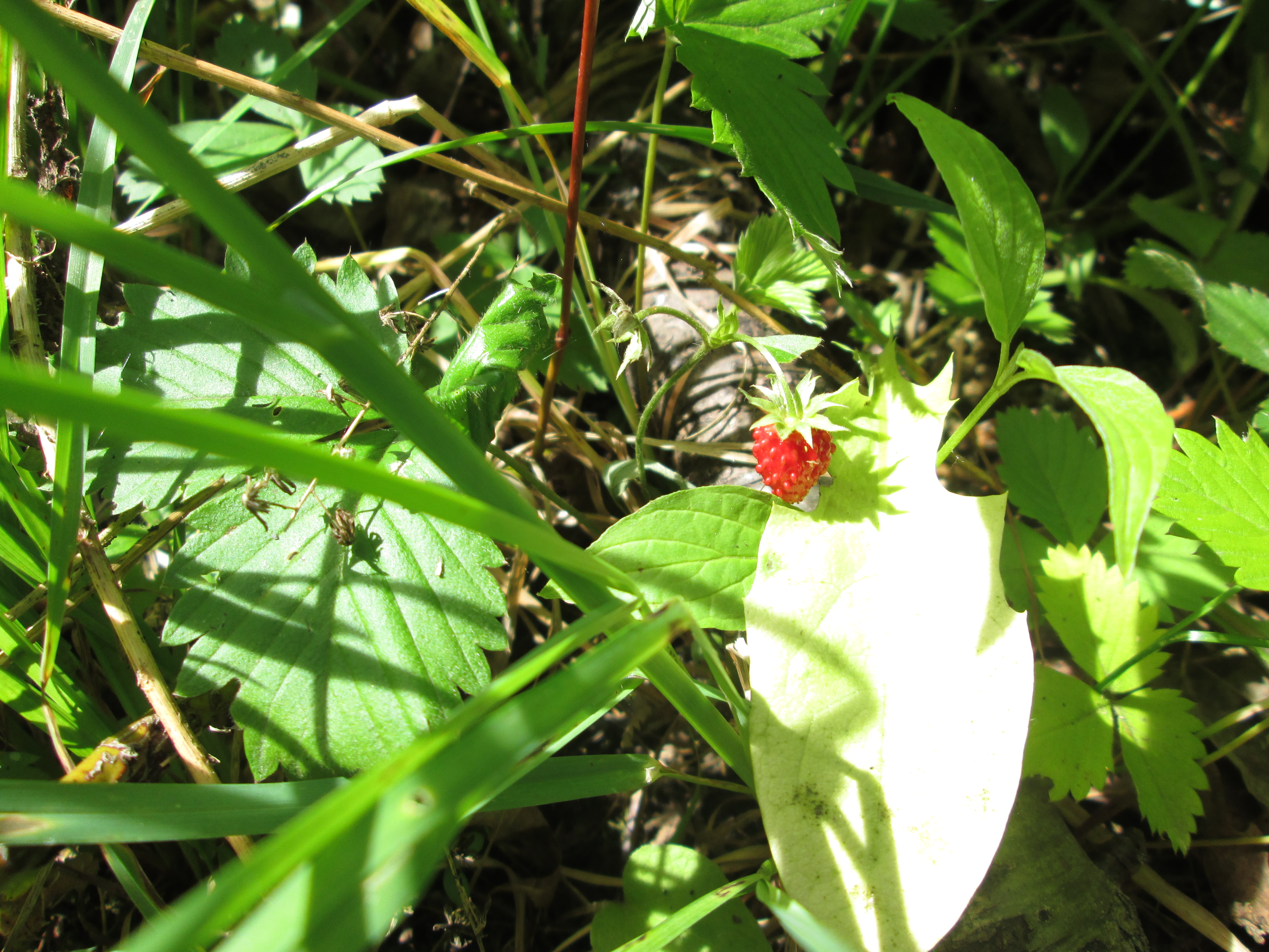
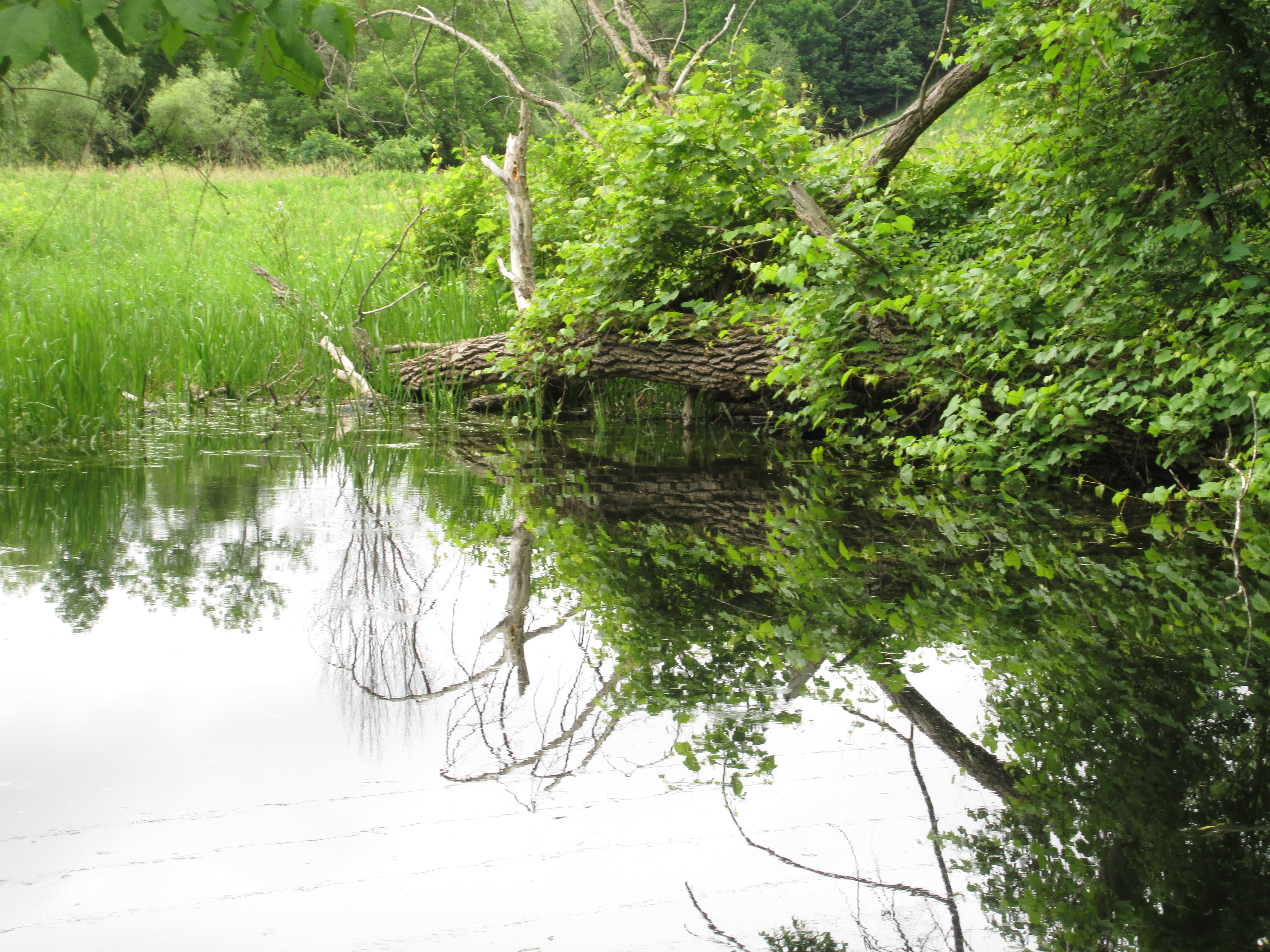
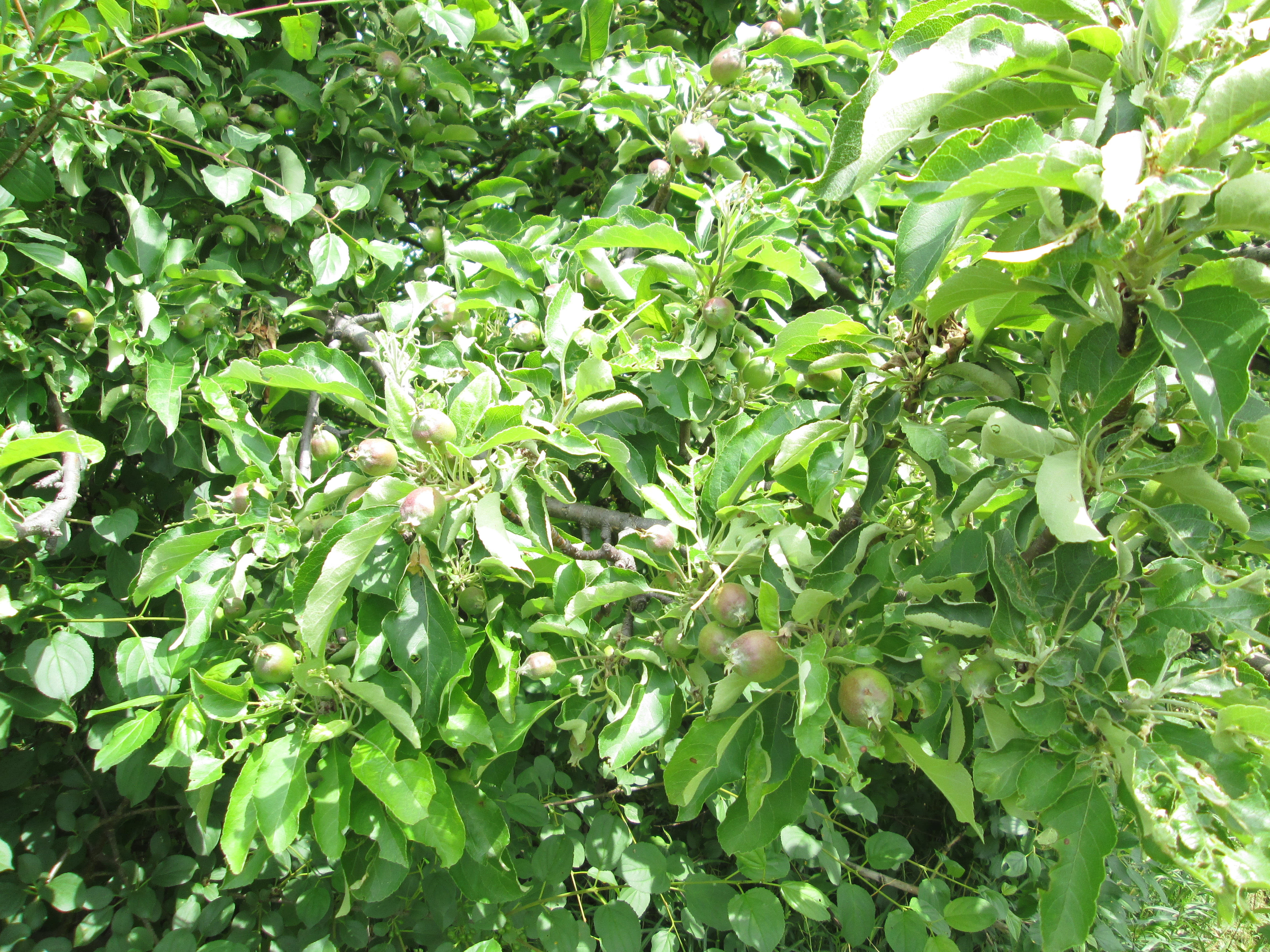
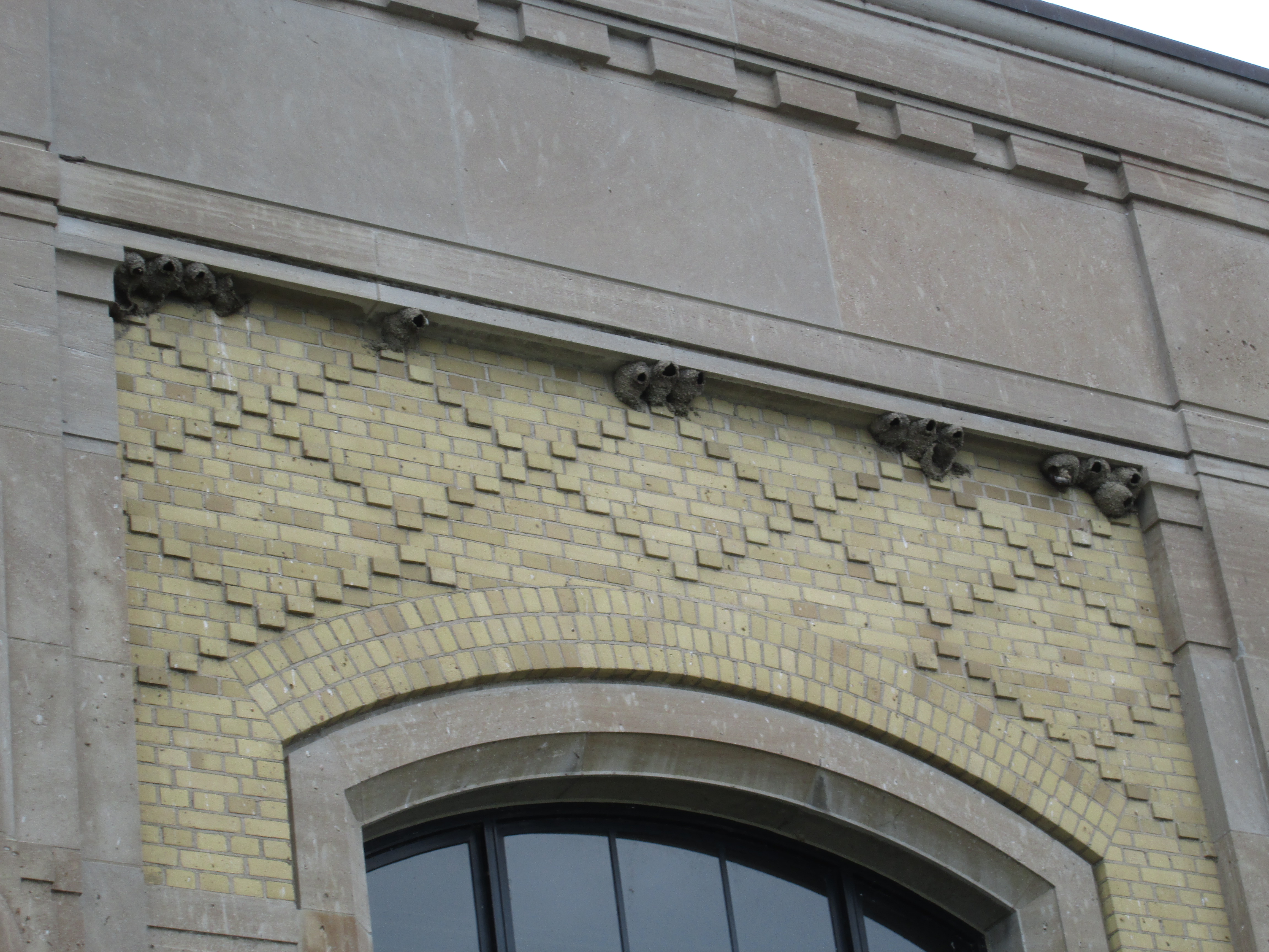
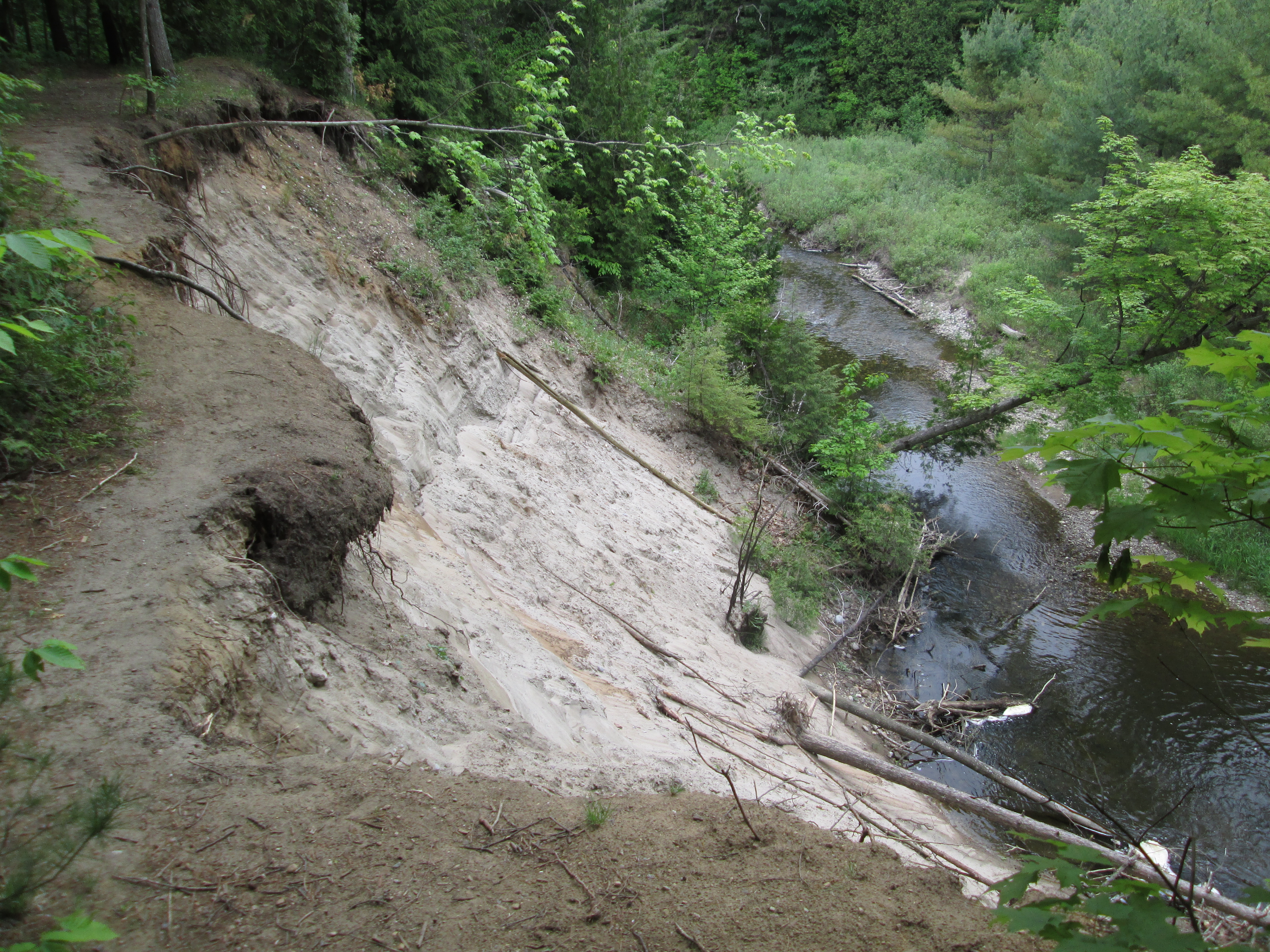
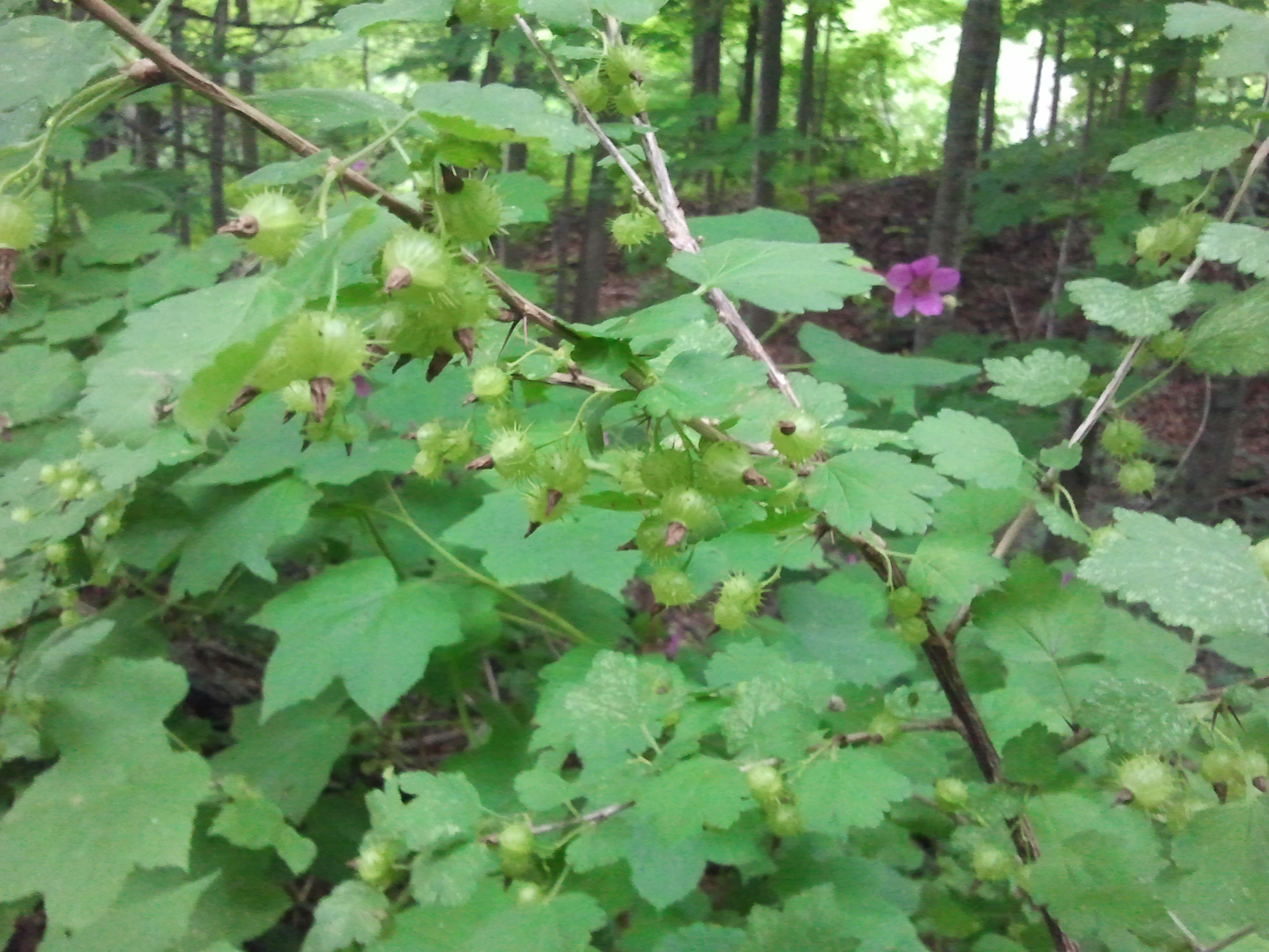
It was cloudy and rain was in the forecast but at 18 degrees it was quite comfortable.  We parked at the Barber Paper Mills and started to hike north up the east side of the Credit River. A blue marked side trail, part of the Bruce Trail, runs for 12 km between here and Terra Cotta. With the sky turning black we decided that maybe the weather man was right and getting caught in the rain would be better left for a warmer day.  Along the trail a small patch of Gooseberries are growing.  Gooseberries are related to the currant family and were valued in the middle ages for their cooling properties in fevers.  They are currently harvested for jams and preserves.

SAMSUNG

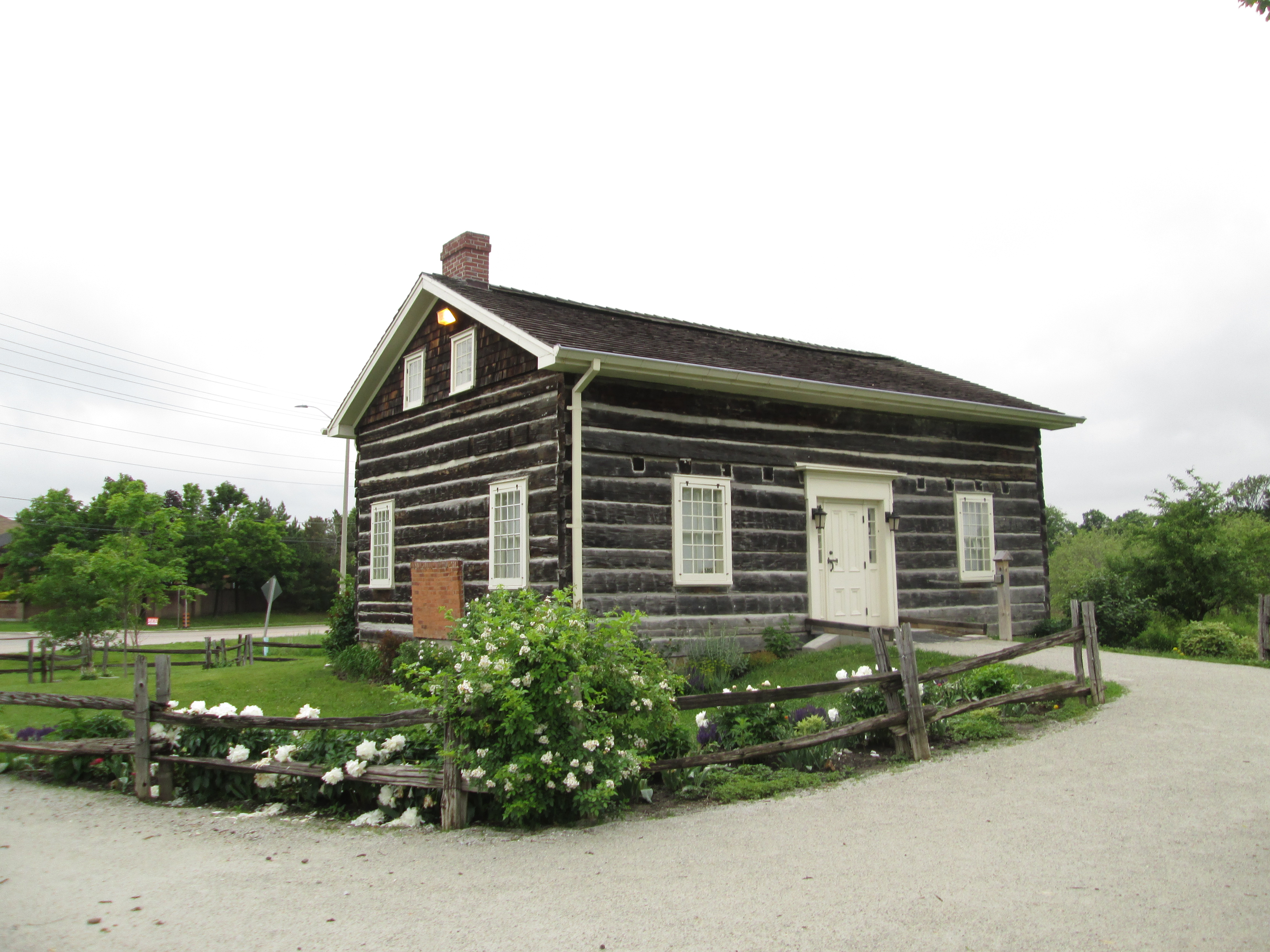
The story of Glen Williams is very much the story of the Williams family.  Benajah Williams arrived in 1825 and built a saw mill and a flour mill on the Credit river in what would become known as Williamsburgh.  He was born in 1765 in New York but as a staunch Loyalist he emigrated to Upper Canada.  The Williams family supplied all the services that a rural community needed with Joel being the blacksmith, David the tanner, Isaac made cabinets, Jacob ran the Glen Woolen Mill and Charles had a general store and was first postmaster.  The Glen Woolen Mill was a town fixture until it burned down in 1954.

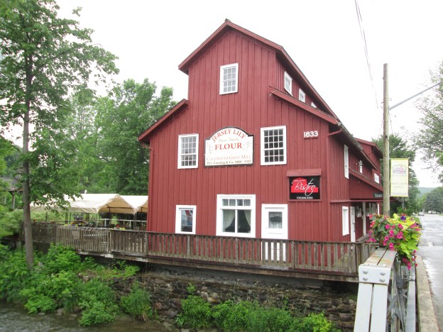
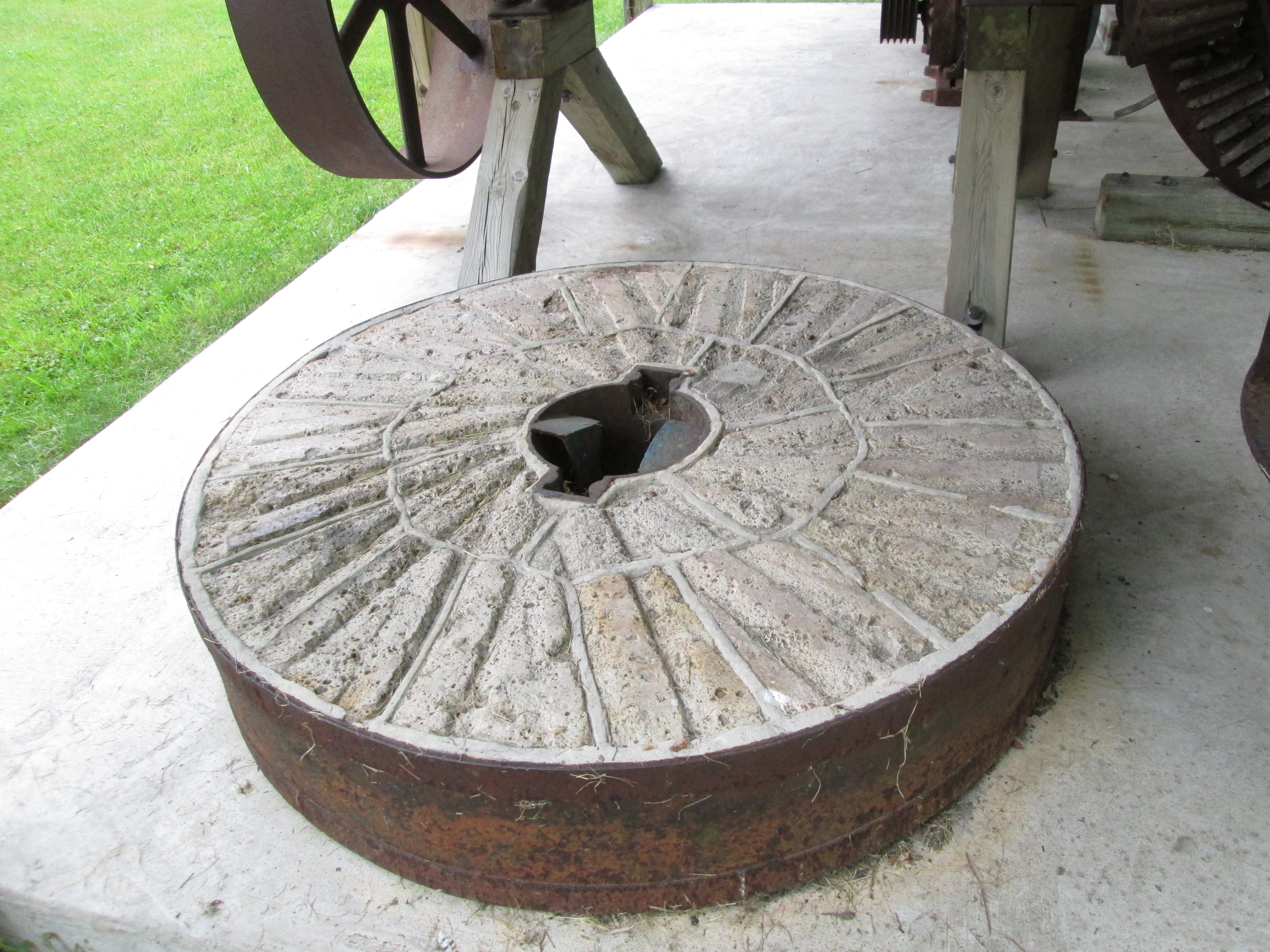
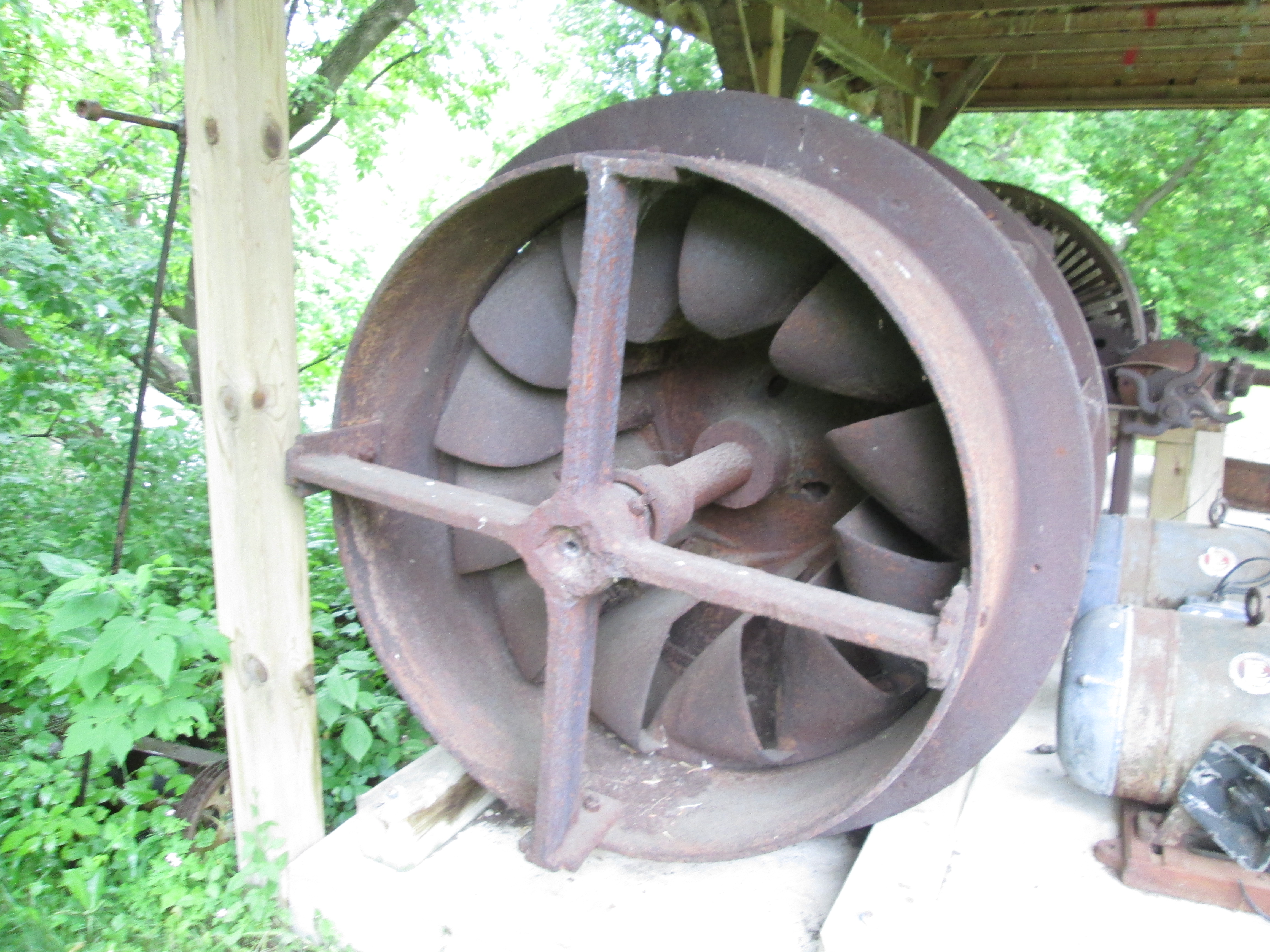
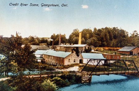
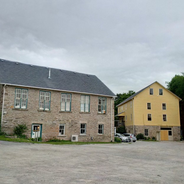
Benajah’s original sawmill was built in 1826 and, along with his flour mill, formed the nucleus of the community.  In the 1850’s he replaced it with the current mill.  It operated as a water powered saw mill before being converted into a hosiery factory and finally serving as an apple processing plant.  It belonged to Rheinhart Vinegars at the time of it’s closure in 1985.  It was restored in 1989 and painted yellow earning the nick name “The Yellow Mill.  Benajah passed away in 1851 leaving Charles to run  much of the town’s industry.

IMG_20150627_114852_hdr

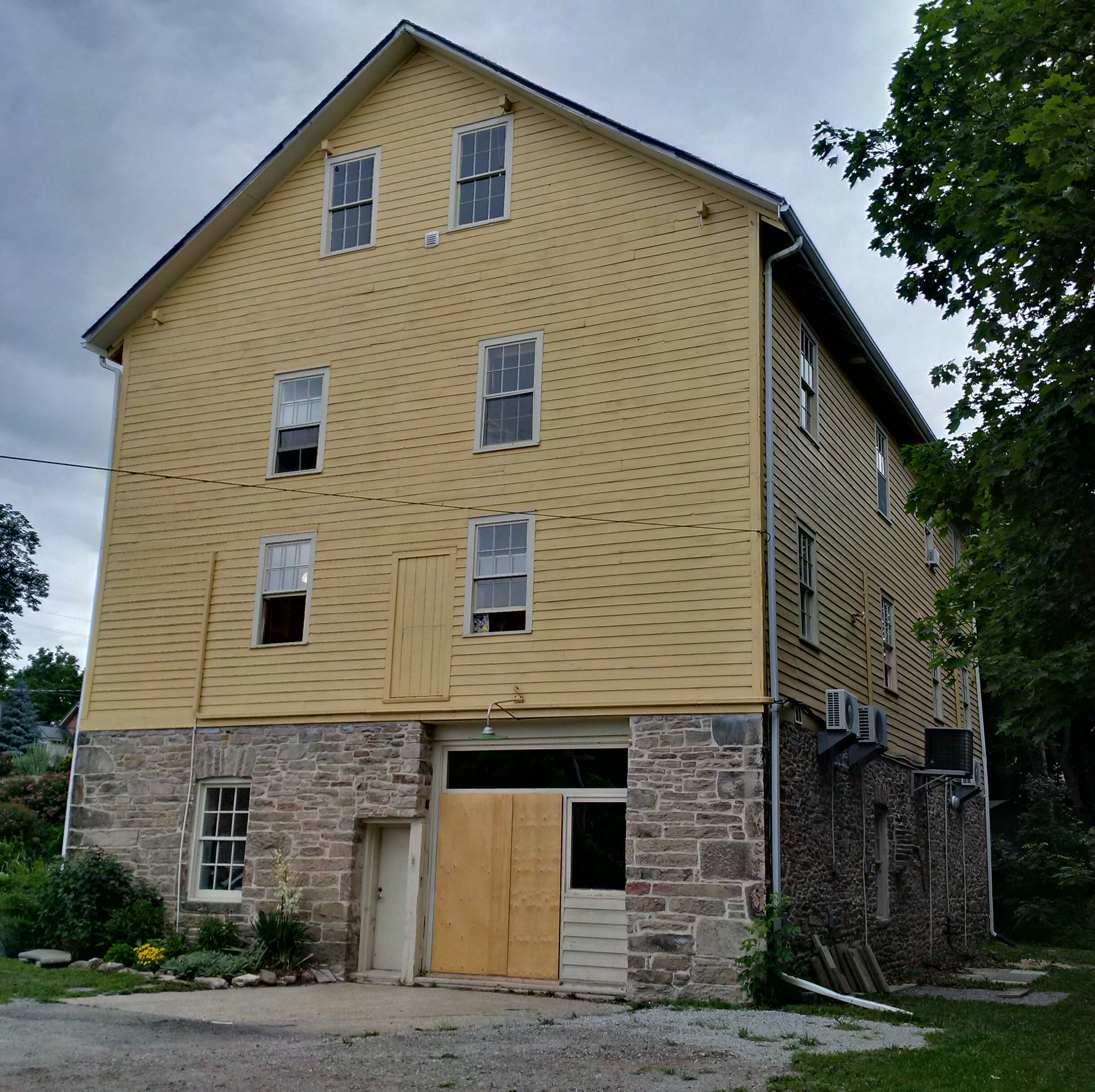
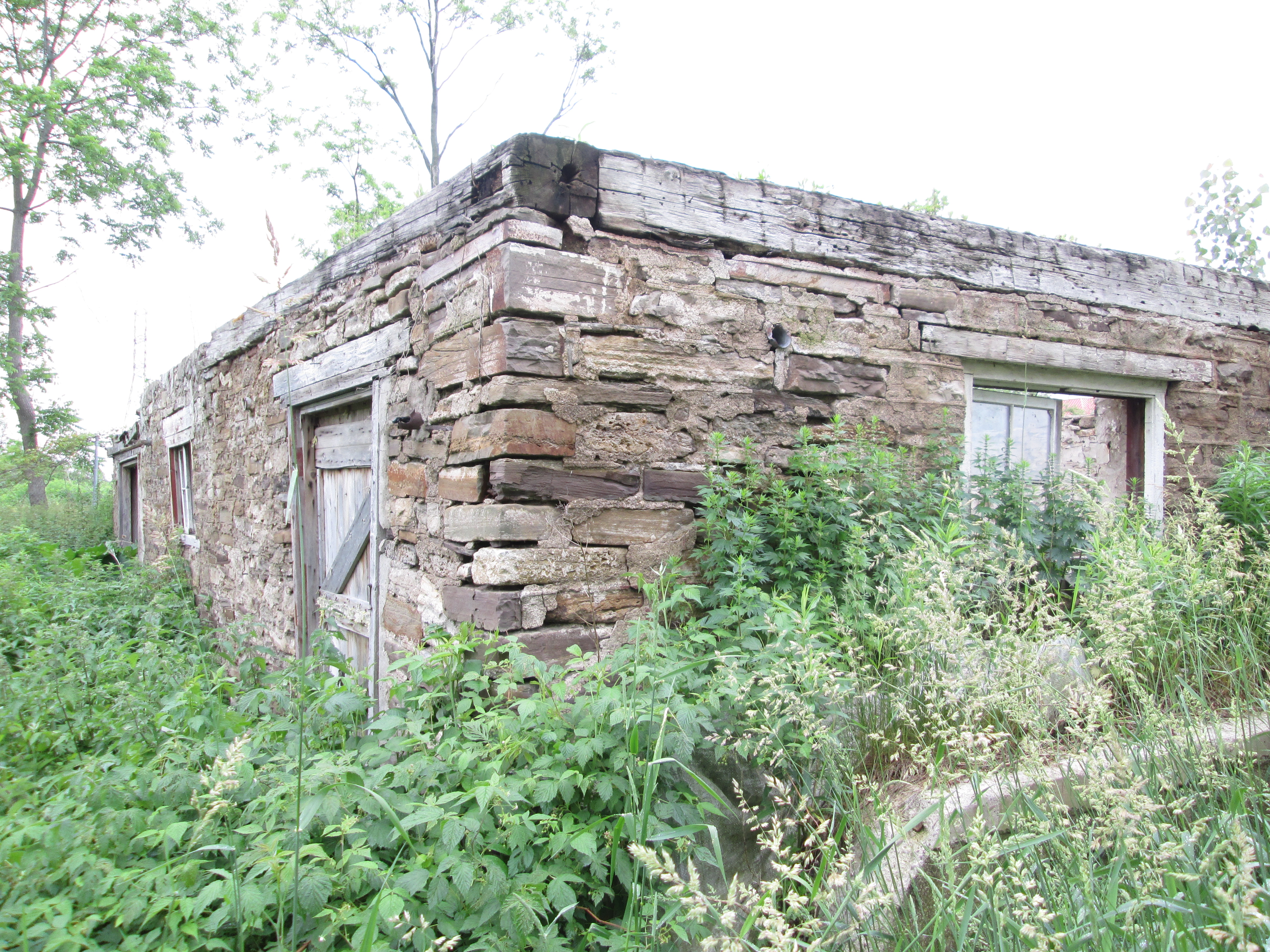
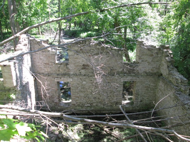
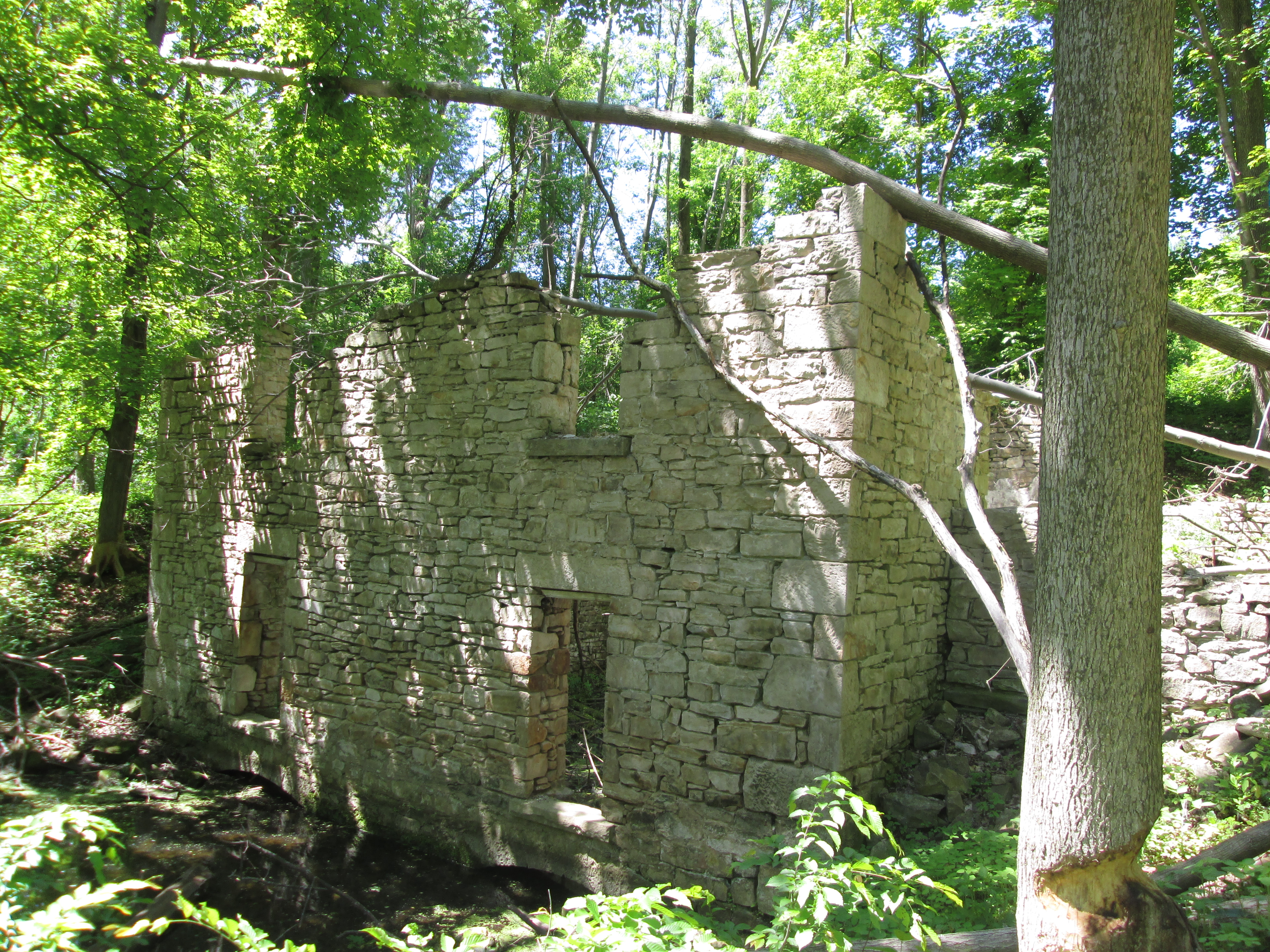
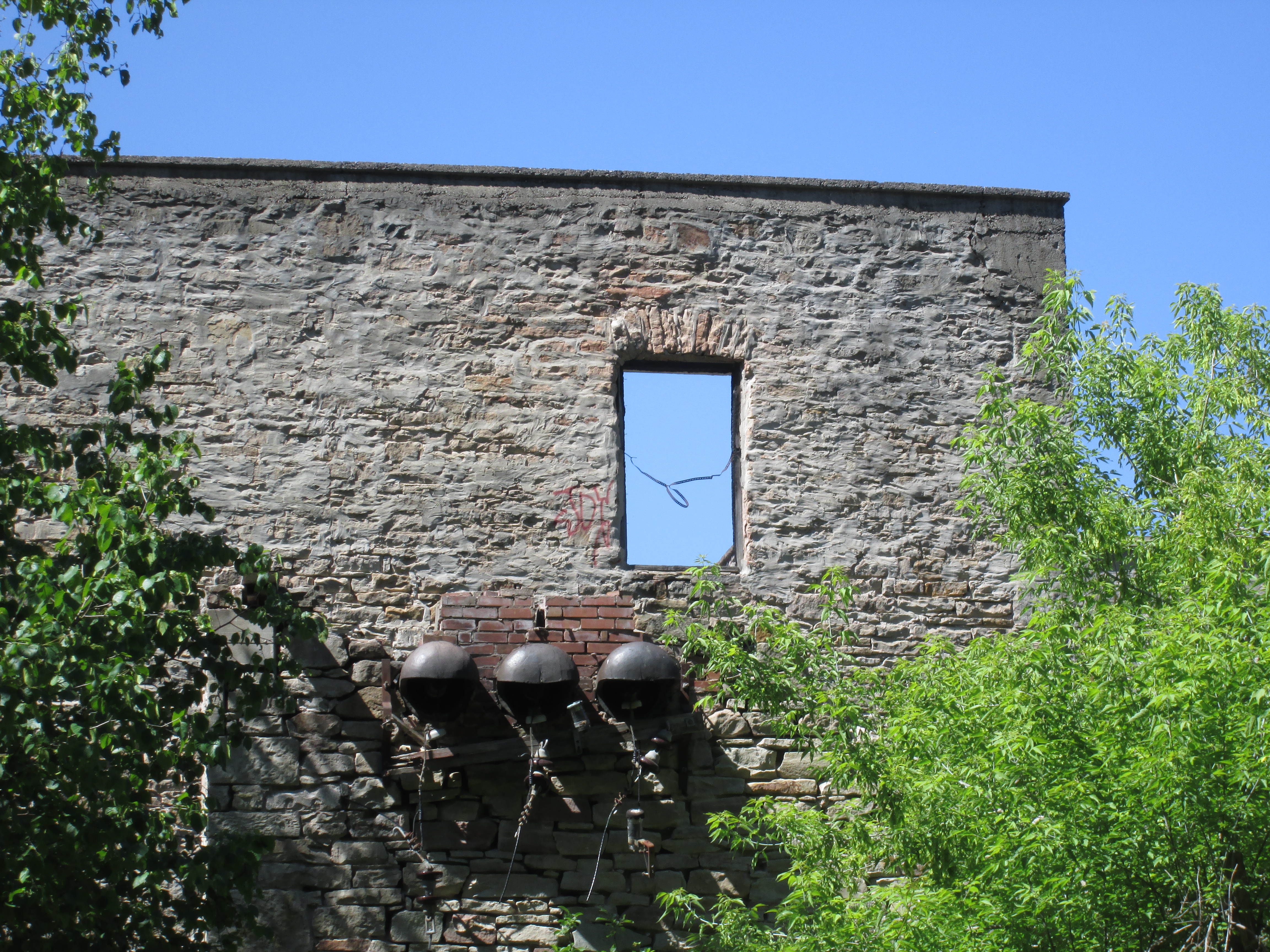
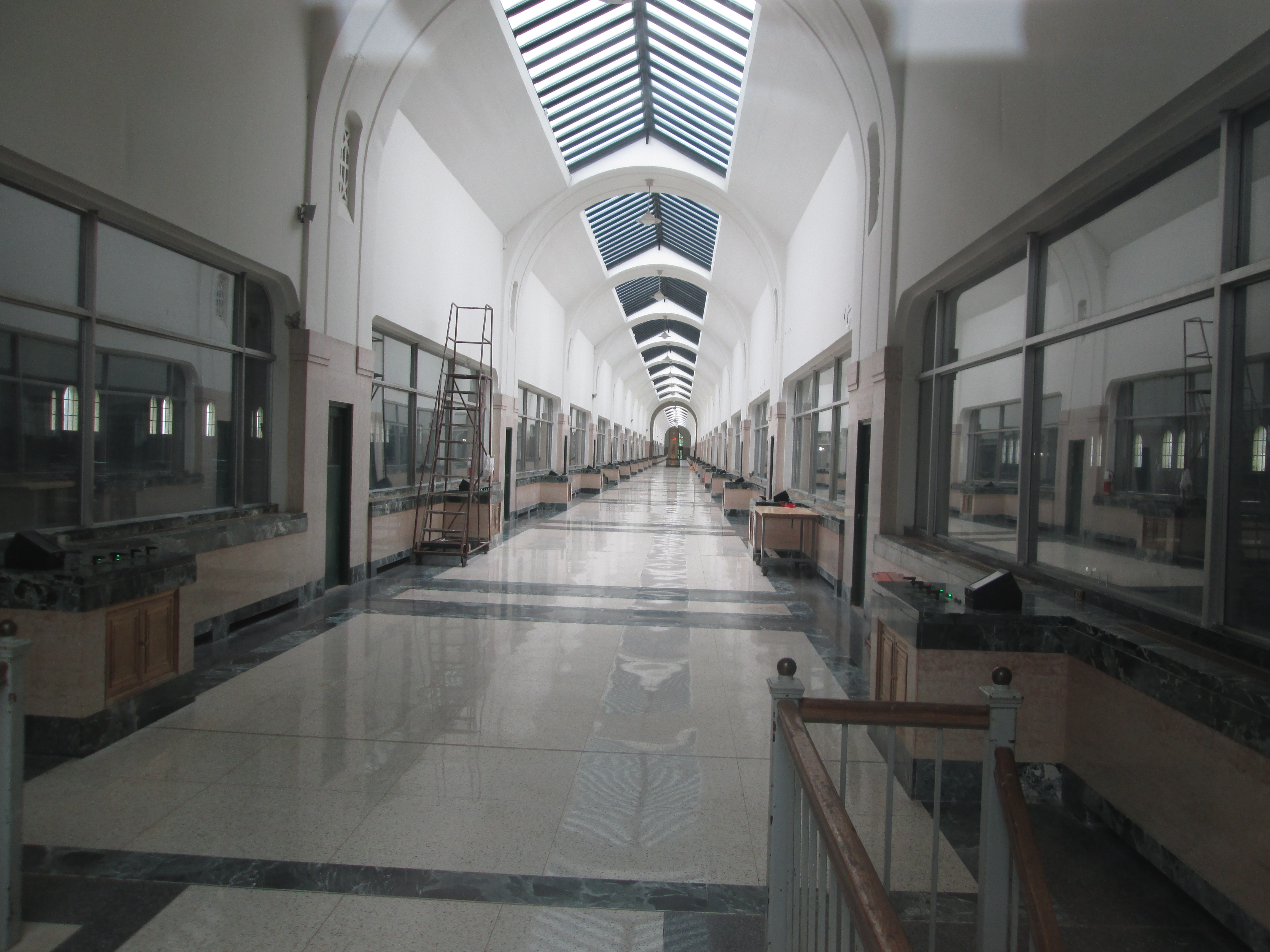
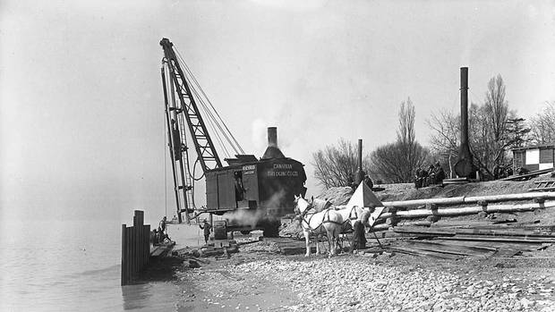
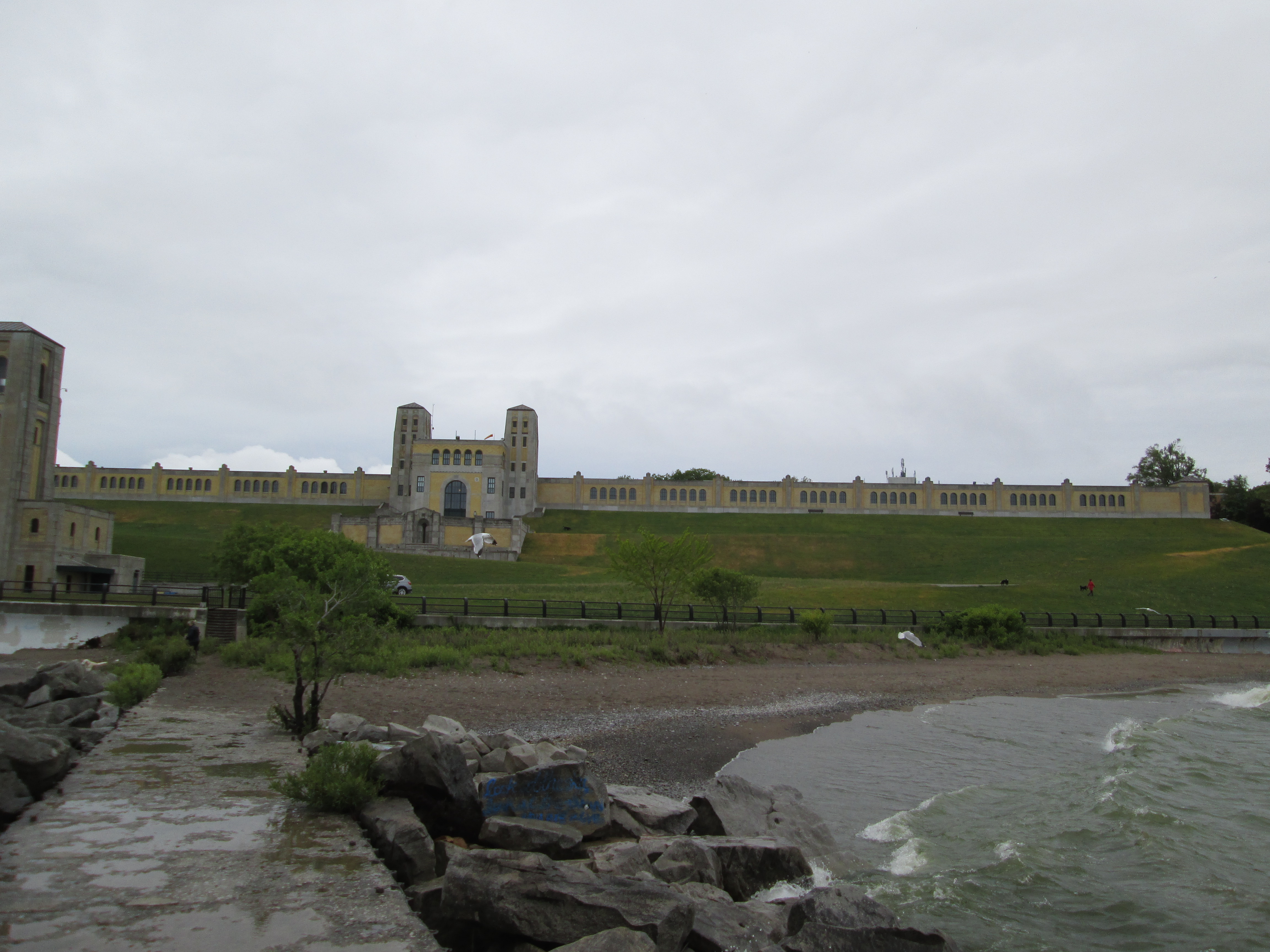
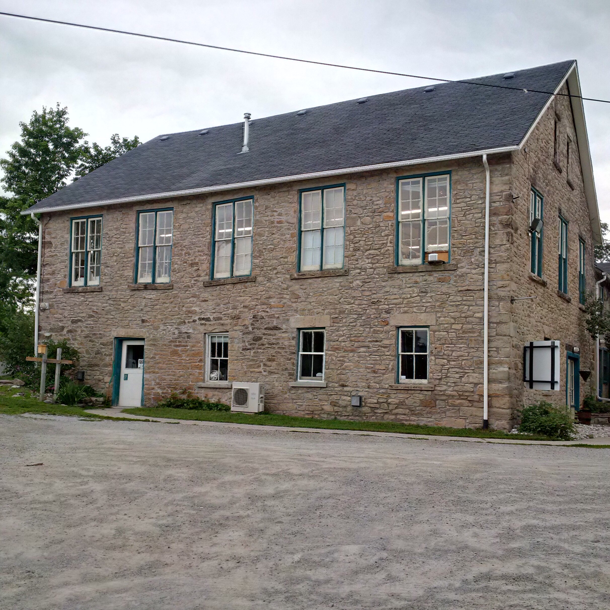
Beside the Yellow Mill stands the old stone building which housed the Georgetown Electric Light Company.  The two structures are shown together in the cover photo.  This two and a half story building was erected in 1893 on the foundations of the grist mill.  It provided electricity to Glen Williams for  20 years until 1913 when hydro was brought from Niagara Falls.  At this time both it and the Barber Dynamo a few km downstream were shut down.  It is an interesting building because the stone mason didn’t take the time to level the windows and so they slant on various angles.

IMG_20150627_114749_hdr

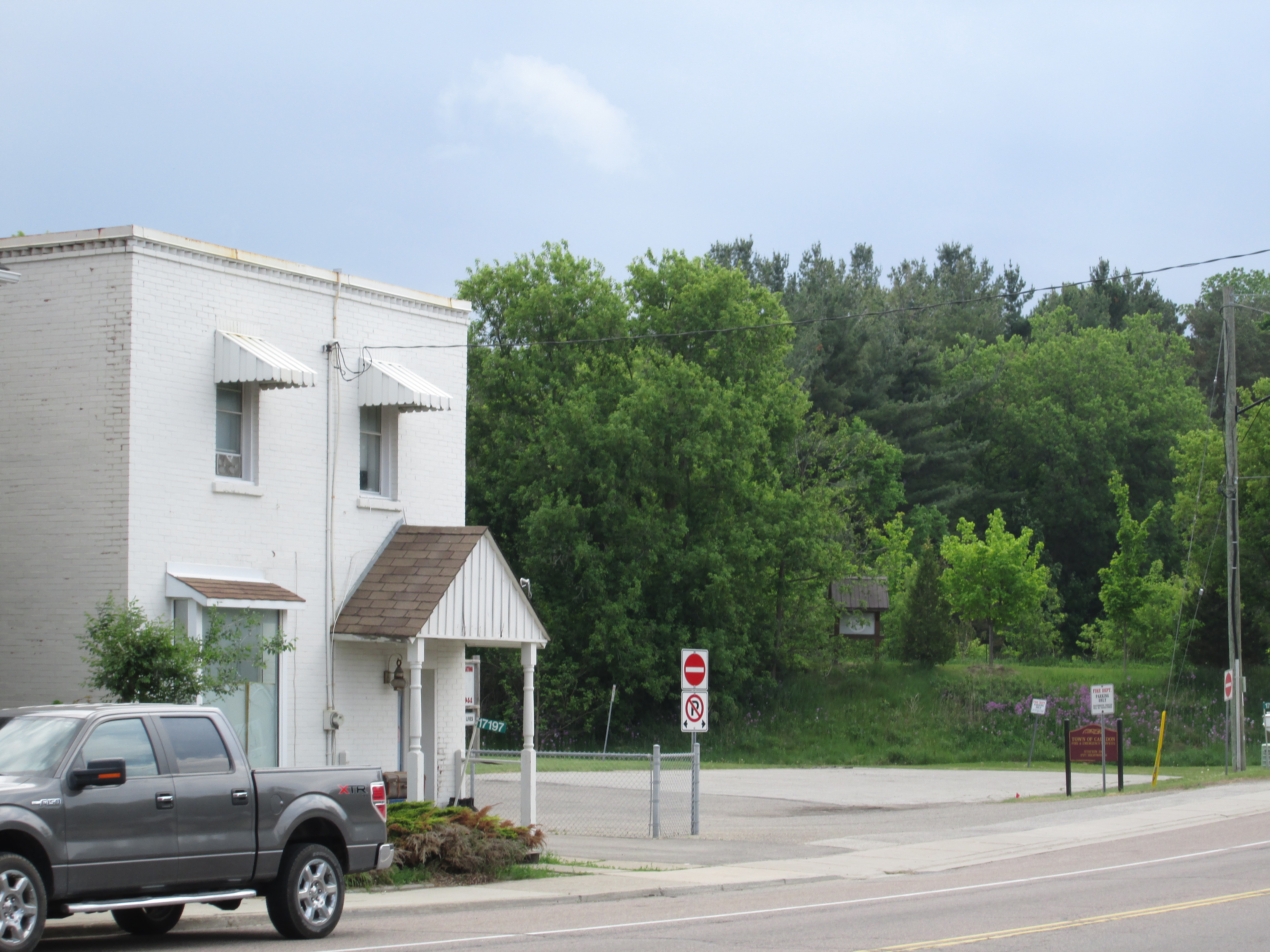
Charles Williams opened a general store and post office in 1852.  When he applied for a post office licence it was refused on the grounds that there was already a post office in another town called Williamsburgh.  Charles settled on the name Glen Williams after the little glen in which the town sat.  The building was recently home to The Copper Kettle but is presently under renovations.

IMG_20150627_115710_hdr

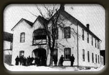
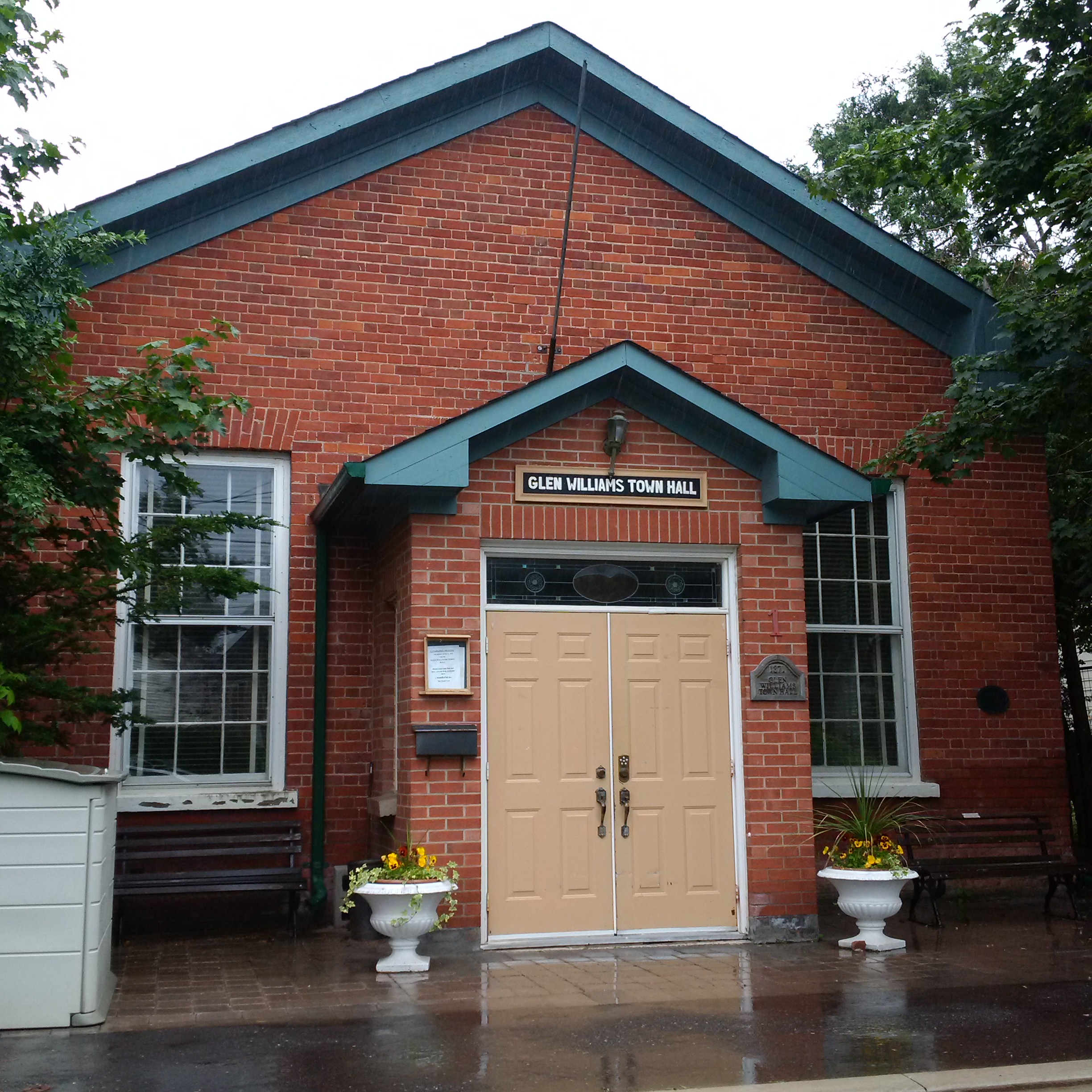
The Good Templars approached Charles Williams in 1870 asking for a piece of land on which to build a town hall for the community that they could also use for their temperance meetings. Charles deeded them the town lot adjacent to his General Store.  The town hall was built in 1871 and has served the community in many capacities including as a stage for Canadian author Lucy Maud Montgomery to perform dramas.

IMG_20150627_120705

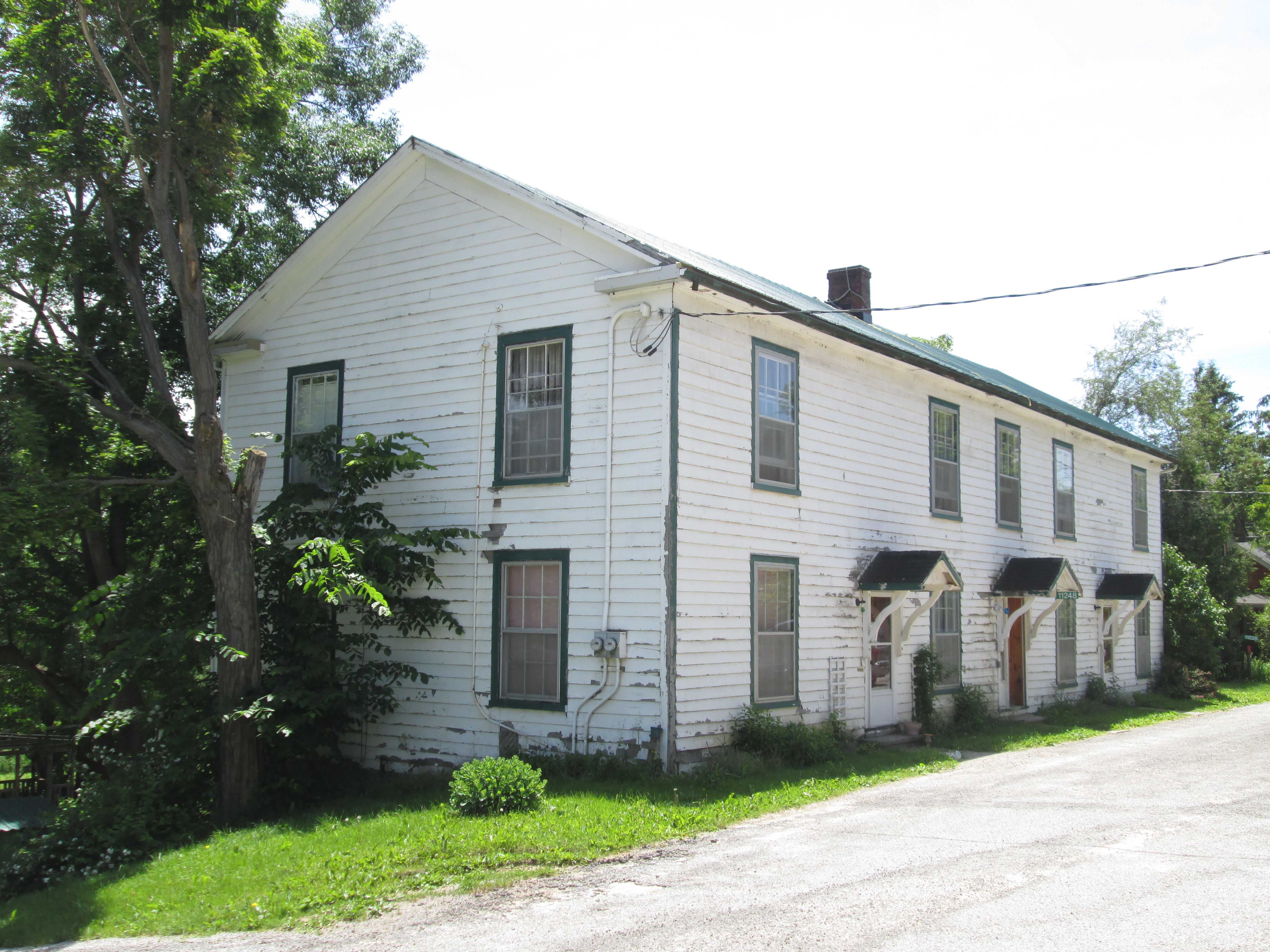
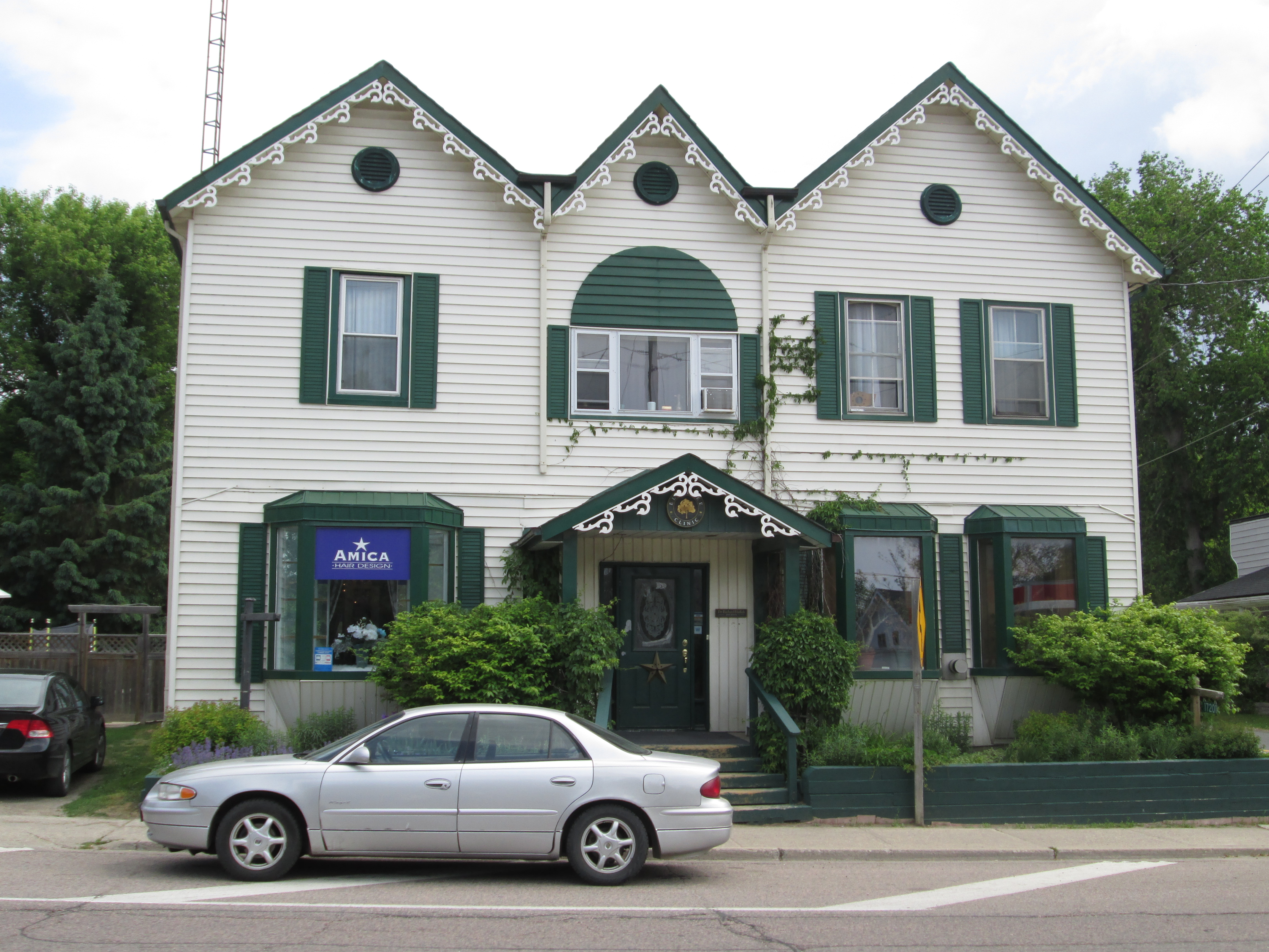
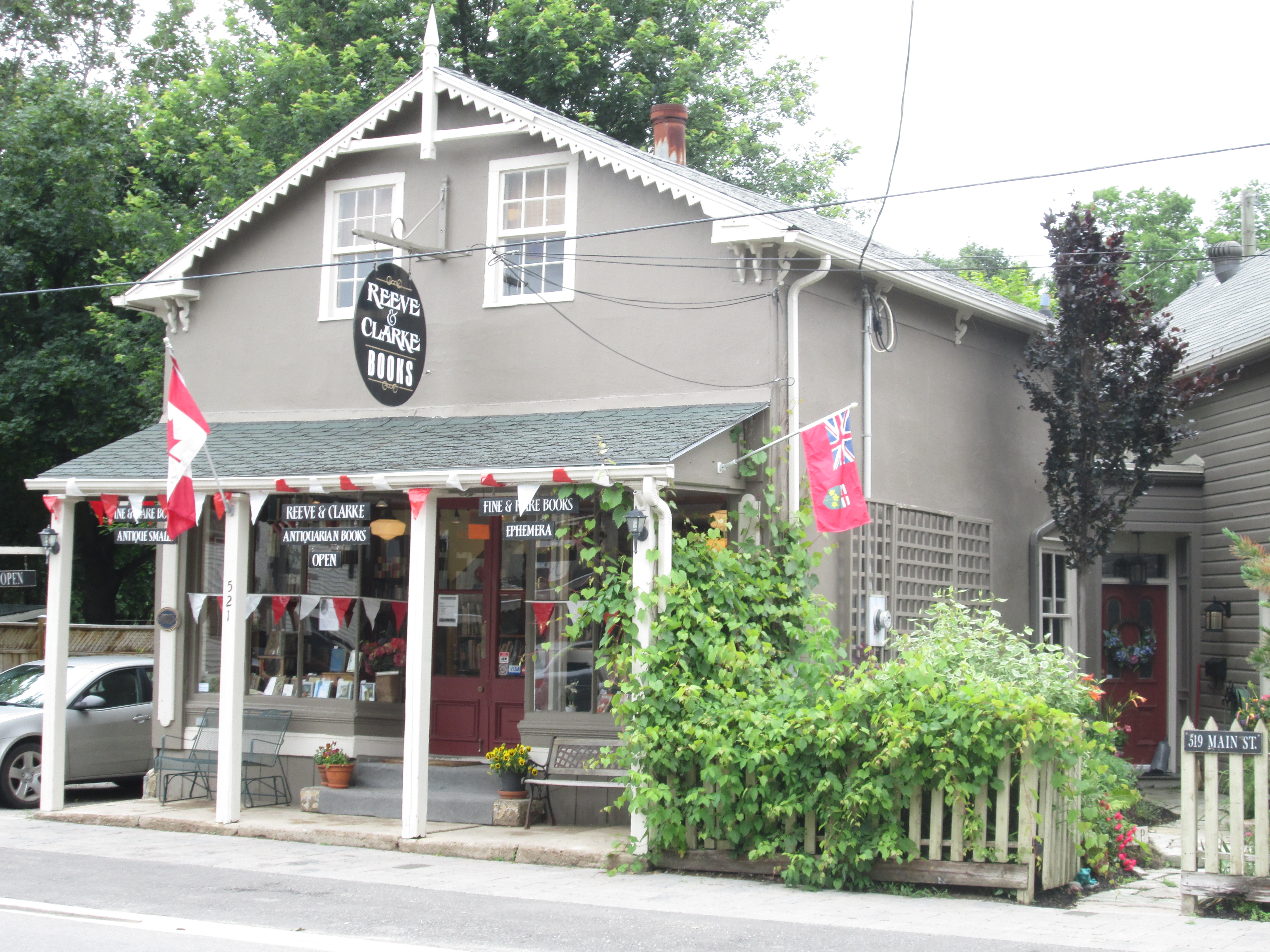
On the corner opposite to the town hall stands two connected buildings.  The first is the home of James Laidlaw who built it in 1858.  The building beside it belonged to the local tailor Thomas Frazier who operated his shop here starting in 1847.  Later it belonged to Laidlaw who ran a store here.  Timothy Eaton was a clerk in this building in 1853 and 1854 starting when he was 19.  Timothy would go on to found Eaton’s Department Store.

IMG_5954

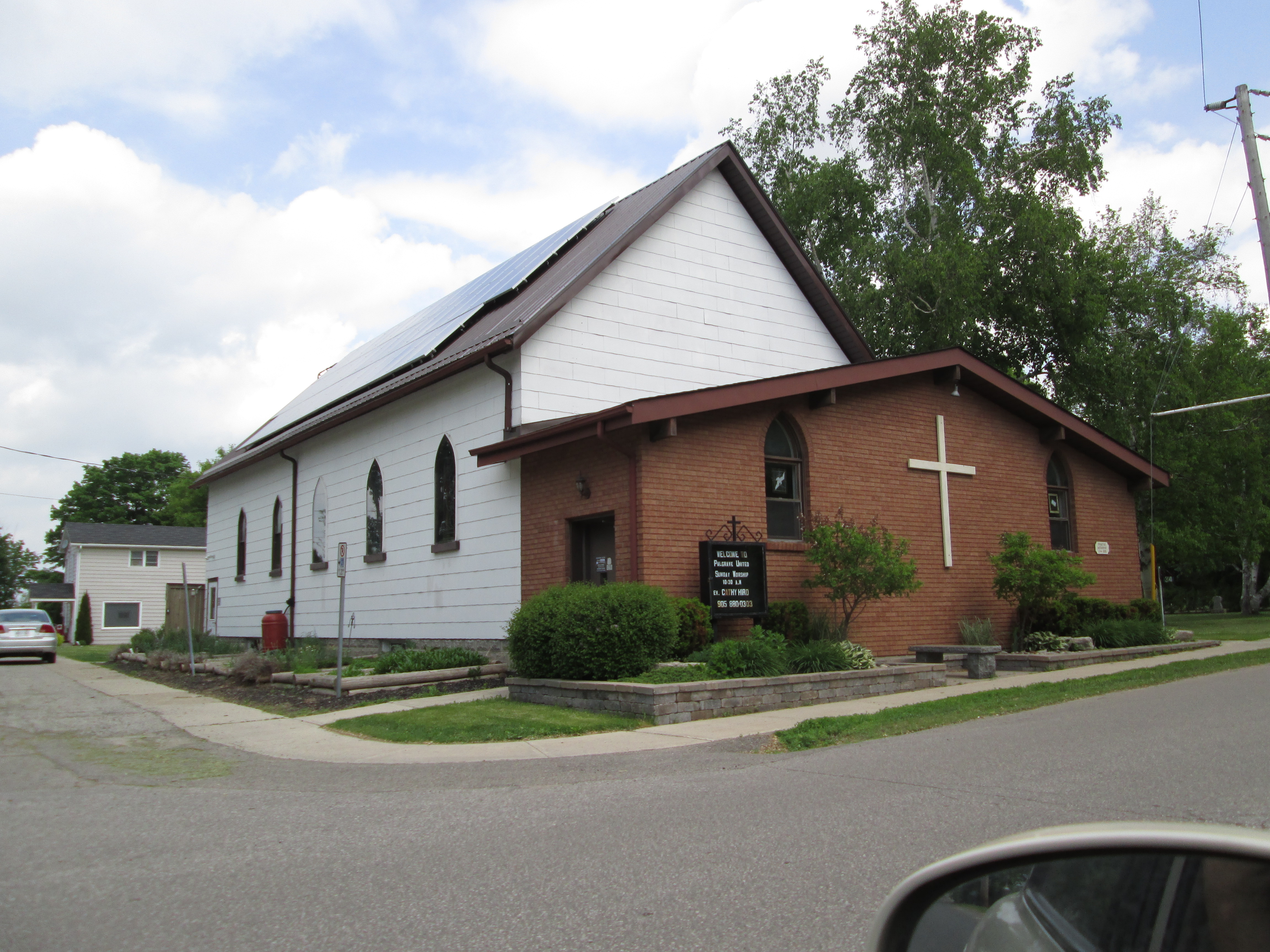
Benajah Williams and his family were Methodists and the first services in town were held in 1836.  The frame church was built in 1837 and given a veneer of bricks in 1903.  This church stands on one side of the Credit River.

IMG_5960

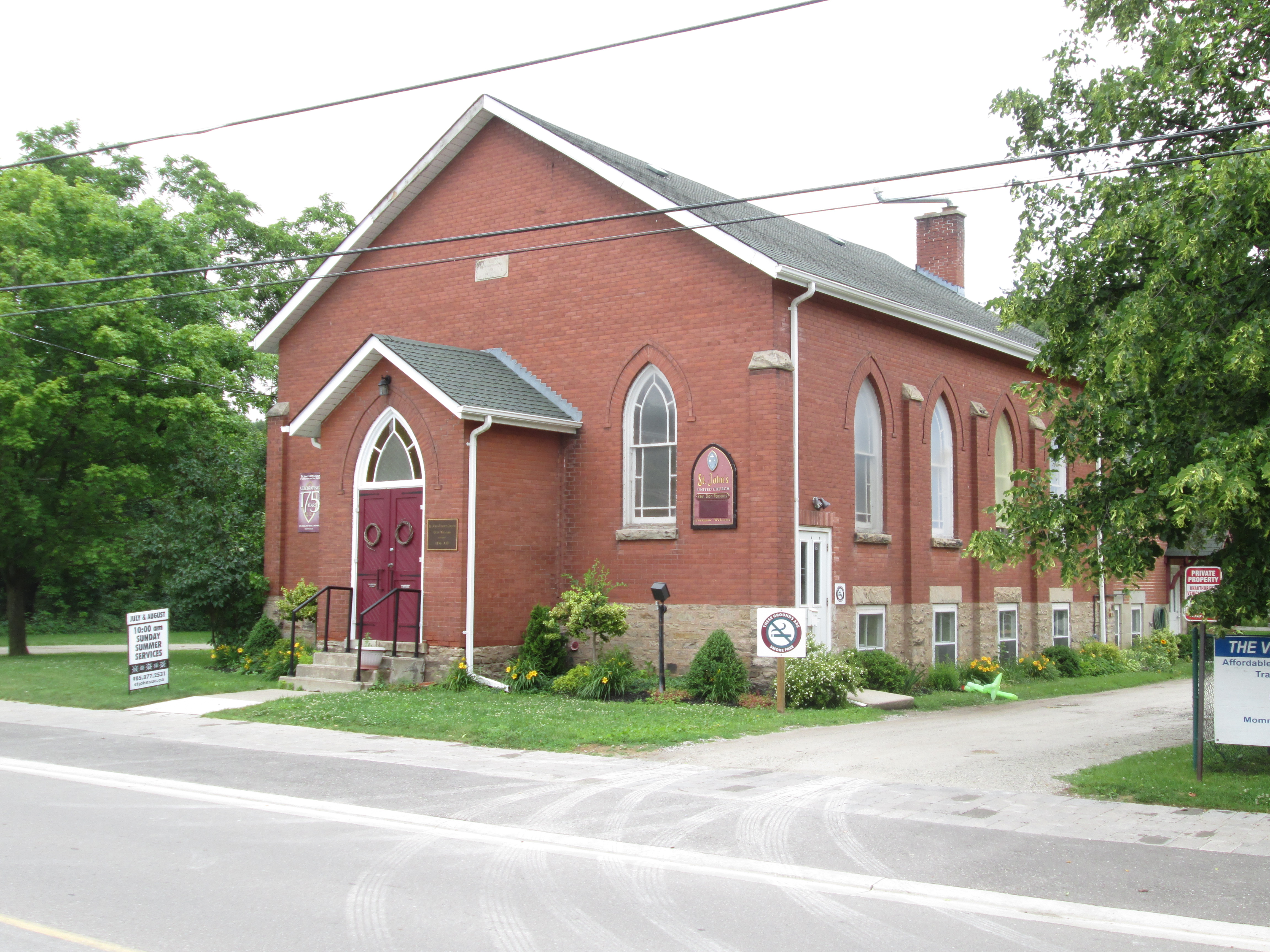
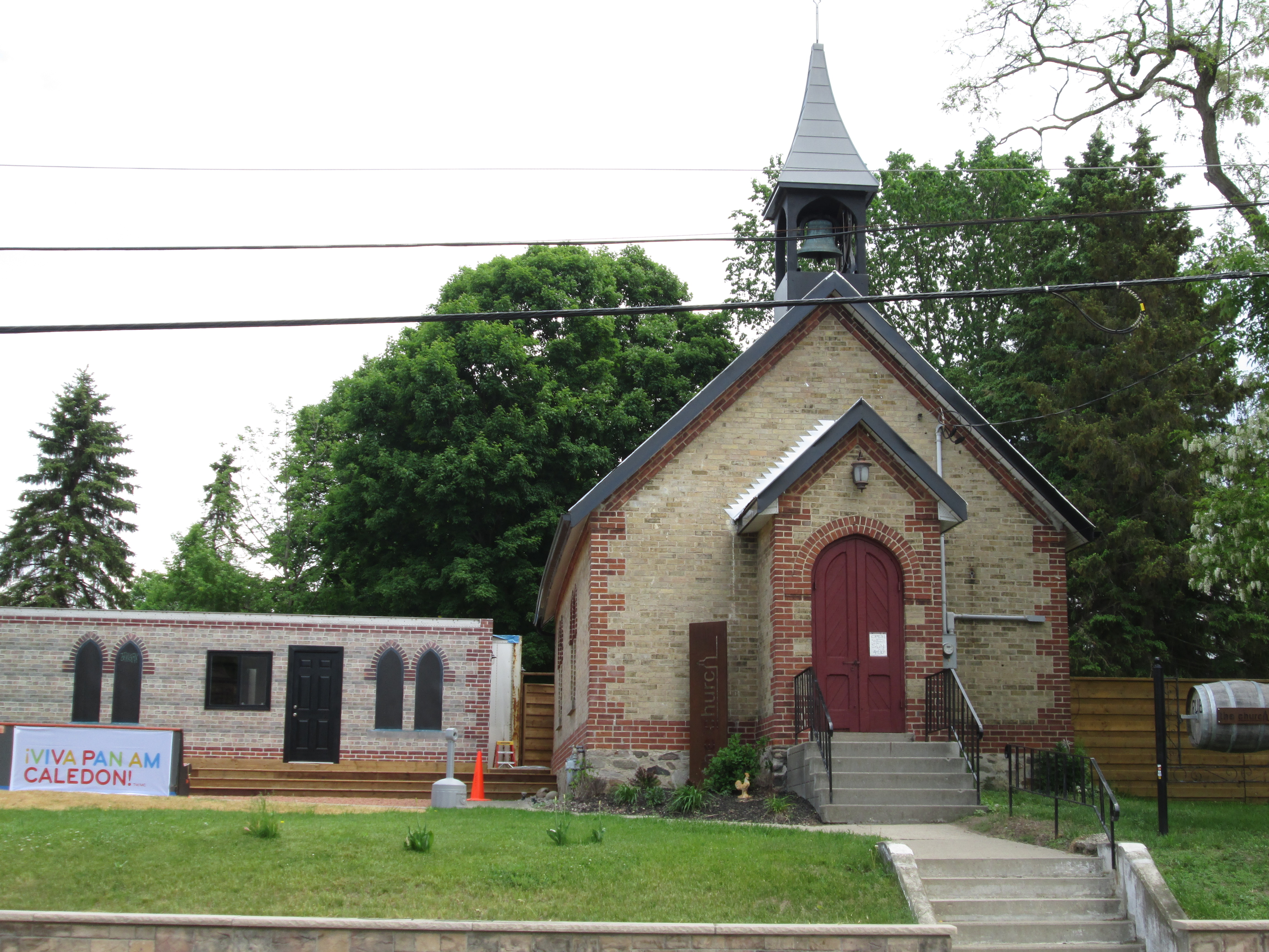
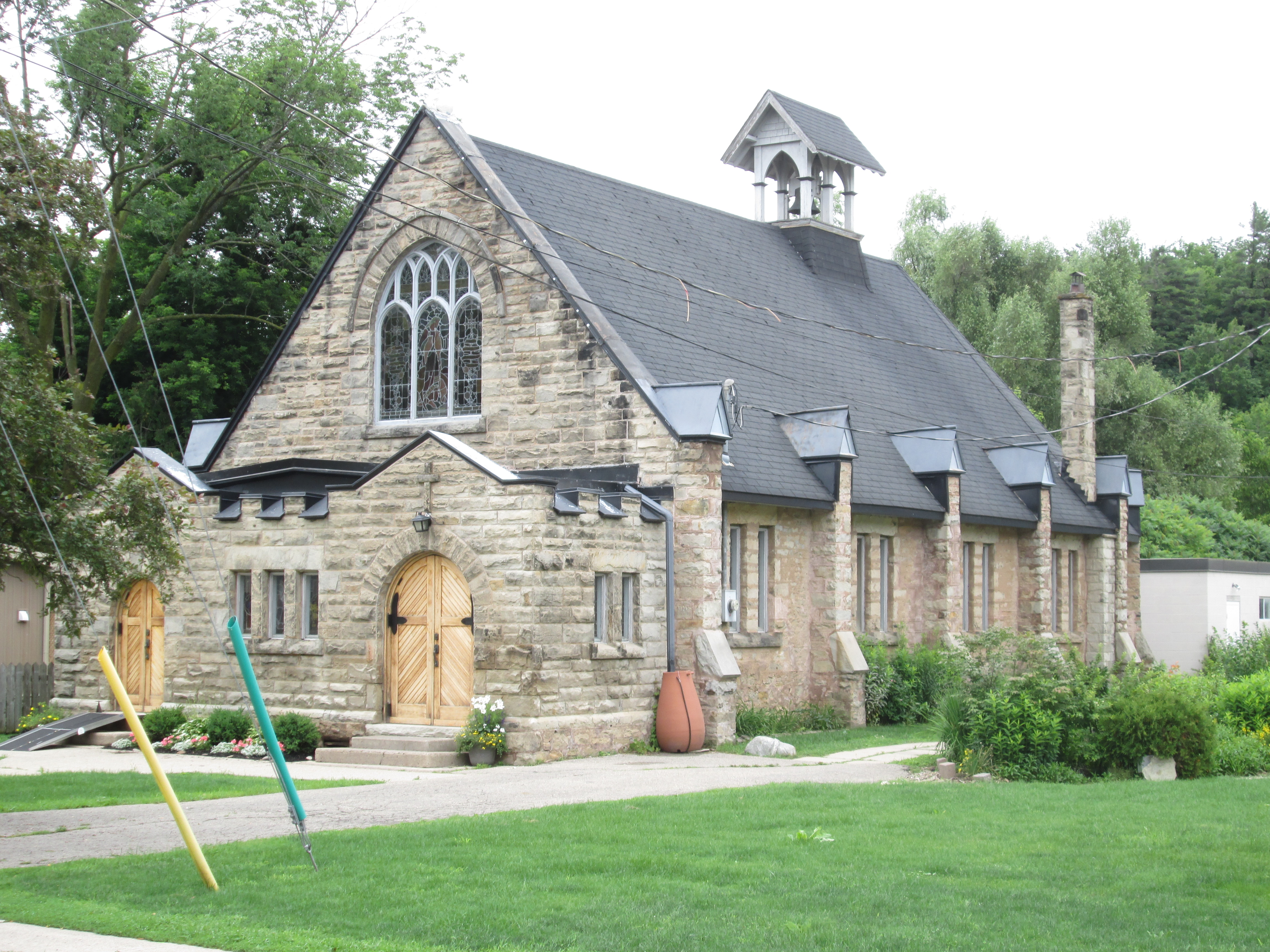
On the opposite bank stands the St. Alban The Martyr Anglican Church.  It has an interesting shape with the bell tower at the rear instead of the front by the street.  The first services held in this building were in June of 1903.  I wonder if the Methodists decided to give their church a facelift of bricks in response to the construction of the Anglican church.

IMG_5983

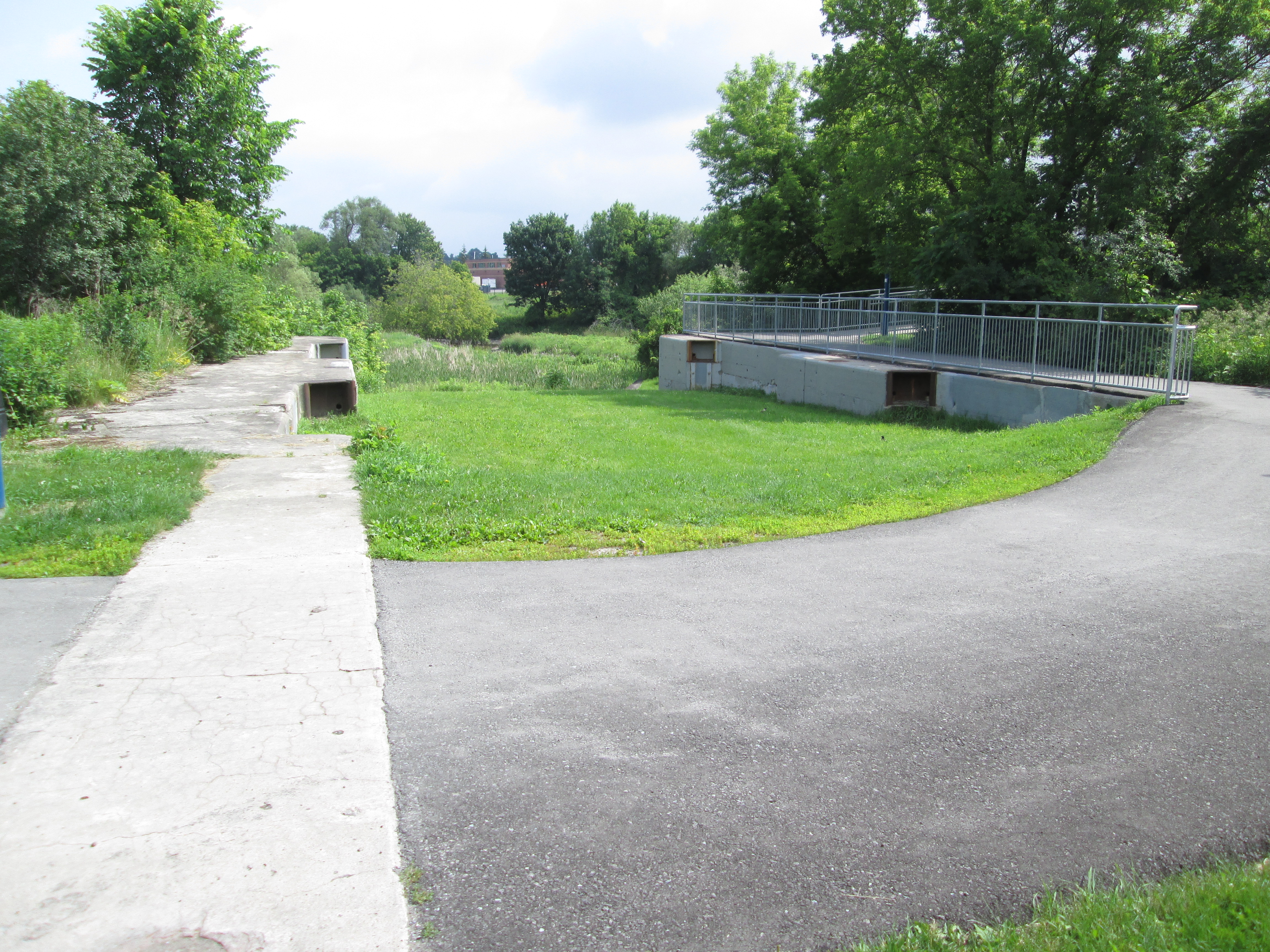
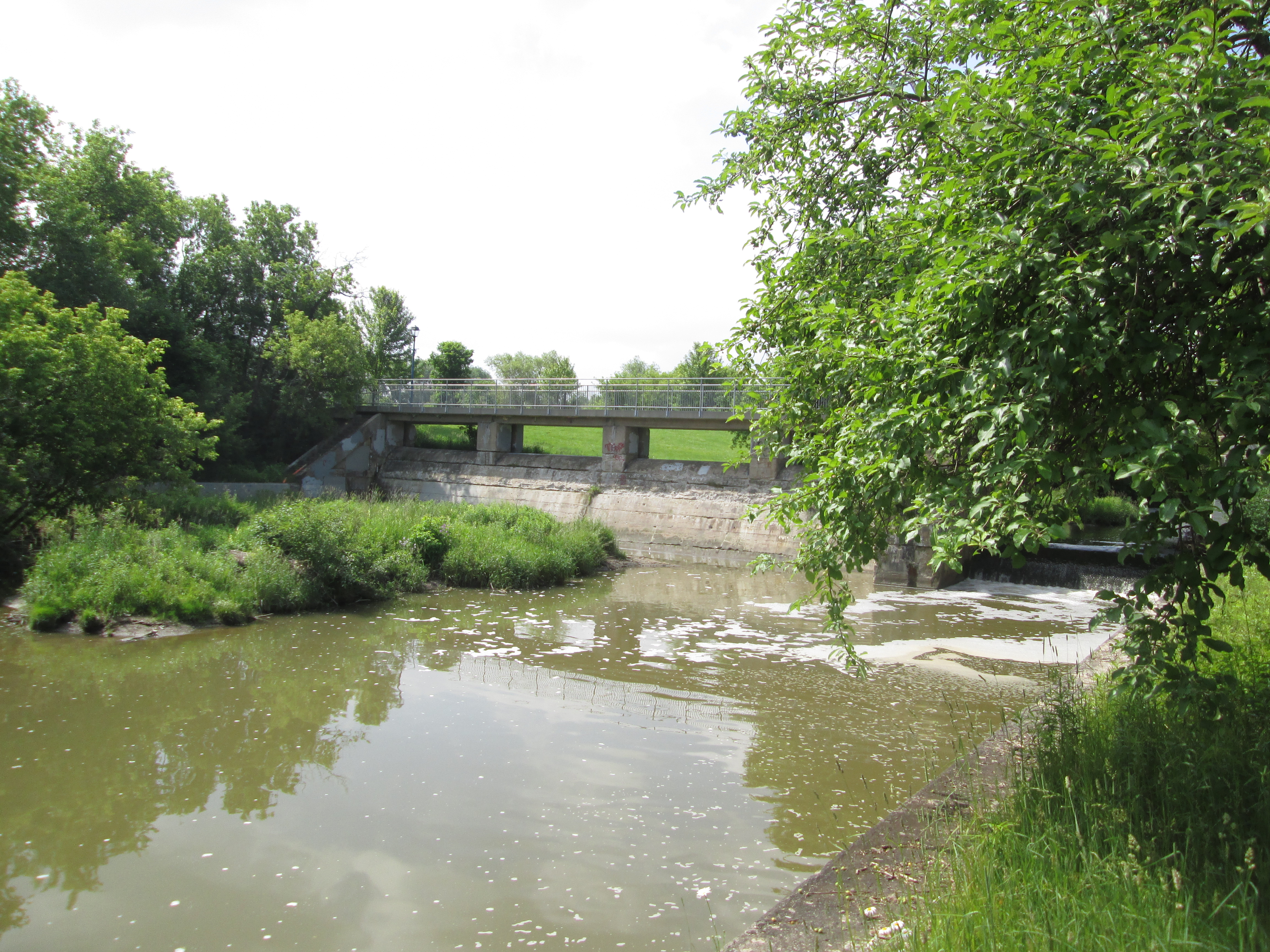
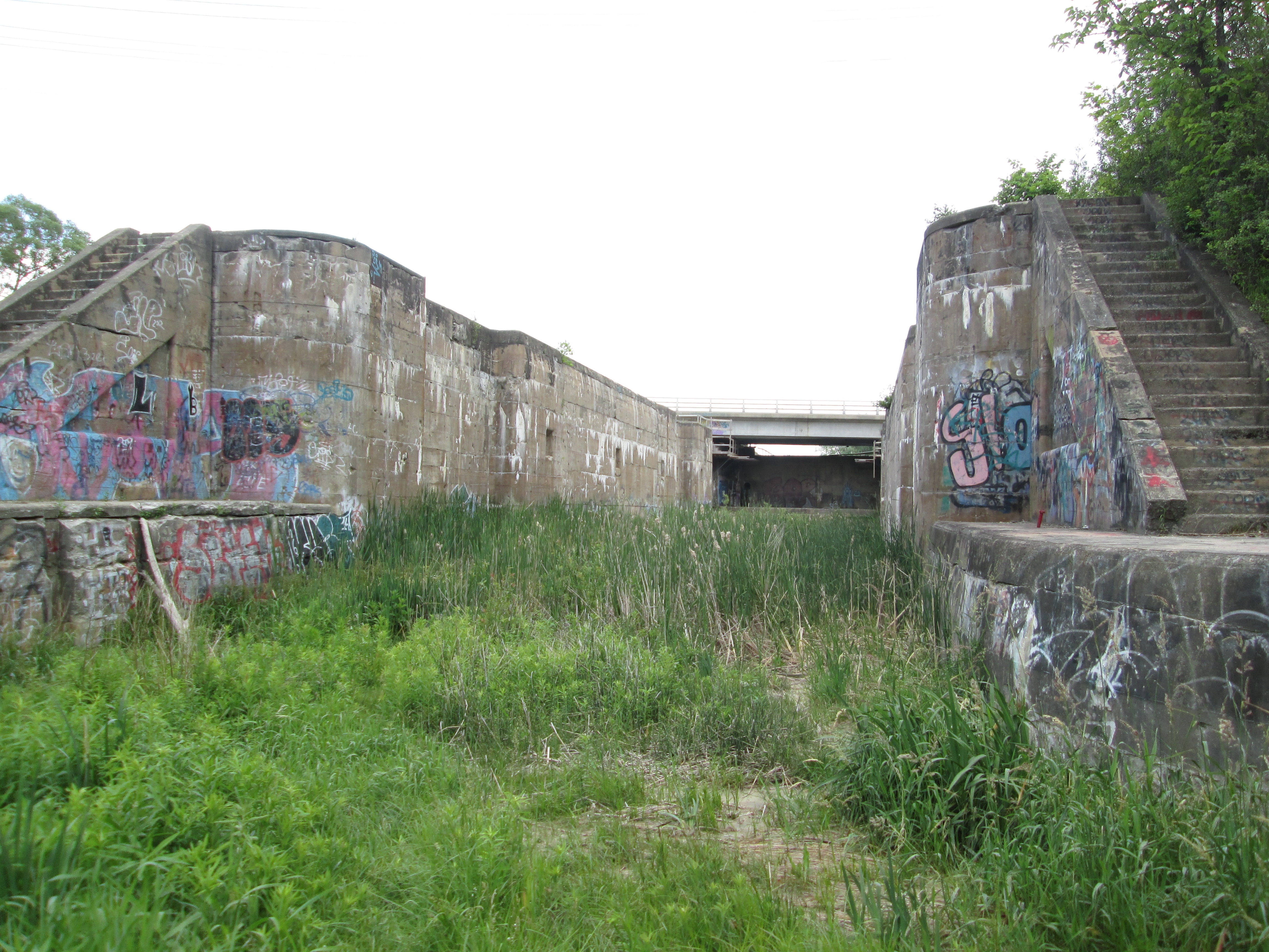
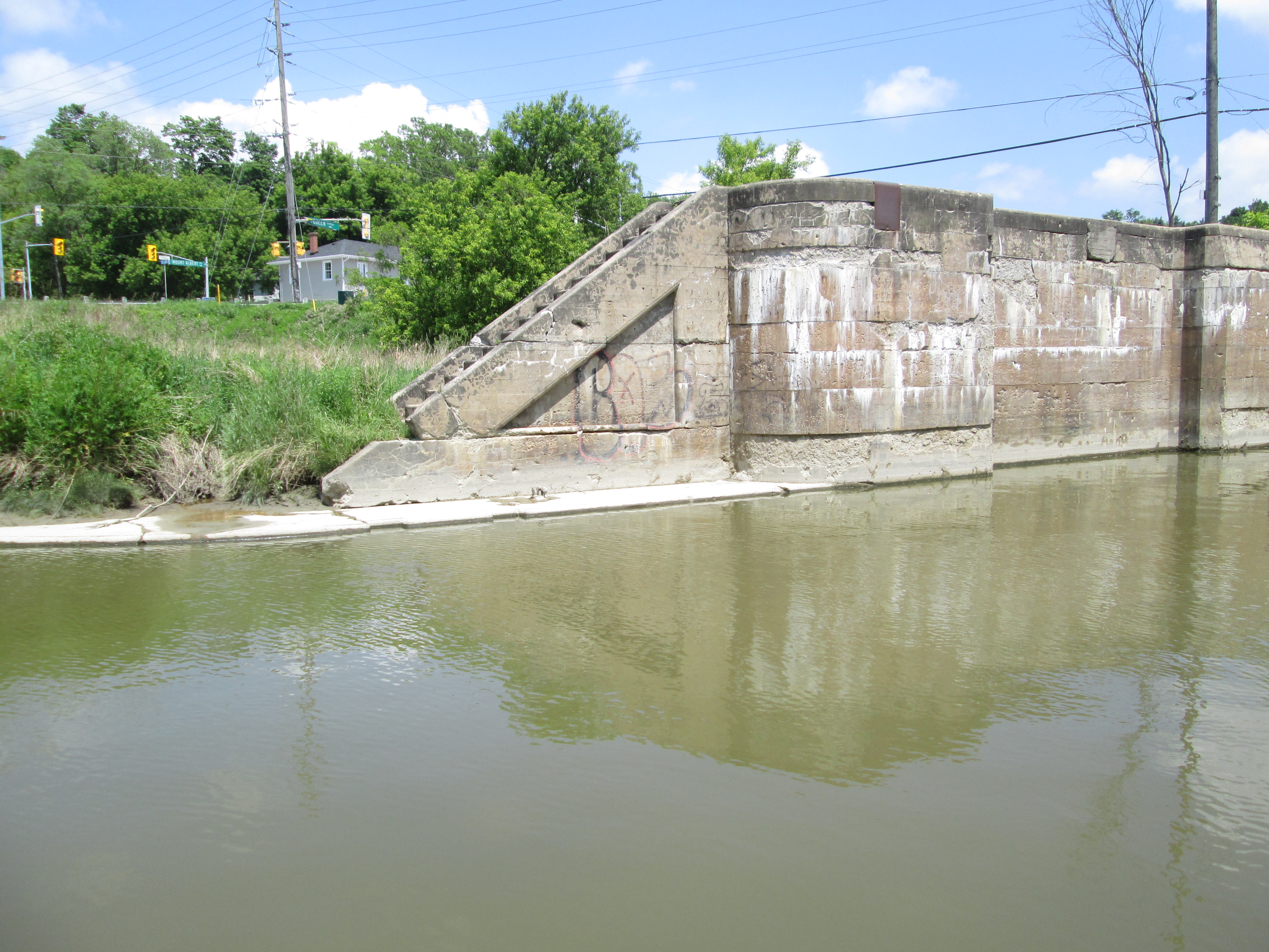
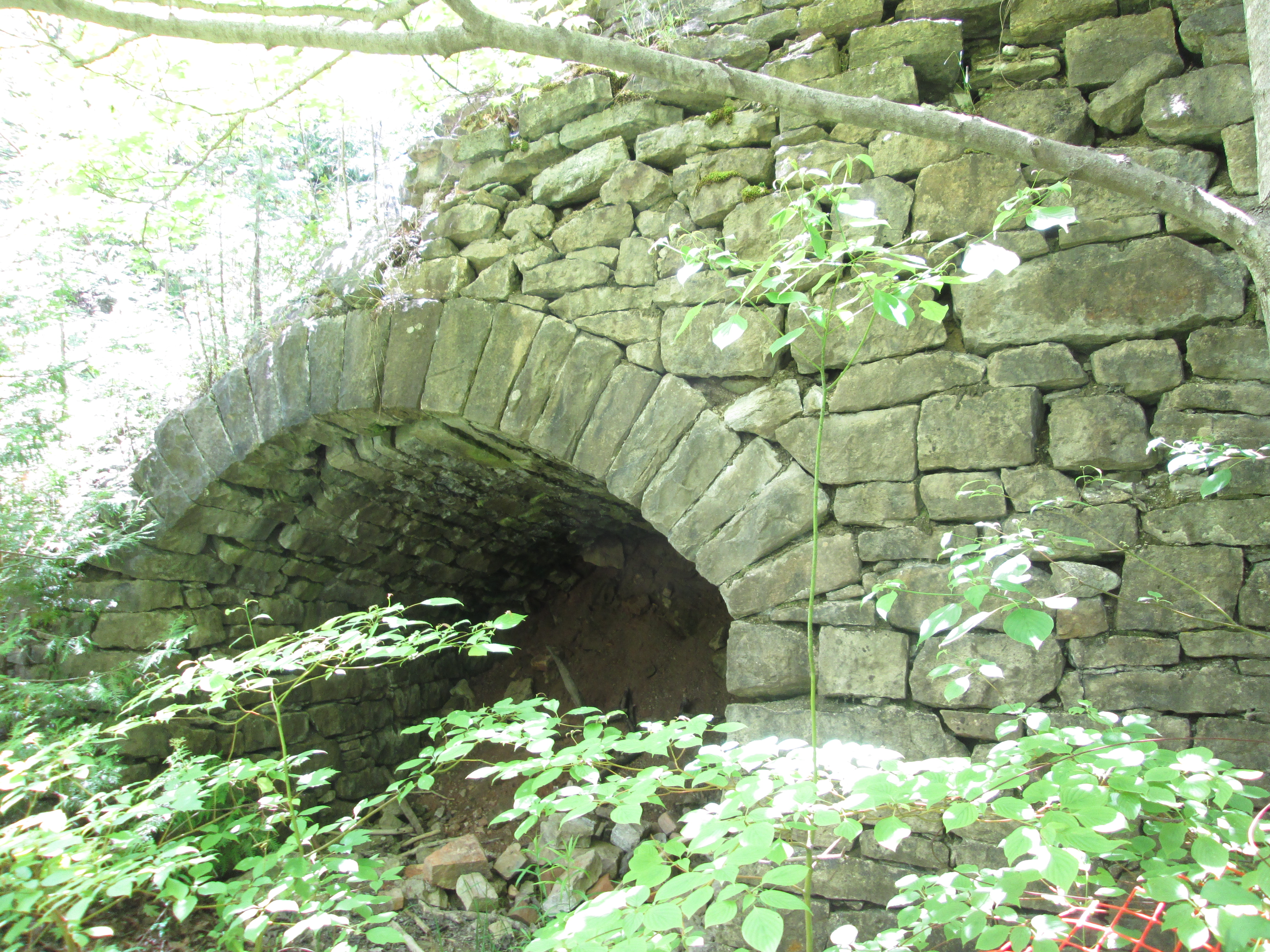
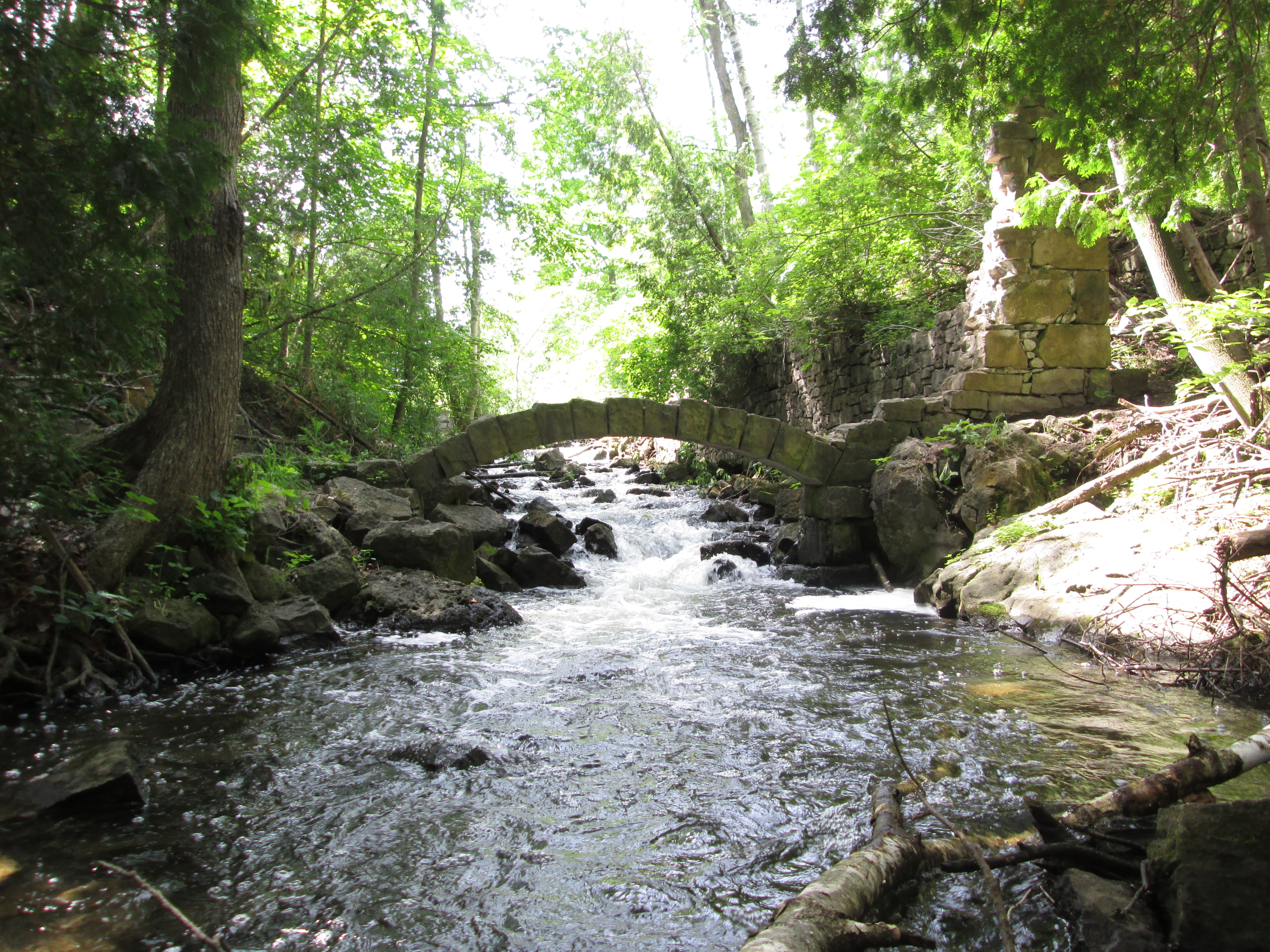
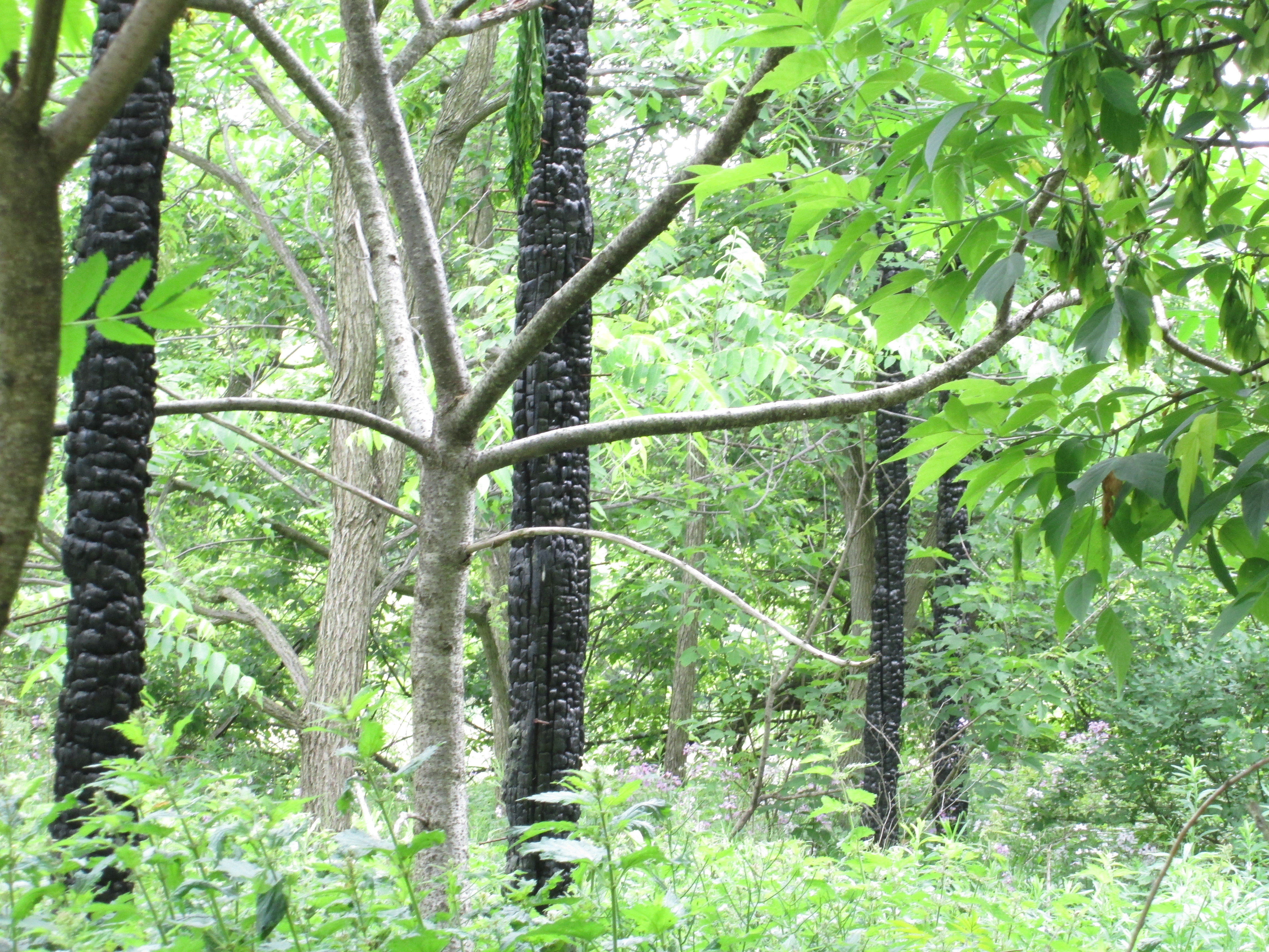
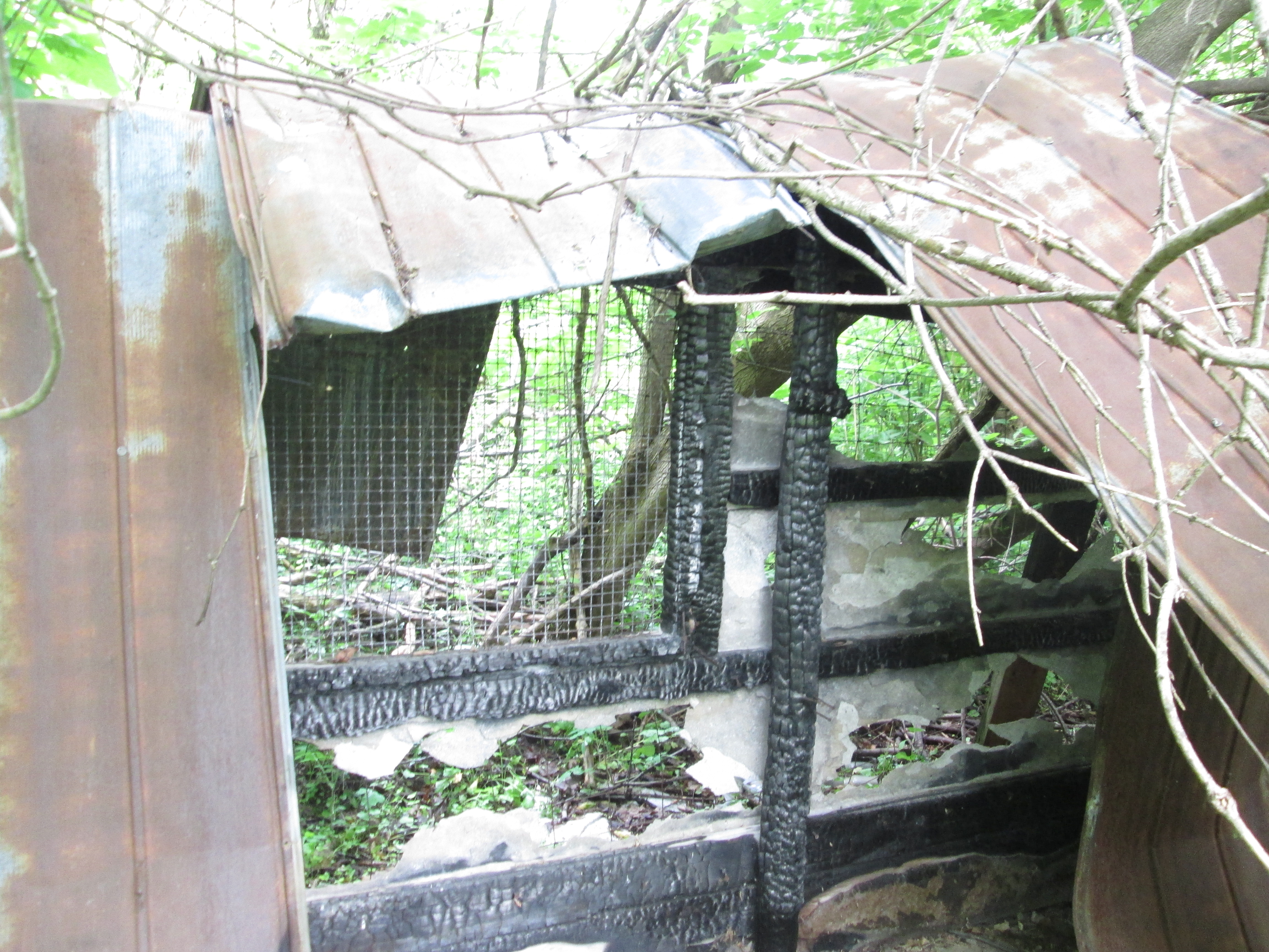
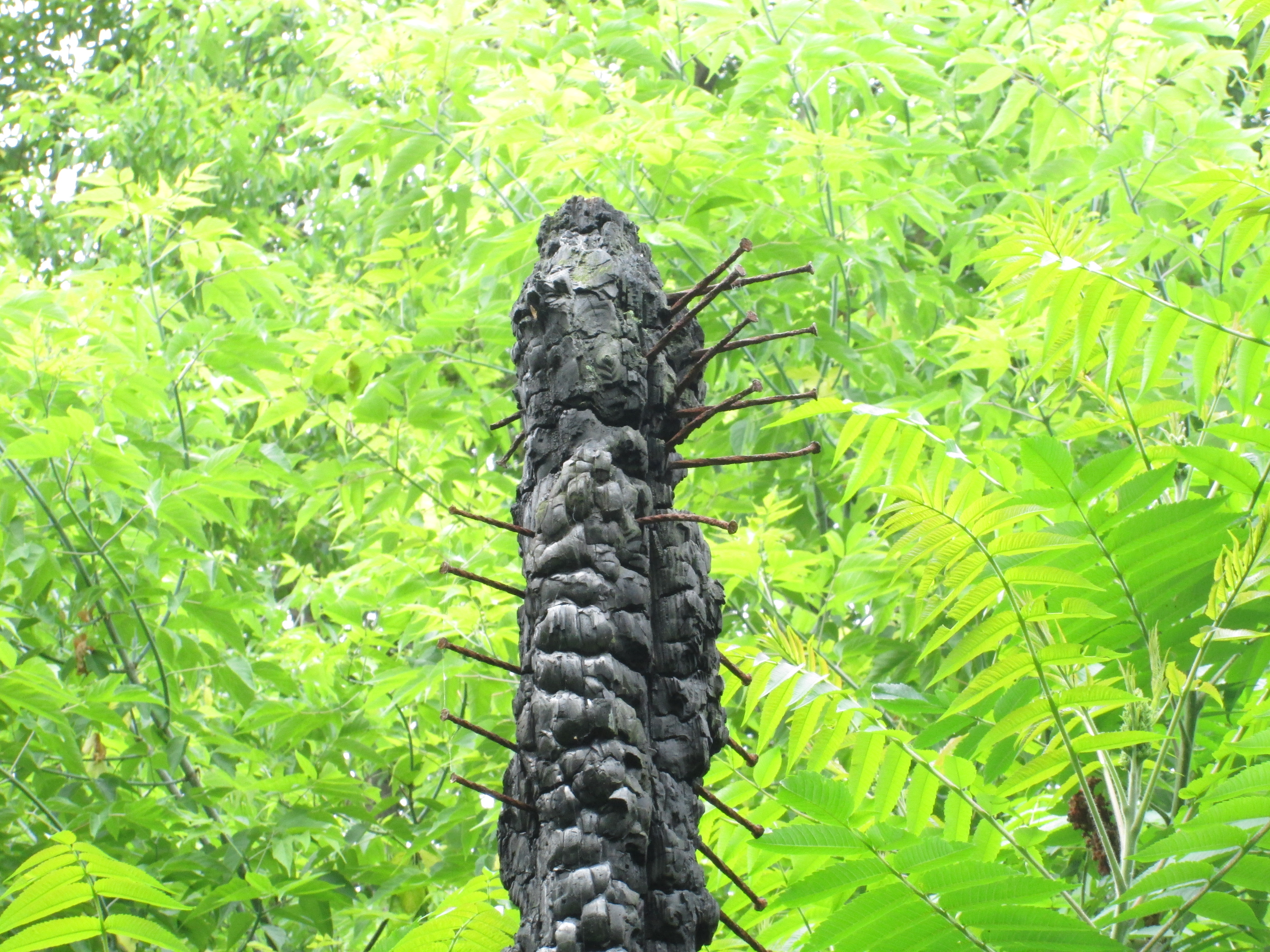
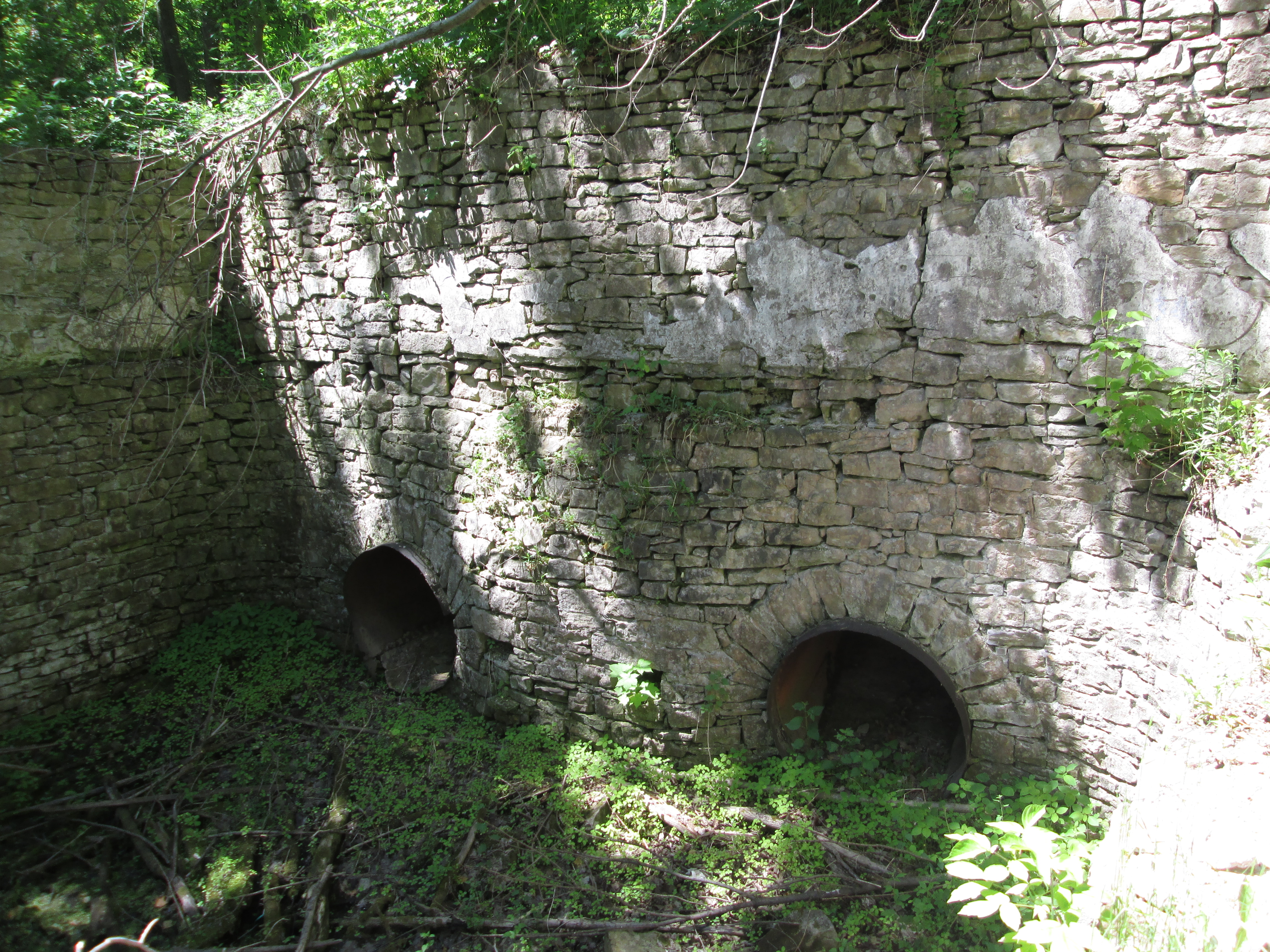
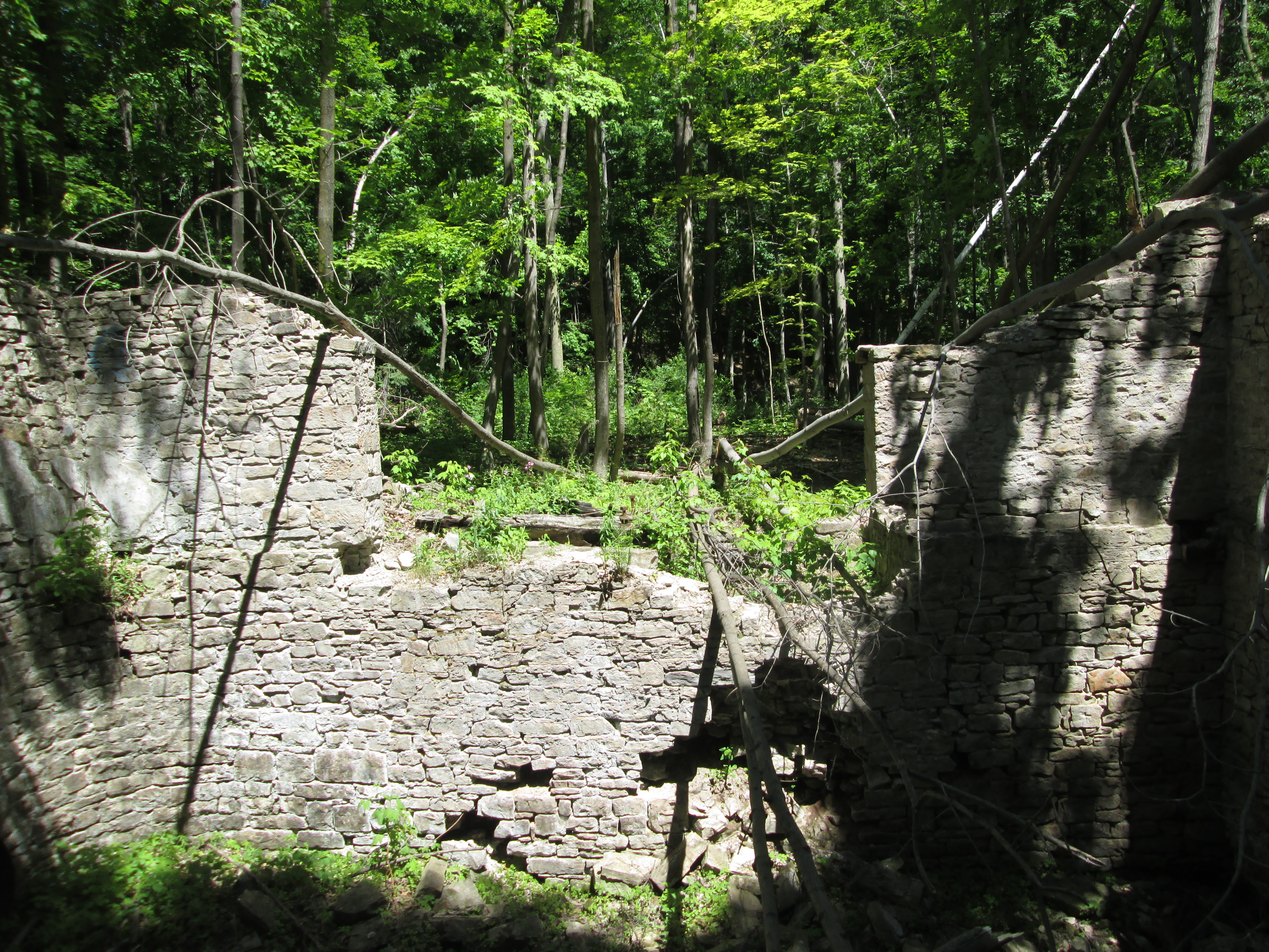
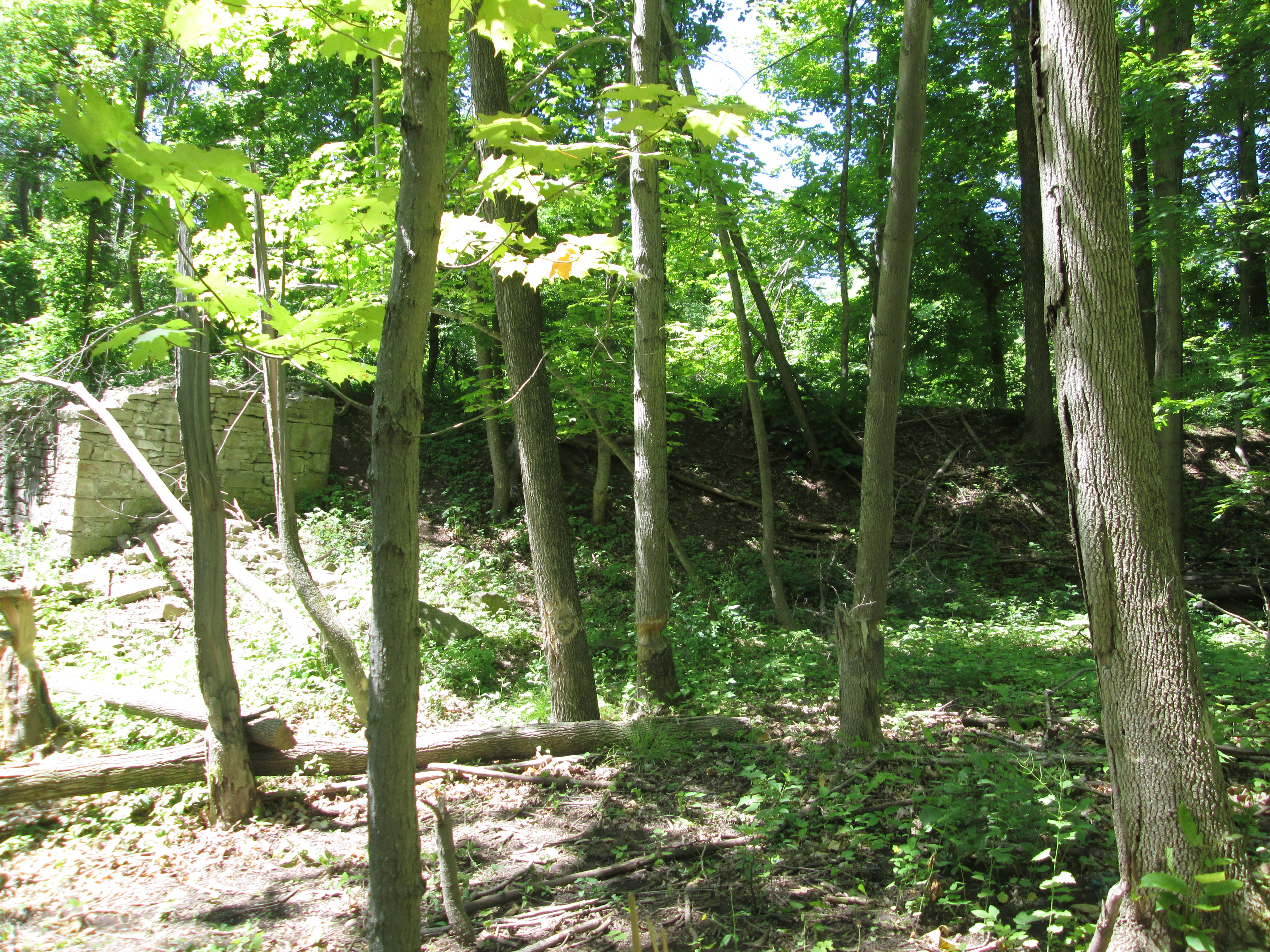
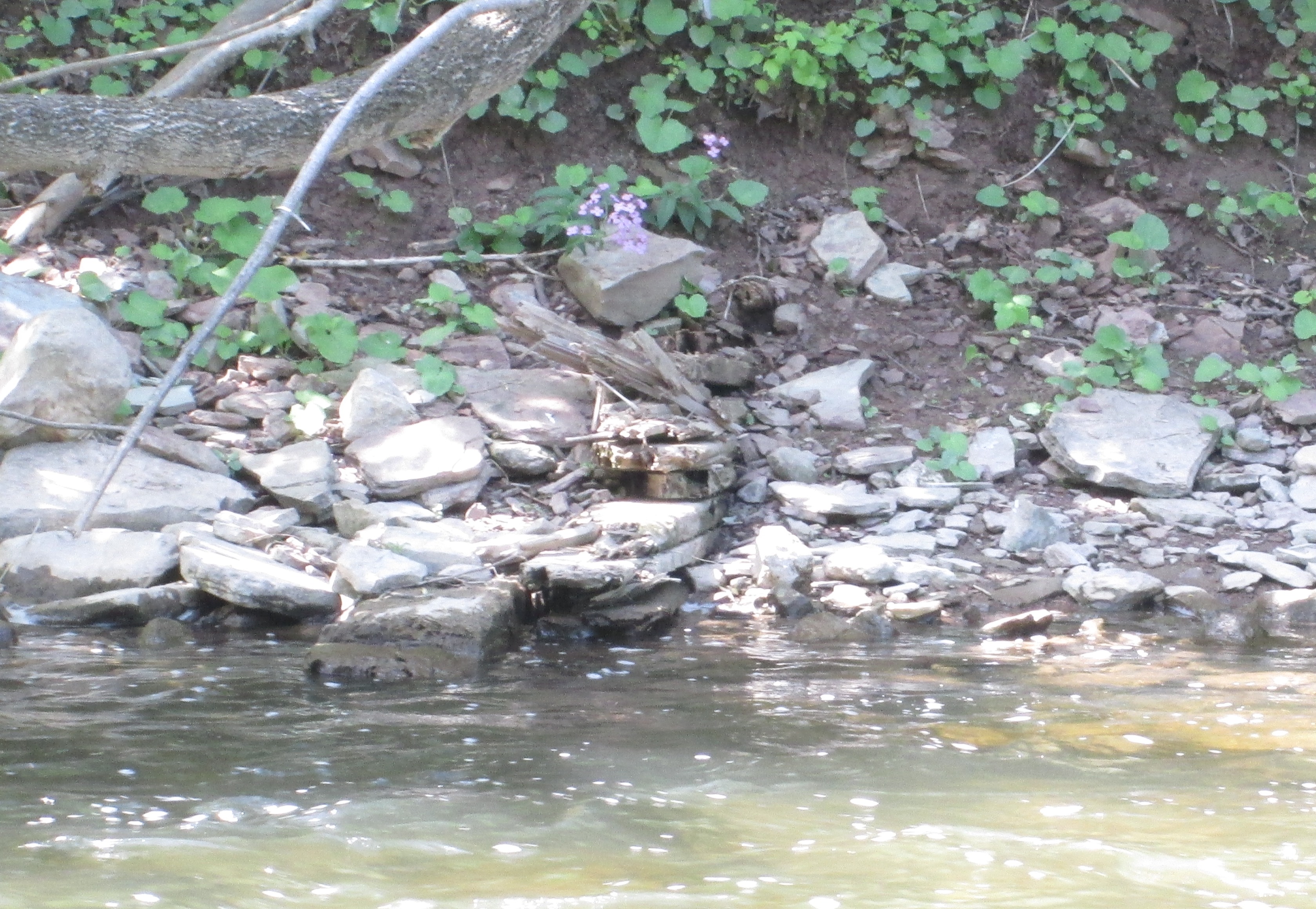
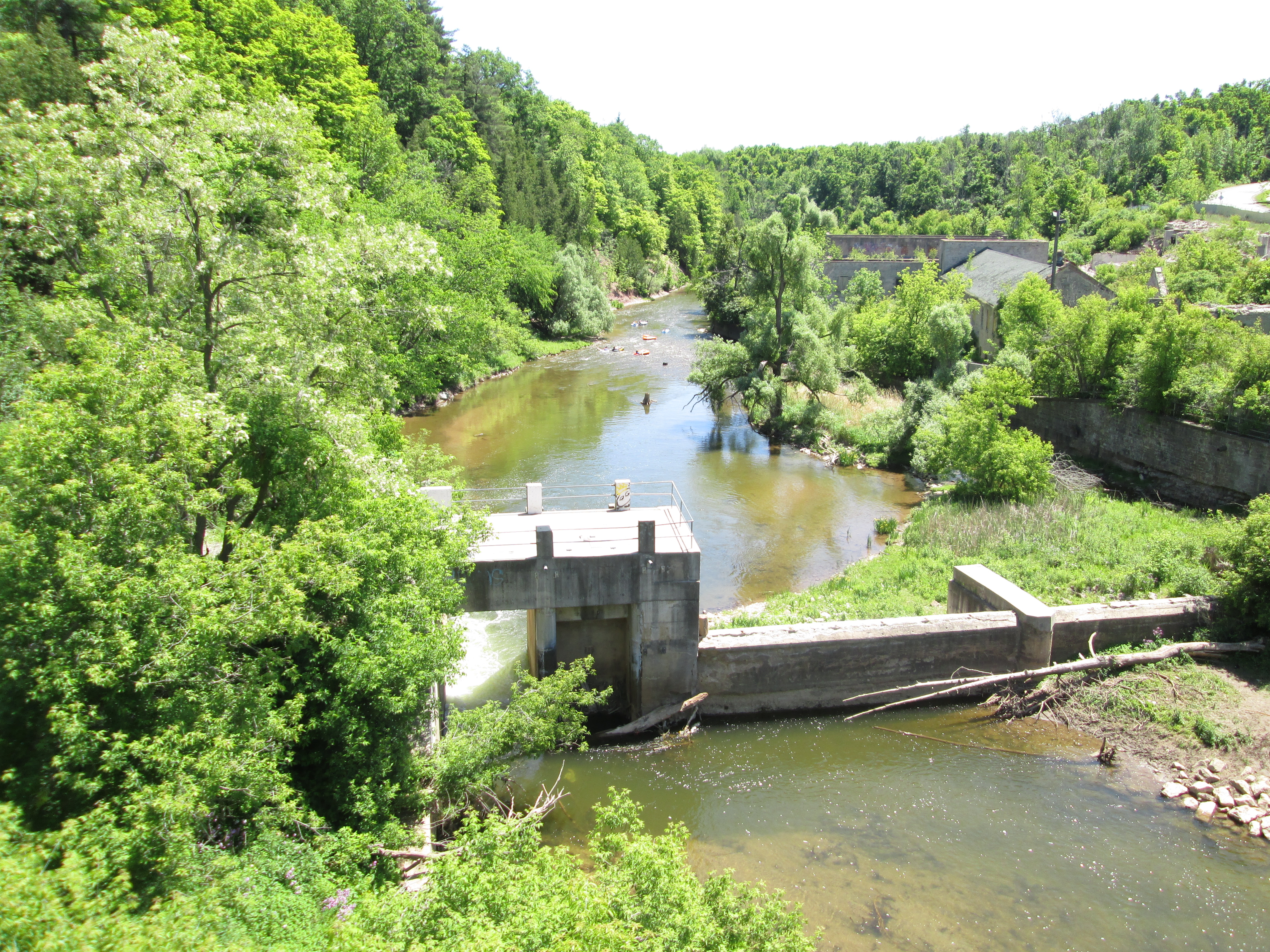
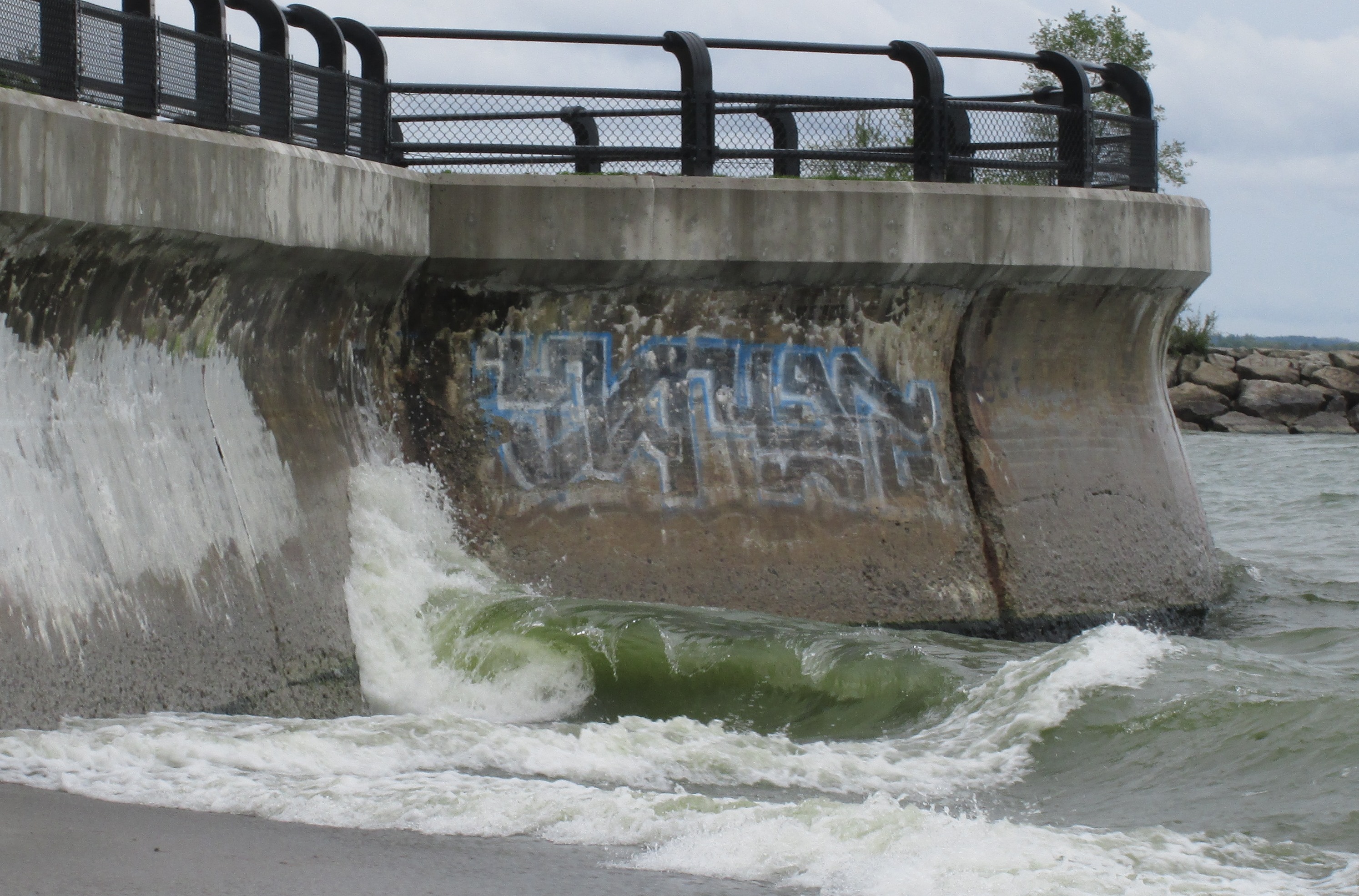
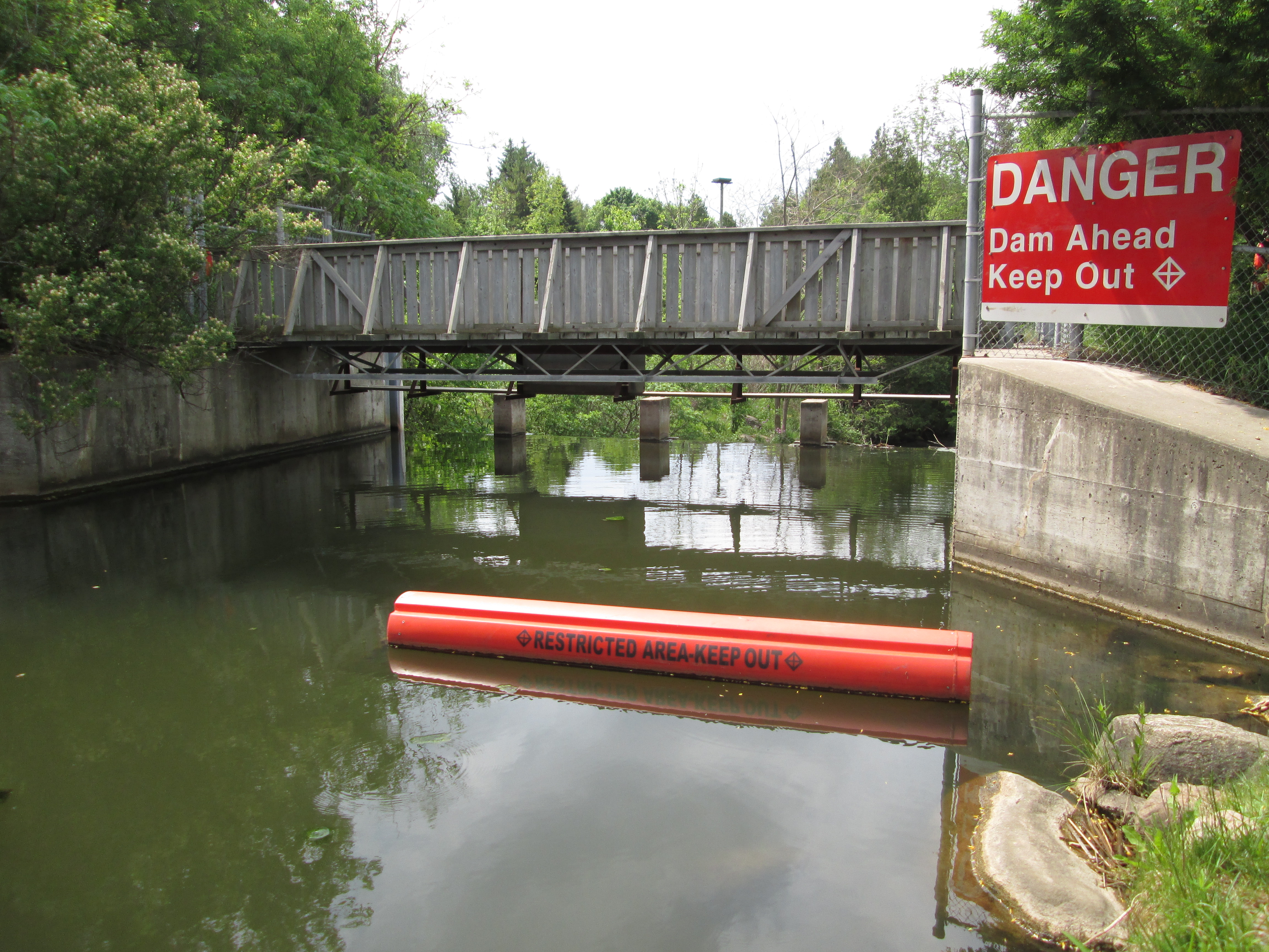
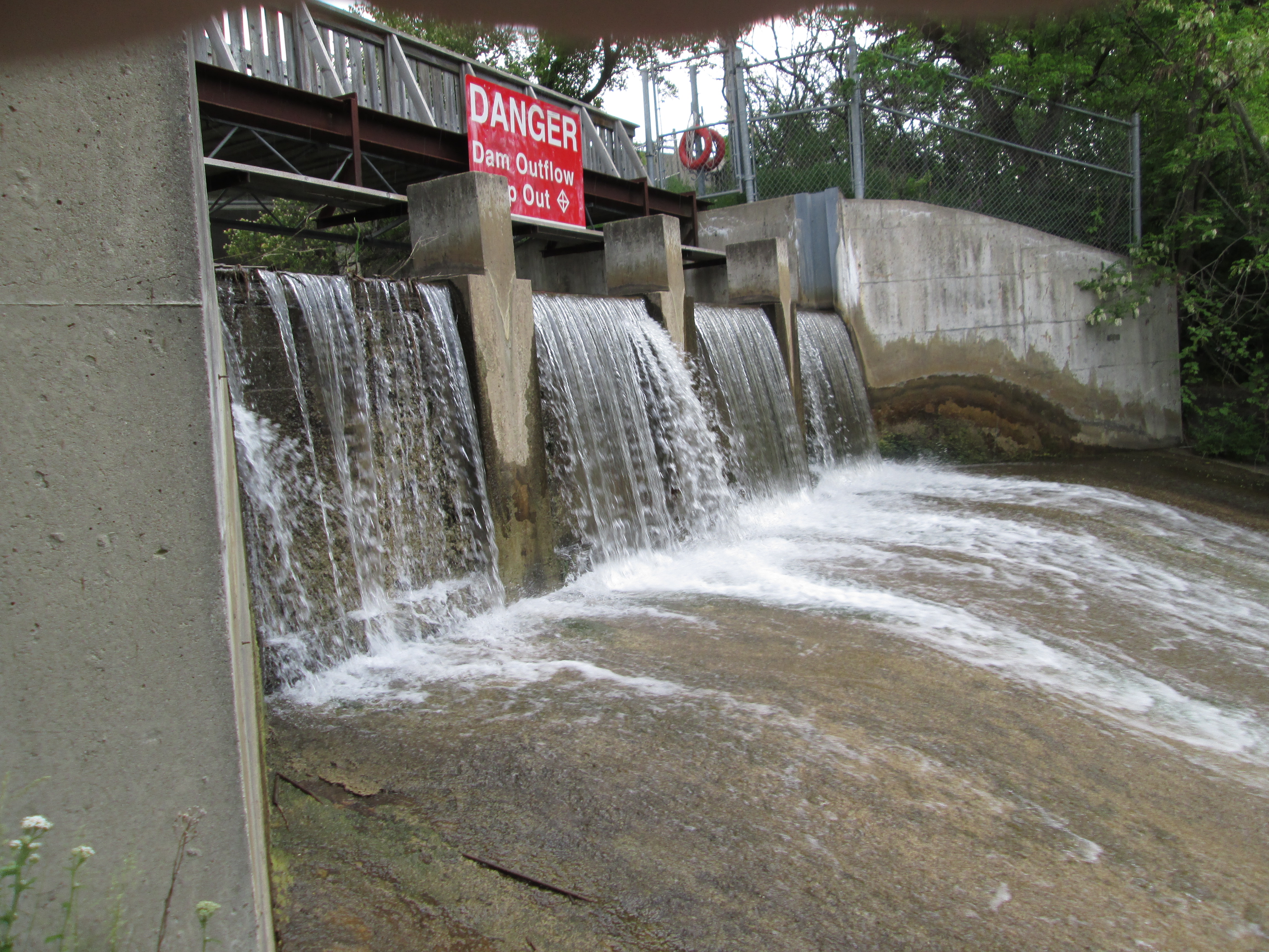
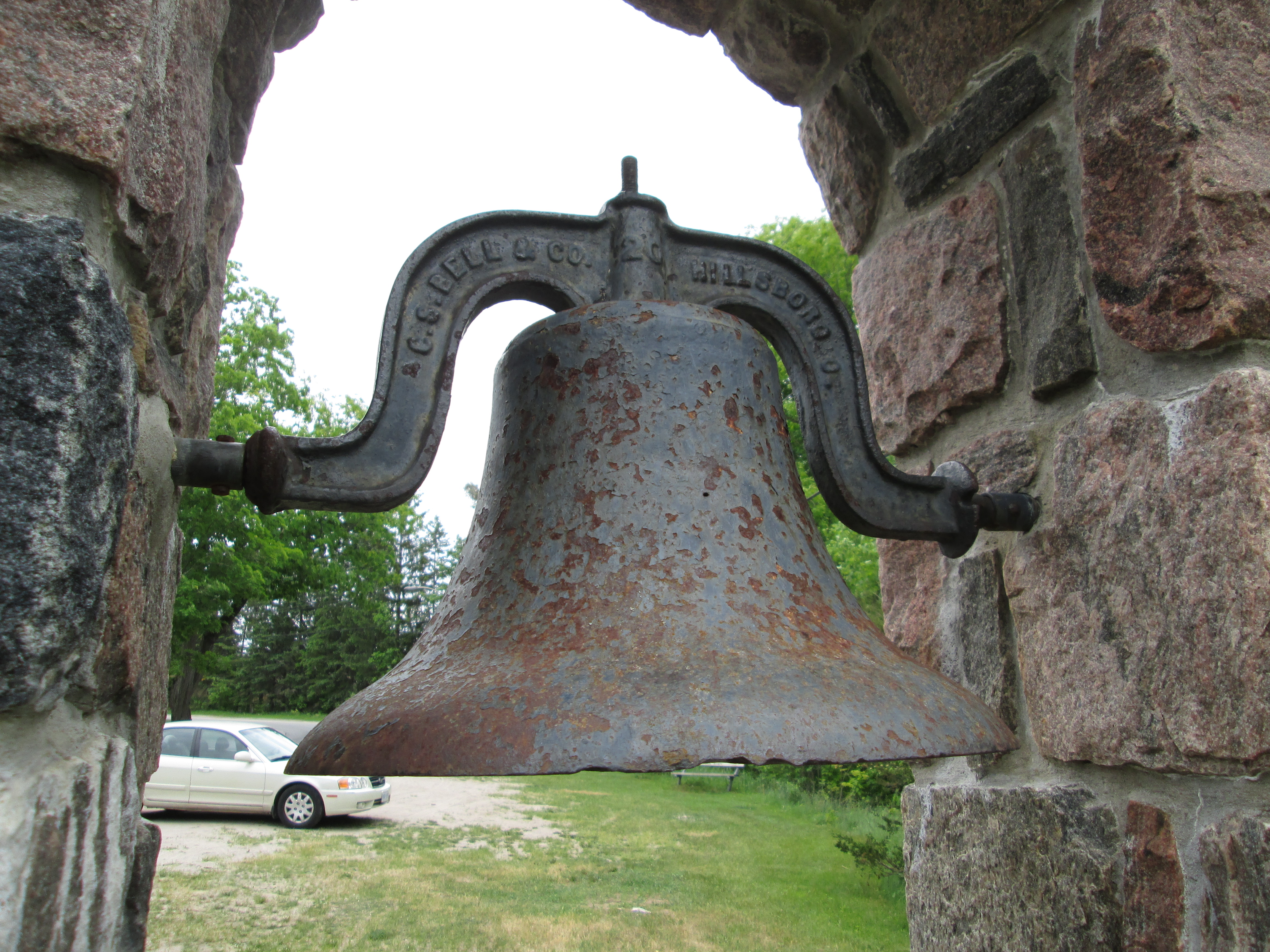
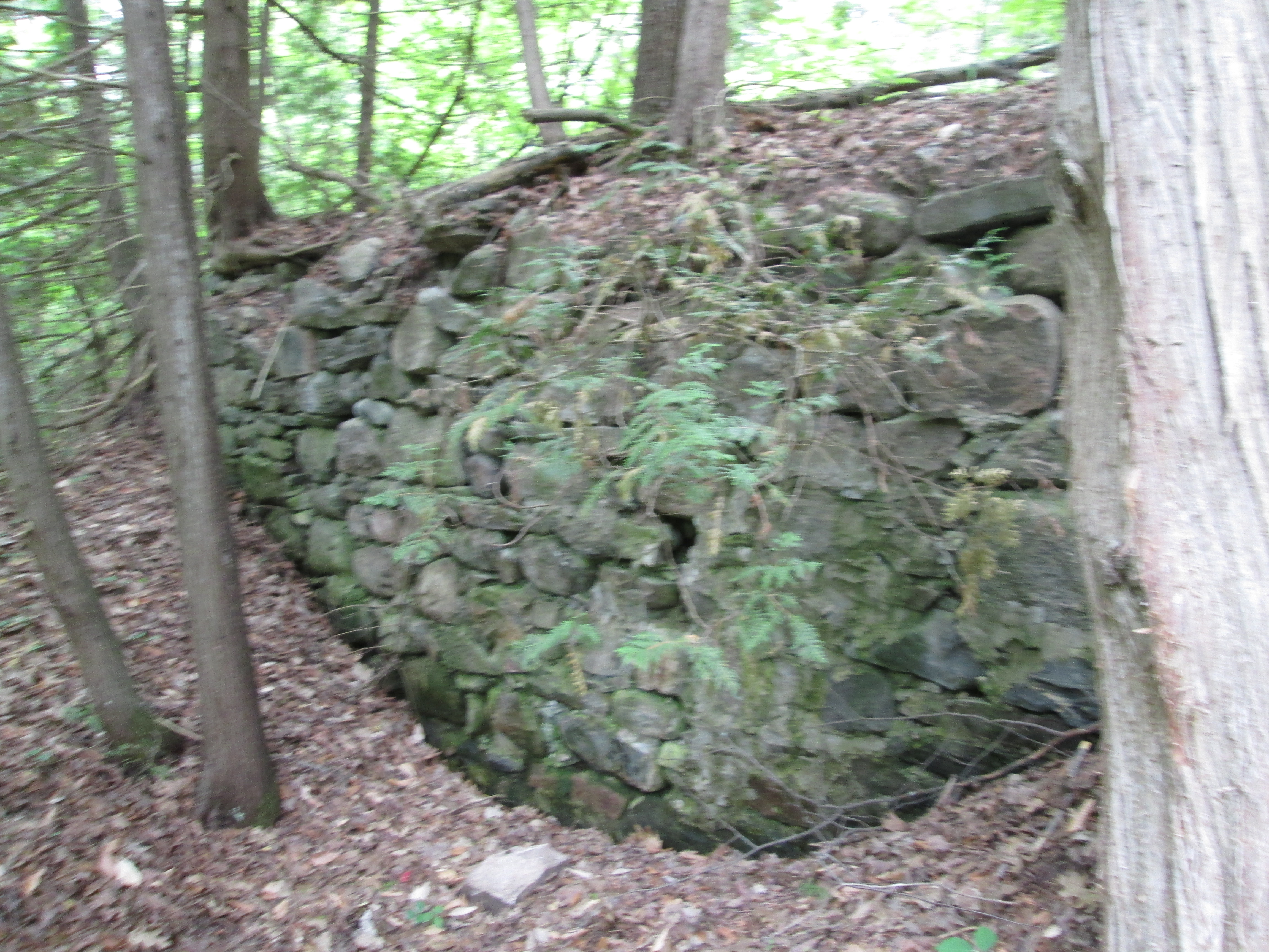
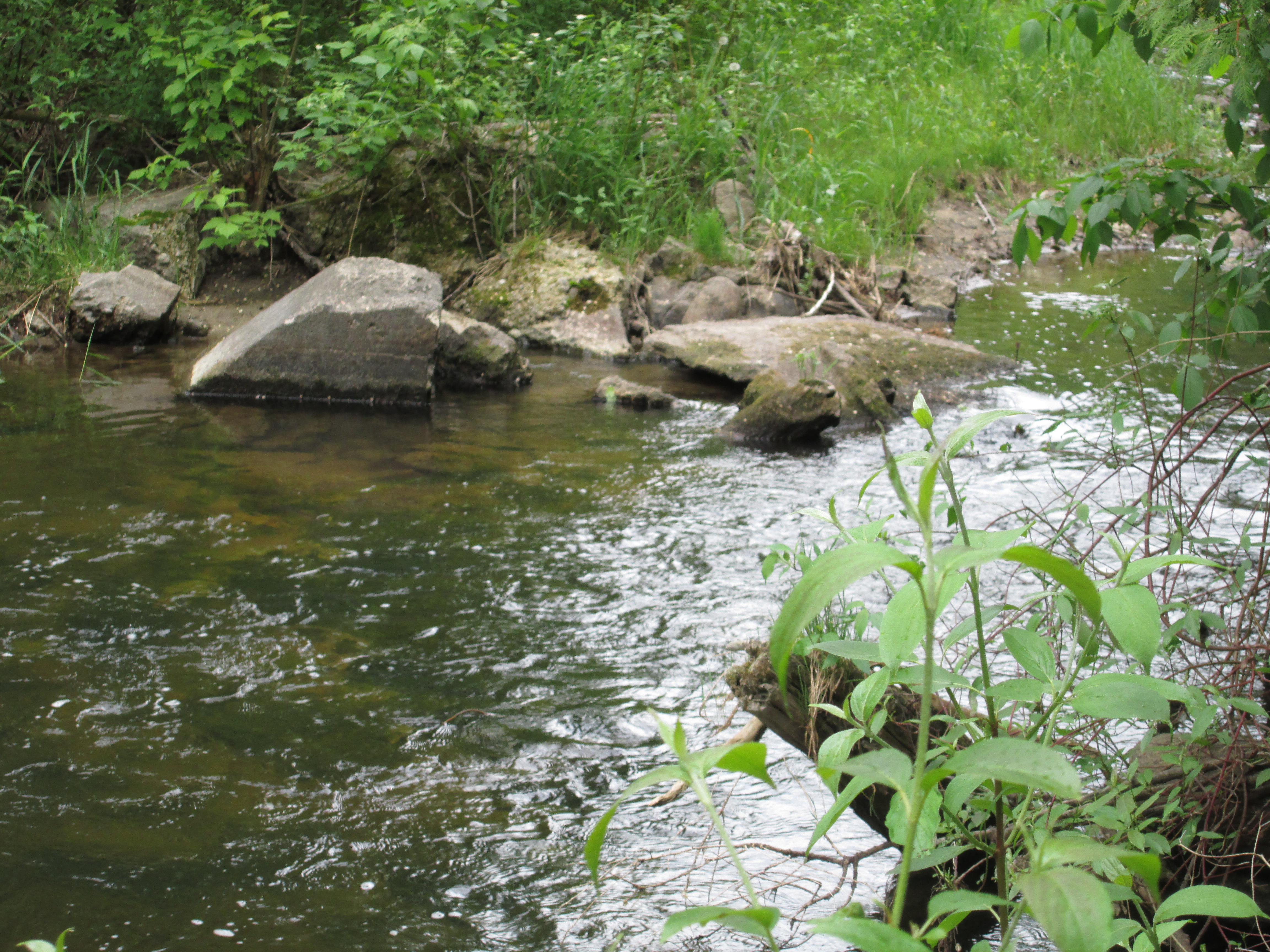
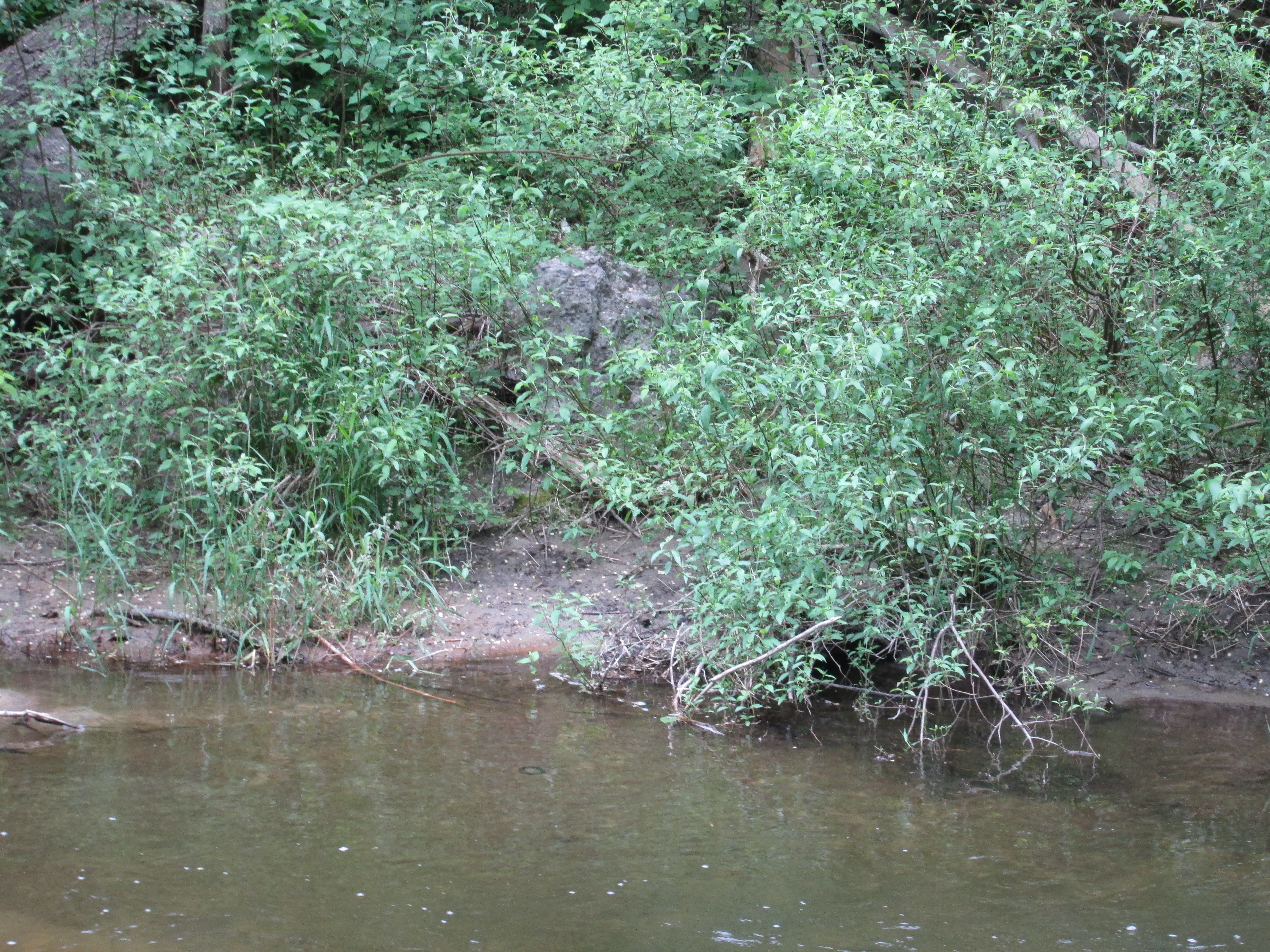
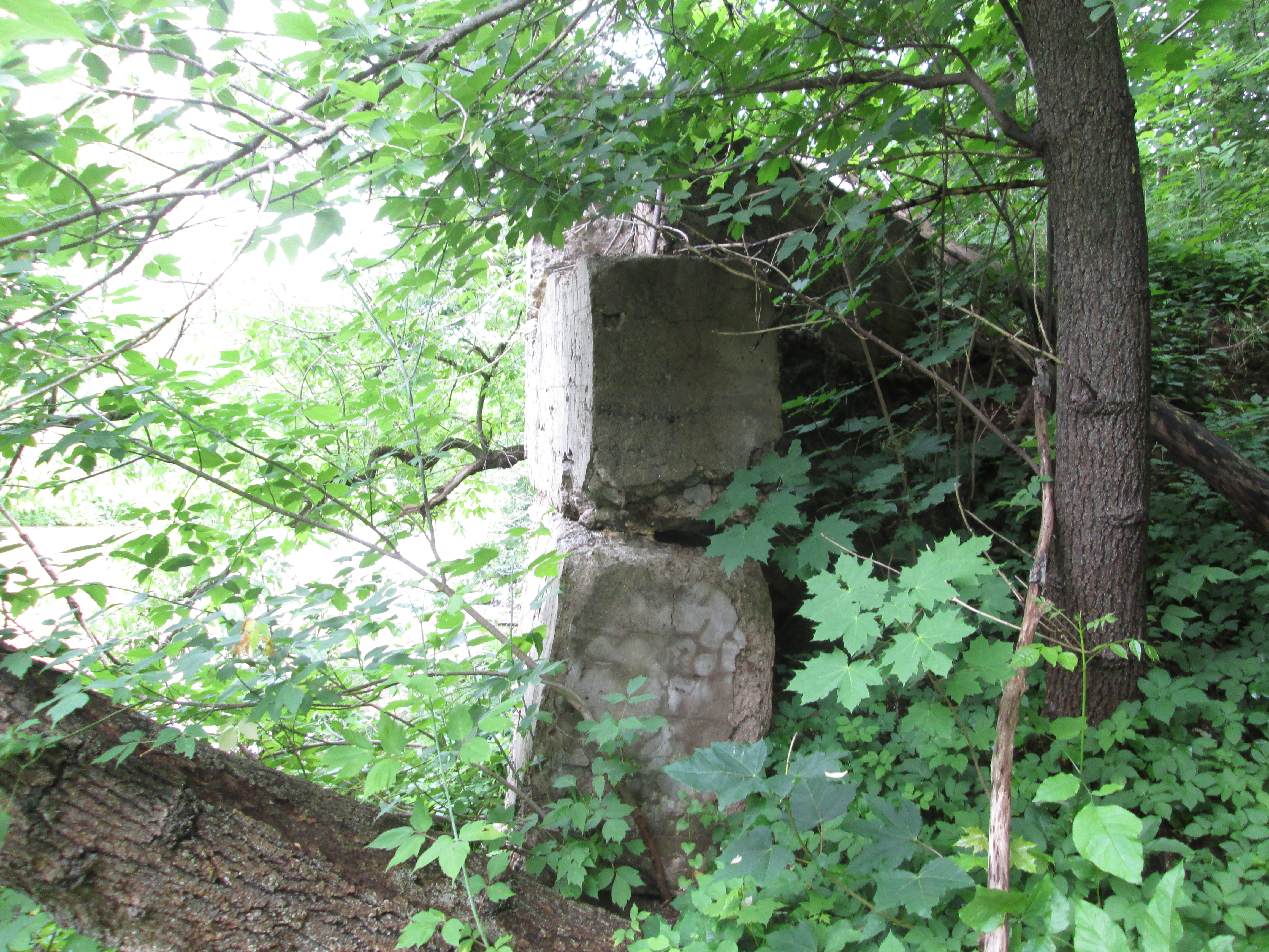
These two churches stood on either side of the Glen Williams mill pond.  The mill dam stretched between the two churches until it was destroyed by a flood in 1950.  Glen Williams has been subject to much flooding over the years with major floods in 1912, 1930, 1964 and 1965. Remanants of the dam can be seen on both sides of the river.

IMG_5965

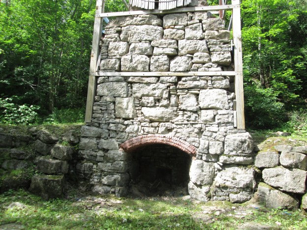
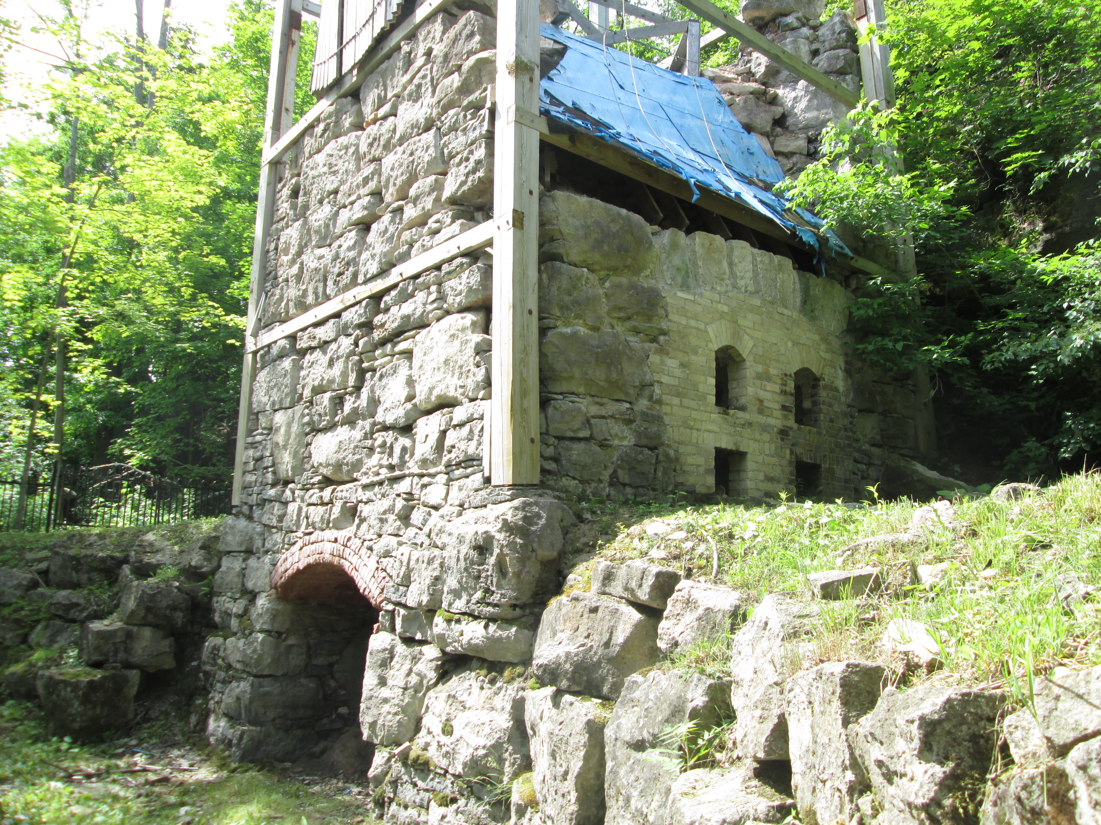
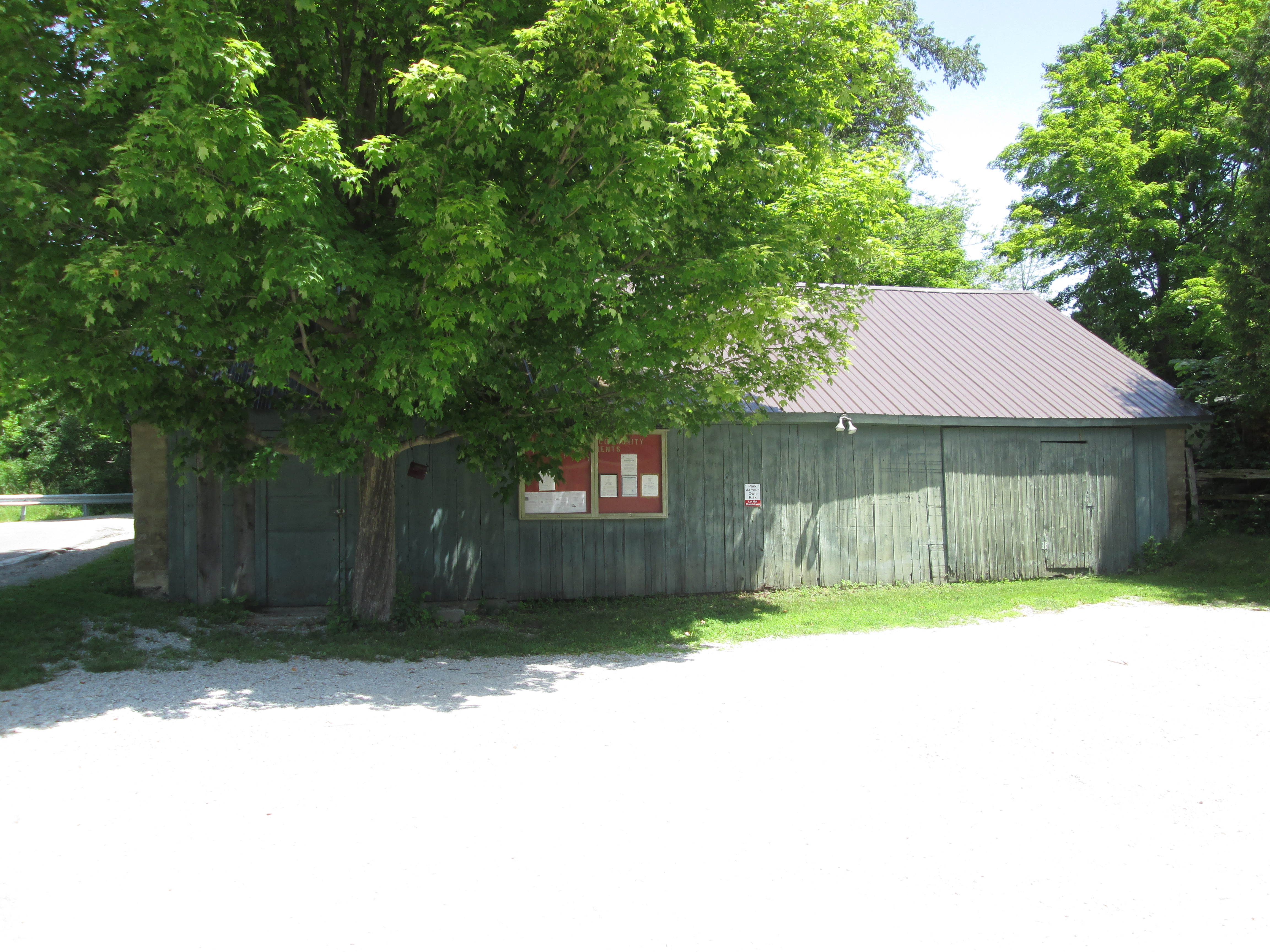
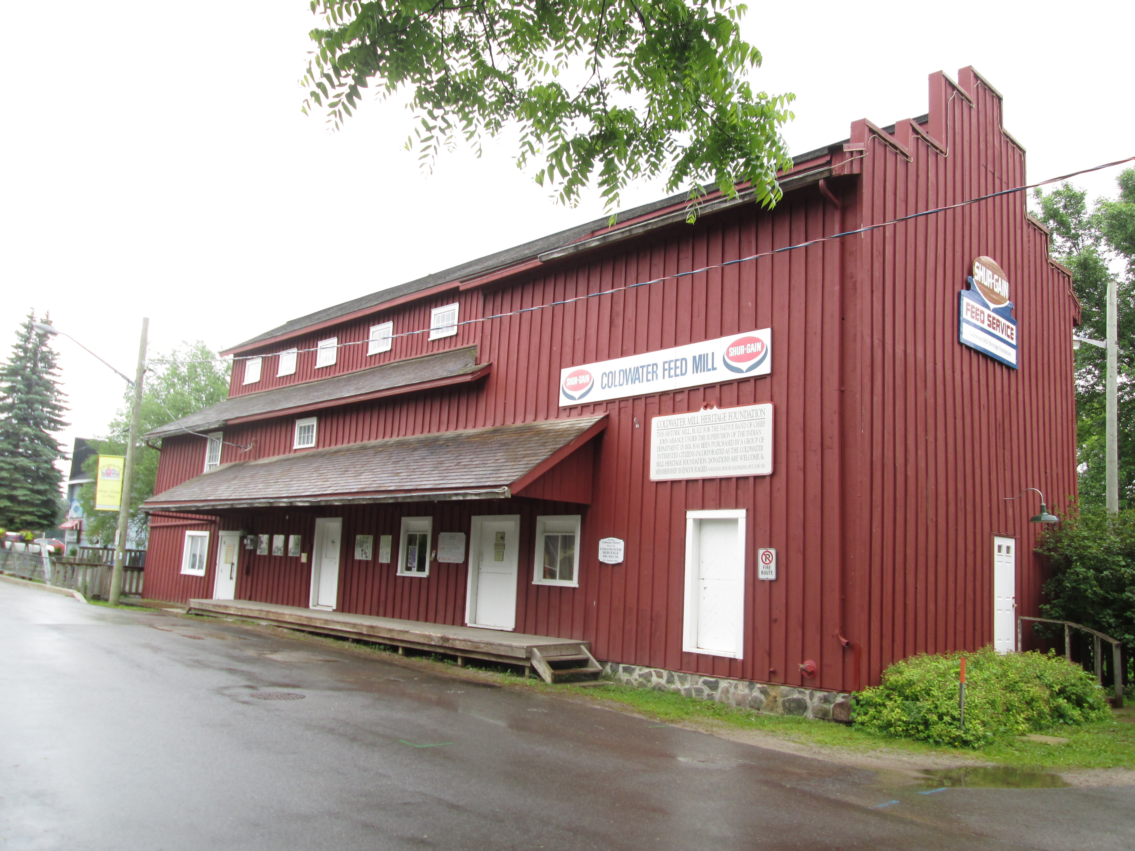
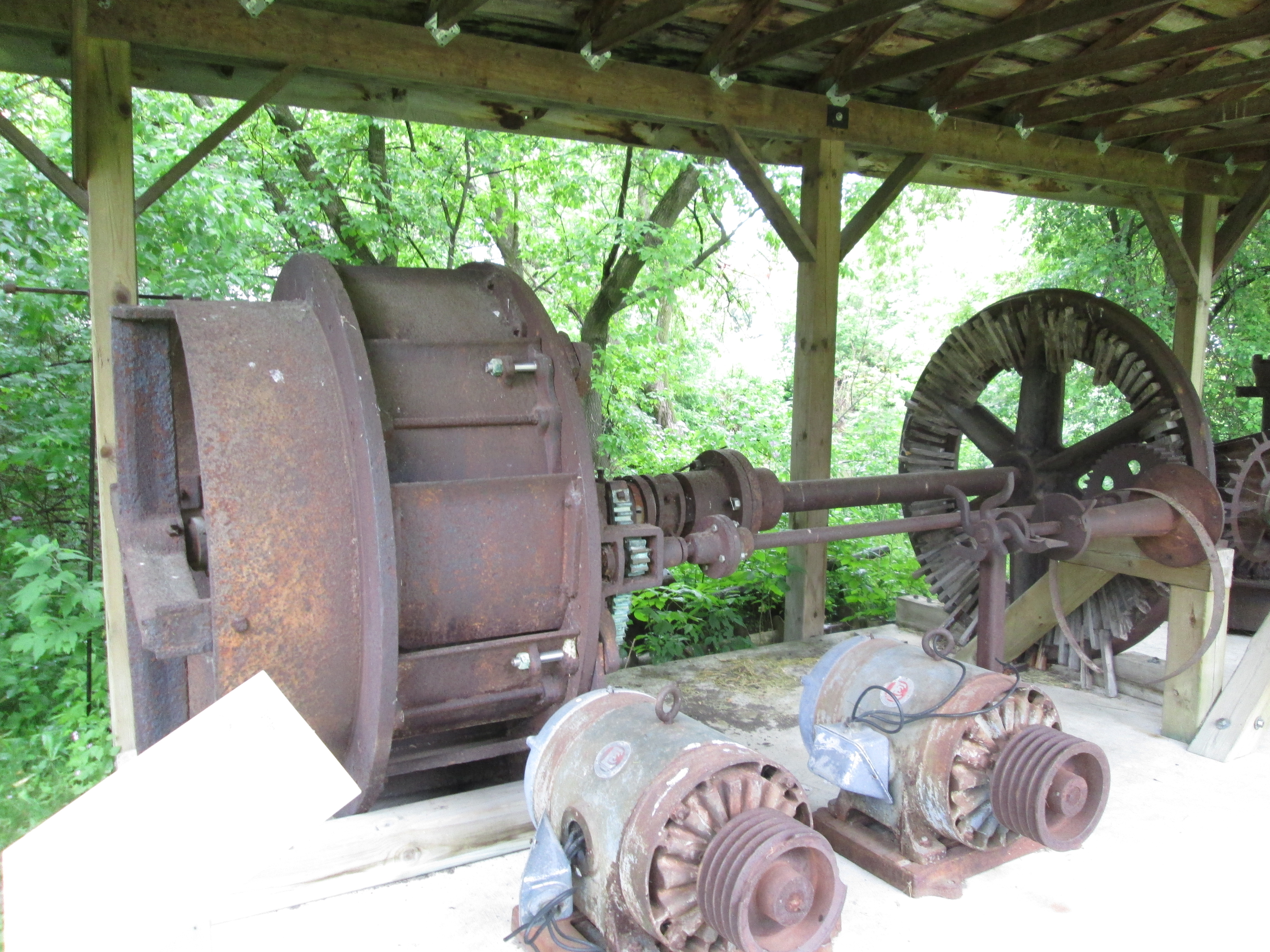
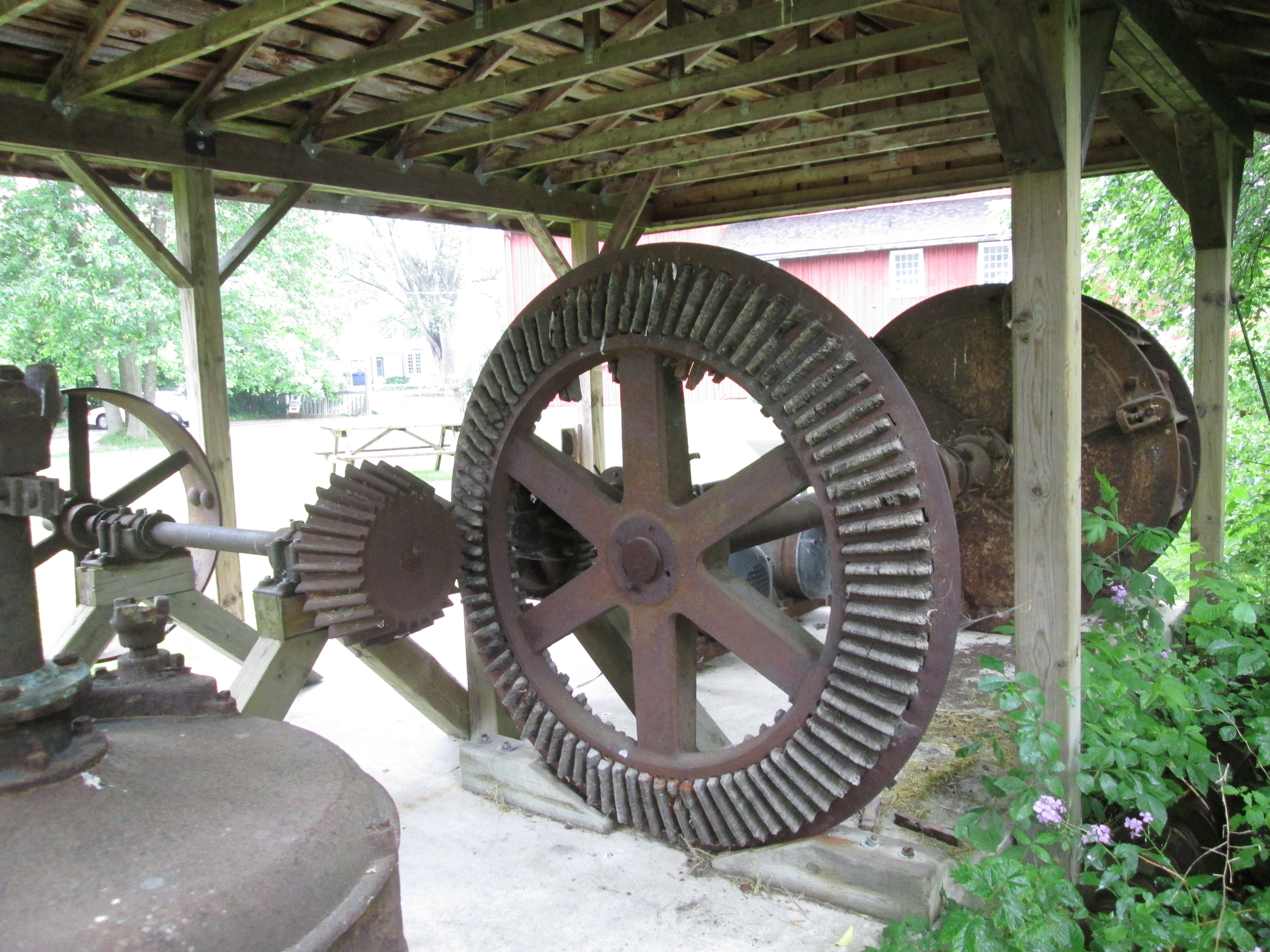
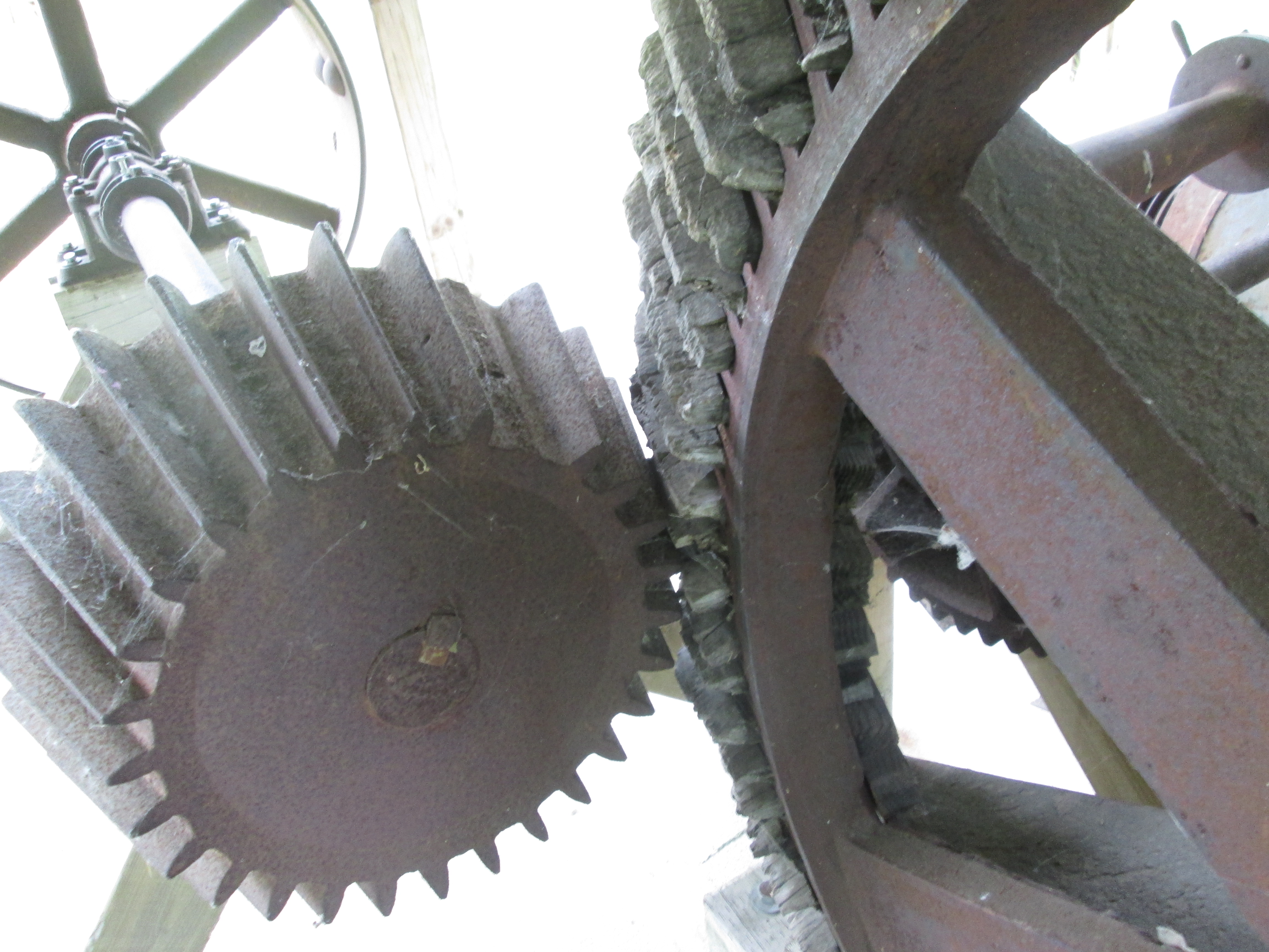
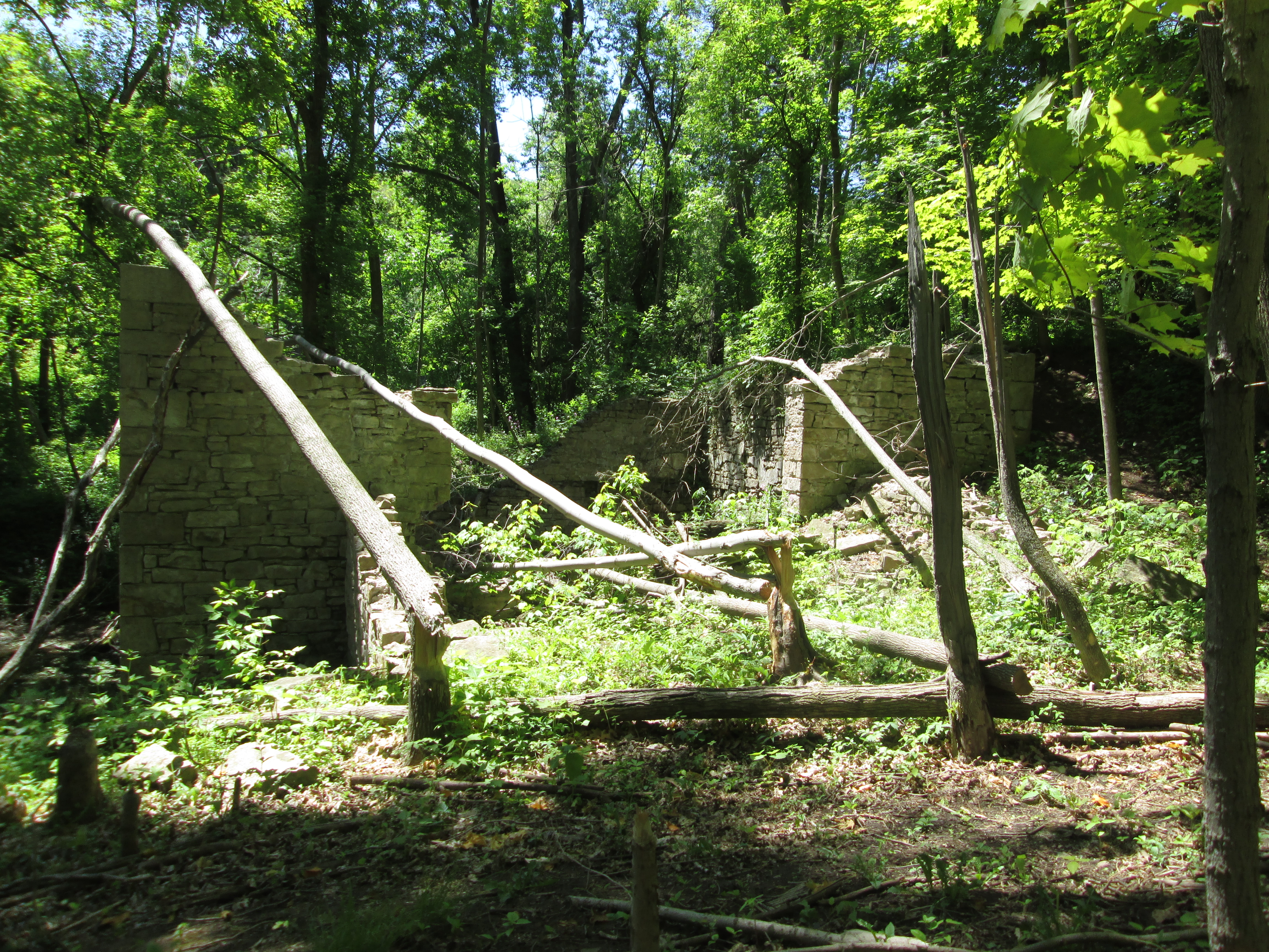
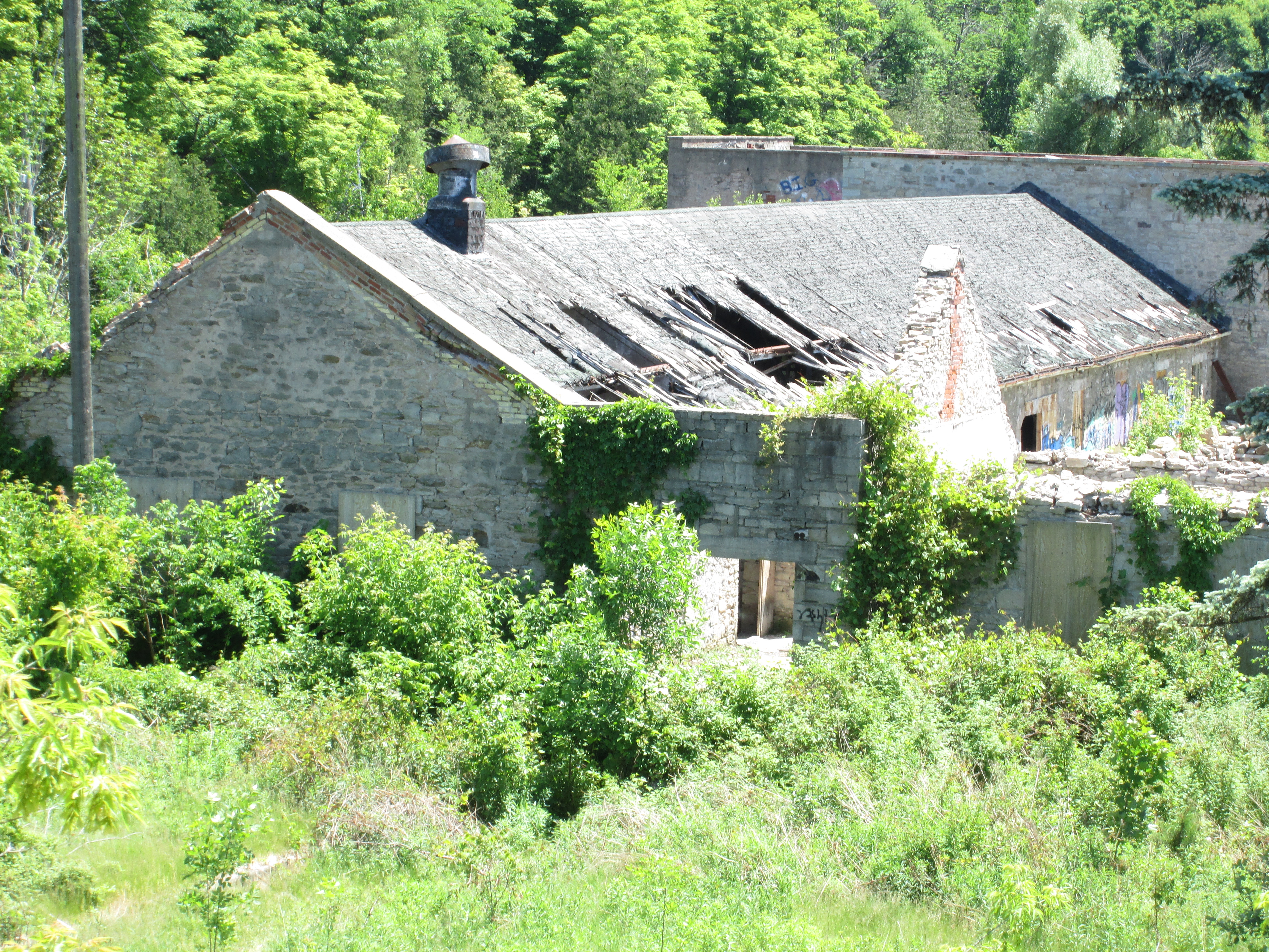
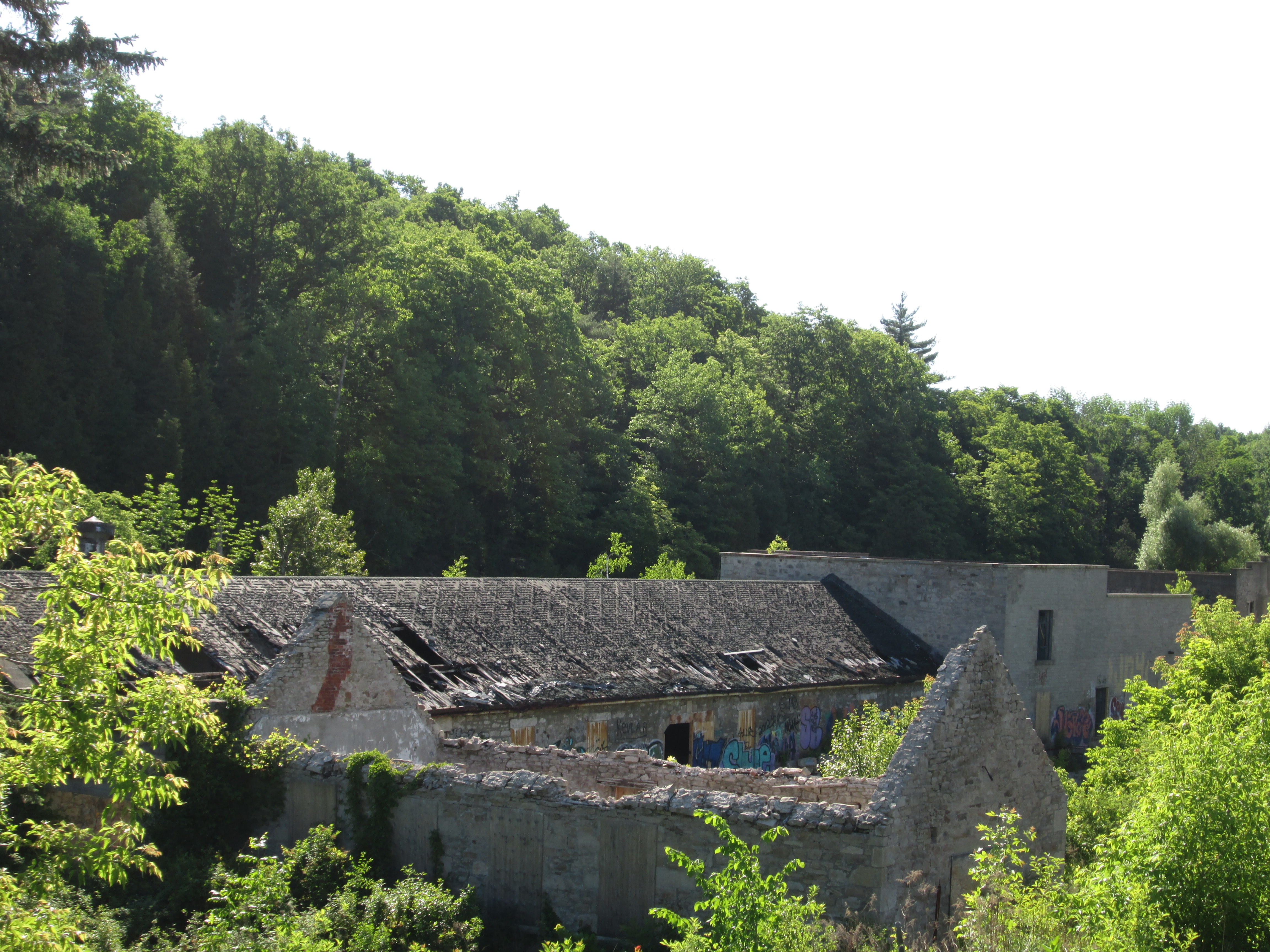
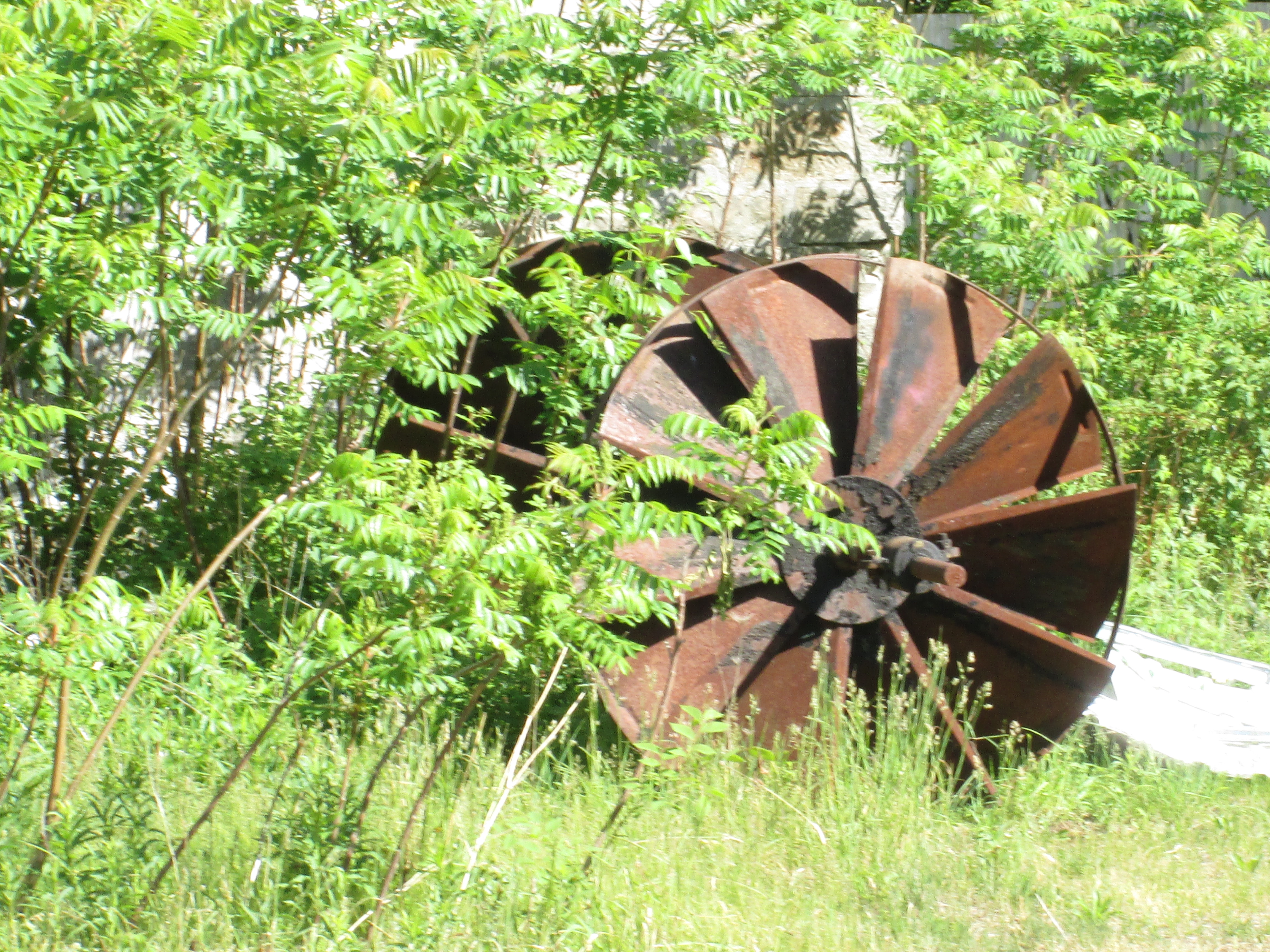
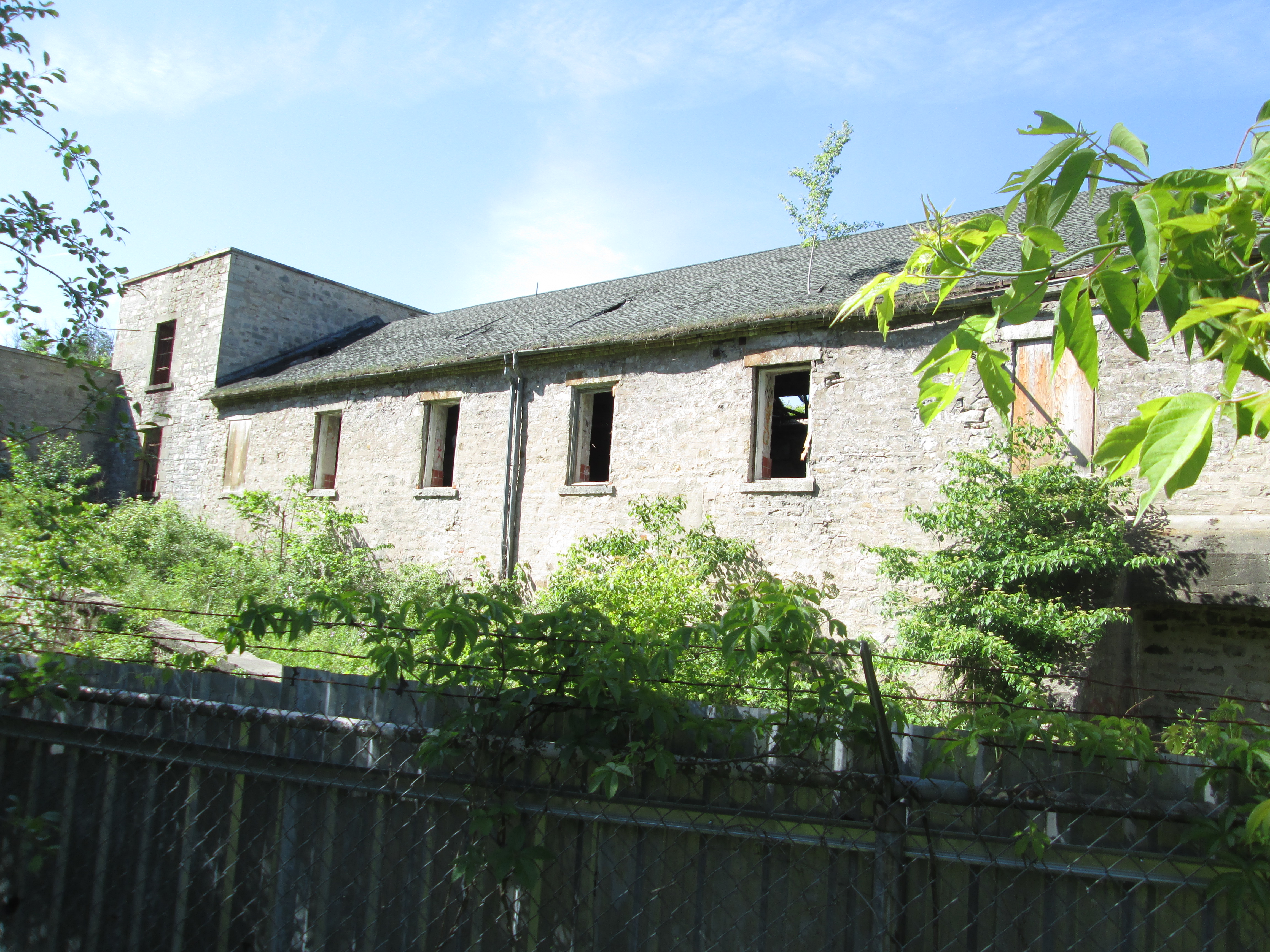
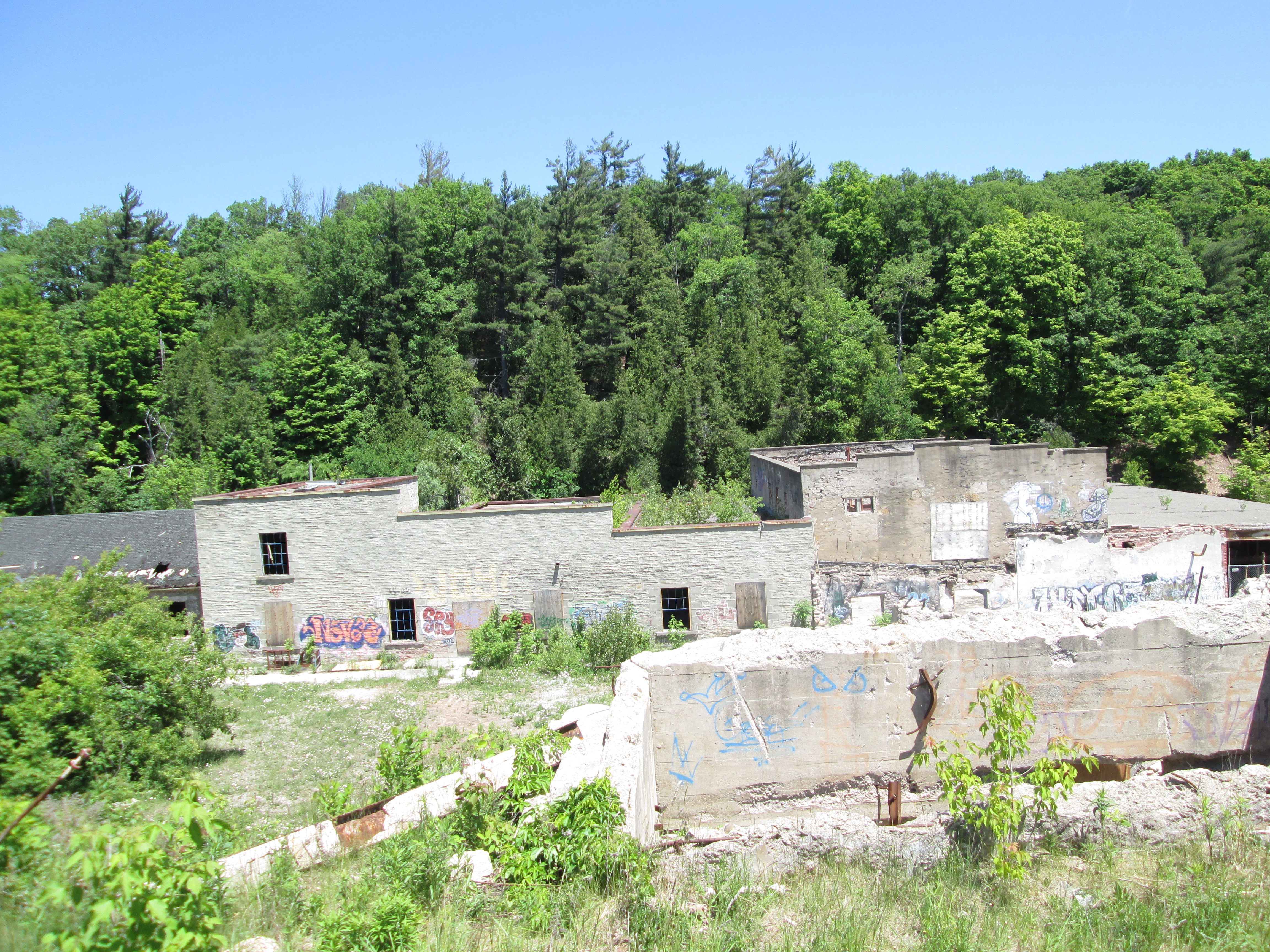
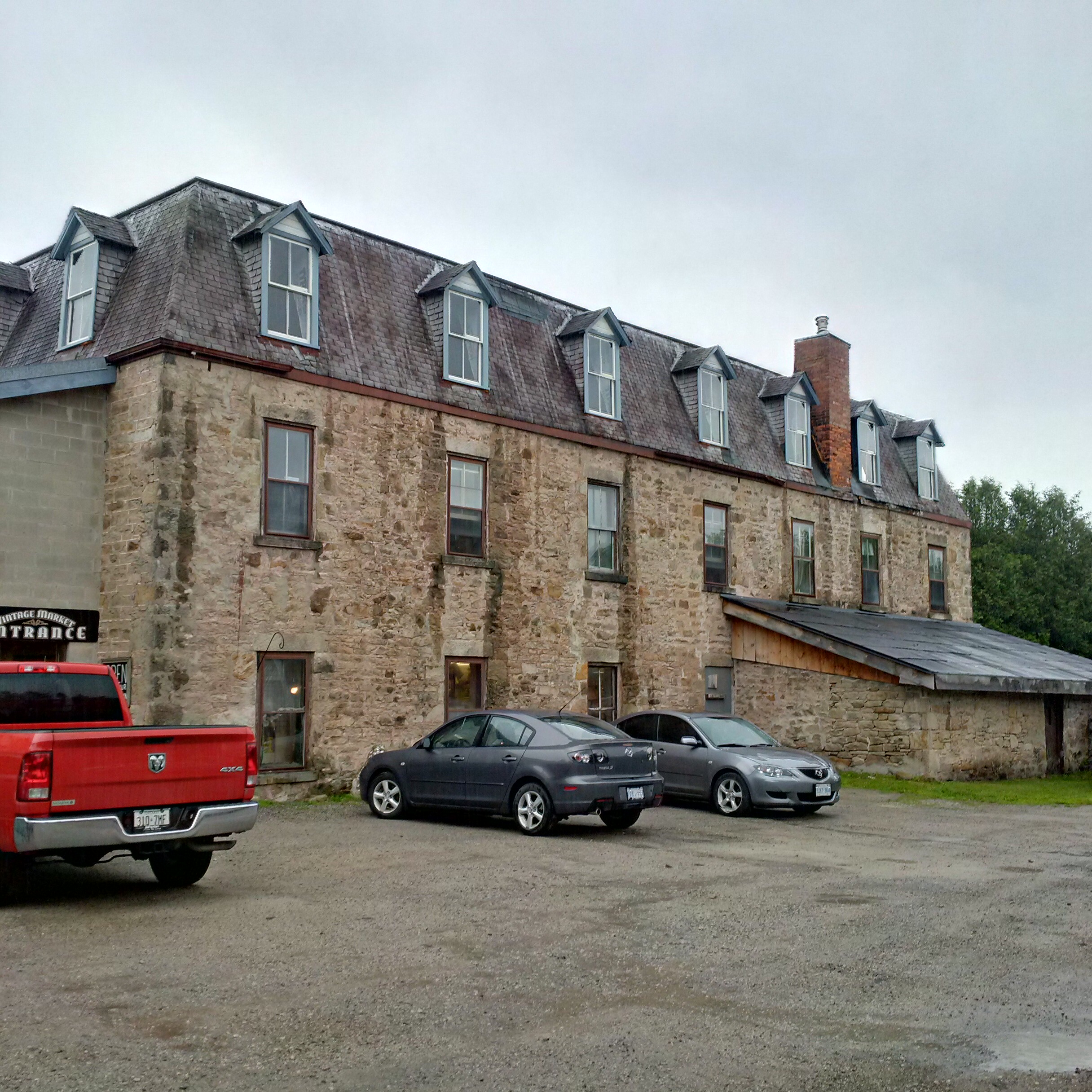
On the north end of town Joseph Tweedle operated a saw mill in the 1860’s.  In 1872 Richard Hurst replaced the saw mill with the large stone structure that stands here today.  In 1882 it was purchased by Samuel Beaumont who opened the Beaumont Knitting Mills.  Products from the mill included blankets, socks and mittens.  This mill at one time competed with Jacob Williams Woolen Mill and Benajah Williams hosiery factory in a local hub of the textile industry.

IMG_20150627_121241_hdr

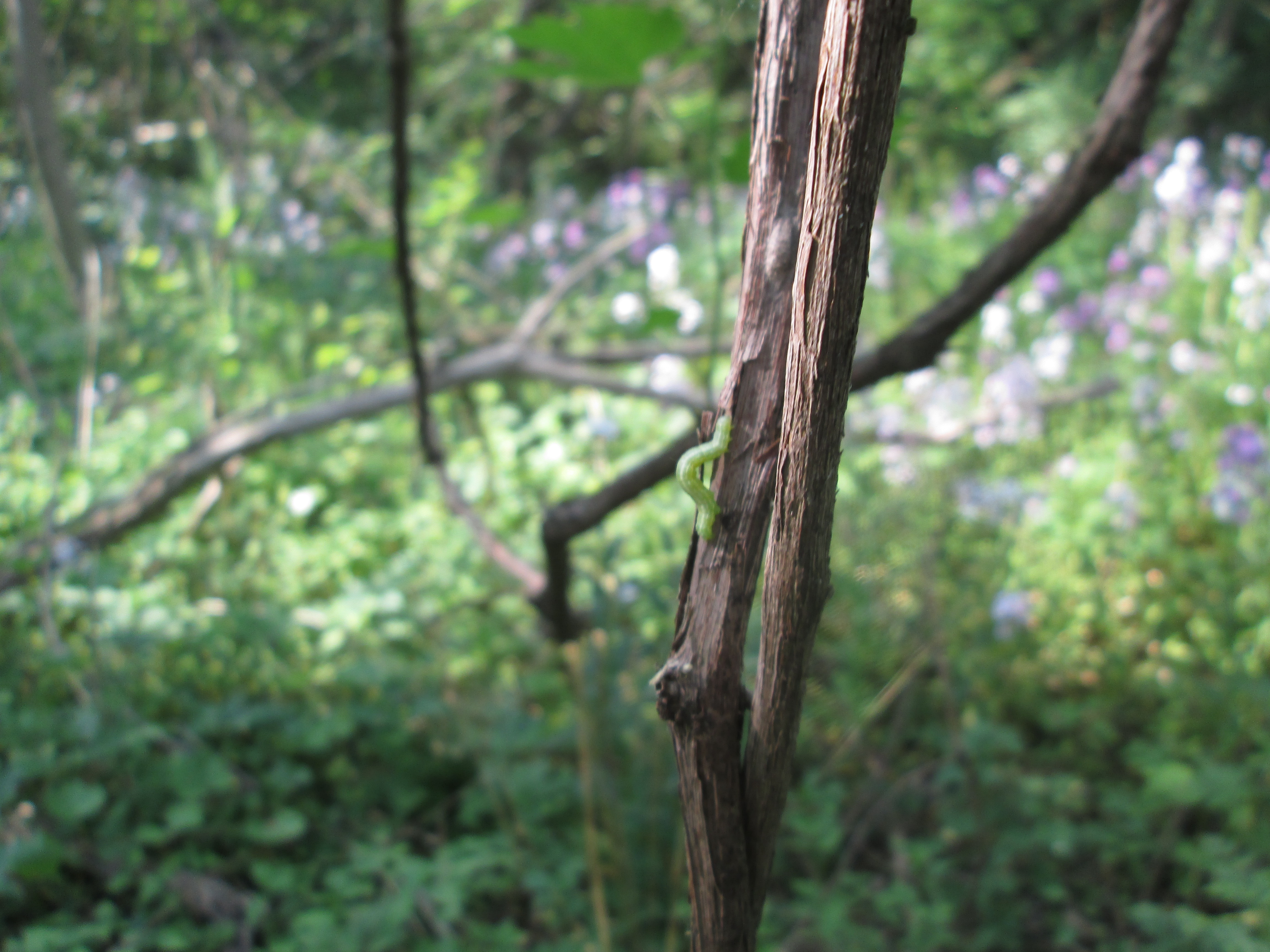
Having previously teased you with teasles in the Barbertown post I thought it fitting to post a picture of the young plant as it starts to open.  Later in the season it will bloom with a purple ring but for now it looks more like it belongs in a movie about an invasive species of plant from outer space.

SAMSUNG

Thanks to my brother for providing some of the pictures in this post.  He’s the guy who puts the “we” in “we”.

Visit us at http://www.facebook.com/hikingthegta for additional photos.

Newmarket Ghost Canal

Sunday June 21, 2015

It was the first day of summer and although the sky was threatening rain it wasn’t actually supposed to happen.  I decided to check out the remains of the partially constructed Newmarket Canal.  I parked in the conservation parking lot off of Green Lane near the second concession.  The East Holland River crosses here and heads north out of
Newmarket.  I walked about 15 minutes south of Green Lane to where the third lock on the abandoned canal was built to start my investigation of the canal.

The idea of building a canal to link Lake Ontario and Lake Simcoe had it’s beginnings in the 1820’s.  Following the War of 1812 greater consideration was given to the moving of goods and people and a period of canal building began.  The first Welland canal opened in 1829, the Rideau in 1832 and Trent-Severn in 1833.  An idea was brought forward to link Lake Ontario near Toronto with Lake Simcoe and then Georgian Bay.  The project never got past the drawing board however and was abandoned until Rowland Burr resurrected it in the 1850’s.  In 1857 he had some success and the government commissioned the Lake Ontario and Georgian Bay Canal.  The idea was to use the Humber and Holland Rivers to reach Cook’s Bay on Lake Simcoe. With all the dredging and locks that would have been required the cost became too great and the idea was put on the shelf.

William Mulock was born in 1844 and was a member of parliament from 1882 until 1905. Serving as the MP for Newmarket, Mulock revived the idea in response to his constituent’s requests to do something about rising railway prices.  Mulock envisioned the canal extending only as far as Newmarket with a possible future extension to Aurora.  In 1904 Mulock proposed the canal which began construction in 1906.  The first section from Lake Simcoe to Holland Landing would require no locks but there would be three locks between there and Newmarket. The third lock was intended to lift boats 11 feet but as can be seen below has been filled in and is now part of Bayview Park.

IMG_5801

The dam has also been partially filled in as the first three sections are near ground level behind the dam. A sluice gate allows the river to bypass the old lock.

IMG_5805

Black Raspberries grow along the sides of the trail between lock number three and Green Lane. It looks like there will be a nice crop coming soon for those who live in the area.

IMG_5815

Four swing bridges were constructed of which only the one near Green Lane remains.  This one was built on the Kelley Farm and was locally known as the Kelley Bridge.  The blue swing mechanism can be seen under the new pedestrian bridge in the picture below.  The bridge would have swung across to rest on the concrete support to make way for a ship to pass through the canal.

IMG_5790

The gears that ran the swing bridge remain in place although the bridge was never used in that manner.  It was used as a stationary steel truss bridge to carry Green Lane over the Holland River until 2002 when it was replaced with the newly widened road and bridge.  The earlier truss bridge was removed in 2004 for safety reasons and the swing bridge works painted to help preserve them.

IMG_5795

The paved path works its way up the west side but I chose the less used dirt path on the east. The trail leads to a hydro corridor and then through a marsh.  I kept following a set of human footprints that led me across two small streams and through a field onto an abandoned piece of roadway.  From there I could see the second lock.  Great Blue Heron seem to like the river and local marshes.  I saw at least three different ones as I made my way along the river.

IMG_5868

A red car hood has been tossed off of the bridge on the second concession and into the East Holland River.  A tree is taking advantage and growing inside the car part.

IMG_5842

Lock number two was the tallest of the three rising 26 feet.   An old concrete bridge still spans the river on the second line but it was added after the canal was abandoned and a swing bridge was no longer required.  This is now an abandoned bridge across an older abandoned canal lock.  Rogers Reservoir was intended to contain some of the water required to operate the canal and the canal walls extend well beyond the actual lock here to form the sides of the reservoir.

IMG_5850

The trail continues into Holland Landing where lock number one stands abandoned.  It’s lift was 16 feet and is the only one of the three locks that the river still runs through.  Holland Landing has it’s own collection of historic buildings including an 1870 court house and two churches from the 1840’s.  It’s interesting to ponder what might have become of the village if it had been home to one of the locks on a functioning canal system.

IMG_5908

The project ran way over budget and construction was about 2/3 complete in 1911 when the Federal Government changed after 15 years of Wilfrid Laurier’s Liberals to Robert Borden’s Conservatives.  Construction was stopped while the new government reviewed the project, ultimately determining that there simply wasn’t enough water to make it work.  Calculations showed it would take over 2 weeks to fill the locks and so the project was abandoned.  No further work was done until 1924 when a crew was sent around to make the locks safe.  The picture below of the first lock shows the mounting position for the swing bridge for Old Yonge Street which has since been removed.

IMG_5887

Although his proposal for a canal to Newmarket ended in disaster, earning the nickname “Mulock’s Madness”, he managed to have a very successful career after leaving politics.  He worked in the justice system serving as Chief Justice of The Supreme Court of Ontario from 1923 until 1936.  He passed away in his 100th year having earned his own nickname, “The Grand Old Man of Canada”, and a street name in Newmarket.

A story published in Newmarket Today on Feb. 9, 2019 contains considerable detail much of it setting the record straight on some fake facts that can be found on the internet.  Included among them is the idea that there was insufficient water to operate the canal.  Richard MacLeod is an expert on Newmarket history (The History Hound) and his article can be found here.

Like us at http://www.facebook.com/hikingthegta


Limehouse

Saturday June 20, 2015

It was a beautiful morning at 16 degrees with just a trace of clouds in the sky.  We set out for the village of Limehouse which is situated on the Black Creek, a tributary of the Credit River.

The village of Limehouse started off known as Fountain Green.  Limestone was easily accessed near the surface and was needed for mortar for construction materials.  By 1840 there were two separate lime manufacturing sites in the village.  When the Grand Trunk Railway came to town in 1856 the means of distribution came as well, and the industry expanded quickly.  Soon it was employing over 100 men in a 24 hour business.  The following year the town got a post office and took the name Limehouse.

The first mill in Limehouse was a saw mill built in 1820 and operated by Adam Stull.  The mill was owned by several people over it’s 120 year history before finally closing in the 1940’s.  The steel flume that carried water to the saw mill turbines is a later addition, likely sometime after 1900.

IMG_5732

The earliest lime kilns were the set kilns of the 1840’s which could burn 6 to 30 tons of rock in a 7 day cycle.  Lime would be added in along with wood and burned.  Wood had to be added through the sides for three or four days to keep the heat up.  The oven then needed a cool down period before the lime could be removed.  Set kilns were often built in rows or clusters. The one pictured below is part of a row which has two larger kilns on either end and five smaller ones in between.

IMG_5761

Blasting powder was used to break large chunks of rock out of the quarry.  Around 1850 a powder house was built in a slight depression on the quarry floor.  It was located here to limit the damage it would cause if there was ever an accident.  The walls are made out of limestone with a plaster coating on the outside.  Inside it would have had wooden shelves to store the dry powder on.  The powder house had deteriorated to half it’s height but was restored in 2004.

IMG_5636

Along the trail from the Powder House to the mill ruins grow woodland strawberries. Strawberries are members of the rose family and as such are not true berries.  Wild strawberry plants have been cultivated to grow the large plants with large juicy berries that we see commercially.  Wild strawberries seldom grow larger than 1 cm but they pack a lot of taste in a little bite.

IMG_5644

In the 1860’s a new style of kiln called a draw kiln was developed that could burn 6-18 tons of limestone per day.  The example in the picture below was 16 metres high and has four fireplaces on either side.    It was constructed of limestone masonry with a double layer of fire brick inside.  It took a day to heat the kiln up but after the interior was hot it could be run continually.  Limestone was fed in from the top, which was level with the edge of the quarry. The burnt lime was removed from the bottom of the kiln.  In 2009-2010 the fireplaces, where the fuel was burned, were restored but the fire brick lining from the stack of the kiln has since collapsed into them.  The rest of the kiln is braced to prevent further collapse until it can also be restored.

IMG_5666

Extensive ruins of the Lime-Mill cross the Black Creek just below the old mill pond.  The lime mill ground lime in much the same way a grist mill ground grain. This arch is an original feature of the mill race.  Older photos show at least two more rows on the top.  The Halton Hills Branch of the Architectural Conservancy Ontario asks that people please keep clear of the arch to assist in it’s preservation.

IMG_5685

The Widow Skimmer is a species of dragonfly found in Ontario.  The adult female has a yellow striped body and both sexes have black bands on the wings.  A dragonfly can be distinguished from a damselfly because it sits at rest with it’s wings spread open.

IMG_5691

In 1917 the Toronto Suburban Railway (TSR) came through Limehouse on the way to Guelph.  It passed over the mill pond and crossed the 5th line where there was a small station.  The railway was closed in 1931 and the railway pilings remaining in the former mill pond are about all that remains.

IMG_5700

Limehouse has a series of caves and cracks that have become known as the Hole In The Wall. We climbed in and out of them in several places.

IMG_5722

An upper mill stone, also known as a runner stone lays face down along the trail just beyond the mill ruins.  This stone was turned using the iron hook in the middle.

IMG_5749

The coach house behind the church likely dates to 1876 like the church building it served. Parking has always been a problem and is made even worse when your vehicle is a horse.

IMG_5772

The Methodist Episcopal Church in front of the coach house was built in 1876.  I can find no explanation for the word Horeb on the front of the church.  The Methodist congregation had been meeting in the Limehouse Presbyterian church which also housed the Episcopalian congregation before they moved into their own building.  The Presbyterian church was frequently referred to as the Limehouse Union Church, much like the chapel in Dixie.  We didn’t stop to photograph the 1861 Presbyterian church on the edge of town because of a two car crash in front of it’s cemetery.  I was in less of a hurry to get in than they were, or so it seemed.

IMG_5775

Limehouse had three hotels in it’s heyday.  The one in the picture below belonged to Miles Mcdonald who was a local carpenter.  He also built the Prebyterian church just up the street, helping it to open debt free in October 1861.

IMG_5779

The fire of 1893 that destroyed the woolen mill and blanket factory as well as a paint factory gave the town a major setback.  Lack of insurance led to the industries never being rebuilt.  The quarry was getting closer to the homes in town and so by 1915 the lime industry was closed down.  A major industrial hub was left to quietly decay.  The Credit Valley Conservation Authority purchased the area in 1967.  Since then they have begun raising funding for restoration with some projects already complete.  Interpretive signs are being added as well.

Like us at http://www.facebook.com/hikingthegta

Coldwater Mill

Sunday June 14, 2015

Today we had the honour of celebrating my parent’s 60th wedding anniversary.  They had a celebration after the morning service in their church near Orillia.  They married in 1955 and raised 5 boys.  After the celebrations we had a choice of heading home down highway 11 from Orillia or going to Coldwater and getting on the 400.  With an historical mill in Coldwater the choice was simplified.  The picture below is just a quick sketch of what my mom and dad may have looked like on their wedding day.

a7c6bad19f2916a1fd12731a07389ac6

In the early 1830’s the government set up a 9,800 acre reserve for native peoples in the area that is now known as Coldwater.  About 500 Ojibwa moved into the reserve and started to grow grain.  In 1832 over 500 bushels of grain were harvested and the need for a grist mill became apparent.  The government thought that the mill would provide employment for some of the local people and so contracted to have mills constructed near the rapids at Coldwater. Although a government project, the mill appears to have been funded by the natives themselves.  A saw mill was constructed first and by July 1833 it was busy cutting the wood for the grist mill.  By April 1834 the grist mill was completed and opened for business.  Within 2 years the natives decided that milling was not for them and they leased the mill to Miles Stennet and moved to Christian Island in Georgian Bay.  By 1849 they decided to sell the mills and thus began a series of ownership changes.  The saw mill was closed in 1874.  In 1880 the mill changed hands again and extensive modifications began.  The third story was added and by the end of the decade the undershot water wheel was replaced with more efficient turbines.

IMG_5593

This mill stone is one of two original ones brought here in 1833 from France.  This type of stone is known as a French Burh Stone.  It is made up of segments of burh stone which are cemented together and held in place with a band of iron.  This stone is about 1.5 metres across and weighs 760 kg.  The flat surfaces are called “land” and the grooves are called “furrows”.  The furrows move the flour toward the outside of the stone as well as letting air in to reduce the heat that is created during grinding of the grain.  A stationary bedstone and a spinning runner stone made up a pair, or run, of stones.  The original stones at Coldwater were removed in 1889 and replaced with metal rollers.

IMG_5580

The first turbine was a small Francis turbine which was replaced in about 1906 by a larger one manufactured by Barber Hydraulic Turbines of Meaford Ontario. The turbine weighs 3100 pounds and has a maximum speed of 81 rpm.  It was operated with a 10 foot head of water to produce the energy to operate the mill.  The turbines from the mill were put on display when the mill was restored in 1995.  Water entered through this end of the turbine to rotate the shaft that contained the cast bevelled gear.

IMG_5574

The photo below shows the turbine and shaft connected to the large beveled gear. Two small electric motors for generating electricity were installed in 1955 and they are on display here as well.

IMG_5575

The beveled gear had 84 wooden teeth.  Wood was used for the teeth for several reasons.  From a noise and vibration point of view these were much quieter.  They also reduced the risk of a spark which could set the dusty old wooden building on fire.  Lastly, they provided a predetermined failure mode if the wheels got jammed.  The wooden teeth would break and not the steel ones making repairs easier and faster.

IMG_5581

The smaller beveled gear rotated the drive shaft that transferred power to the mill stones.

IMG_5583

In 1924 the steel rollers for making flour were removed and the mill became strictly a feed mill providing fodder to the local farmers.  When the mill adopted the steel rollers for flour making in 1889 they marketed their product under the name “Jersey Lily” as can be seen in the cover photo.  The shed behind the mill has a Purity Flour sign which would be more at home in Manitoba.

IMG_5569

In 1955 the mill was converted to electrical power and the turbines shut down for the last time. They sat idle in the mill race until 1983 when they were removed.  Changes in farming and the introduction of personal feed mills on farms led to the mill closing in 1994.  Arend and Connie Meiling had owned the mill since 1989 and now considered tearing it down and selling the lumber.  The Coldwater Mill Heritage Foundation got involved and bought the mill. In 1995 they started an extensive restoration of the mill which is now protected under an architectural and historical designation.

J. H. Pinchin Apple and Turkey Farms

Saturday June 13, 2015

It was 16 degrees and time to take a look at a little spot on the Credit River which is home to the oldest house in Mississauga.  We parked in the parking lot of the Leslie Log House which is now located on the former J. H. Pinchin and Sons Apple and Turkey Farms.

John and Esther Leslie came to Upper Canada in 1824 and leased 200 acres in the area now known as Meadowvale.  This 26 foot by 36 foot house was where they started their family of seven children.  Their son Robert Leslie was a master builder who is credited with building several local houses which have been featured in previous posts.  Robert built the Barber house in Streetsville and the Hammond house in Erindale.  Another of their sons, George, moved to the area east of the Don River in Toronto which is now known as Leslieville.  The log house was moved to this location in 1994 because it’s original farmstead had been redeveloped for industrial uses.  The house is now in use as the home of The Streetsville Historical Society.

IMG_5388

In the back yard behind the Leslie log house is a shed that looks like an outhouse.  This farm was settled in 1833 and like other older properties it may have had several outhouse positions over the years.  As holes were filled with waste a new hole was dug and the shed moved over it. There is a group of bottle collectors who seek out old outhouse locations and re-dig the holes. Very often old medicine bottles were dropped into the outhouse hole for disposal before the days of organized garbage collection. The bottle had a soft landing and frequently survived intact.  The contents of the hole turns to soil over time much like fertilizer in the garden.  I’ve never gone digging for bottles but have seen pictures of some pretty amazing finds including a gold pocket watch that likely elicited a curse as it fell.  Outhouses were freezing cold in winter, smelly in summer and full of bugs.  I’m thinking that reading in the washroom is a modern invention.

IMG_5392

Behind the Leslie house are the foundations from a small barn or shed that originally belonged to the Pinchin Family.  James Herbert Pinchin bought this farm in 1926 and named it Riviere Farms. He raised apples and turkeys and children. In 1927 J.H. Pinchin was the secretary of the Clarkson-Dixie Fruit and Vegetable Farmer’s Co-Op. He held the position of secretary until at least 1939. The foundations of this building are field stone collected from around the farm when the land was cleared. Farmers collected stones every spring from their fields and used them for fences, foundations and sometimes entire buildings.

IMG_5401

Angelica is one of several plants which are similar in appearance.  The toxic Giant Hogweed looks almost the same but grows much taller.  Queen Anne’s Lace is another similar plant which is smaller.  All of these plants should be avoided if you are unsure of the identification because of the dangerous burns the giant hogweed plant can inflict.

IMG_5410

As you follow the curve of the river downstream you come to a series of burned out wooden posts standing like sentinels in the trees.  These small trees have grown up inside the foundations of a former turkey barn.  The barn is in the 1971 aerial photo but must have burned down some time shortly thereafter based on the way the forest is taking over again.

IMG_5448

The old turkey barn has some of its original cages still intact.

IMG_5487

In May 1927 James Pinchin announced in the Credit News that the Farmer’s Co-op had secured the rights to use the Bean Power Sprayer between Islington and Oakville.  When John Bean retired in 1880 he bought a ten acre almond orchard in California.  He found that he had to spray for bugs but that no suitable sprayer existed.  So he invented one and started manufacturing them in 1885.  Very soon the company became the largest manufacturer of orchard spray equipment in the world. Behind the remains of the burned out turkey barn is the remains of a Bean power sprayer.

IMG_5460

If you are thinking about exploring this location please take note of the number of nails in this support beam from the old turkey barn and choose your footwear carefully.

IMG_5429

The Pinchin family lived on this farm for about 90 years and when you see the beauty of the property and the Credit River that flows through it you can understand why.  Victor Pichin took over running the farm from his father and continued until around 2010.  Victor moved to the retirement home across the street where he passed away in his 93rd year.

IMG_5424

The orchards must have looked and smelled amazing a month ago when the apple, pear and plum trees were all in blossom.  For 90 years people came to this farm for the “pick your own” fruit or to get their holiday turkeys. Today, the property belongs to the City of Mississauga and it is not clear what they will eventually do with it. So far they have torn down several buildings which is not a great start.  The trees in the orchard are loaded with this year’s crop of fruit.  It was reported that the farm produced 400 bushels of fruit per acre when it was in operation.

IMG_5539

Visit us at http://www.facebook.com/hikingthegta for additional photos.

The Barber Dynamo – Georgetown

Saturday June 6, 2015

After visiting the Barber Paper Mills we crossed the Credit River and made our way toward the Barber dynamo.  The walk back to the dynamo is about 3 km and will take you up and down the 100 foot sides of the ravine three times.  The former Grand Trunk Railway bridge is about half way back to the site.

The Grand Trunk Railway Bridge was built in 1855 and earned the nick-name the Iron Bridge. It crosses the 2000 foot wide river valley using 8 spans of 96 feet each and extensive berms on either side. The bridge rises 115 feet above the river. It was expanded in 2010 to accommodate a double track as part of GO Transit’s expansion of services.  Provision has been made for a third track in the future.  When you reach the rail bridge you will have the option of an upper or lower trail. Choose the upper trail as the climb is less severe here than further down the trail.

IMG_5242

The paper mills were a growing business in the 1880’s when John Roaf Barber was running the company.  Born in Georgetown in 1841, John became the plant manager in 1861 and took over full control upon his father’s passing in 1880.  John was a visionary who had converted his mill to the use of paper pulp and was producing some of the finest paper in Canada.  The Barbers had already moved their mills once to get a better head of water to run the water wheels.  Now the water supply was proving to be inadequate again for the size of the business.

After you pass the train bridge you will descend back to the river level before climbing once more as you approach the dynamo.  The trail will split with one trail headed further downstream while the one to the right heads to the dynamo.  You will see a long earthen wall with a small bridge set into it.  This is the weir that was built to help retain the power mill pond.  The bridge sits above a former sluice gateway that has since disappeared.

IMG_5366

When J.R. Barber was thinking about his shortage of power in the mill, the early uses of electricity were limited to a few street lighting applications.  No one had thought about generating it and transmitting it across wires for use in industry.  He contacted C. F. Brush, an early manufacturer of dynamo equipment, in Ohio and told him of his plans.  Originally it was deemed impossible but Barber persisted and convinced Brush to manufacture a 100 hp dynamo for him when Brush’s previous largest one had been 30 hp.  Barber selected a site downstream where he could dam the river and create a head of water 6.6 meters tall.  This height of drop was used to power the turbines that ran the dynamo.

The cover photo shows the ruins as you approach them from the west where the water entered.  Directly behind the dynamo building is a 3 meter deep intake channel.  The dynamo was a three story building.  Turbines were on the first floor, dynamo equipment on the second and living and eating quarters on the third.  The east wall in the picture below shows the remains of the second story windows which were the same as those on the first floor.  At water level a pair of stone arches were the outlets for the water after it was used to turn the turbines that powered the mill.  The water flowing out of these arches formed the tail race and was returned to the river downstream.

IMG_5259

Water from the inlet was fed into a “Y’ branch penstock, the two ends of which can be seen below.  These in turn were connected to the turbines that were mounted in pairs in front of the water inlet ducts.  The turbines were 1.5 meters in diameter and may be the very ones pictured in the Barber Paper Mills post.

IMG_5265

This view is from the south side of the dynamo looking across to the power house (now gone) on the north side.  When I was last here there was a pair of beautiful stone arches in that square hole.  Shafts ran through these arches to connect the dynamo to the turbines in the main room on the lower floor.  The arches are now only so many stone blocks smashed on the floor inside.

IMG_5271

The larger of the two dynamos operated here was the 100 hp one that was mounted in the power house, a small extension on the north side of the building.  A smaller 60 hp unit was mounted inside on the second floor.  The 100 hp unit supplied power to the machinery at the mill while the smaller unit provided lighting.  Each was connected to the mill by one of two wires strung on telegraph poles installed for the purpose.  The larger unit was bolted down to rail ties. The remnants of the rail ties and mounting bolts can be seen in the picture below.

IMG_5370

The weir can be seen in this picture as a the dark line running across the middle of the photo. The wall of the crumbling building can be seen at the left side of the weir.

IMG_5292

By following the line of the old earthen berm toward the river it is possible to locate some of the original wooden crib that was the main part of the dam.  Several flat rows of wood are stacked up just near the water line in the picture below.  They would have been under water 127 years ago when they were installed.

IMG_5375

The paper mill is under attack from developers.  The dynamo building is under attack from beavers.  John Roaf Barber chose this site because it was a suitable place to dam the river to create the pond he wanted to use to power his mill.  The local beavers also think it is a great place for a pond.  They are chewing down trees to make their dam and lodge out of.  Several of the trees they have chewed through have fallen onto the old dynamo building.  The same factors that led to the dynamo being constructed here are also speeding up the destruction of this historic building.

IMG_5291

The Eastern Tiger Swallowtail on the plant in the picture below is a female.  The female can be identified by the band of blue spots along the hind wing.

IMG_5251

When public power came to Georgetown it was under the persuasion of J. R. Barber.  He closed the dynamo in 1913 and let the Alexander family live there.  Tragedy struck in 1918 when their young son fell off of the railway bridge and died.  The dynamo was closed and left to the mercy of the weather, vandals and the beavers.

Like us at http://www.facebook.com/hikingthegta


Barber Paper Mills – Georgetown

Saturday June 6, 2015

The Barber Paper Mill ruins are comprised of several Victorian era industrial buildings that are slowly decaying in Georgetown.  It was sunny and 11 degrees with enough breeze to blow the bugs away.  The next stop up the Credit River north of Norval is the Barber Dynamo.    We decided to access it from the north side which meant parking on Maple Ave. in Georgetown right beside the ruins of the Barber Paper Mills.  An exploration of the Dynamo pretty much requires a look at the paper mill that led to it’s creation.

The Barber family came to Upper Canada in 1822 and settled in the Niagara Peninsula.  In 1825 they helped James Crooks win a $500 bounty from the government for establishing the first paper mill in the colony.  In 1837 they decided to go into business for themselves and moved to Hungry Hollow (now Georgetown) and bought the woolen mill that belonged to George Kennedy who, in 1820,  was the founding father of Georgetown.  As the business expanded they started a second woolen mill just south of Streetsville in what would be known as Barbertown. By 1852 their woolen industry outgrew both buildings and a new larger one was built in Streetsville.  It was at this time that the new paper rolling building was completed.  This allowed the mill to expand from a 91 cm cylinder to a 122 cm paper rolling machine.  Wallpaper was added to their list of products and by 1862 it is said that they had the largest wallpaper factory in North America.

IMG_5314

Beside the Paper Mill building stood the machine and maintenance shop.  It has lost all of it’s roof and can be seen in the foreground of this picture.

IMG_5135

The archive photo below from 1910 shows the paper mills as they looked in their prime.  The paper machine building and maintenance shops can be seen near the bridge.  The little brown building behind the bridge was the offices, now demolished.  A horse barn and wood storage lot stand where Maple Avenue now runs.  The two smoke stacks were on boiler and digester rooms where the paper pulp was made.

Barber paper Mill 1910

The dam across the Credit River for the paper mill was replaced with the current concrete one some time between the picture above from 1910 and a subsequent one from 1930.  This picture is taken from the modern bridge which was built in 1973.

IMG_5311

In 1869 John Roaf Barber took over the mill operation at the age of 30.  By 1886 the business was growing and the mill ran into an old problem.  Insufficient water power to keep the machines running.  At the mill site the head of water (height which it could be made to drop to do work) was only 4.5 meters.  A spot was found about 3 km downstream where a head of 6.6 meters could be obtained. The solution was to build the Barber dynamo which will be explored in a companion post.  The mill was using two sets of turbines like the one pictured below.  It appears that there may be at least 3 of these sets of turbines in the grass behind the sorting building which means the old ones from the dynamo may have been brought here as well. When the dynamo was brought into service in 1888 it made the paper mill the first industry in North America to generate and transmit electricity to operate it’s machines.

IMG_5351

This is the river view of the paper machine building.  Paper had been made out of cotton and linen rags until 1869 when a pulp mill was added so that paper could be made from oat, wheat and rye straw.  By 1879 wood pulp was replacing straw and John Roaf Barber was on the leading edge of the new process.  The building below produced some of the countries finest wood based papers and ironically today there is a small tree growing on the roof above the first window.

IMG_5334

The power connection station on the river side of the building is a later addition as is testified to by the red bricks inset into the field stone construction of the rest of the building.  There were originally two lines running from the dynamo to the mill.  One was used for lighting and one to power the machines.  After 1913 the mill was converted to Ontario Hydro.

IMG_5200

This shot is taken from Maple Avenue and shows the south end of the property.  The incoming sorting and storage building is in the rear while the foundations for the incinerator building or the shipping building can be seen in the foreground.

IMG_5319

We crossed the bridge to a blue marked side trail that is part of the Bruce Trail. Forget me nots grow along the north side of the Credit.  Legend has it that when God was naming the plants, this little one called out “forget me not” and God chose that for it’s name.  Prior to joining Canada in 1949 the Dominion of Newfoundland used the forget me not flower for their Remembrance Day flower. The poppy has since been adopted but some still prefer the traditional blue flower instead.

IMG_5189

Normally born between late May and early July white tail deer fawns weight 4 to 8 pounds at birth. Fawns are supposed to hide for the first week while their mother forages. After this they will be with the mother until weaned in the fall. They will lose their white spots within the first year but they help camouflage them when they’re infants.  This little one is barely taller than the log it stands in front of and at first I thought it was a dog.

IMG_5361

The paper mill was sold by the Barbers to Provincial Papers in 1913 who operated it until it closed in Nov. 1948.  Various tenants occupied the buildings until the mid-1970’s when it was closed and left to rot.  As for the fate of paper mill ruins?  That remains undetermined but in 2008 the site was named as a cultural heritage property.  In 2015 it made Heritage Canada’s top 10 list of most endangered heritage sites.  The current owners proposed a 14 story condo with much of the remaining heritage buildings retained.  Problems with clean-up of soil contaminated by years of heavy industry have left the project on hold and the property is on the market again for a cool 5 million dollars.  Leaving it behind we continued along the river toward the site of the Barber Dynamo.

Like us at http://www.facebook.com/hikingthegta

Follow us at http://www.hikingthegta.com

R. C. Harris Filtration Plant

Sunday May 31, 2015

It was cloudy with occasional light rain.  Having been downtown I decided to drive east to visit the so called Palace of Purification.  Otherwise known as the R. C. Harris Filtration Plant.

Roland Caldwell Harris became Toronto’s Commissioner of Works in 1912.  One of Harris’ first projects was the Prince Edward Viaduct which spans the Don River and connects Bloor Street to the Danforth.  Harris’ vision for the bridge included adding a lower deck for rail transport.  It was an addition that saved the city millions when the TTC opened the Bloor-Danforth line in 1966.  In 1913 Harris presented a vision for the Toronto Water Works Extension which was basically clean, safe drinking water for everyone.  The project got delayed due to the First World War and subsequent budget restraint. The city by-law to expropriate the Victoria Park site was repealed and the land didn’t come under city control until 1923.  When Harris saw the drawings for the buildings in February 1928 he declared them to be plain and unattractive.  The reworked design is what we have today and was recognized in 1992 as a National Historic Civil Engineering Site.  It is a grand civil structure built in the popular Art Deco style and set in a terraced park.  Built between 1932 and 1941 it had a major addition in the 1950’s.

Lake Ontario has about 1% of the earth’s surface fresh water.  It is Toronto’s only source of drinking water, but unfortunately, is frequently polluted by run-off and waste.  For this reason Harris envisioned an intake well out in the lake, 2.6 km from the shore.  Water is then bought in through the centre of the site by the pumps in the pump house.  Built in 1935 this building is the closest to the lake.

IMG_5027

Inside the pump house the original pumps remain.

IMG_5029

Outside, the swallows have built dozens of nests in the shelter of the stonework.

IMG_5039

The service building with it’s alum tower stands just north of the pump house.  Water passes under the alum tower on its way to the filtration plant on the next terrace up the hill.  Alum is dropped into the water to help contaminants floc so that they will drop to the bottom of settling pools or be more easily filtered out in the filtration plant.

IMG_5081

The picture below shows the terrace with it’s niche and bronze fountain.  Harris designed his architecture to be viewed and this is meant to be lined up with the long filtration plant on the terrace behind.

IMG_5045

The main entrance to the filtration plant.  A stylized TWW (Toronto Water Works) adorns the wood right above the main door.  It also appears on either side of the arched windows.  The wing on the left was built in 1932 and was in use when the plant opened in 1941.  The wing on the right was added in the 1950’s.  Unlike most public buildings, the style wasn’t changed with the addition as a means of cost cutting.  Harris had supplied pipes and connections so that capacity could be easily doubled to nearly 1 billion litres per day.  Inside this building are 40 filtration beds where water is cleaned before being pumped to a network of reservoirs and water towers throughout the city.

IMG_5019

Inside the filtration plant.  It’s no wonder it got the nick-name Palace of Purification.

IMG_5007

Seawall construction in 1933.

water-april1933

Along the front of the facility there is a seawall that meets Lake Ontario.  It has a curved lip at the top to direct large waves back into the lake.

IMG_5064

Just to the east the mouth of a storm drain opens onto the beach.  The concrete slabs that look like teeth are disipators designed to release energy from the water before dumping it on the beach.

IMG_5092

Early Toronto had several grand parks that attracted people out for an afternoon’s leisure. Victoria Park was set on rolling hills at the water’s edge at the end of the street that bears its name. In the late 1870’s ferries from downtown began bringing passengers to enjoy the gardens. There were different rides available such as a steam powered carousel, donkeys and tethered balloons. A small zoo, dancehall and waterfront trails along with tight-rope walking displays completed the attraction to the park. It was bought out in 1899 and for a while there was an outdoor school and camp operated here. In 1927 the city bought the site and later chose it for its new water filtration plant. Aerial photos show a building on the beach at the east end of the site that was already in disrepair in 1947. By the 1980’s it had been demolished leaving only a few walls standing. The shot below looks out through a second story window opening onto the foundations on the beach below.

IMG_5101

Meant to be viewed from the lake, the R.C. Harris Filtration plant can be seen with the 10 bays of the east wing stretching out to the right.

IMG_5058


Don’t forget to visit http://www.facebook.com/hikingthegta


Palgrave

Saturday May 30, 2015

It was a day after my father’s 80th birthday and so the plan was to meet in Barrie to celebrate. The choice between driving up the 400 or leaving earlier and making a side trip was less difficult than determining where that side trip would lead.  In the end we chose to look at the Palgrave dam and mill pond.

Palgrave  was originally called Buckstown after the owner of the Western Hotel which was opened in 1846.  This name survived until 1869 when the post office was established and the name was changed to Palgrave.  Due to the large amount of lumber in the local forests this became an important industry in the early development of the town.

It is the season for moth and butterflies to be in their larvae or caterpillar state.   Inch worm is a term that is applied to the caterpillar of the geometer moth, a large family of 35,000 species. Ironically the word geometer applies better to the caterpillar than the moth as it comes from the Latin “geometra” or earth-measurer.  This is because the caterpillar has only 2 or 3 prolegs on the back end.  Their looping gait makes it look like they’re measuring the ground as they go along.

IMG_4898

Palgrave grew up around a saw mill and a grist mill.  These two industries were essential to the development of a community.  The saw mill provided basic building materials while the grist mill provided basic food supplies for humans and livestock.  A dam would be built to create a constant supply of water.  The mills are gone but the mill pond remains, complete with its own secrets.  In August 2011 a body was found in the pond which belonged to a 42 year old woman who had been kidnapped from her home in Brampton.  Raqual Junio was murdered by her estranged husband and her body dumped in the old mill pond.

IMG_4926

The view of the dam from below the waterfalls.

IMG_4938

The jack-in-the-pulpit plant exhibits a wide variance in size with this example being near the upper end of 65 cm (26 inches).  Identifiable by it’s flowers contained in a spadix and the hood drooped over top this was the only specimen in the immediate neighbourhood.  Once cooked or properly dried this plant can be eaten as a root vegetable.  The raw plant, however, contains raphides that are like tiny little needles that cause a burning sensation and possible severe irritation if eaten. The plant grows from the same corm for up to 100 years.

IMG_4909

On March 5, 1880 town lot 4 was sold to the Reverend W.F. Swallow for $70 for use as a church property. It had been the site of a store and saloon prior to that.  In  1882 they purchased lot 3 beside it for use as a cemetery.  Prior to this, Anglicans had to take their loved ones to Bolton for burial.  St. Alban’s Anglican Church was built in 1882 in the English Gothic Revival style that was popular at the time.  St. Alban’s retains it’s original bell tower and entrance vestibule.   The church was closed in 1996.  The cemetery was closed in 2007 and the remaining bones were dis-interred and moved to Bolton for reburial.  The church is now used as a saloon, as the property has come full circle.  The one story building on the left has been built on the site of the former cemetery.

IMG_4950

The Elm Tree Hotel was just one of the hotels in town but survives with it’s unique three point roof.  This hotel appears to have been built in 1878 after the arrival of the railway in town.  This spurred growth and the town doubled in size in a year from 150 to 300 residents.  Several other old buildings remain in town but there is little information available on-line about their history.

IMG_4952

The Elm Tree hotel no longer has it’s elm tree.  It was cut down to allow for the widening of highway 50 through town.  The picture below was taken in 1914 and borrowed from Wikipedia.

.Palgrave_elm_tree_hotel

Canadian artist David Milne lived in town from 1929 until 1932 and painted several scenes.  The painting Kitchen Chimney is in the National Gallery of Canada and the Elm Tree Hotel can be seen in the background at the left.  His painting “The Village” is also in the National Gallery and is used as the cover photo for this post.  St. Alban’s church with its bell tower can be seen at the left.

Kitchen Chimney

In 1877 the Hamilton & North-Western railway was built through the middle of town.  The railway was later taken over by the Grand Trunk Railway in 1888 and ended up as a part of the Canadian National.  Passenger service ended in 1960 and the tracks were removed in 1986. The rail bed has since been turned into a hiking trail.   The trail can be seen in the picture below on the little rise where the wooden trail sign stands.

IMG_4954

The Primitive Methodists built their church and cemetery in 1878 on lots 17, 18 and 19.  Their cemetery remains and the church has served the United Church since it’s inception 1925.

IMG_4956

The Pan American Games are the third largest international multi-sport games in the world. Started in 1951 in Buenos Aires it now contains 41 member nations.  The games are played every four years in the summer before the next Summer Olympic Games.  Toronto is host to the 2015 Pan Am and Parapan Am games which run from July 10-26.  The dressage and jumping competitions will be held in Palgrave at the Caledon Equestrian Park.  We were able to stop by and have a look at some of the local horses getting warmed up.

IMG_4959

It is so nice to see the fresh green of the new growth on the ends of the pine tree branches.

IMG_4921

The Barrie Light Company

Saturday May 30, 2015

After visiting with my parents in Barrie there was an opportunity to make a short visit to a site near town.  A street with the name Finlay Mill Road pretty much needs to be investigated and we were only a km away.  Light rain was falling with the threat of a downpour.

Willow creek crosses Finlay Mill road where a half dozen mills, a soap factory, distillery and two power generating plants once stood.  This was the industrial core of Midhurst.  Preserved here are a set of mill stones and the school bell that was used in SS No. 6.  The original building dates to 1866 but a second building containing this bell was built in 1887 where it was used until 1962.

IMG_4973

Charles Singleton Bell operated a bellfoundry in Hillsboro Ohio starting in 1875 under the name C.S. Bell.  In 1882 he changed the name to C.S. Bell & Co. when his son joined the company, a name he operated under until 1894. Starting in 1894 he changed the name again, this time to The C.S. Bell Company when the company was incorporated.  The name stamped on the bell below dates it to 1882-1894 which is correct for the 1887 date for the second school building. The number 20 on the stem identifies it as a 20″ bell.  C.S. Bell and Co. sold school bells in diameters ranging from 20 to 28 inches.  Farm bells were smaller than 20 inches while bells over 30 inches in diameter were made for churches and fire halls.

IMG_4977

On April 15, 1878 the town of Barrie enacted legislation creating the Barrie Water Company and the Barrie Gas company.  Town by-law 345 in 1888 gave exclusive rights to James Burton, George Ball and Samuel Lount to provide electric power to the town.  They formed the Barrie Light Company.  They built two generating plants on Willow Creek.  On June 4 1888 they successfully transmitted power to a station on the end of Bayfield Street.  In August, with great fanfare, they lit 17 street lights in downtown Barrie.  At the same time the Barrie Gas Company’s 10 year contract for street lighting expired and was never renewed.  By the mid-1890’s people began to feel that the private companies were charging too much and public ownership was proposed.  The Barrie Light Company was sold to the city for $22,501.  Barrie’s population reached 6,500 by 1910 and the electrical consumption started to exceed production capacity at the two old generating stations.  The solution was to switch to Ontario Hydro which was completed by 1912.  The old production facility was abandoned and later demolished.

The foundations from the 1888 power generating station remain on the west side of Willow Creek.

IMG_4981

Concrete pieces are strewn across the creek where the power facility once stood.

IMG_4982

Remains of foundations can be seen in the trees on the other side of the creek.

IMG_4983

Just beyond the first power mill Willow Creek flows through an area where erosion of the sandy hillside makes following the trail a very risky concept.

IMG_4980

Dragonflies and Damselflies are two separate species which are often confused. The easiest way to tell them apart is in the rest position of the wings.  Dragon flies sit with their wings spread out while damselflies sit with them folded above the back.  The female Ebony Jewelwing damselfly has a small white spot on the tips of the wings while the male is all black.  The female is pictured below.

IMG_4969

It began to rain harder and lacking a paddle we decided not to venture farther up the creek. The foundations of a second power station remain to be located on a future visit when hopefully the surrounding area will yield more of the secrets of historic Midhurst.