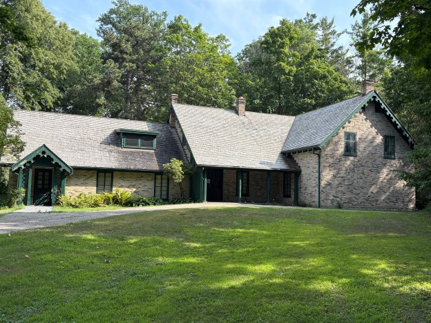
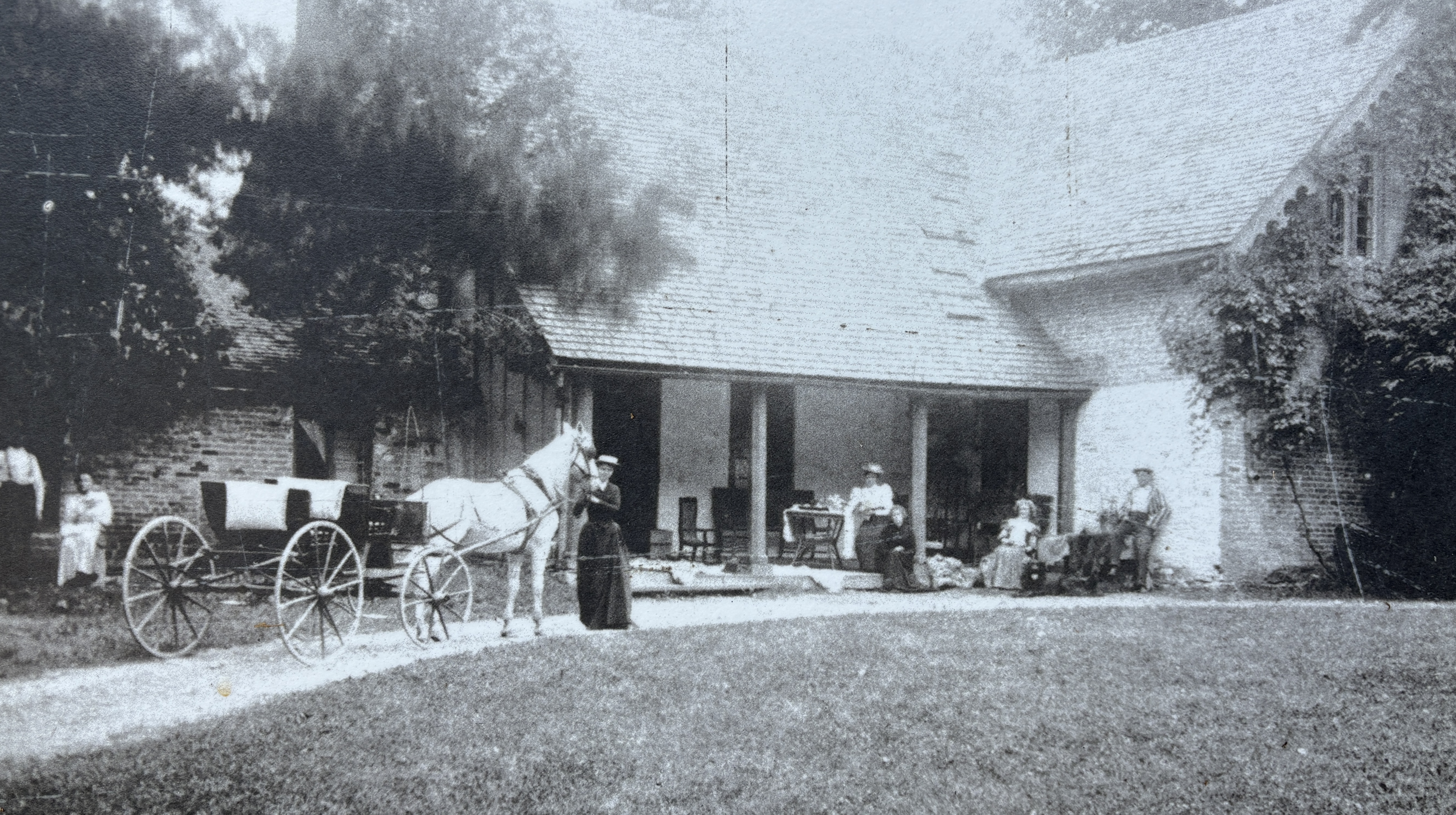
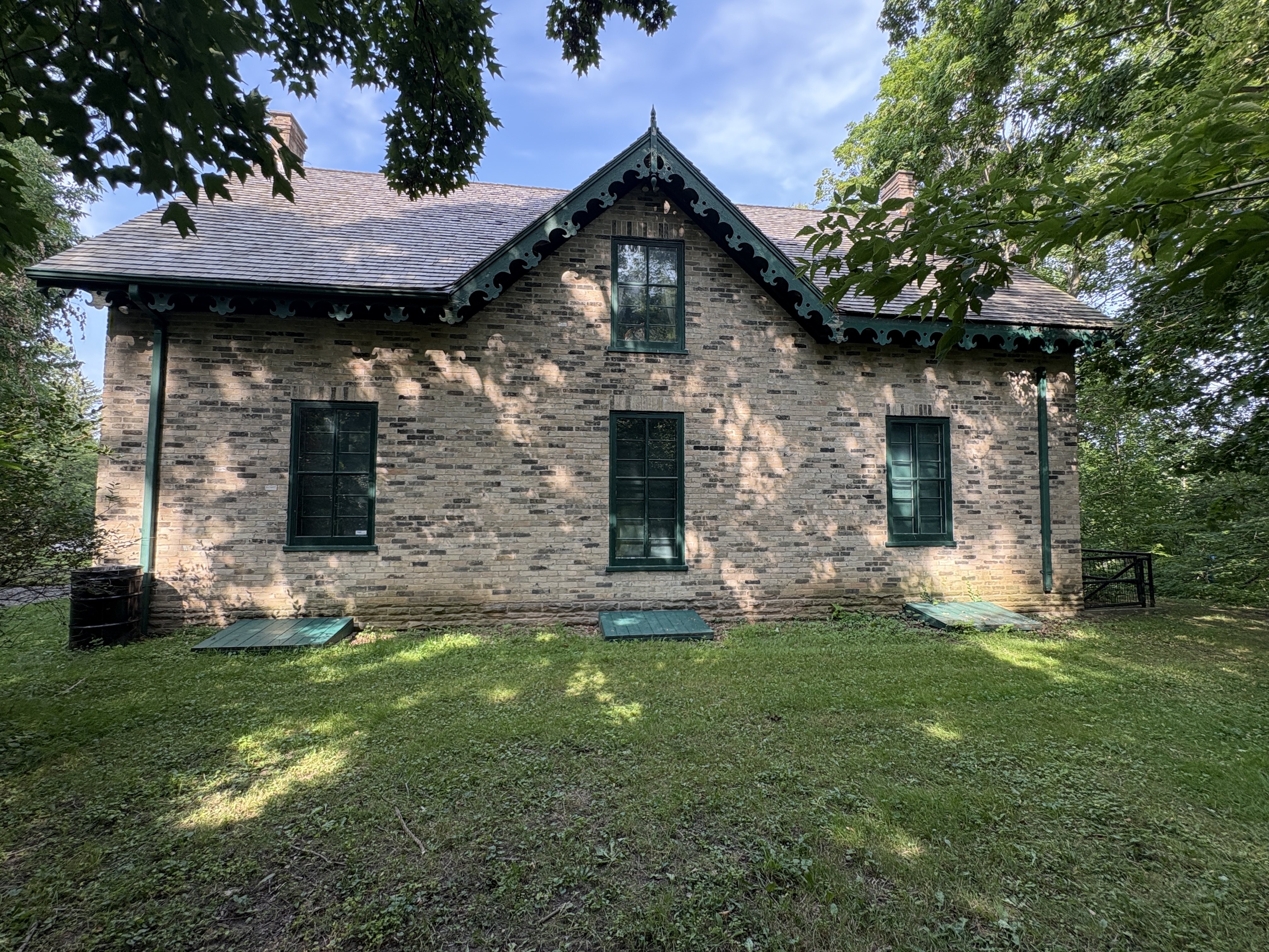
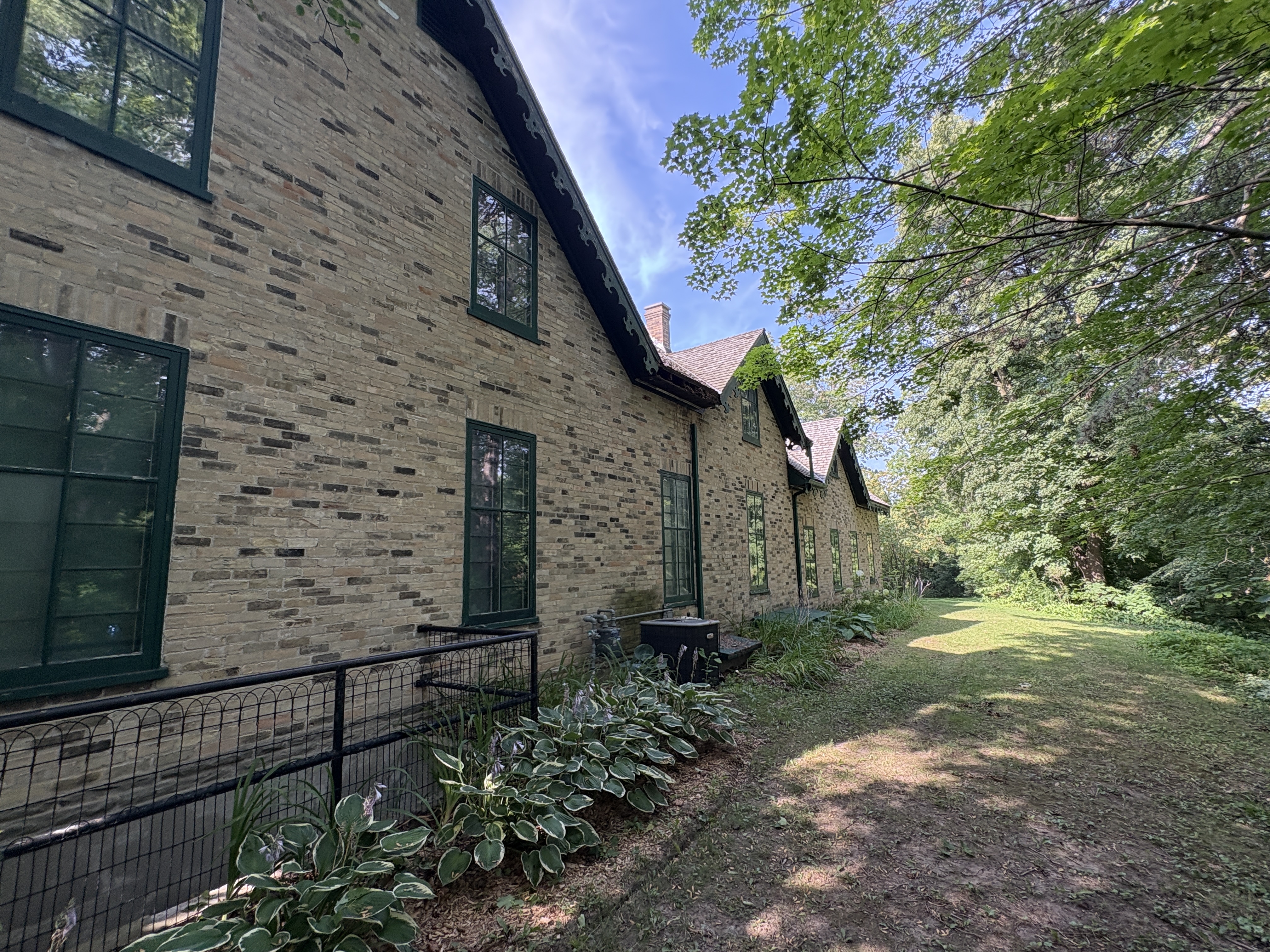
A former country estate has become surrounded by Kitchener/Waterloo but still retains its earlier charm. Now known as Woodside, the home was originally built in 1853 by James Colquhoun. When he passed away in 1877 the property underwent several tenants until it sat empty for several years. The image below shows the home in the Victorian Era.
Between 1886 and 1893 the house was occupied by the King Family. John and Isabel King lived here with their four children. Isabel, Janet, Dougall and William who enjoyed their childhood in this quiet setting. William would go on to become the tenth Prime Minister of Canada.
William Lyon Mackenzie King was the grand child of William Lyon Mackenzie who was instrumental in leading the Rebellion of 1837 in Upper Canada.
William became the leader of the Liberal Party in 1919 and held that position until 1948. He was elected Prime Minister in 1921 and held the position until 1926. Arthur Meighen was the Prime Minister for about three months between June 29, 1926 and Sept. 25, 1926. King would then take back over from then until Aug. 7, 1930. He would return again as Prime Minster from Oct. 23, 1935 until Nov. 15, 1948.
When the King family moved out the house went through several more tenants until it sat empty until the early 1940s when it was in danger of being demolished for a housing development.
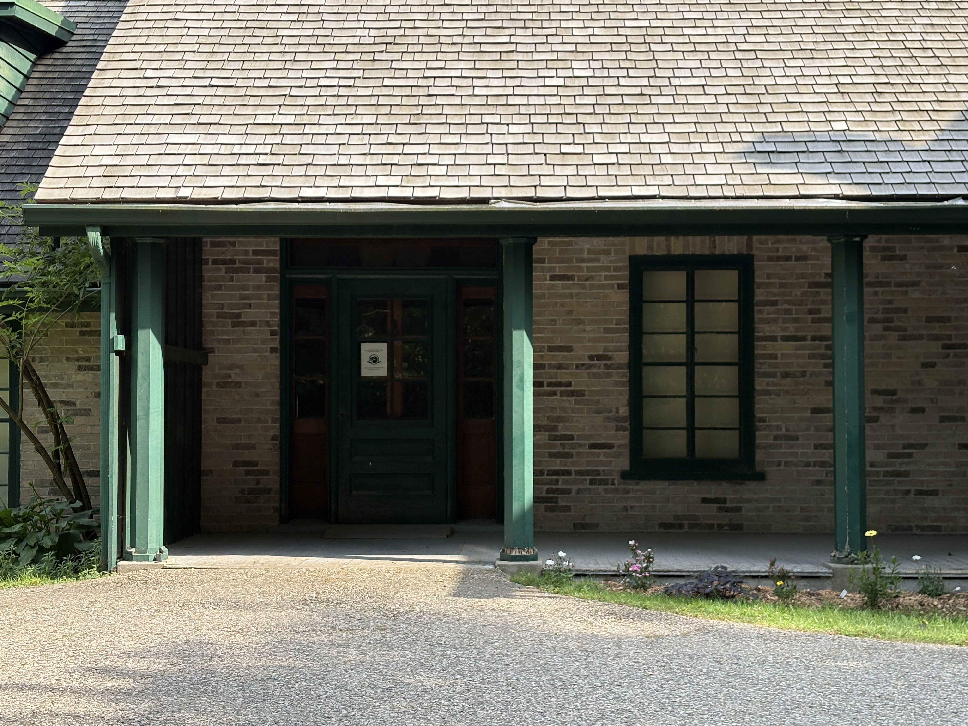
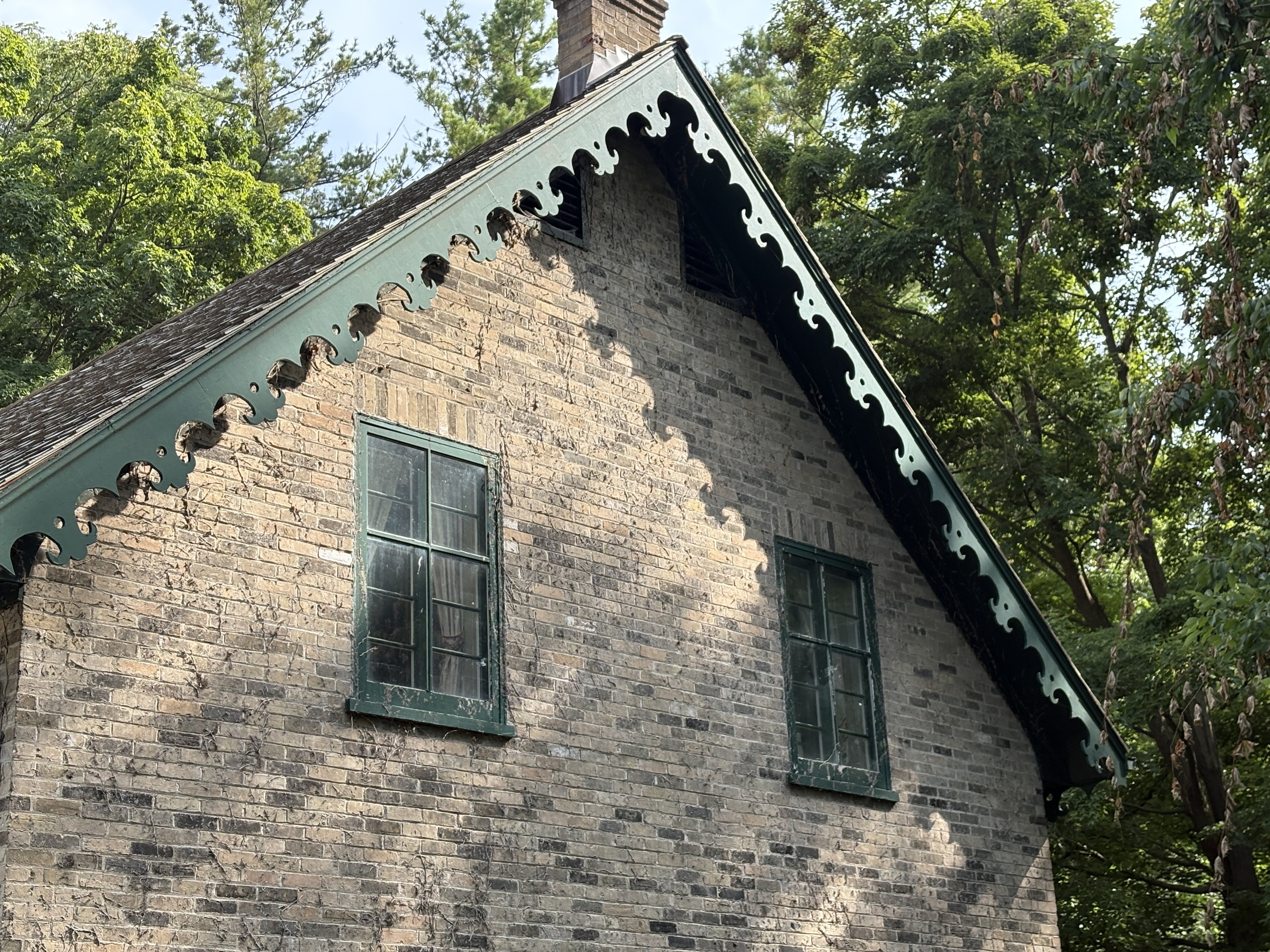
The home was reconstructed in 1942 using original materials and furnished to represent the 1890s when William Lyon Mackenzie King lived there. William and his family were consulted during the renovations to help with the authenticity of the decor. It was designated as a National Historic Site in 1952.
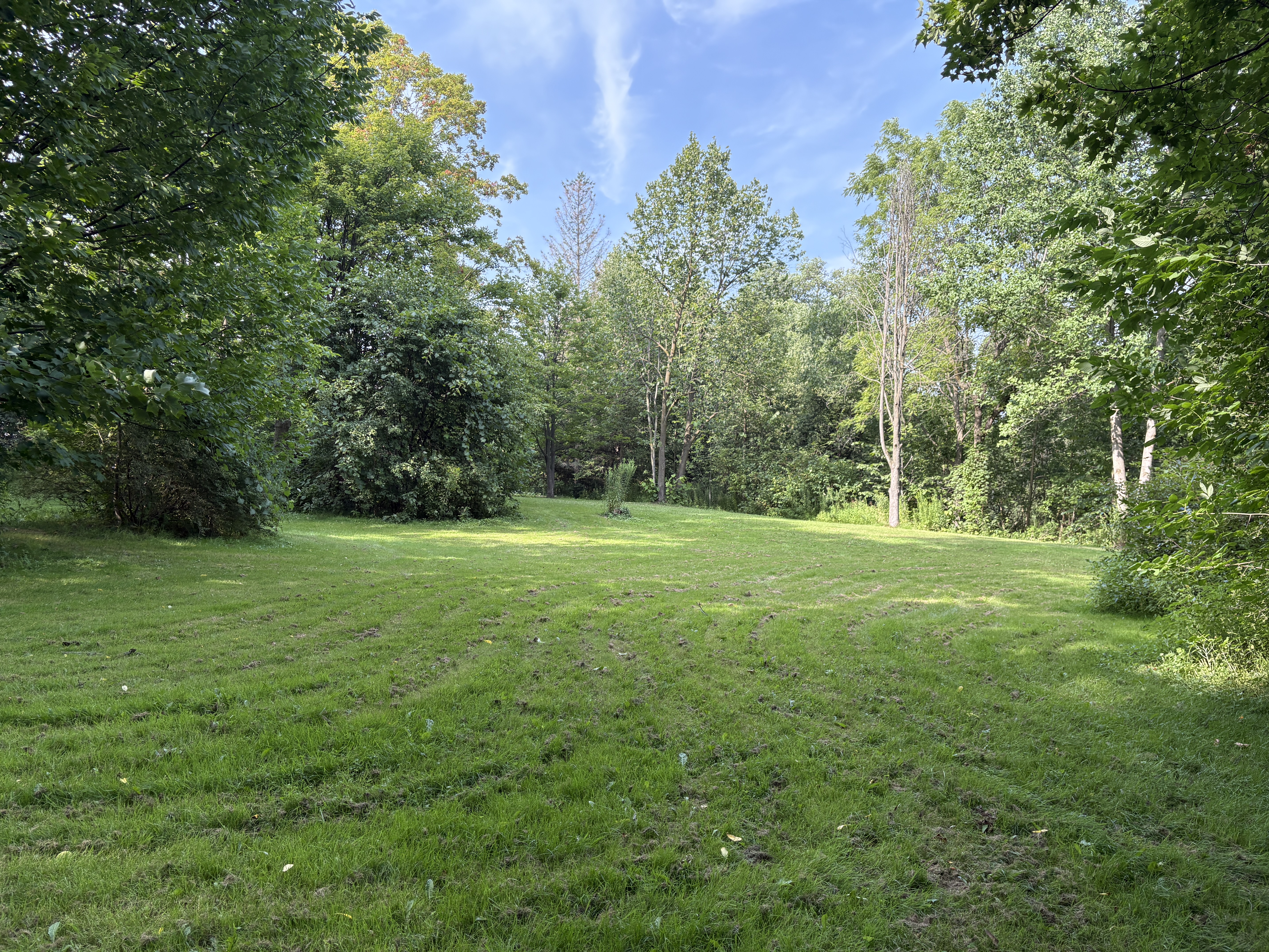
4.5 Hectares of property has been retained along with many of the original pathways and gardens. A lily pond and Tulip Tree have been retained behind the house as well as several acres of forests and lawns.
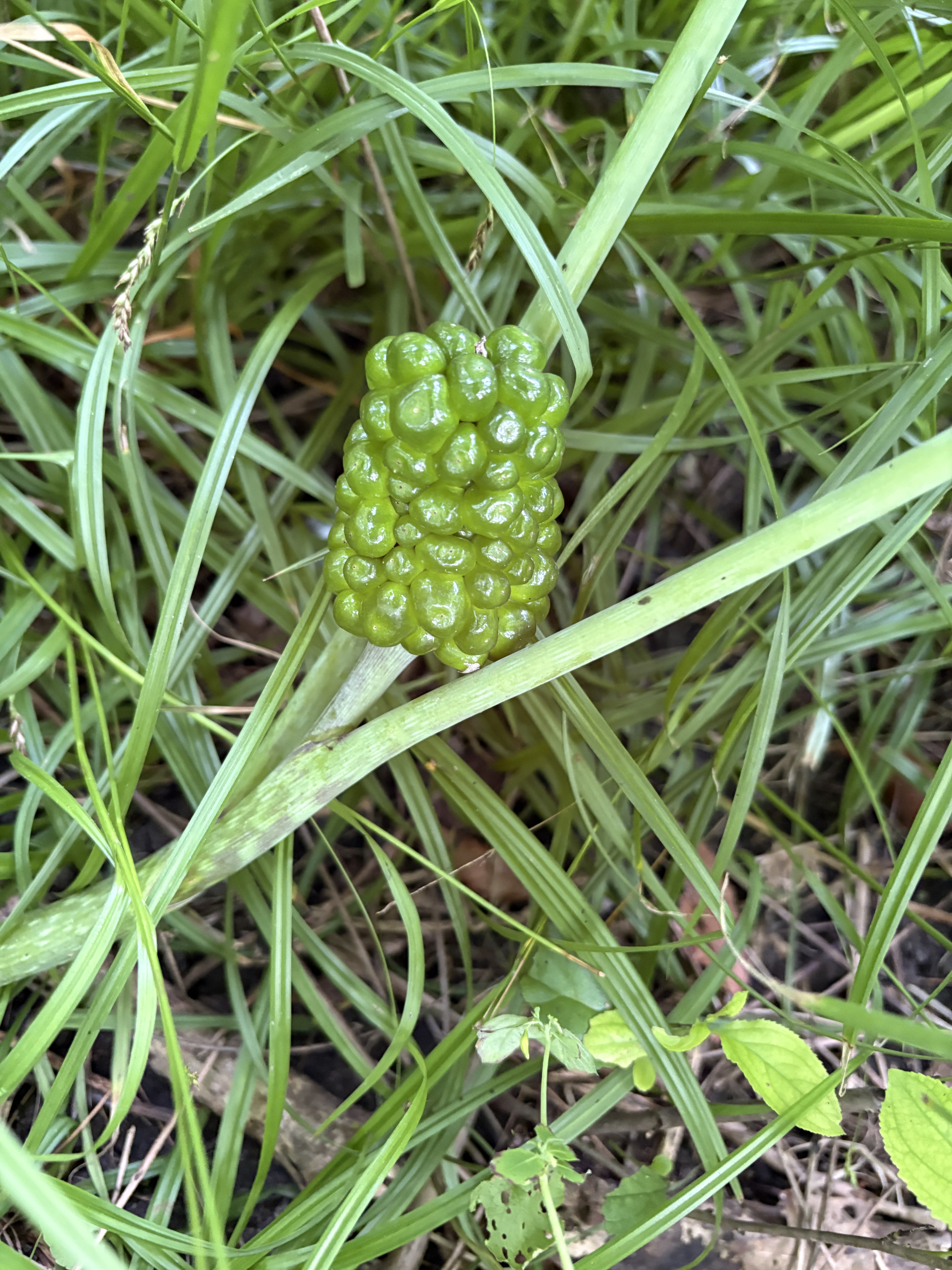
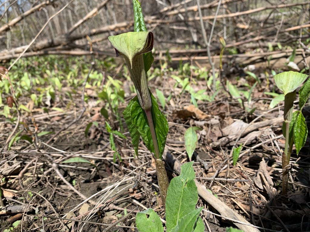
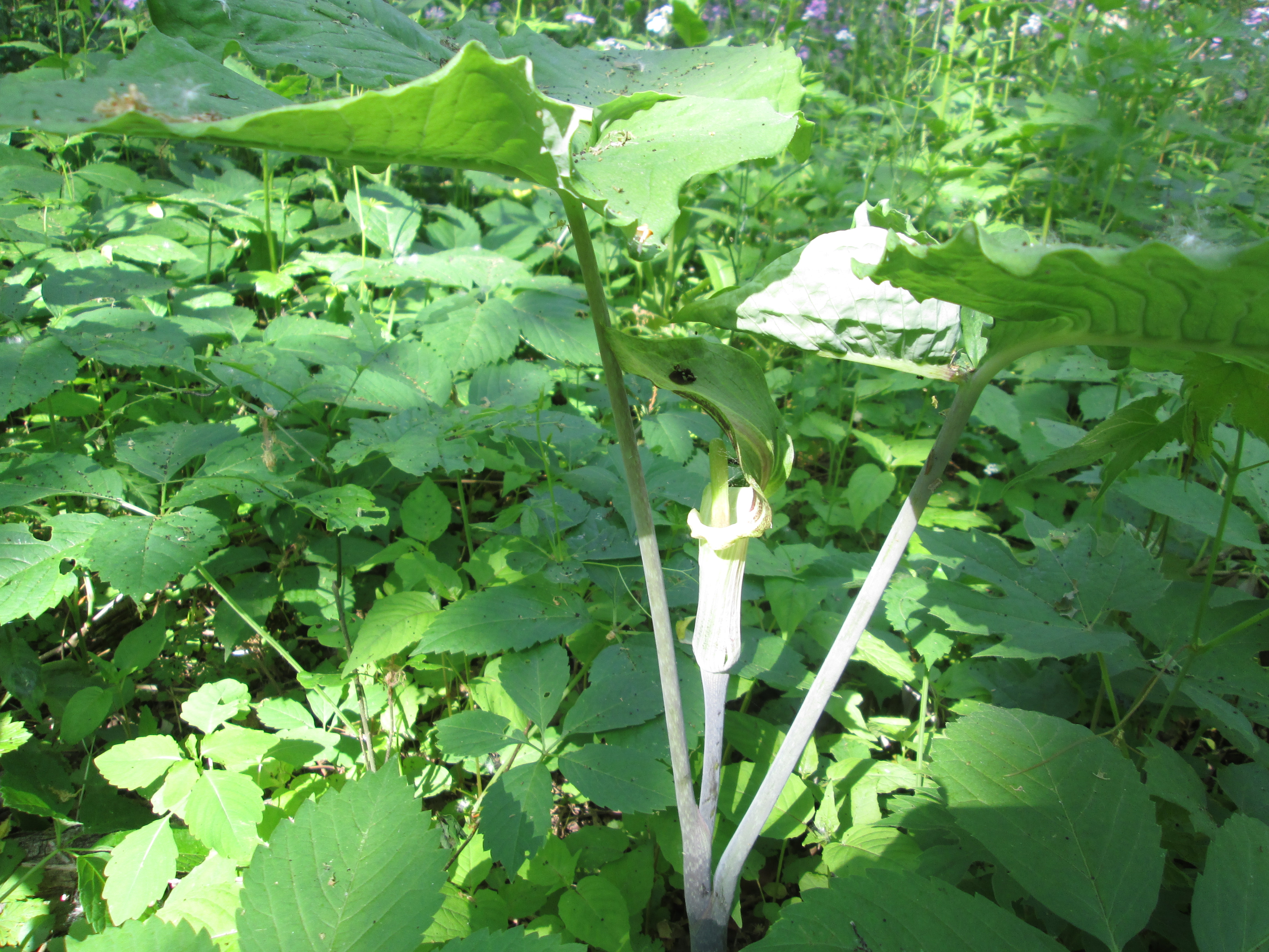
Jack In The Pulpit seeds come out in the summer after the plant is done flowering. These seeds will turn bright red in the fall and can be planted under a small amount of soil. Jack in The Pulpit can grow for 100 years from the same underground corm.
Like other National Parks in Canada, Woodside is free to visit this year.
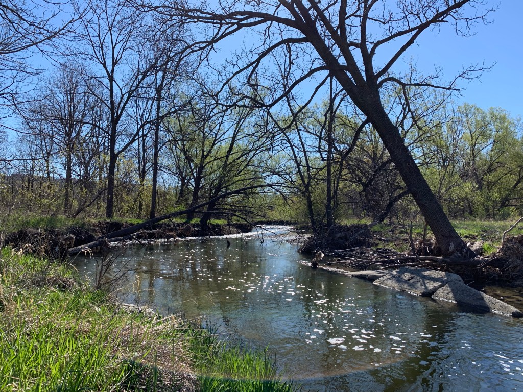
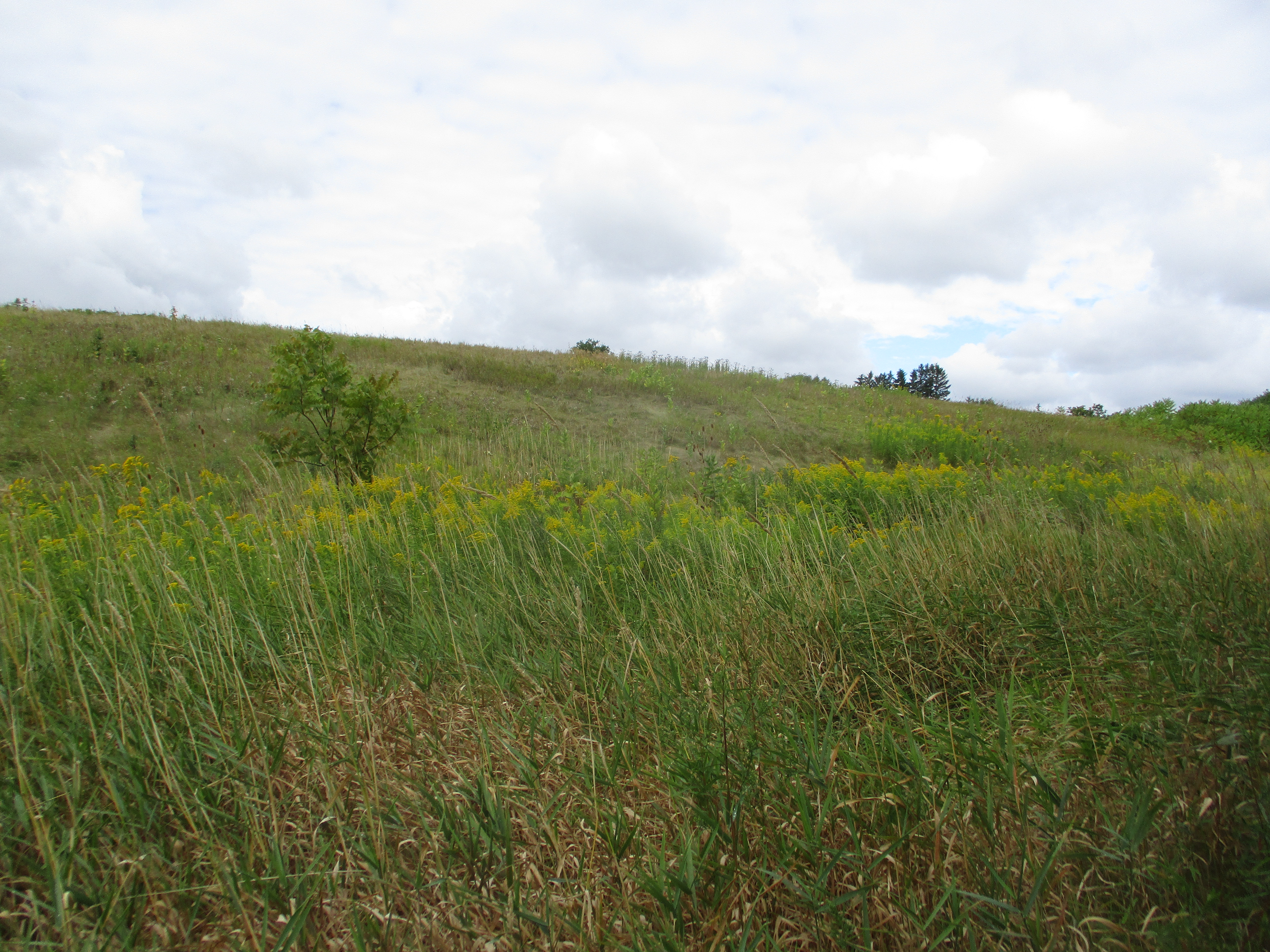
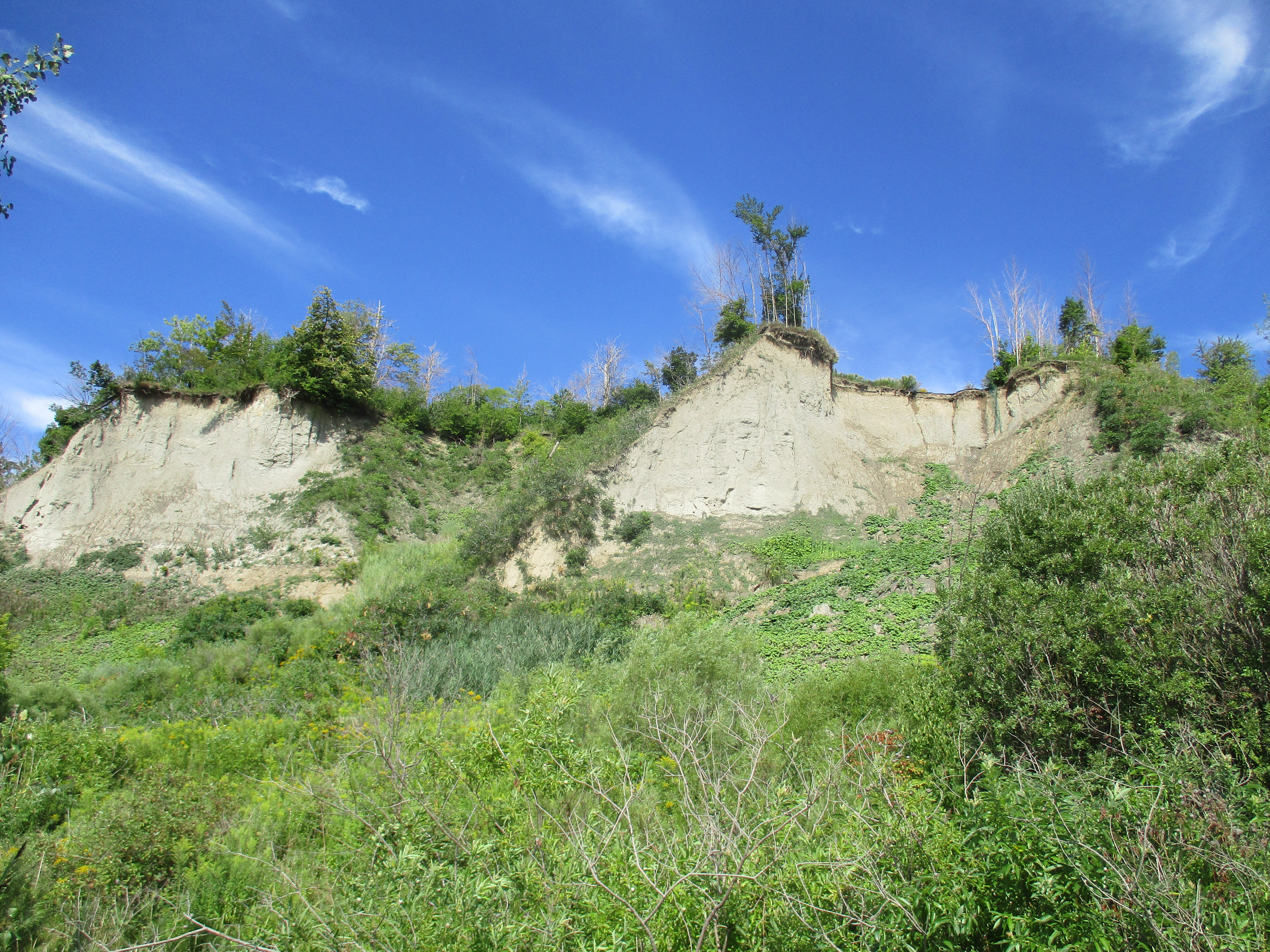
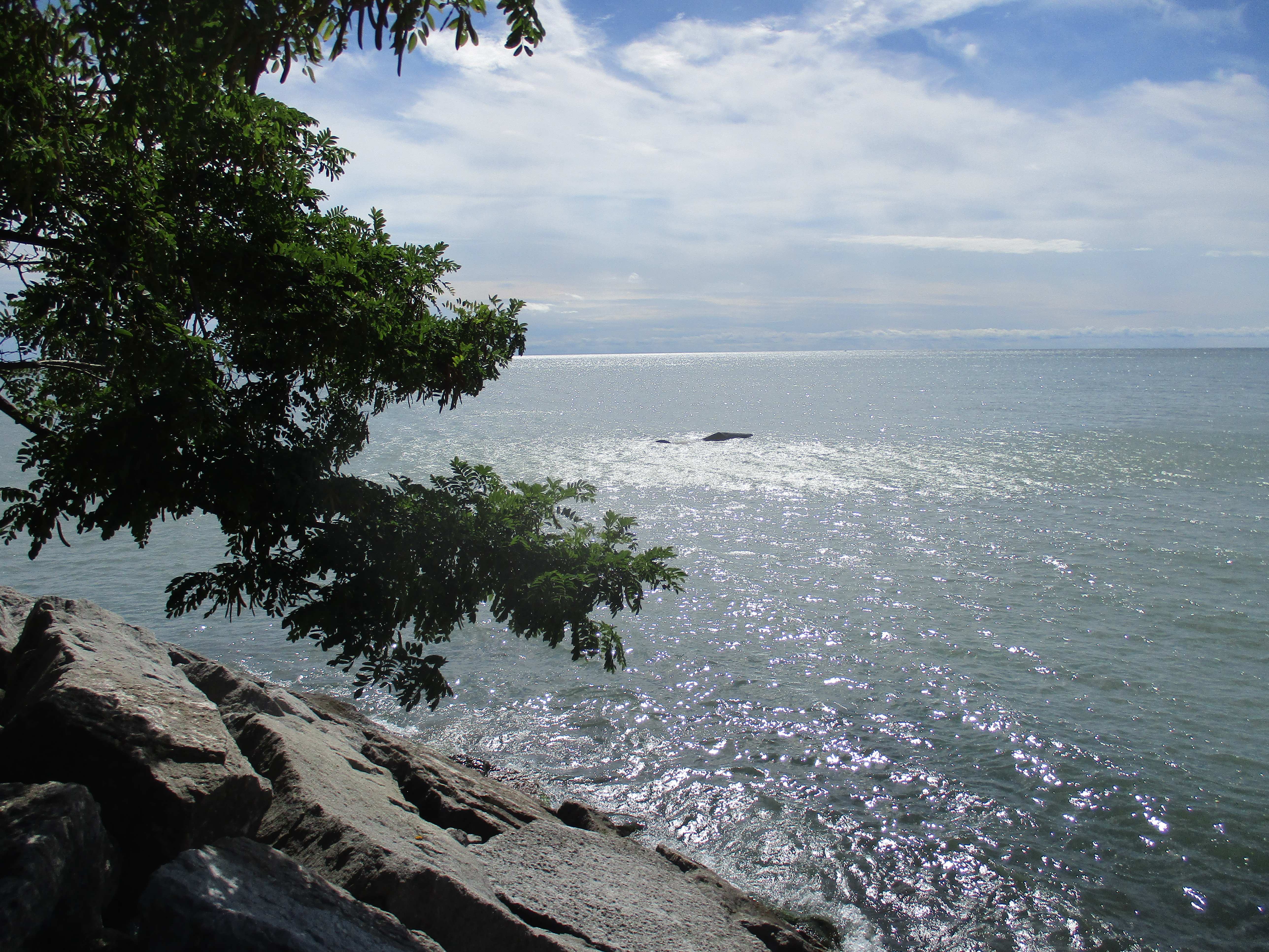
When the last ice age retreated about 12,000 years ago each of the rivers and streams that drain into Lake Ontario were swelled with meltwater. The Rouge River, Don River, Humber River and Credit River along with all the little creeks in between carved deep ravines. These are much wider than the modern rivers that flow through their valleys. After Hurricane Hazel in 1954 these ravines were transformed into conservation areas and parks. They have become greenbelts and migration corridors for the local wildlife. With ongoing travel restrictions it is important to remember that there is some good hiking with plenty of wildlife available right in our own part of the city. This post features a selection of the plants and animals we saw in a few hours on Saturday, May 1, 2021 along a section of Etobicoke Creek.
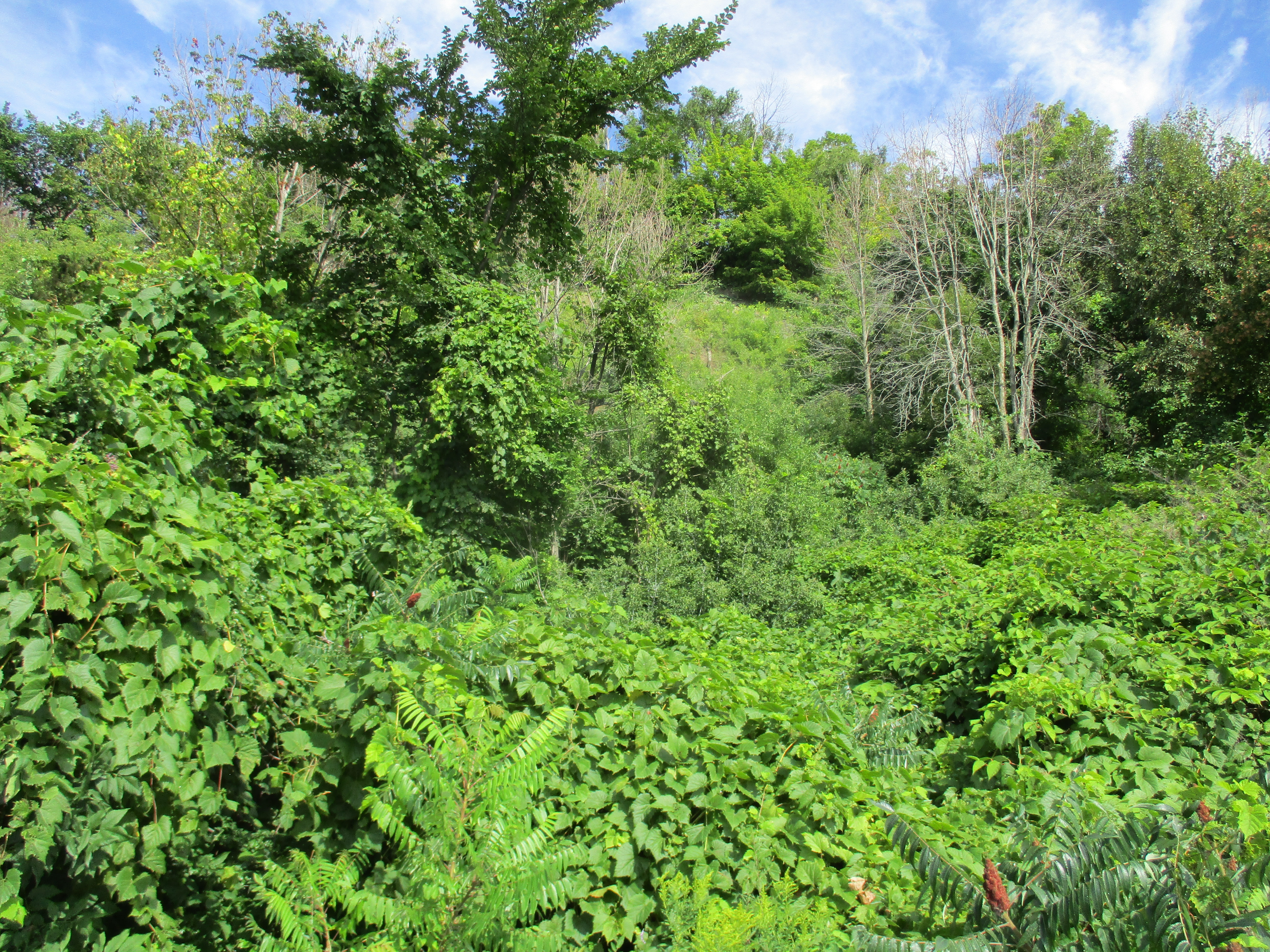
Most ravines will have more than one type of habitat and you should explore each one, slowly. Rivers and their banks will have a distinct group of plants and animals which they may share with local wetlands. Grasslands provide habitats to pollinators and small birds while new and old growth forests will each have their own distinct species. We customarily head for the water first, but move quietly or you might not see the heron, if there is one, until it’s in flight.
Mallard ducks and Canada Geese can be found almost anywhere there’s water. However, there’s lots of other types of waterfowl that you can watch for. The picture below shows a female (left) and male (right) Merganser. Their young will feed themselves a day or two after hatching and will be able to fly after about ten weeks.
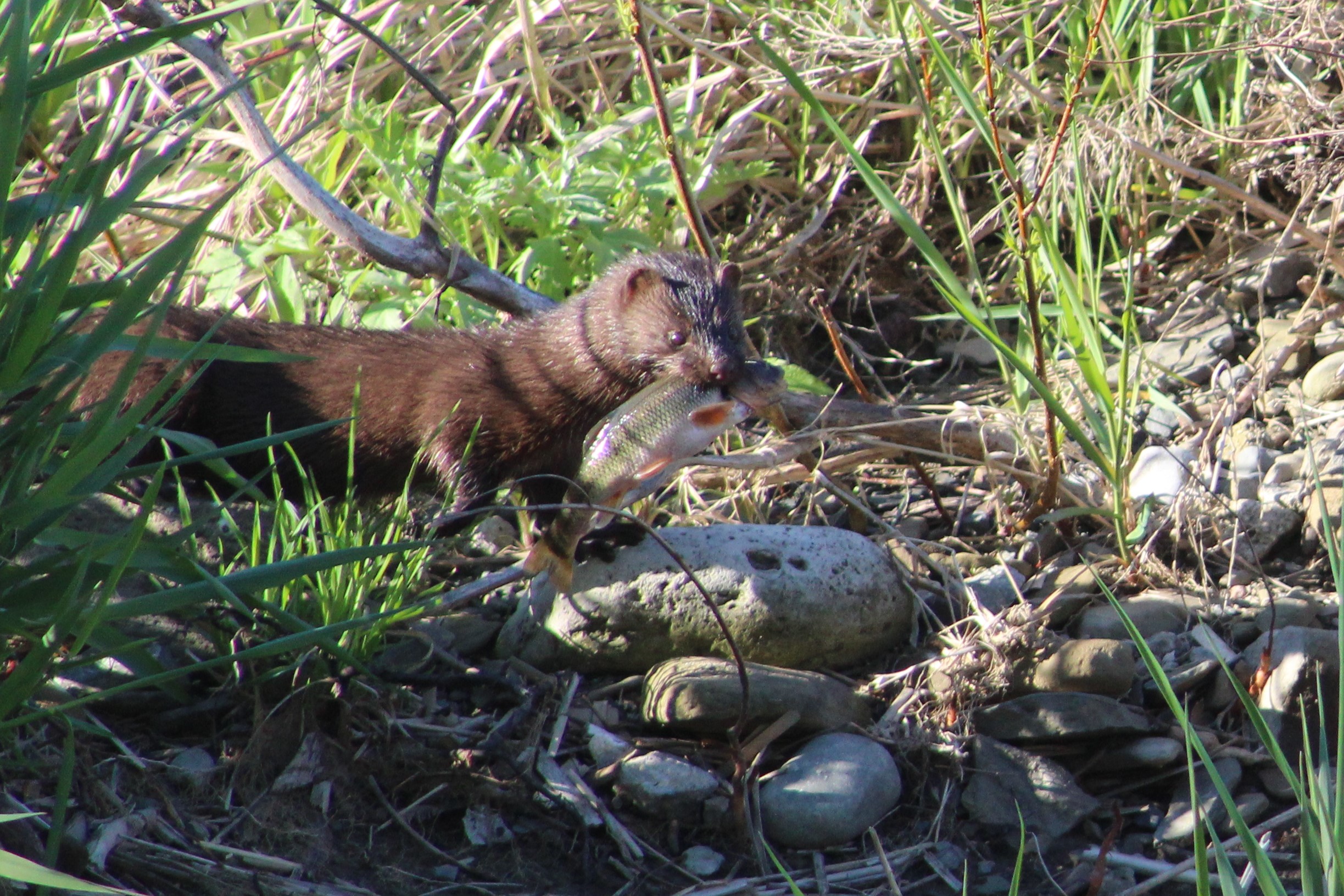
An American Mink came running along the opposite creek bank and down a fallen branch to quietly slip into the water. After a moment it emerged with a small fish in its mouth which it then carried away out of sight.
As we watched, the mink returned and went back into the same quiet pool behind some larger rocks. After coming up a couple of times to catch a breath it eventually came out with another fish, this one a little smaller. The mink kits will still have their eyes closed and won’t be weaned for a few weeks yet. As soon as their teeth start to come in their mother will feed them small bits of ripped up fish or mouse to get them started on solid food. The kits will eat every 90 minutes or so which means she will need extra food intake herself to be able to supply the milk they require.
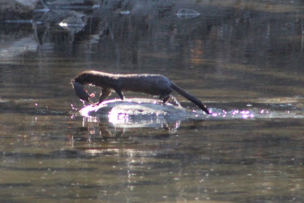
Last April 24th we witnessed a mother mink carrying her kits across Etobicoke Creek and into a den on the other side amongst the rocks. In all, we saw her carry four kits across the creek. The picture below was taken last year while she carried the first one. There’s lots more pictures of the other mink babies in our story Mink Kits.
As we were watching the mink fishing a small heron flew upstream and briefly rested in a tree before moving along. It landed in another tree a little farther upstream. It seemed likely that people using the trail would scare it and there was a reasonable chance it would come back our way, which it did. The Green Heron is smaller than other herons and has a short stalky neck that is usually drawn down toward the body. The green on their back and head is set off by the chestnut colour of their chest.
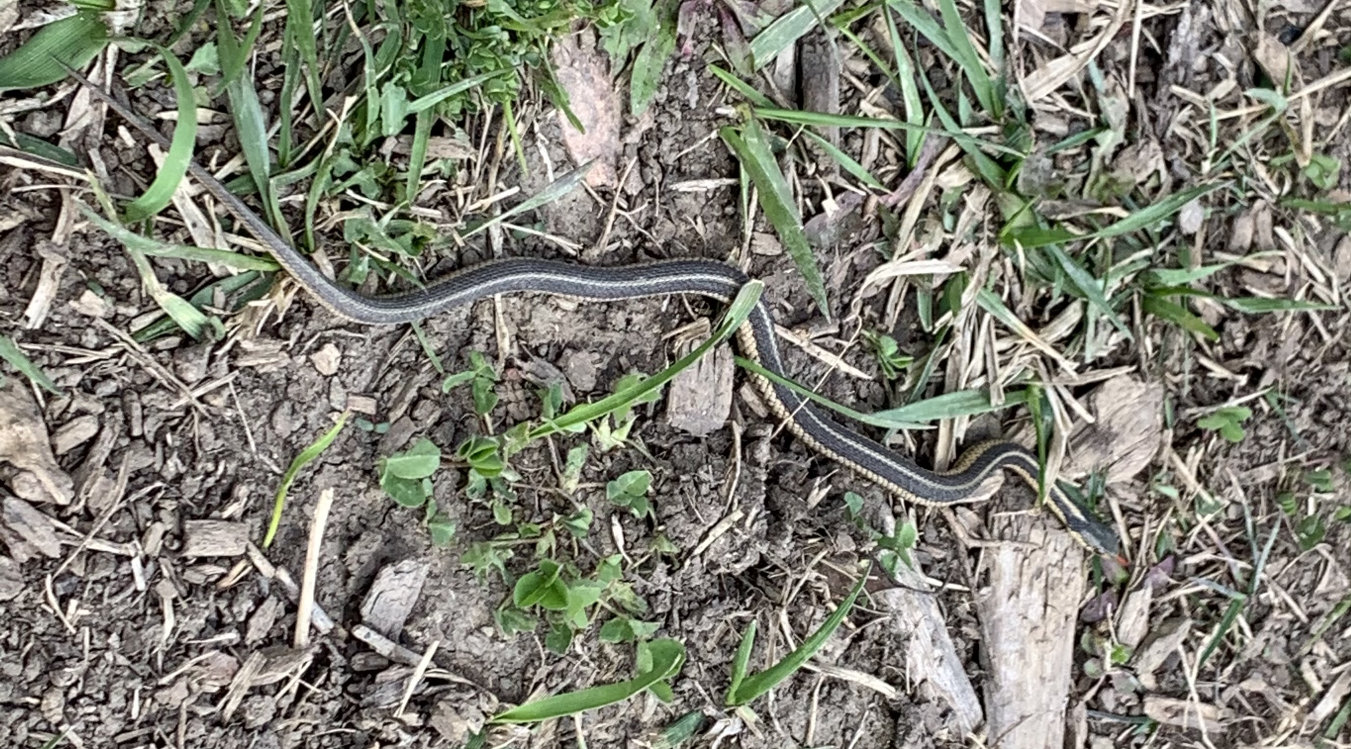
The grasslands, especially tall grass prairie areas support a wide variety of flowering plants and grasses which attract birds and pollinators. On a sunny day you might see one of several, harmless species of snakes taking advantage of the sun to regulate their body temperature. Garter Snakes give birth to a litter of 20-30 live young in the late summer. This little one was likely born last year and will have a life expectancy of two years in the wild. Garter Snakes are sometimes kept as pets and average ten year life spans in captivity.
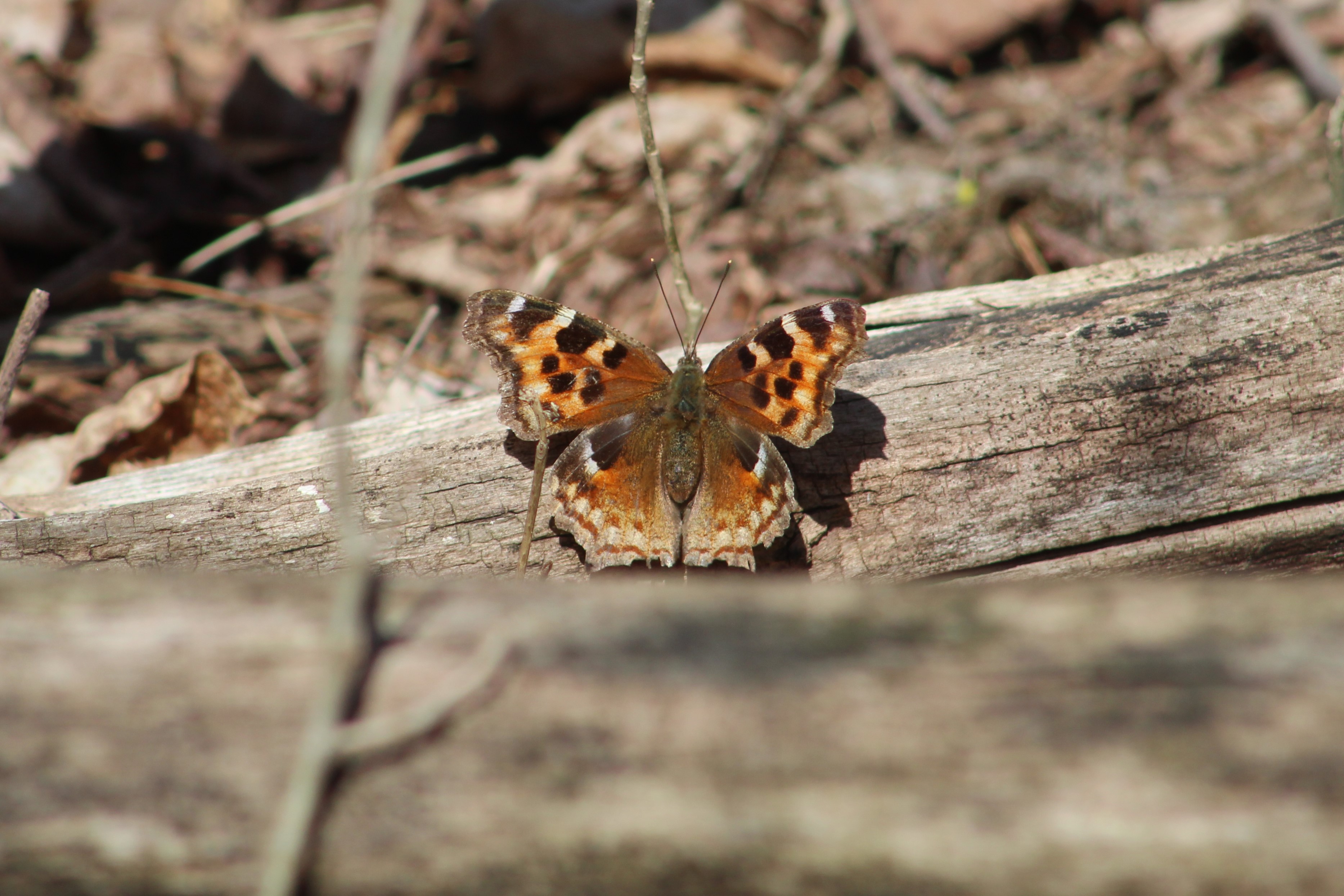
Butterflies and moths can be spotted on most days. The picture below shows a Compton Tortoiseshell butterfly which finally rested long enough for a photo op.
Eastern Cottontail Rabbits were not known in Southern Ontario until about 1860. Rabbits never stray far from a hedgerow, woodpile or burrow where they can escape their many predators. This is known as edge habitat and prior to the settlers cutting the forests there weren’t any of these places where fields gave way to shrubs. Their slow migration north didn’t bring them to the Ottawa area until as recently as 1931. They molt twice per year and this one is in the middle of its spring molting.
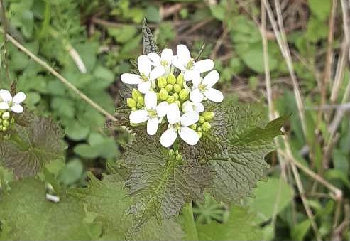
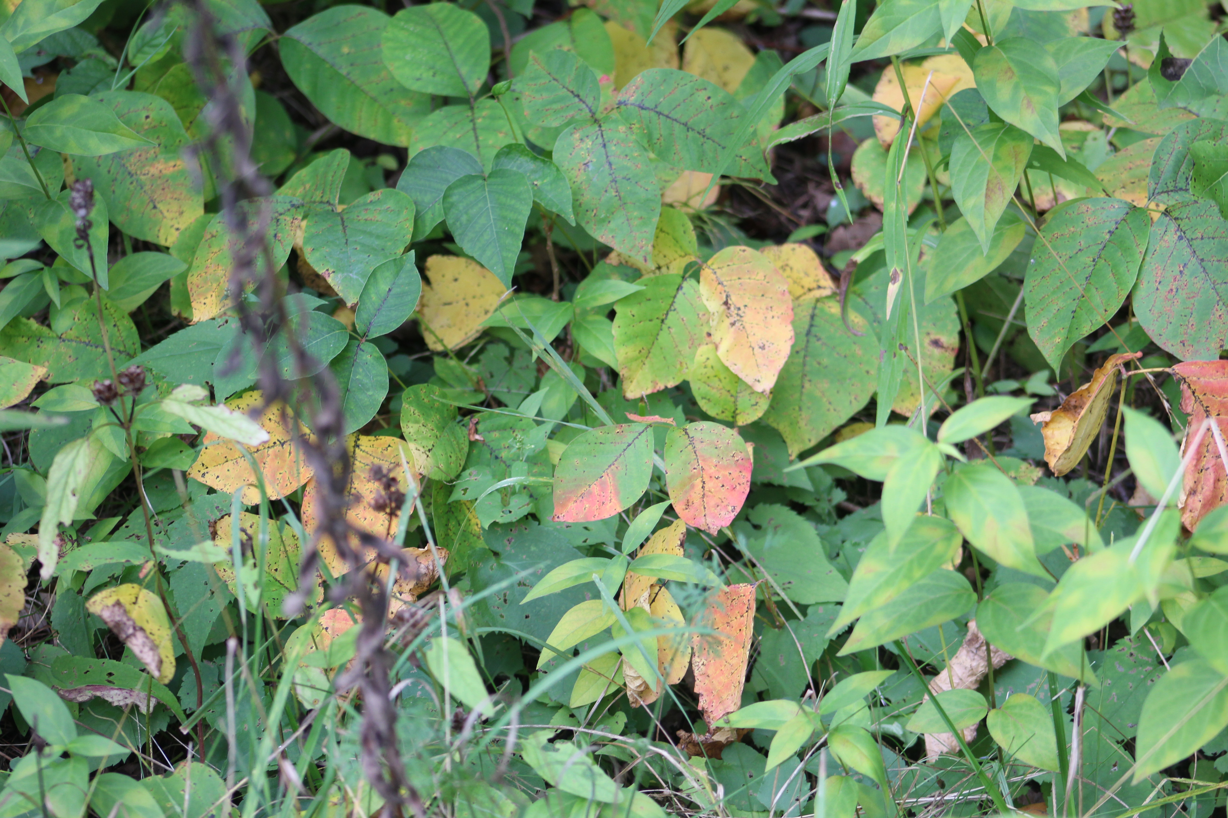
Not everything you see in your ravine belongs there. Unfortunately invasive species have taken over some areas of our parks and ravines. They grow quickly and overtake the natural species and eventually choke them out. Dog-strangling Vines are a key example of an invasive species as they routinely choke out the milkweed our Monarch Butterflies need. Garlic Mustard, pictured below, is another invader which is doing overly well. Once it gets going, Garlic Mustard will choke out the Trilliums and Trout Lilies (Dog’s-toothed Violet).
The Mayapples are just starting to form the bud that will open into the flower. Plants with a single leaf won’t flower but the colony along this stretch of the creek is almost all female. They have a pair of leaves and a flower bud forming in between. This particular patch appeared to be mostly flowering this year. These plants grow in patches from a single rhizome and will be found in the same location year after year.
Violets are a large family of plants that have over 525 species. This time of the year they form a purple or blue carpet on the forest floor. Many violets are perennials which means that the plant will live for more than one year.
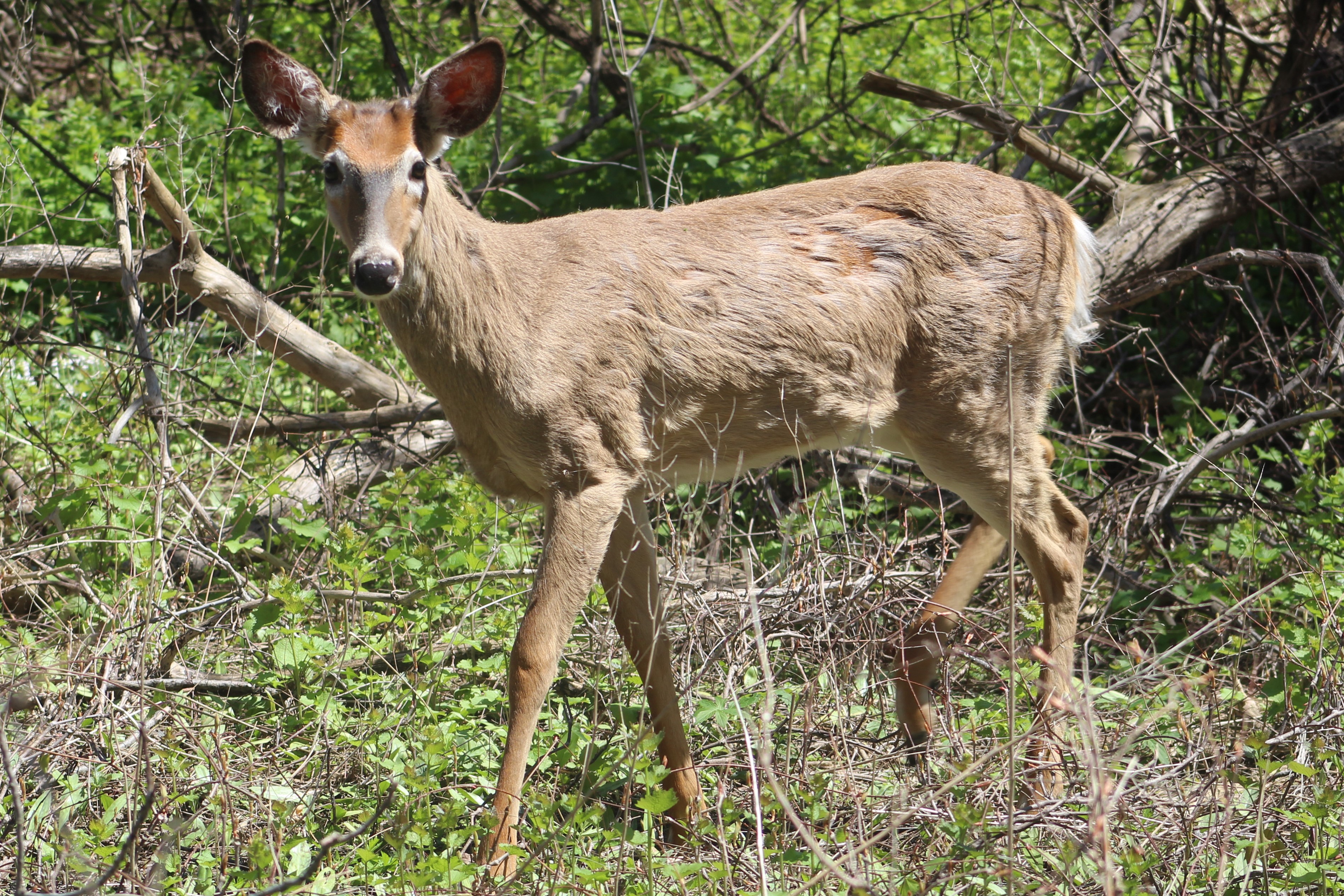
Experience has shown that almost every ravine in the GTA has both coyote and deer. The Etobicoke Creek is no exception. Although the local coyote didn’t make an appearance on this Saturday, the deer showed up in force. While walking a side trail a flash of white in the trees betrayed the presence of a White-tailed Deer. Upon closer examination a small herd of five was detected. Three of them went off along the ridge while the other two continued to browse. The pair are shown in the cover photo and the smaller of the two was very curious. It walked to within a few metres of where we were sitting as it casually munched leaves and grasses.
July 27, 2020 while taking an observation break, a fawn walked right up to us and pretty much said “Hello.” Its mother was nearby and called it back when she thought it was getting a little too curious. From the way the deer approached today, it was almost as if it was the same one with its mother and that it recognized a friendly acquaintance.
This male Hairy Woodpecker is in the process of digging some little snack out of a dead tree. The term “snag” applies to a standing dead tree and they make up an important part of the local ecosystem. They provide unobscured views for raptors such as the pair of hawks we saw circling high above at one point. Snags also provide homes for wood and bark boring beetles and their larvae. This is what attracts the woodpeckers and serves as a source of food for them. Small animals will nest in hollow snags and they’ll continue to serve as housing even after they fall.
Once you know where to look for Jack-in-the-pulpit you should be able to go back every spring and see the same plants. This is because they can grow from the same underground corm for up to 100 years. It’s quite possible that this little plant in the picture below will outlive everyone reading this article today.
This is just a sample of the types of things you can expect to see in almost any ravine, watercourse, or major park in the GTA. So, the question is, “What’s in your local ravine and when are you going exploring?”
The community of German Mills didn’t last very long and there is only one building left standing. We decided to investigate the area which has now become a park and we found free parking on the end of Leslie Street where it has been closed north of Steeles Avenue.
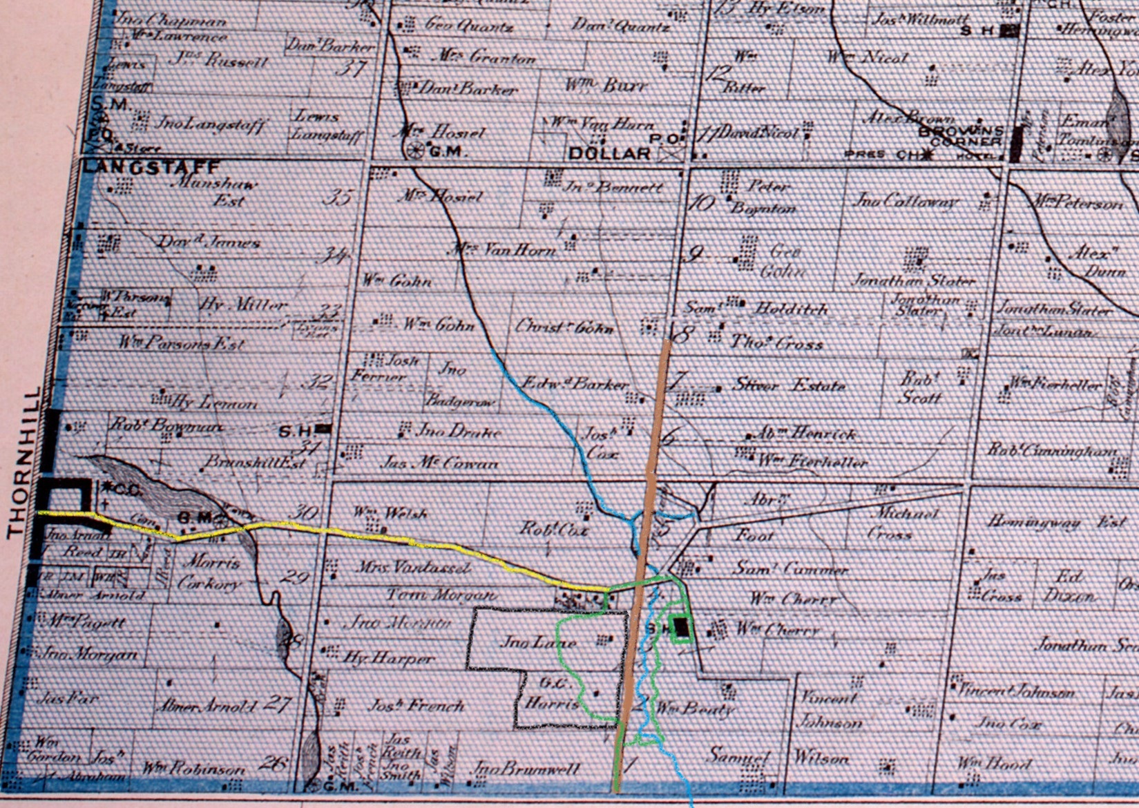
The county atlas was drawn in 1877 and by that time there was no longer a community named German Mills. The school was replaced in 1874 with a new building on German Mills Street but it is the last remaining structure from this early settlement. On the map below Leslie Street is brown while John Street, a given road, is yellow. German Mills Creek is in blue while our hike is roughly outlined in green.
Jack in the pulpit grow for up to 100 years from their corm, a type of root similar to a small turnip, although basically inedible. They spread through seeds that are grown inside their berries. The berries will turn from green to red when the seeds are ready. The berries can be harvested and the seeds gently squeezed out. There will usually be 4 to 6 seeds in each berry. These can be planted about 1/2 inch deep in the fall.
German Mills was settled in 1794, the year following the founding of York (Toronto) by a group of German families. They not only established the first industrial complex in Markham but set an early example of the development of Canada through a multicultural approach. The settlement didn’t last long because the water supply was inadequate to power their mills. The picture below shows a sketch of the settlement that can be found on an interpretive plaque along the trail.
The main paved trail crosses German Mills Creek but we chose to follow the old road allowance for Leslie Street. German Mills Creek appears to have a few minnows in it but not much else. The creek runs for about 10 kilometres before emptying into the East Don River in the East Don Parklands.
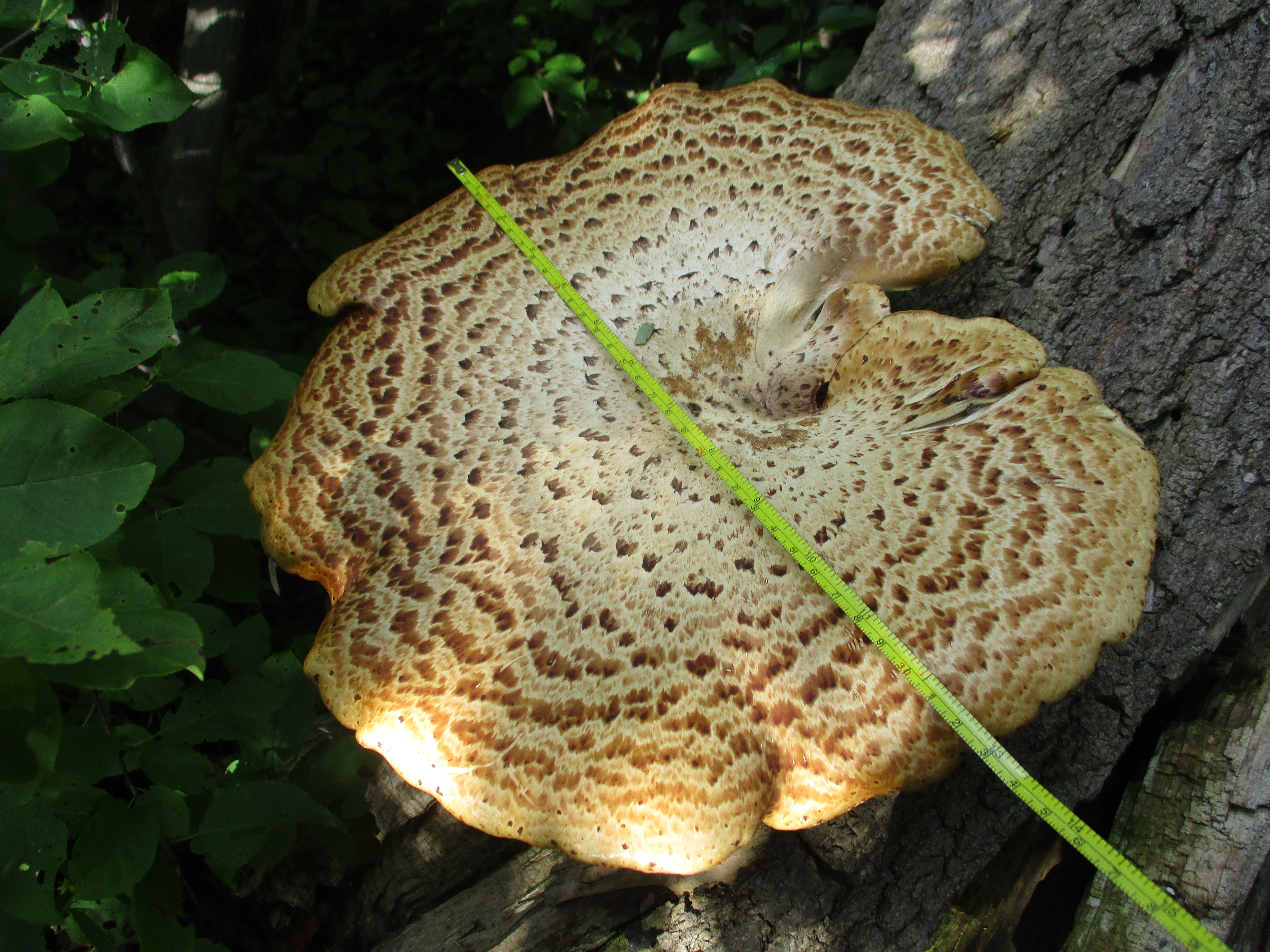
Pheasant’s-back Polypore is also known as Dryad’s Saddle and is one of the larger polypore mushrooms found in Ontario. The caps can reach 12 inches or more with the example seen below coming in at nearly 13 inches. Although this mushroom is edible it is also rather tough and rubbery. The outer edges are sometimes pickled or fried and are reported to taste like watermelon rind. They are common from May until November and they seem to have been quite prolific this year with some trees having had several crops growing on them already.
On the county atlas above the lots belonging to John Lane and G. C. Harris have been outlined in black. A large portion of each of these lots was used for gravel extraction between 1940 and 1960. When the aggregate supply was exhausted the empty pit was converted into the Sabiston Landfill. From 1960 to 1975 the landfill operated with no records of what types of materials were dumped there and in which sections. The site continues to produce methane gas that is released into the air and leachate which enters the groundwater. Today there is a one metre clay cap over the landfill and the area has been designated as the German Mills Meadow and Natural Habitat.
The mound that represents the former landfill is now monitored for discharges. A decade ago the Town of Markham was considering installing an aerobic system to help speed up the elimination of methane and leachate from the site. Local residents protested the plan based on the fact that methane was below the 2.5% level that the Ministry of the Environment sets as safe. The community succeeded in 2012 in getting the plan halted by arguing
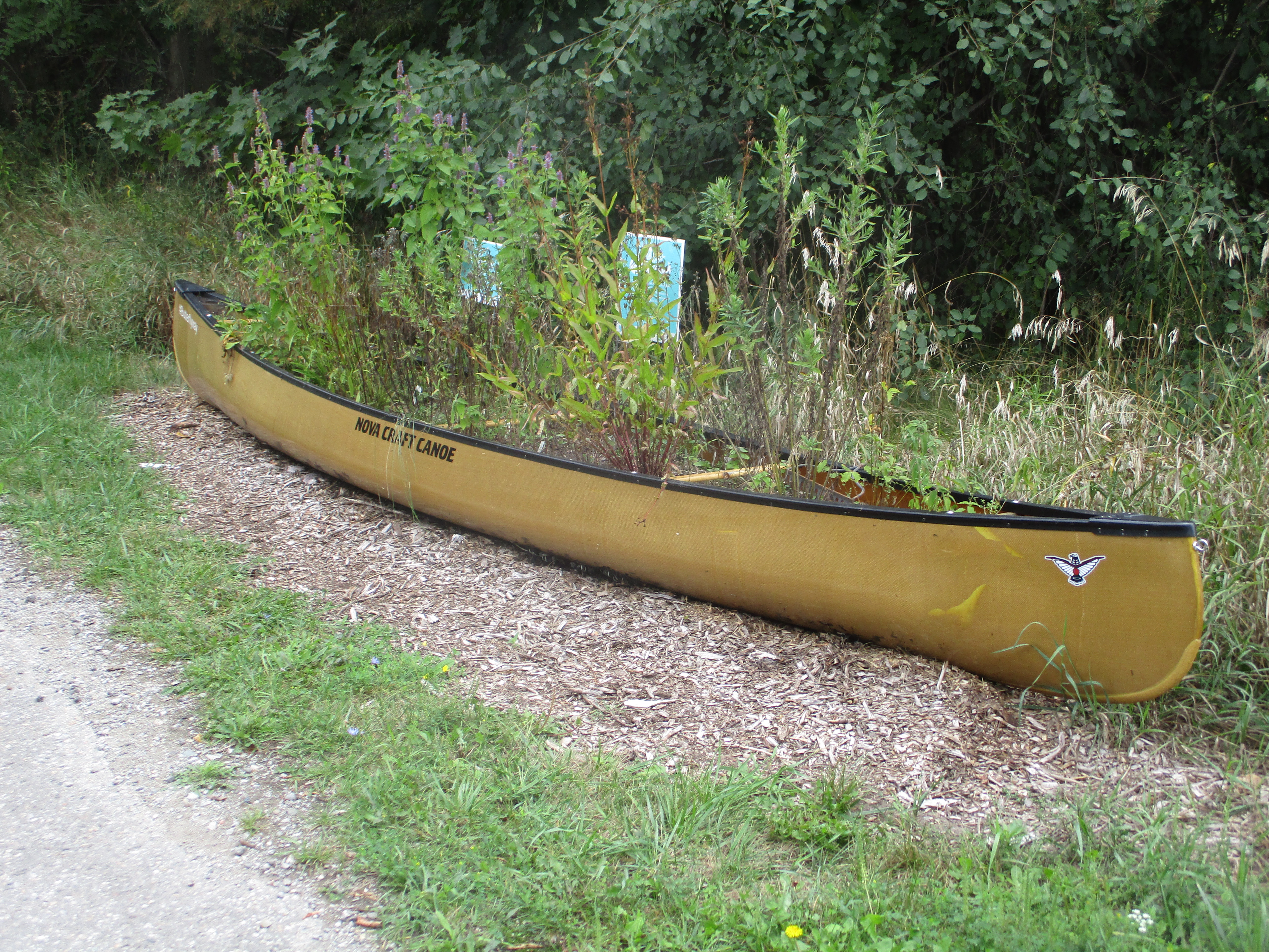
We found another one of these old canoes which has been planted to help encourage pollinators to do their thing.
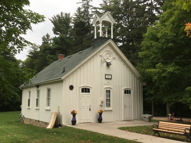
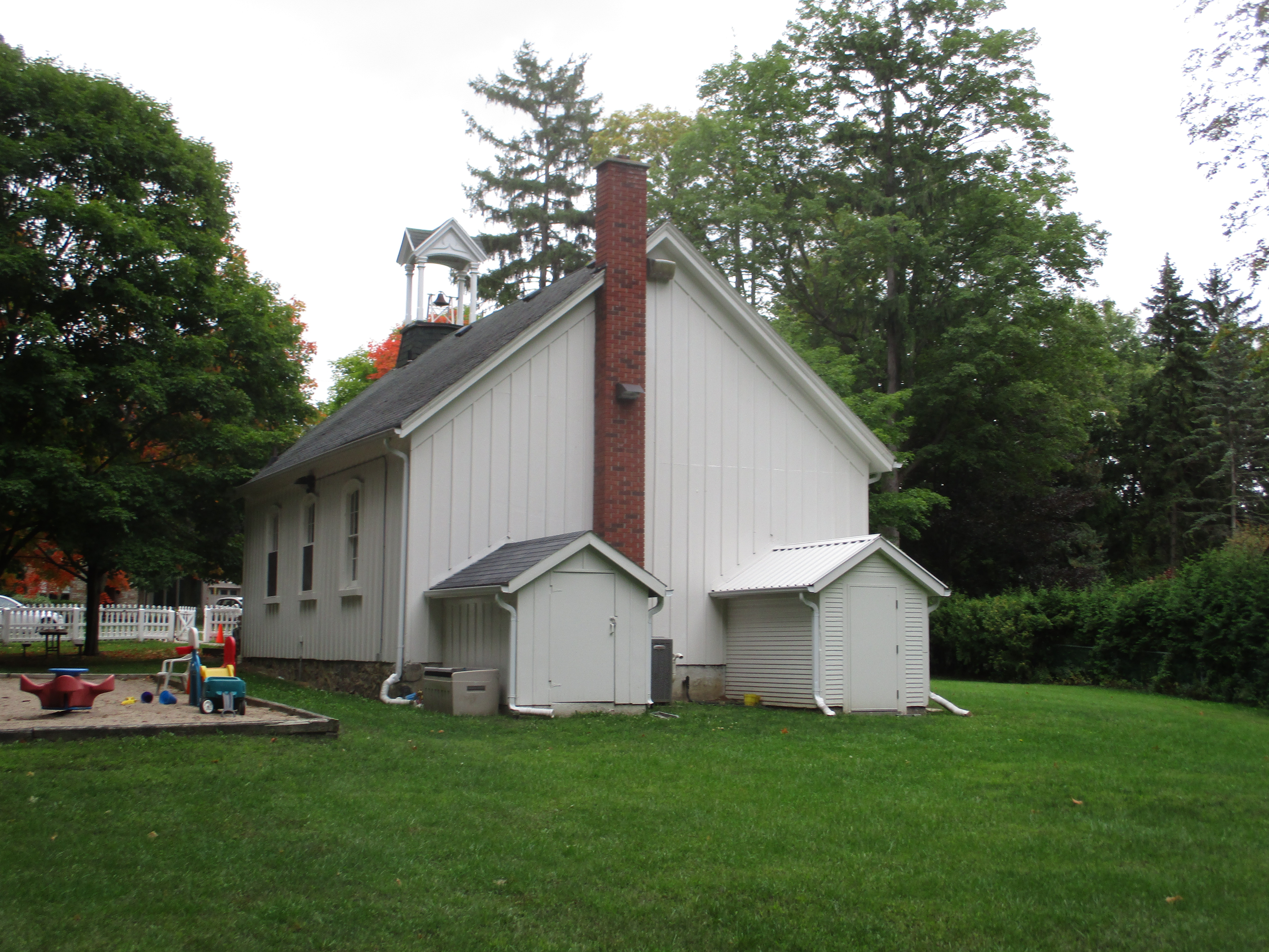
The community of German Mills constructed a one room log school to serve the children of the community. In 1874 it was decided to replace the school with a larger board and batten structure. The school was built with separate entrances for the boys and girls as was common in the Victorian Era. One of the interesting features of the architecture is the way the batten curve into scallops under the boxed cornice of the roof.
Originally known as school section number 2 there were over thirty different teachers who served here between 1874 and 1962 when it closed. The original bell still hangs in the bell tower.
One of the notable teachers from the school was Leonard S Klink who taught here in the 1890’s. He was responsible for getting the students to plant rows of spruce trees around the sides of the property. These trees continue to mark the outline of the school yard. Klink went on to serve as the President of The University of British Columbia from 1919-1944.
Poison ivy seems to have had a good year and there is plenty of it in German Mills Settlers Park. The sap contains a substance known as urushiol that usually causes a reaction within 24-48 hours. Controlling poison ivy by burning it can be very dangerous because inhalation of the smoke can cause the rash to develop on the inside of the lungs. This can be very painful and possibly fatal.
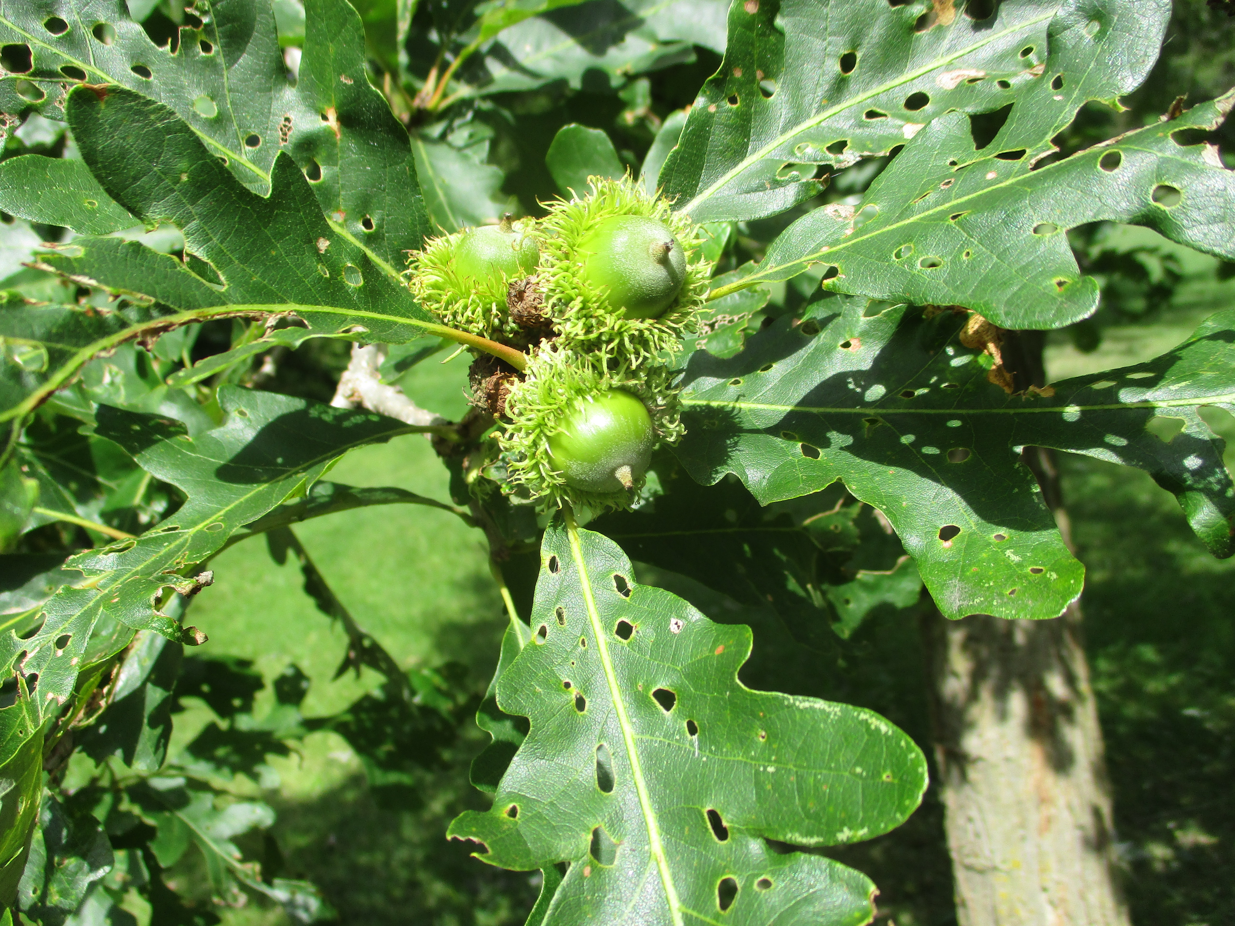
Bur Oak is a member of the group of white oaks and is also known as mossy cup oak. The tree typically reaches 30 metres tall but has been known to be as large as 50 metres. Like most oak trees they grow slowly but can live for up to 400 years. The acorns are also large growing up to 5 cm in size. These trees produce a heavy crop of acorns every few years in a process known as masting. This bumper crop overwhelms the ability of the local wildlife to consume the acorns and ensures the survival of some seeds.
German Mills Settlers Park is about to undergo construction work to prevent erosion from damaging the sewer pipe that runs along the length of the creek. This will change the natural look of the creek for several years.
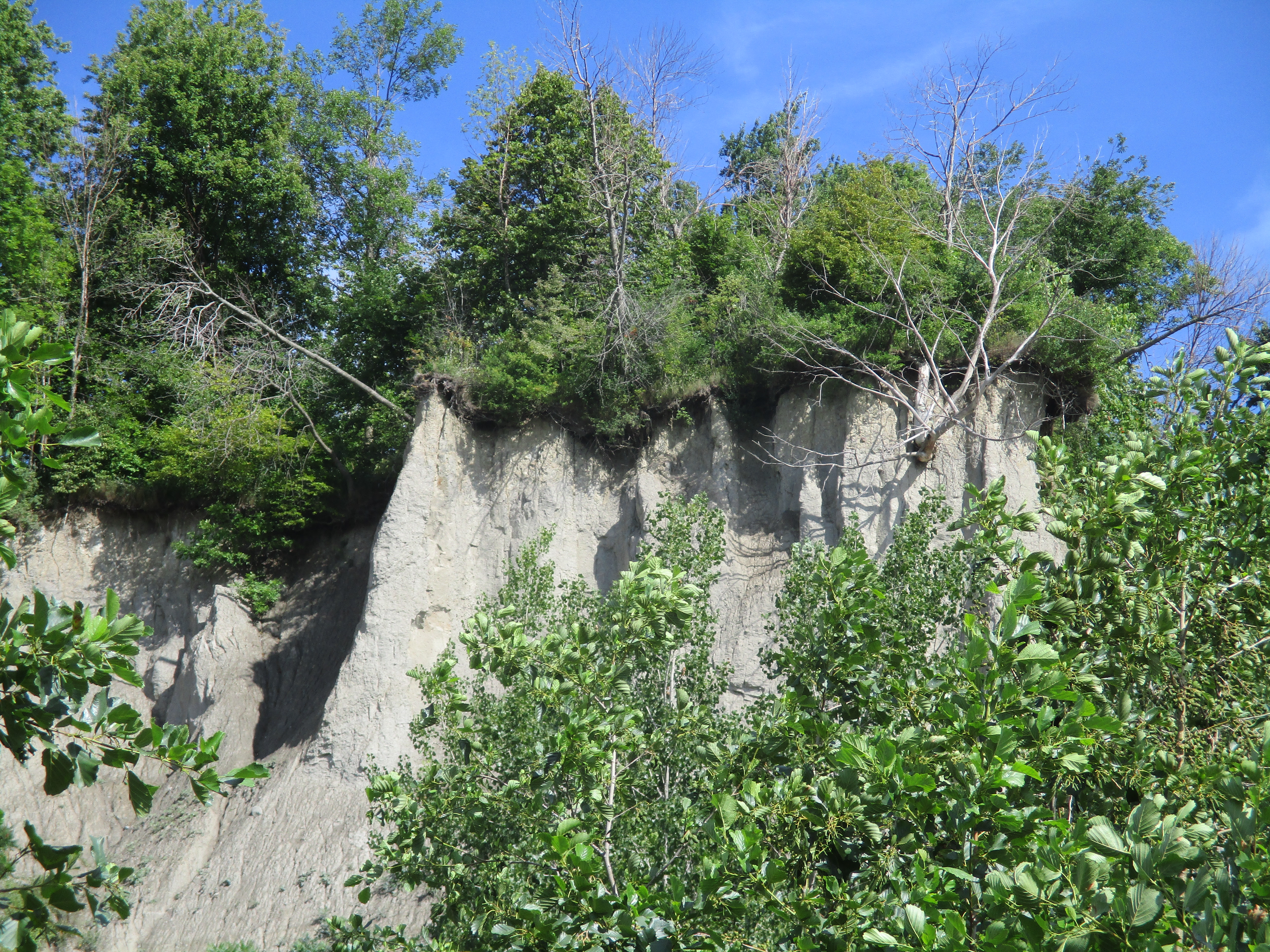
The Scarborough Bluffs run for fifteen kilometers from Victoria Avenue east to Highland Creek. At their highest point they rise ninety meters above the water and have been described as a geological wonder. They are the only bluffs of their kind in North America.
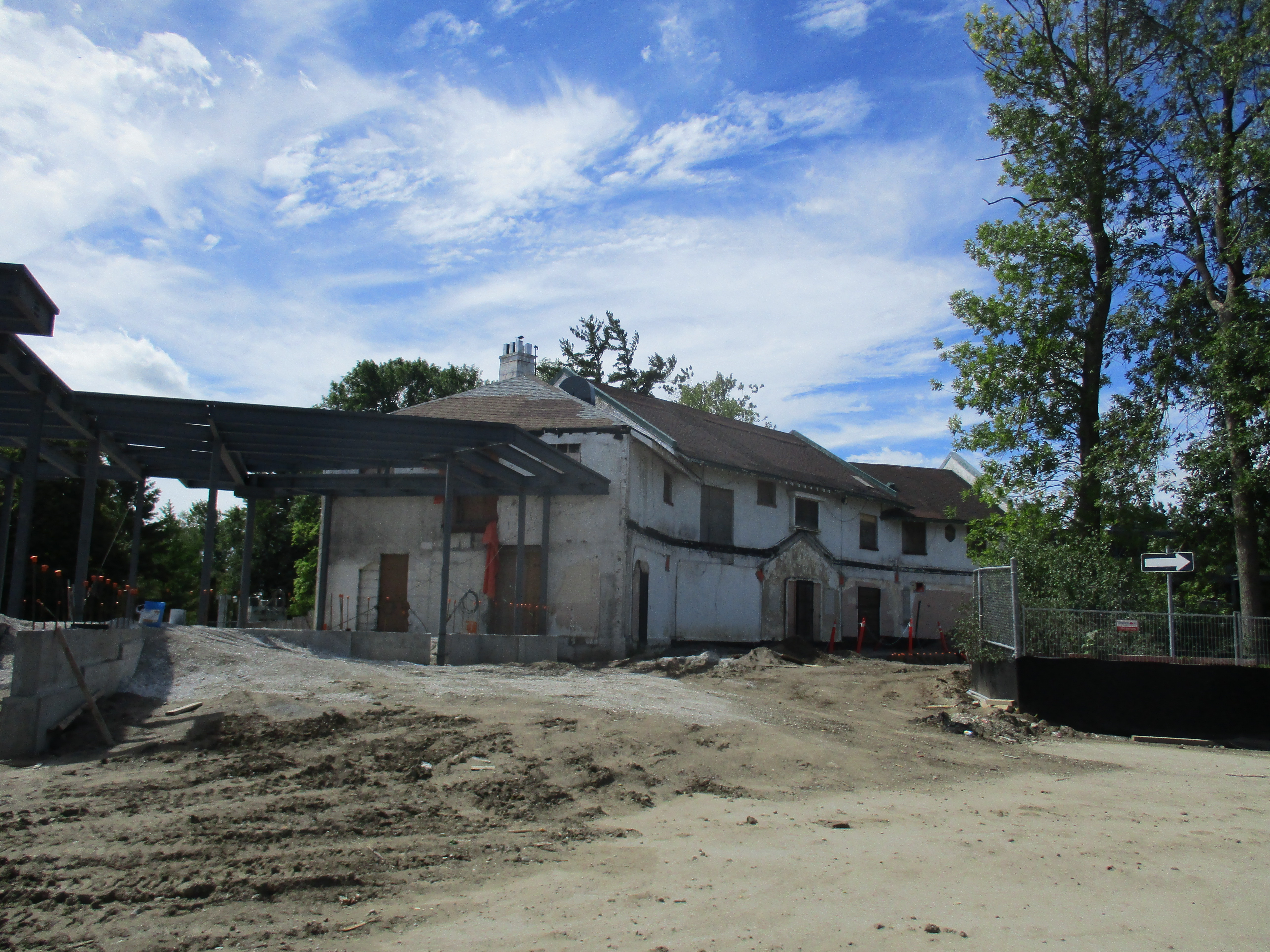
Hiking the GTA has made several visits to the bluffs starting with Guidwood Park in April 2015. At that time the historic inn sat closed and in need of repairs. The Guild Inn is currently undergoing restoration along with the addition of a multi-purpose event hall. It was time to go and see how that was coming along as well as explore the construction roadway that leads down to the bottom of the Scarborough Bluffs. The $20 million dollar restoration will include a 40,000 square foot addition to the original inn. The Guild was the only Depression Era artist colony in Canada. Over the years the Guild had been expanded with several additions, including a hotel tower. After the inn closed in 2001 the tower was removed. The current restoration strips the inn back to it’s original building and adds new structures to both ends.
The restoration is scheduled for completion in December 2016. The city is paying for the removal of mold and asbestos while the developer will pay to renovate the inn to it’s 1932 appearance. A banquet hall is being built on the one end while an outdoor pavilion is going on the other end. The developer has signed a 40 year agreement with the city.
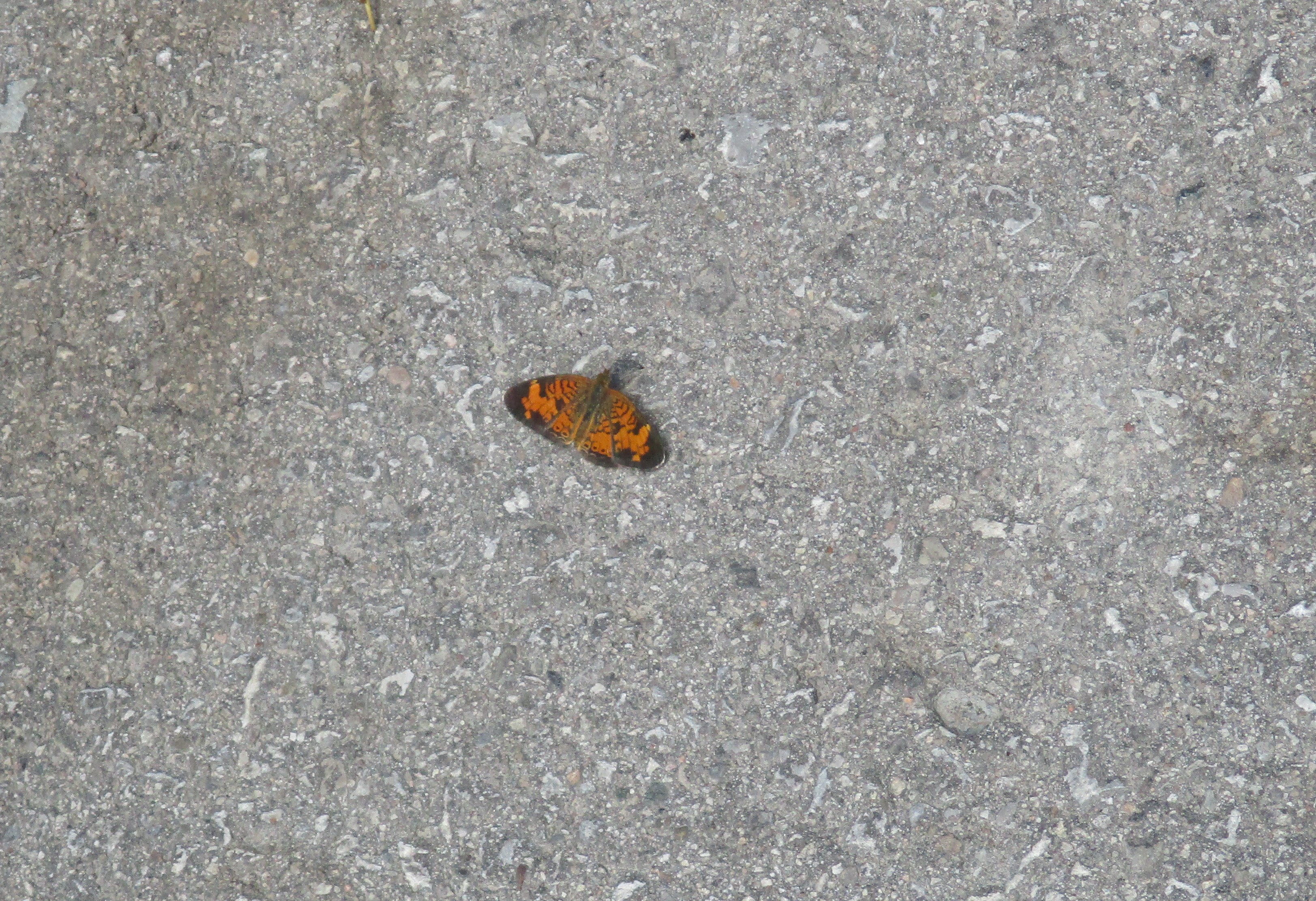
Parking is currently restricted to a lot on the east side of the old construction roadway. The road was littered with old leaves and this Northern Crescent butterfly was quite well disguised among them. I only caught sight of it when it moved. It feeds on many species of the aster family of which we have many in Ontario. The Northern Crescent has only recently been recognized as a separate species from the Pearl Crescent. The latter of which has black lines in the large orange patches on the hind wings.
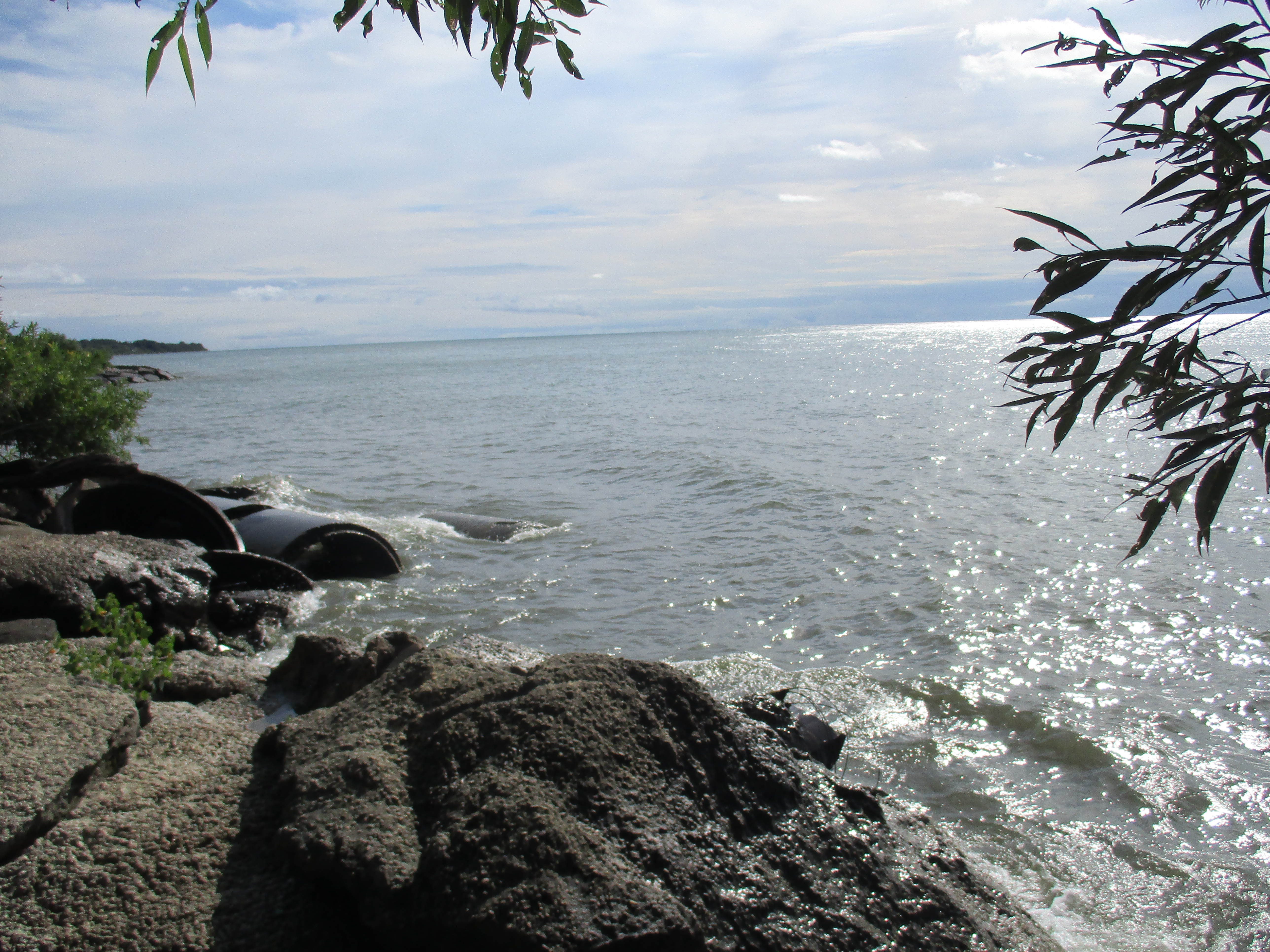
There are only a couple of places where a vehicle can get to the bottom of the bluffs. Bluffer’s Park is one of them and it sits near the western end of the bluffs. This roadway is not open to public vehicles and is currently in use for heavy construction equipment. One of the ways in which the city is trying to slow down the erosion of the bluffs is to create hard shorelines and South Marine Drive was created for that purpose. Old construction material, demolished buildings and slabs of pavement are known as rip rap when dumped along the shoreline as seen below. There is a project currently in process on the shoreline in front of The Guild.
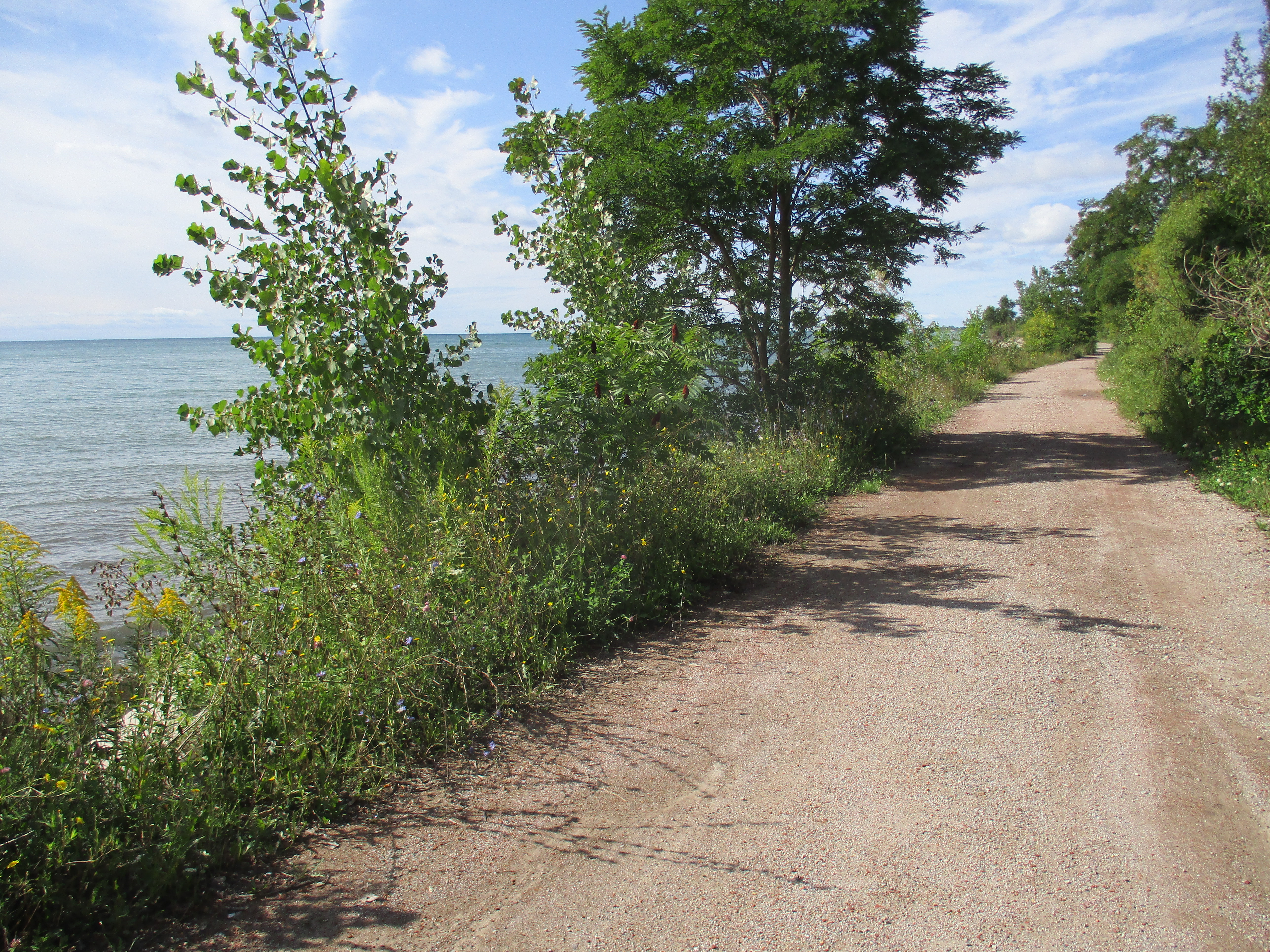
This roadway has been turned into a linear park known as South Marine Drive Park. It runs for several kilometers along the south edge of the bluffs and was largely abandoned this morning except for a couple of hikers and a few cyclists. With the views of the bluffs, and the breeze off the lake, I was surprised to see so few people. Access is very limited though as you must come in from one end or the other.
The sand in the bluffs was laid down in a river delta prior to the last ice age. The melting ice sheet created a larger lake where Lake Ontario is today and this was known as Lake Iroquois. It cut through the old river delta and exposed the bluffs. This lake suddenly drained into a smaller lake known as Lake Admiralty which has since become Lake Ontario. The exposed sand face has been eroding quickly ever since and in spite of all our efforts, continues to do so. The roots of the trees and grasses hold the top layer together but when the sand below disappears it is only a matter of time before the tree crashes down the hill side. The sand will make its way into the lake and eventually come to rest on one of Toronto’s many beaches, all of which are west of the bluffs. The lake has a slow rotation that means that water takes six years to make its way around the lake and out into the St. Lawrence River.
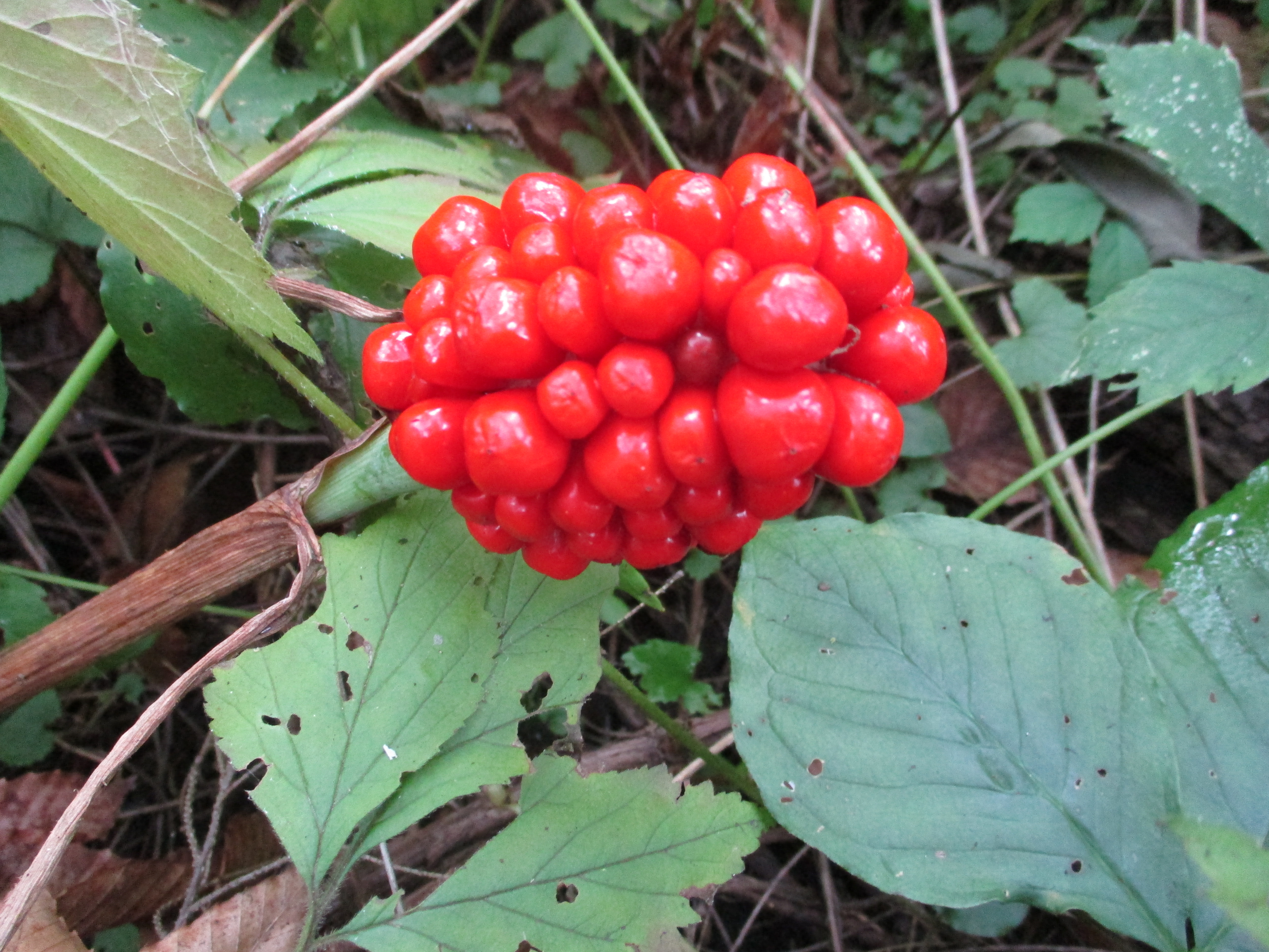
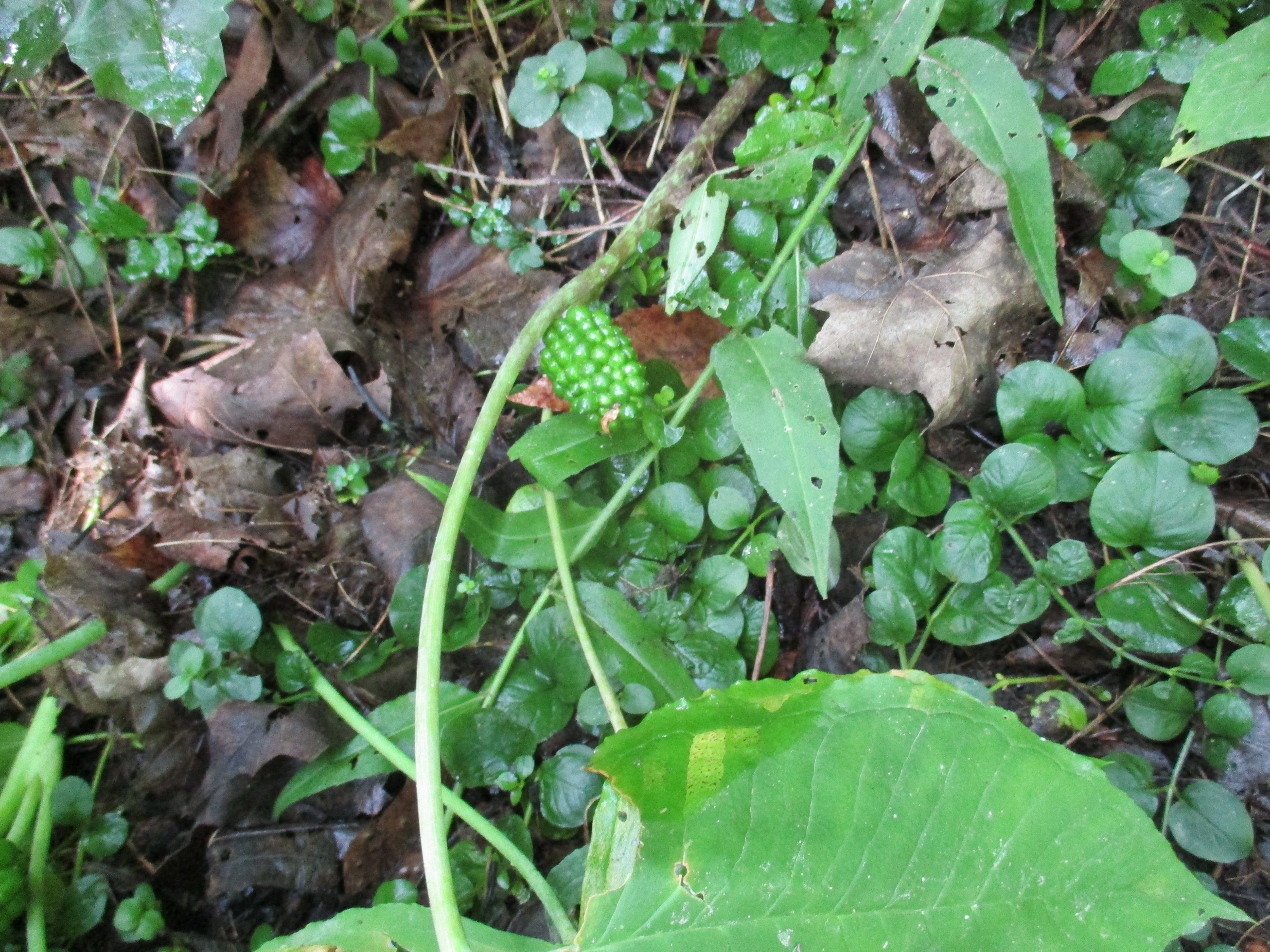
Jack-in-the-Pulpit can live up to 100 years. The corm, similar to an onion, grows underground and it will produce one flower if it is male or two if it is female. The plant has the ability to change sex over it’s lifetime with only the female plant producing berries. These berries will turn bright red and provide food for wild turkeys and wood thrushes. The berries are listed as toxic to humans most likely because of the raphides of calcium oxalate that are present in the plant. The sap of the plant makes an instant pain reliever when applied to a wound. The natives used the plant in this way as well as making a red dye from the berries. The picture below shows the unripe green berries in their cluster.
The trees along this section of the bluffs are hanging over the edge as they start their journey to the bottom.
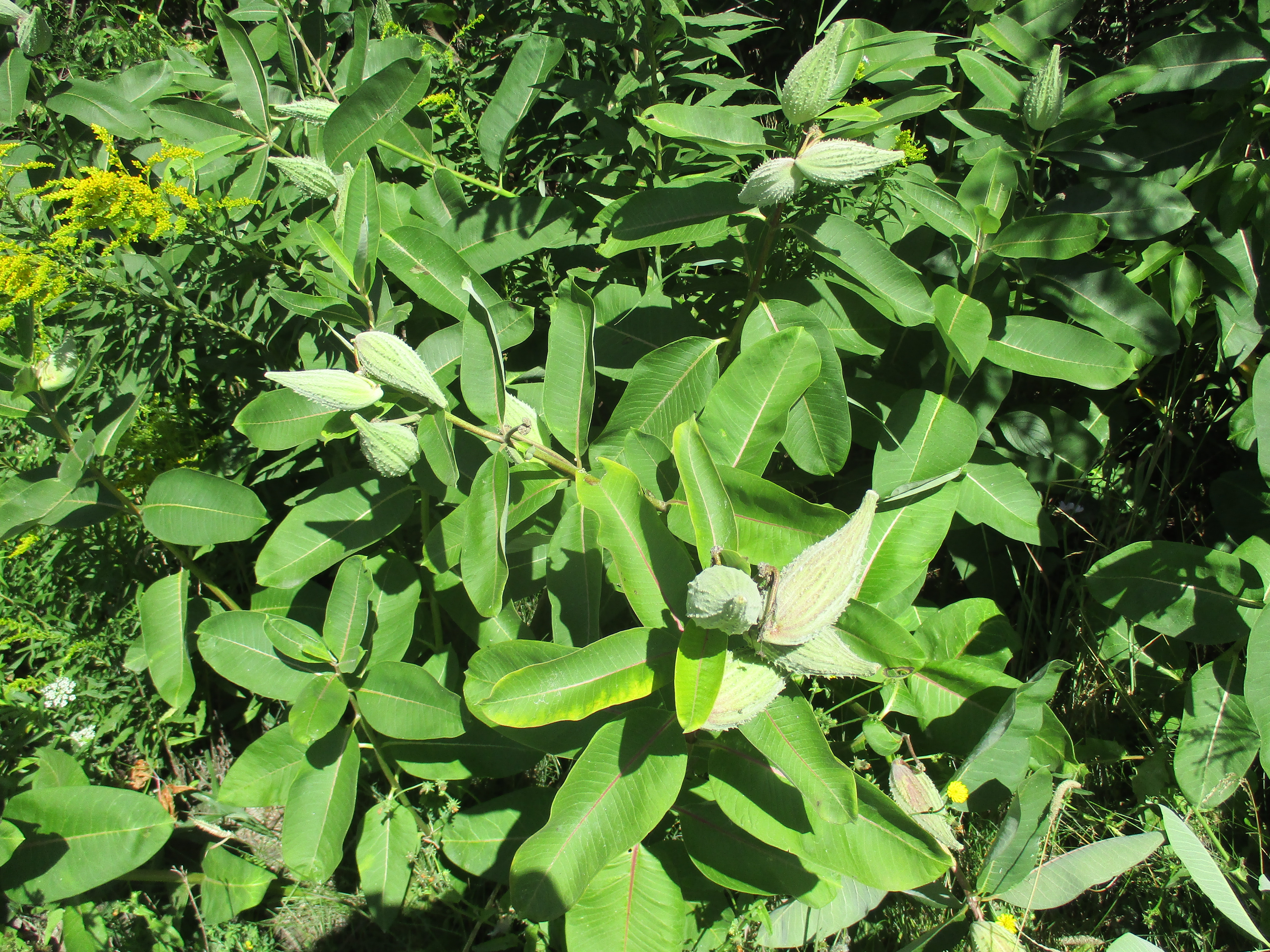
Milkweed provides the only home for monarch butterfly larvae and the park has quite a large number of the plants growing along the side of the roadway. The seed pods are getting ripe. They will soon pop open sending the little white seeds floating on the wind.
Following the trail will bring you to Gates Gully where the Doris McCarthy Trail leads back up to the Kingston Road. Just before you reach the gully one section of a sunken ship can be seen sticking out of the lake. On August 3, 1915 the steamship Alexandria was wrecked near the entrance to the gully. The Alexandria was built in 1866 and served both as a passenger ship and a cargo ship. On this night it was bringing 300 tons of beans and tomatoes when it was blown too close to the shore and was grounded. The ship broke into sections and was completely destroyed. The locals made short work of stripping everything of value above the water line. They say that many cellars were well stocked with sugar, vinegar and canned goods for the coming winter. In maritime tradition Captain William Bloomfield was the last man off the ship at about 2:00 am the following morning. All passengers were brought to safety and led up the bluffs through Gates Gully. The steamer remains in the lake 100 years later, just to the east of the gully. The picture below shows the wrecked ship as seen from the shore. The cover photo shows the ship in close up. There is a place rusted through the rectangular part of the hull right at the waterline. A rounded piece of hull on the left of this is briefly exposed with each rolling wave.
There are plenty of places where the slopes of the bluffs are covered with shrubs and trees. This helps to stabilize the slopes and you will notice on the return trip that this section has some well vegetated areas.
Having reached this point it is about a 45 minute walk back to the parking lot at the Guild.
Presented below is a gallery of plant, flower and fungi pictures taken during the first 100 hikes on the journey called Hiking the GTA. This post concludes our celebration of chapter one in this adventure.
On July 21, 2015 I published my 100th post in this blog under the title Hiking the GTA #100 – Greatest Treks. That post presented the 15 most popular stories on the blog, so far. I’ve posted a gallery of animal pictures from those first blogs under the title Hiking the GTA – Amazing Animals. Ontario has many edible plants, some very beautiful ones and several really nasty ones. The pictures below are in no particular order except that the three most common poisonous ones are presented first.
Giant Hogweed is one of the nastiest plants in Ontario. It can cause severe burns and even blindness. These picture shows last year’s stocks and this year’s white blossoms and was published in the Canada Day post on July 1, 2015.
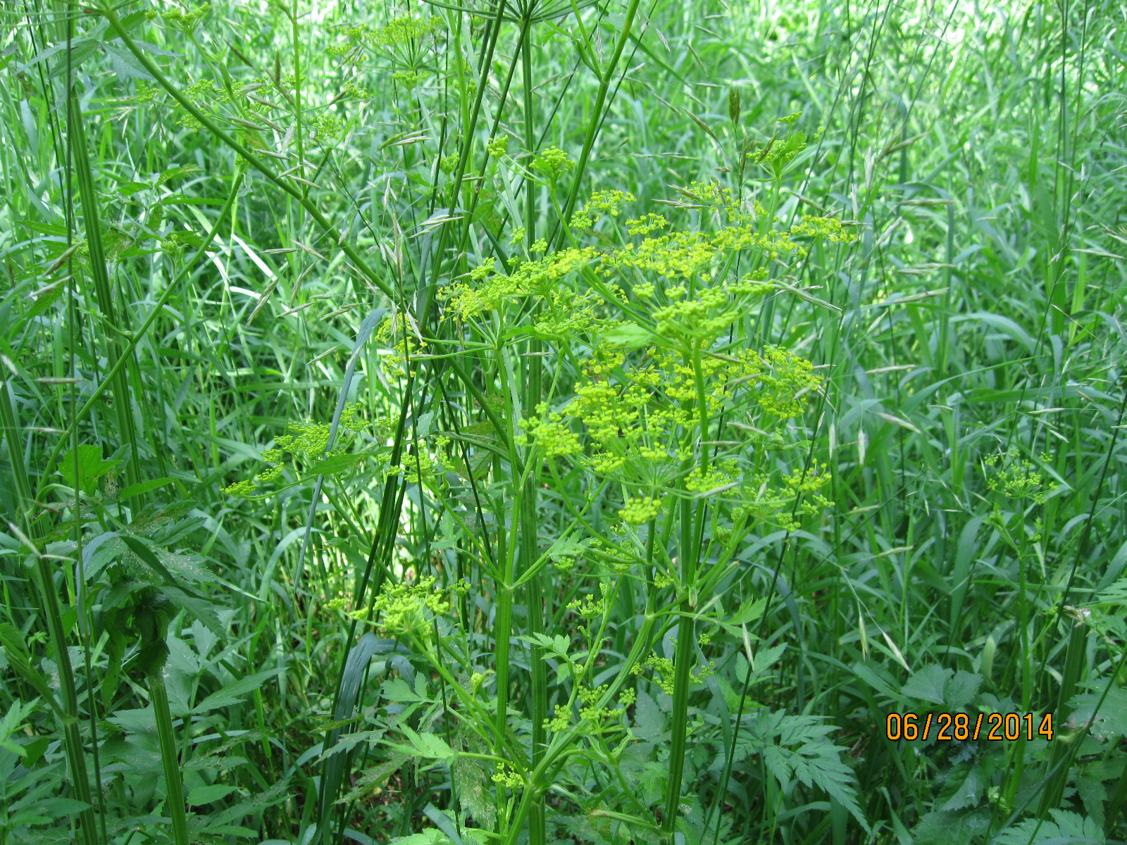
Wild Parsnip is another plant with similar poisonous sap to the Giant Hogweed. This picture was taken in Riverwood Part 1 – The Bird Property on June 28, 2014.
A third poisonous plant is Poison Ivy. This patch was photographed at Barbertown on Aug. 23, 2014.
Burdocks have a tiny hook on the end of each stem that inspired velcro. This one, complete with Lady Beetle, was photographed at The Winding Lane Bird Sanctuary on Oct. 11, 2014.
Coral Mushroom are one of the plants that although relatively rare can be eaten. This fungi was discovered on Canada Day 2015.
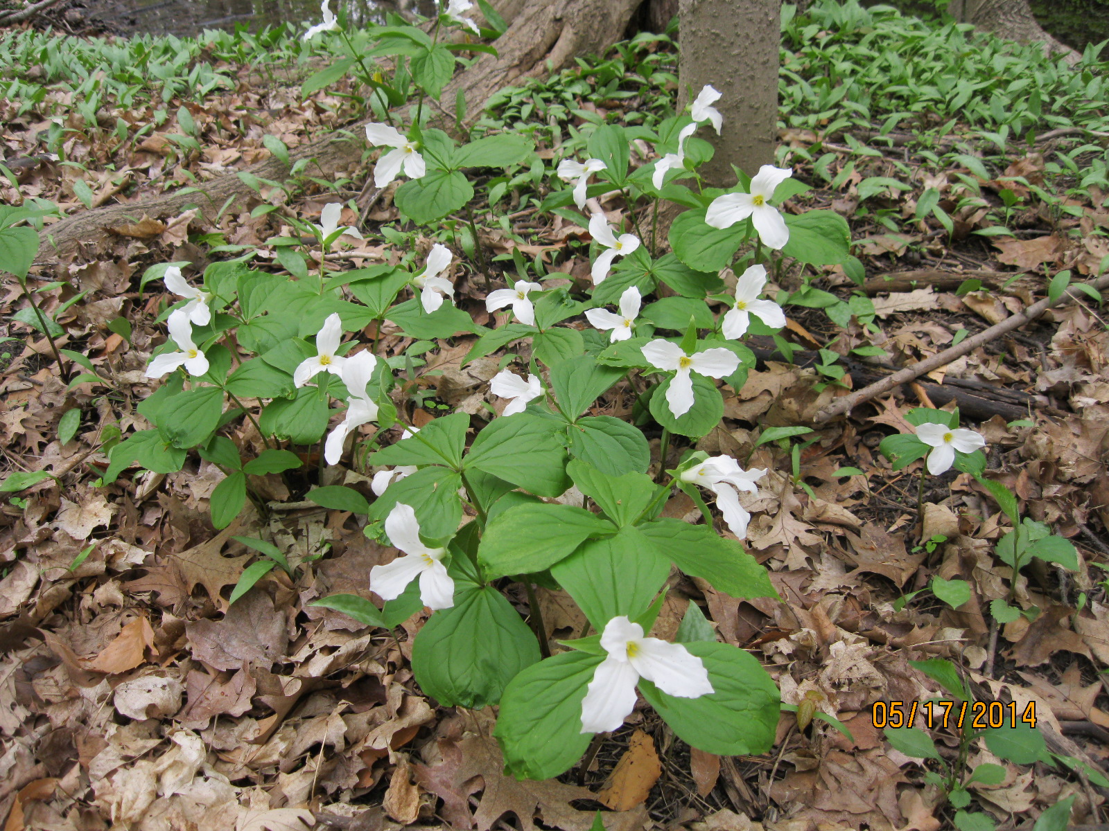
Ontario’s provincial flower is the Trillium. These were seen on our hike from Old Mill to Lambton Mills on May 17, 2014.
The Yellow Iris is an invasive species that takes over our wetlands and chokes out other plant life. This patch was seen on June 14, 2014 near Raymore Drive.
Dog-Toothed Violets were seen on the hike where we discovered the Ovens Above Old Mill on May 10, 2014.
The Vipers Bugloss has a brilliant shade of blue. We found this example during our hike at the Devil’s Pulpit on July 11, 2015.
We found young teasels growing at Glen Williams on June 27, 2015.
Jack-In-The-Pulpit plants can live up to 100 years. We found this large plant growing in Palgrave on May 30, 2015.
Forget-Me-Nots were used in Newfoundland for their Remembrance Day celebrations before they joined confederation and adopted the poppy. There were photographed near the Barber Paper Mills on June 6, 2015.
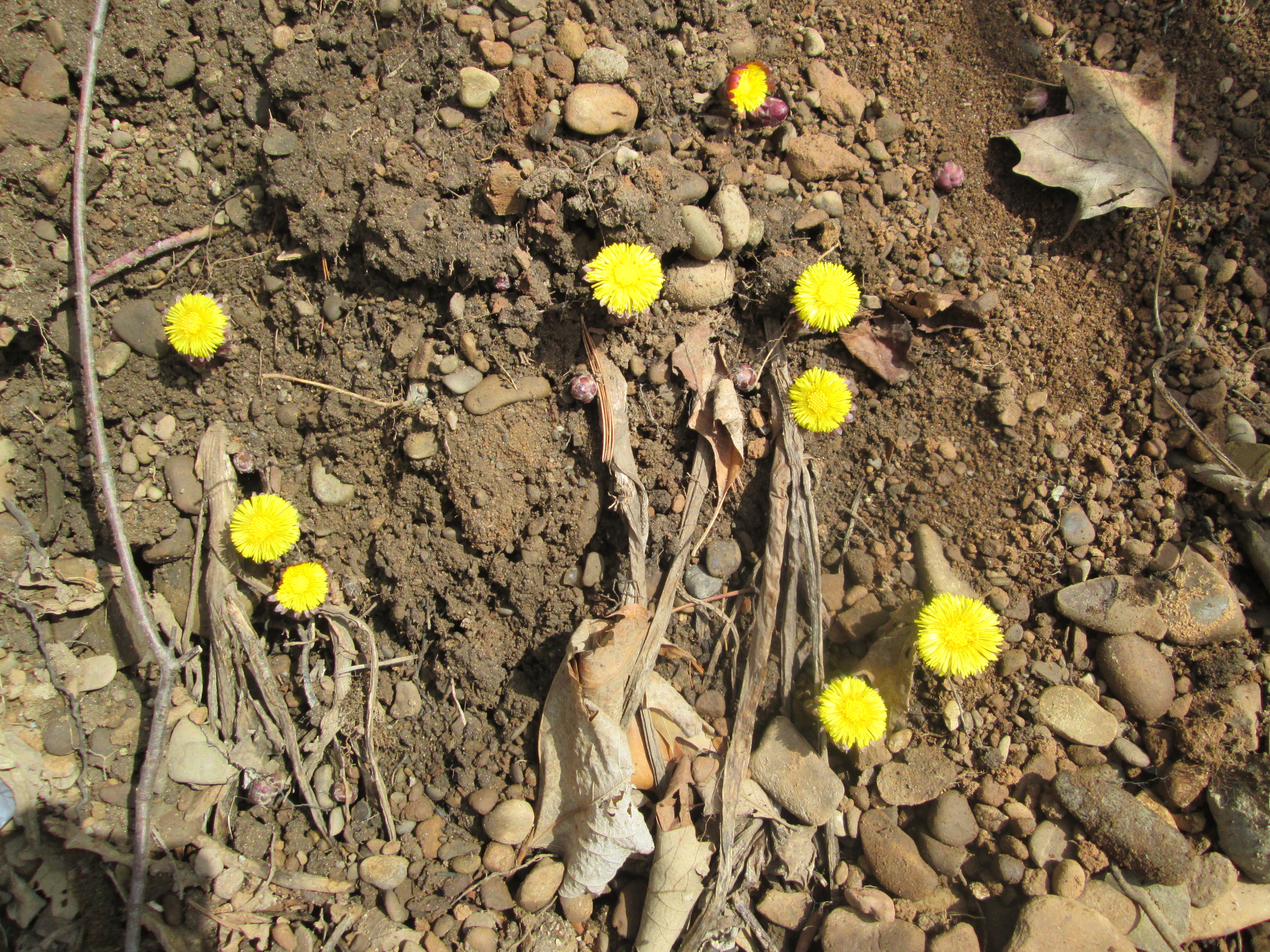
Coltsfoot is one of the first flowers seen in spring. We found this patch at Churchville on April 3, 2015.
Canada Thistle isn’t native to Canada but appears on our Coat of Arms. This bee was collecting pollen on a Canada Thistle near the Erindale Hydro Electric Dam on Oct. 19, 2014
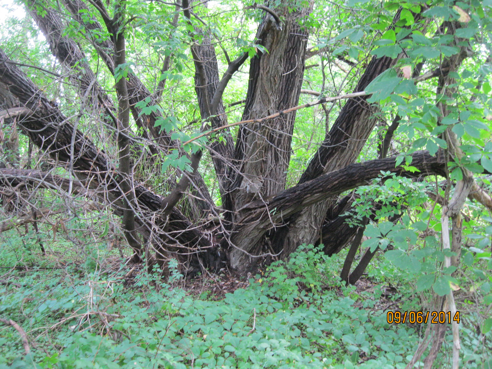
Black Willow trees grow in wet areas and reach massive sizes. This one is in Riverside Park in Streetsville where we visited on Sep. 6, 2014.
Trees suck the chlorophyll back out of the leaves and store it in the woody parts of the tree for re-use the next year. These trees appear to be doing just that. These were also photographed at The Winding Lane Bird Sanctuary on Oct. 11, 2014.
Our parks are full of a wide variety of plants which keep the woods alive with splashes of colour from early spring until late fall. Watch out for the pernicious plants and enjoy the beautiful blossoms as you have your own adventures, Hiking the GTA.
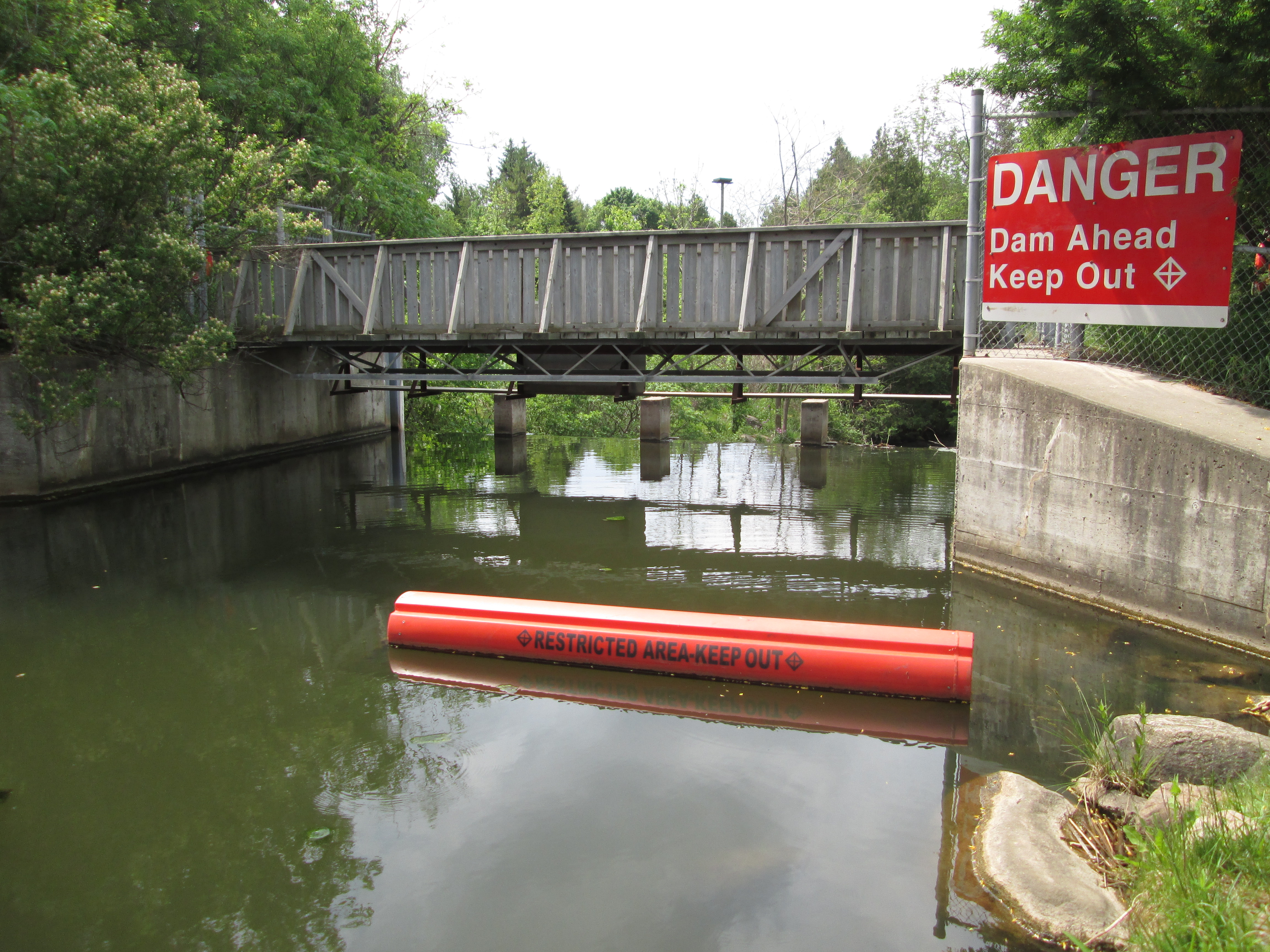
It was a day after my father’s 80th birthday and so the plan was to meet in Barrie to celebrate. The choice between driving up the 400 or leaving earlier and making a side trip was less difficult than determining where that side trip would lead. In the end we chose to look at the Palgrave dam and mill pond.
Palgrave was originally called Buckstown after the owner of the Western Hotel which was opened in 1846. This name survived until 1869 when the post office was established and the name was changed to Palgrave. Due to the large amount of lumber in the local forests this became an important industry in the early development of the town.
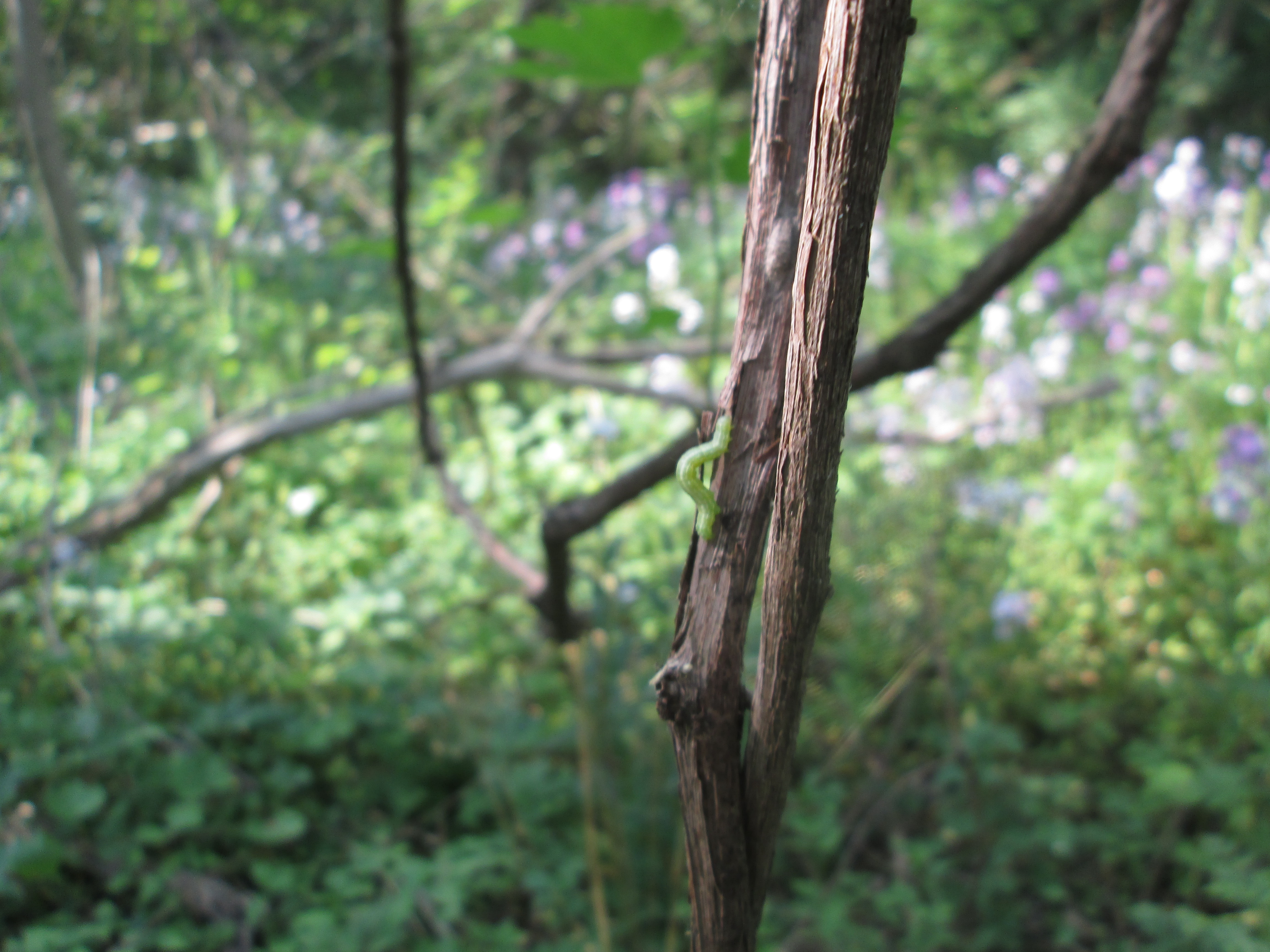
It is the season for moth and butterflies to be in their larvae or caterpillar state. Inch worm is a term that is applied to the caterpillar of the geometer moth, a large family of 35,000 species. Ironically the word geometer applies better to the caterpillar than the moth as it comes from the Latin “geometra” or earth-measurer. This is because the caterpillar has only 2 or 3 prolegs on the back end. Their looping gait makes it look like they’re measuring the ground as they go along.
Palgrave grew up around a saw mill and a grist mill. These two industries were essential to the development of a community. The saw mill provided basic building materials while the grist mill provided basic food supplies for humans and livestock. A dam would be built to create a constant supply of water. The mills are gone but the mill pond remains, complete with its own secrets. In August 2011 a body was found in the pond which belonged to a 42 year old woman who had been kidnapped from her home in Brampton. Raqual Junio was murdered by her estranged husband and her body dumped in the old mill pond.
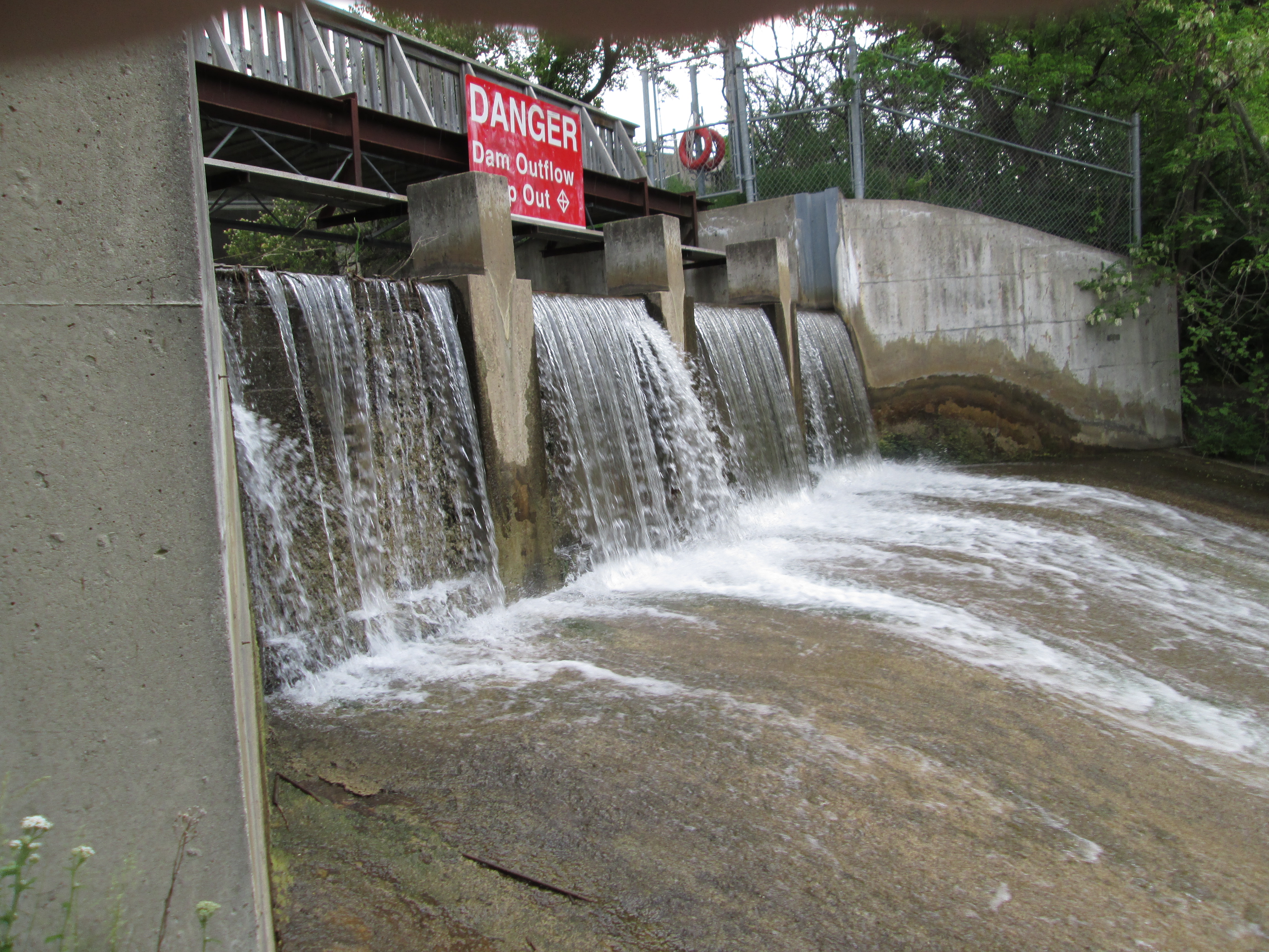
The view of the dam from below the waterfalls.
The jack-in-the-pulpit plant exhibits a wide variance in size with this example being near the upper end of 65 cm (26 inches). Identifiable by it’s flowers contained in a spadix and the hood drooped over top this was the only specimen in the immediate neighbourhood. Once cooked or properly dried this plant can be eaten as a root vegetable. The raw plant, however, contains raphides that are like tiny little needles that cause a burning sensation and possible severe irritation if eaten. The plant grows from the same corm for up to 100 years.
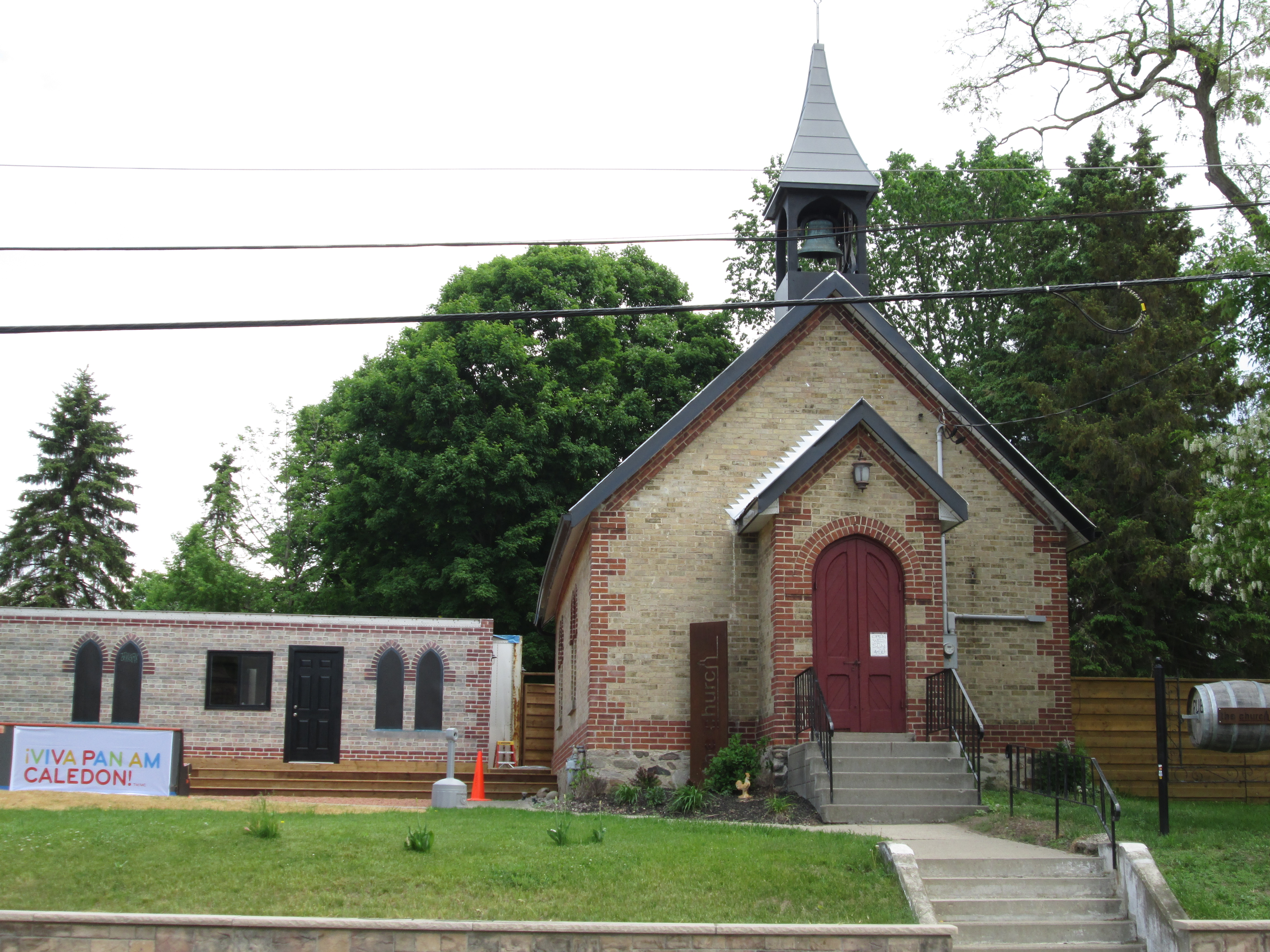
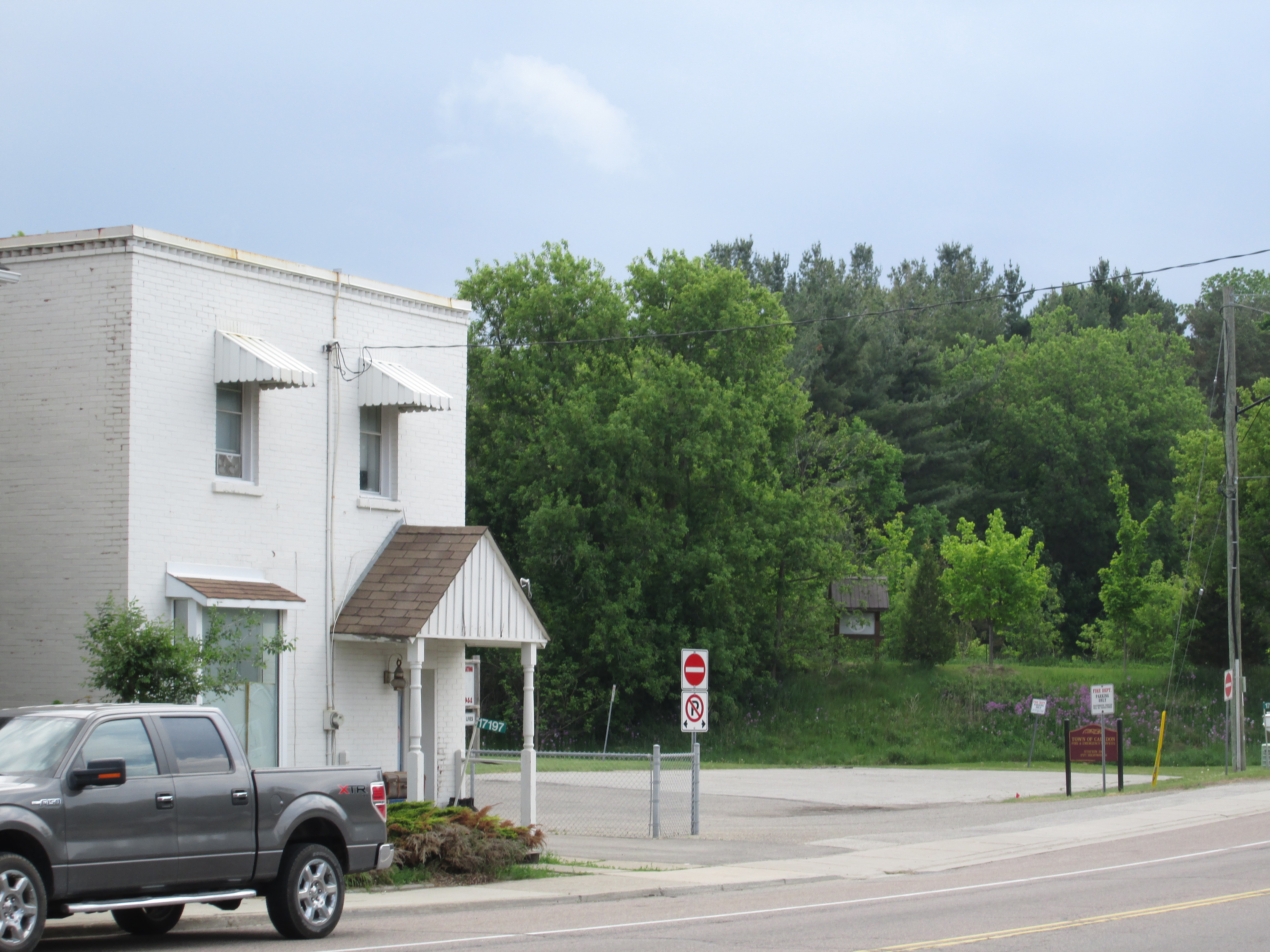
On March 5, 1880 town lot 4 was sold to the Reverend W.F. Swallow for $70 for use as a church property. It had been the site of a store and saloon prior to that. In 1882 they purchased lot 3 beside it for use as a cemetery. Prior to this, Anglicans had to take their loved ones to Bolton for burial. St. Alban’s Anglican Church was built in 1882 in the English Gothic Revival style that was popular at the time. St. Alban’s retains it’s original bell tower and entrance vestibule. The church was closed in 1996. The cemetery was closed in 2007 and the remaining bones were dis-interred and moved to Bolton for reburial. The church is now used as a saloon, as the property has come full circle. The one story building on the left has been built on the site of the former cemetery.
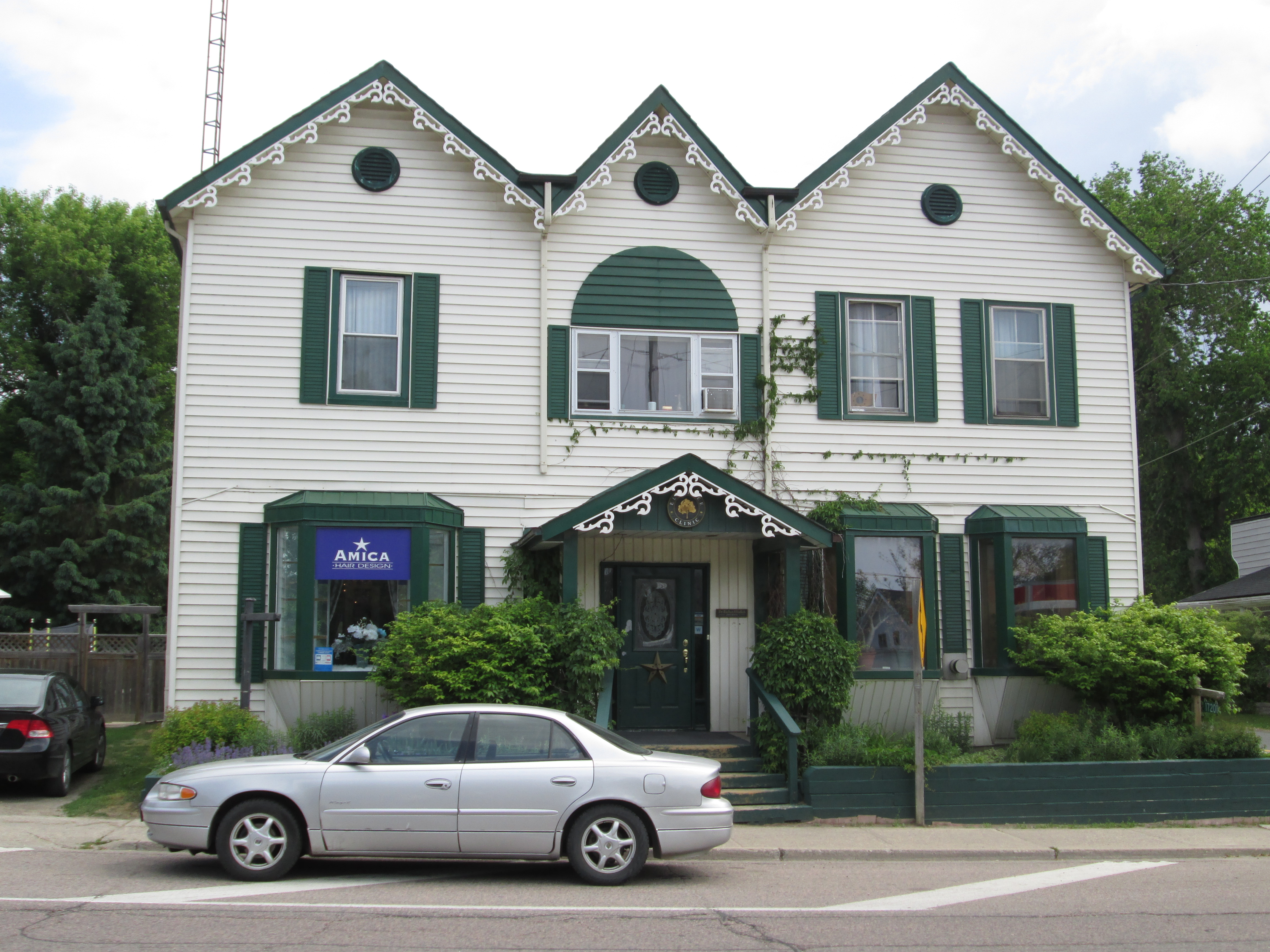
The Elm Tree Hotel was just one of the hotels in town but survives with it’s unique three point roof. This hotel appears to have been built in 1878 after the arrival of the railway in town. This spurred growth and the town doubled in size in a year from 150 to 300 residents. Several other old buildings remain in town but there is little information available on-line about their history.
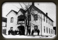
The Elm Tree hotel no longer has it’s elm tree. It was cut down to allow for the widening of highway 50 through town. The picture below was taken in 1914 and borrowed from Wikipedia.
.
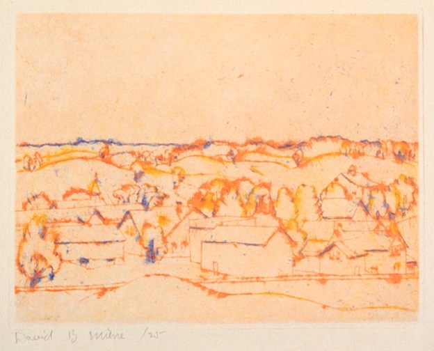
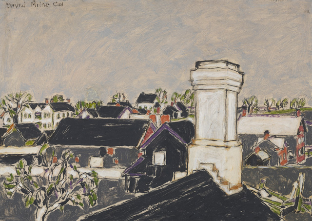
Canadian artist David Milne lived in town from 1929 until 1932 and painted several scenes. The painting Kitchen Chimney is in the National Gallery of Canada and the Elm Tree Hotel can be seen in the background at the left. His painting “The Village” is also in the National Gallery and is used as the cover photo for this post. St. Alban’s church with its bell tower can be seen at the left.
In 1877 the Hamilton & North-Western railway was built through the middle of town. The railway was later taken over by the Grand Trunk Railway in 1888 and ended up as a part of the Canadian National. Passenger service ended in 1960 and the tracks were removed in 1986. The rail bed has since been turned into a hiking trail. The trail can be seen in the picture below on the little rise where the wooden trail sign stands.
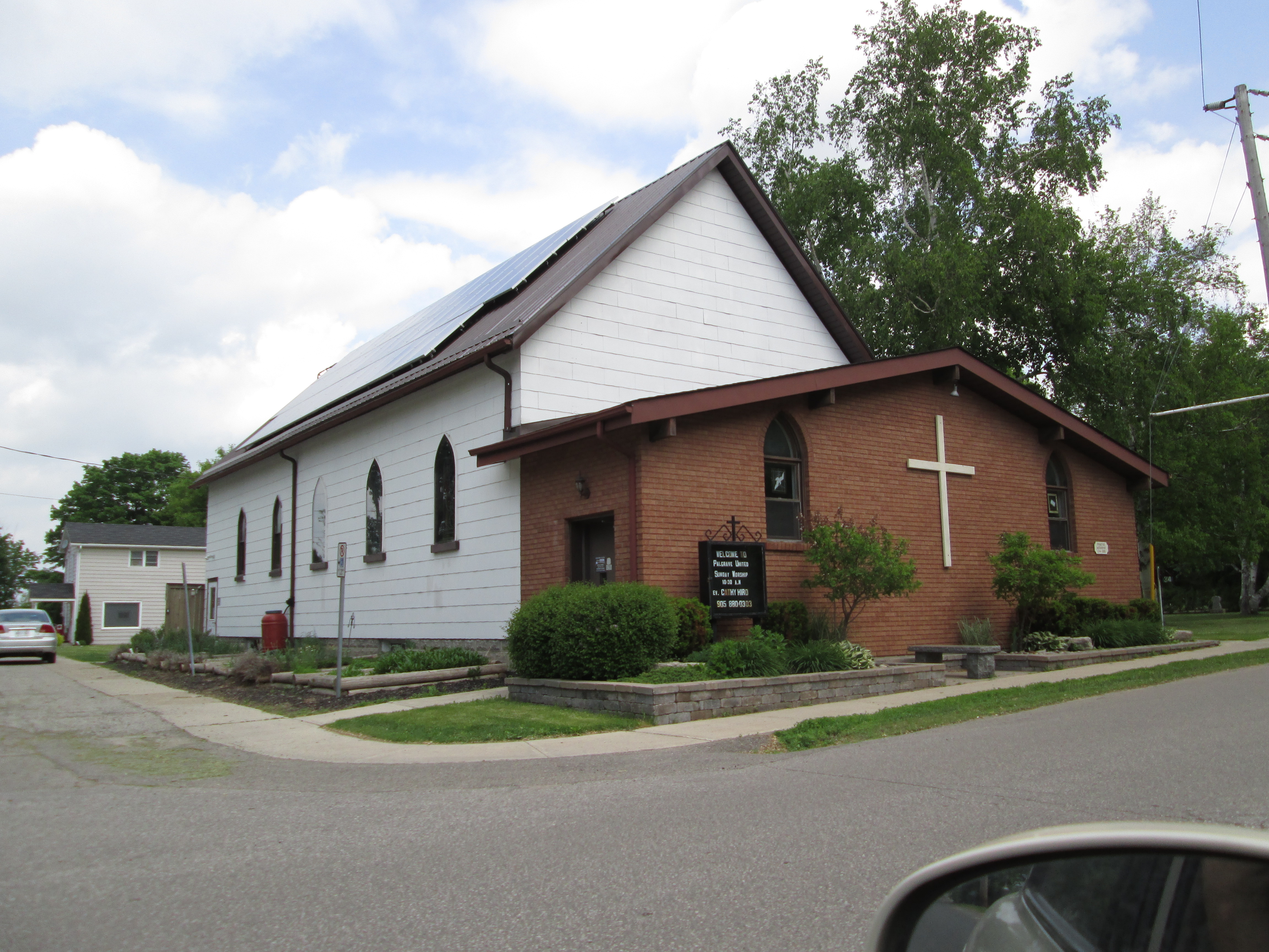
The Primitive Methodists built their church and cemetery in 1878 on lots 17, 18 and 19. Their cemetery remains and the church has served the United Church since it’s inception 1925.
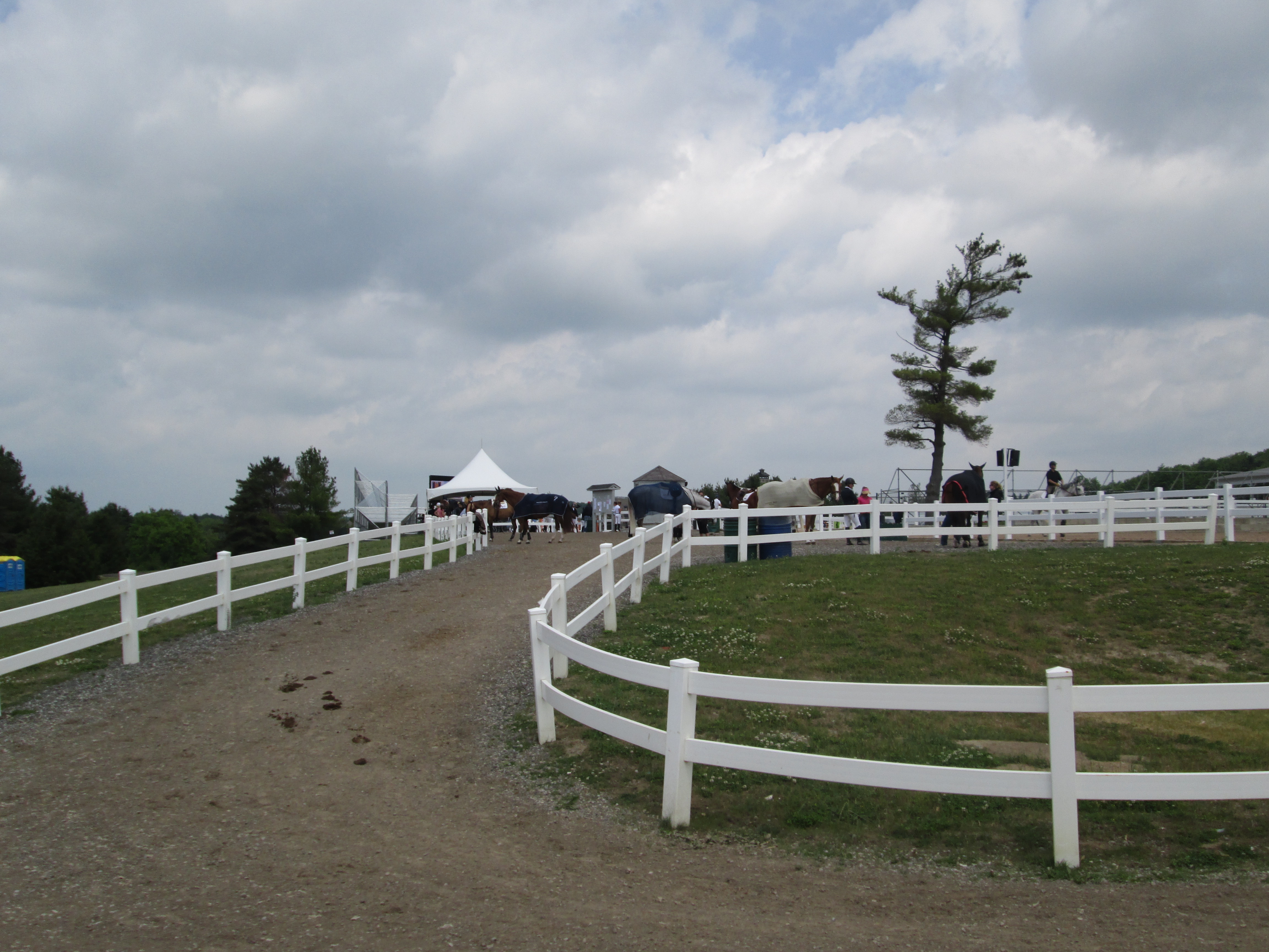
The Pan American Games are the third largest international multi-sport games in the world. Started in 1951 in Buenos Aires it now contains 41 member nations. The games are played every four years in the summer before the next Summer Olympic Games. Toronto is host to the 2015 Pan Am and Parapan Am games which run from July 10-26. The dressage and jumping competitions will be held in Palgrave at the Caledon Equestrian Park. We were able to stop by and have a look at some of the local horses getting warmed up.
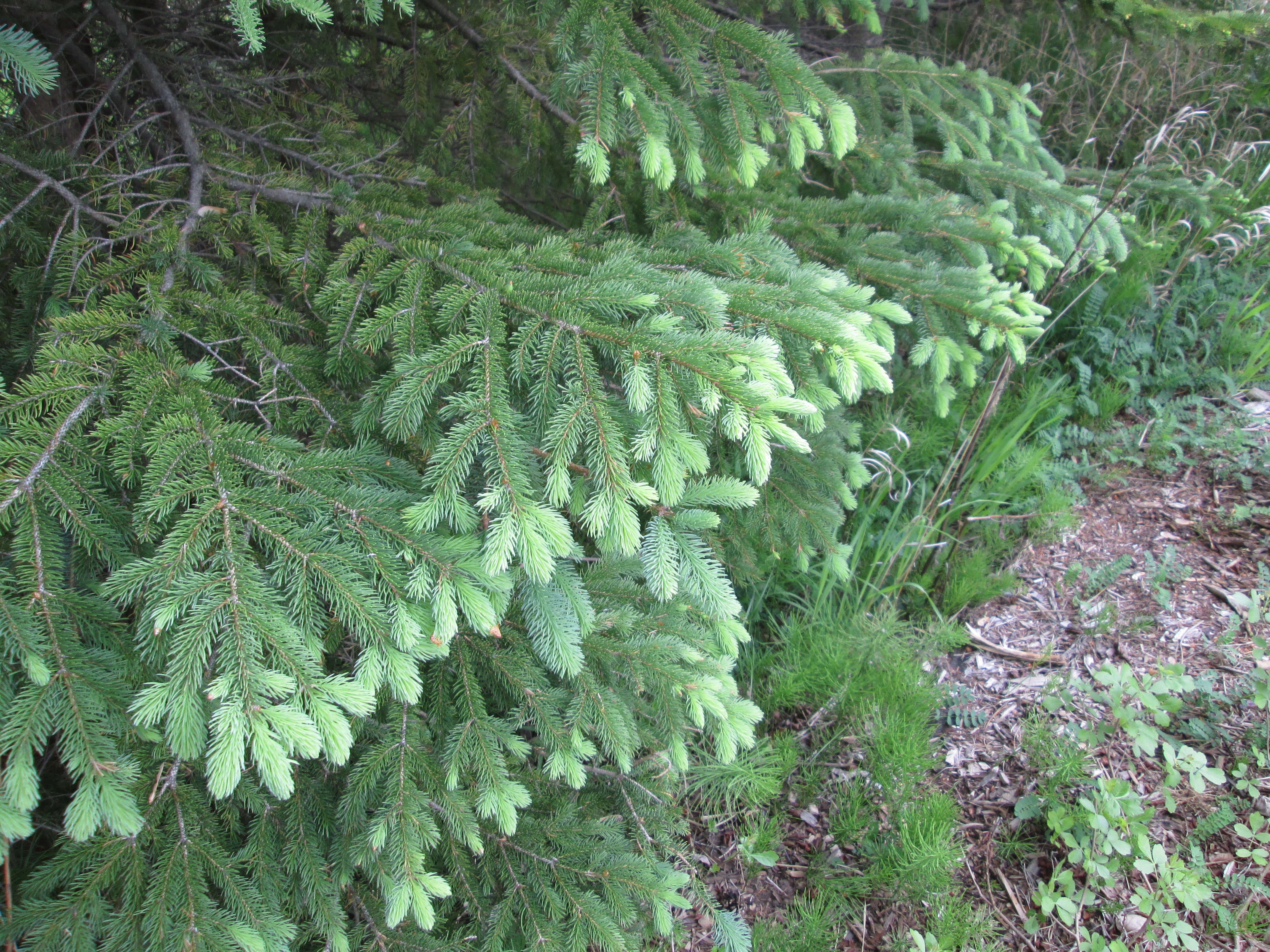
It is so nice to see the fresh green of the new growth on the ends of the pine tree branches.