Tag Archives: poison ivy

German Mills Settlers Park

Saturday, September 7, 2019

The community of German Mills didn’t last very long and there is only one building left standing.  We decided to investigate the area which has now become a park and we found free parking on the end of Leslie Street where it has been closed north of Steeles Avenue.

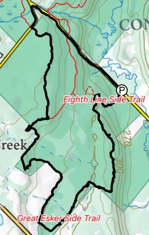
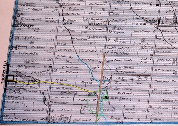
The county atlas was drawn in 1877 and by that time there was no longer a community named German Mills.  The school was replaced in 1874 with a new building on German Mills Street but it is the last remaining structure from this early settlement.  On the map below Leslie Street is brown while John Street, a given road, is yellow.  German Mills Creek is in blue while our hike is roughly outlined in green.

German Mills (2)

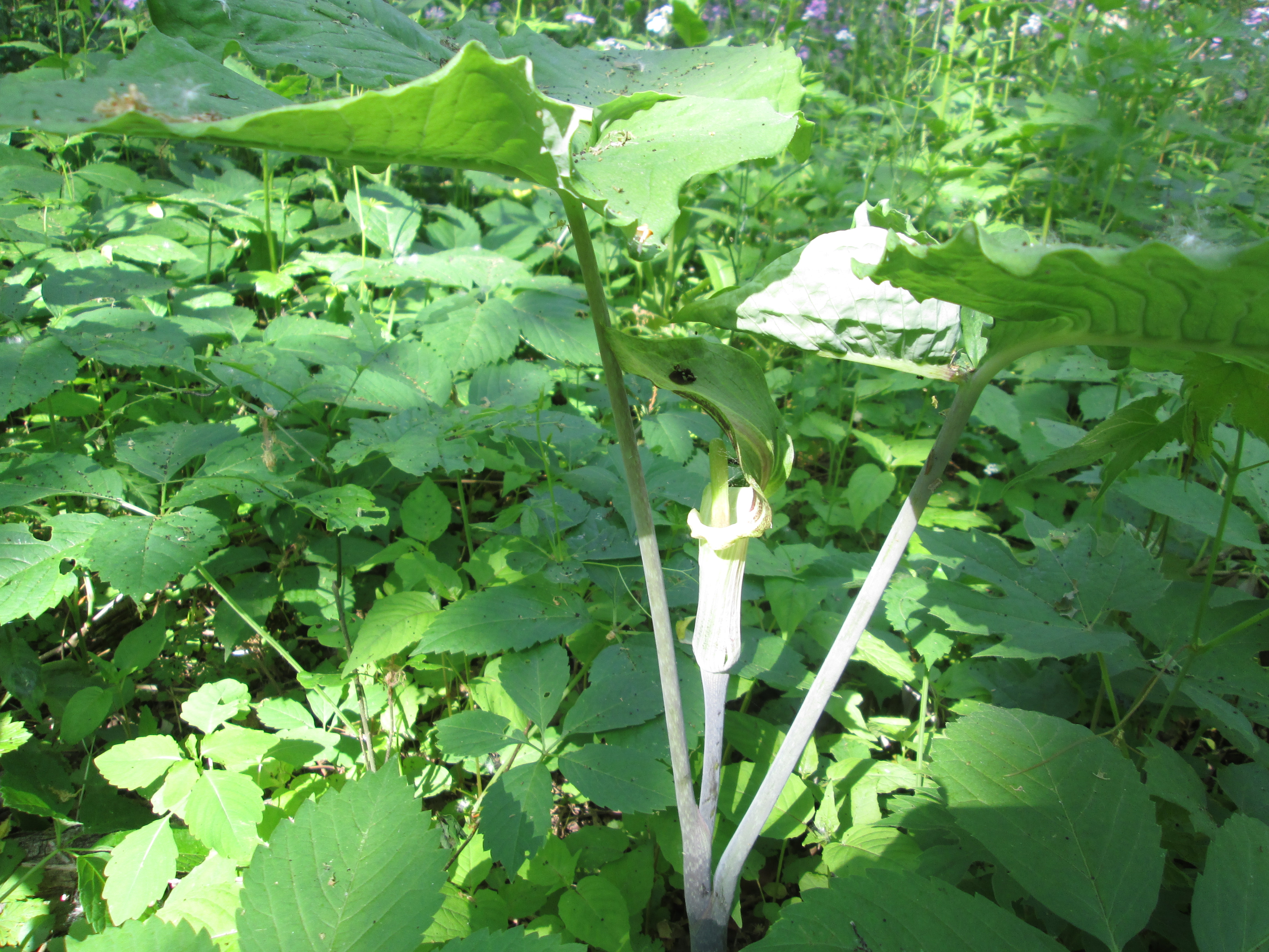
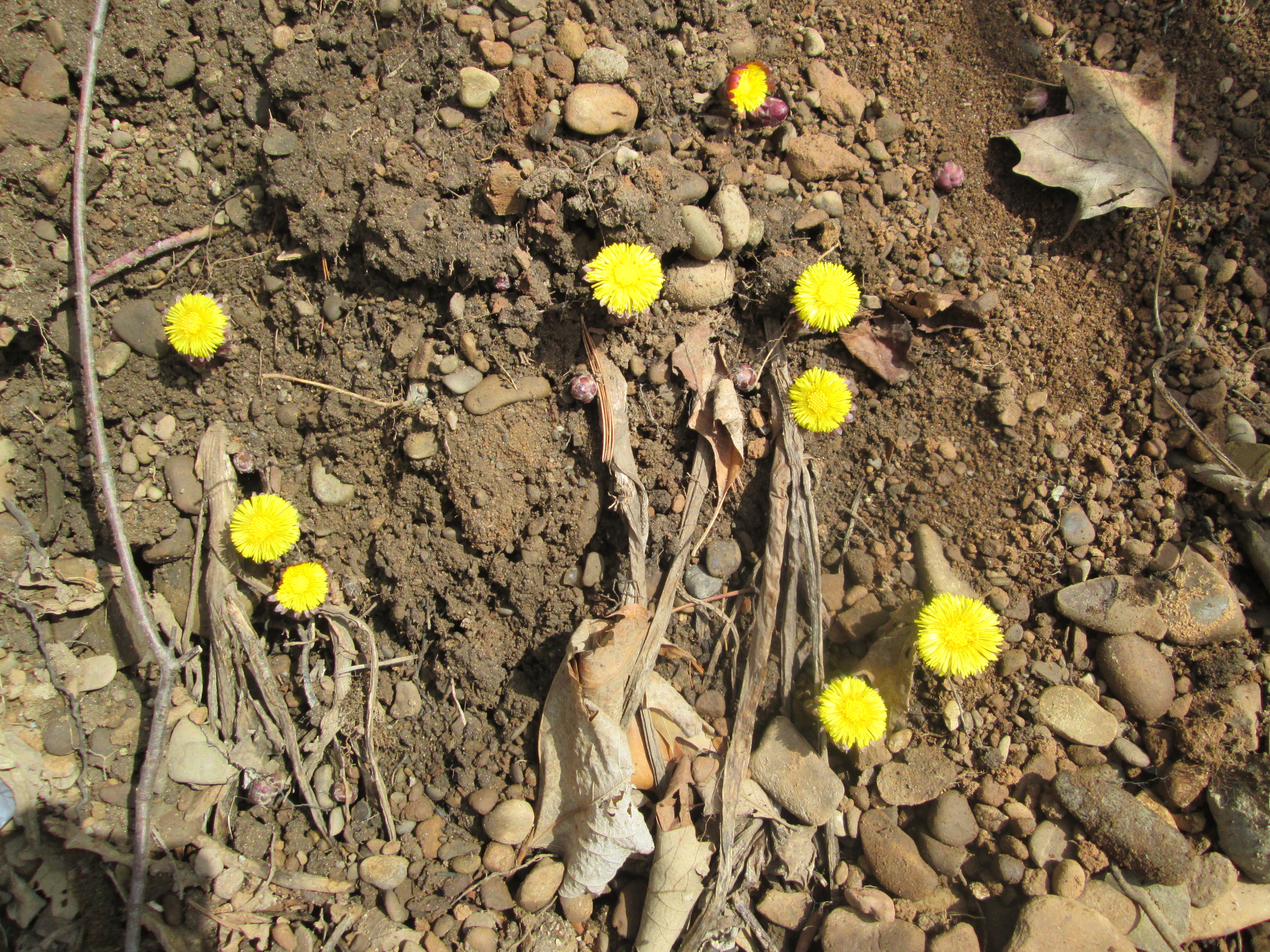
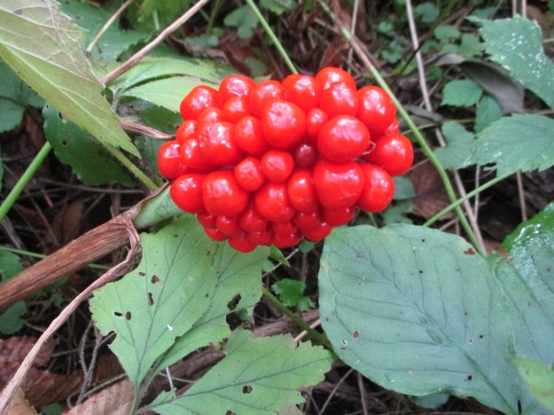
Jack in the pulpit grow for up to 100 years from their corm, a type of root similar to a small turnip, although basically inedible.  They spread through seeds that are grown inside their berries.  The berries will turn from green to red when the seeds are ready.  The berries can be harvested and the seeds gently squeezed out.  There will usually be 4 to 6 seeds in each berry.  These can be planted about 1/2 inch deep in the fall.

IMG_6505

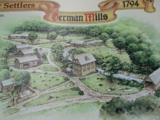
German Mills was settled in 1794, the year following the founding of York (Toronto) by a group of German families.  They not only established the first industrial complex in Markham but set an early example of the development of Canada through a multicultural approach.  The settlement didn’t last long because the water supply was inadequate to power their mills.  The picture below shows a sketch of the settlement that can be found on an interpretive plaque along the trail.

IMG_6526

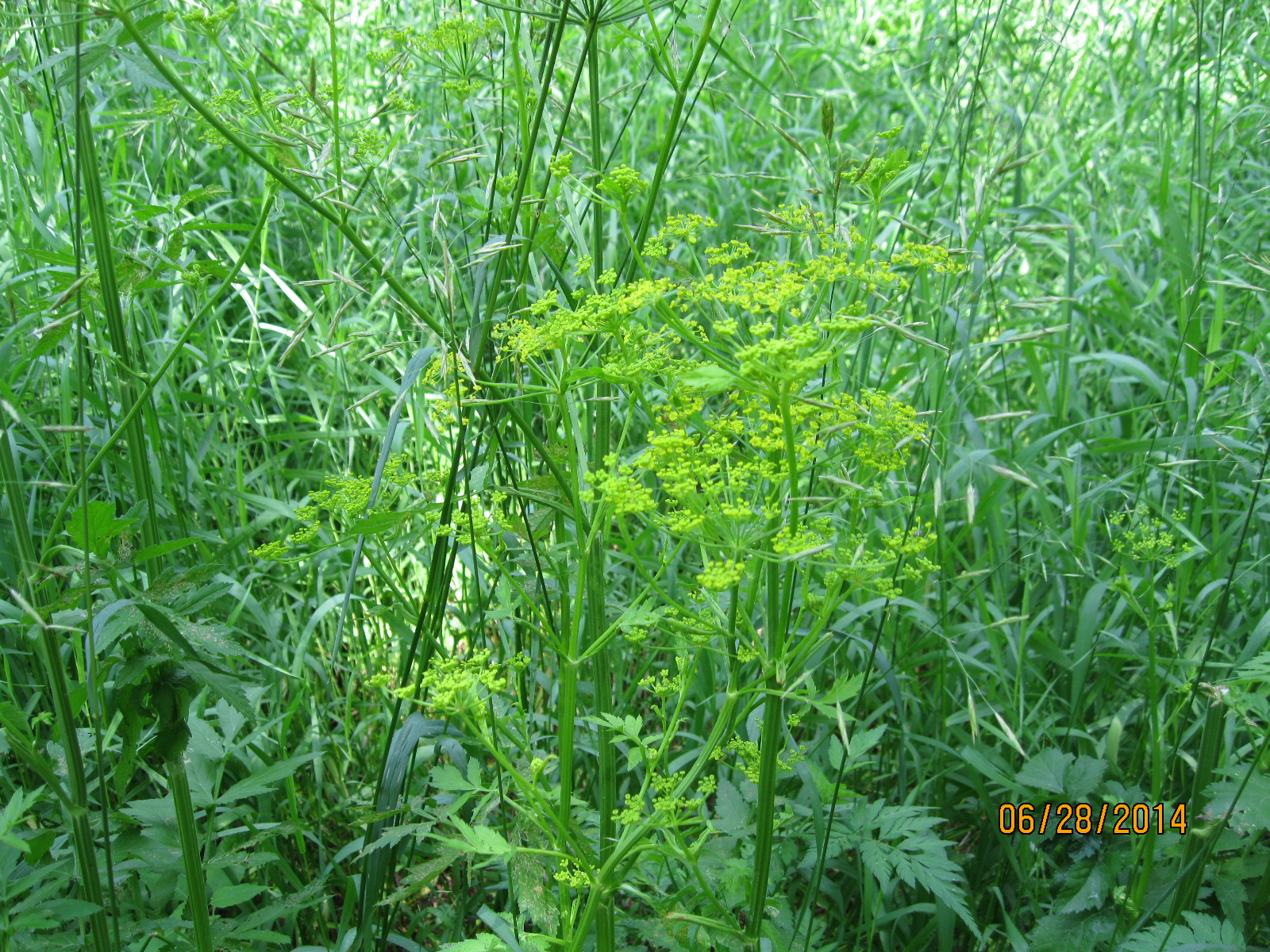
The main paved trail crosses German Mills Creek but we chose to follow the old road allowance for Leslie Street.  German Mills Creek appears to have a few minnows in it but not much else.  The creek runs for about 10 kilometres before emptying into the East Don River in the East Don Parklands.

IMG_6704

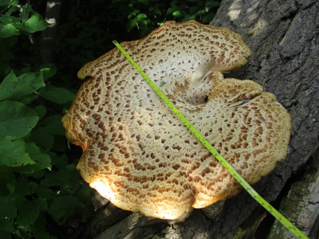
Pheasant’s-back Polypore is also known as Dryad’s Saddle and is one of the larger polypore mushrooms found in Ontario.  The caps can reach 12 inches or more with the example seen below coming in at nearly 13 inches.  Although this mushroom is edible it is also rather tough and rubbery.  The outer edges are sometimes pickled or fried and are reported to taste like watermelon rind.  They are common from May until November and they seem to have been quite prolific this year with some trees having had several crops growing on them already.

IMG_6502

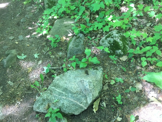
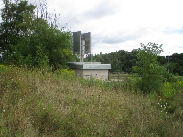
On the county atlas above the lots belonging to John Lane and G. C. Harris have been outlined in black.  A large portion of each of these lots was used for gravel extraction between 1940 and 1960.  When the aggregate supply was exhausted the empty pit was converted into the Sabiston Landfill.  From 1960 to 1975 the landfill operated with no records of what types of materials were dumped there and in which sections.  The site continues to produce methane gas that is released into the air and leachate which enters the groundwater.  Today there is a one metre clay cap over the landfill and the area has been designated as the German Mills Meadow and Natural Habitat.

IMG_6509

The mound that represents the former landfill is now monitored for discharges.  A decade ago the Town of Markham was considering installing an aerobic system to help speed up the elimination of methane and leachate from the site.  Local residents protested the plan based on the fact that methane was below the 2.5% level that the Ministry of the Environment sets as safe.  The community succeeded in 2012 in getting the plan halted by arguing

IMG_6511

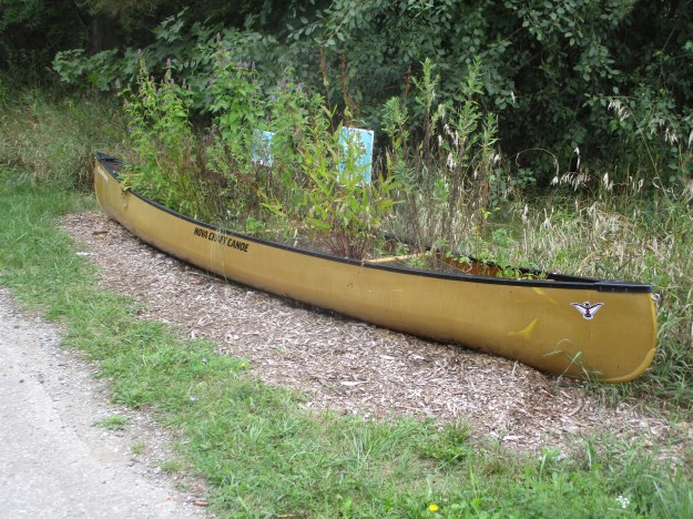
We found another one of these old canoes which has been planted to help encourage pollinators to do their thing.

IMG_6513

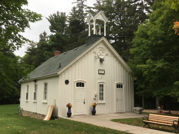
The community of German Mills constructed a one room log school to serve the children of the community.  In 1874 it was decided to replace the school with a larger board and batten structure.  The school was built with separate entrances for the boys and girls as was common in the Victorian Era.  One of the interesting features of the architecture is the way the batten curve into scallops under the boxed cornice of the roof.

IMG_6524

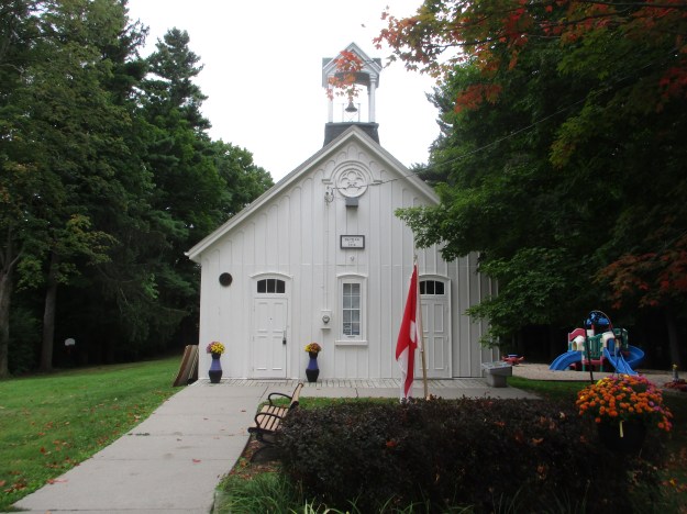
Originally known as school section number 2 there were over thirty different teachers who served here between 1874 and 1962 when it closed.  The original bell still hangs in the bell tower.

IMG_6726

One of the notable teachers from the school was Leonard S Klink who taught here in the 1890’s.  He was responsible for getting the students to plant rows of spruce trees around the sides of the property.  These trees continue to mark the outline of the school yard.  Klink went on to serve as the President of The University of British Columbia from 1919-1944.

IMG_6521

Poison ivy seems to have had a good year and there is plenty of it in German Mills Settlers Park.  The sap contains a substance known as urushiol that usually causes a reaction within 24-48 hours.  Controlling poison ivy by burning it can be very dangerous because inhalation of the smoke can cause the rash to develop on the inside of the lungs.  This can be very painful and possibly fatal.

IMG_6729

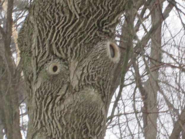
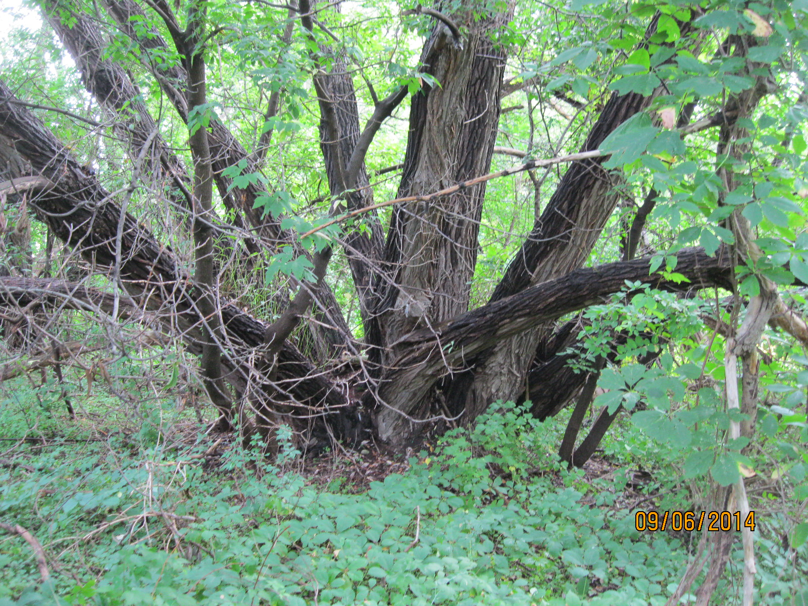
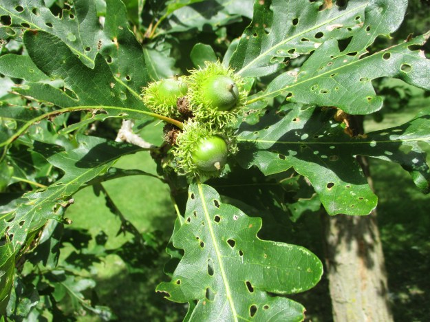
Bur Oak is a member of the group of white oaks and is also known as mossy cup oak.  The tree typically reaches 30 metres tall but has been known to be as large as 50 metres.  Like most oak trees they grow slowly but can live for up to 400 years.  The acorns are also large growing up to 5 cm in size.  These trees produce a heavy crop of acorns every few years in a process known as masting.  This bumper crop overwhelms the ability of the local wildlife to consume the acorns and ensures the survival of some seeds.

IMG_6530

German Mills Settlers Park is about to undergo construction work to prevent erosion from damaging the sewer pipe that runs along the length of the creek.  This will change the natural look of the creek for several years.

Google Maps Link: German Mills Settlers Park

Like us at http://www.facebook.com/hikingthegta

Follow us at http://www.hikingthegta.com

The Great Esker

July 7, 2018

This week I bought the Bruce Trail App for my phone and so it got it’s first workout.  After identifying a section we hadn’t been on before we set out for the parking area on the map (8th line north of 22 Side road, north of Georgetown).  There are several places that you can pull off and park that are not on the map including where the main trail crosses the road a little farther north.  With the tracking feature turned on it marked our trail as we progressed and created a record of the hike that can be saved toward earning trail badges.

Great Esker

We entered on the Eight Line Side Trail and made our way to The Great Esker Side Trail.  Along the way we identified the remains of an old car in the woods.  It has clearly been there for decades as it has no motor and is surrounded by mature trees. It is in a very advanced state of decay.  The front bumpers and grill pattern were quite unique in the various car models of the 1940’s.  Having looked through hundreds of online picyures, positive identification wasn’t possible but the closest candidate was a 1946 Chevy Stylemaster.  That particular car was a sedan and this model was most likely a truck.

IMG_5128

Flowering Raspberries grow along the trail in many places.  Their flowers are quite large for the raspberry family and have a long period of blooms which also makes them of special interest to honey bees.  The fruit looks like a large flat raspberry and is used by mammals and birds.

IMG_5176

Eskers are glacial deposits that run in nearly straight lines and rise above the surrounding landscapes.  They are formed during the melting phase of the ice age when water is rushing in a river either over or under the ice.  The formation of eskers is described in greater detail in our earlier post The Brampton Esker.  The Great Esker Side Trail runs, in part, along the top of an esker.  It stands about 30 metres above the surrounding terrain but is much shorter than the one in Brampton.  As far as eskers go, the Great Esker isn’t so great.  The Thelon Esker is almost 800 kilomtres long.  The trail leads directly up the esker.

IMG_5133

The escarpment is made up of limestone and harder layers of dolostone.  Scattered throughout the landscape are large granite boulders that appear to be out of place.  They have been carried by the glacier and deposited across the province by the retreating ice sheet.  Rocks that are different sizes or minerals than the ones common to where they are found are known as glacial erratics.

IMG_5134

Old stone fences run through the trees marking off the earlier fields.  More recently some guide wires have been put in some places along the trail.  These are growing into the trees in several spots.

IMG_5135

Most of the mayapples, or mandrakes, have been harvested by the local wildlife but a couple large ones remained that are still green.  When they start to turn yellow they will put off a pungent odor that attracts raccoons. It is suggested to remove the seeds if you do happen to harvest some of this native fruit.  You’ll have to be lucky because the raccoons check daily for the newly ripening fruit.

IMG_5137

Butterflies abound along the trial and this Appalachian Brown was one of several flittering among the plants.

IMG_5141

The poison ivy doing very well along the sides of the trails.  Urushiol oil in the leaves and stem causes an allergic reaction in 85% of people.  It is white when the stem is broken but turns black upon exposure to oxygen.  The oil is highly concentrated and a drop the size of a pin head can cause an allergic reaction in 500 people.  In the United States about 350,000 people a year get a rash that can last for up to 3 weeks.

IMG_5144

One of the truly interesting boardwalks is this one that takes advantage of this tree and the massive root system to carry the trail.

IMG_5152

Snow’s Creek Falls are located at the intersection of 27th side road and the 8th line so we made a detour to see how much water was there at this time.

IMG_5163

It was certainly cool to check out the Great Esker Side Trail and take the Bruce Trail App for a test run.  It likely means more hikes on the Bruce in the near future.

Google Maps Link: The Great Esker Side Trail

Like us at http://www.facebook.com/hikingthegta

Follow us at http://www.hikinghtegta.com

Hiking the GTA #100- Pernicious Plants and Beautiful Blossoms

April 28, 2014 to July 18, 2015

Presented below is a gallery of plant, flower and fungi  pictures taken during the first 100 hikes on the journey called Hiking the GTA.  This post concludes our celebration of chapter one in this adventure.

On July 21, 2015 I published my 100th post in this blog under the title Hiking the GTA #100 – Greatest Treks.  That post presented the 15 most popular stories on the blog, so far.  I’ve posted a gallery of animal pictures from those first blogs under the title Hiking the GTA – Amazing Animals.  Ontario has many edible plants, some very beautiful ones and several really nasty ones.  The pictures below are in no particular order except that the three most common poisonous ones are presented first.

Giant Hogweed is one of the nastiest plants in Ontario.  It can cause severe burns and even blindness.  These picture shows last year’s stocks and this year’s white blossoms and was published in the Canada Day post on July 1, 2015.

IMG_6074

Wild Parsnip is another plant with similar poisonous sap to the Giant Hogweed.  This picture was taken in Riverwood Part 1 – The Bird Property on June 28, 2014.

IMG_2492

A third poisonous plant is Poison Ivy.  This patch was photographed at Barbertown on Aug. 23, 2014.

IMG_3016

Burdocks have a tiny hook on the end of each stem that inspired velcro.  This one, complete with Lady Beetle, was photographed at The Winding Lane Bird Sanctuary on Oct. 11, 2014.

IMG_0579

Coral Mushroom are one of the plants that although relatively rare can be eaten.  This fungi was discovered on Canada Day 2015.

IMG_6023

Ontario’s provincial flower is the Trillium.  These were seen on our hike from Old Mill to Lambton Mills on May 17, 2014.

IMG_1961

The Yellow Iris is an invasive species that takes over our wetlands and chokes out other plant life.  This patch was seen on June 14, 2014 near Raymore Drive.

IMG_2190

Dog-Toothed Violets were seen on the hike where we discovered the Ovens Above Old Mill on May 10, 2014.

IMG_1894

The Vipers Bugloss has a brilliant shade of blue.  We found this example during our hike at the Devil’s Pulpit on July 11, 2015.

SAMSUNG

We found young teasels growing at Glen Williams on June 27, 2015.

SAMSUNG

Jack-In-The-Pulpit plants can live up to 100 years.  We found this large plant growing in Palgrave on May 30, 2015.

IMG_4909

Forget-Me-Nots were used in Newfoundland for their Remembrance Day celebrations before they joined confederation and adopted the poppy.  There were photographed near the Barber Paper Mills on June 6, 2015.

IMG_5189

Coltsfoot is one of the first flowers seen in spring.  We found this patch at Churchville on April 3, 2015.

IMG_3227

Canada Thistle isn’t native to Canada but appears on our Coat of Arms.  This bee was collecting pollen on a Canada Thistle near the Erindale Hydro Electric Dam on Oct. 19, 2014

IMG_0730

Black Willow trees grow in wet areas and reach massive sizes.  This one is in Riverside Park in Streetsville where we visited on Sep. 6, 2014.

IMG_3181

Trees suck the chlorophyll back out of the leaves and store it in the woody parts of the tree for re-use the next year.  These trees appear to be doing just that.  These were also photographed at The Winding Lane Bird Sanctuary on Oct. 11, 2014.

IMG_0611

Our parks are full of a wide variety of plants which keep the woods alive with splashes of colour from early spring until late fall.  Watch out for the pernicious plants and enjoy the beautiful blossoms as you have your own adventures, Hiking the GTA.

Visit us at http://www.facebook.com/hikingthegta