Tag Archives: Teasel

The Vale Of Avoca

Saturday Sept. 5th, 2015

In need of a shorter hike this week we set off to visit The Vale Of Avoca.  We investigated the collapsed ruins of an old saw mill, the eastern abutments of an old bridge and a 90 year old example of recycling as we explored a section of Yellow Creek.  It was 21 degrees early in the morning and quite comfortable, except for the unending mosquito attacks.  Only the female mosquito bites after which they live off the blood while 100-200 eggs develop.  They normally live for up to two weeks or until they land on me, which ever comes first.

We parked on Roxborough just off of Mount Pleasant.  From here the trail goes to the left and follows the creek to the lower portion of the Belt Line Trail.  We turned to the right and entered the Rosedale Ravine which we followed north to The Vale of Avoca, the name given to a section of this ravine.  As we walked north we came to the Canadian Pacific Railway bridge. This intricate concrete bridge replaces an earlier trestle bridge for which the cut stone foundations remain.

IMG_7973

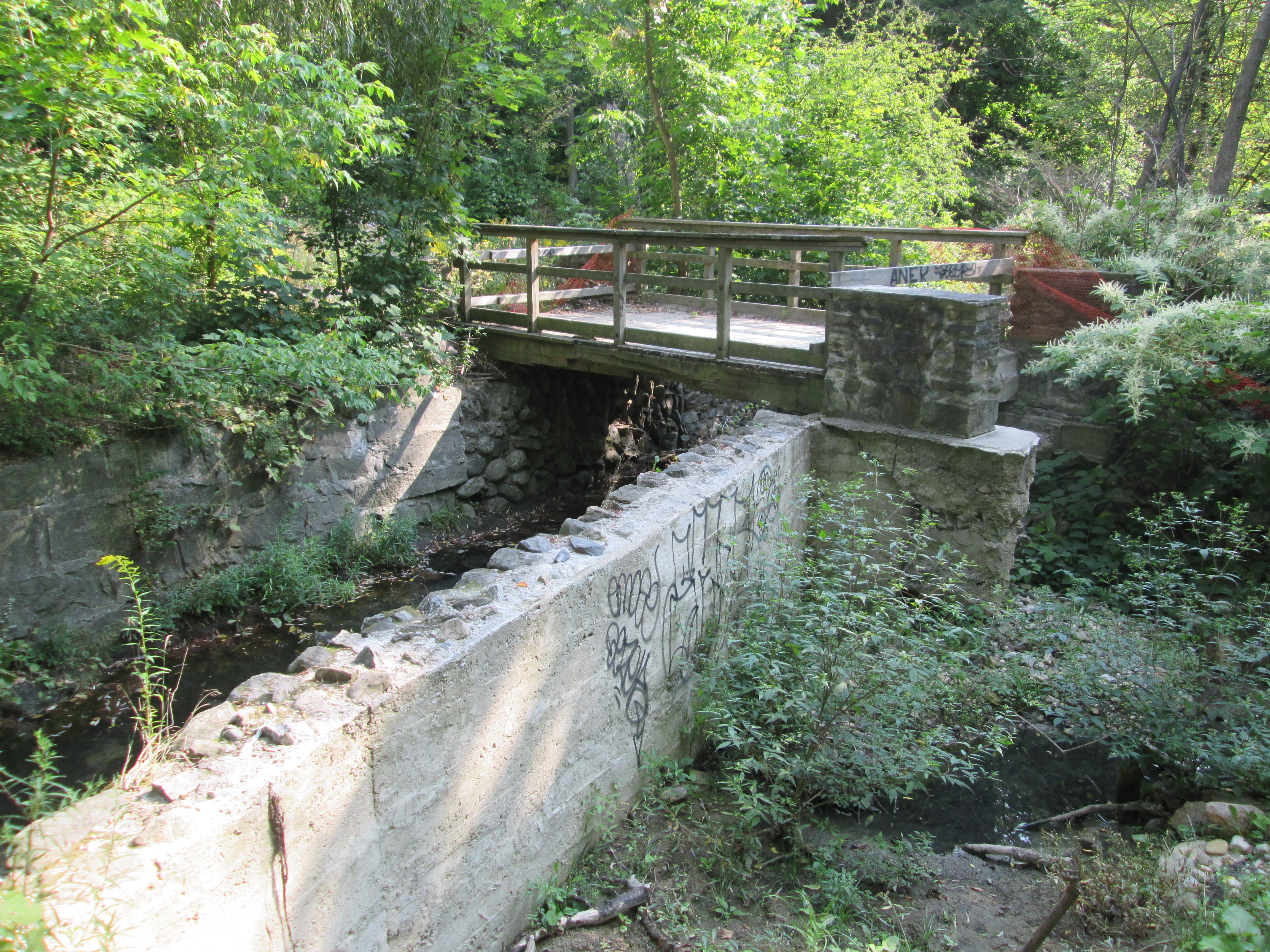
In 1837 the Heath Family purchased the north west corner of Yonge Street and the Third Concession Road (renamed St. Clair Ave. in 1914).  They named the area Deer Park and built a hotel where patrons could feed the local deer.  Their lot was subdivided and by the 1870’s the community was well established.  Today the Heath’s are commemorated by a street name. Deer Park extended as far east as the ravine carrying the Yellow Creek, which St. Clair didn’t cross.  In 1888 John Thomas Moore began to market his community of Moore Park which would be constructed between Yellow Creek and the ravine to the east of it containing Mud Creek.  To support his community he built bridges across both ravines and also attracted the Belt Line commuter railway.  Just prior to reaching St. Clair an old abandoned bridge crosses the channelized creek in the bottom of the ravine.  This concrete bridge sits on an earlier stone foundation.

IMG_7980

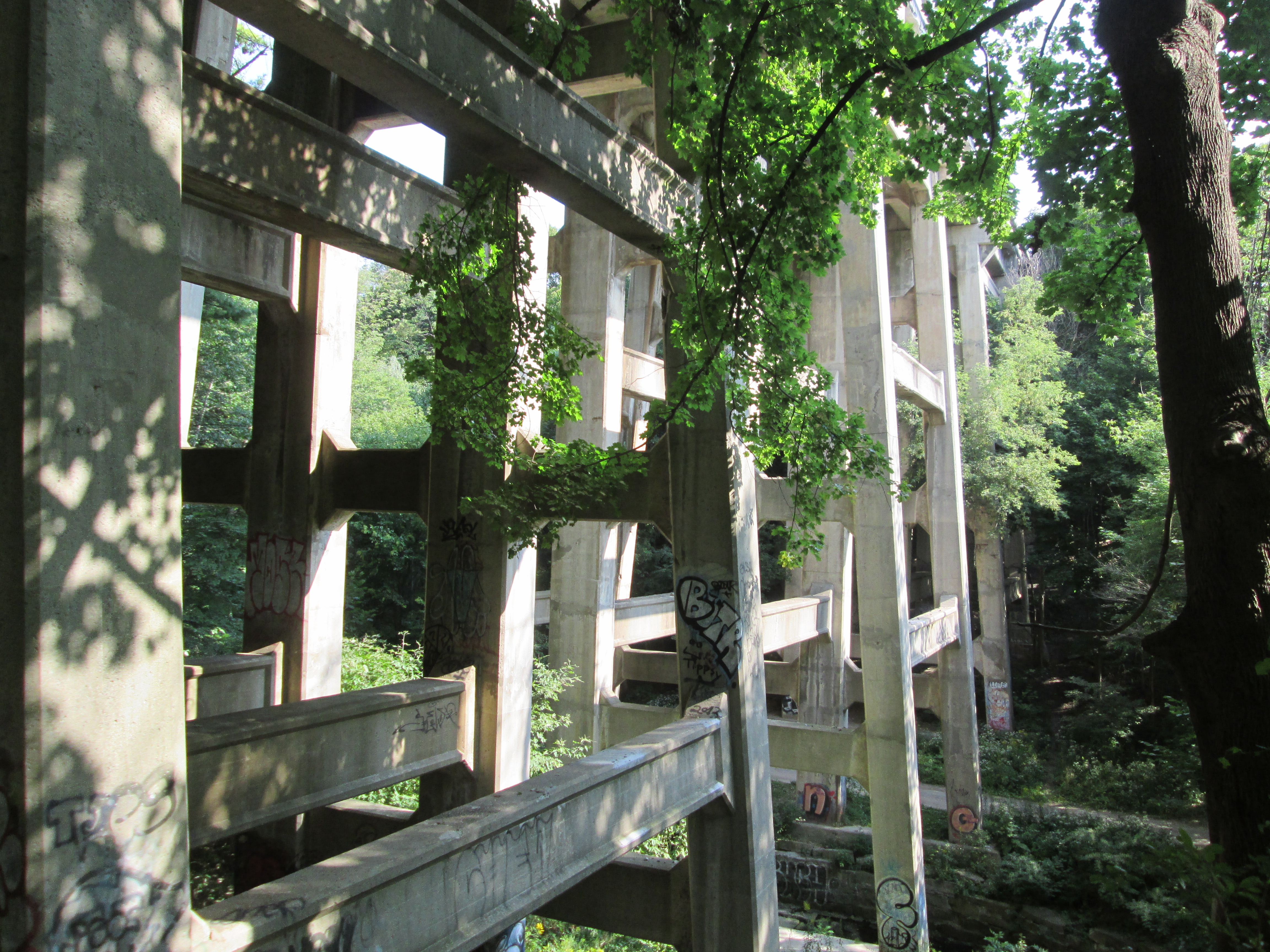
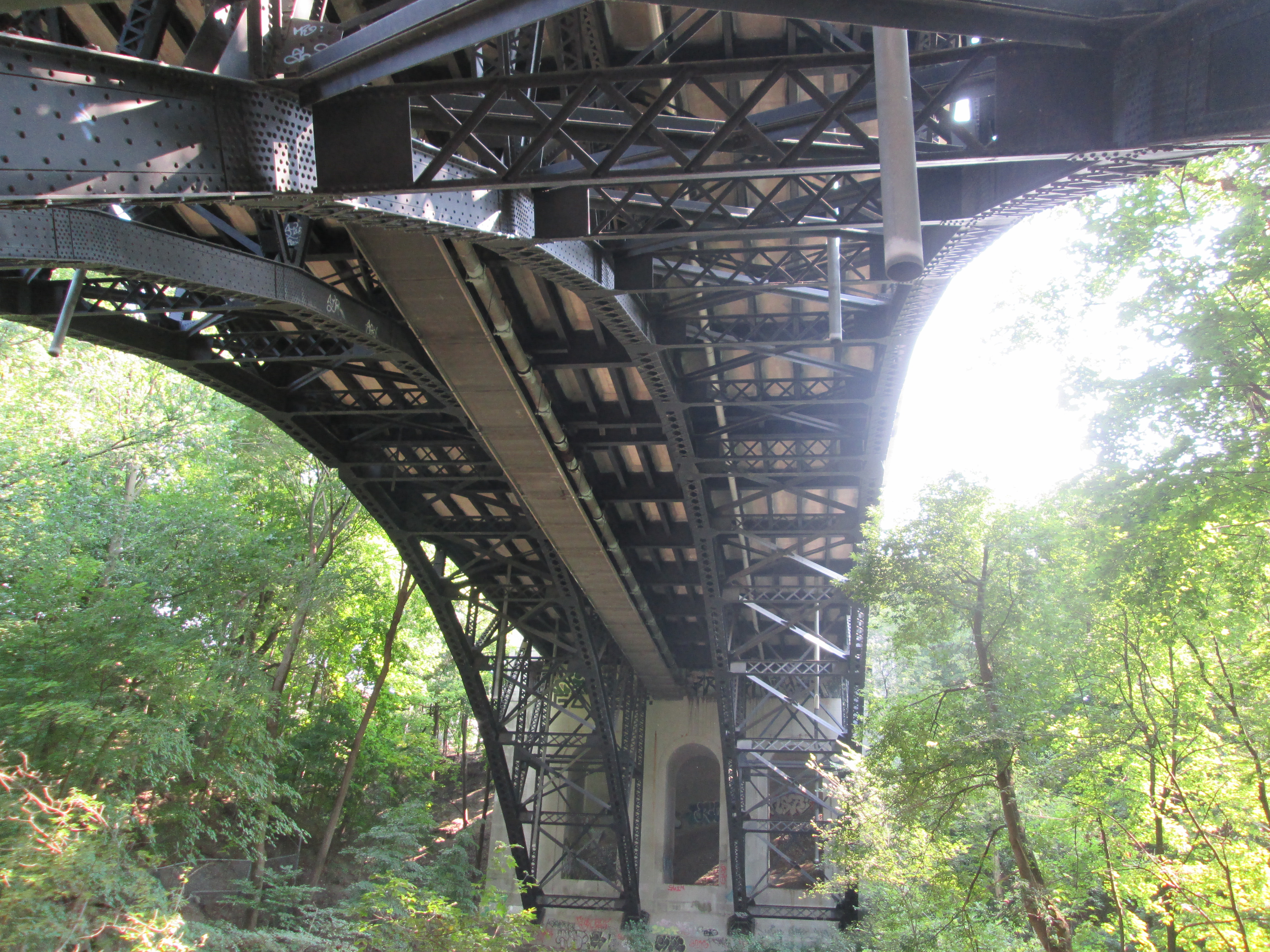
Moore’s bridge across Yellow Creek was built of iron and didn’t follow the alignment of the third concession.  It angled slightly south west and aligned with today’s Pleasant Boulevard.  By 1922 the bridge was starting to become a safety concern and approval was given to build a replacement. It was decided to straighten the alignment of the road and provide for four lanes of traffic and two of street cars.  The new bridge was built over a period of two years and is 509 feet long and 89 feet high.  It opened in 1924 and cost the equivalent of $9M in today’s economy.  The bridge is a steel and concrete triple span bridge.  The picture below shows the steel arches under the bridge as well as three concrete arches at the other end.  The bridge and the valley they span were renamed The Vale Of Avoca in 1973. The name is taken from a poem by Thomas Moore called The Meeting of The Waters.  It is said that Thomas Moore the poet and John Thomas Moore the community builder were related.

IMG_7989

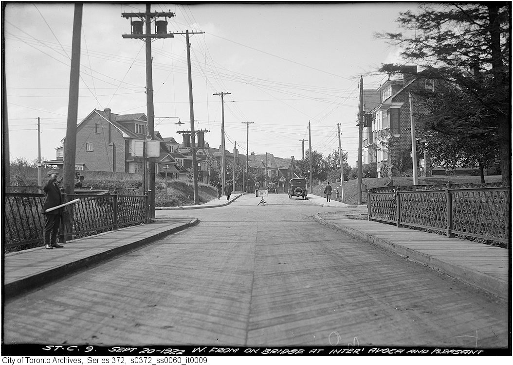
The Toronto Archives photo below shows the bridge looking west toward Pleasant Boulevard. Notice the lattice work iron railings on either side.

Construction photographs of St. Clair Avenue E. viaduct

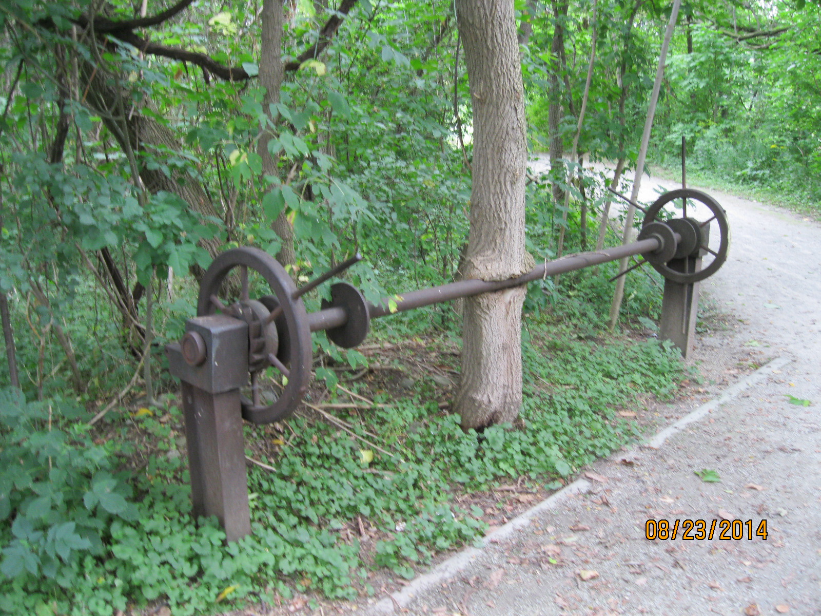
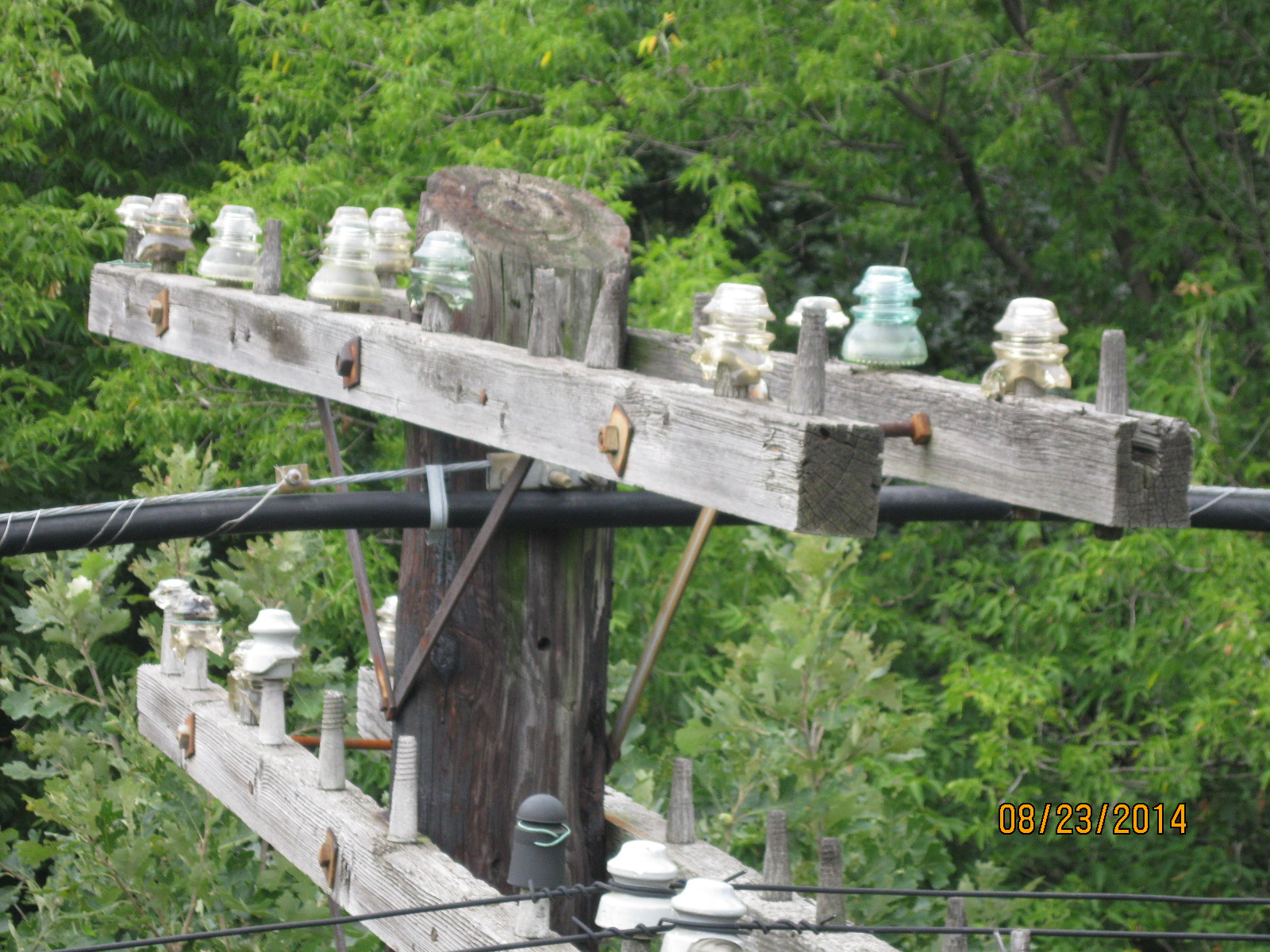
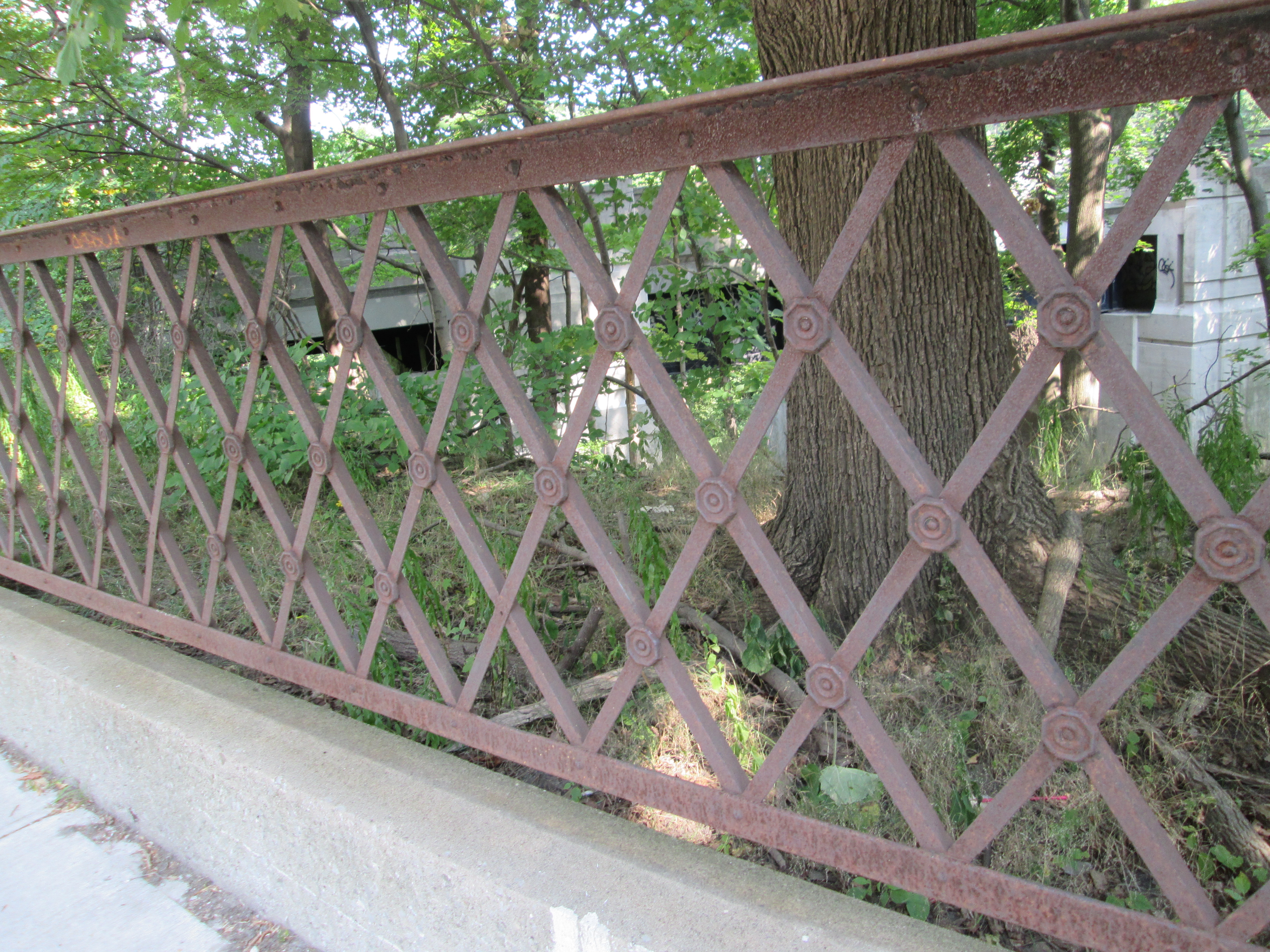
When The Vale of Avoca opened in 1924 the old iron bridge was immediately removed.  The iron railings from John Thomas Moore’s bridge were cut up and recycled as fencing along the side of Avoca Avenue.  The Vale of Avoca bridge can be seen in the background.

IMG_7997

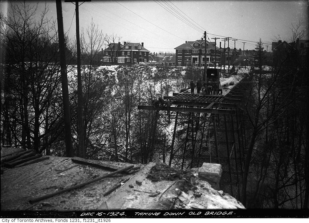
The archive photo below from 1925 shows the work in process of removing the old bridge.

Old Bridge

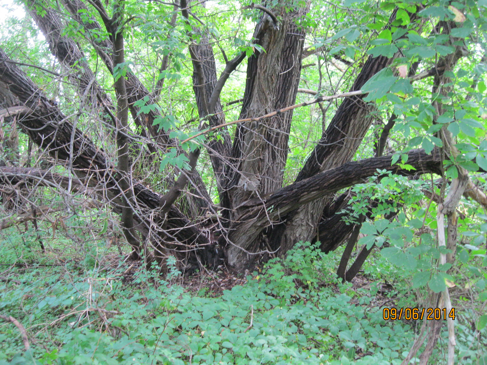
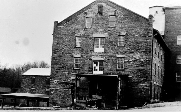
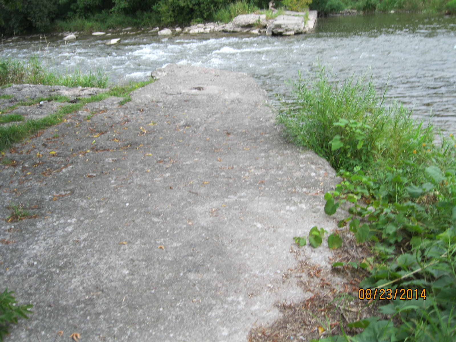
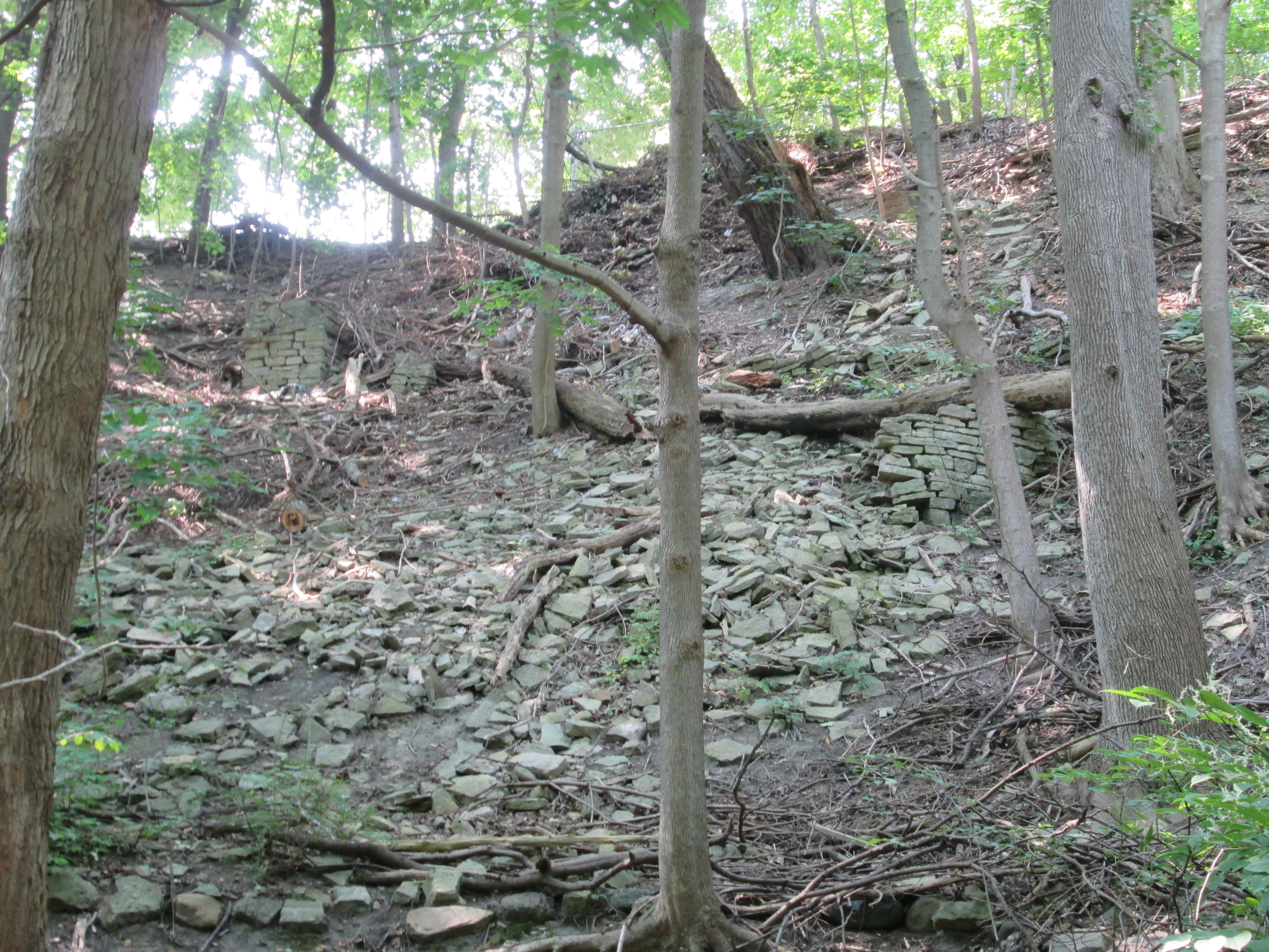
Just north in The Vale of Avoca lie the remains of an early sawmill. The  mill dam created a pond that stretched back upstream flooding part of what is today’s Mount Pleasant Cemetery.  This seems hard to believe looking at the present condition where the cemetery is on such higher ground.  The ravine that formerly held Yellow Creek through the cemetery property has been filled in with ten metres of soil that were excavated when the Yonge subway was built in the 1950’s.  The earthen works of the dam provided the first bridge across Yellow Creek at this location, prior to Moore’s bridge.  Today most of the structure of the mill has collapsed into a mess of shale on an otherwise soil covered embankment.  The horizontal tree in the middle of the picture below is resting on, and perhaps knocking over, part of one wall.  Near the left side of the picture there stands one of the other corners of the building.

IMG_8020

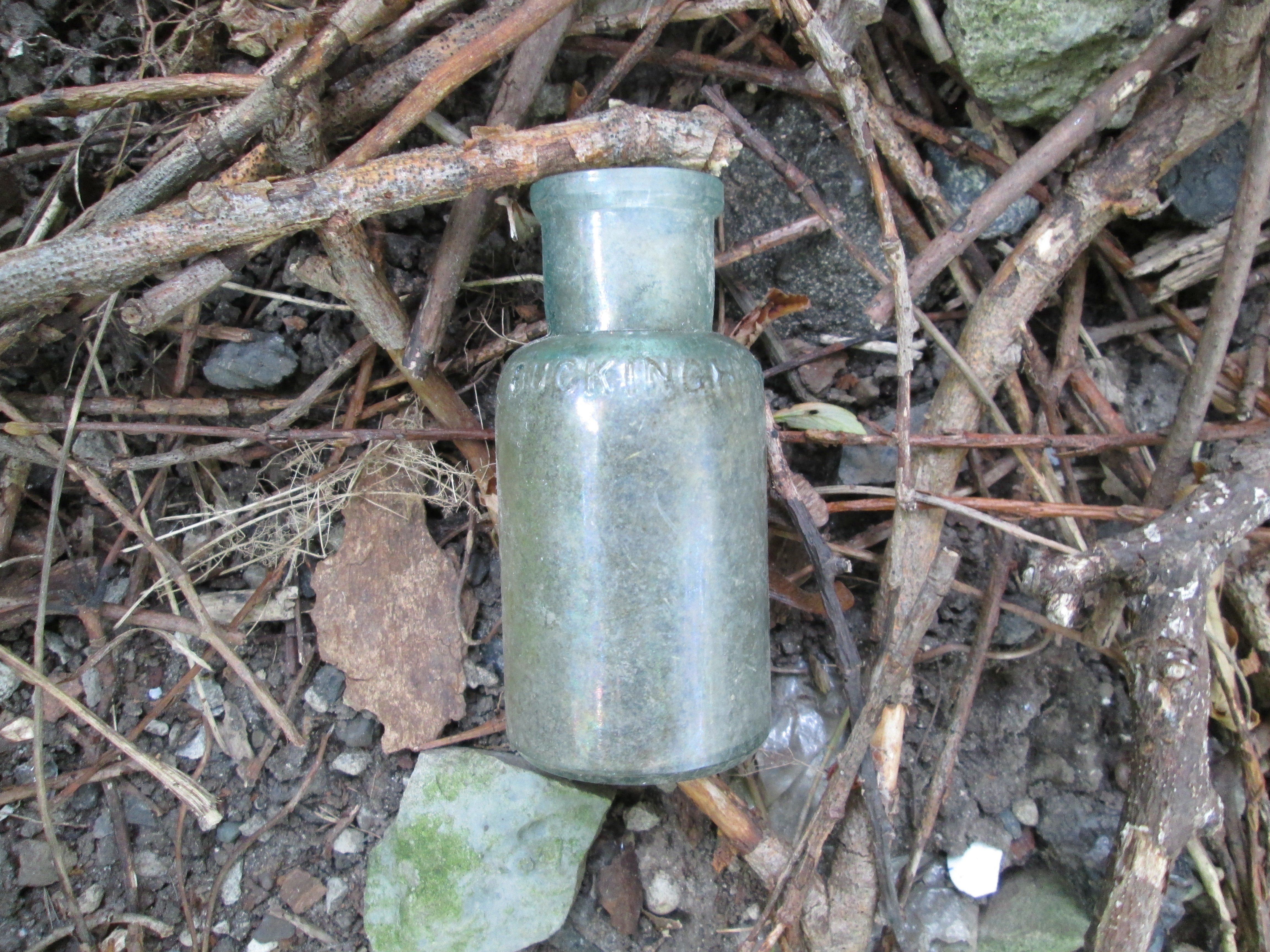
In the midst of the ruins of the collapsed mill I found the bottle pictured below.  It is embossed Buckingham Cleaner but bears no other markings.  The seam on the edge ends just below the lip suggesting a date between the late 1880’s and the introduction of the bottle machine in 1906.  Researching Buckingham Cleaner suggested to me that people in Buckingham have no excuse for dirt as you have a lot of cleaning services available.  The original product in this bottle is a little harder to find information about.

IMG_8012

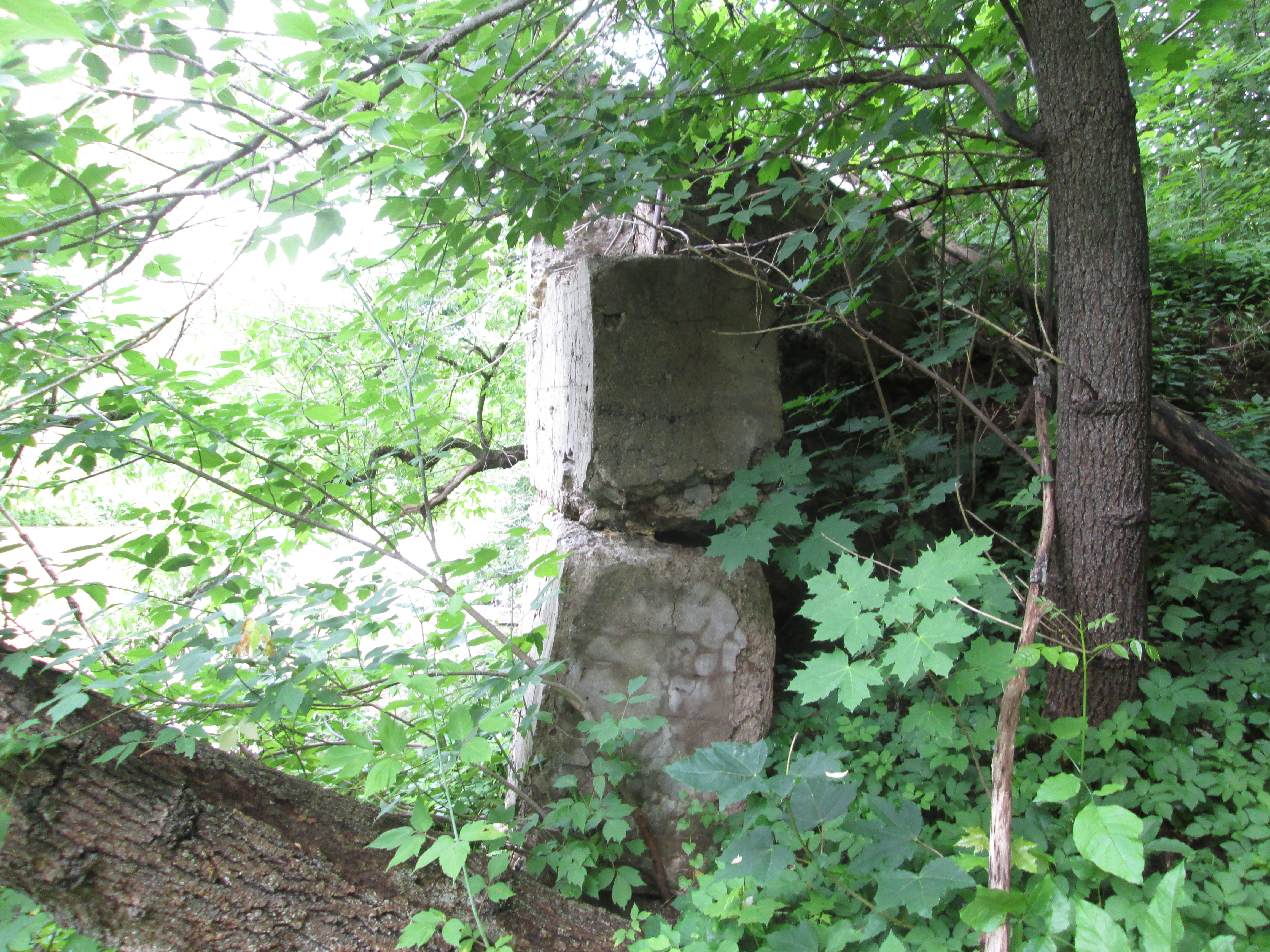
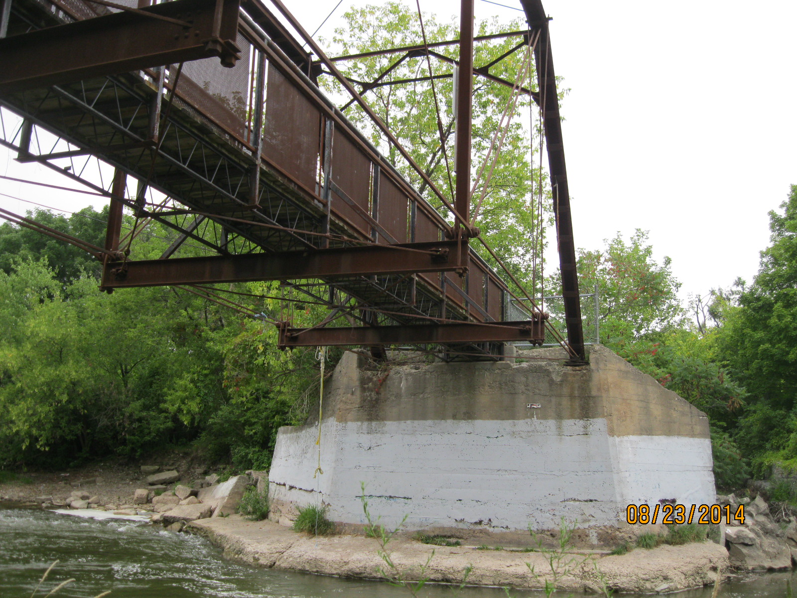
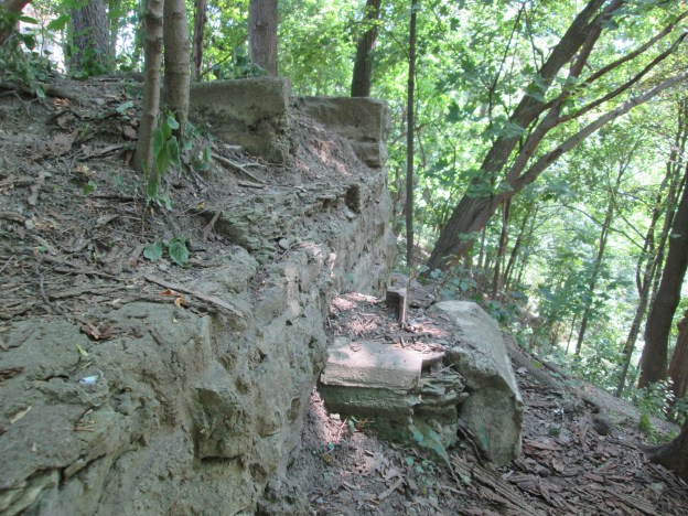
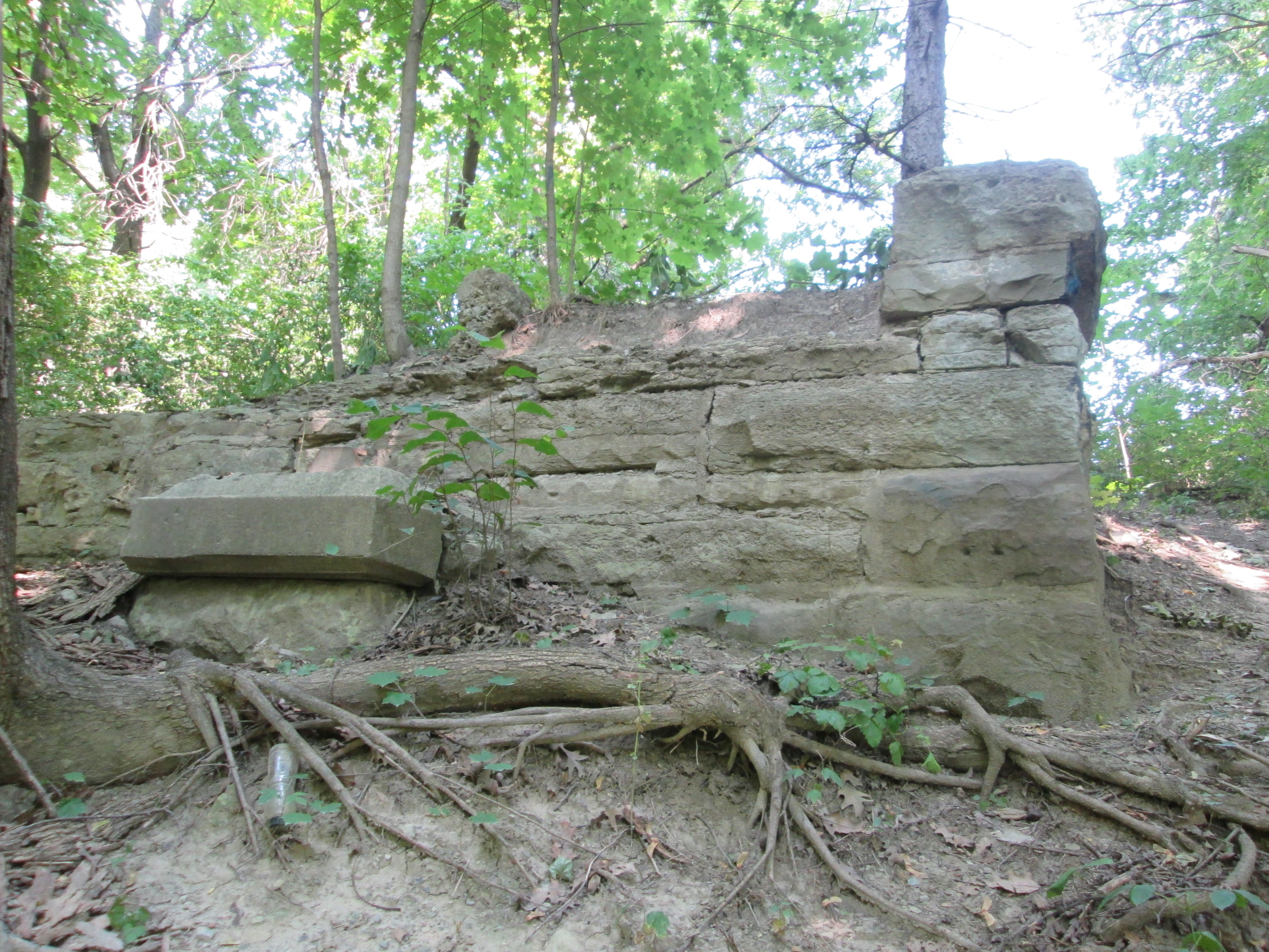
We returned to St. Clair and crossed Yellow Creek on The Vale Of Avoca.  On the east bank of the creek just south of the bridge stand the remains of the abutments and footings for the 1888 bridge.  The original bridge abutment was made of cut stone.  A rectangular slab of concrete near the left of the picture is from a repair conducted just prior to replacement.  The cover photo also shows the former bridge abutment looking out across The Vale Of Avoca.

IMG_8030

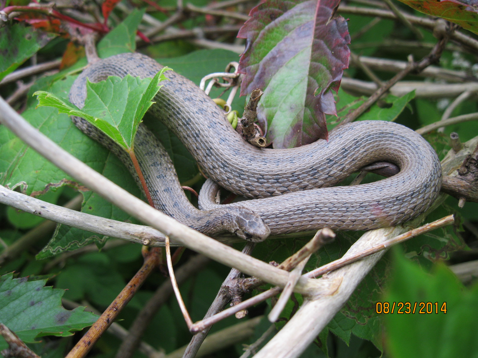
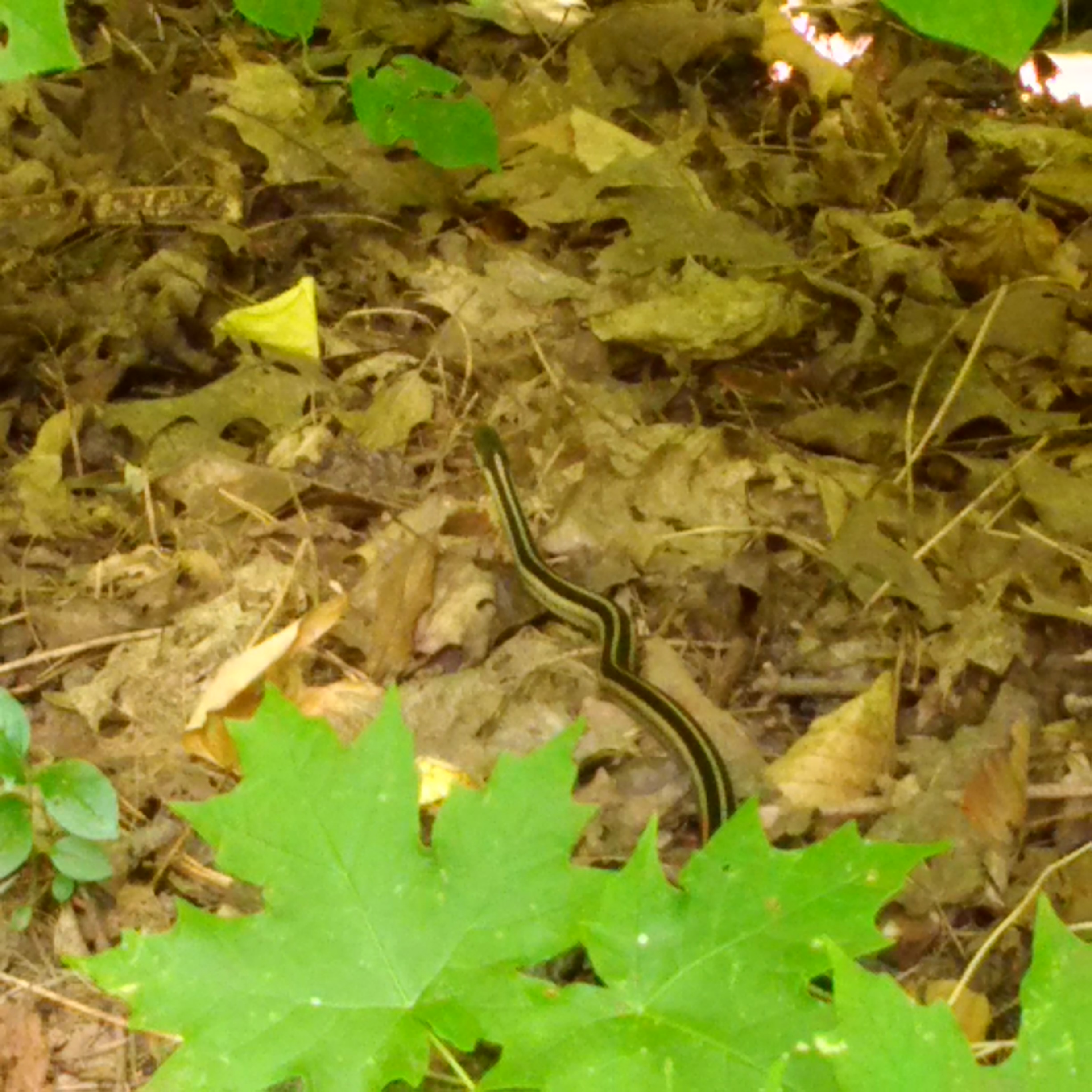
The common Garter Snake lives in a wide variety of habitats and is completely harmless.   Various species of snakes either lay eggs or give live birth.  The garter snake is one of the species that gives live birth and the female can have as many as 70-80 snakes in a single litter.

Snake

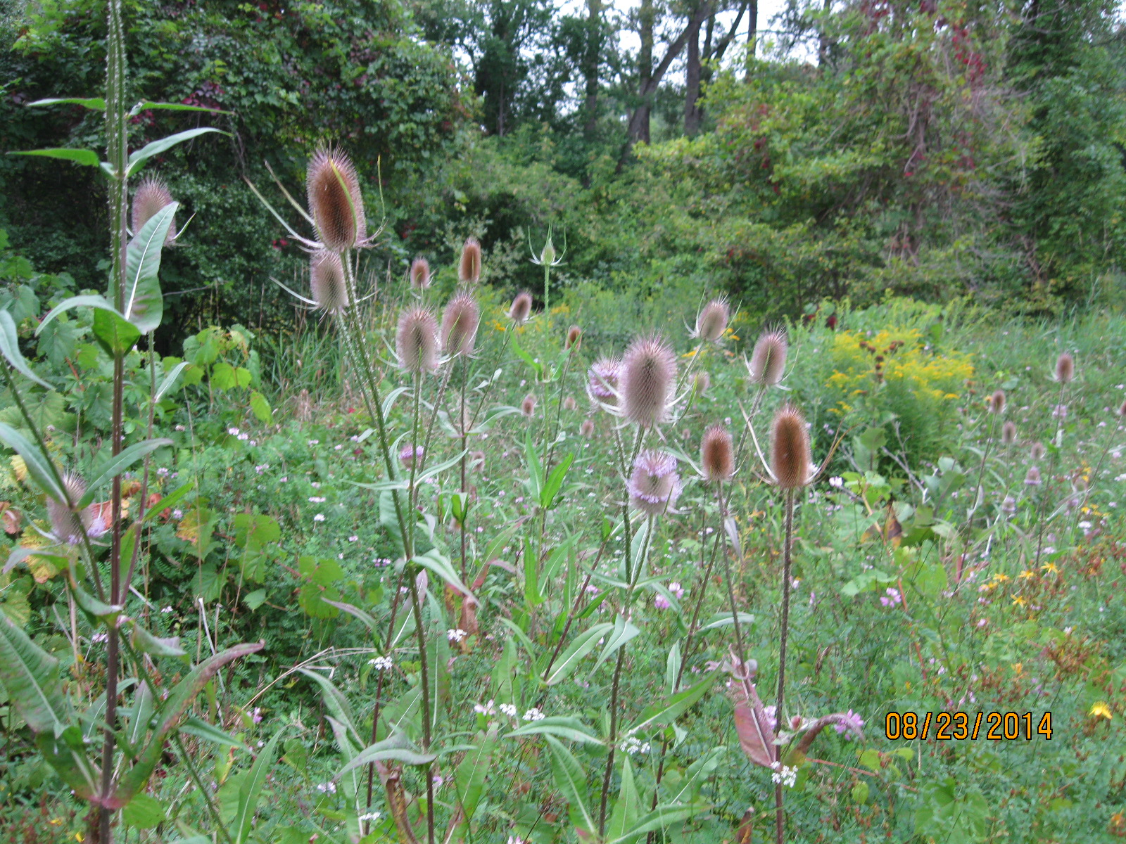
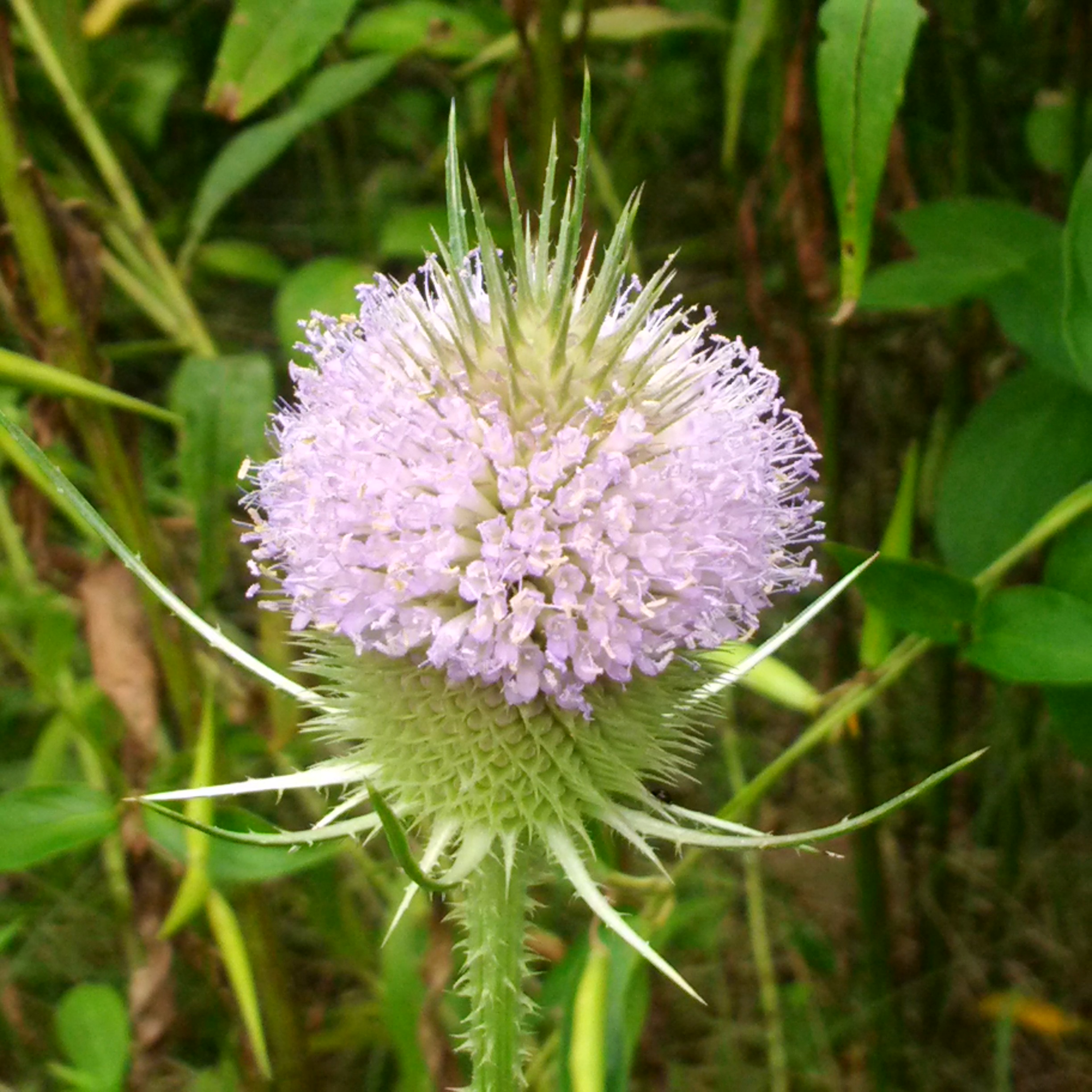
The teasel has nearly finished blooming for this year.  A few still have their purple ring of tiny flowers but these are only the ones which get less direct sunlight.  A group or cluster of tiny flowers such as these is known as an inflorescence.  The little flowers are actually specialized leaves known as bracts which bloom in a ring around the middle of the inflorescence and then progress toward the ends of the oval flower head.

IMG_20150825_125318

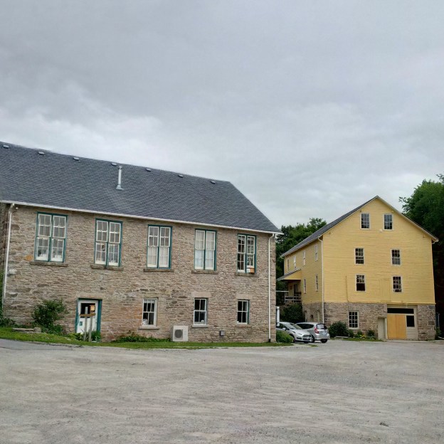
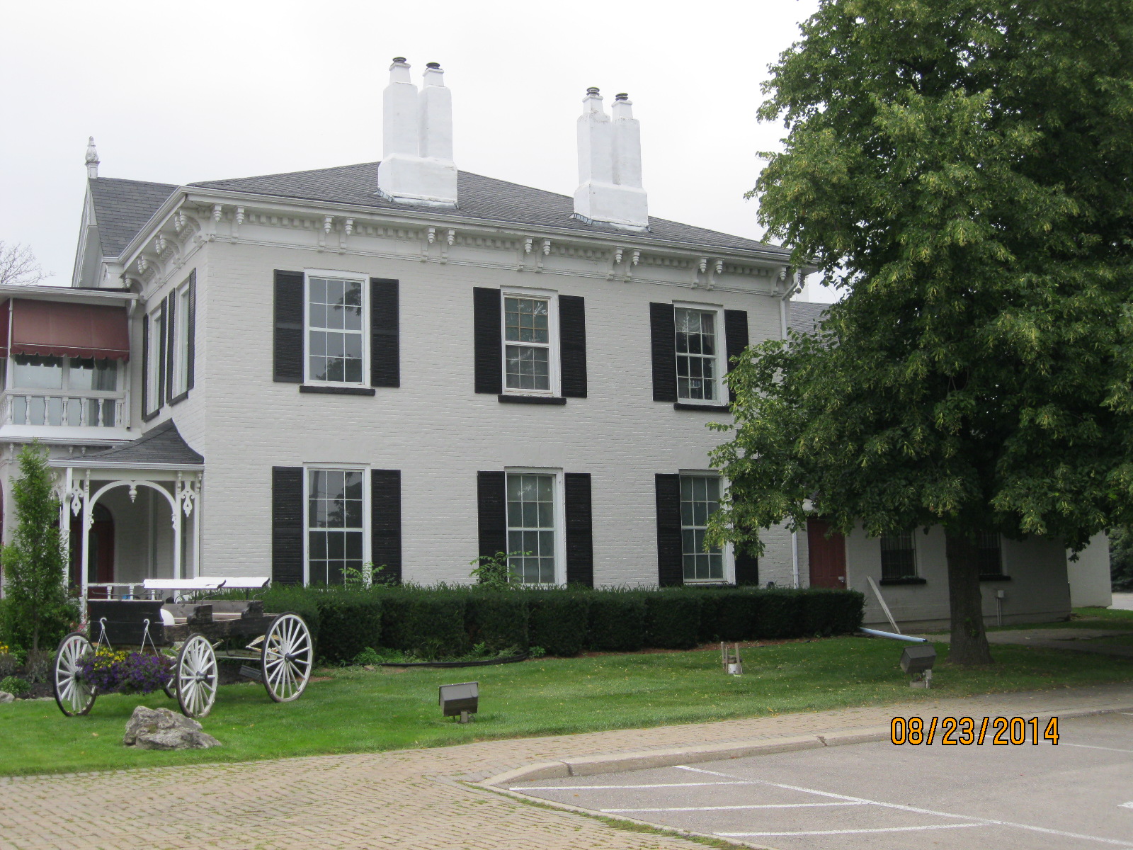
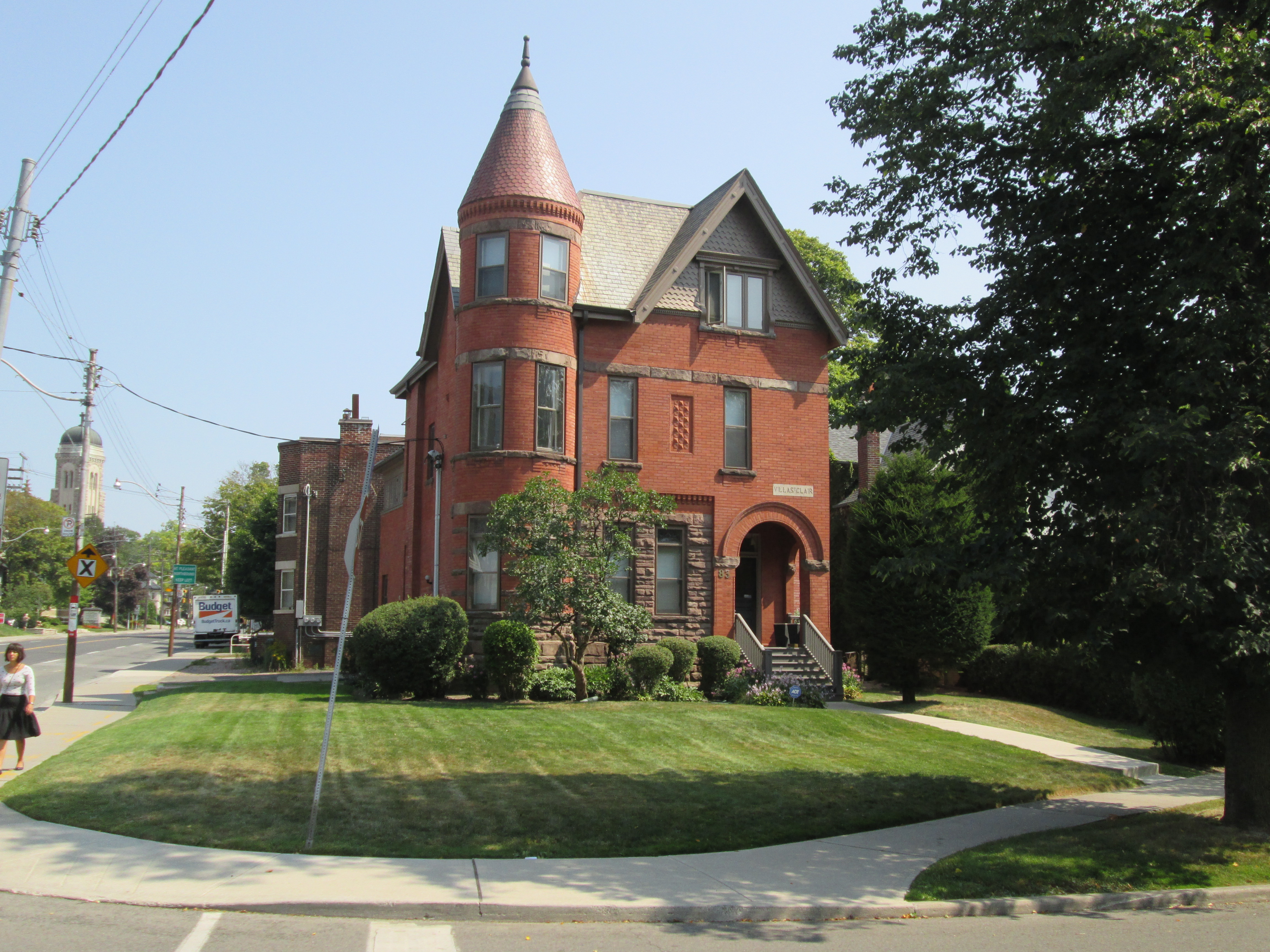
The Villa St. Clair was built in 1892 and added to Toronto’s list of heritage properties in 1984.  It has a small tower, or turret,  which looks out across The Vale Of Avoca.

IMG_8035

visit us at http://www.facebook.com/hikingthegta

Hiking the GTA #100- Pernicious Plants and Beautiful Blossoms

April 28, 2014 to July 18, 2015

Presented below is a gallery of plant, flower and fungi  pictures taken during the first 100 hikes on the journey called Hiking the GTA.  This post concludes our celebration of chapter one in this adventure.

On July 21, 2015 I published my 100th post in this blog under the title Hiking the GTA #100 – Greatest Treks.  That post presented the 15 most popular stories on the blog, so far.  I’ve posted a gallery of animal pictures from those first blogs under the title Hiking the GTA – Amazing Animals.  Ontario has many edible plants, some very beautiful ones and several really nasty ones.  The pictures below are in no particular order except that the three most common poisonous ones are presented first.

Giant Hogweed is one of the nastiest plants in Ontario.  It can cause severe burns and even blindness.  These picture shows last year’s stocks and this year’s white blossoms and was published in the Canada Day post on July 1, 2015.

IMG_6074

Wild Parsnip is another plant with similar poisonous sap to the Giant Hogweed.  This picture was taken in Riverwood Part 1 – The Bird Property on June 28, 2014.

IMG_2492

A third poisonous plant is Poison Ivy.  This patch was photographed at Barbertown on Aug. 23, 2014.

IMG_3016

Burdocks have a tiny hook on the end of each stem that inspired velcro.  This one, complete with Lady Beetle, was photographed at The Winding Lane Bird Sanctuary on Oct. 11, 2014.

IMG_0579

Coral Mushroom are one of the plants that although relatively rare can be eaten.  This fungi was discovered on Canada Day 2015.

IMG_6023

Ontario’s provincial flower is the Trillium.  These were seen on our hike from Old Mill to Lambton Mills on May 17, 2014.

IMG_1961

The Yellow Iris is an invasive species that takes over our wetlands and chokes out other plant life.  This patch was seen on June 14, 2014 near Raymore Drive.

IMG_2190

Dog-Toothed Violets were seen on the hike where we discovered the Ovens Above Old Mill on May 10, 2014.

IMG_1894

The Vipers Bugloss has a brilliant shade of blue.  We found this example during our hike at the Devil’s Pulpit on July 11, 2015.

SAMSUNG

We found young teasels growing at Glen Williams on June 27, 2015.

SAMSUNG

Jack-In-The-Pulpit plants can live up to 100 years.  We found this large plant growing in Palgrave on May 30, 2015.

IMG_4909

Forget-Me-Nots were used in Newfoundland for their Remembrance Day celebrations before they joined confederation and adopted the poppy.  There were photographed near the Barber Paper Mills on June 6, 2015.

IMG_5189

Coltsfoot is one of the first flowers seen in spring.  We found this patch at Churchville on April 3, 2015.

IMG_3227

Canada Thistle isn’t native to Canada but appears on our Coat of Arms.  This bee was collecting pollen on a Canada Thistle near the Erindale Hydro Electric Dam on Oct. 19, 2014

IMG_0730

Black Willow trees grow in wet areas and reach massive sizes.  This one is in Riverside Park in Streetsville where we visited on Sep. 6, 2014.

IMG_3181

Trees suck the chlorophyll back out of the leaves and store it in the woody parts of the tree for re-use the next year.  These trees appear to be doing just that.  These were also photographed at The Winding Lane Bird Sanctuary on Oct. 11, 2014.

IMG_0611

Our parks are full of a wide variety of plants which keep the woods alive with splashes of colour from early spring until late fall.  Watch out for the pernicious plants and enjoy the beautiful blossoms as you have your own adventures, Hiking the GTA.

Visit us at http://www.facebook.com/hikingthegta


Glen Williams

Saturday June 27, 2015

It was cloudy and rain was in the forecast but at 18 degrees it was quite comfortable.  We parked at the Barber Paper Mills and started to hike north up the east side of the Credit River. A blue marked side trail, part of the Bruce Trail, runs for 12 km between here and Terra Cotta. With the sky turning black we decided that maybe the weather man was right and getting caught in the rain would be better left for a warmer day.  Along the trail a small patch of Gooseberries are growing.  Gooseberries are related to the currant family and were valued in the middle ages for their cooling properties in fevers.  They are currently harvested for jams and preserves.

SAMSUNG

The story of Glen Williams is very much the story of the Williams family.  Benajah Williams arrived in 1825 and built a saw mill and a flour mill on the Credit river in what would become known as Williamsburgh.  He was born in 1765 in New York but as a staunch Loyalist he emigrated to Upper Canada.  The Williams family supplied all the services that a rural community needed with Joel being the blacksmith, David the tanner, Isaac made cabinets, Jacob ran the Glen Woolen Mill and Charles had a general store and was first postmaster.  The Glen Woolen Mill was a town fixture until it burned down in 1954.

Benajah’s original sawmill was built in 1826 and, along with his flour mill, formed the nucleus of the community.  In the 1850’s he replaced it with the current mill.  It operated as a water powered saw mill before being converted into a hosiery factory and finally serving as an apple processing plant.  It belonged to Rheinhart Vinegars at the time of it’s closure in 1985.  It was restored in 1989 and painted yellow earning the nick name “The Yellow Mill.  Benajah passed away in 1851 leaving Charles to run  much of the town’s industry.

IMG_20150627_114852_hdr

Beside the Yellow Mill stands the old stone building which housed the Georgetown Electric Light Company.  The two structures are shown together in the cover photo.  This two and a half story building was erected in 1893 on the foundations of the grist mill.  It provided electricity to Glen Williams for  20 years until 1913 when hydro was brought from Niagara Falls.  At this time both it and the Barber Dynamo a few km downstream were shut down.  It is an interesting building because the stone mason didn’t take the time to level the windows and so they slant on various angles.

IMG_20150627_114749_hdr

Charles Williams opened a general store and post office in 1852.  When he applied for a post office licence it was refused on the grounds that there was already a post office in another town called Williamsburgh.  Charles settled on the name Glen Williams after the little glen in which the town sat.  The building was recently home to The Copper Kettle but is presently under renovations.

IMG_20150627_115710_hdr

The Good Templars approached Charles Williams in 1870 asking for a piece of land on which to build a town hall for the community that they could also use for their temperance meetings. Charles deeded them the town lot adjacent to his General Store.  The town hall was built in 1871 and has served the community in many capacities including as a stage for Canadian author Lucy Maud Montgomery to perform dramas.

IMG_20150627_120705

On the corner opposite to the town hall stands two connected buildings.  The first is the home of James Laidlaw who built it in 1858.  The building beside it belonged to the local tailor Thomas Frazier who operated his shop here starting in 1847.  Later it belonged to Laidlaw who ran a store here.  Timothy Eaton was a clerk in this building in 1853 and 1854 starting when he was 19.  Timothy would go on to found Eaton’s Department Store.

IMG_5954

Benajah Williams and his family were Methodists and the first services in town were held in 1836.  The frame church was built in 1837 and given a veneer of bricks in 1903.  This church stands on one side of the Credit River.

IMG_5960

On the opposite bank stands the St. Alban The Martyr Anglican Church.  It has an interesting shape with the bell tower at the rear instead of the front by the street.  The first services held in this building were in June of 1903.  I wonder if the Methodists decided to give their church a facelift of bricks in response to the construction of the Anglican church.

IMG_5983

These two churches stood on either side of the Glen Williams mill pond.  The mill dam stretched between the two churches until it was destroyed by a flood in 1950.  Glen Williams has been subject to much flooding over the years with major floods in 1912, 1930, 1964 and 1965. Remanants of the dam can be seen on both sides of the river.

IMG_5965

On the north end of town Joseph Tweedle operated a saw mill in the 1860’s.  In 1872 Richard Hurst replaced the saw mill with the large stone structure that stands here today.  In 1882 it was purchased by Samuel Beaumont who opened the Beaumont Knitting Mills.  Products from the mill included blankets, socks and mittens.  This mill at one time competed with Jacob Williams Woolen Mill and Benajah Williams hosiery factory in a local hub of the textile industry.

IMG_20150627_121241_hdr

Having previously teased you with teasles in the Barbertown post I thought it fitting to post a picture of the young plant as it starts to open.  Later in the season it will bloom with a purple ring but for now it looks more like it belongs in a movie about an invasive species of plant from outer space.

SAMSUNG

Thanks to my brother for providing some of the pictures in this post.  He’s the guy who puts the “we” in “we”.

Visit us at http://www.facebook.com/hikingthegta for additional photos.

Barbertown – Ghost Towns of the GTA

Saturday August 23, 2014

Overcast and 21 degrees but feeling more like 26 with the humidity.  We parked in the little parking lot on the east side of the Credit River just south of Eglinton Ave.

We encountered a patch of poison ivy that had started to turn red.  Poison Ivy is distinctive with it’s three leaf pattern on each stem.  It likes carbon dioxide and has doubled both it’s habitat and strength since the 1960’s.  Late in August the berries turn white as seen in the photo below.  The berries are eaten by birds and bears and are still viable after passing through them.  Some people can have a severe allergic reaction to poison ivy.

IMG_3016

We saw a small Dekay’s Brown snake lying on a branch sunning itself.  They can grow to about 50 cm but the young, which are born in late summer, are 8-11 cm in length.  This snake is not poisonous but can emit a foul smelling musk if it feels threatened.

IMG_3021

In 1843 the Barber Brothers, William and Robert, decided to expand their Georgetown mill operation by buying William Comfort’s farm and mill site just south of Streetsville.  In 1852 they built a 4 storey wollen mill.  When it burned in 1861 their workers just built a new one and opened again only three months later.  Within 10 years it was the fourth largest textile mill in Ontario.  During the first world war it was converted to a flour mill which it continues as today.  The second mill remains on the left in the photo below but has been covered over with stucco and aluminum siding.  The cover photo shows the mill as it looked in 1950.

IMG_3053

Mills used to be built tall to take advantage of shafts and pulleys that were turned by the water wheel.  In this four story mill the wool was carded on the top floor then moved to the third floor where it was spun into yarn.  On the second floor it would be woven into blankets and assorted textiles.  On the first floor it was was cleaned, checked for quality and prepared for shipping.

Carding wool is a process which runs the wool through a carding material.  We get the word “carding” from the Latin word “carduus” which means teasel.  When the Barbers ran their mill, their workers would have used the heads of the teasel plant to draw out the fibres of the wool into long strands that could be spun.  Today carding is performed with a set of paddles with many closely spaced pins on them.  Teasel plants still grow around the mill property.  By mid summer the plant can be up to 2 meters tall with large purple heads on them.  The flower forms a purple ring that works its way down the the head as it blooms.  The ones pictured below have finished blooming.

IMG_3017

The Barbertown bridge was built in 1898 to carry workers from about 40 cottages that were built along Base Line (now Eglinton Road).  The staff of the mill reached 200 at one point and used this bridge to access the cottages on the other side of the river along Barbertown Road.  The bridge originally carried a roadway as wide as the cross beams on the bottom.  A narrower foot bridge has been installed for modern pedestrian traffic.

IMG_3056

A sluice gate is used to control the flow of water at a mill site.  By raising and lowering the gate a mill could control the speed of the water wheel.  At Barbertown the sluice gate was raised and lowered by a hand crank that would have been operated by two people. When water power was finally abandoned here in 1974 the sluice was filled in. Today a tree grows where a deep ditch full of water once ran.  The tree has grown almost completely around the steel rod as if to still the works of man even further.

IMG_3057

The Barber dam was washed out in 1974 and never replaced.

IMG_3064

William Barber built himself a two story house in 1862 on the corner of Barbertown Road and Mississauga Road.  It survives today as a restaurant. An 1860’s carriage parked near the front of the house reminds us of how these roads and the Barbertown Bridge were originally used.  I can picture William coming out in the morning and getting onto perhaps this very carriage.  After an inspection of the mill, perhaps a trip down Mississauga Road into Port Credit to arrange the sale or shipment of some of his textiles.

IMG_3106

Rail corridors were strung with telegraph wires allowing transmission of information about train positions.  When electrical power was spreading in the early 1900’s the utility poles were converted to carry power as well.  Glass insulators were patented in the 1880’s and were used where each wire was attached to the pole.  In the picture below many of the original ones have been broken off but several good examples remain.  The light blue ones are possibly older than the clear glass style but to know for sure a date is usually embossed on the right side of the molder’s logo.

IMG_3072

We disturbed a Red-Tailed Hawk who was having a little snack.  Although they eat mainly rodents they are not opposed to a little water fowl once in while as this one was enjoying. Females are up to 25% larger than males and this was therefore likely a female.

IMG_3098

Like us at http://www.facebook.com/hikingthegta

Follow us at http://www.hikingthegta.com