Tag Archives: Hiking

West Toronto Railpath

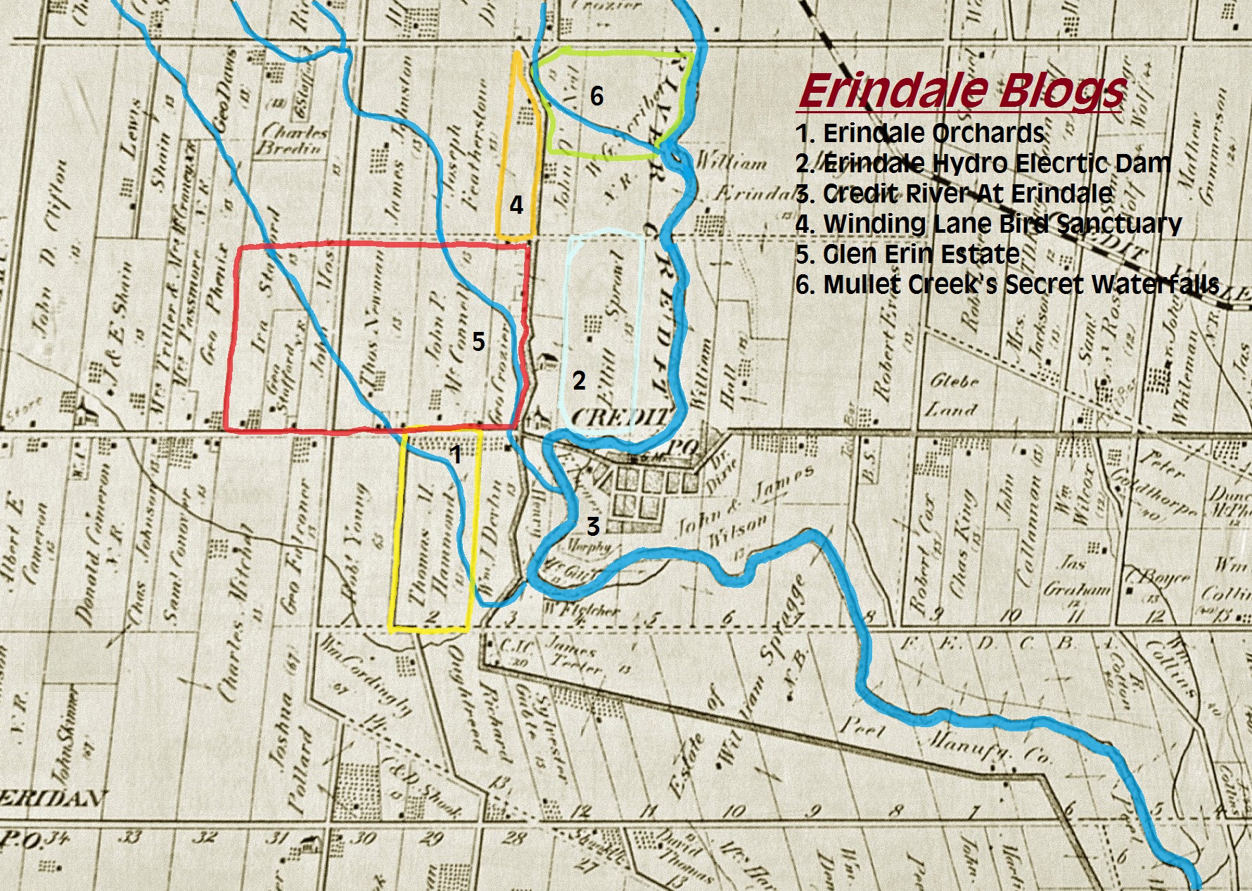
Sunday, July 4, 2021

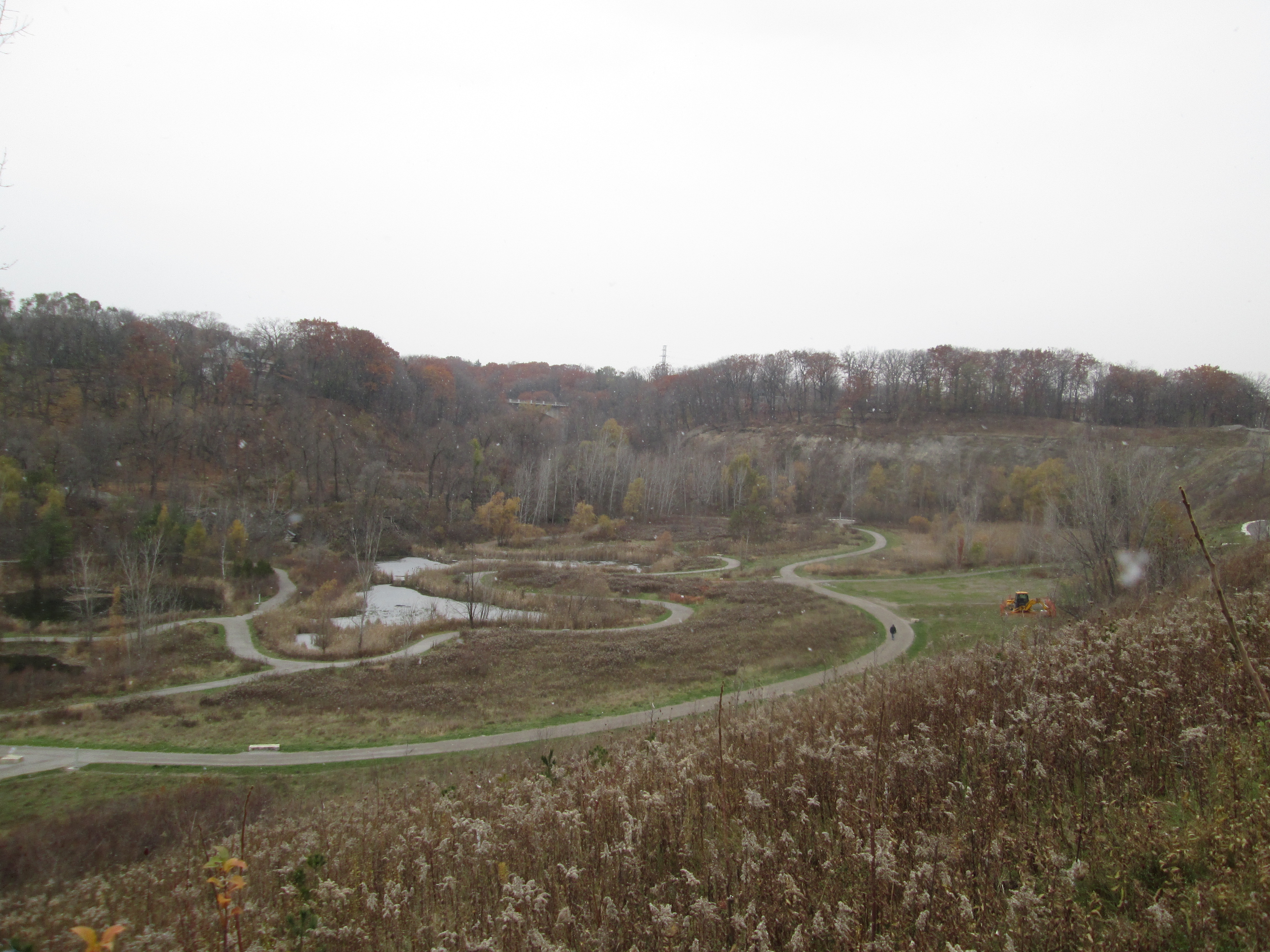
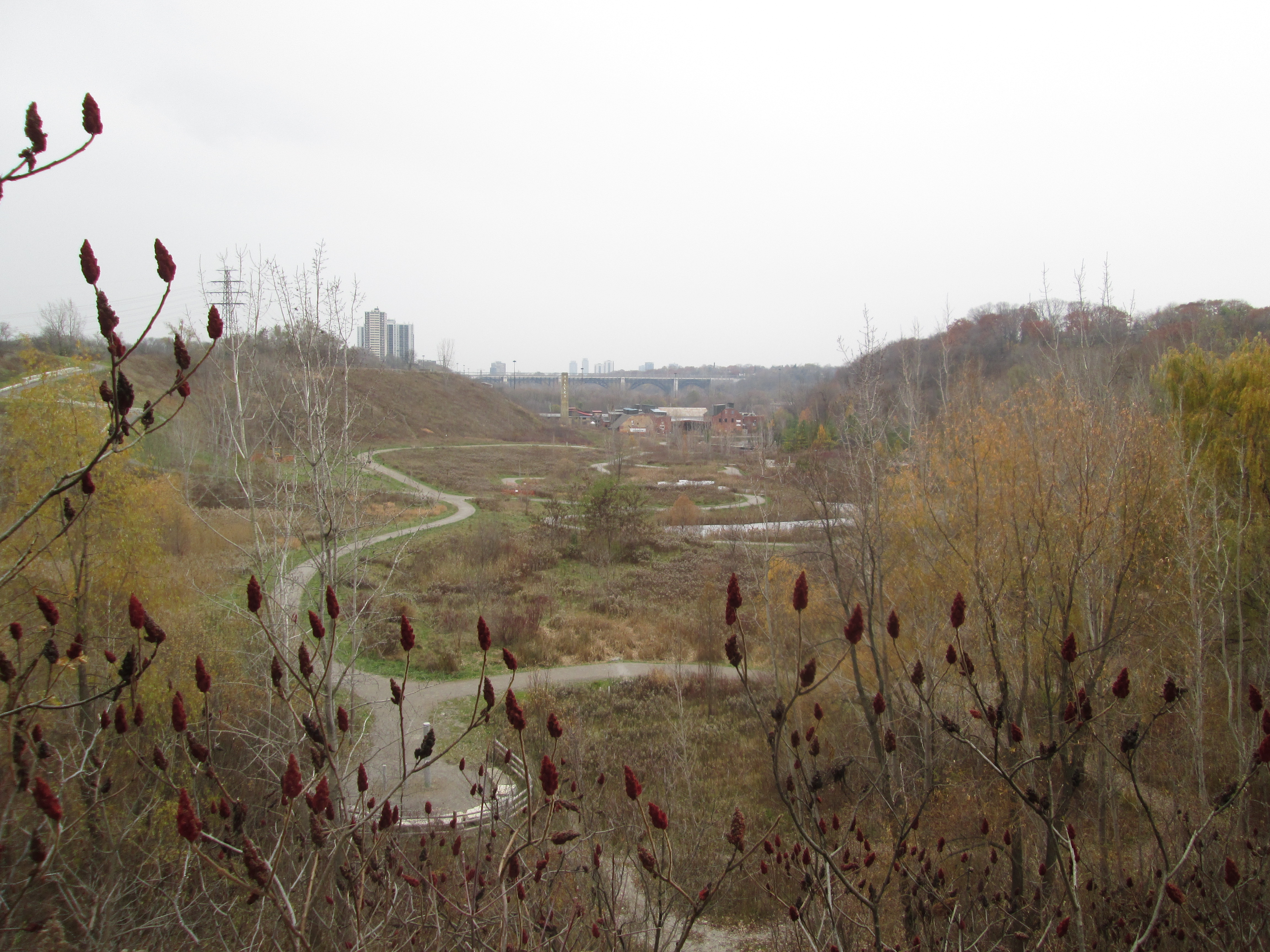
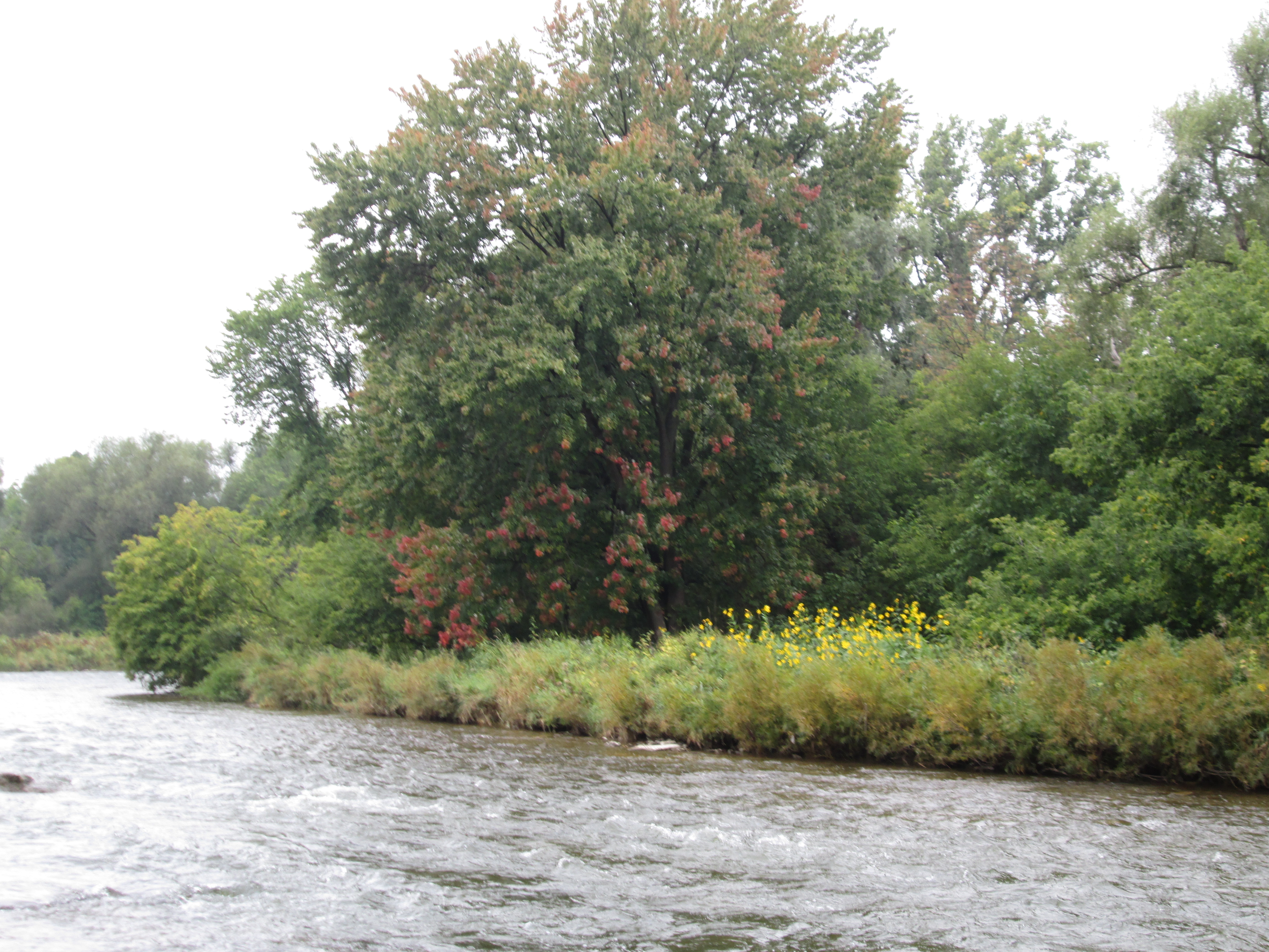
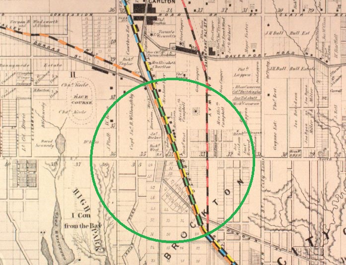
The West Toronto Railpath is currently 2.1 kilometers long and runs along the former right of way of the Toronto Grey and Bruce Railway. The County Atlas below shows the area as it looked around 1877. Several railways have already been built through The Junction and more would follow over the next decade. On the map I’ve coloured the Toronto Grey & Bruce in blue with the section on the rail path being green. The Grand Trunk Railway is yellow while the Credit Valley Railway is orange. To the right, The Northern Railway is red.

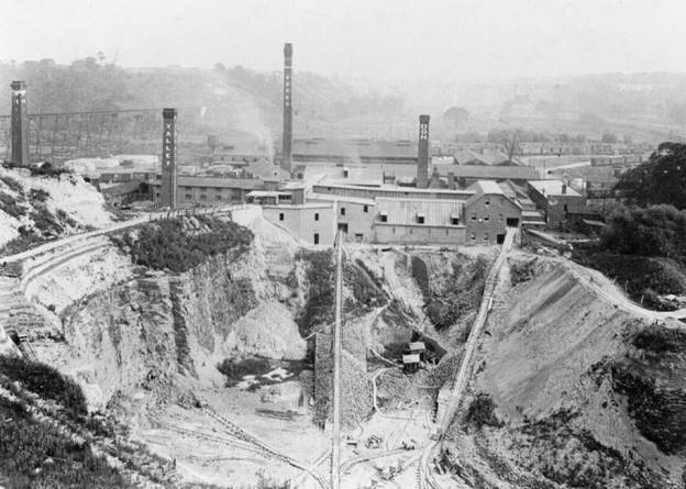
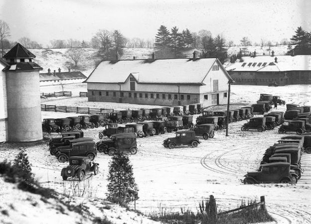
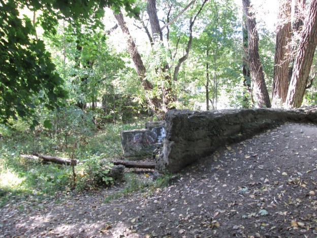
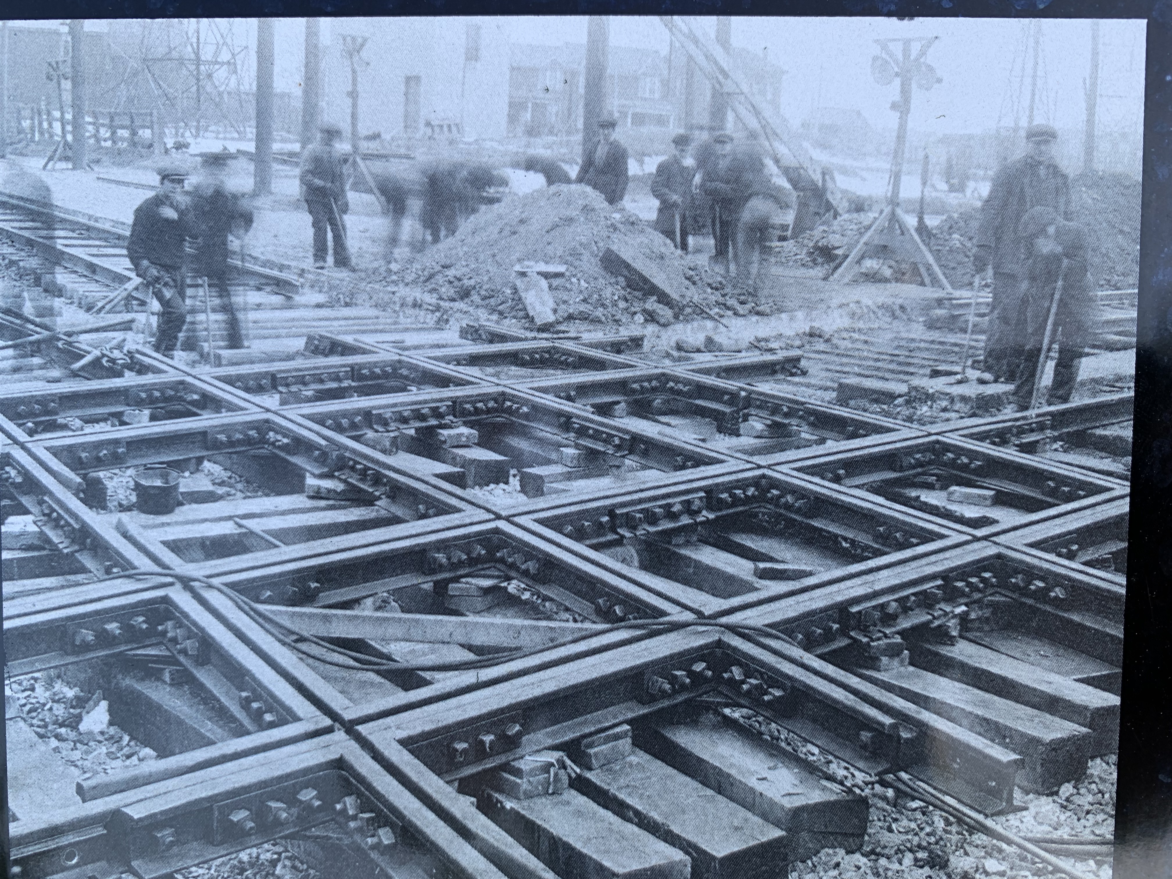
Before mergers began, there were five railways that intersected in West Toronto, or The Junction. These would eventually become three lines of Canadian Pacific Railway and two of the Canadian National Railway. The crossed each other on a complicated set of tracks known as the West Toronto Diamond Crossings. The archive picture below shows crews working on the diamond in 1924 and is part of an information plaque at the northern end of the rail path.

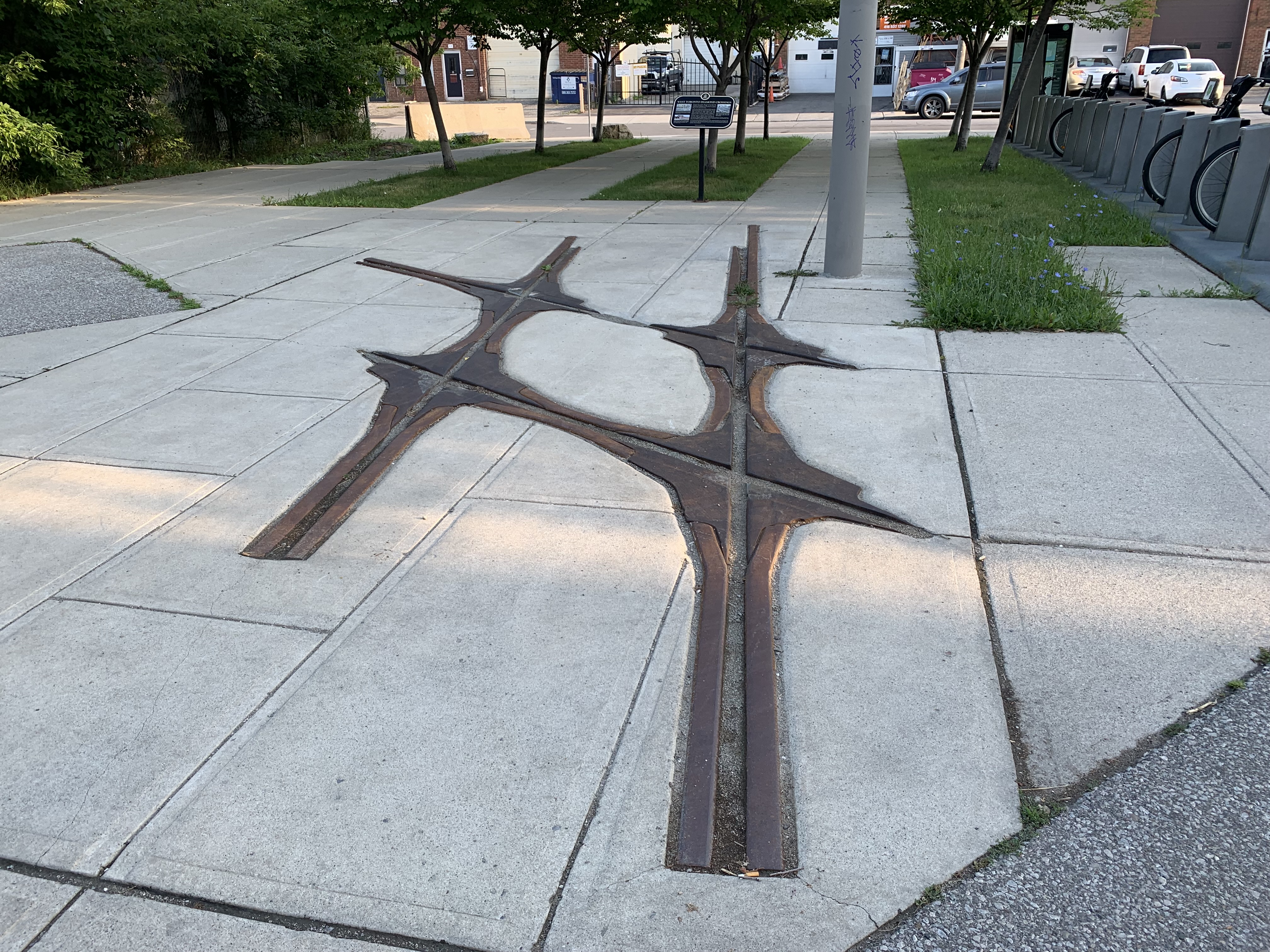
When the crossings were rebuilt with grade separations, which were much safer, the diamonds were no longer required. The last one was relocated to the trailhead and preserved as part of the information installation.

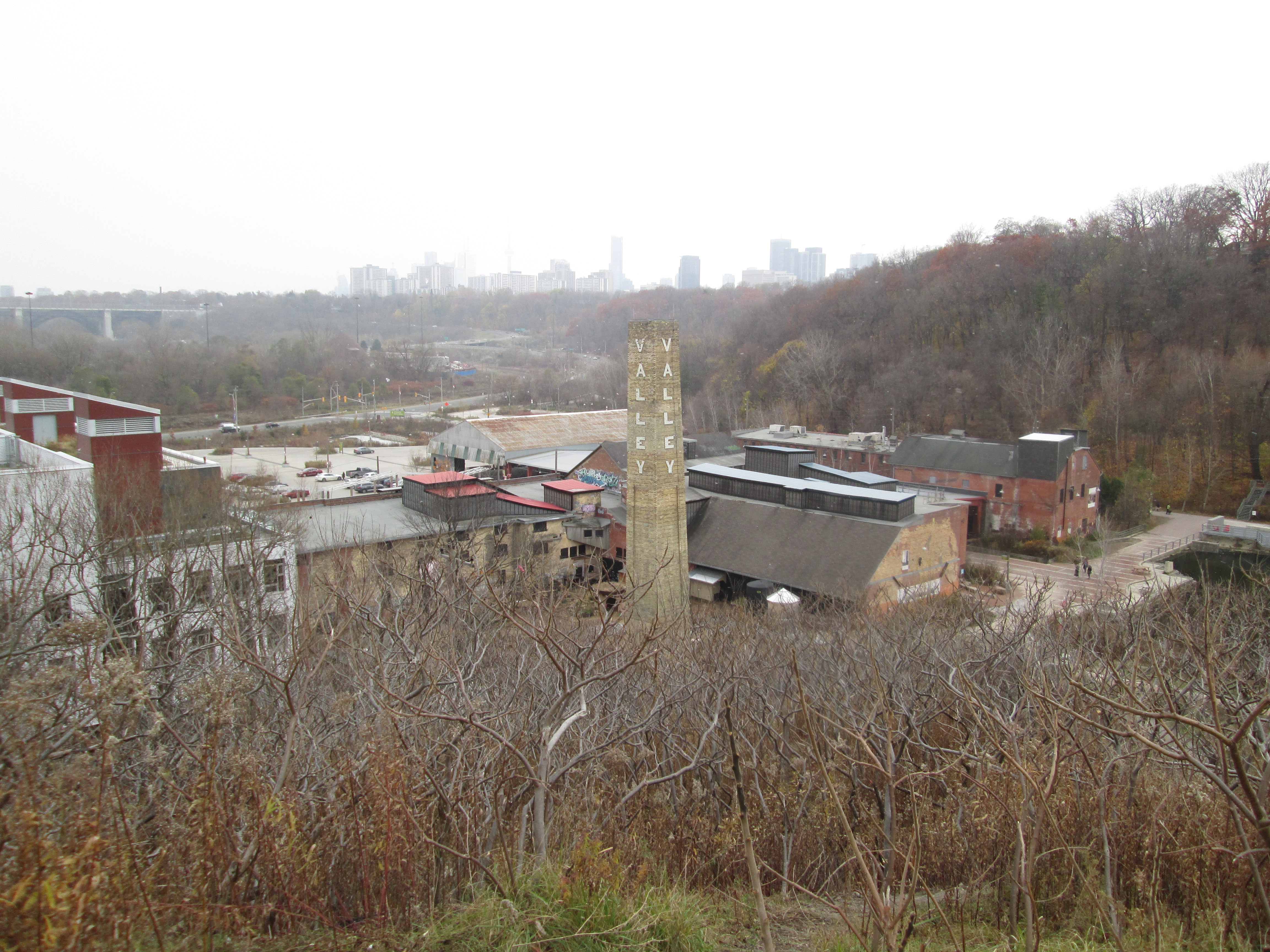
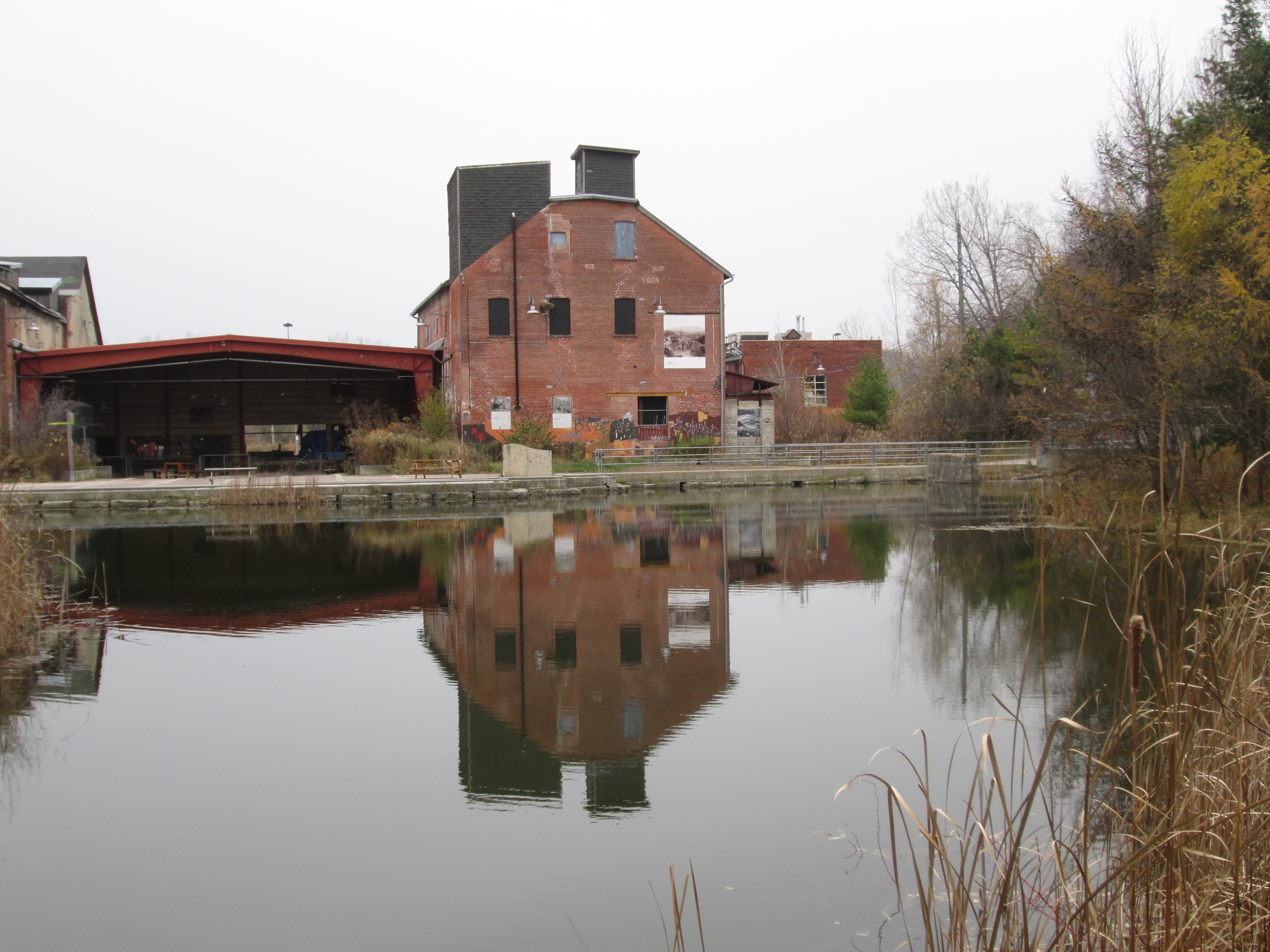
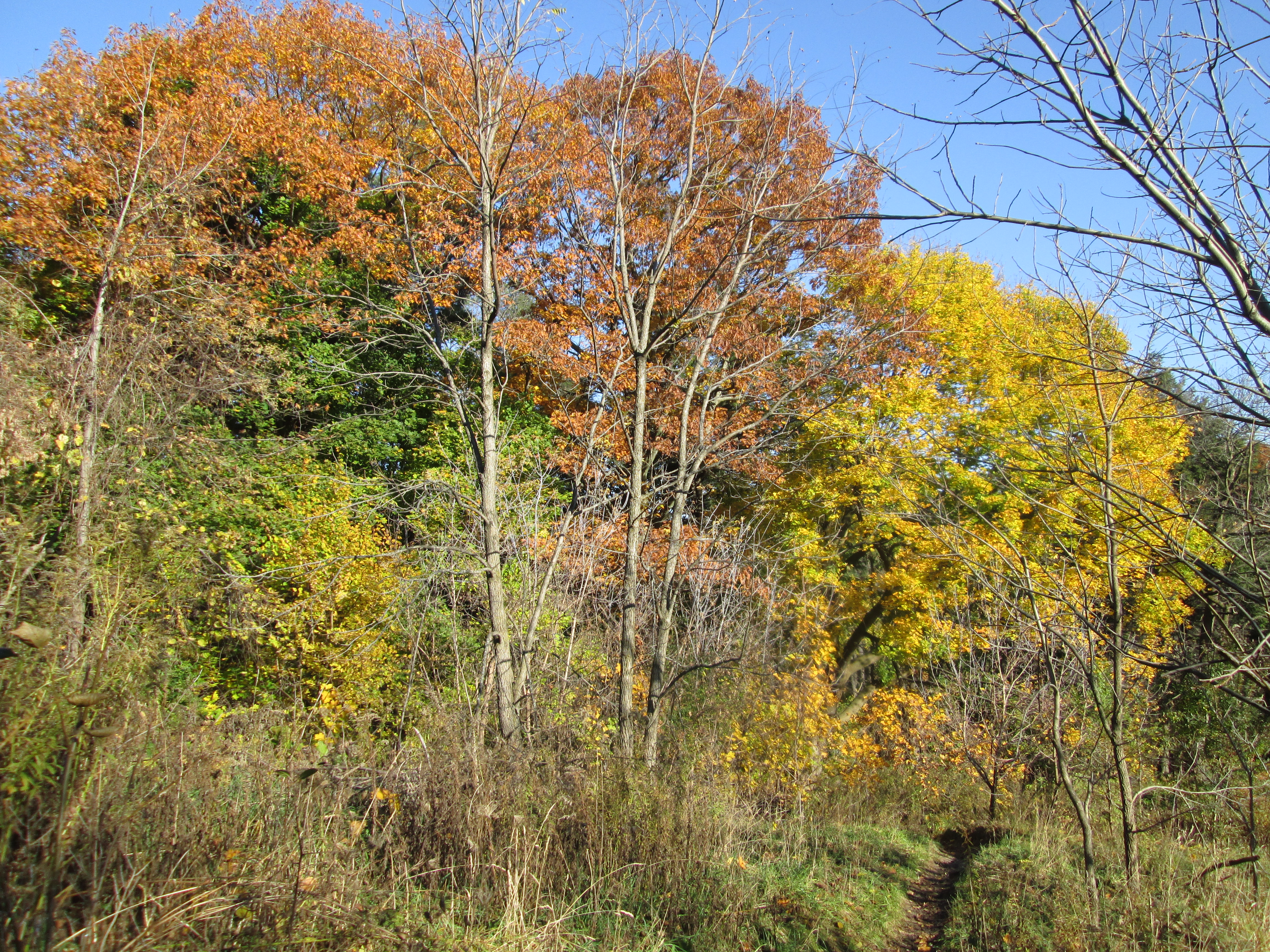
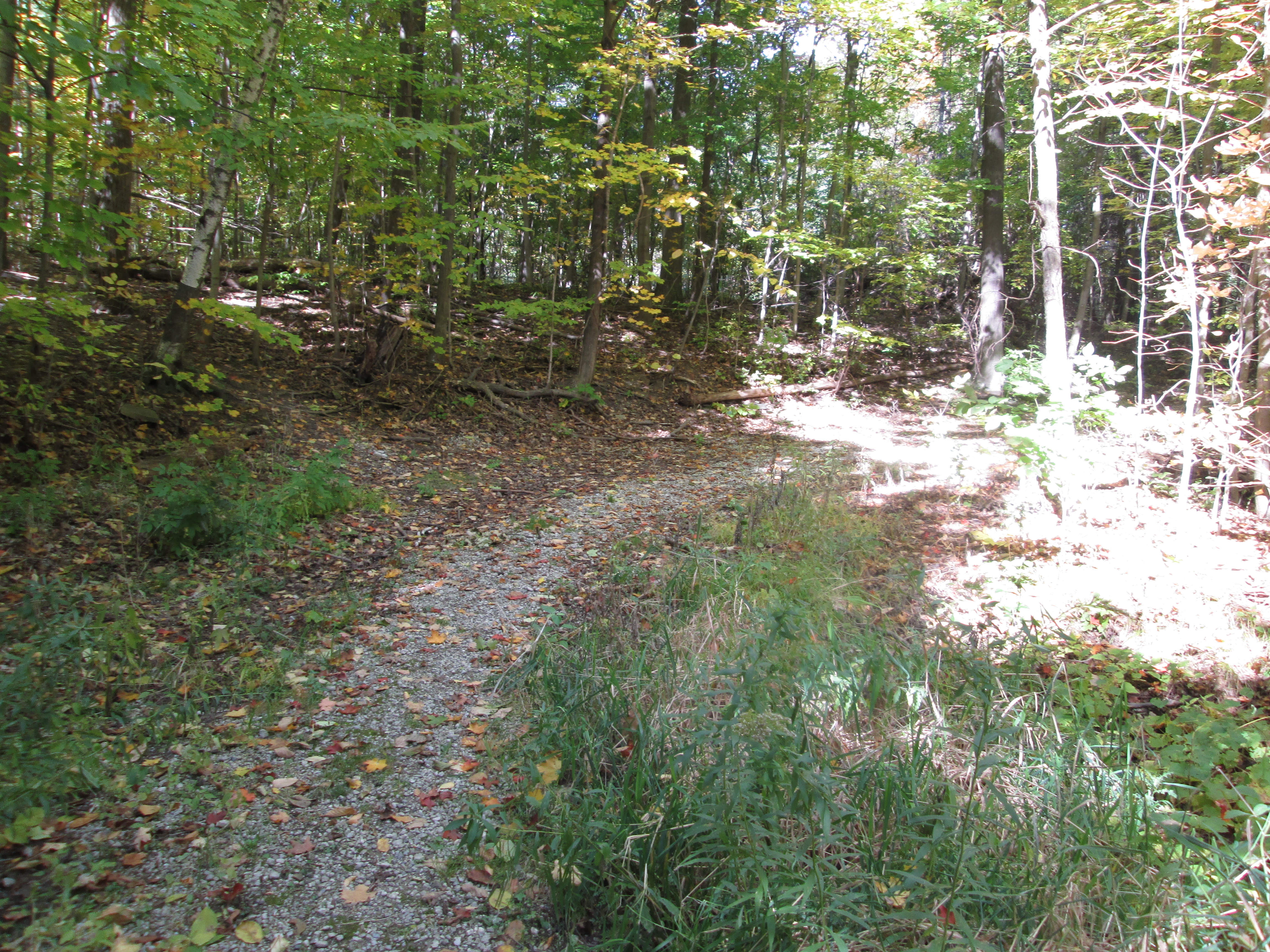
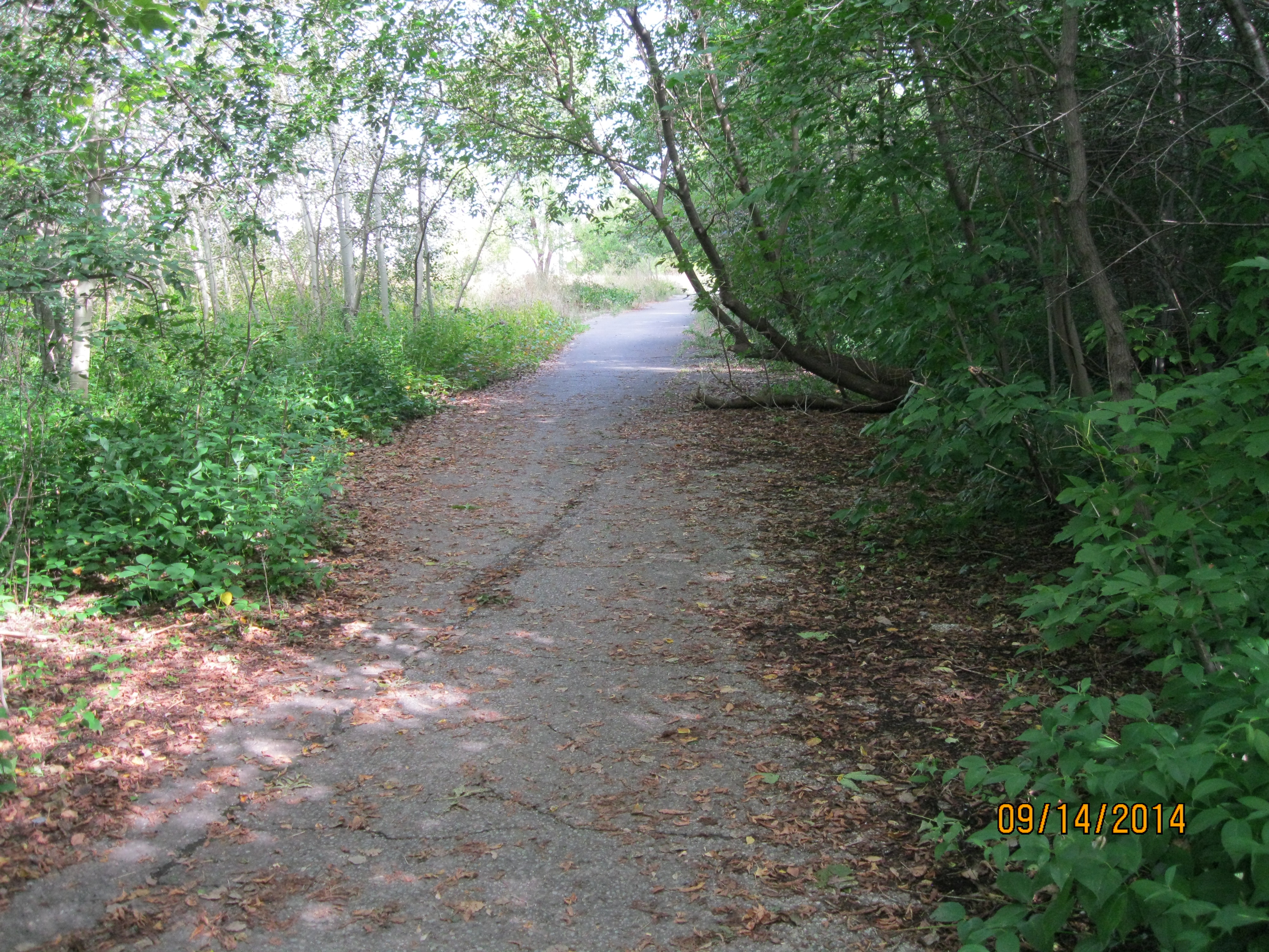
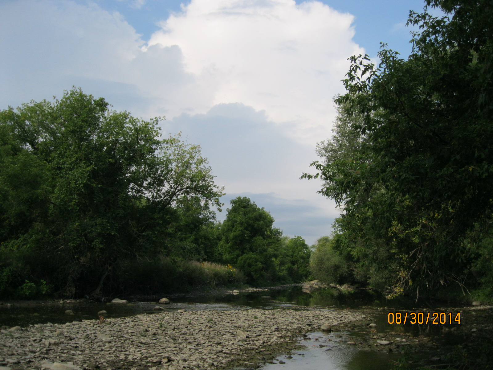
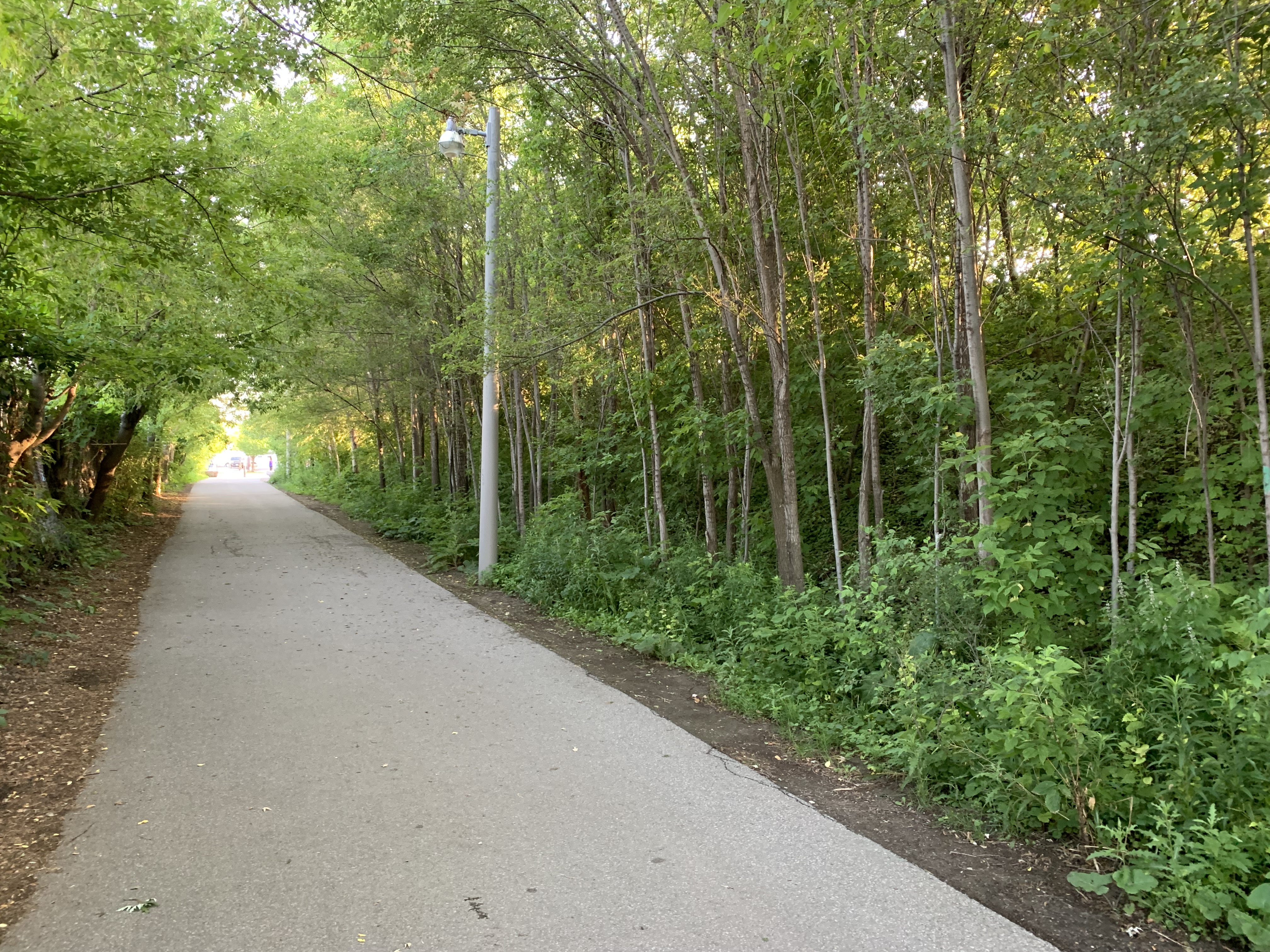
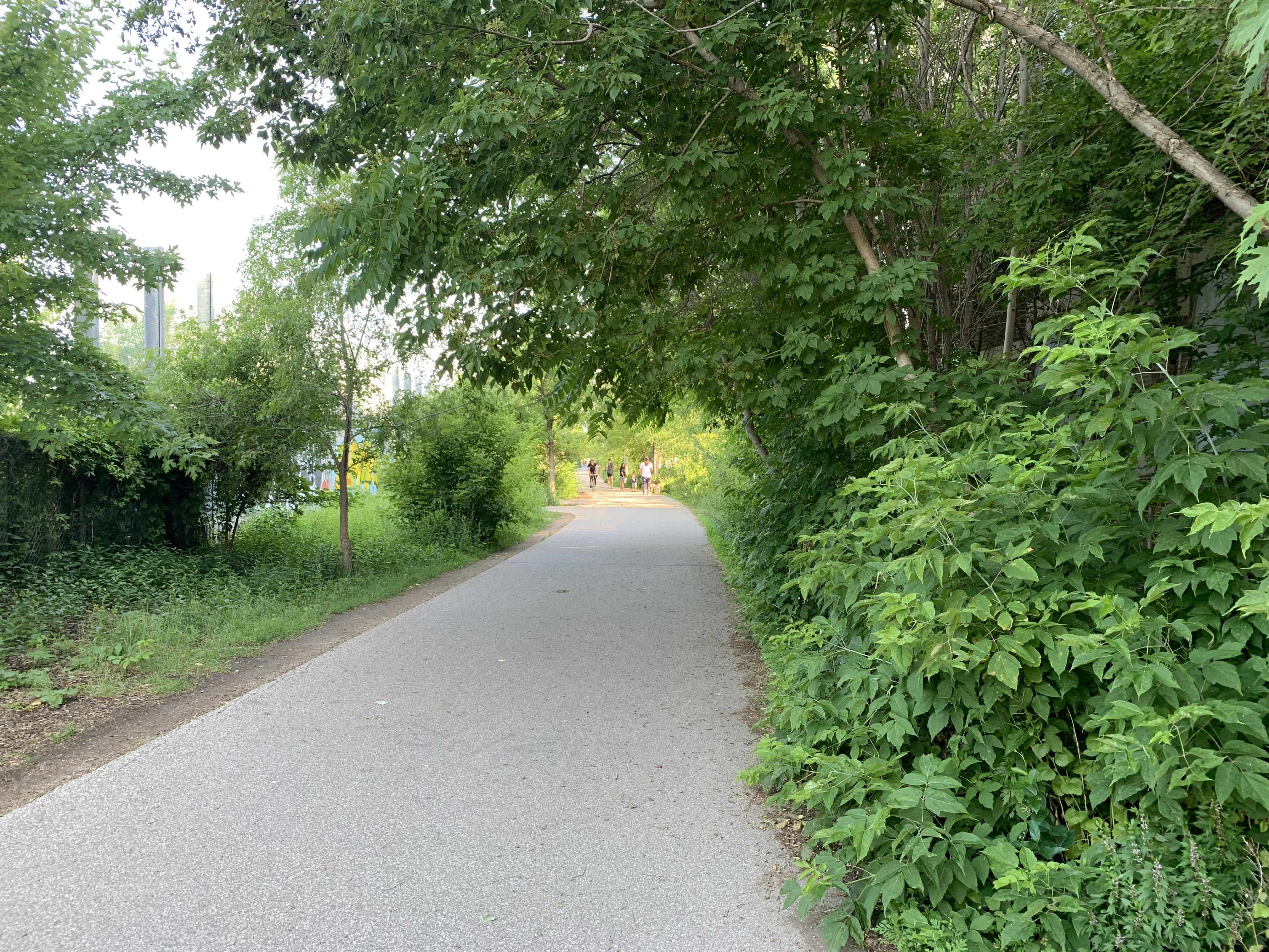
The Toronto Grey & Bruce Railway was incorporated on March 4, 1868 with the official sod turning ceremony being held in Weston in October of the following year. To save money, the railway was built to a narrow gauge of 3’6″ instead of the standard (or Provincial) gauge of 5’6″. This allowed construction to proceed for $5,100 per mile instead of the $8,100 required for the standard gauge. It formally opened on November 3, 1871 with the first train making it to Owen Sound in 1873. The picture below shows a nearly deserted railpath early on a Sunday morning but it filled up quickly with a variety of dog walkers, cyclists and joggers.

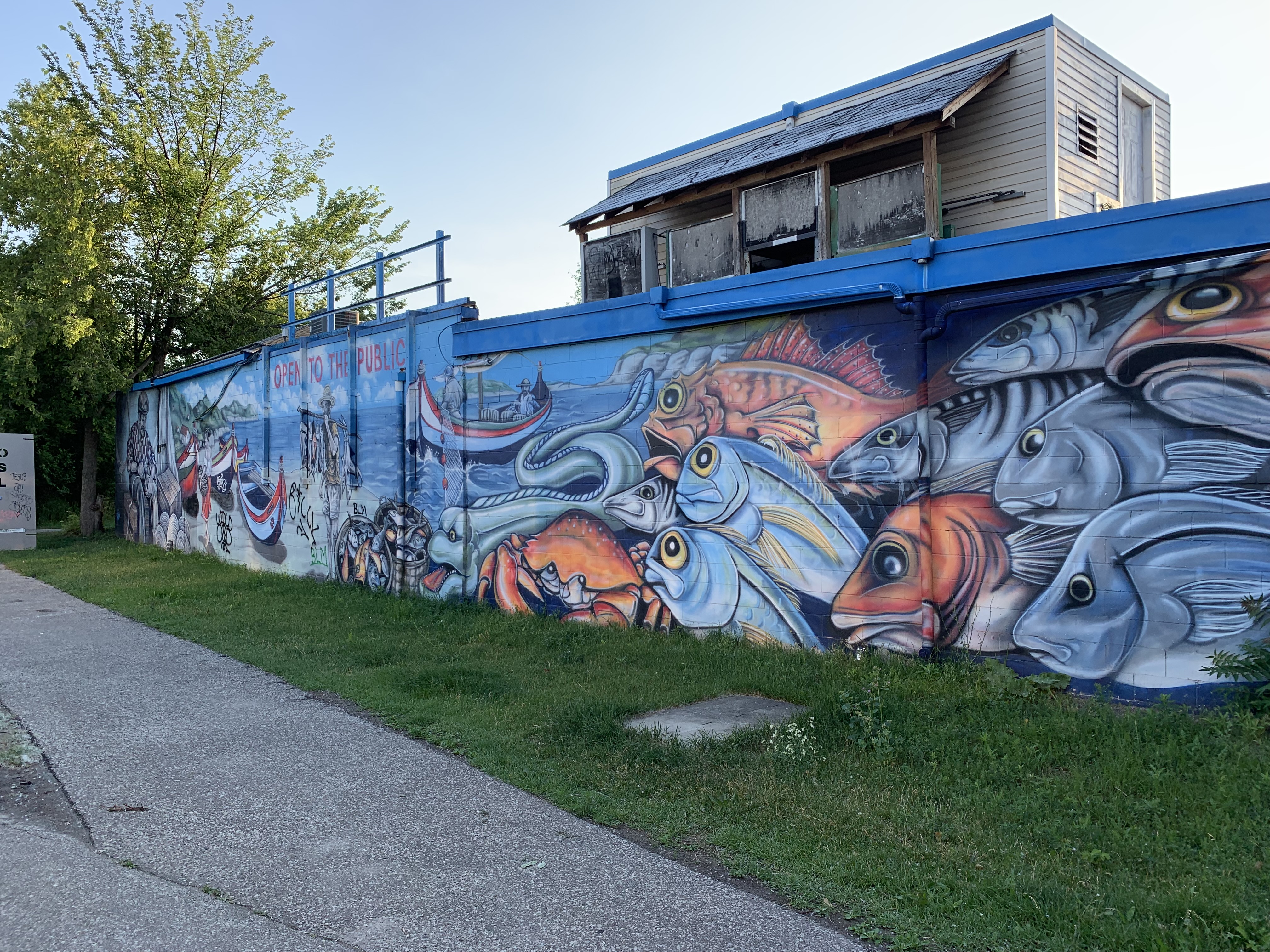
There are several works of art along the railpath including murals on a few buildings. One building has been painted in blue and green with the shapes of the vegetation along the building being left white. This allows for a visual growth indicator as the trees and vines continue to grow onto the painted sections. Four steel sculptures have also been erected along with various places to sit and pause as you walk the trail. Other buildings have extensive murals on them.

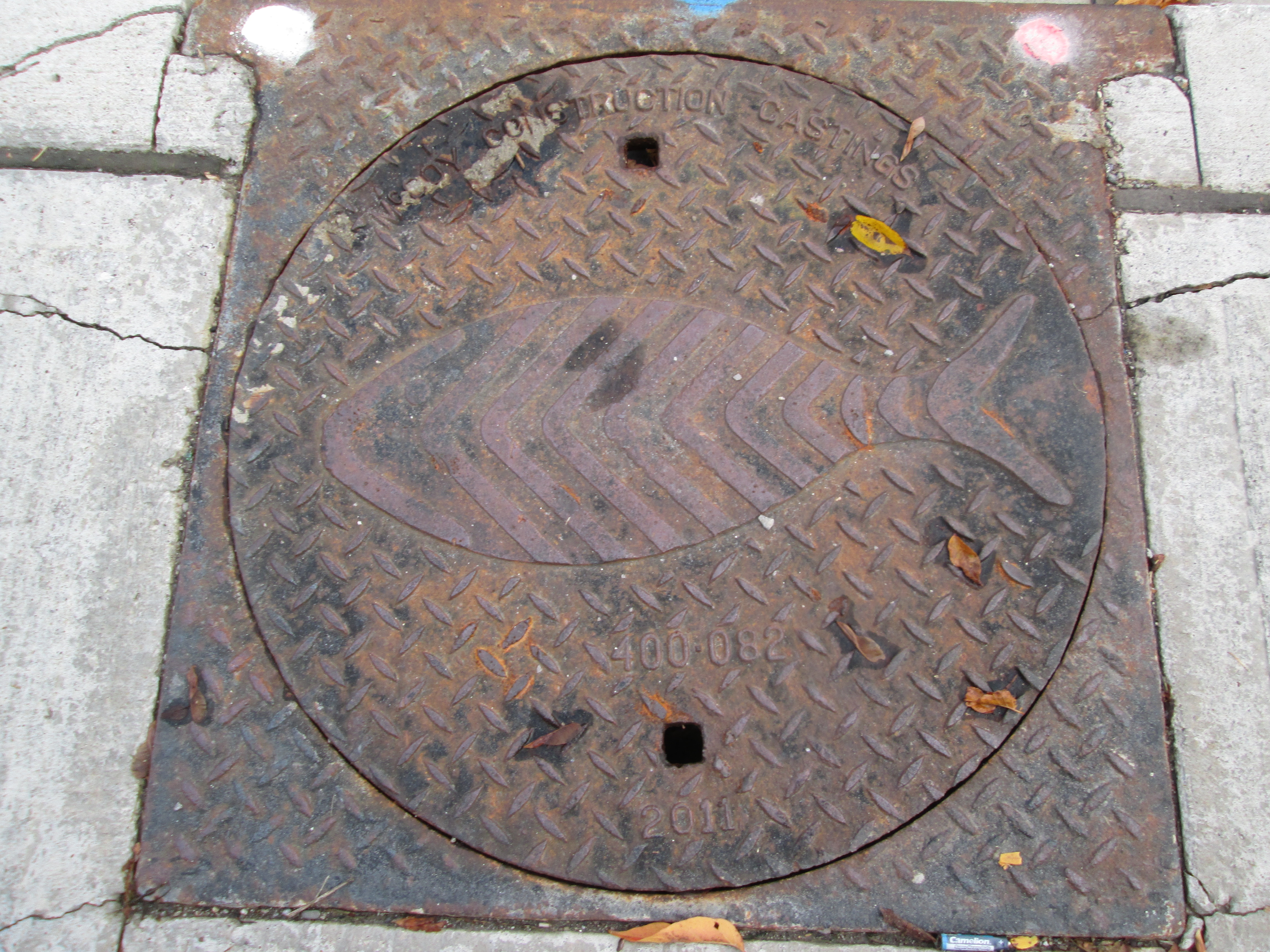
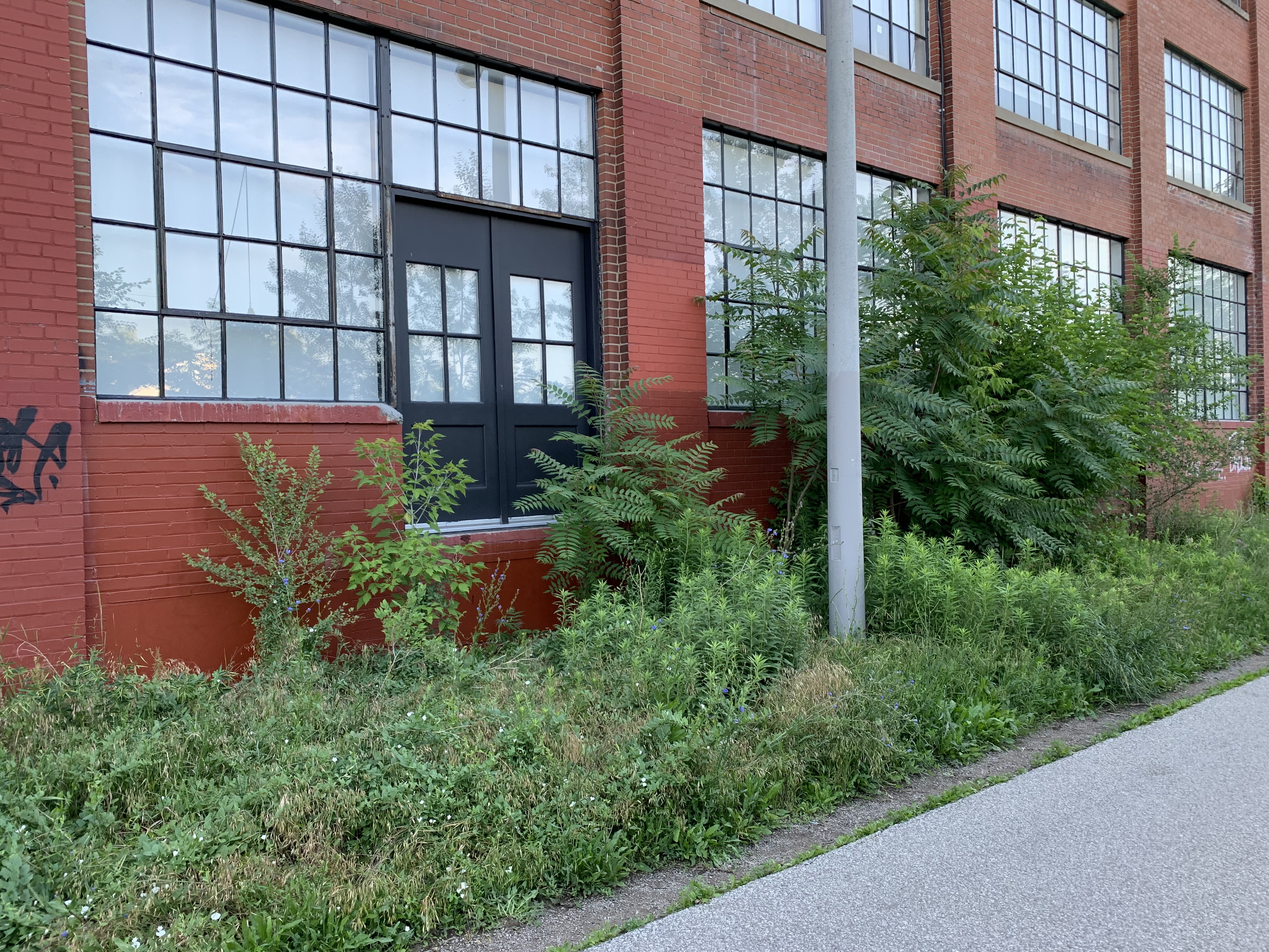
Railway sidings ran along the track side of most of the industrial buildings in the Junction Triangle. Although the rails are gone the sidings can be spotted by looking for doors that open a couple of feet off the ground. These would have been at the right level to load and unload the rail cars.

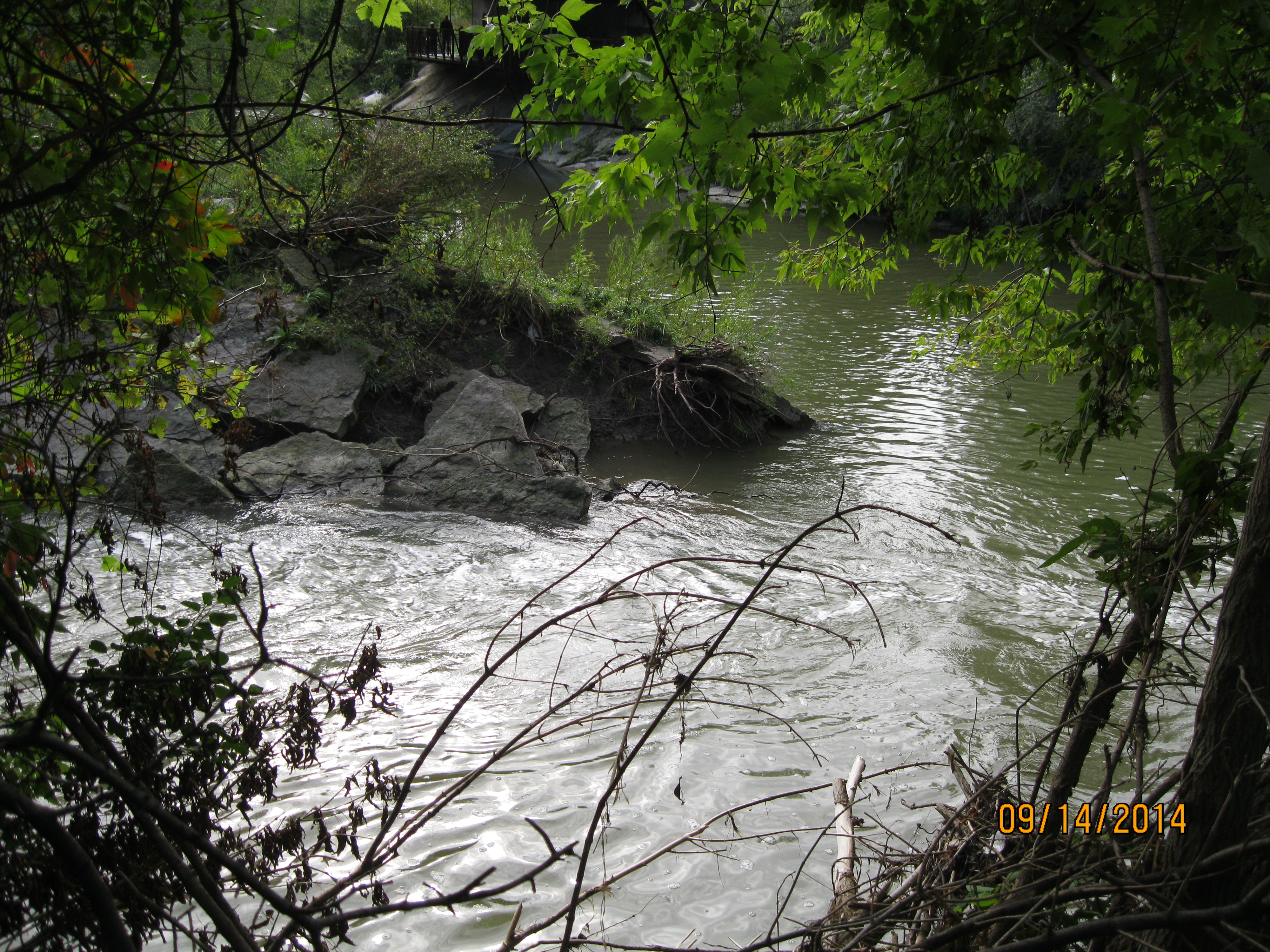
The Toronto Grey & Bruce Railway was converted to standard gauge in 1881 to make the interchange between its freight trains and those of other lines easier because the cars could just be moved from one line to the other. In 1883 it was leased to the Ontario & Quebec Railway and was taken over by the CPR the following year. By the 1950s the line was known locally as the Old Bruce and when it stopped serving the local industry it was closed for good. The line was dismantled in 1996 and the right of way was purchased by the city for a railpath which opened in 2009.

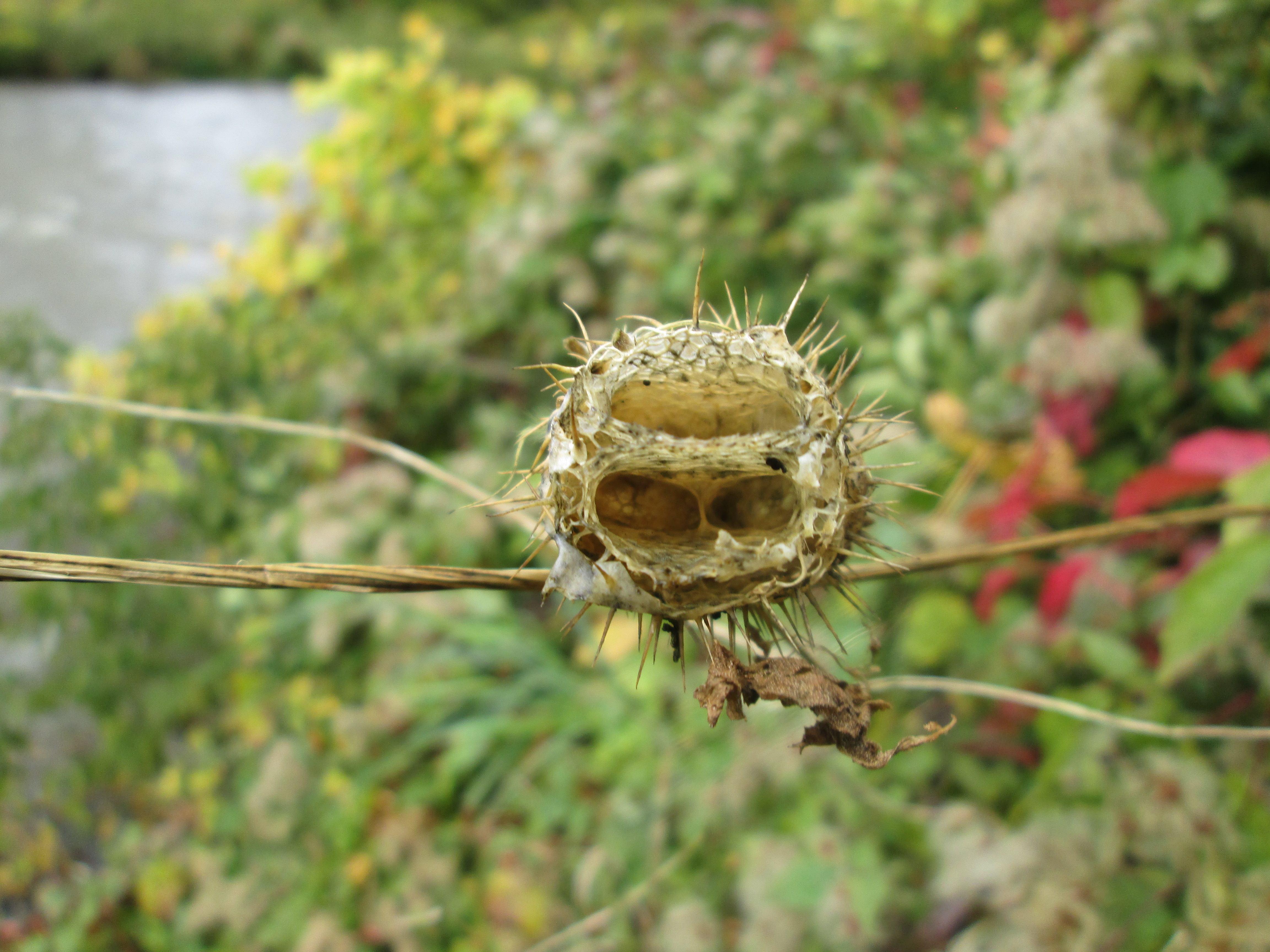
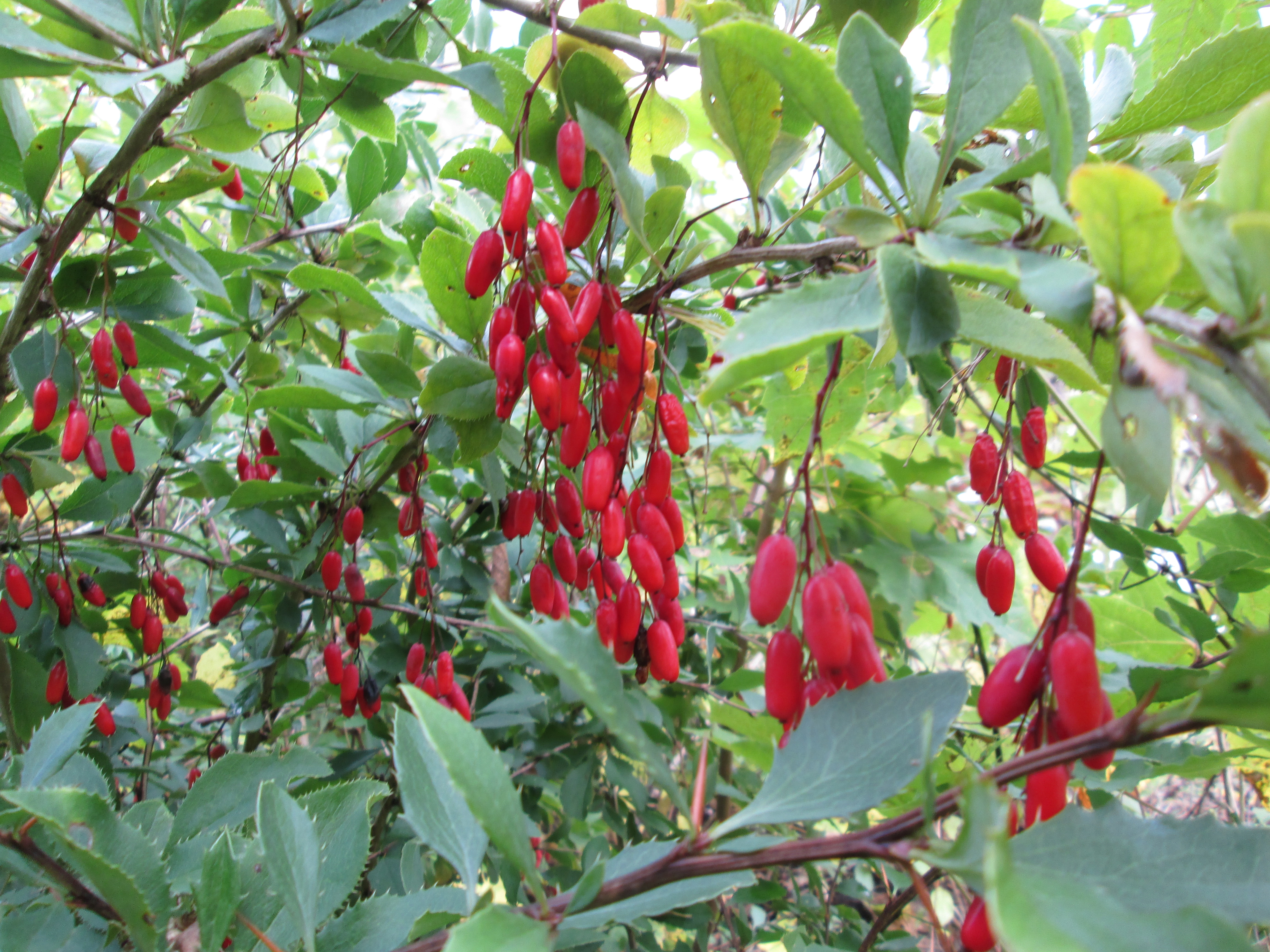
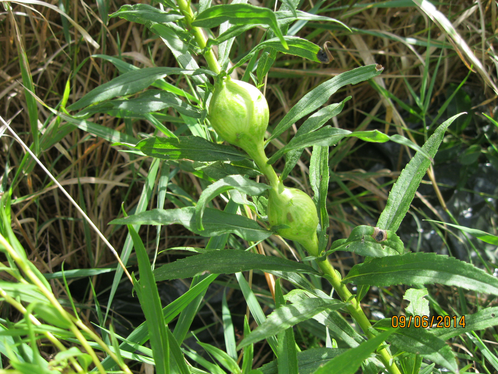
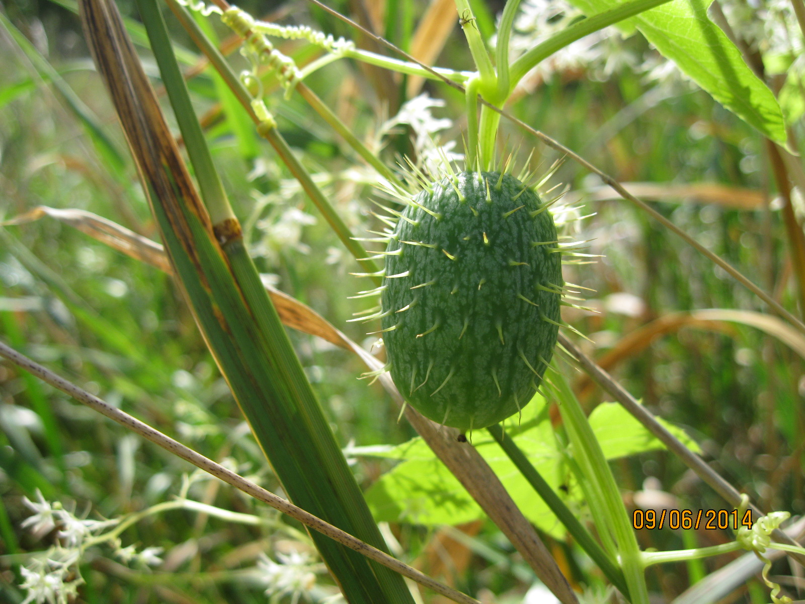
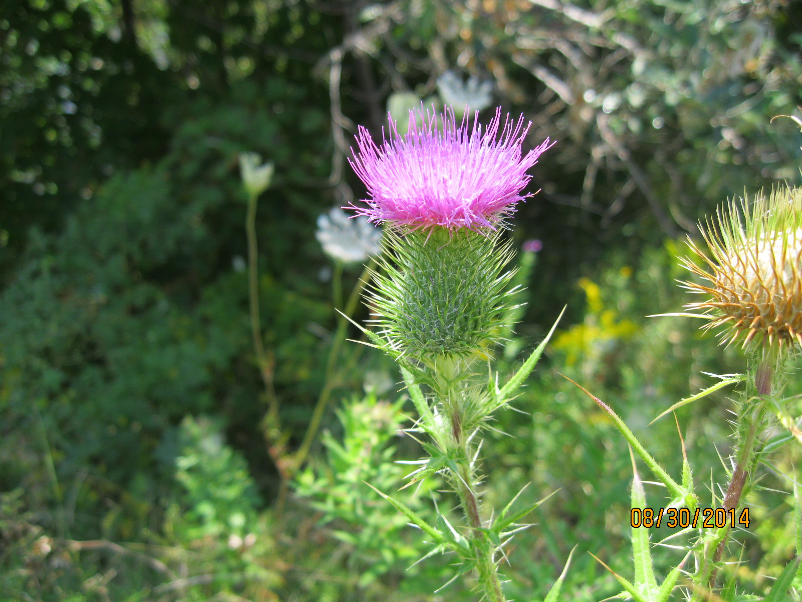
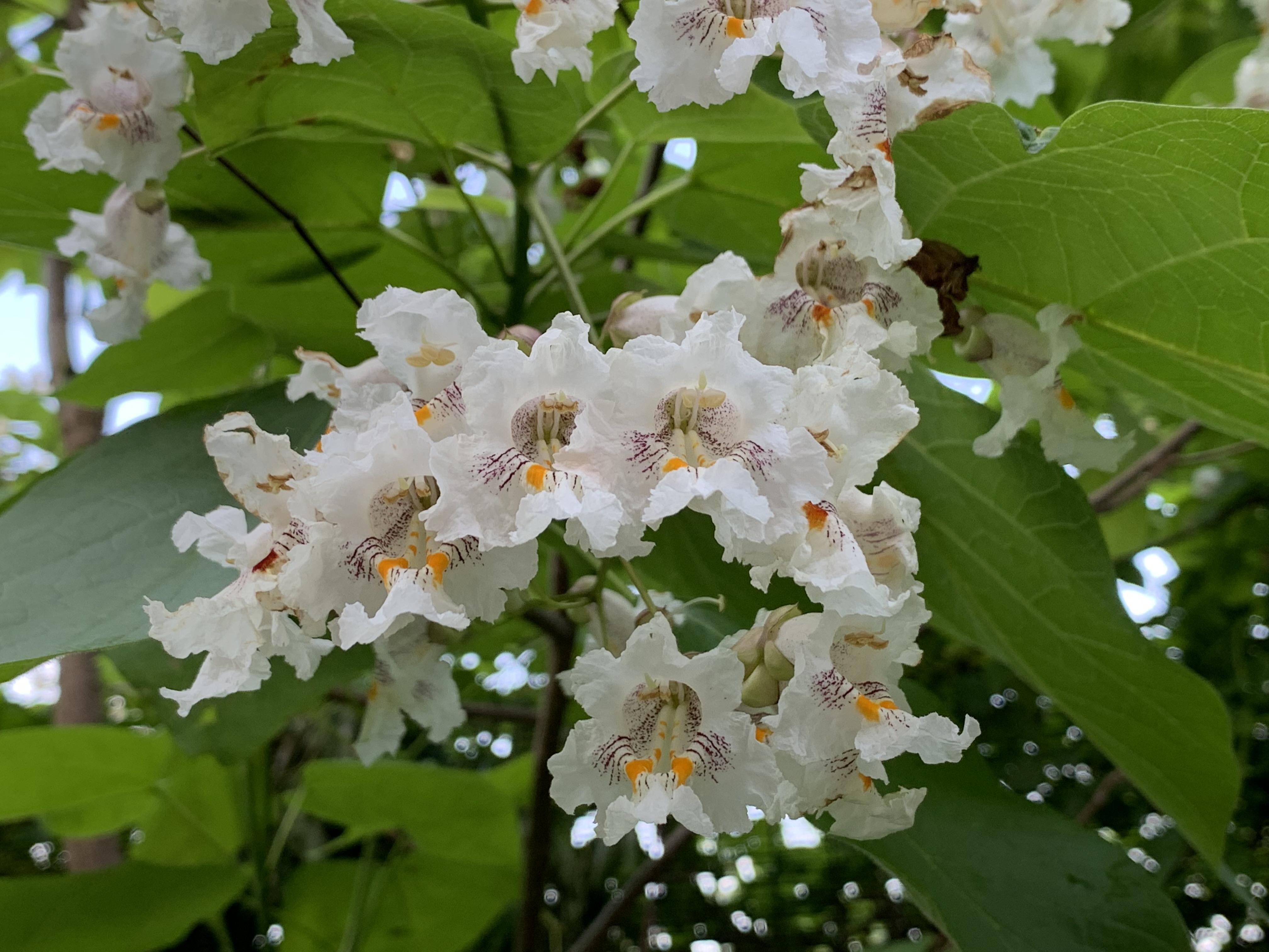
Catalpa Bignonioides is a flowering tree that is native to the southern states but has adapted to northern climates including parts of Canada. There are some of them in flower along the side of the trail and they produce a powerful scent. The flowers will turn into long beans that hang from the branches. This is just one of the many flowering plants that line both sides of the trail making it a great place to see butterflies and other pollinators.

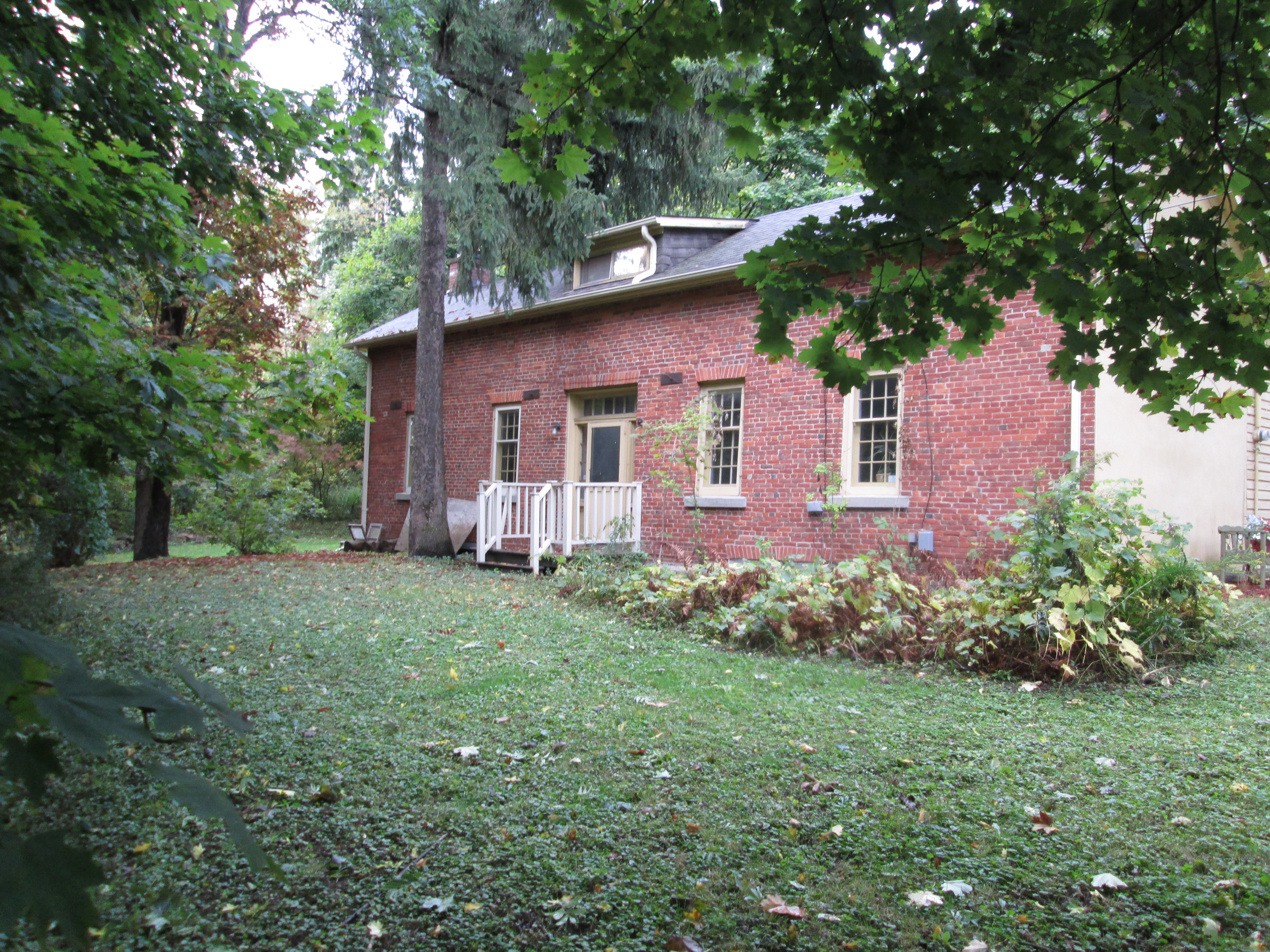
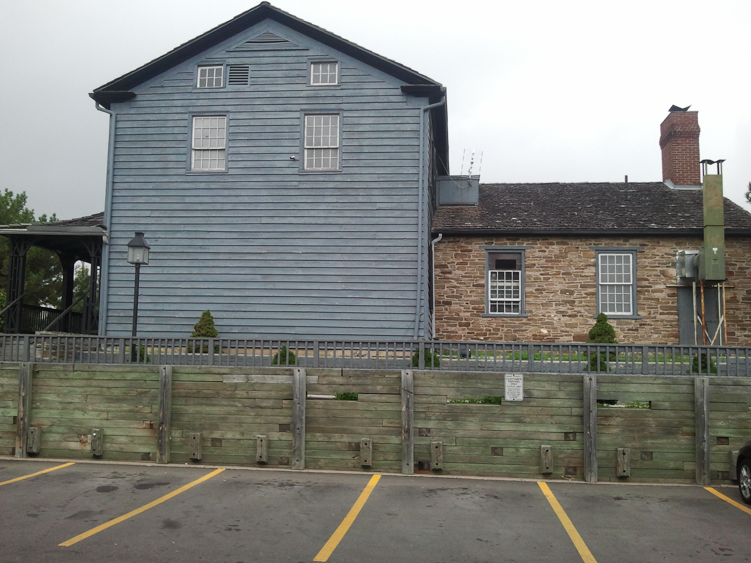
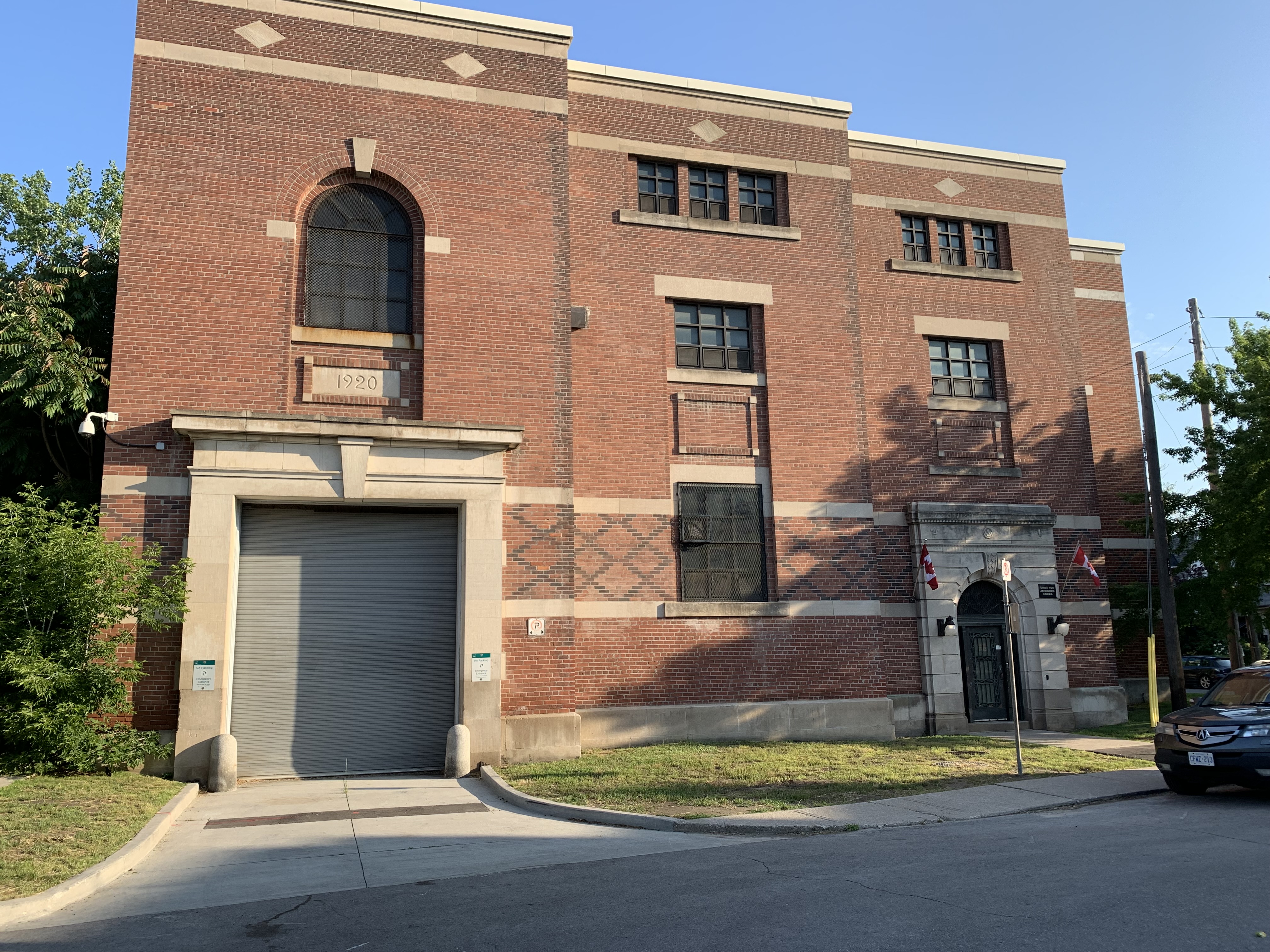
The Junction hydro substation is tucked in along the rail corridor and has a date stone that reads 1920. For some reason several on line resources, including the Toronto Architectural Conservancy, list the building as having been completed in 1911. Perhaps the 1920 date above the large door refers to an expansion.

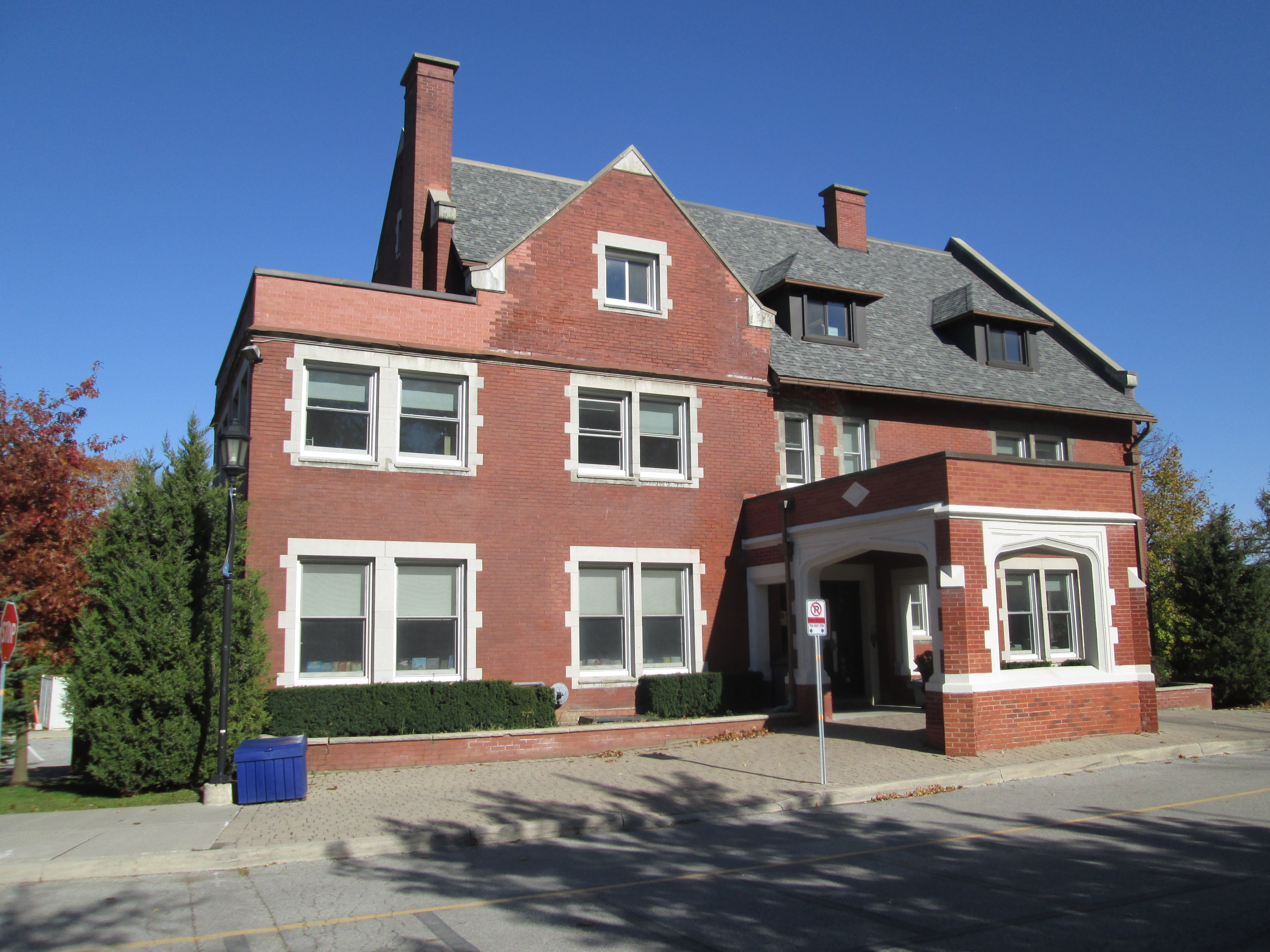
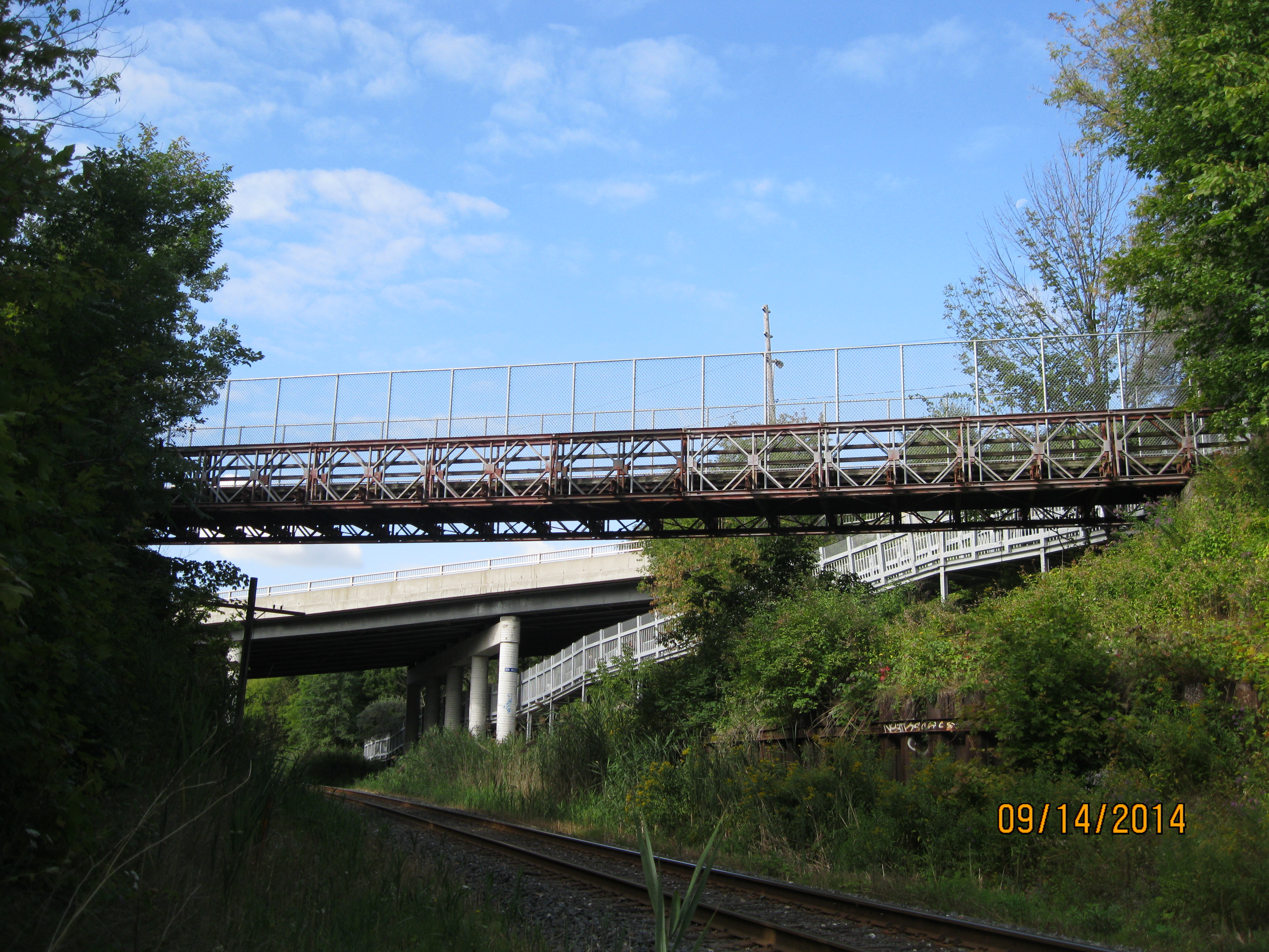
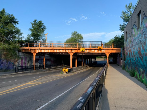
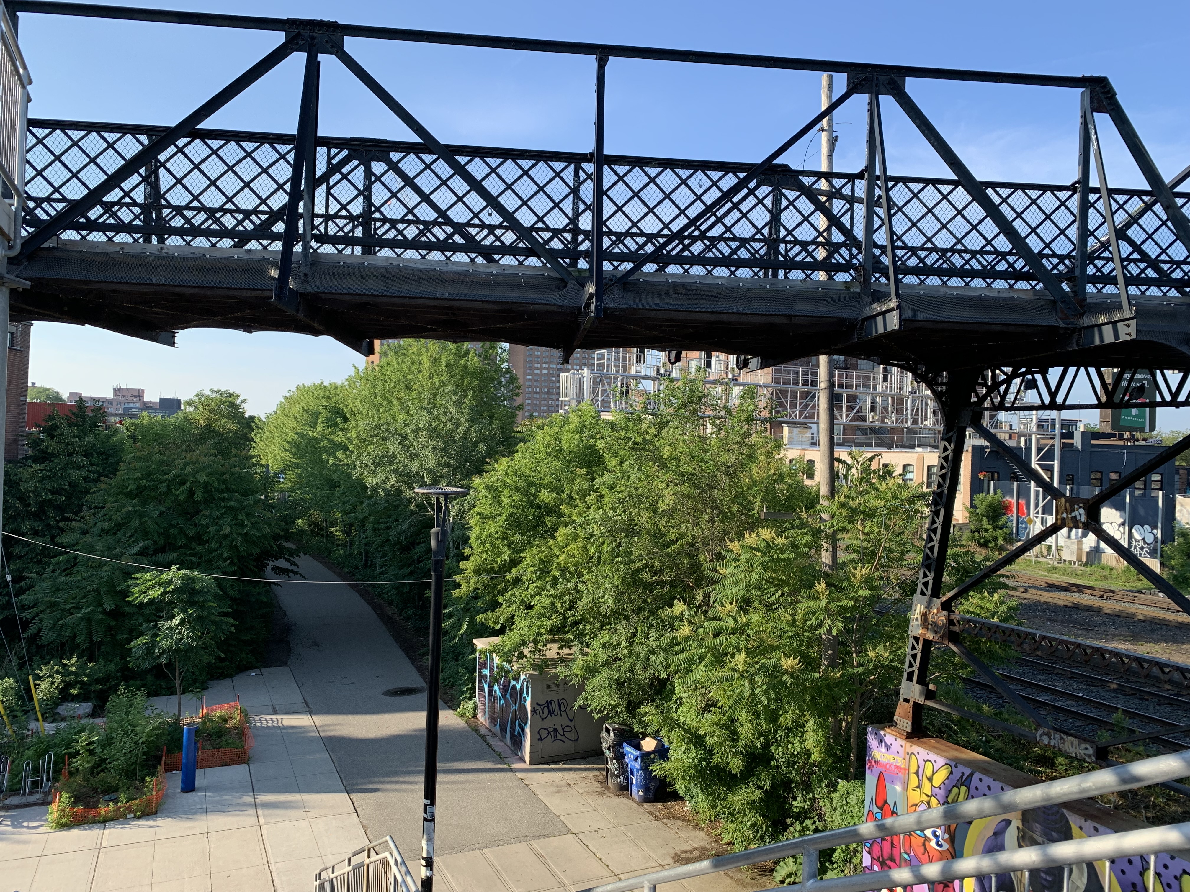
By 1883 there were five railways passing through the area and getting around them safely was starting to become a problem for the communities that surrounded the tracks. Workers had to cross the busy rail lines to get to the various industries where they worked. In 1907 a temporary pedestrian bridge was built as the first project designed by the Ontario Bridge Company. It is one of only a few multi-span steel Warren pony truss bridges in the province. It connects Wallace Street with Dundas Street West and was only intended to be in use until two underpasses were created on Dupont and Bloor Street. The bridges that were built over those underpasses are dated 1925 and one of them is featured in the cover photo.

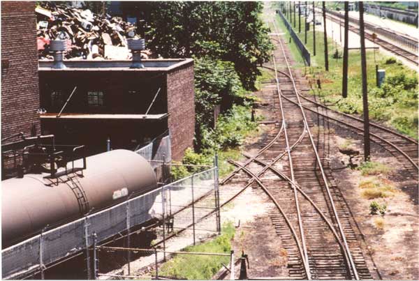
The picture below is looking south from the Wallace Avenue Footbridge in July 1985 and was taken from “Old Time Trains” web page. The tracks would be removed in April 1996.

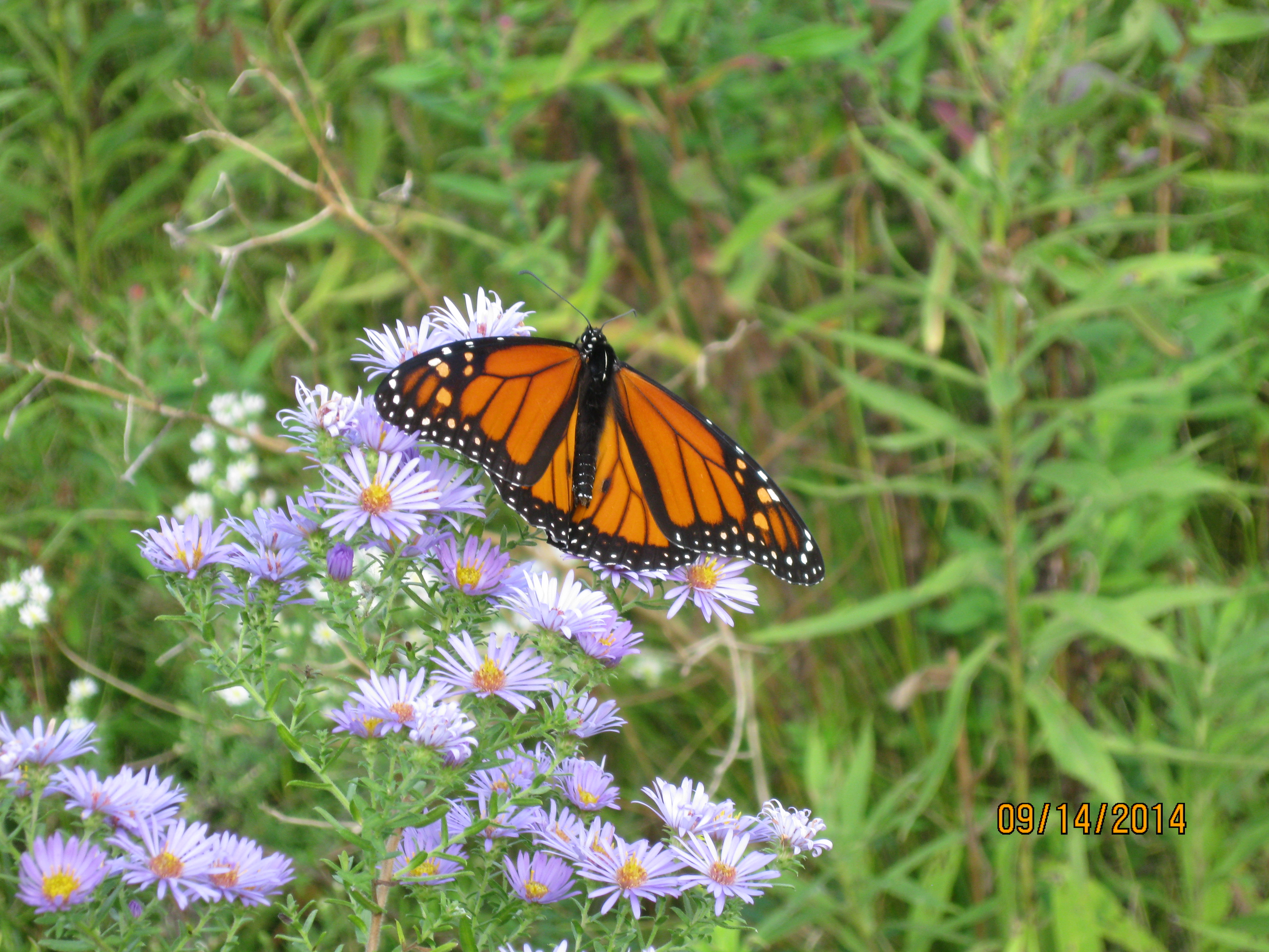
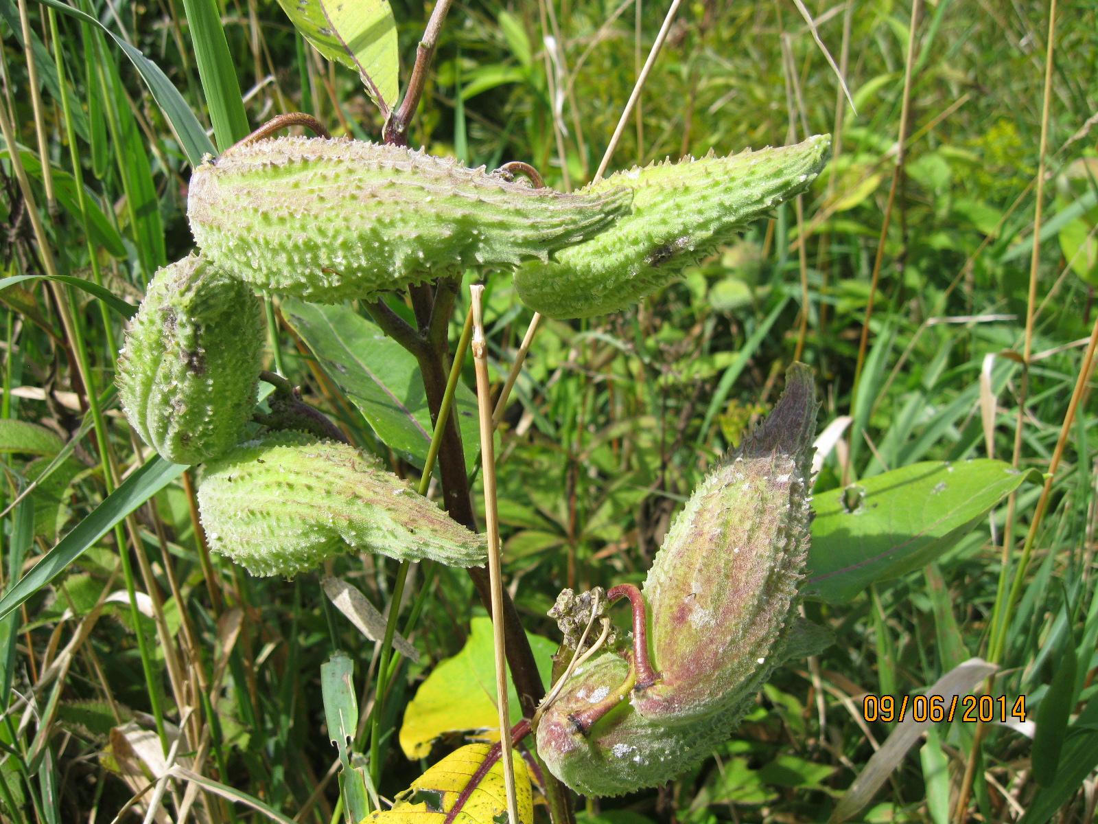
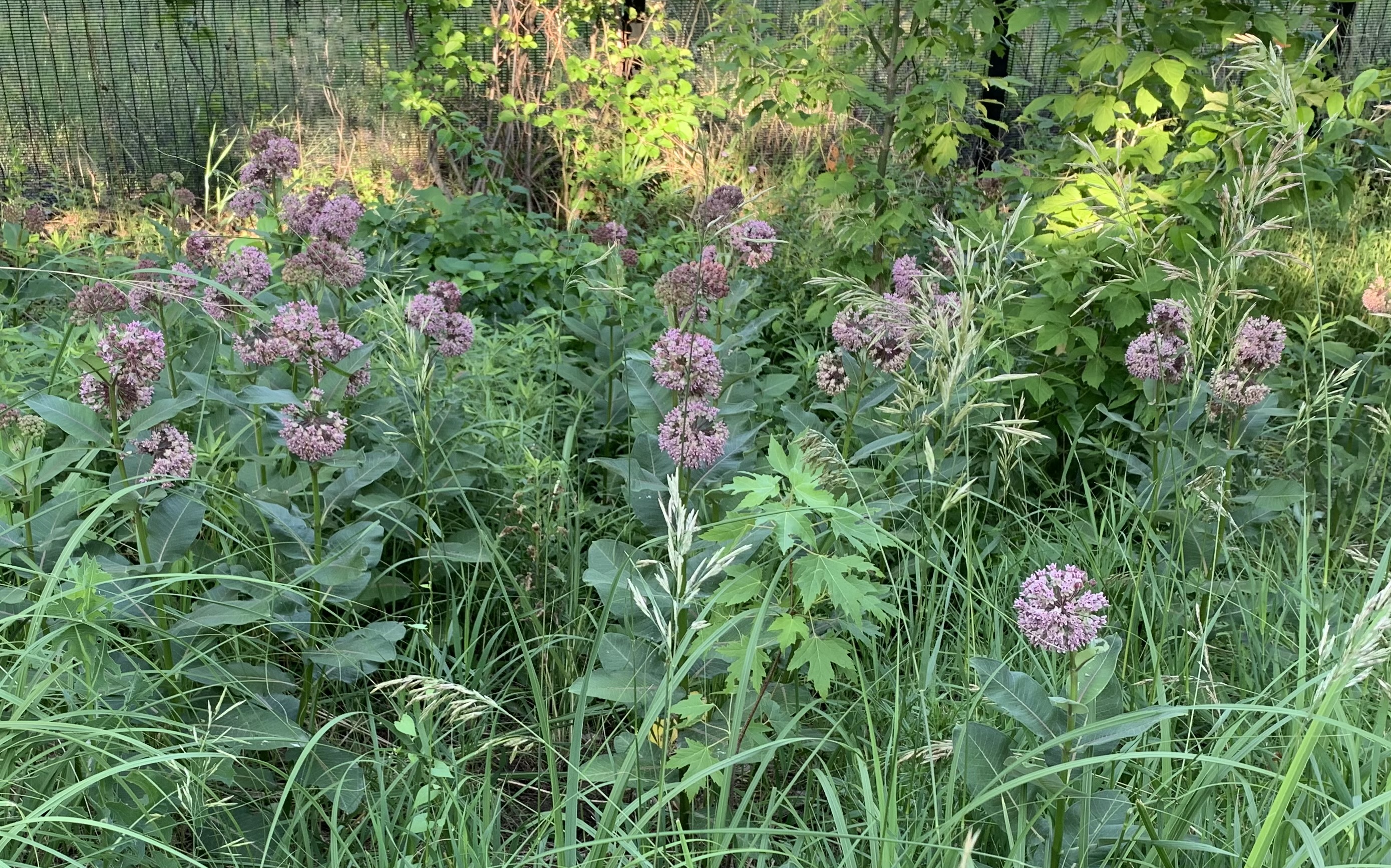
Milkweed grows in great numbers along the sides of the pathway however I didn’t see any Monarch Butterflies nor any caterpillars. Both seem to be a little scarce so far this season but this will be a great place to see them when they are in full flight.

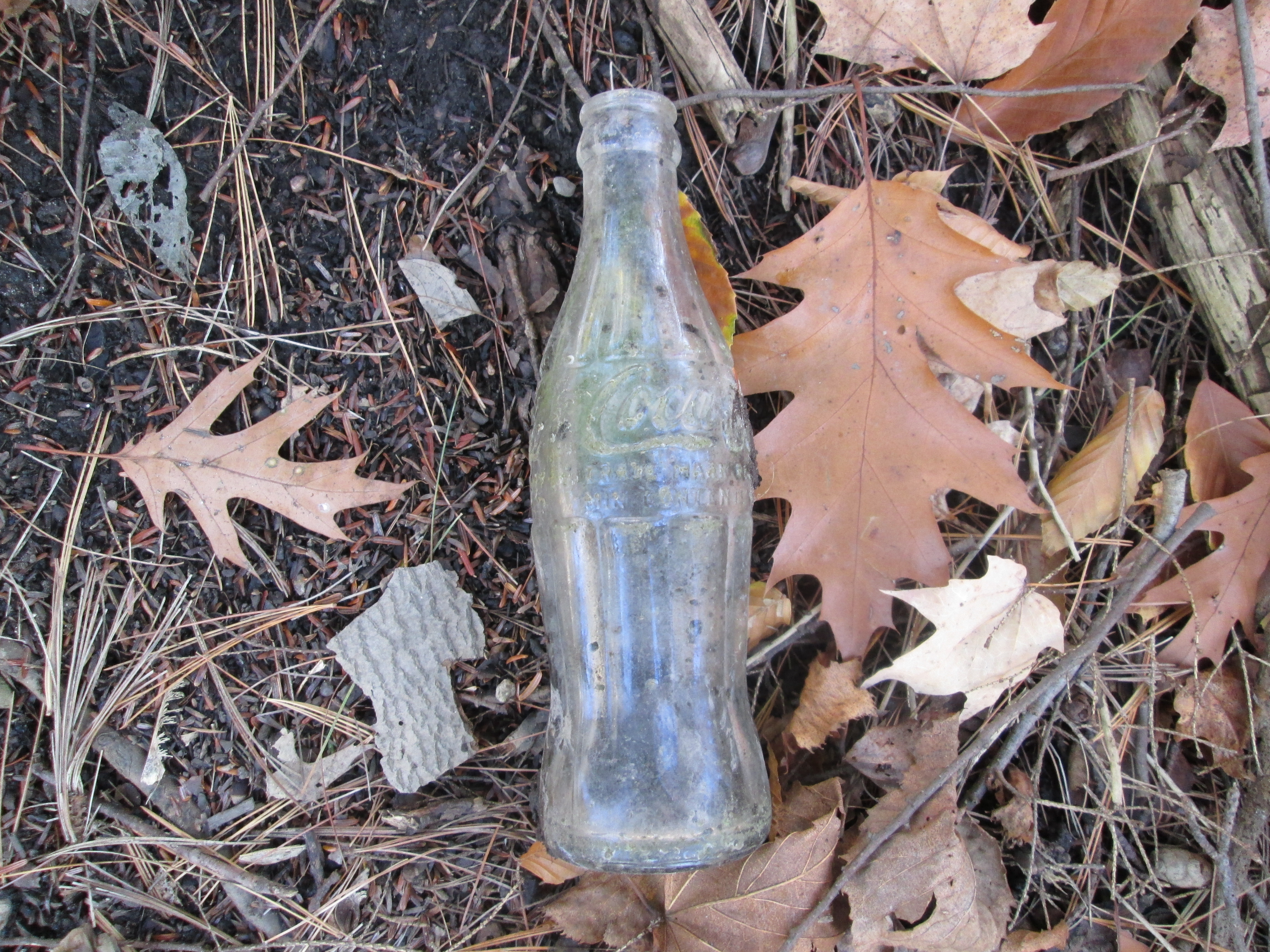
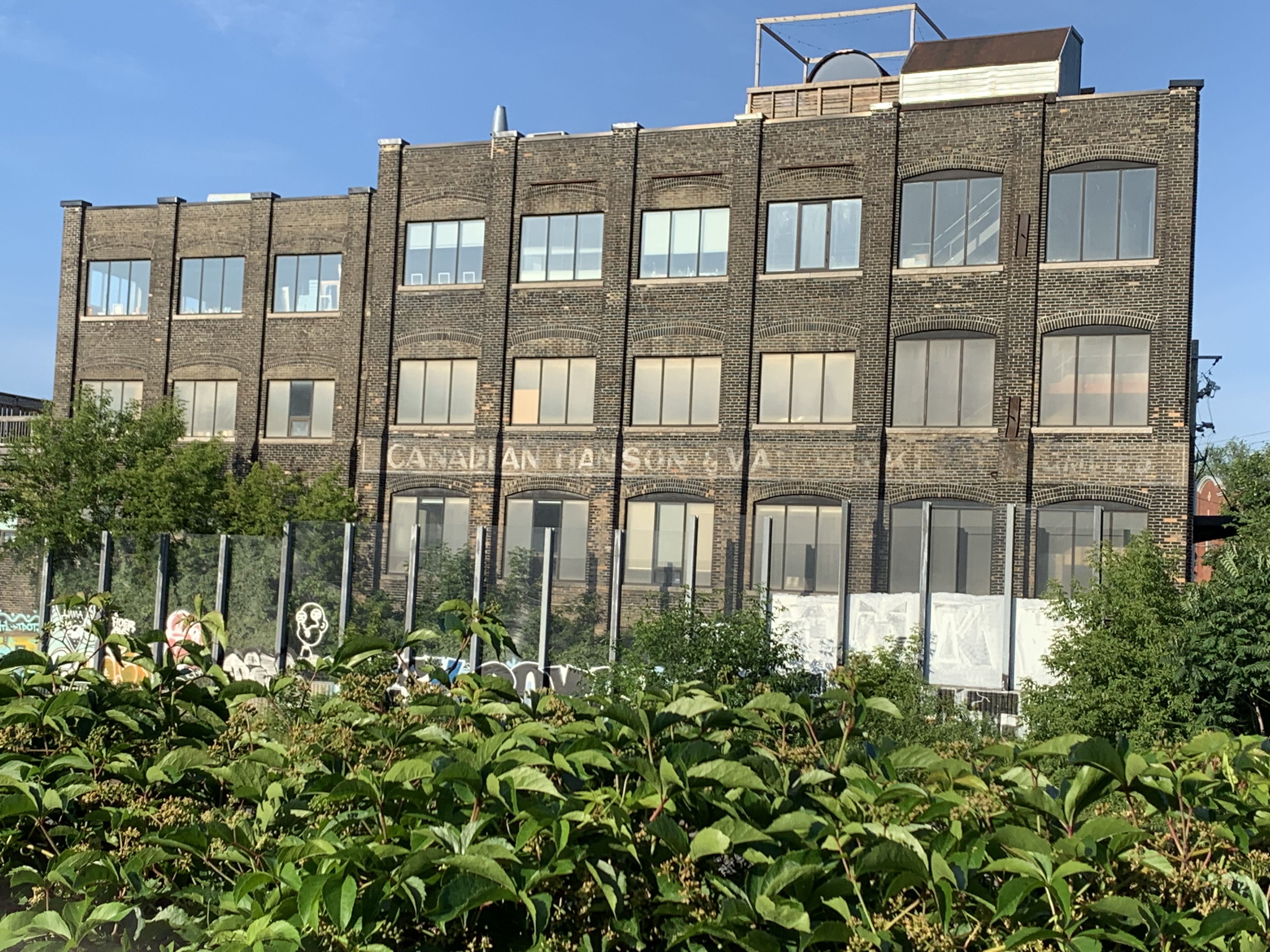
“Ghost sign” is a term that is sometimes applied to faded lettering or images on the sides of old buildings. Also known as brickads, they were common between 1890 and 1960 with most of them being from the 1920s and earlier. Advertising for Coke was often painted on the sides of convenience stores and for industry it was common practice to paint your company name and perhaps a list of products or services right on your building. Canadian Hanson & Van Winkle erected their building in 1917 on the west side of the rail corridor where they produced equipment for the electroplating, polishing and buffing industries.

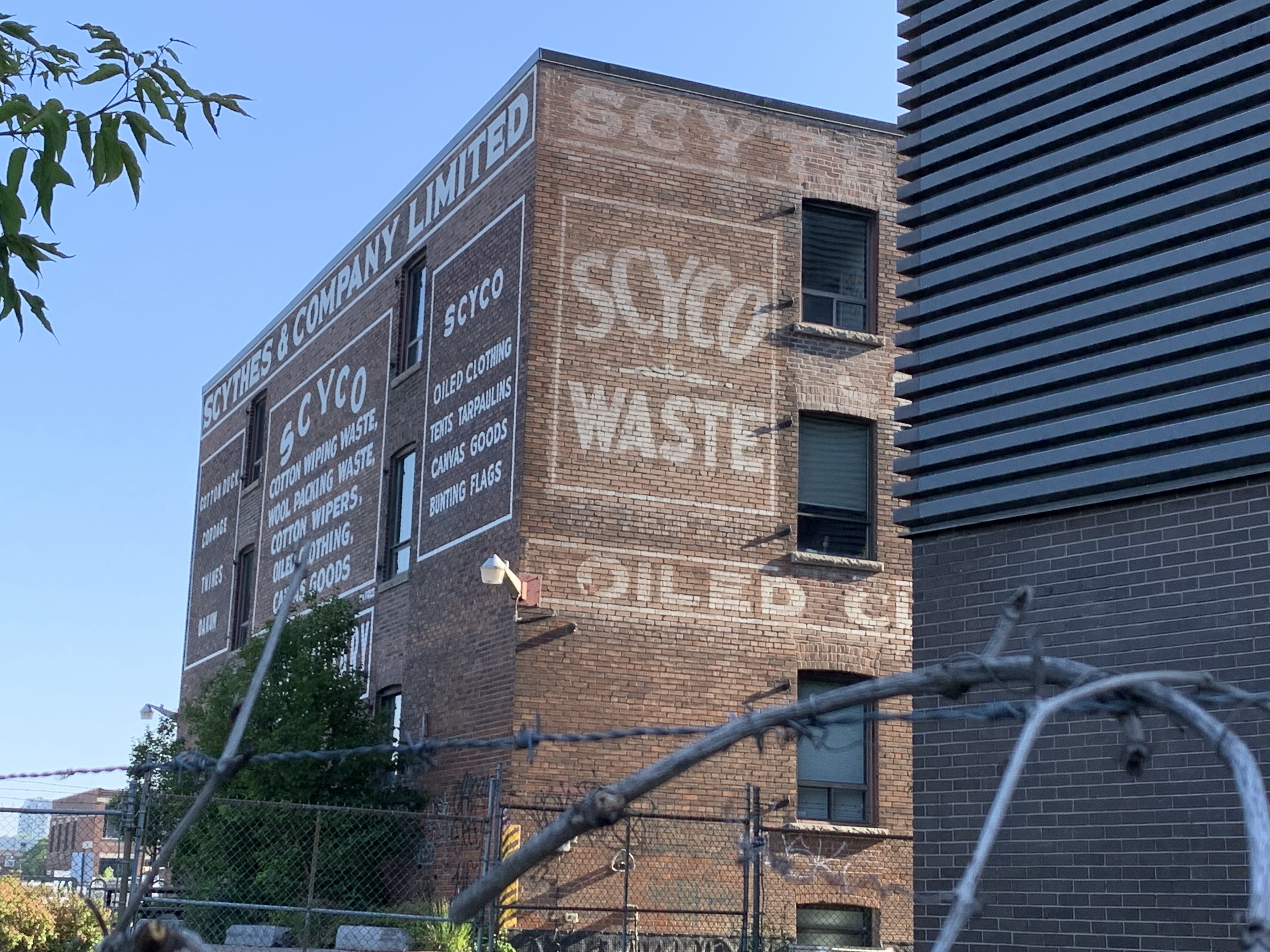
Scythes and Company Limited opened their company in the Junction in 1910. Aside from cloth and canvas products the building was also home to the manufacture of pickles, sauces and catsup. Ghost signs adorn all four sides of the building but the side facing the railpath has been freshly painted to restore the original brickads on the building.

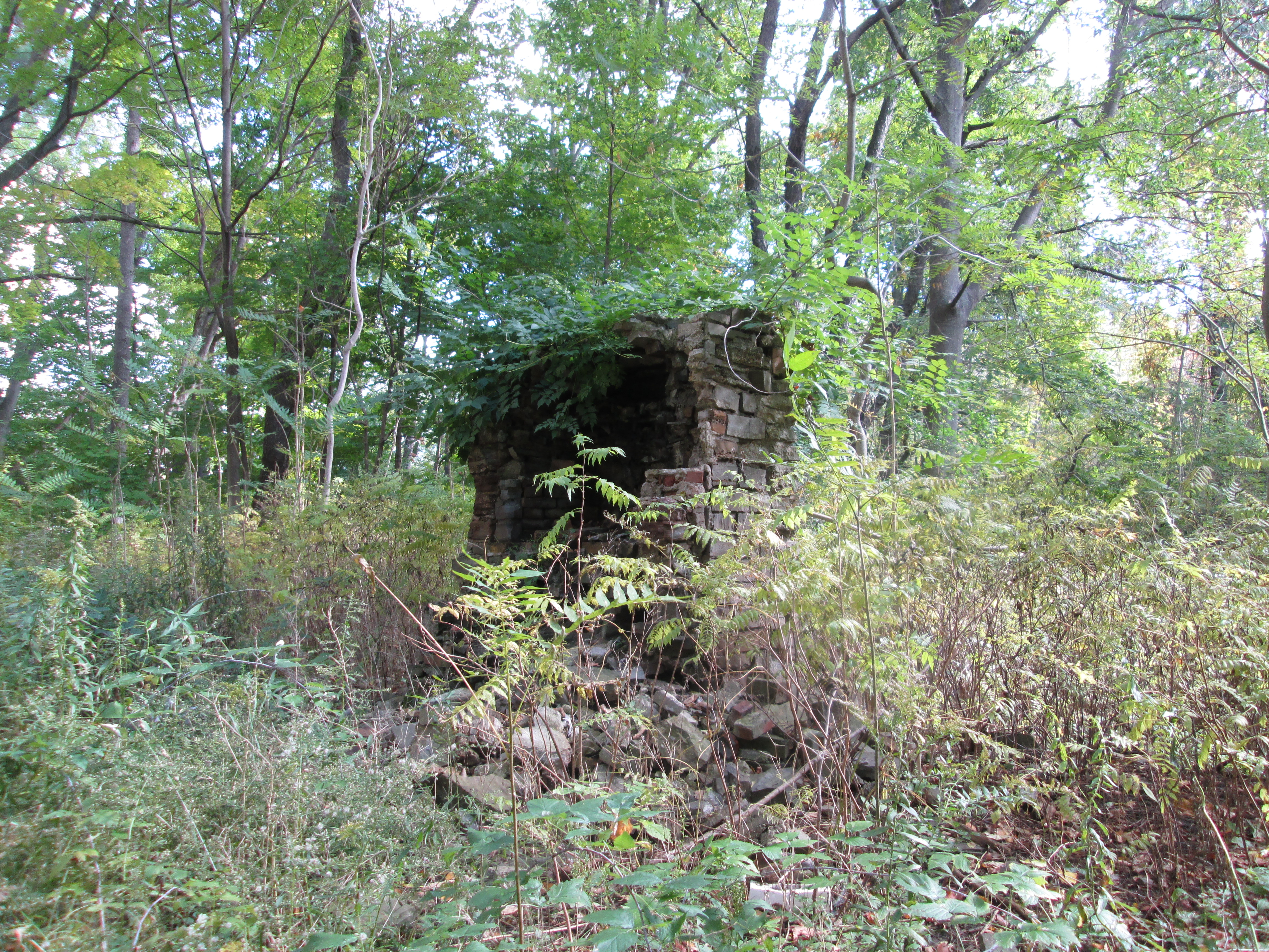
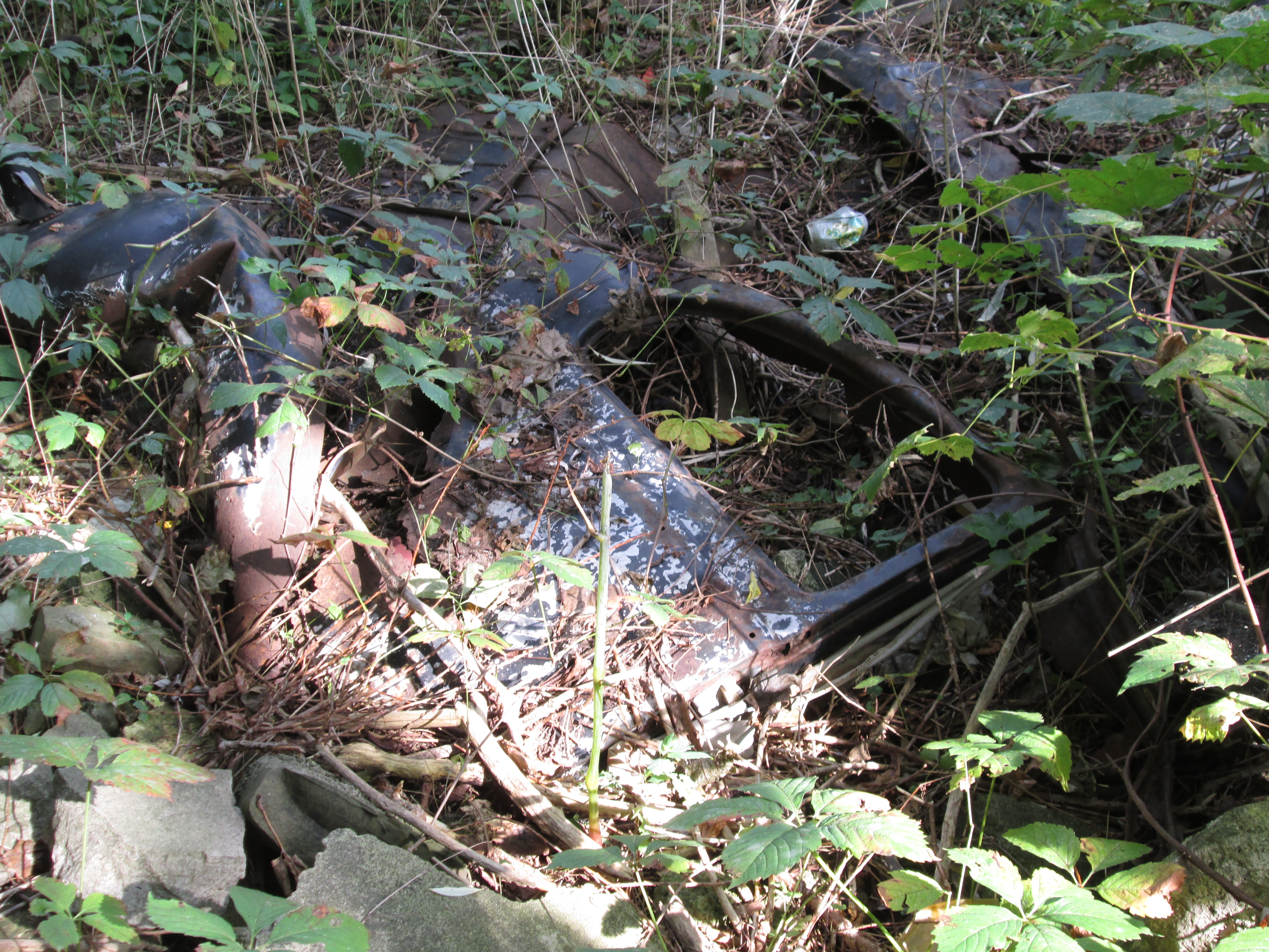
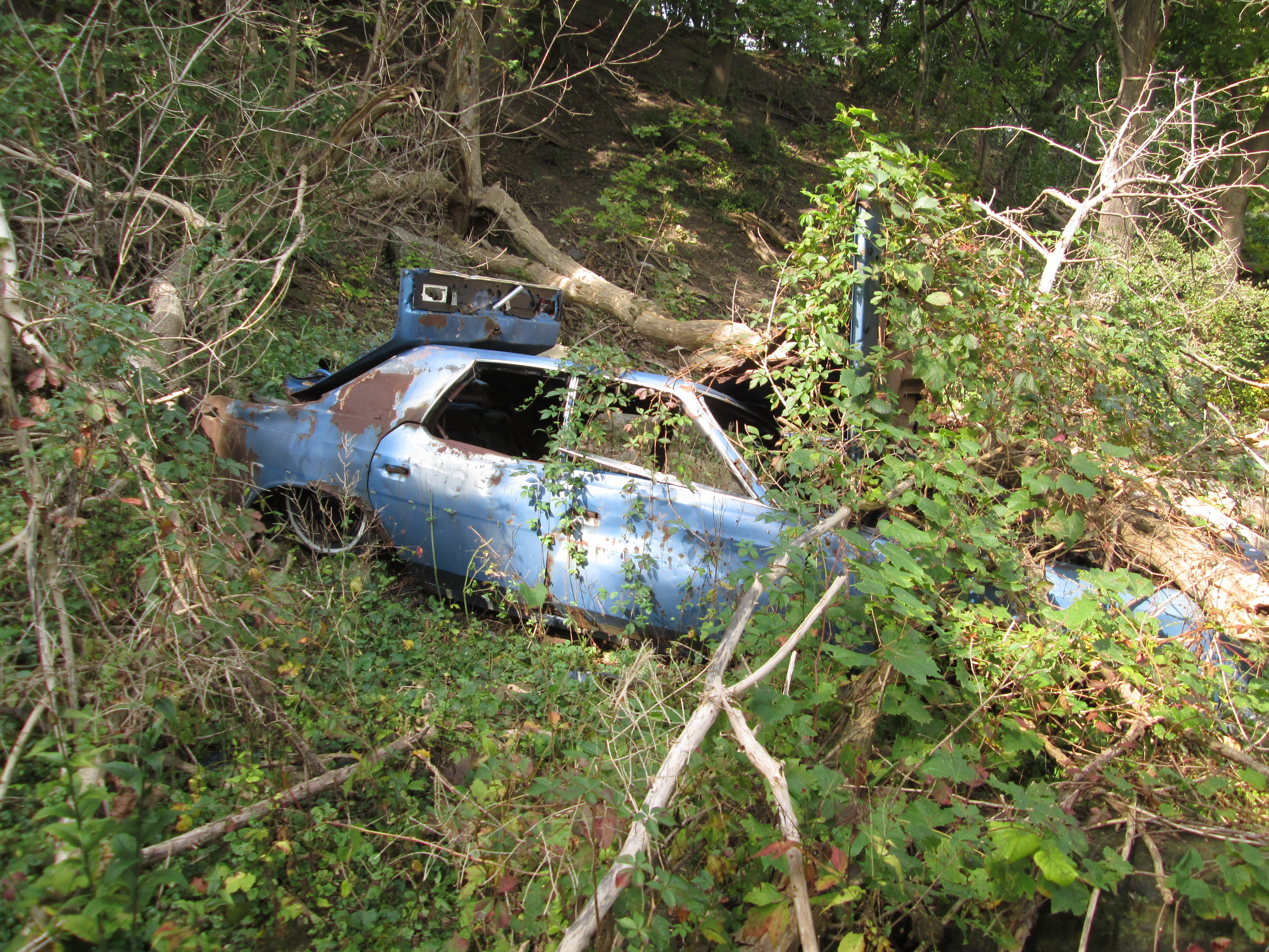
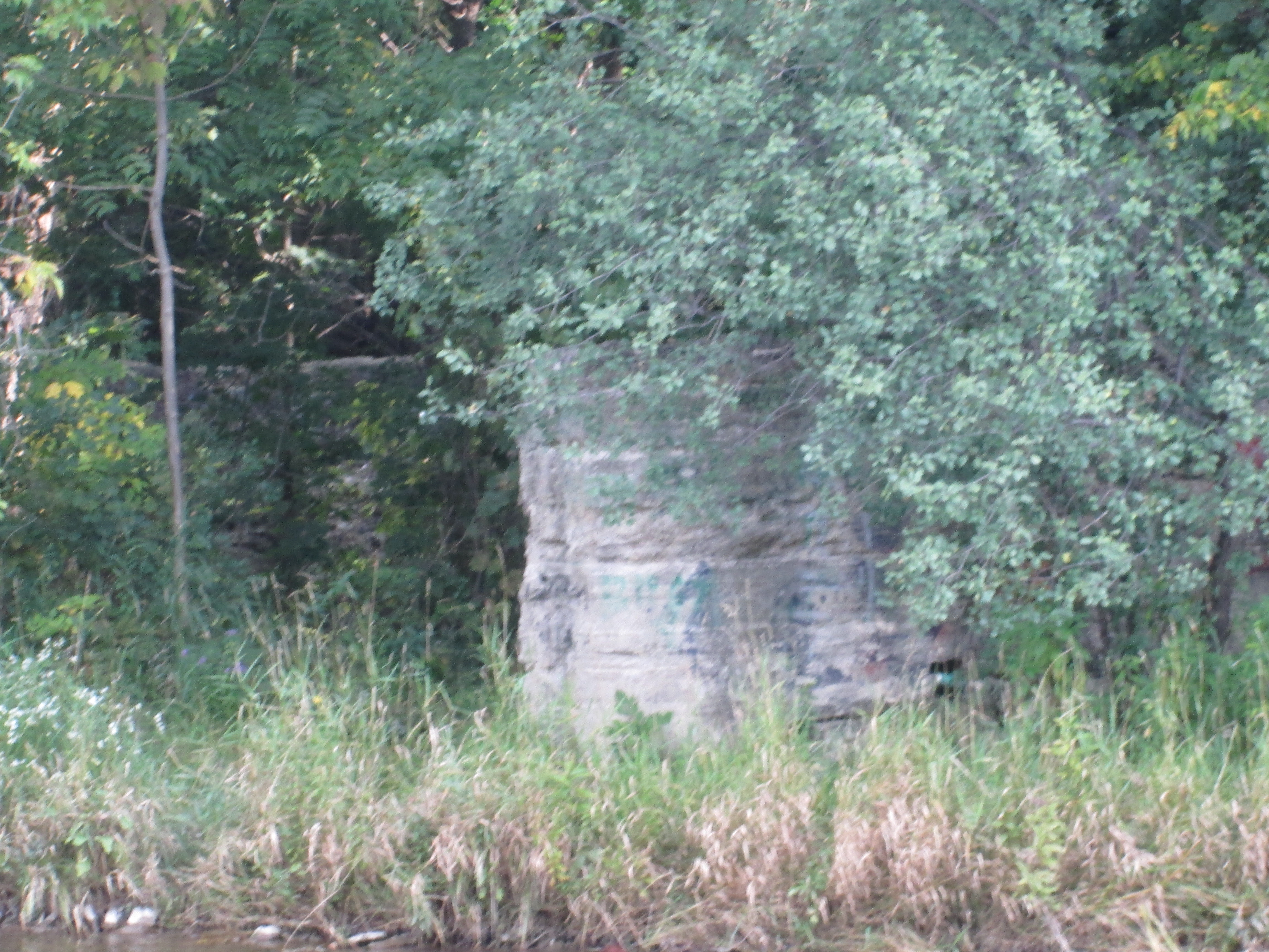
The Toronto Grey & Bruce Railway passed through the city and headed north through Cardwell Junction which is now only marked by a set of bridge abutments where two former rail lines once crossed. From there it went a short distance north to where it climbed the escarpment on a long horseshoe shaped curve. This was the location of a tragic derailment on September 3, 1907 known as the Horseshoe Curve Rail Disaster.

Approval has been made to extend the trail another 2 kilometers with an agreement between Metrolinx and the city to complete it in 2022. A third phase could see the trail extended to Strachan Avenue.

This is a convenient trail because of all the places where there is access and it’ll be interesting to come back and check out the extension when completed.

Other Rail Trails in Toronto: Leaside Spur Trail, the Beltline Railway is described in three parts: Kay Gardner Beltline, Moore Park Beltline and York Beltline Trail.

Other Toronto Grey & Bruce Blogs: Cardwell Junction, Horseshoe Curve Rail Disaster

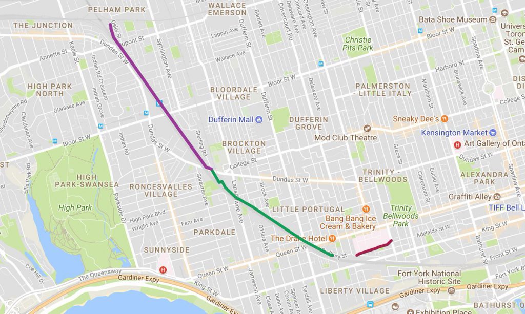
Google Maps Link; West Toronto Rail Path

Like us at http://www.facebook.com/hikingthegta

Follow us at http://www.hikingthegta.com

Also look for us on Instagram

Don Valley Brick Works

Sunday, Nov. 16, 2014

It was minus two with light snow flurries but one of those pleasant days when fall is trying to be winter. There is plenty of pay parking on the site of the brick works (Google Maps link).

In 1882 William Taylor was digging holes for fence posts on his farm when he uncovered some good looking clay.  Checking with a local brick maker, he was told that the clay was ideal for bricks.  William and his two brothers operated the paper mills at Todmorden.  By 1889 they had opened up the Don Valley Pressed Brick Company.  By the early 1890’s they were winning international awards for the quality of their bricks.

There were earlier wooden buildings but the oldest of the 15 remaining ones, and the first one made of Don Valley bricks, is the 1891 dry press brick plant.  This building held most of the early production and was built in the first two years of operation.

IMG_1121

This is the view from the top of the quarry looking down on the last remaining kiln chimney, built in 1906.  This chimney, as well as three others, provided a continuous draft over a series of kilns. As can be seen in the cover photo each chimney contained one word that together spelt out Don Valley Brick Works.  Only the “Valley” chimney remains.

IMG_1073

On April 19, 1904 a great fire destroyed much of the downtown of Toronto.  When it was over, there were 104 buildings which had burnt down.  The city enacted new laws to reduce the risk of another serious fire and these included a move toward more brick construction.  Over the next few years much of the Toronto skyline would be built using Don Valley bricks.  Some of the major buildings constructed of their bricks include Sick Kids Hospital, Toronto General, Osgood Hall, Massey Hall, and Old City Hall.  The fire proved to be a major boom for the brickworks and they expanded quickly over the next few years.  By 1907 production was up to 100,000 bricks per day.  The picture below from the Toronto Archives shows Front Street after the fire.

800px-4TorontoFire

In 1909 the business was sold by the Taylor brothers to their brother-in-law Robert Davies. Davies invested a lot of money into the brickworks and erected four of the buildings that remain today.  In 1910 he built the sales office pictured below.

IMG_1048

That same year another production facility was added beside the 1891 building where soft mud, stiff mud and dry bricks were produced.  It still houses the original shakers, dust collectors and sieves as pictured below.

IMG_1134

In 1912 a sand and lime storage facility was added.  The picture below is taken from the rear of the building.  This building features prominently in most old photos, including the aerial ones, of the 43 acre site due to the conveyor belt that always runs into a window on the back.  In the cover photo the conveyor on the right is carrying raw materials from the quarry into this building.  The picture of the complex in the cover photo includes the Half Mile Bridge which is described in a separate post.  We can date the photo to the early 20’s by the buildings and the steel construction of the half mile bridge.

IMG_1083

Large quantities of water are essential for the production of bricks.  The Taylor brothers diverted nearby Mud Creek to flow through their brick factory site.  In the picture below  there is a water channel that runs down the centre of the picture.  A rock wall lines the left side of the channel. The 1926 water treatment plant is the single story building that actually straddles the waterway. The front view of the 1912 sand and lime storage shed is on the right with the flower art sticking out of one third story window.

IMG_1100

During the second world war there were many German soldiers taken captive.  It was feared that if Germany invaded England these prisoners would be freed to fight again on the side of Germany.  A shortage of food and people to guard the prisoners led to the decision to inter some of them in prison camps in Canada.  One of these camps was at Todmorden and the inmates were forced to work at the Don Valley Brick works.  If you own a brick home built in the early 1940’s chances are that German POW’s made the bricks.

The business was sold again in 1956, this time to United Ceramics of Germany who went on an expansion program.  Seven new buildings were added between 1956 and 1961.  These included another dry press brick production building and in 1956 a building with 3 rows of kilns.  These kilns were fired at 1800 Fahrenheit and it would take a cart of bricks 2 days to pass through the 5 stages of the oven.

IMG_1060

An old brick press machine still sits in the welcome centre.

IMG_1091

The view from near the front of the pit looking north to the back.  In the early 1900’s the north face became an international geological site when it was discovered that there were fossils indicative of warmer climates.  From this they deduced that there was more than one ice age.  To get perspective on the size of the pit take notice of the person walking on the trail below.

IMG_1077

I climbed the hill on the north face to get a clear view back across the quarry to the cluster of old buildings.  The Bloor Viaduct (1918), also known as the Price Edward Viaduct, can be seen just beyond the compound.

IMG_1081

When the clay and shale were exhausted the pit was shut down and some of the equipment was sold off. The site sat abandoned for close to 20 years while the weather and lack of repairs took it’s toll on the buildings.  Wild parties and graffiti artists left their marks in the various facilities as well.

Starting in the mid 1990’s the site has been under restoration.  The quarry was partly filled in using excavations from the towers downtown including the Scotia Bank tower.  Mud Creek has been used to form 3 ponds and native vegetation has been re-established.  The site is now managed by Evergreen which has transformed it into an environmental showcase.  The building below was constructed to qualify for LEED platinum status as a building with one of the smallest carbon footprints in the world.  It uses part of the old holding building where bricks were kept before they went to the kilns.

IMG_1141

There is much more to be seen at the brick works and more opportunities to explore.  The guided tour sounds interesting but was not operating when I was there.

A list of our top 15 stories can be found here.

Google Maps link: Don Valley Brick Works

Like us at http://www.facebook.com/hikingthegta

Follow us at http://www.hikingthgta.com


Bayview Estates

Sunday Nov. 2, 2014

It was bright and sunny but cold, minus 1 on the thermometer with a wind chill of -9.  Warmly dressed I set off from home on foot.  I headed to Sherwood Park to cut out to Blythwood Ave.  A few trees in the park are holding onto their leaves.  These three trees are distinctive in their colouring.  The yellow one on the right is a maple, the rusty one in the middle is an oak and the orange on one the left is an aspen.

IMG_0857

In the early 1920’s it became fashionable for Toronto’s wealthy to want a country estate on the edge of the city.  The area of First Line East (Bayview Avenue) and 5th Side Road (Lawrence Ave) was ideal with Don River Ravine lots.  One of the largest tracts was 175 acres which belonged to Alice and Joseph Kilgour.  It is at the end of Blythwood and stretched from Bayview to Leslie. Many original buildings including the barns and stables remain in use.  The cover picture shows the estate as it looked in the 1920’s.  When she passed away in 1928 Alice gave the property to the city on condition that it never be developed.  The influx of injured soldiers during the second world war created a need for a new hospital which was originally to be called Soldier’s Military Hospital. Today it is known as Sunnybrook Health Sciences Centre. Tucked away in behind the newer hospital is the original building with it’s clock tower.  The date stone shows that it was laid on Nov. 10, 1945.  As we come to Remembrance Day 2014 it is fitting to think of the sacrifices that so many made to secure our freedoms.  Sometimes we remember the dead but forget that so many were injured that we needed a new hospital just to cope with them all.

IMG_0858

In 1928 James McLean, the president of Canada Packers, bought 50 acres of land overlooking the Don river on which to build his estate.  He called the property Bay View, leading to the changing of the name of First Line East to Bayview Avenue.  When McLean and his family moved into the house in 1931 they employed 4 gardeners for the upkeep of the grounds.  Today the home is known as McLean house and it is on the grounds of Sunnybrook Hospital.

IMG_0867

Many of the Bayview Estate owners had horses and McLean was no different so a separate coach or carriage house was built to store the carriage and the tack.

IMG_0865

John James Vaughan was the vice president of T. Eatons Company in 1930 when he had Donningvale built on 31 acres of land on the Don River.  It was grandly appointed with mahogany and large fireplaces.  It too is now located on the property of Sunnybrook Hospital.

IMG_0870

In 1920 Edward Rogers Wood purchased 85 acres of land nestled into a glen on the Don river where he set about creating the aptly named Glendon Hall. Wood had made his fortune as president of the Bank of Commerce and Canada Life starting when he was just 30.  The property had been in use as a farm and the land was fully cleared of trees.  Wood brought in mature trees and built gardens that became internationally known for their beauty and the speed with which they were built.  Wood had spent forty years as a millionaire quietly donating his fortune to hospitals, churches, and universities.  In 1959 when his wife Agnes passed away it became known that they had made their last and greatest gift by leaving their estate to the University of Toronto.  In turn, U of T gave it to York University in 1961.  The property now is in use as York University Glendon Hall.

IMG_0882

Bayview Avenue was originally known as First Line East and then later as East York Line because it divided Toronto from East York.  Until 1929 it was a dirt country road which crossed the West Don River on a single lane bridge.  When Bayview  was widened it was also moved to the west and given a new bridge across the valley.  The first Bayview  Bridge was built in 1891 and has been abandoned for 85 years and the old road allowance is becoming grown over.

IMG_0886

Just past the new Bayview bridge on the west side of the river is the full contents of an old home. A fridge, stove, washing machine, and many other items have been thrown down the embankment.  Lying among the oak leaves I found a 1944 Coke bottle.  This is the oldest soft drink bottle that I have brought home so far this year.

IMG_0894

Clifford Sifton was influential in Canadian politics at the turn of the twentieth century.  He was the minister of immigration and was key in the development of the Crows Nest Pass agreement. American railways were extending their lines into southern B.C. to take advantage of the minerals that had been found there.  At the same time, prairie farmers were complaining about the high rates charged for moving their grain.  This made it political suicide for the government to fund the railway expansion.  Sifton negotiated a deal that funded the Canadian Pacific Railway extension through the pass and secured permanently lower rates for the farmers.  This also served to protect Canadian interests in lower B.C.

In 1923 he built this 22 room mansion on 26 acres of land on the former Lawrence property on the north west corner of Lawrence and Bayview.  Like the other estate owners in the area, Sifton was into his horses and kept riding stables on the property.  The area just north of here is known as The Bridle Path because of it’s horse trails that used to cater to the Bayview Estate owners.  Sifton only got to enjoy his dream of living on a country estate for a few years as he died in 1929.

IMG_0920

This house was built for Clifford’s son, Clifford Sifton Jr.  It was complete with a swimming pool.

IMG_0918

A third house was built on the estate for his other son, H. Arthur Sifton.  These three homes are now part of the Toronto French School.

IMG_0917

For about 30 years from 1925 to 1955 the Bayview and Lawrence area was a pastoral country home to many of Toronto’s most influential people.  Today, their grand homes are almost forgotten in the bustle of mid-town Toronto.  Toronto’s millionaires have located onto The Bridle Path making it the most affluent community in Canada.

According to my pedometer I made it back home after 16173 steps.

Looking for places to explore?  Check out Greatest Treks and Greatest Treks 2 for 30 of the most popular hikes.

Like us at http://www.facebook.com/hikingthegta

Follow us at http://www.hikingthegta.com


Winding Lane Bird Sanctuary

Saturday Oct. 11, 2014

A chilly start to the day at only 5 degrees.  The sun was out and the sky was bright blue.  To access Sawmill Valley Creek near Dundas and Mississauga road it is easiest to park in Erindale Park and walk across the bridge over the Credit River.

Many of the trees are still green, which is nice.  When the cool evenings of the fall signal the onset of winter, deciduous trees begin the process of collecting and storing the useful resources in the leaves.   The tree stores the green chlorophyll pigment and other photosynthetic parts of the leaf in the roots, trunk and branches of the tree for use again the following spring.  The removal of the green from the leaves produces the bright colours we enjoy.

IMG_0611

Sawmill Valley trail enters the north west corner of Mississauga Road and Collegeway.  As you follow the trail you will soon come to the start of a fence.  If you follow to the right of the fence you will find yourself on an old winding laneway.

IMG_0577

This is the laneway of Roy Ivor, also known as the birdman of Mississauga.  In 1928 Roy, along with his assistant Bernice Inman-Emery, started the Winding Lane Bird Sanctuary.   During the 50 years he ran the bird sanctuary he cared for thousands of birds.  He was a regular contributor to National Geographic during the 1950’s as well as teaching countless school children about birds.  Ivor died in 1979 shortly before he would have turned 100.  He is buried close to home at St. Peters Anglican Church in Erindale.  Bernice ran the sanctuary from the time of his death until she moved to a retirement home in 2007.  The sanctuary has been closed since then and all of the bird cages have been removed.  Recently the property has been purchased by the city for incorporation into the adjacent parkland.

Ivor’s house is featured in the cover photo showing how it looked before it burned down on December 29th 1970.  A portion of the large central chimney remains standing.

IMG_0582

The outline of the east wing of the house is still clearly visible.  When the house burned down a trailer home was brought in and parked over this end of the foundation.  Here life went on pretty much as it had before.

IMG_0585

Each Burdock seed pods contain hundreds of stems that stick to clothing and fur.  Inside the pods are little tiny seeds that get transported around and then discarded to start new plants elsewhere.  In the early 1940’s Swiss inventor George de Mestral was out walking his dog when both of them got covered in burdocks.  Curious about how the burdock attached itself to his clothes he looked at one under a microscope.  He noted the little hook on the end of each one of these little spines.  De Mestral patented Velcro in 1955 based on the hook and loop system used by burdock.  The hooks can clearly be seen on the burdock in the picture below.  Inside the burdock pictured below is a lady beetle.  There are over 5,000 species of lady beetles but all are protected by noxious body fluids based on cyanide.  Their bright colours are used as a warning to birds that might consider eating them.

IMG_0579

Geo-caching is an activity that rose to world popularity in May 2000.  When GPS restrictions were removed a high-tech game of hide and seek began.  A cache is hidden which includes a log book, pen or pencil and often trinkets.  People hunt for the caches based on a set of co-ordinates using a GPS.  When the log book is found it is signed and carefully re-hidden.  Geo-caching never achieved the prominence that is made possible in the era of cell phones with GPS.  One possible explanation for this is 9/11.  Security scares have become common with police bomb squads having been called in after suspicious activity has been reported.  Several schools and even Disneyland have been locked down.  We found a geocache with a skeleton in it.  Since we were the first to find the cache, and that quite by accident, the skeleton may be symbolic of a dead pass-time.

IMG_0593

Other Erindale hikes featured on the historical atlas below include:

  1. Erindale Orchards, 2. Erindale Hydro Electric Dam, 3. Credit River at Erindale and 6. Mullet Creek’s Secret Waterfalls.


sawmill valley legend

Like us at http://www.facebook.com/hikingthegta


Streetsville’s Forgotten Foundations

Saturday Oct. 4, 2014

Autumn has certainly set in.  It was cool at 14 degrees and the skies were dark with clouds.  We decided that it wouldn’t dare rain on us so we set out.  Having parked on Mill street in Streetsville we were right in the area where Timothy Street had built the mill in 1819 that got the town started.

In 1818 the final parcel of land along the Credit River was ceded by the natives to the government.  Timothy Street financed the task of surveying the area while Richard Bristol conducted the work.  In exchange for his work Timothy was given 1000 acres of land which is now known as Streetsville as well as 3,500 other acres scattered throughout Halton and Peel counties.   Timothy Street is listed in the town directories as a tanner.

In 1825 he built the house in the picture below which looked out over his business empire.  This house is believed to be the oldest remaining brick house in Peel County.

IMG_0461

Access covers are one of many items that are usually dated and can therefore tell a little of the tale of a place.  Main street crosses the Credit near Timothy’s house.  At this point the name changes to Bristol Road in honour of Richard Bristol for his work in surveying the area.  Access covers usually indicate the date on which a road or bridge was built or restored.  The cover featured in the photo below is unique in the fact that it has a fish on it.  Dated 2011 it came from St. George which is near Brantford.  It is appropriate because this bridge is a suitable place to stand and watch the fall salmon run in the river.  We didn’t see any this week because the river was too dirty and cloudy.

IMG_0462

From the west bank of the  Credit River we had seen a set of foundations that we believed were another of the five mills that once lined the Credit River around Streetsville.  We went north in Timothy Street Park along the Culham Trail.  When we finally had a chance to check them out they appear to be a little less obviously mill foundations.  There are four thick concrete pillars which run in a slightly curved line with the first one beside the river, pictured below, having four holes formed in the side.  The fourth one abutting against an earthen mound has a mounting surface on top of it.  The mound behind it runs in a curved line off through the trees.  The cover picture shows the four pillars from the side of the mound looking out toward the river.  Large trees growing in places between them.  Having visited the site it is hard to see this as a mill.  It looks more like an unfinished roadway of some kind.  A member of the Streetsville Historical Society suggested that it may be related to Timothy Street’s mills but the use of concrete suggests a date around 1900 or later.

IMG_0478

The picture below shows the third pillar in the foreground and the fourth behind it.  Notice the step down on the side of number three. The fourth one has a full ledge along the front as if something was mounted there. Forgotten by time and seemingly undocumented on the internet this project could be up to about 125 years old.  Older bridge supports would likely have been made of cut stone and not concrete. If anyone has any information about this artifact please feel free to leave a comment.

IMG_0488

When we visited Riverside Park on Sept. 9th the wild cucumber were in full fruit.  A seed grows in each of four chambers inside the cucumber.  In the fall the bottom of the fruit literally pops open and the seeds are dropped out.  The plant dies off every winter and relies on these seeds to carry on the following season.

IMG_0517

The fall is a time when many berries ripen.  Several types of berries last on the bush and provide food for birds that spend the winter here.  The red berries in this picture hang in clusters on a plant with serrated edged leaves.  After looking through countless sites dedicated to berries in Ontario, I have to conclude that this is not a native plant and that it has escaped from a garden somewhere.  One way plants can escape from gardens is when their berries are eaten and the seeds pass through the bird and remain viable.  A seed that gets dropped in a soil condition in which it can grow may be found miles from the original plant.

IMG_0555

The male Bank Swallow chooses a colony to join.  Colonies are founded in areas of loose soils for easy digging.  The male will then select a site for his burrow which is normally about 2/3 of the way up the embankment to reduce access to ground predators.  The tunnel will extend about 2 feet into the soil where temperatures are more stable and here a larger chamber will be dug for the nest.  When the nests are complete, female Bank Swallows will hover in front of the nests to choose a mate.  The female will then collect the grasses to line the bottom of the nest where she will lay her eggs.  Several holes were seen along the river bank, one of which is shown below.

IMG_0546

Here is another view of Hyde mills which clearly shows the 1840 part of the mill built of stone on the right (closer to the river) and the 1906 portion built of bricks on the left.  Having reached here we came to the most southern point on the Riverview Park hike a couple of weeks ago. This completes a section of the river but the mystery of the four concrete supports and the earthen wall remains, for now…

IMG_0534

Like us at http://www.facebook.com/hikingthegta

Follow us at http://www.hikingthegta.com

Hyde Mill Streetsville

Sat. Sep. 20, 2014

A beautiful morning for the final Saturday of summer.  We parked on Mill street in Streetsville. Taking the little trail that heads north on the west side of the Credit River we passed through and area where the young bushes were cropped off a foot off of the ground.  Deer had grazed as they made their way along the river bank.  We followed them toward the walls of an old mill we had seen when we were in Riverside park a couple weeks ago.

At the mill site water was diverted from the stream or mill pond to the water wheel by a small stream that was usually man made.  Where the water was brought to the wheel was called the head race.  The water wheel, or later a turbine, was used to transfer the energy from the falling water to turn the gears inside the mill.  This would drive the grinding wheels in a grist mill or the saw blades in a saw mill.  The water was then returned to the river by means of the tail race. We found the tail race to the mill and knew that it would lead us there.

IMG_0211

The remains of an old vehicle, likely a late 1940’s or early 1950’s, lay at the bottom of the hill. This car may have been here for quite a long time as it is damaged beyond identification.

IMG_0232

A second car lies decaying in the same area.  This car is in much better shape although it has been stripped clean of every usable part.  The trunk lid still contains an old decal showing how to use the tire jack.  From the part number on the decal we were able to identify this car as a 1977 Ford Galaxy 500.  These two vehicles must have been dumped down here before the trees grew up on the embankment above.  They may have been stolen and dumped down here or just abandoned here by their owners.  Either way, it is hard to see why they were left here and not removed by the city.  There is now a new acronym for those wishing to make fun of Fords. (F)ound (O)n (R)iver (D)rowned.

IMG_0249

The car in the foreground of the picture below shows what the Galaxy 500 would have looked like when it was new.

77FordLTD

Heman and Mary Hyde ran a large inn at Church and Main street for 40 years and this, along with proceeds from their saw mill, placed them among the wealthy in early Streetsville.  Their son, John “Church” Hyde, built his own little merchant-miller empire.  By 1840 he had built a mill on the west side of the river near the end of Church street.  The mill expanded into a saw and grist mill, cooperage and stave factory.  Staves are the thin wood boards which were used by a cooper to make barrels.  He also built quarters for his workers at the mill site.  In 1906 the mill was converted to produce hydro electricity for the town of Streetsville.  It was Ontario’s first municipally owned power plant.  The plant continued to be the source for power for the town until 1943 when Streetsville joined Ontario Hydro.  The plant continued to provide auxiliary power until 1960 when it was shut down.  In the photo below are two tunnels under the building where water was used to turn turbines.

IMG_0262

There are two holes where shafts from the water turbines came up from these water tunnels below.

IMG_0279

A steam pipe like the one below helped us to locate the Millwood Mills during a hike back in June.  This also helps to identify this part of the mill as being of the newer 1906 construction.

IMG_0289

The mill is designated as a heritage site because of the remaining door and window frames which can be seen in the cover photo.  Since it is now intended to be preserved I find it odd that the interior of the mill is allowed to become overgrown with small trees. In a few years these trees will push over the walls and ruin this historical building.

IMG_0291

When the mill was restored in 1906 a new dam was built across the Credit River.  The foundations remain in a pattern of squares on the river bed.

IMG_0295

Fall would officially begin a day later, but there was a hint of colour coming in some maple trees already and the sumac trees are bright red.  Fall’s showcase of beauty is about to begin.


IMG_0175

As we had hiked up the west side of the river we had seen the remains of yet another mill, this one on the east bank of the Credit river.  Hmmm….

IMG_0197

Google Maps link: Hyde Mill

Like us at http://www.facebook.com/hikingthegta

Follow us at http://www.hikingthegta.com


Forks Of The Don

Sunday, Sep.. 14, 2014

Sunny and warm with a temperature around 16 degrees.  My seventh wedding anniversary and a few minutes for a short walk while my wife gets ready to go out with me for dinner.  I parked in E. T. Seton park off of Thorncliffe Park Drive.  Taking a left when you reach the bottom of the hill will bring you across an old bridge and into a parking lot.  This parking lot is on the site of several former buildings.   The bridge crosses the East Don River and right beside the bridge is a trail that goes down and under the old rail bridge.  Soon you will hear rushing water which tells you  that you have come to a waterfall at an old dam.

In 1846 the Taylor Brothers built a paper mill near this dam to join the saw and grist mill already here.  This became known as the upper mill.  The Taylor’s had two other paper mills.  The middle mill was just above Todmorden and the lower mill was at Todmorden.  Mid-nineteenth century paper was often made out of rags.  Homespun wool and cotton was mixed with straw and jute and cooked with soda and lime.  It was then washed, drained, pressed and dried to be made into various paper products.  All traces of this operation have either been removed or are hidden in the tall weeds.  At least the old mill dam is still easy to find.

IMG_3347

The Don river is divided into the East and West and just south of Overlea Blvd., right where Don Mills Road crosses the river,  is where they meet.  The forks of the Don can be approached from either bank as well as the little point of land that juts out between where the branches meet in the picture below.  The cover photo features the dam from between the East and West Don.

IMG_3348

Don Mills road was named for the saw and grist mills that it provided access to.  Originally it ran from the mills at the forks of the Don down to Parliament street.  It was later extended as far north as York Mills road, passing through various people’s well established land grants.  Since this road was independent of the actual mandated road allowance it was called the Independent Mills Road for a time. More recently it has simply been known as Don Mills Road. When it was widened to four lanes in the 1950’s a section south of Gateway Blvd leading down the hill was abandoned.  It remains today as part of a trail and a parking lot at the bottom of the hill.

IMG_3352

The old Don Mills bridge now carries a trail instead of a road across the railroad tracks. The bridge is constructed of steel beams bolted and pinned together.  I arrived here while the Terry Fox run was going on.  Crossing this bridge I could feel the sway caused by the runners as they pounded their feet.  It must have been interesting when cars and trucks were crossing here. The new Don Mills Road bridge can be seen in the background.

IMG_3353

Monarch butterflies are likely the most commonly known species of butterflies in Ontario.  They migrate south each winter to central Mexico.  Point Pelee Park is the most southerly point in Canada and on Sep. 17, 2014 (2 days ago) they reported over 2,000 monarchs spent the night in the park on their way south.  From this they estimate that populations will be up next summer. The butterfly in the picture below is a male.  Male monarchs have two little black spots on their rear wings (seen near the back end of the body) that are used to release a scent to attract the females.  Monarch’s taste bad due to a chemical in the milkweed they eat and that provides them with protection from being eaten by birds.  Another type of butterfly that looks almost identical is the Viceroy.  Viceroy’s are slightly smaller and have a second black ring around the back of their rear wings.

IMG_3361

Visit us at http://www.facebook.com/hikingthegta


Credit Meadows Park

Saturday Sep. 13, 2014

A rainy Saturday morning and only 11 degrees.  We parked in the parking lot on Creditview Road just north of where the Credit River crosses near Britannia Road.  This is the second lot north of Britannia and was home to Ephraim Steen who lived here from 1842 until he died in 1921.  Ephraim also owned land on the other side of Creditview as well as the land where Riverside Park and subdivision now stand in Streetsville.  This lot of land was taken over by the conservation authority in the late 1950’s and named Credit Meadows Park.

We didn’t wander too far from the cars but there is always something to see.  There is frequently one or more great blue herons that like to fish on either side of the bridge. We watched one feed across the river from us.  Herons in this part of the Credit are likely feeding on Blacknose Dace which are one of the most common minnows in the river.

IMG_3252

Near the parking lot is a stand of mature trees which includes several old black walnut trees. They can live for 130 years and attain heights of 40 meters.  The tree in the cover photo has had a tree fort built in it many years ago but only the ladder remains today.

Pileated Woodpeckers feed on beetle larvae and ants that live in trees.  They are known to bore out large, roughly rectangular, holes in trees while searching for food.   The tree in the picture below features a shelf mushroom just below the woodpecker hole.  These mushrooms are also known as The Artist’s Conk.  They have a soft white underside that is perfect for carving in. When they dry they become as hard as a piece of wood and can last for many years.  They usually will stand up on the flat side where they grew on the tree.  They can grow to be 50 cm in length by 30 cm wide.

IMG_3261

We found a branch growing a fungi called Turkey Tail.  Turkey Tail grows on fallen hardwood. This fungi is known for it’s medicinal properties especially as a supplement for conventional cancer treatment.  It is helpful for overcoming the side effects of chemotherapy.

IMG_3294

Wood frogs are easy to miss as they blend in well with their surroundings.  The small specimen in the centre of the picture is only a couple of centimeters long.  Wood frogs winter close to the surface and have the ability to withstand being frozen and thawed many times during the winter.  They convert their body fluids to urea and glucose, both of which don’t freeze as easily as water.

IMG_3307]

Wild Grapes, also known as River Bank Grapes have been climbing the larger trees in GTA parks for many years.  They can reach the tops of the largest trees and are capable of smothering the tree and killing it.  The woody vine can be several inches thick where it sprouts from the ground. The vine in the picture below is about four inches thick and easily supports the weight of an adult.  My picture of a Canadian Tarzan, however, will have to remain in my personal collection.

IMG_3314

This mushroom is known as a Dung Loving Bird’s Nest.   When mature they have a cap that has a few spore capsules that look like eggs in a bird’s nest.  It is designed to use the force of falling rain to distribute it’s spores and can throw it’s spore capsule up to two meter’s with the force of a single raindrop.  These mushrooms have already launched their spores.

IMG_3329

The Yellow Waxcap mushroom is edible but is not recommended as there is a poisonous mushroom that looks very similar.  They appear in late summer and there were many of them scattered throughout the woodlot.

IMG_3331

Riverside Park Streetsville

Saturday Sept. 6, 2014

It was a cool morning following a night of rain.  We decided that there was time for a short hike. Parking on Riverside Place we walked the path down to the east bank of the Credit River.  We thought we just might find evidence of Timothy Street’s mill, after which the town of Streetsville was named.  Streetsville has retained it’s small town feel even as it has been surrounded by the city of Mississauga.  In 1953 two of the first suburbs in Canada were built near Streetsville.  The one on the north east was called Riverside and opened in 1955.  The park at the bottom of the hill along the river may have contained the mill pond.  The tree in the cover shot is a massive black willow that stands near the side of an old mill race.  It is likely over 100 years old and witness to many changes in the river valley.

We watched a female downy woodpecker looking for lunch on a dead tree.  The downy is the smallest woodpecker in Ontario.  The males can be distinguished from the females by the red cap on the back of the head.  The downy and the hairy woodpecker look almost identical, yet they come from different genera.  Downy woodpeckers average about 6 inches while the hairy is normally around 15 inches in size.  They have the same markings except the white feathers on the tails.  Being unrelated they cannot inter-breed raising the question as to why they look so much alike.  Scientists use the term “convergent evolution” to describe two apparent random sets of independent mutations that, against all odds, somehow produced the same result.

IMG_3189

The Goldenrod Gall Fly is a small brownish fly that lives it’s entire life cycle around the plant.  In the spring the male will wait on a plant for the female to arrive so he can dance for her.  After mating she deposits her eggs directly into the stem of the young goldenrod plant.  The eggs hatch in about 10 days, roughly the same time as the adult completes it’s two week life cycle and dies.  The larva live their whole lives inside the plant where they chew a nest.  Their saliva causes the plant to grow a gall around the larva, up to the size of a golf ball.  Just before winter the larva will chew an escape tunnel out almost to the outer skin.  Then it converts most of its body fluid to glycol, a substance like anti-freeze, and sets down for the winter.  In the spring the larva wakes up and molts into the pupa from which the adult fly will hatch.  The adult will escape through the tunnel it dug the fall before.  When it reaches the end of the tunnel it inflates special pouches in it’s head to “blow apart” the skin of the gall.  The male fly then begins its two week life cycle on the outside.  Goldenrod galls are easy to find but it is rare to see two galls on a single plant.

IMG_3196

Wild cucumbers grow along the edges of Toronto’s rivers and streams.  They are related to cucumbers, squash and other gourds but unlike other members of it’s family, are not edible. The fruit will contain 4 seeds which drop out of the bottom after the pod has ripened.  The plant dies each fall and re-grows in the spring from the seeds of the year before.

IMG_3200

Milkweeds produce a pod which contains hundreds of little seeds.  These little seeds each have a silky tassle which allows them to be blown by the wind to aid distribution.  Milkweed is essential to the life cycle of monarch butterflies.  They lay their eggs on the plant and the emerging caterpillars eat it.  Monarch butterflies travel 4,800 km to Mexico to winter every year. In the winter of 2013-2014 only 44% of the butterflies arrived compared to the year before.  In order to improve the future of these butterflies the David Suzuki Foundation has a program promoting the planting of milkweed in Toronto.

IMG_3203

We found the old Streetsville mill but it was on the other side of the Credit River.  Exploration awaits…

IMG_3219


Summerville

Saturday August 30, 2014

It was partly sunny with humidity making it feel several degrees warmer than the 21 degrees on the thermometer.  We parked off of Nelson street and followed a little path to the edge of the creek.  From there we went south on the east side of Etobicoke Creek.  We very quickly saw two Great Blue Herons flying upstream followed shortly by a Belted Kingfisher.  A minute later one heron flew back downstream with the kingfisher scolding him all the way.  Having chased the heron out of his personal fishing hole, the kingfisher chattered final warnings as it flew back upstream.  Although we followed the heron downstream he was spooked enough that we never got a good picture of him.

Grass Spiders, also known as Funnel Weavers, weave a large web with a funnel shaped hole near one side where they sit and wait for prey.  The web isn’t sticky but the spider makes up for this with it’s lightning speed.  When I opened the back door of my car I found a large mess of spider web running from the door to the head rest on the back seat. One of these grass spiders, about an inch across, was trying to hide along the door seal. Living in my car and walking up my neck while I am driving is not an option but she jumped to the ground and ran away fast enough to avoid becoming a sticky mess on my shoe.

IMG_3116

There is still plenty of evidence of last year’s July flooding along most of Toronto’s ravines. Rows of sticks and other debris has been packed into plants and trees high above the normal water level.  In one of these places we found an old tractor tire in which a grass spider has built it’s nest.  The round hole near the centre of the picture is opening of the funnel which is the spider’s home.

IMG_3152

In the 1820’s John Silverthorn  built a saw mill and a grist mill north of Dundas Street on the Etobicoke Creek.  John also built a road through his property from Burnhamthorpe Road  to Dundas Street to help people bring their goods to his two mills.  This road still exists today as Mill Road north of the Etobicoke Creek.  South of the creek a clever city planner named it Southcreek Road.  The mill was at the crossing of the river but is now off limits to hikers as it is on property owned by the Markland Wood Golf Club.   A community grew up around the mills and by the 1850’s it had a population of around 100 with two blacksmiths, the grist and saw mills, a chair factory and, naturally, two taverns.  It took the name Summerville in 1851 when the post office opened.

John’s brother, Joseph, built Cherry Hill House in 1822 and it is said to be the oldest house in Mississauga.  As seen in the 1972 photo below, the house was allowed to fall into ruin. It was restored in 1979 and moved to it’s current location on the corner of Silvercreek Blvd and Lolita Gardens where it now serves as a restaurant.

Cherry Hill House  1972


SAMSUNG

A Spud Bar is a cylindrical steel tool which is typically 5 to 6 feet long and weighs up to 15 lbs.  They usually have a chisel point on one end and a tamper two to three inches in diameter on the other end.  In north America they are also known as millwright bars reflecting one of their primary uses.  Early millwrights built water powered mills like the saw and grist mills of john Silverthorn.  The millwright bar in the picture below, and in the cover photo, was found quite close to the location of the Silverthorn mills.

IMG_3122

Not much to say here other than this is included as one of the strangest findings of all time.

IMG_3129

We could see a thunderstorm coming our way and we made it to the bridge on Dundas before it arrived.  The storm only lasted for a few minutes and the rain evaporated quickly, increasing the humidity and making the hiking a little stickier.

IMG_3128

Along the side of the embankment was a long section of old bridge siding.  Hurricane Hazel took out over 50 bridges and it is quite likely that this is part of one of them.

IMG_3156

“A Mari Usque Ad Mare”, From Sea to Sea.  These words adorn the Canadian Coat of Arms. Just below the words Mari and Mare appear two purple thistles.  These are Canadian Thistles and have appeared on our Coat of Arms since 1921.  In-spite of the name, it is not actually native to Canada and is classified as a noxious weed here.  Other names include Lettuce From Hell and Cursed Thistle.  In spite of it’s status as an unwanted intruder it hangs on the walls of our government buildings, graces the 50 cent coin and shows up wherever the Coat of Arms is displayed.

IMG_3158

Apples, pears, cherries, peaches and roses are all related, being members of the “Rosa” family.  They all produce a type of fruit where the flower was.  The rose plant grows a fruit which is called a Rose Hip.  These are used for a wide variety of things including herbal teas, jams and jellies, pies and wine.  Rose hips contain 50% more vitamin C than oranges do and are one of the best natural sources.  They are also known to help prevent cancer and improve cardiovascular function.  Don’t just stop and smell the roses, take some time to eat them too!

IMG_3167

Barney and Friends debuted in April 1992.  The purple singing T-Rex was the star of 248 children’s tv shows until PBS cancelled the show on Sept. 18, 2009.  Listed by TV Guide as one the top 50 worst tv shows of all time it is rumored that no one has seen Barney since. Perhaps not until now….

IMG_3173