Tag Archives: Don Valley Brick Works

Time Travel in Toronto

November 28, 2021

Throughout the GTA there are several homes and historic sites that are open to the public, although usually with a small admission price to cover upkeep costs. They are typically decorated in the style of a different era. This means that if you chose to, you could visit each one in sequence and watch the changes over time. This post collects the various historic homes and sites and presents them in chronological order. A link will take you to the feature article on the site, if available, where a Google Maps link can help you locate them for yourself.

1814 Fort York

Fort York contains an amazing collection of buildings that date to the War of 1812, although many of them were replaced in 1814 after they were destroyed in the Battle of York on April 27, 1813. This is the first stop on our time journey as we start with our oldest museum.

As you go through the buildings notice how low the ceilings are. This is due to the fact that two hundred years ago people were generally shorter than today. (The track lighting and interpretive signs are obviously recent additions)

1820s Todmorden

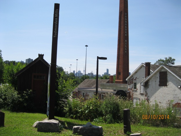
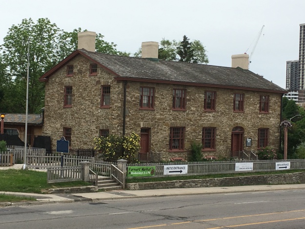
If we move ahead a decade we come to Todmorden Mills, a reminder of the city’s early industrial era. Mills were operated by water power and the Don River provided power to a series of three paper mills belonging to the Taylors. Only the lower one, which was at Todmorden, still survives. There’s also an old brewery and a pair of early industrialists homes. During the 1820s Trade Unions were still illegal and people were apprenticed for 7 years to learn a trade. General labour required long hours worked six days per week for sustenance wages.

1830s Montgomery’s Inn

If we move ahead another decade we can get a glimpse of how people survived as they traveled in the 1830s. A journey had to be broken into smaller sections so that horses could be allowed to rest and passengers could rest their weary bones that had been shaken up on the poor roads. Inns and taverns were built at convenient distances along the main roadways. Montgomery’s Inn was built in 1830 by Thomas and Margaret Montgomery.  It served as a rest and watering place for travelers along Dundas Street as they passed through the town of Islington. It served food and beer to travelers while providing fodder and water for their horses. Rest could also be had for those who needed to break their journey into several days’ travel.

1835 TollKeeper’s Cottage

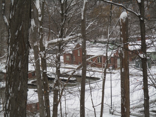
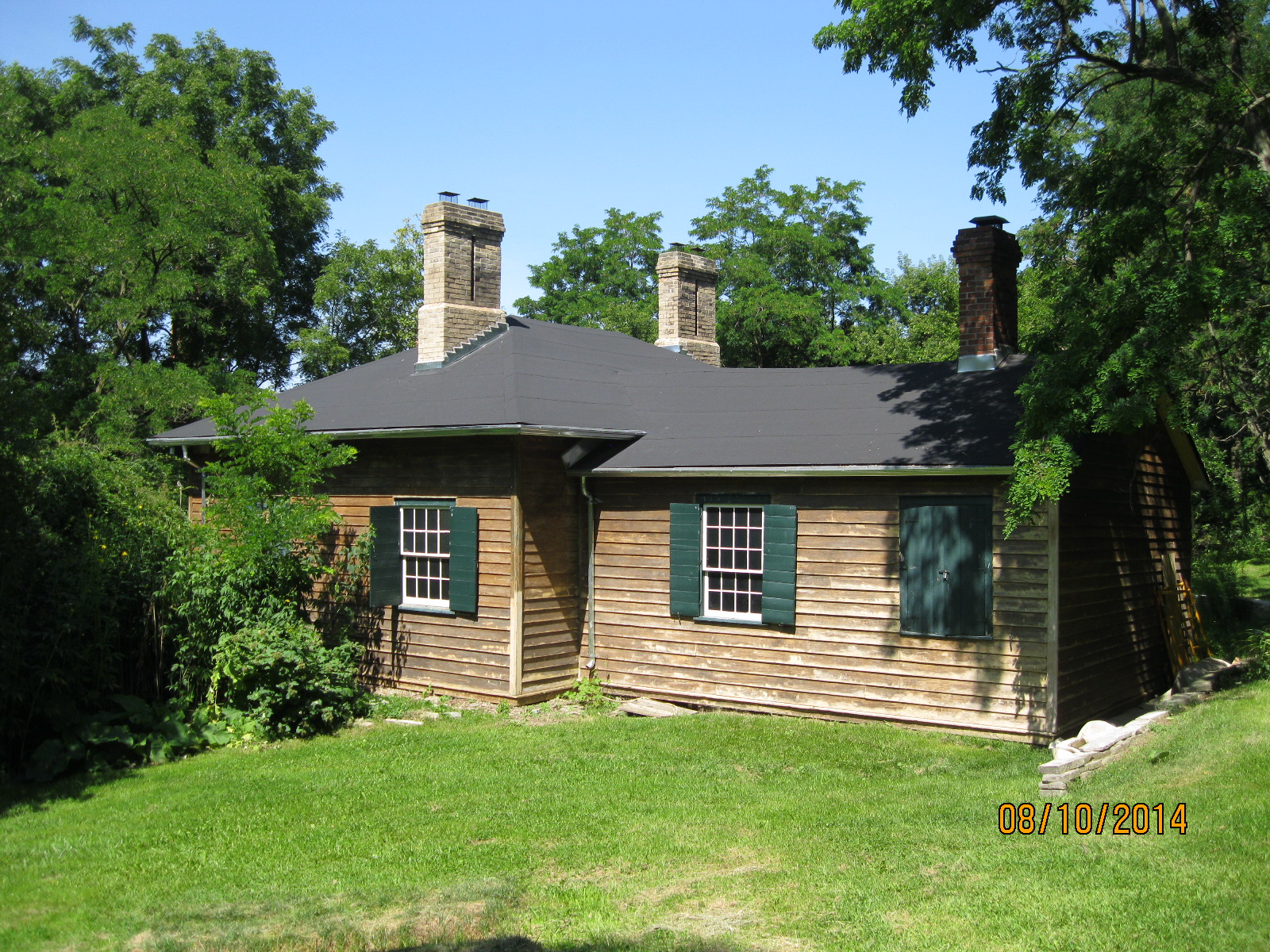
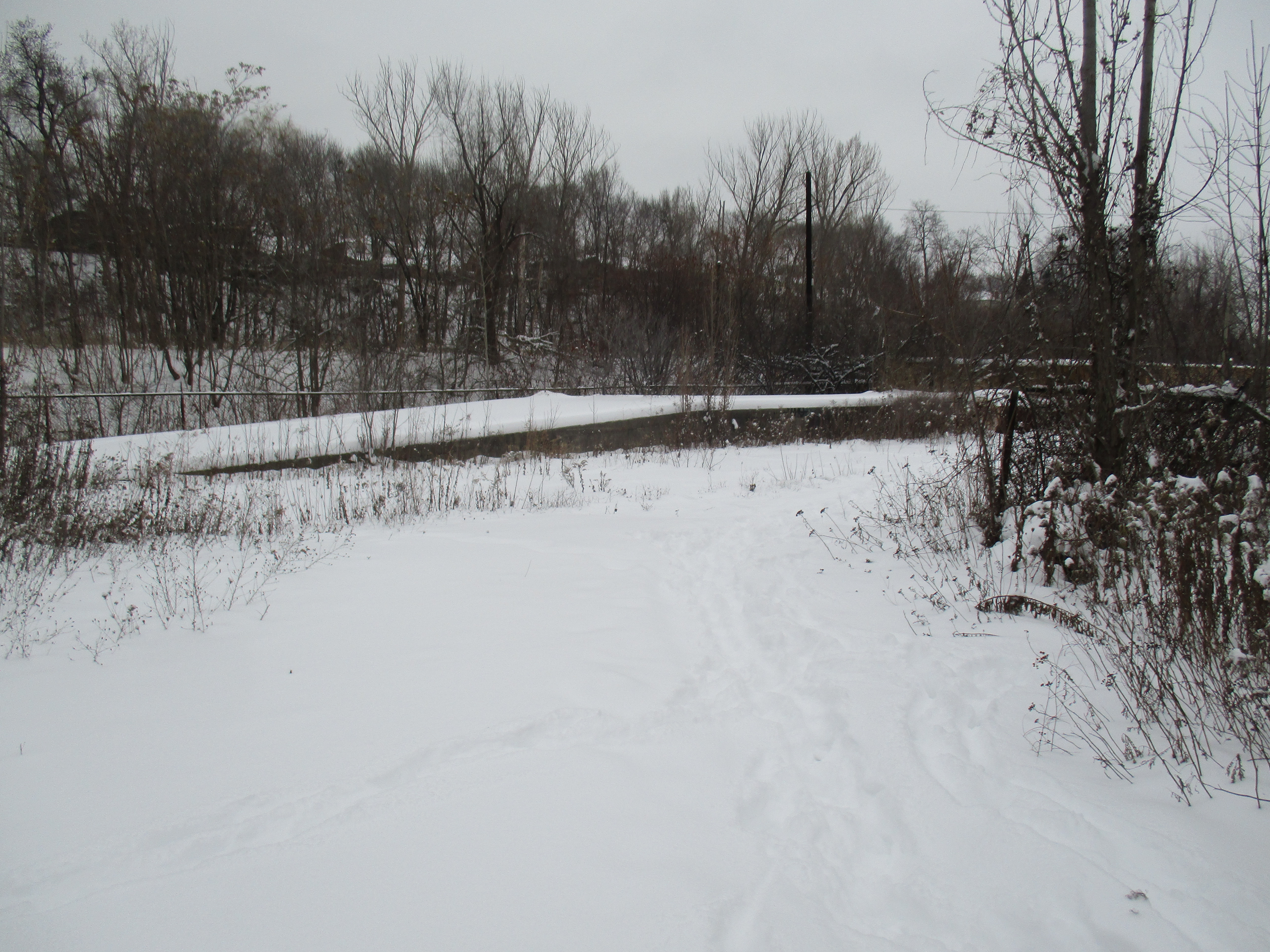
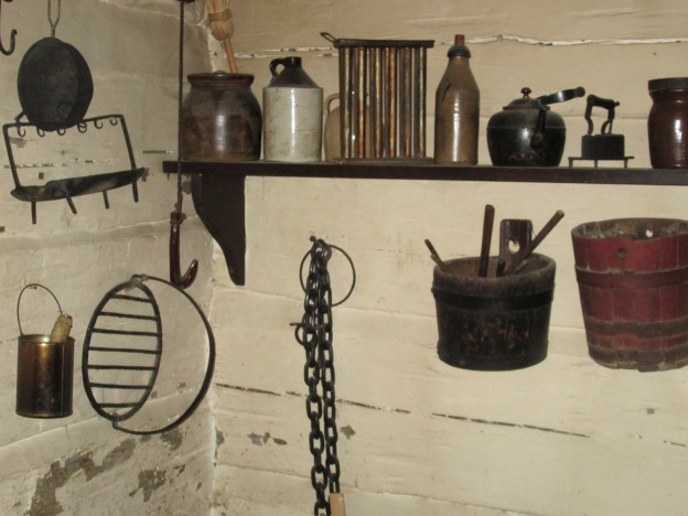
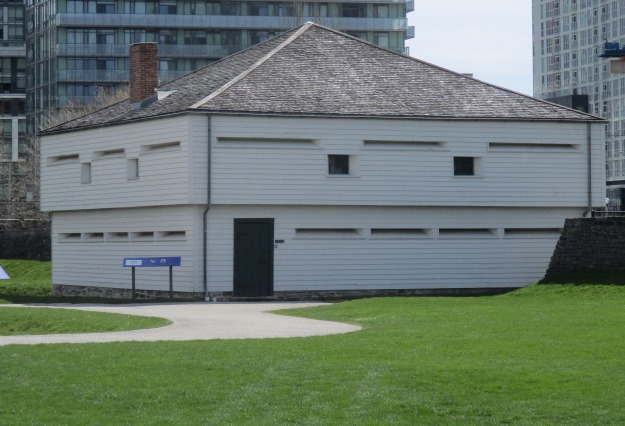
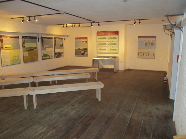
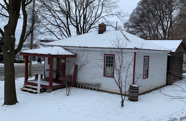
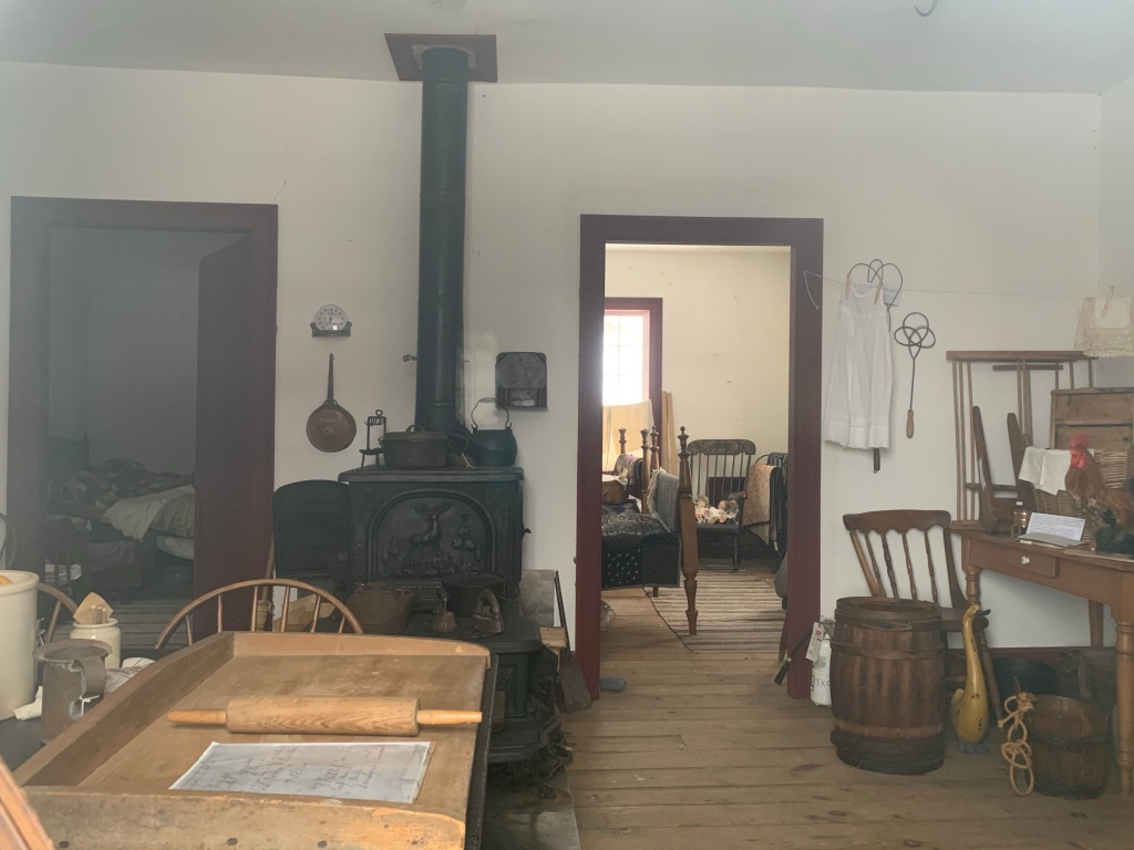
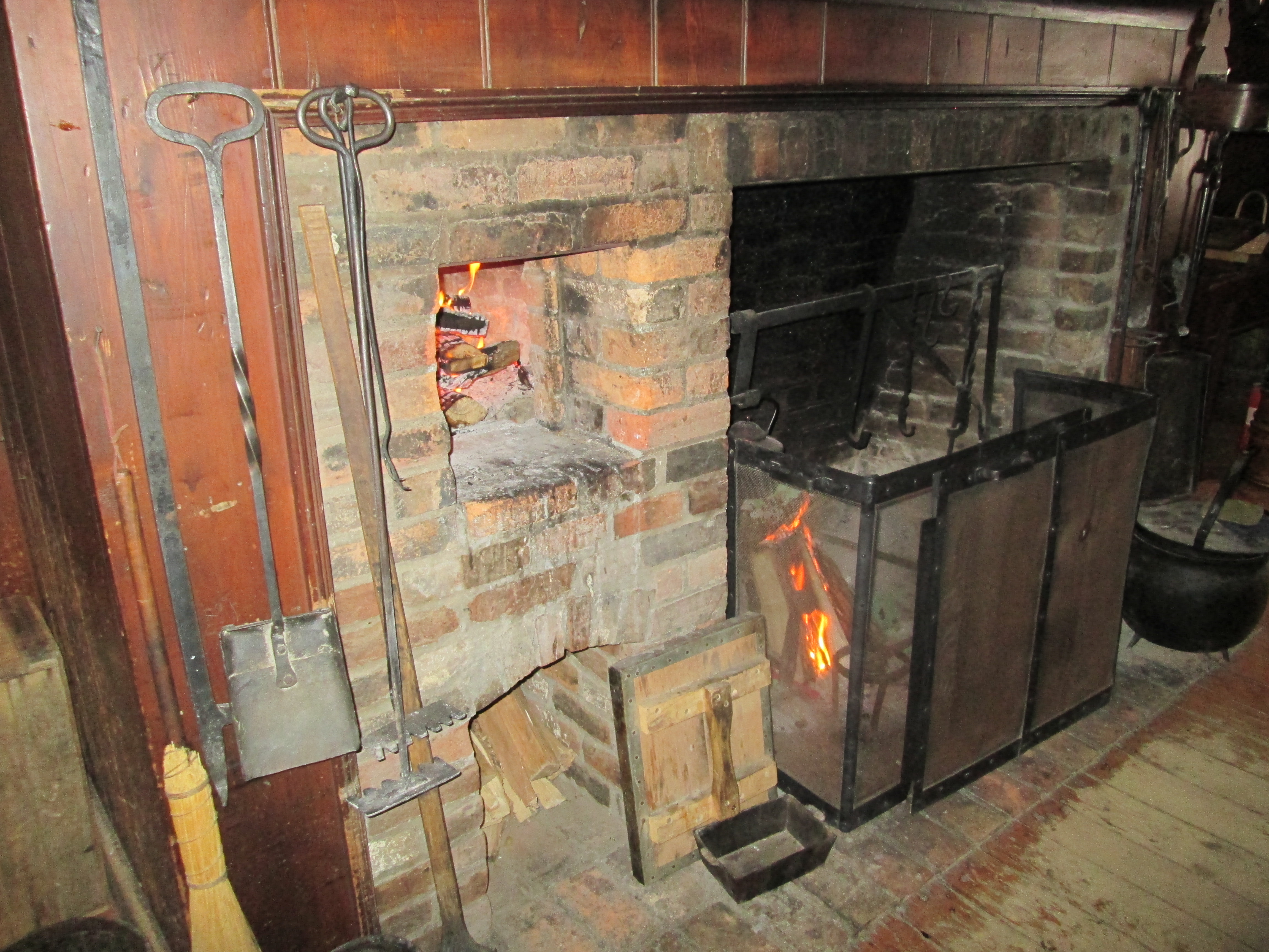
Those same travelers often made their way along snow-clogged roads in the winter with their sleds but in the spring and fall, these same roads could become almost impassable due to the mud and ruts. One solution was the creation of plank roads where cut boards were laid side by side to create a wooden road. These were expensive to build and required constant maintenance. A system of tolls was established and people were employed to collect them. This small cottage was built for the family whose job it was to collect tolls along Davenport Road at the intersection with modern Bathurst street. Inside it is furnished with the items that kept a family of 9 as comfortable as the times would allow.

Inside the cottage is the wood stove for heating and cooking that had to keep the family from freezing in the winter.

1845 McKenzie House

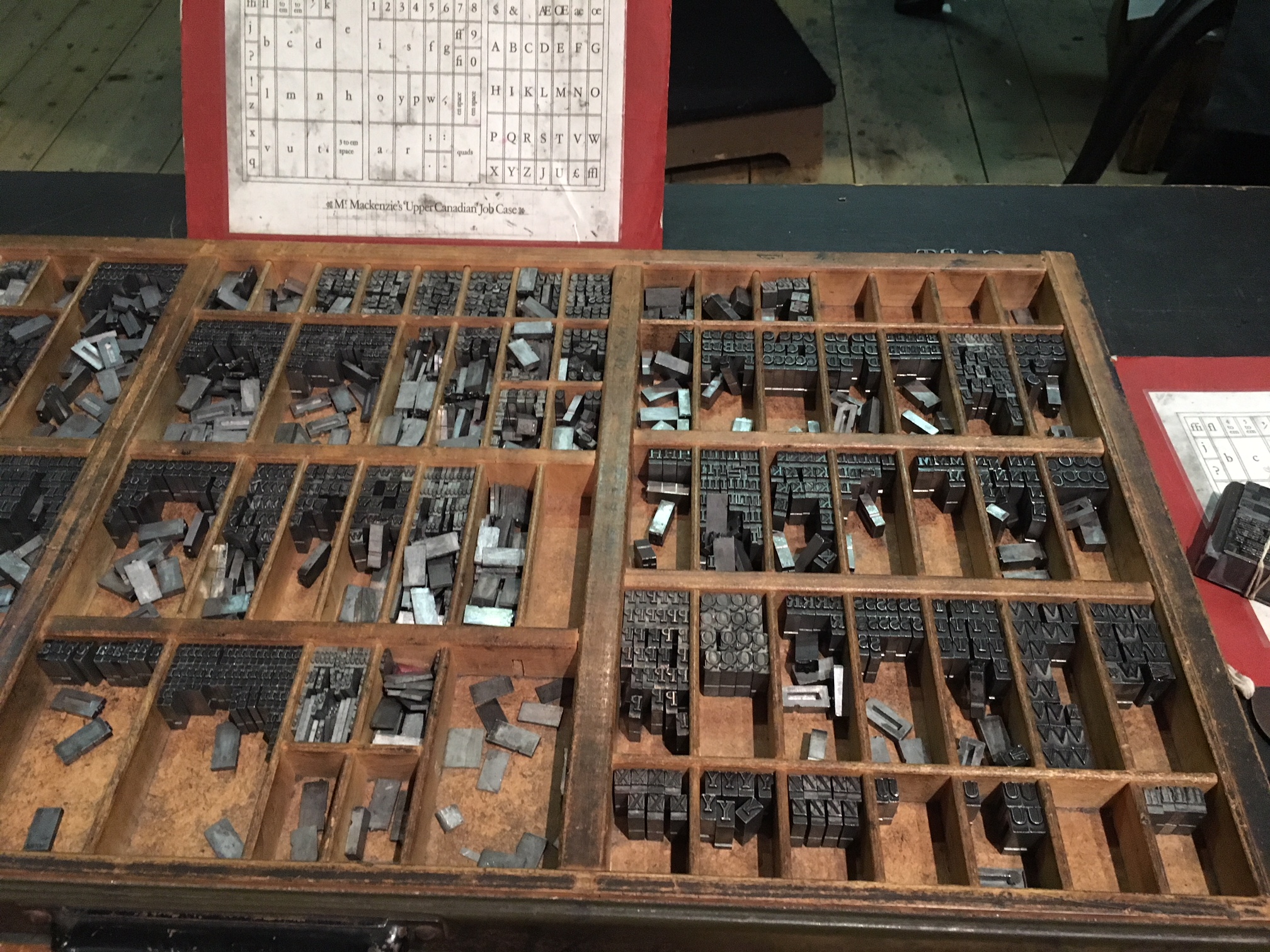
Our next two stops are related to the Upper Canada Rebellion of 1837. William Lyon McKenzie was the prime instigator for the rebellion. He used his printing business to incite discontent with the ruling Family Compact which would lead to rebellion. This museum takes you into a typical printing shop of the era.

This museum even includes a set of MaKenie’s own printing types.

1850s Gibson House

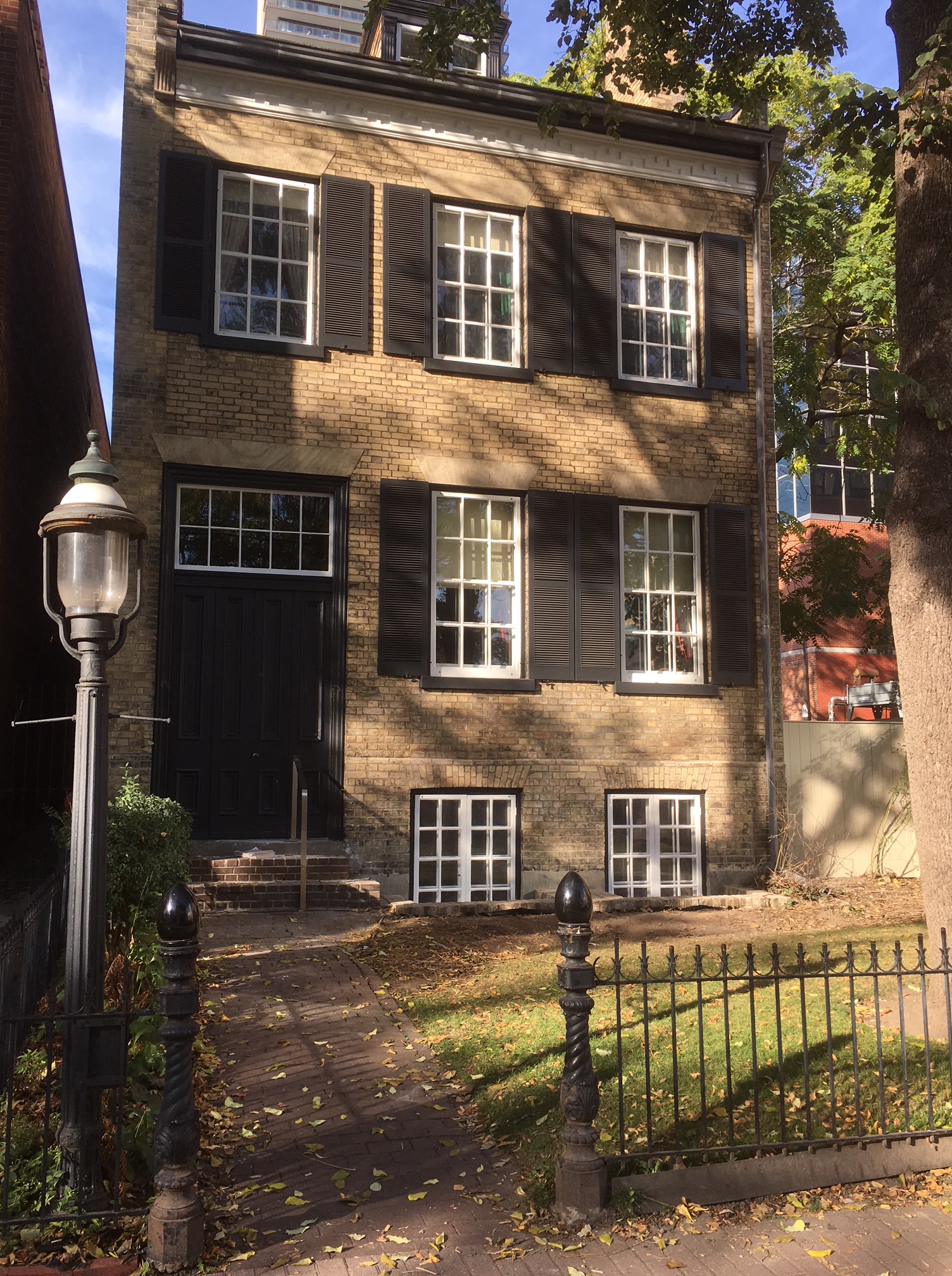
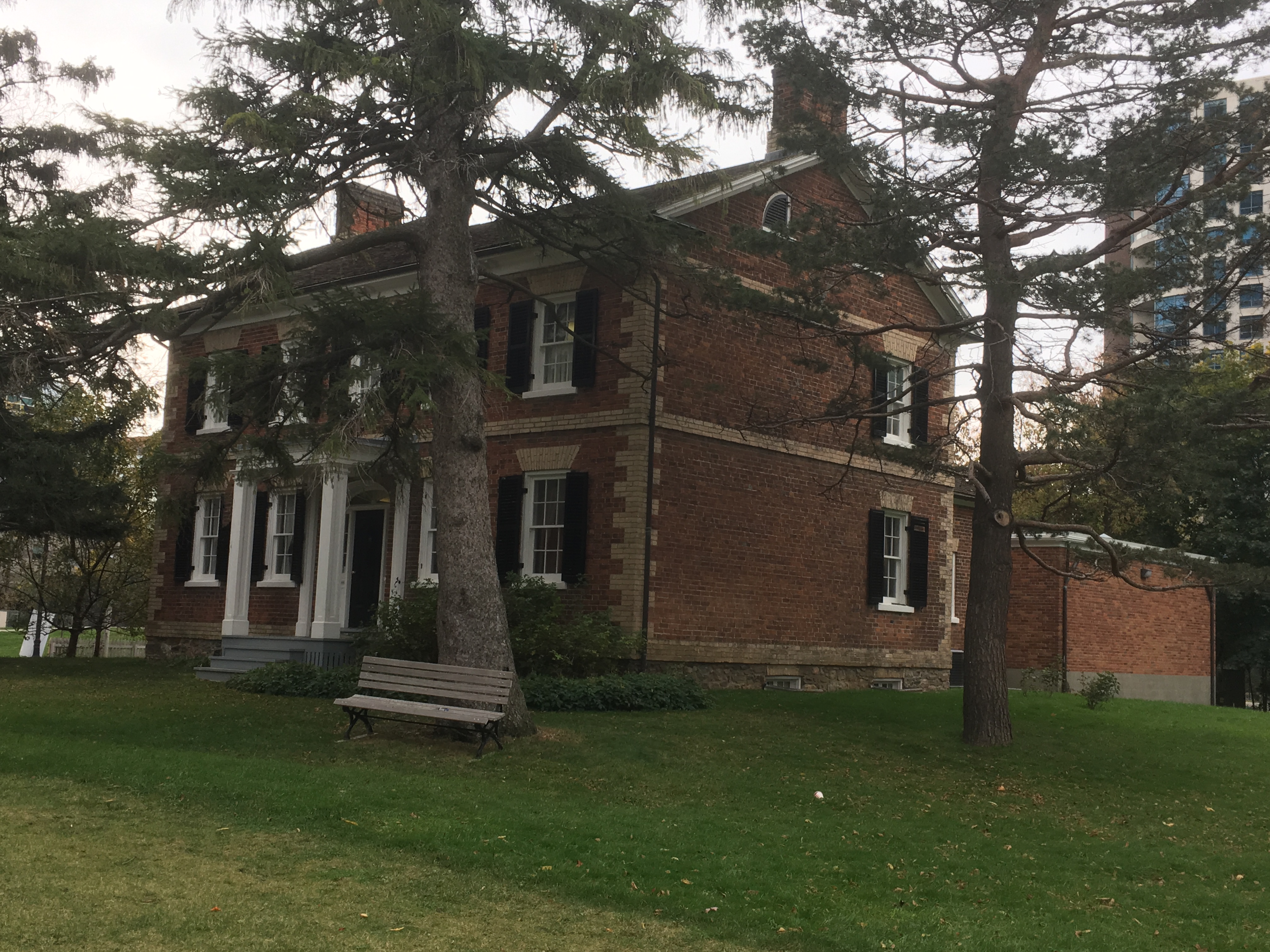
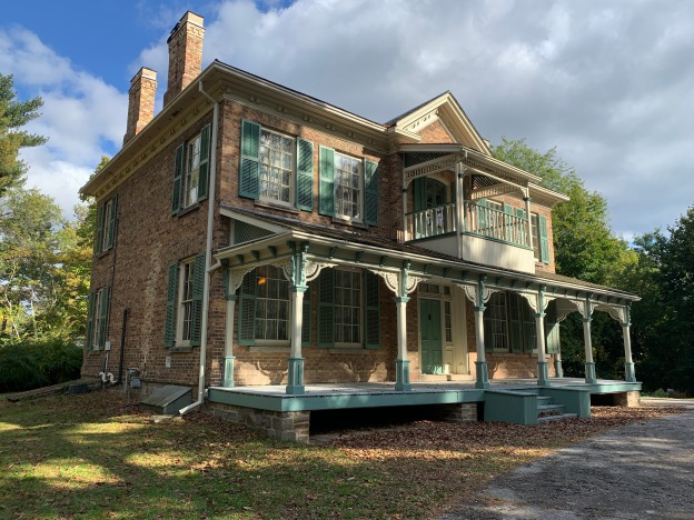
David Gibson was a consistent supporter of Mackenzie and when the rebellion failed he was exiled and his house and barns were burned down in retaliation. When he returned in 1851 he built the next house on our museum tour. Here we get a glimpse into the life of a provincial land surveyor in the 1850s.

1855 Colborne Lodge

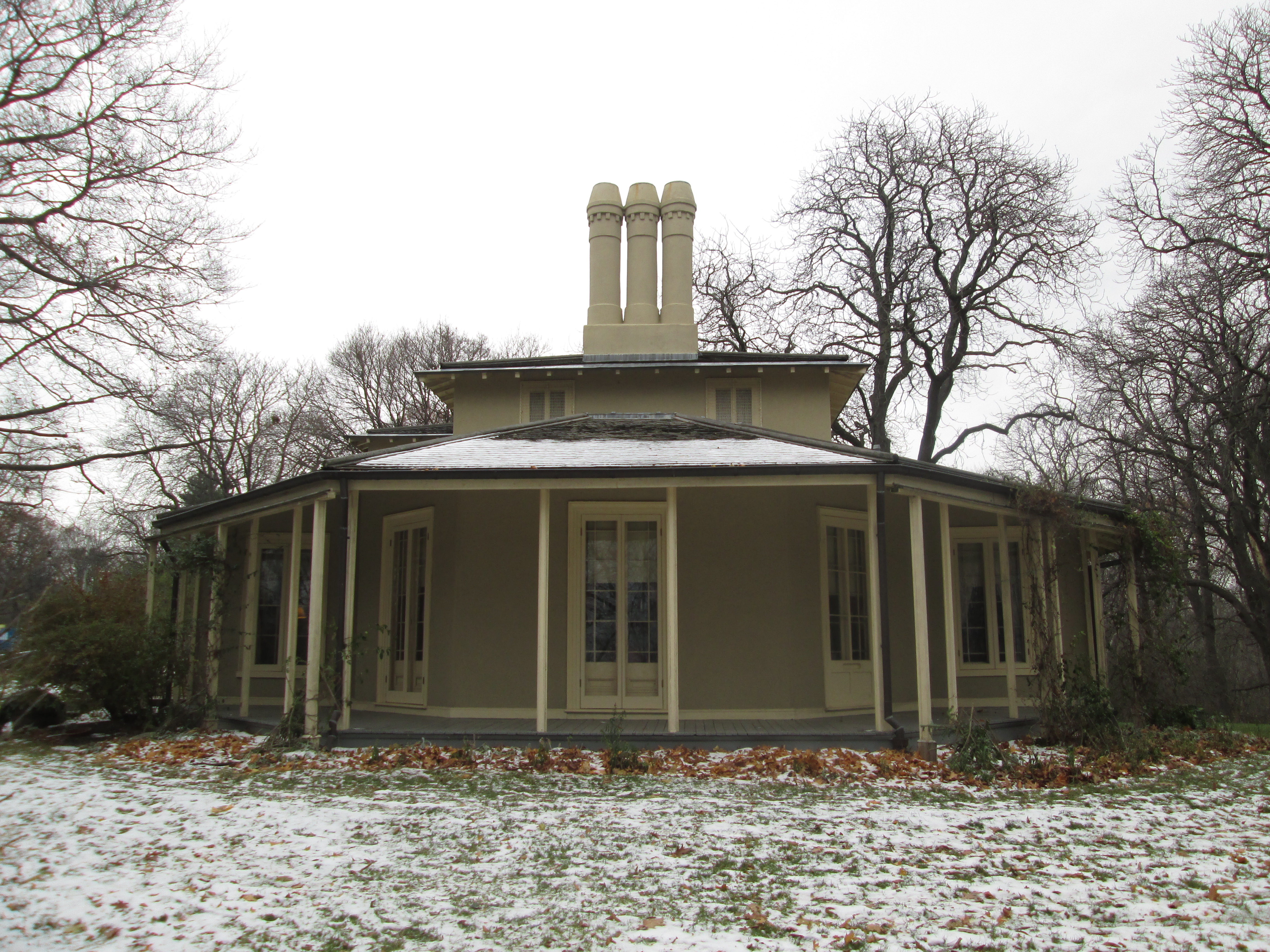
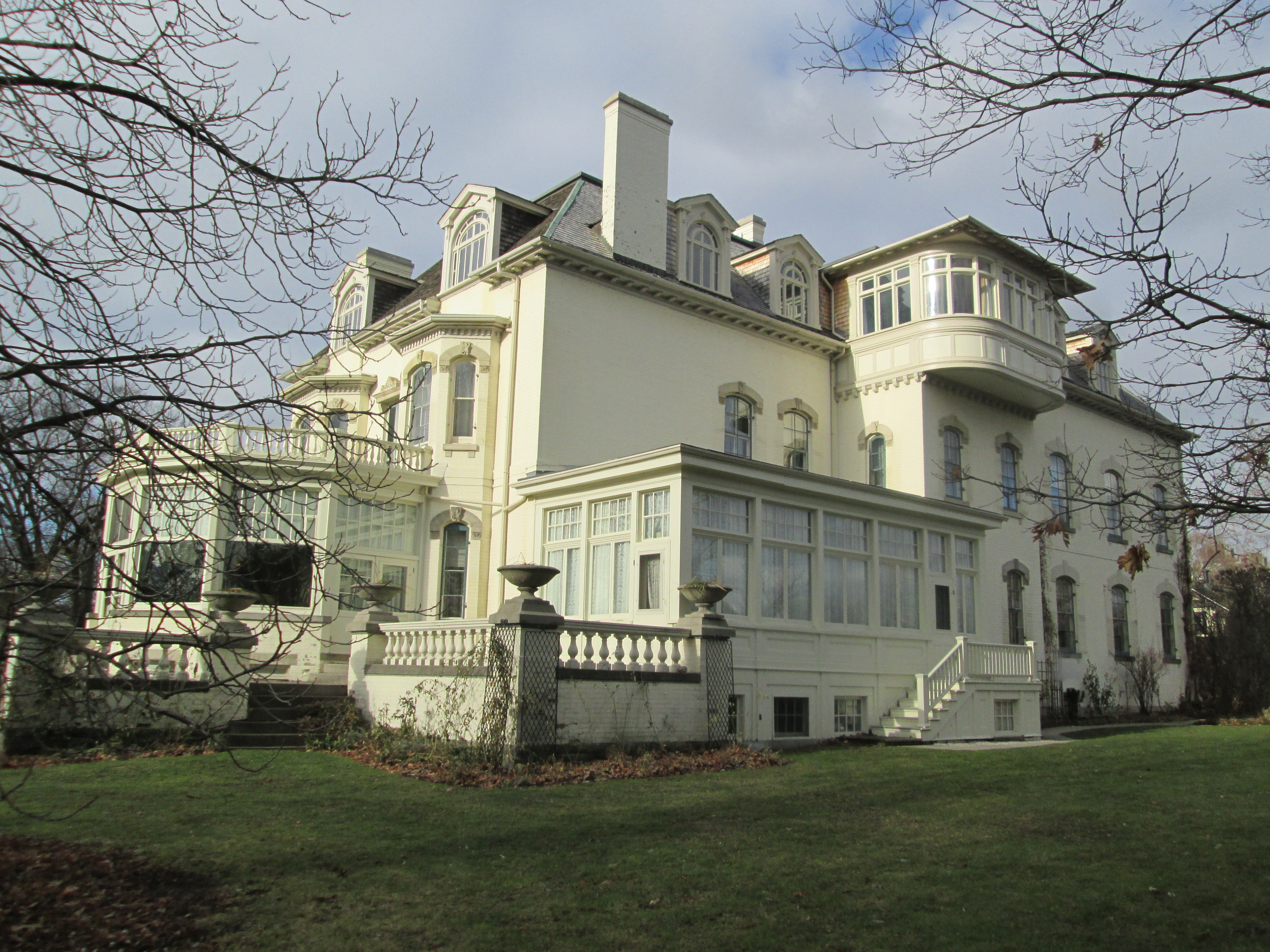
Colborne Lodge was built in 1837 but became a full-time home in 1855. This stop on our journey shows us how the wealthier people lived in the mid-1850s. The Howards built the first indoor flush toilet in the city and devised a method of delivering heated water to a showerhead.

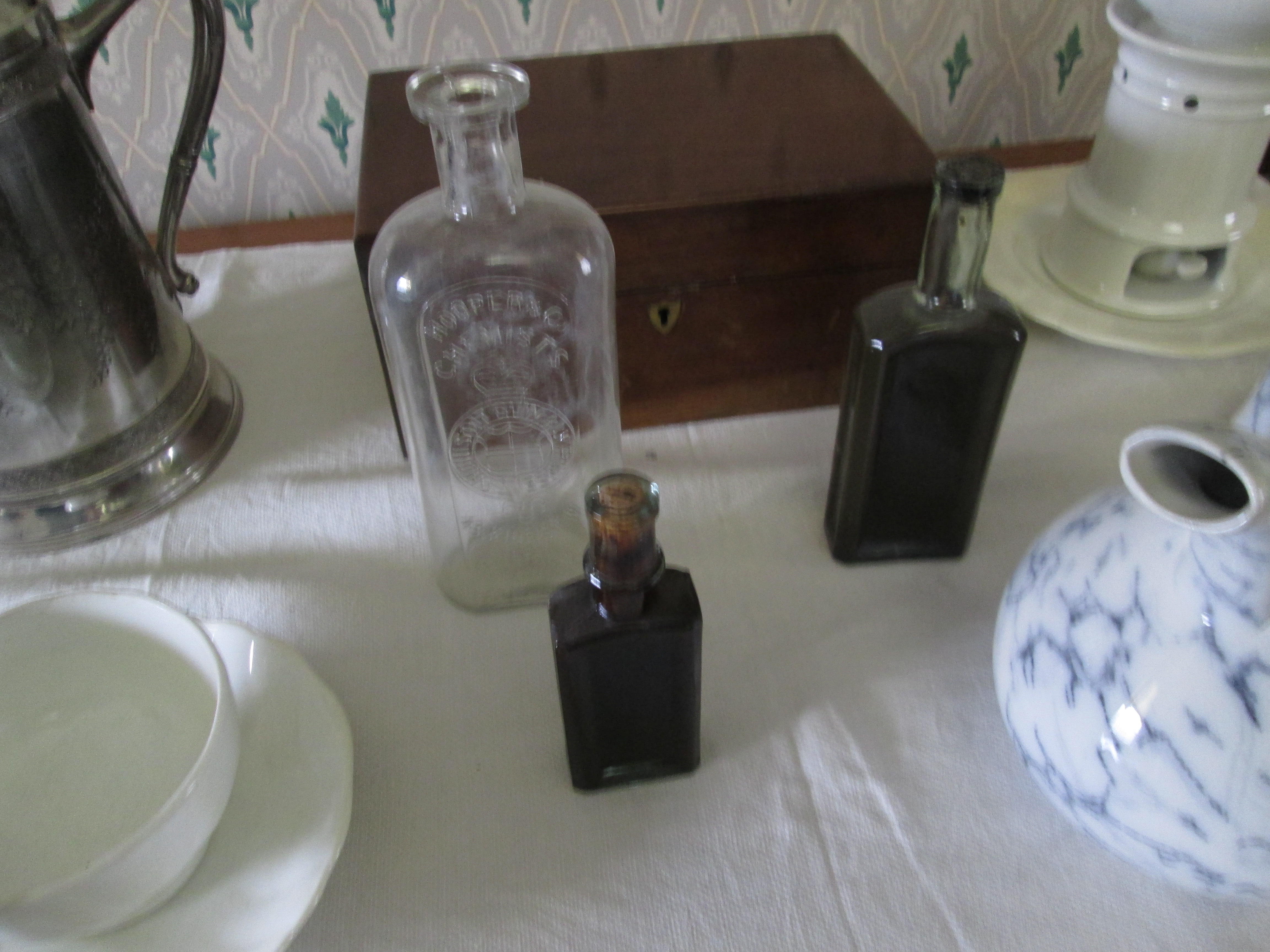
When Jemima became ill, John Howard nursed her at their home. Her sick room shows the level of medical intervention that could be expected in this period.

1860s Black Creek Pioneer Village

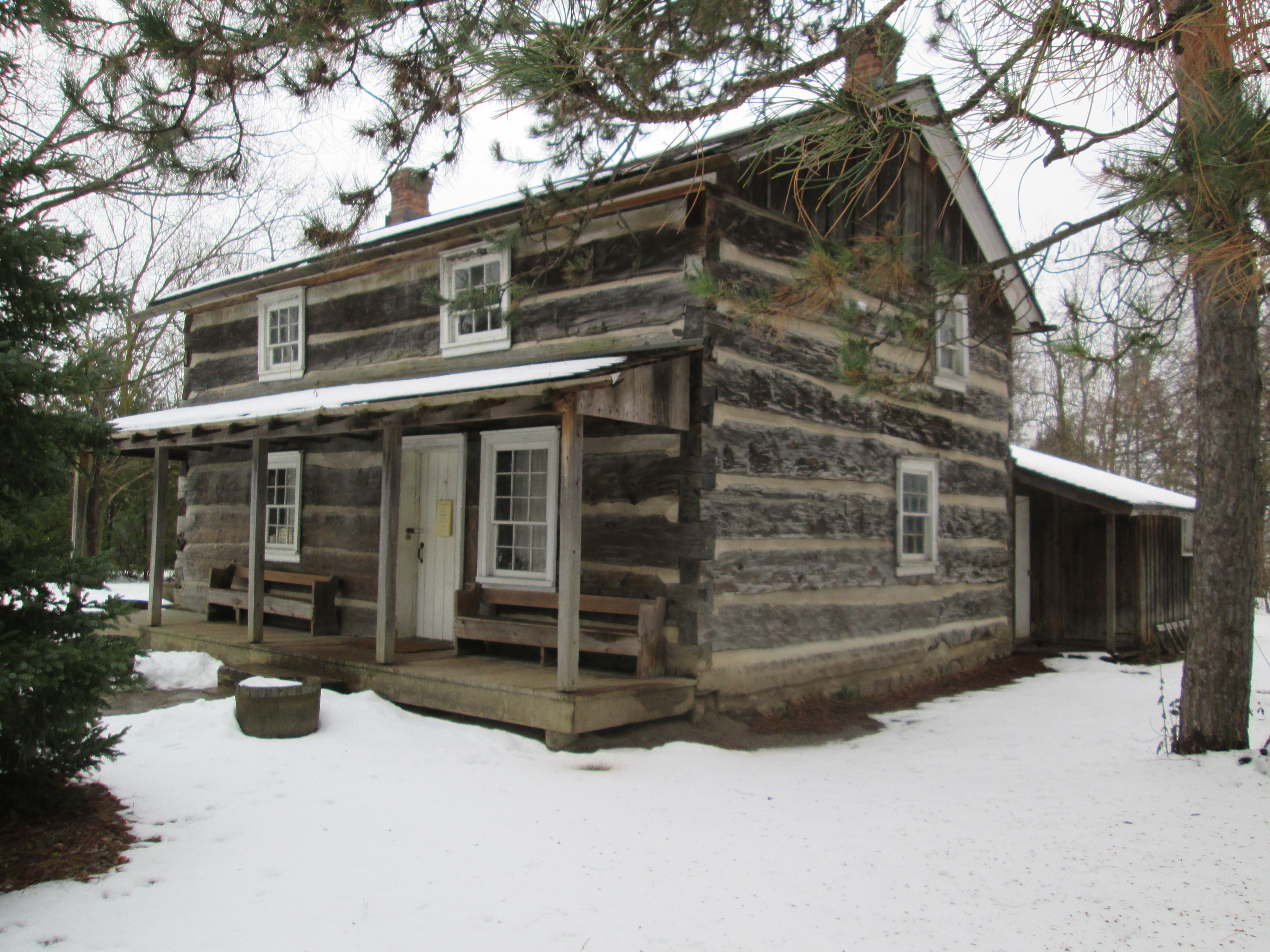
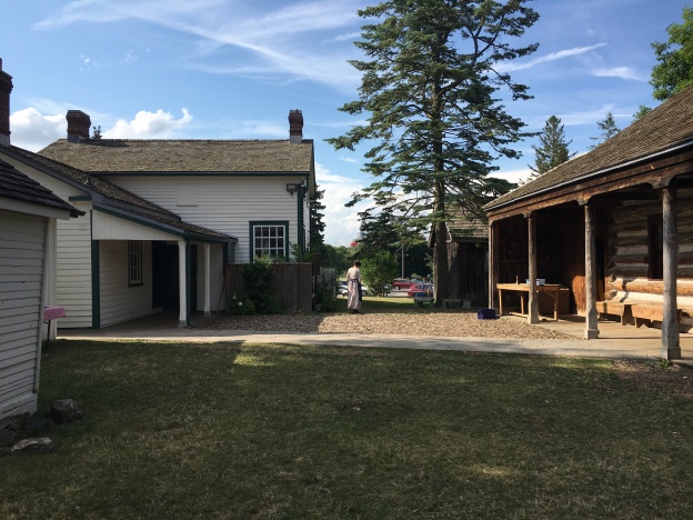
The next stop on our time travel trip lands us in the 1860s on the farm of Daniel and Elizabeth Stong. Their early houses and farm buildings were so well preserved by the family that they became the basis for Black Creek Pioneer Village. Many other buildings have been moved here and a small town has been recreated. A blacksmith shop, printing shop, hotel, store, carriage works, church, and manse, among other buildings, can be explored. Christmas By Lamplight has been an annual favourite because it allows one to sample treats and decorations from the mid-1860s.

Women of the 1860’s would cook using the fireplace and the small oven on the side and could turn out quite impressive dinners with the means that they had at hand.

1870s Don Valley Brick Works

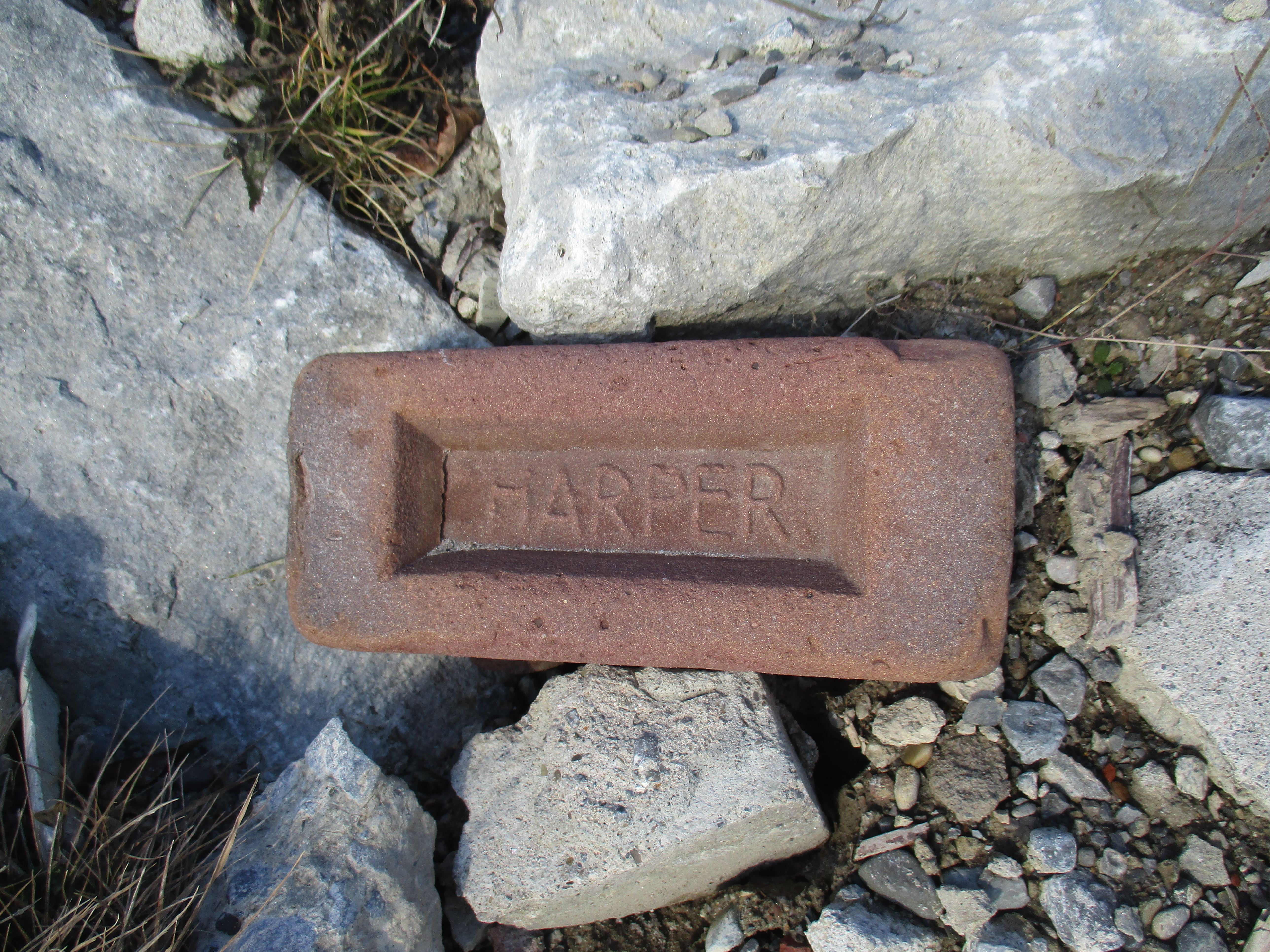
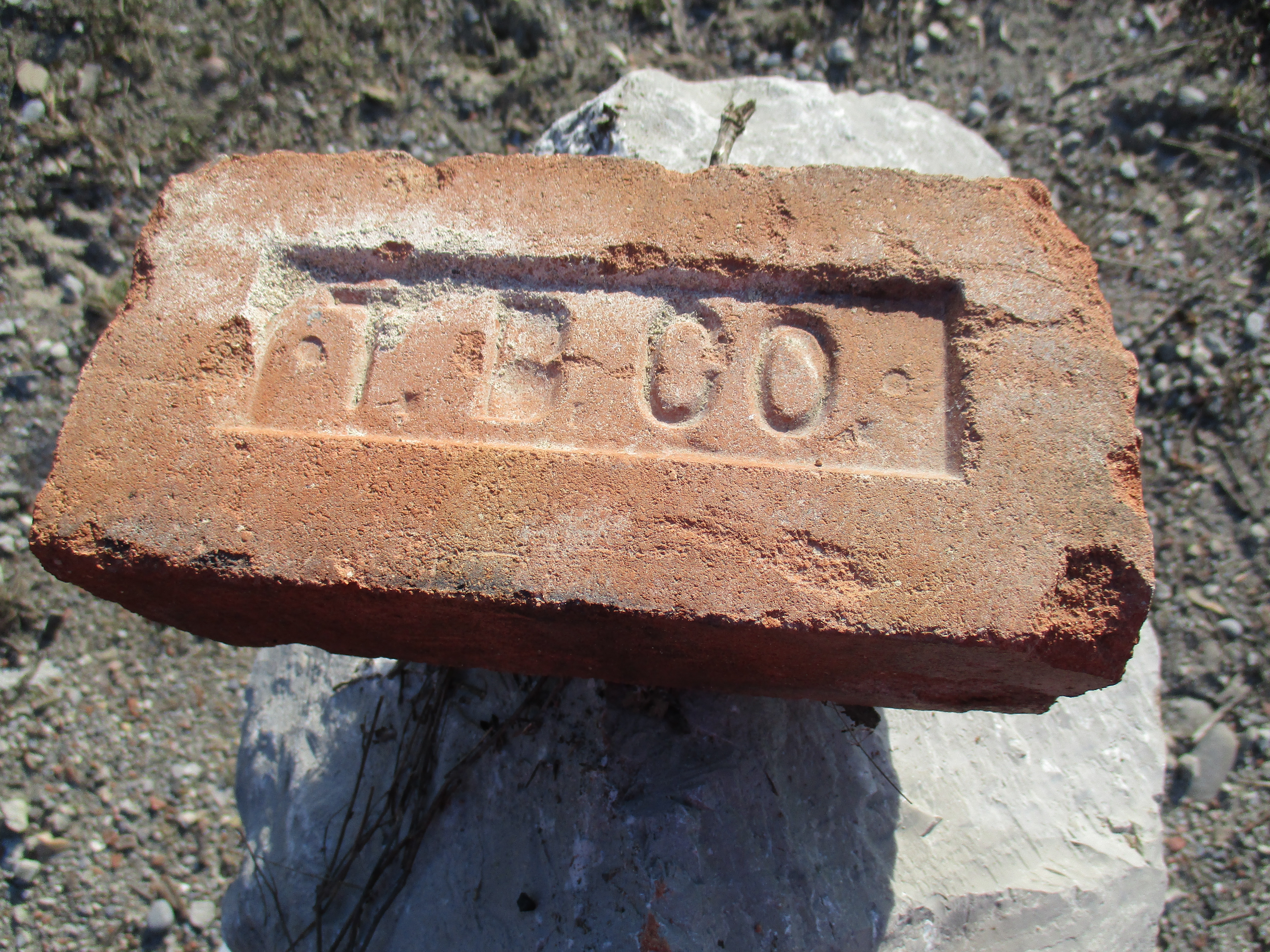
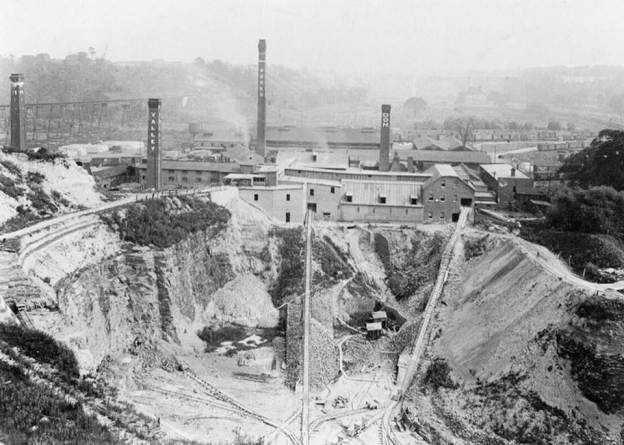
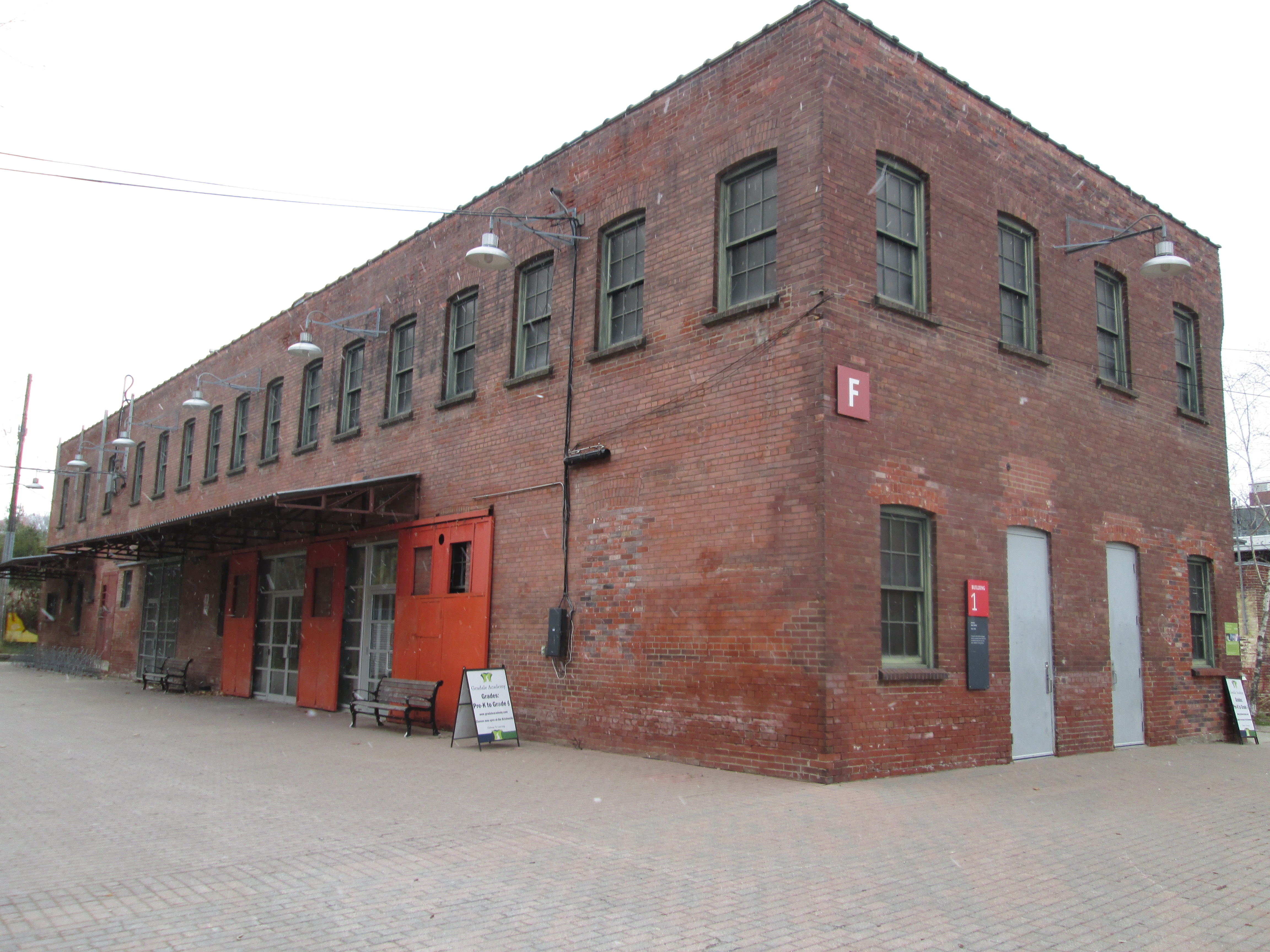
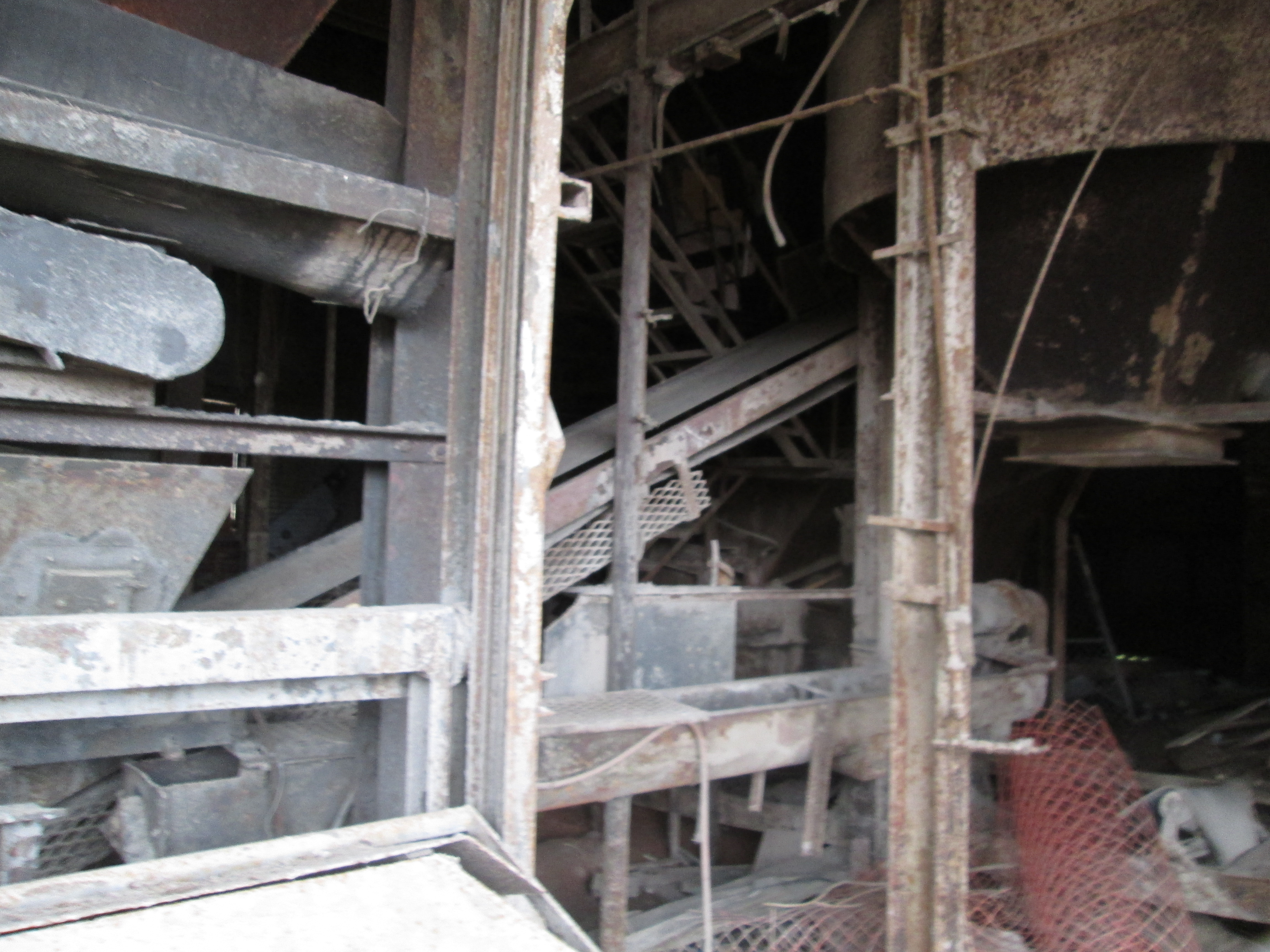
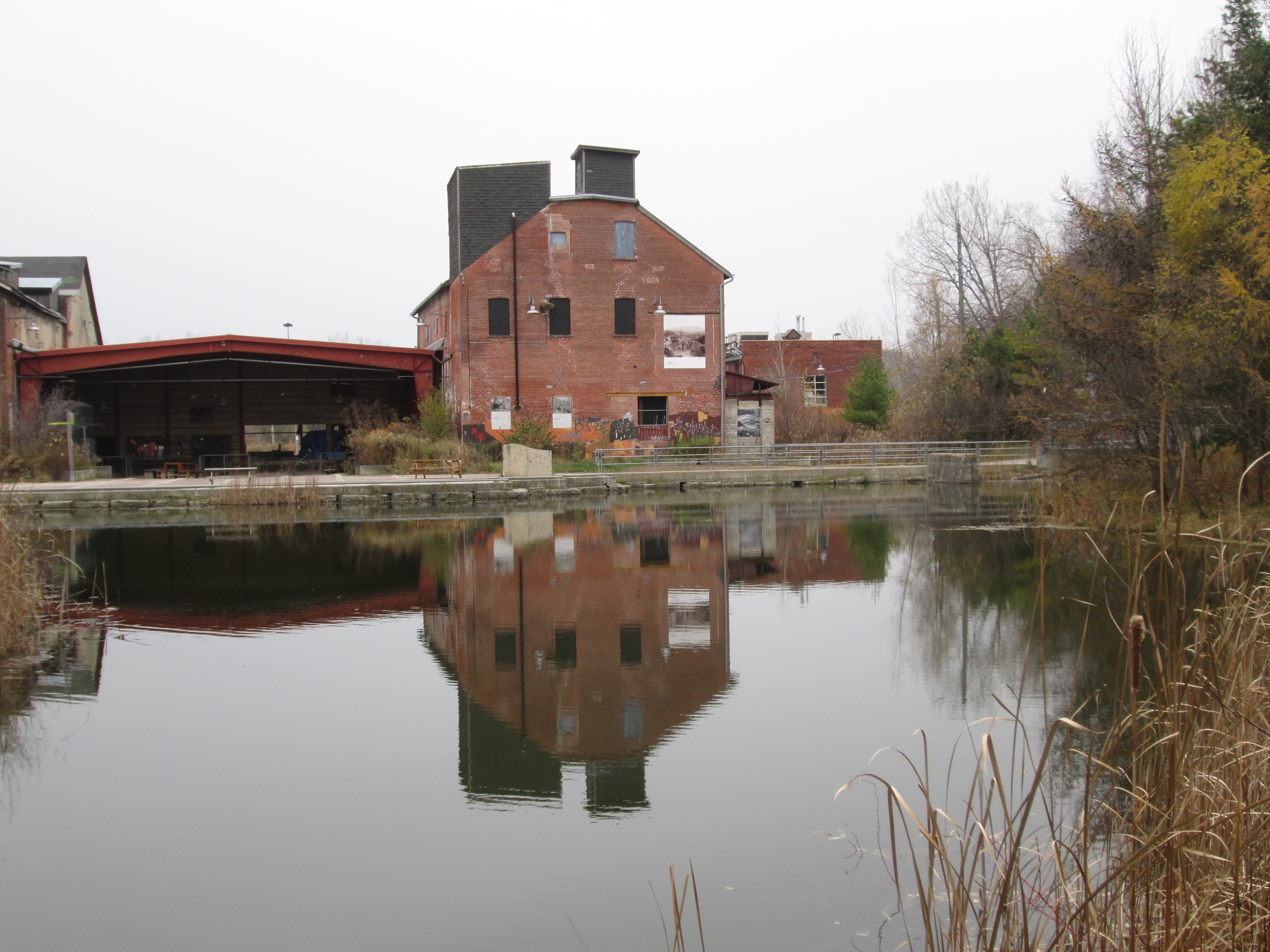
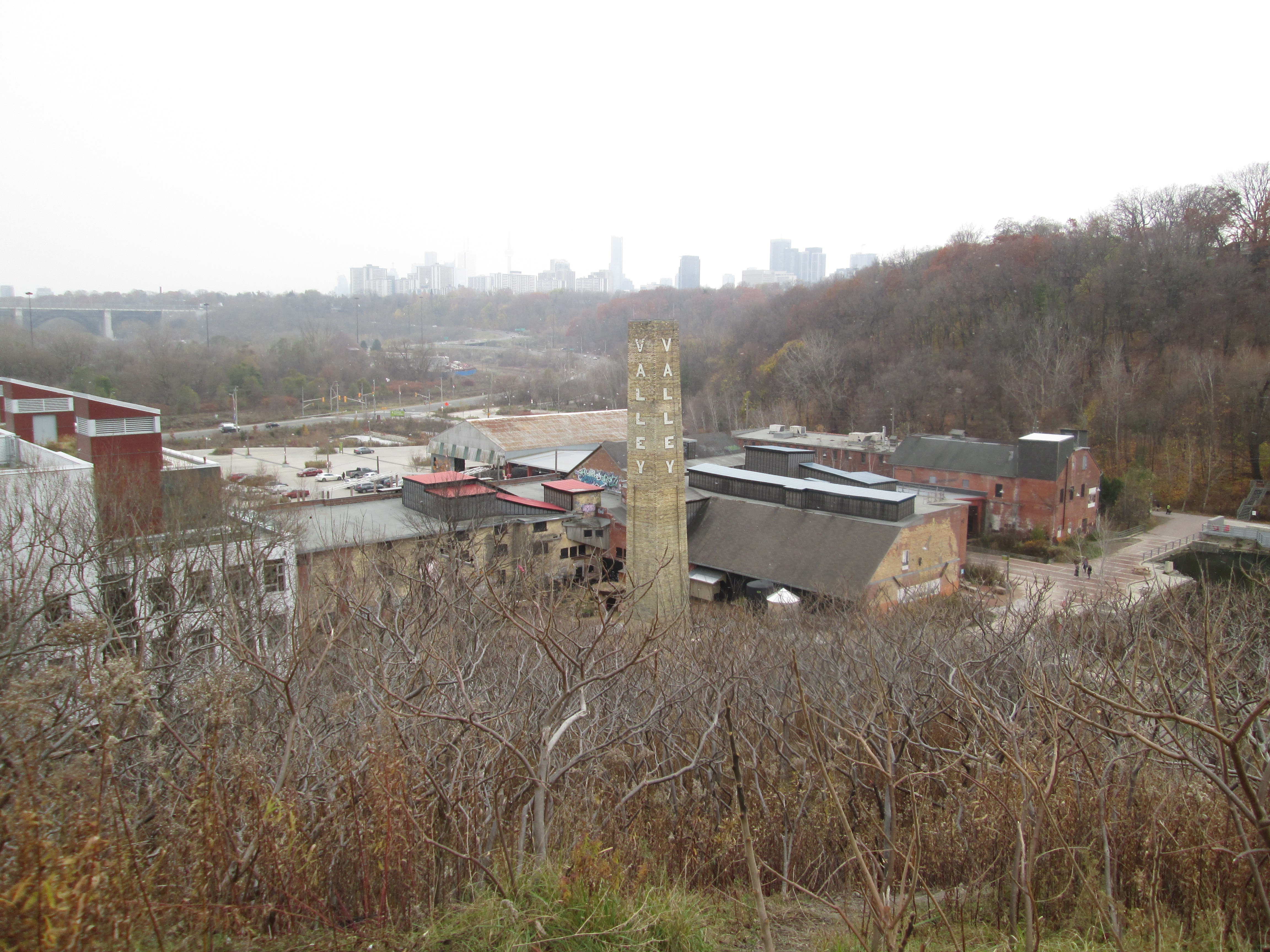
Although not specifically operated as a museum, the Don Valley Brick Works demonstrates this industry as it operated in the 1870s. It was owned by the Taylor brothers who also operated the mills at Todmorden.

1910 Zion School

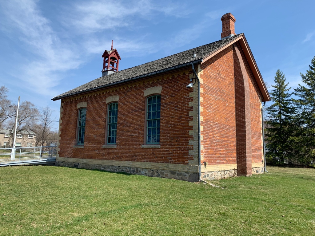
Throughout the 19th-century and into the 20th-century it was common for children to go to school in a one-room schoolhouse. The teacher was responsible for teaching all grades and so you didn’t want to get on their bad side because you would have them again next year. This school was vacant for several decades before it was restored and opened as a museum showcasing school as it was around 1910.

1914 Thomson Park

Thomson Memorial Park in Scarborough contains the Scarborough Historical Society and a few locally historical buildings that have been moved into a small cluster. This stop on our time trip lands us just prior to the start of the First World War.

WW 1 Benares House

Benares House is not in Toronto, it is in Mississauga, but we’ve included it here because it showcases life during The Great War (WW1) for the average farming family in the area. Keeping up with the chores around the farm was a constant challenge with so many of the men off fighting the war in Europe.

1920s Spadina House

Our final stop on our journey brings us to 100 years ago and the house of a wealthy Toronto politician and businessman. Spadina House and gardens have been furnished and decorated to reflect the 1920’s, a period of prosperity that followed The Great War and preceded the economic depression of the 1930s.

While time travel might not be possible, a structured tour through Toronto’s museums could be the next best thing. Where will you start?

Like us at http://www.facebook.com/hikingthegta

Follow us at http://www.hikingthegta.com

Also, look for us on Instagram

Beachcombers – Scarborough Bluffs

Saturday, January 7, 2017

The beach along the Scarborough Bluffs is an ever changing environment.  It is eroded by wind, rain and waves.  Objects are washed ashore, washed down the bluffs or dumped here.  As such it is a great place to look for treasures, each of which has a story to tell or a little bit of history to reveal.

This hike set out to investigate the Scarborough Bluffs, specifically the section from The Guild Inn through to East Point Park. There is a small parking lot for The Guild Inn at the end of Galloway Road and Guildwood Parkway that will provide access to the beach via an old construction road which was used to harden the shore west of here in an attempt to prevent erosion.  The picture below shows the view from the top of The Bluffs looking west.

img_5629

The morning was bright and sunny but the beach was virtually deserted.

img_5671

East Point Park is one of the places that is known for its Monarch Butterfly migrations. Milkweed is essential to the lifecycle of this species of butterflies and it is encouraging to see milkweed seeds scattered along the bluffs.  The flat brown oval seeds are attached to the white fluff that helps them to be spread by the wind.

img_5638

The vegetation on the top of the bluffs slows erosion down but doesn’t stop it.  The roots are holding a thin layer of soil above where the sand has vanished below.  Walking along the top of the bluffs it is, therefore, necessary to stay back from the edge so that you don’t have the ground disappear below your feet.  The cover photo shows a fence that was installed to keep people away from the edge.  The fence is now falling over the edge itself.

img_5645

The area of Leslieville was situated on clay deposits that were excellent for brick making. As a result, Greenwood Avenue in 1914 had seven brickyards including that of Albert Wagstaff.  When Wastaff died in 1931 he left the brickyards to his drinking buddy Albert Harper who operated the brickyards while the family contested the will.  When the will was found to be valid he closed the yards down and the pit was turned into the town dump. The name Harper on the brick below was his way of stating his claim to the company while the will was being reviewed.

img_5668

The ravine at Greyabbey Park is one of the places where there is a flow of water from the top of the bluffs to the bottom.  Tall invasive phragmites grow in wetlands all along the sides of the bluffs, sometimes as much as half way up.  These ravines provide homes for the white-tailed deer, coyotes and other animals that call the bluffs home.

img_5679

As we walked along the beach we met a local couple who walk there daily.  We noted that they were combing the beach looking for interesting objects, as were we.  They collect antique bottles and glass and display them on an Instagram account.  Their treasures can be seen at this location.  The picture below shows several pieces of glass, including a couple of Coke bottle bottoms, that have been tumbled by the water and sand until they are well rounded.

img_5684

The Toronto Brick Company was stamped onto bricks produced at The Don Valley Brick Works, one of Toronto’s largest manufacturers.  Their bricks may also read TPB Co for Toronto Pressed Brick Company.  Much of the early Toronto skyline was made of buildings constructed using bricks from this brickyard.  Much of the beach along The Bluffs is also made up of bricks from this brickyard now that old construction debris has been used for fill and for hardening the shoreline.

img_5642

Rose hips provide a splash of colour in the winter and can also be eaten if you avoid the seeds.  It is said that they help to reduce inflammation and they contain 50% more vitamin C than oranges do.

img_5699

It’s hard to say where this plastic elephant got tossed away at because the lake may have carried it a long distance before depositing it here.  It may also have come from the top of the bluffs.  Unlike some of the glass on the beach, plastic has little chance of being taken home.

img_5688

The rusting remains of a milk chum, or milk can, lie behind a log on the beach.  Starting in the 1850’s metal cans were introduced for milk collection so it could be taken to the dairy.  By the 1970’s collection was converted to tanker trucks and the cans became collected for their antique value.

img_5670

There is a movement to pave a trail along this section of the bluffs and add armour stone to the shore to slow down the erosion of the bluffs.  Nature will continue to have its way and the bluffs will continue to recede.  The vegetation that is growing along the shoreline and up the sides of the bluffs will go a long way toward slowing the process down.

img_5690

This post brings the total along the Scarborough Bluffs to 8 which cover much of the distance between Bluffer’s Park and Highland Creek.  From the west to the east the adventure began with Sand Castles in Bluffer’s Park.  That story looks at the geology of the bluffs.  Erosion investigates the effect of the lake, the wind and rain on the bluffs.  Gates Gully is the most famous ravine along the bluffs with a sunken ship and stories of buried treasure.  South Marine Park Drive follows the lakeshore between the sunken Alexandria and The Guild Inn.  The Inn is a former artist guild and preserves some of Toronto’s early architecture.  This post fills the gap between the Inn and East Point Park where there is a Monarch Butterfly migration point.  Highland Creek is the eastern most point of The Bluffs.

bluffs

There’s still Greyabbey Park on the top of the Bluffs to be explored at some time in the future.

Google Maps link: The Bluffs

Like us at http://www.facebook.com/hikingthegta

Follow us at http://www.hikingthegta.com

Crothers Woods

Saturday, December 17, 2016

Crothers Woods has at least three access points, each with parking.  There is one parking lot at the Don Valley Mountain Bike Trailhead on Pottery Road (map link at end) just before the bow-string bridge over the Don River.  This parking lot sits on the old road allowance for Pottery Road, a section of which was abandoned when the Bayview Extension was built in 1959.  From the trailhead, the path leads north following the side of Bayview Avenue until it reaches the northern tip of the park where there are a couple of parking spots.  To the right along this trail is an area known as Sun Valley.  It was home to a small brick making company called The Sun Brick Company which operated until the late 1930’s.  The property had been home to the Taylor Family who built their homestead here in 1826.  The family owned the Don Valley Brick Works and Todmorden Mills where they ran one of their three paper mills. When the clay for the bricks was nearly exhausted the town of Leaside purchased the pit for a landfill.  Over the next few decades, they dumped garbage up to 25 metres deep in the pit.  It has now been capped with clean fill and is being restored as a meadow at this time.  The Taylor Family home has been moved to Todmorden Mills where it is being preserved.  The picture below shows the home, that once stood in today’s Crothers Woods, as it appeared in the summer of 2014.

terry-house

Following the trail into the woods leads to a slight diversion, the abandoned CPR tracks. The first train to roll across the tracks here was a freight train in 1891.  That train continued south along the Don Valley and into downtown Toronto.  Along the way, it passed over the Half-Mile bridge.   The first good snowfall of the season sits largely undisturbed on the tracks in the picture below. Due to the fact that the snow had fallen without much drifting the rails and ties can be clearly seen in spite of the fact that there is about a foot of fresh snow.  This is one of the few local abandoned railways that still has the rails and ties intact.  It is likely that Metrolinx, who owns the railway corridor, will incorporate it into some future passenger line.

img_5134

An active set of tracks belonging to Canadian National Railway runs parallel to the abandoned CPR ones as the Don Valley made a suitable access to the city.  Two freight trains passed along the other tracks while the lower ones were being briefly explored.

img_5144

Crothers Woods is one of the most bike friendly parks in the city.  Bikers are encouraged to use the trails although pedestrians still have the right-of-way. Winter biking has its challenges and a bike is normally fitted out especially for the season.  Fat tires and wider frames are matched with enclosed gears that prevent freeze up.  The tires may be inflated to as low as 5 pounds pressure.  A group of winter bike enthusiasts was using the park to get some exercise and enjoy their custom cycles.    It is always nice to see others who find a way to enjoy the winter weather.

img_5121

Crothers Caterpillar had a manufacturing plant in Crothers Woods until 1979.  Built by George W. Crothers it produced heavy equipment, primarily for the mining industry.  The plant backed onto the railway and the factory buildings on the site were removed by 1991. The site has recently been partially repurposed as a Loblaws store and parking lot.  There is a trail head here as well that was the starting site of the group of fatbikes we had seen earlier.  There is also lots of parking available in the back of the parking lot near the trailhead.

aerial-crothers

The loading ramp from the former Crothers Caterpillar plant still stands along the abandoned railway track.

img_5148

A lone hydro pole stands in the woods where it once was part of the Crothers Caterpillar plant.  What was an open field 30 years ago has grown back in quite well!

img_5157

In 1929 the city built the North Toronto Sewage Treatment Plant on the edge of Crothers Woods.  It processes the effluent from North Toronto and Leaside.  Personal experience indicated that the sewage system covers in North Toronto are mainly dated 1928 with a few from 1929.  The cover photo shows another view of the treatment plant.

img_5173

Crothers Woods was a farm for about 100 years before it spent the next century as an industrial site.  Today it still retains some areas of Carolinian Forest consisting of beech, maple and oak.  There are also a few butternut trees which are locally rare.  Crothers Woods has been designated as an Environmentally Sensitive Area (ESA) because it is a home to some rare undergrowth plants.  It is also a good place to see common spring flowers like trout lilies and trilliums.  The east ravine wall contains some climax forest which is the historical normal vegetation that exists in a stable condition in this part of the country.  New growth forest has taken over much of the rest of the 52-hectare park.

img_5158

An extensive set of stairs leads from the corner of Redwood Road and Millway Road down to the sewage plant.

img_5175

There are plenty of remnants from old land usage in the ravine.  A lengthy penstock runs down the hill behind the treatment plant while these concrete structures stand a little farther along.  They say that old relics from the Crothers Caterpillar plant are still dug up on occasion in the woods.

img_5179

Crothers Woods also includes the Beechgrove Wetland which is a successful restoration project.  The wetlands, Sun Valley and an abandoned road await a visit in the spring when the wetlands will be teeming with life.

Google Maps link: Crothers Woods

Like us at http://www.facebook.com/hikingthegta

Follow us at http://www.hikingthegta.com

Don Valley Brick Works

Sunday, Nov. 16, 2014

It was minus two with light snow flurries but one of those pleasant days when fall is trying to be winter. There is plenty of pay parking on the site of the brick works (Google Maps link).

In 1882 William Taylor was digging holes for fence posts on his farm when he uncovered some good looking clay.  Checking with a local brick maker, he was told that the clay was ideal for bricks.  William and his two brothers operated the paper mills at Todmorden.  By 1889 they had opened up the Don Valley Pressed Brick Company.  By the early 1890’s they were winning international awards for the quality of their bricks.

There were earlier wooden buildings but the oldest of the 15 remaining ones, and the first one made of Don Valley bricks, is the 1891 dry press brick plant.  This building held most of the early production and was built in the first two years of operation.

IMG_1121

This is the view from the top of the quarry looking down on the last remaining kiln chimney, built in 1906.  This chimney, as well as three others, provided a continuous draft over a series of kilns. As can be seen in the cover photo each chimney contained one word that together spelt out Don Valley Brick Works.  Only the “Valley” chimney remains.

IMG_1073

On April 19, 1904 a great fire destroyed much of the downtown of Toronto.  When it was over, there were 104 buildings which had burnt down.  The city enacted new laws to reduce the risk of another serious fire and these included a move toward more brick construction.  Over the next few years much of the Toronto skyline would be built using Don Valley bricks.  Some of the major buildings constructed of their bricks include Sick Kids Hospital, Toronto General, Osgood Hall, Massey Hall, and Old City Hall.  The fire proved to be a major boom for the brickworks and they expanded quickly over the next few years.  By 1907 production was up to 100,000 bricks per day.  The picture below from the Toronto Archives shows Front Street after the fire.

800px-4TorontoFire

In 1909 the business was sold by the Taylor brothers to their brother-in-law Robert Davies. Davies invested a lot of money into the brickworks and erected four of the buildings that remain today.  In 1910 he built the sales office pictured below.

IMG_1048

That same year another production facility was added beside the 1891 building where soft mud, stiff mud and dry bricks were produced.  It still houses the original shakers, dust collectors and sieves as pictured below.

IMG_1134

In 1912 a sand and lime storage facility was added.  The picture below is taken from the rear of the building.  This building features prominently in most old photos, including the aerial ones, of the 43 acre site due to the conveyor belt that always runs into a window on the back.  In the cover photo the conveyor on the right is carrying raw materials from the quarry into this building.  The picture of the complex in the cover photo includes the Half Mile Bridge which is described in a separate post.  We can date the photo to the early 20’s by the buildings and the steel construction of the half mile bridge.

IMG_1083

Large quantities of water are essential for the production of bricks.  The Taylor brothers diverted nearby Mud Creek to flow through their brick factory site.  In the picture below  there is a water channel that runs down the centre of the picture.  A rock wall lines the left side of the channel. The 1926 water treatment plant is the single story building that actually straddles the waterway. The front view of the 1912 sand and lime storage shed is on the right with the flower art sticking out of one third story window.

IMG_1100

During the second world war there were many German soldiers taken captive.  It was feared that if Germany invaded England these prisoners would be freed to fight again on the side of Germany.  A shortage of food and people to guard the prisoners led to the decision to inter some of them in prison camps in Canada.  One of these camps was at Todmorden and the inmates were forced to work at the Don Valley Brick works.  If you own a brick home built in the early 1940’s chances are that German POW’s made the bricks.

The business was sold again in 1956, this time to United Ceramics of Germany who went on an expansion program.  Seven new buildings were added between 1956 and 1961.  These included another dry press brick production building and in 1956 a building with 3 rows of kilns.  These kilns were fired at 1800 Fahrenheit and it would take a cart of bricks 2 days to pass through the 5 stages of the oven.

IMG_1060

An old brick press machine still sits in the welcome centre.

IMG_1091

The view from near the front of the pit looking north to the back.  In the early 1900’s the north face became an international geological site when it was discovered that there were fossils indicative of warmer climates.  From this they deduced that there was more than one ice age.  To get perspective on the size of the pit take notice of the person walking on the trail below.

IMG_1077

I climbed the hill on the north face to get a clear view back across the quarry to the cluster of old buildings.  The Bloor Viaduct (1918), also known as the Price Edward Viaduct, can be seen just beyond the compound.

IMG_1081

When the clay and shale were exhausted the pit was shut down and some of the equipment was sold off. The site sat abandoned for close to 20 years while the weather and lack of repairs took it’s toll on the buildings.  Wild parties and graffiti artists left their marks in the various facilities as well.

Starting in the mid 1990’s the site has been under restoration.  The quarry was partly filled in using excavations from the towers downtown including the Scotia Bank tower.  Mud Creek has been used to form 3 ponds and native vegetation has been re-established.  The site is now managed by Evergreen which has transformed it into an environmental showcase.  The building below was constructed to qualify for LEED platinum status as a building with one of the smallest carbon footprints in the world.  It uses part of the old holding building where bricks were kept before they went to the kilns.

IMG_1141

There is much more to be seen at the brick works and more opportunities to explore.  The guided tour sounds interesting but was not operating when I was there.

A list of our top 15 stories can be found here.

Google Maps link: Don Valley Brick Works

Like us at http://www.facebook.com/hikingthegta

Follow us at http://www.hikingthgta.com