Saturday August 27, 2016
Highland Creek marks the eastern limits of the Scarborough Bluffs and very nearly the county itself. The community of Highland Creek grew around the place where Kingston Road crossed the creek. The presence of water and the road made this one of the first places to be inhabited in Scarborough township. There is some parking on Beechgrove Drive and the trail to the bottom of the ravine enters from the south east corner at Lawrence. The trail does a couple of hairpin turns as it winds it’s way down the side of the ravine. The county atlas below shows the community of Highland Creek and the trail that this hike follows (red).

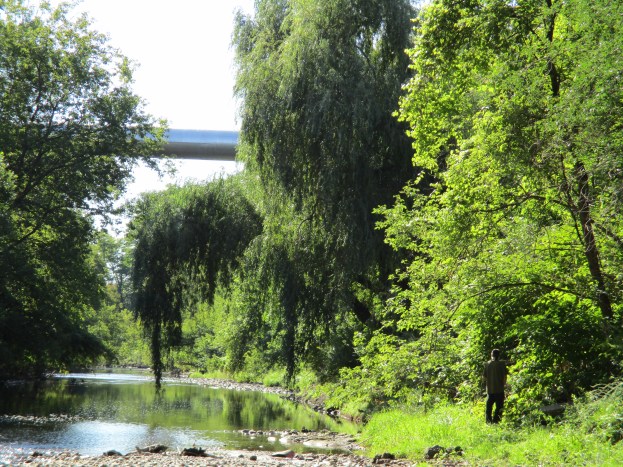
Highland Creek (blue) flows through a ravine that was cut during the retreat of the last ice age. Like the Credit, Humber, Don and Rouge Rivers the water volume was much greater during the melting of the 1 kilometer thick Wisconsin ice sheet. The creek averages about 20 meters across but the ravine is 100 meters wide and 30 meters deep. This formed a natural barrier that prevented major development of the eastern side of the county. The long span bridges that cross the ravine today didn’t exist until 1937 when the one on Kingston road was built. Ellesmere Road and Lawrence Avenue didn’t get their bridges until the 1960’s. The long span bridge across the ravine at Lawrence Avenue is seen below and it gives a perspective to the depth of the ravine.
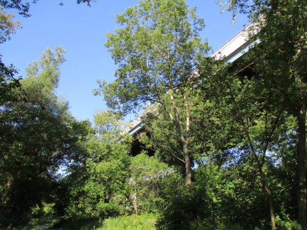
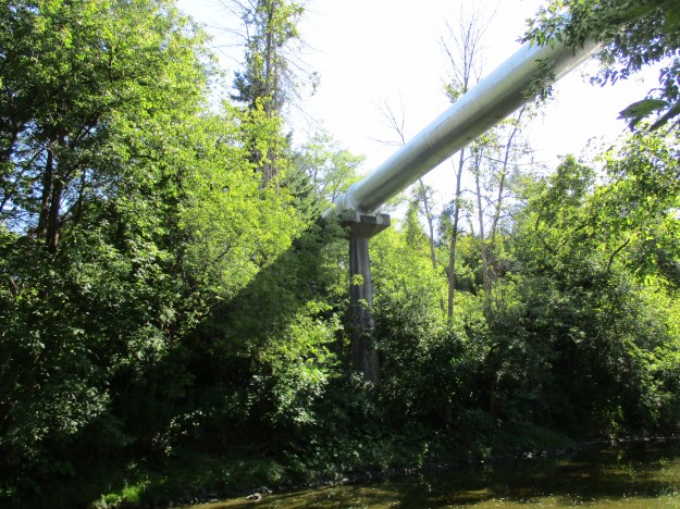
It is easy to think of Kingston Road, or Old Kingston Road (purple), as the early route between York (Toronto) and Kingston when the latter was the military capital of Upper Canada. When the British set off the gun powder magazine and abandoned York to the Americans during the War of 1812 they retreated to Kingston to save the troops for battle another day. The only bridge across Highland Creek at the time was north of here on the appropriately named Military Trail (green). Just south of the bridge over Lawrence Avenue (yellow) is a large water pipe that crosses the creek high above.
Muskrats are the only species in their genus but are related to 142 other species of rodents, including moles and lemmings, of which they are the largest. In spite of the name they are not related to rats. They are semiaquatic and can be found in wetlands over a wide range climates. The name likely comes from the Algonquian name for the animal which means “it is red”. They can weigh up to 4 lbs and reach over 2 feet long but the length is half tail. The tail is their primary means of propulsion while swimming even though the hind feet are partially webbed. In addition to being a food source for people, muskrats also are used for their fur in clothing. RCMP winter hats are made from muskrat. In 1976 The Captain & Tennille performed their hit “Muskat Love” for Queen Elizabeth II. Some thought a song about muskrat sex to be a little racy for the occasion.

The ravine also became a barrier to the Toronto and Scarboro’ Electric Railway, Light and Power Company. In 1904 this electric radial line had been merged with the Toronto & York Radial Line and was expanding eastward. When they reached West Hill, on the west table lands of the creek, they had to end the line. The street cars were not able to make the grade where Kingston Road entered the ravine. The ravine continues to be a shelter for wild life even as the surrounding lands have become developed. There are 360,000 people living in the watershed and 85% of the area has been developed. This makes it the most developed watershed in the GTA. The sand along the edge of the creek shows the foot prints white tailed deer. At least two different generations have been passing in each direction.

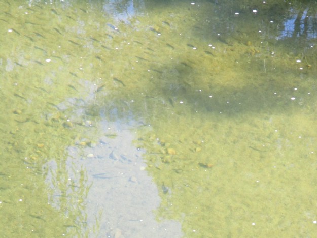
Highland Creek was home to Atlantic Salmon until the late 19th century. Dams at mills blocked migratory routes and pollution degraded the habitats. Atlantic salmon became locally extinct in Lake Ontario and were replaced with Chinook which are not native. Due to the highly developed nature of the watershed rainwater runs into storm drains and causes flash floods and poor water quality in the creek. Because of this, only the hardiest fish remain in the creek. It is now home to White Sucker, Creek Chub, Blacknosed Dace, Longnose Dace and Fathead Minnow. There were schools of these little fish in the creek as can be seen in the picture below.
Erosion is a serious problem because of the rapid flooding that can occur when it rains hard. The layers of sand have been washed out from under the trail causing the path to be rerouted a little farther away from the river bank.

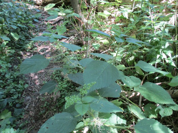
Stinging nettles grow in several places along the trail. The leaves and stems of the plant are covered with a fine hair-like mess of fine needles. These little hollow tubes spread a chemical on your skin that causes an immediate stinging sensation. It will pass in just a few minutes, unless you rub it. In that case you will spread the chemical into your skin and the burn could last much longer, possibly for days. Stinging nettles lose the chemical when cooked and can then be eaten. They are also used in arthritis and fibromyalgia pain management.
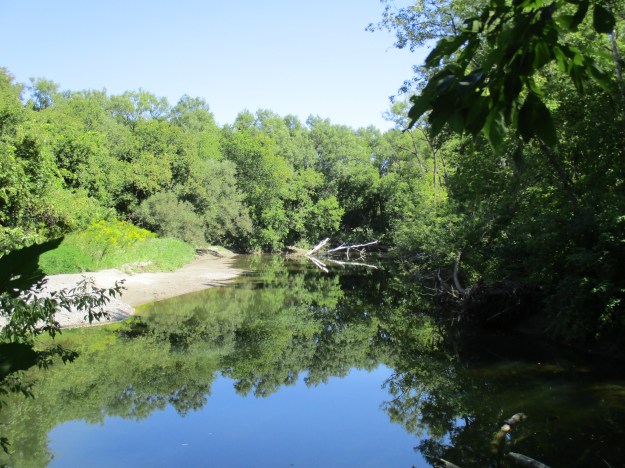
There are plenty of places along Highland Creek that the city seems very far away.
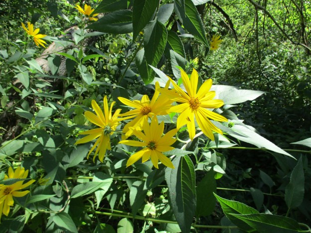
These woodland sunflowers are one of three varieties of sunflowers that grow wild in Ontario. They bring a nice splash of yellow to the woodlands as the summer winds into fall.
The mouth of Highland Creek is crossed by the CN tracks as well as a pedestrian bridge. The original tracks were the Grand Trunk Railroad in 1856. They built the cut stone bridge pier pictured below. A more recent addition is the steel and concrete ice breaker that has been built around the base of the pier. The pedestrian bridge is on the Pan-Am Path, an 80 kilometer pathway that links the Humber River with the Rouge river. Parts of this path also serve the Waterfront Trail.

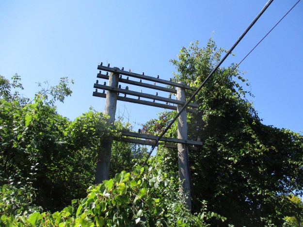
Just before the rail bridge are the old telegraph and electrical poles which obviously carried many more wires in the past. The glass insulators are remarkably intact.
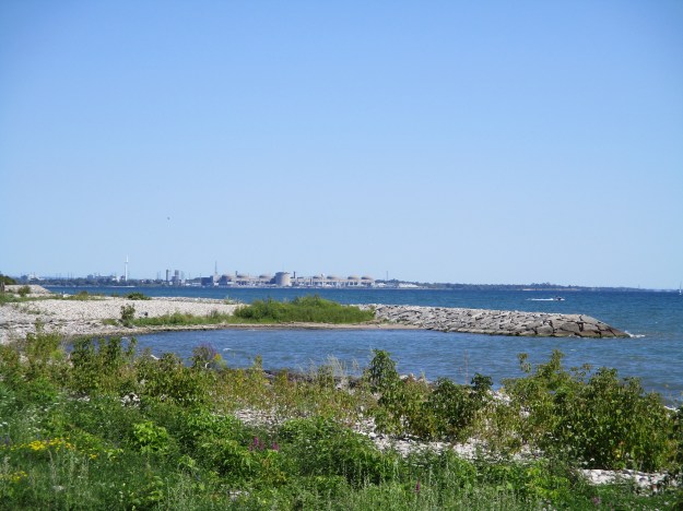
Walking down the beach toward the west will bring you to East Point Park while a trip to the east brings you to Port Union. Can I see the Pickering Nuclear Generating Plant in the distance? Candu!
There are plenty of areas along Highland Creek north of Lawrence Avenue that beg to be explored someday.
Google Maps link: Lower Highland Creek Park
Like us at http://www.facebook.com/hikingthegta
Follow us at http://www.hikingthegta.com

Pingback: Passmore Forest | Hiking the GTA
Pingback: Beachcombers – Scarborough Bluffs | Hiking the GTA
Pingback: The Great Trail – Caledon East | Hiking the GTA
Pingback: The Scarborough Bluffs | Hiking the GTA
There seems to be a “orphan” paragraph about muskrats in this piece on Highland Creek.
I once saw two beavers swimming just upstream from the railway bridge. I’ve encountered white-tailed deer along the trail a few times. Haven’t noticed any muskrats, though.