There is a series of linear parks that run east of Yonge Street in North York that comprise Willowdale Park North and Willowdale Park South. Starting in 2014, part of Willowale Park North was expanded by demolishing three developer owned residences and the newly created park was named Lee Lifeson Art Park. Construction of the park took place in 2016 with the grand opening being held on September 17, 2016. It was held in the rain with Mayor John Tory giving Geddy Lee and Alex Lifeson (as well as Neil Peart who wasn’t present) the keys to the city in front of a few hundred Rush fans.
The one remaining house on the property was purchased by the city in 2015 for just over $2,058,000 with the intention of demolishing it and adding the property to the park. The current tenant was given a four year lease with three options to renew for a five year period each. Therefore, it could be 2034 before this becomes part of the park. The city has acquired several other properties with the intention of expanding Willowdale Linear Park. The December 2015 Google Earth capture below shows the three yet to be demolished houses circled in green while the one remaining home has the park name written over the roof.
Geddy Lee (Gary Lee Weinrib) was born on July 29, 1953 in Willowdale and went to Fisherville Public School with Alex Lifeson (Aleksandar Zivojinovic) who was born on August 27, 1953. In September 1968 they joined forces in the band that would go on to become Rush.
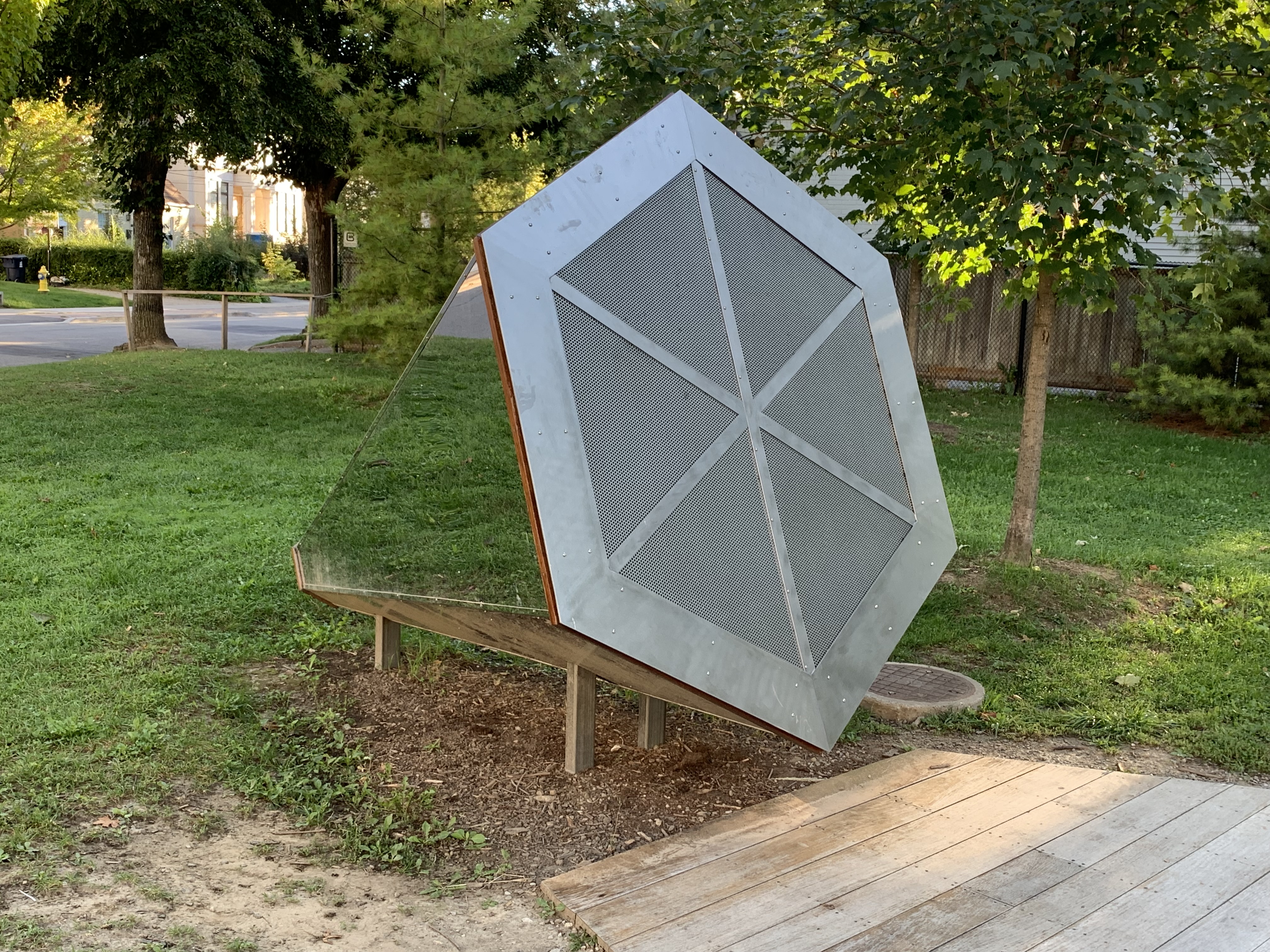
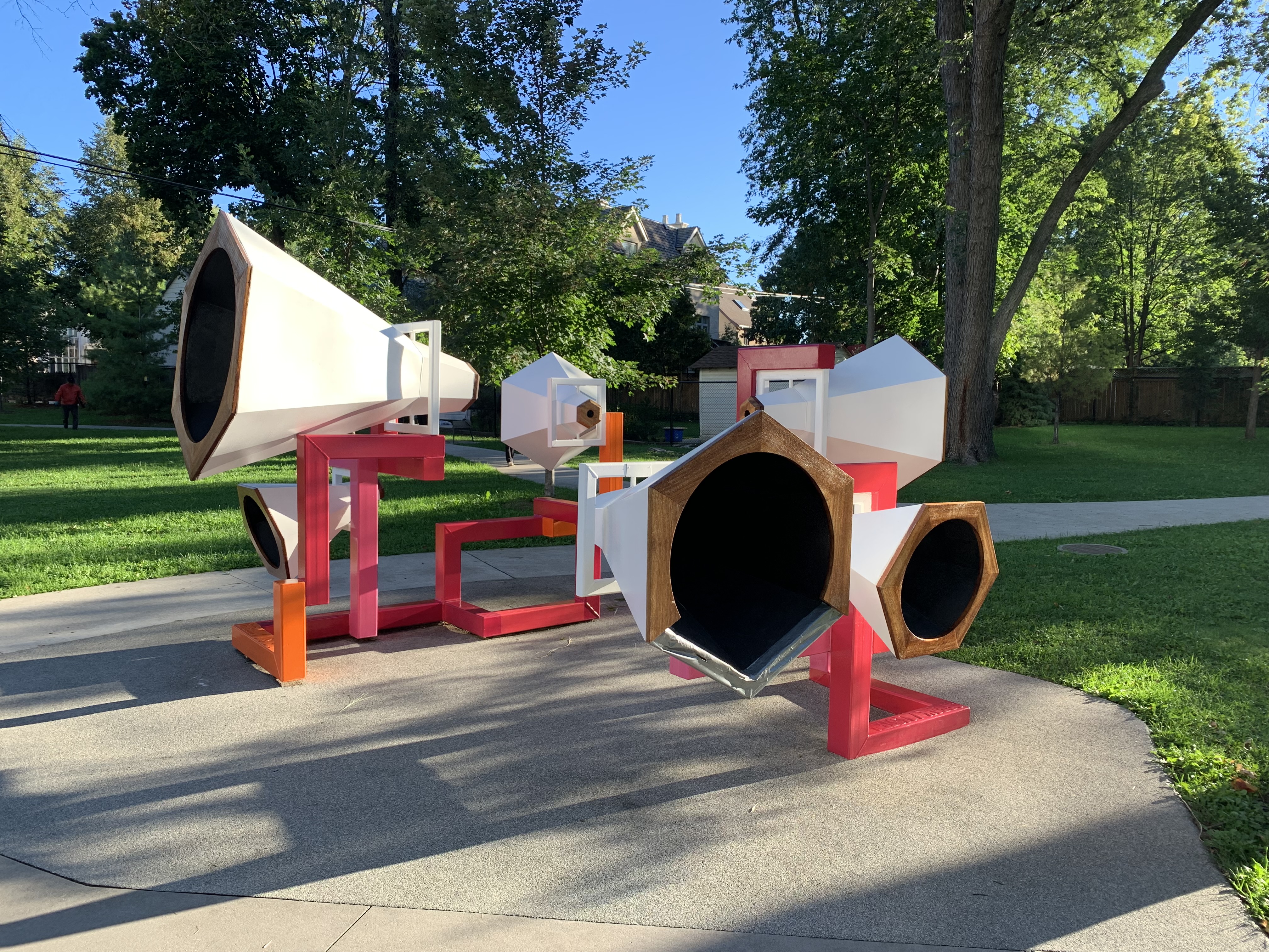
There is a permanent three part art installation in the park called 120 Mirrors which is inspired by the gramophone. The Horn of Reflection was created as a space for someone to sit inside and enjoy the soundscape as it is captured and amplified by the shape. However, you can’t get into the cone anymore because the end has been closed off.
The Hornucopia can be used to amplify sound within the park and by rotating it you can pick up distant bird songs.
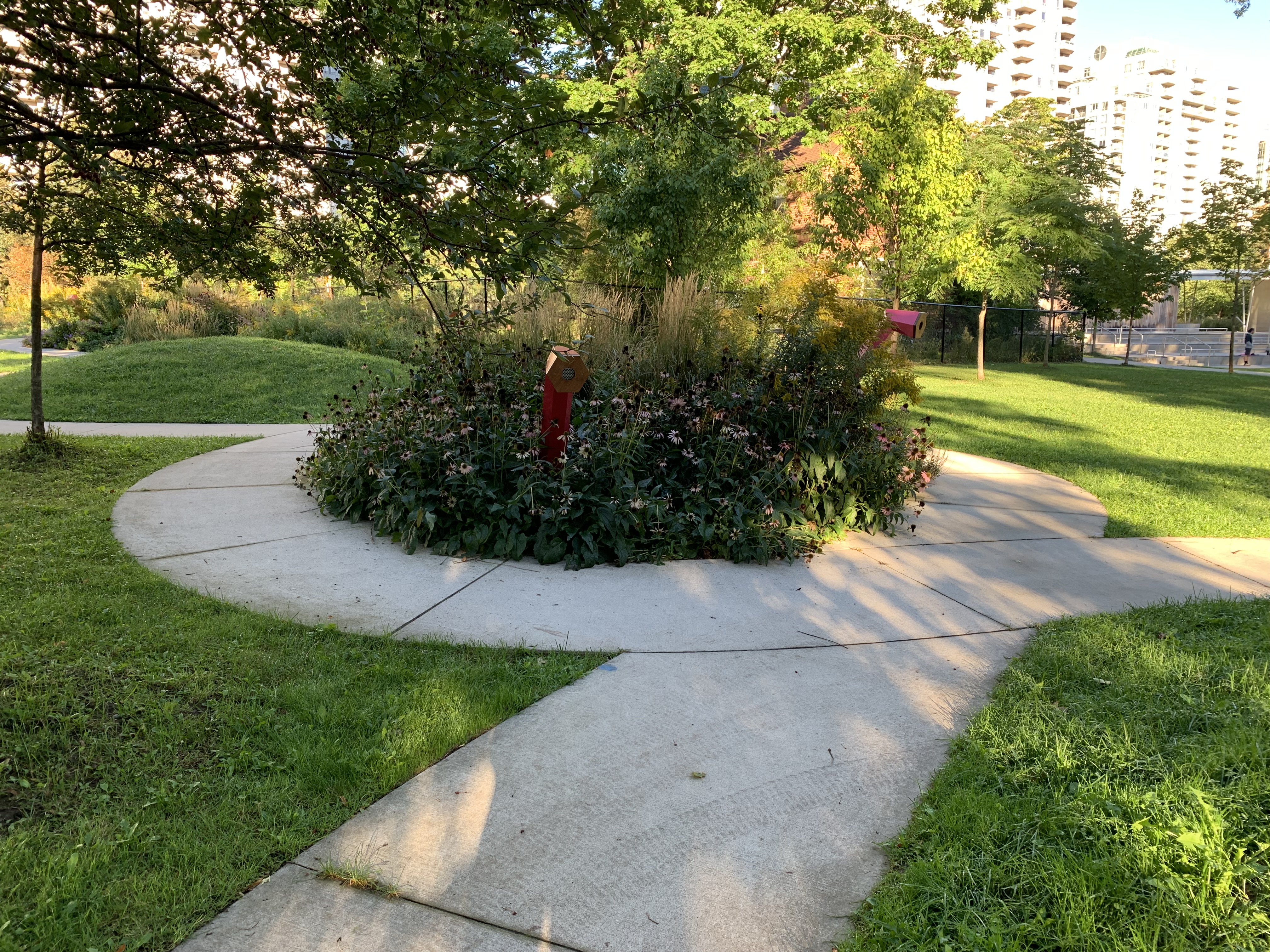
Speak and Listen is the installation that has been overtaken by this garden in the picture below. Sound can be transmitted between the two points in much the same way that cup on the wall or a pair of cans on a string can.
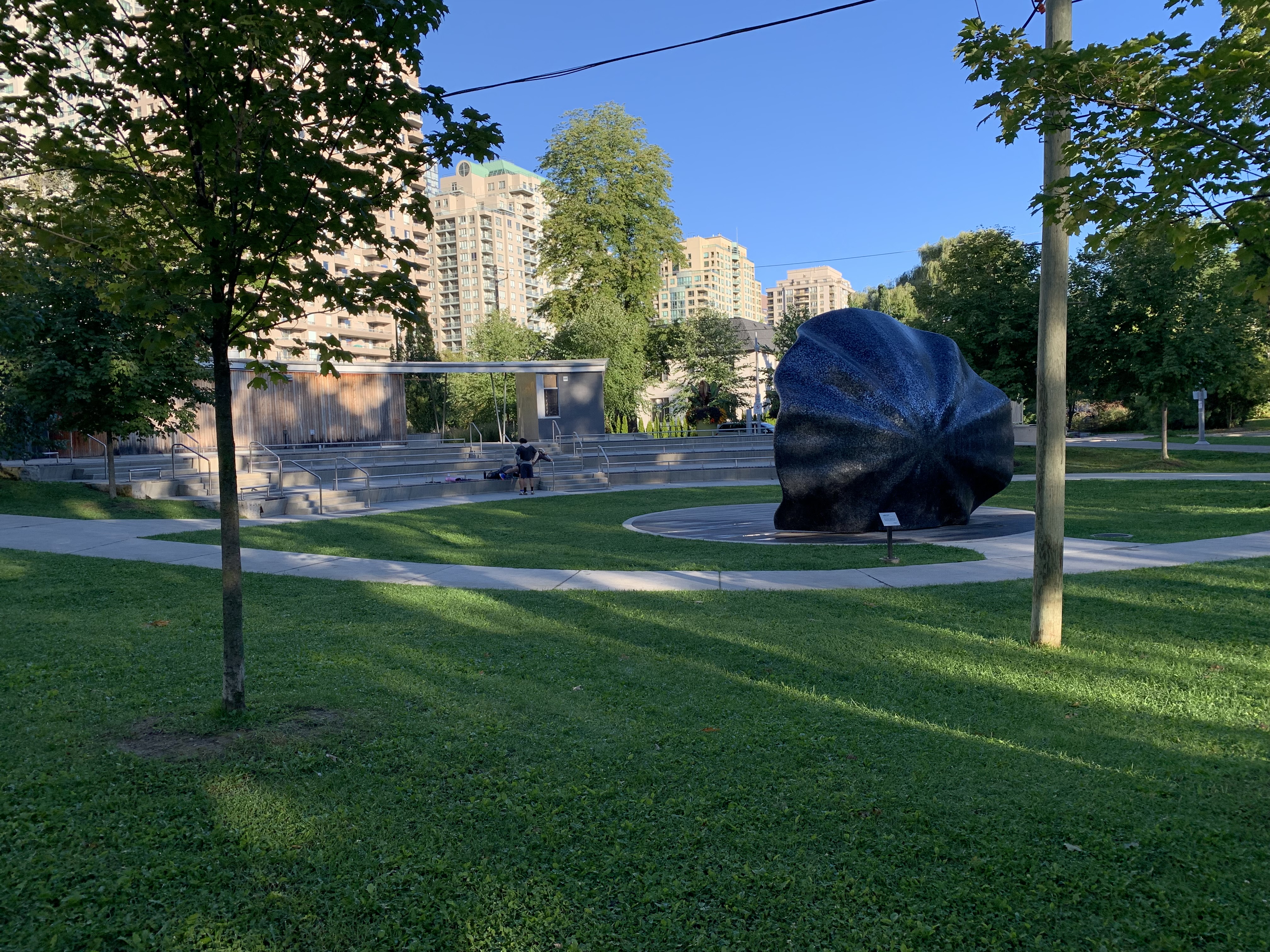
Looking from the south east end of the park you can see the band shell and the three level amphitheater west of it.
The bandshell in Lee Lifeson Art Park is fittingly named Limelight after one of the songs on Rush’s 1981 album Moving Pictures. It was their most successful record, having sold over 5 million copies. Limelight was designed on a computer to amplify and direct sound with the best acoustics possible. It is based on a parabolic reflector and is covered with thousands of black glass mosaic tiles. It allows formal and informal presentations to be heard throughout the park. Limelight was created by Paul Raff Studios who also did the mosaic mural of Lee and Lifeson that can be seen in the cover photo and also later in the article.
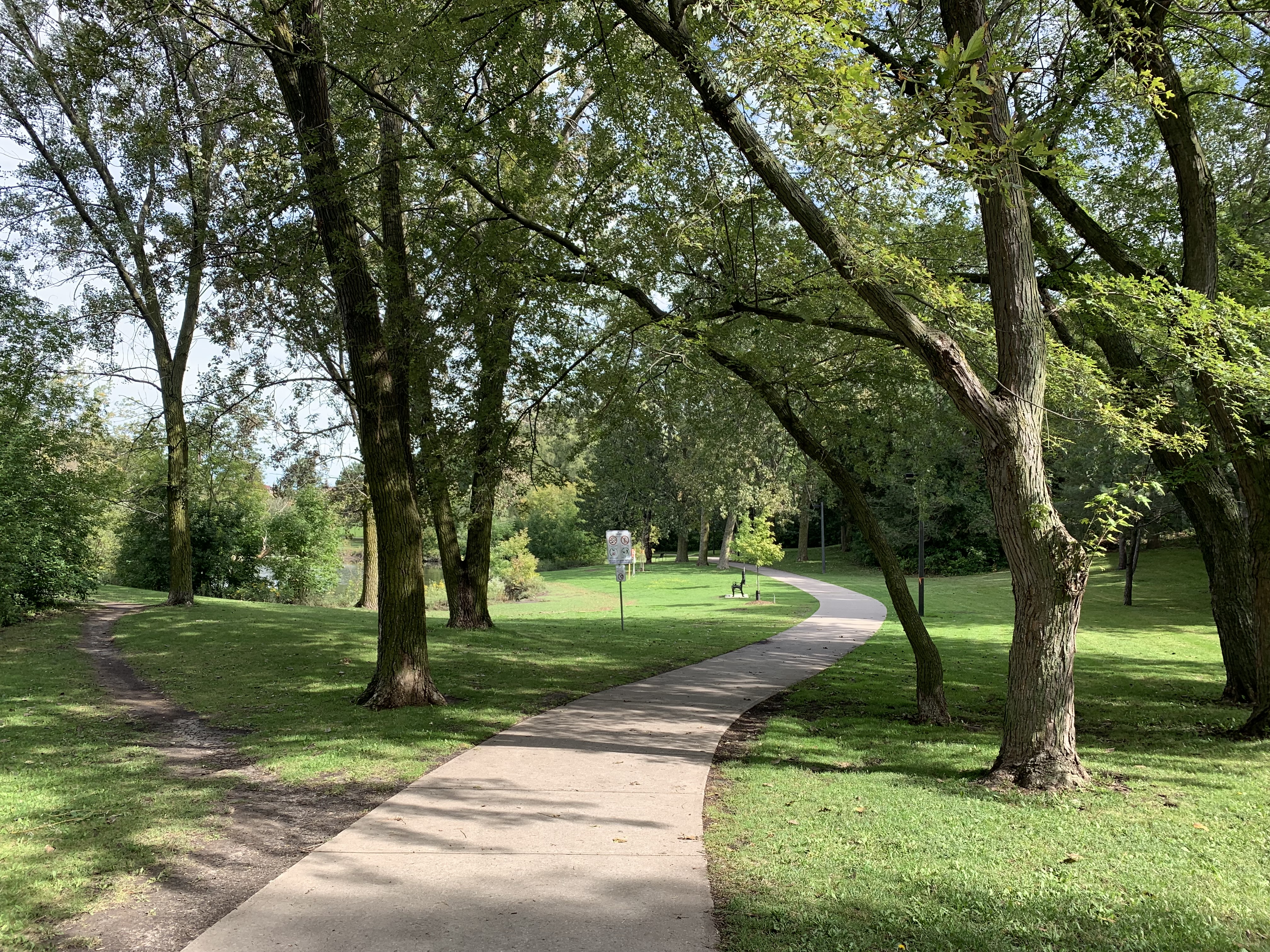
The park is cut throughout by winding paths that lead among the plantings and art exhibits. Performances in the park were scheduled on a regular basis before being temporarily stopped by COVID restrictions. There’s plenty of space for people to sit on the grass and enjoy a show when the amphitheater is full.
Geddy Lee, Alex Lifeson and their partner in rhyme, Neil Peart, created a legacy of music that will be enjoyed for years to come. Sadly, Neil Peart passed away on January 7, 2020 but not before amassing 14 Platinum records and 24 Gold ones with sales of over 40 million albums. Together they toured the world multiple times and performed for this writer on 12 occasions beginning in 1982. Lee and Lifeson have been featured in a mosaic mural on the west end of the amphitheater where the washrooms and support buildings are located.
Lee Lifeson Art Park is only about 7,000 square meters, for now, but is an interesting little enclave among the high rises of North York. And, it’s a fitting tribute to two of the neighbourhood’s most nationally and internationally recognized men.
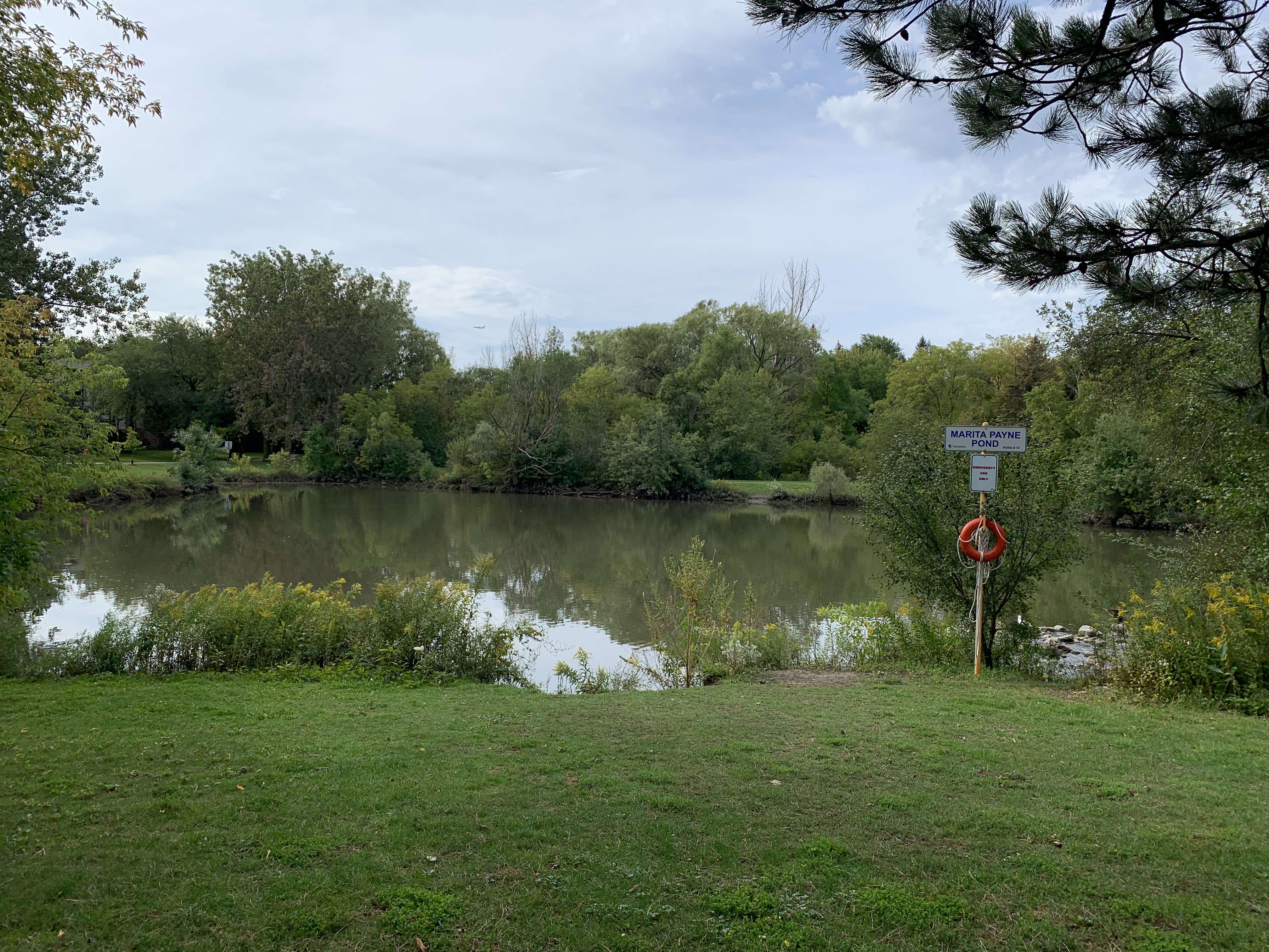
Marita Payne Pond is in a small residential park that follows the Don River through the Dufferin Road and Steeles Avenue area. The pond, and the park it is located in are named after Marita Payne who is a Vaughan resident. She is remembered for winning two silver medals in the 1984 Summer Olympics in Los Angeles. She is also currently a co-holder of the Canadian record for the 400-metre dash.
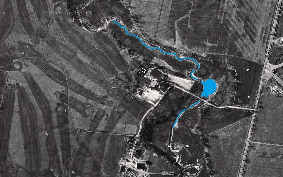
The park was developed on the grounds of the former Glen Shields Golf Course (1952-1979) where it ran along both sides of the Don River. The 1967 aerial photo below is from the Toronto Archives and shows the river and an earlier pond where Marita Payne Pond is today. The fairways and greens from the old golf course can still be seen in the picture. The table lands were developed for housing while the ravine areas were turned into Glen Shields Park and Marita Payne Park.
The pond serves as a flood control feature by holding heavy rainfall until it can be slowly released into the Don River. The pond is fairly small but has a surprising amount of wildlife.
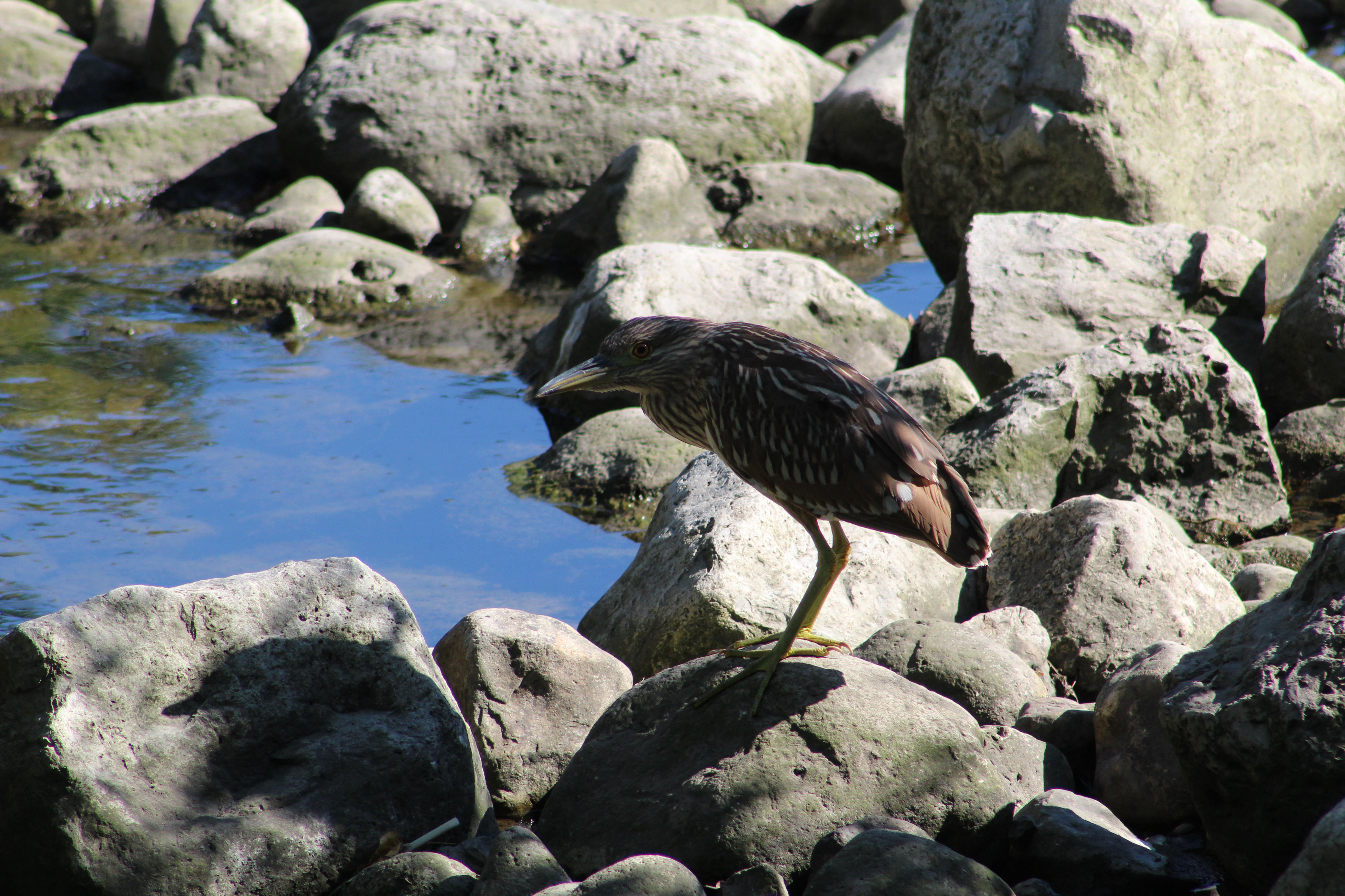
Although the pond has been home to a Great Blue Heron for the past several summers it was a pleasant surprise to see a juvenile Black-crowned Night Heron standing on the rocks at the storm water outfall into the pond. Juveniles have a brown colour with lighter streaks and a pale yellow beak. As they mature the belly turns a pale white and they develop a black crown and back. As their name suggests, they are nocturnal and do most of their feeding in the evenings. During the day they can be hard to spot because they sleep in trees or dense foliage. The average Black-crowned Night Heron can expect to live for about 20 years.
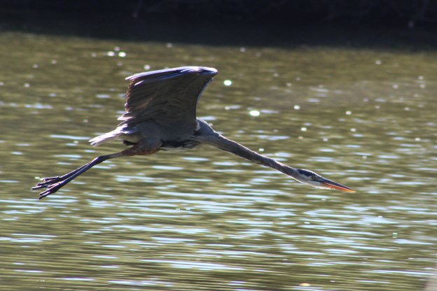
Great Blue Herons, on the other hand tend to live for around 17 years. With their wingspan of nearly two meters they are able to reach speeds of 55 kilometers per hour in flight. It’s common for them to nest in large colonies and then fly for up to an hour each day to reach their feeding places. There has been a Great Blue Heron at Marita Payne Pond for several years in a row and it’s likely the same one each year. Birds that have been banded for tracking purposes are known to migrate to the same place each winter and return to the same nesting grounds each spring. For some reason many of these birds moved farther north this spring and we seem to have a lot more of them in the GTA. The Great Blue Heron in the cover photo is a second one, the first time I have ever seen two at this little pond. It is flying with its neck stretched out straight unlike the normal retracted “S” curve we usually see when they’re in flight.
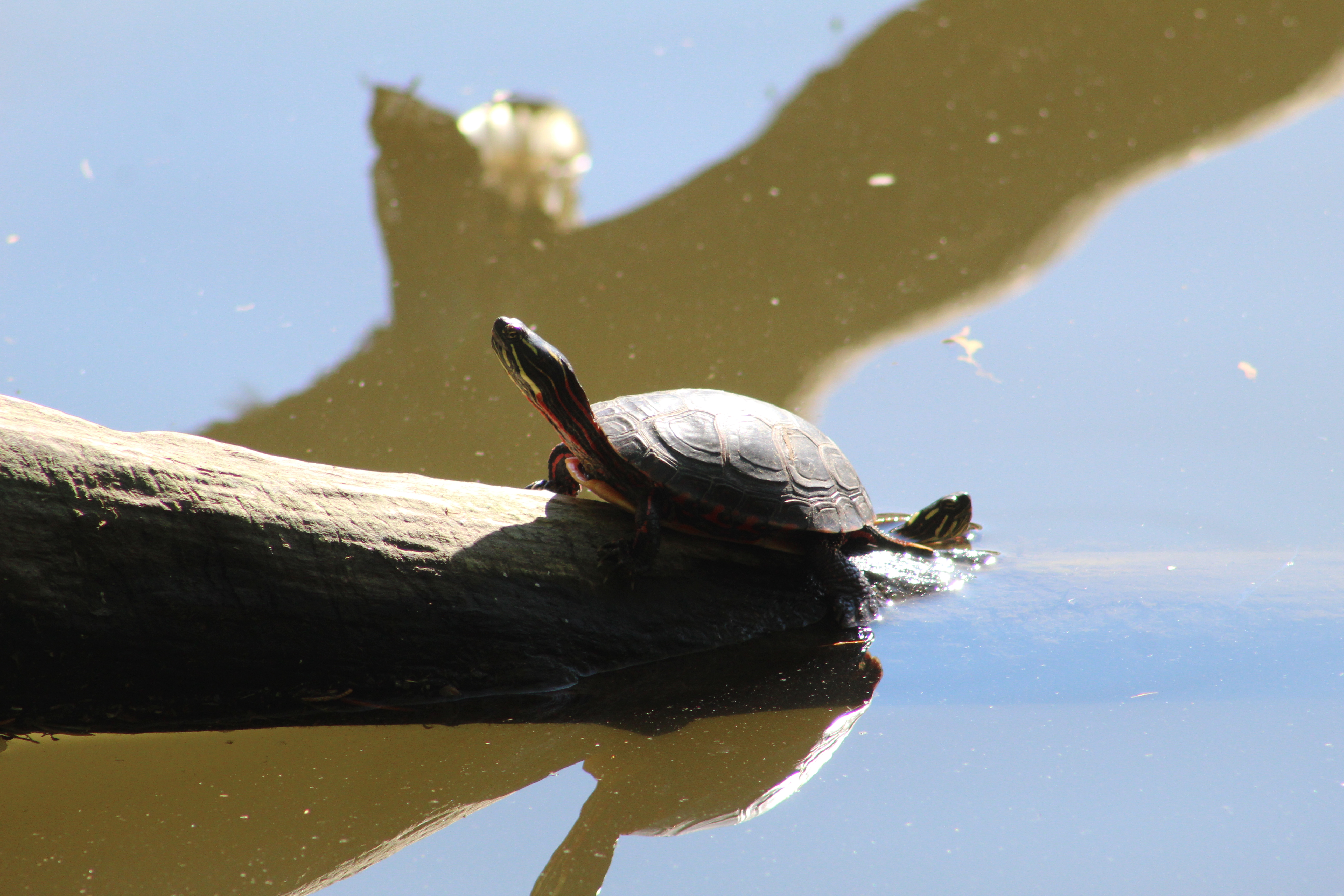
Painted Turtles usually live between 20 and 30 years but some have been known to survive for 50 years. When you see the feet of Painted Turtles you may notice that some of them have long nails while others have relatively short ones. The long-nailed ones are the males and they use them to stroke the female turtle on the head to indicate interest in mating. If she is tickled correctly she will dive to the bottom of the water and wait for him to come and mate. When I took the picture below I thought there was just one turtle in it but a second one decided to photobomb my picture. That was nice of it.
Call Ducks are domesticated and sometimes kept for pets. They were developed in the mid-19th century as hunting ducks. They were specifically bred to be smaller than average ducks so that they could lure other ducks into funnel traps and then escape through the small exit. They also have a distinct call that carries well and can lure wild ducks from great distances. With the advent of duck whistles and the decline in popularity of hunting, Call Ducks became relatively rare. In the mid-20th century they made a come-back as show ducks and as livestock on hobby farms where they are raised for eggs and food. The pair of Call Ducks at Marita Payne Pond were quite attached to each other and when they decided to sleep they snuggled up and dozed off.
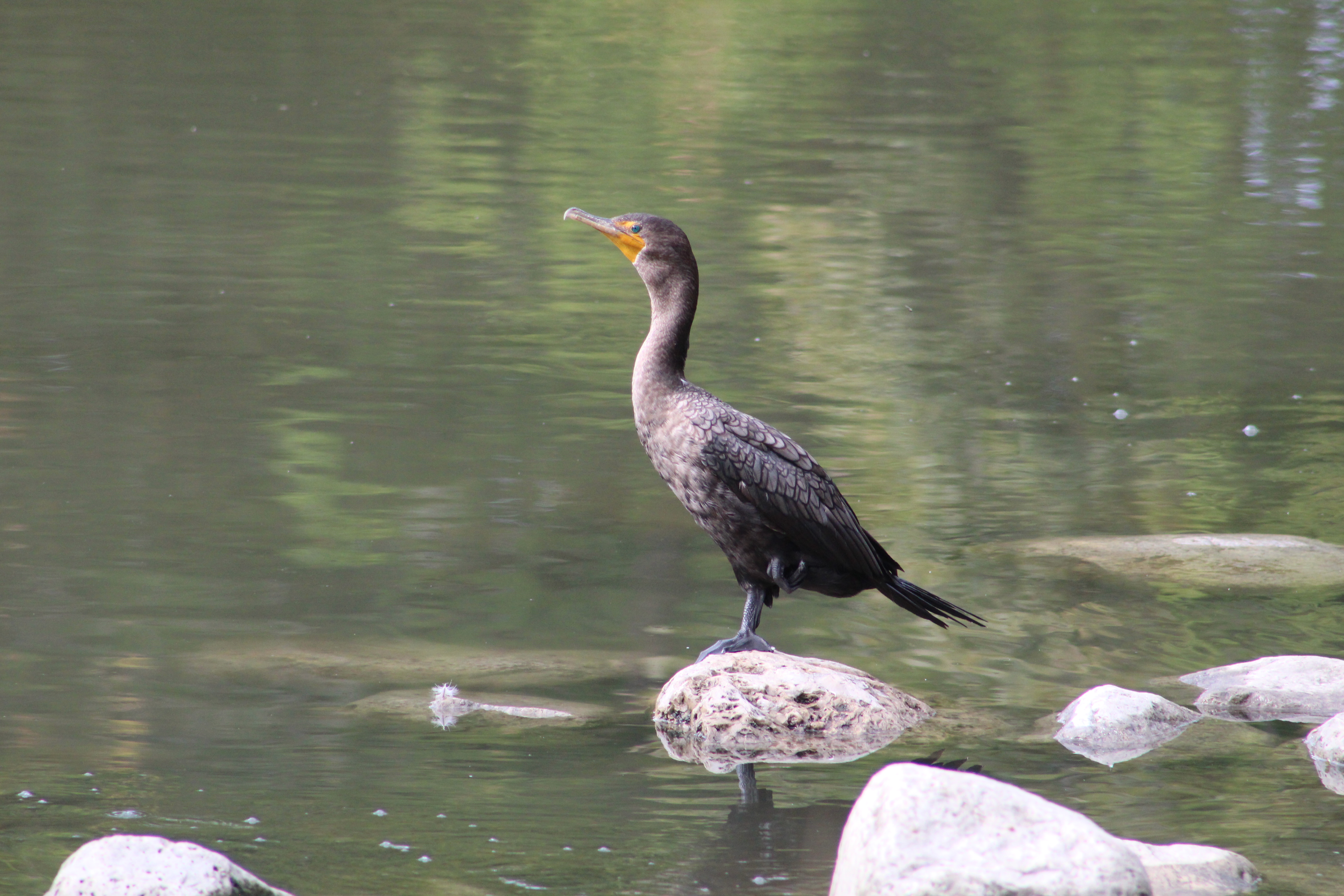
I was surprised to see a Cormorant at Marita Payne Pond for the first time in nearly 20 years of visiting here. An adult Cormorant will eat about a pound of fish per day which is nearly 10,000 pounds in their 23 year lifetime. The pond is said to have Bass, Carp, Sunfish, Catfish and Black Crappie but I wonder if it isn’t being over-fished by the large predatory water birds.
Pleated Inkcap Mushrooms grow in short grass or on wood chips and can be found in the mornings, especially the day after a rain storm. These little mushrooms are also known as Little Japanese Umbrella and the caps are between 1 and 2 centimeters and stand atop a 6 centimeter stem which is only 4-5 millimeters in diameter.
These mushrooms are very frail and thin. The radial grooves that extend from the centre to the edge of the cap match the gills on the underside. They reach maturity around noon and after releasing their spores they bein to fade away. Twenty-four hours later there will be hardly a trace of their coming and going.
The Eastern Grey Squirrel comes in both grey and black colours. Both can be born in the same litter but some confuse them for two different species. The black ones are more common in the northern range of their habitats while they don’t exist at all in the southern United States. Some populations are also known to have a black body with a red tail and a few groups of albino squirrels have also been reported.
The trail through Marita Payne Park is part of the Bartley-Smith Greenway, a 15-kilometer trail that follows the West Don River. As you follow it north-west you pass under the Glen Shields Avenue bridge and the trail changes to fine gravel from pavement. The park also become a little less maintained between here and and where it passes under the bridge for Highway 407.
I was wondering if the second Heron at Marita Payne was possible the one that is usually at the old dam just past the 407 bridge. As it turns out, this bird is in its normal spot at the base of the abutment from the dam. There’s no shortage of Herons this year in any of our parks.
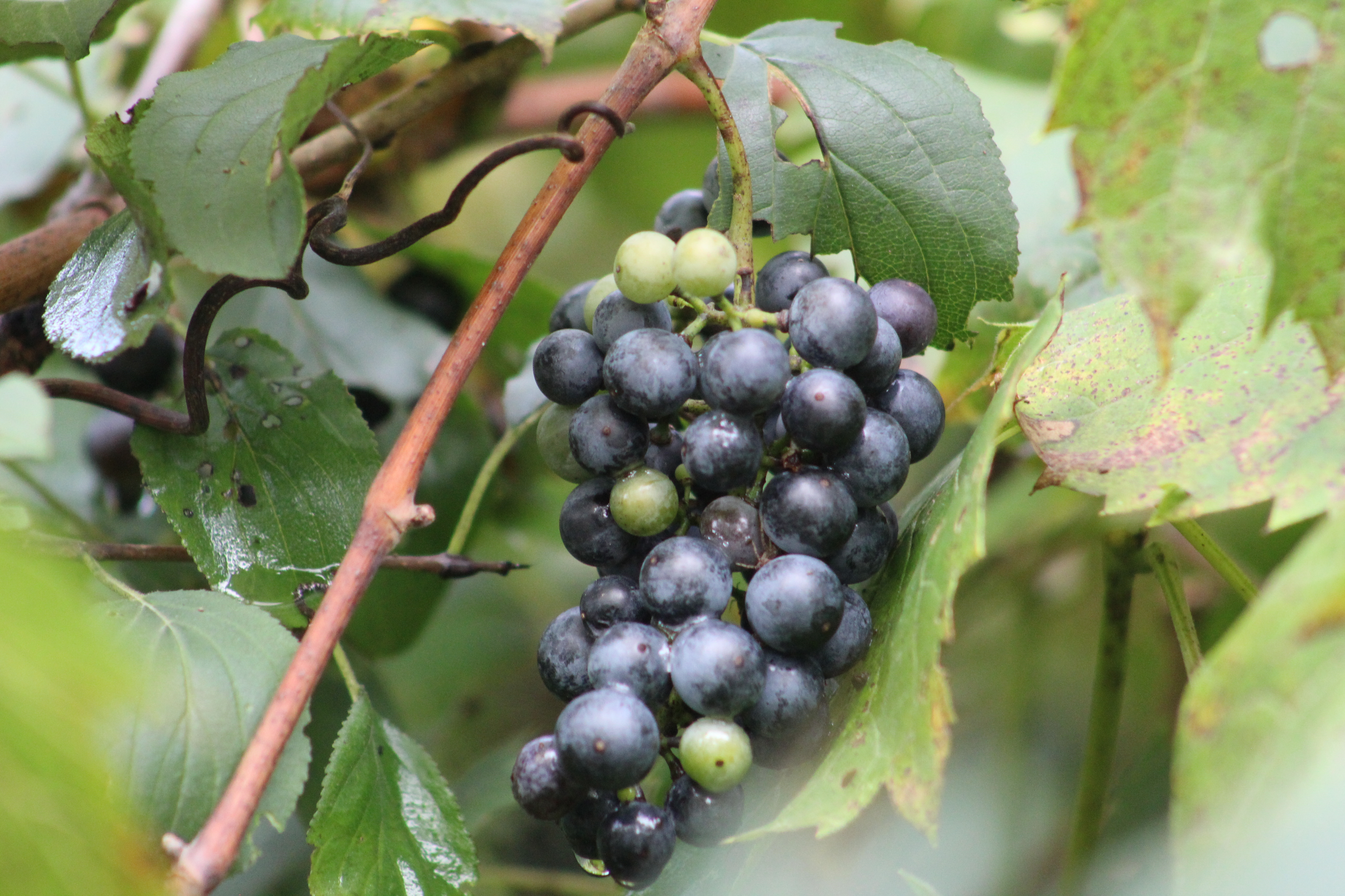
River Grapes or wild grapes are growing in abundance along the side of the river. From the looks of the fruit, it’s going to be a good year for a large crop. Cultivated grapes have been developed from wild grapes by choosing plants that are the hardiest and cross breeding them.
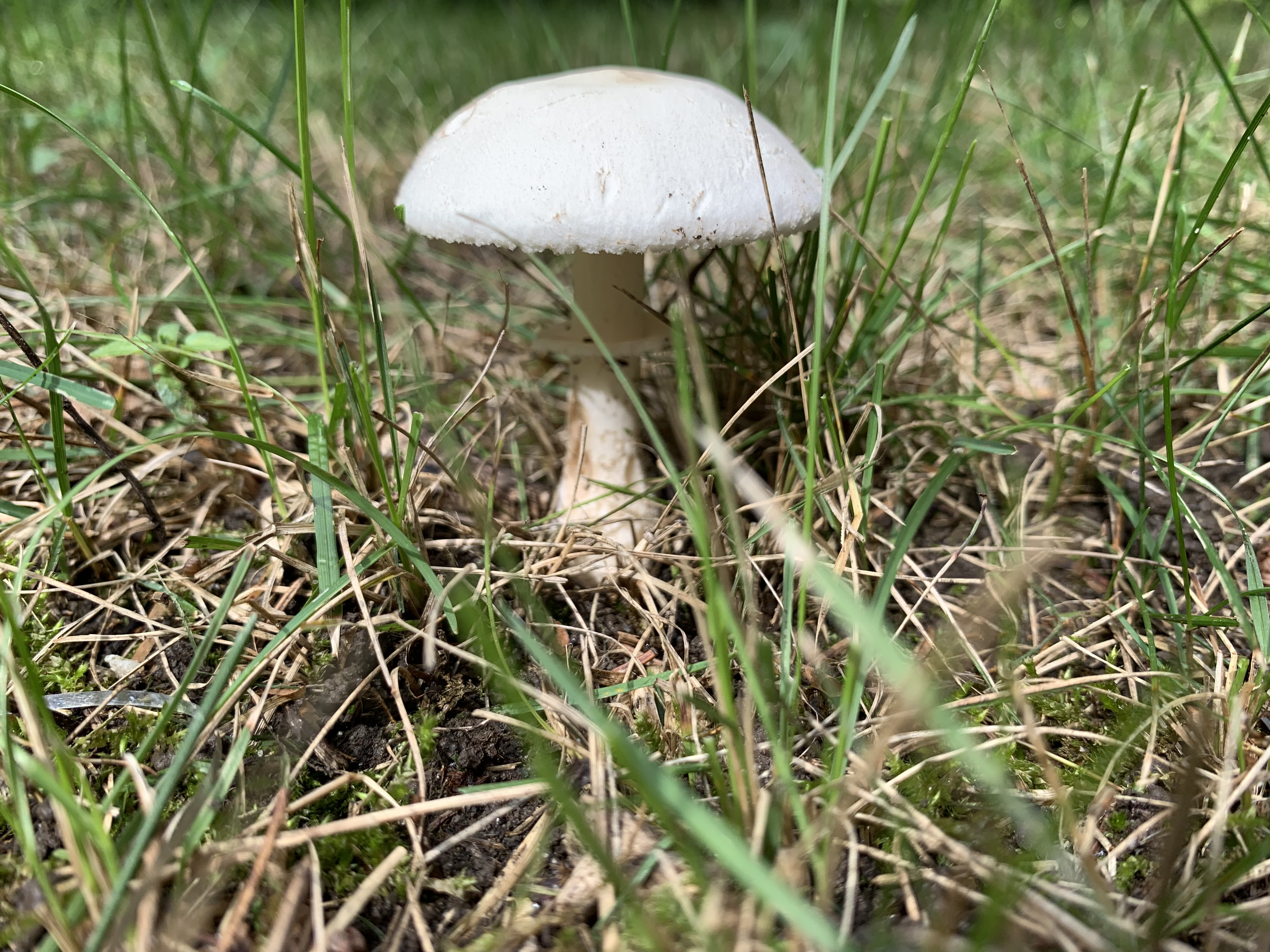
Destroying Angel is one of the poisonous mushrooms that grow in the region. They are often found growing solo and can be identified by their bright white colour and the large veil below the cap. A distinguishing feature is the sac-like cup at the bottom of the stem.
Highway 407 was originally proposed in 1959 but the first section wasn’t opened until 1997. When construction was completed through the Concord area it was decided to re-align Highway 7 where it crossed the West Don River. A small portion of the old highway was closed and the bridge was removed. There is still a small section of the old road allowance that can be found just before the present Highway 7 bridge.
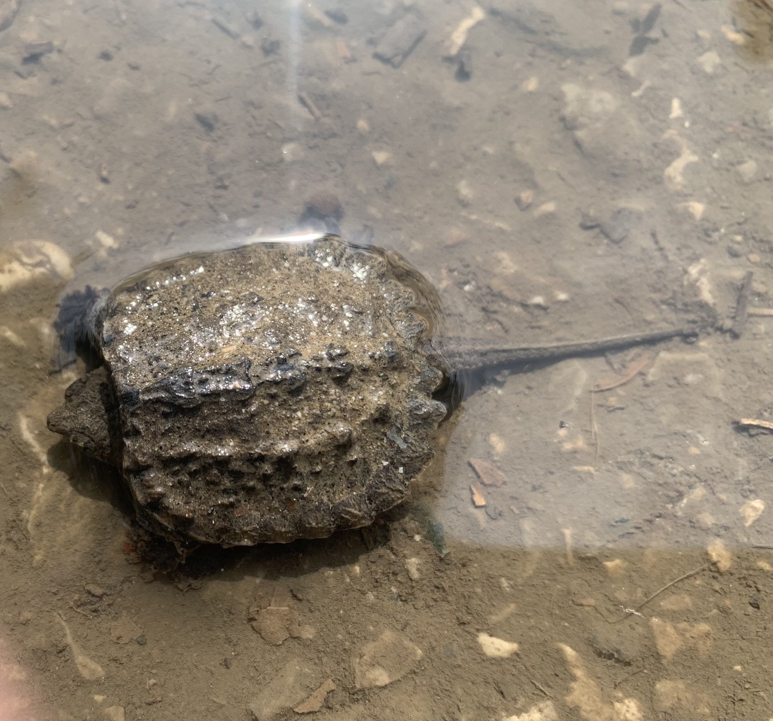
We often look for loop trails so that we can experience more terrain without having to go back over sections we already explored. Trails along the rivers in the GTA tend to be “out and back” as the parks are normally only as wide as the floodplain of the waterway they surround. It’s amazing how often we see something on the way back that was missed on the outward part of the journey. This time it was a baby Snapping Turtle that was lying in a puddle on the edge of the path. It looked a lot like a leaf in the water and could have easily been stepped on or crushed by a bike tire. Snapping Turtles can live up to 45 years in the wild and this one will have a better chance after I moved him up onto the grass between the path and the river.
Returning to the pond, it’s possible to follow the trail to the corner Of Glen Shields Avenue and Dufferin Street where it cuts through the Ghost Town of Fisherville before ending at the entrance to G. Ross Lord Park.
Marita Payne Pond has a direct connection to the Don River and fish have an easy way into the pond. Perhaps this is why such a small pond can support four large fishing birds.
The Town of Georgina is the northern most community in the Township of York. It’s made up of the three little towns of Keswick, Sutton and Jackson’s Point and several smaller communities. At the turn of the last century it was a tourist attraction and served as cottage country for people from Toronto. In the early 20th century it was serviced by the Toronto & York Radial Railway which ran as far as Sutton. One of the objectives of the grand tour presented below was the photographing of two more relics from the old railway.
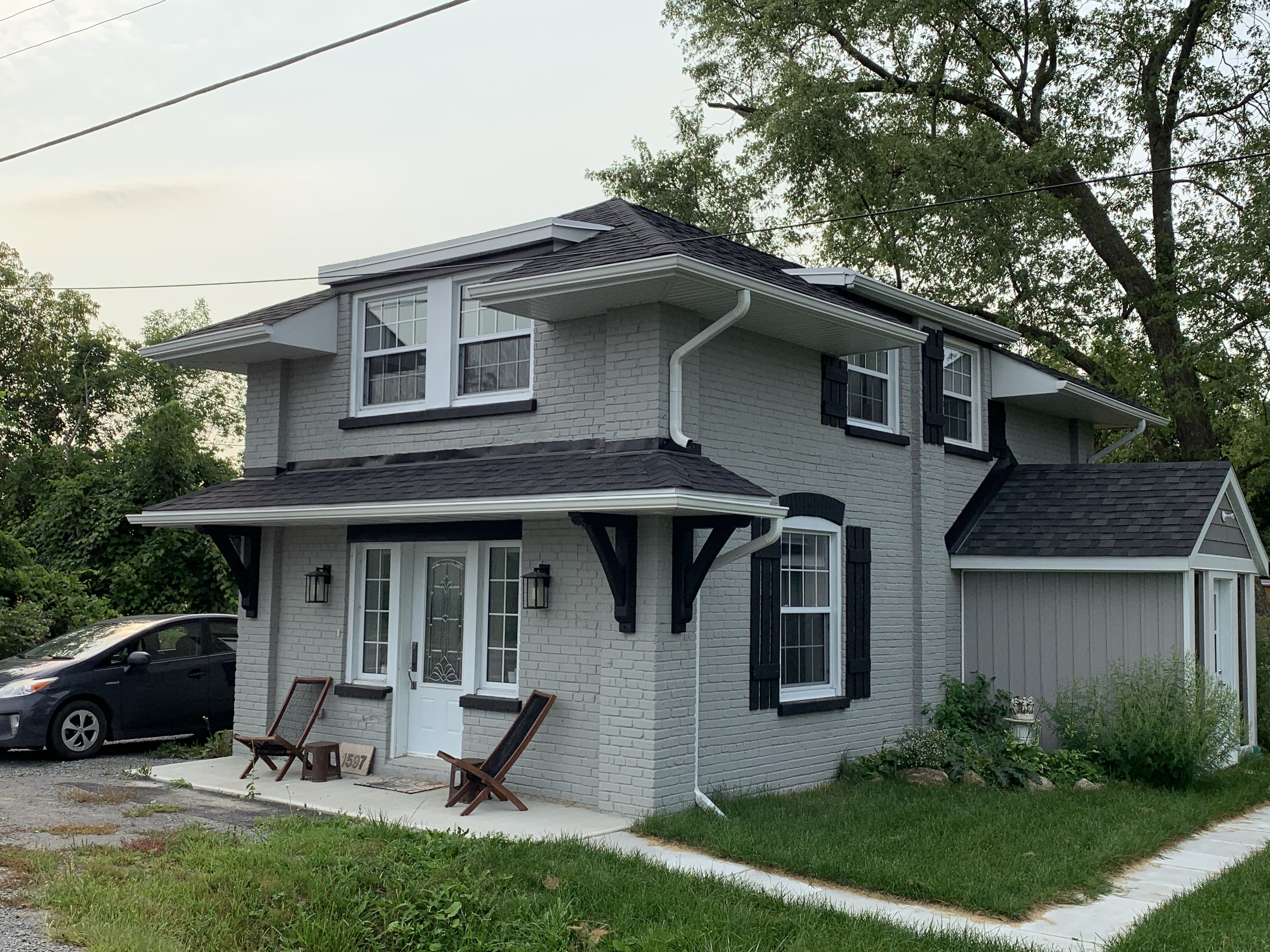
As the Toronto & York Radial Railway expanded north in 1899 it built power stations at Bond Lake and Lake Simcoe. The Bond Lake power house has been left abandoned and now is in a poor state of repair. The one at Lake Simcoe was located at Kennedy Road and Metro Road and is now in use as a private residence.
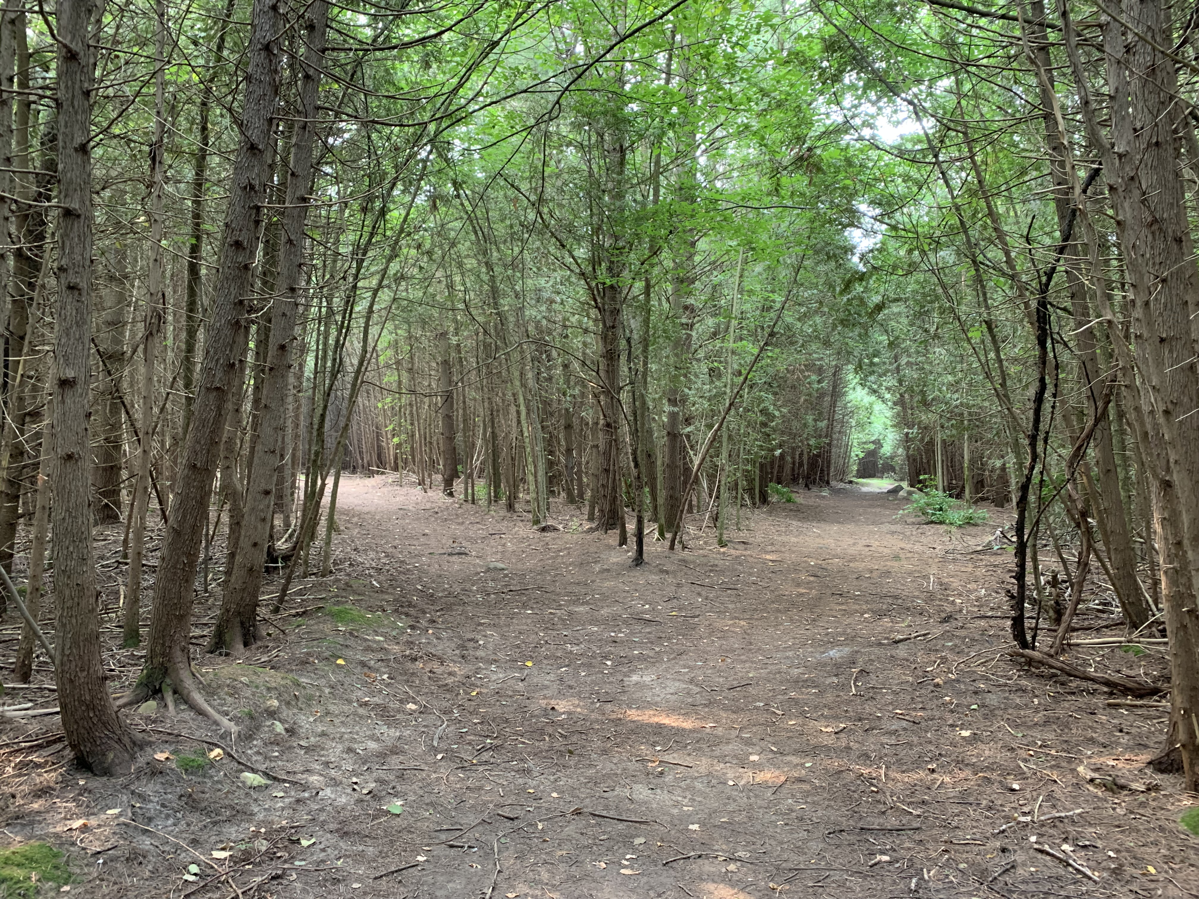
The York Regional Forest covers 2,300 hectares of land that is protected and yet available for public use. It is comprised of 18 different forested properties that have a total of over 120 kilometers of trails. The Metro Road Tract is near Jackson’s Point and has a 2.6 kilometer trail in it, although most of the property is left without formal trails.
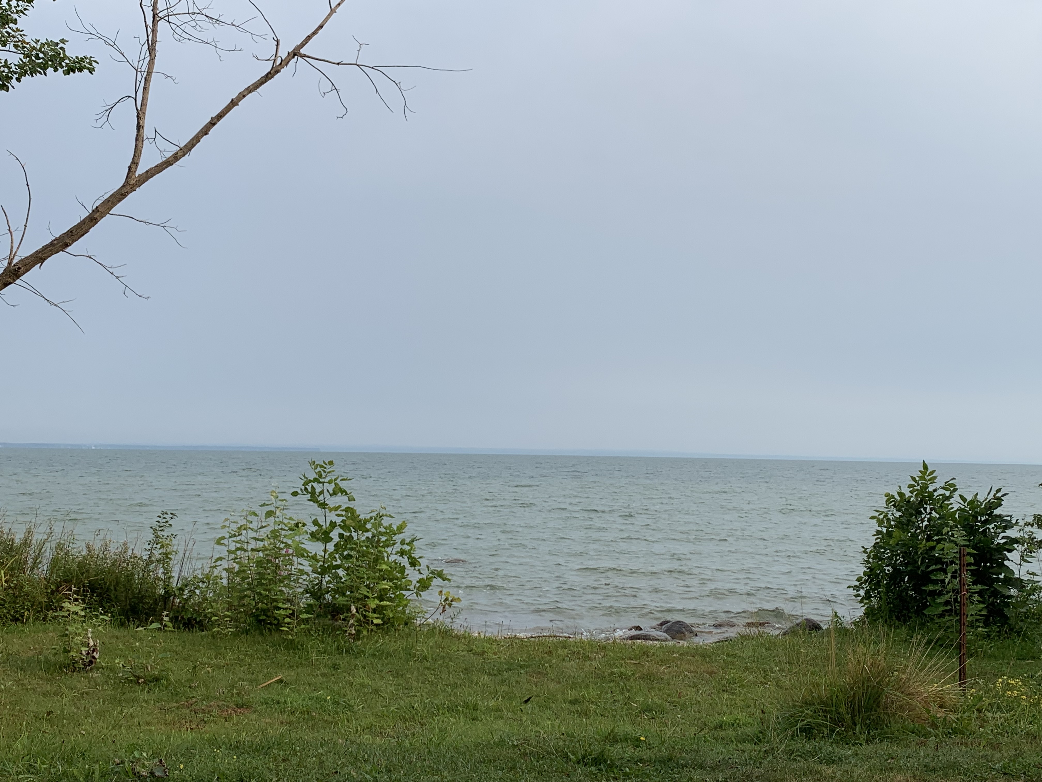
Jackson’s Point was a beach resort for those who arrived by the radial railway to escape the city for the day. However, when cars started to become more popular its importance started to fade because other places became accessible to the family. Today, most of the beach is private property and parking is restricted to a few parking lots. Even so, Lake Drive East has plenty of great views out over the lake.
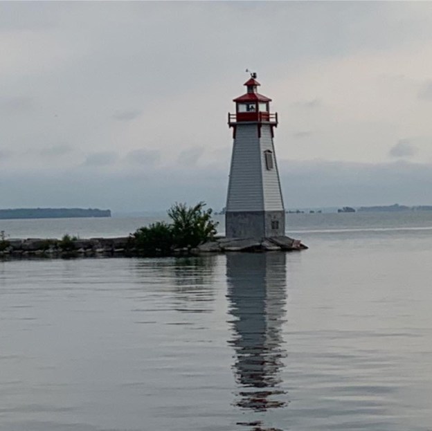
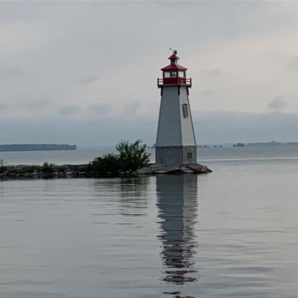
Until 2018 the harbour at Jackson’s Point had a day marker to guide boaters away from the rocks at the harbour entrance. That year, the Town Council authorized a local resident to begin work on designing a lighthouse for the harbour that would celebrate Jackson’s Point as a destination on Lake Simcoe. Daryl Urquhart has put up the $160,000 for the lighthouse himself and construction was completed in 2019. It stands 30 feet tall and has an LED light that is programmable and can be seen for up to 5 nautical miles.
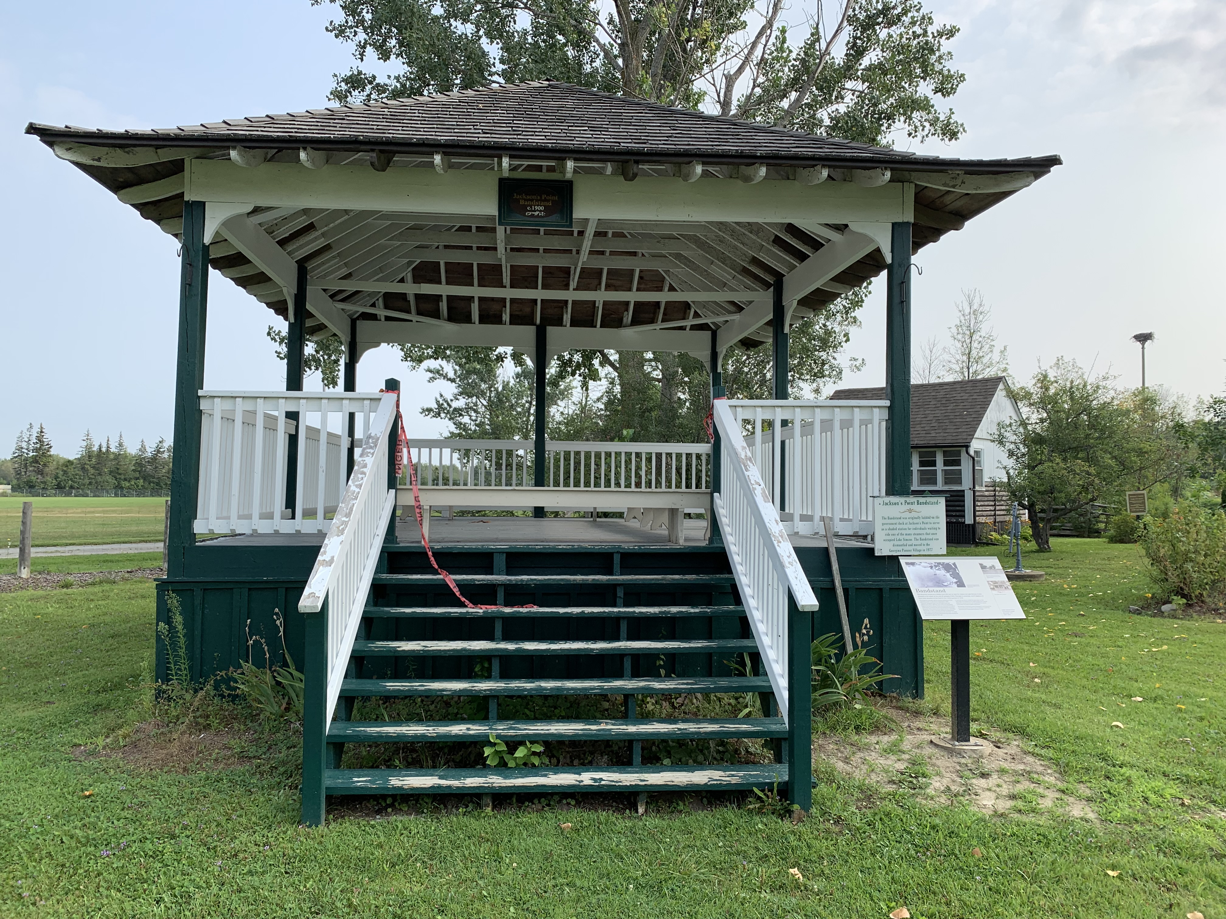
In the 1830s Jackson’s Point was a destination for steamships that visited for trade, and later, for tourism. Sometime between 1910 and 1920 the bandshell was built as a shelter on the end of the government wharf. In 1977 it was dismantled and moved to the present site at the Georgina Pioneer Village and Archives. Here it was fully restored and added to the collection of historic buildings. We’ll look at a few other buildings from Pioneer Village a little later in this post.
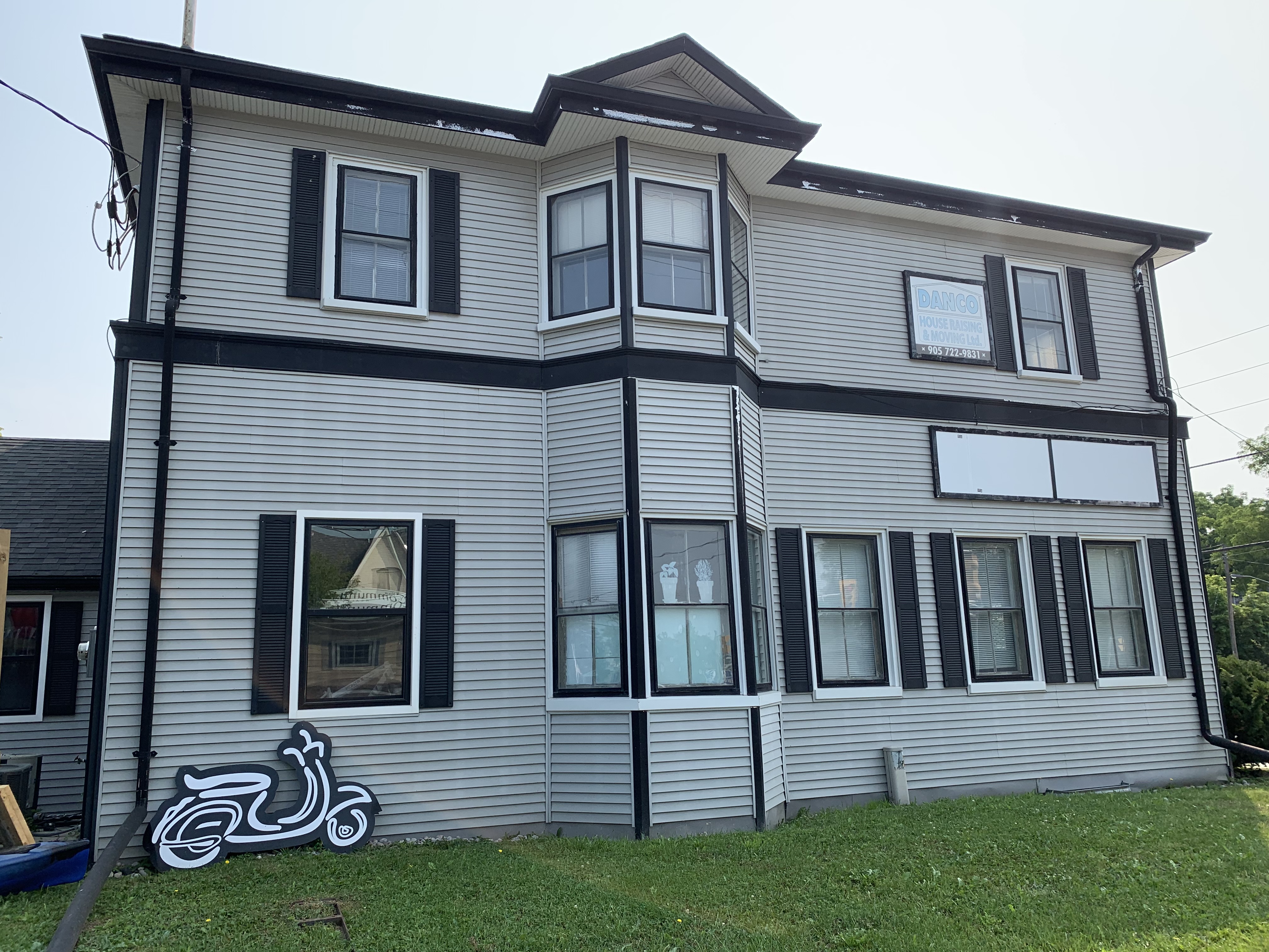
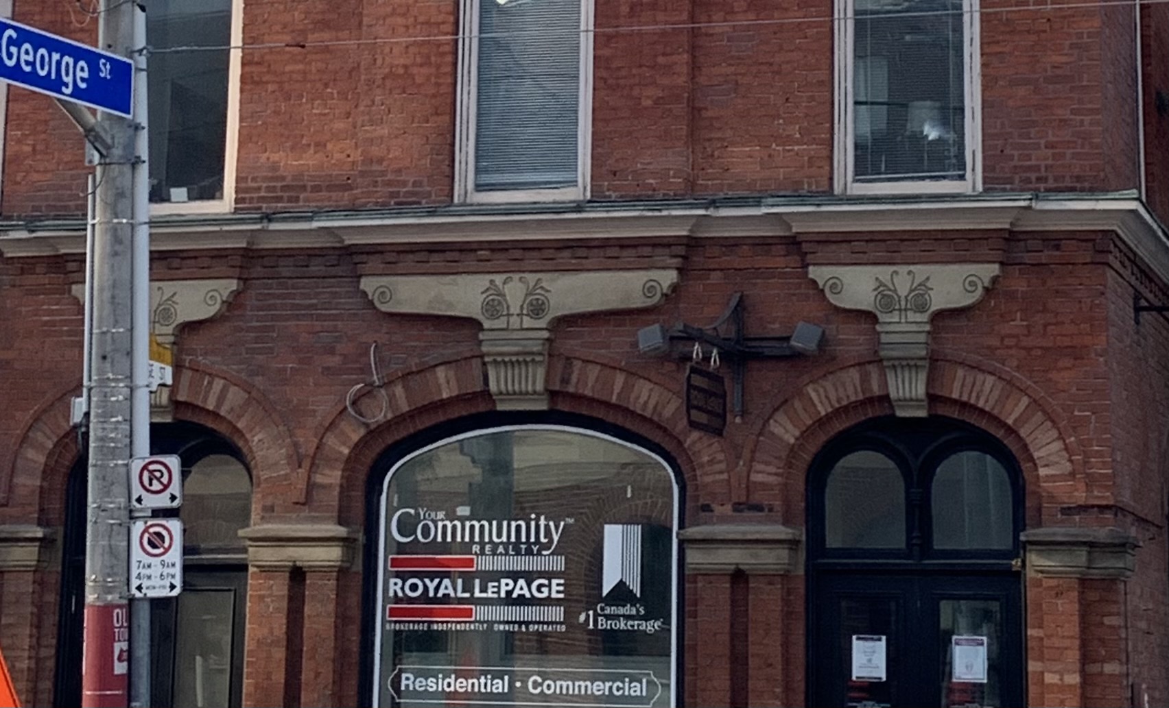
The Toronto & York Radial Railway built its terminus in Sutton in 1908. The station master and his family lived on the upper floor while the lower one served as the station. Radial service began in Sutton on January 1, 1909 and continued until March 16, 1930. The building was then purchased by the Hydro Electric Power Commission who used it as an office until 1970. It currently serves as home to a real estate brokerage. The beautiful brickwork has been covered over with bland siding but otherwise it remains in good shape with a bay window that no longer looks out over railway tracks.
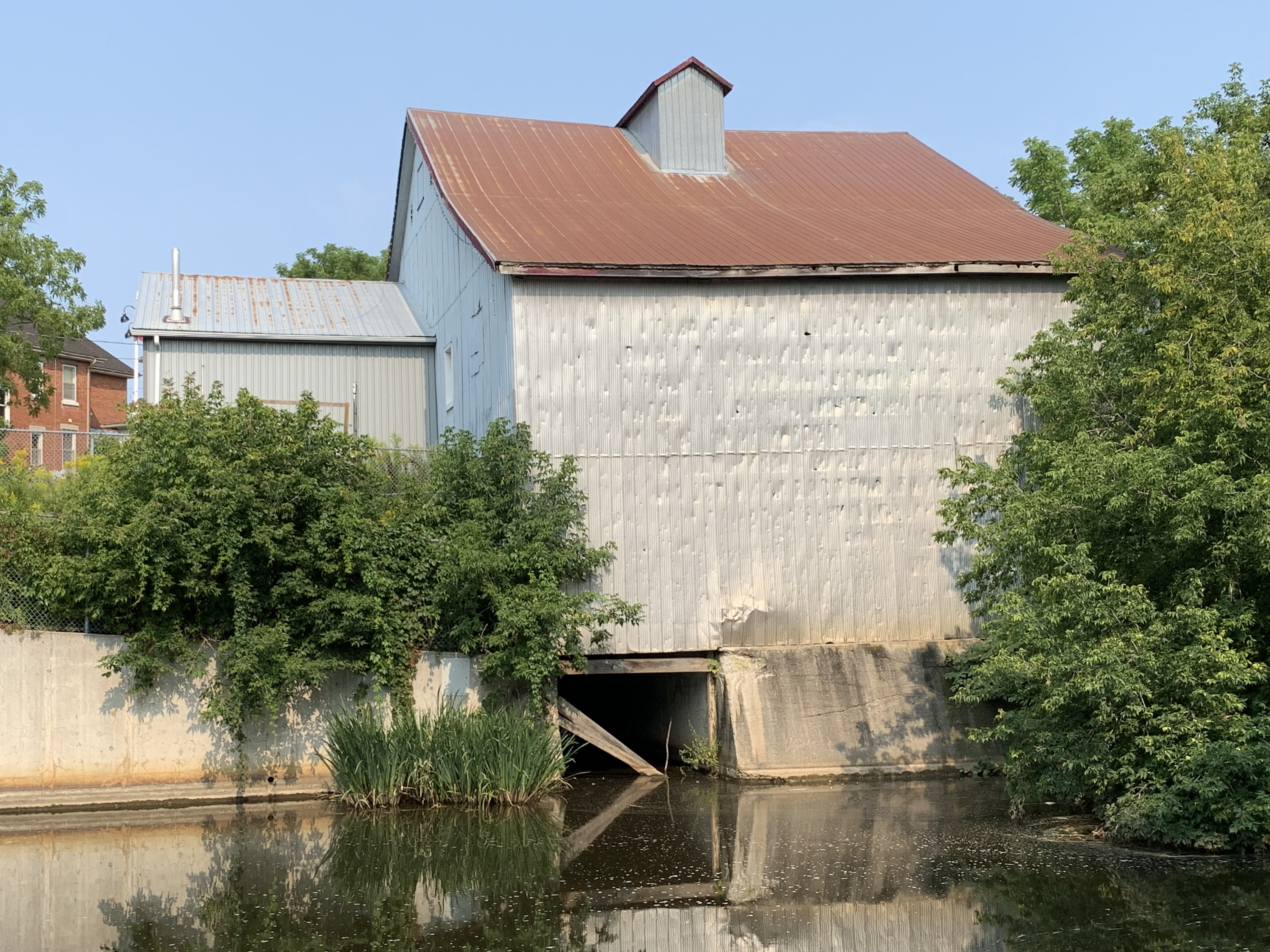
In 1819 the first grist mill was opened on the Black River where Sutton would eventually be founded. By 1830 it had been converted to a board and batten construction which is now covered over with aluminum sheeting. The mill was operated under several different millers until the 1950’s when milling operations were shut down. For a period of time starting in the 1880s it also supplied surplus electrical power to the community. The mill dam still exists on the opposite side of High Street and the tail race where water was returned to the river is still open on the side of the building.
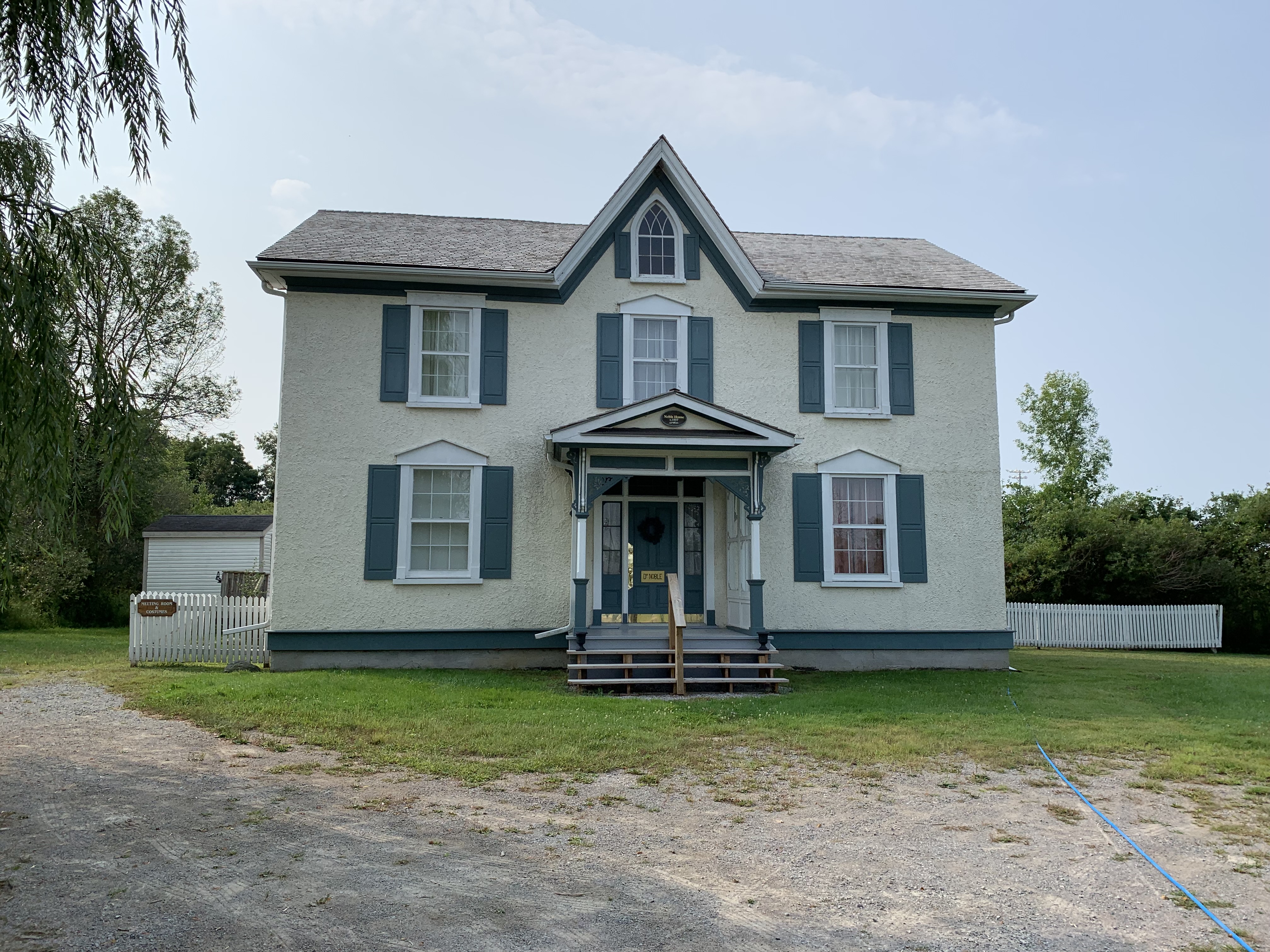
Georgina Pioneer Village & Archives were officially opened on Thanksgiving Day 1975 and the 10 acre site has become home to quite a few buildings that were constructed in the area between 1850 and 1920. One of these buildings is the Noble House which was built in the mid 1850s and moved from High Street in Sutton in 1986. During its prime it was home to three generations of doctors.
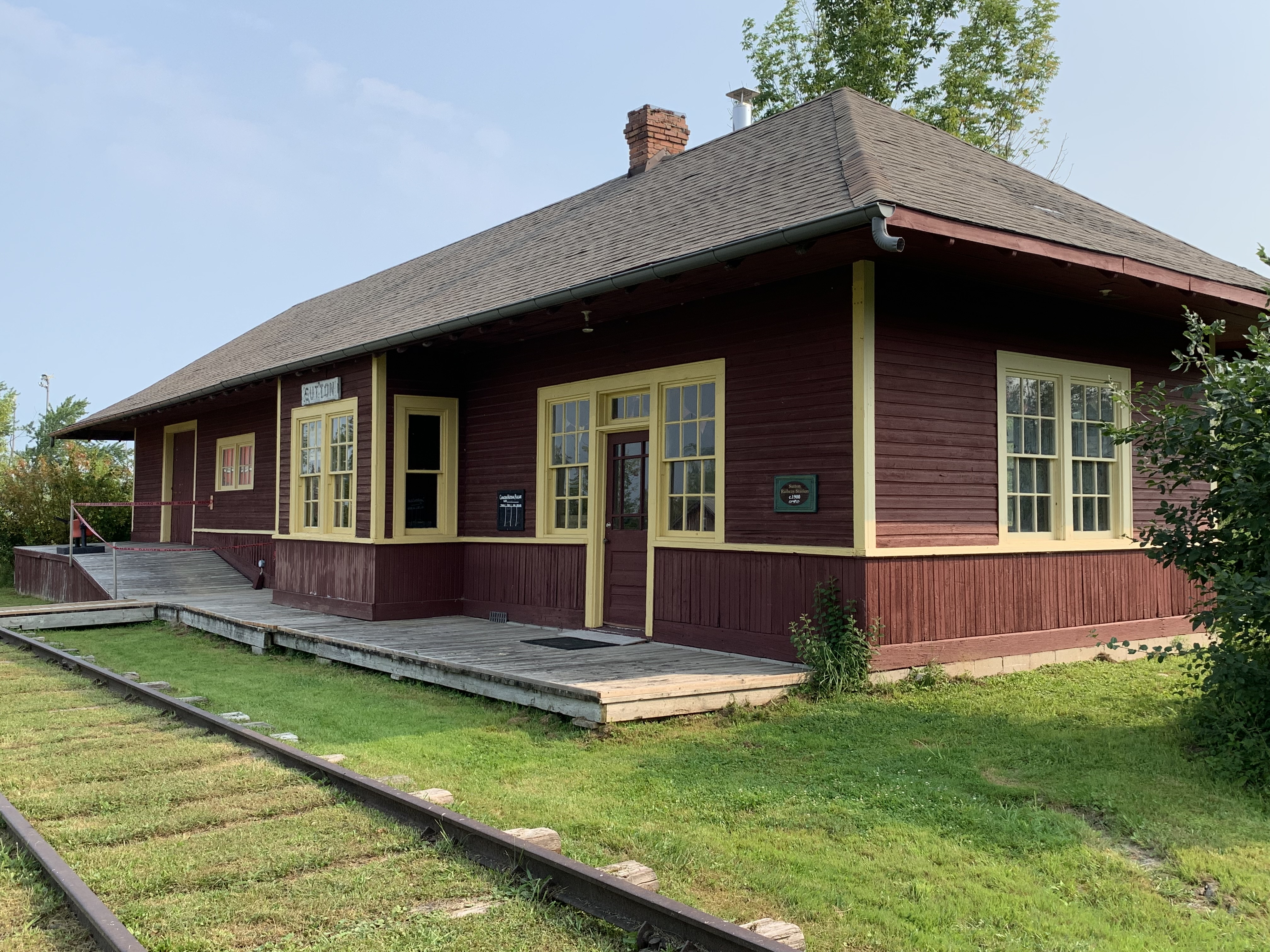
The first Sutton train station was built in 1871 for the Lake Simcoe Junction Railway. When it burned down in 1900 the railway was under the ownership of The Grand Trunk Railway who replaced it with one in their typical style of the era. This station was also lost to fire in 1920 and was replaced in 1924. When the station was no longer in service the Georgina Historical Society was able to purchase it for $2.00, moving it to the village in 1977.
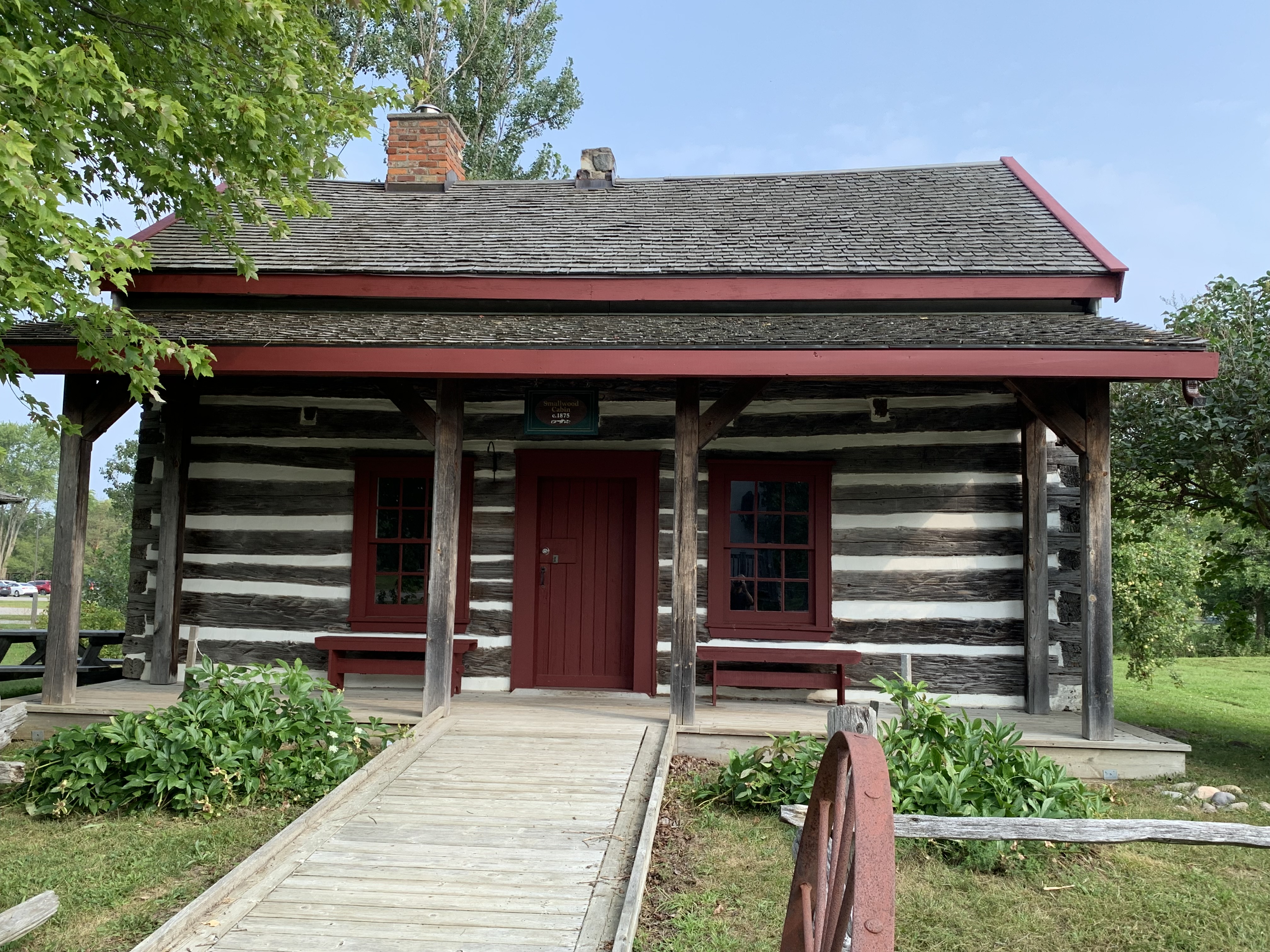
The Smallwood Family built a log house in Elm Grove around 1866. After standing empty from 1966 until 1974 it was acquired by the Georgina Historical Society and relocated to the village.
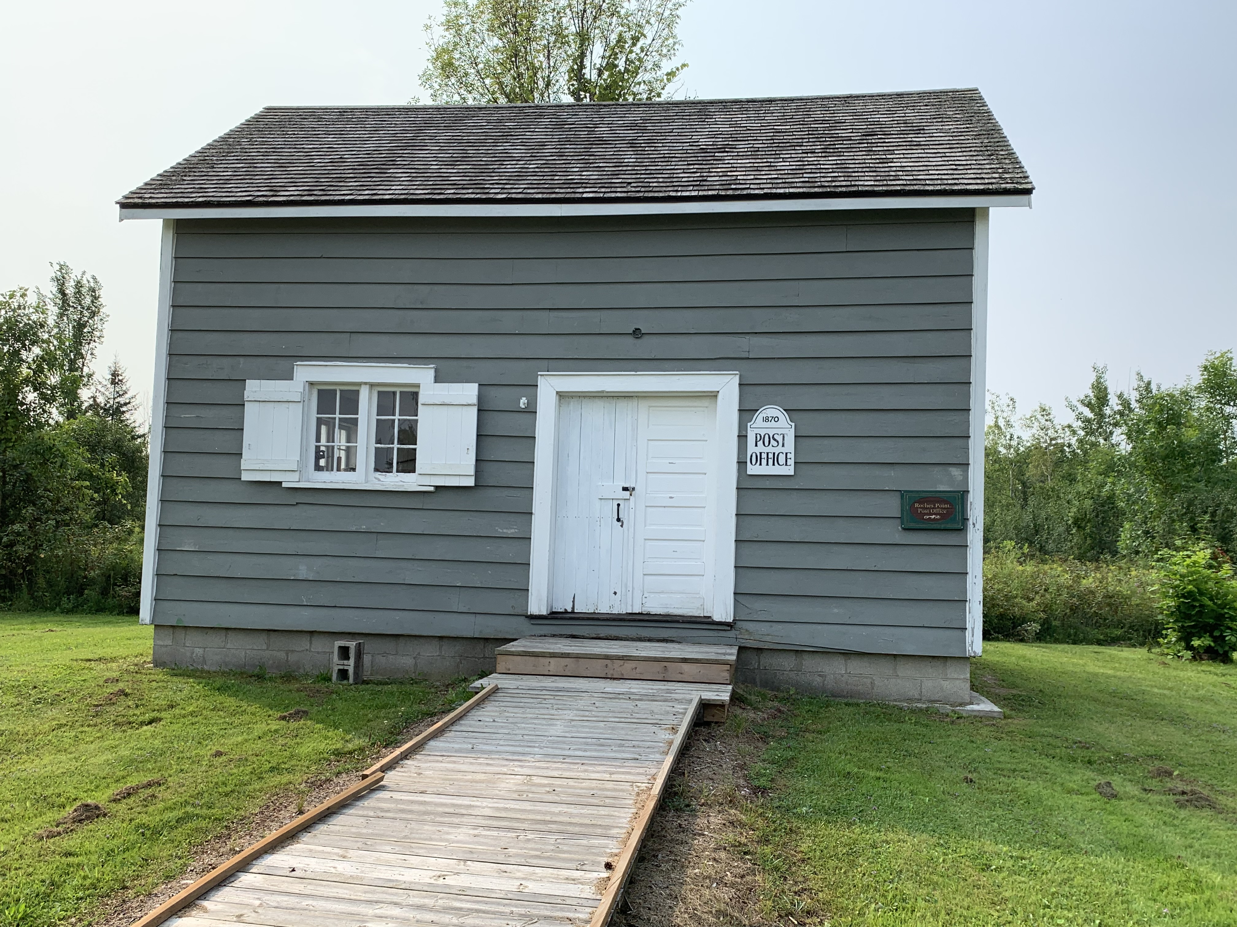
Roche’s Point kept applying for a post office and was finally granted one in 1870. Most post offices were opened by the proprietors of the local general store. In Roche’s Point it is believed that the local boot and shoe retailer used his store as the post office until 1921. Following the death of the post master, the post office was moved to an alternate location in town. The former post office and shoe store was moved to the Pioneer Village in 1999.
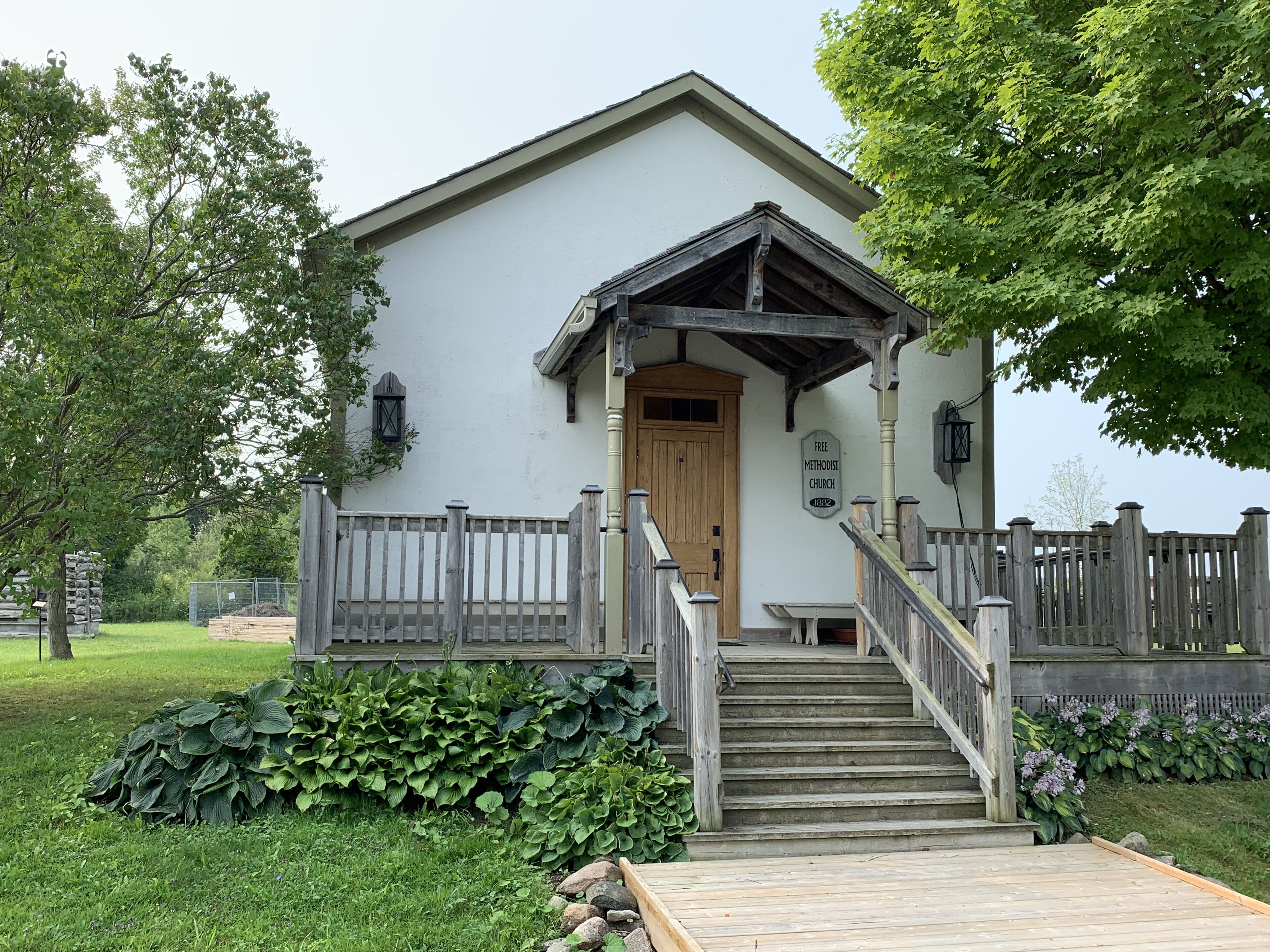
Prior to 1884, there were several Methodist Denominations that competed for the same adherents. The Primitive, Wesleyan, Episcopalian, and New Connexion all united as simply The Methodist Church leaving only the Free Methodists as a separate denomination. The Methodist Church in the Pioneer Village is believed to have started life as a Wesleyan Methodist Church in Elm Grove around 1871. When it closed, the Free Methodists bought the building and moved it across the street. They met there from 1887 until 1925 when they joined with the newly created United Church of Canada. The oldest continually serving Free Methodist Church in Canada continues to hold services in Armadale. You can read about it in our feature Armadale Free Methodist Church.
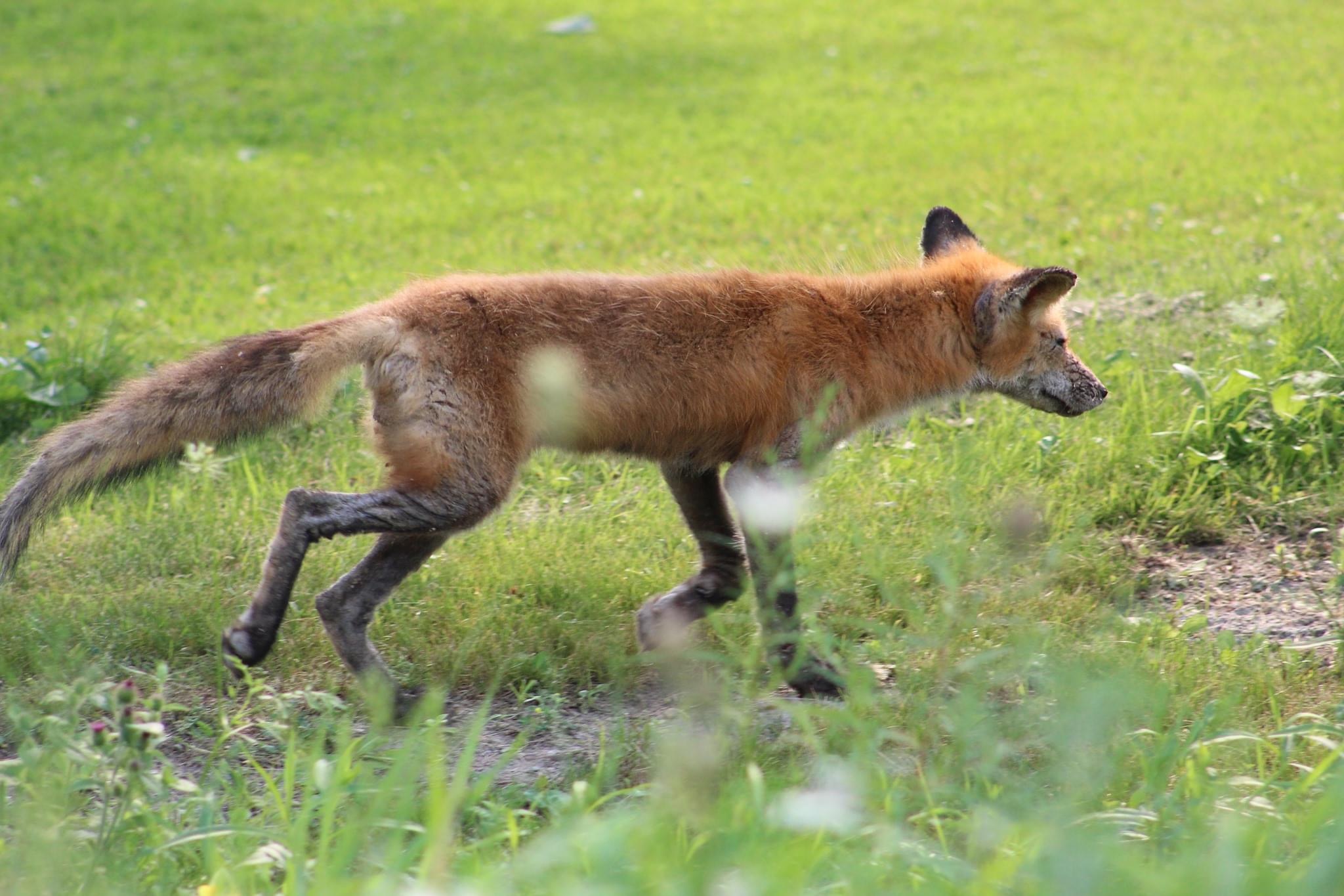
Just north of the Pioneer Village on Civic Centre Drive is the Georgina Animal Shelter. As I was driving past the laneway I saw a very skinny fox which was likely suffering from mange. It was running along the side of the road and looked very ill and terribly skinny. Its eyes were almost crusted closed and it looked like it would have a hard time capturing food. I was able to alert the animal shelter of the fox and hopefully they were able to have it caught and treated.
There’s no doubt that this is just a teaser of all the things to be seen in the Town of Georgina. It’s well worth planning a day trip to enjoy the area for yourself.
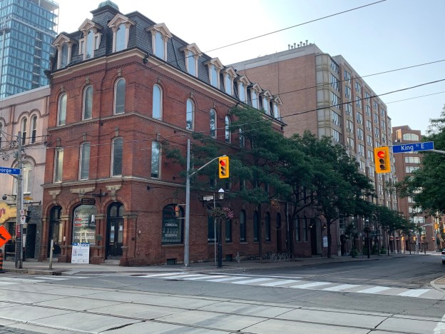
During the 19th century a horse and carriage was the primary mode of transportation and travelers had to have a place to keep them at the end of their journey. Hotels and inns were built at convenient distances apart for thirsty horses to get water and fodder and their owners to grab an ale. Almost every hotel had a stable and coach house and while many of the hotels remain there’s very few of the out buildings left standing. There’s only one coach house and stable left in the ten blocks that make up the historic Town of York (now Toronto). In spite of its uniqueness, a developer wants to tear the last one down to make way for a 17-story condominium.
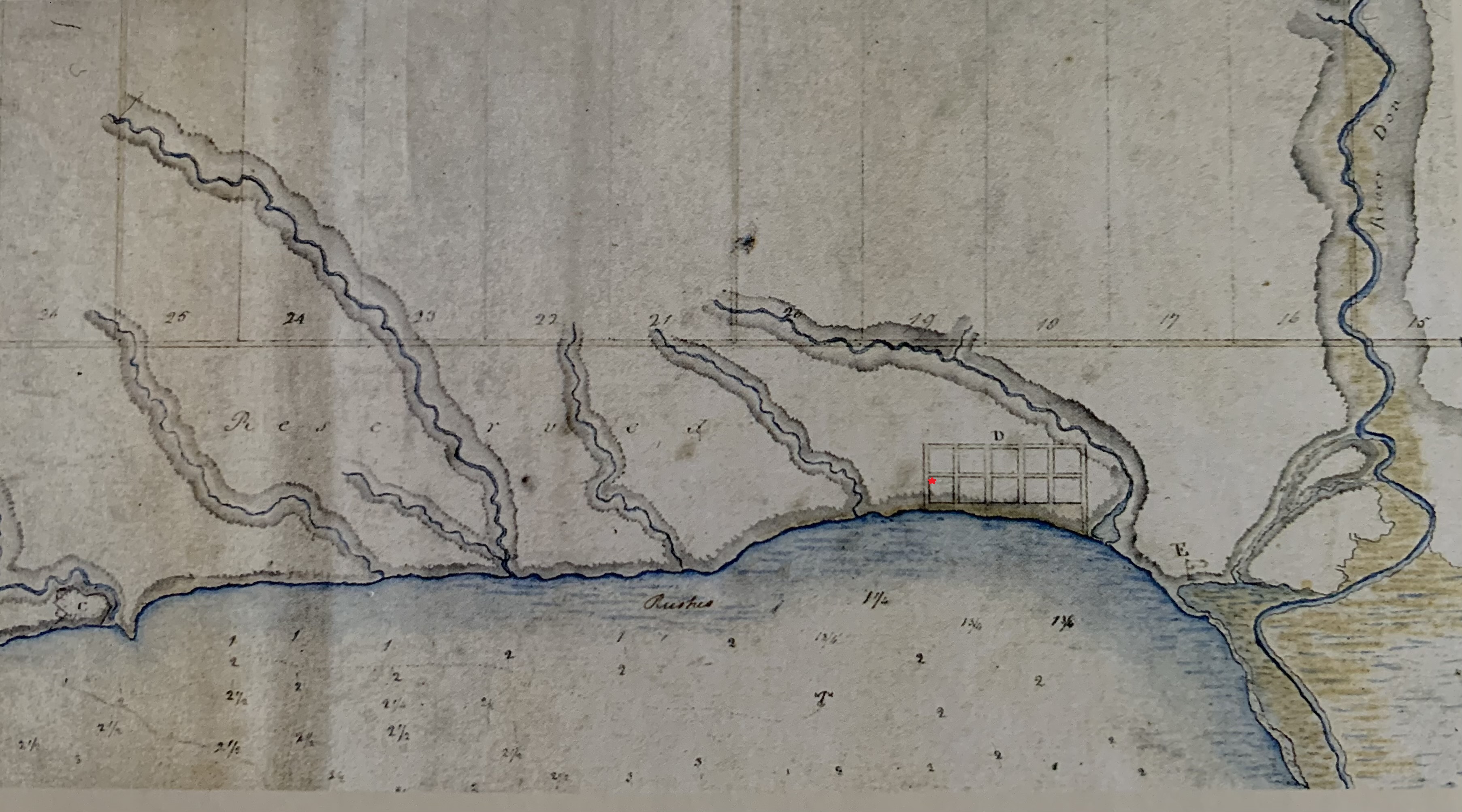
This 1793 map shows the original plan for the Town of York. The Don River is shown on the right hand side of the map and Fort York is in the lower left corner. The fort is labelled as “C” and is nestled between Garrison Creek and the lake. The town plan is shown right on the harbour, which reveals how much infilling the lake has seen over the years. The site of the Little York Hotel is shown at the South-East corner of King Street and George Street and marked with a small red star.
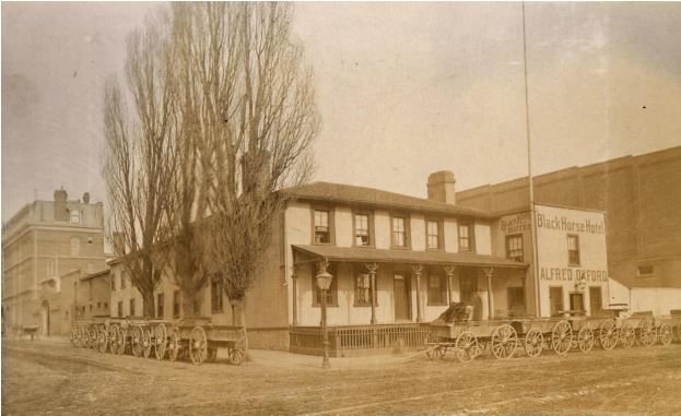
The archive photo below is from 1885 and shows George Street looking north toward King Street, The Little York Hotel was just 5 years old at the time and is in the lower left corner of the picture. Just behind it you can make out the arch of the carriageway on the stables and coach house.
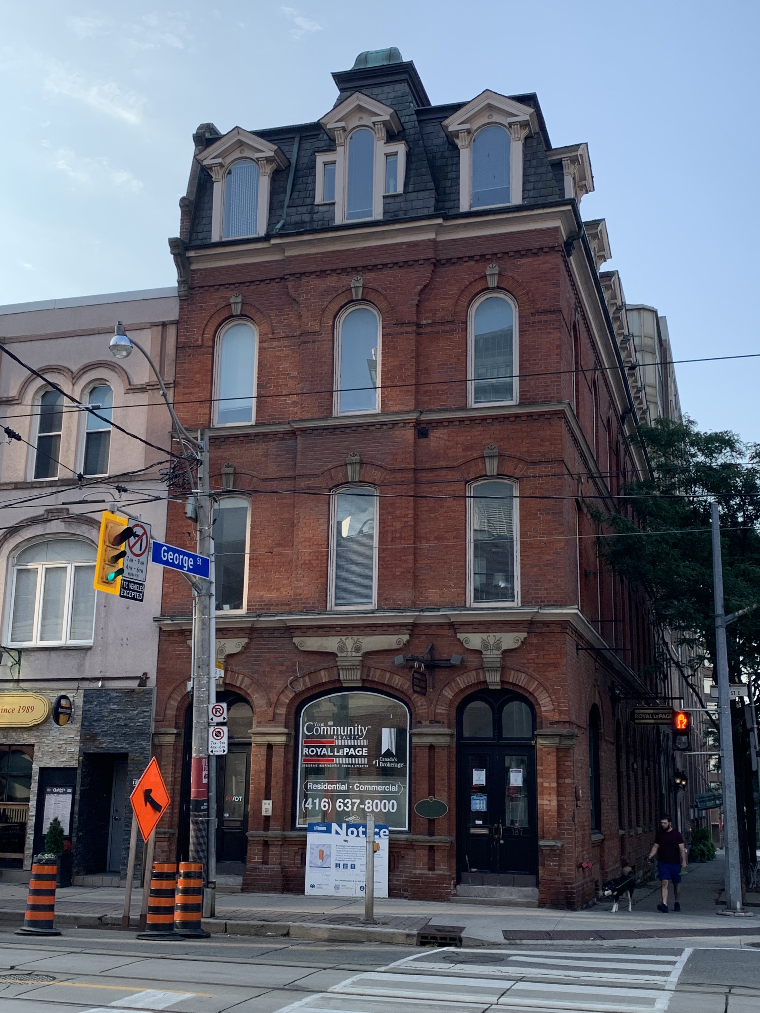
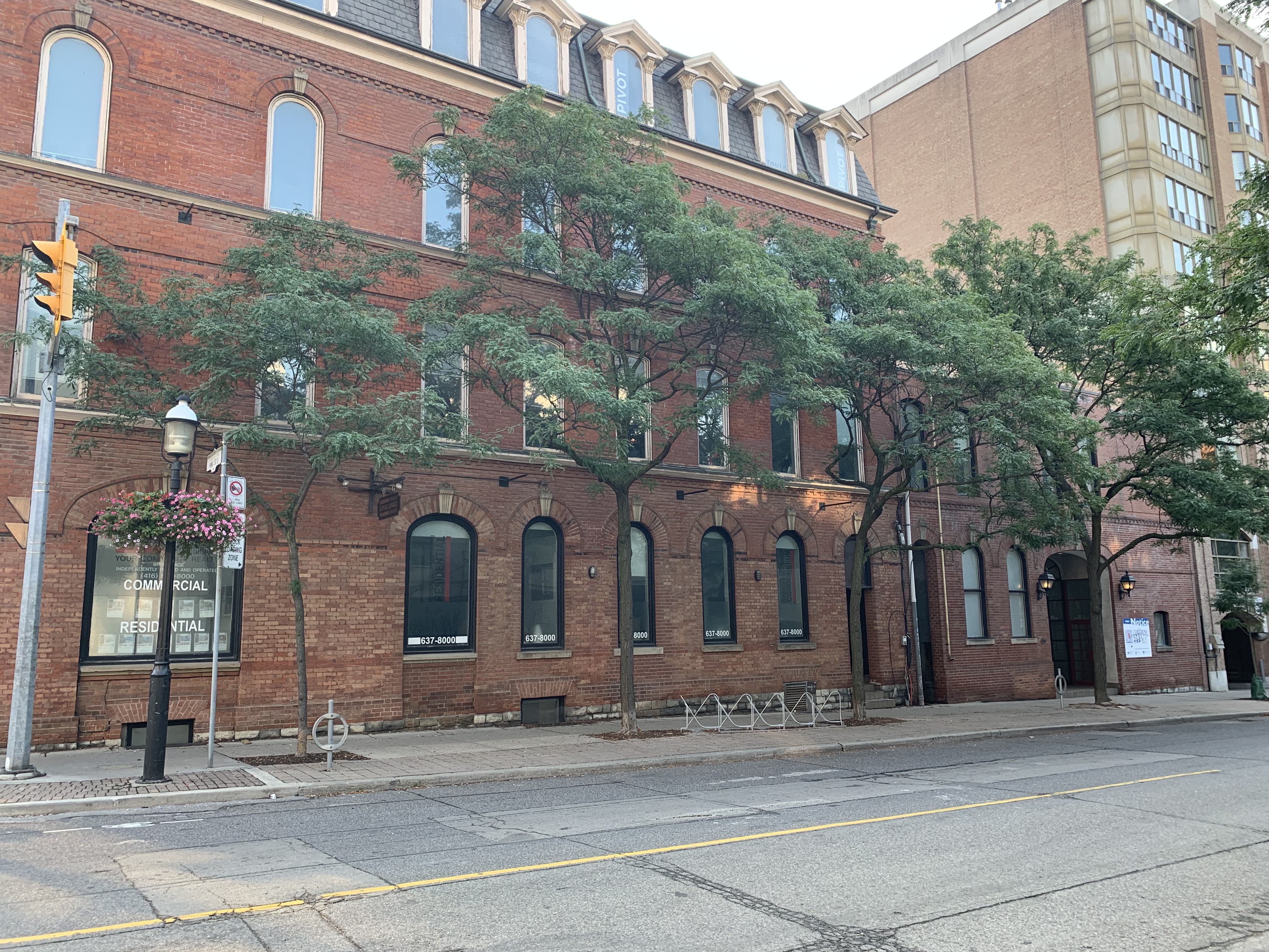
The site of the building is Lot 20 on the original town plan and it was patented to Richard Beasley in 1805. Beasley quickly sold it to Rev. George O’Kill Stuart who opened the Home District School there and operated it from 1807-1817. George Duggan bought the school in 1817 and turned it into a tavern. Over the next 62 years it was the site of taverns, hotels, a grocery store and even a furniture store. In 1879 Robert Waterhouse bought the property and put out a tender to build a new hotel. In May the local architectural firm of Langley, Langley & Burke began contracting the construction of the four story hotel in the Second Empire style that they were using on several other buildings around town at the time. Unfortunately, all those other buildings have been demolished already leaving this as the sole survivor. The three brick buildings to the east of the hotel on King Street were built by Waterhouse in 1882 to replace older wooden structures that had been condemned. The masonry and windows were designed to compliment those of the hotel. While the building beside the hotel sports a coat of pink paint, the hotel and stables were eventually covered in blue paint.
The building is clad in brick and has cast stone masonry over the doors and windows. Each of the windows in the hotel and carriage house has a key stone with intricate carvings on them.
In 1880 a coach house and stables were built on the south end of the property behind the hotel. Although just two stories in height, it was constructed with windows and brickwork to match the hotel. The hotel was sold to Robert Davies in 1885 and he rented it out to tenant operators who ran it as Little York Hotel and the York House. In 1900 it was renamed York Hotel which it operated as until 1925.
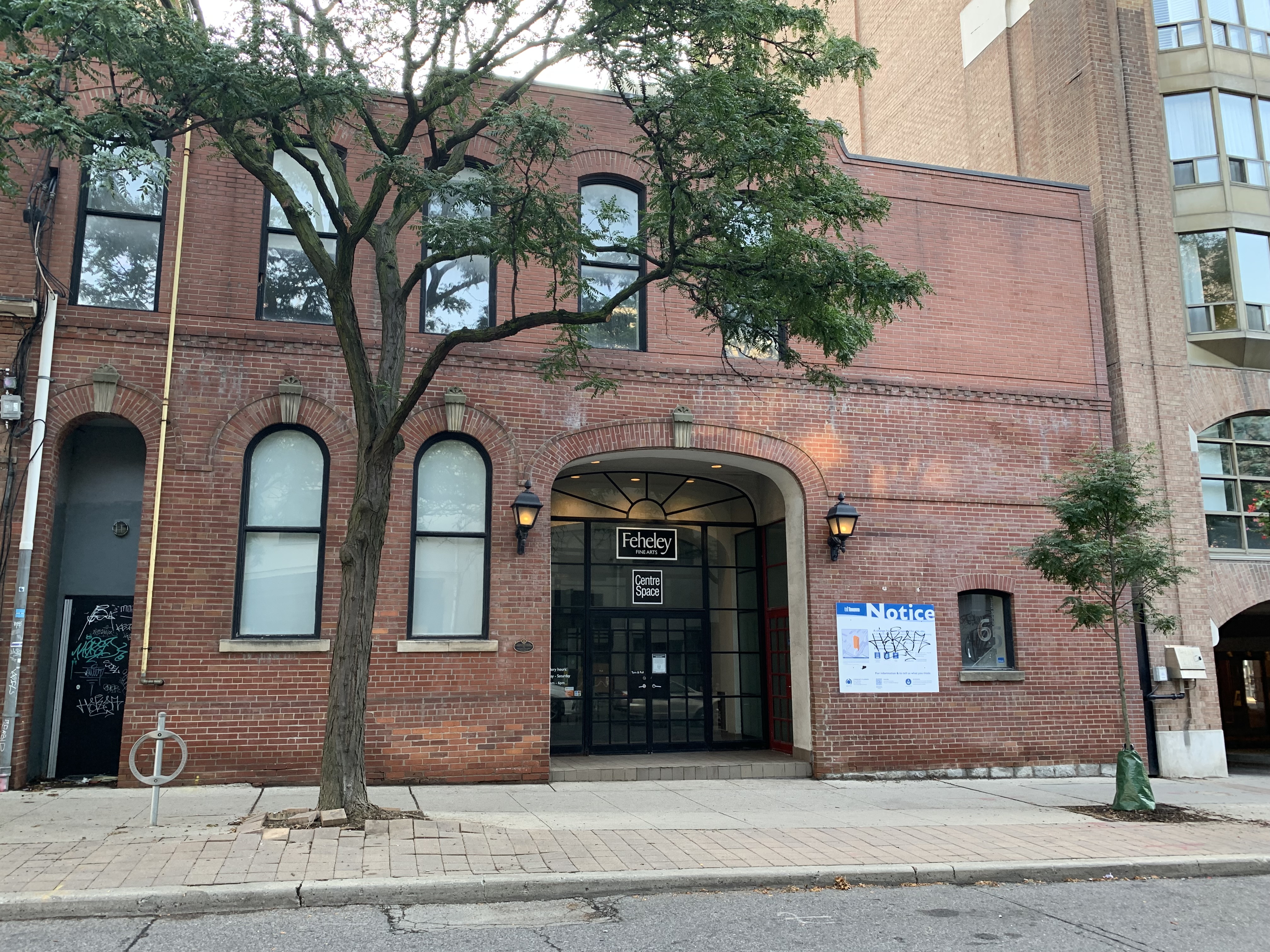
Like the hotel, the carriage house has decorative brickwork in the form of a string course above the windows, highlighted by a dentil course. The ground floor of the coach house had a place to store coaches and tackle for the night as well as stables for the horses. The second floor was used for storage of hay. Between 1892 and 1899 Dr. Alfred Asa Brown leased part of the stables for his veterinarian practice. In those days vets only really worked on horses and this was the perfect location. Starting in the 1920s a series of express and transport companies occupied the stables. Like the hotel they were also painted an ugly shade of blue, but that was stripped off in the 1980s. Today the stables are occupied by an art shop. The large entrance for carriages has been given a recessed glass doorway and the window on the left in the picture below has been extended to form a second doorway.
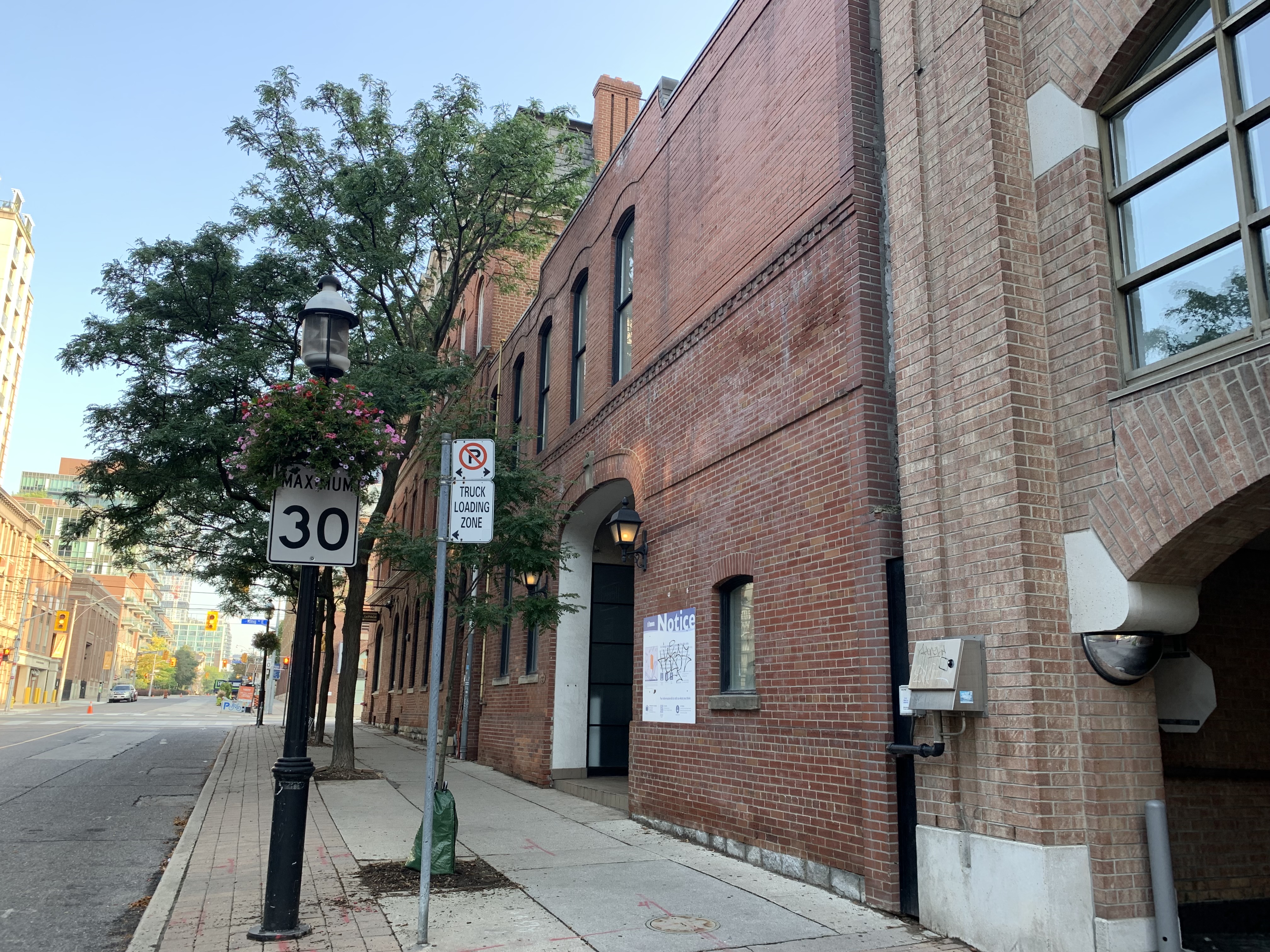
Looking from the south you can see the Little York Hotel Carriage House and Stables, the last remaining building of this type in the old Town of York. Very few remain in the city, but a stone carriage house still stands on the property of Sunnybrook Hospital and it is featured in our story Bayview Estates.
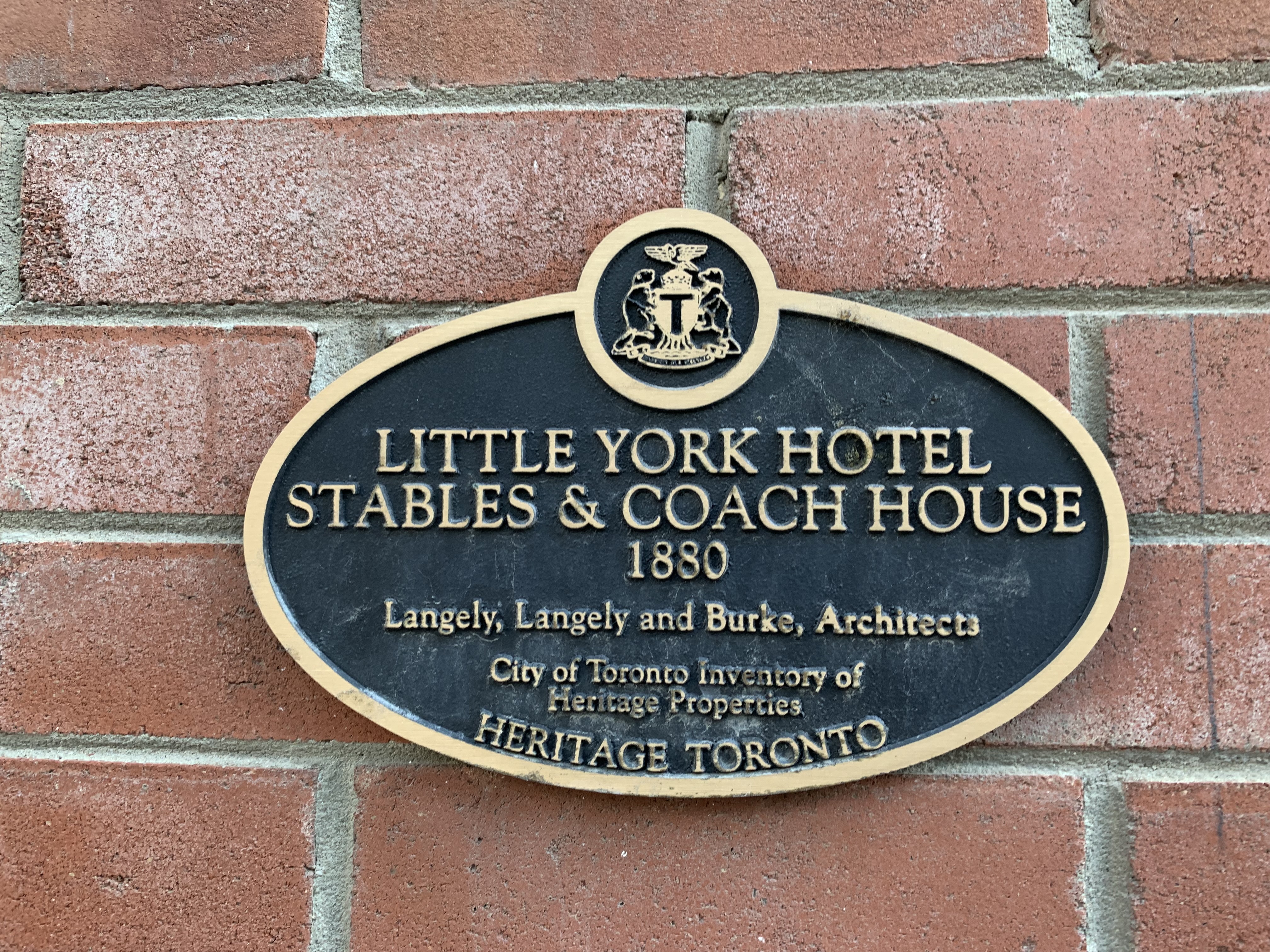
In 1973 the hotel was listed on the first Toronto Heritage Register while the stables and coach house would have to wait another eleven years to be listed. Then, on April 21, 2017 its very existence came under threat as a 17-story condo was proposed to replace the stables and coach house. To their credit, the city unanimously rejected the proposal. With the developer refusing to back down the city moved to designate the property under the Ontario Heritage Act. Designation, unlike the previous listing, allows the city to refuse demolition and limit alterations to the building. So, the developers have appealed to the Ontario Municipal Board who will pass a final judgement on the development proposal. The only question is whether or not the OMB will agree that the building merits the heritage designation. As recently as August 3, 2021 the city made its defense of the heritage designation to the OMB. That hearing was adjourned without making a judgement in this case. The building still proudly sports its 1984 heritage plaque while it waits to see if the city and the public win or if the last standing stable in the old town will give way to 16 condo units.
We’ll see what happens over the next few months but at least city council took a stand and defended this cultural link to our travel and transportation heritage.