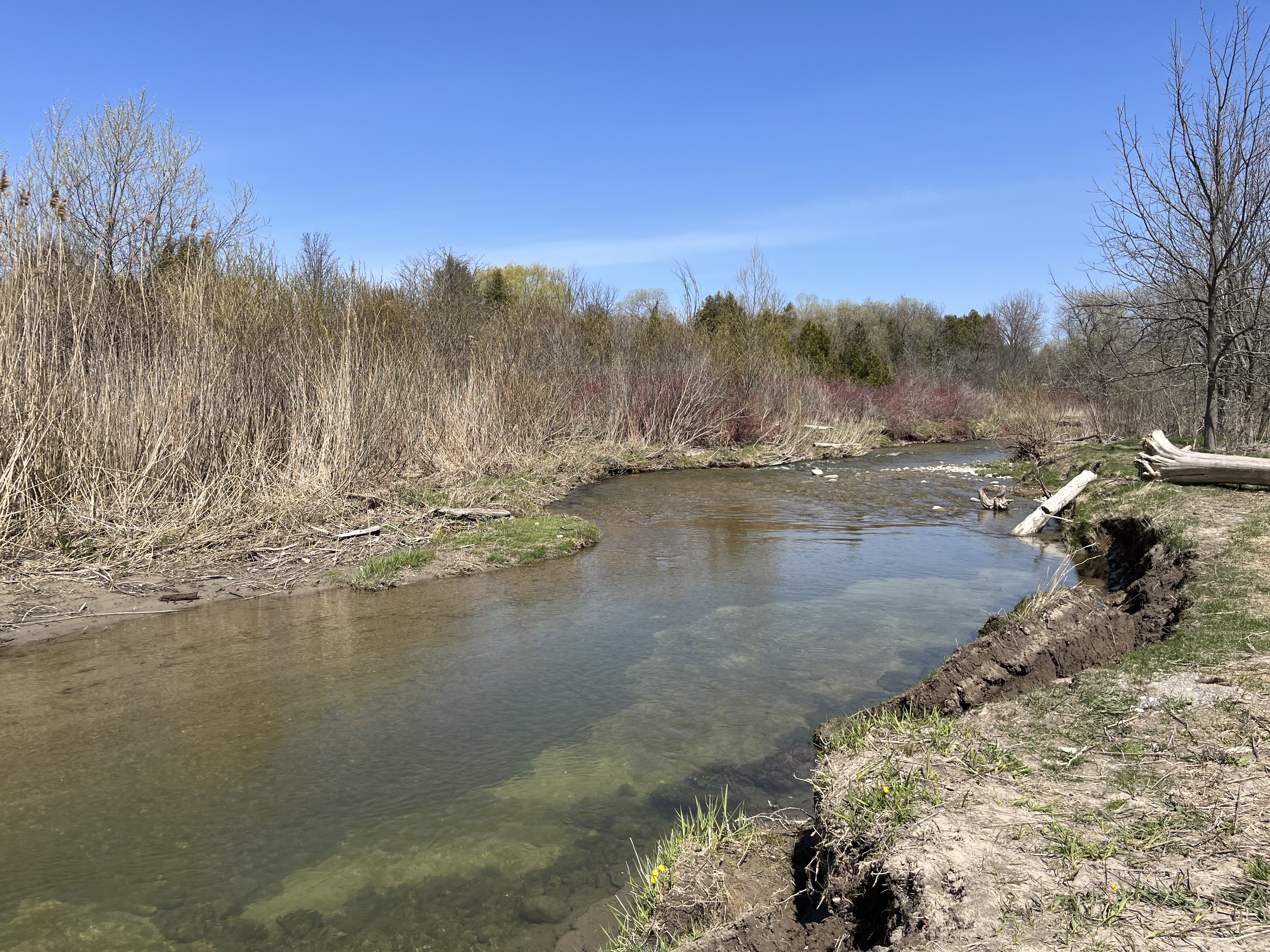
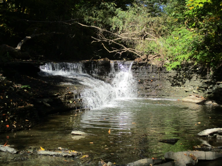
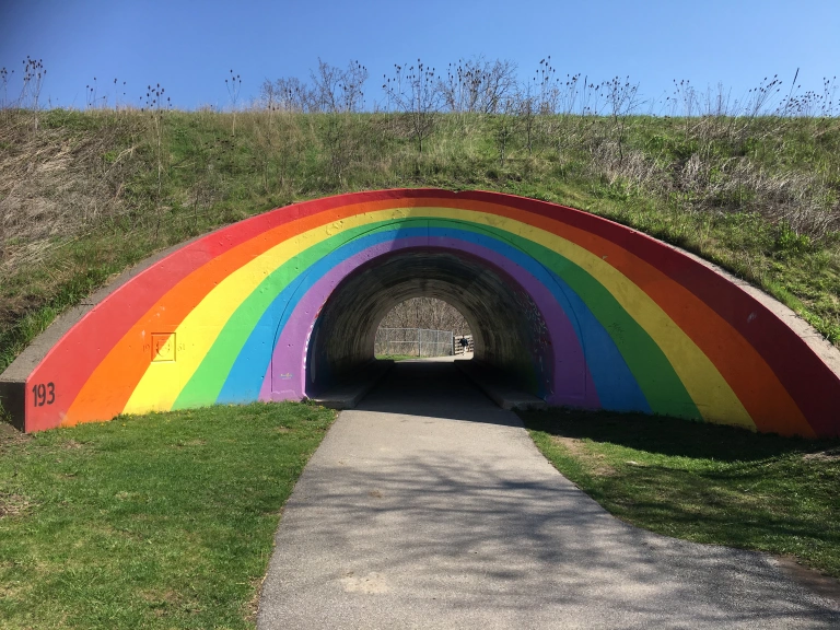
Bowmanville Creek has a long history of industrial use but has lately been converted into an area full of walking trails. I parked in a small parking lot on the north side of Baseline Road West near Hunt Street to check out the newly opened Bowmanville Valley Trail Extension. While the main trail heads north along Bowmanville Creek, I took the one that follows the creek south toward the 401. I wanted to check out the new section as well as the old railway bridge from the former Goodyear Plant that carried a spur line to the Canadian National line below the highway.
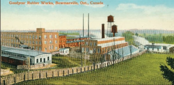
Charles Goodyear discovered the process for vulcanization of rubber in 1839. This process uses sulfur to harden natural rubber into various products. As the automotive age was dawning, a company was founded in Akron, Ohio in 1898 which was called The Goodyear Tire & Rubber Company. By 1907 they had a contract with Henry Ford to provide tires for the Model T. In 1910 they bought a rubber company in Bowmanville and expanded their manufacturing outside of the United States for the first time. The old postcard image below shows the plant in its early days.
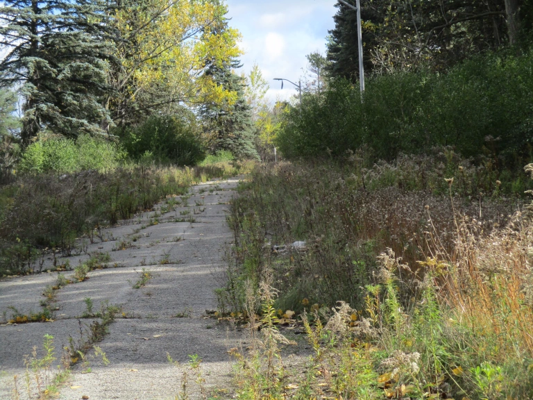
Goodyear built a spur line down Hunt Street to connect to the CN railway into Toronto. The line was still in use in 1982 when the abutments were replaced but by 2000 it was abandoned. The tracks were soon removed and the portion of Hunt Street where the rail lines ran has been repaved, hiding all evidence of its route. The steel bridge remained in place until the Bowmanville Valley Trail Extension was developed at which time it was removed.
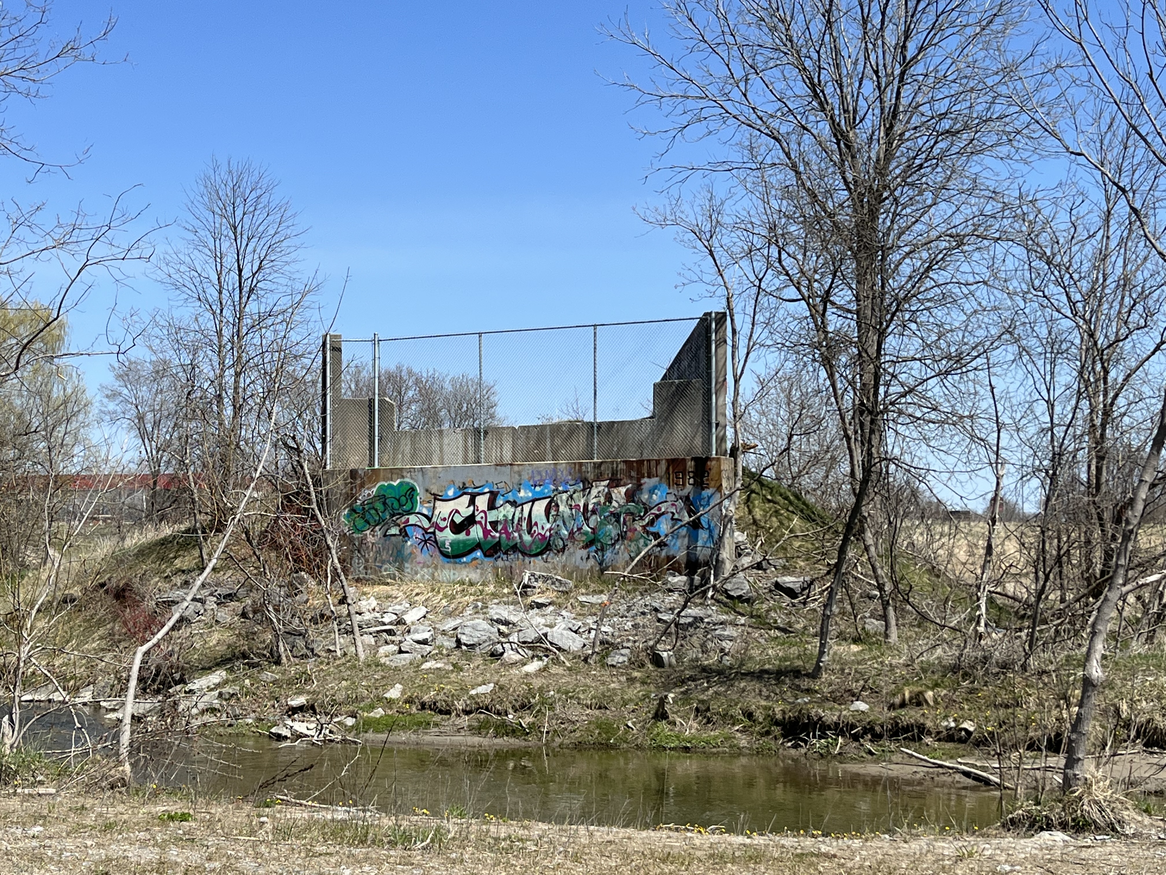
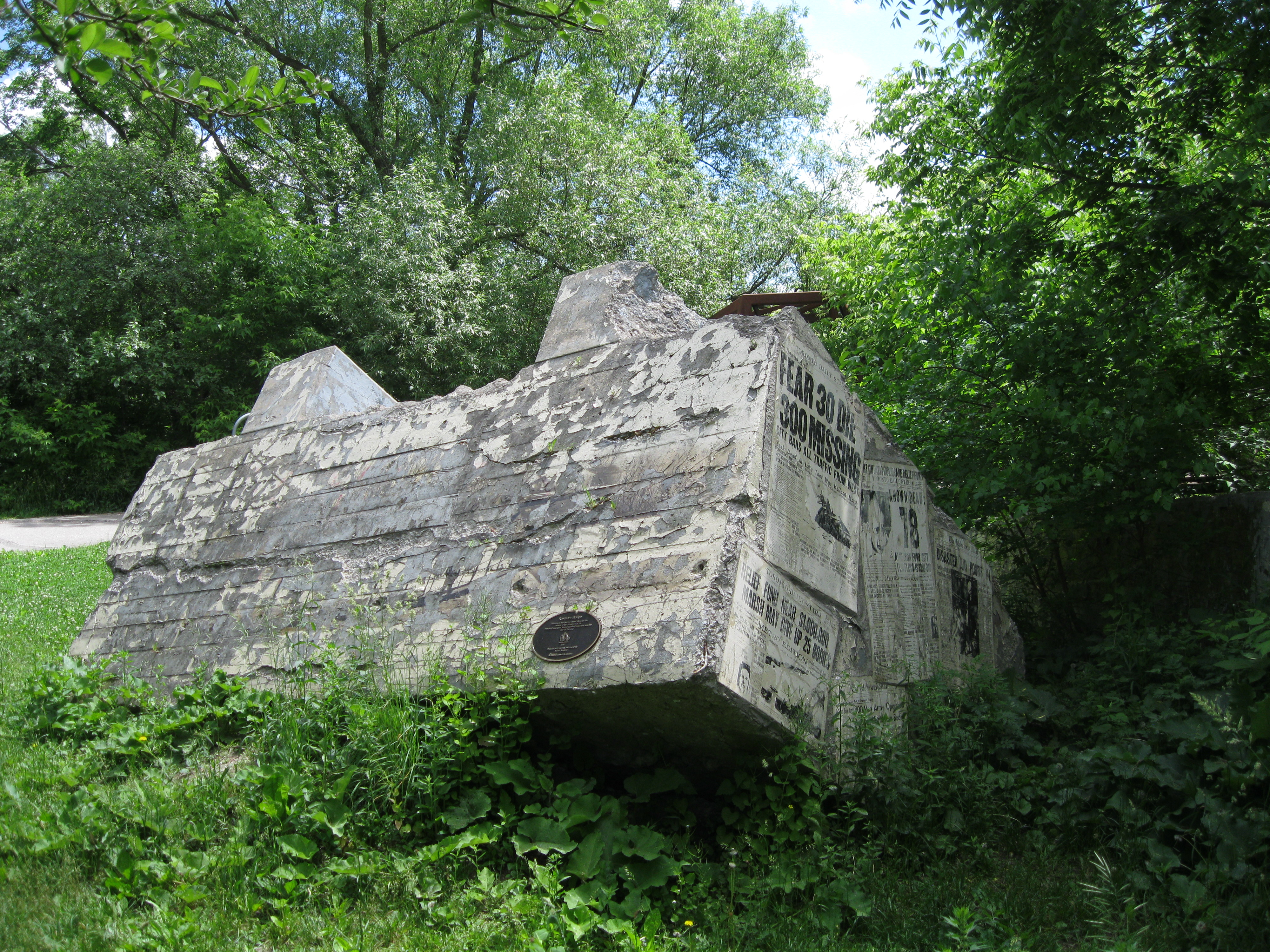
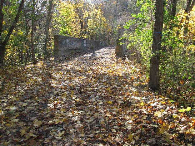
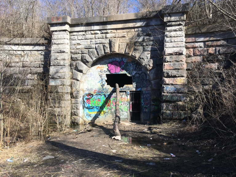
Returning to Baseline Road I crossed the creek and followed the former right of way for the spur line until I came to the foundations for the bridge.
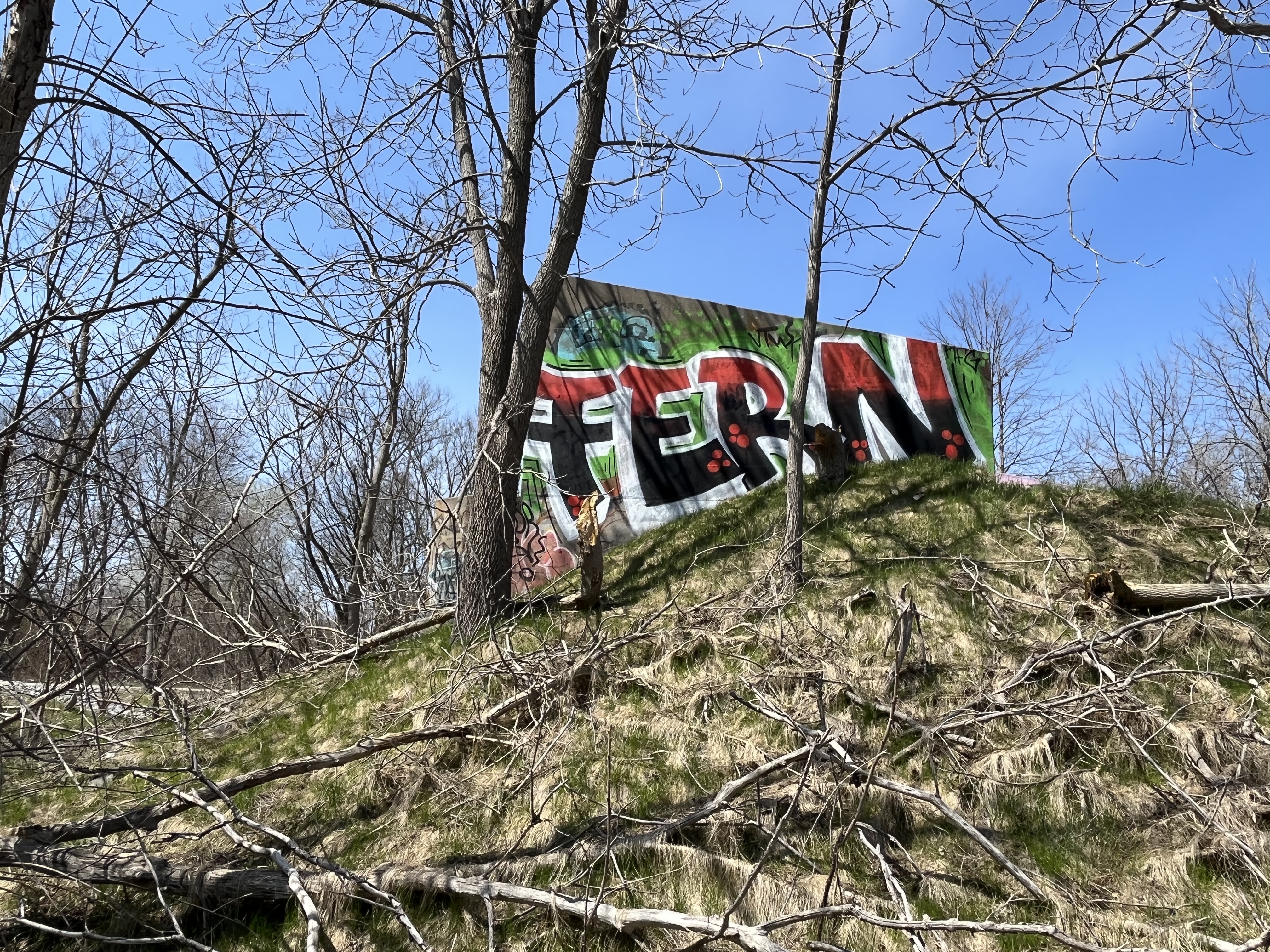
There’s not much to see from this end and looking across the creek there’s no indication of the location of the other abutment as it was removed to put the trail through. Graffiti artists have been at work on the remaining concrete and it has been painted on almost every surface.
The Bowmanville Rubber Company had started on King Street in 1898 and after changing names to the Durham Rubber Company they moved beside Bowmanville Creek in 1905. The location was chosen because it provided access to the creek to dispose of their process wastes! In those days it was believed that the solution to waste was to dilute it with running water. No wonder every water source in the area was polluted in the 19th and early 20th century.
Goodyear built additional buildings on the site and greatly expanded the business by connecting it to markets with the rail line.
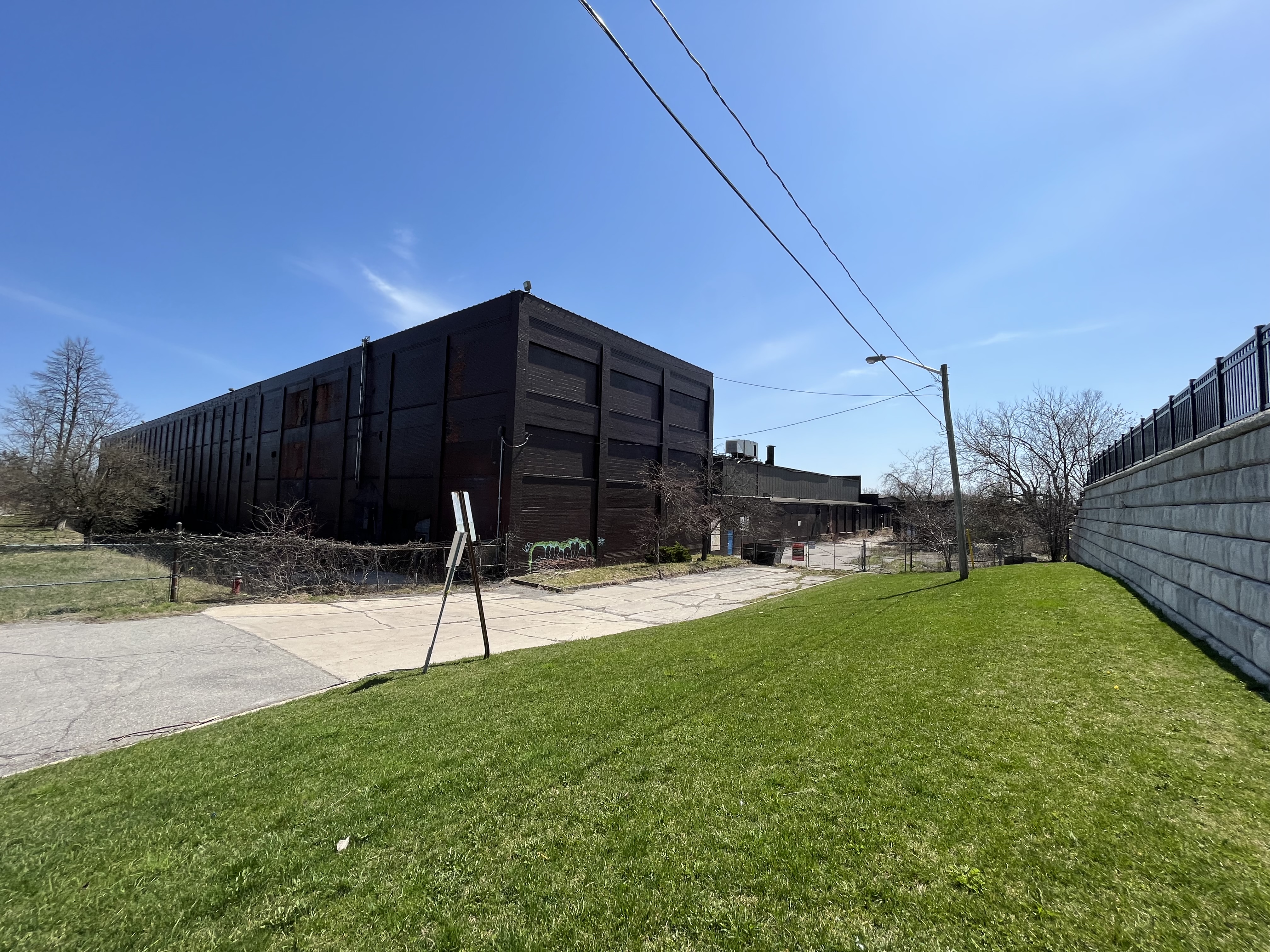
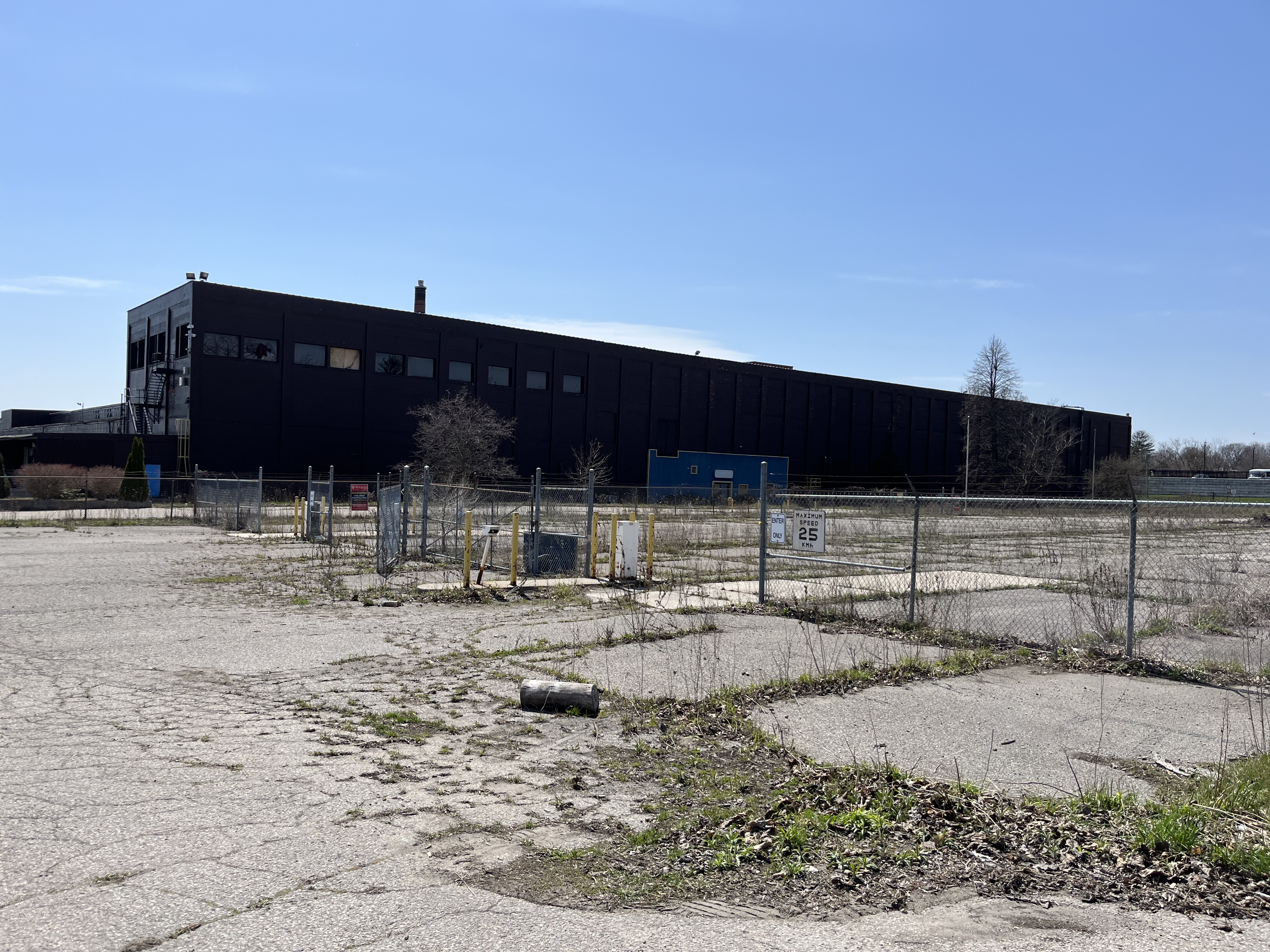
The plant operated under several names over its year history of over 100 years. After Goodyear, it became Veyance Technologies and later ContiTech Continental. Under the latest name it produced conveyor belts for the mining, tar sands and coal sectors. With the downturn of operations for many of its customers, the plant closed in 2016. Today the building sits empty awaiting its destiny, most likely demolition for the construction of a subdivision.
There’s lots more to explore along Bowmanville Creek and another trip will likely happen in the near future to see what lies along the trail to the north.
For a listing of our 50 most popular stories check out Back Tracks
Hiking the GTA was founded in April 2014 and this post marks our eighth anniversary and our 553rd post. To celebrate, we’re presenting our top 50 posts as determined by the number of times the story has been read. You can click on either the post title or the picture caption to be taken to the original post, each of which is about a five minute read with 10-12 pictures. Each one also has a Google Maps link so that you can find it for your own exploration. How many have you been to and how many are going on your “places to visit” list? Have a look and see.
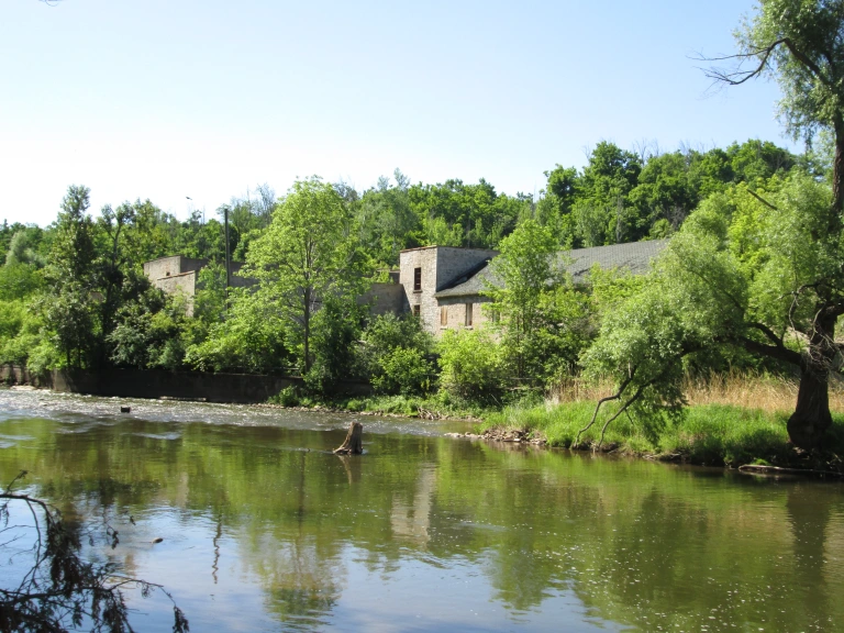
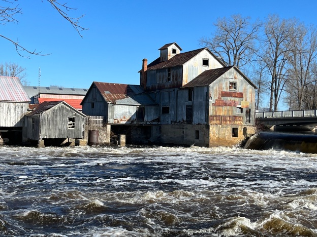
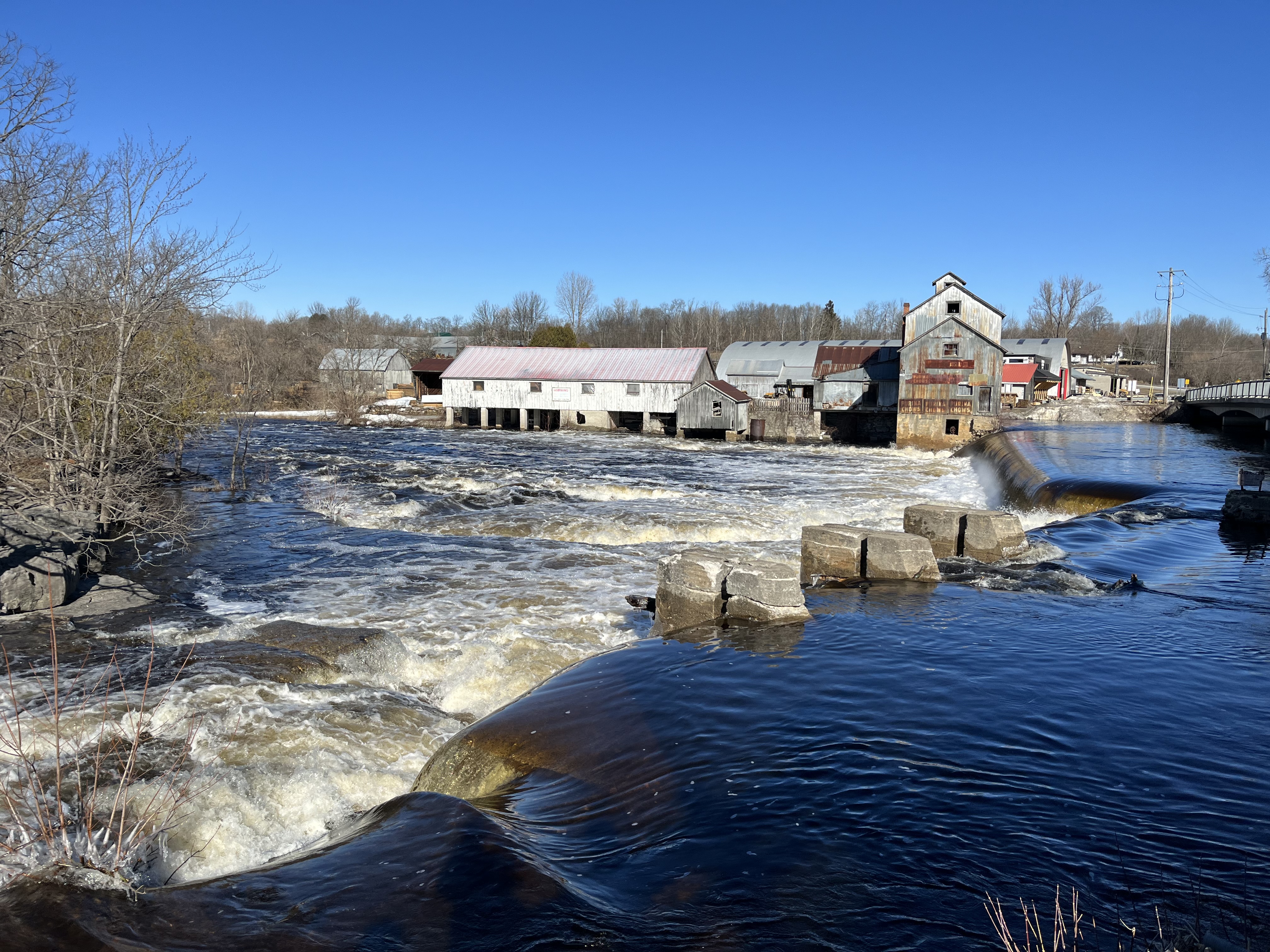
One of the most scenic mills in Southern Ontario is the Chisholm Mill in Roslin. As my work now carries me into this part of the province on a regular basis I look forward to exploring some of the local sights and sharing them with everyone. Perhaps, over time, we’ll be able to provide a little more content for those who live “around the GTA”.
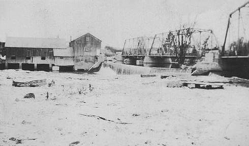
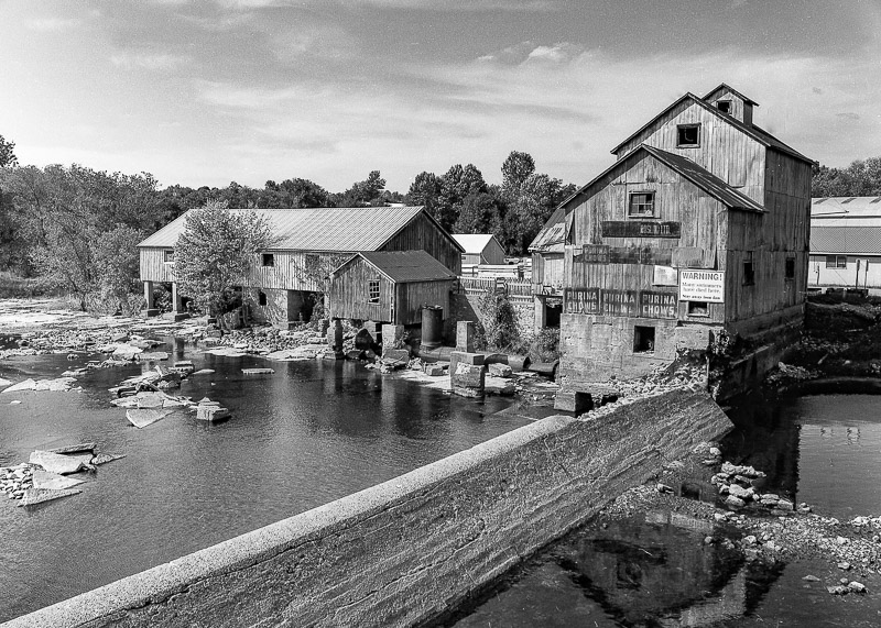
The original mills on the Moira River in Roslin were known as Shipman’s Flour and Saw Mill and were purchased in 1857 by William Fraser Chisholm. They have been in operation ever since and carry on today as Chisholm Lumber. The archive picture below was likely taken in the 1920s or 1930s based on the fact that the old truss bridge is in still place and the original frame mill buildings are present.
Six generations of the Chisholm family have operated the mill since it was renamed after them. Originally, the saw mill was kept in operation cutting logs from the Chisholm forests upstream. They would cut logs on their own property and then float them down the Moira River to the saw mill.
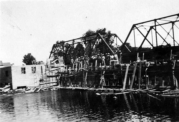
A fire broke out in the feed mill in 1944 which destroyed the building. The mill and the dam were both rebuilt with the feed mill getting a small grain elevator. The archive photo below shows the work crew standing on the old iron truss bridge that was built in the 1920s. Framing is in place for the dam and the foundations for the replacement mill are seen on the left of the picture.
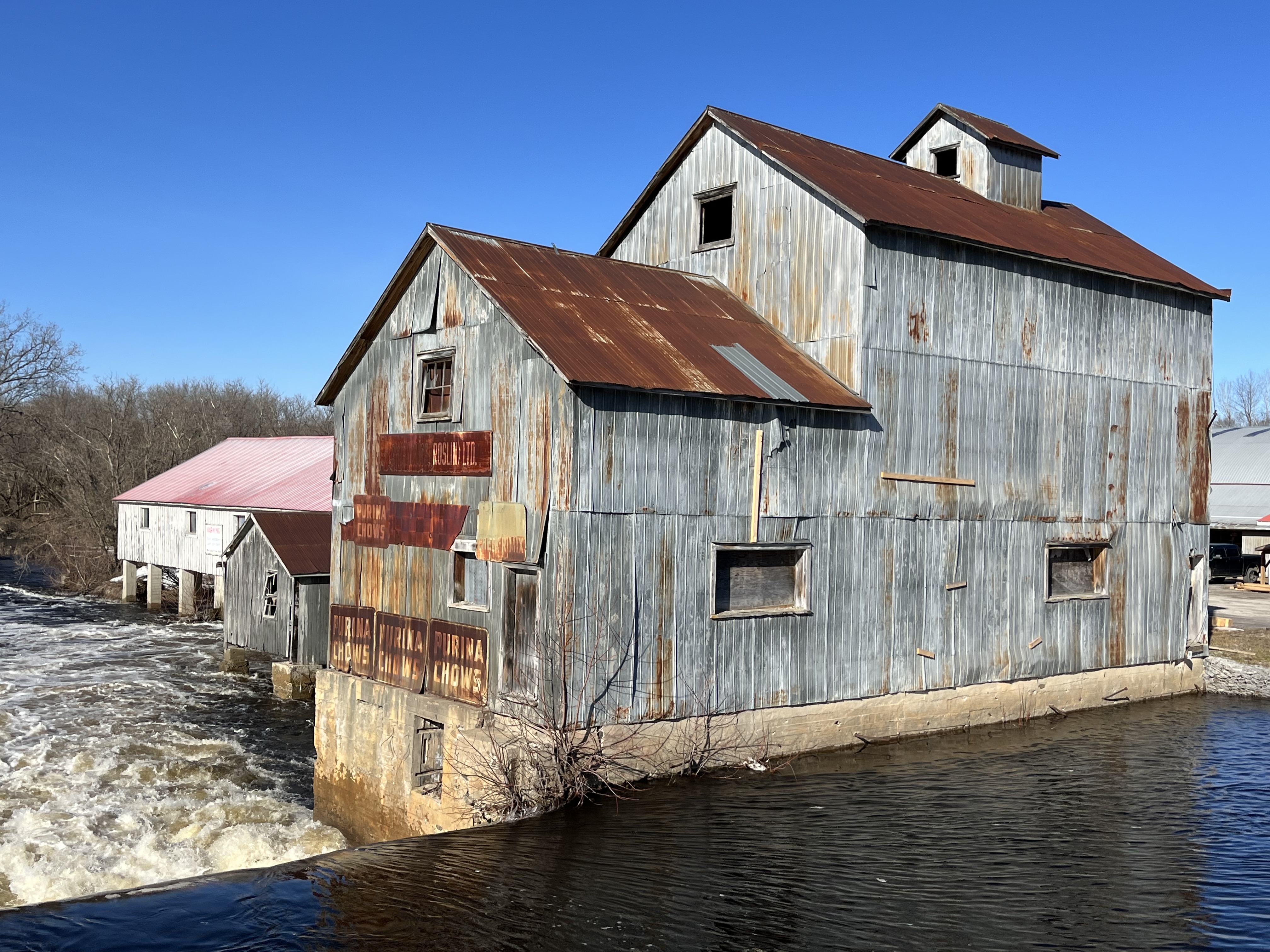
The dam and the bridge have each been upgraded several times. The first dam would have been made of an earthen berm and a wooden crib. The crib would have stretched across the river and been filled with rocks and would have needed repairs annually. Some time after 1900 the dam was replaced with a concrete one that requires much less maintenance and repairs. Earlier bridges were replaced with an iron bowstring arch bridge around 1900. A steel truss bridge was built in the 1920s which lasted for about 60 years. In the 1980s a concrete bridge was constructed and it continues to serve the mill and community. The picture below shows how the walls of the feed mill form part of the dam structure.
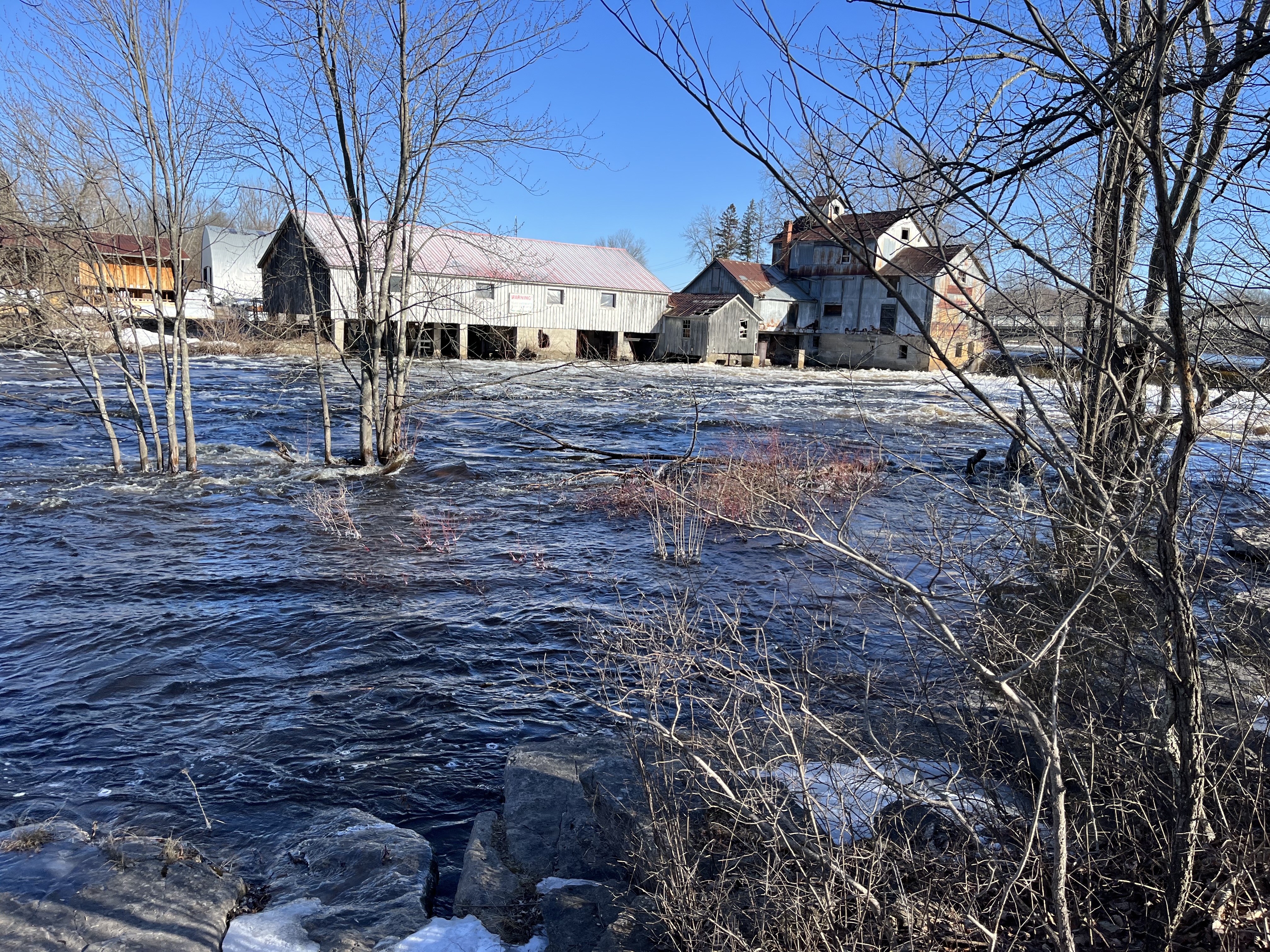
The feed mill has closed but an active lumber mill continues to operate on the site covering several acres behind the buildings pictured below.
The Moira River was in flood mode the day I stopped for these pictures and its easy to see how it could be quite dangerous in the Spring and after major rain storms.
The Chisholm family has preserved many antique pieces of equipment as well as hundreds of paintings and photographs dating back to around 1900. The three archive photos in this story were taken from their website where many others can be found. The image below is fairly recent but was taken at at time when the mill pond was drained and the back side of the dam was exposed.
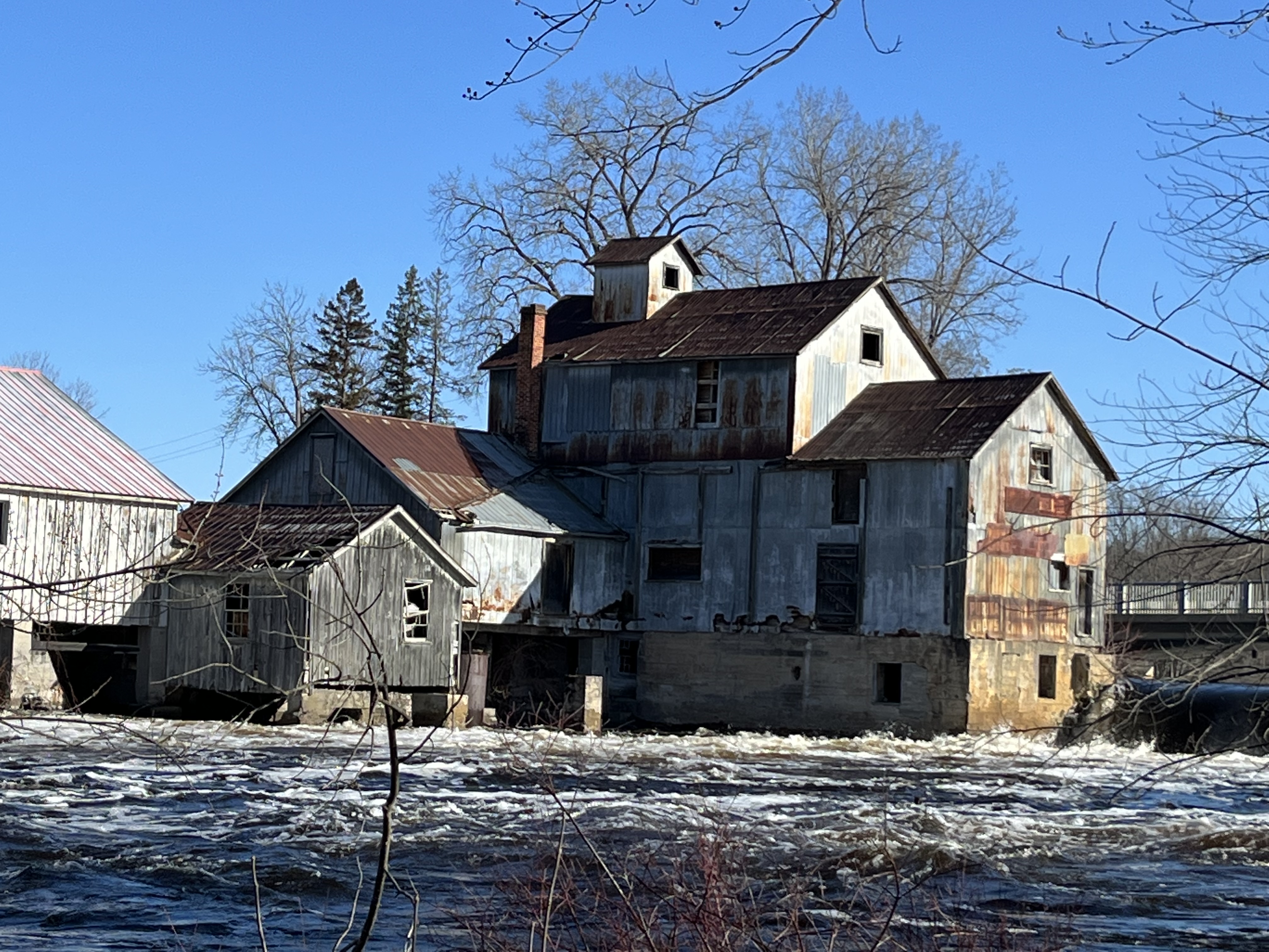
The feed mill building is starting to show signs of weather damage and some holes are appearing in the roof of the building. The Chisholms are proud of their heritage and it’s possible that they will do what is necessary to keep the buildings from falling into complete disrepair so that they don’t become lost.
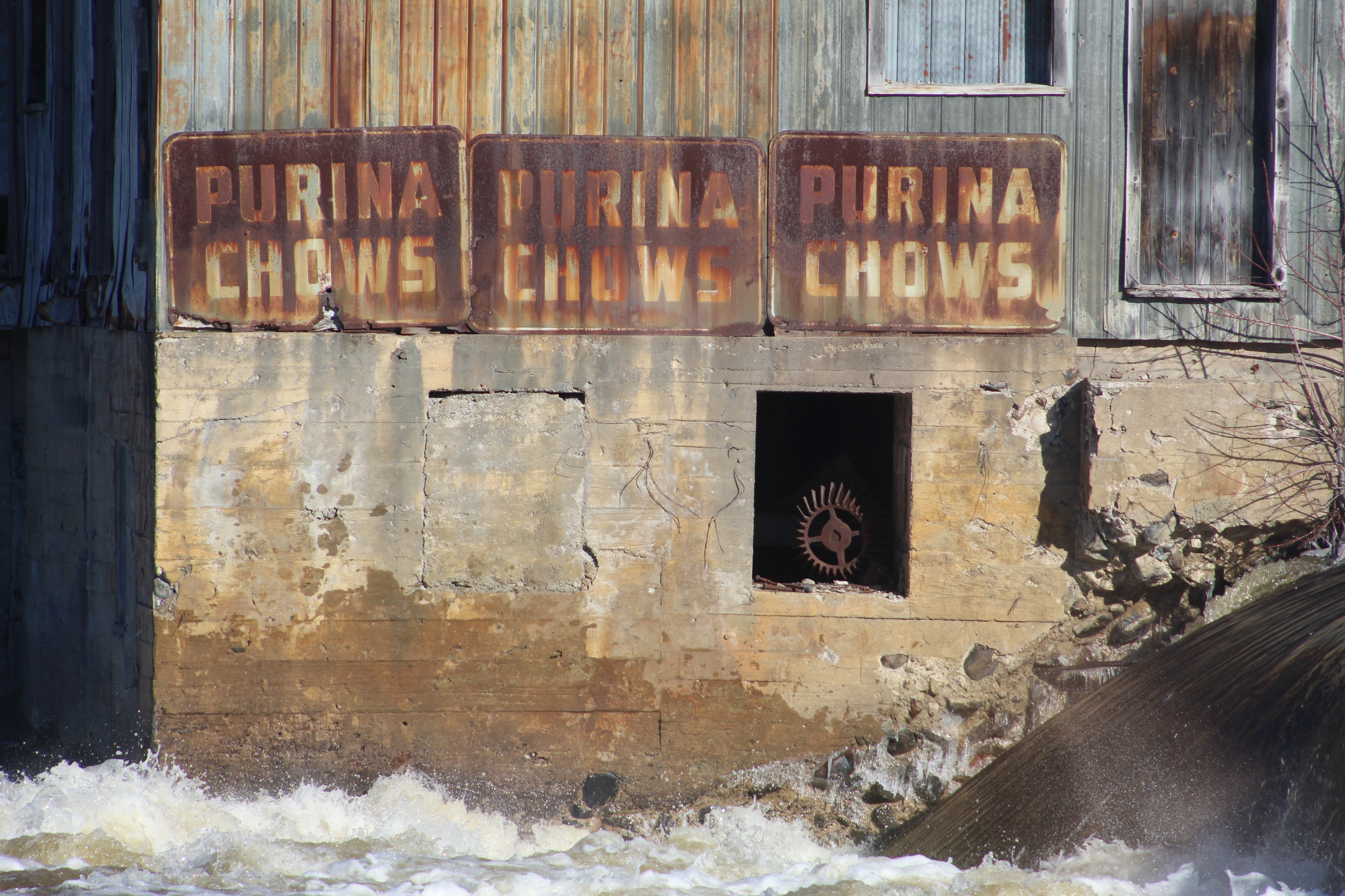
A series of old metal signs on the side of the building have been preserved as a record of the history of grinding and blending feed for the use of the local farming community. The Chisholm family has preserved the inner workings of the mill and part of the turbine system can be seen through the opening in the wall. The concrete wall of the building is showing the results of nearly 80 years of water and ice damage.
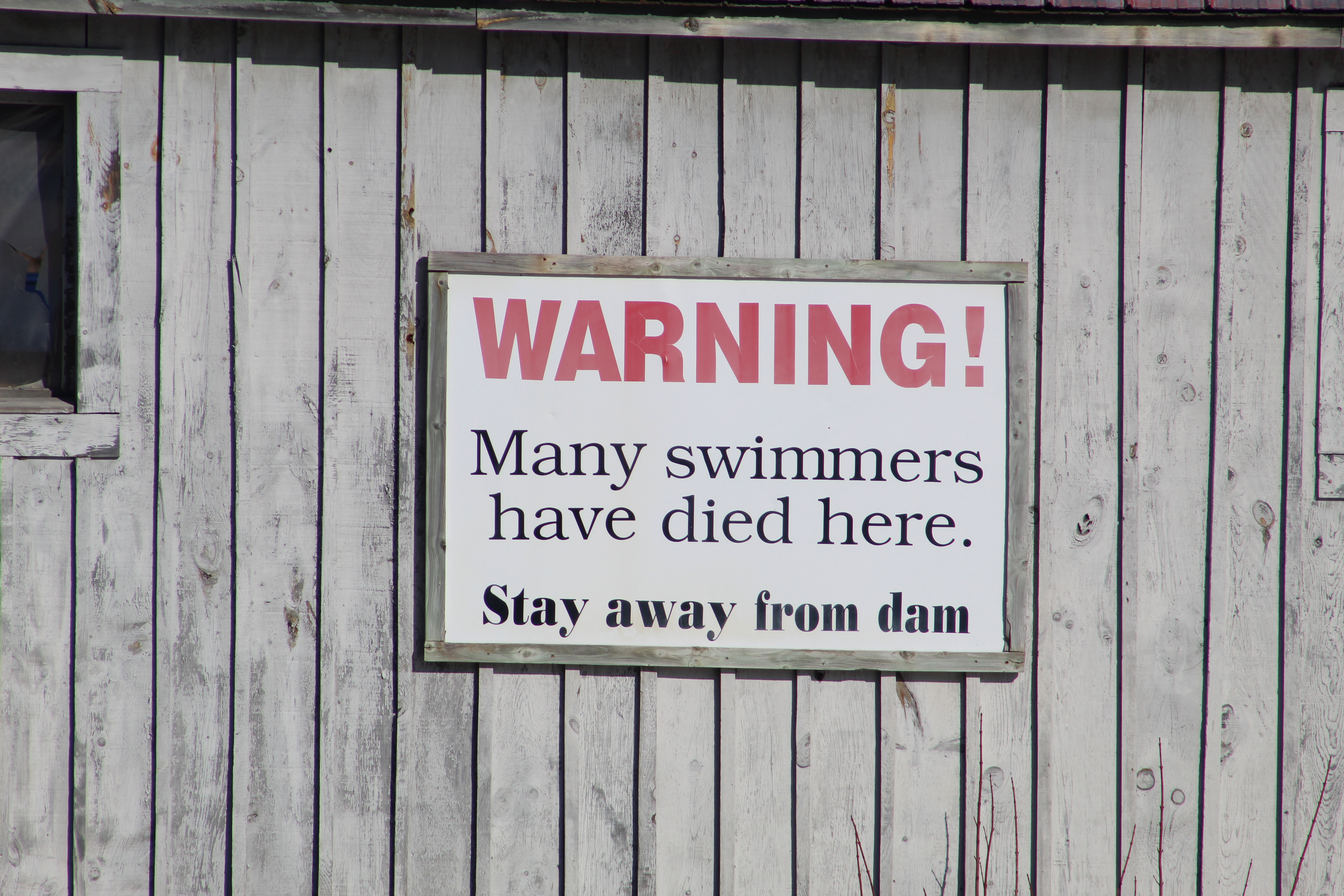
There is another sign on the building, this one warning swimmers to stay away. I notice that it has been moved since 2017 and it can be seen on the side of the mill in the archive picture above where the mill pond is drained. It is actually no longer beside the dam but the message is just as important.
This historic mill makes a great place to take a picture or sit and paint one, and it’s a beautiful scene in all four seasons.
While you’re in the area you can check out the Tiny Tweed Jail, which they claim as the smallest in Canada.
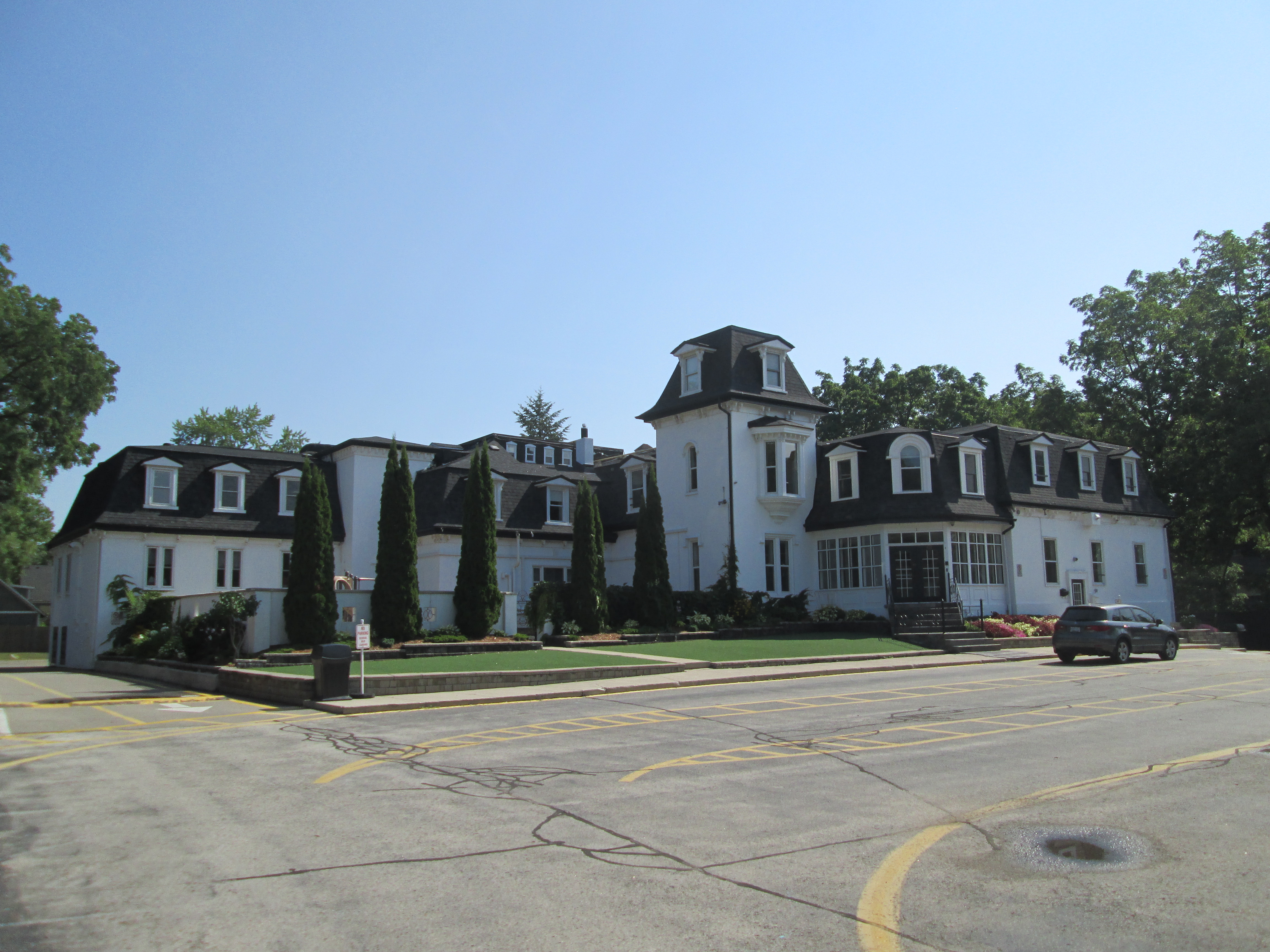
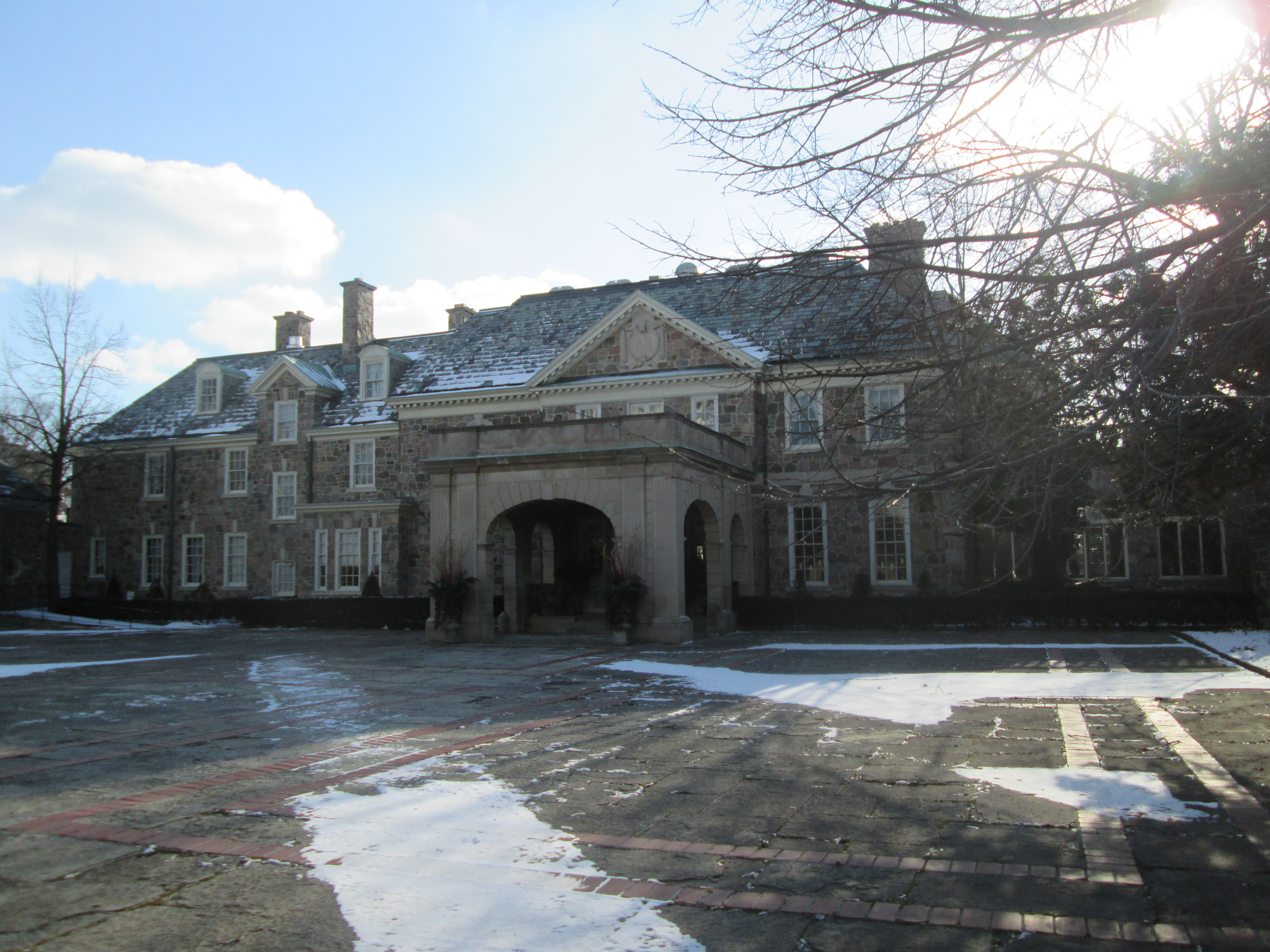
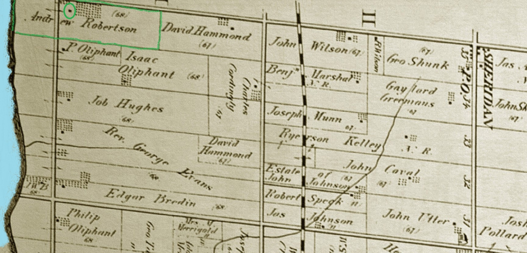
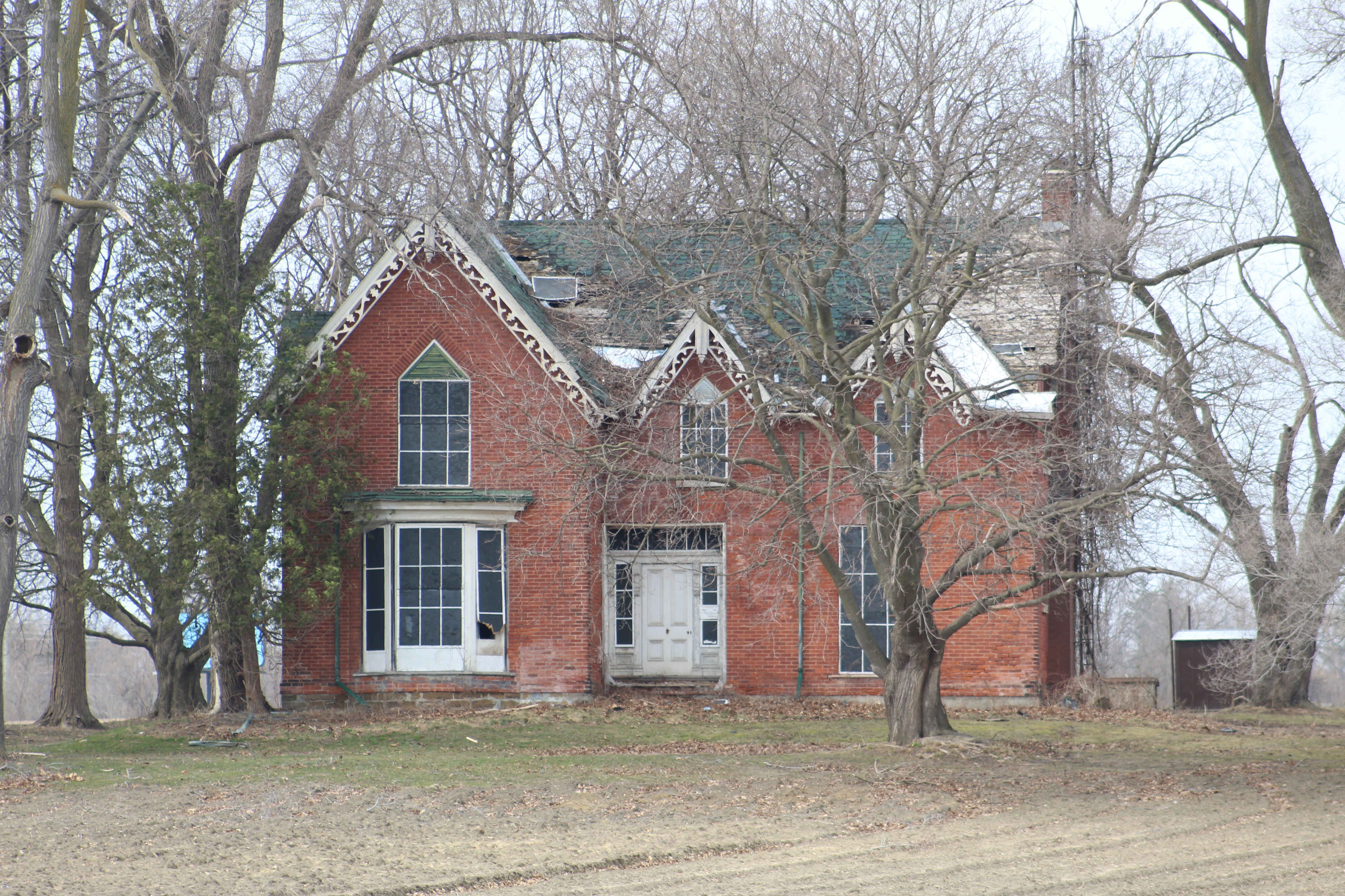
On the western corner of Mississauga stands a 171 year-old historical home that is working on becoming history. The house is located on the south half of lot 35 concession 3 in South Toronto Township which is now part of Mississauga. The lot was deeded to Henry Grant in 1808 when he met the land grant responsibilities and gained ownership of the 200 acre lot. It has a broken front, which means that it borders on the lake and there is not a straight line along the southern side of the lot. In 1851 the lot was split and sold in two halves. David Hammond had the northern section while Andrew Robertson bought the south portion including the lake frontage. The lot can be seen on the 1877 County Atlas below where it is outlined on green. The house we’re about to look at is circled in green.
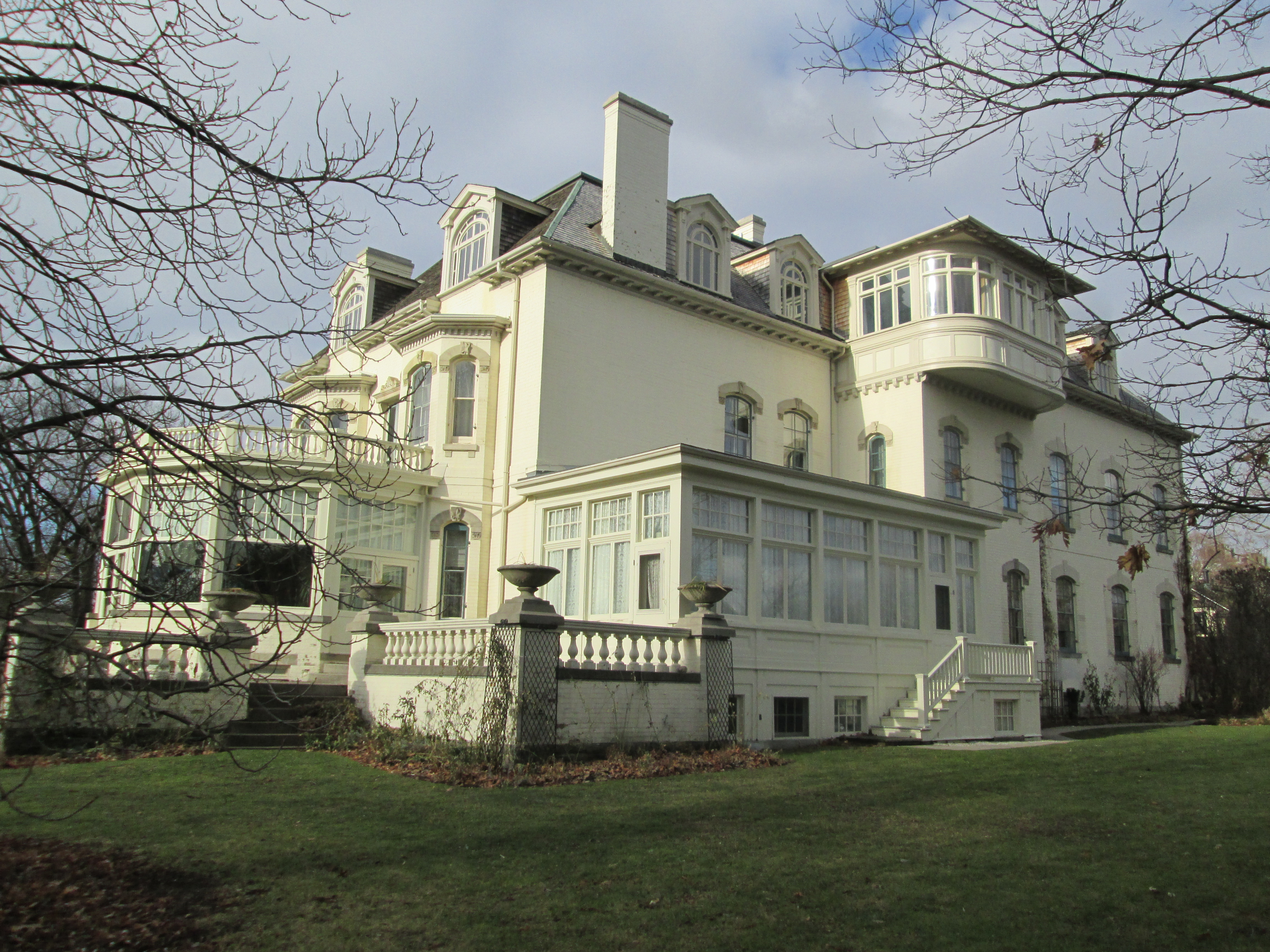
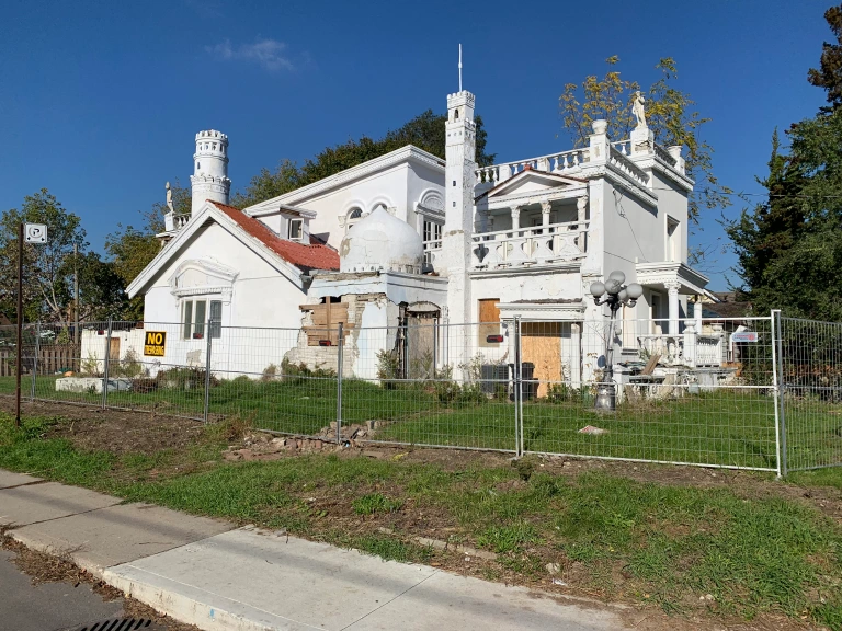
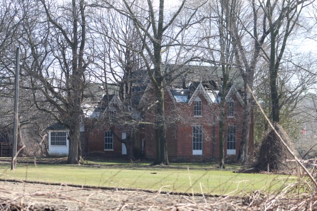
In 1851 Robertson built his family home in a grand style. While many of Ontario’s farmers in this era were building small homes, this one was a sprawling mansion by comparison. The house faces the lake and featured a trio of gables on the south elevation which each has extensive gingerbread bargeboards. Each second floor window features a triangular section on the top which is outlined by the brick pattern. This is neither the rounded arch favoured by the Italianate (1840-1890) or the pointed arch of Gothic Revival (1830-1890) architecture, but something less common.
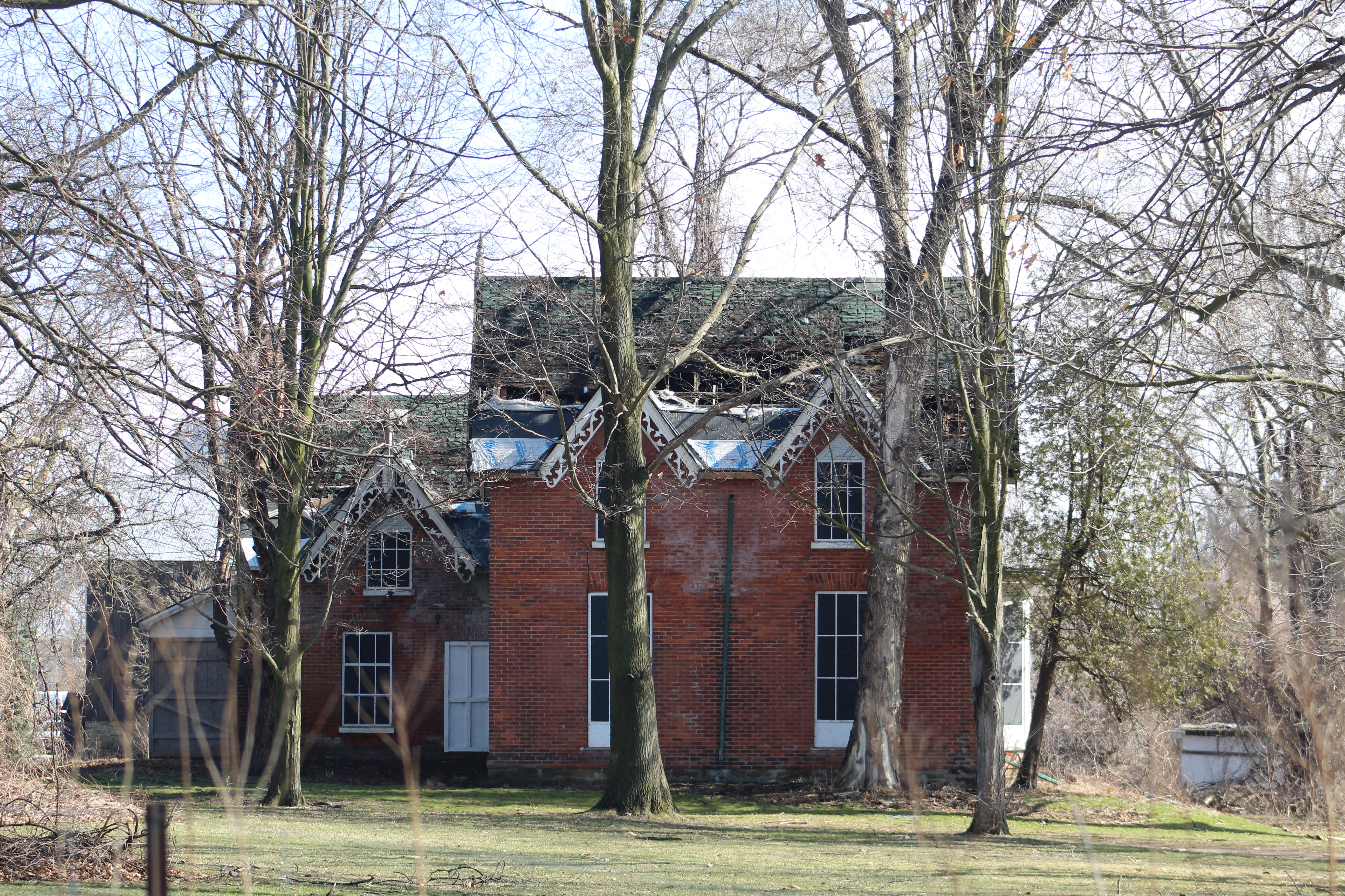
The view facing Winston Churchill Blvd also features three gables with gingerbread trim and triangular points above the second floor windows. The Robertson family had hired hands to assist with the farm and they lived in the section above the rear stairs. The stories suggest that the house was haunted with a spirit that lived in the storage space below the front stairs. When the ghost would act up, the hired hands would hide in their section at the back of the house.
In 1942 57 acres of the property was sold to William Lightfoot who passed it on to his daughter and her husband, Edward and Marguerite Abbs. They farmed it until April 24, 1970 when they sold it to Hydro who planned to build the Clarkson Generating Station. The station was never built and the house and barn were rented until at least 2001 when the house was given an heritage designation. Since then it has been left to rot and the roof is ready to fall into the structure.
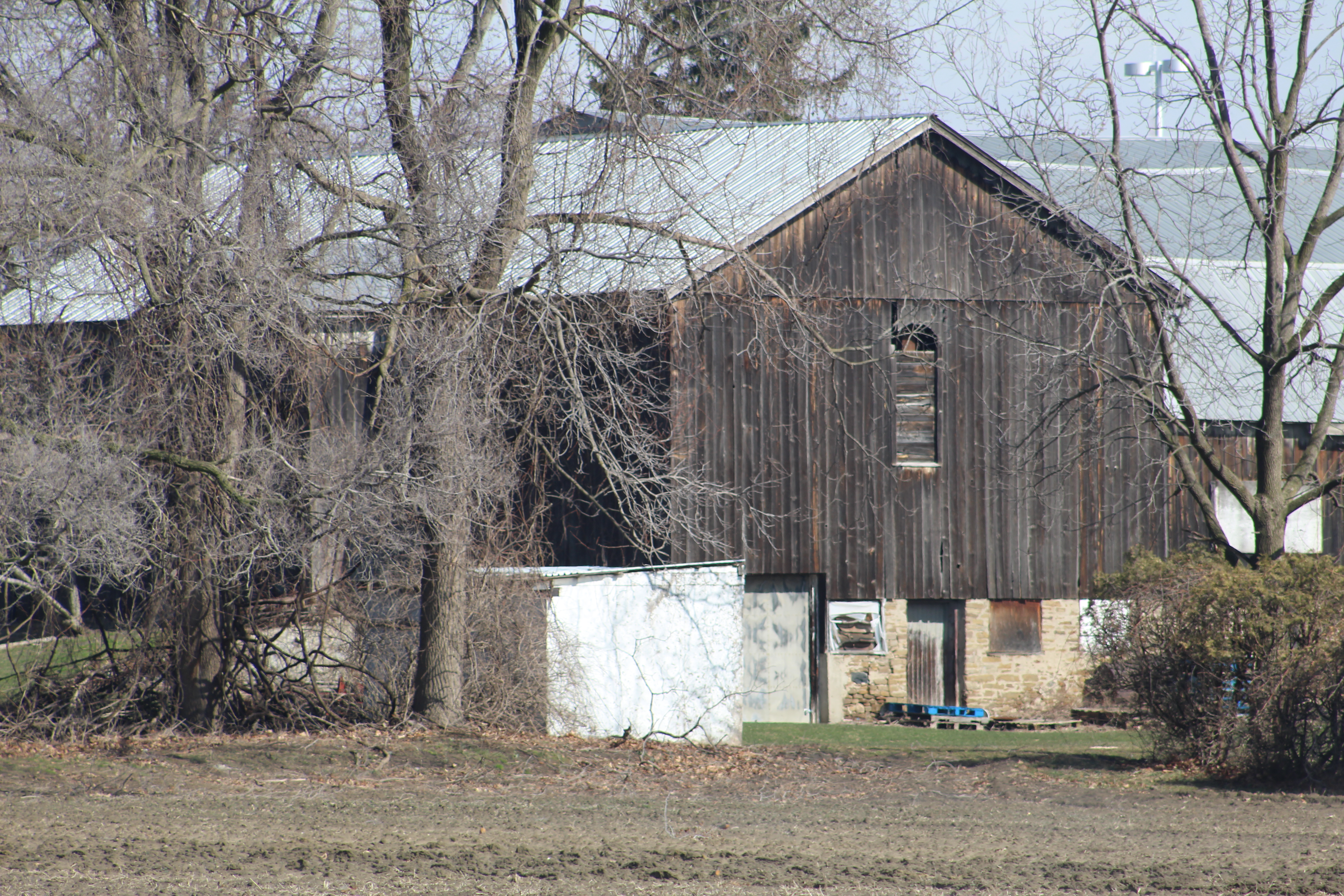
The barn that was also built in 1851 is the only building left on site that appears to still be in good shape. The farm won an award in the early 1900’s as a Gold Medal Farm but the award winning structures are almost all in poor shape. Like the house, it has a historical designation with the city of Mississauga.
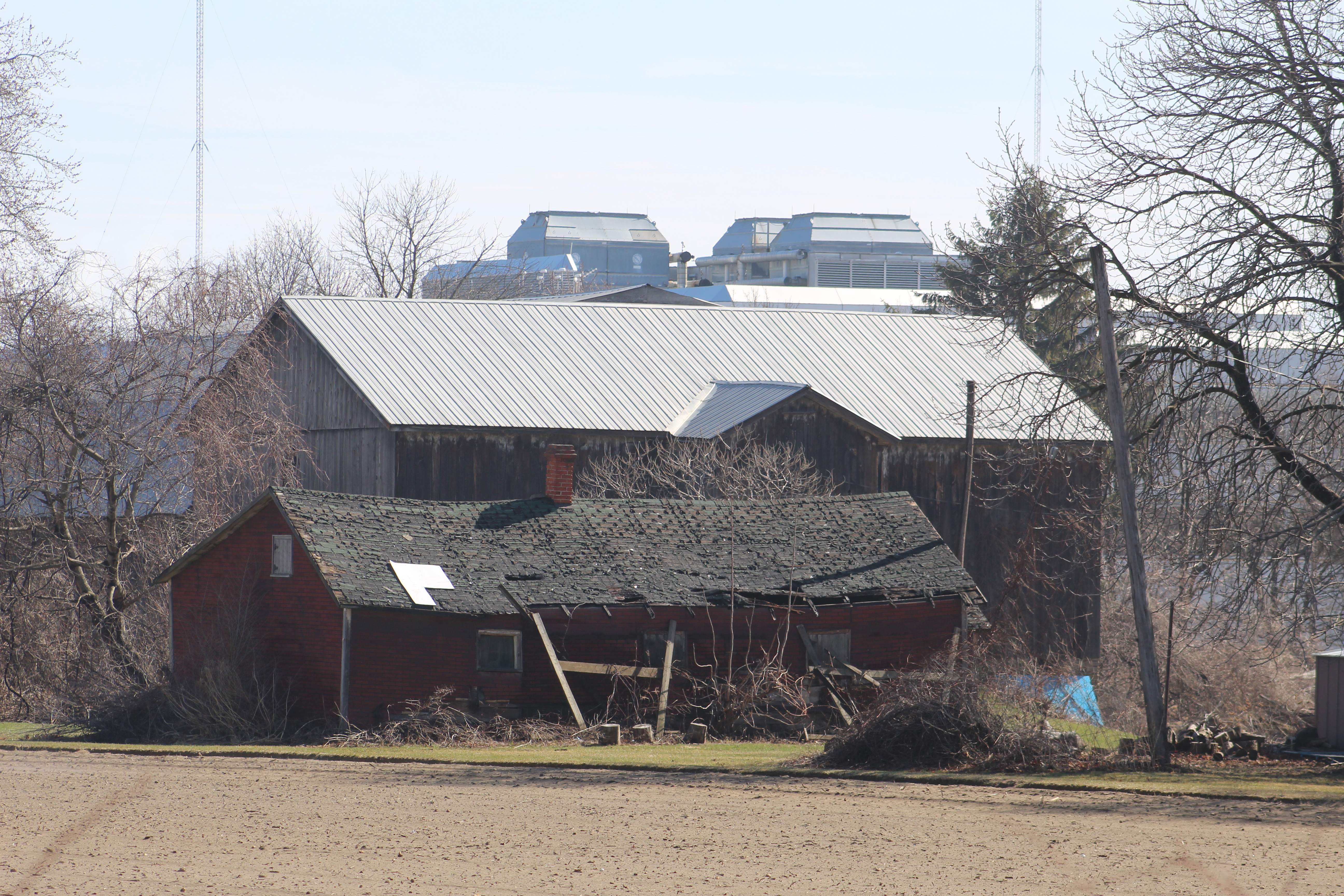
The red drive shed in front of the barn also has problems with the roof. Once the interior of the building is opened up to snow and rain it doesn’t last very long. The tin roof on the barn looks to be its saving grace.
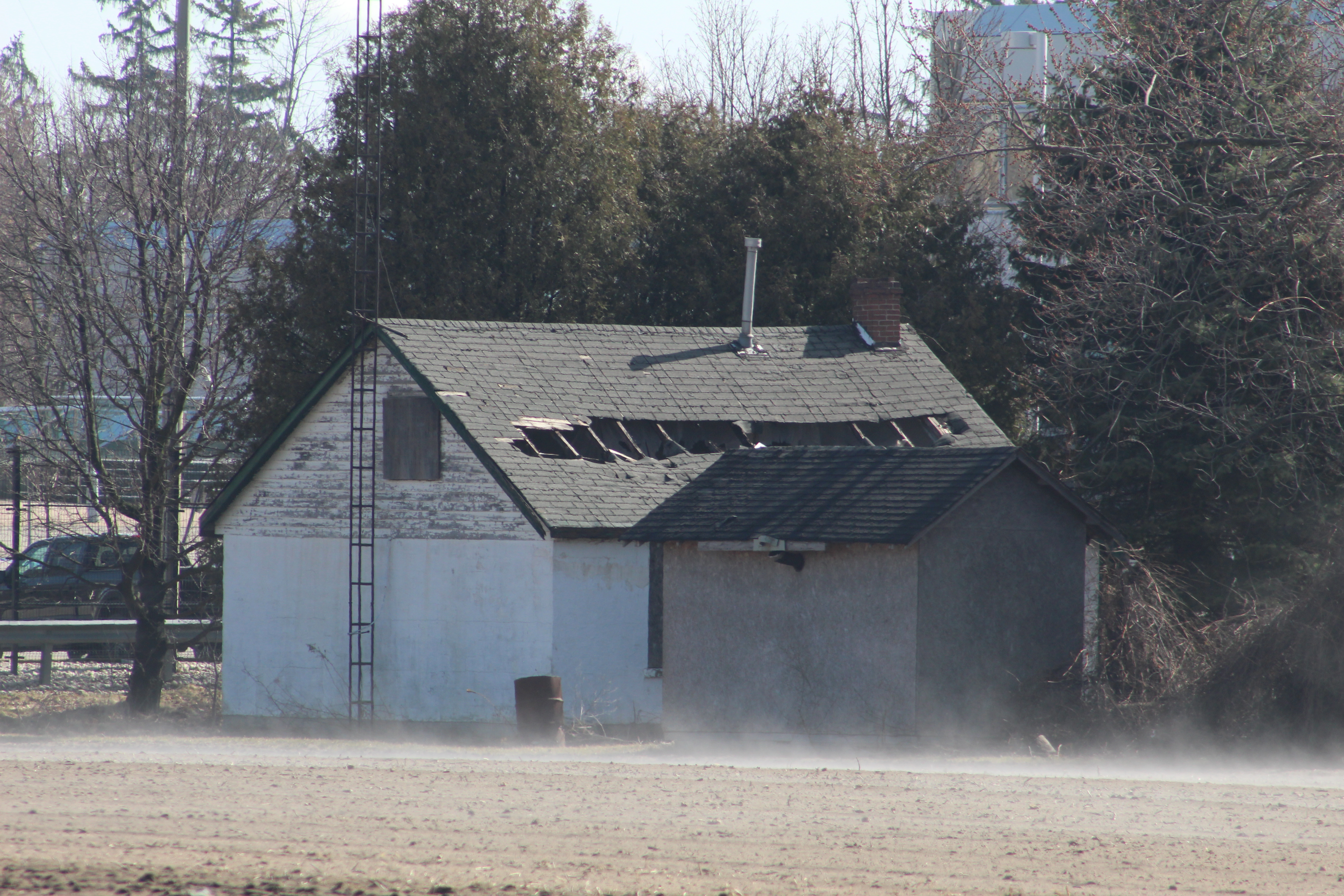
A third building to the rear of the house also has the roof caving in. It’s interesting that this little cottage has a chimney as well as a TV antenna. The property is marked “No Trespassing” at the front gate and so all of these shots are taken from the road. This building must have served as a residence for a farm hand.
Two green sheds a little north of the house are also suffering from roof rot. All of the neighboring farms have either been developed or are in the process of becoming housing. When this property succumbs to the developers these sheds will disappear without a second thought.
There’s a couple more sheds along the property line but they have already collapsed into themselves.
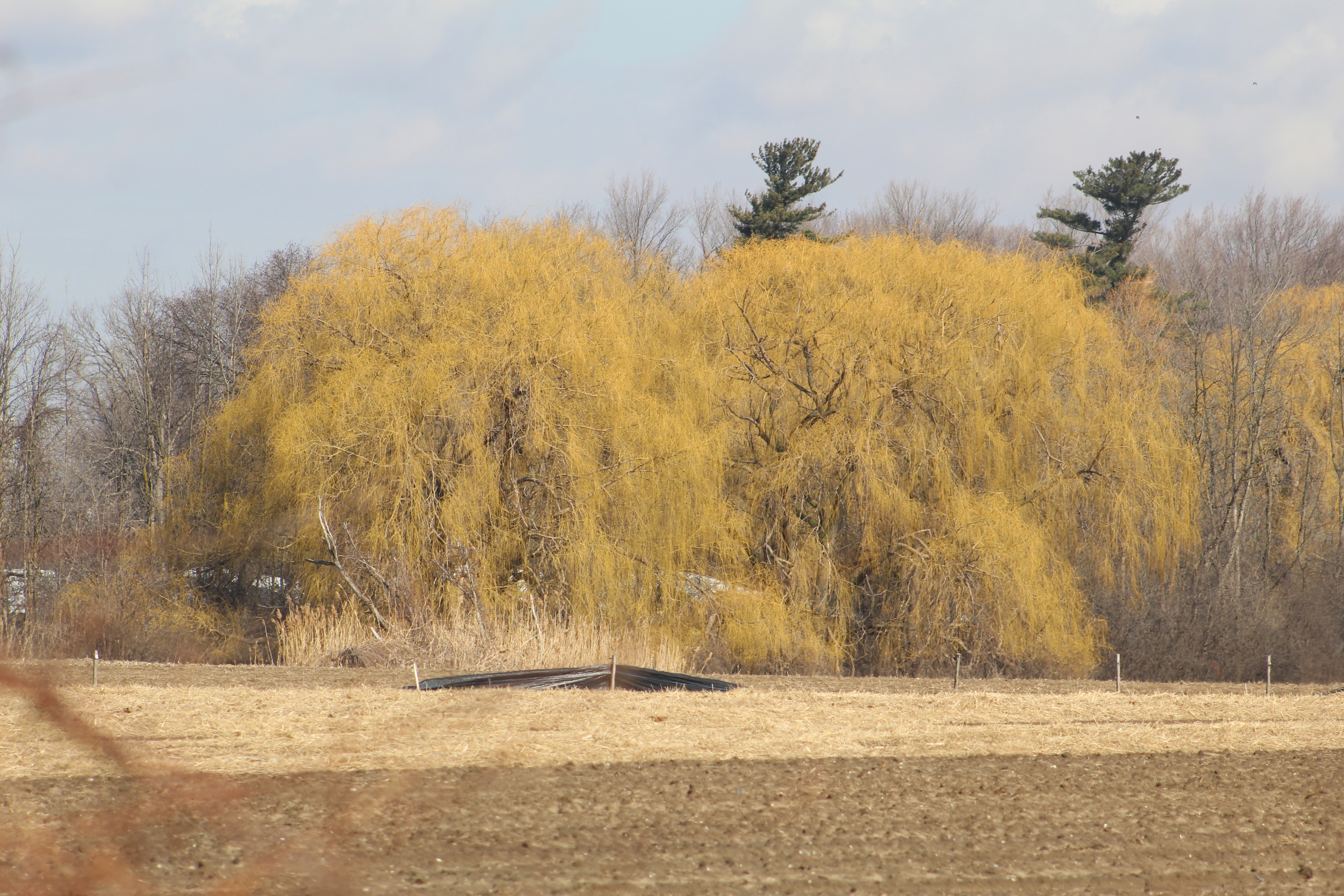
While the buildings on the property are in various states of decay the willow trees are showing the yellow that indicates they are starting to respond to the springtime conditions. At least there’s still some signs of life on the old award winning farm.
When the Robertson house was built it faced the lake and likely had a very lovely view of the lake across Lakeshore Road. In 1938 Charles Powell Bell and his wife Kathleen Harding moved into their estate home near the mouth of Joshua Creek. We’ve featured the story of this mansion in our Joshua Creek post and featured a picture of the home as seen from the lake. This is the view from Lakeshore Road.
The Andrew Robertson house is just up the street from Lakeside Park which has a unique red beach. You can check it out while you’re in the area or look at pictures and read the story at the link.
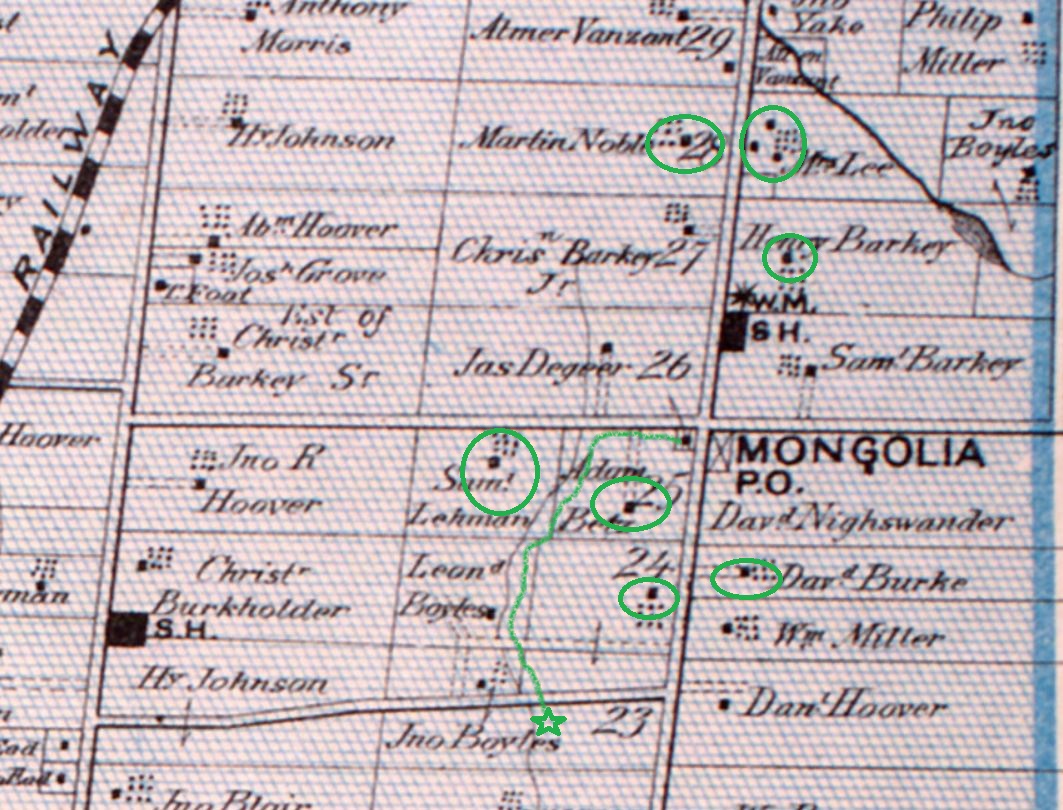
Mongolia was a community that grew around the modern intersection of Elgin Mills Road and Reesor Road. Peter De Guere arrived in 1801 and took the north west corner on lot 26. The adjoining lots were soon taken up as people cleared land for farming. As the community grew it got a tavern in 1841 and took on the name California Corners. It was never more than a farming community with a school, Methodist Church, and a Temperance Hall beside the blacksmiths shop. The rural atmosphere was lost in 1972 when the federal government decided that the flat land north of Pickering would make a good site for a future airport. They expropriated the entire town and then never built the airport. Studies show it won’t ever be needed and slowly the government is giving sections of the airport lands to help create Rouge National Urban Park. This is a far better use for the land, although it could still be productive farm land again. To explore and record what remains before it is lost we parked at the trail parking lot on the south east corner of the intersection. From there you can walk up or down Reesor Road to view the old homes or follow the trail to the historic Boyles Pioneer Cemetery. We did both. The 1877 county atlas section below shows many of the homes that still remain as well as the trail to the cemetery, which is marked with a star.
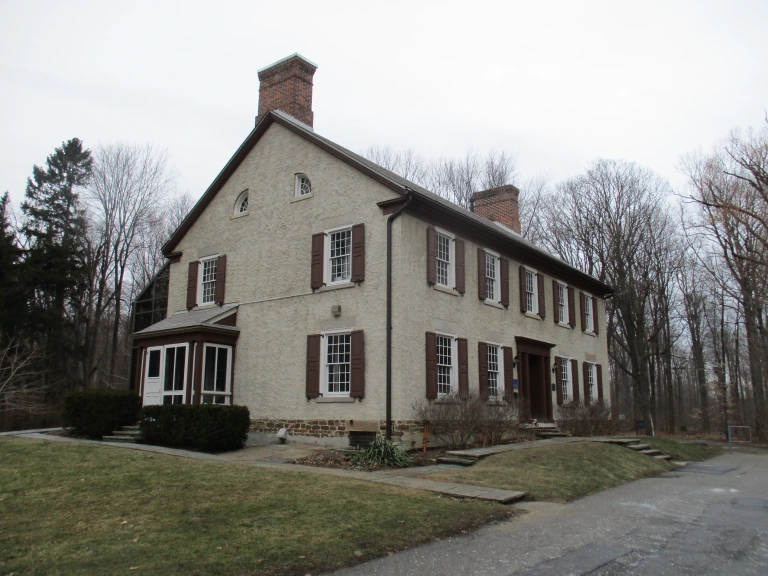
It was in 1853 that James Holden bought the corner of David Nightswanders property and the following year he opened a general store which he operated until 1861. When Nightswander got a post office for the town in 1864 he was told the name California Corners could not be used and so Mongolia was chosen from a list of approved names. A house was added beside the store in about 1870 but the store and post office burned down in 1920, leaving just the house behind. It is now being used as an information centre for Rouge National Urban Park and is one of the few homes from Mongolia that is still in great condition.
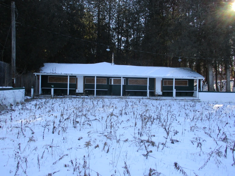
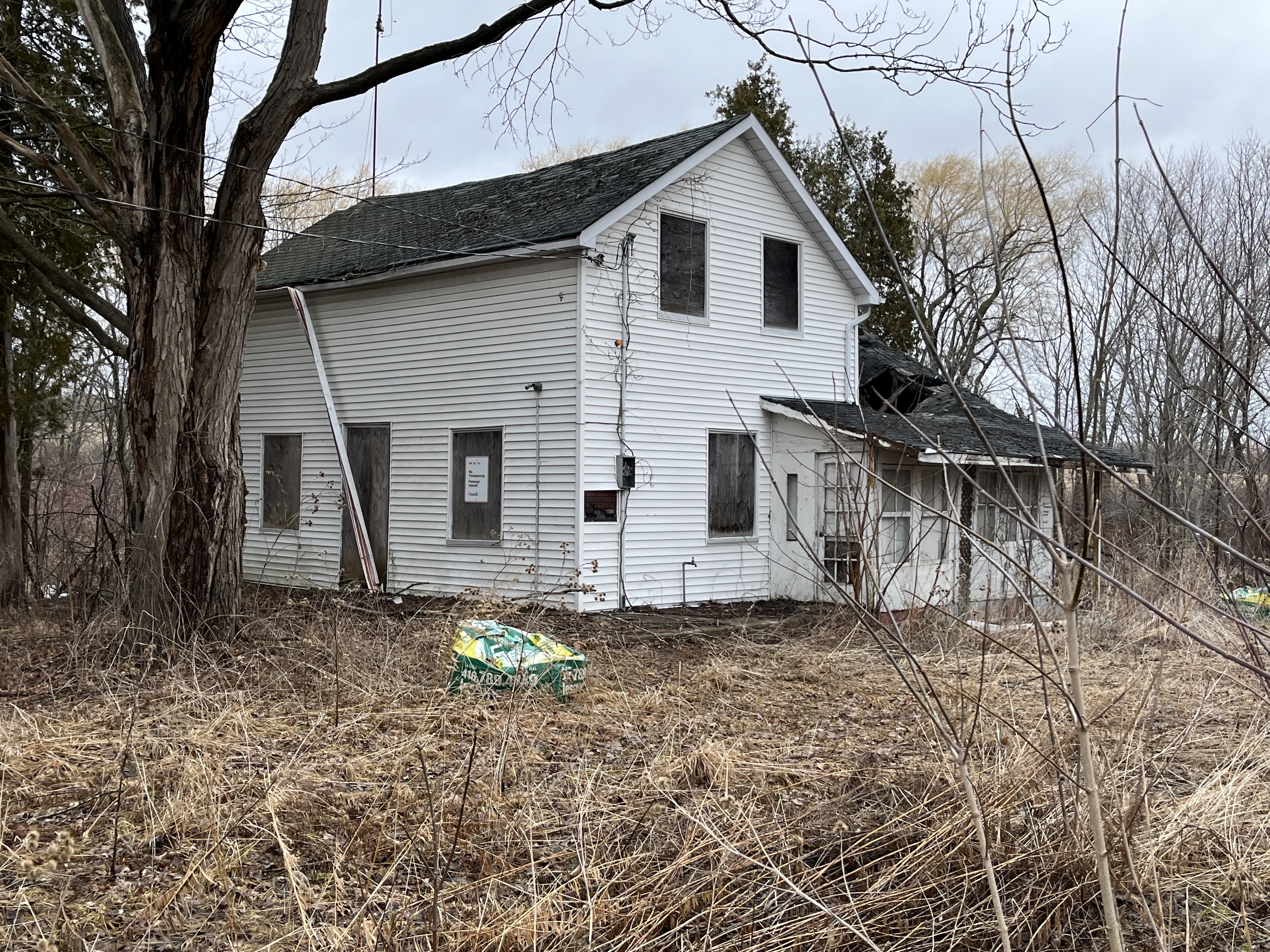
Martin Noble built this farm house in1840 and like several other older homes in the community it has been covered in white siding. I wonder if it was built of field stone like so many of the local homes were in the mid 1800s. I think we’ll be able to find out soon as the roof is caving in on this home in spite of it being on the heritage listing for Markham. Mongolia appears to be falling victim to neglect like so many of the heritage properties in the Pickering Airport Lands. It’s interesting that a designated home can’t have unapproved alterations because they can detract from the heritage properties that set it aside for preservation. However, there’s no provision in the listing to require a property to be maintained even though lack of maintenance is seriously detracting from the heritage value of these buildings.
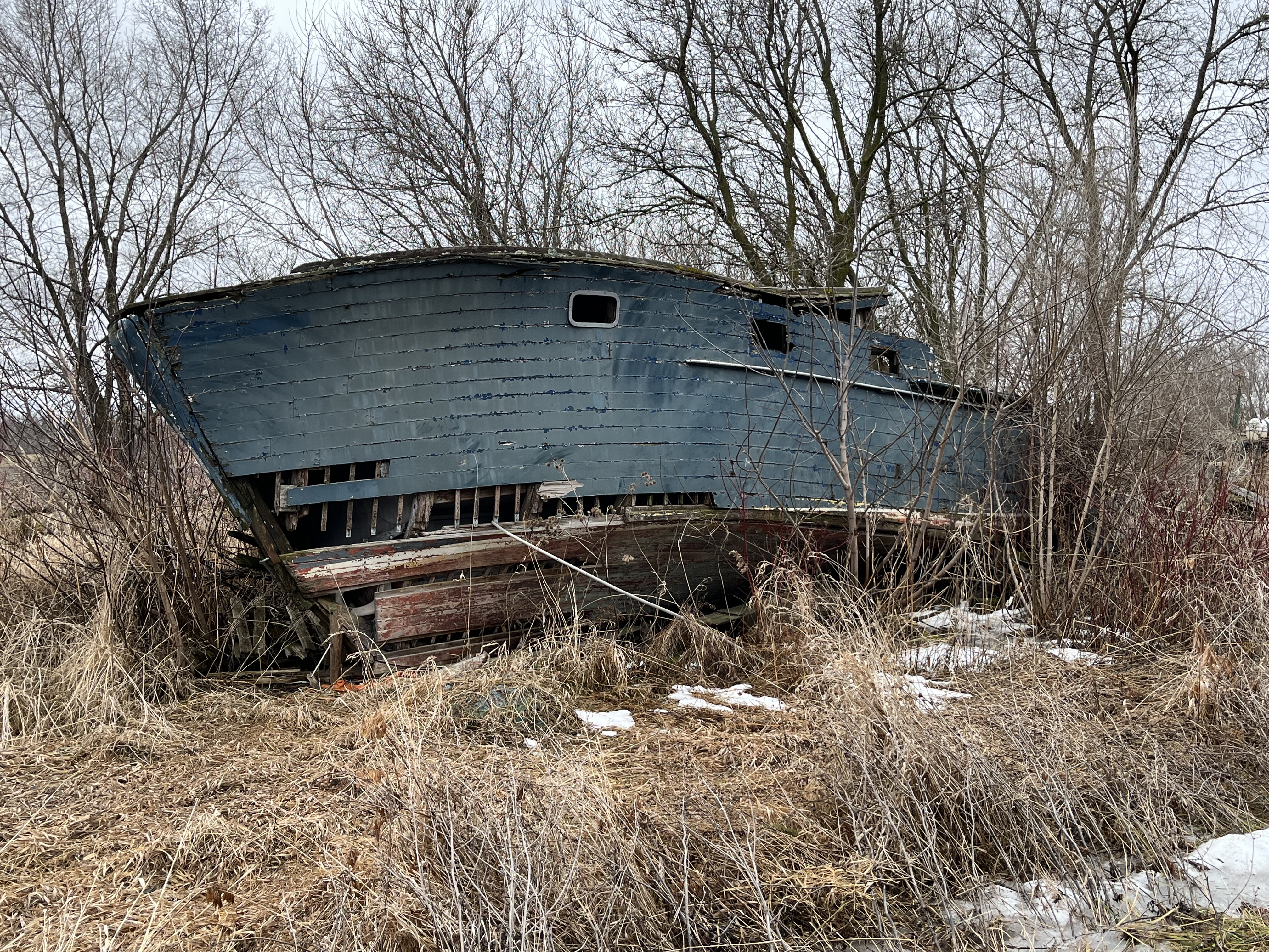
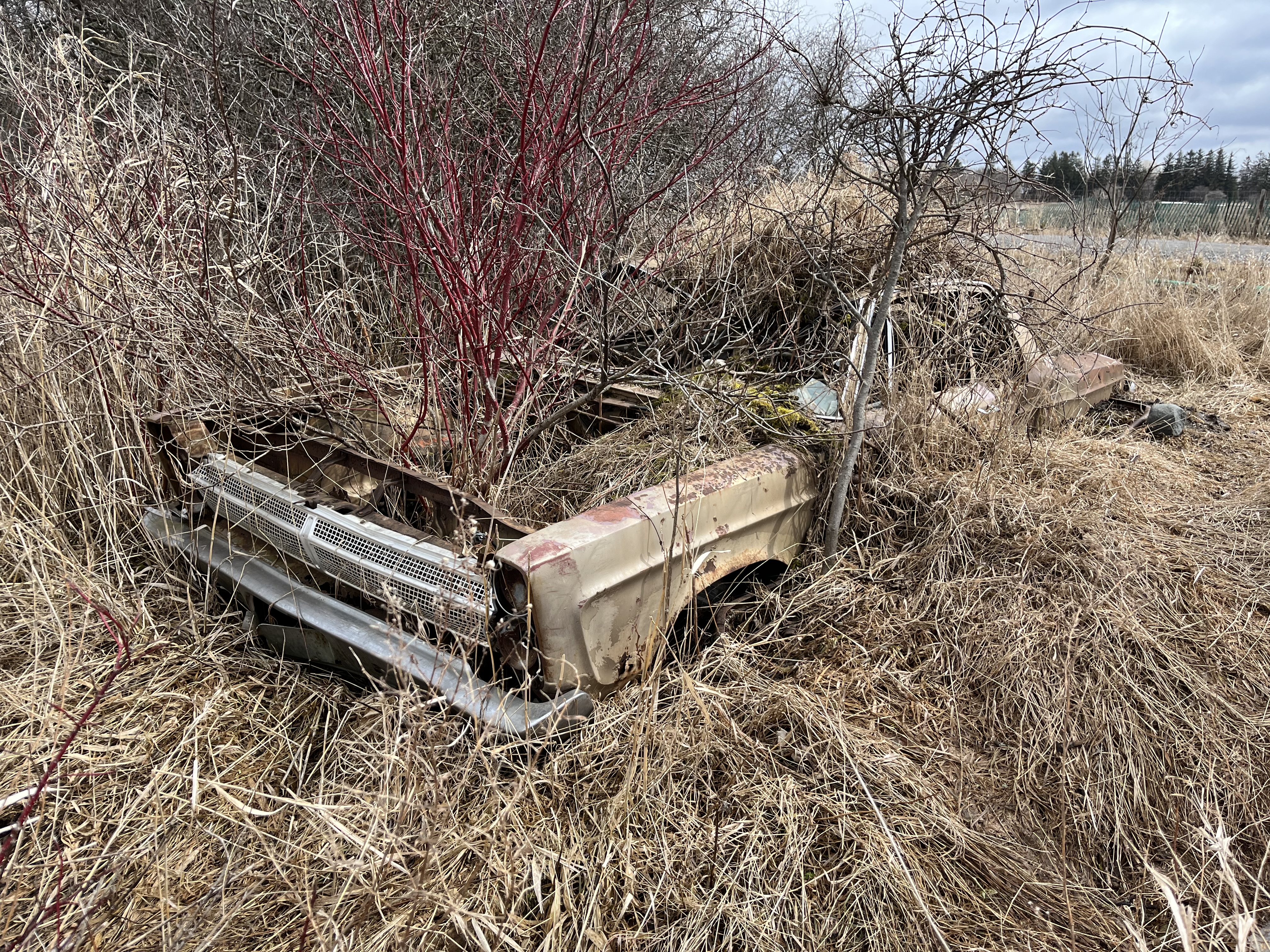
The fields and forests around Mongolia are littered with the neglected dreams of the former inhabitants. Many out buildings, barns and drive sheds remain as well as several abandoned cars and at least a couple of boats. Now that this section of the former airport lands has been designated as part of Rouge National Urban Park it may be that some of this will be demolished while the rest is left to vanish into the new forest as it regrows across the farm fields.
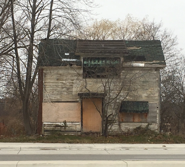
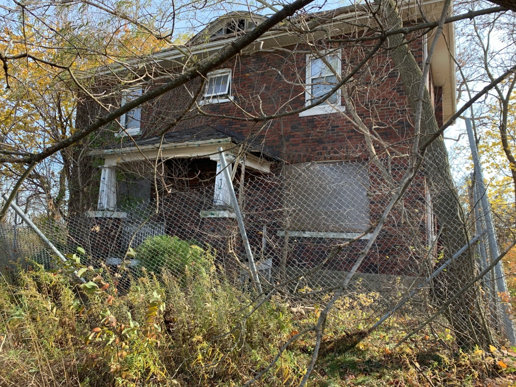
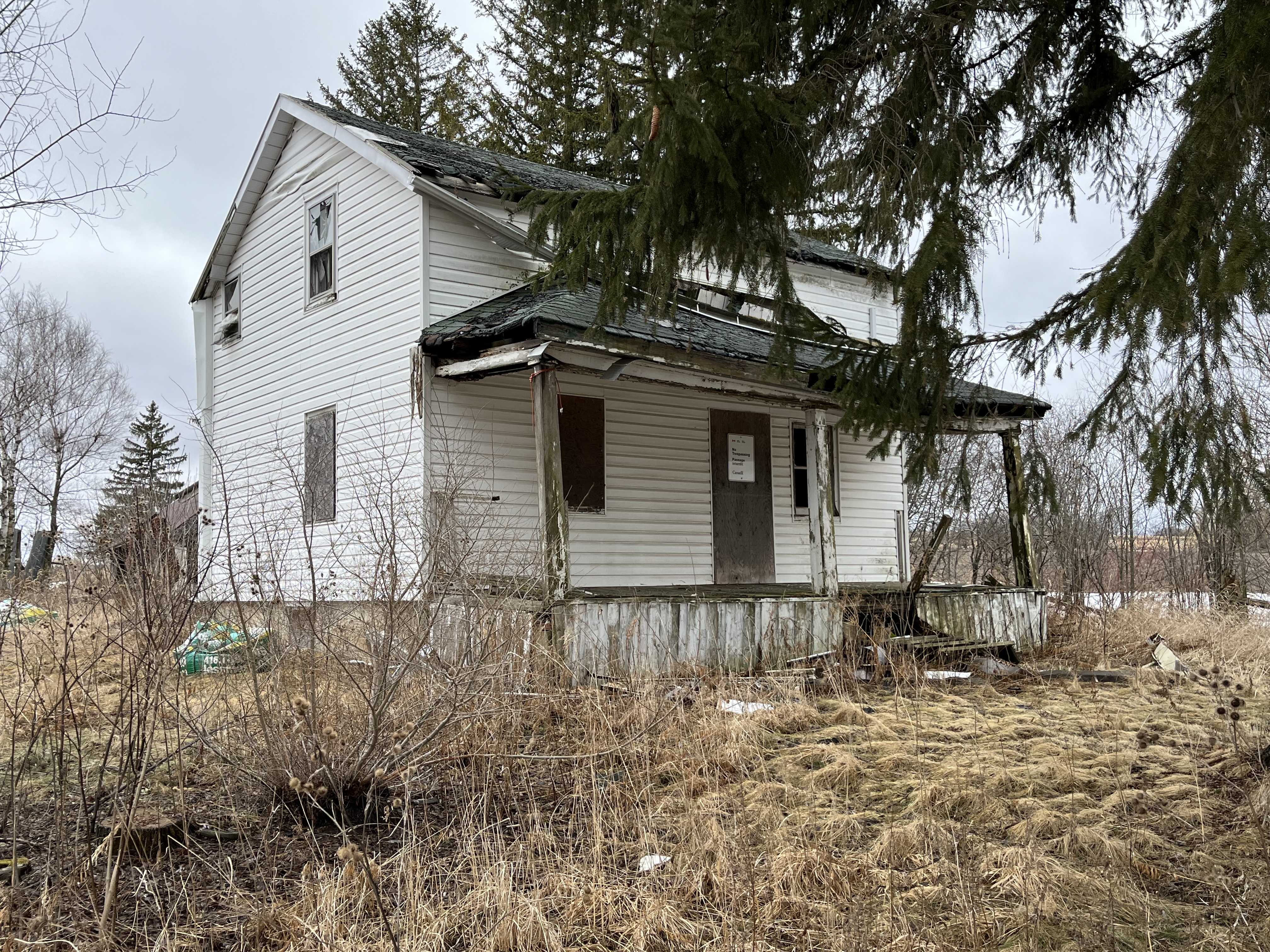
The James Collins house was built in 1850 and was also subjected to white siding which likely hides a lovely brick or stone home on its stone foundation. The entire back side of this house is missing the roof and it won’t be long before this heritage designated home is lost forever.
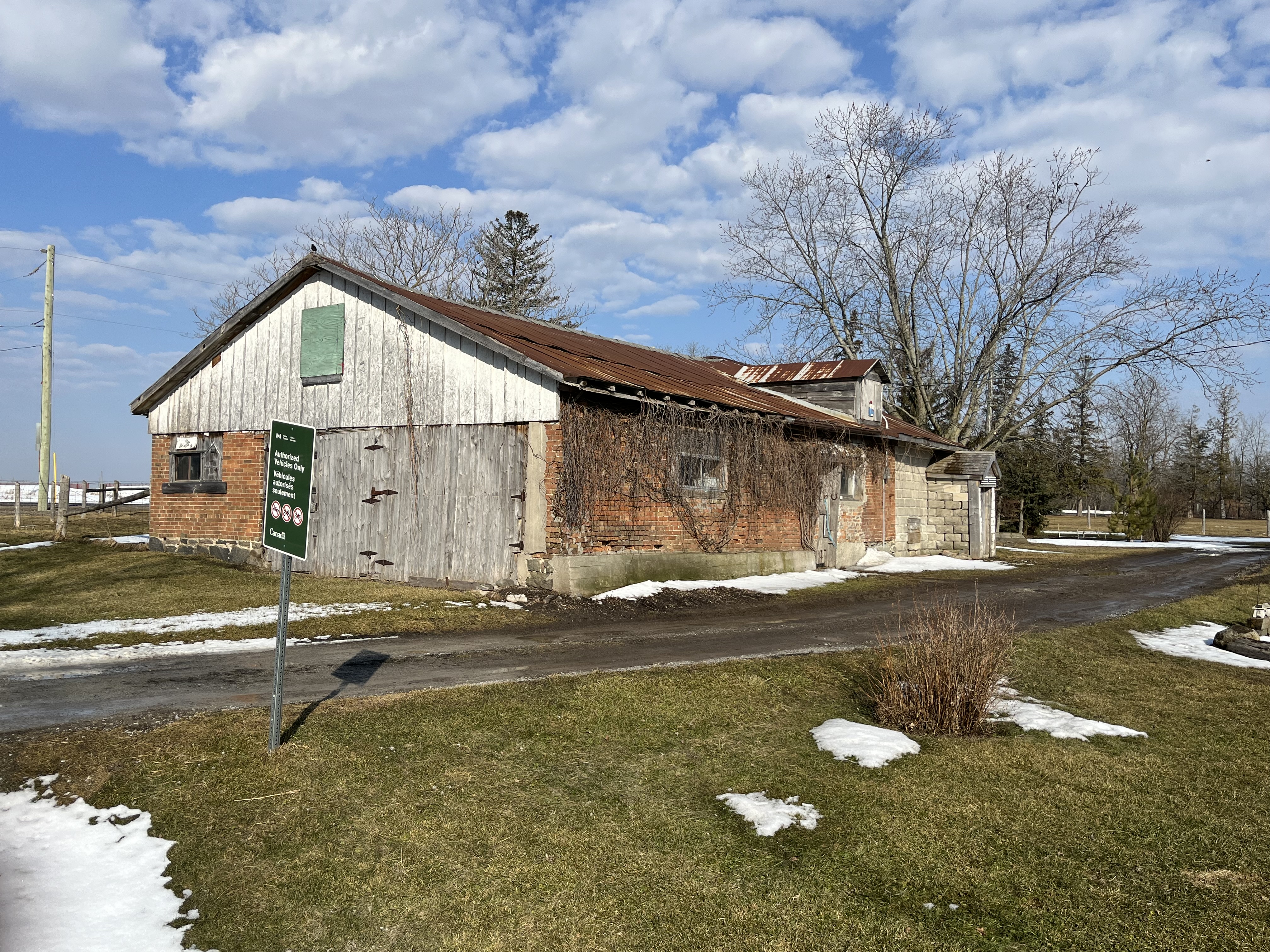
The drive shed on the property is still in very good condition even though it may have been 50 years since the farm was active.
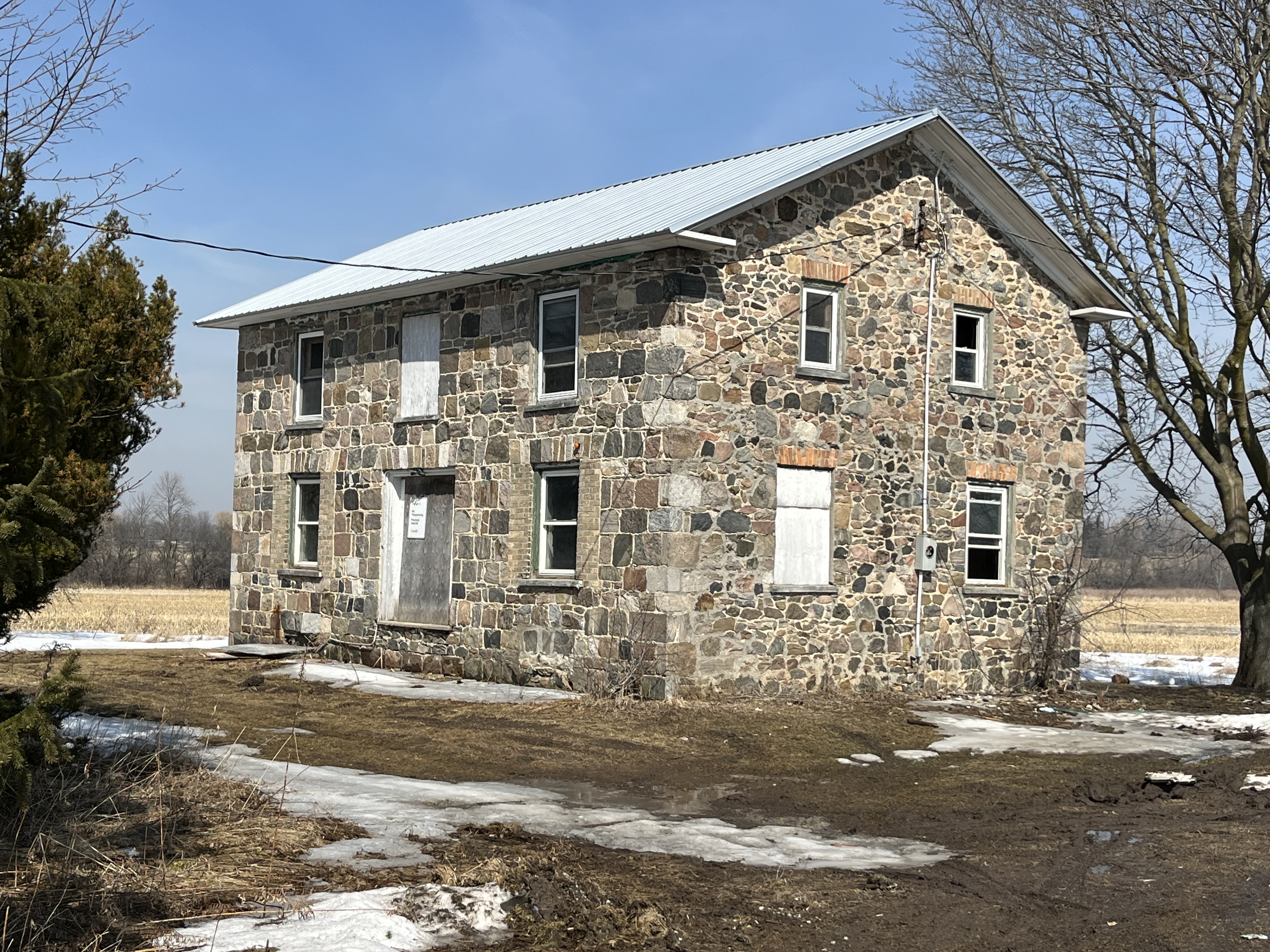
Another heritage property is the David Burke house from 1850. This home still looks pretty solid but has had all the interior walls stripped down to just the framing. One noticeable alteration to the home is the ground floor windows which have been replaced with smaller ones. Buff coloured bricks have been used to fill in the openings around the smaller windows which hides the alteration from a casual glance.
The Adam Betz house stands on the south west corner lot as it has done since 1851. Another one of the white siding victims in town, it stands an a thick stone foundation that may indicate another beautiful stone house.
Henry Barkey took over the North East corner of the intersection from Jacob Barkey in 1832 and lived near the centre of the lot. In 1860 a blacksmith shop was built near the corner of the intersection and was rented by George Calvert who appears in the 1861 census and the following couple as well.
The tenant in the house next door was usually the blacksmith although after the blacksmith shop closed it was rented to various people until it was taken over for the airport. It still appears to be lived in under a rental arrangement with the government.
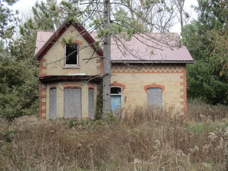
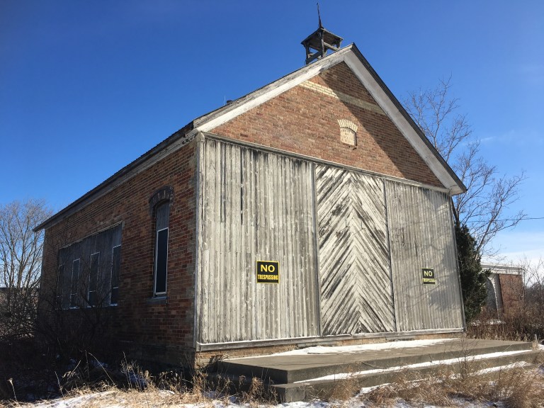
School section #22 originally occupied a frame building on the east side of Reesor Road but in 1882 a new brick school house was opened across the street. When the school was closed the building was renovated and continues to serve as a residence.
There is a new trail that leads west from the parking lot and then turns south. It currently runs for only a little more than a kilometre but will eventually connect to a new parking lot on Major Mackenzie Drive. If you keep your eyes open you will find a 1965 Plymouth Fury which has obviously been parked here for quite some time. The Fury model was first released for the 1956 model year and was updated to its fourth generation for 1965.
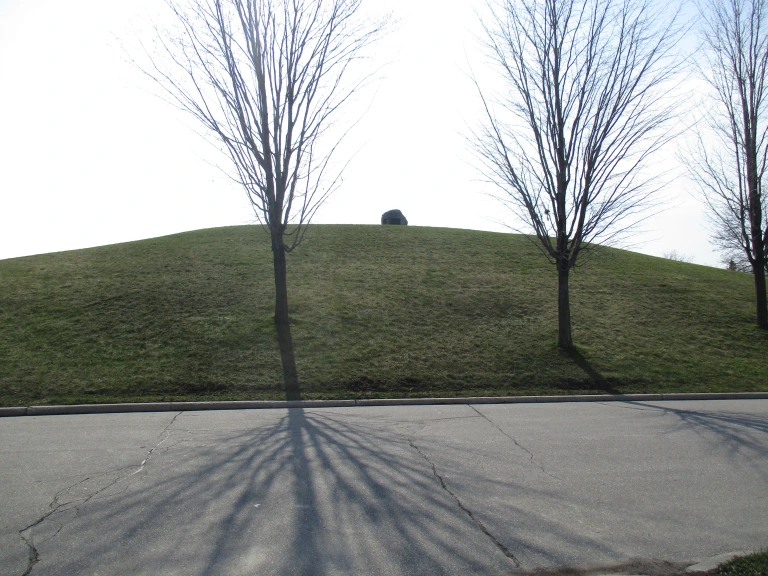
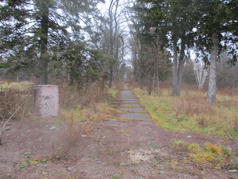
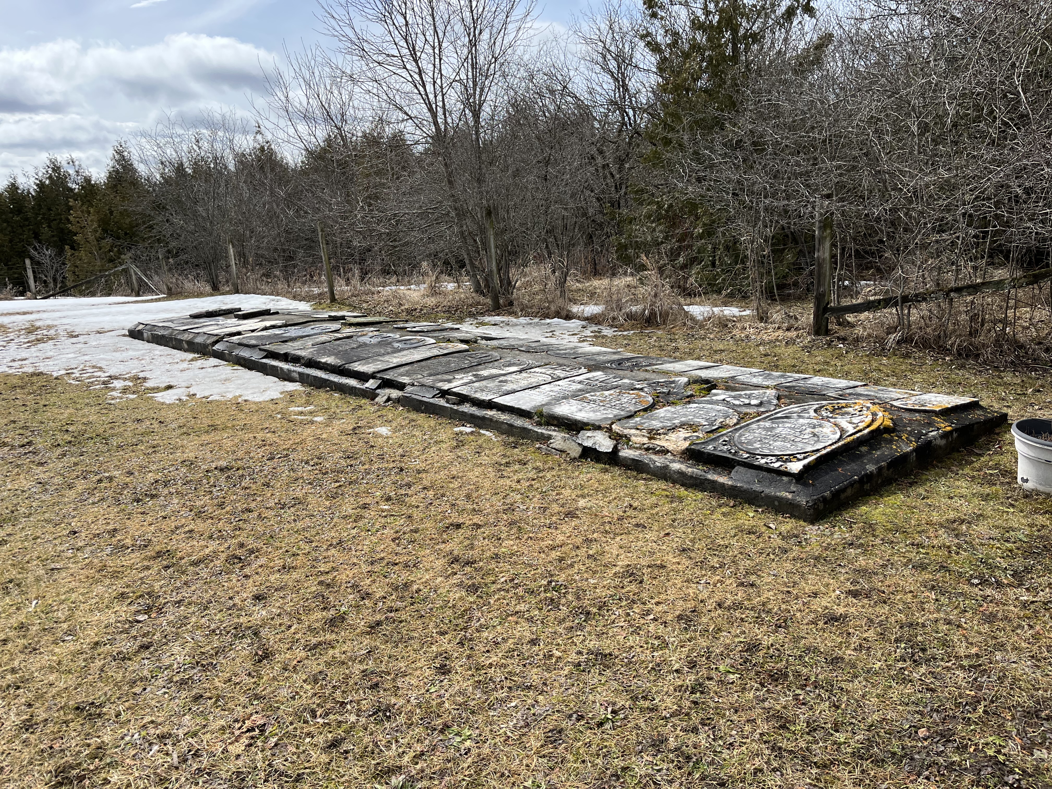
The Methodist church stood north of the main intersection but its burial grounds were on the property of John Boyles. Located on a small plateau overlooking the river, it stands about 400 meters from the road. The stones have been gathered up and placed into an unusual ground level cairn with the stones lying flat. They may be more subject to the weather than they would be in a more common vertical presentation. There are at least 47 burials commemorated in this cairn and one additional one from 2002 that has a grave marker beside it. Please note that the trail ends before the cemetery and it is not part of the trail. If you choose to visit, please do so respectfully.
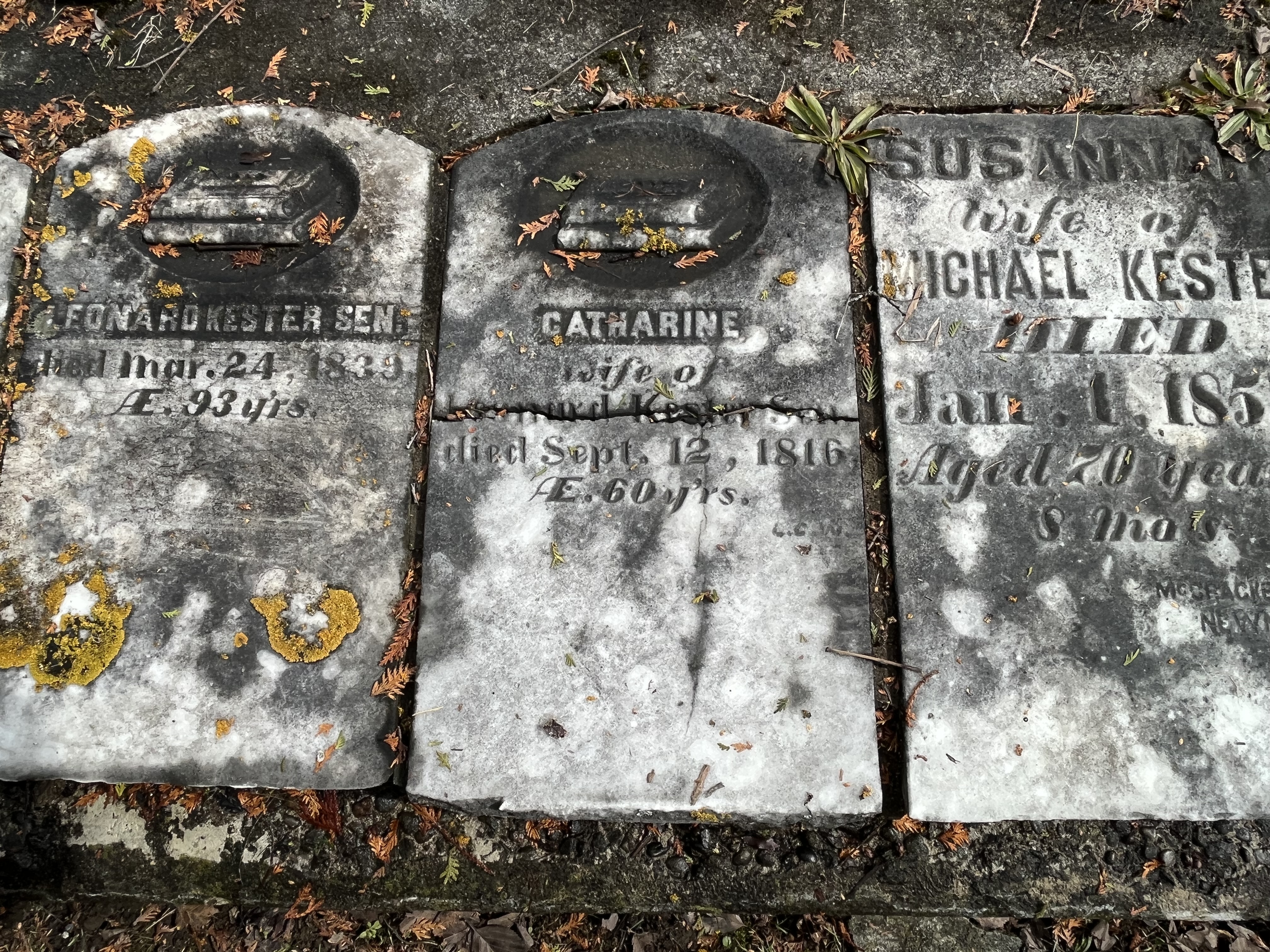
The gravestones in this cairn mark the lives of many of the early families in the area. John Boyles was the property owner and he died June 23, 1885 at the age of 91 and is buried here. Catherine Kester died on Sept. 12, 1816 in her 60th year and her headstone is one of the earliest that I’ve photographed anywhere in the GTA.
We previously looked at Brougham, which is another one of the Pickering Airport Lands ghost towns, which has also been left to rot and be demolished. Mongolia has a lot of heritage designated buildings that won’t be around in another ten years because they’re already becoming structurally unsound.