
Sunday January 3, 2016
Seen on historic maps since at least 1890, Milkman’s Lane is an abandoned roadway in Rosedale that now serves as a pathway connecting one of Toronto’s wealthiest communities with the Rosedale Ravine, the Don Valley Brick Works and the Lower Don trail system. It has been given various names over the years and when it took on the name Milkman’s Lane is unknown, as is the reason behind the unusual name. The 1890 Goads Fire Map below is available in the Toronto Archives but the city was nice enough to add the red arrow on their parks page where this map can be found. South Drive and Milkman’s Lane were known as Beau Street at the time. I parked at the corner of Beau and Elm on the map below.

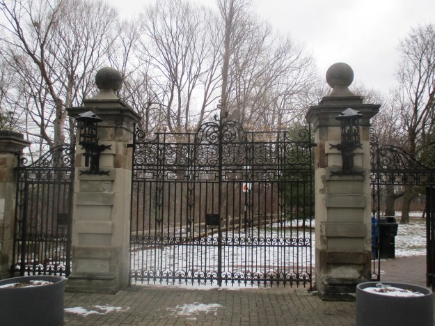
The fire map shows the large property on the south side of Milkman’s Lane as Craigleigh and belonging to E. B. Osler. Edmund Boyd Osler was born in 1845 and as a teenager began to work as a clerk at the Bank of Upper Canada which was featured in Toronto’s First Post Office. By 1901 he was president of the Dominion Bank as well as being in the fifth of his 21 years as MP for Toronto West. Osler had a major impact on the city having helped fund Toronto General Hospital, he was also a trustee at the Hospital For Sick Children. After a trip to Egypt in 1906 Osler became a founder of the Royal Ontario Musem. Craigleigh was his family home from 1877 until 1924. After his death his children donated the property to the city for a park. The ornate gates to the park have the date 1903 in the metal work on either side of the centre.
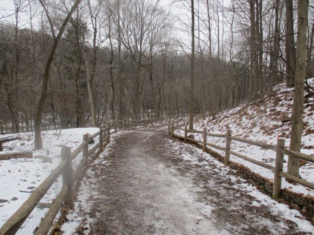
Milkman’s lane ran down the side of Osler’s property and carried traffic into the Rosedale Park Reserve. Park Drive made it’s way through the bottom of the ravine. The property belonged to Thomas Helliwell in the 1820’s and provided access through Park Drive to his mills at Todmorden. Horses and wagons, and possibly the milkman, once climbed the steep ravine side along the 300 metre lane. Today it is used by hikers, joggers and dogs walking their owners.
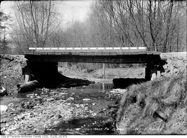
Some time prior to 1875 Edgar Jarvis bought the property. In 1854 at the age of 19 Edgar submitted what was known as plan #104, called “Plan of Rose Park”, to the city to subdivide Rosedale Estates. He bought up land in the area through the 1860’s and 1870’s in support of this plan. He had been living with his wife Charlotte and their 12 children in Glen Hurst, their home which still stands behind the stone gates of Branksome Hall. Edgar built the first two high level bridges across the ravine and planted the trees that give Maple and Elm Avenue their names. He also likely named Beau Street after his son. In 1880 he built the home on the other side of Milkman’s Lane from Osler’s Craigleigh property. Jarvis named his home Sylvan Towers and it can be seen on the map as well. For awhile Yellow Creek was known as Sylvan Creek. At the bottom of Milkman’s Lane runs Yellow Creek. It lies buried for much of it’s 12 kilometers but in 1915 it had a bridge at the bottom of the hill. The picture below is from the Toronto Archives and the road is labeled as Milkman’s Road.
In 1880 the right of passage for the land known as Milkman’s Lane was granted to The Scottish Ontario and Manitoba Land Company. Today you are greeted at the bottom of the ravine with a place where the Yellow Creek is forced underground as it makes it’s way toward the Don River. Near the bottom of Milkman’s Lane stand a pair of stone gate posts that now enter onto a tennis court. In years gone by they led to the estate at the top of the hill on the other side, likely 4A on Beaumont Street. They are featured in the cover shot.
The bridge over the ravine on Glen Road took on the name The Iron Bridge. It was later replaced with the bridge shown below that is built in the typical City of Toronto style. This type of architecture was promoted by Roland Caldwell Harris when he was city engineer. He designed the R. C. Harris Filtration plant and commissioned the Prince Edward Viaduct on Bloor Street. That famous concrete and steel arch bridge style would be repeated many times in the city, including here.
The picture below is from Wikipedia and shows the bridge on the lower end of Glen Road. It was built by Jarvis and now serves as a foot bridge over Rosedale Valley Road.

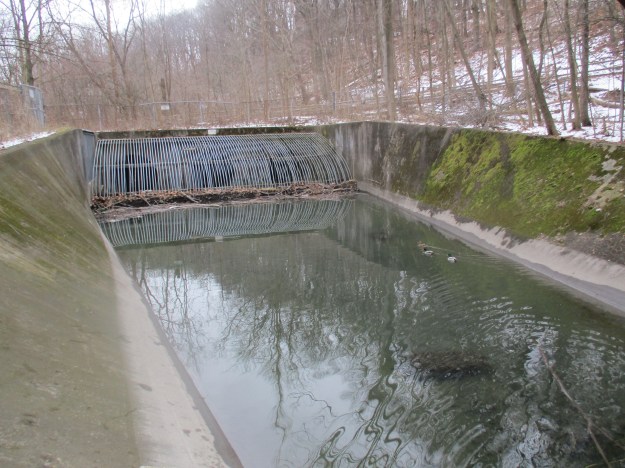
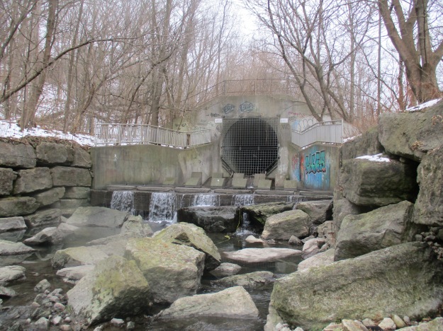
Yellow Creek flows partly underground and partly above. As you follow the trail toward Mount Pleasant Road you come to the place where the creek emerges from the underground pipe. Notice the concrete squares at the mouth of the pipe. They are designed to dissipate the water’s energy before it is released into the channel.
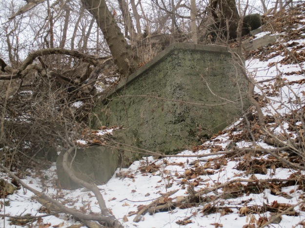
Partial walls and other concrete structures stand high on the hillside near Mount Pleasant Road. A couple of years ago I found an intact glass milk bottle here from City Dairy. I didn’t realize at the time how fitting this was, so close to Milkman’s Lane. On the other side of Mount Pleasant Road the trail continues into The Vale Of Avoca.
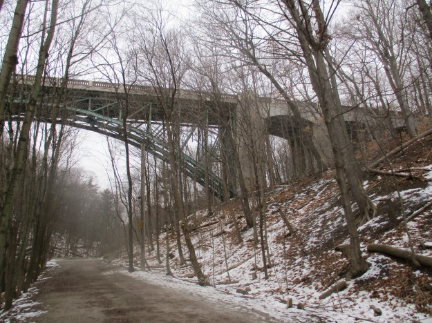
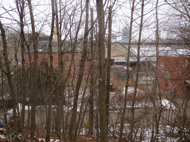
Following the trail south again and back past Milkman’s Lane will bring you to a link with the Don River trail system. Just south of the Don Valley Brick Works there is a patch of new pavement on Bayview Avenue. It marks the former crossing for a side spur that carried rail cars to the brick factory for shipping purposes. Hidden in the trees along the trail are a few exposed sections of the former rail line.

The trail leads up the old right of way for The Belt Line Railway which looks down upon the structures of the former Don Valley Brick Works. The straight line above the roofs in the picture below is the now abandoned rail bridge known as the Half Mile Bridge.
Google Maps link: http://www.google.ca/maps/@43.6780187,-79.3733876,16z
Like us at http://www.facebook.com/hikingthegta

I did a post about this ravine too, but I’m actually jealous I didn’t come up with the great research you did! Very amazing! And you solved the mystery of those pillars. I was curious about them too: https://scenesto.wordpress.com/2015/05/10/scenes-from-south-rosedale-and-ravines/
Pingback: Scenes From South Rosedale and Ravines | Scenes From A City
Pingback: Belt Line Railway – Moore Park | Hiking the GTA
Pingback: Toronto’s Abandoned Roads | Hiking the GTA
Pingback: Favourite Toronto Walks – The Beltline | Walkablog
Pingback: Favourite Toronto Walks -Rosedale Rambles | Walkablog
Pingback: Back Tracks – 8 Years of Trails | Hiking the GTA