
Saturday June 14, 2014
We parked on Emmett Ave and crossed the Humber on Eglinton. On the west bank stands a memorial to the Ukrainian Canadian War Heroes and we descended to the river level near there. Following the hillside between here and where the Humber Creek meets the Humber River is difficult and we alternated between hillside and river side.
Whitetail Deer mate (rut) in late October or early November and give birth to up to three fawns in late May or early June. Along the way we found a spot where a fawn, only a few weeks old, had been down to the river to drink.
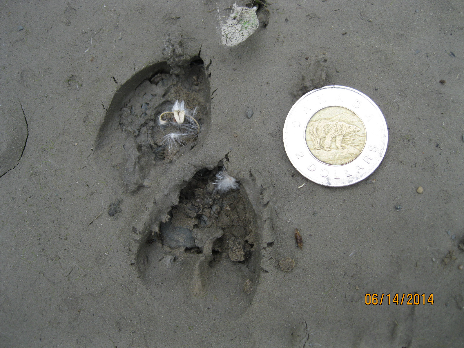
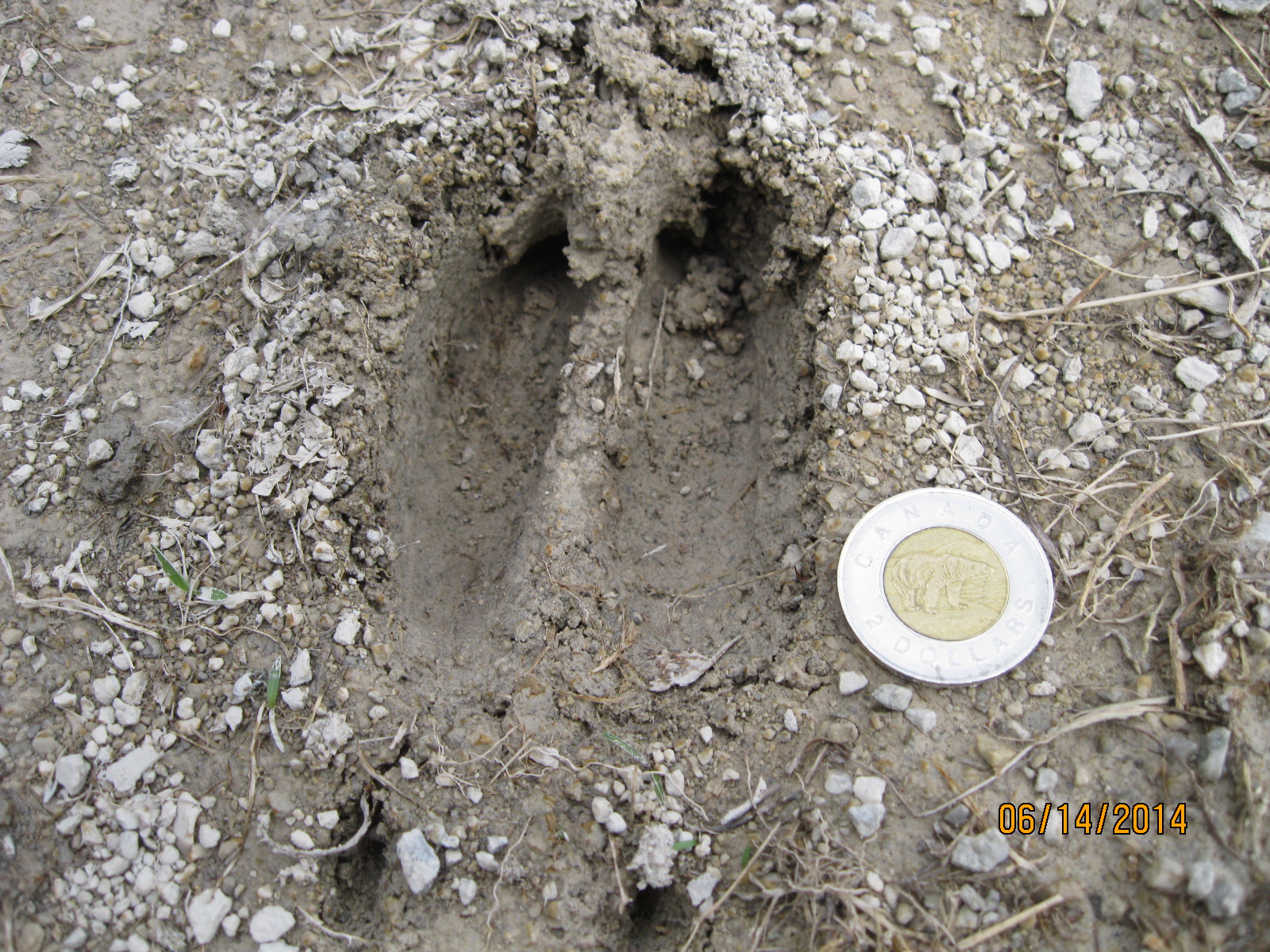
By comparison, the foot prints of an adult deer are about three times the size of the toonie. The foot prints in the picture below were found on one of the baseball diamonds in the park where the deer was apparently thrown out at second base.
The first electric washing machine was the 1907 Thor machine built by a Chicago company called Hurley. The first washing machine to use a drum, replacing the ancient washboard, was patented in 1851. It was powered by a hand crank. To remove water from the clothes after washing, a pair of rollers called a wringer or mangler were used to squeeze the excess water out.
We found an old washing machine likely from the mid-1940’s manufactured by Thor Canadian Co. Ltd. Toronto. The aluminum pole in the centre held the drum and the rusted steel pole held the wringers.
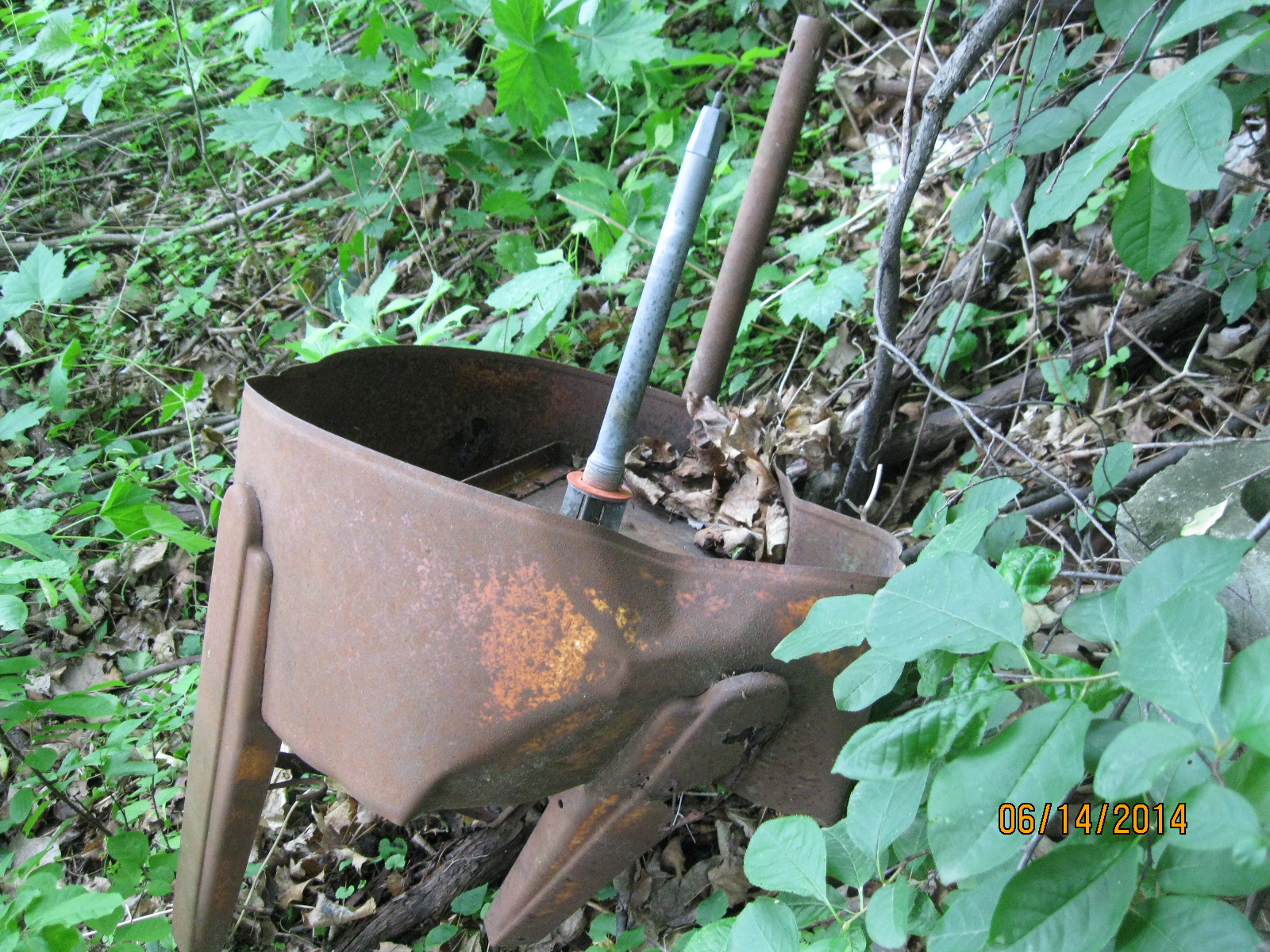
The Canadian Standards Association (CSA) was created in 1944 from The Canadian Engineering Standards Association. In 1946 they introduced the CSA logo. This name plate says CSA but lacks the logo. That, along with it’s low CSA approval number (520), suggests that it is from 1944 or 1945.

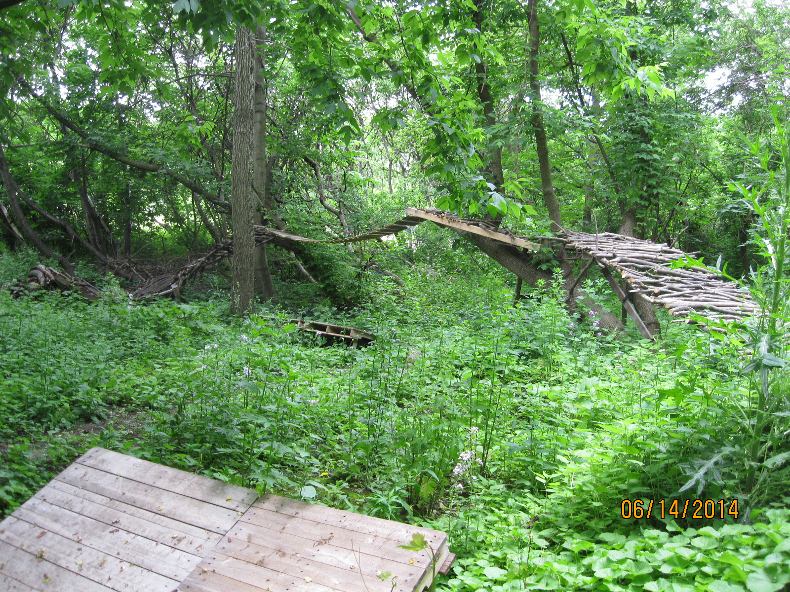
We came across an extensive race track built through the trees for remote control cars. It appears to have been abandoned recently.
When Ontario was surveyed for settlement it was frequently laid out in 1000 acre square sections with a road allowance along all 4 sides. The north/south roads were called lines and the east/west ones called side roads or concessions. Within, the parcels of land would usually be divided into 5 land grants of 200 acres each. Five lots ran north between side roads and extended between the two lines. In York Township, Eglinton Avenue was known as Base Line and the lot on it’s north side was known as lot one. Lawrence Avenue ran along the north side of lot five and was known as 5th side road. Other side roads going north were Wilson/York Mills (10th SR), Sheppard (15th SR), Finch (20th SR) and Steeles (25th SR). So York Township had 25 lots between Eglinton and Steeles. Going west the lines were Bathurst (1st Line West), Dufferin (2nd Line), Keele (3rd Line), Jane (4th line) and Weston (5th line). This grid is lost in the maze of the city but is still very evident in rural Ontario where there are often 5 grand old Victorian homes between the side roads marking out the original lots.
In the historical atlas example below we see the Etobicoke side of the Humber River. Just above Lambton Mills is a road marked A, B, C. That is the Base Line (Eglinton) and the five lots we hiked on are owned by Anderson, Stonehouse, Thompson and Pearson in the County Atlas from the 1880’s. The road that runs along the top of Pearson’s property is the 5th side road (Lawrence)

We were hiking between the 4th and 5th lines on lots 1 through 5. A surveyor’s stake lets us know that we are moving off lot two onto lot three.

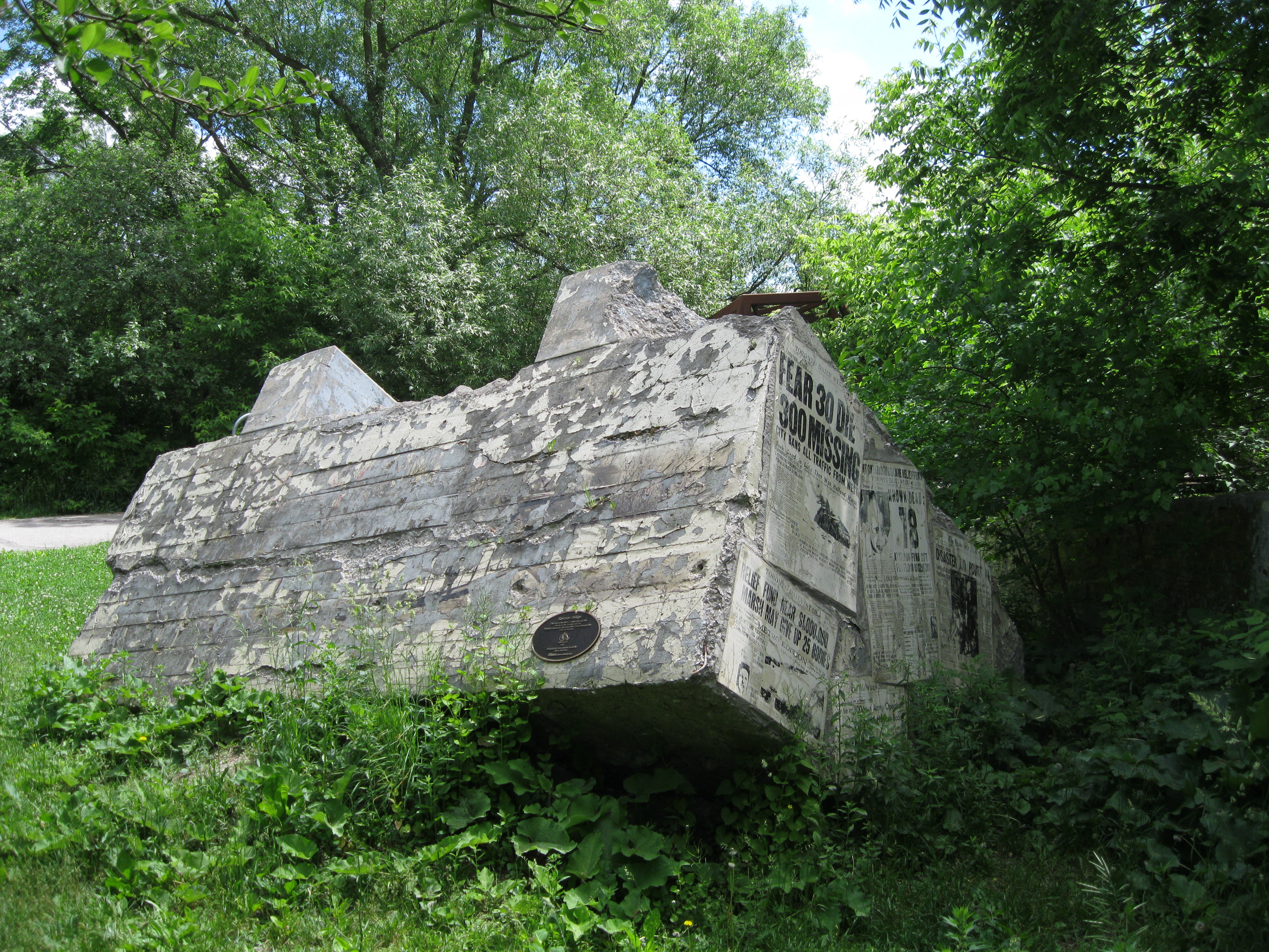
Raymore Drive is on lots 4 and 5 which was owned by the Scarlett family until the 1850’s. When Hurricane Hazel hit on October 15, 1954 Raymore Drive was home to a subdivision along a curve in the river. A footbridge crossed the river just upstream of the community and when the water level in the Humber rose by 20 feet it swept it off of one abutment swinging it out into the river. This caused the water in the river as well as a lot of debris to be re-directed onto the area of Raymore Drive. 14 homes were washed away, many with their occupants still inside. Of the 81 people who lost their lives in the storm, 35 of them lived on Raymore Drive. The cover photo shows the street on the morning after the storm.
The footbridge abutment was thrown up on the east side of the river. The second abutment still stands on the middle of the river where it was washed by the flood.
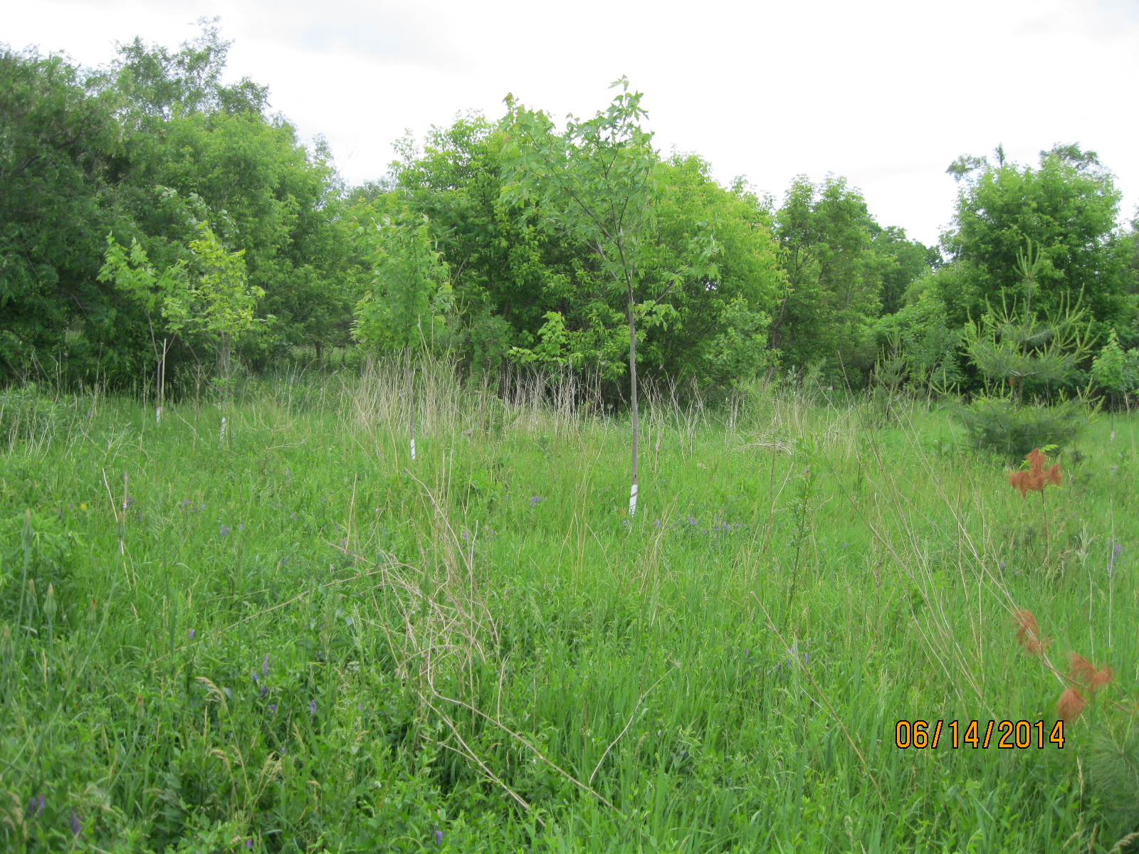
Raymore Drive as it appears today with new growth trees where rows of houses once stood.
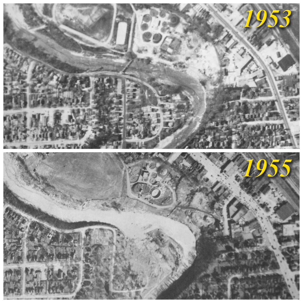
Raymore Drive as seen in this before and after comparison. In the 1953 photo there are two streets of houses tucked inside the curve of the river. The footbridge is seen crossing the river on an angle. In the 1955 picture the area has been swept clean.
The Yellow Iris is native to Europe and parts of Asia but in Canada it is considered to be an invasive species. It was first identified in 1911 in Newfoundland and in 1940 in Ontario. It grows in wetland areas but it’s dense mats of leaves tend to cause the marshes to dry up reducing native habitat.

Google Maps Link: Raymore Drive
Like us at http://www.facebook.com/hikingthegta
Follow us at http://www.hikingthegta.com

Pingback: The Don Narrows | Hiking the GTA
Pingback: Hiking the GTA #100- Pernicious Plants and Beautiful Blossoms | Hiking the GTA
Pingback: All-Time Top Trails (So far…) | Hiking the GTA
Pingback: Back Tracks – 5 Years of Trails | Hiking the GTA
Pingback: Hurricane Hazel – Raymore Drive | Hiking the GTA
I remember that night. I was very young. The wind was raging, the china rattling. We were living in a basement apartment in a very old house. We were situated in the Birchcliffe area and sustained no damage. Thanks so much for sharing this.
Pingback: Back Tracks – 8 Years of Trails | Hiking the GTA
Pingback: Raymore Drive – Monument to the destructive force of nature – Canadian Military History