Tag Archives: Humber River

Elder’s Mills – Ghost Towns of the GTA

Saturday,October 3, 2020

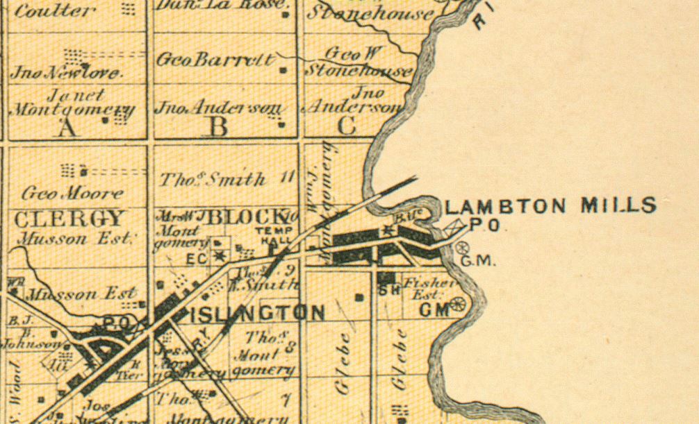
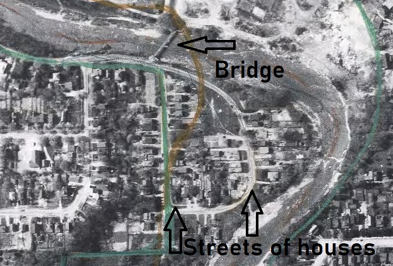
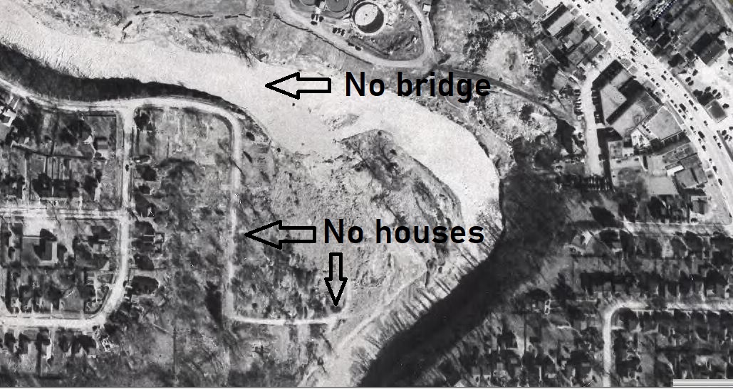
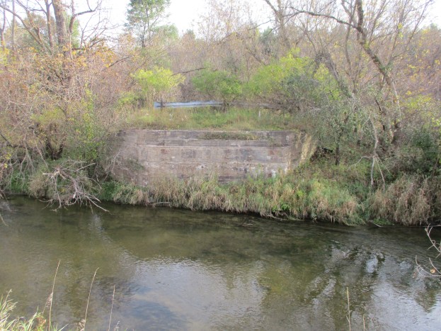
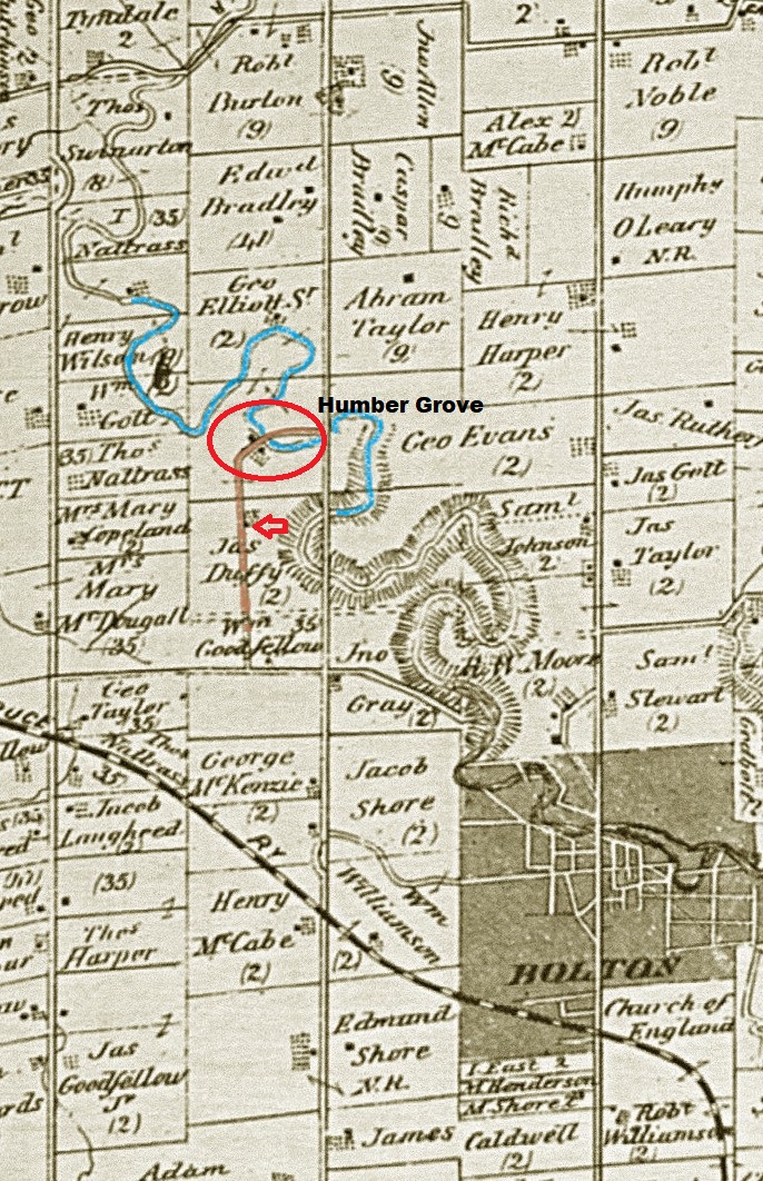
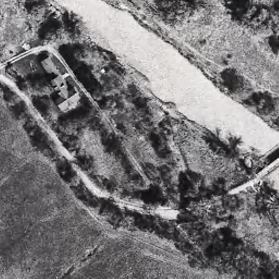
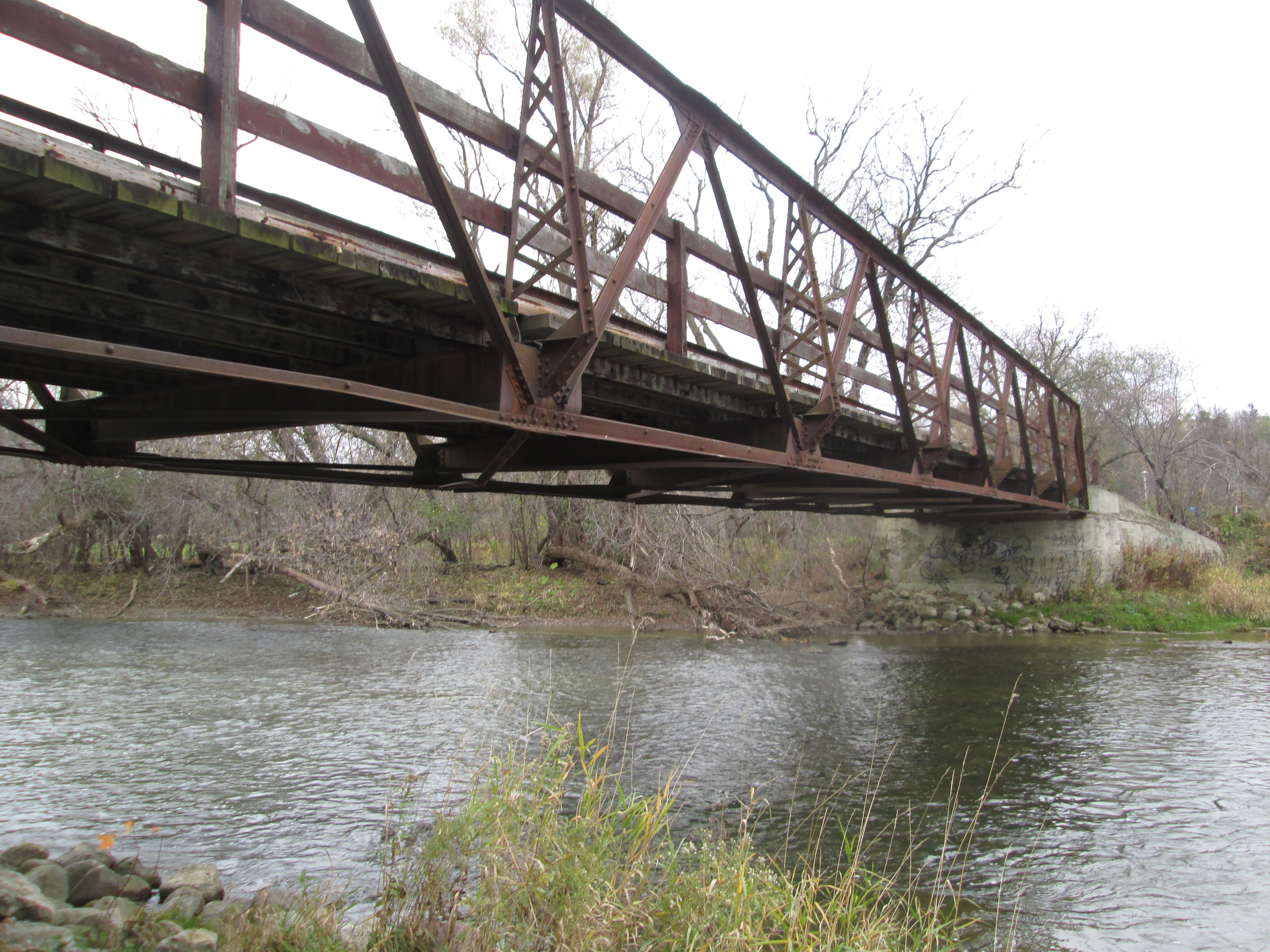
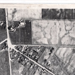
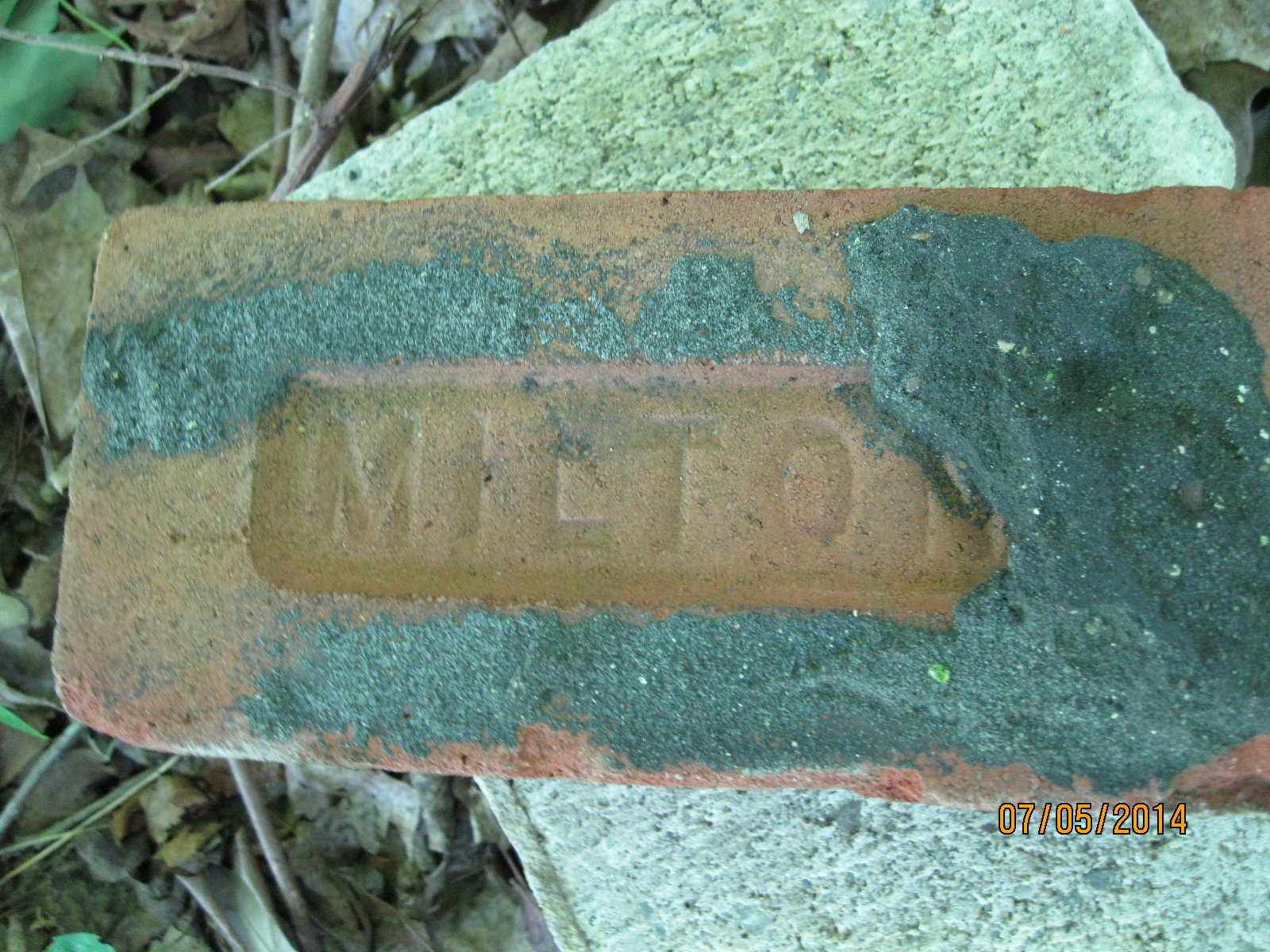
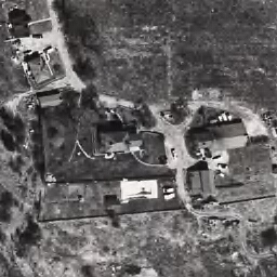
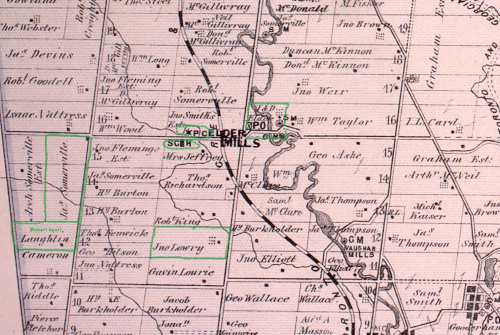
Elder Mills began life as a farming community that centred around a set of mills where the Humber River crosses Rutherford Road at Highway 27. To investigate we started at Elder’s Mills Nature Reserve which can be accessed off of Napa Valley Road. The 1877 County Atlas section featured below shows the town and the location of the saw mill (SM) and grist mill (GM) on the Elder property as well as the Presbyterian Church (and cemetery (*PC). The school house (SCH) is across the road from the church. It also shows three properties that still contain the Robert Agar House (1855), John Lawrie House (1855) and James Sommerville House (1856) that form part of the legacy of Elder’s Mills.

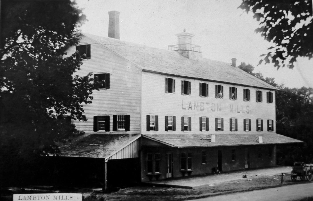
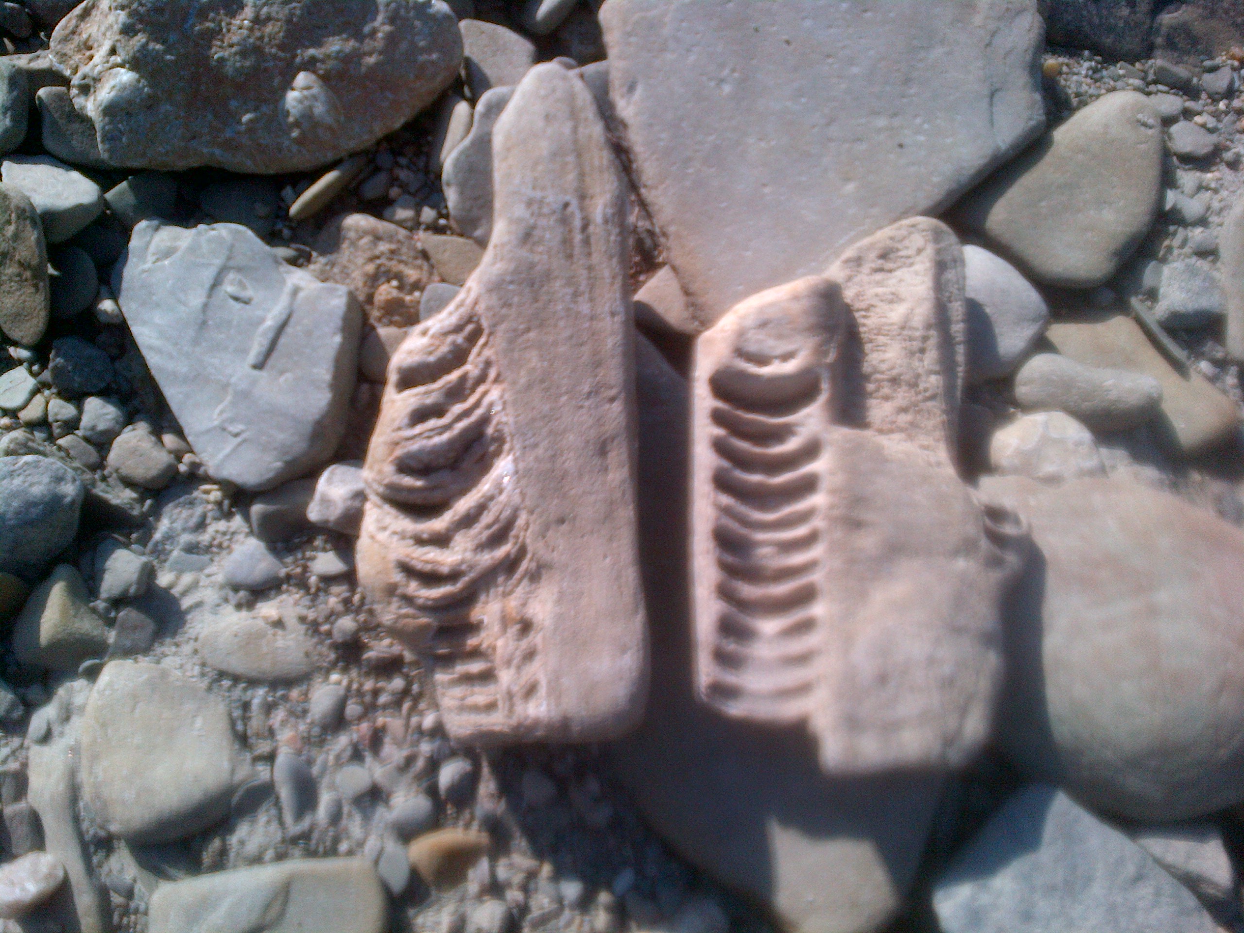
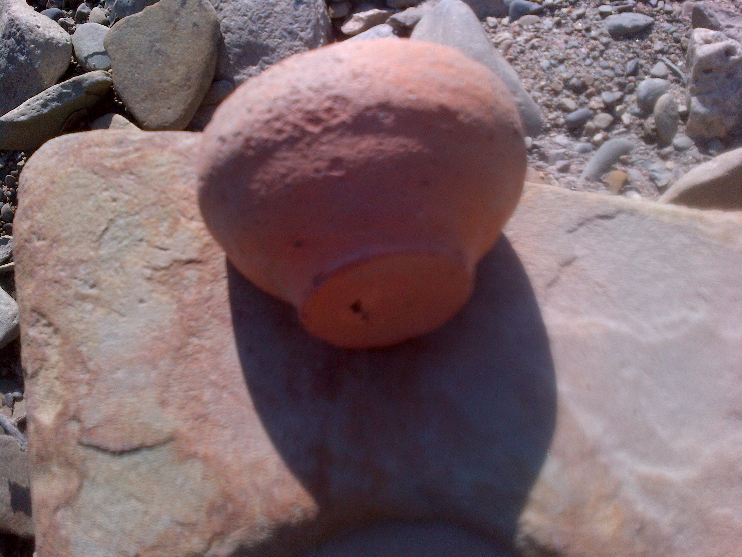
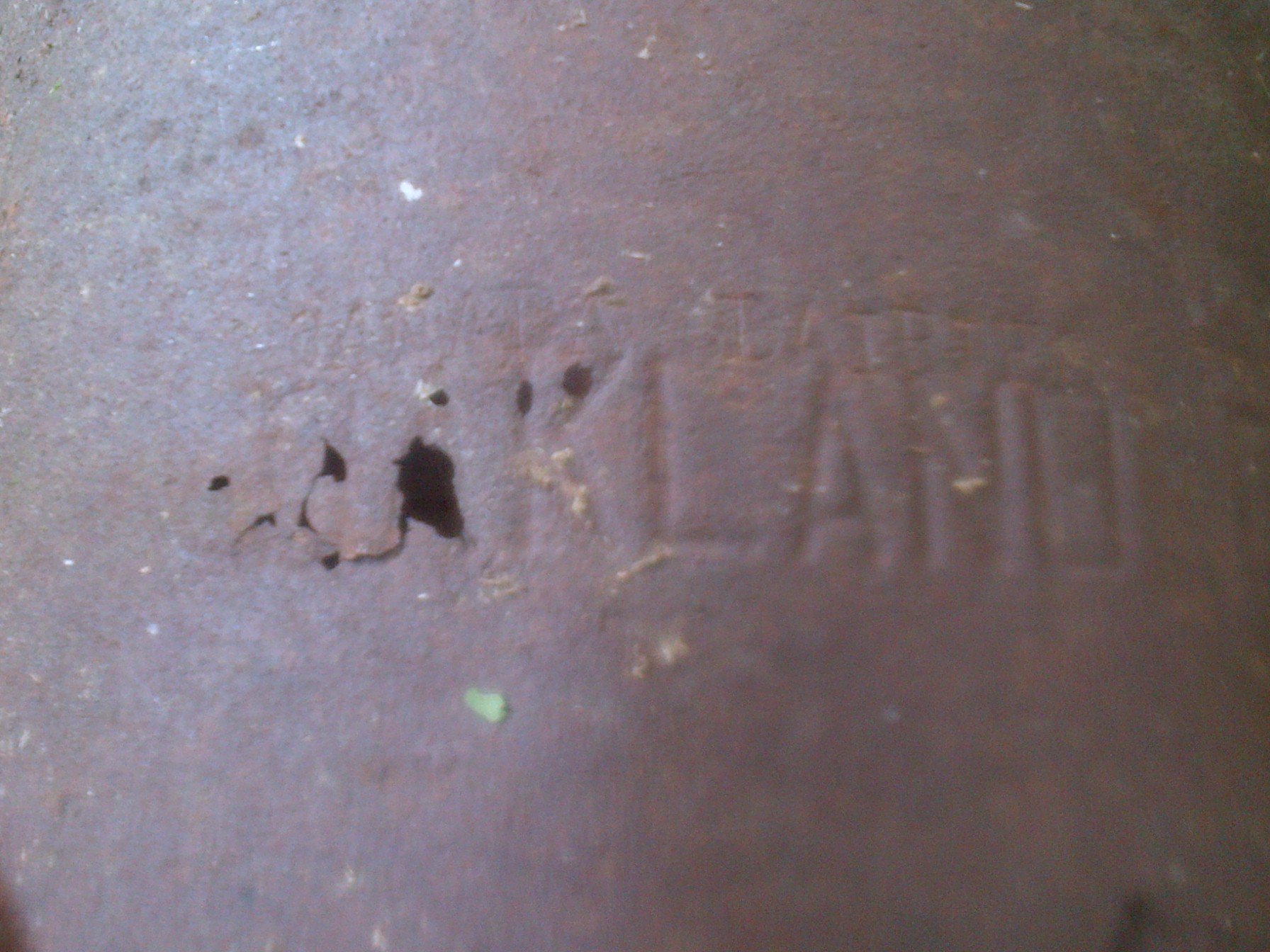
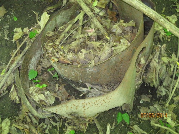
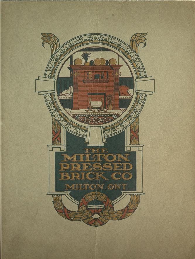
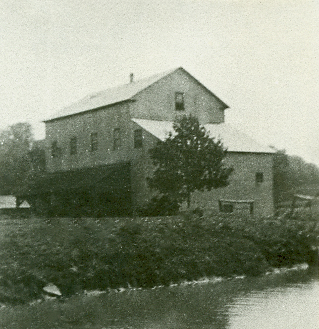
In 1850 James Gibb Thompson started milling in the area by building a saw mill, grist mill and carding mill along the Humber River. He sold the business to David Elder in 1869 and in 1874 when the post office was opened on the corner of his property the town took the name Elder’s Mills. His children continued to run the grist mill and comb wool in the carding mill until 1919. The Vaughan Archives photo below shows one of the mill buildings but is unfortunately undated.

Elder’s Mills

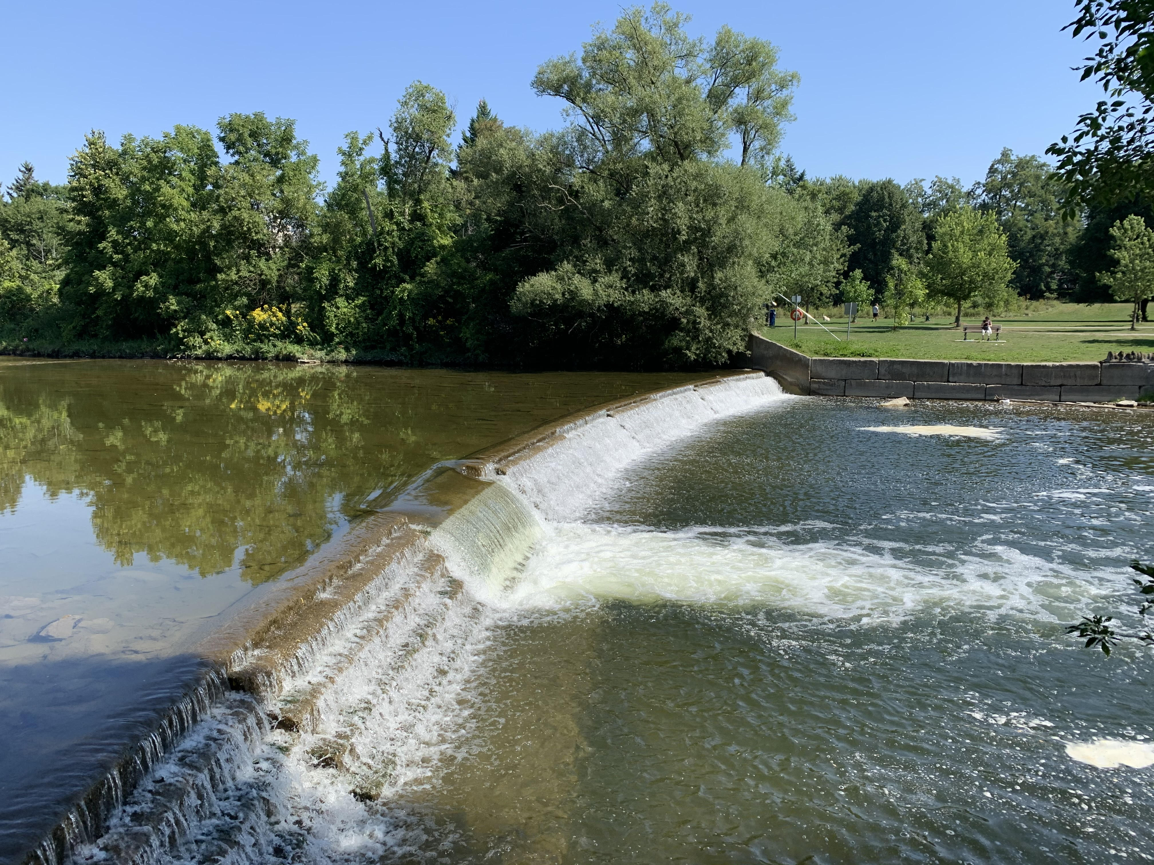
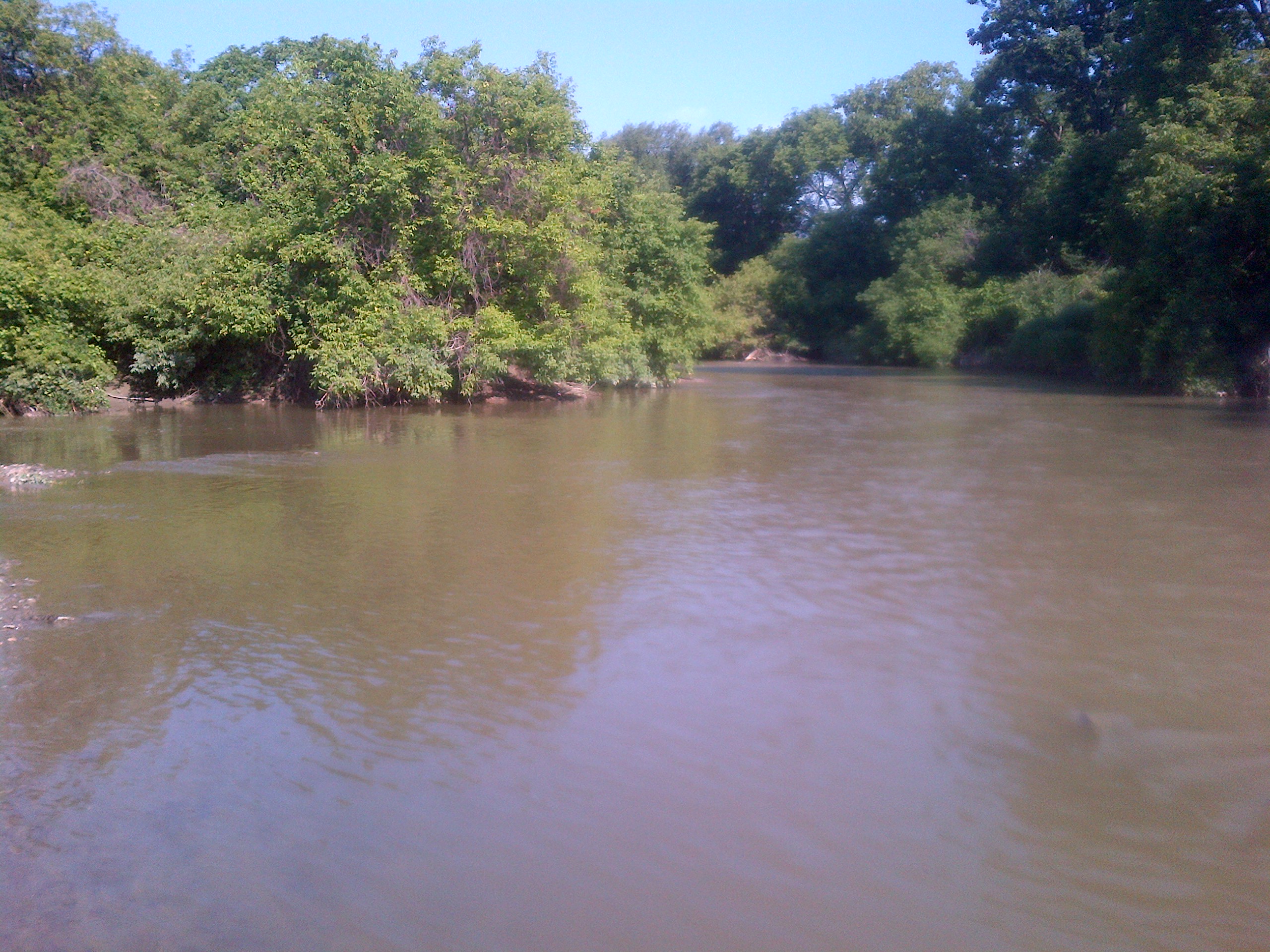
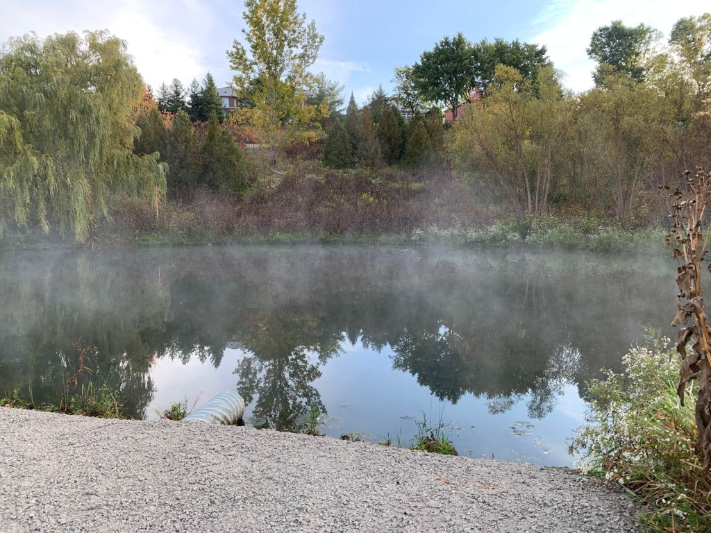
At the foot of the ravine are a couple of flood control ponds which were showing steam fog this crisp morning. Water cools down slower than the surrounding land and cooler air will flow over the water. The warmth of the pond causes a thin layer of air above it to warm up and moisture evaporates into it. When this air mixes with more colder air coming in off the land a fog condenses out of the moist warmer air that looks like steam rising off the water.

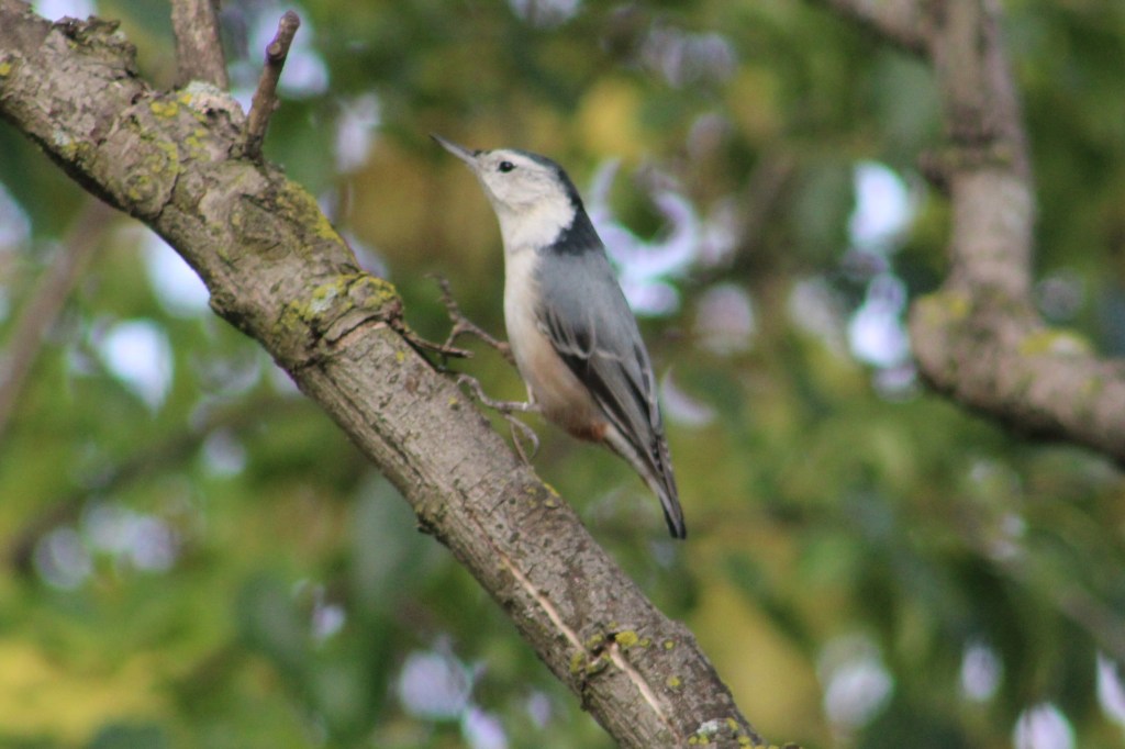
A White Breasted Nuthatch was bobbing its way around the branches of a tree, often standing upside down. Walking straight down the branch of a tree is a quick indication that the bird you are watching could be a type of nuthatch. The back of the neck and cap of the head on the white breasted nuthatch is dark and make it appear to be wearing a hood. Nuthatches probe into cracks in the bark with their long straight bills and unlike woodpeckers they don’t lean against their tails when probing a tree.

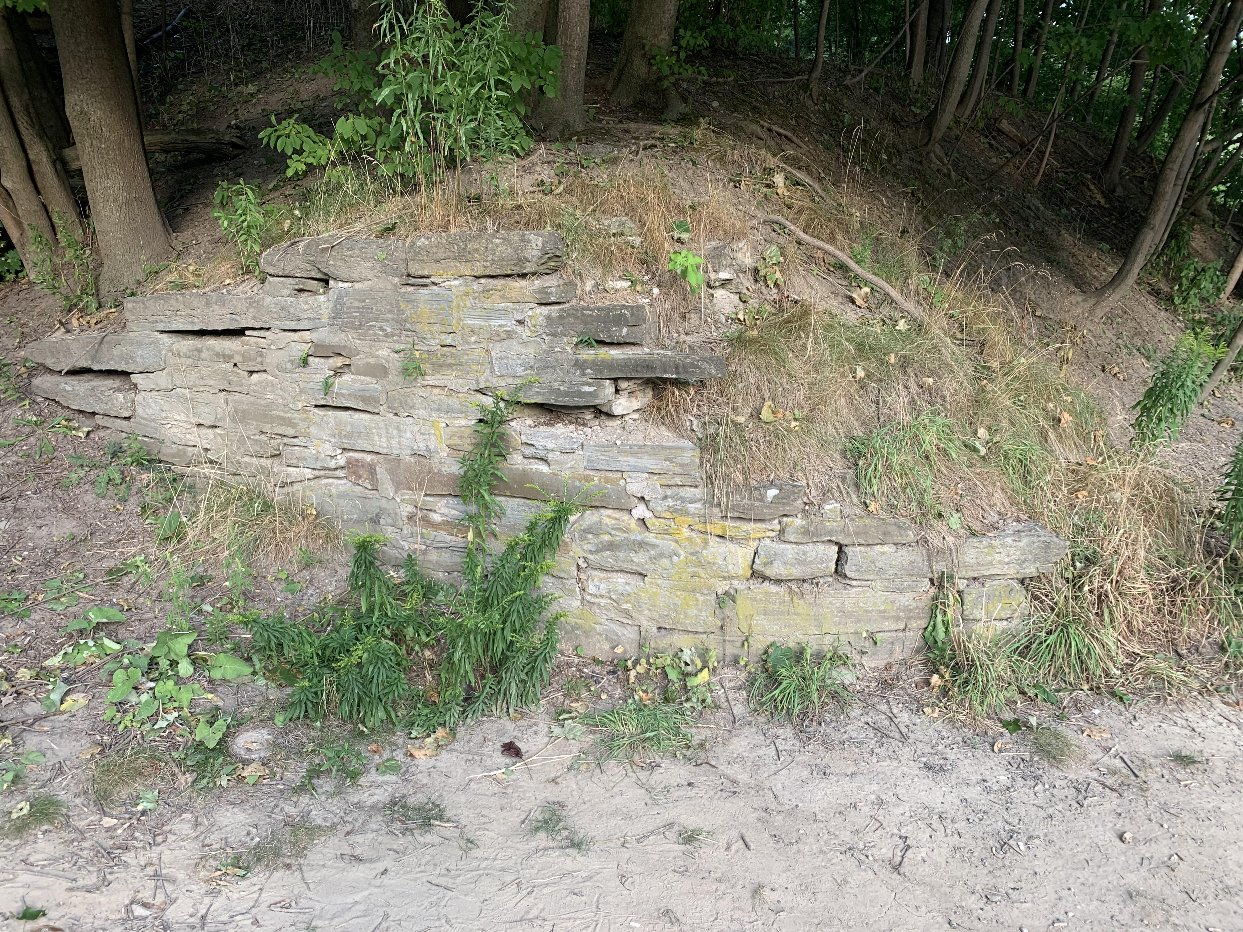
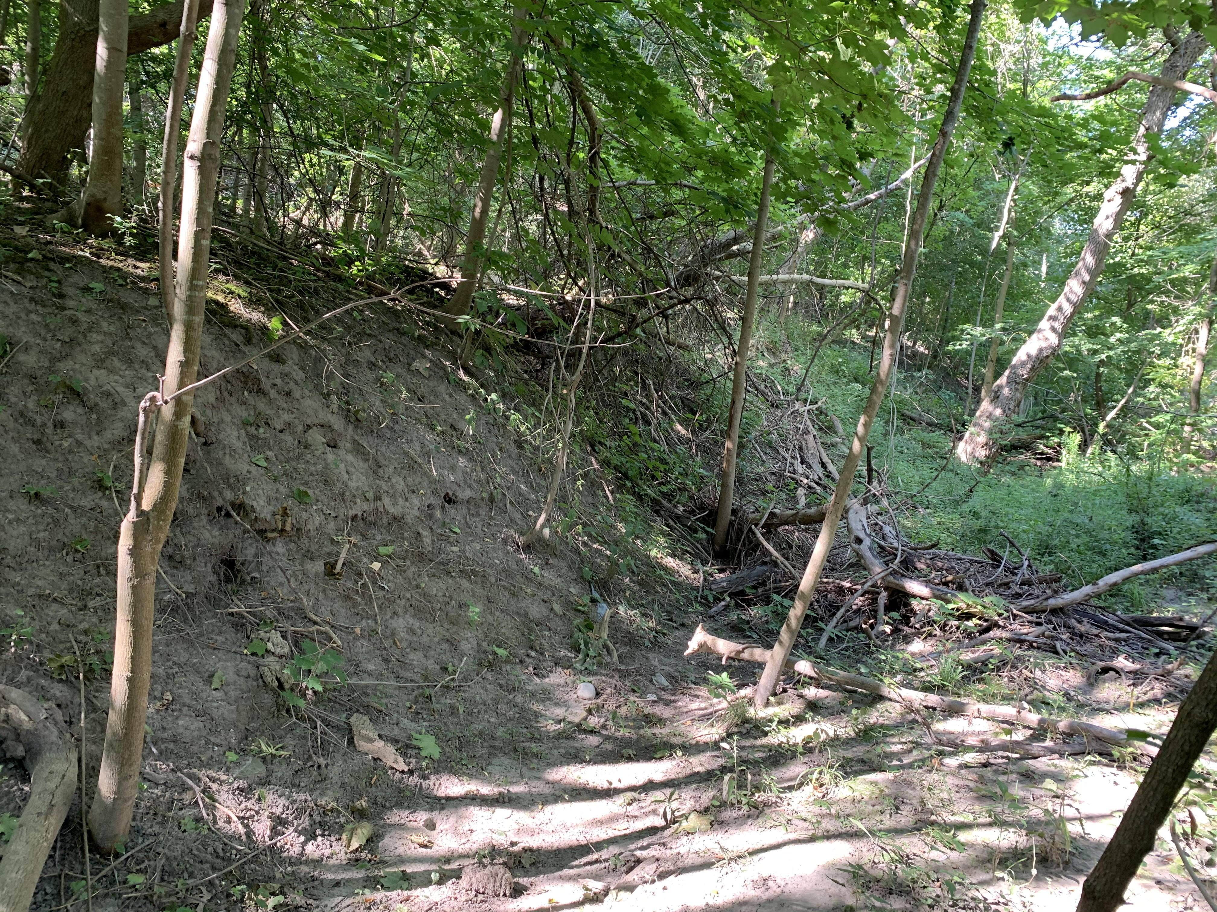
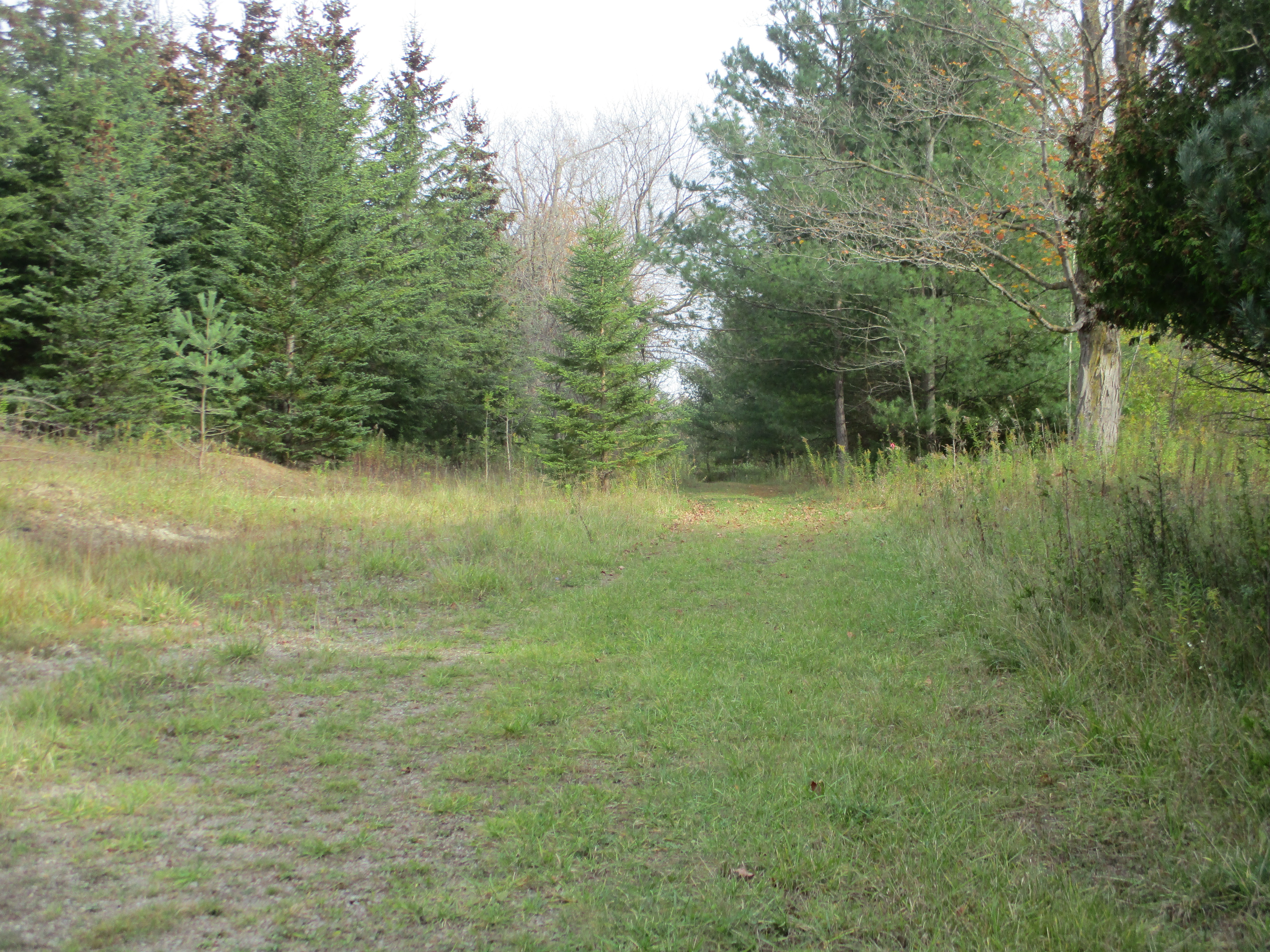
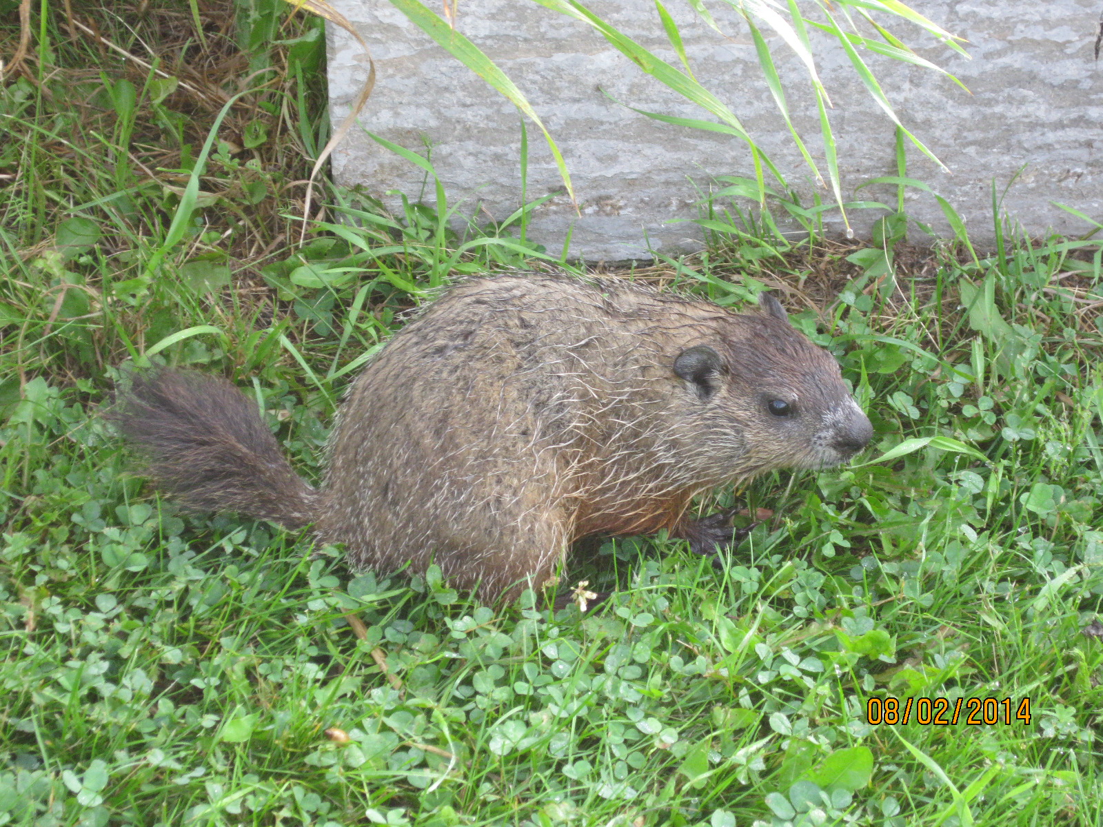
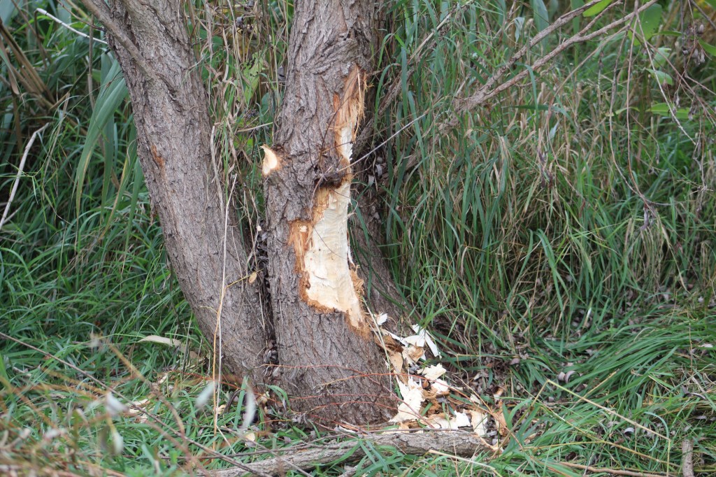
There are two small storm water control ponds near the bottom of the hill that were originally separated by a row of about twenty small trees. All but four of these have recently been chewed off and dragged into the water to serve as food supplies. The picture below shows how ambitious the local beaver is as it is working on a much larger tree than it can possibly move after it fells it. It will then work on removing smaller branches and bringing them closer to the underwater entrance to their home.

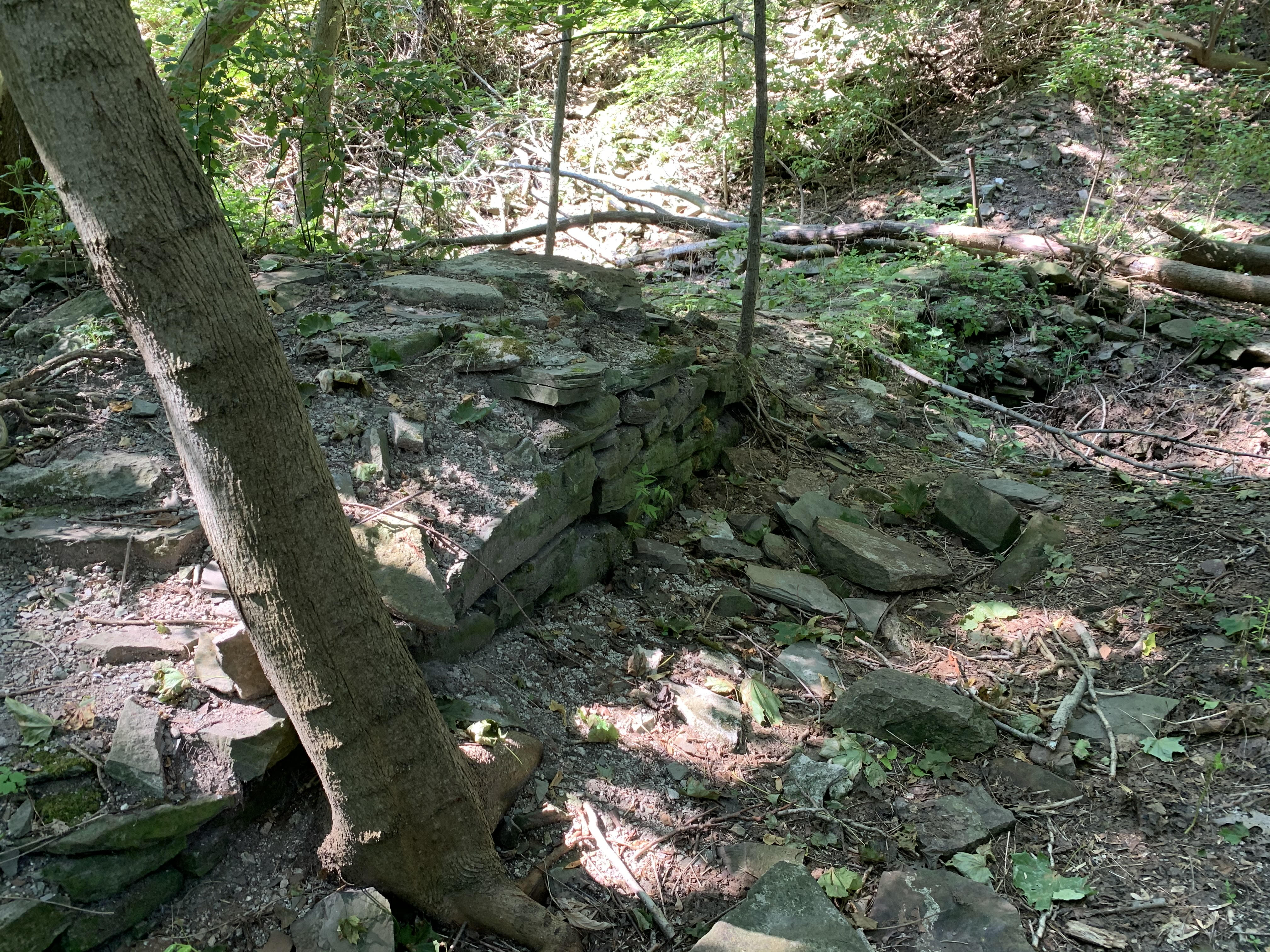
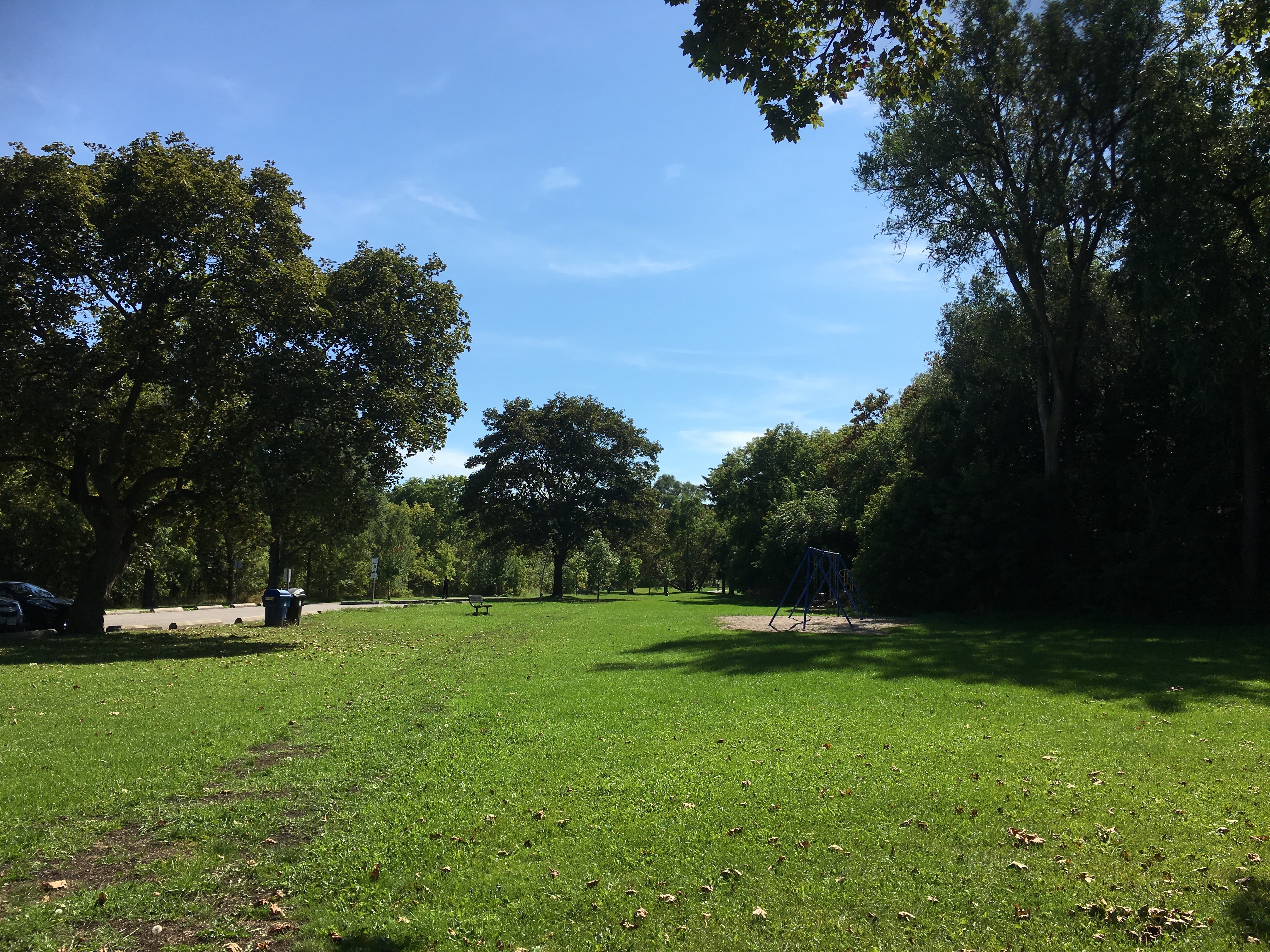
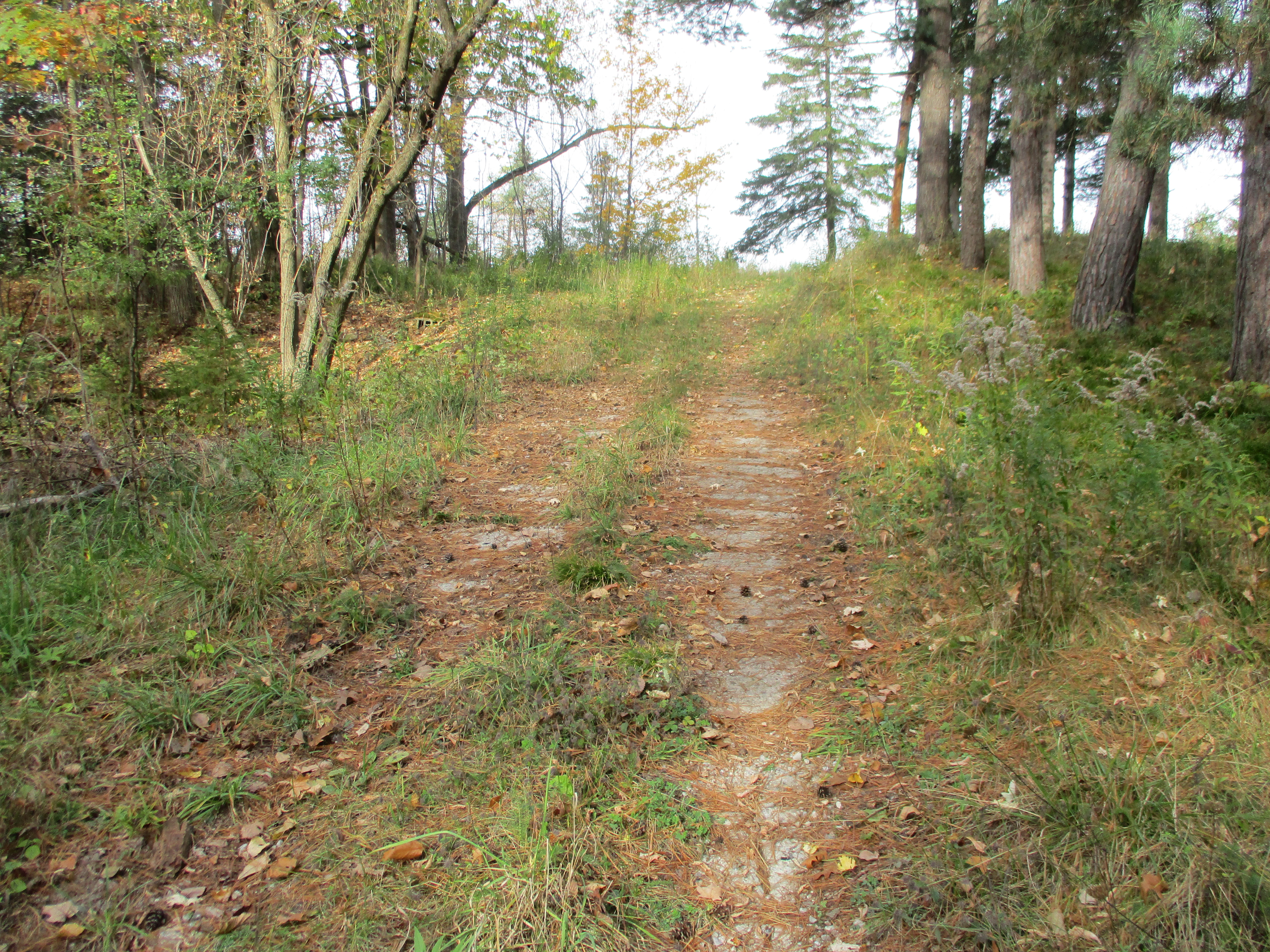
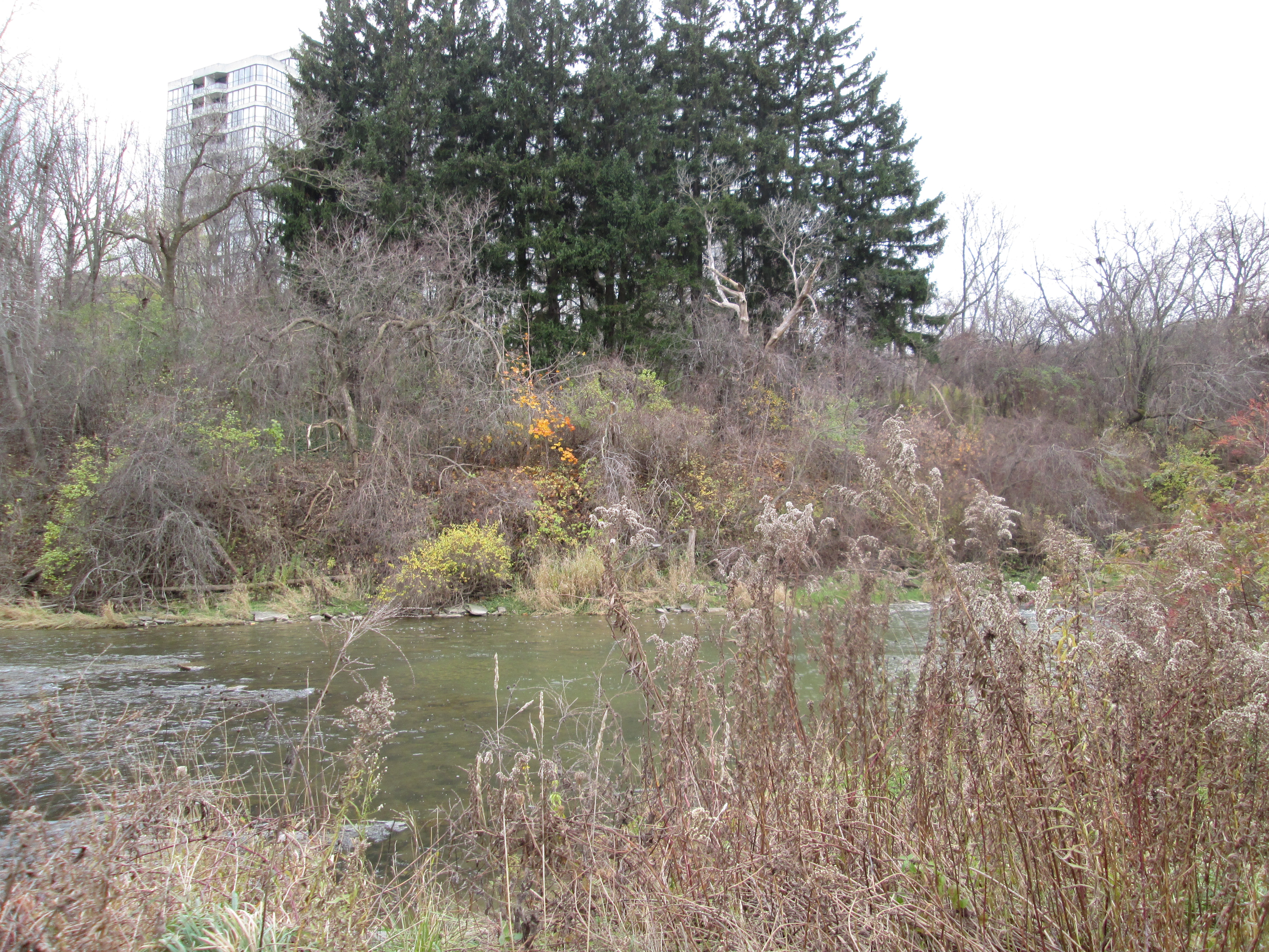
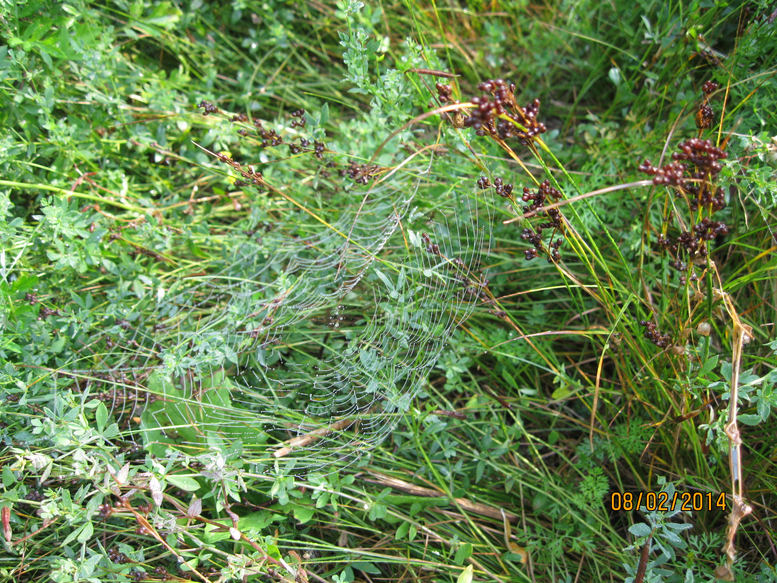
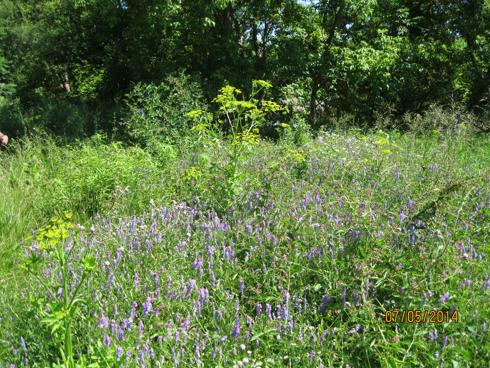
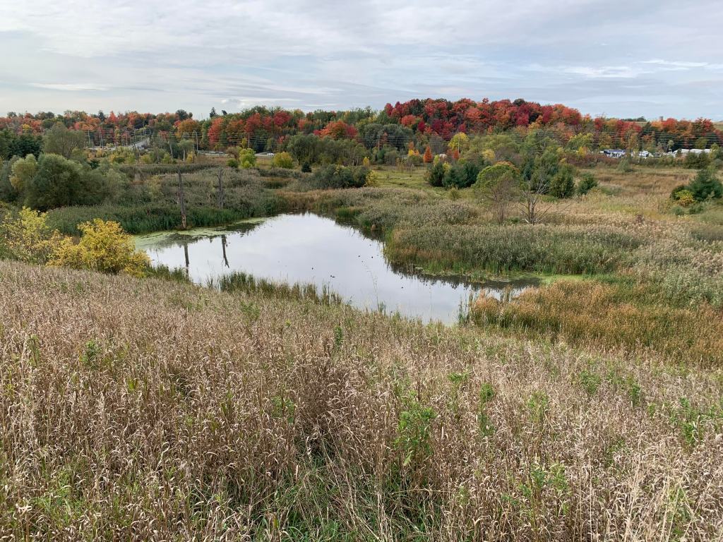
The former Elder property has seen a few changes over the years. It spent 70 years as an industrial hub when the mills arrived and then it was later turned into a golf course. More recently it has been restored with new plantings and water management systems that allow meadows and wetlands to flourish all year. The noise of Elder’s Mills has been replaced with the tranquility of Elder’s Mills Nature Reserve.

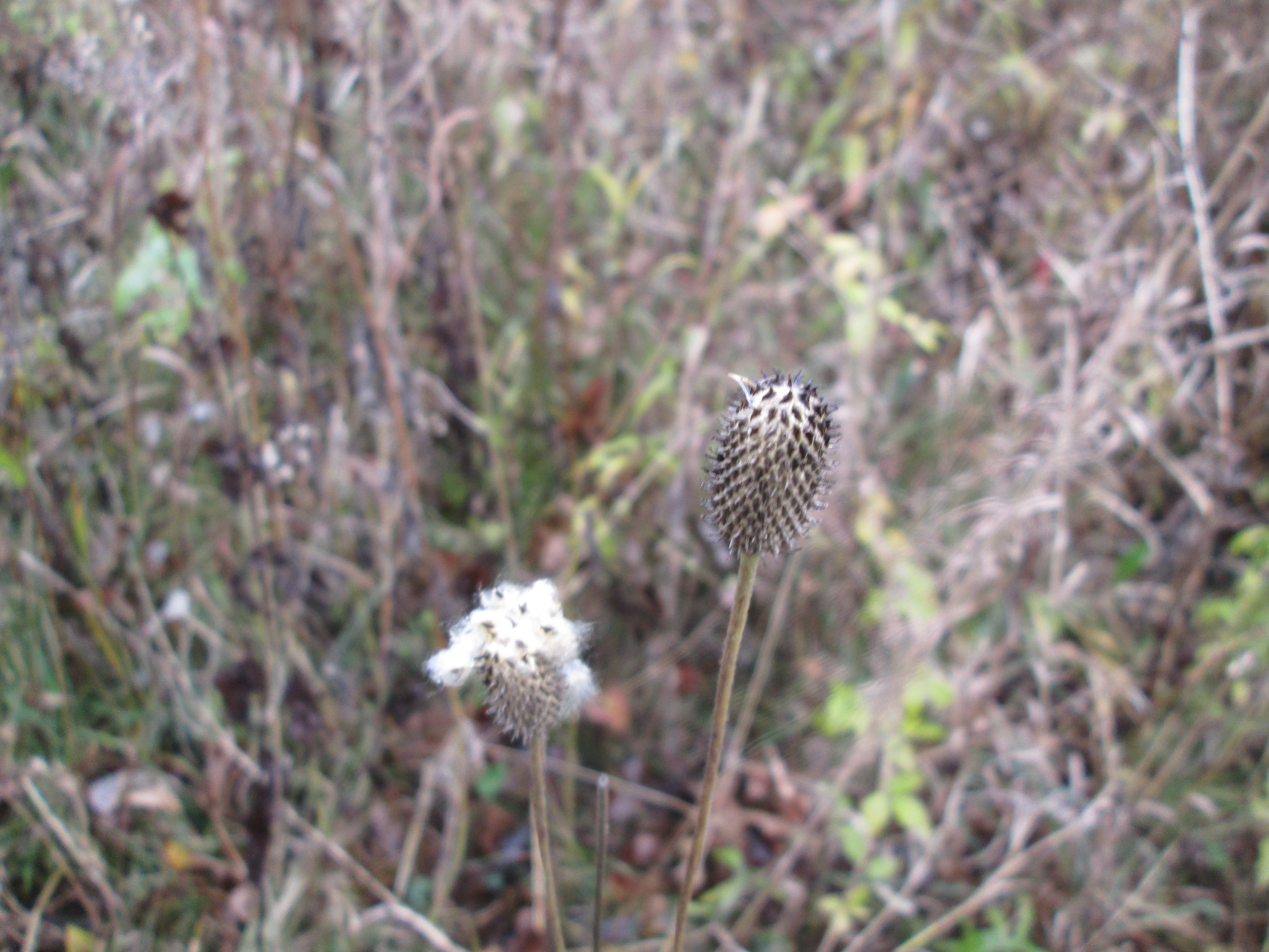
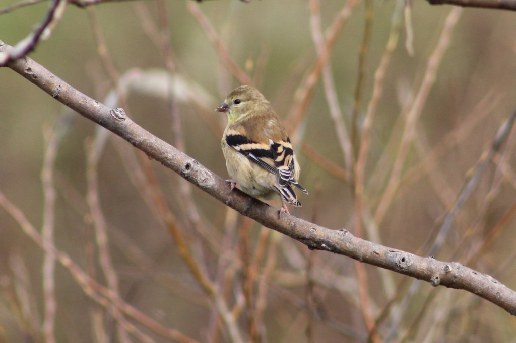
American Goldfinch shed their bright yellow plumage after the mating season and it becomes harder to tell the male from the female. They are better set to blend in with their surroundings for the winter months. Some goldfinches will migrate south into the northern states while a few in eastern Ontario will move north into boreal forests for the winter.

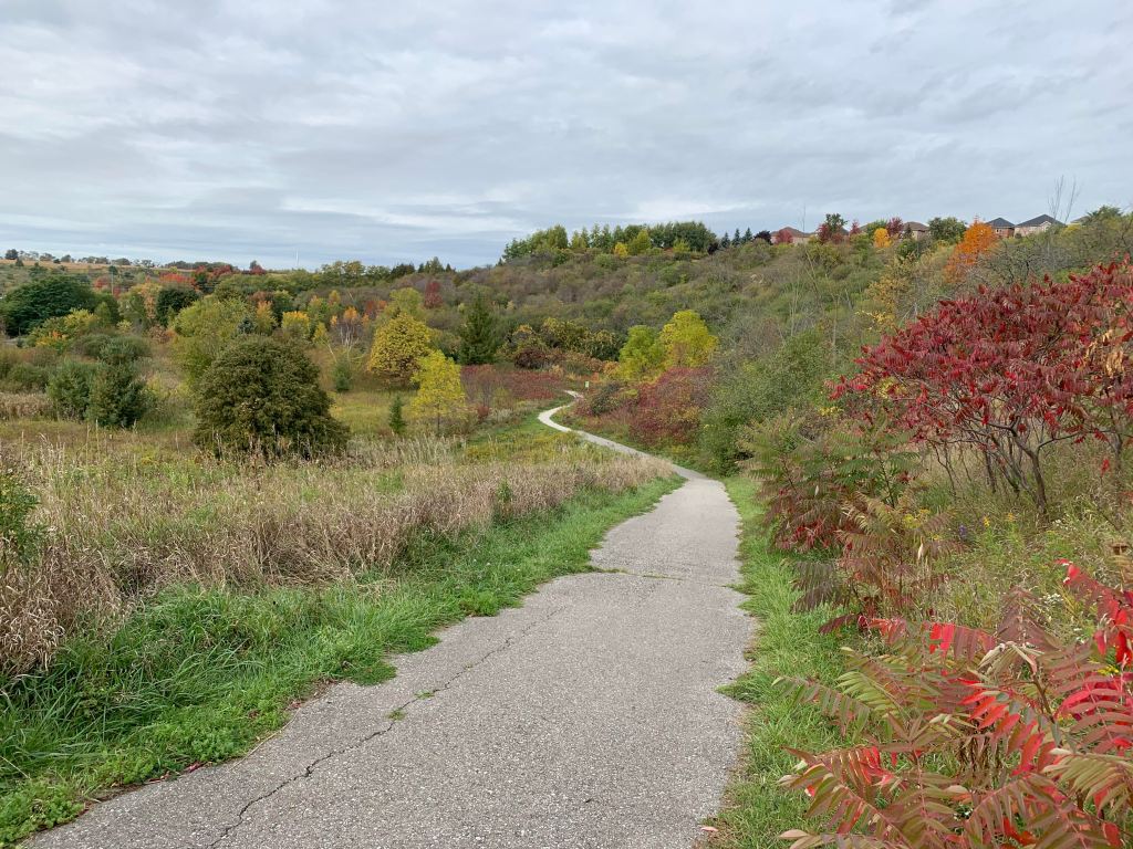
There is a lookout two-thirds of the way up the side of the ravine that provides a nice view out across the nature reserve. The forests on the far side of Highway 27 are a bright red and orange that would really look nice on a sunny day.

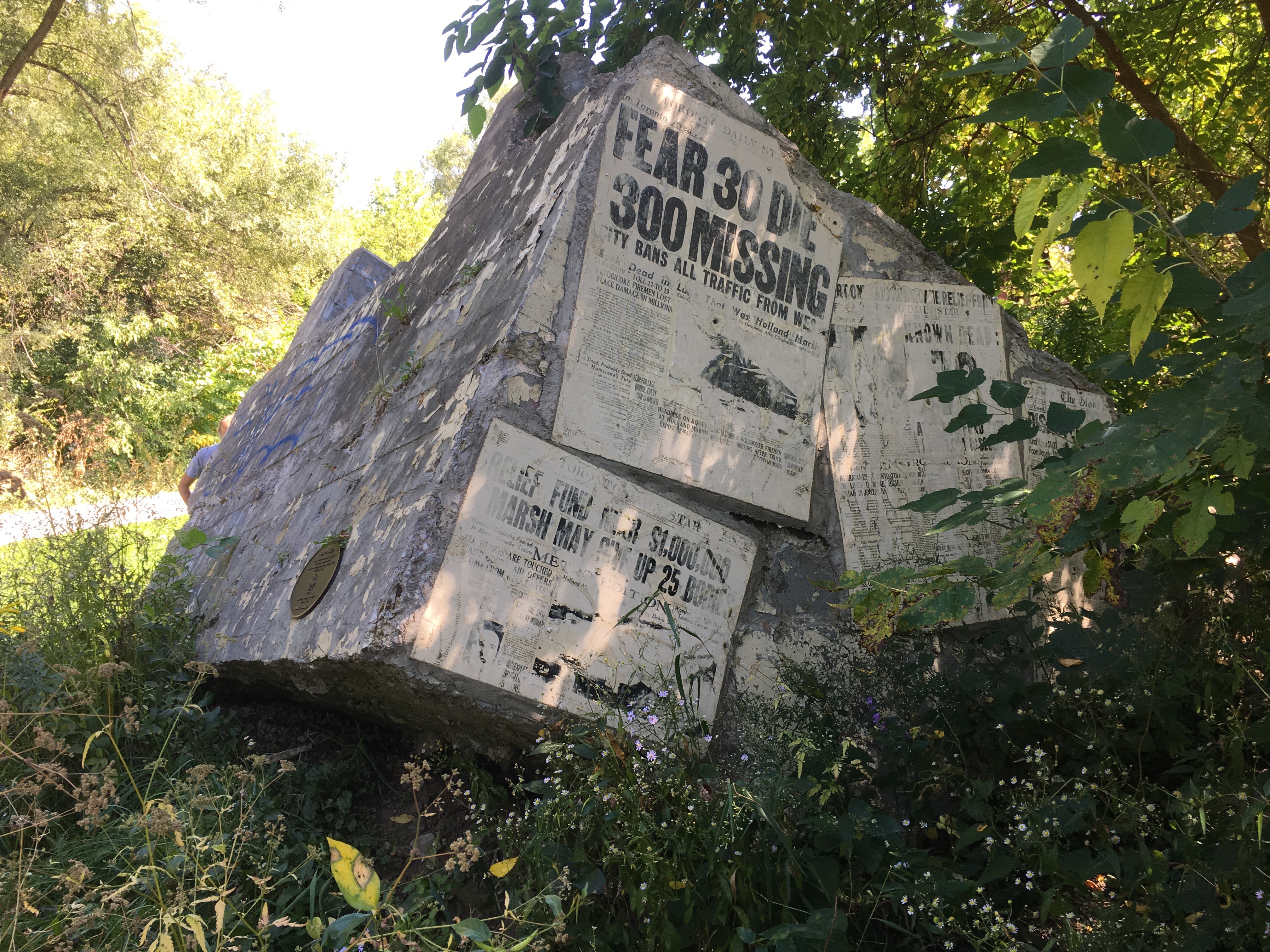
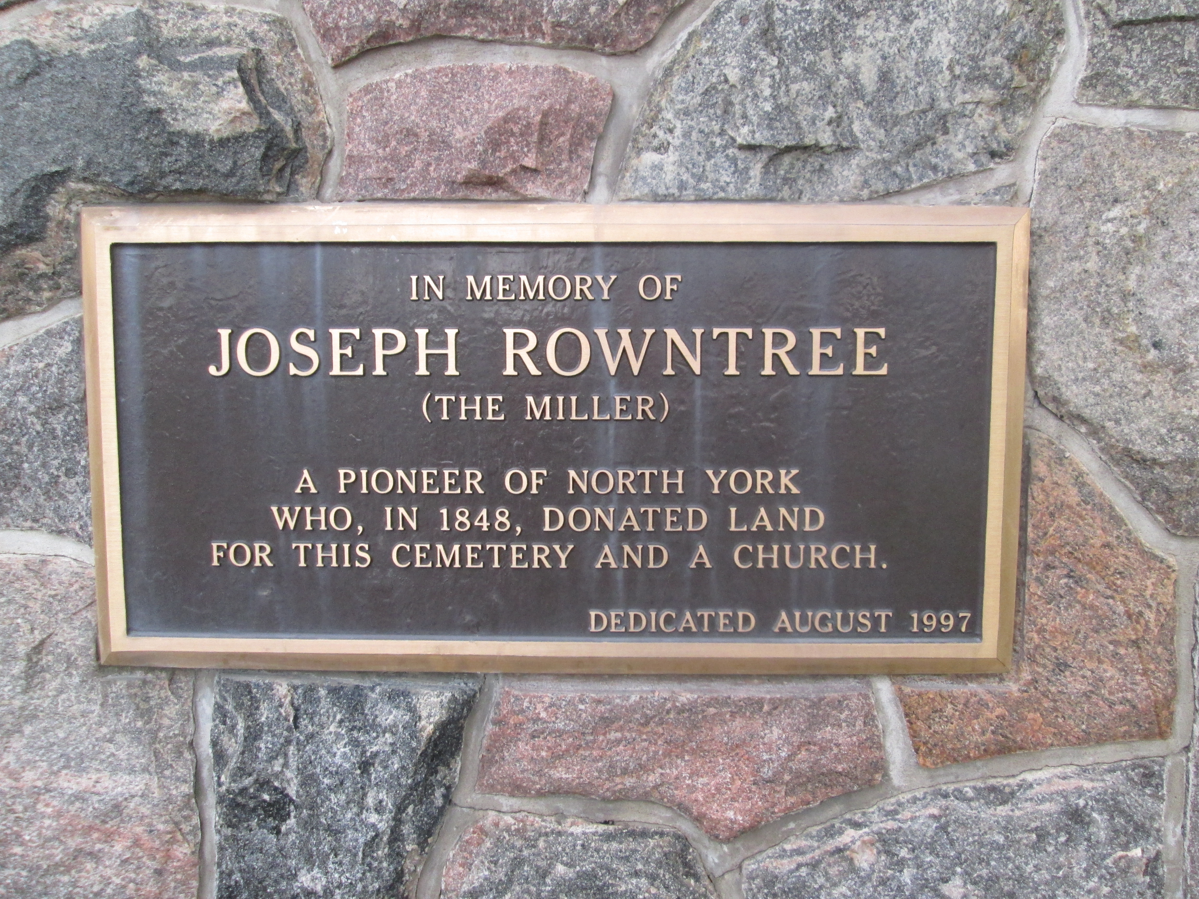
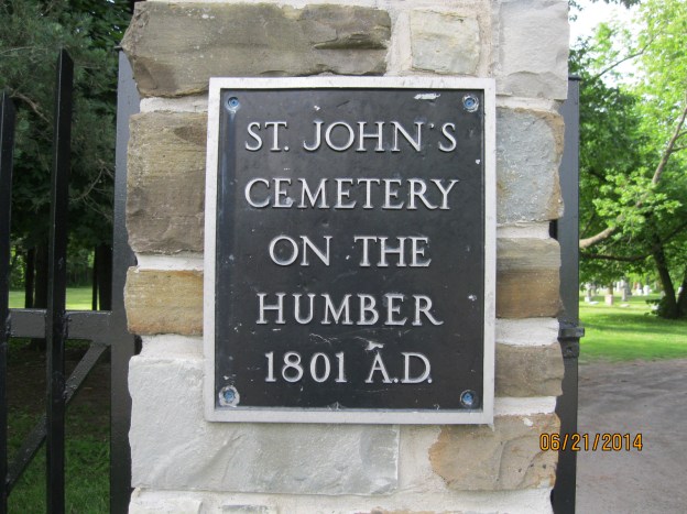
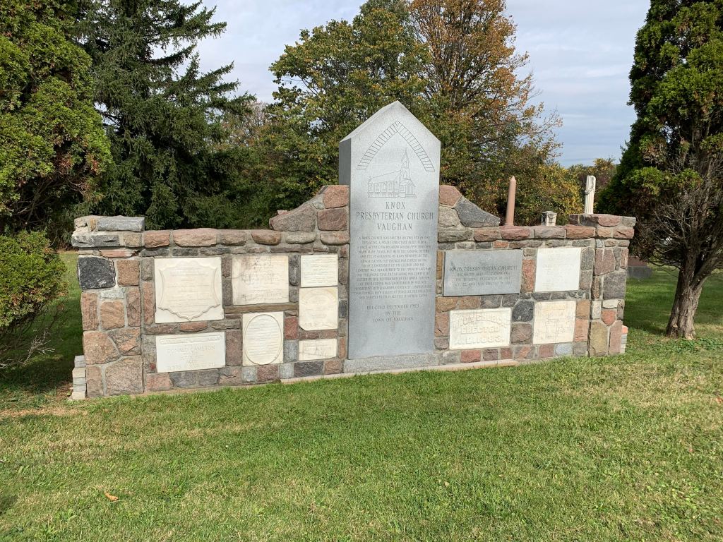
The congregation of Knox Presbyterian Church had been meeting from as early 1841 in local homes. After the school building was erected they moved into it until they built their first frame church building in 1845. The church quickly grew to 175 members and by 1883 they had completed the construction of a new brick building on the same site. When the United Church was formed in 1925 nearly half of the congregation left to join the new denomination and the church never recovered its former size. In 1961 it closed and, sadly, the building was destroyed by fire in 1974. Older or damaged stones were gathered into a cemetery cairn in 1983. You can read about other Pioneer Cemetery Cairns in our feature presentation.

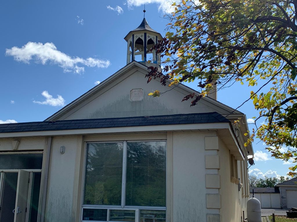
Across the road from the church stood the town school. The original frame structure was built in 1843 and then replaced with the structure that still stands behind a new front section. The bell appears to be missing from the small cupola but the date stone is still clearly legible. It reads “School Section No 15 Erected 1872”.

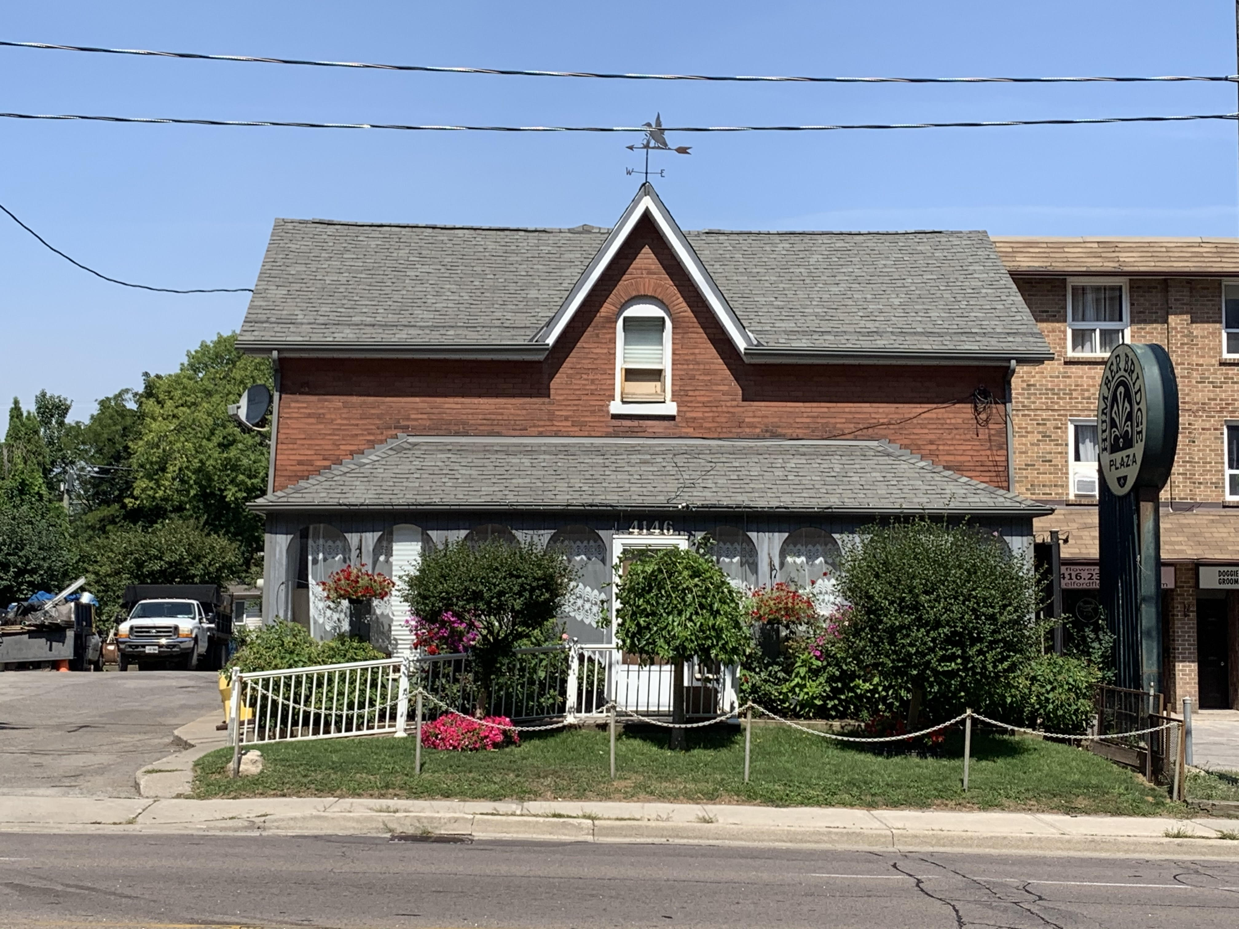
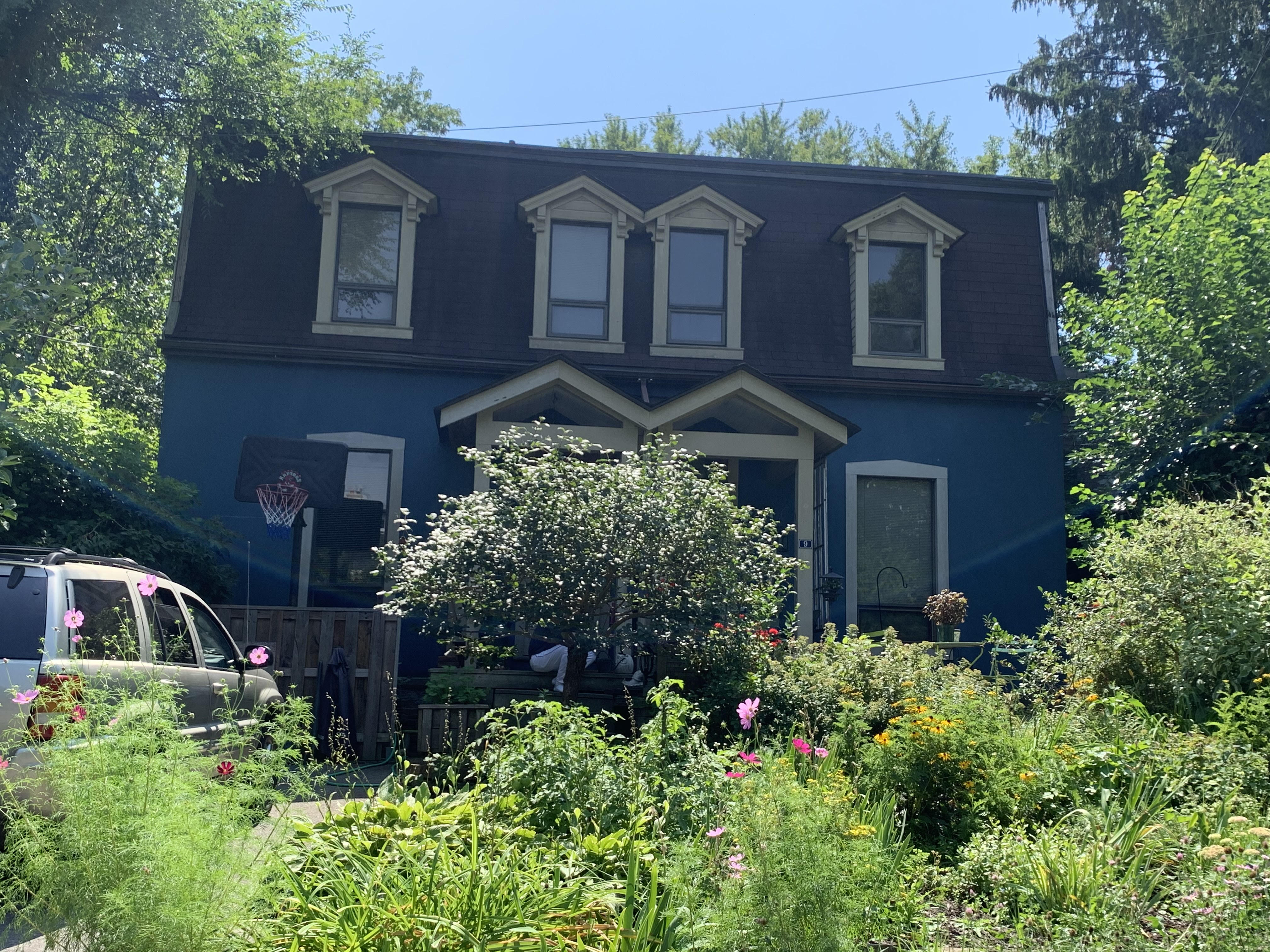
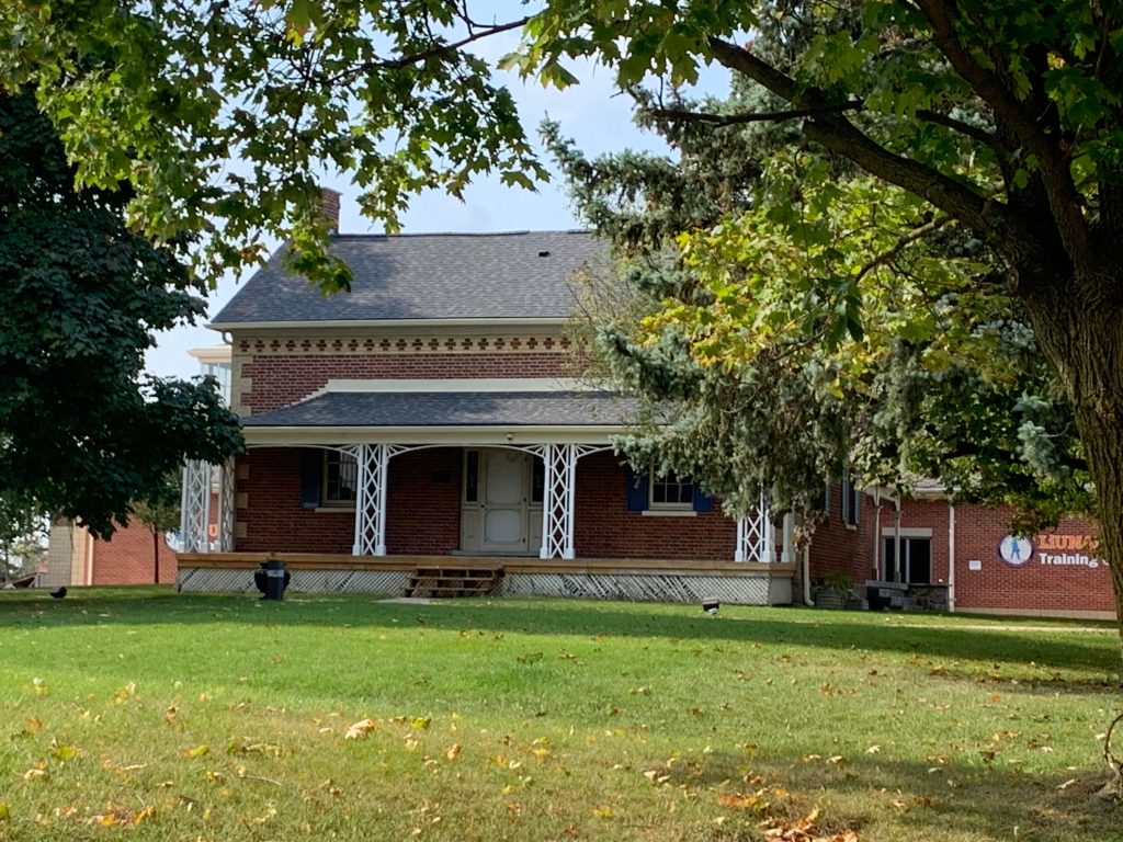
Robert Agar had his house built in 1845 and it is made of bricks manufactured on his farm. The use of light coloured bricks to form the quoins and add a pattern below the eaves makes this a very attractive home. There’s a rear entrance with a porch decorated with gingerbread.

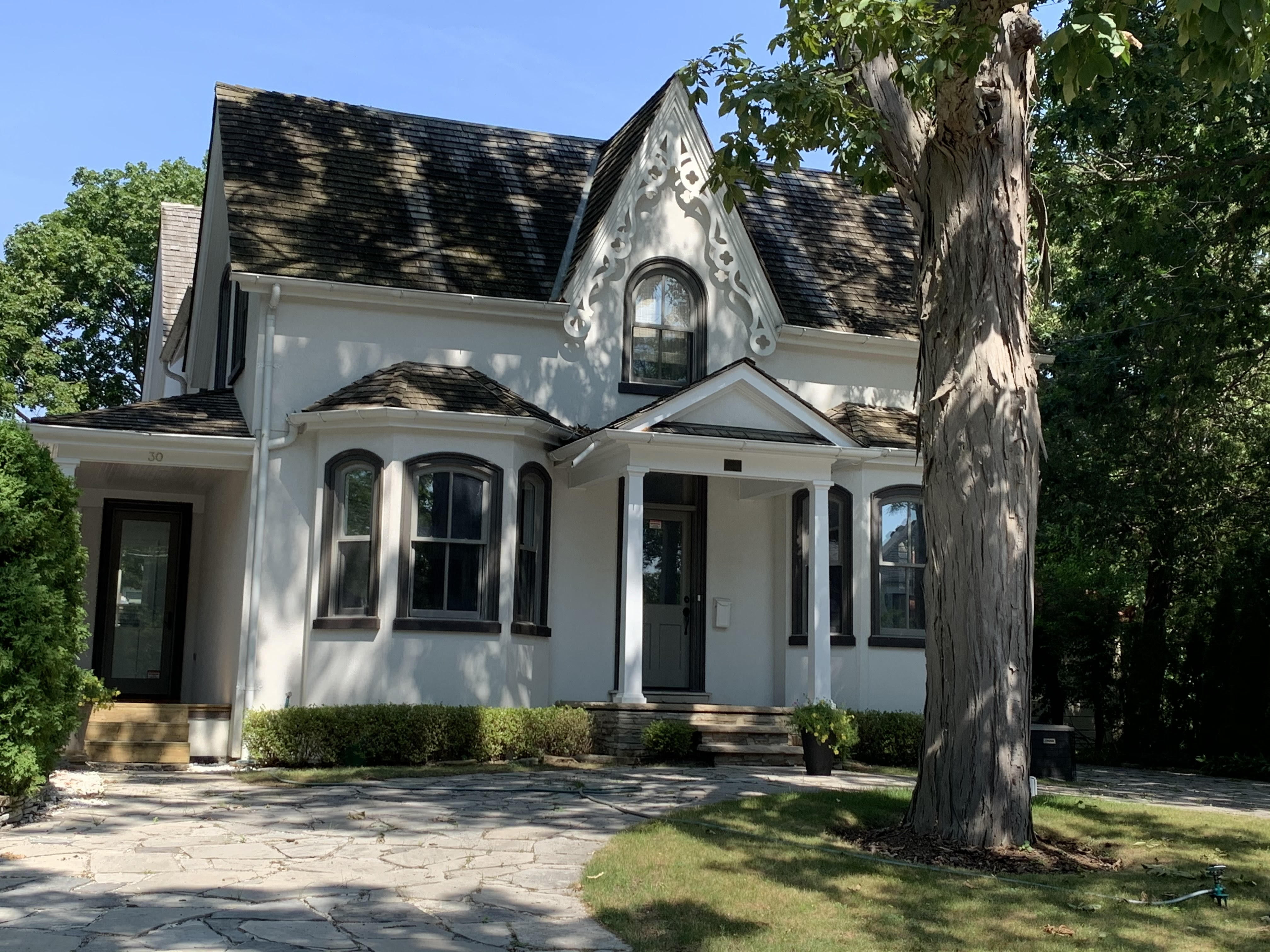
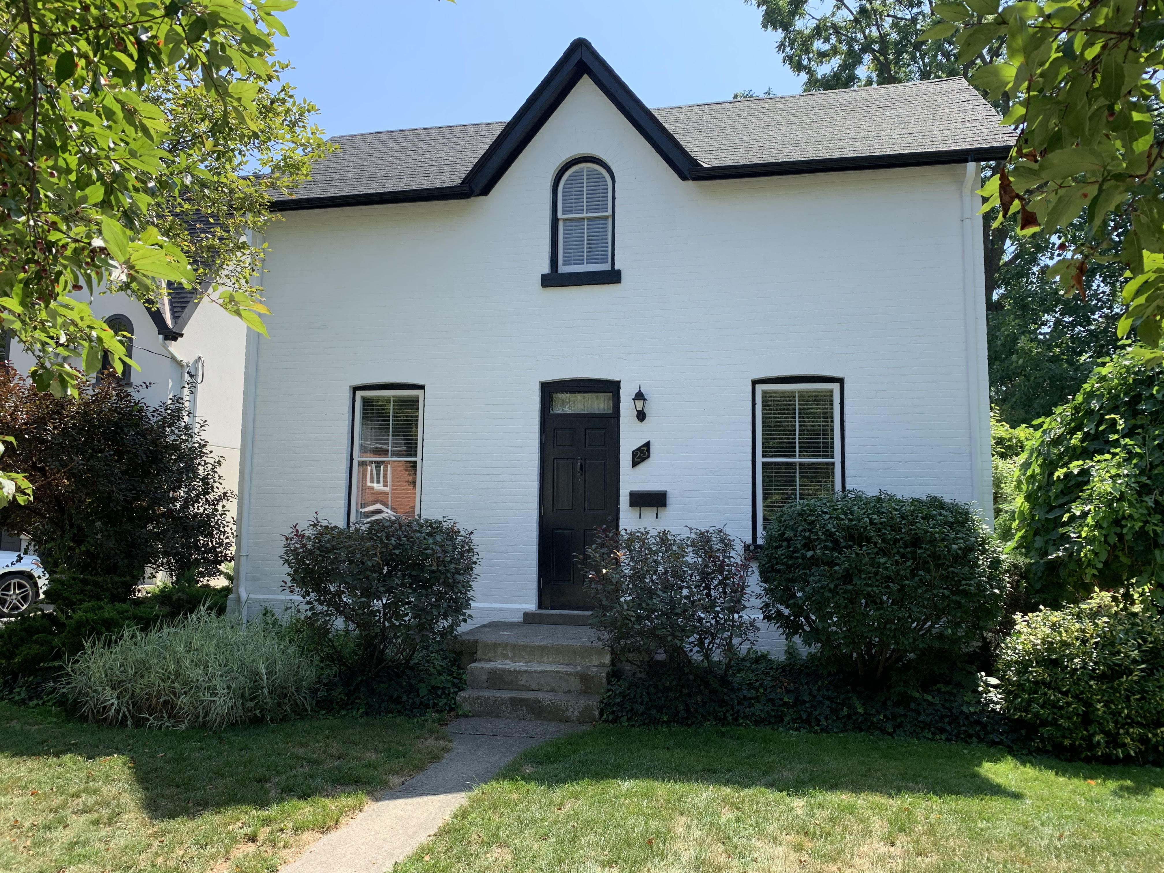
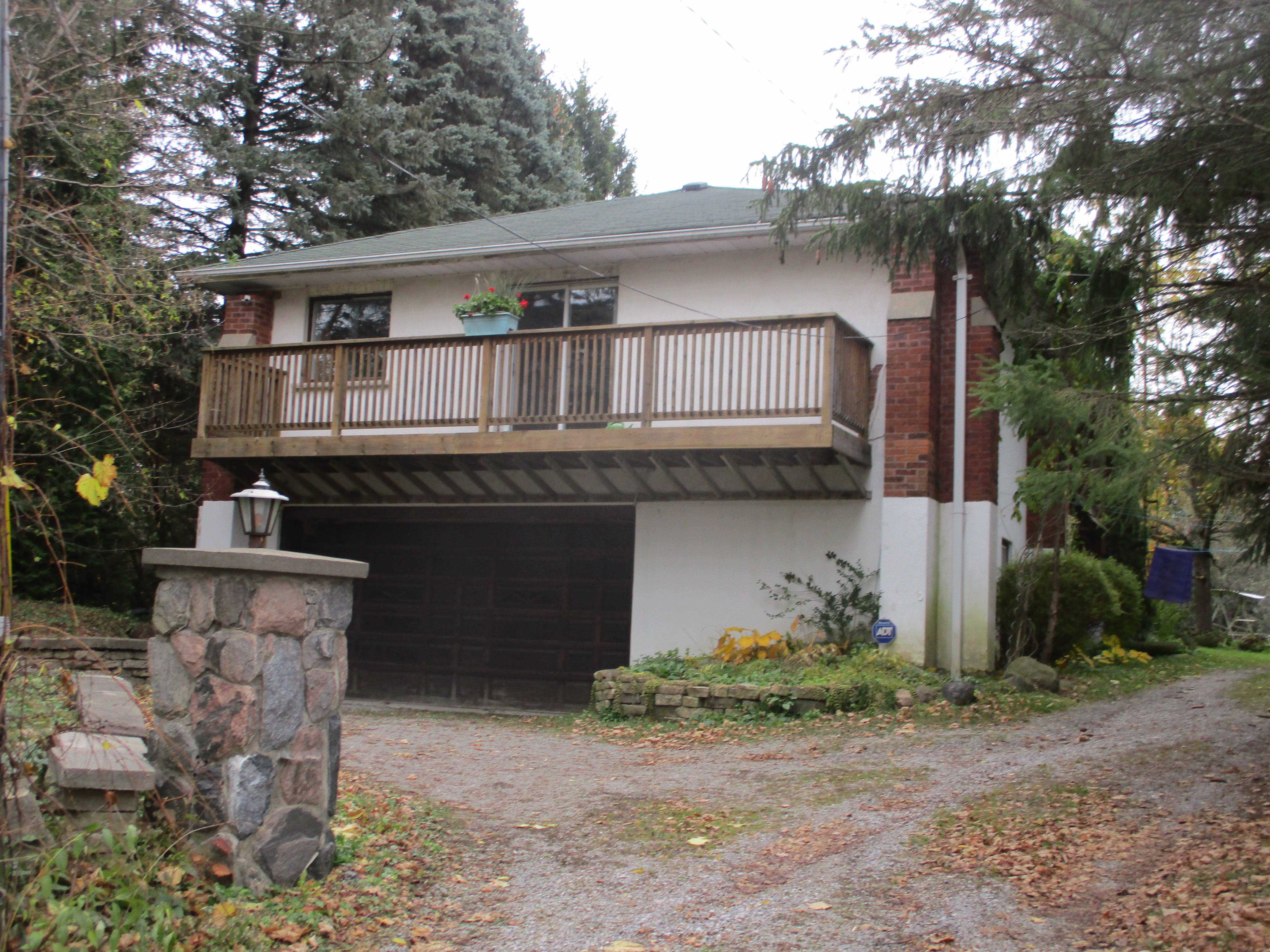
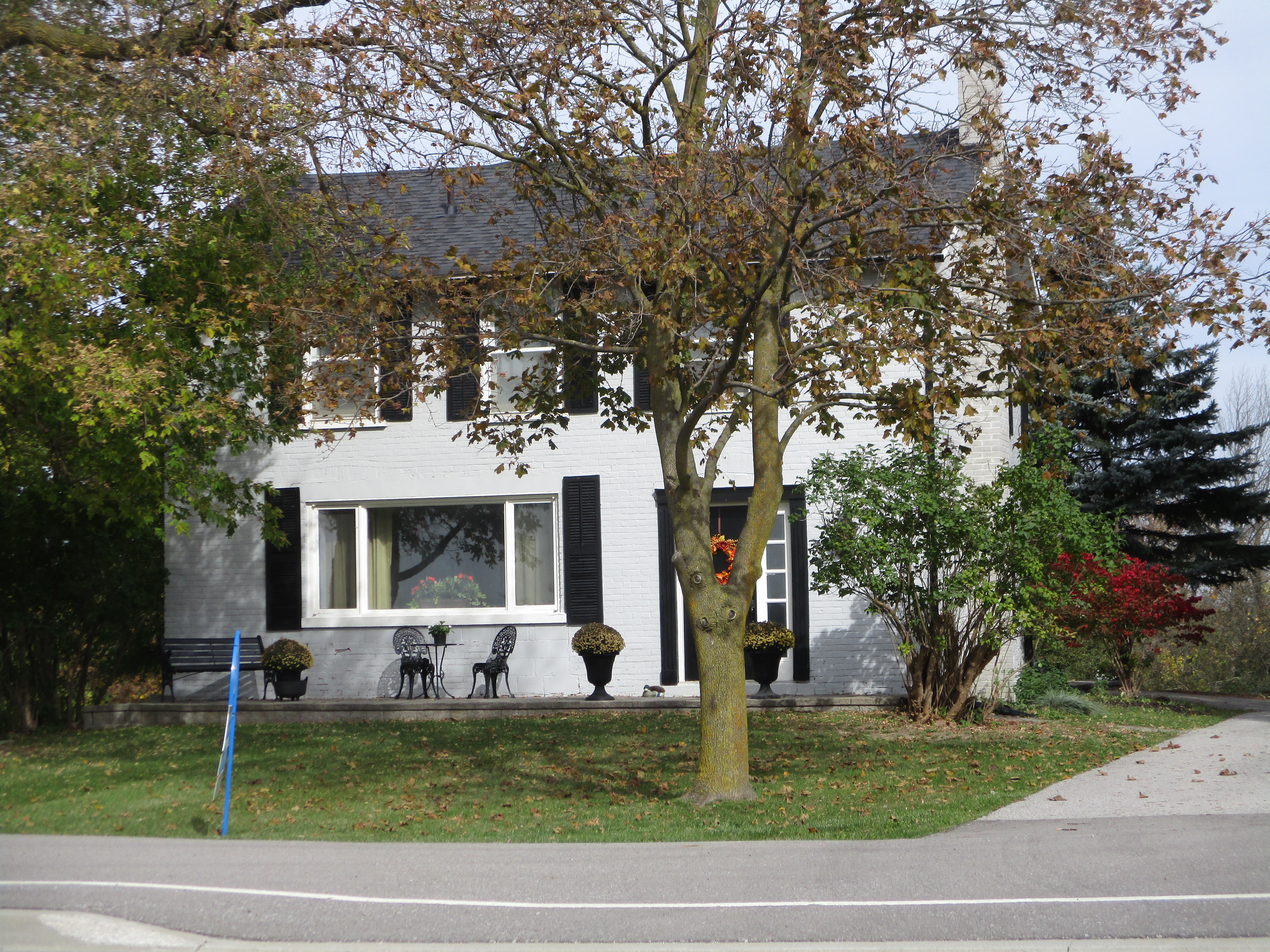
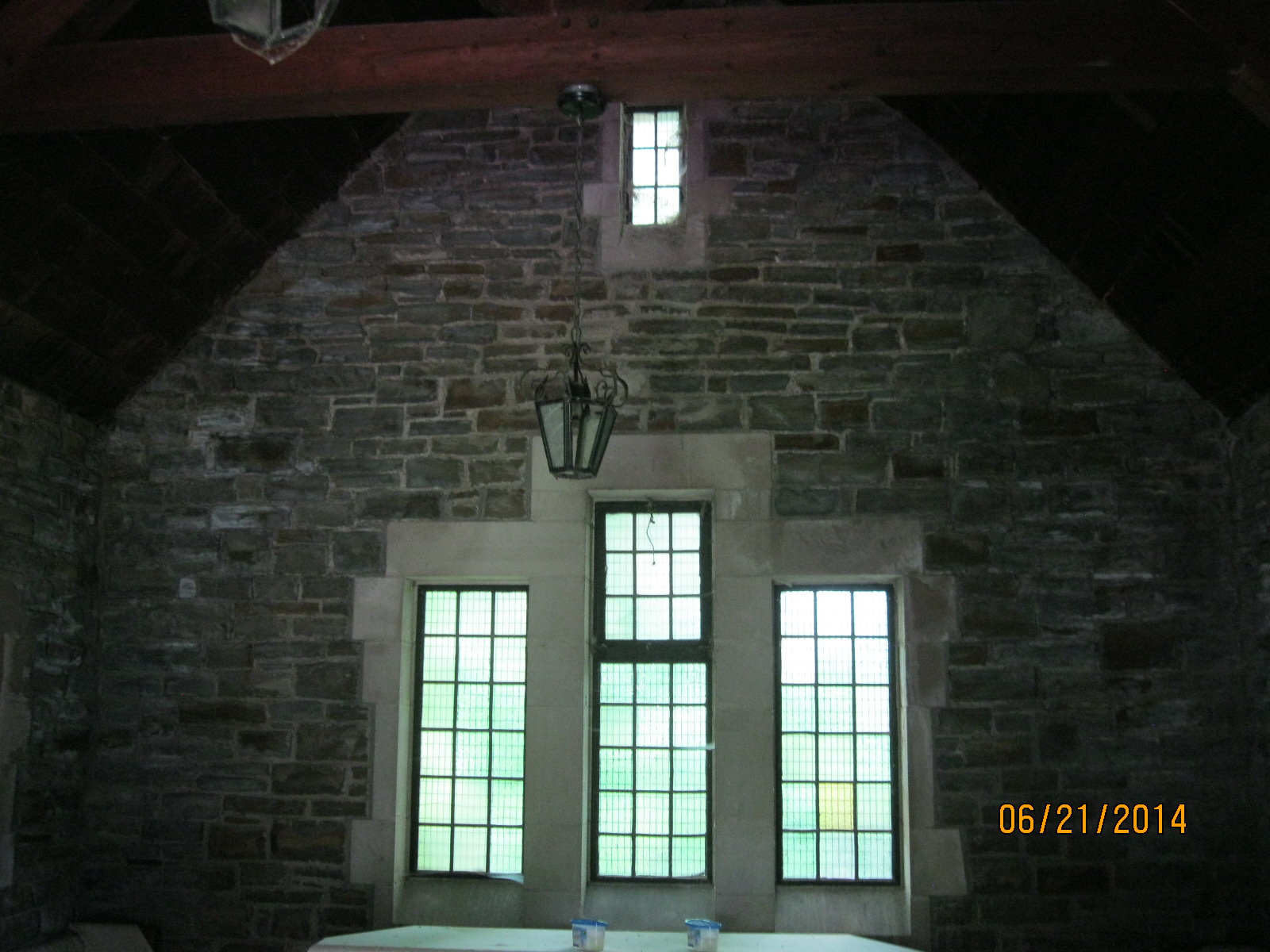
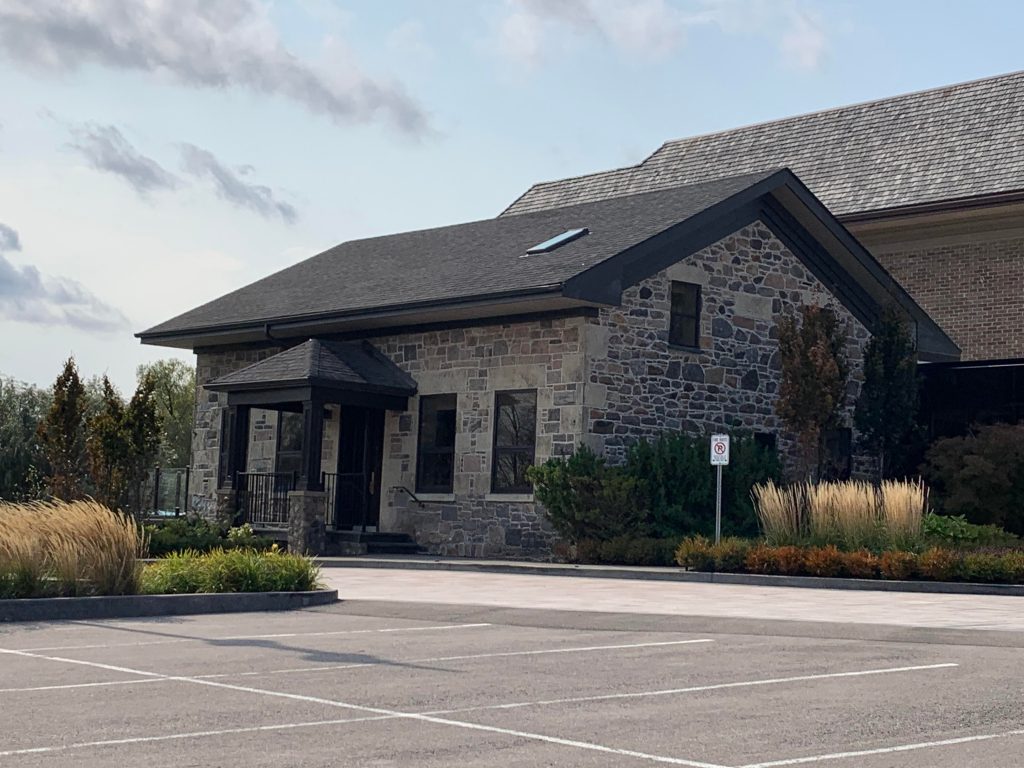
James Sommerville built his story and a half house of split field stone collected on his farm. It was completed in 1856 and cut stone was used for the quoins as well as the window and door frames. It is a simple 5 bay Georgian style house and has recently been renovated and incorporated into the Arlington Estate Event Centre.

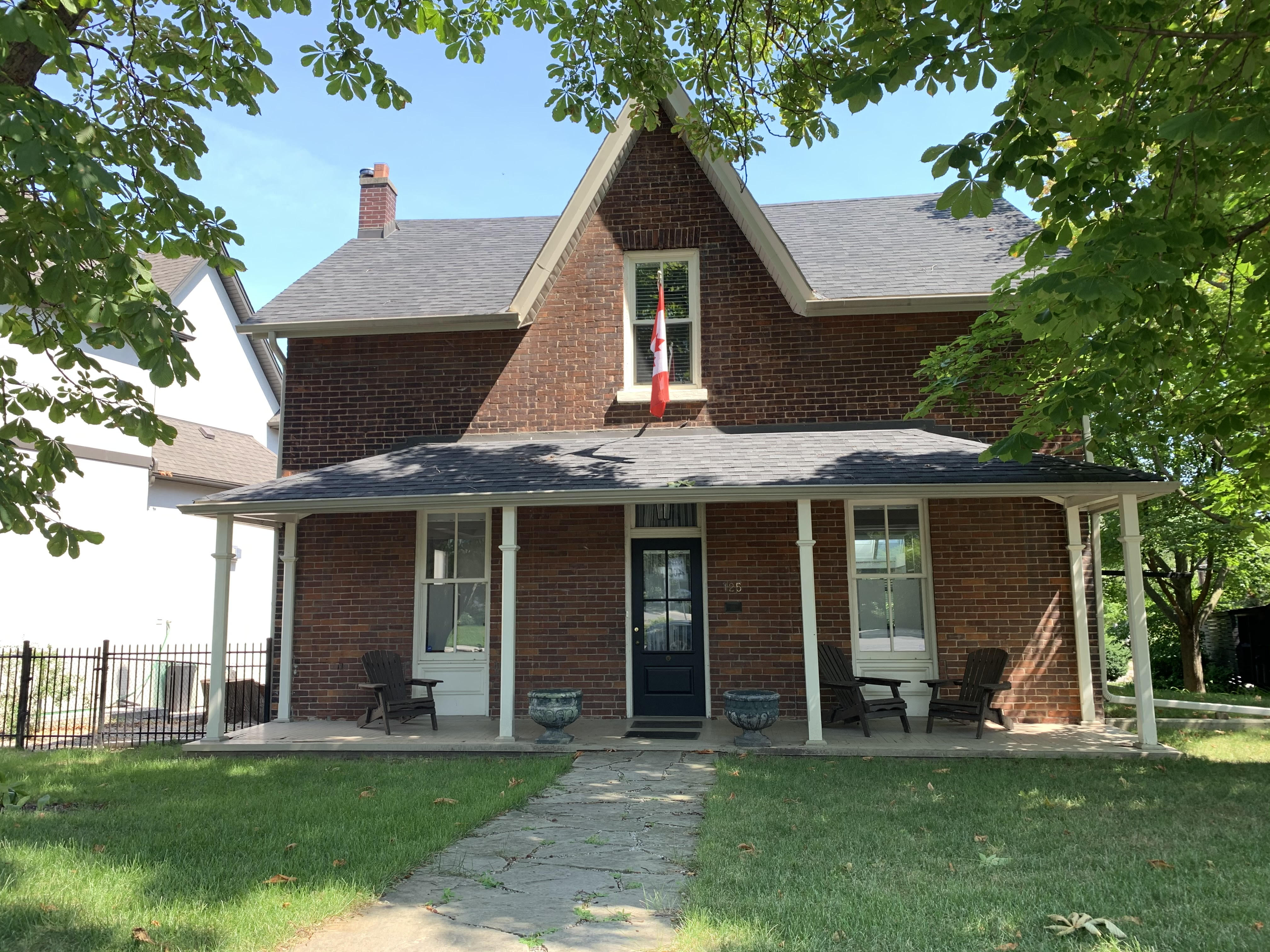
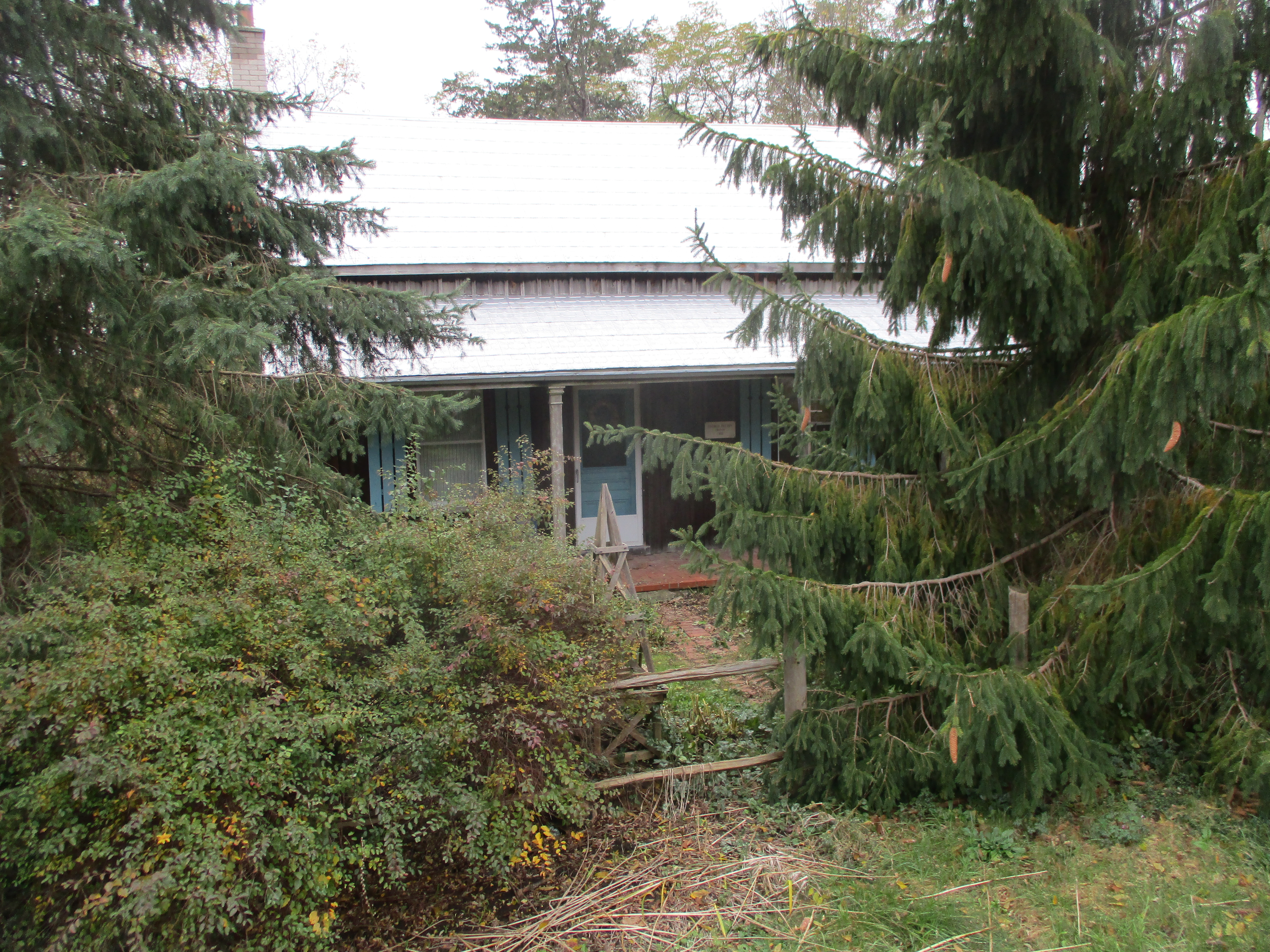
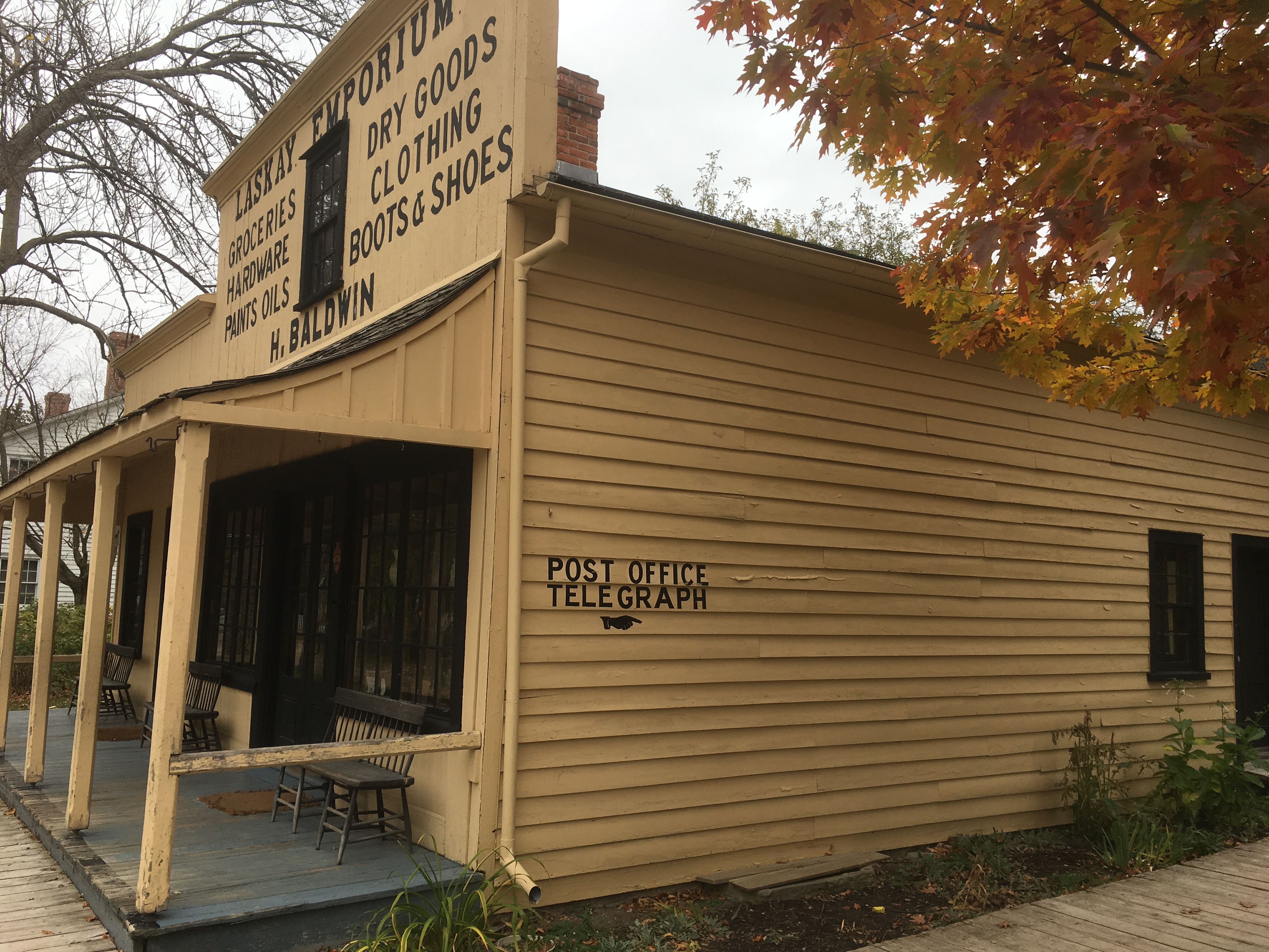
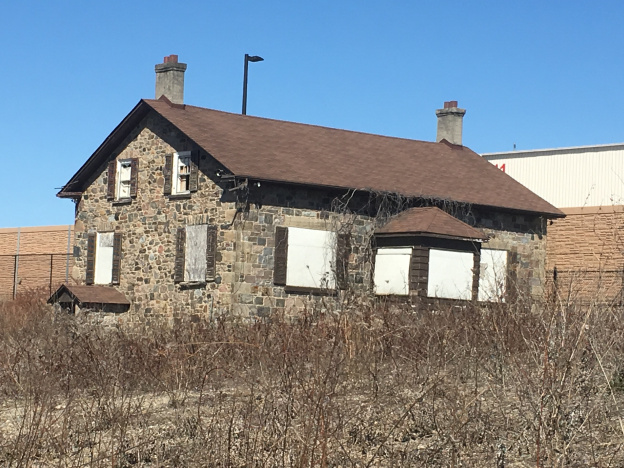
John Lawrie built his Georgian style house in 1855 at Lot 12, Concession 9 in Vaughan Township. Four generations of Lawrie family farmed on this lot over the next 120 years. John would have gone into Elder’s Mills to visit the post office for his mail and to get things for his farm. You can read more in our feature post John Lawrie Heritage House.

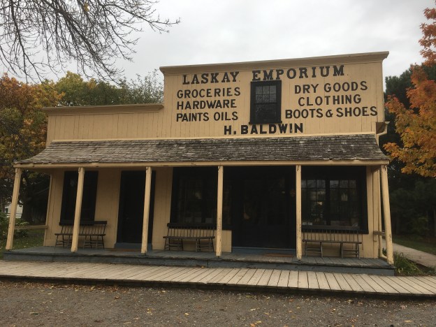
There were four other homes on Huntington Road that were listed on the Vaughan Heritage Register but only the Agar and Sommerville ones were designated. Developers have apparently demolished the others as the farms around them are being stripped for development.

Google Maps Link: Elder Mills Nature Reserve

Like us at http://www.facebook.com/hikingthegta

Follow us at http://www.hikingthegta.com

Also look for us on Instagram

Lambton Mills – Ghost Towns of the GTA

Saturday, August 22, 2020

Lambton Mills has changed considerably since the days when it was a mill town on the Humber River, half in Toronto and half in Etobicoke.  It isn’t a ghost town in the classic sense because so many people still live there but the ghost of the pioneer community is still evident.  To explore we parked in the small lot on the west side of the Humber River at the end of Old Dundas Street.

Lambton

Dundas Street used to cross the Humber River on an iron bridge set on stone abutments.  When the new high level bridge was built Dundas Street was realigned and Old Dundas Street lost its bridge.  The old stone abutments have have been collapsing and there isn’t much left on the west side of the river.

unnamed (15)

Lambton Mills grew up around several mills and soon became home to blacksmiths, inn keepers and many mill workers.  North of Old Dundas Street you can still find the remains of the earthen berm that was part of the early mill dam in town.

unnamed (20)

The archive photo below shows the large mill that William Pearce Howland built on the south side of Dundas Street.  Howland went on to be one of the Fathers of Confederation and then served as the second Lieutenant Governor of Ontario.

image1123_orig

A short walk south along the river brings you to the remains of an earlier dam.  This helps to mark the site of another mill.

unnamed (19)

Millwood Mills was built by Thomas Fisher on the west side of the river and south of Dundas Street.  It is shown on the historical atlas as G.M. for grist mill on the Fisher Estate.  The two story mill burned down in 1847 and was replaced with a five story building.  After Fisher’s death in 1874 the mill passed to his son who operated it for four more years before passing away himself.  In 1880 the mill was converted to steam and became eventually became a rope manufacturer named Canada Woolen Mills.  After a fire in 1901 it was permanently abandoned and now exists as a set of stone foundations in the trees.

unnamed (21)


Lambton House was operated as a hotel on the Dundas Road beginning in 1848 as a rest stop and watering hole for travelers and horses alike.  It served as a hotel for 140 years until closing in 1988.  The property has changed a lot over the years and high rise apartments now stand all around the hotel and on the former site of the mill.  The building itself has also changed over the years.  Looking above the rear door on the east end of the building you can see where there is a set of lines that form an upside down V below the roof line.  Lines like this can often be seen on older homes where a former porch has been removed.  In the case of Lambton House, the pioneer equivalent of a garage was attached at the back of the hotel.

unnamed (11)

The photo below from the Etobicoke Historical Society shows the hotel as it appeared a century ago.  The rear entrance on the side led directly to the drive shed where the horses sheltered.  It certainly is a more attractive hotel without the apartment buildings in the background.

Lambton House

Thomas Colton owned one of the two blacksmith shops on Dundas on the west side of the river.  It was here that he built his story and a half family home complete with a rounded window in the front gable.

unnamed (14)

The Methodist congregation in Lambton Mills needed a new church building and local architect Meade Creech designed and built one for them in 1877.  The first services being held on March 3, 1878 in the new brick building with Gothic architecture and a large rose petal window above the main entrance.  The congregation joined the United Church in 1925 and soon needed a new building.  The old one was sold and a new retail addition was put on the front and it was turned into a store.  The city of Toronto has over 4,500 properties on their heritage register.  This means that they cannot be altered without city council approval.  There’s another 11,700 properties that are heritage listed which means that although they have been recognized as having heritage value they are basically unprotected.  Developers must give the city 60 days notice of their intention to demolish a listed building.   From the vacant lot that now exists where the church used to be it seems those 60 days have passed already.

unnamed (12)

The house at 30 Government Road was built in 1870 for Harry Phillips who was the postmaster for the town.  This little house has a rounded arch window in the upper gable that is typical of Lambton Mills and a feature of Italinate architecture.  The four leaf clover motif in the bargeboard on the gable is also typical of the era.

unnamed (13)

John Berry took over running Millwood Mills in 1890 and two years later he built his house at 125 Kingsway.  The mill failed and in 1894 he moved to Quebec to run a textile mill there.  He returned to Lambton Mills in 1914 and became treasurer of Etobicoke in 1918.  He served as treasurer for twenty years, walking to Islington every day because he never owned a car.

unnamed (16)

A pair of historic homes stand at 7 and 9 Government Road where mill workers lived during the mid-1800’s.

unnamed (17)

Another historic home stands at 23 Government Road.  This simple one and a half story house has the Lambton Mills vernacular gable window with a rounded arch.

unnamed (18)

Lambton Mills has been totally surrounded with development but there’s still a large number of historic buildings on the west side of the Humber River.  A walk through the area reveals many old gems complete with beautiful gardens.

Also see our feature Old Mill to Lambton Mills as well as the story of Millwood Mills

Google Maps Link: Lambton Mills

Like us at http://www.facebook.com/hikingthegta

Follow us at http://www.hikingthegta.com

Also look for us on Instagram

Hurricane Hazel – Raymore Drive

Sunday, April 5, 2020

With restrictions in place that are intended to prevent the spread of COVID-19, Hiking the GTA is looking into our collection of unpublished pictures to see what new stories we can bring you.  We hope to keep ourselves entertained, and perhaps you as well, while we wait for the parks and trails to be opened up for us again. 

These pictures were taken on September 19, 2019 with the idea of a possible post about the destruction caused by Hurricane Hazel in the area of Raymore Drive.  We had previously featured some information in our post Raymore Drive and so we won’t cover all that material again.  As we walked along the Humber River on a beautiful Saturday in September we stopped to watch the ducks and admire one that was a little different.  It may be just a variegated mallard as it doesn’t seem to match any duck in the National Geographic bird book.

img_1894

The picture below shows Raymore Drive in Etobicoke in 1953, about a year before Hurricane Hazel struck.  When the hurricane paused over the GTA on October 15, 1954 it dumped so much rain that the rivers all flooded their banks and 81 people were killed.  Notice the pedestrian bridge that crossed the Humber River and the two streets of houses that were tucked into the curve of the river.

Raymore 1953

When the water levels rose on the river the bridge was swept off of the west abutment and began to deflect the flow of the river into the housing development.  With the full flow of the river rising by 20 feet there were 14 homes washed away and 35 people lost their lives in this small enclave.  In the 1956 picture the bridge is gone and so are the houses on the two streets closest to the river.

raymore 1956

The east bank of the river still has the remains of the bridge abutment and, as a memorial, it has been plastered with replicas of the news papers that came out following the storm.

img_1895

There is a set of concrete walls that surrounded the old bridge abutments.  Just for fun I walked through the grasses and shrubs that surrounded the old structure.  That was a big mistake because I ended up with hundreds of little seed pods stuck to my clothes that had to be picked off one-by-one.

The whole structure has been overgrown during the past 65 years and it is difficult to imagine exactly what it may have looked like when it was in use.

This willow tree will eventually push over this section of the wall as nature slowly reclaims its own space.

img_1899

Some parts of the old bridge foundations have been washed into the river where they now provide some shelter and habitat for the blacknose dace that live in the river.

A new pedestrian bridge has been built across the river to link two sections of the Humber River Trail.

A large section of the west abutment can be seen in the river where pieces of wood and tree branches have been washed onto the top by high water and then left stranded there.

The former residential streets have been retained and are now in use as the main hiking trails through Raymore Park.  Many of the homes in the various flood plains around the city were washed away or damaged beyond repair.  In the aftermath of the hurricane it was decided that no homes would be allowed on the flood plains of any watercourse in the GTA.  Homes that survived Hazel were bought up by local conservation authorities and soon demolished.  This led to the creation of many of the ravine trails and parkland that we enjoy in the city today.

The Old Albion Road bridge across the Humber River was destroyed on the night of October 15, 1954 along with another 40 bridges in the GTA.  A short piece of the former road allowance and the old cut stone blocks of the east bank abutment mark one side of the old road alignment.  On the west bank of the river all traces of the former road have been removed.

img_2569

Over on The Rouge River the storm washed the Old Finch Avenue bridge away and shifted the abutment so that the new bridge appears to be on a new alignment.

img_88491

It’s tragic to think of the destruction that nature can cause but there have been several steps take to reduce the risk in the future.  Flood control dams were built on each of the three main rivers.  Milne Dam on the Rouge River, G. Ross Lord Dam on the Don River and Claireville Dam on the Humber River.

Google Maps Link: Raymore Drive

Like us at http://www.facebook.com/hikingthegta

Follow us at http://www.hikingthegta.com

Look for us on Instagram

Laskay – Ghost Towns of the GTA

Saturday, November 4, 2017

Laskay is not a ghost town in the formal sense because people still live there.  It was founded in 1832 when a dam was erected on the East Humber River to create a mill pond for a sawmill.  Joseph Baldwin took over the mill site that year when he bought the 100-acre property.  In 1849 he added a grist mill and later expanded with a woollen mill.  When he arrived the community had the nickname Bulltown but Baldwin changed the name to Laskay after his hometown of Laskay in England.

Laskay (2)


The Humber River was prone to flooding and the mill dam was often washed out.  The buildings themselves were destroyed in the floods of the late 1870’s.  By the time of the map above the sawmill was already gone.  The Grist Mill and Carding Mill are marked in blue.  Fires took out the rest of the mills and by the end of the century, they were all gone.

IMG_1652

Village lots were laid out on either side of the river on Joseph Baldwin and David Archibald’s lands.  From the 1850’s these lots began to fill up with workers from the mills along the river.  The town soon had a blacksmith whose shop once stood on Old Forge Road.  Travellers along 3rd line west (Weston Road) would seek a place to water their horses and wash the dust from their throats and beginning in 1845 they made Laskay Tavern a regular stop.  The tavern was built by Baldwin who constructed a general store and post office next door.  Adjacent to that, he built a dressmaking store for his wife to run, a business she shared with her sister.  The tavern is in use as a private home today.

IMG_1651

The town doctor lived in this house on the main street.  The side and rear of the house were planted with herb gardens used in various healing ointments and potions.

IMG_1655

The county atlas shows a Primitive Methodist church in the town in 1877, marked with red on the map.  The church itself was absorbed into the United Church of Canada and the building was eventually closed as a church.  Today it is marked by Old Church Road on which this interesting house can be found.  The walls contain double sets of buttresses with concrete caps as was common on churches around the turn of the past century.  It appears that the old wood structure was either replaced or given a new brick cladding around 1908.  Today most of the church structure is gone and a house stands amid the old walls.

IMG_1646

The Laskay Emporium is shown below and in the cover photo.  It was one of the main hubs of the community starting in 1856 when it was built.  It served the town as a general store and post office for nearly a century.  The store had a “Boom Town” front that hid the sloping roof from the street.  The veranda has a unique sloping roofline under which the locals would sit to watch the evening fade and smoke their pipes.  The Emporium closed and sat vacant waiting for demolition until February 19, 1960, when it was rescued and moved to Black Creek Pioneer Village where it is preserved.

IMG_0431

Joseph Baldwin’s son Henry was the postmaster for 20 years and part of his job was to sort the daily mail into the various slots on the post office pigeonholes.  The Post Office is designated with PO and marked in orange on the map.

IMG_0422

The emporium was the Walmart of the era, importing things and reselling them.  All the usual household needs could be bought here.

IMG_0406

Customers could buy milk by the cup for 2 cents or a lemon for 3 cents.  Three cups of sugar sold for 20 cents and eggs were 2 cents each. You could get four cups of flour for 20 cents, a cup of butter for 18 cents and baking soda for 5 cents.  For under a dollar you could get the ingredients to make a cake.  The cod for your main meal would cost you 8 cents.

IMG_0411

The Emporium was divided into three rooms on the ground floor with one serving in part as an office.  The post master’s desk and safe are seen in this picture.

IMG_0413

The third room was used to sell larger items and to unpack the crates of imported goods.  Beginning in 1852 the Ontario, Simcoe and Huron Railway began stopping at their new station in Springhill (King City) to deliver products from overseas as well as to allow local products, such as grain milled in Laskay, to be shipped to market. A selection of typical cookware is displayed in the rafters of the Emporium.

IMG_0418

One other building from Laskay has been preserved and that is Laskay Hall which was moved from the town to King Township Museum in 2017.  It was built in 1859 by the Sons of Temperance.  Since this museum also houses the railway station mentioned above, the oldest surviving railway station in Canada, it will certainly be featured in a future post.

Google Maps Link: Laskay

Like us at http://www.facebook.com/hikingthegta

Follow us at http://www.hikingthegta.com

Humber Grove – Ghost Towns of the GTA

Saturday, October 21, 2017

The remains of a ghost town lie along the Humber River on Duffy’s Lane just north of Bolton.  The property of George Elliot on the county atlas below was in the Elliot family from 1855 until 1929.  During this time a few homes were built along Duffy’s Lane with views of the river.  Only two are shown at the time the atlas was drawn in 1877.  By 1909 there were half a dozen homes with a small community forming around the bridge over the river.  In 1929 the 100-acre half lot was sold to Bertram Realty Company who planned to capitalize on the quiet setting along the river.  They divided the land into small parcels and started selling them for cottages.  People began to buy the lots and build on them and by the early 1950’s there were enough children to support the construction of a new school at the corner of King Road and Duffy’s Lane.

In October 1954 Hurricane Hazel hit the GTA killing 81 people and changing the way we managed our floodplains.  Local conservation authorities across the GTA began to buy properties and remove houses that were considered at risk.  They also developed a plan that called for the construction of 15 major flood control dams and reservoirs including one on the Humber River just north of Bolton.  Of these dams only Claireville, G Ross Lord and Milne Dam were constructed.  The Glasgow dam would have been 29 metres high and Humber Grove would have been under the new flood control lake.  Slowly the houses were moved or demolished until by 1977 there were no buildings remaining.

humber Grove (2)

Duffy’s Lane is exactly that, their original laneway.  This is what is known as a “given road” because it is not part of the original grid of the township survey.  It is a privately constructed road, on private land, that was given for the use of the public.  For reference, Duffy’s Lane has been coloured brown on the map above.  The Duffy house was built in the 1840’s and has been given a historical designation by the township of Caledon.  It is seen in the picture below and marked with a red arrow on the map above.

IMG_1606

Duffy’s Lane has had many alignments in the area where Humber Grove was and there have been at least four bridges over the river.  The county atlas above shows a bridge over the west branch of the Humber River that predated the use of poured concrete for bridge construction by 20 to 30 years.  Therefore, the abandoned bridge in the cover photo has to be at least the second bridge at this location.  The picture below shows the abutment for the old bridge in the lower right corner.  This bridge was likely built at the time that a subdivision plan was put forward in the 1920’s.  A new bridge would have been helpful in persuading people to buy a lot this far outside of Bolton. On the left in this picture are two newer bridges, the lower one from 1985.  In 2013 work began on the Emil Kolb Parkway as a bypass to keep the increasing flow of traffic from going through downtown Bolton.  The new multi-lane bridge was built in 2014 and the older one converted to a pedestrian trail.  It is likely that some of the original Humber Grove foundations were lost during the construction of these various bridges.

IMG_1573

Milkweed pods have started to break open exposing their seeds to the wind.  Each tiny, flat seed is carried on the breeze by hundreds of tiny filaments attached to it.

2432


Milkweed is essential in the lifecycle of the monarch butterfly.  There were many of these orange beauties flying around and it seems like it is late in the year for them.  This is the fourth generation of monarch born in Ontario this year and it is programmed to fly to Mexico to spend the winter.  The example in the picture below is a female because it lacks the two little black dots on the hind wings that mark the male scent glands.

IMG_0071 (1)

Throughout the woods, there are several obvious laneways, most often marked with a double row of trees that lined either side of the old roads.  In a couple of places, there are old hydro poles in the woods that have the wires cut from them because the homes they once served no longer exist.

IMG_1586

At the end of the laneway above is an obvious clearing where a house once stood.  The back end of the property has been reinforced with a concrete wall.

IMG_1587

A garter snake was sitting on a fallen branch taking in the late October sunshine.  These snakes don’t actually hibernate unless they are in a climate where it goes below -40 Celcius.  In reptiles, hibernation is normally referred to as brumation.  In most cases, the garter snake is awake through the winter with a 77% reduced heart rate and minimal oxygen intake.

IMG_0078

The original alignment of Duffy’s Lane can still be found running north from the earlier bridge abutments at the river.  Former laneways extend into the woods along the sides of the road.  We found an old concrete foundation a few feet into the first of these laneways.  The woods have been regenerating for 40 years and most of the former entrances can only be made out due to the parallel rows of mature trees that line either side.

IMG_1599

Old fence lines mark the edges of the various properties that used to line both sides of old Duffy’s Lane.

IMG_0075

The boletus family of mushrooms includes over 100 varieties, many of which are edible.  They can be distinguished by the tubes that carry the spores under the cap rather than the gills that can be found on many other types of mushrooms.  Make sure that you never touch or eat any mushroom that you cannot positively identify.  There are often similar looking species where some are edible and some are poisonous and can kill you.

IMG_0068

There is a lot of tall grass, dog-strangling vines and undergrowth throughout the area. There are plenty of foundations remaining to be found, perhaps when there is less foliage.  Humber Grove can be accessed from the Humber Valley Heritage Trail.  We explored part of this trail in a previous post called Humber Heritage Trail Bolton.

The Toronto Region Conservation Authority has an informative article on Humber Grove with historic maps that can be found here.

Google Maps Link: Humber Grove

Like us at http://www.facebook.com/hikingthegta

Follow us at http://www.hikingthegta.com


Rowntree Mills

Saturday, Nov. 8, 2014

It was overcast and 5 degrees with occasional light drizzle.  Parking is available on Hathor Crescent just before Rowntree Mills Road descends the hill to the river.  The road is closed at the bottom of the hill and from here the bridge across the Humber river can be seen.  The bridge is a steel girder construction and has been fitted with new wood decking to convert it into a safe pedestrian bridge.  It’s construction likely dates to around 1900.  The bridge can be seen crossing the river in the lower corner of the cover photo, which is an aerial shot from 1953. The photo below of the bridge is taken from the west bank of the river.

IMG_0923

Joseph Rowntree arrived in Canada from England in 1830 and set himself up in an area known as Pine Ridge, just outside of Thistletown.  In 1843 he built a saw mill on the east side of the Humber river and in 1848 he built a grist mill on the west side.  A road was built to access the mill which we now call Rowntree Mills road.  A bridge was built across the river and he named it all Greenholme Mills.  In 1870 Joseph added the Humberwood Mills, a mile down river, to the family holdings.  The cover photo shows the grist mill as it appeared in 1953. Rowntree Mills road crosses the bridge and passes to the west of the mill.  A laneway completes the loop on the river side of the mill.  Today the area where the mill stood 60 years ago has become completely overgrown.  All that could be found was this square area of concrete in the woods and many piles of bricks, stone and concrete.

IMG_1017

From the east side of the river the former mill site can be identified by the row of pine trees that ran along side of the lane way that lies between the mill and the river.  They show up as the dark strip to the right of the road, adjacent to the mill, in the cover photo.  I can picture Joseph planting these pines along the ridge in honour of the community of Pine Ridge where he lived. The mill stood about 20 feet above the current water level of the river.  It isn’t immediately obvious how Joseph used the water power from the river to turn the grinding wheels in his grist mill.  It may have initially been an undershot wheel sticking out into the river.

IMG_1024

It was a morning full of various birds.  At one point a migration of cardinals passed through but none sat still long enough to get their picture taken.  There were also flickers, herons, and large birds of prey.  Some of the trees in the area display the straight rows of tiny holes that are typical of a yellow-bellied sap sucker.  These woodpeckers drill little holes from which they feed on the sap that flows out.  The tree in the picture below had these rows of holes extending for as far up the tree as the eye can see.

IMG_0930

This plant is known as tall thimbleweed.  The single head on a tall stem contains tiny nubs that make it look like a thimble.  When the seed heads burst open they look and feel like cotton. Native peoples used the plants for medicinal purposes but we now know that the leaves are toxic in large doses and so the plant is used mainly for decoration.  The picture below shows both a closed pod and one that has blown open to spread its seeds to the wind.

IMG_0937

This very large red tailed hawk didn’t seem to mind posing for the camera.

IMG_0993

Rowntree Mills Park and the surrounding ravines have been taken over by white tail deer.  In one spot I was able to see 8 females at one time plus at least one male.  Mating season is known as rutting season for these deer.  Males begin their part of the rut in the fall when the velvet is falling off of their antlers.  In North America this lasts for several weeks with the peak being on average, November 13th.  The male’s part in the reproductive act lasts for exactly one thrust.  Ho-Hum.  Females go into rut for periods of up to 3 days at a time and can do so 7 times over the rutting season, or until they conceive. The picture below has at least 4 deer looking at the camera plus 4 others hiding in the background.

IMG_1005

In October 1954 the area on the east bank of the river just north of Rowntree Mills road was home to a small community of houses.  On the morning of October 16, 1954, there were 12 less of them there because Hurricane Hazel had swept them away.  Two people died in this area as well when they were trapped in their car as the river washed it down stream.  Today the area has been cleaned up and there is no trace, other than in old aerial photos, to show where the homes were. Rowntree Mills Park was named after Joseph in 1969 but was closed in 2009 due to wild parties that trashed the park.  Today it is basically abandoned although the grass is cut and the leaves are cleaned up.  The picture below is taken from the front yard of one of these former homes looking along the street where others once stood.

IMG_1023

At the corner of Rowntree Mills Road and Islington Avenue is a pioneer cemetery.  This land was donated in 1848 by Joseph Rowntree to be used for Pine Ridge Methodist Church and its cemetery.  There are many grave markers in here that commemorate the lives of various members of the Rowntree family.  Although it seems likely that Joesph was laid to rest here, I was unable to locate his grave marker.

IMG_1026

Google Maps link: Rowntree Mills Park

Like us at http://www.facebook.com/hikingthegta

Follow us at http://www.hikingthegta.com


Claireville

Saturday Aug. 3, 2014

It was cool, at least to start with, at only 17 degrees.  We parked in the Humberwoods Community Centre and hiked north on the west side of the Humber.  Just south of Finch Avenue is a little park that has been developed as a bird flyway.  There are dozens of nests and things to attract birds and this is a great little park for bird watchers.  In the picture below are a couple of the many odd shaped nesting places that have been constructed there.

IMG_2715

The groundhog is a member of the Marmot family and is a type of ground squirrel.  They are one of the few species that enter true hibernation and they sleep until March or April. In the wild in Ontario they are always sleeping on groundhog day, and therefore, actually never see their own shadow.  After mating in the spring the pair stays together until the young are about to be born in April or May.  The male then leaves the burrow and the parenting to the female.  She gives birth to between 2 and 6 hairless blind kits. The young groundhog below was scared of us but didn’t try to run away.

IMG_2720

It was early in the morning and the dew sparkled on the spider webs.

IMG_2728

When the 427 was built plans were already in place to expand the highway by adding lanes between the North/South lanes.  As we went under the highway we could see the supports for the expansion that were built at the same time as the rest of the bridge.

IMG_2740

Claireville Dam was one of the flood control dams built in response to the damage caused by Hurricane Hazel.  in 1959 The Plan For Flood Control and Water Conservation was released.  Since 1960 over 40,000 acres of land has been acquired and 3 of the originally proposed 15 dams have been built.  Claireville dam was the first one, built in 1964.  The dam allows the Conservation Authority to collect water from heavy rains and release it slowly after the storm has passed.

IMG_2748

Indian Line started off as an Indian trail along the shore of the Humber river.  When the land survey was made it was part of the border between Peel County and York County. When hwy 427 was extended north it became part of an off and on ramp to the highway. In 1992 when the highway was further extended it was closed off and abandoned.  Parts of it now form hwy 50 north of Steeles ave.  Indian Line campground used to be accessed from just south of the river off of this road but is now accessed off of Finch Ave.  The picture below looks up the old roadway to the bridge that crosses the CN tracks.  When this bridge was built in the 1960’s this was an important road and it was made wide enough for 4 lanes to be opened one day.

IMG_2771

Claireville was a community that started in 1850 on the estate of Jean du Petit Pont de la Haye at the intersection of Steeles and Indian Line.  He named the town after his daughter Claire.  A third road ran diagonal through the property and was originally known as Claireville Road because that was the location of the toll booth along the road.  Early roads in Ontario were known for their mud (an early nick-name for Toronto was “Muddy York”) and were covered over in planks as soon as possible.  Plank roads required continuous maintenance and this was paid for through tolls collected by the road keeper. A horse and rider would pay 1/2 pence and 20 hogs or sheep cost 1/2 pence.  A wagon was 1 pence if drawn by a single horse but 1 1/2 pence if drawn by two.  When the Claireville road was planked a toll house was established.  Of all the houses which once stood in this town only a few remain.  There is a white two story house which remains and this was originally the toll house.  Since the 1950’s the town has declined and is now mainly an industrial neighbourhood.  The picture below shows the town as it was in 1947.

Claire 2

This picture has nothing to do with this hike but is a follow-up to last week’s move.  As I was cleaning the apartment I swept deep under a baseboard heater and out popped a little round black disc.  At first it didn’t look like anything but I could see that there was some writing on it.  I placed it in Coke for a few minutes to remove some of the gunge on it.  King Christian 7 ruled Denmark from 1668 to 1808.  The 1 Skilling Danske coin I found is in poor condition but still has a value of about $10.  Thank You to the previous tenant in my unit who lost this coin.  Don’t worry, it has found a good home in my collection.  It is interesting to me that Toronto was founded in 1796 at which time this coin was already 25 years old.  I find a lot of older things out hiking, but the oldest one so far was right under my heater for the past 8 years!

IMG_2714


Summerlea Park

Saturday July 12, 2014

It was another in a string of warm and sunny Saturdays.  It wasn’t very long before we were feeling the effects of the heat and humidity.  The Humber river has a west branch which meets up with the main river in Summerlea park.  We parked both vehicles here and took a brief excursion to the confluence of the two.  The water was high and dirty.

IMG-20140712-00244

There is a stretch of rocky shoreline here where we found two excellent examples of Crinoid fossils.  Crinoids are marine animals of which about 600 species exist today.  They have a mouth surrounded by feeding arms.  The arms have a mucous that captures food particles as they float past.  The picture below is a species that lives near Indonesia today.

Crinoids

The two crinoid examples below are the best we have seen so far.  The segments of the feeding arms have been particularily well preserved.

IMG-20140712-00240

We also found a very small piece of pottery about the right size to hold a small candle.

IMG-20140712-00238

We left one vehicle parked here and moved to the corner of Finch and Islington where we parked the other in Irene Risk Park.  We wanted to look for Rowntree Mills after which the park on the east side of the Humber, just north of here, is named.  We didn’t find the mill because we got side tracked and actually never looked for it.  Along the side of the ravine there is a deep set of woods with multiple steel artifacts.  As we wondered through here we saw deer in front of us. We followed their trail and ended up on the side of the hill again.

Dairy farmers used to sell their milk to local creameries and cheese factories.  They collected the milk in 17 gallon milk churns which were left on a platform at the end of the laneway.  In the 1930’s a smaller 10 gallon churn was introduced.  Creameries collected the milk and packaged it in glass bottles which were delivered directly to the home well into the 1950’s. With the improvement in processing and delivery of dairy products a lot of smaller dairy operations were bought out and closed.   A 1925 list of cheese factories and creameries in Canada lists 1600 in Ontario alone.  By 1998 there were only 270 in all of Canada.  We found the old milk churn in the cover photo which was imprinted with “Canada Dairy” “Oakland” “Toronto”.  In the 1925 directory Oakland Dairy Limited is listed as registration #419 at 108 Nassau Street, near Spadina and College.

IMG-20140712-00274

It seems like every week we are finding parts of old washing machines.  This is the wringer hood from a Kenmore Visi-Matic wringer washer.  Kenmore was the store brand sold by Sears.  Like the Thor and General Electric we found earlier, this one is from the 1950’s. There doesn’t appear to be a good reason for so many washing machines to be spread out along the Humber River valley.  Jim Gifford in his book “Hurricane Hazel” published a photograph of a washing machine that had been swept out of a home and deposited along the flood plain.  While that may explain the Thor machine, the GE and Kenmore were found well up the side of the ravine.

IMG-20140712-00278

This washing machine sold for $149.95 in 1954.

Fall 1954 944_96

The side of the ravines in Toronto are strewn with old bricks.  Some of them have a story to tell.  In 1913 the Ontario Government found clay and shale deposits on land it owned in Mimico and opened the Toronto Brick and Tile Company using labour from the Toronto Central Prison which had opened in 1874.  The plant could produce over 2 million bricks per year which were used on government buildings providing a cheap source of construction materials.  During WWII the site was converted into POW Camp 22 and housed German marines and U-boat men.  In 1969 it was closed after pressure from labour unions claiming the factory was taking jobs away from their members.  The Mimico brick below was either made by a prison inmate or a prisoner of war.

Toronto-20140712-00292

As we made our way south along the hillside we got boxed in between two fences.  There is a large assortment of old metal objects along here including an old bbq, an engine, old oil containers and car horn.  We also found an old bottle from the late 1860’s or 1870’s. Bottles from this era are dated by the seam on the side.  On this one the seam only extends to the bottom of the neck and the lip on the top was added later.

Toronto-20140712-00295

It looks like Rowntree Mills will have to wait for another day.


Pine Point Park

Saturday July 5, 2014

We parked in the Pine Point arena parking lot and walked down the hill to the river. During the winter months the long steep run makes this one of the best toboggan hills in the city.  It was 19 degrees and sunny when we set out.  The trail runs under the 401 into a small park that extends to the Weston Golf and Country Club.

Crawford-Jones Memorial Park is named after Jim Crawford and Herb Jones.  Jim Crawford was a police officer and Herb Jones a contractor in 1954.  On the night of Hurricane Hazel they took a small boat along the Humber River and rescued dozens of people stranded in their homes.  The picture below is taken from the park on the east side of the river looking at the stack on the steam plant on Resources Road.  There is a spiral staircase running up the outside of the tower.

IMG_2514

Along the edge of the river we saw a couple of dead Crayfish.  Crayfish are fresh water lobsters and live in places where the water does not freeze to the bottom in the winter.   They don’t tolerate polluted water which suggests that the Humber is pretty clean these days.  This was a larger specimen, about 10 cm long, but is missing one claw.

IMG_2506

Most of the parks we hike have evidence of a local coyote but we rarely see one.  Coyotes are related to the wolf and have become very successful in urban areas.  Coyotes hunt a variety of small animals and will even eat a crayfish if the opportunity presents itself.  The tracks below were found along the edge of the river.

IMG_2523

North of the 401 we followed the embankment on the side of the ravine.  This area is known as Pine Point Park.  Part way along we found a 1963 Pepsi bottle in an area where a lot of old bricks had been dumped.  Among several manufacturers we found Milton Bricks.  In 1877 when the Credit Valley Railway passed through the area of Milton they found a lot of clay and shale. Lot 1 Concession 1 of Esquesing Township belonged to Duncan Robertson and a large amount of Medina Shale was found here.  His son, David, started Milton Pressed Brick and Sewer Company.  Their bricks were pressed before baking and were a much higher quality brick than much of their competition.  By 1901 they were considered to be the best bricks available on the continent.  They employed 200 people at their peak but closed in 1974.  Ontario is unique in the large amount of it’s buildings which are made of bricks. In 1931 27% of Ontario buildings were built of brick while only 6% of Quebec buildings were and 2% or less in other provinces.  Ontario was rich in clay and had a huge export market for lumber which led to this trend in construction in the province.

IMG_2536

By the early 1900’s Milton Brick was publishing a catalog of beautiful brick fireplace designs that could be ordered.

fireplaces00miltuoft_0001


A little further along we found the half buried artifact that is in the cover photo.  We excavated enough to determine that it is an old hand crank broadcast seed spreader.  It is rusted right through and likely dates to the 1930’s.

IMG_2543

As we were starting downhill to make our way back we found and old set of wooden stairs on the side of the hill.  Beside here in the little ravine we found the wringer from an old General Electric washing machine. Edison General Electric Company was founded in 1889 by American inventor Thomas Edison.  Edison is credited with inventing the long lasting light bulb, phonographs and the motion picture camera among his 1,093 patents.  This washing machine likely dates from the 1940’s or early 1950’s.  Clothes would have been taken out of the washer and pressed between the two rollers to squeeze the water out of them.  This machine had a quick release handle, seen open on the right hand end, to let you get your hand out when it got caught in the rollers.  Earlier versions didn’t have this safety feature and were nick-named “manglers” for obvious reasons.

IMG_2556

The hillside trails are fully overgrown and its quite possible to walk within a few feet of something interesting and never see it.  The woods and fields are full of colour and purple is now prominent.  Asters, thistles, bellflowers and violets abound.

IMG_2519


St. John’s Cemetery On The Humber

Saturday June 21, 2014

Summer officially started at 6:51 am.  So we did too!  It was a beautiful morning.  As I arrived on Emmett Road I saw a white tailed deer walk off of the soccer field (World Cup fever has taken over everywhere) and cross the road right in front of me.  She stopped and waited until I had my camera almost ready before disappearing into the woods.  We parked in the parking lot on Emmett and entered the woods on the east side of the river. This property was originally granted to John Dennis who died in 1832 in Toronto’s cholera epidemic.  His grandson, Henry Dennis, ran a saw mill on this site after 1851 but we saw no traces of it.

We walked north along the east side of the river planning to cover lots 1 through 5 between Eglinton and Lawrence Ave.  A tall smoke stack on the eastern hill marks the site of West Park Healthcare Centre.  It was opened in 1904 as the Toronto Free Hospital For Consumptive Poor.  Consumption is an older term for Tuberculosis or TB.  The hospital was generally known as Weston Sanitorium or “The San”.  The first effective treatment for TB was Streptomycin in the mid-1940’s.  It was given by injection or intravenous and became the cure for “the white plague”.

Close to the river, near the old hospital there is a large area of bottles in the woods.  There are dozens of little medication bottles for injections.  The smallest one in the middle of the picture below is dated 1948 and the slightly larger one on the right is 1945.  I have seen many medicine bottles shaped like the long rectangular bottle but none of them curved at the bottom like this one. It has HSP for hospital imprinted on the bottom and the shape may be for hanging it for IV purposes.  Glass containers were first used in the mid 1940’s for IV and were initially packed by the hospital pharmacy as this one likely was. Later, they were packed by major companies and then plastic replaced glass containers in the 1970’s.  Any or all of these three bottles could have contained Streptomycin for treating the TB patients in the hospital.

IMG_2291

In the woods between the bottles and the hospital on the hill lie the remains of some old buildings from the farmstead on the former John Dennis property.  John Dennis was a United Empire Loyalist and it was 40 acres of his property on which the hospital was built. The picture below is the front entrance porch for the house.

IMG_2296

A few feet away there are several of these long cement structures which appear to be part of the fence line.

IMG_2299

This is a view from 1962 in which the house can be seen on the right with it’s little square front entrance porch and the fence line near the bottom.

Weston 1962

Along the water’s edge we found many fossils including Crinoids and this Brachiopod fossil.

IMG_2302

As you walk along the east side of the river you will come to a larger water fall.  The east wall extends all the way from the river to the base of the ravine.  If you climb the ravine on the trail at the end of this wall you will find St. John’s Cemetery On the Humber.

John Denison came to York (Toronto) in 1796 and lived with Governor Simcoe at Castle Frank which was the first dwelling built by a white man in York.  In 1798 he purchased lots 3 and 4 on the Humber river.  The Denison men established themselves by serving in the war of 1812 and the rebellion of 1837.

While living in York, John had lost his infant daughter Elizabeth.  She was buried in the garden at Castle Frank because there was no burial ground in the town of York.  When he established himself on the Humber he had her moved to a plot of ground overlooking the river.  Elizabeth’s untimely death accounted for what surely must have been one of the first modern burials in Toronto. This cemetery is still in service and has been used exclusively for family members related to John Denison and the family of his wife Sophia Taylor.

IMG_2323

John and Sophia Denison are buried beside their daughter.

IMG_2326

In 1930 a chapel was erected by the Denison family in memory of George Taylor Denison (1816-1873).  The grounds crew gave us a rare opportunity for someone other than family to see inside the chapel.

IMG_2330

The smoke stack from the Sanitorium as seen from the Eglinton Street bridge.

IMG_2356

Google Maps Link: West Park Health Centre

Like us at http://www.facebook.com/hikingthegta

Follow us at http://www.hikingthegta.com