
Saturday, April 21, 2018
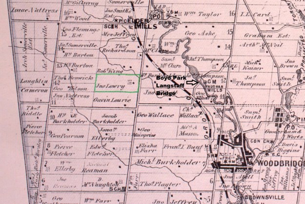
While on a visit to Boyd Conservation Area we took a short side trip to photograph the historic John Lawrie house. John Lawrie built his Georgian style house in 1855 at Lot 12, Concession 9 in Vaughan Township (outlined in green on the county atlas below). The county atlases were notorious for spelling names incorrectly and changing them from edition to edition. This map shows the spelling as Lowry. It’s also possible that Gavin Lourie on lot 11 could be a son, with yet another spelling.
The original tree lined lane is part of the contextual heritage of the property and the home is set back from Highway 27 and originally had a workable field in the front. The remains of corn stocks still stand on the sides of the house. It has been designated under Part IV section 27 of the Ontario Heritage Act and scored 85 of a possible 100 points on the heritage survey. This defines it as having very significant heritage value.
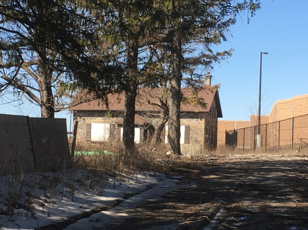
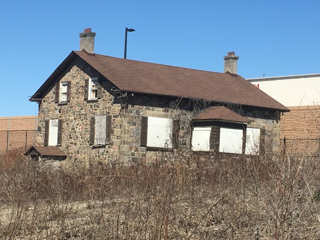
John Lawrie was the first of four generations who worked this farm and it was in the family for over 120 years. John was instrumental in the construction of a community church and sat on the first Vaughan Township Council when rural municipal governments were established in 1849. The house was constructed by a local stone mason named Henry Burton out of field stone collected on the property. Burton built many local homes and was also responsible for one of the additions to Osgood Hall in Toronto.
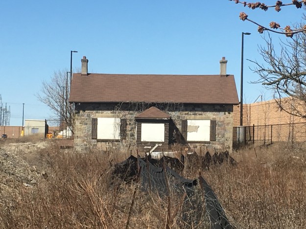
The stonework on the front of the home is squared and dressed while the sides and back are made of random sized stone. The house is one and a half stories, the upper floor being partially restricted by the slope of the roof. Two chimneys indicate a pair of fire places and finely tooled limestone quoins adorn the corners of the house. There is a rear extension that was added around 1870, as the family grew. A little side entrance to the cellar has a gabled roof and was designed to protect the cellar entrance.
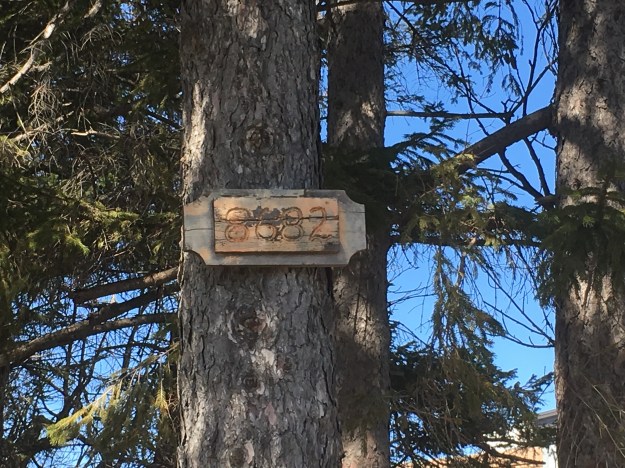
The house was still occupied as recently as 2005 but since being closed for a few years has suffered a bit of vandalism. The street address is 8682 Highway 27 and now home to a new Costco distribution centre. Costco paid $50,000,000 for the 95 acre property in 2015. The house will be moved slightly to accommodate a flood control pond on the property and new landscaping done to model the historical setting. I don’t suppose Lawrie ever thought his property would be worth 50 million dollars when he took possession and started making improvements such as clearing fields and building the house.
Also see our story Boyd Conservation Area for one of the historic concrete bowstring bridges in the area.
Google Maps Link: 8682 Highway 27
Like us at http://www.facebook.com/hikingthegta
Follow us at http://www.hikingthegtacom

Pingback: Old Major Mackenzie Drive | Hiking the GTA
Pingback: Elder’s Mills – Ghost Towns of the GTA | Hiking the GTA