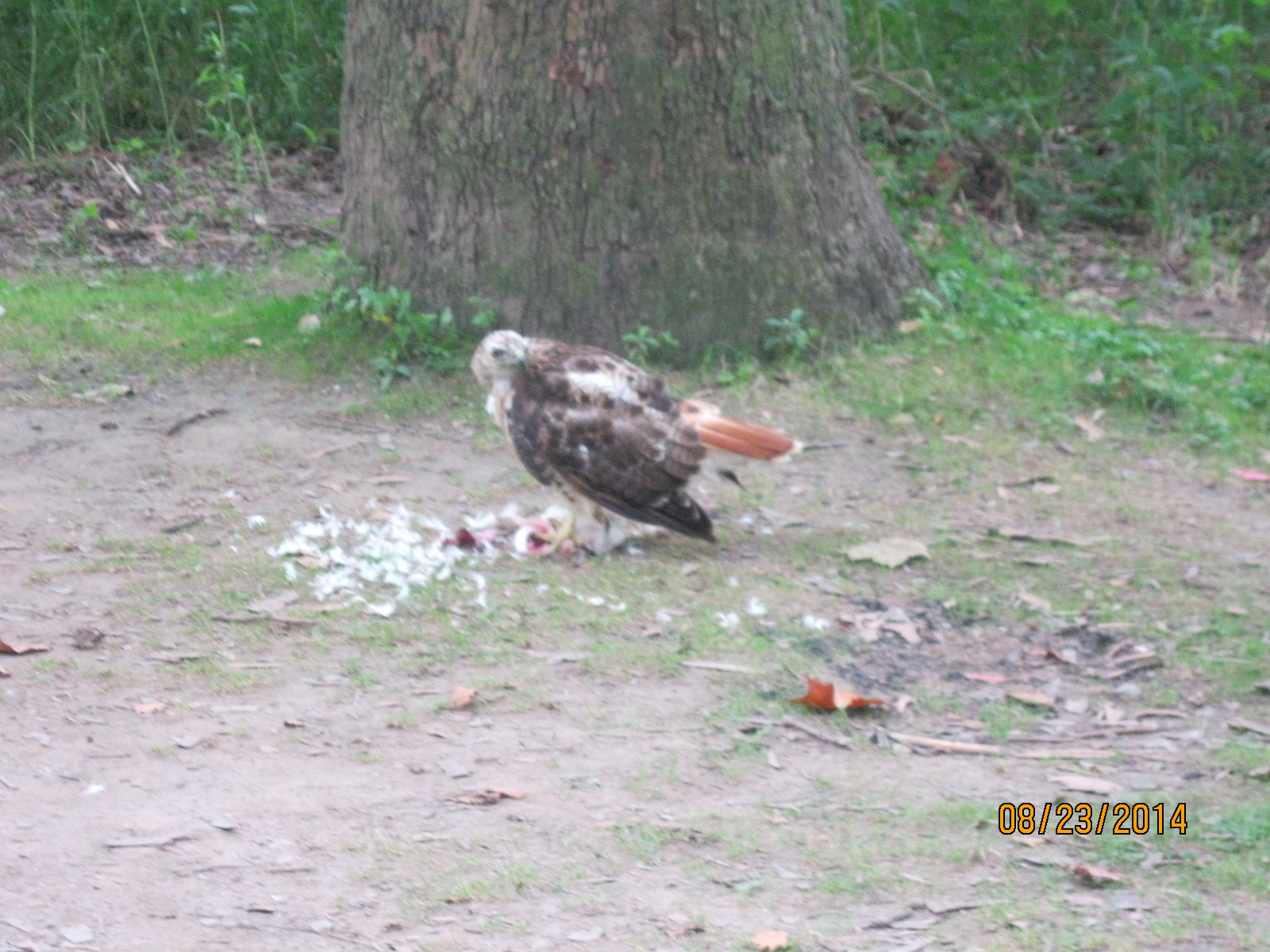
Tag Archives: White Tail Deer

White-tailed Deer

October 16, 2022

White-tailed deer can be found throughout the GTA, and they are quite comfortable with the human presence, partially because they don’t experience the hunting season that their country cousins have to survive. Between Canada and the USA, the population is estimated to be over 710 million animals. Local populations and food sources are used to determine the number of animals that can be culled during hunting season so that the remainder can be healthy and thrive. While hunting deer may seem horrible to some of us it allows for a healthier herd that doesn’t suffer and die from starvation.

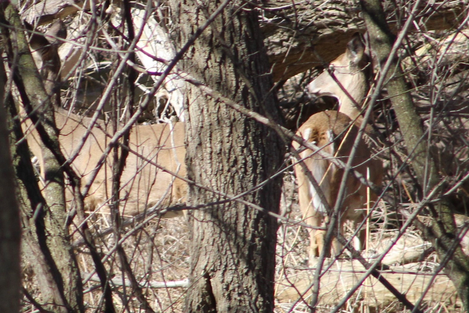
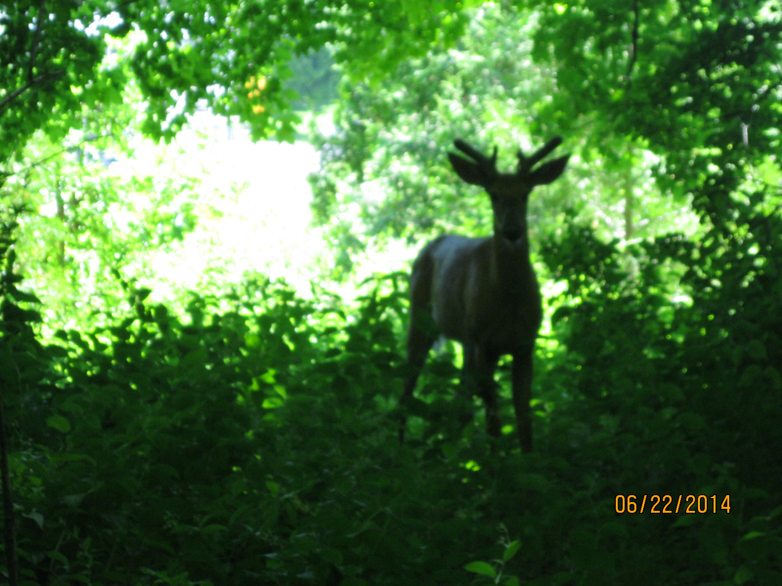
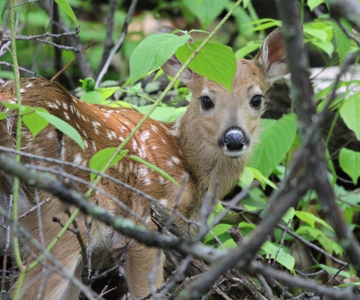
The life cycle starts in late May or June in Ontario when fawns are born. They are born earlier in the colder environments so that the young have the advantage of a full summer to get larger and stronger before the challenge of the next winter comes along. A yearling doe will have a single fawn in her first year and she’ll leave it alone while she forages in the first week of its life. She returns to nurse it 4-5 times per day until it is old enough to forage for itself. The newborn fawn in the picture below is well disguised among the branches and leaves.

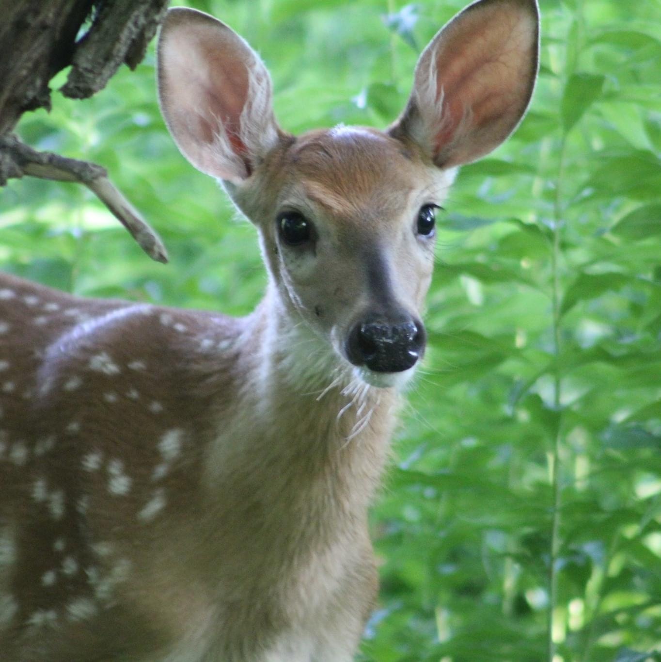
Fawns have white spots in their fur when they are first born which they lose over the course of their first year.

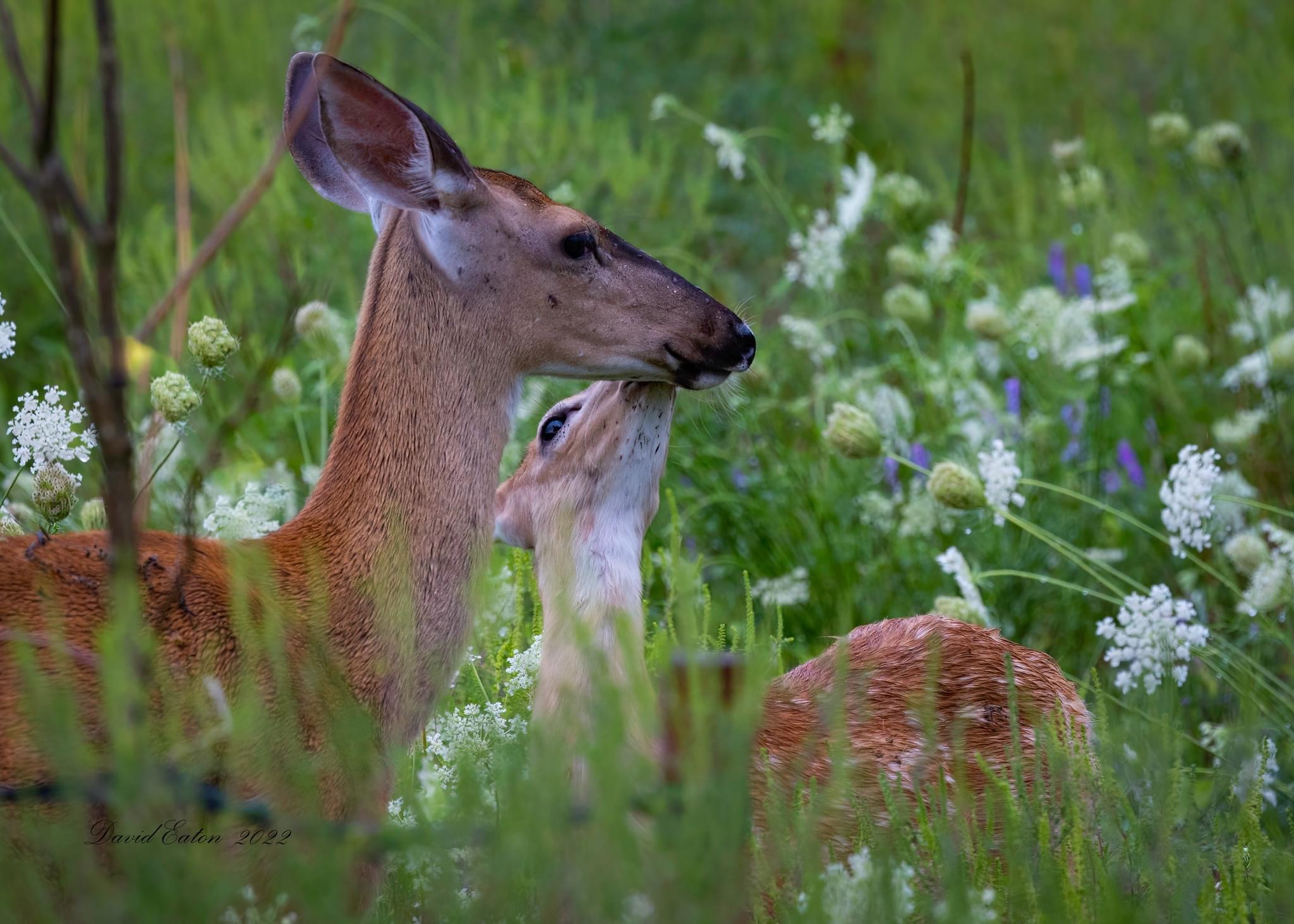
The doe will take care of the fawn for the first year and they are very paternal and caring. The doe in the picture below is giving her fawn a lick on the top of the head.

In return, the fawn is very fond of the mother and shows signs of affection. The fawn in the cover photo was walking up to us to check us out but was called back by its mother who was concerned about how close it was getting. When she snorted the fawn immediately responded by returning to her. The fawn will become sexually mature in about six months if it is a female but will usually not mate until it is in its second fall. The males take about 1.5 years to become sexually mature.

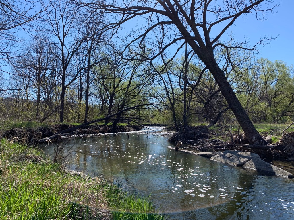
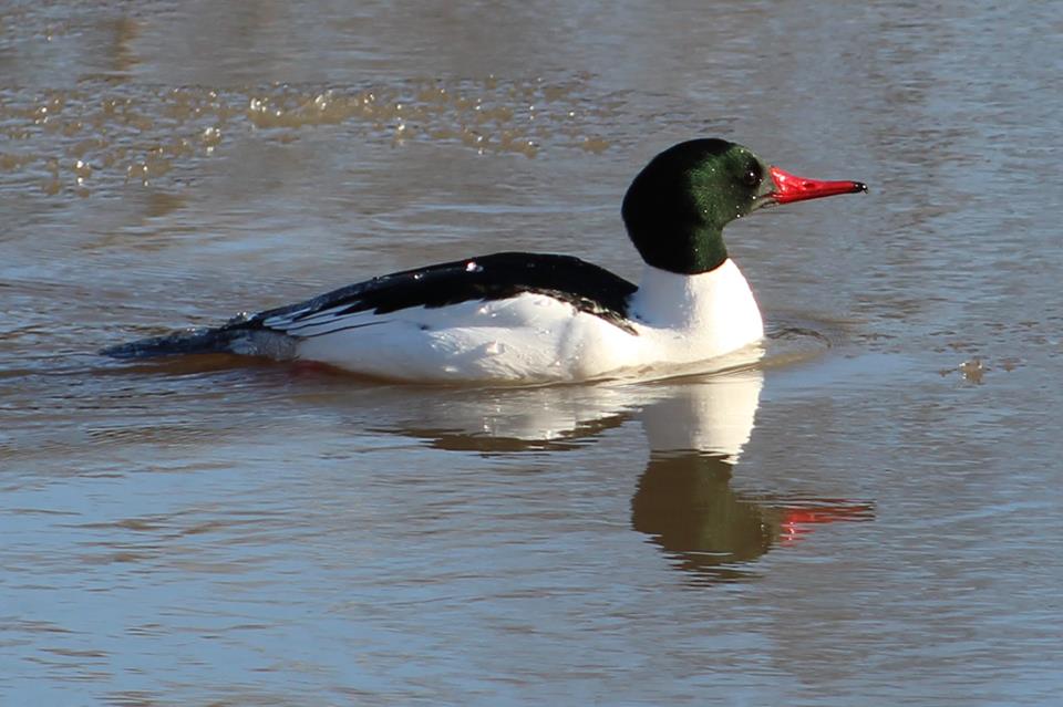
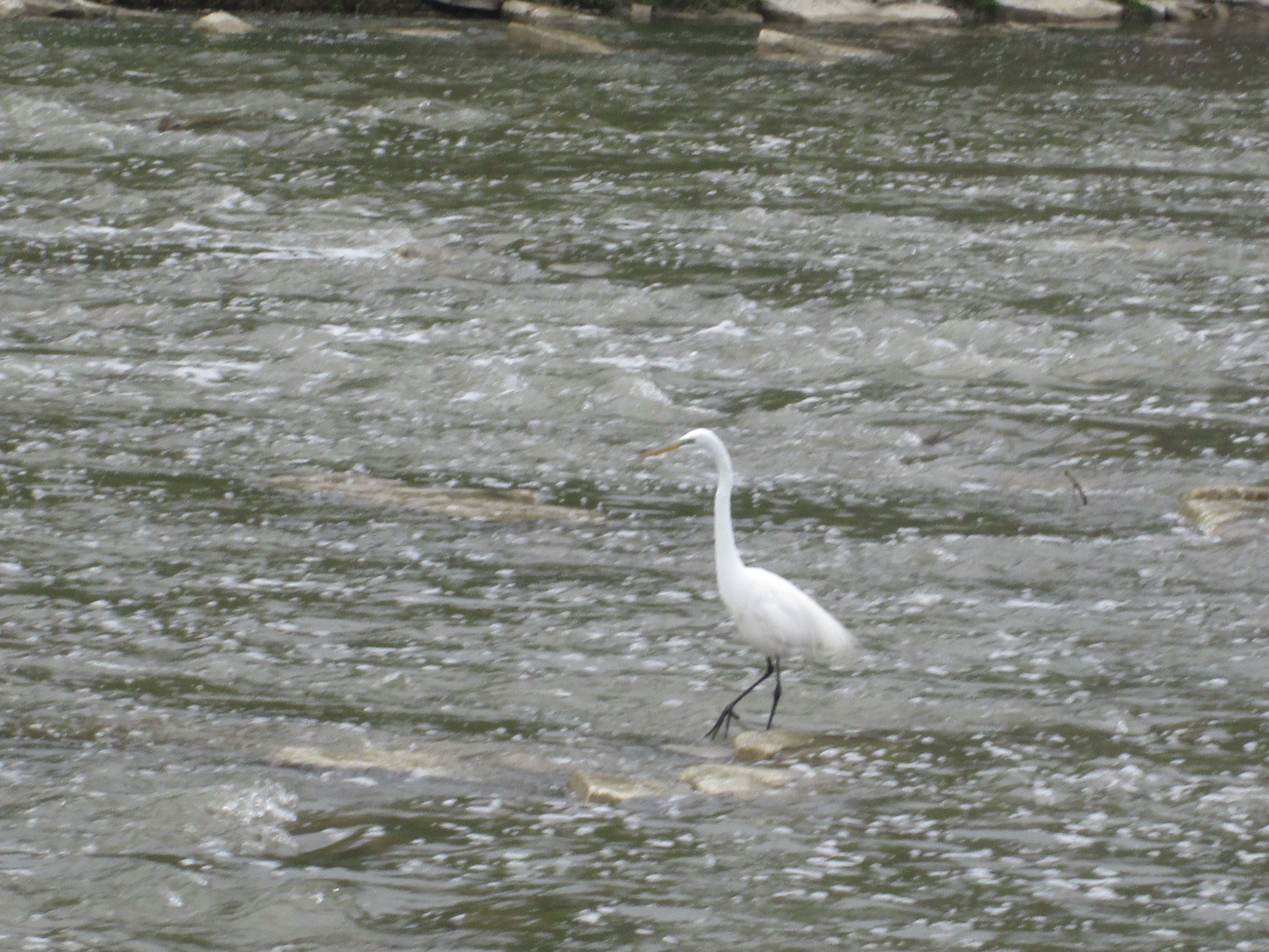
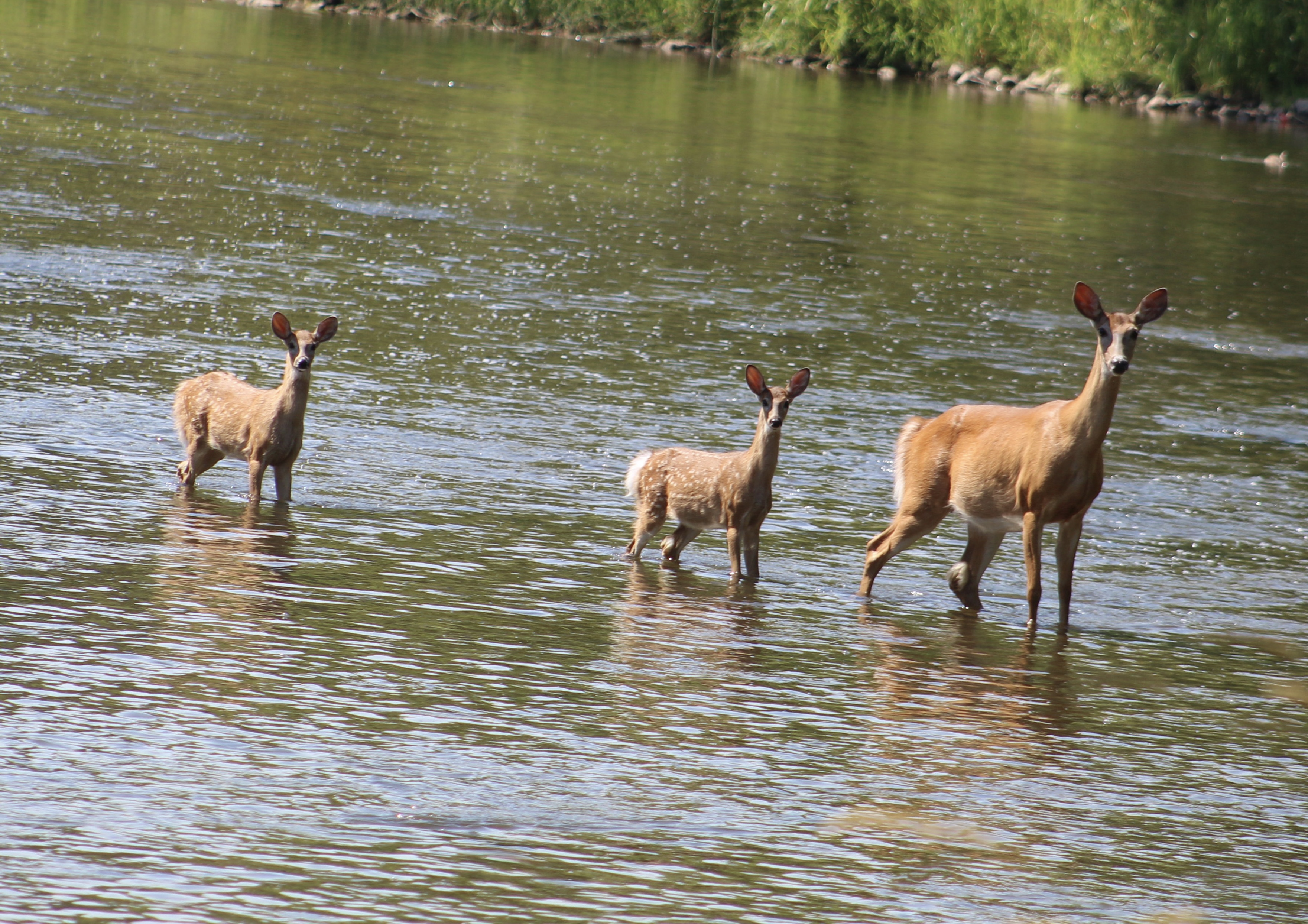
A female will have a single fawn in her first year of reproduction but can have up to three fawns in subsequent years. These two fawns were following mama deer across the Credit River in Mississauga until she spotted us and called them into a retreat to the far shore.

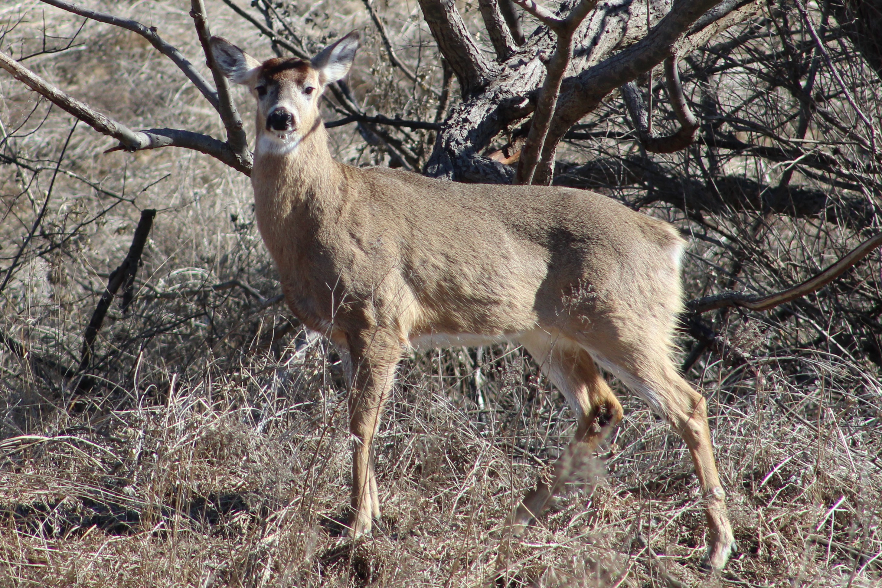
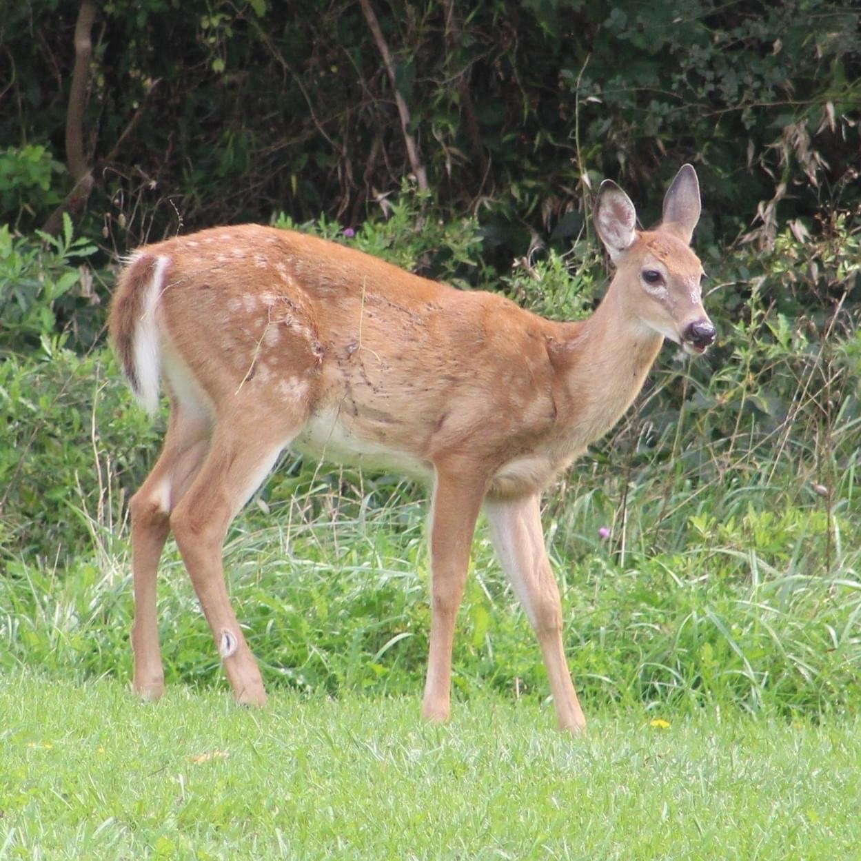
Deer will molt twice per year, spring and fall, although the fawns will only molt in the fall of their first year. They will lose their spots in their first molt and the fawn below is seen part way through that process.

White-tailed deer will live between 6 and 14 years on average but can survive up to 20 years. A female will weigh between 88 and 200 pounds while the males typically will reach 150 to 300 pounds. They can reach 4 feet tall and 8 feet long.

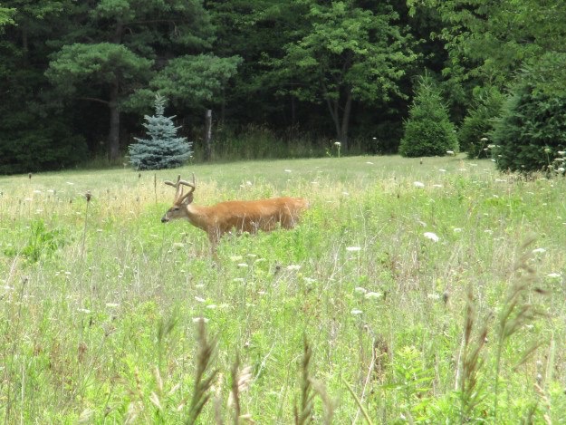
Adult deer can run at speeds up to 64 kilometres per hour (40 miles per hour) and can jump up to 2.5 metres (8.2 feet). They rut (mate) in the fall between October and November and the female can come into heat every 28 days until she becomes pregnant. The normal gestation period is about 200 days while the animal passes through the winter.

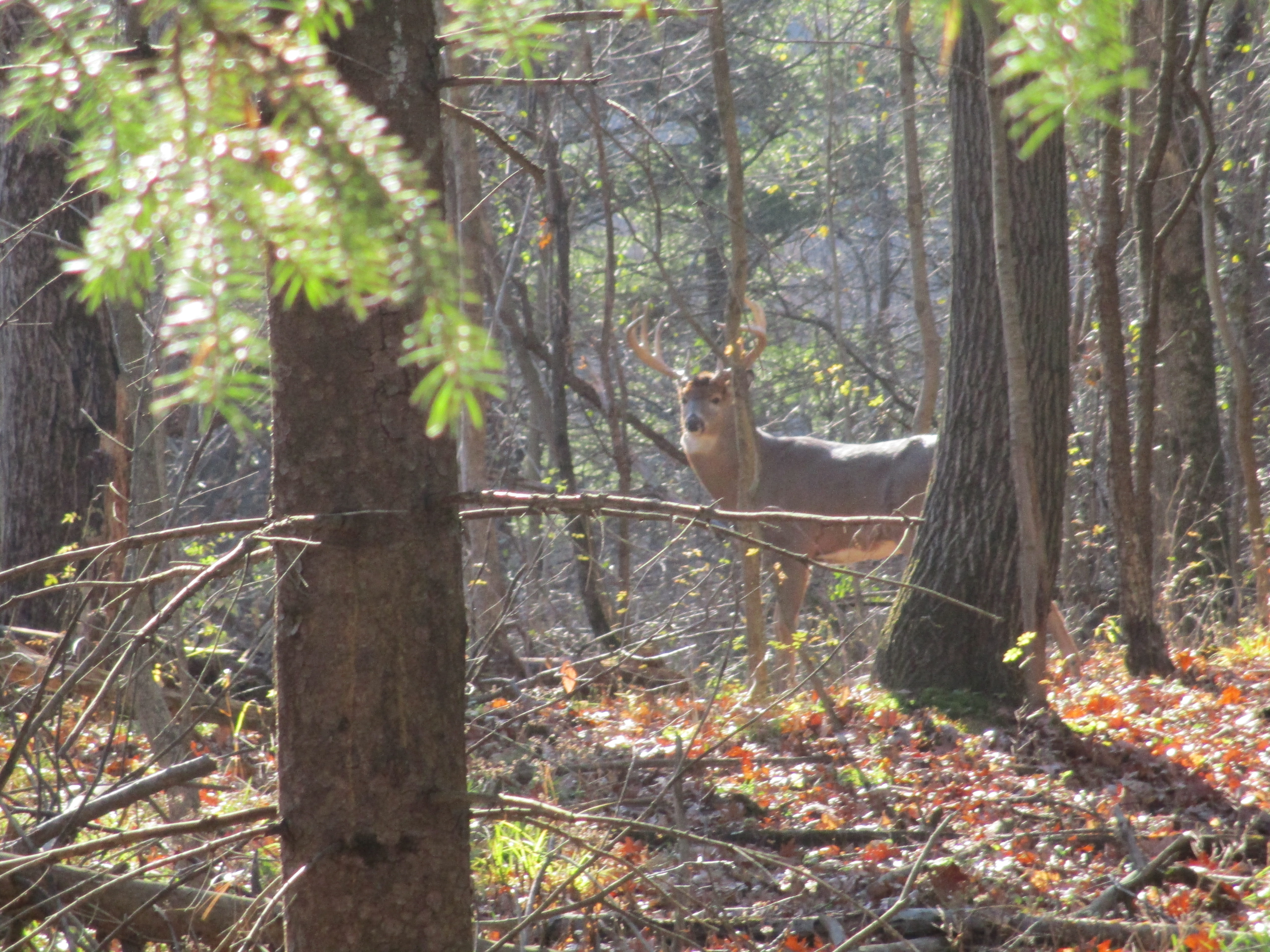
Male deer are known as bucks and grow a set of antlers every spring which they cast off after mating season each year. They are the fastest growing tissues in nature and are made of bone, nerves and cartilage. They are covered by velvet which has small hairlike structures that allow the buck to feel their antlers and prevent them from getting damaged during the growing phase.

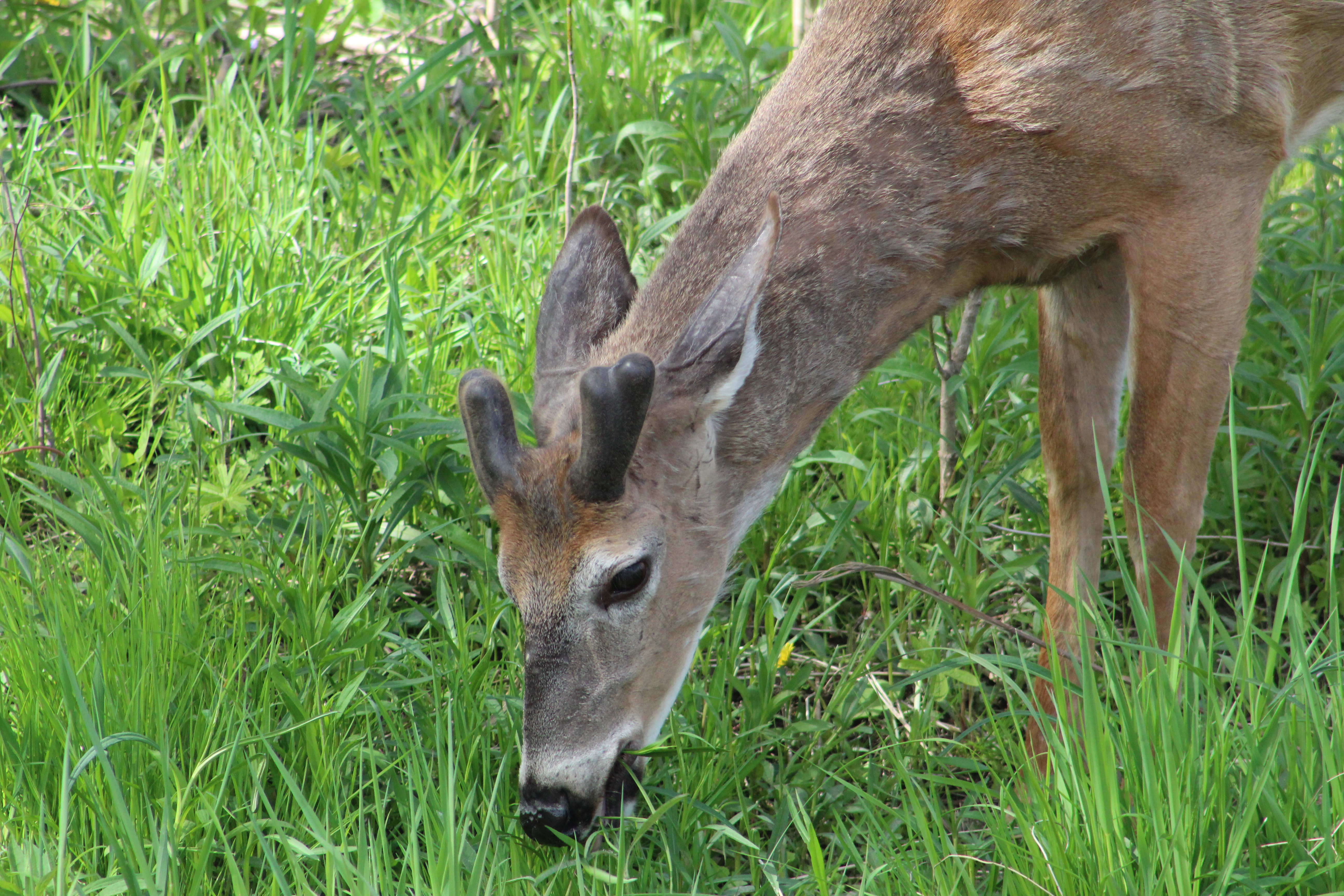
Growing antlers can take 3-4 times the nutrients that are required to grow the rest of the skeleton. For this reason, a male will have larger antlers after 4.5 or 5.5 years when the skeletal structure is finished growing. Dropping testosterone levels cause the antlers to be cast off in late winter or early spring.

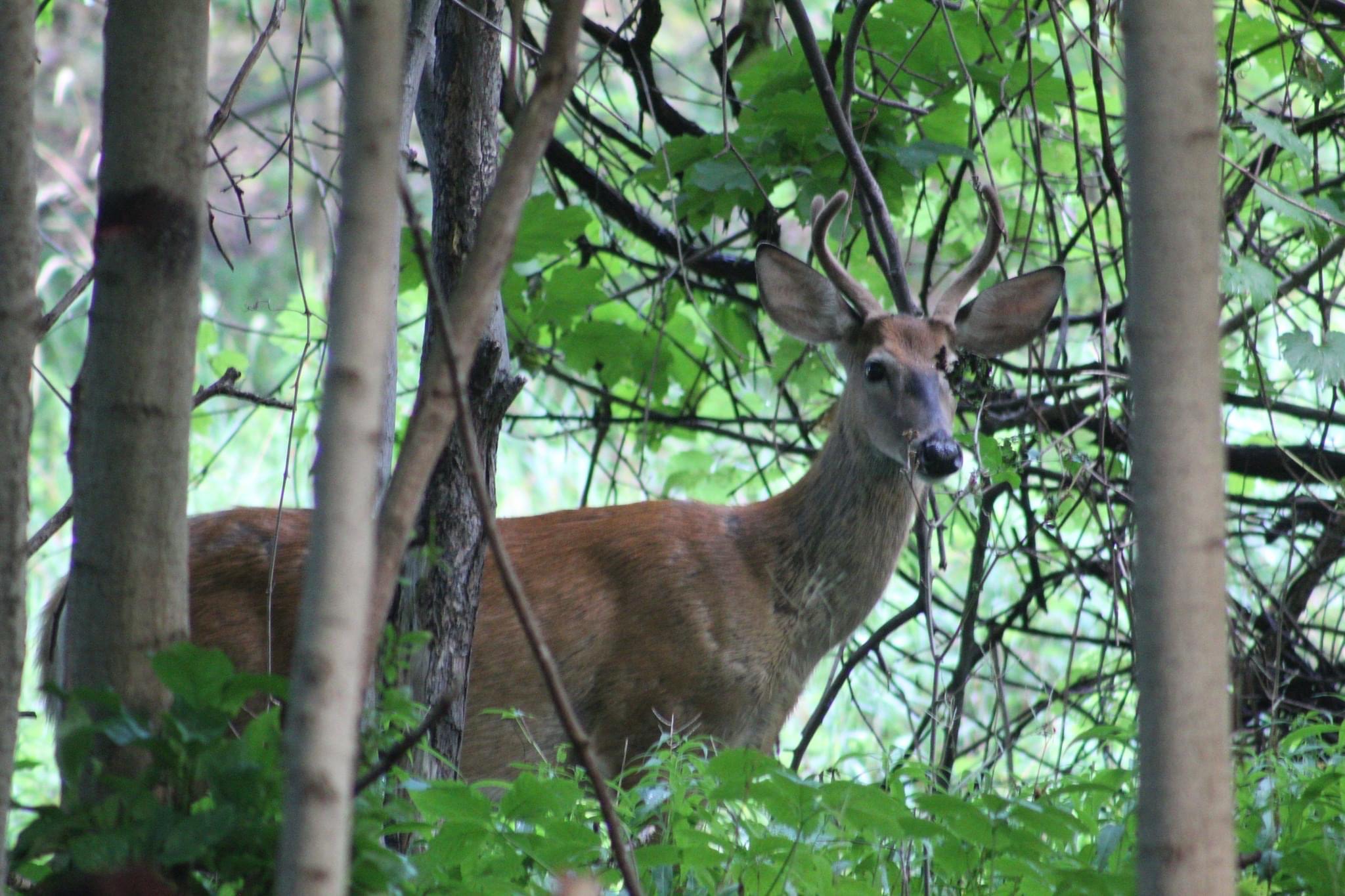
Antler size and growth potential increases with the age of the animal. When they are 1.5 years old their antlers will only be 55-60% of their later potential. At 4.5 years they will have reached about 90% of their potential. The availability of food, severity of the winters and drought will determine whether a male reaches 100% of its antler potential at 6.5, 7.5 or 8.5 years of age.

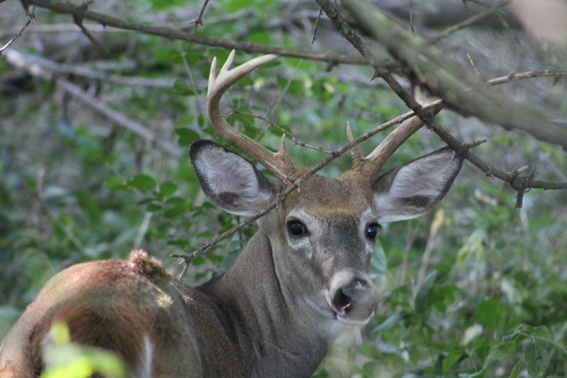
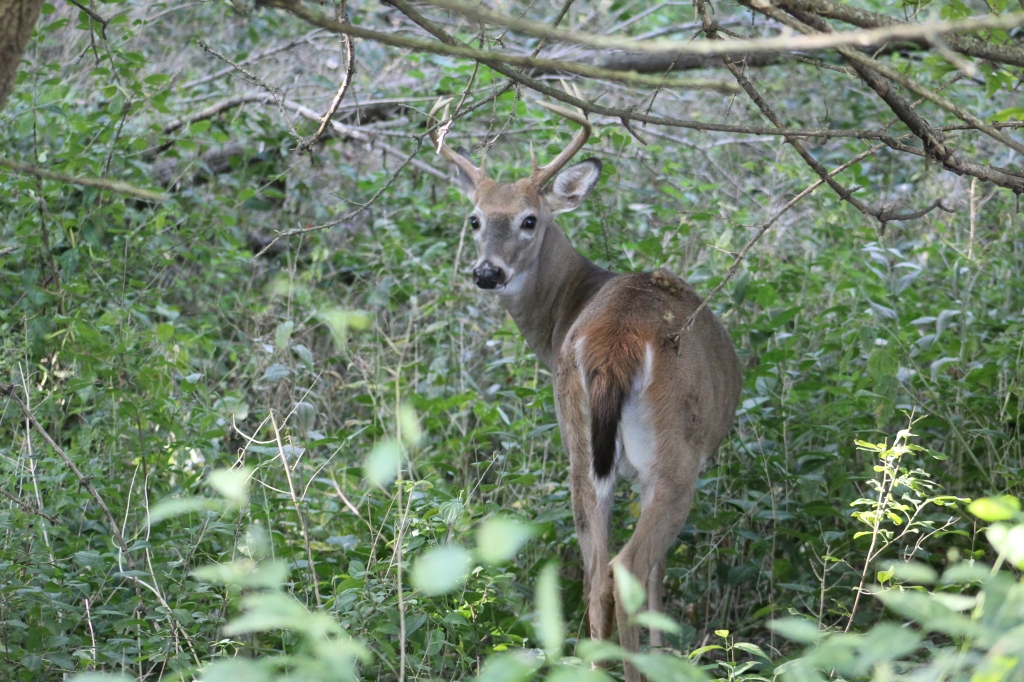
The bucks tend to spend most of their lives alone except during the mating season when they use their antlers to fight other bucks for the right to mate with the local does. The females may mate with more than one male in the effort to become pregnant. Deer eyes have more rods than cones which means that they actually see better at night.

White Tailed Deer can be found in all of the ravines in Toronto and most of the larger parks. In the city they have become accustomed to people and are easier to spot while outside of town they tend to vanish at the first scent of humans.

Like us at http://www.facebook.com/hikingthegta

Follow us at http://www.hikingthegta.com

Also look for us on Instagram

What’s In Your Ravine?

Sunday, May 9, 2021

When the last ice age retreated about 12,000 years ago each of the rivers and streams that drain into Lake Ontario were swelled with meltwater. The Rouge River, Don River, Humber River and Credit River along with all the little creeks in between carved deep ravines. These are much wider than the modern rivers that flow through their valleys. After Hurricane Hazel in 1954 these ravines were transformed into conservation areas and parks. They have become greenbelts and migration corridors for the local wildlife. With ongoing travel restrictions it is important to remember that there is some good hiking with plenty of wildlife available right in our own part of the city. This post features a selection of the plants and animals we saw in a few hours on Saturday, May 1, 2021 along a section of Etobicoke Creek.

Most ravines will have more than one type of habitat and you should explore each one, slowly. Rivers and their banks will have a distinct group of plants and animals which they may share with local wetlands. Grasslands provide habitats to pollinators and small birds while new and old growth forests will each have their own distinct species. We customarily head for the water first, but move quietly or you might not see the heron, if there is one, until it’s in flight.

Mallard ducks and Canada Geese can be found almost anywhere there’s water. However, there’s lots of other types of waterfowl that you can watch for. The picture below shows a female (left) and male (right) Merganser. Their young will feed themselves a day or two after hatching and will be able to fly after about ten weeks.

An American Mink came running along the opposite creek bank and down a fallen branch to quietly slip into the water. After a moment it emerged with a small fish in its mouth which it then carried away out of sight.

As we watched, the mink returned and went back into the same quiet pool behind some larger rocks. After coming up a couple of times to catch a breath it eventually came out with another fish, this one a little smaller. The mink kits will still have their eyes closed and won’t be weaned for a few weeks yet. As soon as their teeth start to come in their mother will feed them small bits of ripped up fish or mouse to get them started on solid food. The kits will eat every 90 minutes or so which means she will need extra food intake herself to be able to supply the milk they require.

Last April 24th we witnessed a mother mink carrying her kits across Etobicoke Creek and into a den on the other side amongst the rocks. In all, we saw her carry four kits across the creek. The picture below was taken last year while she carried the first one. There’s lots more pictures of the other mink babies in our story Mink Kits.

As we were watching the mink fishing a small heron flew upstream and briefly rested in a tree before moving along. It landed in another tree a little farther upstream. It seemed likely that people using the trail would scare it and there was a reasonable chance it would come back our way, which it did. The Green Heron is smaller than other herons and has a short stalky neck that is usually drawn down toward the body. The green on their back and head is set off by the chestnut colour of their chest.

The grasslands, especially tall grass prairie areas support a wide variety of flowering plants and grasses which attract birds and pollinators. On a sunny day you might see one of several, harmless species of snakes taking advantage of the sun to regulate their body temperature. Garter Snakes give birth to a litter of 20-30 live young in the late summer. This little one was likely born last year and will have a life expectancy of two years in the wild. Garter Snakes are sometimes kept as pets and average ten year life spans in captivity.

Butterflies and moths can be spotted on most days. The picture below shows a Compton Tortoiseshell butterfly which finally rested long enough for a photo op.

Eastern Cottontail Rabbits were not known in Southern Ontario until about 1860. Rabbits never stray far from a hedgerow, woodpile or burrow where they can escape their many predators. This is known as edge habitat and prior to the settlers cutting the forests there weren’t any of these places where fields gave way to shrubs. Their slow migration north didn’t bring them to the Ottawa area until as recently as 1931. They molt twice per year and this one is in the middle of its spring molting.

Not everything you see in your ravine belongs there. Unfortunately invasive species have taken over some areas of our parks and ravines. They grow quickly and overtake the natural species and eventually choke them out. Dog-strangling Vines are a key example of an invasive species as they routinely choke out the milkweed our Monarch Butterflies need. Garlic Mustard, pictured below, is another invader which is doing overly well. Once it gets going, Garlic Mustard will choke out the Trilliums and Trout Lilies (Dog’s-toothed Violet).

The Mayapples are just starting to form the bud that will open into the flower. Plants with a single leaf won’t flower but the colony along this stretch of the creek is almost all female. They have a pair of leaves and a flower bud forming in between. This particular patch appeared to be mostly flowering this year. These plants grow in patches from a single rhizome and will be found in the same location year after year.

Violets are a large family of plants that have over 525 species. This time of the year they form a purple or blue carpet on the forest floor. Many violets are perennials which means that the plant will live for more than one year.

Experience has shown that almost every ravine in the GTA has both coyote and deer. The Etobicoke Creek is no exception. Although the local coyote didn’t make an appearance on this Saturday, the deer showed up in force. While walking a side trail a flash of white in the trees betrayed the presence of a White-tailed Deer. Upon closer examination a small herd of five was detected. Three of them went off along the ridge while the other two continued to browse. The pair are shown in the cover photo and the smaller of the two was very curious. It walked to within a few metres of where we were sitting as it casually munched leaves and grasses.

July 27, 2020 while taking an observation break, a fawn walked right up to us and pretty much said “Hello.” Its mother was nearby and called it back when she thought it was getting a little too curious. From the way the deer approached today, it was almost as if it was the same one with its mother and that it recognized a friendly acquaintance.

This male Hairy Woodpecker is in the process of digging some little snack out of a dead tree. The term “snag” applies to a standing dead tree and they make up an important part of the local ecosystem. They provide unobscured views for raptors such as the pair of hawks we saw circling high above at one point. Snags also provide homes for wood and bark boring beetles and their larvae. This is what attracts the woodpeckers and serves as a source of food for them. Small animals will nest in hollow snags and they’ll continue to serve as housing even after they fall.

Once you know where to look for Jack-in-the-pulpit you should be able to go back every spring and see the same plants. This is because they can grow from the same underground corm for up to 100 years. It’s quite possible that this little plant in the picture below will outlive everyone reading this article today.

This is just a sample of the types of things you can expect to see in almost any ravine, watercourse, or major park in the GTA. So, the question is, “What’s in your local ravine and when are you going exploring?”

Related blogs: Mink Kits, Etobicoke Creek Trail

Google Maps Link: Etobicoke Creek

Like us at http://www.facebook.com/hikingthegta

Follow us at http://www.hikingthegta.com

Also look for us on Instagram.

Lower Don Trail

Friday, September 18, 2020

The Lower Don Trail runs along the Don River from Corktown Commons to Pottery Road. Having previously covered the section from Riverdale Park south to Corktown Commons in our feature The Don Narrows it was time to return and visit the north section. As before there was free parking on the end of Carlton Street at Riverdale Farm. A metal staircase leads you down the 88 steps to the floodplain of the Don River in Riverdale Park. The picture below shows the pedestrian bridge that crosses Bayview Avenue and the railway tracks. There’s a set of stairs that lead to the Lower Don Trail on the west side of the Don River.

South of the bridge the trail follows the section of the Don River that was straightened in the 1880’s. This section is sometimes referred to as The Don Narrows. Heading north the river quickly starts winding and turning as it follows its natural course. Blue Jays were out in abundance along the trail.

The Don River is known to flood its banks and the Don Valley Parkway during heavy rain storms but on this morning it was perfectly calm in many places. The railway bridge in the picture below belongs to Metrolinx and is currently not used. It leads to the Half Mile Bridge and makes an interesting walk. We have previously proposed that this section be turned into The Half Mile Bridge Trail, at least temporarily. It is currently illegal to walk along these tracks and when I was making my return along the trail I saw a Metrolinx rail truck driving along the tracks. That likely would have been trouble for anyone caught walking there.

The main trail heads north after crossing the Don river on a footbridge. The Bloor Viaduct spans the ravine and the trail passes underneath it. Officially known as the Prince Edward Viaduct, construction was started in 1915. A detailed story of the bridge can be found in our feature story The Bloor Viaduct.

Goldenrod is a member of the aster family and usually has the distinct disc and ray florets of a daisy. There are over 100 members of the goldenrod family and their tiny yellow flowers bring witness of the changing of the seasons.

A white tailed deer buck was casually grazing on the trees on the side of the Don River. This buck had 6 points on his antlers. Some people believe that you can tell the age of the animal by the number of points but this isn’t true. The deer will grow about 10 % of its potential antler mass in the second summer of its life. The third year it may reach 25-35% of its full growth. Out side the parks and ravines the male deer typically only live about four years due to hunting pressure. That obviously isn’t a factor in the downtown area. They say that the only real way to tell the age of a deer is to look at the teeth. This one let me get pretty close, but not quite that close.

A short distance north of the Bloor Viaduct is a public art display known as Monsters for Beauty, Permanence and Individuality. It contains fourteen cast concrete sculptures that were placed here in 2017.

The sculpture are recreations of gargoyles that adorn buildings in downtown Toronto. Old City Hall and Queens Park provided some of the inspiration for the artwork.

The artist is named Duane Linklater and he is an Omaskeko Cree from Moose Factory. Duane has been awarded by the Canada Council for the Arts as well as having won the Sobey Art Award. His display on the Lower Don Trail is intended to draw attention to the changing role of the Don River in the early industrialization of the city.

Side trails run along the edge of the river in places where the floodplain is wide enough. These can be much more interesting and you are more likely to see the local wildlife on these less used trails. Kingfishers were zipping up and down the river calling out in their urgent chatter and a couple of hawks were circling in the distance. This is the area where you may see one of the deer that reside in this greenbelt.

The Half Mile Bridge was replaced in the 1920’s with a wider bed on concrete piers. The old steel piers were all removed except the one on the west end by the Don Valley Brick Works.

As you approach Pottery Road you can see the chimney from Todmorden Mills which was the first industrial site in the new town of York (Toronto). I love the 1967 Canadian Centennial Maple Leaf that was installed at the top of the chimney during restorations that year.

When you reach Pottery Road you have the option to follow it across Bayview Avenue and explore the abandoned section which can be read about in our post Abandoned Pottery Road. If you follow the trail north it brings you to Beechwood Wetlands and Crothers Woods.

Google Maps Link: Lower Don Trail

Like us at http://www.facebook.com/hikingthegta

Follow us at http://www.hikingthegta.com

Also look for us on Instagram

Old Albion Road

Saturday, March 23, 2019

The Humber Recreational Trail is pretty much continuous through Toronto from Lake Ontario to Steeles Avenue.  It has a short section on the road where a golf course restricts passing.  We chose to explore a section north of the 401 so we could look for the remains of Old Albion Road.  Free parking is available at Pine Point Park at the end of Hadrian Drive.

Staying close to the river, we were treated to several Mergansers who were playing in the slushy waters.  The males were attempting to impress a group of seemingly bored females.  In breeding season the male Merganser gets a glossy green tinge.  Later in the summer and fall both he and the females will be mostly a dull grey.  The diet is mostly fish and so their bills have serrations to help with holding onto their slippery prey.  For this reason they are also sometimes known as “sawbills”.


Merganzer

Male whitetail deer rapidly grow their antlers for three or four months during the summer when their testosterone levels are high.  Following the rutting season the testosterone levels drop quickly which activates specialized cells called osteoclasts at the point of connection of the antlers.  These cells eat away at the pedicle, where the antlers grow, until the connection becomes so weak the antlers are simply shed to make way for new ones.  Depending on the age and health of the animal as well as their local climate they shed their antlers between January and April.  This young buck has clearly visible pedicles, just waiting for new antlers to begin to grow.

IMG_2559

Albion Road was originally a private road built for a French teacher named Jean du Petit Pont de la Haye and ran to his estate at Indian Line and Steeles Avenue.  The settlement he founded there was named Claireville after his daughter Claire.    In 1846 the road was upgraded from Musson’s Bridge at the Humber River all the way to Bolton by The Weston Plank Road Company.  At this time the road was named Claireville Road and there was a toll booth in Claireville to help pay for maintenance of the road.  It is believed that the white house that can be seen from Steeles Avenue is the old toll house.  Claireville Road is coloured brown in the 1877 County Atlas image below.

Musson

Early bridges were built of wood and seldom lasted more than 20 years.  Flooding would often destroy them even earlier than that.  By the time of the County Atlas, Claireville Road was likely on its second bridge across the Humber.  In 1905 the bridge was again in need of replacement and Octavius Laing Hicks was commissioned to build the new one.  The bridge was his first and also the first all-riveted steel bridge to have a permanent deck.  Hicks built it on cut stone abutments instead of concrete that had started to become popular in construction at the time.  As his next bridge was a concrete bow bridge it is clear that Octavius was familiar with concrete as a bridge building material.  This suggests that he built his bridge on the abutments from the previous one.  The bridge became known as Musson’s Bridge because the family owned several pieces of property on the Etobicoke side of the river.

When the remnants of Hurricane Hazel swept down on the city on October 15, 1954 they destroyed or severely damaged 40 bridges.  Musson’s bridge had already been replaced with the new alignment of Albion Road and was no longer as critical to transportation as it had once been.  The bridge wasn’t badly damaged and remained on site until it was removed in 1962.

Albion Road Bridge Hurricane hazel

The bridge abutments on the west side of the river were removed in 1963 but the ones on the east side remain, and we can see them but for the moment there’s still an icy river between us.

IMG_2569

We followed the edge of the Humber Valley Golf Course until the river doubled back on itself leaving us to also turn back.  Just as we were about to do so, we caught sight of a coyote who saw us at about the same time.  Unfortunately, he didn’t hang around to get his picture taken.  Soon, movement in the trees across the river alerted us to the presence of at least two more deer.  These two were likely females who will be giving birth to their fawns in late Spring.  The deer were keeping the swiftly flowing river between them and the coyote.

IMG_2588

We retraced our steps to a pedestrian bridge we had seen earlier in Louise Russo Park and made our way back to the abutment on the east side of the river.  The steel beam is still in place that anchored the bridge to the abutment, however it may have been added by Octavius in place of a previous wooden span.

IMG_2556

One thing that never changes is human interest in seeing the damage that storms can cause.  Ice, wind or water can all inflict a lot of damage and this 1954 picture from the Toronto Public Library shows us the curious ones out to see the damage from the hurricane.  This view is from the east side looking toward Musson’s bridge and the river.

Old albion road bridge 1954

The street view today is much different with the road closed off and the bridge missing.  The embankment on the left of the picture has grown over with trees and there is a park on the right side.  The road crossed the river and then angled north-west  right where the apartment is today.  The small section of Albion Road that ran between Weston Road and the river still provides access to a few houses under the name Norris Place.

IMG_2559

It was nice to see so many birds this weekend along with the other wildlife.  It’s a certain sign of warmer days ahead.

Google Maps Link: Pine Point Park

Like us at http://www.facebook.com/hikingthegta.com

Follow us at http://www.hikingthegta.com

Imperial Oil Lands

Saturday, March 4, 2017

J. C. Saddington Park sits between Mississauga Road and the mouth of the Credit River.  To the west of Mississauga Road, south of Lakeshore, lie the 73 acres of brown space known as the Imperial Oil Lands.  There is parking on at the end of Mississauga Road at J. C. Saddington Park, as can be seen on the Google Earth map below.  Key points from today’s exploration are also marked on the map.

oil-lands

Thomas Nightingale opened a brickyard on the west side of the Credit River in the 1880’s. The addition of a stone crusher increased production to the point that by 1900 there wasn’t enough local labour to run the brickyards.  A series of bunkhouses were constructed and Italian workers were brought in to meet the demand.  The archive photo below shows the Port Credit Brickyards in their prime.

port-credit-bricks

After the First World War, the clay was becoming exhausted and the yards started operating at a loss. By 1929 the brickyards were closed.  This brick was found on the property of the old brickyards where it was made, perhaps over 100 years ago.

img_6658

In 1933 the Lloyd Refining Company purchased part of the property to build a modern refinery capable of producing 1,500 barrels a day.  The refinery changed hands a few times including 1937 and 1946.  In 1955 the property was purchased by Texaco and their Canadian subsidiary McColl-Frontenac began operating the refinery.  In 1959 the name was changed to Texaco Canada Ltd.  Petrochemicals were produced here beginning in 1978 but by 1985 it was starting to be decommissioned.  The oil tank farm was removed first and by 1987 it was fully closed.  Only one small building remains on site along with a storage shed.

img_6656

The property has sat vacant for a couple of decades now and is highly contaminated from its years as an oil refinery.  As of March 2017, Imperial Oil is selling the property to a developer who plans to develop a waterfront park, mid-rise condos and affordable housing on the site.  Today the property is home to a large selection of wildlife.  Coyote scat is everywhere and rabbits and squirrels provide food for them as well as the hawks.  A white tailed deer was casually feeding just inside the fence from Mississauga Road.

img_6664

Roadways and concrete pads mark the locations of the former tanks and buildings.  The property is marked as no trespassing because of the numerous hazards that exist throughout.  This story is presented to preserve the site as it exists at this moment in time.  Soon it will change forever and this chapter will be lost.  Choosing to explore here is solely your responsibility.  A large man-made pond covers a section of the property and may feature in redevelopment plans for a central park within the community.  The pond is currently full of pipes that have started to break apart over the years of abandonment.

img_6644

The lower corner of the pond still has the dam and flood control devices intact.  Two sluice gates could be opened by turning handwheels.  The cover photo shows a closer look at the mechanics of the system.

img_6625

Outflow from the pond was transferred to a series of settling ponds to remove solids from the water.  From here it was carried through a concrete pipe and released into the lake.

img_6643

We made our way to the end of the concrete pipe that discharged the water from the pond on the Imperial Oil Lands.  The round concrete pipe has been encased in a concrete shell to protect it from the effects of the lake.

img_6676

The Waterfront Trail takes the name Imperial Oil Trail as it passes along the lake side of the property.  We followed it west to where you are forced briefly to follow the road.  That wasn’t such a bad thing as we were treated to a broad-winged hawk sitting on a hydro wire.  These birds usually winter in the south and I wonder if this one was noticing the -20-celsius wind and wishing it hadn’t come back yet.

img_6680

Ben Machree Park has some interesting wood carvings by Jim Menkin.  Jim has converted dead tree stumps into art with his chainsaw in many parts of Ontario including Orangeville and Mississauga.  This park features three wood carvings named “Sirens of Homer’s Odyssey”.

img_6705

We returned along the Imperial Oil Trail east toward the mouth of the Credit River.  Just east of the concrete drainage pipe from the oil lands is a lengthy finger pier extending out into Lake Ontario.  This pier provides great views to the west looking toward Rattray Marsh.  To the east, you can see the Ridgetown with the city of Toronto in the background. The ship is partially sunk at the mouth of the Credit River to provide shelter for the marina.  Our post on the Ridgetown contains its fascinating history.

img_6713

In the 1940’s Port Credit ended at Lake Street, of all places!  Today it extends out into the lake in the form of J. C. Saddington Park.  This park is built on a decommissioned dump that was in use from 1949 to 1970. A pond has been created for recreation and fishing and benches positioned around for relaxation. The pond has a thin layer of ice on it from the past two days of cold weather and a light dusting of snow.  A sliver of the moon can be seen above the trees in the middle of the picture.

img_6746

Three historic buildings stand in the corner of the parking lot. Dating from 1922 to 1923 the Port Credit Waterworks pumping station was a major advancement in the infrastructure of Port Credit.

img_6766

Swans, Canada Geese and several species of ducks were all to be seen in the lake today.  Of interest was the fact that they have gone back into pairs after spending the winter in groups.  Spring must be coming soon…

A 1973 Toronto Archive Aerial photo of the oil lands can be accessed here.

Our readers selected the top 15 stories for this special feature.

Google Maps Link: J. C. Saddington Park

Like us at http://www.facebook.com/hikingthegta

Follow us at http://www.hikingthegta.com


The Haunted Hermitage

Sunday, Nov, 15, 2015

The ruins known as The Hermitage are said to be one of the best spots for ghost watchers because of it’s haunted past.  Reverend George Sheed bought this property in 1830 when he moved to Ancaster to become the first resident Presbyterian Minister.  He built a frame house on low ground close to the stream. The property seems to have had some odd things going on from the very beginning.  The first service conducted in the new church was the funeral for Reverend Sheed who had passed away suddenly in 1832.  As you walk back though the former estate grounds, now part of the Bruce Trail, you pass a small pond that was almost perfectly calm on this sunny morning.

IMG_1529

Otto Ives came to Upper Canada in 1833 and purchased the land from Sheed’s estate.  Legend has it that Ives and his wife hired a coachman named William Black to assist them.  Black became obsessed with Otto Ives’ niece who had moved to Canada with them.  Finally he worked up the nerve to ask Otto for the young woman’s hand in marriage.  William Black was quickly rejected and told he was beneath the family and could never hope to marry into it.  When he failed to turn up for work the following morning Ives went looking for him.  Whether found hanging in the rafters or a tree it is recorded that heartbreak caused Walter to take his own life. Otto then cut the body down and took it for burial.  Suicides could not be buried in the church cemetery and so the body was transported via a manure wheel barrow to a burial site near Lover’s Lane. They say that the ghost haunts the property today looking for his lost love.  There are many claims of sightings and the park is now closed at night as a result.

George Gordon Brown Leith bought the property in 1855 and he built a two story home in a park-like setting that came to be known as The Hermitage.  The front and side walls were made of hammered limestone while the rest was made of random field stones.   The house has been in ruins for years with the walls being propped up from the inside.  For safety the walls either needed to be lowered to waist height or be secured.  It was decided to rebuild the walls. Restoring the Hermitage is a $600,000 project and was started in July.  Each stone was removed, numbered and set aside.  A new foundation was poured and steel support beams installed to support the walls.  The stone masons are busy putting the walls back in place.  In the end we will have a set of restored ruins.

IMG_1457

Behind the two story home an extended carriage house also contained a workroom and space for wood storage.  This building itself was 85 feet long.  There was also a smaller building which housed the nursery.  Their ruins can be seen in relation to the Hermitage in the picture below.

IMG_1467

At the rear of the house was a two room building that housed the laundry.  One of these rooms had a cistern built into the floor.  The ruins of the laundry are relatively more intact than the stable or nursery.  The cover photo shows the inside of the laundry while the picture below is from the rear.

IMG_1473

Beside the parking lot on Sulphur Springs Road stands the gatehouse which was built around the same time as the rest of the structures.  It was also called The Lodge and was occupied by the gatekeeper and his family. His duties included opening the gate for the family and their guests and escorting people back to the house.  For many years it was lived in by the grand daughter of George Leith.  Today the gatehouse hosts a museum on the property.

Gatehouse

By the 1860’s the farm was quite prosperous with 150 acres cleared and cultivated out of the total 250.  The family of 8 shared the home with five servants and lived in relative opulance for the time period.  Slowly the family died off with Mr. Leith going first in 1887 followed by his wife in 1900.  Their daughter, Mrs. Alma Dick-Lauder, lived in the house after they were gone.  In October 1934 there was a fire that totally destroyed the buildings leaving only ruins.  In another small example of unusual behaviour on the property, Mrs. Lauder lived in a tent while she had a smaller new home built inside the ruins.  She lived there until her death in 1942 when the farm began to return to the forested condition it enjoys today.  Among the trees grow wild grapes, some of which have reached massive sizes as the vine below illustrates.

IMG_1477

The park is full of deer tracks, some of them very fresh.  I followed what looked to be the freshest ones and soon came to a set of deer bones scattered on the ground.  Thinking the tracks were much newer than this, I carried on and came to an old orchard.  This is a prime area to see deer, especially at this time of year when they can find some apples to eat.

IMG_1485

At the end of the orchard stands a giant old red oak tree.  I estimated that it must be six feet across at the base of the trunk.  These trees can live to be 600 years old.

IMG_1494

In the park is a section which belongs to a private residence. These structures were built by Leith for the farmer who lived there and tended the farm for him.  There is a house, granary and a barn.  It is clearly fenced off and as I admired the old architecture I wondered if those might not be three arrowslits in the top of the wall on the second story of the barn.  How many times has a musket poked out of one of those I wondered?

IMG_1498

Finally, my following deer tracks paid off as I came to a buck and doe grazing.  They both posed for some great shots but the buck was especially proud of himself.  Following wild animals through the woods is hazardous because they are unpredictable and they are, therefore, safer enjoyed by photo and video.

IMG_1508

After a few pictures he decided to strut off into the woods as if I didn’t concern him at all.

I didn’t feel anything that was unusual while I was around the Hermitage.  Perhaps the restoration project has caused the ghost of William Black to find temporary new lodgings.  And then again, was that a musket in the arrowslit on the old barn?

Like us at http://www.facebook.com/hikingthegta

Hiking the GTA #100 – Amazing Animals

April 28, 2014 to July 18, 2015

Presented below is a gallery of animal pictures taken during the first 100 hikes on the Hiking the GTA adventure.

On July 21, 2015 I published my 100th post in this blog under the title Hiking the GTA #100 – Greatest Treks.  That post looked back at the creation of Hiking the GTA and listed the top 15 hikes as determined by activity on WordPress.  This post presents some of the amazing animals that we encountered along the way.  By hiking quietly and keeping off of the beaten path you have the opportunity to come face to face with some of the wide variety of wildlife we share our parks with.  Most of the animals are more afraid of you than you are of them and will disappear quickly.  In reality some of the plants in our parks are more dangerous than the wildlife.  The following pictures are in the order in which I took them except that I saved my personal favourite for last.  Links to the related articles are provided where additional descriptions of the animals are presented.

This White Tail Deer buck was following me through the woods along Wilket Creek on June 22, 2014.  This was the only creature I saw all year that made me nervous as I’m usually the one doing the following.

IMG_2389

The little baby Cross Orb Weaver spiders in this picture are just hatching and look like grains of pepper leaving the egg sac.  The mother spider had previously brought a Daddy Long Legs spider into the web to provide a breakfast to the hatchlings.  Seen near Middle Road Bridge on Aug. 16, 2014

IMG_2944

This Red Tailed Hawk was feasting near Barbertown on Aug. 23, 2014.

IMG_3098

Also seen in Barbertown was this Dekay’s Brown Snake on Aug. 23, 2014

IMG_3021

The Monarch Butterfly below was seen at the forks of the Don on Sept. 14, 2014.

IMG_3361

Spadina House has it’s own resident fox as photographed on Dec. 21, 2014.

Spadina 74

This Snowy Owl was seen at the Adamson Estate on Jan. 24, 2015

IMG_2092

This coyote was photographed in West Deane Park on Jan. 31, 2015

???????????????????????????????

The beaver in this picture was seen in Etobicoke Valley Park on Feb. 28, 2015

IMG_2663

This White Egret was fishing near the dam at The Old Mill on May 10, 2015.

IMG_4287

The Red Breasted Grosbeak below was photographed in Norval on May 16, 2015.

IMG_4404a

This Trumpeter Swan, complete with tracking tag, was seen at the mouth of the Credit River and featured in The Ridgetown – Port Credit on May 23, 2015.

IMG_4755

This Black-crowned Night Heron was published in The Forks of the Credit – The Stone Cutter’s Dam on July 18, 2015.  Unlike the Great Blue Heron in the cover photo it does not have long legs and neck.

IMG_6600

Hiding in plain sight in the picture below is a new born White Tail Deer Fawn.  This is my favourite picture of the past year and was taken near the Barber Paper Mills on June 6, 2015.

IMG_5361

This is just a sample of the some of the amazing animals we saw on our journeys in the first 100 hikes in this blog.  Many others were featured and many more will yet be photographed on future hikes.

visit us at http://www.facebook.com/hikingthegta

Rowntree Mills

Saturday, Nov. 8, 2014

It was overcast and 5 degrees with occasional light drizzle.  Parking is available on Hathor Crescent just before Rowntree Mills Road descends the hill to the river.  The road is closed at the bottom of the hill and from here the bridge across the Humber river can be seen.  The bridge is a steel girder construction and has been fitted with new wood decking to convert it into a safe pedestrian bridge.  It’s construction likely dates to around 1900.  The bridge can be seen crossing the river in the lower corner of the cover photo, which is an aerial shot from 1953. The photo below of the bridge is taken from the west bank of the river.

IMG_0923

Joseph Rowntree arrived in Canada from England in 1830 and set himself up in an area known as Pine Ridge, just outside of Thistletown.  In 1843 he built a saw mill on the east side of the Humber river and in 1848 he built a grist mill on the west side.  A road was built to access the mill which we now call Rowntree Mills road.  A bridge was built across the river and he named it all Greenholme Mills.  In 1870 Joseph added the Humberwood Mills, a mile down river, to the family holdings.  The cover photo shows the grist mill as it appeared in 1953. Rowntree Mills road crosses the bridge and passes to the west of the mill.  A laneway completes the loop on the river side of the mill.  Today the area where the mill stood 60 years ago has become completely overgrown.  All that could be found was this square area of concrete in the woods and many piles of bricks, stone and concrete.

IMG_1017

From the east side of the river the former mill site can be identified by the row of pine trees that ran along side of the lane way that lies between the mill and the river.  They show up as the dark strip to the right of the road, adjacent to the mill, in the cover photo.  I can picture Joseph planting these pines along the ridge in honour of the community of Pine Ridge where he lived. The mill stood about 20 feet above the current water level of the river.  It isn’t immediately obvious how Joseph used the water power from the river to turn the grinding wheels in his grist mill.  It may have initially been an undershot wheel sticking out into the river.

IMG_1024

It was a morning full of various birds.  At one point a migration of cardinals passed through but none sat still long enough to get their picture taken.  There were also flickers, herons, and large birds of prey.  Some of the trees in the area display the straight rows of tiny holes that are typical of a yellow-bellied sap sucker.  These woodpeckers drill little holes from which they feed on the sap that flows out.  The tree in the picture below had these rows of holes extending for as far up the tree as the eye can see.

IMG_0930

This plant is known as tall thimbleweed.  The single head on a tall stem contains tiny nubs that make it look like a thimble.  When the seed heads burst open they look and feel like cotton. Native peoples used the plants for medicinal purposes but we now know that the leaves are toxic in large doses and so the plant is used mainly for decoration.  The picture below shows both a closed pod and one that has blown open to spread its seeds to the wind.

IMG_0937

This very large red tailed hawk didn’t seem to mind posing for the camera.

IMG_0993

Rowntree Mills Park and the surrounding ravines have been taken over by white tail deer.  In one spot I was able to see 8 females at one time plus at least one male.  Mating season is known as rutting season for these deer.  Males begin their part of the rut in the fall when the velvet is falling off of their antlers.  In North America this lasts for several weeks with the peak being on average, November 13th.  The male’s part in the reproductive act lasts for exactly one thrust.  Ho-Hum.  Females go into rut for periods of up to 3 days at a time and can do so 7 times over the rutting season, or until they conceive. The picture below has at least 4 deer looking at the camera plus 4 others hiding in the background.

IMG_1005

In October 1954 the area on the east bank of the river just north of Rowntree Mills road was home to a small community of houses.  On the morning of October 16, 1954, there were 12 less of them there because Hurricane Hazel had swept them away.  Two people died in this area as well when they were trapped in their car as the river washed it down stream.  Today the area has been cleaned up and there is no trace, other than in old aerial photos, to show where the homes were. Rowntree Mills Park was named after Joseph in 1969 but was closed in 2009 due to wild parties that trashed the park.  Today it is basically abandoned although the grass is cut and the leaves are cleaned up.  The picture below is taken from the front yard of one of these former homes looking along the street where others once stood.

IMG_1023

At the corner of Rowntree Mills Road and Islington Avenue is a pioneer cemetery.  This land was donated in 1848 by Joseph Rowntree to be used for Pine Ridge Methodist Church and its cemetery.  There are many grave markers in here that commemorate the lives of various members of the Rowntree family.  Although it seems likely that Joesph was laid to rest here, I was unable to locate his grave marker.

IMG_1026

Google Maps link: Rowntree Mills Park

Like us at http://www.facebook.com/hikingthegta

Follow us at http://www.hikingthegta.com