Tag Archives: coyote

Cook Woodlot

Saturday, October 10, 2020

The Cook Woodlot was once part of the property belonging to Thomas Cook who played an important role in the community of Carrville in Vaughan Township. The county atlas below shows his property outlined in green while the woodlot comprised the section closest to the Northern Railway line. Settlers would often clear most of their lot but left a woodlot that served them as a source of lumber and firewood. There is limited parking on Halo Court and residents would likely prefer people to park on Peter Rupert Avenue if they plan to visit. Notice that Peter Rupert owned the land below the woodlot and he lends his name to the avenue. His property extended west to Keele Street and was the site of Rupert’s Chapel in the former community of Sherwood, a Ghost Town of the GTA.

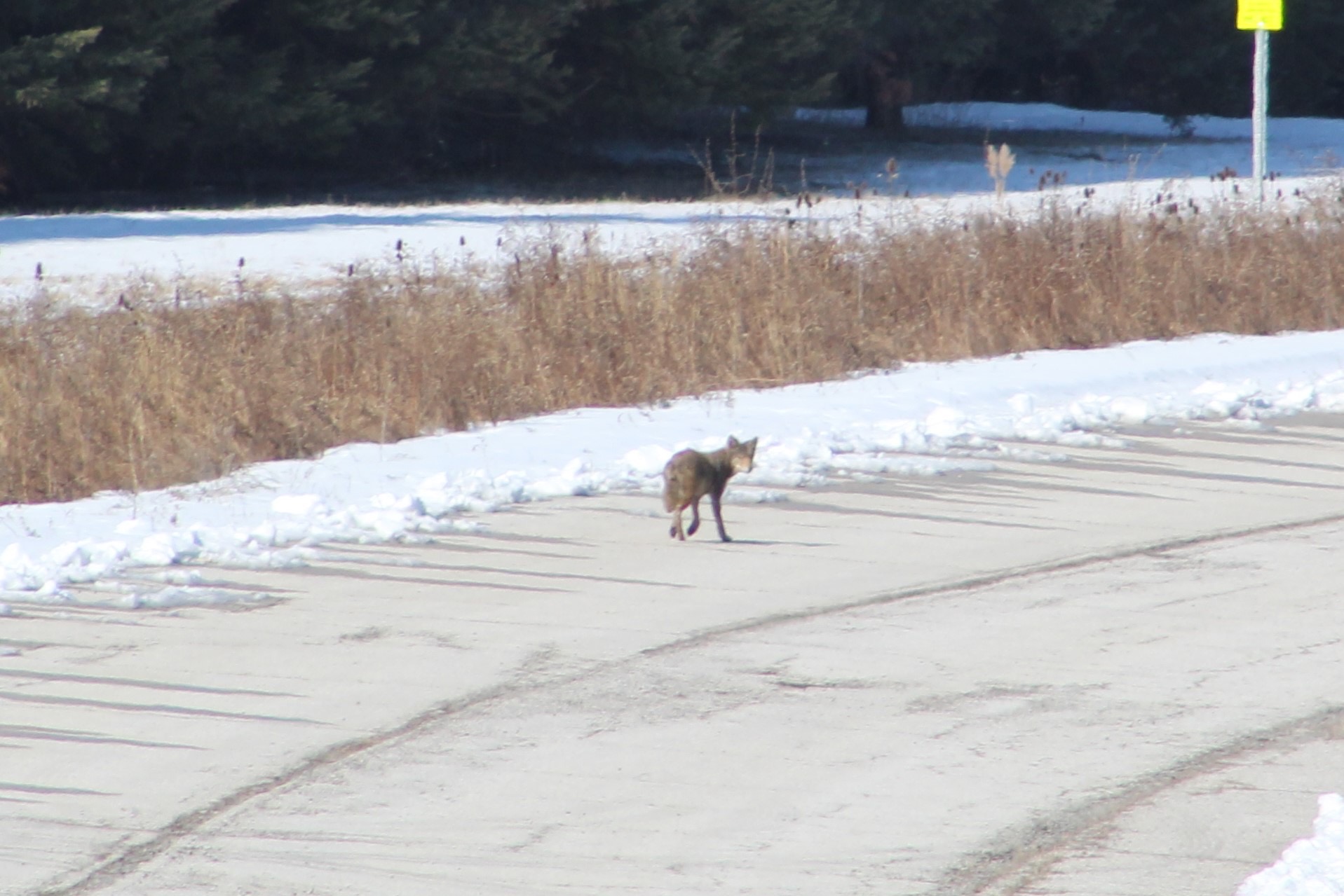
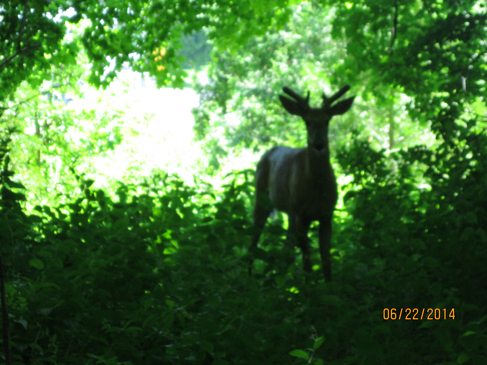
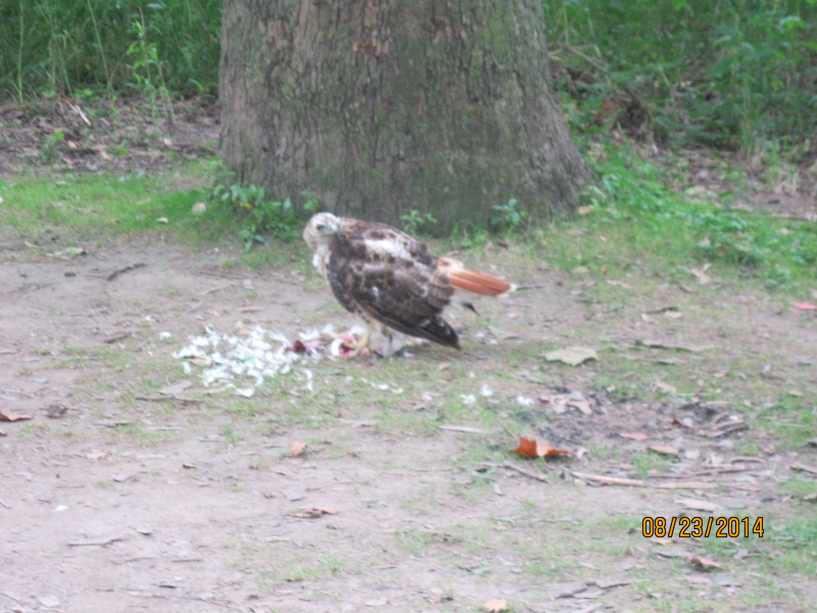
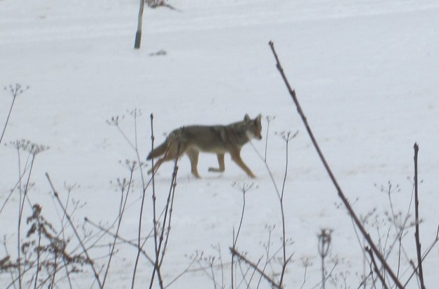
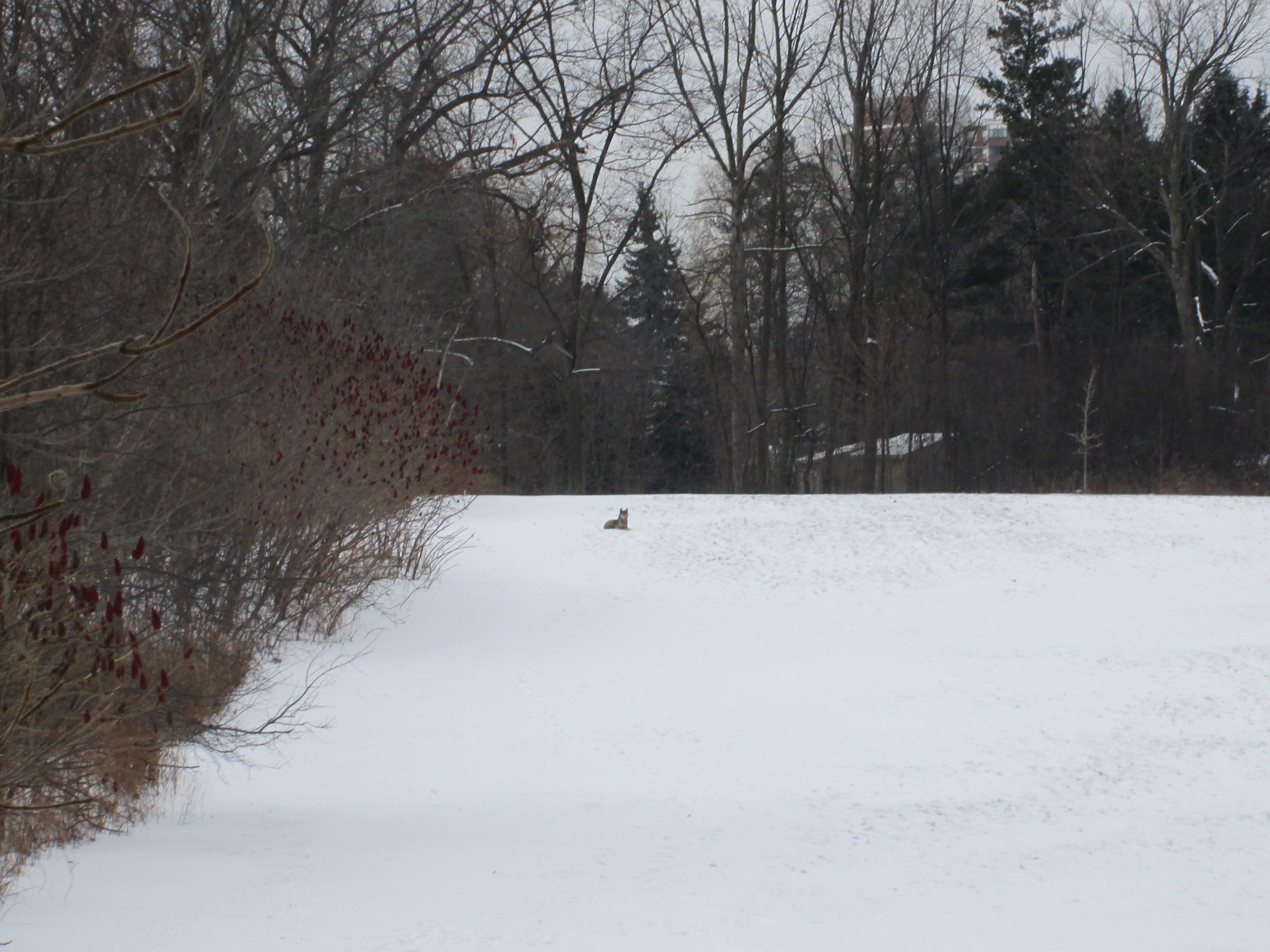
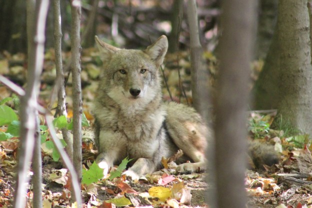
Cook woodlot is large enough to be home to a variety of animals. The oak trees seem to support a large number of squirrels. These in turn support a number of predators including red-tailed hawks and coyotes. The coyote in the picture below was sitting in the trees when I spotted it. It allowed me to get three successively closer pictures before it got up and took off.

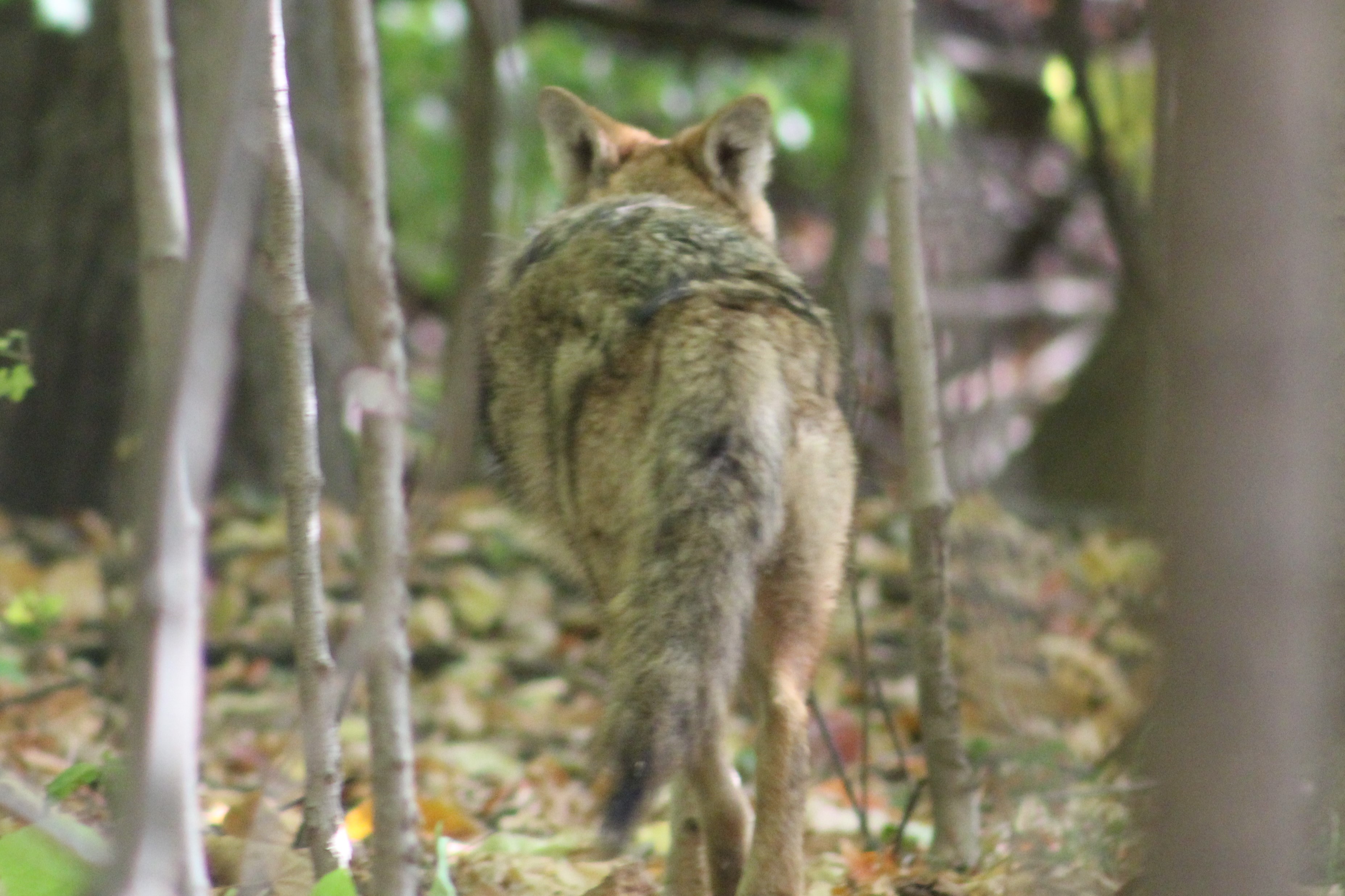
I took two more pictures as it retreated. Although it took its eyes off of me it made sure I wasn’t following it. They have keen hearing and can detect the squeak of a mouse from 100 yards away.

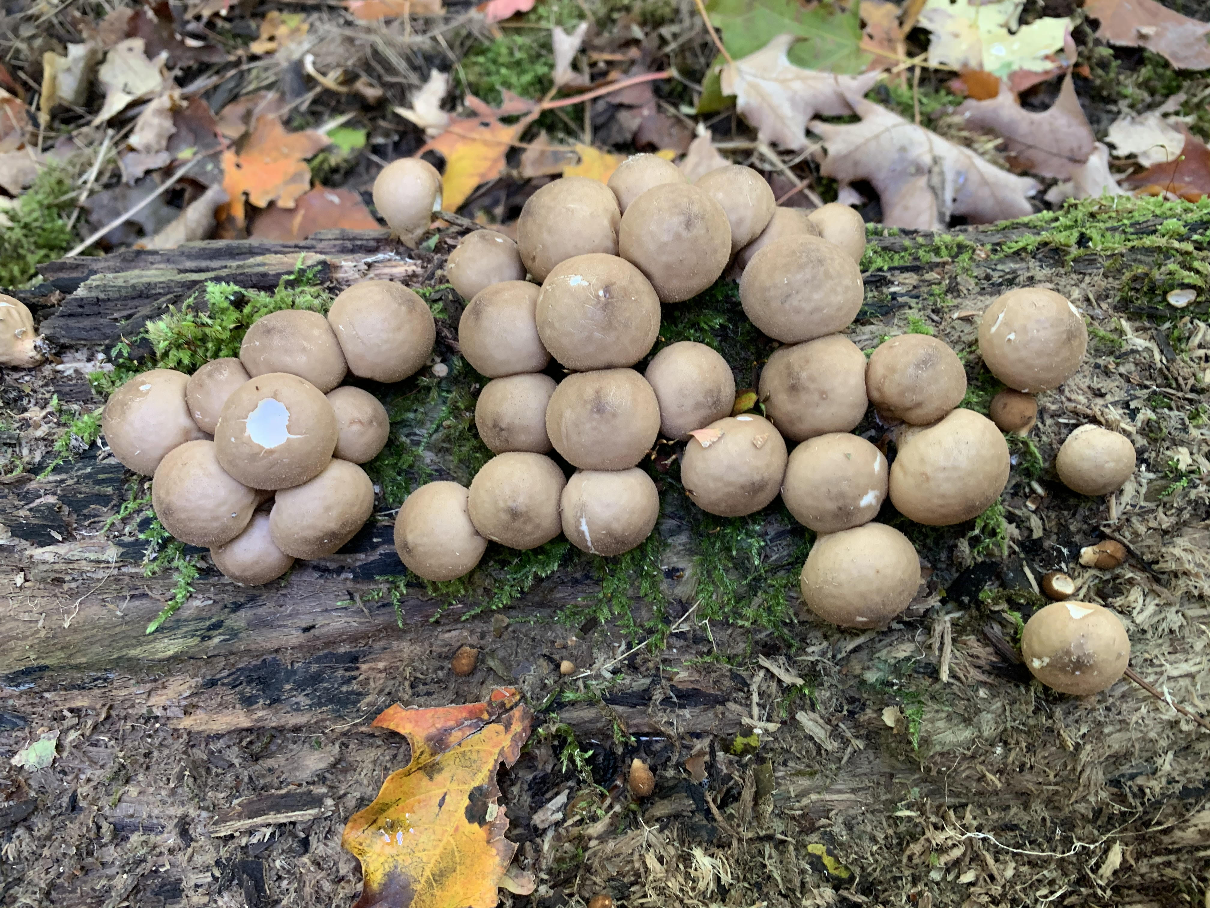
Pear-shaped Puffballs grow on decaying logs and stumps. These ones were still fresh and had a white mass in the centre that hasn’t gone to spores yet. Some of these have been partially eaten by insects and they are considered choice edibles. Although, again, we promote a no picking type of hiking adventure.

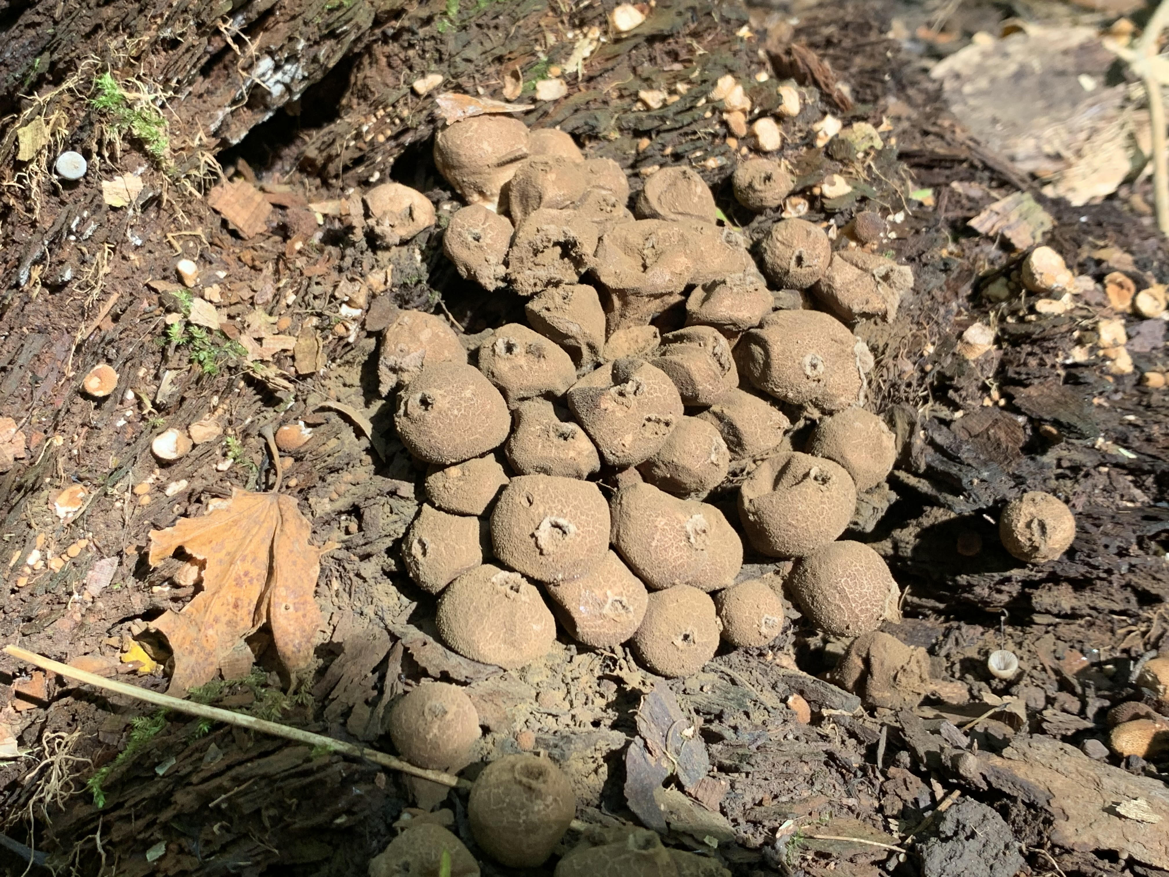
An earlier crop of puffballs have reached the stage where they have released most of their spores. They have a small opening near the top of each of the small balls. When they are poked with a stick they still have enough spores to release a small green/brown cloud. Between the effects of wind and rain these spores will be released in an effort to spread the fungus to new hosts.

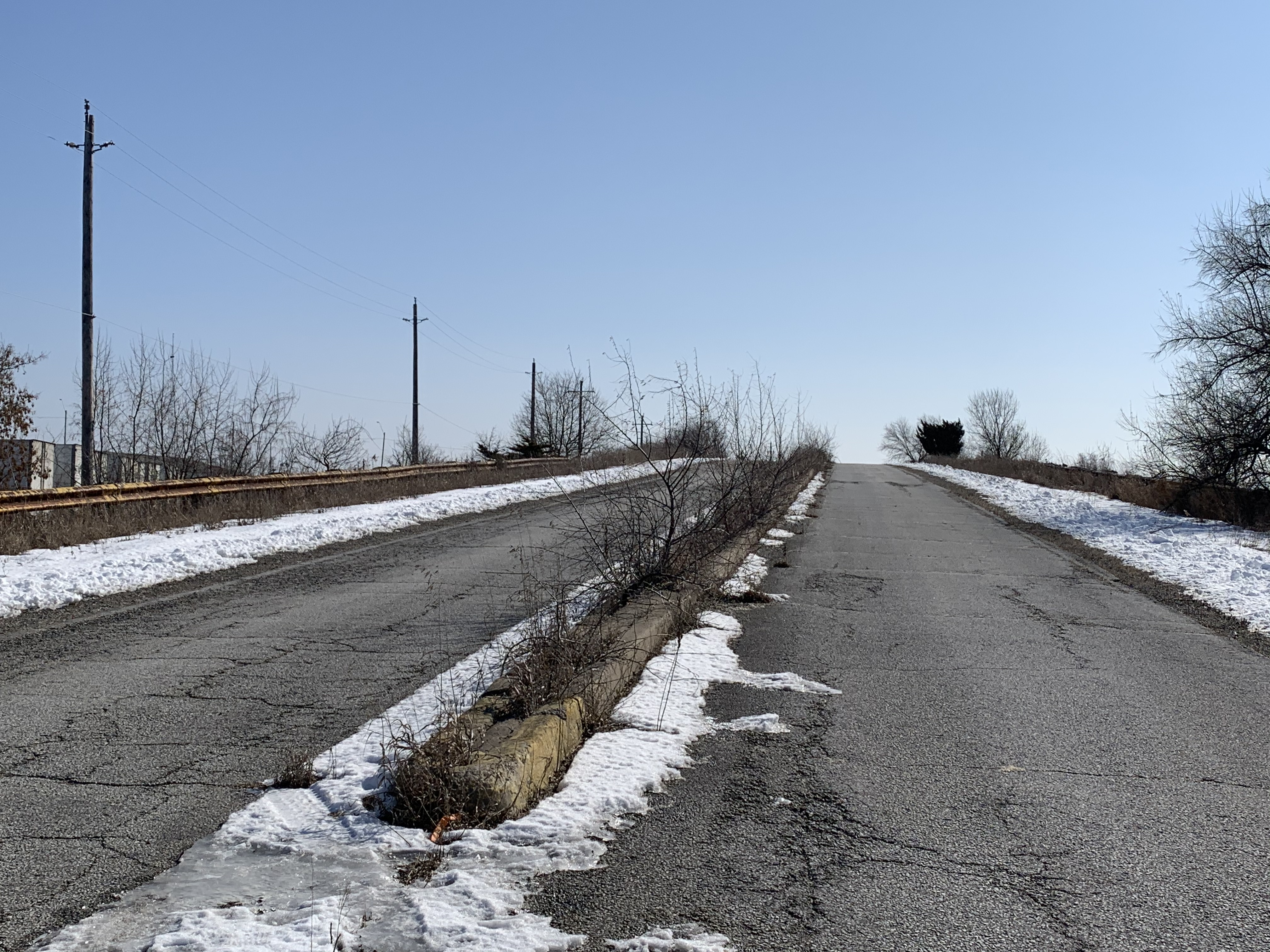
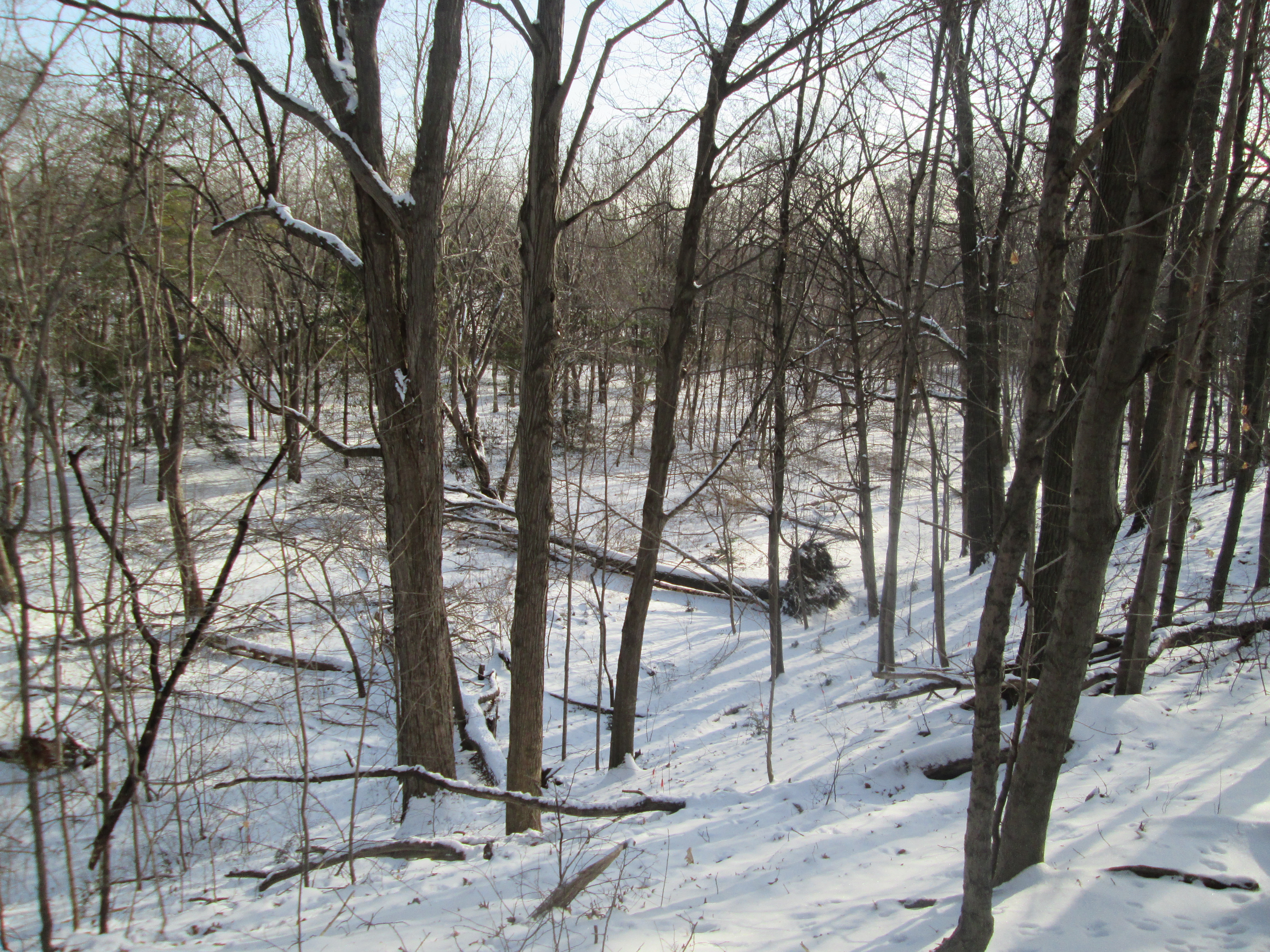
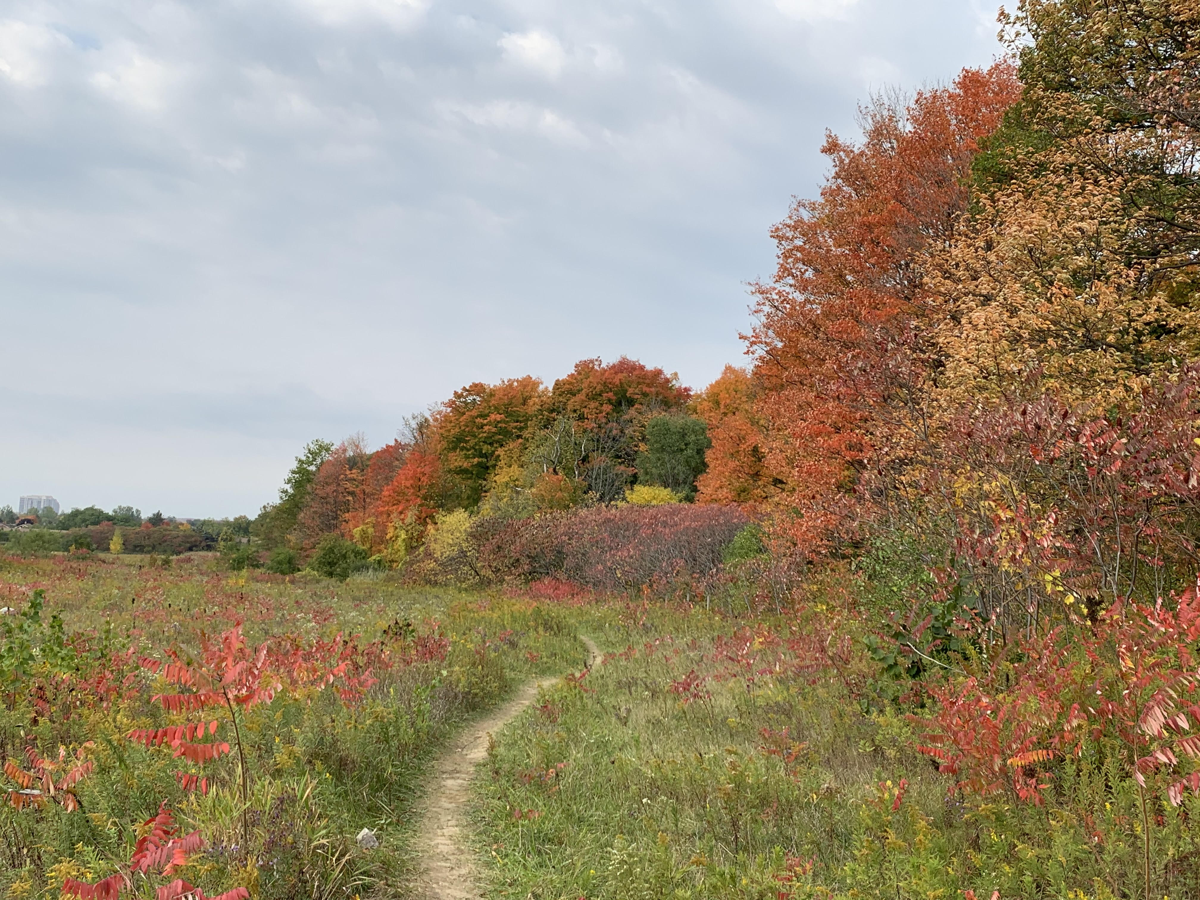
At the edge of the forest the trail turns and runs along the former pasture on Peter Rupert’s property. At the far end it comes to a paved trail that leads south to Rutherford Road and a large storm water pond. To the north it runs along the western edge of the wood lot and passes a couple more storm management ponds.

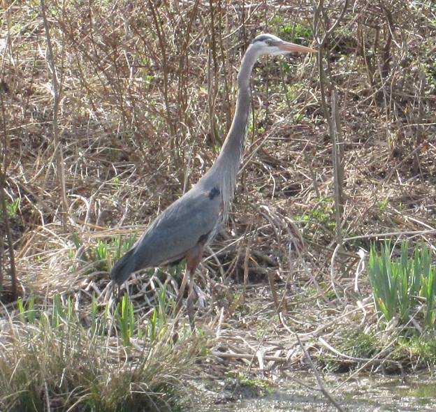
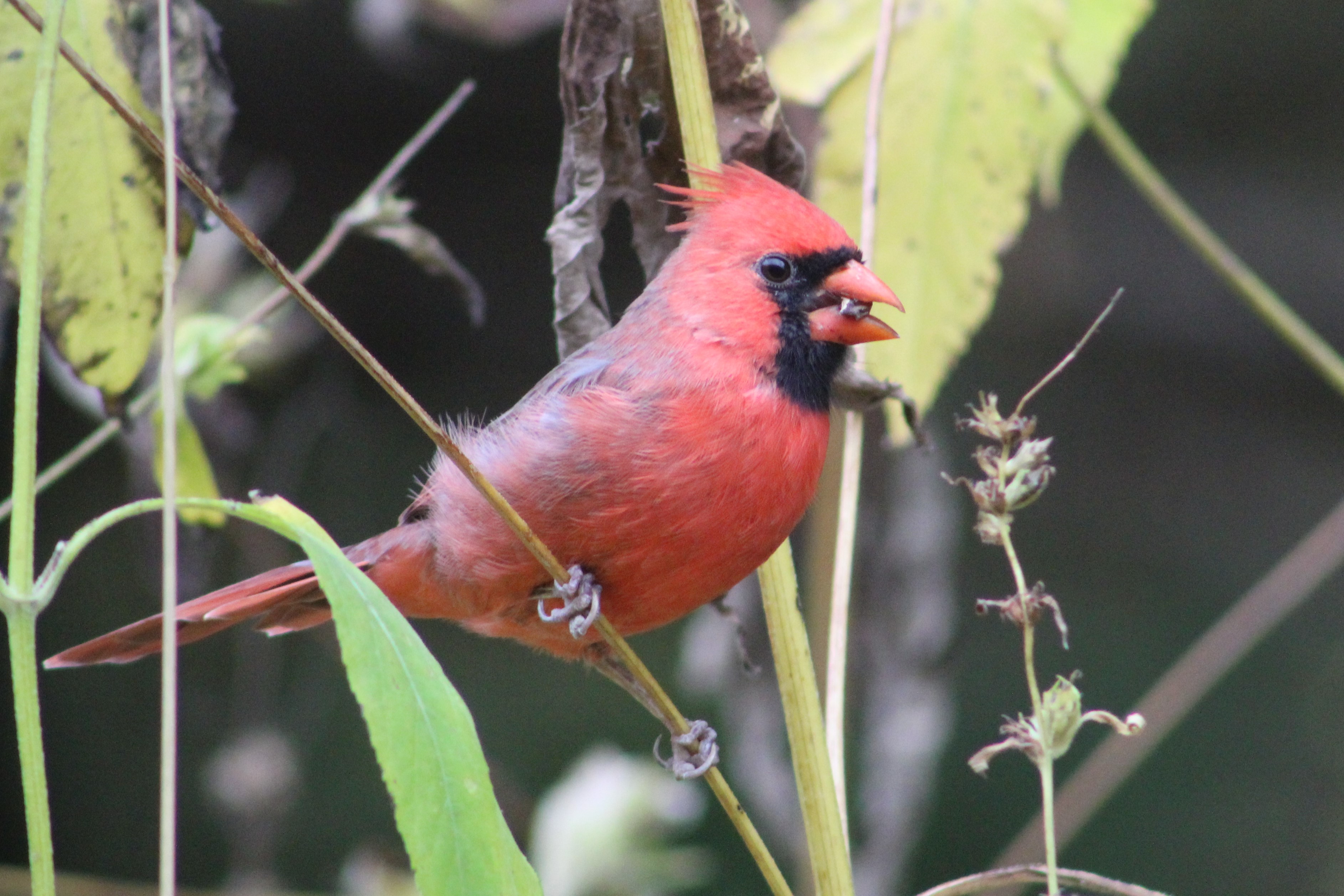
Cardinals have a curved beak and powerful set of jaws that allow them to crack hard seeds and nuts. Cardinals have one of the greatest varieties of seeds and nuts in their diet of any species in the local bird population. They eat about 40 different types of grass and sunflower seeds and during summer supplement 30% of their diet with various insects. This allows them to survive quite well in the winter as most of their food sources stay above the snow level.

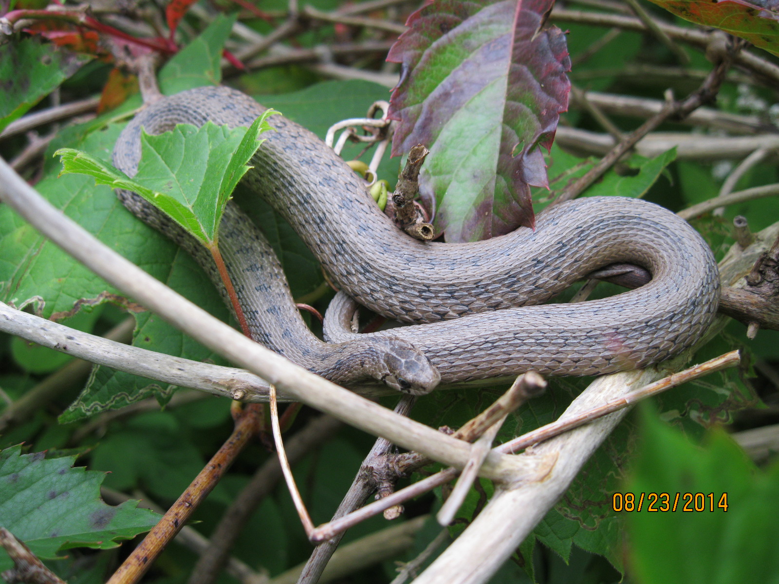
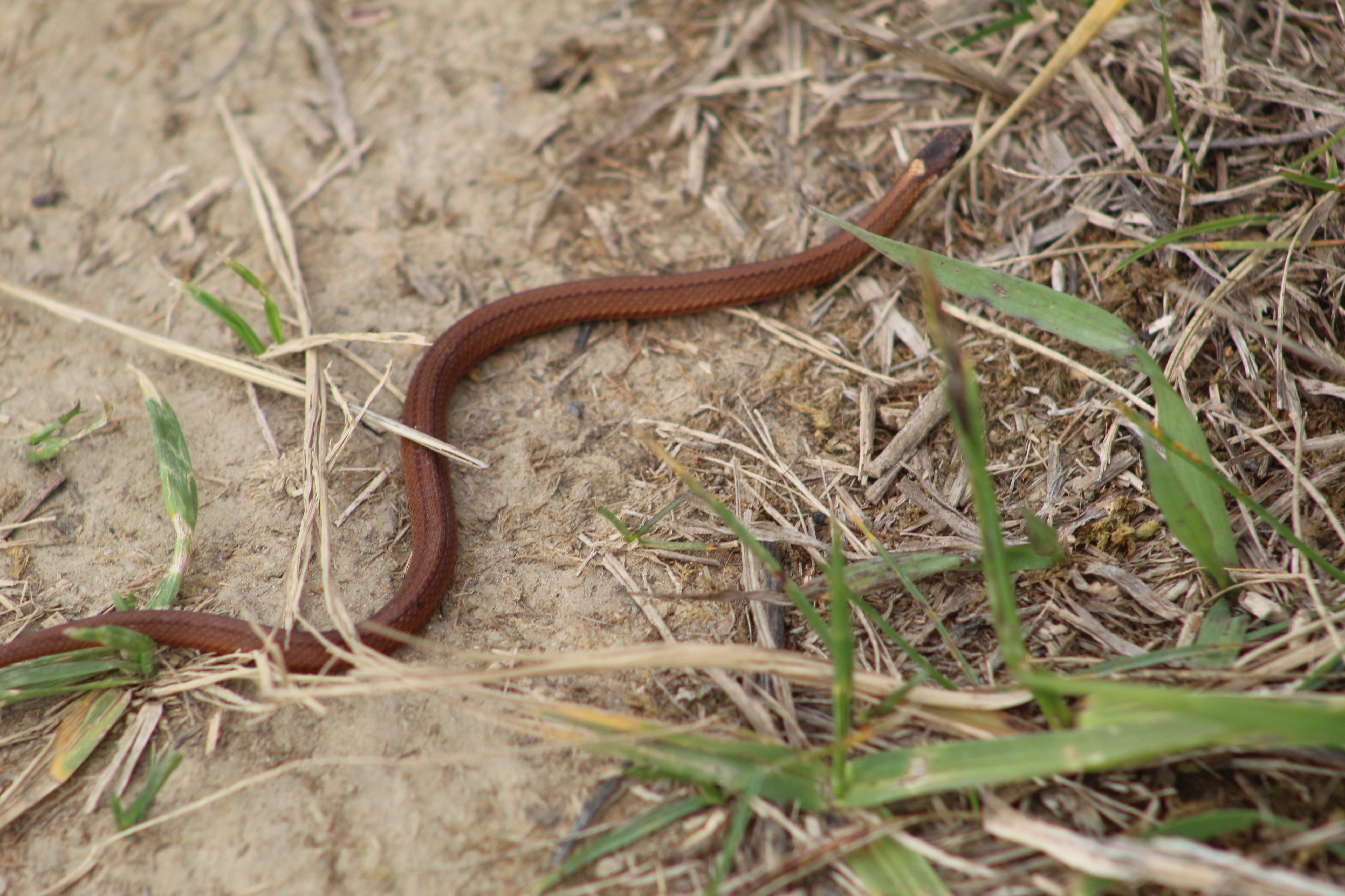
There appeared to be a large population of juvenile DeKays Brownsnakes. One feature of the young snakes is their small patch at the back of the head. While we saw four different snakes there was one that stood out from the others. This specimen was more red than brown in colour.

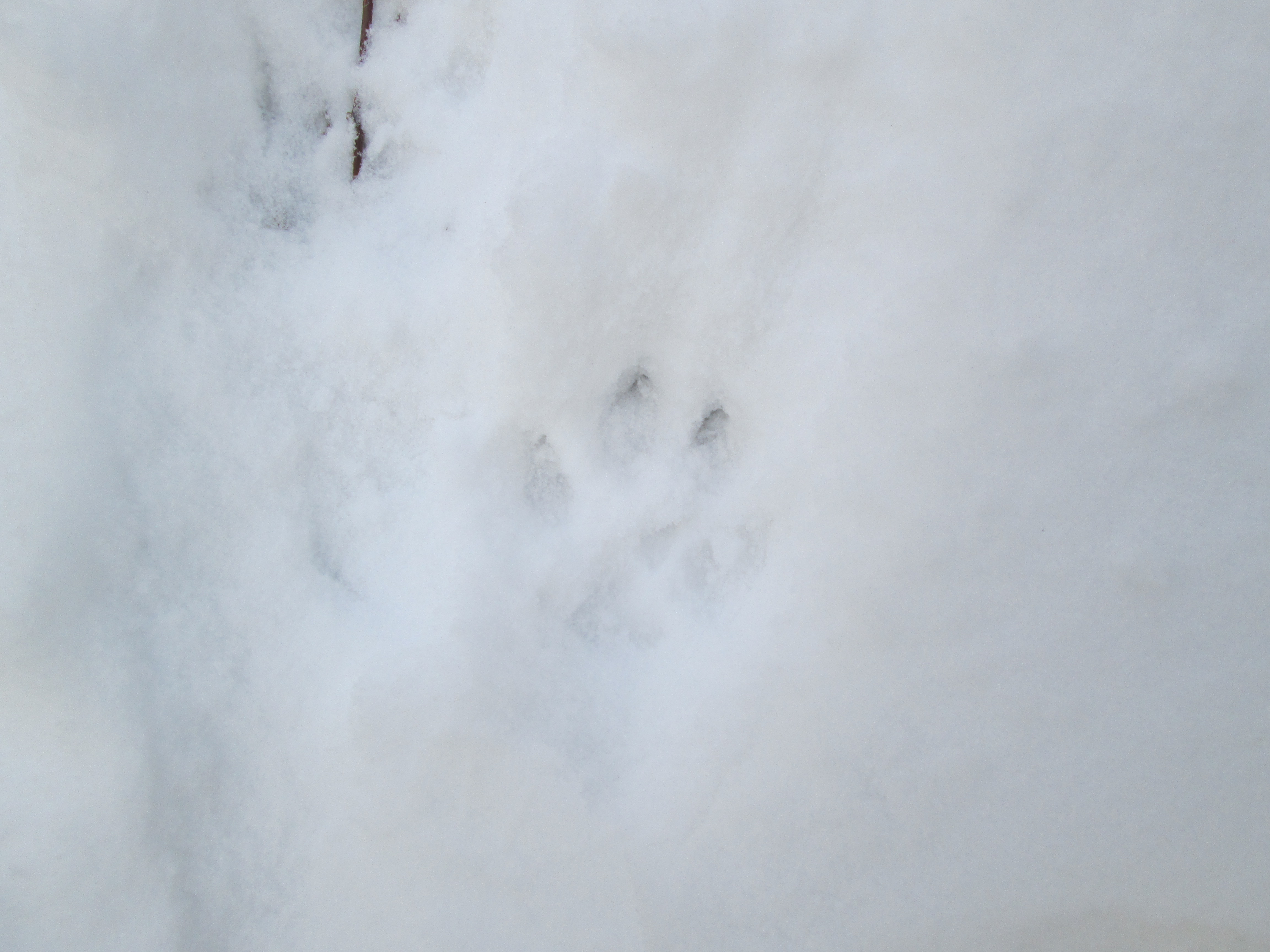
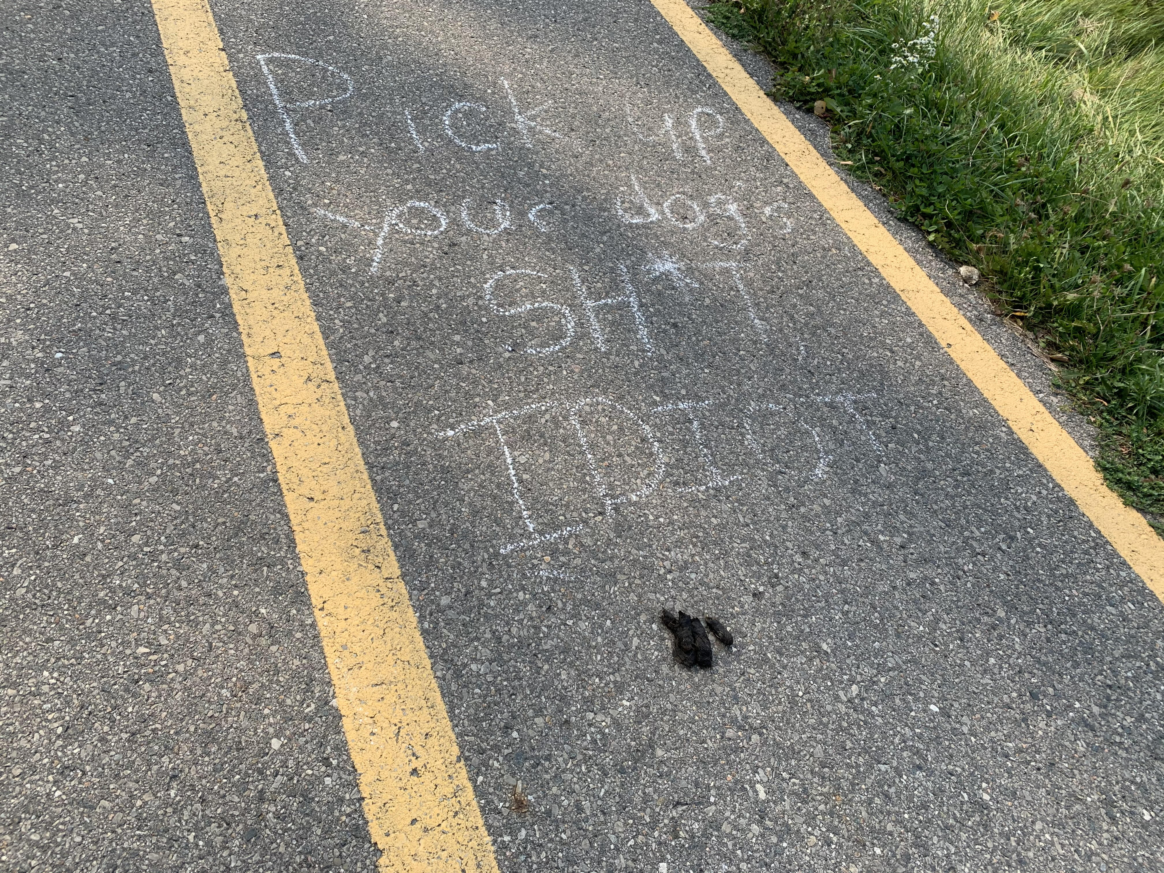
On the lighter side, we found several places along the paved path where someone has written messages on the trail. It would appear that they made at least a second trip as I venture that very few people carry a piece of chalk in their pocket when they walk. The part that caught me funny was the fact that most of the feces on the trail wasn’t from a dog. Some contained a lot of seeds and was likely from racoons while other piles had a lot of fur in them suggesting that the local coyote was using the trail in more ways than one. It makes me think that someone should write on there: “You don’t know sh*t, this is coyote”, etc.

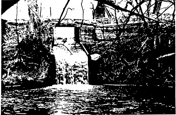
Thomas Cook left us a little more than a woodlot. You can’t fully tell his tale without touching on the community of Carrville. This was a mill town in support of a flour mill that was built by Michael Fisher in 1816. Thomas Cook and his brother William emigrated from England in 1831 and Thomas bought the mills from Fisher. He added other mills and built a store in 1856 which contained the post office from 1865 to 1923, of which he was the first post master. The Carrville Mill Dam was originally built in 1816 and must have been repaired many times. It still exists, but on private property, and is designated under the Ontario Heritage Trust. This dam served Cooks mills and it is said that his name is carved in the structure. The picture below was taken from the August 26, 1987 Town of Vaughan council act designating the dam.

The Primitive Methodists began meeting at Cook’s Mills as early as 1848 and in 1850 at the urging of Thomas they erected a white frame church near Bathurst Street. The land belonged to The Evangelical Association and they shared the building until 1857 when it was vacated by the Methodists in favour of their new church building. This church has been moved about a kilometer east on Rutherford Road and can be found in Wood Park.

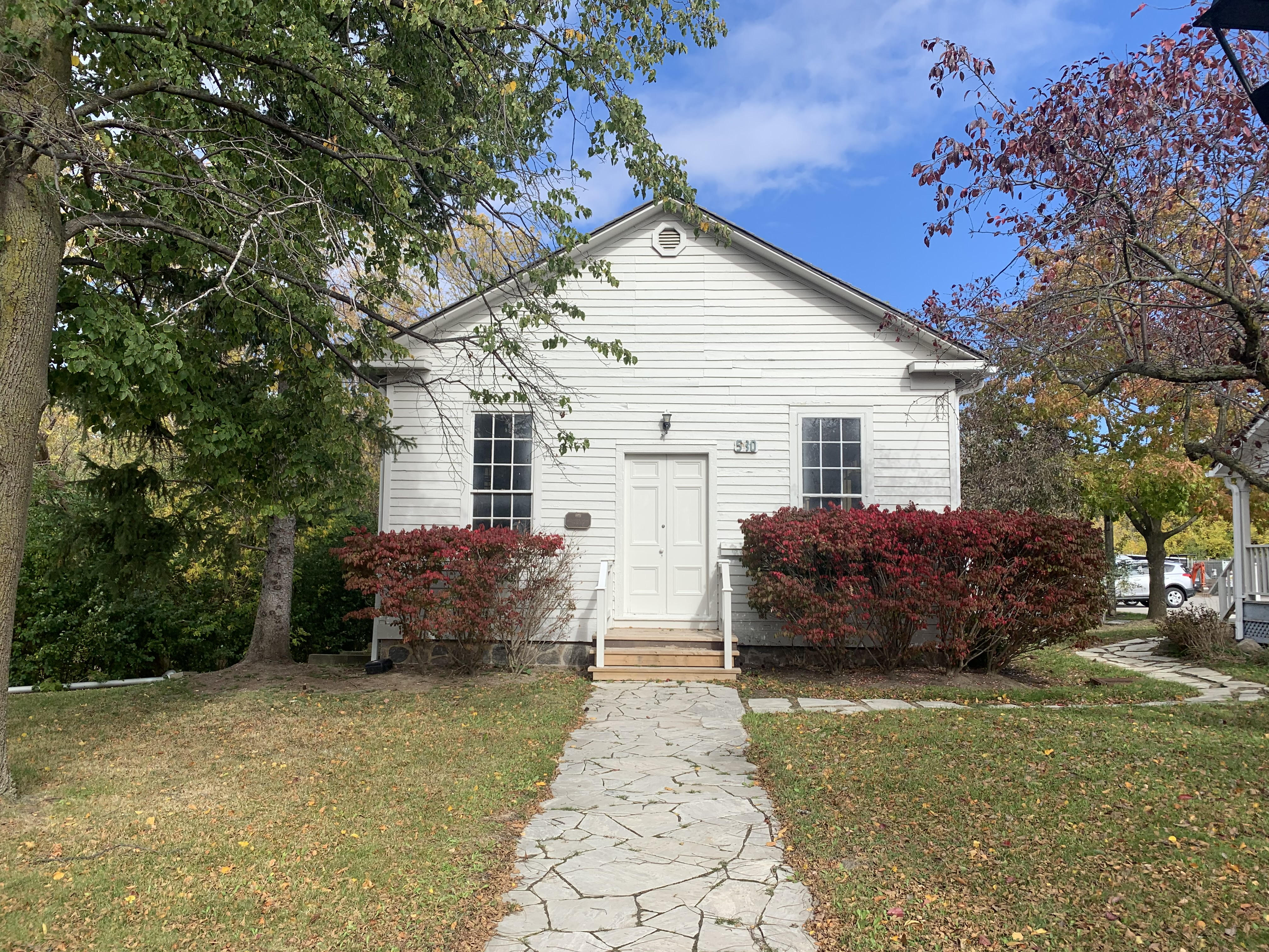
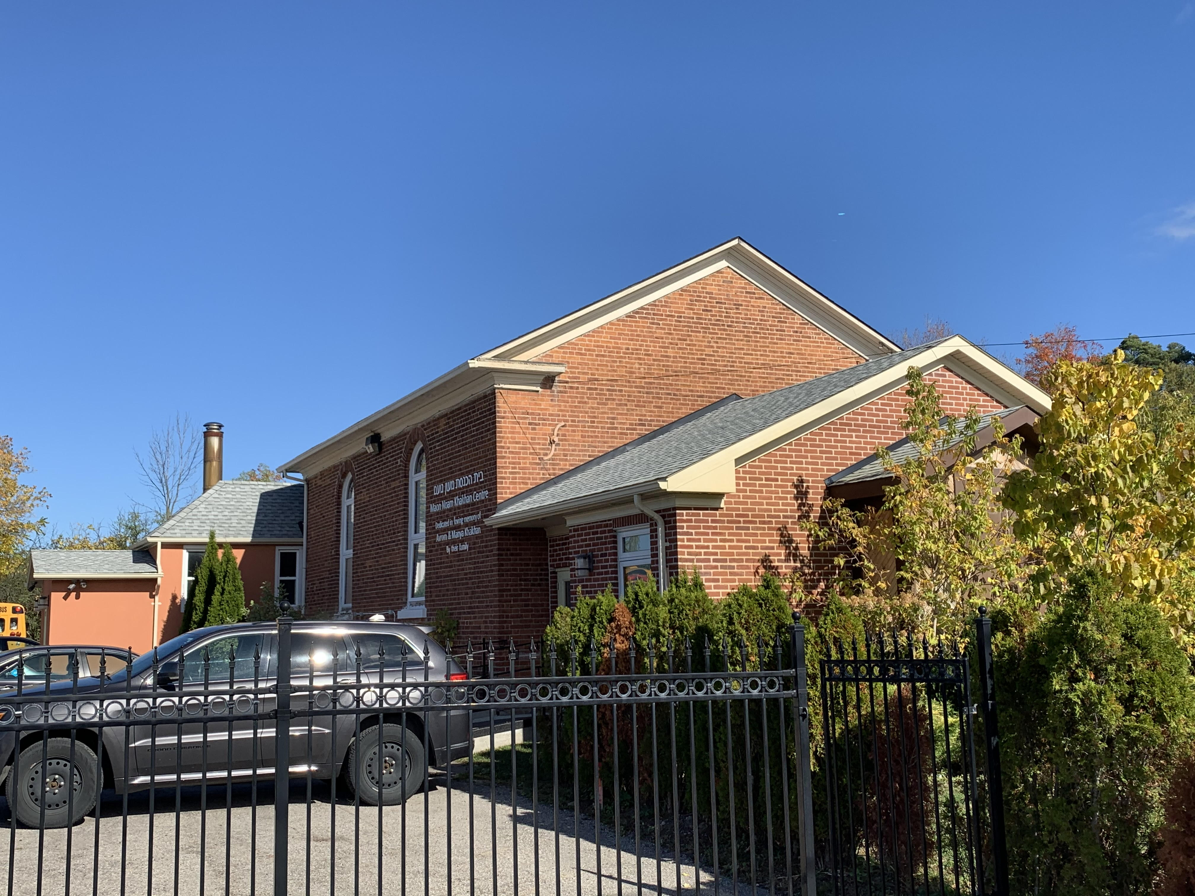
Thomas Cook wanted the church to have its own land and so he donated it in 1857. He also provided the clay for the bricks which were made nearby on the property. To keep costs down he provided housing for the work crew while they erected the church building. He was known to provide the minister who served the church with lodging and a horse for his personal use. It was known as Cook’s Mills Primitive Methodist Church until it became Carrville Methodist in 1884. They joined the United Church in 1925 and continued to serve the community until the congregation could no longer support themselves and merged with the United Church in Maple. The building now serves as a community centre for the Jewish group Maon Noam.

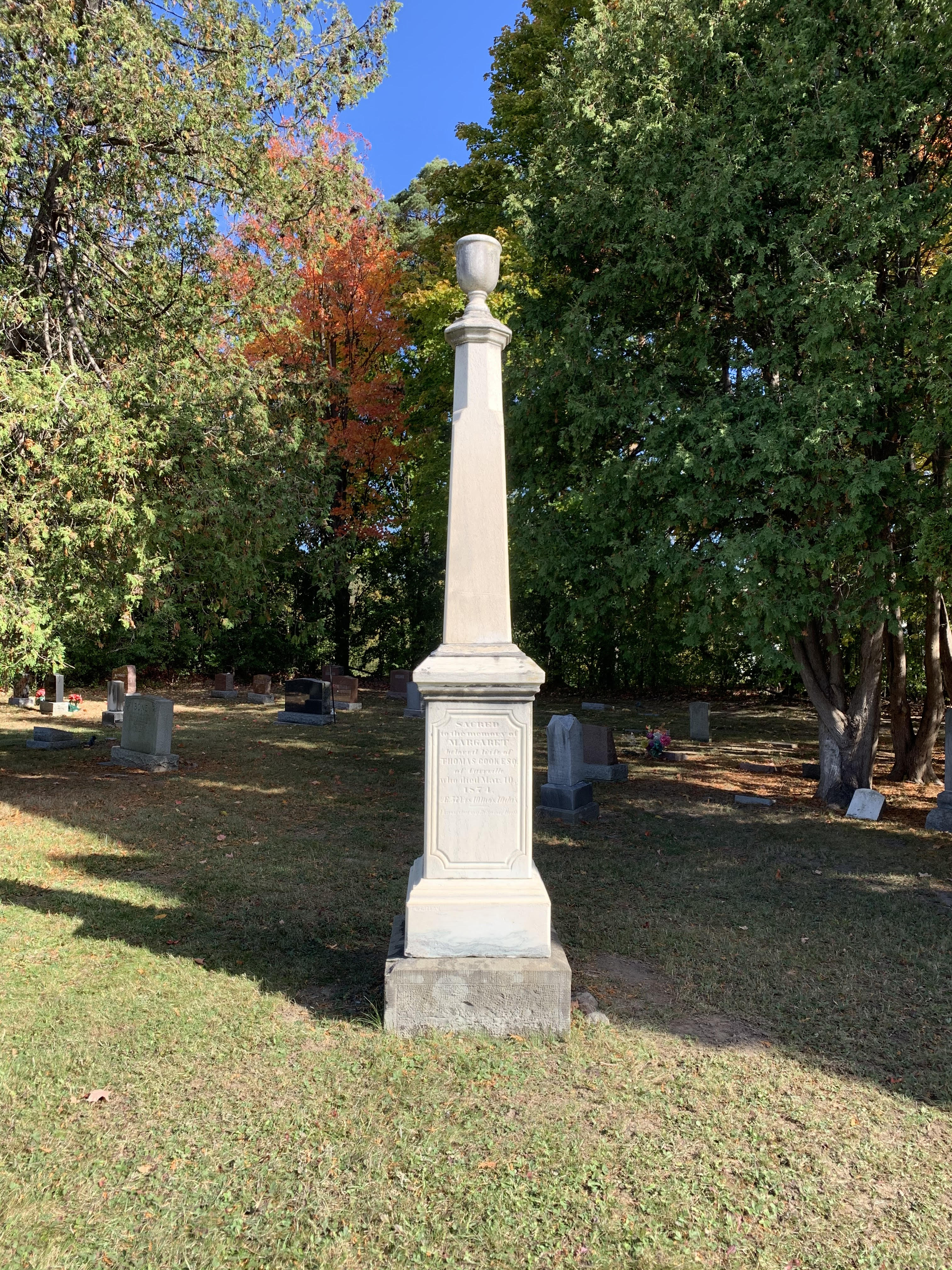
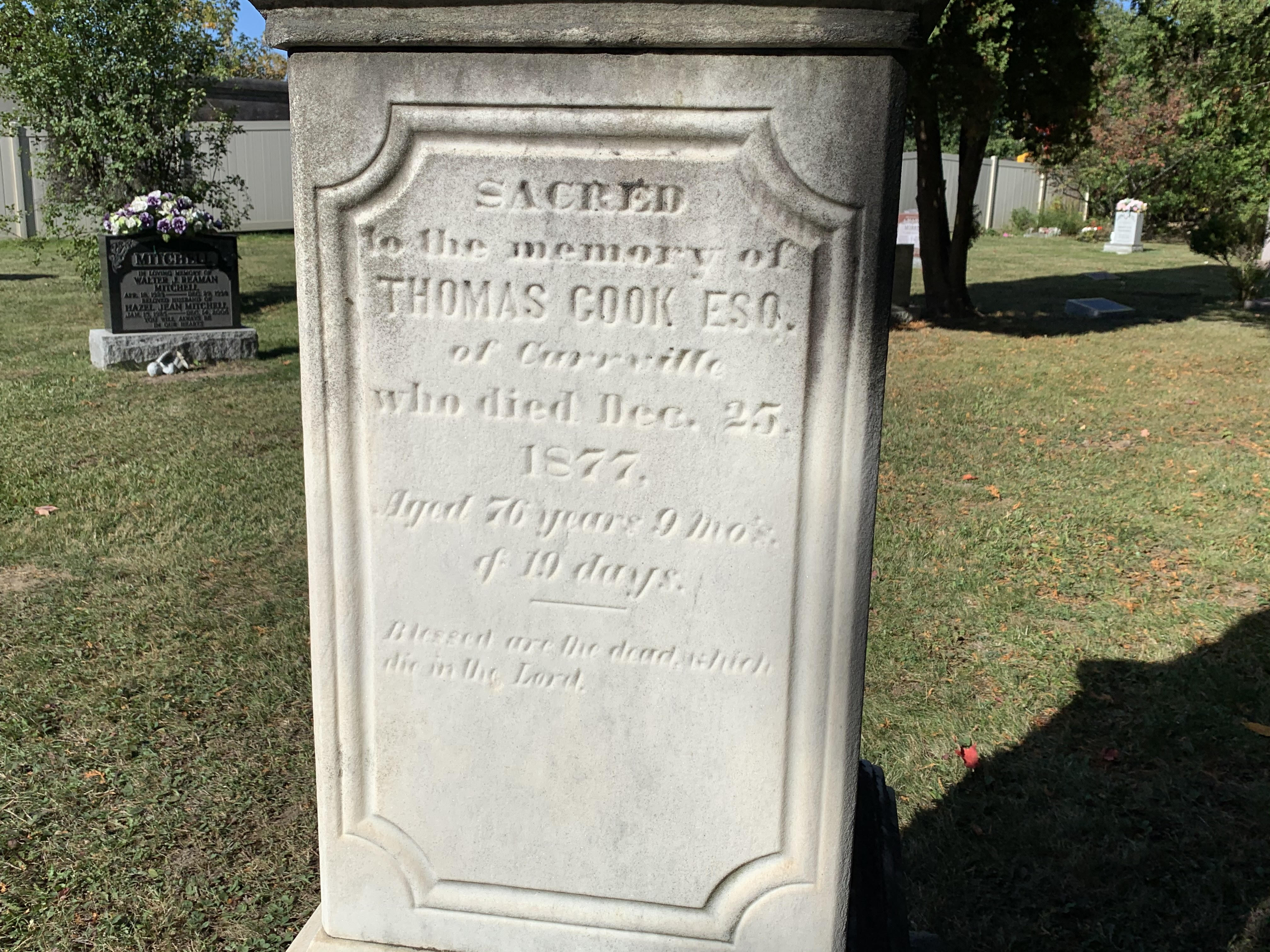
Thomas Cook also donated land for a cemetery beside the church. Burials date back to 1860 and the cemetery is still active with interments in the past few years. A single tall white grave marker stands near the centre of the cemetery marking the resting places of Thomas Cook, his wife and two children.

Thomas was born in 1801 and after coming to Canada contributed greatly to his new home. He died on Christmas Day in 1877 and although there is a woodlot named after him there is no information plaque there to tell the story of his legacy.

Perhaps one day we’ll return with a feature story on Carrville as a feature story in our Ghost Towns of the GTA series.

Google Maps Link: Cook Woodlot

Like us at http://www.facebook.com/hikingthegta

Follow us at http://www.hikingthegta.com

Also look for us on Instagram

Claireville – Ghost Towns of the GTA

Saturday, February 22, 2020

Claireville was a community that started in 1850 on the estate of Jean du Petit Pont de la Haye at the intersection of Steeles Avenue and Indian Line.  He named the town after his daughter Claire and it grew until by 1870 there were 175 people living there.  The town grew up to service the local farmers and soon had two general stores and two hotels.  It attracted a butcher, a cabinet maker, blacksmith, tailor and flour mill.  Today it has been isolated by the construction of Highway 50 and Highway 427.  Most of the historic buildings in town were removed for the reconfiguration of roads in the area.

The first building in the area belonged to John Stark in 1832 and it was a halfway house on the south west corner of the intersection.  It was demolished long ago.  One of the former homes in Claireville now serves as the Bhagwan Valmiki Temple serving the nearby Hindu population.

IMG_0969

De La Haye was a very generous man and he gave land to three different congregations to build churches in town.  In 1842 the Congregationalists were the first to build a permanent church building in Claireville.  The Primitive Methodists were next in 1846 and the Roman Catholics didn’t build until 1860.  All three of those churches have since been demolished.  The house pictured below was likely built in the 1860s or 1870s and is one of the few that is still lived in.

IMG_0970

This house sits on early 1900s precast blocks but is missing the front steps.  Like many others along Albion Road (now Codlin Crescent) it is likely waiting for a demolition permit because it has no heritage protection.

IMG_0971

Edwardian Classicism is a style of house that emerged around 1910 and lasted for about 20 years.  It was very simple in style, a reaction to the more fanciful Victorian Styles that had prevailed for the previous few decades.  The presence of this style of house in Claireville suggests that the town was still serving the rural community at that time.

IMG_0972

A similar house was built directly across the street quite possibly by the same contractor.  Today both of these houses stand beside large buildings with  industrial or transportation and shipping uses.  The farmlands around Claireville were designated for Industrial/Employment uses by the 1980s and the end of the town followed quickly.

IMG_0973

The “Albion Plank Road Company” was formed in 1846.  Their mission was to build a plank road from Thistletown to Bolton, passing right through Claireville.  To maintain the road a series of toll houses were established to collect money from users of the road.  Typical tolls at this time were 1/2 pence for the passage of a horse and rider or 1/2 pence for each 20 hogs or sheep.  The toll house in Claireville was built in 1851 and was located at 2095 Albion Road.  The house is now sitting in the parking lot of a tractor trailer storage company and is also featured as the cover photo.  It is the oldest remaining building in Claireville and the only one with a heritage designation.  For more on plank roads see our post The Gore And Vaughan Plank Road.

IMG_0976

Of the 14 original homes that remain in Claireville, only a couple are still being used for residential purposes.  The former plank road had eventually been replaced with a more modern road as transportation was changed to the automobile.  The main street became a busting centre for the local rural community.  On a Saturday morning in February it is almost as abandoned as nearby Indian Line.

IMG_0977

Indian Line started off as an Indian trail along the shore of the Humber river.  When the land survey was made it was part of the border between Peel County and York County. When Highway 427 was extended north it became part of an off and on ramp to the highway. In 1992 when the highway was further extended it was closed off and abandoned.

IMG_0964

It is believed that there are at least 150 pair of coyotes living in the parks and ravines of the GTA.  Each of these breeding pair will have a litter of about 5 pups each spring.  This will raise the population from around 300 to closer to 1000.  Many of the young coyotes will not survive but the remainder do very well living in the city.  We saw a coyote come out onto Indian Line and walk in front of us for a short distance before returning to the woods.

IMG_0978

The Humber River has frozen over multiple times this winter but we’ve never had a long enough deep freeze to allow the ice to be safe for crossing.  Ice needs to be at least four inches thick in order to safely support a person on foot.  Since the ice thickness is rarely the same across an entire body of water, especially one which is flowing beneath, it needs to be more than that to tempt us to cross.  Sometimes in the spring we see the ice flows pushed up on the shore and realize the ice was much thicker than we thought.  Still, it’s better to be safe than on the evening news.  There are still open places on the river as can be seen in the picture below.

IMG_0957

We made our way back into Claireville Conservation Area where we had found free parking earlier.  The conservation area includes 848 acres and the historic Wiley Bridge.

IMG_0959

Silver Maples are one of the first trees to bud in the spring.  Their tiny red flowers are often hidden by the scales on the buds.  They react to the increased hours of daylight towards the end of February and early into March rather than to the increase of temperature which will follow a few weeks later.

IMG_0950

Claireville and the surrounding area has plenty to explore, you can read more in our Claireville post.

Google Maps Link: Claireville

Like us at http://www.facebook.com/hikingthegta

Follow us at http://www.hikingthegta.com

Look for us on Instagram

Hiking the GTA #100 – Amazing Animals

April 28, 2014 to July 18, 2015

Presented below is a gallery of animal pictures taken during the first 100 hikes on the Hiking the GTA adventure.

On July 21, 2015 I published my 100th post in this blog under the title Hiking the GTA #100 – Greatest Treks.  That post looked back at the creation of Hiking the GTA and listed the top 15 hikes as determined by activity on WordPress.  This post presents some of the amazing animals that we encountered along the way.  By hiking quietly and keeping off of the beaten path you have the opportunity to come face to face with some of the wide variety of wildlife we share our parks with.  Most of the animals are more afraid of you than you are of them and will disappear quickly.  In reality some of the plants in our parks are more dangerous than the wildlife.  The following pictures are in the order in which I took them except that I saved my personal favourite for last.  Links to the related articles are provided where additional descriptions of the animals are presented.

This White Tail Deer buck was following me through the woods along Wilket Creek on June 22, 2014.  This was the only creature I saw all year that made me nervous as I’m usually the one doing the following.

IMG_2389

The little baby Cross Orb Weaver spiders in this picture are just hatching and look like grains of pepper leaving the egg sac.  The mother spider had previously brought a Daddy Long Legs spider into the web to provide a breakfast to the hatchlings.  Seen near Middle Road Bridge on Aug. 16, 2014

IMG_2944

This Red Tailed Hawk was feasting near Barbertown on Aug. 23, 2014.

IMG_3098

Also seen in Barbertown was this Dekay’s Brown Snake on Aug. 23, 2014

IMG_3021

The Monarch Butterfly below was seen at the forks of the Don on Sept. 14, 2014.

IMG_3361

Spadina House has it’s own resident fox as photographed on Dec. 21, 2014.

Spadina 74

This Snowy Owl was seen at the Adamson Estate on Jan. 24, 2015

IMG_2092

This coyote was photographed in West Deane Park on Jan. 31, 2015

???????????????????????????????

The beaver in this picture was seen in Etobicoke Valley Park on Feb. 28, 2015

IMG_2663

This White Egret was fishing near the dam at The Old Mill on May 10, 2015.

IMG_4287

The Red Breasted Grosbeak below was photographed in Norval on May 16, 2015.

IMG_4404a

This Trumpeter Swan, complete with tracking tag, was seen at the mouth of the Credit River and featured in The Ridgetown – Port Credit on May 23, 2015.

IMG_4755

This Black-crowned Night Heron was published in The Forks of the Credit – The Stone Cutter’s Dam on July 18, 2015.  Unlike the Great Blue Heron in the cover photo it does not have long legs and neck.

IMG_6600

Hiding in plain sight in the picture below is a new born White Tail Deer Fawn.  This is my favourite picture of the past year and was taken near the Barber Paper Mills on June 6, 2015.

IMG_5361

This is just a sample of the some of the amazing animals we saw on our journeys in the first 100 hikes in this blog.  Many others were featured and many more will yet be photographed on future hikes.

visit us at http://www.facebook.com/hikingthegta

West Deane Park

Sat. Jan. 31, 2015

It was -11 feeling like -12 which seemed like a nice temperature considering that the weatherman had been calling for -18 with a wind chill of -30. It started off cloudy but the sun came out a little later on.  We parked in the parking lot off of Martin Grove at West Deane Park.

Andrew and Martha Coulter emigrated to Etobicoke from Ireland in 1822 along with the first two of nine children.  They bought 100 acres of land which lay between highway 27 and Martin Grove Road, halfway between Rathburn and Eglinton in an area known as Richview.  Over the next few years they acquired an additional 150 acres.   The Coulter’s operated the farm until the 1880’s and in 1939 the land was purchased by construction magnate Percy Law.  He kept race horses here until he sold it for development in 1956.

We crossed Mimico Creek and headed uphill on the south side of the bridge.  At the top of the hill we found a small playground where there was a coyote sitting in the distance in  the snow. Coyote are related to the grey wolf and have become quite adept at living in close proximity to humans in urban environments.

IMG_2232

We started to sneak up on what we believe was a female but when she saw us she ran into the trees.  One advantage of fresh snow is the ability to follow animal tracks and we soon found where she had gone.  Following her we found ourselves in the middle of her hunting ground. The coyote started circling us at a distance and we were soon able to capture the short video below and the picture in the cover photo.

Tracking the coyote we found that the footprints were smaller than some we had seen previously suggesting that perhaps the animal was not fully grown.

IMG_2244

We came across the remnants of a Christmas party hanging in the trees.

IMG_2246

The sun came out at one point and lit up the valley in front of us.  For scale, the large tree laying in the bottom of the ravine once stood at the base of the hill but would not have been tall enough for the canopy to reach the upper rim.

IMG_2248

We followed the west side of Mimico Creek north and soon came to an area full of winter birds. A cardinal was singing in the trees above us and we soon spotted him.  Cardinals eat insects in the summer, raising their young almost exclusively on them.  In the winter cardinals will live off of seeds and will also eat the bark of elm trees.  There were several pairs of doves sitting in the trees.  Doves are one of 11 animals that mate for life, along with termites and Schistosoma mansoni worms.  Wolves, which are related to Coyotes, also mate for life.  This is perhaps the reason that doves come in pairs in the Twelve Days of Christmas.

IMG_2255

There was a flock of a dozen or more woodpeckers moving through.  There were both the larger Hairy, pictured below, and the smaller Downey flocking together.  These two birds are not actually birds of a feather as they are unrelated in spite of their nearly exact same marking and appearance.

IMG_2259

Andew Coulter built a saw mill on Mimico Creek and operated a farm on his property.  After his death in 1857 the farm was run by his 4 sons.  Andrew Coulter and his sons are buried in the Richview Methodist Cemetery which sits in the very middle of the highway 401 and 427 interchange.  By 1852 Andrew had built an 11 room 5 bay Georgian style farmhouse on the property.  The Coulter’s house was built of red brick with yellow quoins and lintels.  Percy Law modified this brick farm house to create a Kentucky colonial revival style home by adding white clapboard siding and a two story classical portico with four Corinthian columns.  He also built himself a horse ranch complete with stables and a carriage house.  The picture below shows the Coulter’s 1852 house as it appeared in 1929.

1ET_AndrewCoulterHouseIn1929BW_Content

The house remains today at 59 Beaver Bend Crescent but the white siding has been replaced with yellow aluminum.  The Law family retained the house and 11 acres surrounding it until it was sold for development in 1981.  The original patterned brick house is still hiding inside the veneer that has been added to the outside over the years.  I think I’d strip it all off.

IMG_2264

Law built a house for his farm manager which stands at 18 Deanewood Crescent.  It is conspicuous among the surrounding homes as it faces sideways to the rest of them.  It also sports a tv antenna indicating that it was constructed prior to the arrival of cable in the neighbourhood.  In Sept. 1952 CBLT, the Toronto CBC station began experimenting with cable broadcasts in the city.  By the time this part of the the farm was sold for development in 1981 cable would have been installed in the new built homes on the street.

IMG_2265

The Coulter’s oldest son, Robert built his house around the same time as his father’s.  It still shows it’s yellow brick quoins and lintels.  The house originally faced east and Martin Grove Road, overlooking what is now Glen Agar Park.  The board and batten addition that now serves as a front entrance and garage would have been a later addition.

IMG_2266

This was our first visit to this section of Mimico Creek but there is lots of unexplored area here for future visits both in the winter and after the snow has melted.