Saturday, June 16, 2018
Claireville Conservation Area is nestled between four major communities in the GTA. A gore is a triangular piece of land and Gore Township is shaped like this. It means the conservation area is easily accessible from Toronto, Brampton, Mississauga and Vaughan. There is free parking in a small lot off Highway 50 just north of Steeles Avenue.
As soon as we stepped out of the car we spotted a female white tailed deer in the field beyond. A healthy looking deer she wasn’t too keen on a photo shoot and quickly disappeared. There are sightings of a leucistic deer in the park. We didn’t see any white deer on this expedition. but they are seen regularly by visitors to the park.

Orchard Grass grows in the old farmstead. They don’t grow from underground rhizomes but rather spread through a process known as tillering. The subsequent stalks are produced off the original root, having been established from an original seed. The flowers on these examples were in full bloom and producing a pollen that I am allergic to.

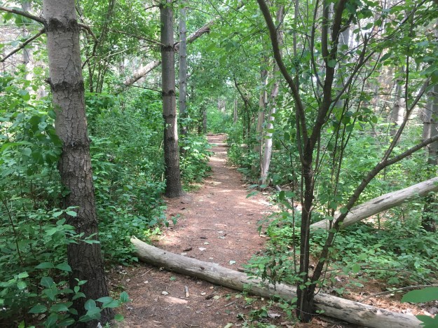
There is a main trail through the park but we found that it was used by cars who drove quick enough to stir up a choking cloud of dust. As usual the secondary trails were much better.
Pearl Crescent butterflies have a wide range of habitat throughout North America. It is quite common throughout the United States but in Ontario it is not as common as the Northern Crescent. The main distinguishing feature between the male and female is the colour of the antenna knobs. The males usually have black ones while the female seen below has white antenna knobs.

Claireville Conservation Area features a tree caching trail. Nineteen trees along the trail have been tagged so that hikers with smartphones can access information about the tree species in the park. With my phone I only had to take a picture of this tag to find out that it is an American Beech. The link provides considerable information about the tree including the fact that it could live for 300 years. For those with an understanding of environmental concerns they also tell you that this tree is storing over 2000 kilograms of carbon.

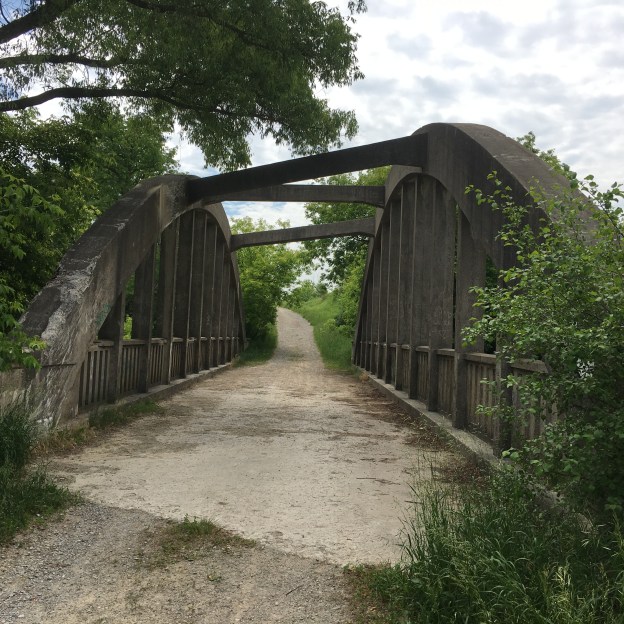
John and Rebecca Wiley emigrated to Upper Canada in 1836 and settled in Gore Township. Their one hundred acre farm was called River-view Farm and was divided between their two sons when John passed away in 1864. The two properties of Leonard and William are outlined in yellow on the 1877 county atlas below. The Wiley family operated the farm until 1962 when it was sold to the Metropolitan Conservation Authority. The bridge over the West Humber on Gorewood Drive was named after the family.

Wooden bridges were built across the many streams and rivers in Ontario using timber from trees that were cut to clear the road. These bridges were in constant need of repair and early in the 20th century concrete bridges became popular. Concrete bowstring bridges were popular because they were able to use local materials and labour. By the 1920’s there were about 65 concrete bowstring bridges in Canada, almost all of them in Ontario. Only a few of these remain in place and even less of these remain open to vehicle traffic. There are only two remaining in Brampton, the other one being on Creditview Road near Eldorado Park.
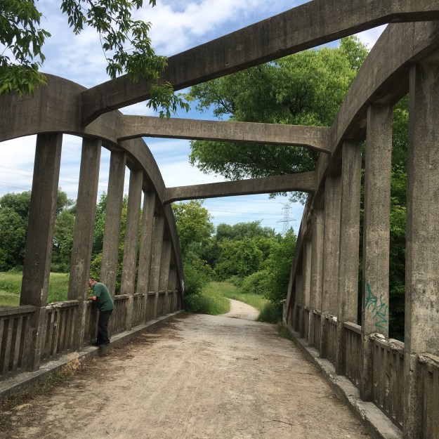
The Wiley Bridge was named after the local family and built in 1924 from materials likely quarried on the property. It was built on a bias, which means that it crosses the river on an angle. The bridge was reinforced with three overhead concrete girders that join the two bowstring arches. These run on opposing angles as can be seen in the preceding picture. All this combines to give the bridge an odd appearance as if one side is longer than the other, or that it is wider at one end than the other. The bridge has a continuous span deck and concrete hangers and parapet, all of which is still in very good condition. The bridge was given heritage protection in 2013.

Claireville Conservation area also includes the reservoir south of Steeles Avenue that was featured in the post Claireville. With 848 acres to explore and a rare white deer to be seen, there is plenty of reasons to return to Claireville Conservation Area.
Google Maps Link: Claireville Conservation Area
Like us at http://www.facebook.com/hikingthegta
Follow us at http://www.hikingthegta.com

Thanks for this informative blog. I visited on July 29th 2018 and had a great time. One important observation that I wish to add here is the sighting of “Wild Parsnip” in oddly humongous numbers. It was almost everywhere and especially throughout the road sides that crosses through the bridge (shown in the blog). I would say – stay safe.
Pingback: Old Albion Road | Hiking the GTA
Pingback: Claireville – Ghost Towns of the GTA | Hiking the GTA
looking for old photos of the high old wooden train trestles in Clairville. Used to dive off them into the water below.