Tag Archives: Grand Trunk Railway

Milton Mill Pond

Sunday, July 18, 2021

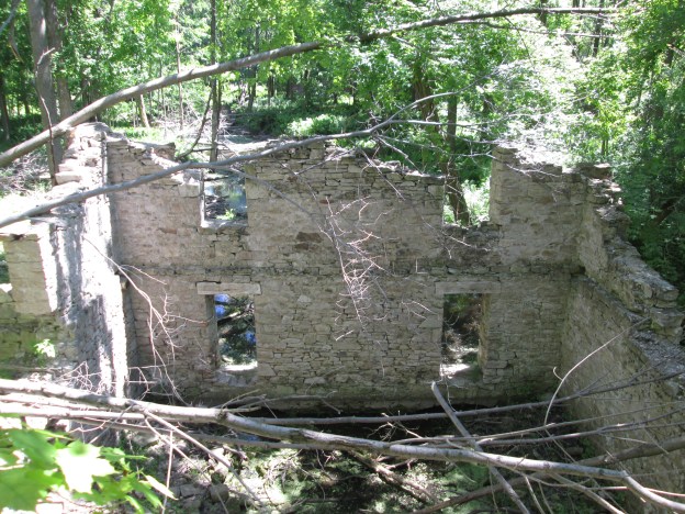
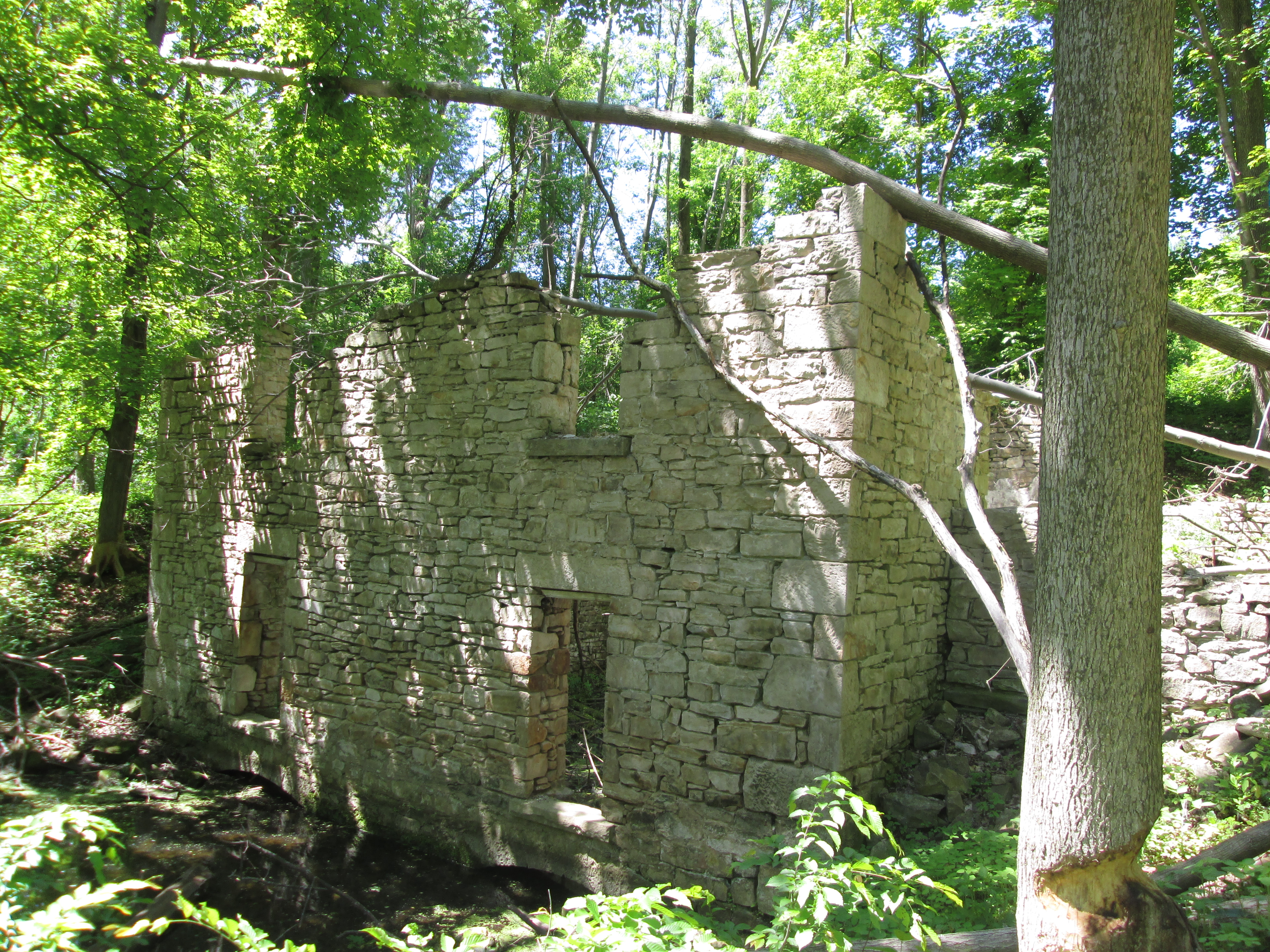
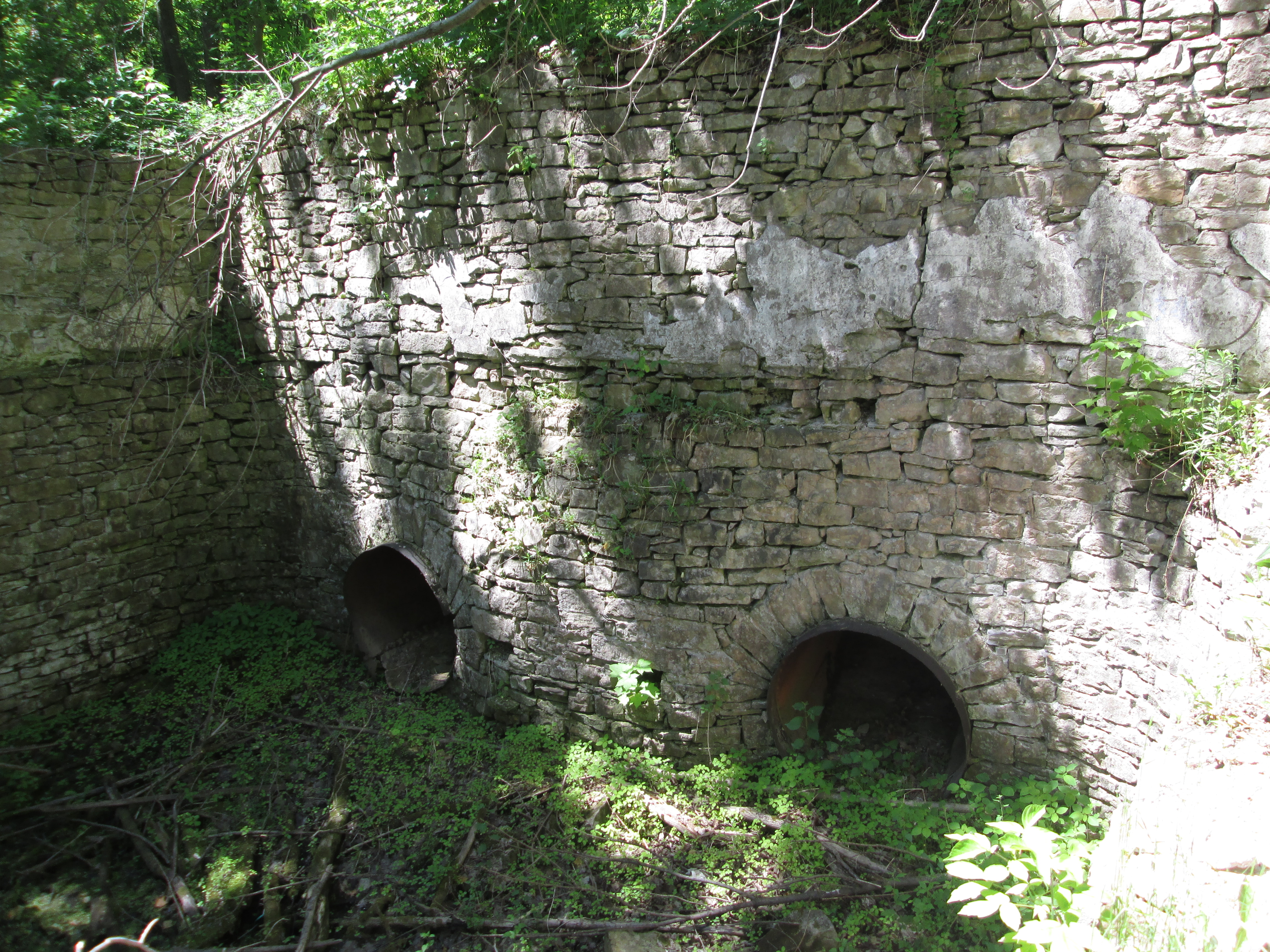
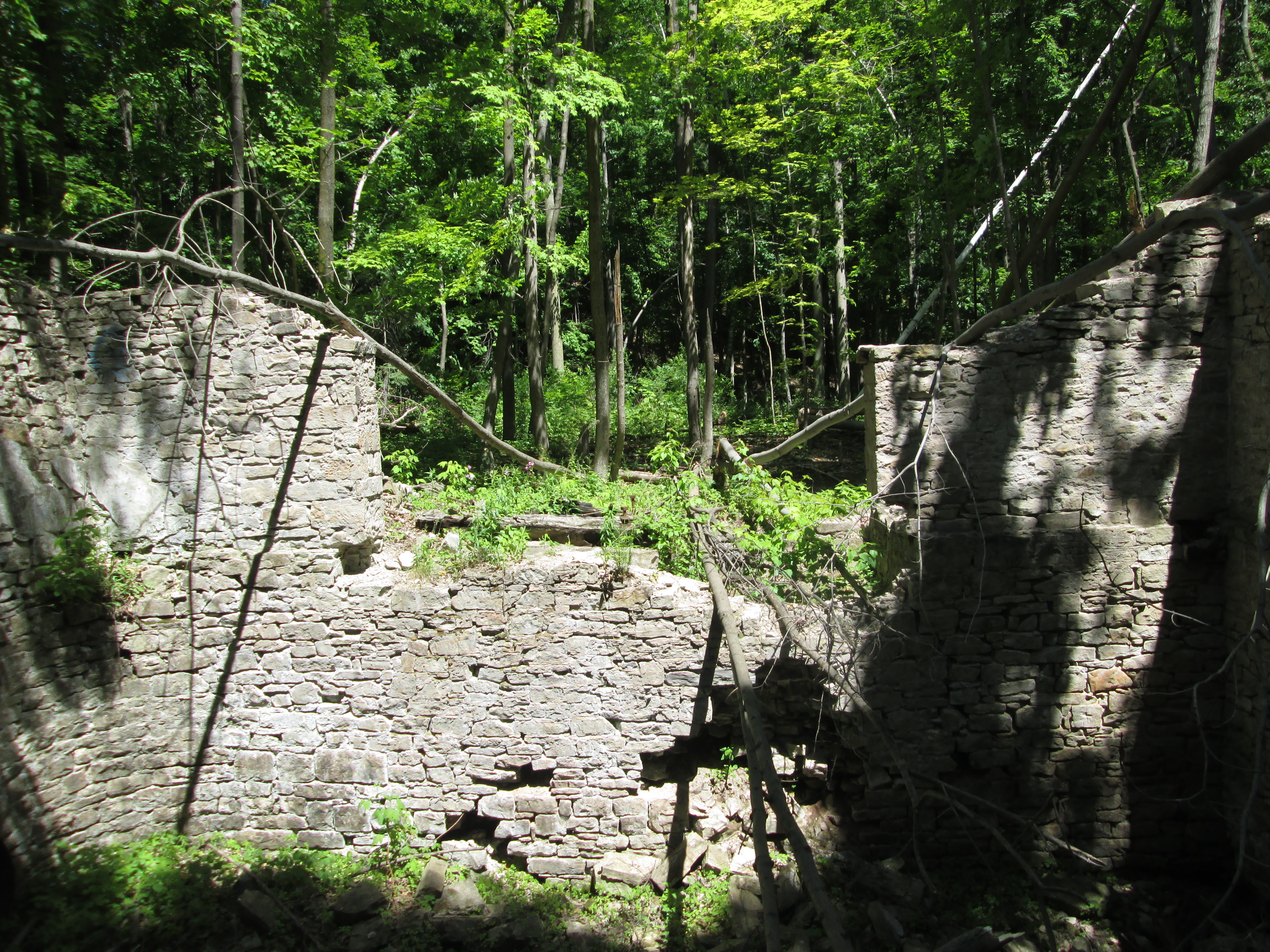
Milton was founded in 1821 by Jasper Martin who had emigrated from Northumberland, England earlier in the year with his wife Sarah and their two sons. They settled on a property along 16-Mile Creek where they built a grist mill. The community was first known as Martin’s Mills but when it got its first post office it took the name Milton from the English poet John Milton, who was a personal favourite of Jasper Martin. A new stone mill was built in 1856 which survived until 1963 when it burned down. At that time the mill was being operated by Robin Hood Flour who donated the property to the town for a park after the fire. The town developed the park as a Centennial Project to mark the 1967 anniversary of Confederation.

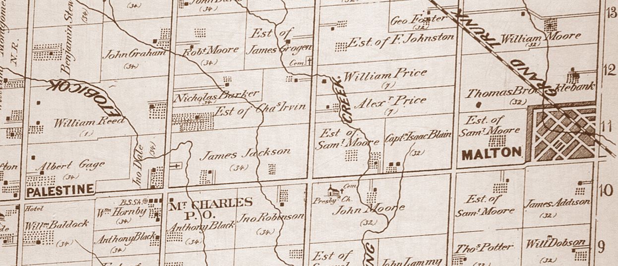
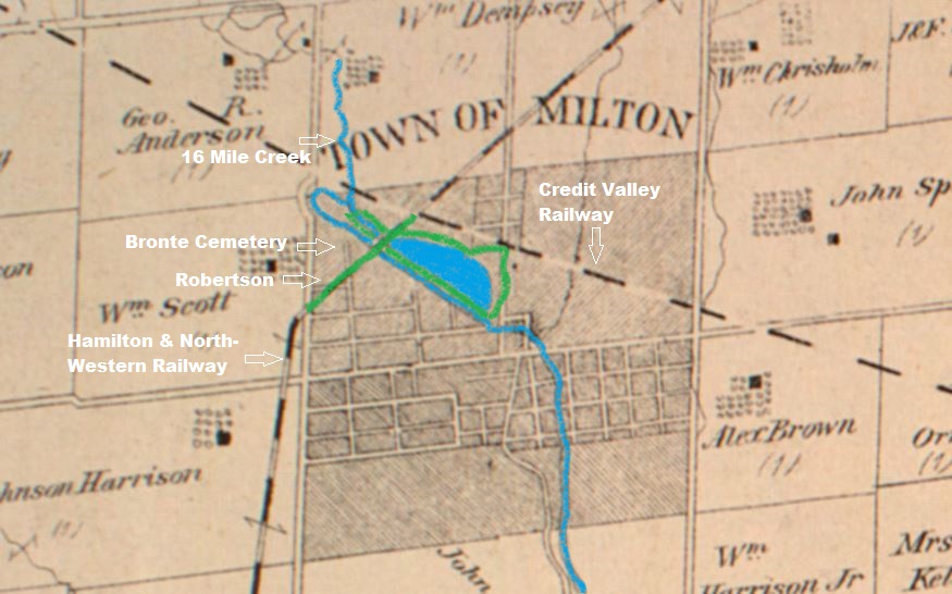
This County Atlas map of 1878 shows the town as it used to be, centred on the mill pond. I’ve marked the approximate route of this hike in green and the waterways in blue.

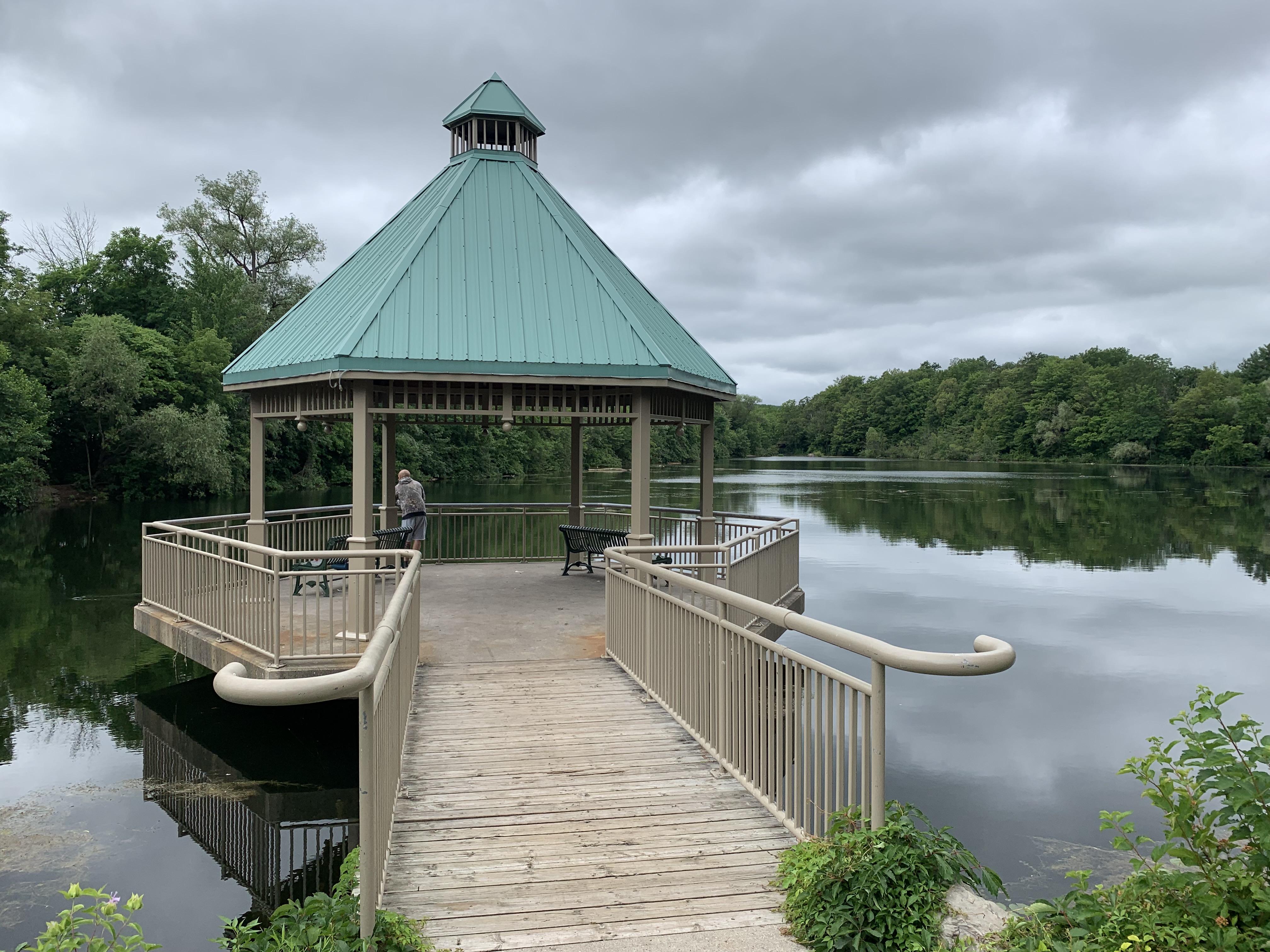
A restoration of the pond took place in 2000 with invasive plants being removed. The gazebo was built in 2001 and has become a popular place to get wedding photos taken.

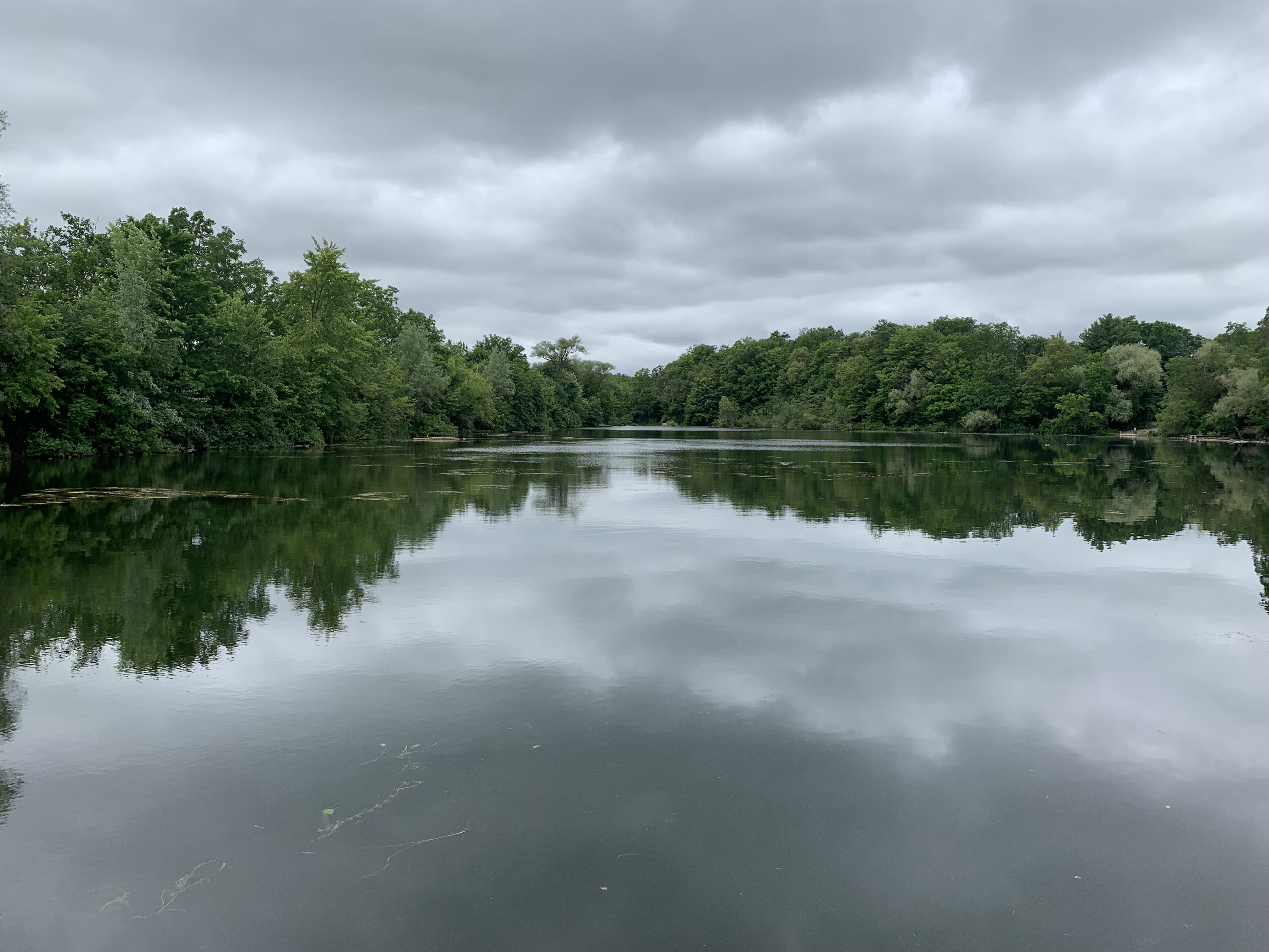
There’s a nice trail that runs along a narrow berm between the south side of the mill pond and 16-Mile Creek. There’s plenty of great views out over the pond where people have created small paths so that they could go fishing. It’s interesting to contemplate the importance of this berm to the early millers who were responsible for maintaining the waterway for a mile upstream and downstream. They had to remove fallen trees and other blockages that could cause a sudden surge of water taking out their dam or one downstream somewhere. Jasper Martin scooped this berm up from the bottom of the pond and then would have walked it regularly to keep an eye on things.

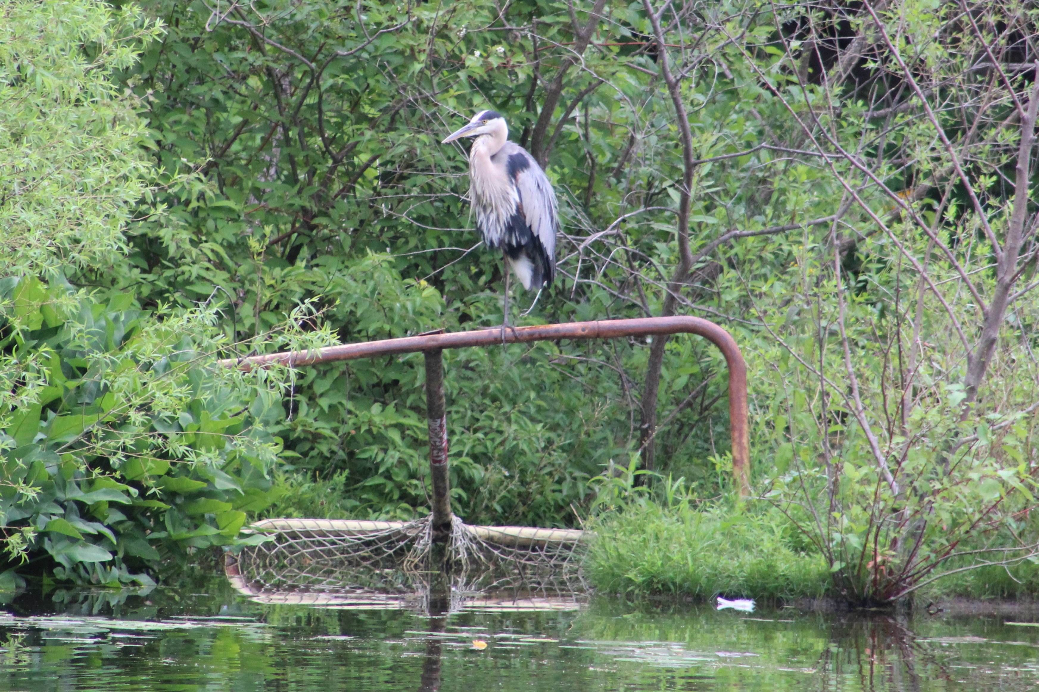
The Mill Pond has been stocked with trout but it doesn’t provide a suitable habitat to sustain their populations. People as well as the local heron fish in the pond for carp and panfish and there were several places along the trail where people were fishing. I stopped to watch two young boys fishing and was rewarded with the sight of a heron sitting on a rail on the other side of the pond.

A Painted Turtle was taking in the afternoon sunshine on a log in the middle of the pond. This was a fairly large specimen indicating that it is likely getting fairly old. The Painted Turtle shell is made up of 13 plates or scutes. As the turtle grows it sheds the outer layer of its plates and grows new ones. These plates exhibit growth rings like those on a tree and can be counted to determine the age of the turtle. But, you have to catch him first.

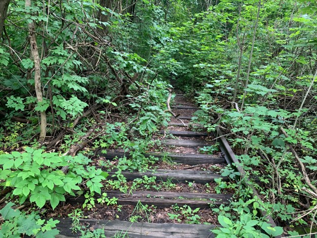
The trail passes under an old rail bridge that provides a pedestrian path across the creek and mill pond. It can be accessed from the park on Mill Street or from the north side of the mill pond but not from the walking trail between the two. We’ll look at the history of this railway later in the article.

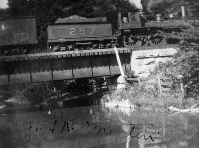
This 1911 photo from Milton Images shows a Grand Trunk Railway train crossing the bridge at the mill pond.

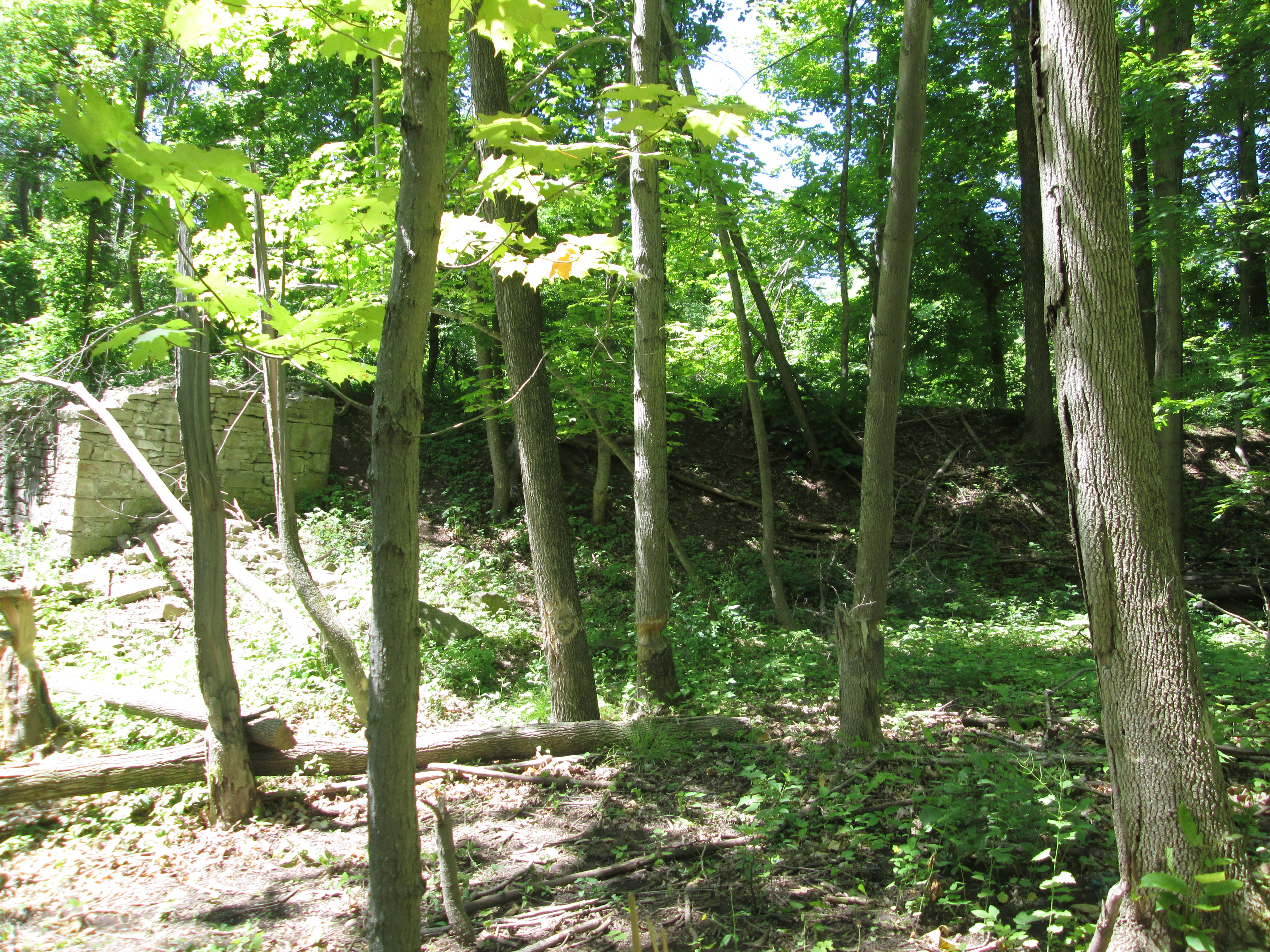
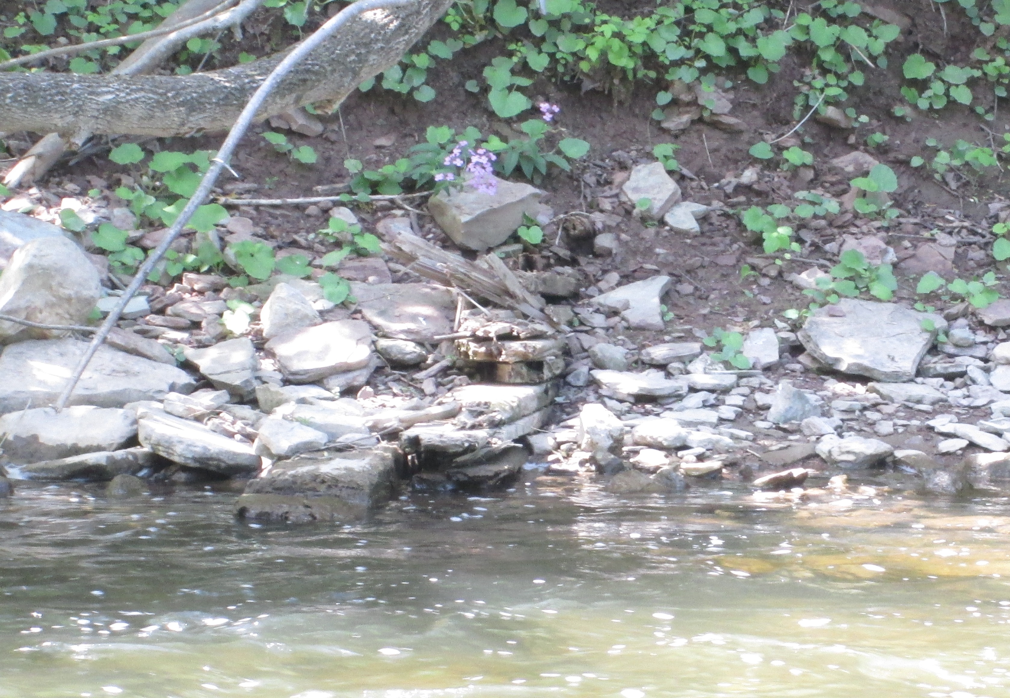
Once you pass below the old train bridge you can continue to follow the trail with the creek on one side and the inflow to the mill pond on the other. You will come to concrete blocks which mark the start of the pond and after that the curve of 16-Mile Creek. Crossing over the creek on a small foot bridge you come to a larger forested area which featured several different types of mushrooms. These Oyster mushrooms were growing in large numbers in one small area beside the creek and are considered to be a delicacy by some.

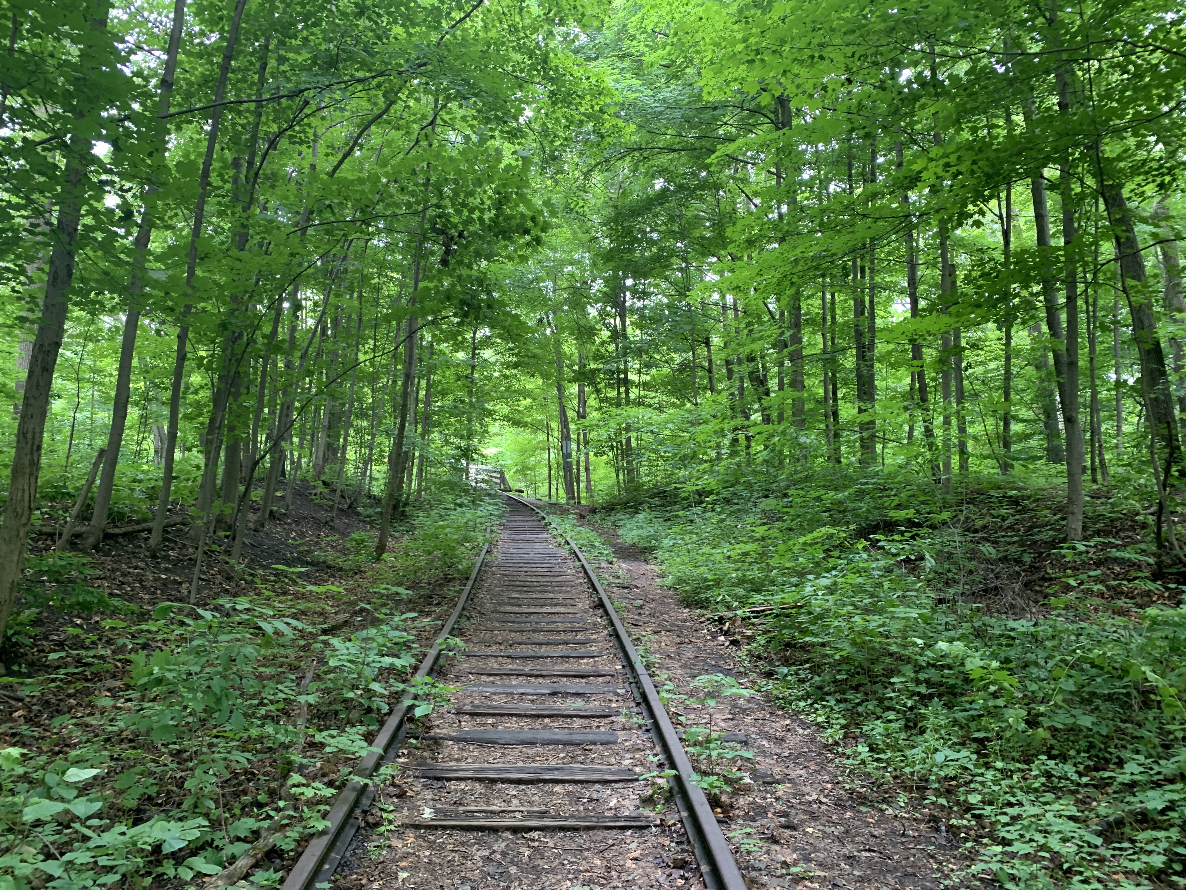
Milton was bypassed by early railways and didn’t get the first one in town until 1876 when the Hamilton & North-western Railway arrived running north-south through town and across the mill pond on the bridge we saw earlier. The Credit Valley Railway arrived the next year running east-west just north of the mill pond. The Hamilton & North-western became the Northern & North-western before being bought by the Grand Trunk Railway late in the century. In 1923 the Grand Trunk became part of the Canadian National Railway and they operated the passenger service on the line until 1973 when the tracks were realigned and service discontinued. I followed the tracks to where they end a little north of the mill pond and also in the other direction to where they used to cross Bronte Road.

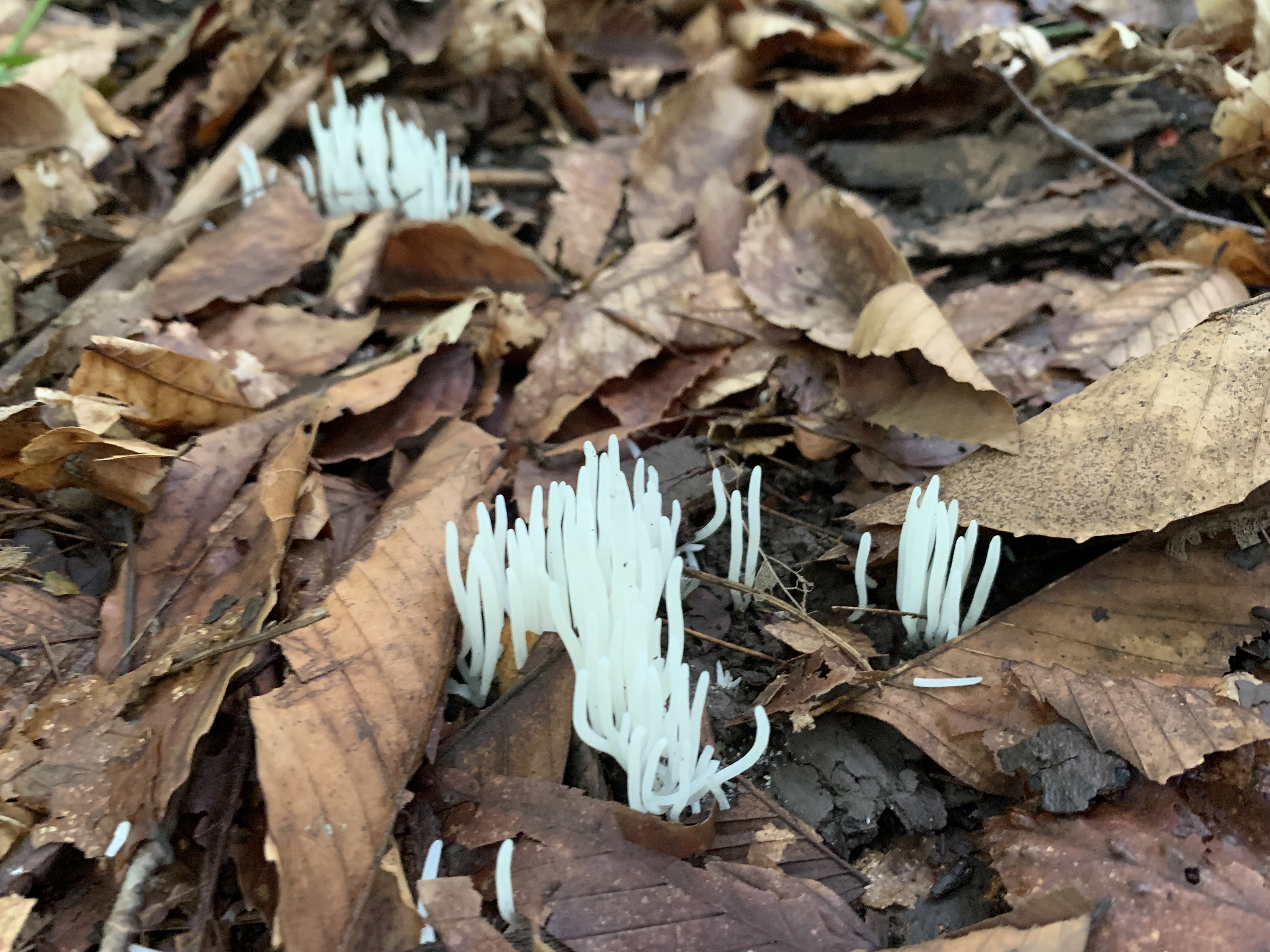
Several areas of the forest floor were covered in clusters of White Worm Coral fungus which grows between July and September and is considered edible. The white fingers are quite brittle but become almost translucent when wet.

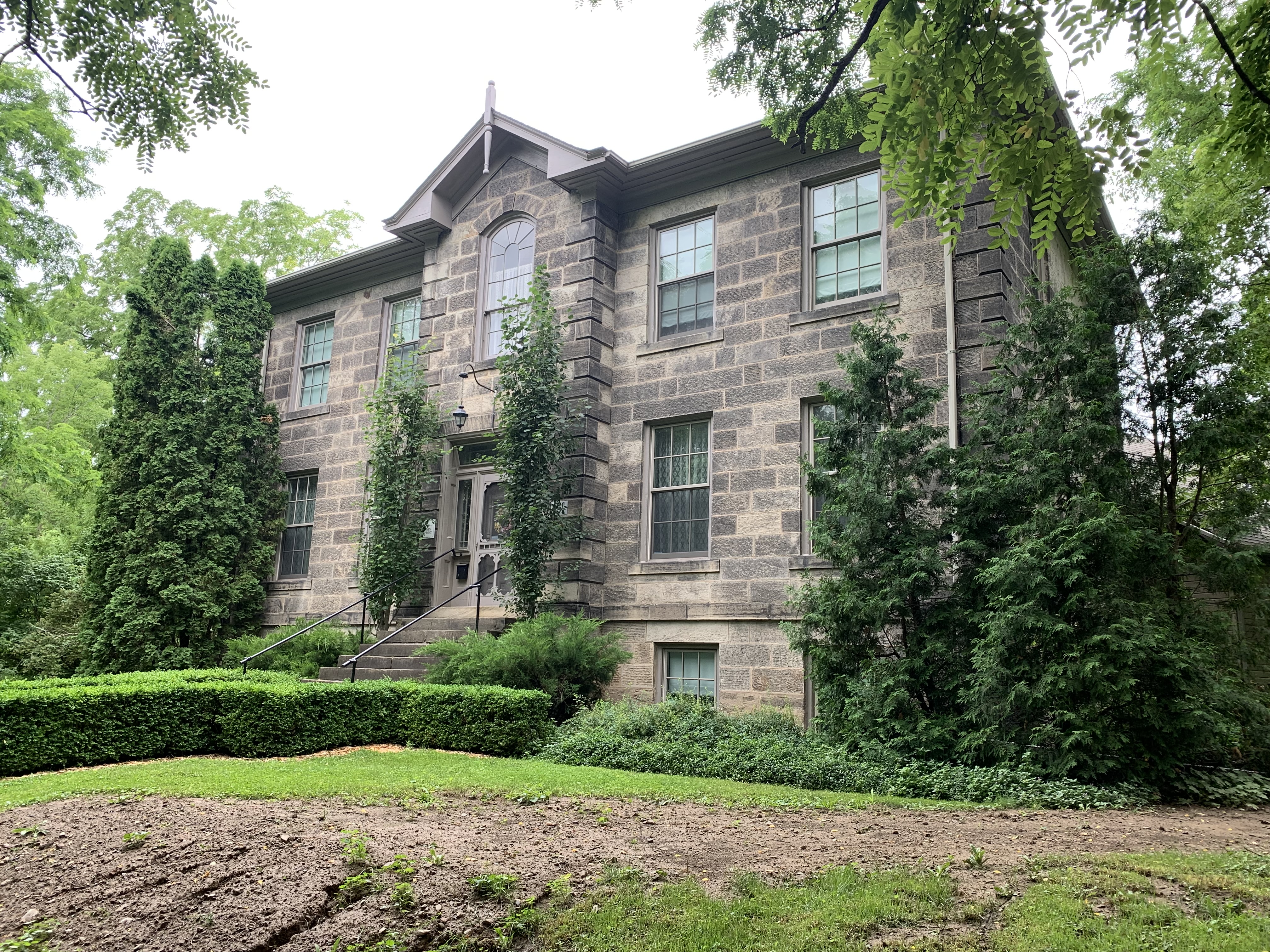
As you make your way around the far end of the mill pond you come to the John Sproat House which was built in the Georgian style in 1857. This stone home was originally built as a Ladies Seminary Educational Residence but was later used as a private residence. One prominent owner of the house was P. L. Robertson who was the inventor of the Robertson Head Screw.

Orange Mycena mushrooms grow in tight little clusters on deciduous wood and are quite common in Southern Ontario. While this species might have some antibacterial properties, it is also known to be a mutagen which can cause genetic mutations that result in cancer.

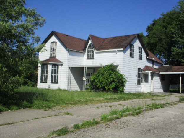
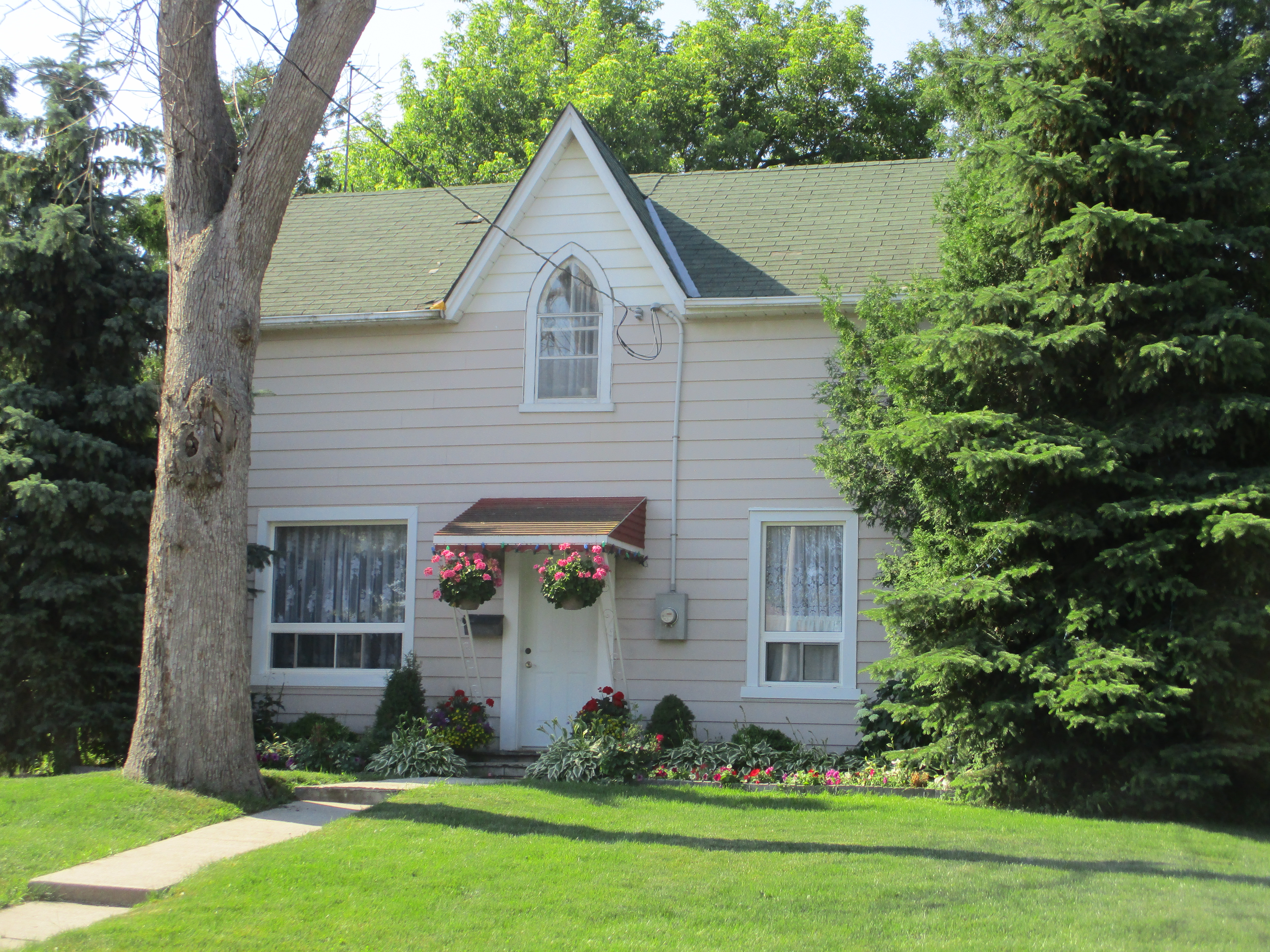
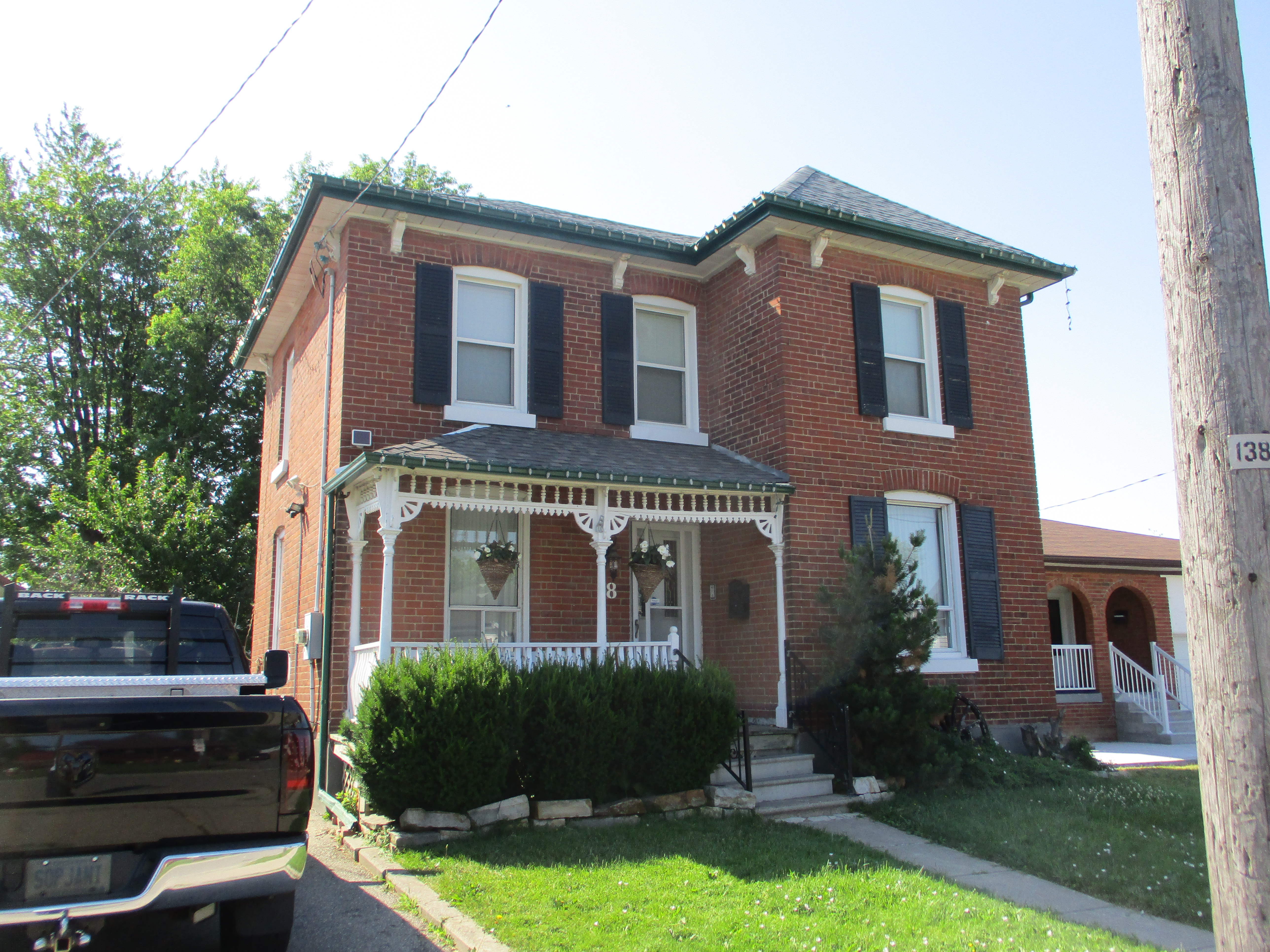
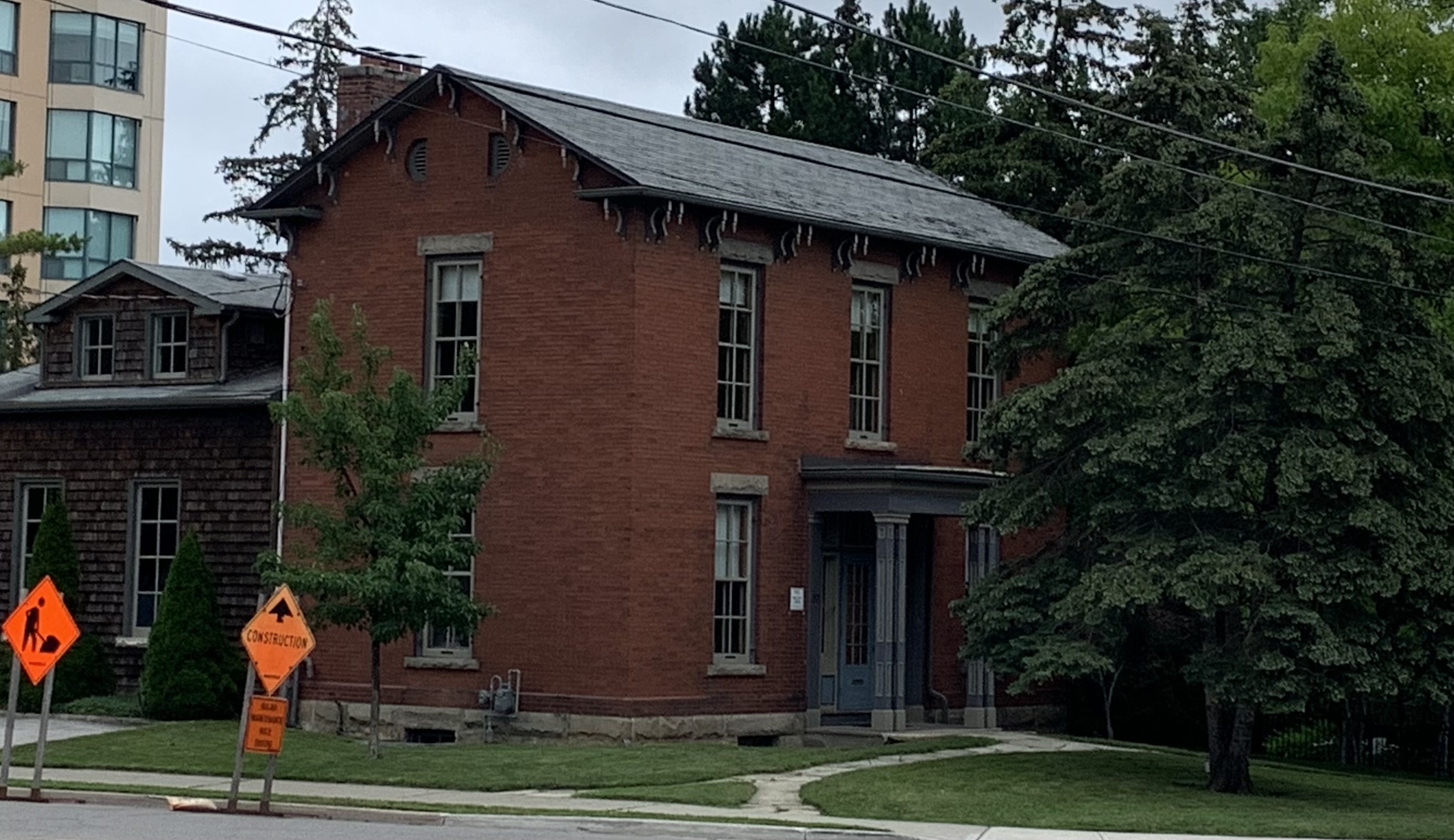
Founding father Jasper Martin built his house across the street from the mill in 1821 making it the oldest building in town. This home has paired brackets under the eves and an ornate doorway but little other decoration. The Milton historical society has done a great job of identifying historic homes and putting small white plaques on them describing the original owner and date of construction.

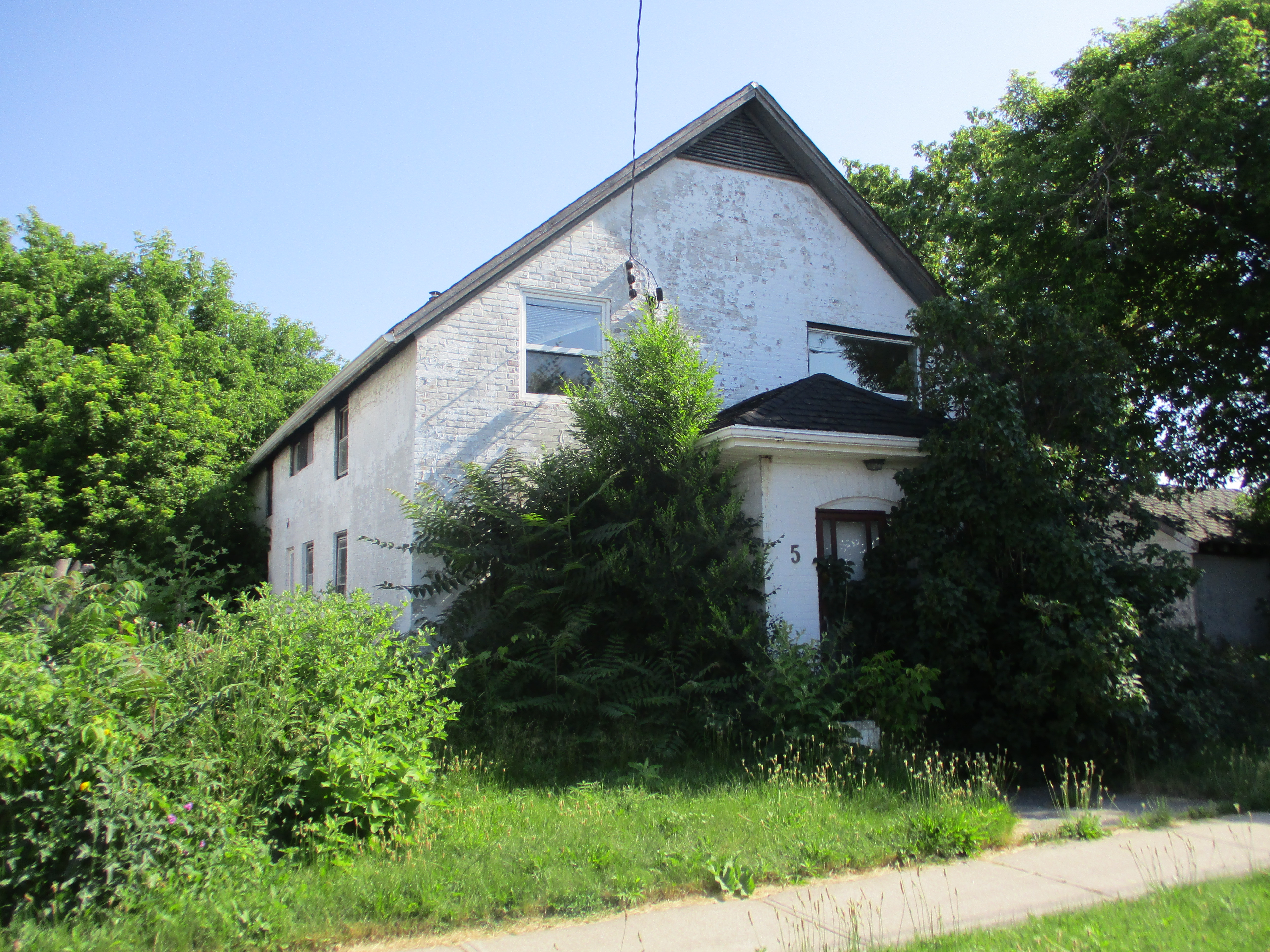
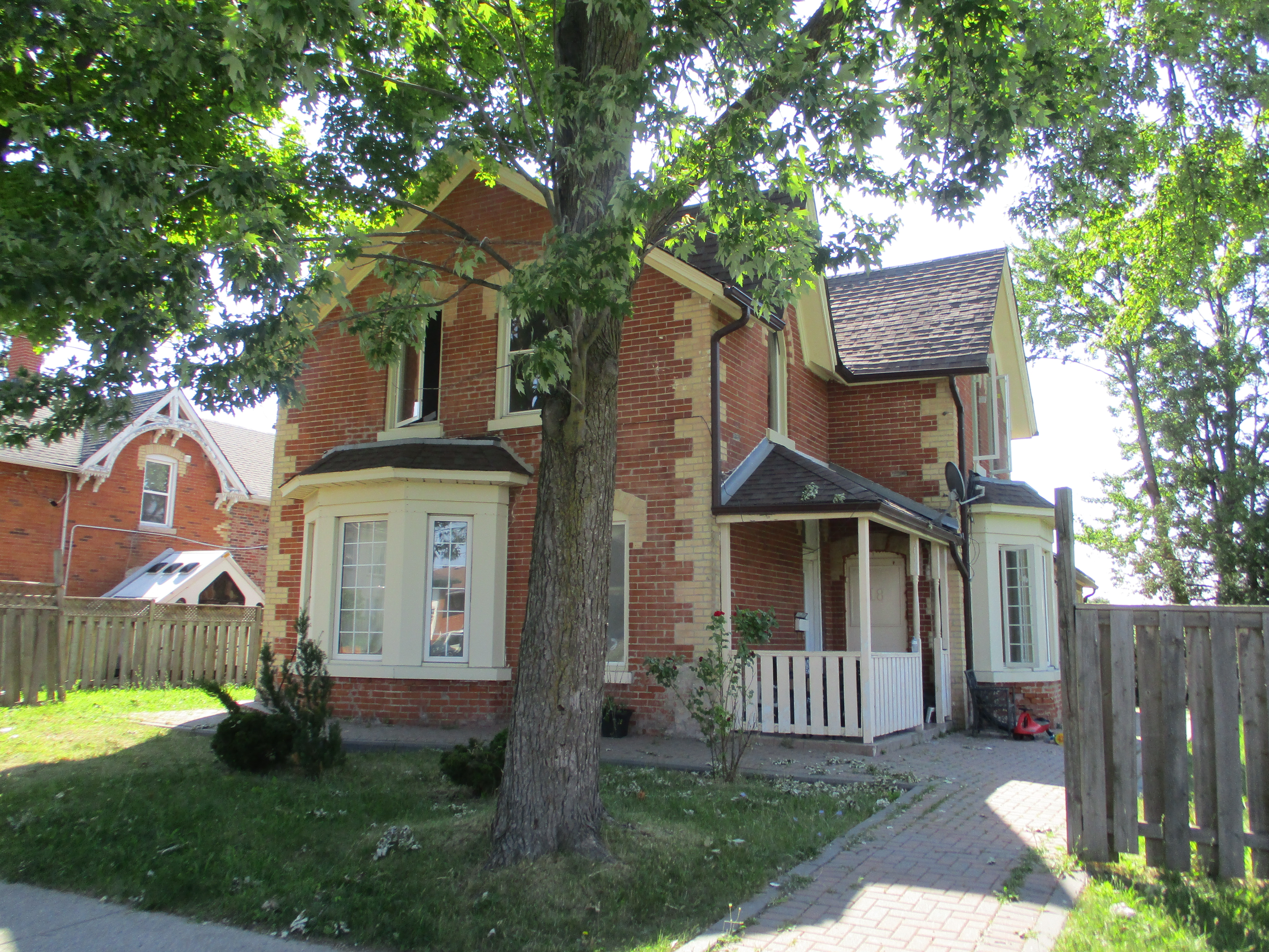
I included this house which stands across the street from the mill pond because I love the style of architecture. The round tower with domed cap is Romanesque and all the accents have been done with terra cotta panels giving the home a unique look. It was built in 1892 for Richard L. Hemstreet the Presbyterian Church bought it to house their various pastors between 1924 and 1970.

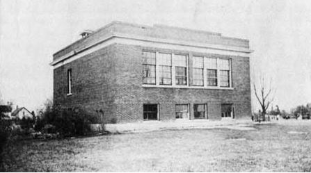
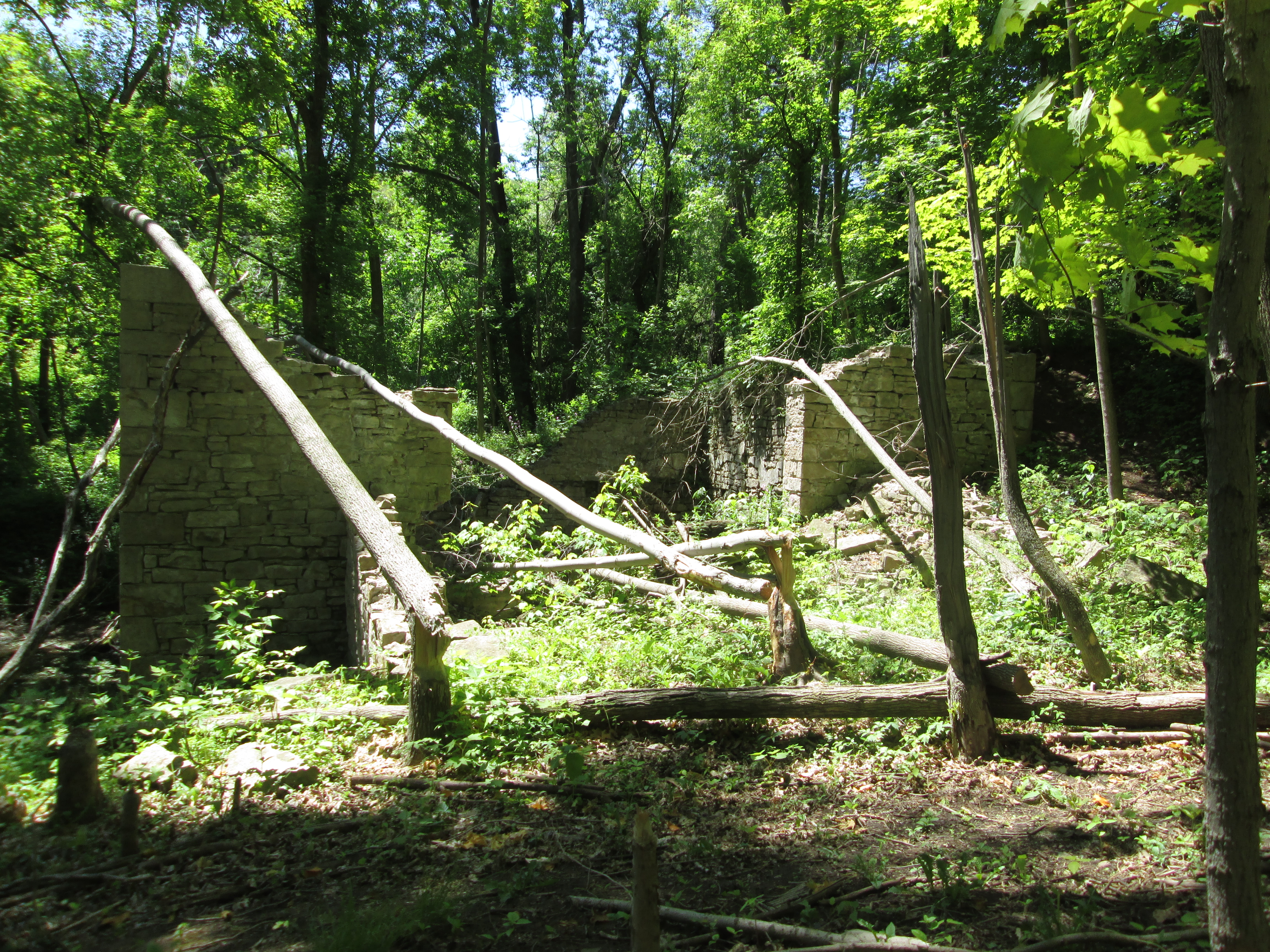
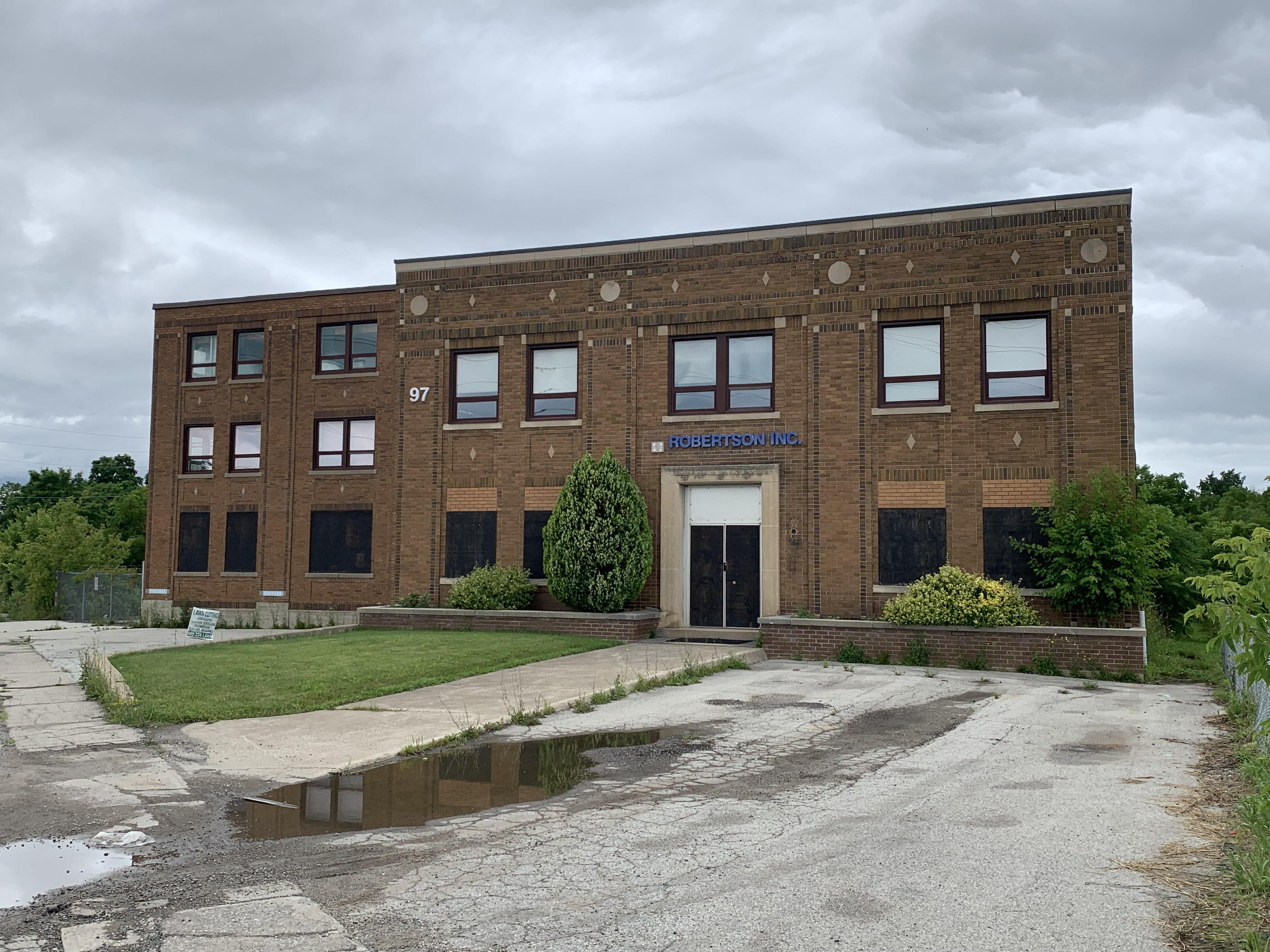
The little side excursion along the old railway line towards Bronte Road leads past the rear of the P. L. Robertson Manufacturing Company. Formed in Hamilton in 1907 the factory relocated to Milton the following year and began marketing an industrial screw with a unique square drive, the first socket head screw available. The Robertson Screw was quickly implemented by Canadian manufacturing while the Phillips drive became popular in the United States. The Robertson building and properties are now vacant.

Bronte Pioneer Cemetery is a short walk north of the Robertson factory and was opened in 1824 as the final resting place of many of Milton’s pioneers. Jasper Martin, the town’s founder was buried here when he passed away in 1833. The cemetery is partially forested and has several stones hiding in a rear corner of the grounds. Many of the earliest stones have been collected into a cairn to preserve what remains of them.

The historic mill pond is a great place to go for a quiet walk with plenty of things to see and is reported to be an excellent place to see the fall colours.

Google Maps Link: Milton Mill Pond

Like us at http://www.facebook.com/hikingthegta

Follow us at http://www.hikingthegta.com

Also look for us on instagram

Malton – Ghost Towns of The GTA

Sunday, July 7, 2019

The town of Malton had grown from humble beginnings to a community of over 900 before growth stalled and it began to decline.  The town developed around the classic four corners of a crossroads, in this case Airport Road and Derry Road.  It didn’t grow in all four directions however, only the 100 acres on the north west corner was laid out for a subdivision.  This happened a year after the Grand Trunk Railway came to town in 1854 and as a result the streets are laid out parallel to the railway and not to the four corners.  This leaves all the streets running at 45 degrees to Derry and Airport Roads.  Much of the original four corners was destroyed in a gas line explosion in 1969 and the rest was lost to road realignment and widening.  While not a true ghost town, the original community is now hidden in the original block of streets and surrounded by the airport and urban sprawl.

Malton 1877

In 1857 the Trinity Methodist Church was built as a wood frame structure.  Later it was given a veneer of bricks with some interesting details around the windows.  This church was used until 1953 when the congregation moved to a new church building and this one was converted into a residence.

Malton 1857

Compared to the beautiful brickwork in the picture above, the renovated building seen below is really awful.

IMG_4148

The house at 16 Burlington Street is a typical 3 bay farmhouse built in 1866 by John and Mary Bateman.  This house has a gothic arched window in the upstairs dormer.  The style is known as a story and a half because of the low headroom in the upstairs rooms.

IMG_4150

The house at 17 Scarboro Street is one of the oldest surviving ones in the community, having been built in 1870.  Richard and Harriet Ibson only owned the house for a few years before selling it to John Guardhouse in 1877.  It has had several additions to it over the years and is currently for sale.  The windows have been boarded over to keep vandals from destroying it and someone has taken the time to paint the boards black and put white trim on them.

IMG_4157

The house at 18 Scarboro Street belonged to David Tomlinson who served Toronto Gore as a councillor and a reeve in the 1860’s.  David built this house in 1884 at the same time that his brother built the house at 16 Scarboro Street.

IMG_4160

Joseph Tomlinson was a carpenter and the original owner of 16 Scarboro Street.  The two houses were built at the same time and likely both by Joseph.  The one at 16 Scarboro has much more interesting brickwork as illustrated in the quoins on the corners of the house.  The house also sports considerable gingerbread, unlike the house beside it.  The one thing the two houses have in common that suggests a common builder is the brickwork above the windows.

IMG_4155

In 1901 Queen Victoria passed away and King Edward VII took the throne.  Victorian architecture tended to involve odd shapes and many different sized windows.  Edwardian architecture moved away from the extravagant and more into the utilitarian.  Buildings tended to become more like blocks as is illustrated by this 1901 home.  I find it interesting that the upper story window has only one shutter because the wall is next to the window.

IMG_4153

The first school in Malton was built in 1828 and was a one room log structure.  This was replaced in 1858 with a larger brick building.  As the town grew the new school also needed to be replaced and the earlier log structure was finally torn down in 1923 and replaced with a two story school building.

1923 School

This school was in use until 1952 when a new school was built and this one was converted into apartments.

IMG_4142

In 1939 the neighbourhood was selected for the construction of an international airport for Toronto.  Malton Airport attracted more than just the airplanes that flew from there and before long aviation related industries were starting up.  During the Second World War a company called Victory Aircraft operated here but after the war they merged with A.V. Roe Canada.  They developed the CF-100 Canuck and the the CF-105 Avro Arrow.  A CF-100 is on display at Paul Coffey Park.

IMG_4137

The town of Malton has been absorbed into the urban sprawl that surrounds the airport but if you look you can still find traces of the original community.  Just west of Malton you can also visit another ghost town and read about it here: Mount Charles – Ghost Towns of the GTA. Just beyond that on the map at the start of this story is Palestine – Ghost Towns of the GTA for further exploration.

Google Maps Link: Malton

Like us at http://www.facebook.com/hikingthegta

Follow us at http://www.hikingthegta.com

The Barber Dynamo – Georgetown

Saturday June 6, 2015

After visiting the Barber Paper Mills we crossed the Credit River and made our way toward the Barber dynamo.  The walk back to the dynamo is about 3 km and will take you up and down the 100 foot sides of the ravine three times.  The former Grand Trunk Railway bridge is about half way back to the site.

The Grand Trunk Railway Bridge was built in 1855 and earned the nick-name the Iron Bridge. It crosses the 2000 foot wide river valley using 8 spans of 96 feet each and extensive berms on either side. The bridge rises 115 feet above the river. It was expanded in 2010 to accommodate a double track as part of GO Transit’s expansion of services.  Provision has been made for a third track in the future.  When you reach the rail bridge you will have the option of an upper or lower trail. Choose the upper trail as the climb is less severe here than further down the trail.

IMG_5242

The paper mills were a growing business in the 1880’s when John Roaf Barber was running the company.  Born in Georgetown in 1841, John became the plant manager in 1861 and took over full control upon his father’s passing in 1880.  John was a visionary who had converted his mill to the use of paper pulp and was producing some of the finest paper in Canada.  The Barbers had already moved their mills once to get a better head of water to run the water wheels.  Now the water supply was proving to be inadequate again for the size of the business.

After you pass the train bridge you will descend back to the river level before climbing once more as you approach the dynamo.  The trail will split with one trail headed further downstream while the one to the right heads to the dynamo.  You will see a long earthen wall with a small bridge set into it.  This is the weir that was built to help retain the power mill pond.  The bridge sits above a former sluice gateway that has since disappeared.

IMG_5366

When J.R. Barber was thinking about his shortage of power in the mill, the early uses of electricity were limited to a few street lighting applications.  No one had thought about generating it and transmitting it across wires for use in industry.  He contacted C. F. Brush, an early manufacturer of dynamo equipment, in Ohio and told him of his plans.  Originally it was deemed impossible but Barber persisted and convinced Brush to manufacture a 100 hp dynamo for him when Brush’s previous largest one had been 30 hp.  Barber selected a site downstream where he could dam the river and create a head of water 6.6 meters tall.  This height of drop was used to power the turbines that ran the dynamo.

The cover photo shows the ruins as you approach them from the west where the water entered.  Directly behind the dynamo building is a 3 meter deep intake channel.  The dynamo was a three story building.  Turbines were on the first floor, dynamo equipment on the second and living and eating quarters on the third.  The east wall in the picture below shows the remains of the second story windows which were the same as those on the first floor.  At water level a pair of stone arches were the outlets for the water after it was used to turn the turbines that powered the mill.  The water flowing out of these arches formed the tail race and was returned to the river downstream.

IMG_5259

Water from the inlet was fed into a “Y’ branch penstock, the two ends of which can be seen below.  These in turn were connected to the turbines that were mounted in pairs in front of the water inlet ducts.  The turbines were 1.5 meters in diameter and may be the very ones pictured in the Barber Paper Mills post.

IMG_5265

This view is from the south side of the dynamo looking across to the power house (now gone) on the north side.  When I was last here there was a pair of beautiful stone arches in that square hole.  Shafts ran through these arches to connect the dynamo to the turbines in the main room on the lower floor.  The arches are now only so many stone blocks smashed on the floor inside.

IMG_5271

The larger of the two dynamos operated here was the 100 hp one that was mounted in the power house, a small extension on the north side of the building.  A smaller 60 hp unit was mounted inside on the second floor.  The 100 hp unit supplied power to the machinery at the mill while the smaller unit provided lighting.  Each was connected to the mill by one of two wires strung on telegraph poles installed for the purpose.  The larger unit was bolted down to rail ties. The remnants of the rail ties and mounting bolts can be seen in the picture below.

IMG_5370

The weir can be seen in this picture as a the dark line running across the middle of the photo. The wall of the crumbling building can be seen at the left side of the weir.

IMG_5292

By following the line of the old earthen berm toward the river it is possible to locate some of the original wooden crib that was the main part of the dam.  Several flat rows of wood are stacked up just near the water line in the picture below.  They would have been under water 127 years ago when they were installed.

IMG_5375

The paper mill is under attack from developers.  The dynamo building is under attack from beavers.  John Roaf Barber chose this site because it was a suitable place to dam the river to create the pond he wanted to use to power his mill.  The local beavers also think it is a great place for a pond.  They are chewing down trees to make their dam and lodge out of.  Several of the trees they have chewed through have fallen onto the old dynamo building.  The same factors that led to the dynamo being constructed here are also speeding up the destruction of this historic building.

IMG_5291

The Eastern Tiger Swallowtail on the plant in the picture below is a female.  The female can be identified by the band of blue spots along the hind wing.

IMG_5251

When public power came to Georgetown it was under the persuasion of J. R. Barber.  He closed the dynamo in 1913 and let the Alexander family live there.  Tragedy struck in 1918 when their young son fell off of the railway bridge and died.  The dynamo was closed and left to the mercy of the weather, vandals and the beavers.

Like us at http://www.facebook.com/hikingthegta