Tag Archives: Limehouse

North Halton Kart Club

Saturday, October 17, 2020

The North Halton Kart Club used to operate on the Fifth Line south of Limehouse but it has been closed for a third of a century. It seemed like a good idea to go and see what remains of a place that so many enjoyed over the years. Before going for your own visit you will need to get permission as it is on private property and the owner doesn’t like trespassing.

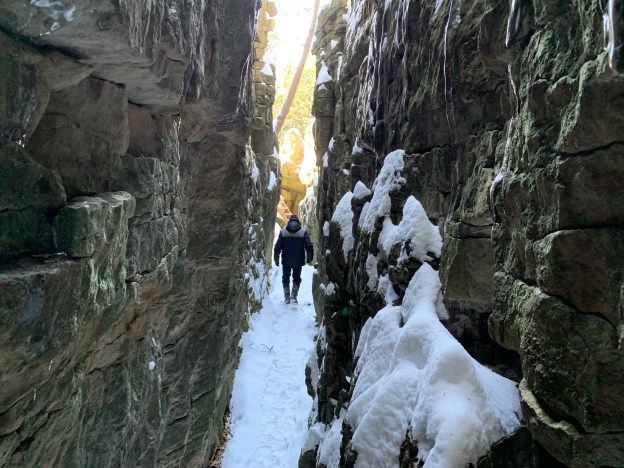
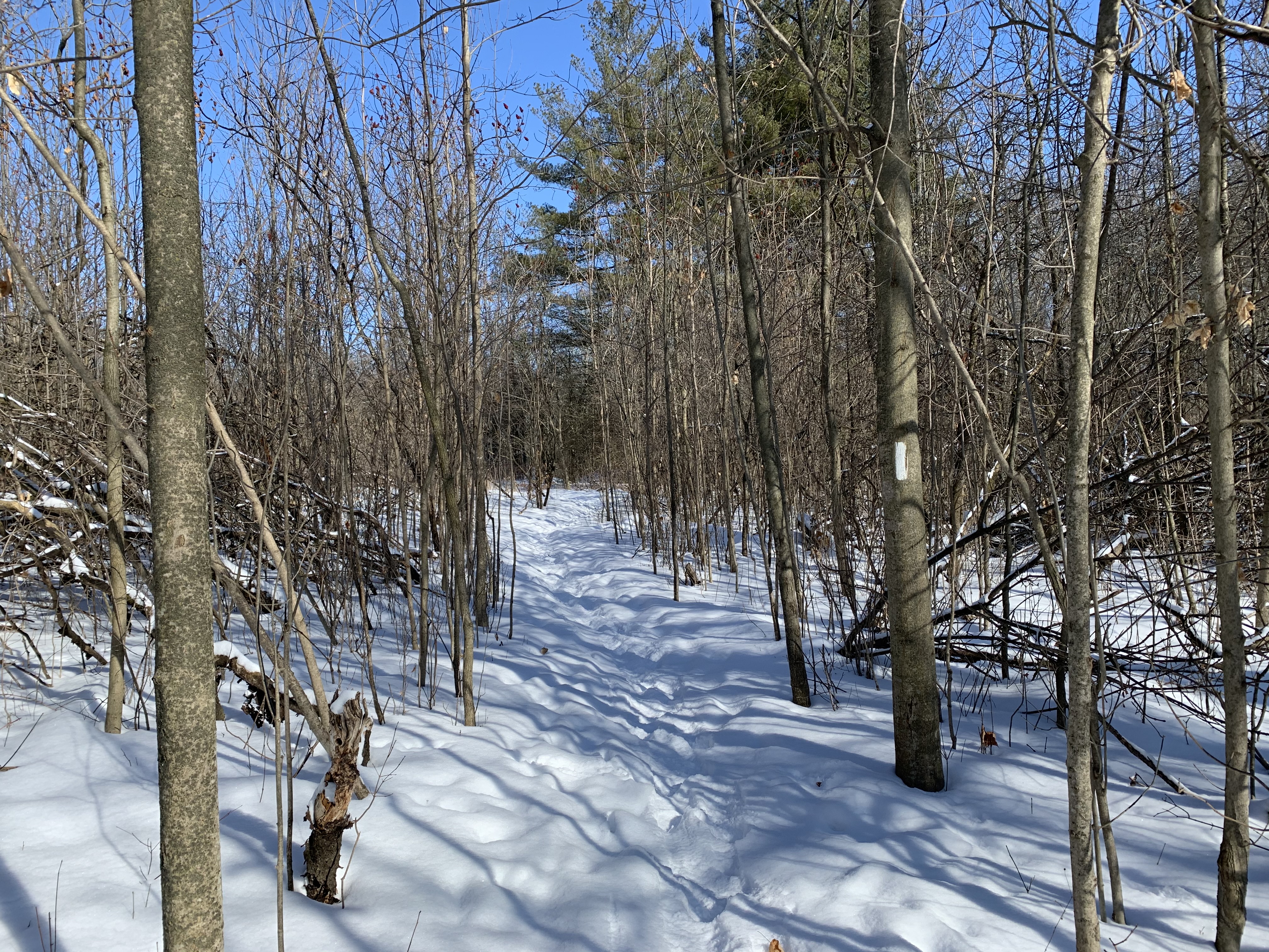
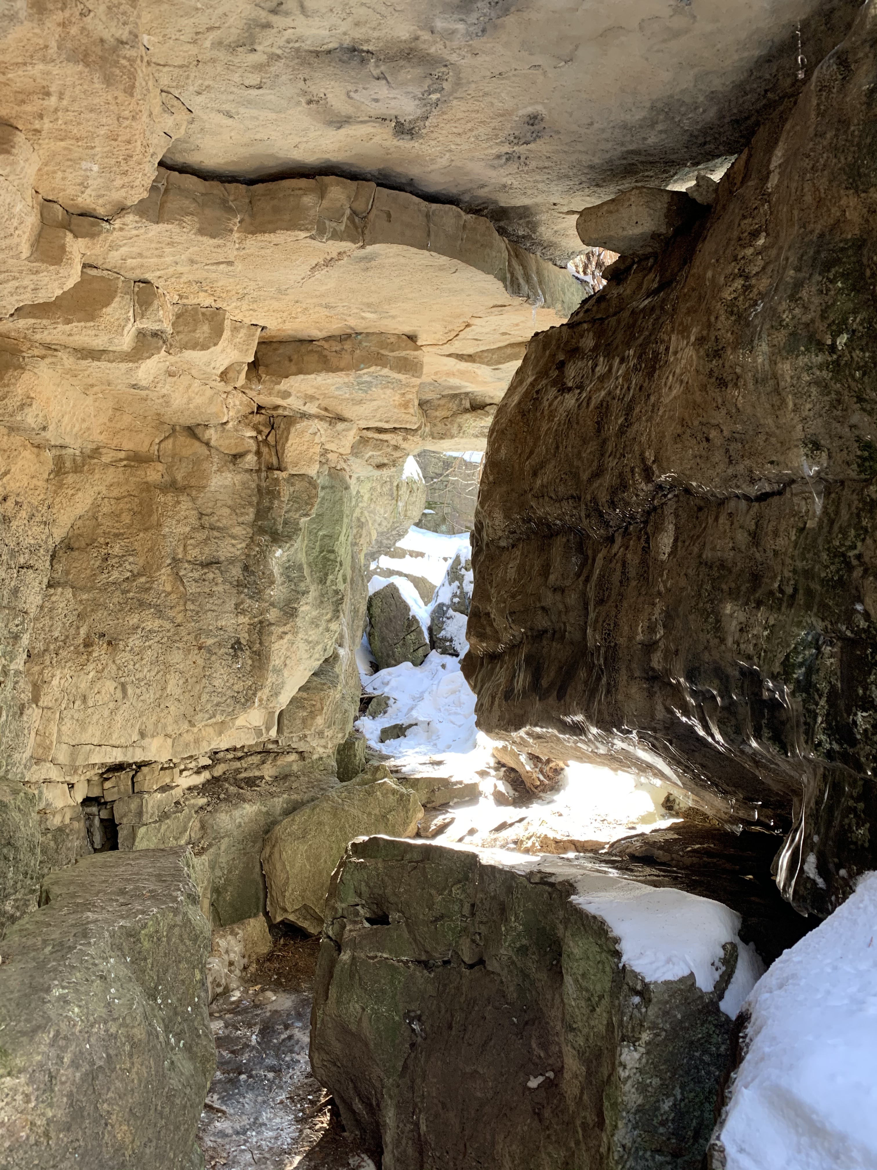
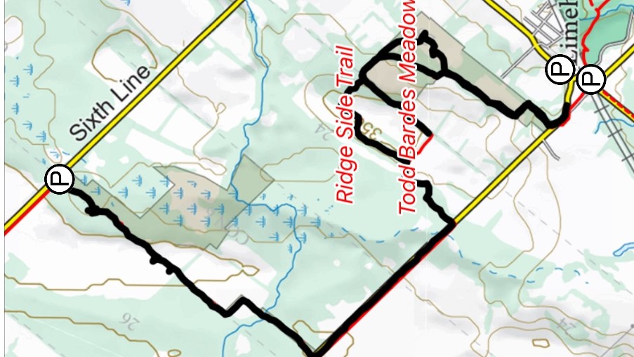
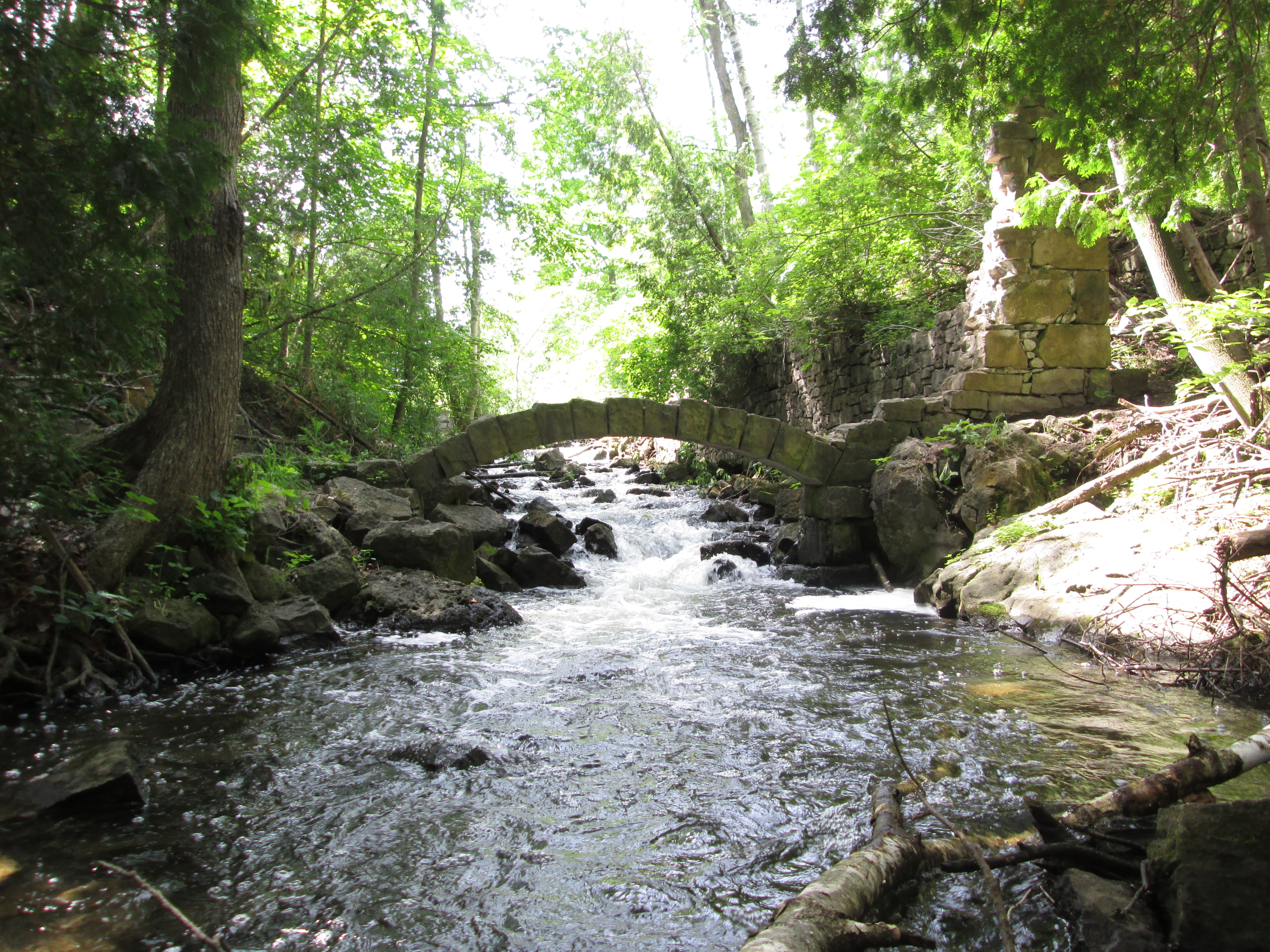
To access it we parked in the Limehouse Conservation Area and took the Limehouse Side Trail to the main Bruce Trail. The main trail heads north toward The Hole-In-The-Wall and the Limehouse Kilns but we turned in the opposite direction. We were a little wary of the Bruce Trail because of stories of overcrowding and lack of parking. Arriving early, there were only two other cars in the parking lot. However, a few hours later there were no available parking spaces and cars were lined up along both sides of the laneway.

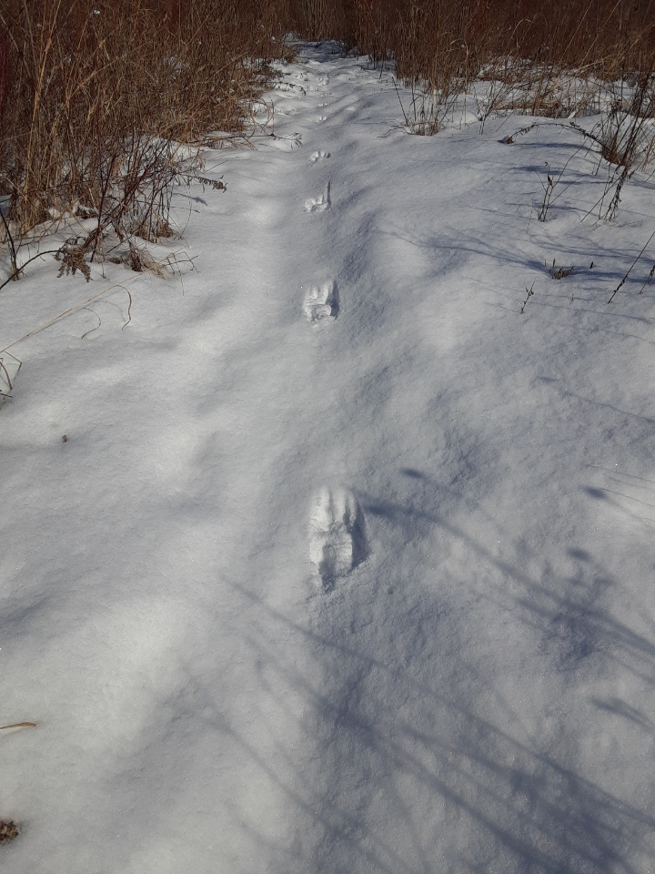
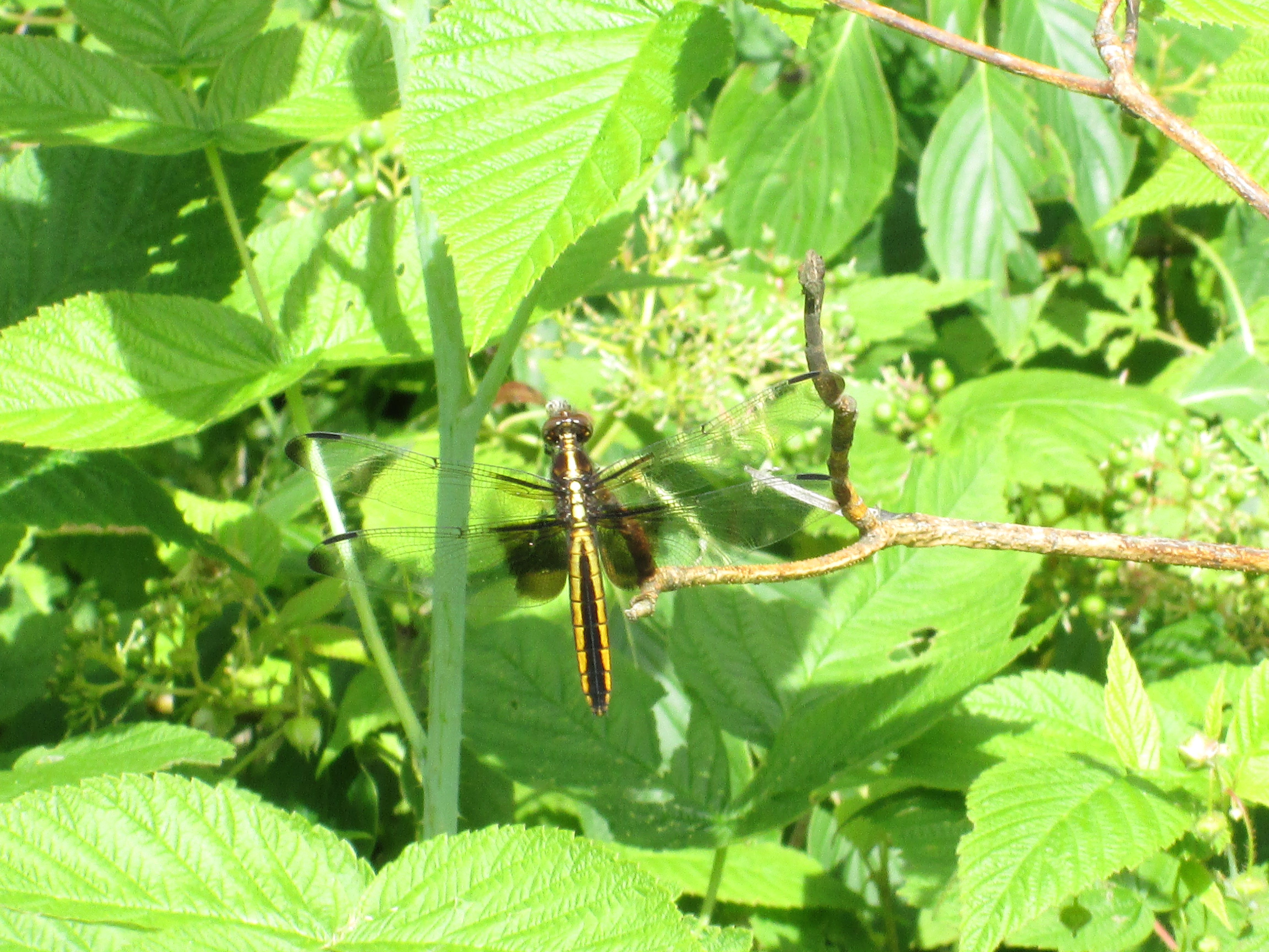
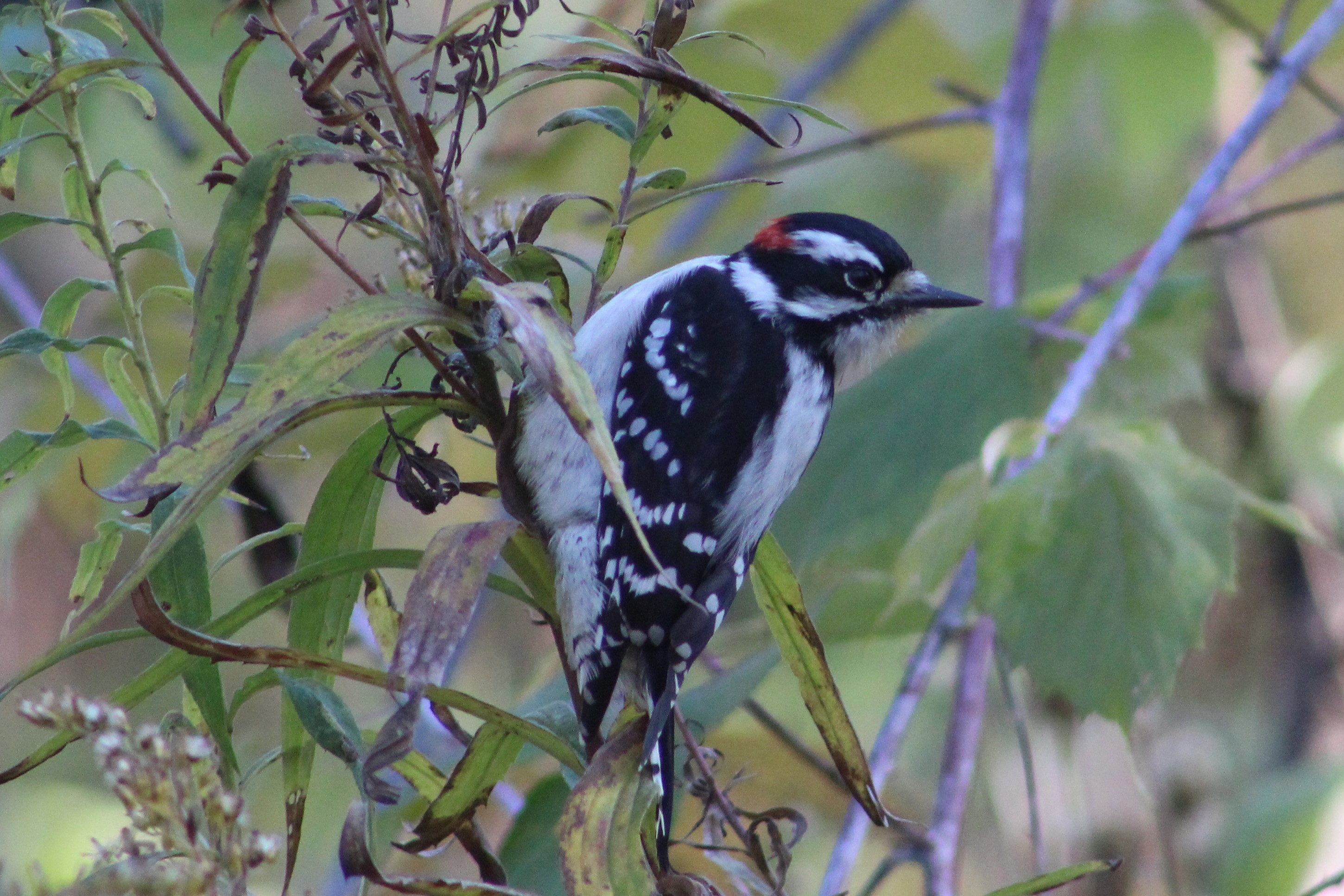
Along the trail on the way to the kart track we observed a small bird known as a Downey Woodpecker. They primarily eat ants and beetles and can often be seen pecking on trees in search of them. They supplement their diet with seeds and berries and this one was in the grass finding things to eat. In the winter they will also be seen at bird feeders eating suet. The small red dot on the back of the head marks this example as a male.

The North Halton Kart Club was founded in 1959 with only three members but they were off to the races and had 30 members by the following summer. This allowed them to rent a piece of land from a farmer in Limehouse and build their first peanut-shaped track which is marked in yellow on the Google Earth capture below. The track was originally unpaved but that only lasted a few races before the members set about fundraising and donating to have it paved in the summer of 1960. The karts were maintained by their owners and had to meet strict inspection before being allowed onto the track. Their engines ranged from 2.5 – 12 horse power and could reach speeds of up to 60 miles per hour. A second track is outlined in orange while other points of interest are marked in blue on the picture below.

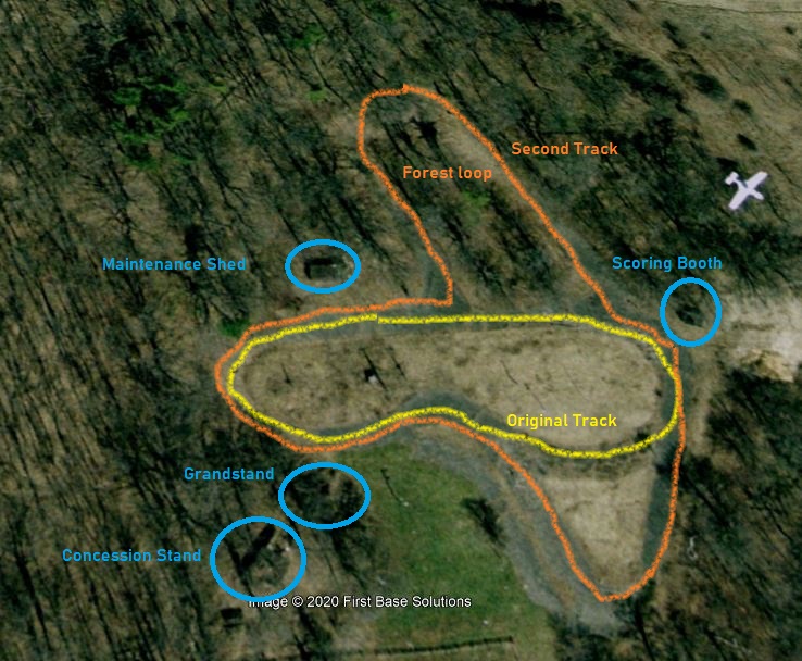
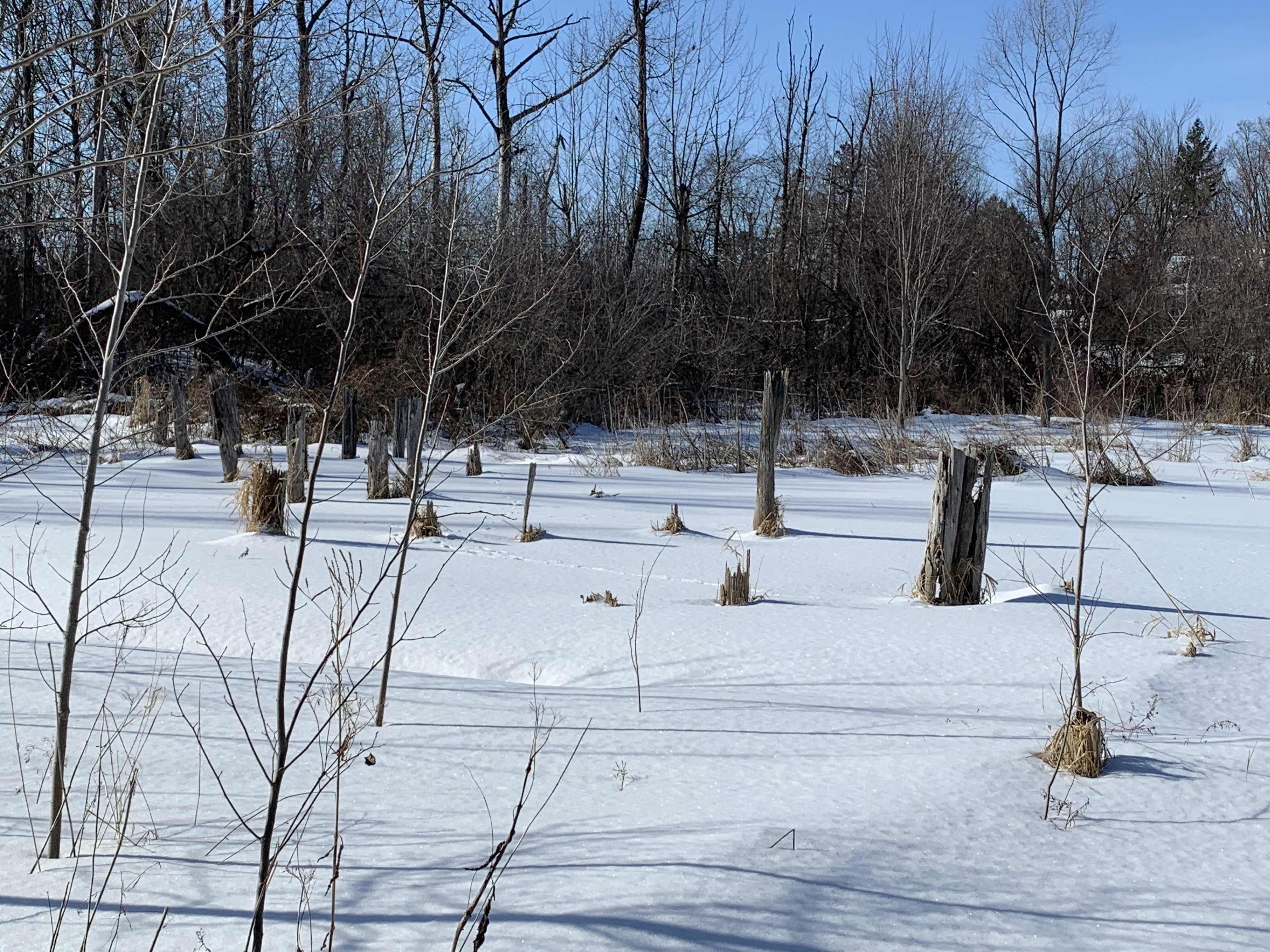
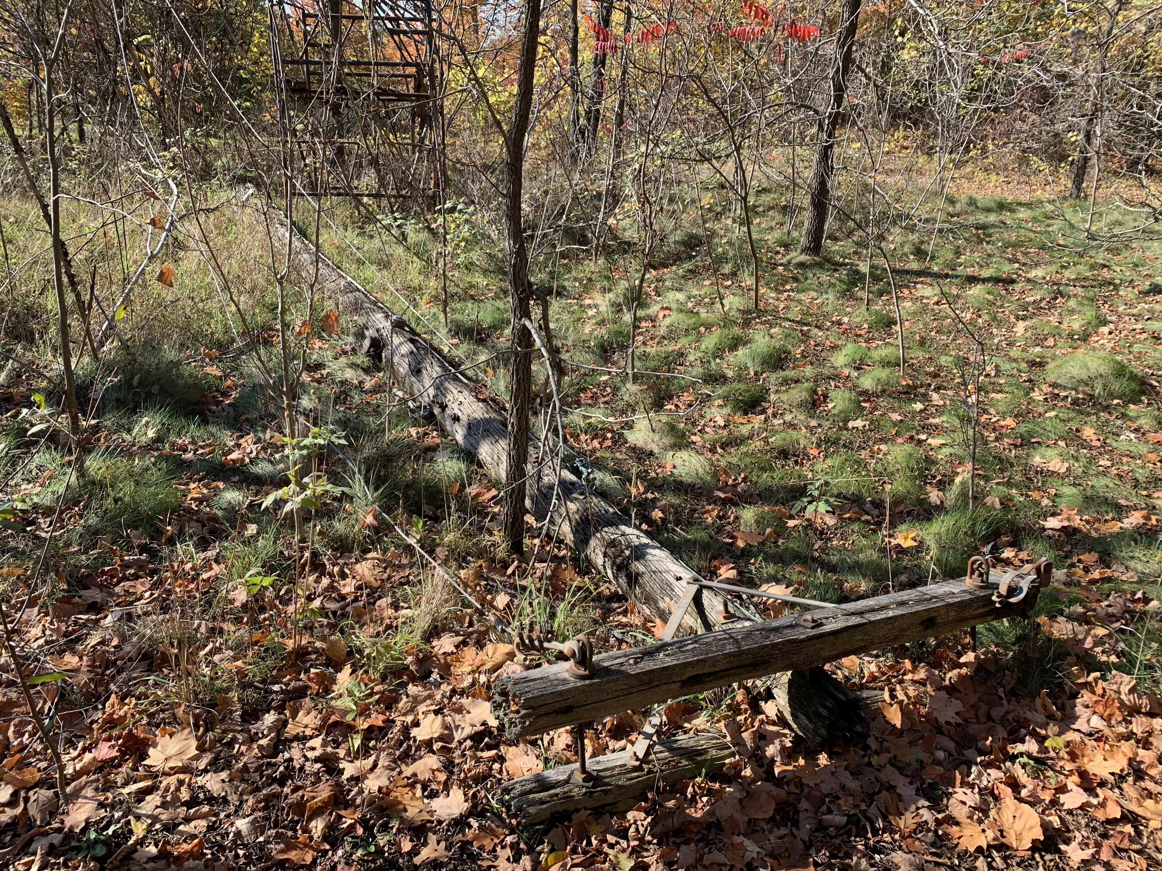
Races were typically run on Sunday afternoons between 2 and 5 and would provide an outing for the whole family. Even the children got to have their turn, some of them beating their elders. Today the track has become overgrown in most places and if you look carefully in the picture below there’s a downed power line crossing the track at about a driver’s neck level.

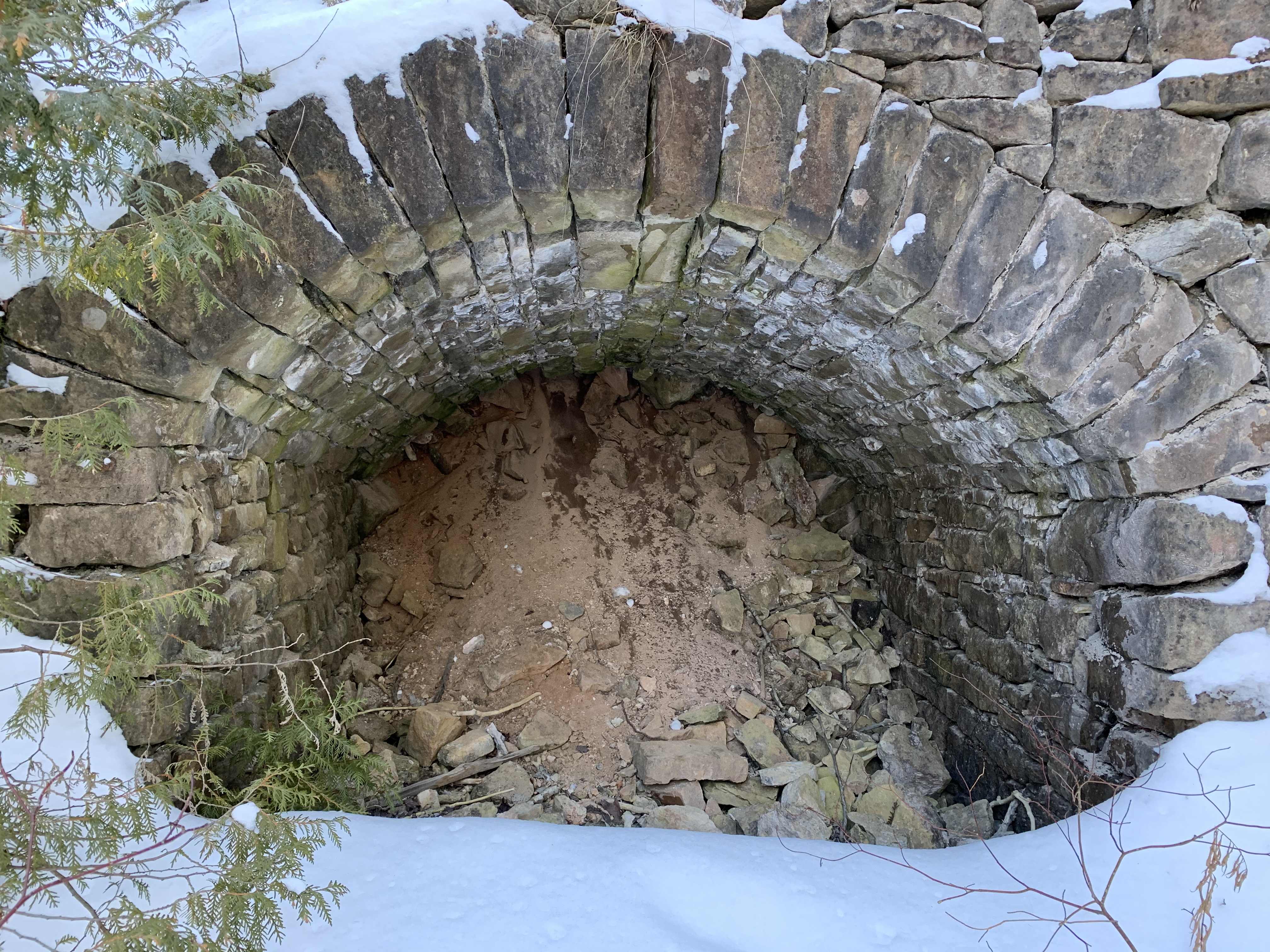
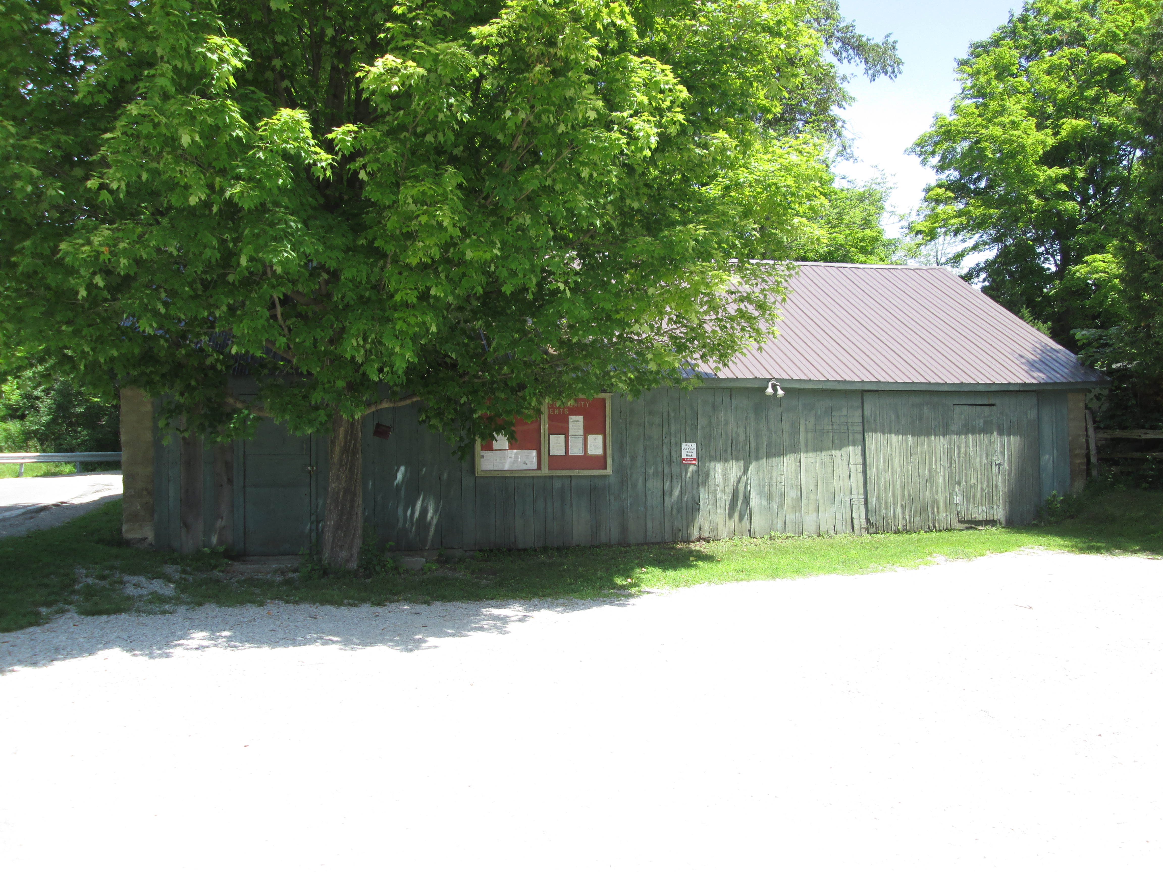
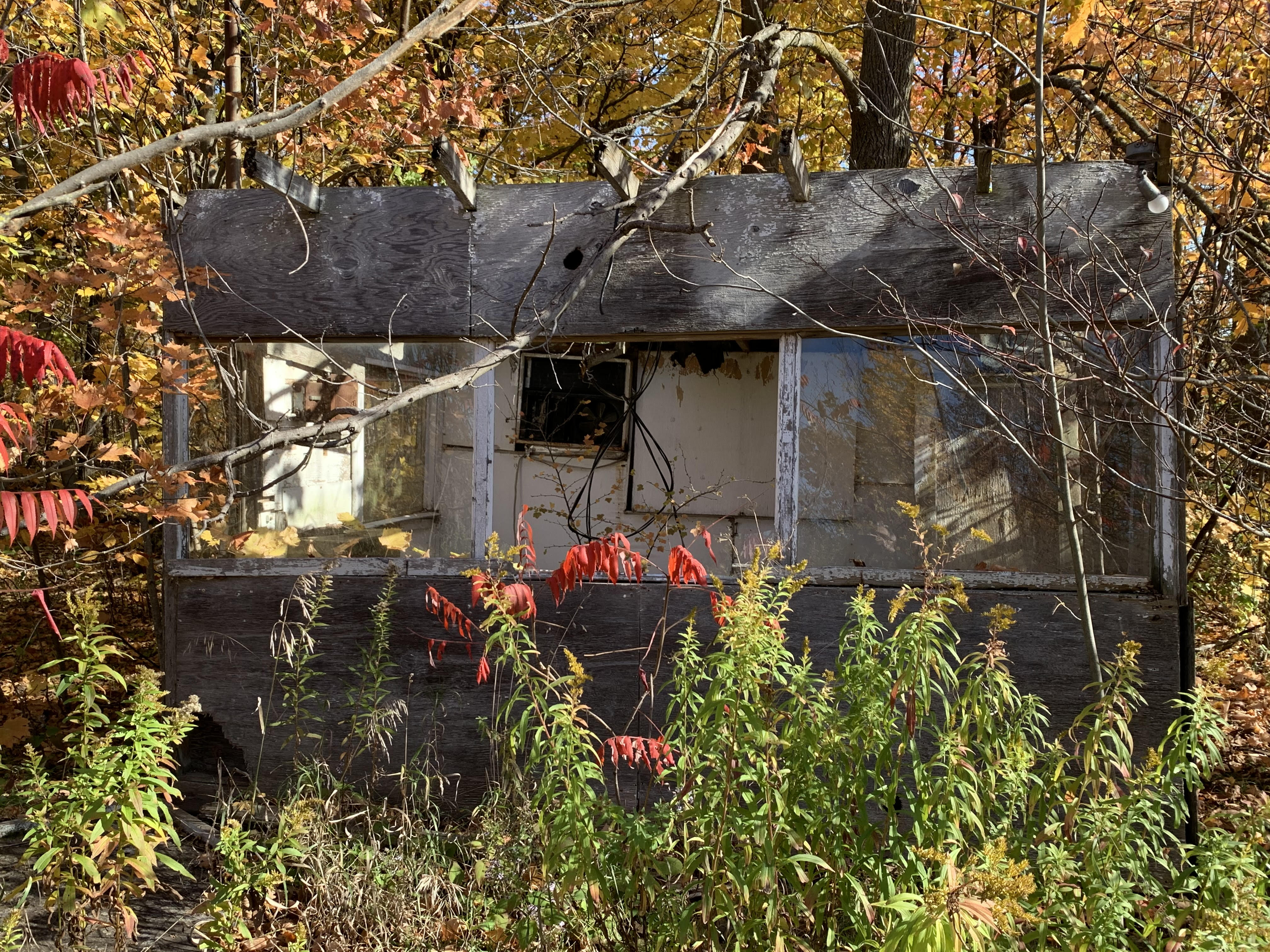
The scoring booth sat at the corner of the original track and is the best preserved of the remaining buildings on the site. With broken windows and a smashed in door the weather will soon take this structure down.

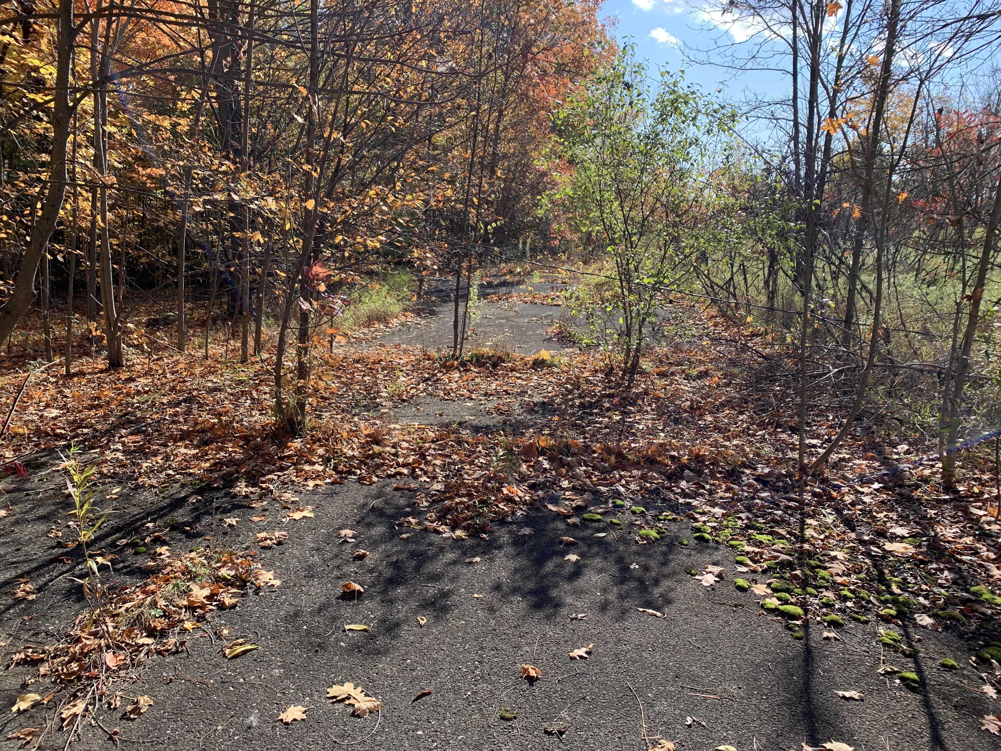
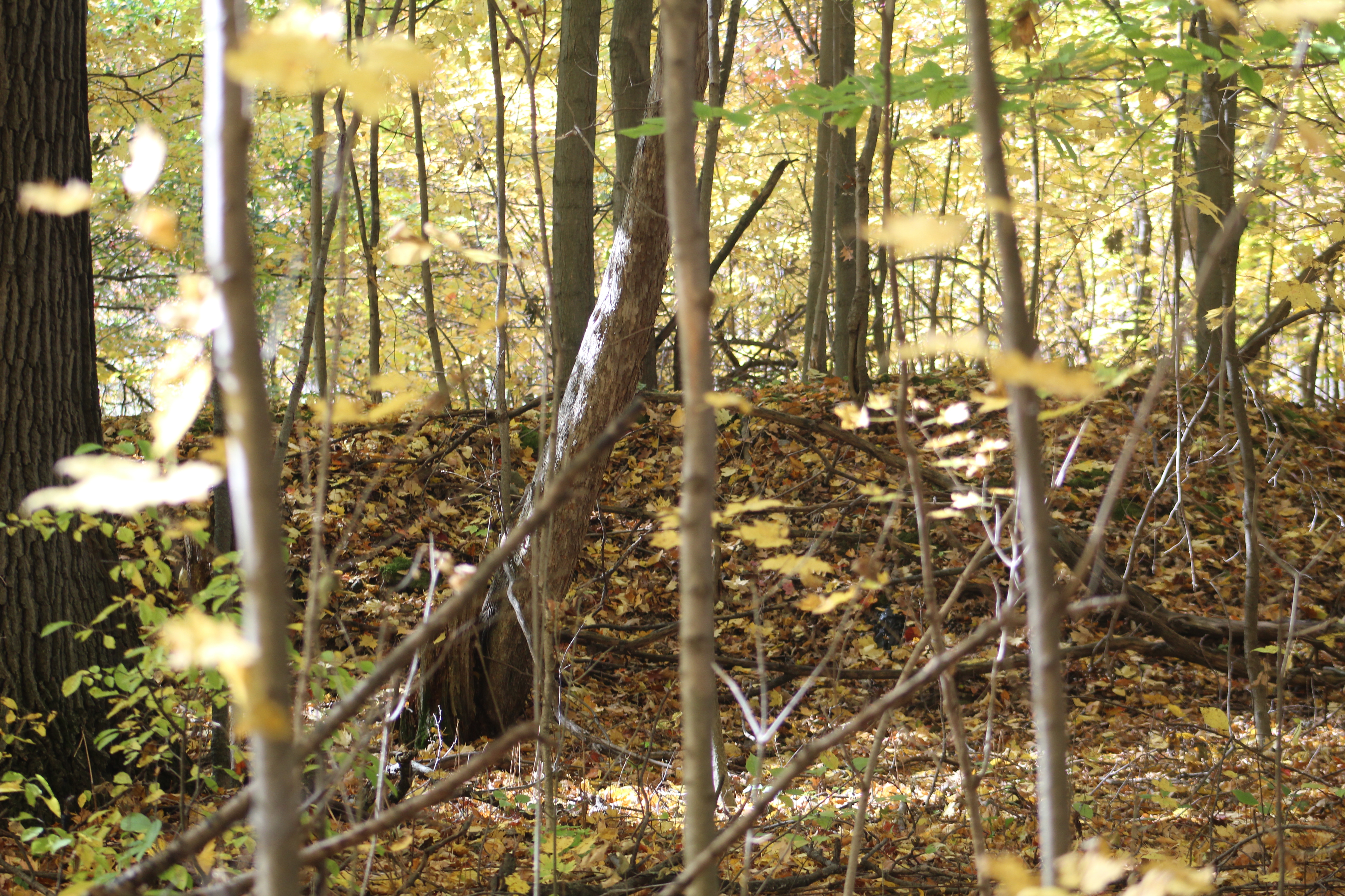
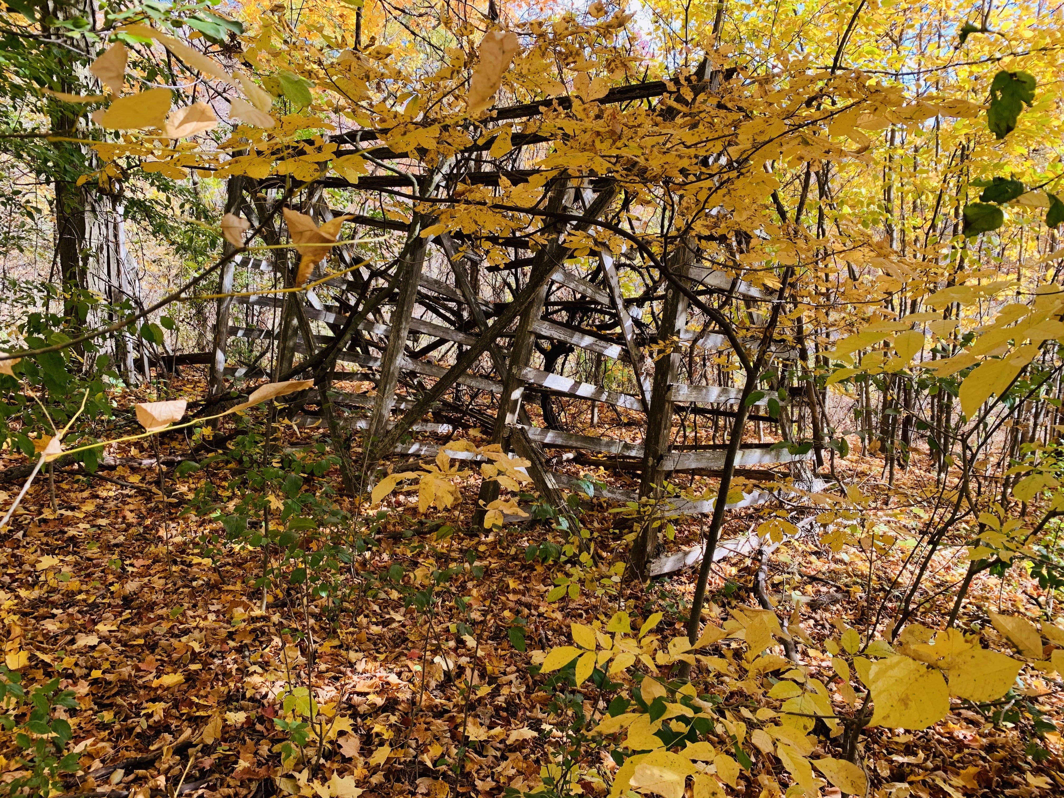
An expanded second track was built with a loop that extended into the forest and back again. Much of this track has been covered over with new soil, especially at the top end, but the asphalt is just a centimeter or two below the surface.

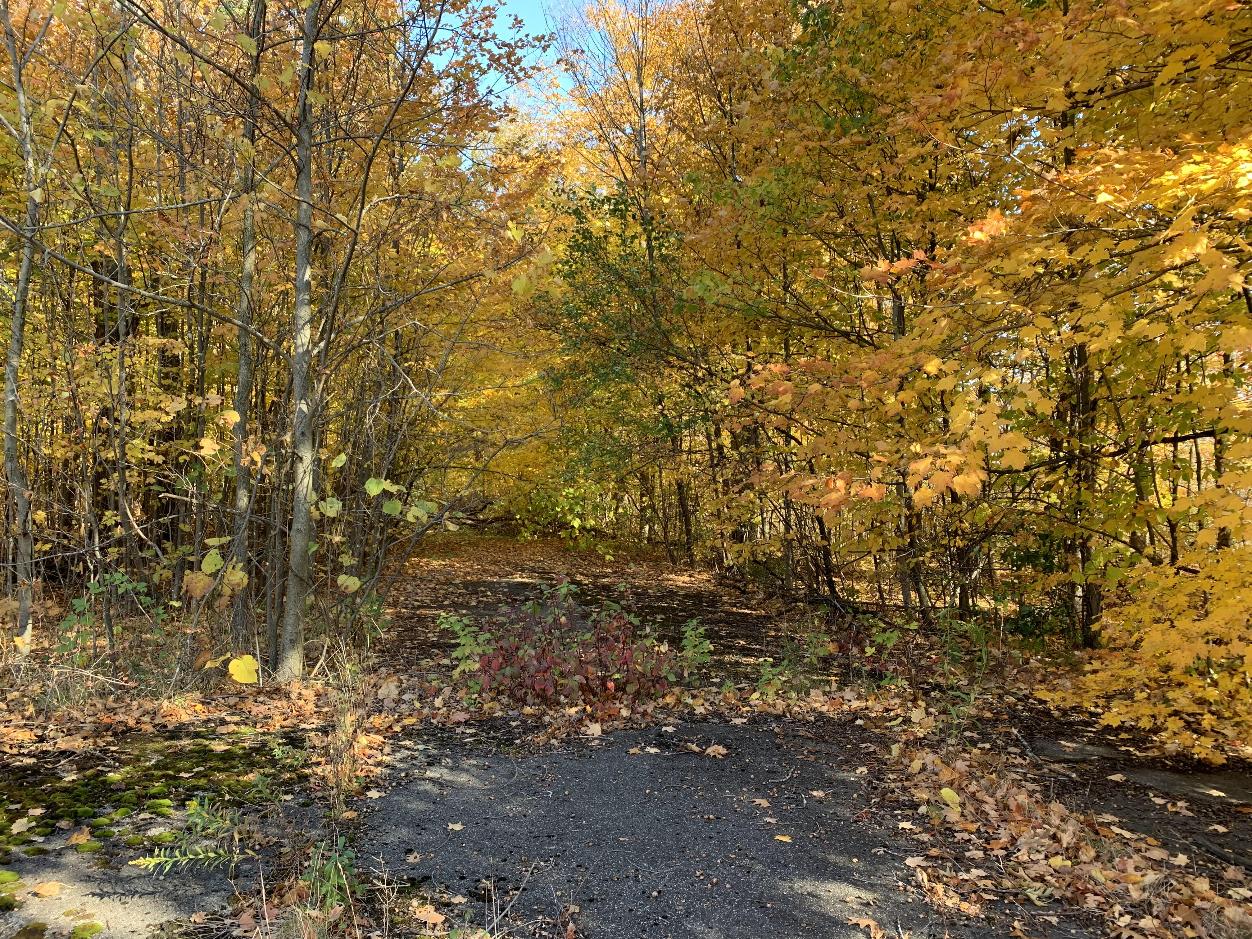
At the top end of the forest loop is a small berm that was built to help keep the karts from jumping the track. From behind the berm looking back toward the forest loop you can see the berm even more clearly.

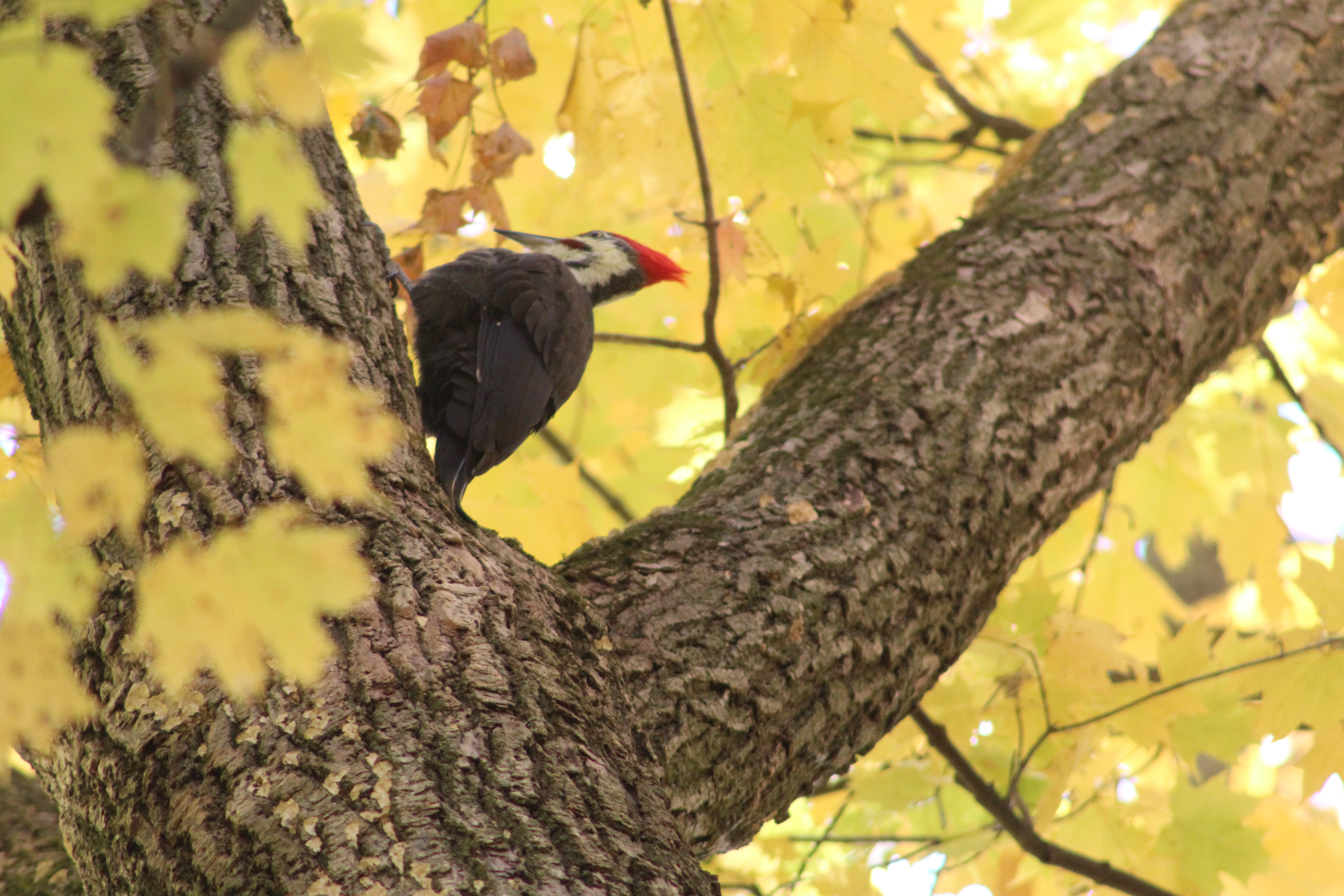
Walking into the trees behind the berm proved to be a good idea because we saw a Pileated Woodpecker ripping big chunks out of the sides of several trees as he searched for food. The small red stripe on the cheek near the beak marks this example as a male.

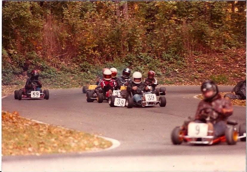
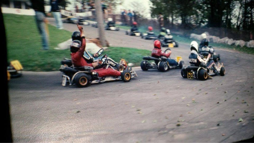
Terry Dalton was an active member of the North Halton Kart Club from 1978 until the end of the 1987 season when the track was closed for good. Terry provided me with some pictures that were taken when the track was in use as well as some valuable insight into what remains today. The picture below was supplied by Terry and shows karts coming back from the loop in the forest.

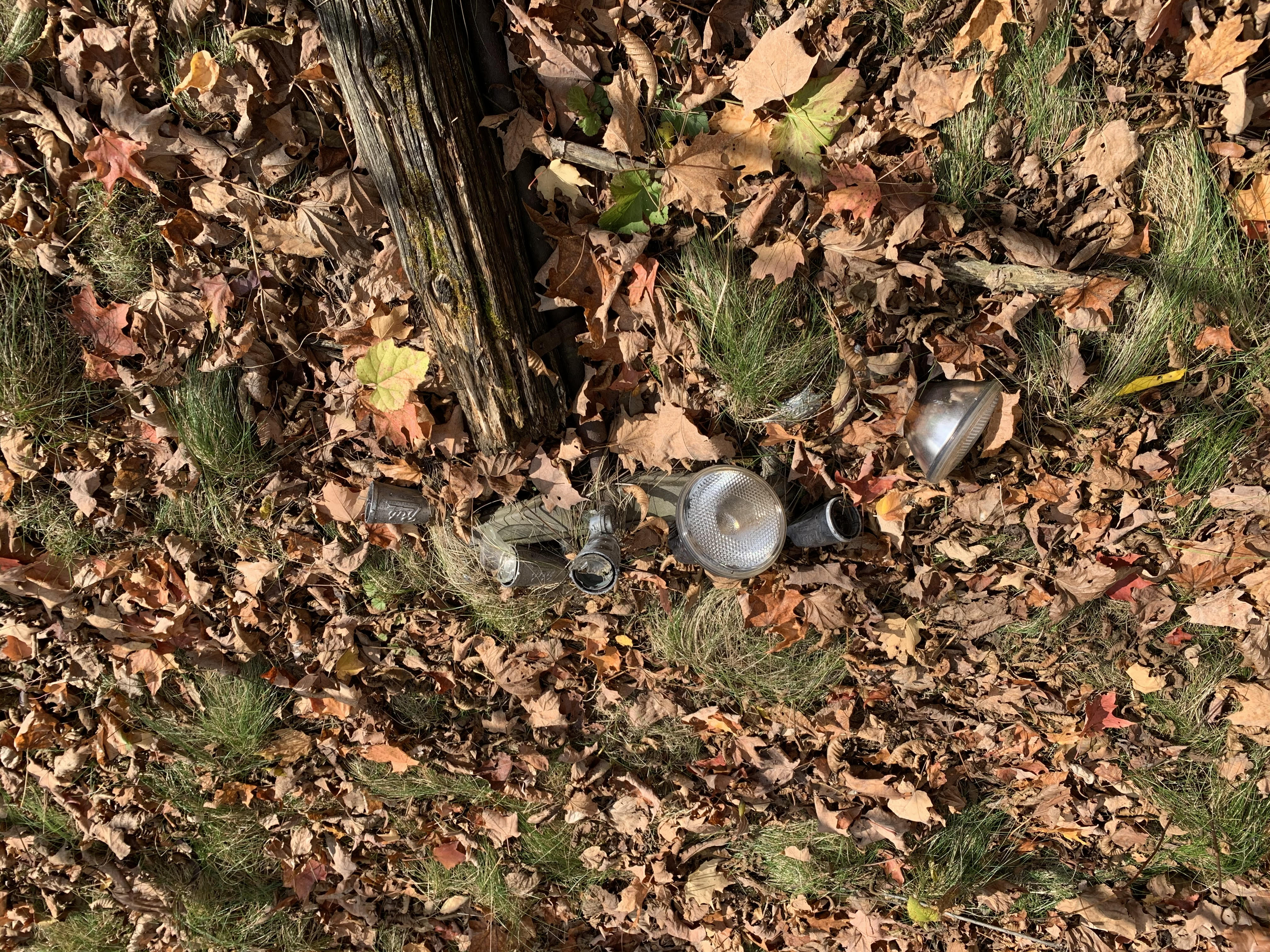
Scaffolding still stands in the centre of the track area but the power lines are down. Several lamp posts, which were installed in 1961, are on the ground as well. There are still a couple of loud speakers mounted around the area, including one near the old grandstands. The flag pole still stands in the middle of the site but the flag no longer waves. It’s interesting to note that when the park first opened the familiar Maple Leaf Flag wouldn’t be developed for another five years.

The grandstands used to provide seating for family members and guests to watch the races. Sometimes people would sit here and wait for their turn to take a few spins around the track. Today the seating faces the empty track but there is a new growth of trees that obscures the view. The grandstands appear to be one good windstorm away from falling over and perhaps those young trees are all that is holding it up these days.

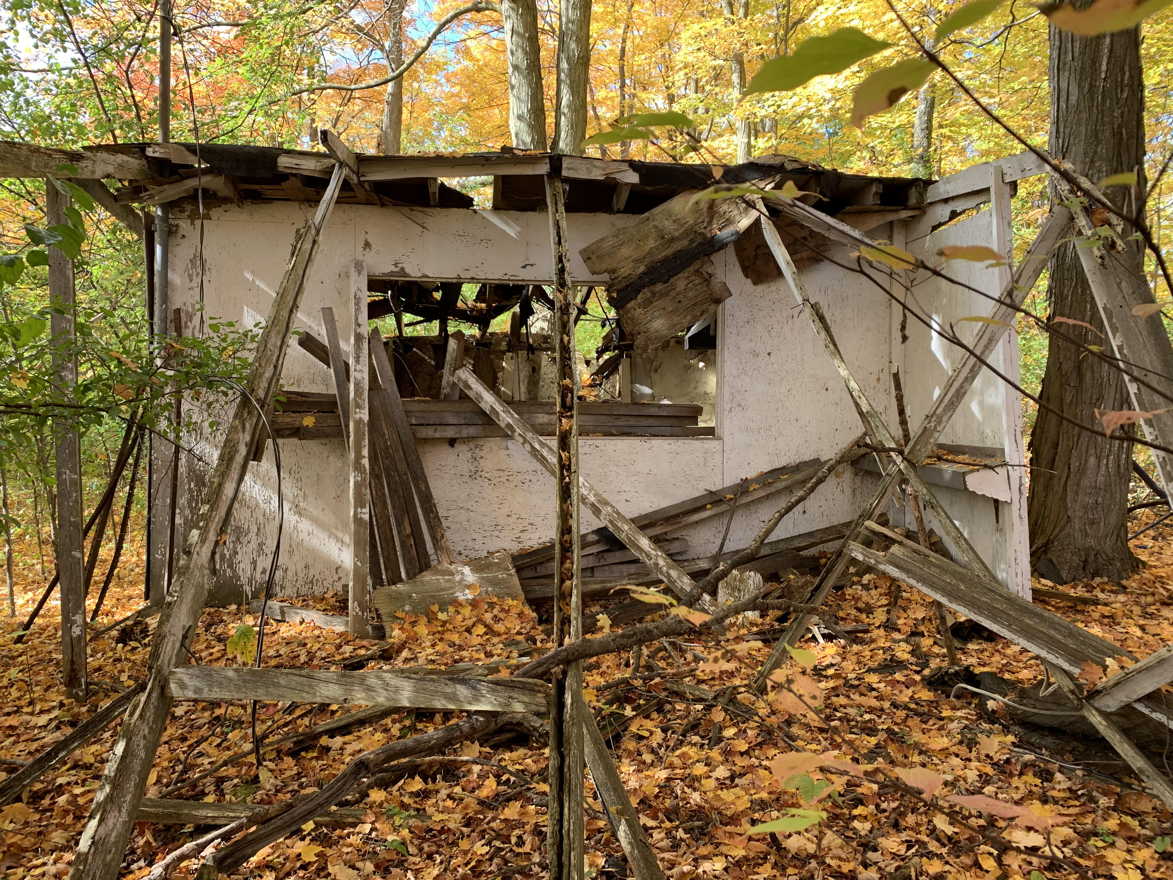
The snack booth stood just behind the grandstands and it is in bad shape. The front has fallen off as has part of the roof and one side. Looking through the missing wall you can see the hood from the grill where food was prepared for those who were watching the day’s entertainment. There was a red squirrel standing in the window frame chattering at me like a server but the days of hot food, cold drinks and salty snacks are long gone.

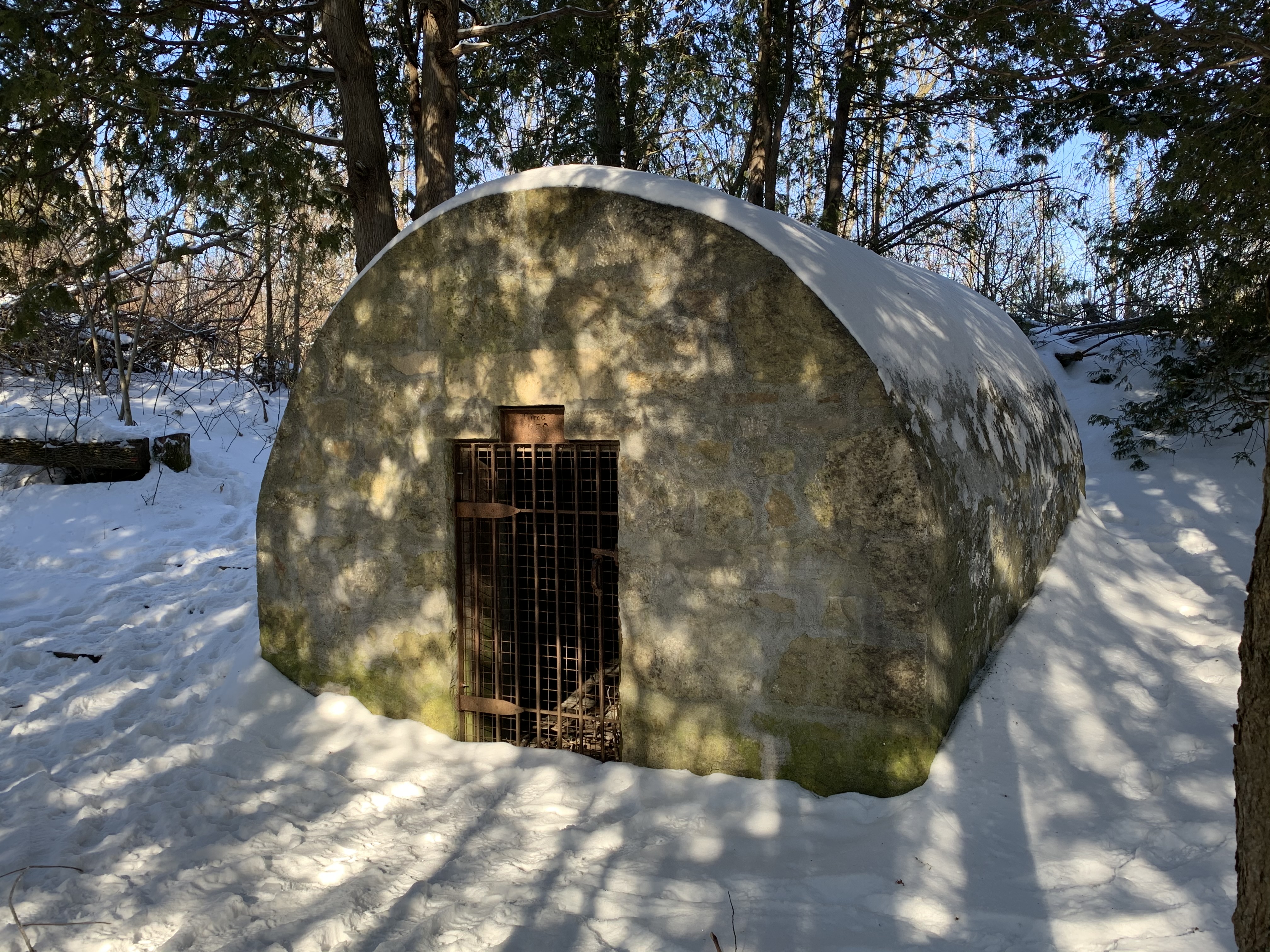
The Maintenance Shed needs a little maintaining of its own. The back wall has fallen out of the building exposing a storage shelf of paint cans. The roof is gone and it too looks like it will be laying on the ground before too many more seasons pass by.

Below is another photo of the track when it was in operation which gives the area a bit of context. Once again it was provided by Terry Dalton who is in cart number 68 getting ready to round the turn and head toward the scoring booth.

In 1987 the property owners decided that the liability insurance the club carried was inadequate and attempted to force them to increase it. This was more than the club could afford and so at the end of the season a 27-year race to have fun came to an end. The lights were switched off for the last time and the 33 winters since then have taken their toll on everything.

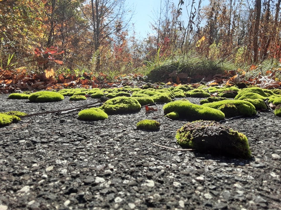
It is said that the North Halton Kart Club attracted people from all over including many who were not regulars to the club. Paul Tracy and Scott Goodyear are reported to have raced there during their early years behind the wheel. Today, kart racers have to attend other tracks scattered around the province. Ironically, one of these tracks is at Mosport while the old North Halton Kart Klub track is looking more like mossport since nature has been working on reclaiming it.

This site provided one of my personal favourite explorations since the pandemic started and we began to visit forestry tracts and nature reserves instead of the busier trails.

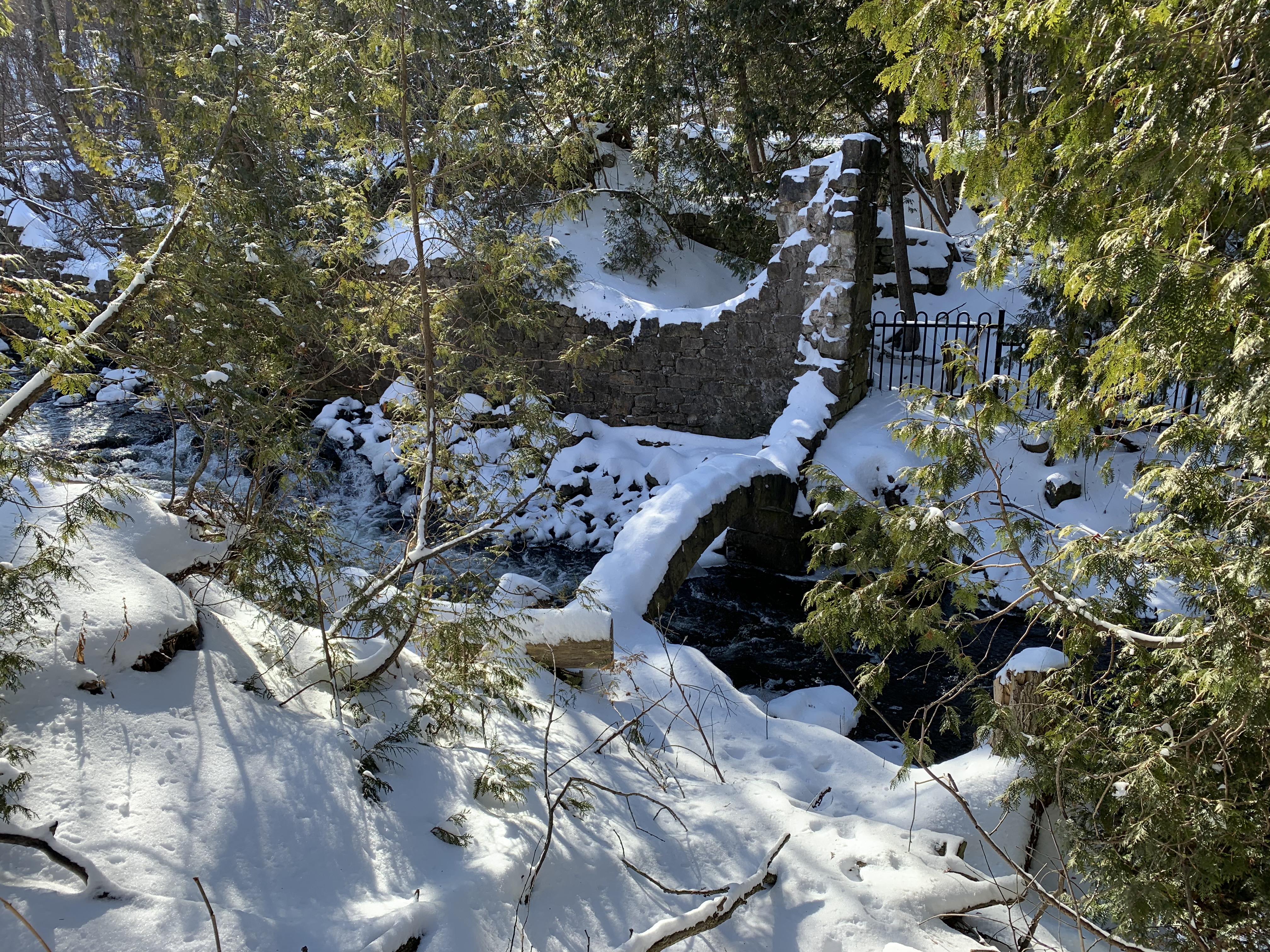
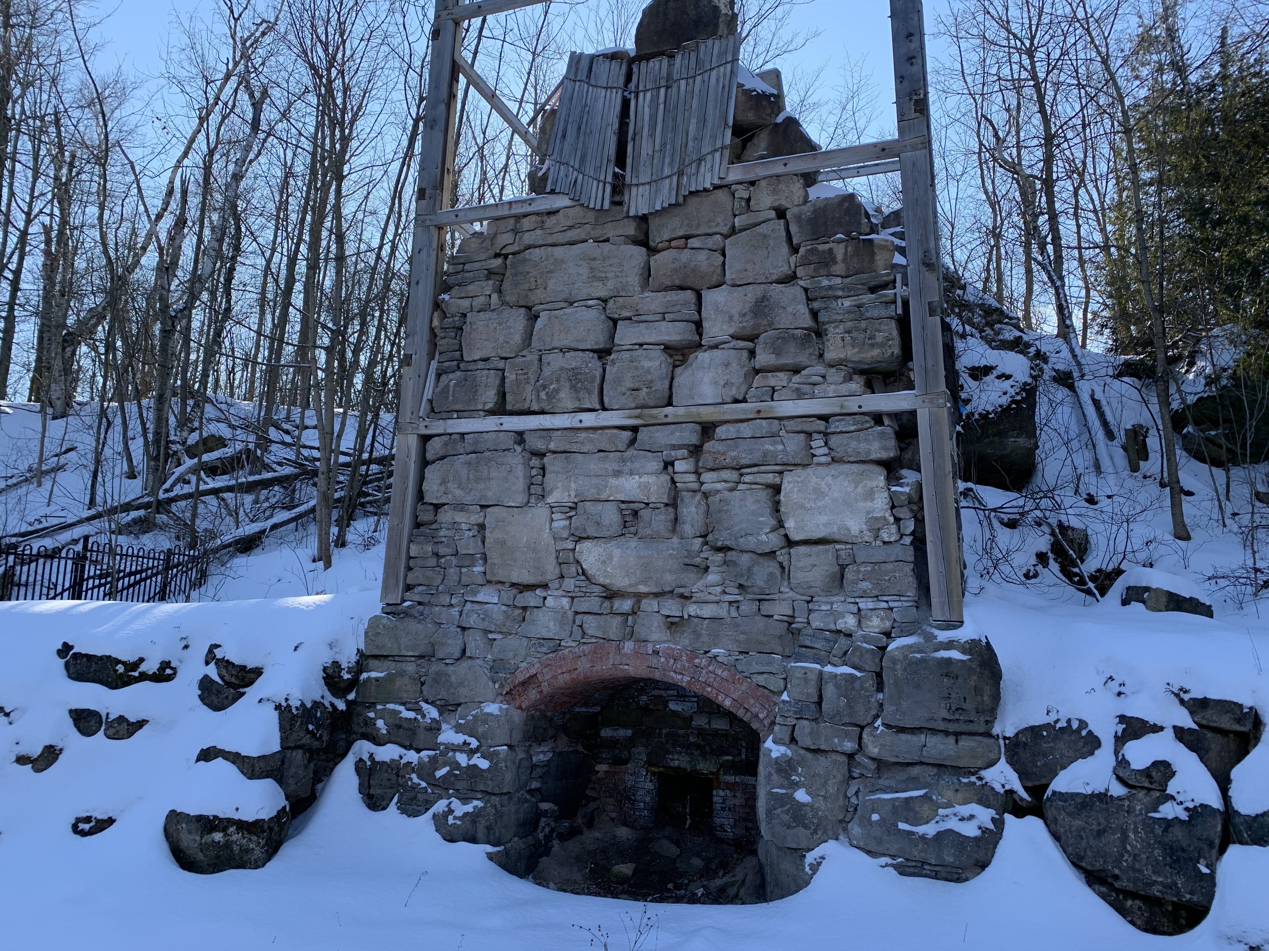
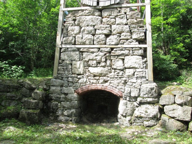
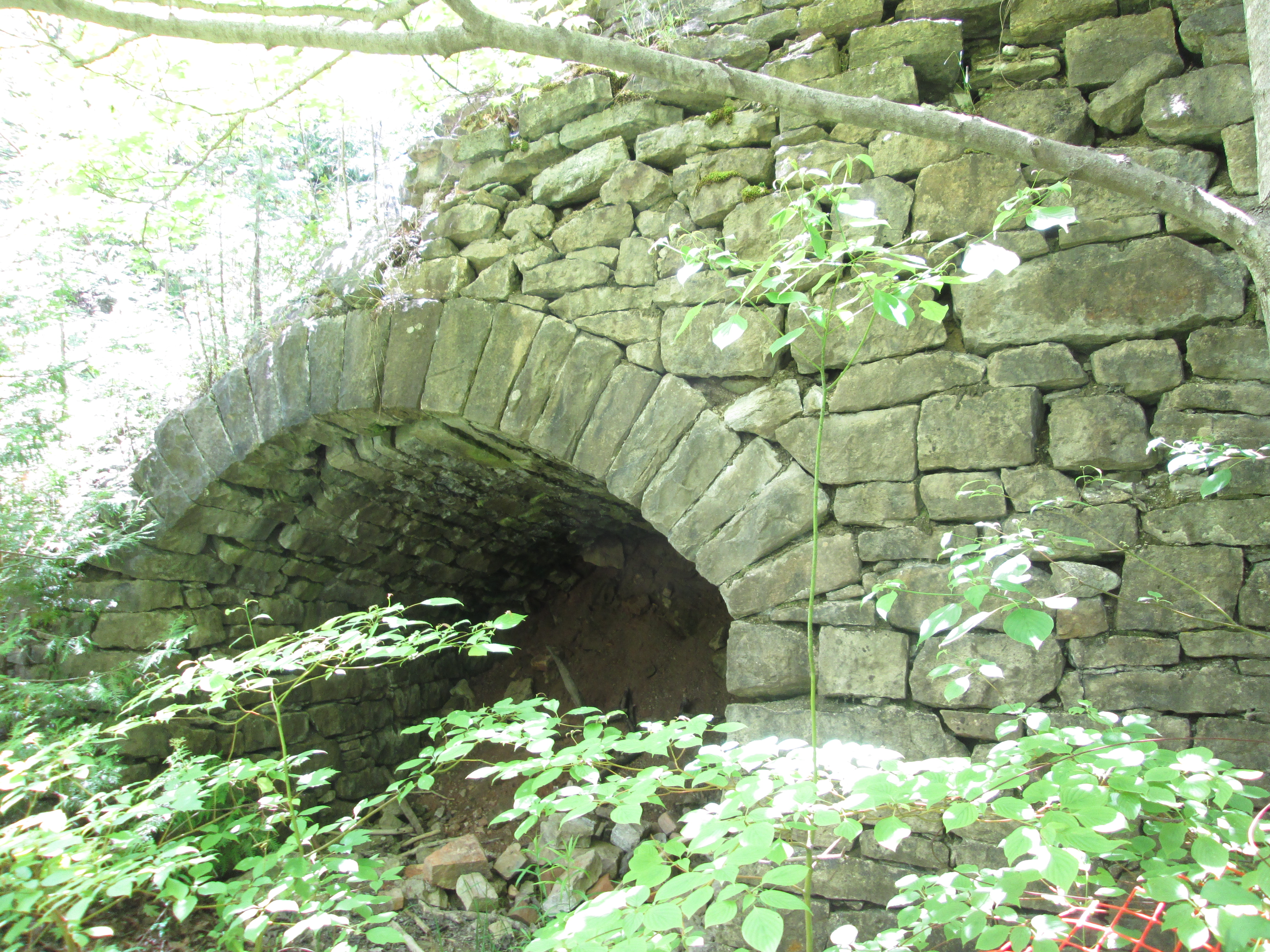
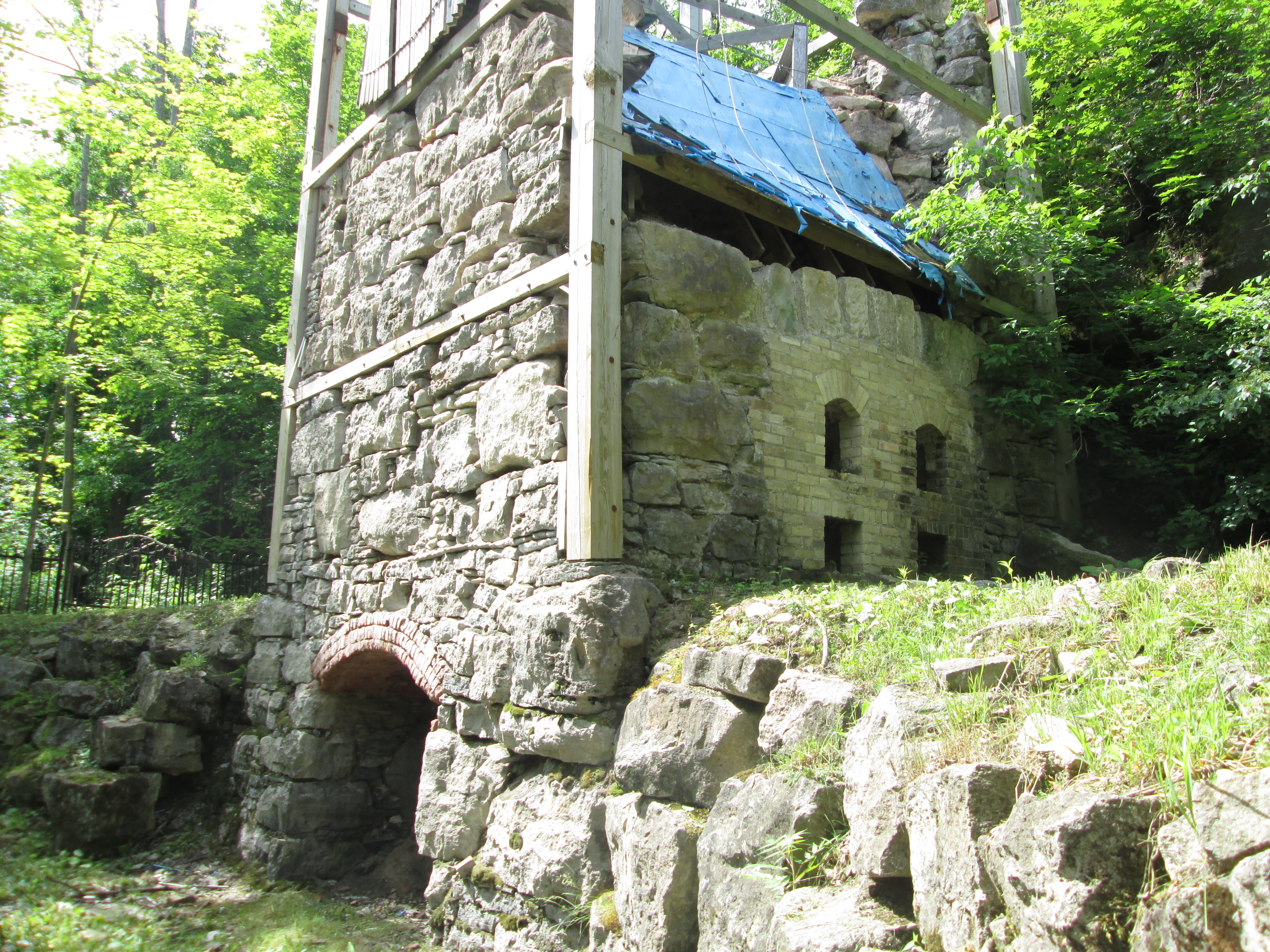
Be sure to check out other sites while you are in the area. The Hole-In-The Wall and the Limehouse Kilns can be explored together.

Google Maps Link: Limehouse Conservation Area

Like us at http://www.faceboof.com/hikingthegta

Follow us at http://www.hikingthegta.com

Also look for us on Instagram

Hole In The Wall

Saturday, February 6, 2020

Saturday proved to be one of the coldest hike days of the year so far and we determined not to set ourselves up for too long of an excursion.  Arriving with two cars, we parked one beside the town hall in Limehouse.  The second car we moved to the point where the Bruce Trail crosses the 4th Line.  With fresh snow on the ground, it is always interesting to see the tracks of the animals we share the trails with.  This small set of tracks includes drag marks from the tail of the mouse that made them.

IMG_0633

The Bruce Trail is a resource that many people seem to ignore in the winter months but each season has its own special beauty.  We saw very few other people until we reached the Limehouse Conservation Area, where dog walkers were taking advantage of the sunny day.

IMG_0639 (1)

The first school in Limehouse was one room made of log construction.  It was replaced in 1862 with a one room stone building.  When the lime industry was prosperous the town grew fast so that by 1876 there were three hotels and three general stores.  That year, 4,130 tons of lime and lumber was shipped from the railway station in town.  A second floor was added to the school in 1875 but it was only used until 1890 when it was closed.  The room was opened again in 1954 and remained in use until 1962 when the school was replaced with a new one.  Today the building serves as a private residence.

IMG_0636

Eastern gray squirrels can move quickly when they are caught by surprise and are capable of clearing surprisingly large distances with each leap.

Resized_20200208_121253

Acidic water breaks down carbonate rocks such as limestone by dissolving them.  This process is known as karst and is common throughout the Niagara Escarpment.  For more detailed information and pictures of this please visit our post on Eramosa Karst.  At Limehouse the Bruce Trail passes through a section of karst known as The Hole In The Wall.  Stairs allow you to access the bottom of these cracks in the limestone.

IMG_0645

The cover photo shows the depth of the karst at Limehouse.  Small caves throughout the area are some of the most accessible caves in Southern Ontario.

IMG_0652

In 1917 the Toronto Suburban Electric Railway arrived in Limehouse with a stop on the 5th line at the foot of what is locally known as Gibraltar Hill.  The stop was convenient because it was located between the school and the heart of town.  The old line can still be traced from Georgetown through to Guelph by looking at Google Earth.  The rail line passed through the middle of the mill pond on a trestle.  Three rows of pilings for the trestle can still be seen crossing the drained pond.

IMG_0659

The lime mill was built by John Newton who took the burnt lumps of limestone and ground them into powder.  This was then “slaked” with water and mixed with sand and cow hair.  The resulting mixture was used as mortar in construction.  The mill ruins and the remains of the stone arch from the tail race are all that is left.  These have been deteriorating from people climbing on them and the arch has lost several rows of stones.  They have now been protected behind a recently installed fence.

IMG_0660

The big innovation in lime kilns came with the creation of the draw kiln.  The draw kiln at Limehouse was 16 metres high when it was completed in the 1860s.  It has since collapsed considerably in spite of restoration efforts.  Several of these kilns can be found scattered across the Ontario landscape, including two near complete ones at Kelso.

IMG_0668

The earliest kilns were set kilns where the limestone was placed in the kiln and packed in with wood.  Burning would take days and then it would be allowed to cool down before being unloaded.  There is a strip of seven set kilns that were built in the 1840s.

IMG_0670

The powder house was added in the 1850’s to provide storage for the blasting powder that was used to break up the larger chunks of limestone.  Blasting was discontinued around 1917 as the quarry had expanded to the point where the local residents feared the explosions would damage their homes.

IMG_0675

Limehouse is one of our favourite places to explore because there is so much history that has been retained.  Fortunately, the local historical society is actively working on preservation of the kilns.

Read our other Limehouse blogs: Limehouse and The Bruce Trial – Limehouse

Google Maps Link: Limehouse

Like us at http://www.facebook.com/hikingthegta

Follow us at http://www.hikingthegta.com

Look for us on Instagram

The Bruce Trail – Limehouse

Saturday, August 11, 2018

The Bruce Trail has many side trails which form little loops along the way, especially in The Toronto Section where side trails account for 60 kilometres compared to only 50 kilometres of main trail.  This makes for a nice change of scenery if you are doing a one car, return hike.  We set out to hike from the parking place on the Sixth Line, north of 22nd Side Road, into Limehouse and back doing the Ridge Side Trail and Todd Bardes Meadowland Side Trail along the way.  A severe limitation to the Bruce Trail App in combination with my iPhone is the extreme drain on the battery.  I was forced to switch it off after only 8 kilometres because the battery was down to 1%.   I have since learned that using airplane mode and low power can help resolve this if I want to map hikes for the sake of a blog.

Limehouse Trail

The trail starts off along a beautiful boardwalk through the woods which were surprisingly free of mosquitoes on this morning.  There was also a stillness to the woods as the birds were quiet.  The trail leads almost directly from the sixth line to the fifth where you are forced onto the road for half kilometre or so.

IMG_6027

Hemlock Varnish Shelf is growing along this fallen tree.  This fungus starts off as a small red nub on the side of the tree and grows into the familiar conk shape.  When it is young it has a brighter red colour and a varnished look to it.  The outer edges will be yellow or white but as it ages over the summer it changes to a more even rusty colour extending to the edges.  These fungi are known as polypores because they have multiple small tubes or pores on the underside of the fruit body that release the spores.  This group of fungi is key to the breaking down of wood and are key in the nutrient cycle of the forest.  Polypores are often used in traditional medicine and science is studying the Hemlock Varnish Shelf for potential uses in cancer therapy.

IMG_6046

As this hike progressed it became obvious that there was an extremely large variety of mushrooms growing along the trail.  Every time we hike there is always something interesting and unique about the area we’ve selected.  This time it turned out be the fascinating colours and forms of the fungi we encountered.  Giant puffballs grow along the trail in several places and are one of the prized edible mushrooms.  They grow from August to September and can grow to 20 inches or bigger.  They can be pan fried or battered and fried in slices.  The spores form inside the mature ball and are released in a “puff” when the skin cracks at maturity.

IMG_6065

As the puff balls mature they turn yellow and the skin cracks to release the spores.  The inside turns from white to grey or dark yellow of the puffball spores.  It has been estimated that an average size puff ball can contain up to 7 trillion spores.

IMG_6063

Oyster Mushrooms are considered to be one of the choice edible ones.  They need to be collected when they are young before the flesh becomes tough and woody.  Many Asian cultures use them extensively in cooking and they are cultivated in parts of India.

IMG_6042

There were several places where Scarlet Fading Waxy Cap mushrooms were growing.  As this mushroom matures the scarlet fades to orange or yellow.  The cap is deeply convex with an incurved margin.  It is one of the edible mushrooms however it is reported to be flavourless so it may be best used in a soup or chili.

IMG_6043

Several types of artificial bee habitats have been set up in places along the trail.  These ones are known as mason bee tubes.  This type of bee habitat can be a fun home project to make as a way to encourage the survival of the honey bee.

IMG_6066

The bees still seem to prefer their own handy work in building their nests but the similarities to the mason tubes is interesting.

IMG_6291

A good example of a mushroom that may be edible or may be a poisonous one is seen below.  If this is a Jack O-Lantern it is poisonous but because it is growing singular instead of in a cluster it is likely a Chanterelle which is edible.  Either way, the gills under the cap make this an interesting looking mushroom.

IMG_6033

The Yellowish-White Melanoleuca is also an edible mushroom but there is a very similar mushroom that is poisonous.  The Entoloma species look almost identical but have very different spores that allow them to be distinguished.  Due to the fact that so many mushrooms have look-a-likes that are poisonous you should either be very sure of your identification or leave the plant alone.

IMG_6035

Having reached Limehouse, where a large collection of 19th century lime kilns are preserved we made our way back to the car.

Google Maps Link: Bruce Trail Limehouse

Like us at http://www.facebook.com/hikingthegta

Follow us at http://www.hikingthegta.com

Limehouse

Saturday June 20, 2015

It was a beautiful morning at 16 degrees with just a trace of clouds in the sky.  We set out for the village of Limehouse which is situated on the Black Creek, a tributary of the Credit River.

The village of Limehouse started off known as Fountain Green.  Limestone was easily accessed near the surface and was needed for mortar for construction materials.  By 1840 there were two separate lime manufacturing sites in the village.  When the Grand Trunk Railway came to town in 1856 the means of distribution came as well, and the industry expanded quickly.  Soon it was employing over 100 men in a 24 hour business.  The following year the town got a post office and took the name Limehouse.

The first mill in Limehouse was a saw mill built in 1820 and operated by Adam Stull.  The mill was owned by several people over it’s 120 year history before finally closing in the 1940’s.  The steel flume that carried water to the saw mill turbines is a later addition, likely sometime after 1900.

IMG_5732

The earliest lime kilns were the set kilns of the 1840’s which could burn 6 to 30 tons of rock in a 7 day cycle.  Lime would be added in along with wood and burned.  Wood had to be added through the sides for three or four days to keep the heat up.  The oven then needed a cool down period before the lime could be removed.  Set kilns were often built in rows or clusters. The one pictured below is part of a row which has two larger kilns on either end and five smaller ones in between.

IMG_5761

Blasting powder was used to break large chunks of rock out of the quarry.  Around 1850 a powder house was built in a slight depression on the quarry floor.  It was located here to limit the damage it would cause if there was ever an accident.  The walls are made out of limestone with a plaster coating on the outside.  Inside it would have had wooden shelves to store the dry powder on.  The powder house had deteriorated to half it’s height but was restored in 2004.

IMG_5636

Along the trail from the Powder House to the mill ruins grow woodland strawberries. Strawberries are members of the rose family and as such are not true berries.  Wild strawberry plants have been cultivated to grow the large plants with large juicy berries that we see commercially.  Wild strawberries seldom grow larger than 1 cm but they pack a lot of taste in a little bite.

IMG_5644

In the 1860’s a new style of kiln called a draw kiln was developed that could burn 6-18 tons of limestone per day.  The example in the picture below was 16 metres high and has four fireplaces on either side.    It was constructed of limestone masonry with a double layer of fire brick inside.  It took a day to heat the kiln up but after the interior was hot it could be run continually.  Limestone was fed in from the top, which was level with the edge of the quarry. The burnt lime was removed from the bottom of the kiln.  In 2009-2010 the fireplaces, where the fuel was burned, were restored but the fire brick lining from the stack of the kiln has since collapsed into them.  The rest of the kiln is braced to prevent further collapse until it can also be restored.

IMG_5666

Extensive ruins of the Lime-Mill cross the Black Creek just below the old mill pond.  The lime mill ground lime in much the same way a grist mill ground grain. This arch is an original feature of the mill race.  Older photos show at least two more rows on the top.  The Halton Hills Branch of the Architectural Conservancy Ontario asks that people please keep clear of the arch to assist in it’s preservation.

IMG_5685

The Widow Skimmer is a species of dragonfly found in Ontario.  The adult female has a yellow striped body and both sexes have black bands on the wings.  A dragonfly can be distinguished from a damselfly because it sits at rest with it’s wings spread open.

IMG_5691

In 1917 the Toronto Suburban Railway (TSR) came through Limehouse on the way to Guelph.  It passed over the mill pond and crossed the 5th line where there was a small station.  The railway was closed in 1931 and the railway pilings remaining in the former mill pond are about all that remains.

IMG_5700

Limehouse has a series of caves and cracks that have become known as the Hole In The Wall. We climbed in and out of them in several places.

IMG_5722

An upper mill stone, also known as a runner stone lays face down along the trail just beyond the mill ruins.  This stone was turned using the iron hook in the middle.

IMG_5749

The coach house behind the church likely dates to 1876 like the church building it served. Parking has always been a problem and is made even worse when your vehicle is a horse.

IMG_5772

The Methodist Episcopal Church in front of the coach house was built in 1876.  I can find no explanation for the word Horeb on the front of the church.  The Methodist congregation had been meeting in the Limehouse Presbyterian church which also housed the Episcopalian congregation before they moved into their own building.  The Presbyterian church was frequently referred to as the Limehouse Union Church, much like the chapel in Dixie.  We didn’t stop to photograph the 1861 Presbyterian church on the edge of town because of a two car crash in front of it’s cemetery.  I was in less of a hurry to get in than they were, or so it seemed.

IMG_5775

Limehouse had three hotels in it’s heyday.  The one in the picture below belonged to Miles Mcdonald who was a local carpenter.  He also built the Prebyterian church just up the street, helping it to open debt free in October 1861.

IMG_5779

The fire of 1893 that destroyed the woolen mill and blanket factory as well as a paint factory gave the town a major setback.  Lack of insurance led to the industries never being rebuilt.  The quarry was getting closer to the homes in town and so by 1915 the lime industry was closed down.  A major industrial hub was left to quietly decay.  The Credit Valley Conservation Authority purchased the area in 1967.  Since then they have begun raising funding for restoration with some projects already complete.  Interpretive signs are being added as well.

Like us at http://www.facebook.com/hikingthegta