Dec. 19, 2015
Revised Jan. 6, 2016
The Toronto Suburban Railway (TSR) ran between Guelph and Toronto providing commuter service until it was shut down and abandoned on August 15, 1931. Since that time the line has been dismantled and much of the right of way has been re-purposed, some of it as a hiking trail. We decided to visit a small section of the Guelph Radial Trail near Acton. We parked on the edge of town near where Mill Road has been closed off at the bottom end of Fairy Lake.
Mass transit in Toronto got started in 1849 when cabinet maker Burt Williams designed and built 4 horse drawn stage coaches which he operated from St. Lawrence Market to The Red Lion Inn in Yorkville. On Sept. 11, 1861 the Toronto Street Railway began with a similar route and made some expansions over a 30 year franchise it held with the city. In 1891 a new 30 year franchise was granted to the Toronto Street Railway under William Mackenzie and James Ross who agreed to eliminate horse drawn buses as part of their deal with the city. Over the next 30 years the city annexed large areas and was unable to force the Toronto Street Railway to service them under their contract. When the contract expired in 1921 the city created the Toronto Transportation Commission (TTC) to operate mass transit.
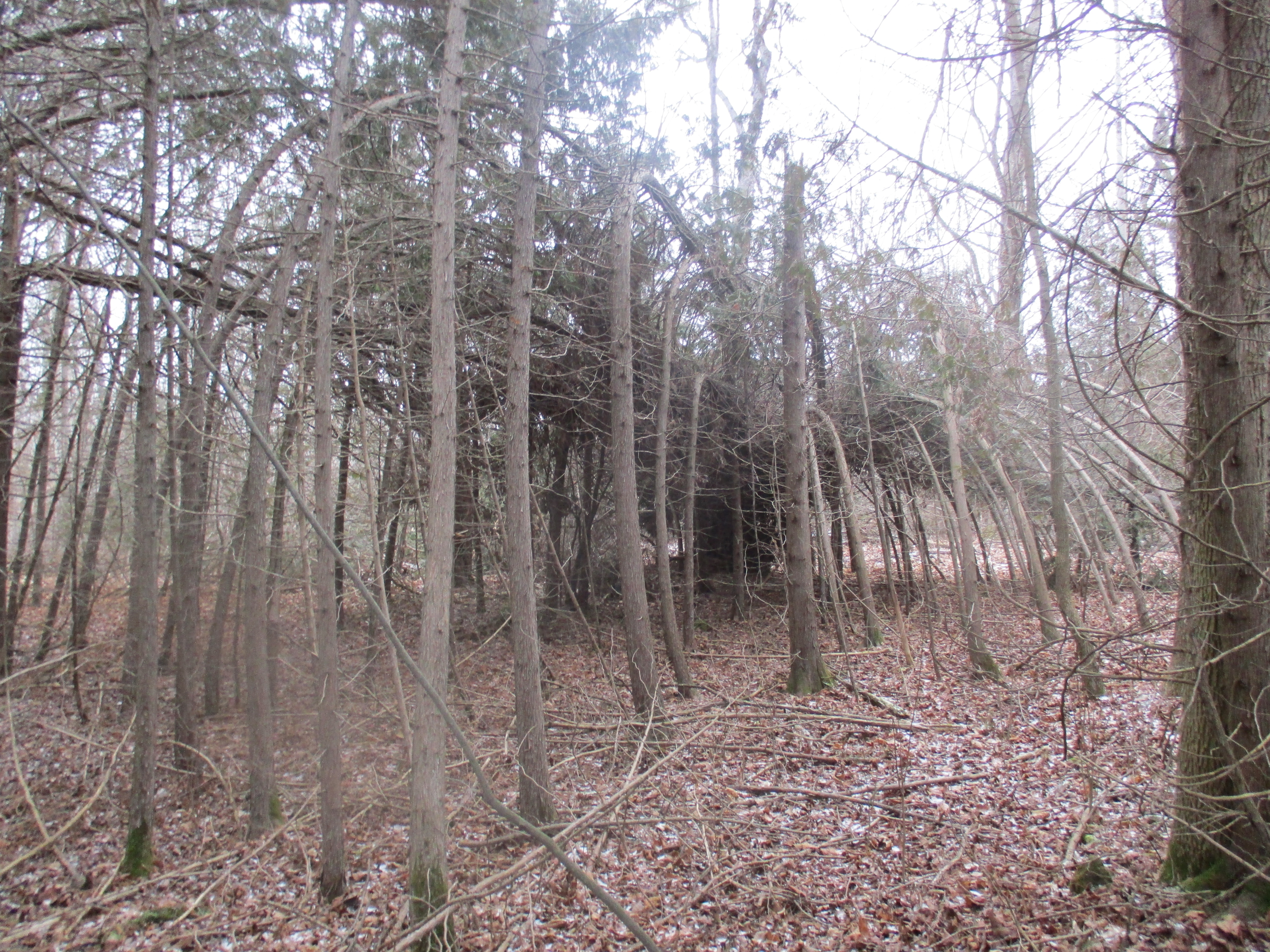
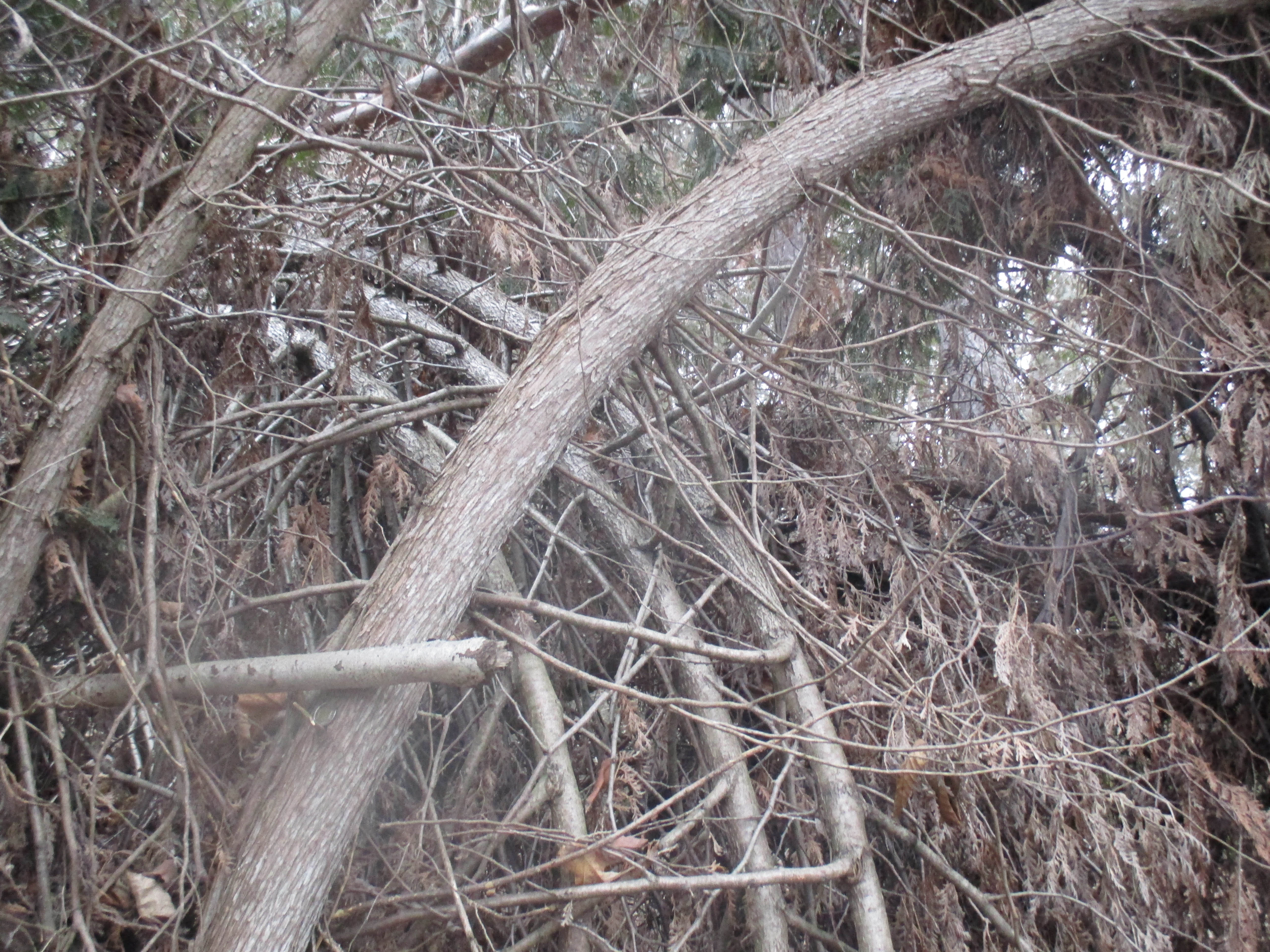
The first trail to the left takes you to the Guelph Radial Trail but first passes through a wooded area where we noticed an odd patch of trees. There are bent trees throughout the woods but we found one spot where they all appear to have been taken from a large oval and tucked into a knot the middle.
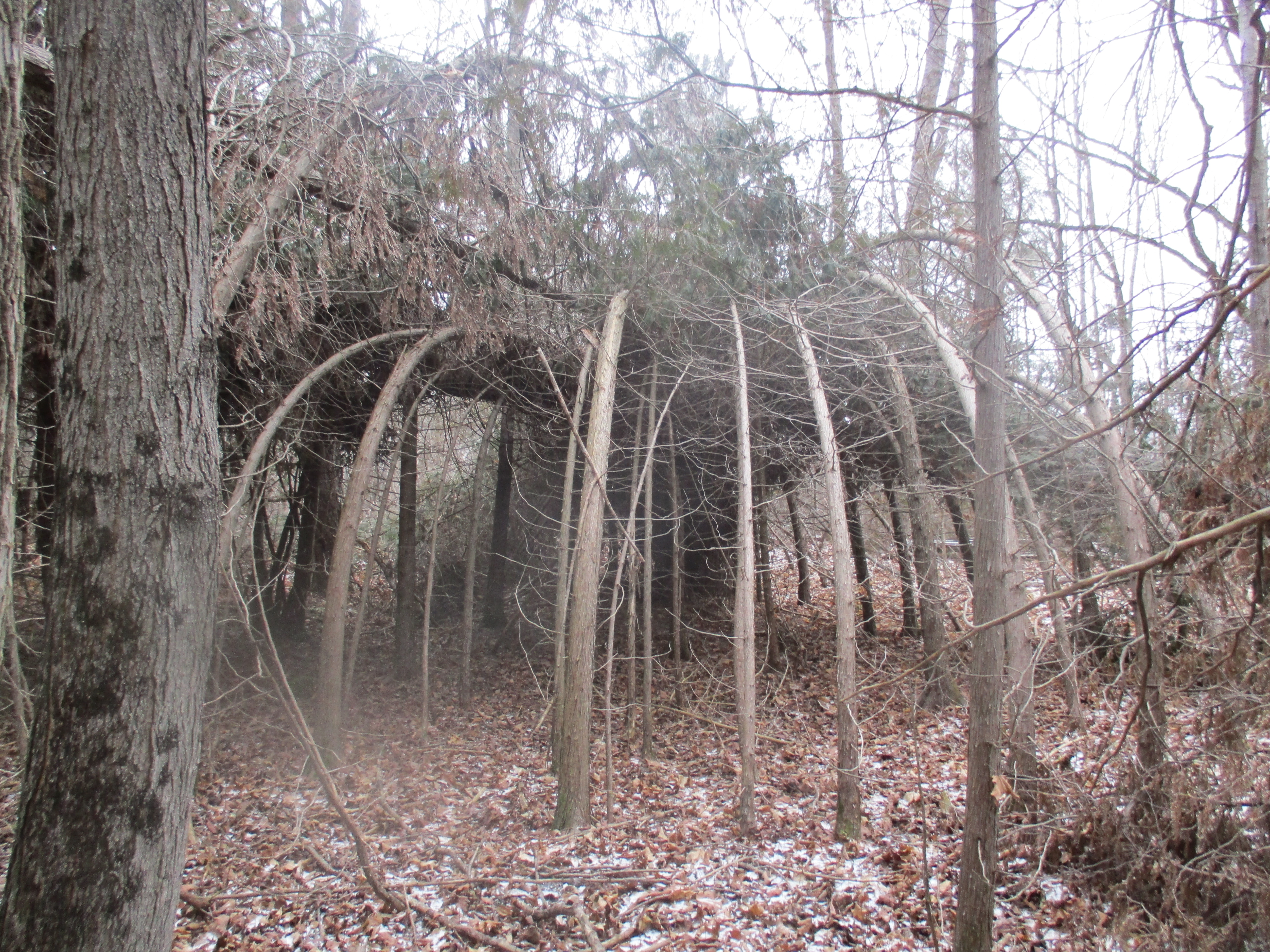
I had originally thought this looked like a circular cluster that had been produced by a spinning wind event but could find nothing on record. A local resident confirmed that the ice storm of Dec. 22, 2013 had, in fact, caused the cedars to bend over to the ground where they stayed until the spring. Some recovered but many didn’t leaving this reminder of just how powerful the weather can be. This individual and his son, like countless others, helped clear the trails in the aftermath of the storm. The long side of the oval is seen in the picture below.
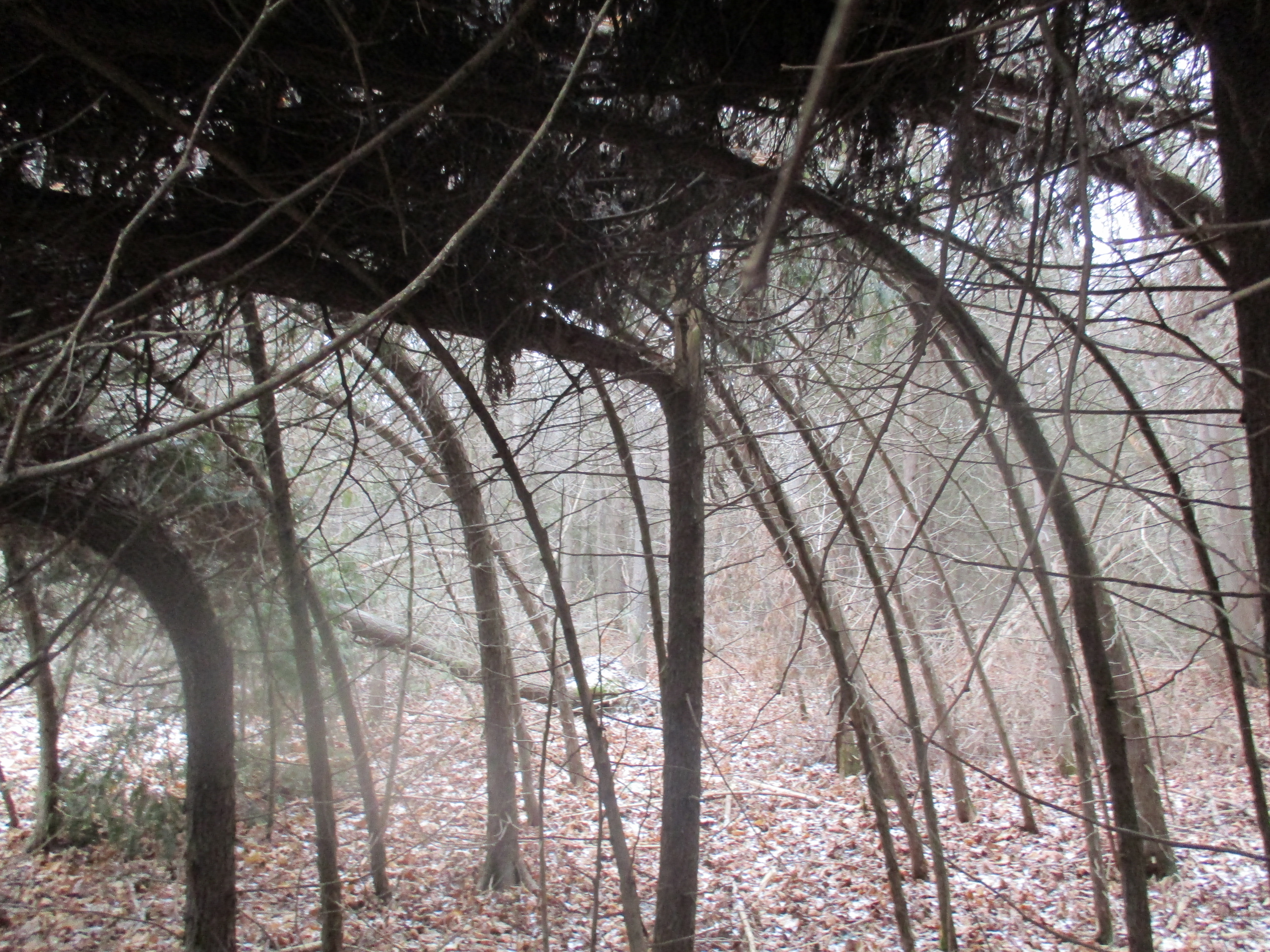
From the inside the bent trees it’s possible to see a few that have cracked but most of them appear to have been folded over without breaking.
Just below the horizontal branch on the largest tree in the picture below is a “toonie” which shows that trees up to 4″ in diameter have been bent over.
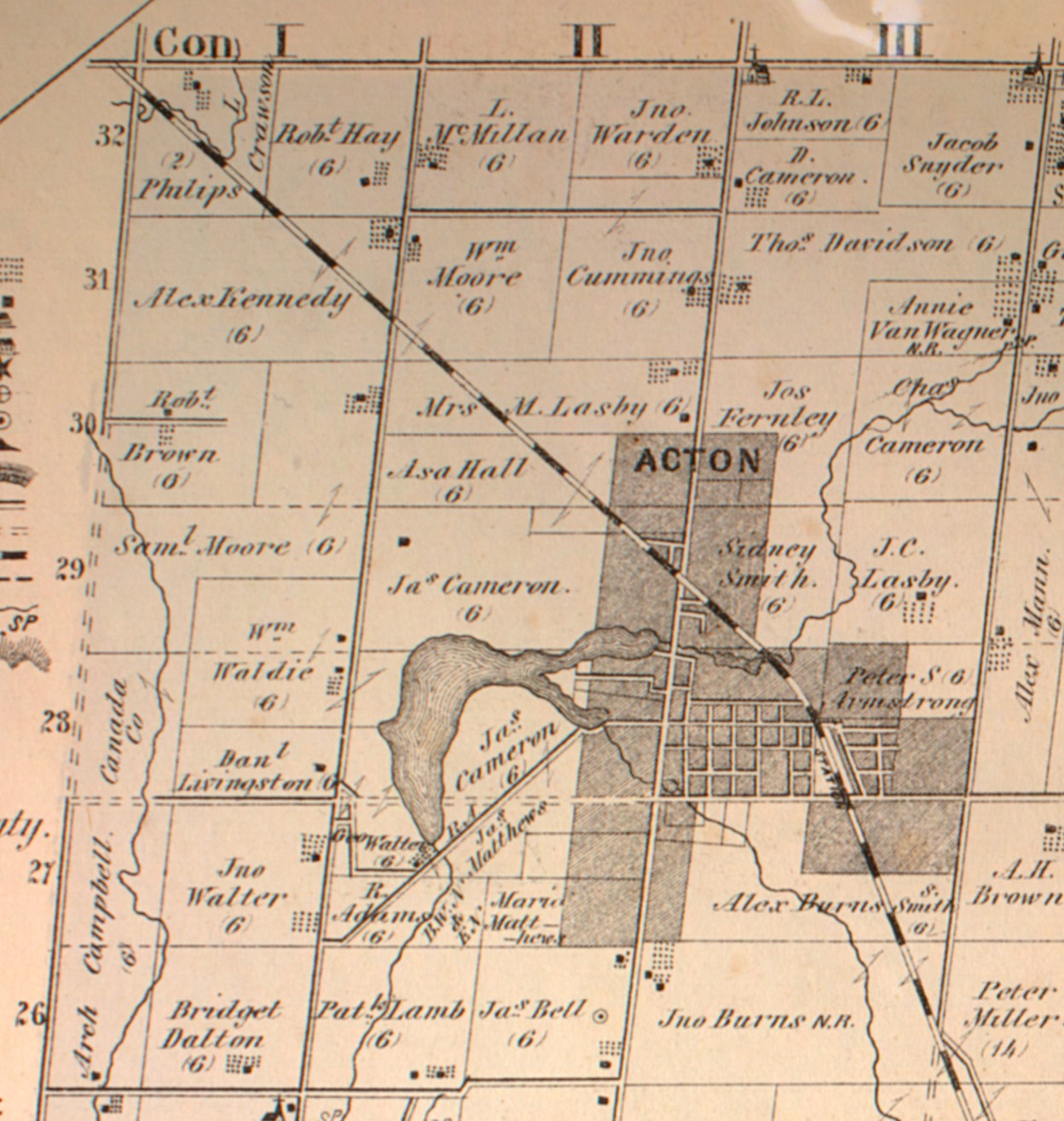
The 1877 county atlas shows Acton as having grown to the east of Fairy Lake along regional road 25 (2nd line) . A grist mill stood at the outlet on the smaller of the two arms of the lake. Mill Street ran from the mill to Dublin Line (1st line). We began our hike near the point where Mill Street touches the lower end of the lake.
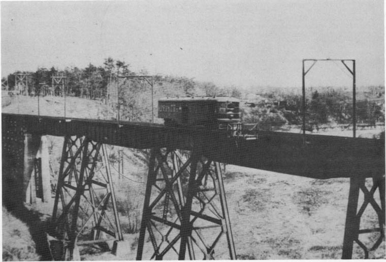
William Mackenzie, along with his partner Donald Mann, decided to expand their Toronto Street Railway service by adding radial lines to other communities. In 1911 they surveyed the route for the Guelph Line which would run from Lambton yards for 49 miles to Guelph. Construction began in July 1912 and most of the track was installed in 1914. The Great War slowed construction as did the building of a 711 foot bridge to cross the Humber River. One of the cars for the railway is seen crossing the Humber River trestle in the archive photo below.
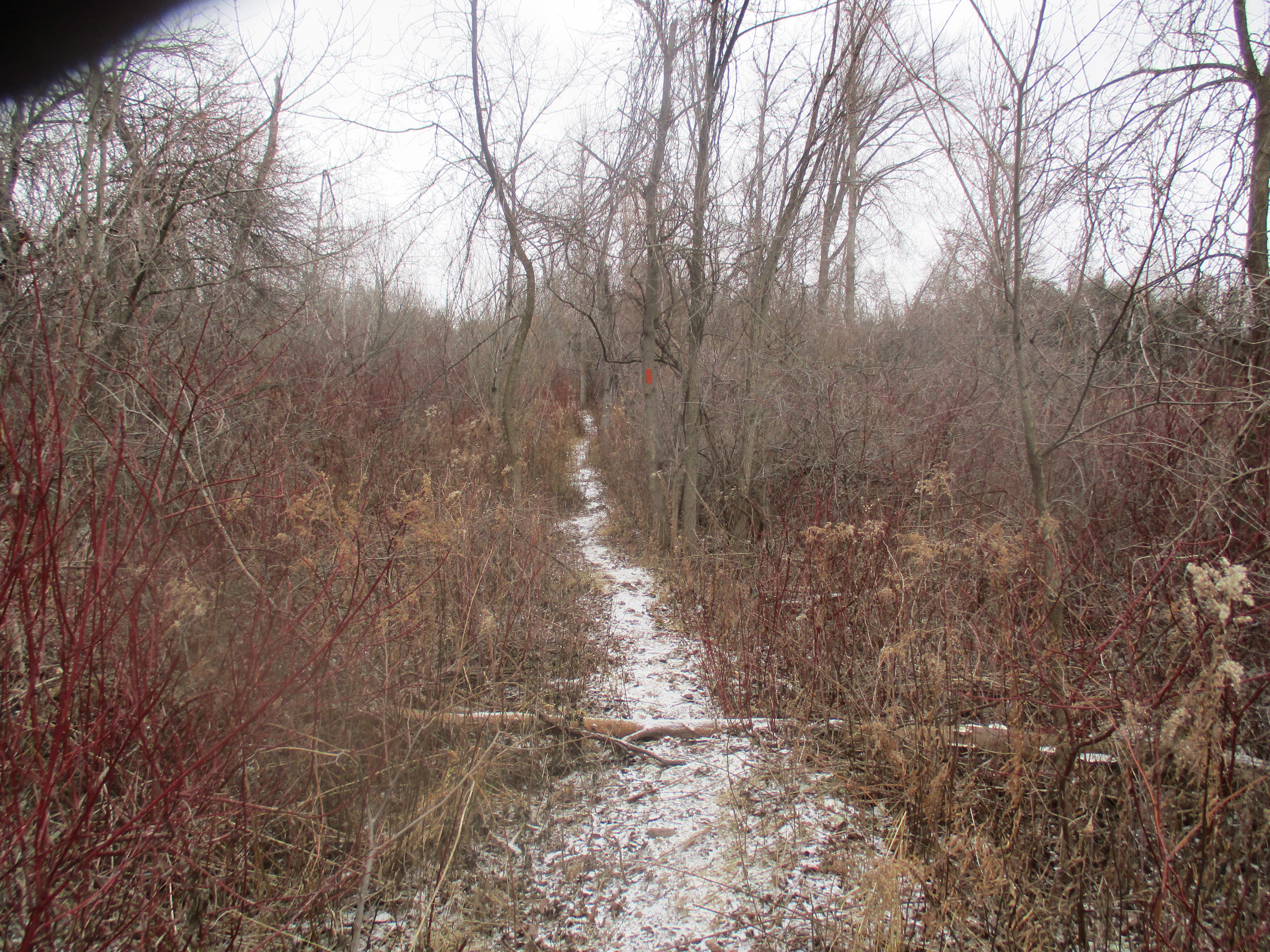
Mackenzie and Mann took steps to keep the costs down and this resulted in many curves to avoid purchasing expensive prime land for construction. This caused the rail line to have to run slowly and this was partially responsible for it’s low ridership, especially in later years. The line ran on private land, in some cases adjacent to highway 7, as it made it’s way toward Guelph. Personal automobiles led to the demise of the line and by 1929 it was operating at a loss. In 1931 the daily ridership was down to just 300 passengers and service was suspended on Aug. 15. The line was abandoned and the rails removed and re-used overseas during WW2. Today the Guelph Radial Trail covers part of the line from Limehouse into Guelph and has painted the trees with an orange blaze to mark the trail
We visited remnants of the TSR in several places this summer and presented photographs in the following stories. The crumbling remains of the bridge across Silverthorne’s grist mill tail race in Meadowvale and the rotting pilings in the mill pond at Eldorado Park are just two examples. Today commuters sit on highway 7 and dream about a rail service on a private right of way that could run from Guelph to Toronto. Perhaps the TSR was just 100 years ahead of its time.
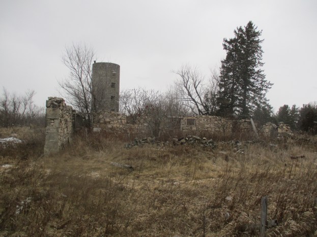
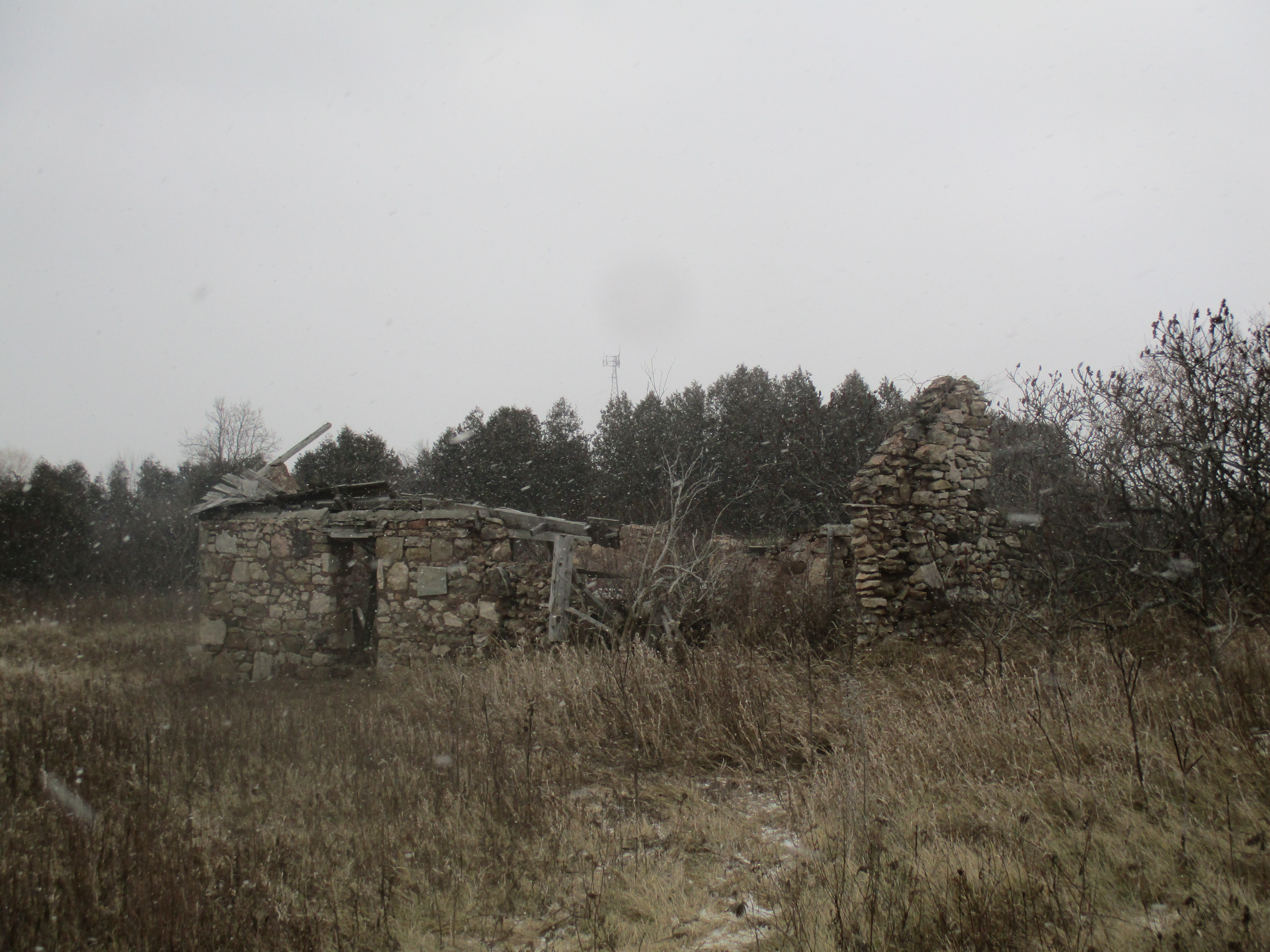
The lot on the corner of today’s regional road 25 and 25 side road was owned by James Bell in 1877 when the atlas above was drawn. He was born in 1841 to Samuel and Ann Bell who had built the stone barn and house on the property. The remains of the barn are featured in the cover shot along with the unique silo. This silo is unlike most that remain in rural Ontario which are made of poured concrete. This one has been constructed of preformed concrete blocks that were made to look like cut stone. The Bell’s would have obtained livestock feed at the mill in Acton until the farm became more prosperous. Later a silo was added to store feed that was grown and milled on the farm. The block construction of the silo dates it to around the turn of the last century. The barn has collapsed in on itself and the old beams can be seen in the bottom. Hand made nails give an indication of the age of construction. James and Agnes Bell were married on Oct. 26, 1877 and the stone house and barn were abandoned after a new brick house was built closer to the front of the property.

The old stone house stands near the barn and it too is slowly falling over. The rear wall looks like it has about one more good wind storm left in it before it becomes a pile of rubble on the ground. When the Bells cleared the land they found an abundance of field stones which had to be removed to make the land suitable for farming. These stones provided building materials for the barn and house as well as the fence lines to separate their fields.
We arrived at regional road 25 and walked back through Acton to the car. We noted an old steel pipe carrying water from Fairy Lake right past the mill and through the heart of town. There’s obviously lots more here for another time.
Like us at http://www.facebook.com/hikingthegta

The bent trees are fascinating. I’ve never seen anything like it. I’m just curious is there a place to find out about GTA ruins worth exploring?
I don’t know of any single site. Almost every one of my posts has some kind of ruins in it, so they’re everywhere.
I see you have been at the Charles Suariol Conservation Area. Have you seen some of this stuff? https://hikingthegta.wordpress.com/2014/06/10/milneford-mills/
Yes I have seen it many times pulling in other parking lot. I prefer the lower stretch of the Conservation Area north of Don Mills. Do you know anything about where the old Sauriol cottage used to be? Or what the purpose of the disconnected gravel trail is that on the east bank of the Don north of the Taylor Creek mouth straddling the DVP?
The bend trees in that area were caused by the ice storm of 2013. Acton or the Halton Hills area was the hardest hit of all the areas. To this day is still recovering. Many area properties will be recovering from this storm for several more years to come if ever.
Thanks Heather! I had wondered about the ice storm but in all the pictures I took following it I found many broken trees and some bent ones. This is the only place I have seen where the trees are bent 360 degrees into a circle. The other ice damage I saw was very random.
The bent trees you see are not from a wind event but from the ice storm of Dec 2013.Just a small example damage to the area where many of us lost power for several days to several weeks. As the ice collected on the tree tops it forced the tops to the ground in a tangled mess where they stayed until spring and many of the cedars weren’t able to spring back. My son and I spent several days clearing the trail from the base of Greenore Cres. to Dublin Line. ;
Thank you Cliff. I’ll make a change to the story.
You were just steps away from the Halton Radial Railway. This is a museum with a collection of both static and operating Electric Locomotives, that they operate on 2km of original Guelph Radial Railway Track. This museum is open weekends from May to October and is located 10 min west of Acton just south of Rockwood.
http://www.hcry.org/ab_us.html Here is a link to their website.
Thanks greatwhite42, this is a great place to check out with the whole family.
It is a very cool place. You can even take a ride on the rails. I posted a picture of the car from the London & Port Stanley railway that they have at the roadside at the end of my story on Rockwood Woolen Mills. There is likely a future story at the museum.
Very nice article. We live just north of the Railway Museum on the Guelph Line, and have walked the old rail bed a number of times, between Guelph Line, and Second Line, Nasagiweya. Access to the trail can be gained from either road. You won’t be able to follow the rail bed the entire way as some of it is on private property, but it is still a nice hike/walk (except for deer hunting season, that is).
Very cool.
Pingback: Guelph Radial Trail – Acton East | Hiking the GTA
This is so interesting to me as my paternal ancestors settled this area in the early to mid-eighteen hundreds. Bell’s, Ryder’s and Swackhamers are all names of ancestors. I am in the process of writing a book about my paternal grandparents “Ryders” who were well known in the area, and westward. The first of my Bell family settled in Meadowvale and later Georgetown. So much history there.
The concrete blocks on the silo are oddly called “hydro stone”. They’re extremely durable and in the Acton/Georgetown area, there are several early 20th Century houses built with hydro stone.
Pingback: Toronto Suburban Railway – Guelph | Hiking the GTA