July 1, 2023
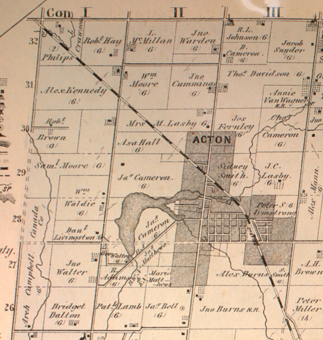
Acton was founded in 1825 by two brothers named Adams who had been Methodist preachers but decided to settle into the farming life. Today, the community is known for The Olde Hide House which was made famous with the slogan “It’s worth the drive to Acton”. Acton is also lucky to have Fairy Lake as a scenic park in the centre of town. The lake is found at the headwaters of Black Creek and was created in 1830. That was the year the Adams brothers built a dam on Black Creek and flooded an area that was previously a wetlands. The dam was created to retain enough water to allow them to power a grist and flour mill in town. The image below is taken from the 1877 County Atlas and shows the lake relative to the small community that existed at the time.
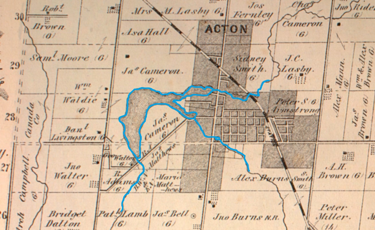
The flooded area was only known as the mill pond until 1872 when it was given the name Fairy Lake. Then, in 1886 the town purchased land from Rufus Adams to allow the creation of Prospect Park.

There is an extensive playground with lots of swings and other attractions for children to play on. There’s even a small zip line for the enjoyment of the little ones.

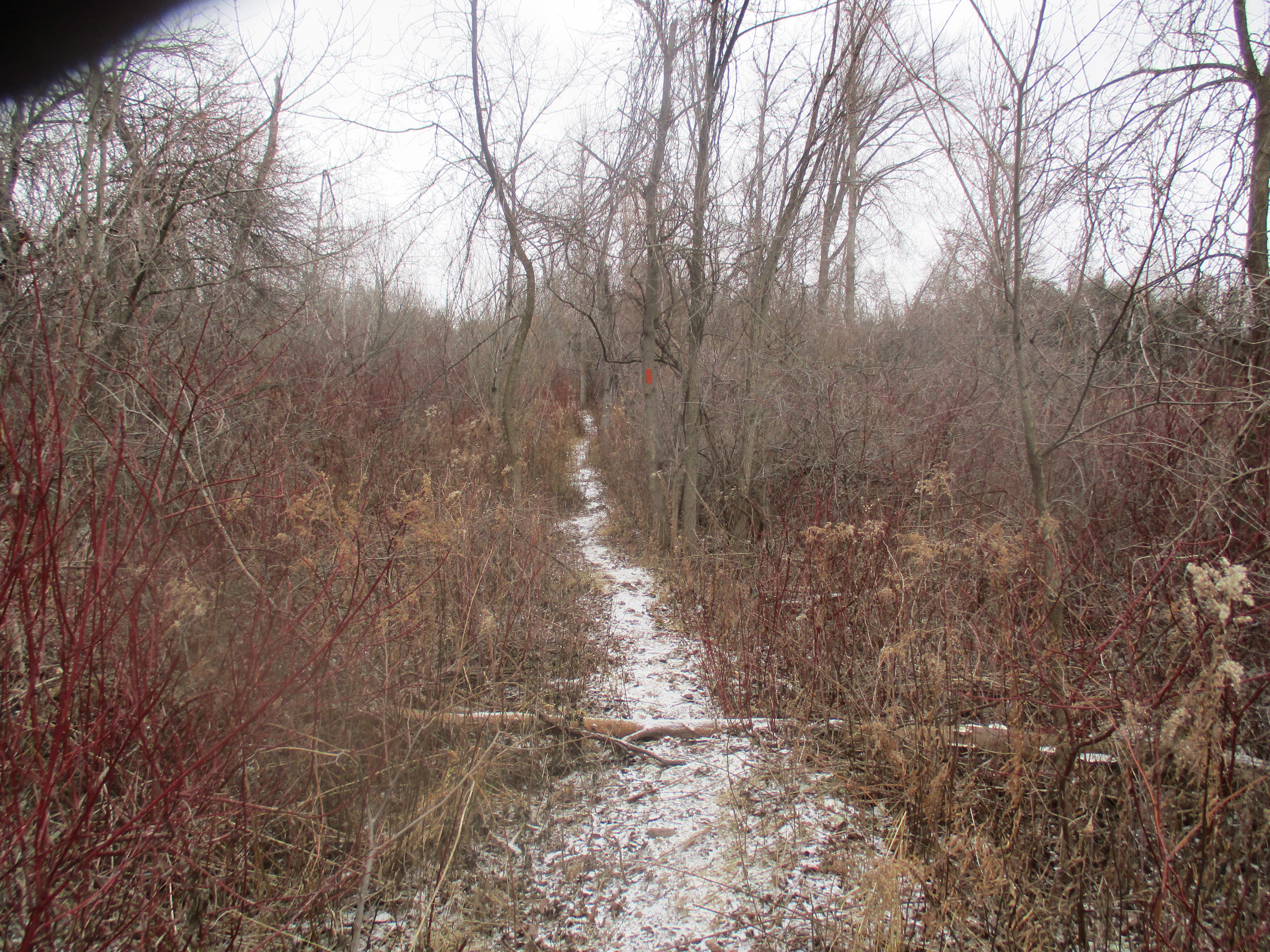
There is a 1.6 km loop trail in the park that takes about 30 minutes to complete. The trail makes its way along the shore of the lake and has several places which are good for fishing or bird watching.

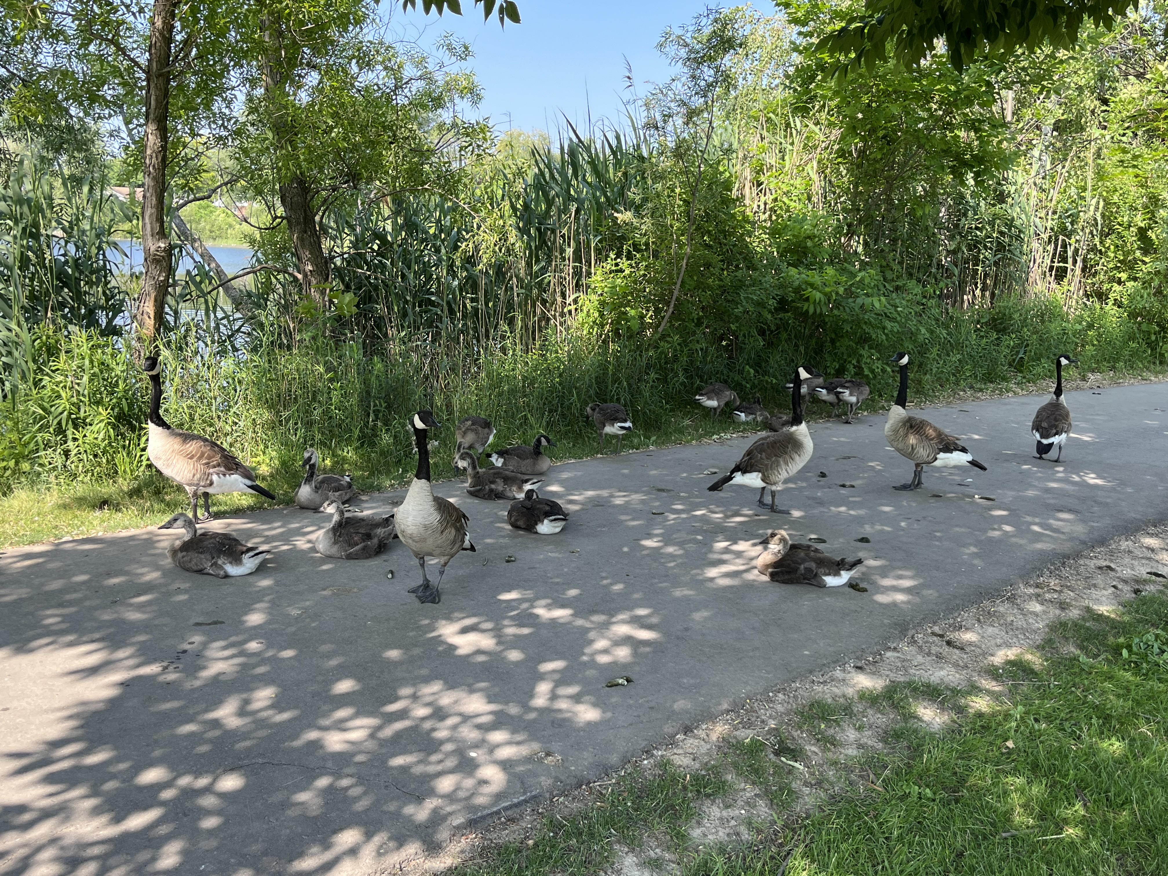
There is also a small beach but unfortunately the sand is covered with lots of Canada Goose poop. This has turned a quiet little spot for the children to wade in the water into a rather unsanitary place.

The geese are busy raising a brood of goslings and they have occupied several sections of the trail where they deter pedestrians by hissing at them and making a mess of the walkway. Each goose is capable of leaving up to two pounds of poop behind every day. They mostly do this while grazing or walking on land and are less likely to drop something while flying or swimming.
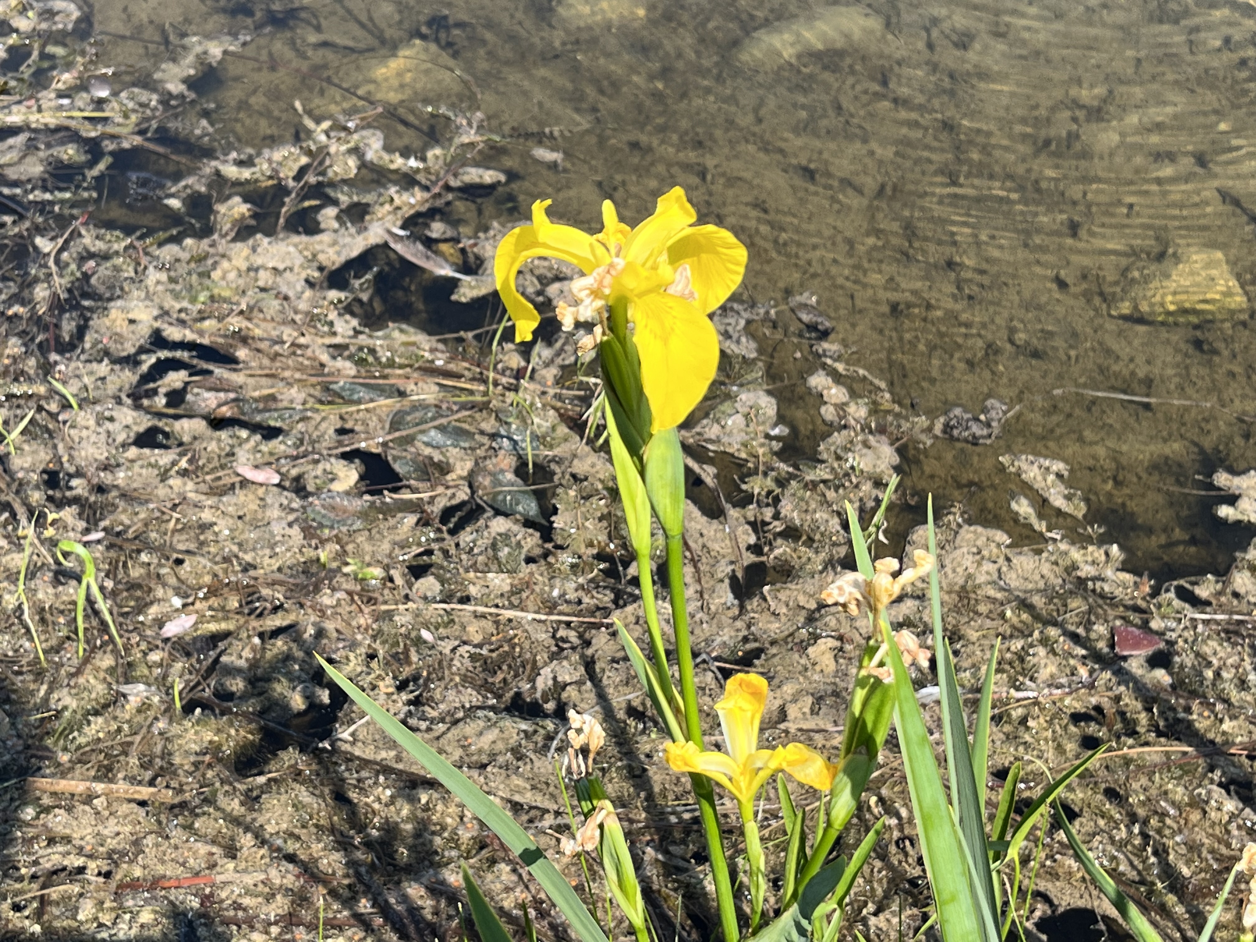
Yellow Iris are growing in the edge of the lake. This aquatic plant is not native to North America but was brought over from Europe in the late 1800s as an ornamental plant. It is sometimes planted in wetlands because it is known to absorb heavy metals and can be helpful in restoring the local environment. However, it forms dense mats that can displace wildlife and change wetlands into drier areas. It is poisonous to both humans and animals and its sap can sometimes cause severe dermatitis.
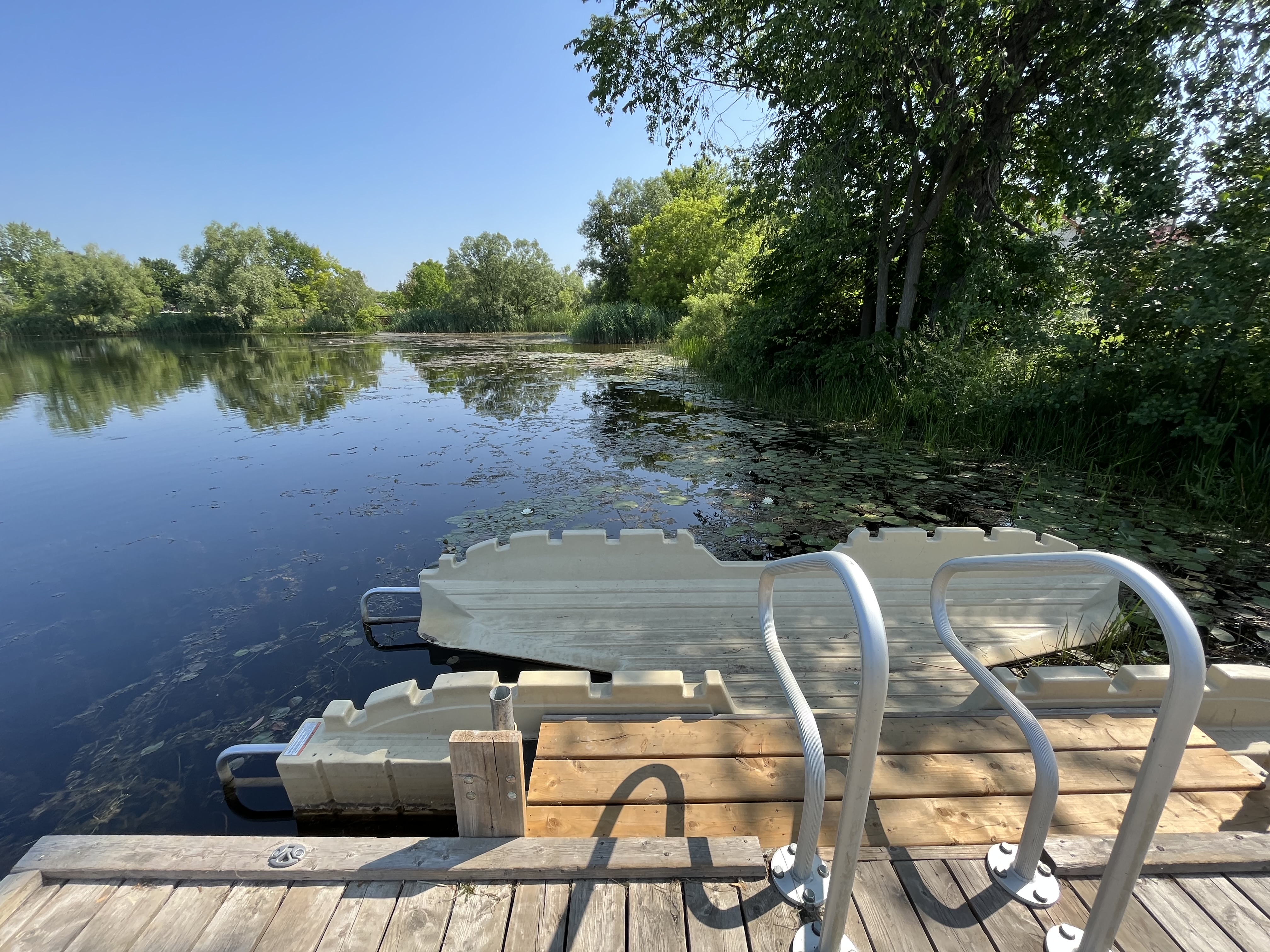
One of the features of the park is a kayak launching system. This allows paddlers to get in and out of their kayak with relative stability.
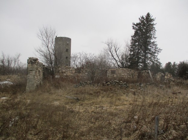
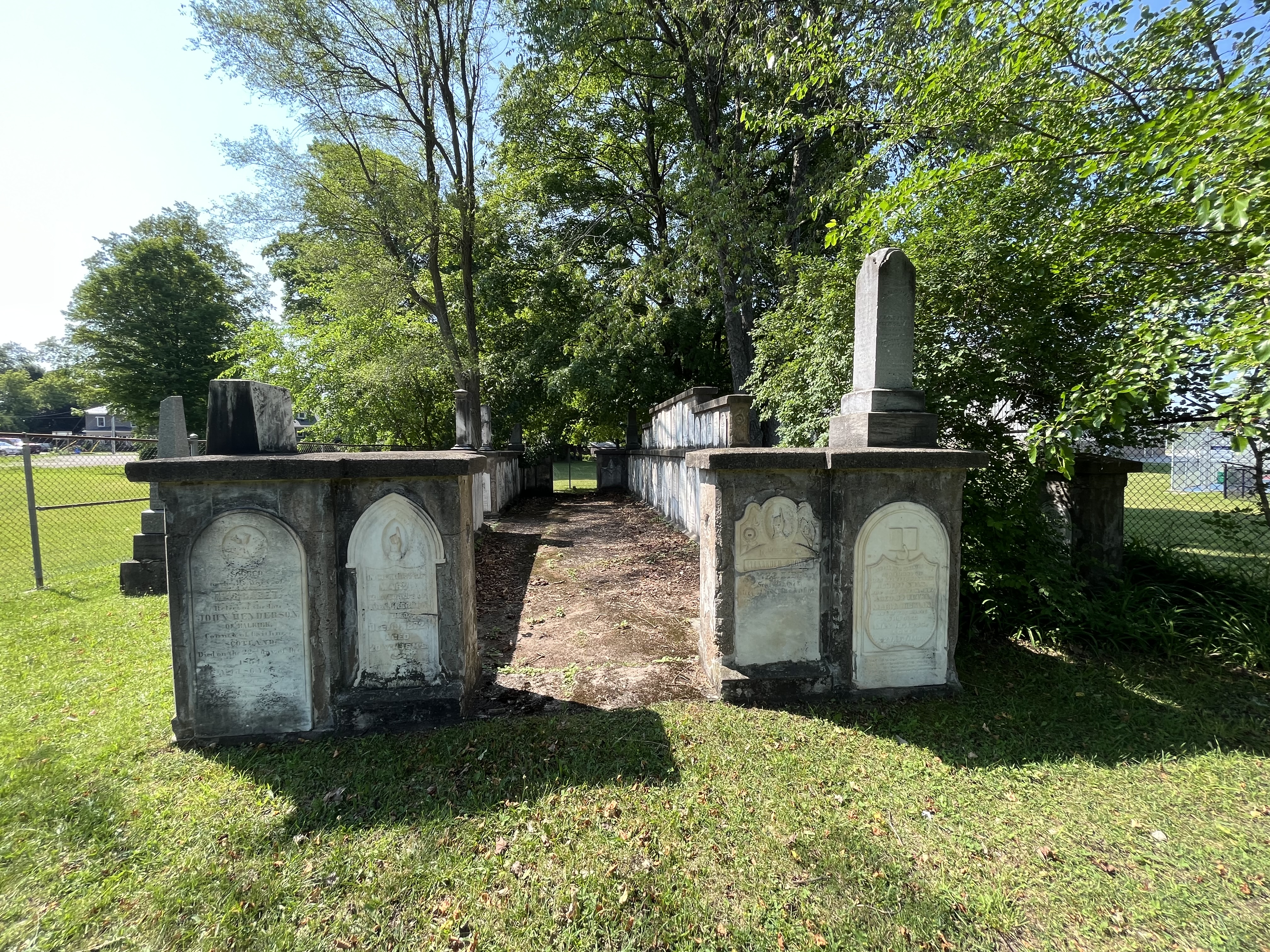
An old cemetery stands vigil in the corner of the park. This is the old Knox cemetery which is also known as Acton Pioneer Cemetery. In 1843 the Adams family sold land for the purpose of building a Scottish Kirk, or church, on. In 1848 a small lot behind the church was purchased to be used as a cemetery. Several members of the Adams clan had already been buried there making it an ideal spot. By 1886 the cemetery was deemed to be too small and a new cemetery was opened a few blocks away. Several of the interments from Knox Cemetery were moved to the new one and in 1933 the remaining head stones in the old pioneer cemetery were gathered into a cairn. A fence has been erected around the cairn but there is a gate so that people can go inside to look closer at the markers.
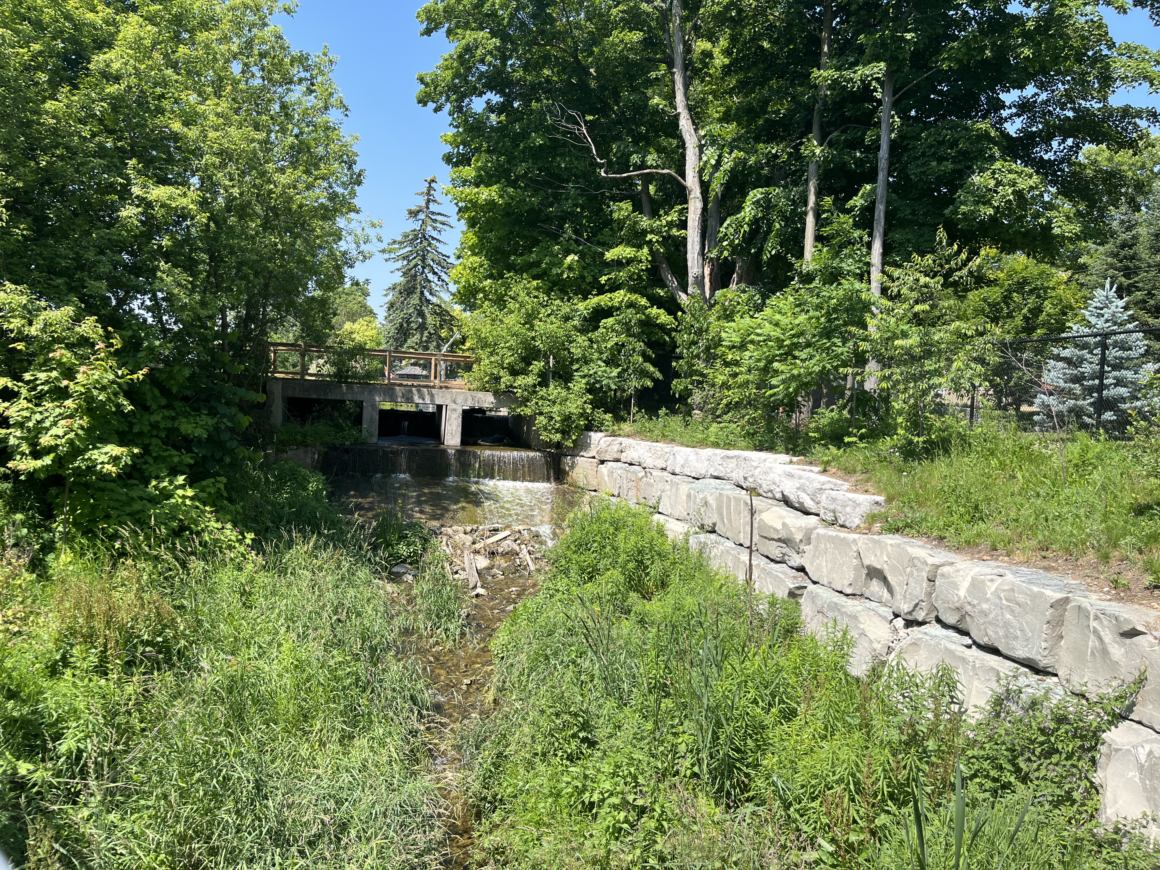
The original 1830 dam was repaired many times and eventually replaced with the present concrete one. This is now owned and maintained by the town so that the lake level can be controlled using the two sluice gates.
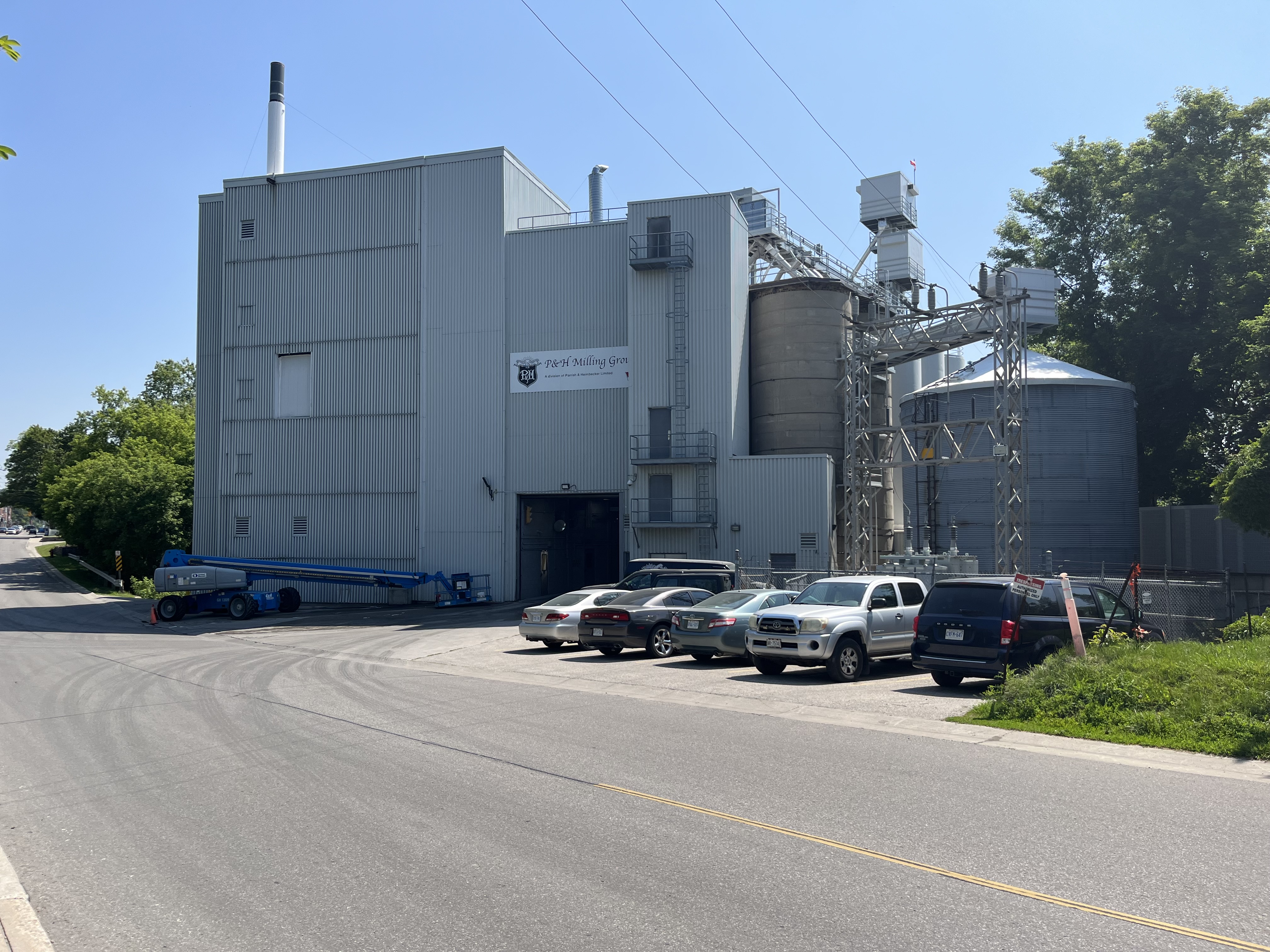
The flour mill in Acton is still in the same location as the original grist and flour mill that was built by Rev. Ezra Adams in 1835. The mill no longer runs on water power taken from Fairy Lake but it has been in business for nearly 200 years.
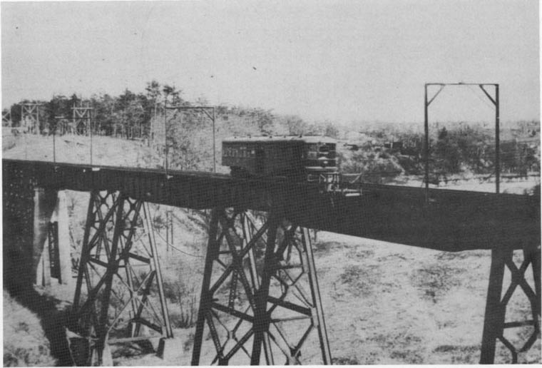
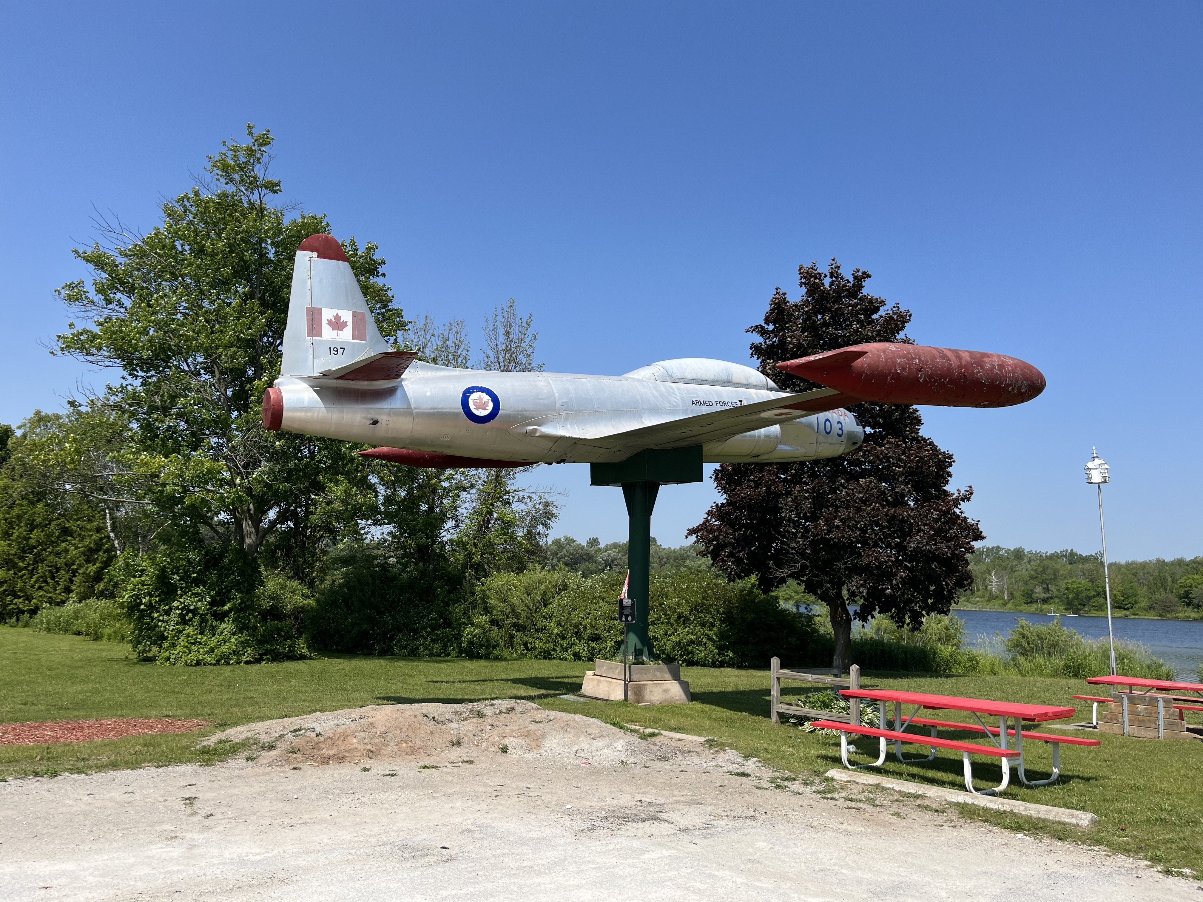
In 1974 a new legion number 197 was opened on the side of Fairy Lake. From Prospect Park you can see a war plane through the trees. This is located at the legion, the third such building in town. The plane is a Silver Star CT33 MK3 Jet Aircraft which was used in training flights and could reach speeds of 920 km/hr. It entered service in December 1952 and was retired in November 1972. It was placed at the legion in November of 1975.
Fairy Lake has been serving the local community for nearly two centuries and makes an excellent place for a picnic or a walk if you are in town. It is also a place you can take the kids for a fishing experience.
Google Maps Link: Fairy Lake
Like us at http://www.facebook.com/hikingthegta
Follow us at http://www.hikingthegta.com
Also, look for us on Instagram