Saturday, May 27, 2017
Last week we visited the former community of Oriole at Sheppard Avenue and Leslie Street and made a short excursion north that only made it as far as Newtonbrook Creek. To pick up where that hike left off, we took advantage of free street parking on Alamosa Drive and Gatehead Road where there is an entrance to the park. The next community north along the river was known as Flynntown and was located around the intersection of Leslie and Finch. Like Oriole, it formed around the mill sites that were prominent along the Don River in the first half of the 19th century. It too was a name applied to a postal district in much the same way that we use postal codes today.
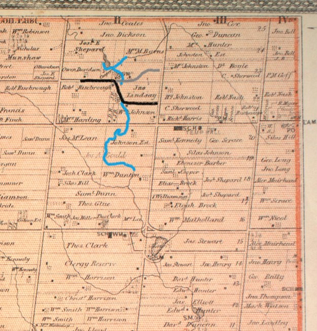
The 1877 county atlas below shows the area of the hike with the section of the East Don River that we covered being outlined in blue. A small tip of German Mills Creek is coloured leading to the right near the top of the map. We started at the former property of William Dunton where we looked for the remains of the saw mill built by Phillip Phillips. Old Cummer Road has been coloured in black and we followed the short piece that runs on an angle from the stream up to where it meets the grey line marking the new section of Cummer Road. Cooper’s grist mill is shown where the new road meets the older section.
Near the bottom of the hill when you enter the park off Alamosa Drive you will find a set of tennis courts. Near the courts, beside the river, is a pole with life saving equipment on it. That marks the spot where Philip Phillips built his saw mill in the early 1800’s. The wood for the mill was rough hewn by hand indicating that it was prepared before the mill went into operation. After the saw mill was up and running the wood produced displayed the obvious signs of being cut with a blade or wheel. The houses and barns closest to the mill would have been constructed with wood that had been prepared at the saw mill. The picture below shows the remains of what is most likely part of the wooden crib for the old mill dam. The only other place we have seen the wooden crib preserved is at the Barber Dynamo. One of the mill mapping sites reports that these are actual timbers from the saw mill.

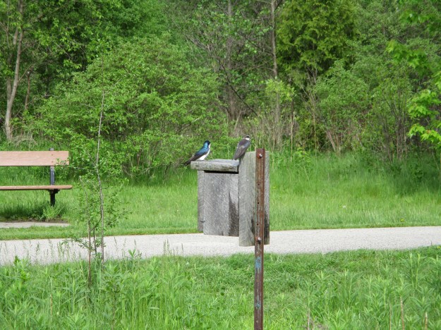
Tree Swallows are highly social birds and can form flocks of thousands around their nesting sites. They breed in Canada and the United States but spend the winter in Mexico, the Carribean and throughout Central America. Their genus name is tachycineta bicolor which comes from the ancient Greek for “moving quickly” and the bicolor from their two coloured markings. The males have much brighter blue-green upperparts while the females tend to have duller colours. The female needs to hide on the nest for two weeks before the eggs hatch and another three before the young ones are ready to leave the nest. The brighter male likes to be obvious as he dive bombs intruders to protect the nest.
Following the trail north of Finch Avenue brings you to the intersection of Old Cummer Road and the century-old bridge across the river. The single-lane bridge was replaced when the surrounding farms were developed for housing. In 1968 the new portion of Cummer Road (grey on the map above) was opened and this became Old Cummer Road and was closed to through traffic.

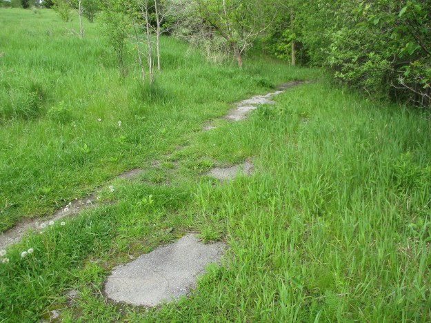
The road north of the closed bridge has been largely overgrown and the former pavement has all but vanished. Cummer operated a saw mill and a woollen mill on the river near his home but it closed in 1857 and all traces are now lost.
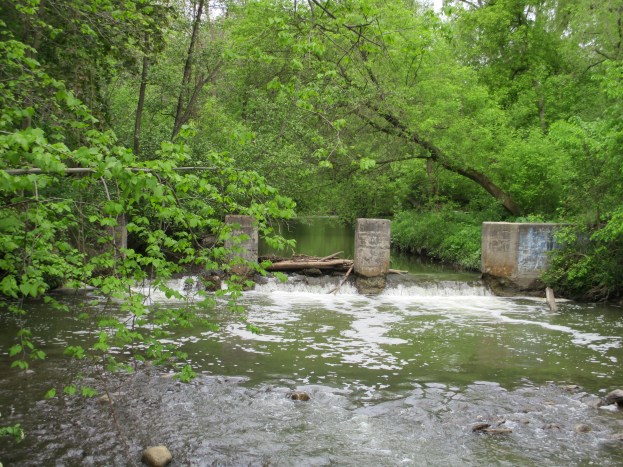
Crossing under the new Cummer Road bridge, the trail quickly follows a pedestrian bridge to the east side of the Don River. We chose a small path that led along the west side but after crossing a drainage ditch the trail quickly vanished. Our intention was to find any evidence of the mill site or dam that was shown on the county atlas. The mill appears to have been somewhere near the new bridge and no trace exists. The concrete dam we found on Cooper’s property would have been built here long after the mill had closed and would have replaced a wood crib dam. The mill pond shown on the map has been drained. The cover photo shows the dam from the downstream side while the picture below shows the upstream side.

This dam looks more like an electrical generating dam than one used to store water for mill operations. A large building stood near the end of the dam but all traces of it have vanished today. What remains is an old utility pole that has a large transformer attached to the top along with several old light sockets. A second electrical pole is leaning into the trees a little farther upstream.

Returning to the main trail, we crossed the Don River and went up the east side to explore the dam from that vantage point. Near this place, German Mills Creek empties into The Don. German Mills Creek flows for about 10 kilometres as a left tributary of the East Don River. It gets its name from the community of German settlers who, in 1796, became the first pioneers in Markham Township. The settlement of German Mills fell apart after only a few years but the name has been preserved via this creek. The bridge across the creek has been here for a long time and formerly provided access to the mills and other establishments in the valley. Today this little bridge supports the traffic along the hiking trail that follows the former roadway.
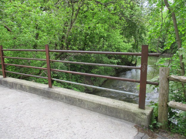
The picture below shows German Mills Creek and the confluence with the East Don River as seen from the old bridge over the creek.
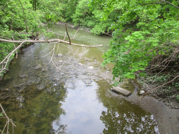
The Don River is interwoven with the early history of Toronto and York County and there will always be more to explore another day.
Google Maps Link: Flynntown
Like us at http://www.facebook.com/hikingthegta
Follow us at http://www.hikingthegta.com
Pingback: The Best of 2017 | Hiking the GTA
Pingback: Ghost Towns of Toronto | Hiking the GTA