Tag Archives: Erindale Power Dam

Erindale – Ghost Towns of the GTA

January 27, 2024

Erindale isn’t a ghost town in the traditional sense because it is now part of the larger city of Mississauga. However the older homes that remain scattered through the area provide a ghost of the town that once was. Over the years we have written eight other blogs which focus on various aspects of the local history of Erindale and links to all of these can be found at the end of this post.

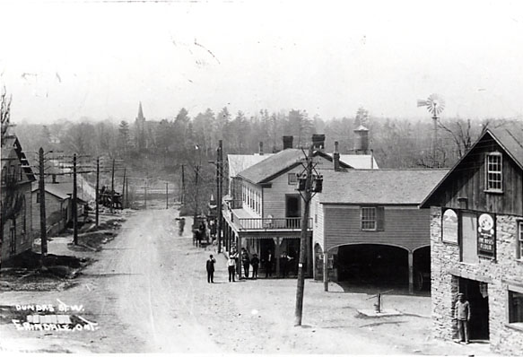
Erindale began in 1825 and was originally known as Toronto. It went through several name changes being known as Credit, then Springfield and finally Springfield-on-the-Credit. In 1900 it took the name of Erindale after a local estate owned by Reverend James Magrath. The town was a major stop on the journey along Dundas Street between Hamilton and York (Toronto). It started to decline after 1855 when the railway bypassed it but saw a revival in 1879 when the Credit Valley Railway built a station nearby. A fire in 1919 destroyed much of the town but several buildings were rebuilt.

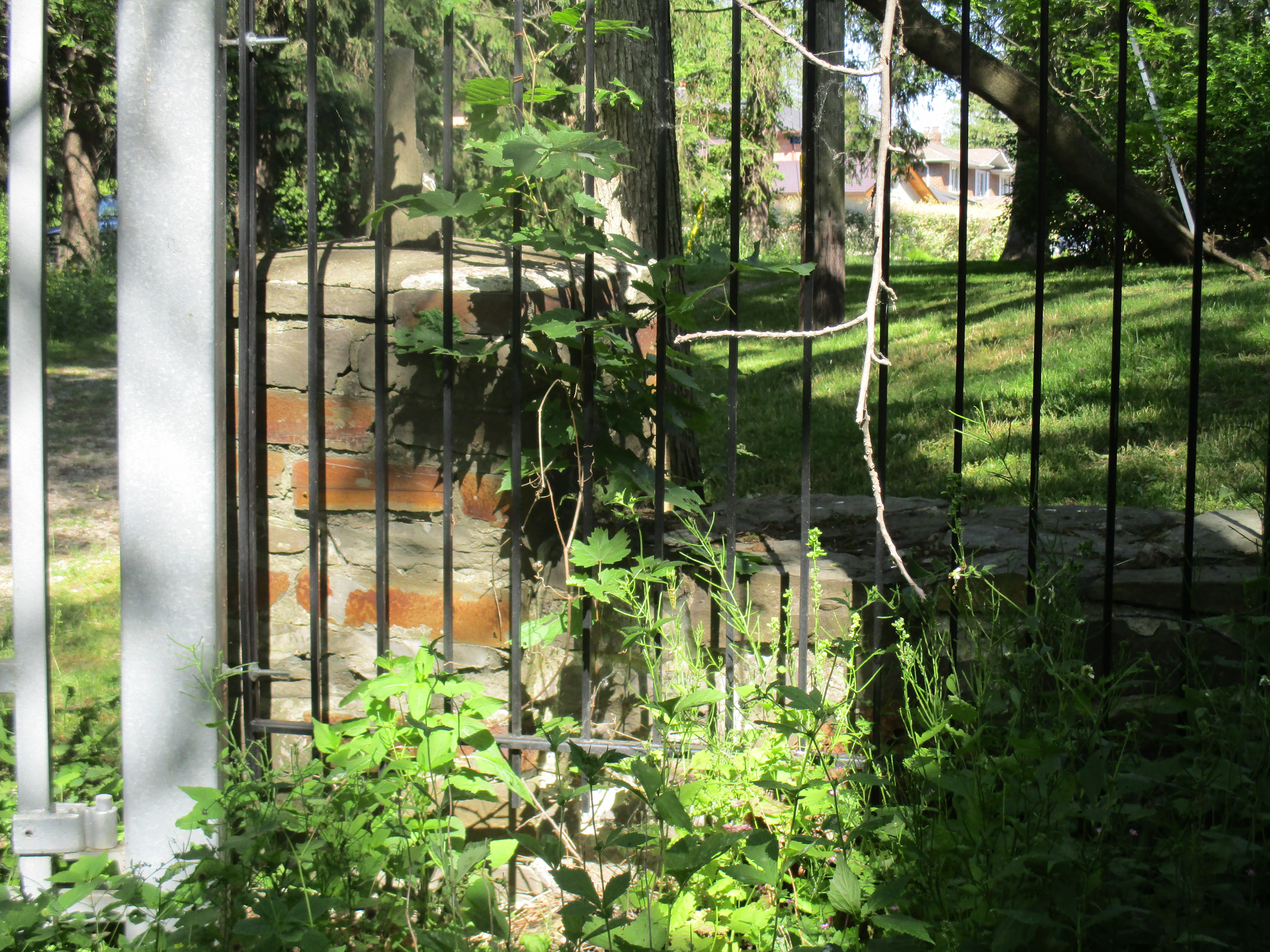
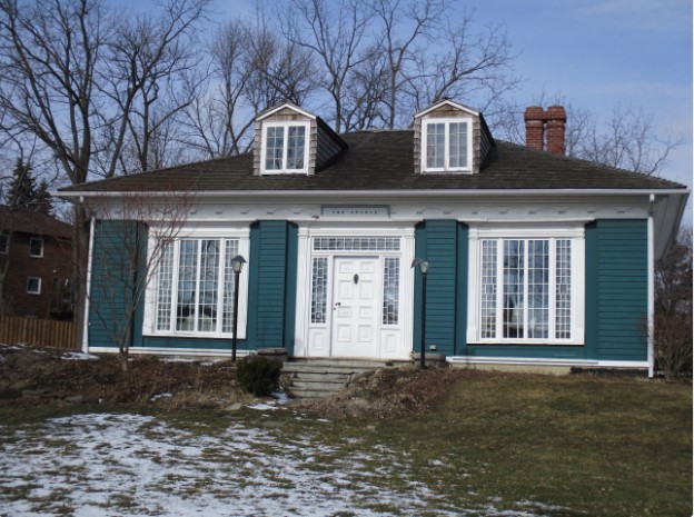
The Grange was built sometime around 1828 for Sir John Beverly Robinson who was the first Chief Justice of Upper Canada.  He was also considered to be the leader of the Family Compact which controlled the government leading to The rebellion of 1837.  The regency styled house with it’s ornate windows was indicative of the status of it’s owner.  Robinson only owned the house until 1833 when it began a rapid change of ownership until around 1910 having seen up to ten owners during this time. Then the Adamson family took up residence here and they stayed until 1973. Sometime during the Adamson years the outside of the home was given an exterior layer, or veneer, of brick from the local Cooksville Brickyards.  The building was given to the city of Mississauga by the land developers and used by the Boy Scouts until 2004.  It has now had it’s bricks removed and been fully restored to it’s original splendor.  The Heritage Resource Centre of Heritage Mississauga is now the occupant of this home.

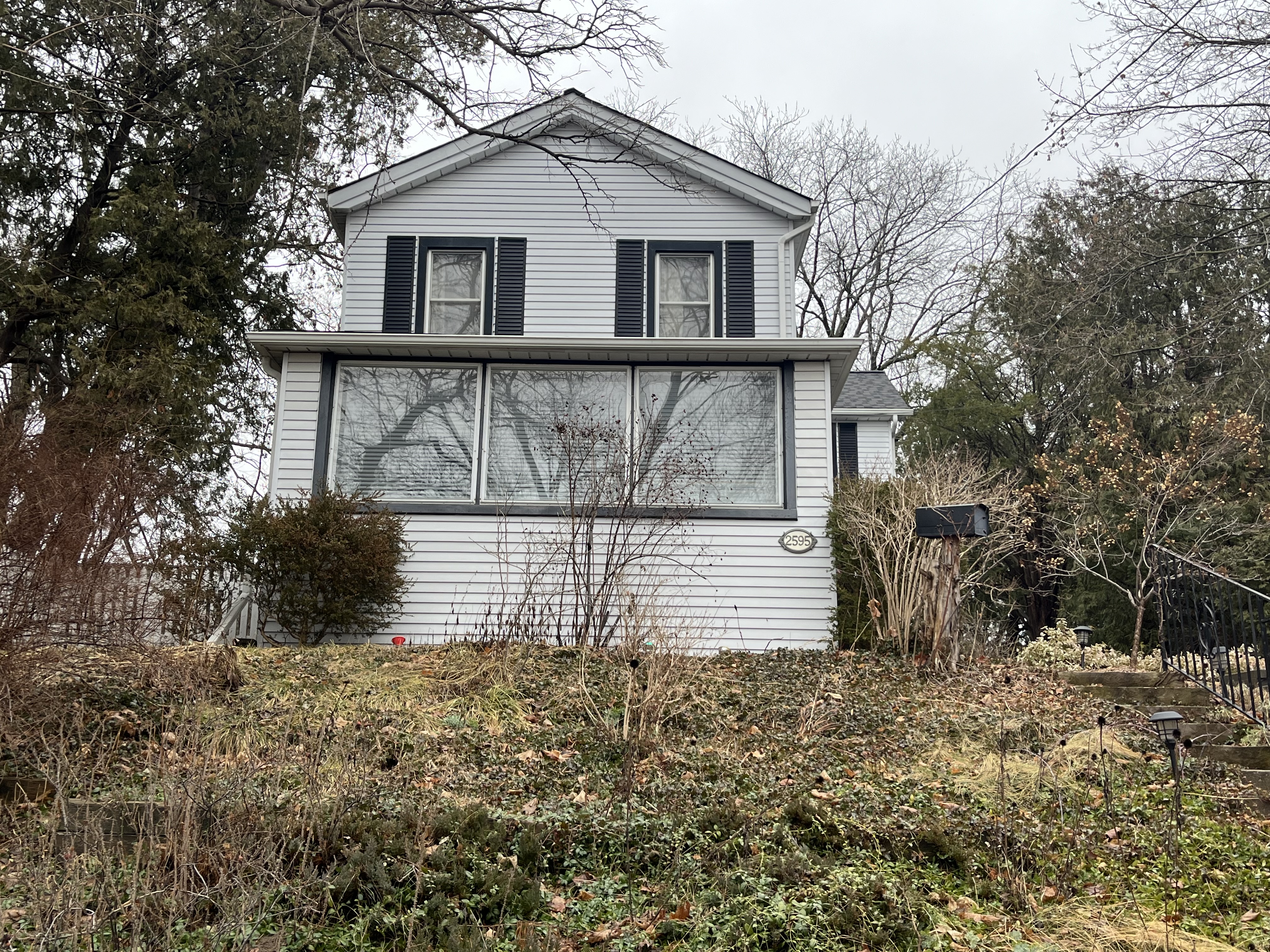
It is generally believed that the house below is the oldest surviving building in the main area of the village. It was likely built between 1835 and 1845 by a local miller named Ira Van Valkenburgh. It may also have been built by the local carpenter named John Blair. Tradition has it that a store was once located in the house.

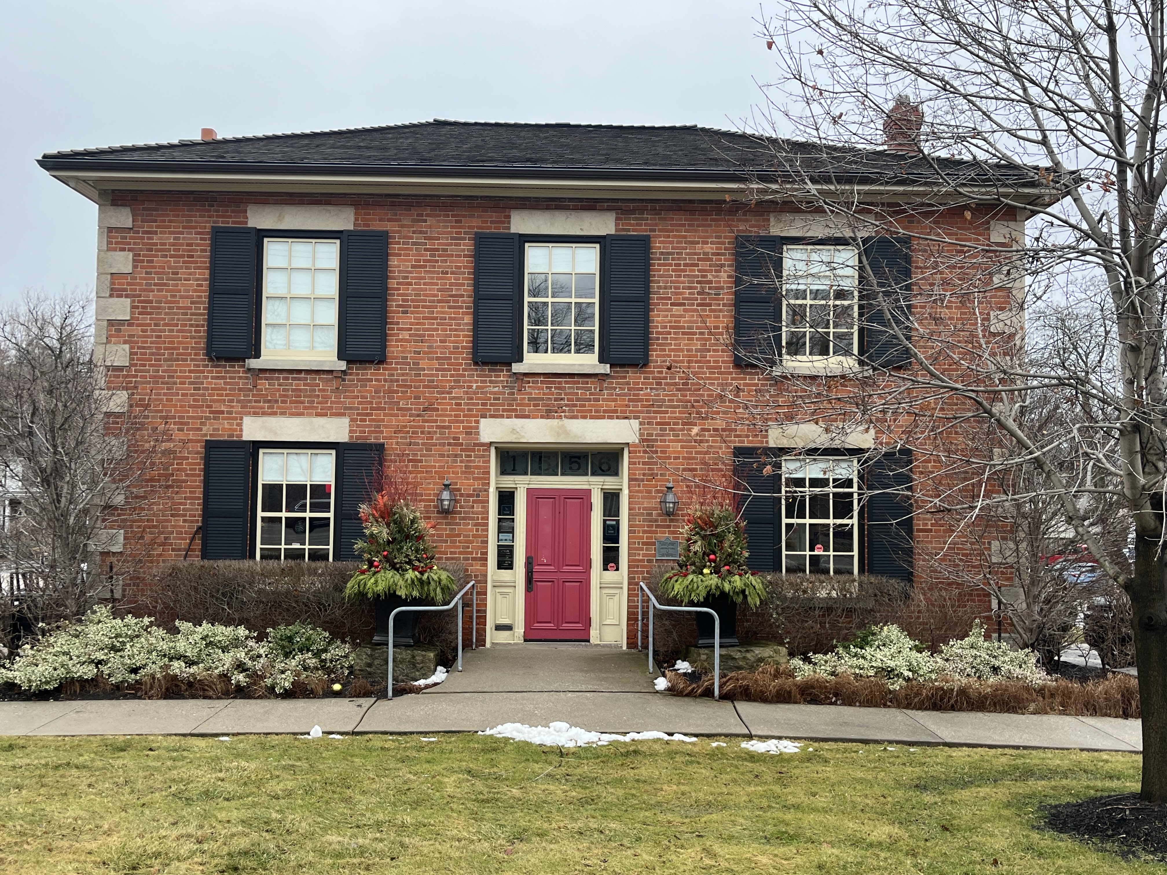
The Anglican Rectory was built in 1861 on the site of a former inn that had burned down. The Georgian Style manse was sold in 1960 and converted to commercial uses.

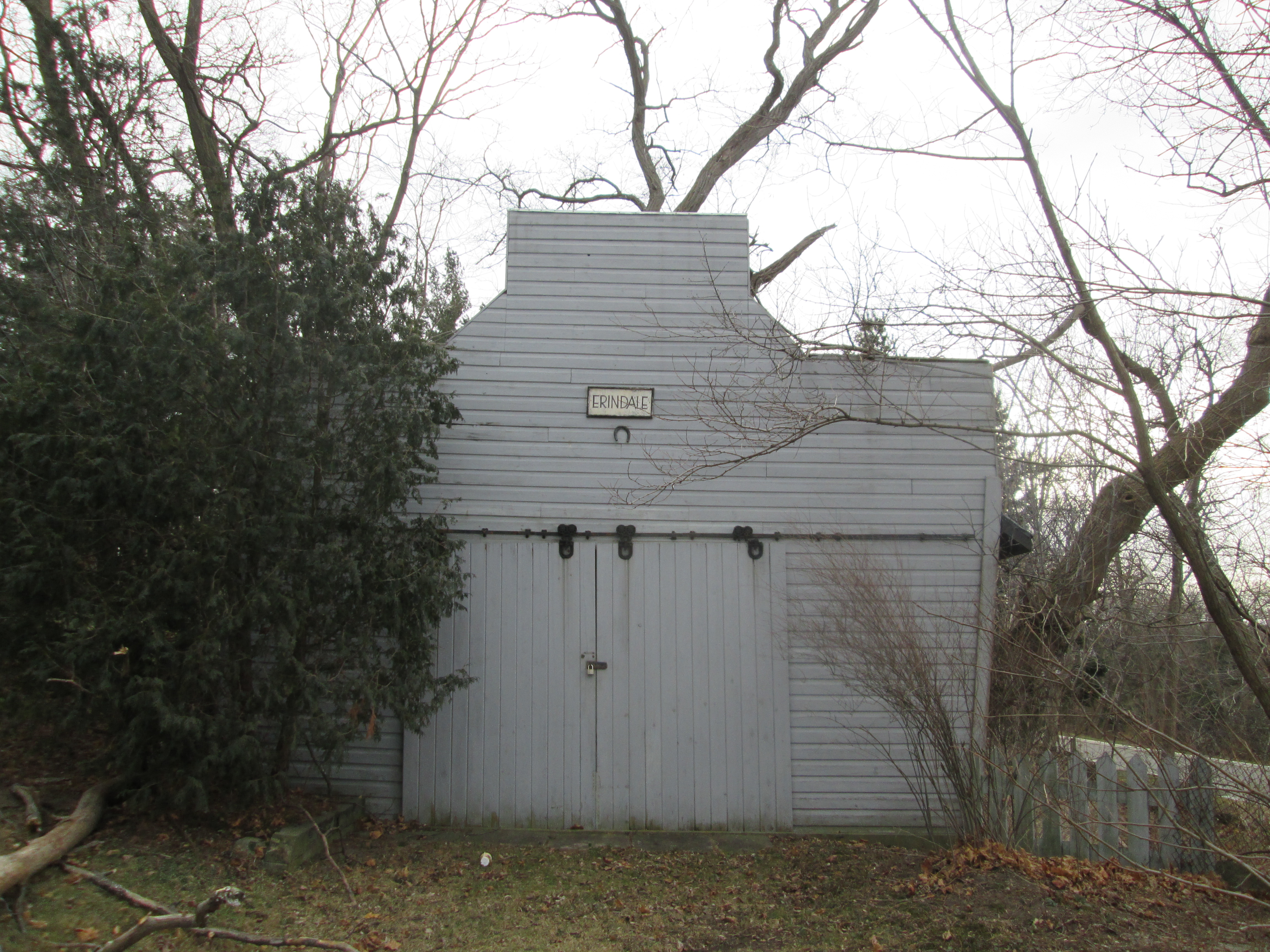
The Royal Exchange Hotel was built sometime between 1819 and 1822, although some sources say 1828, and was once known as the Halfway House. The hotel may have been 100 years old in May of 1919 when it was destroyed by the village fire and never replaced.

In 1877 the Methodist congregation commissioned a new church building as they had been meeting in the room above the Royal Exchange Hotel. The adherents felt that they should no longer meet above a building where alcohol was being sold. Somewhere around 1921 the church lost its spire and in 1925 it became the United Church. When a new building was consecrated in 1964 the building was sold to a Presbyterian congregation. This is ironic as the Presbyterians had rejected a merger with the Congregationalists and the Methodists that saw the creation of the United Church. Local residents each donated $100 and the spire was replaced in 2010.

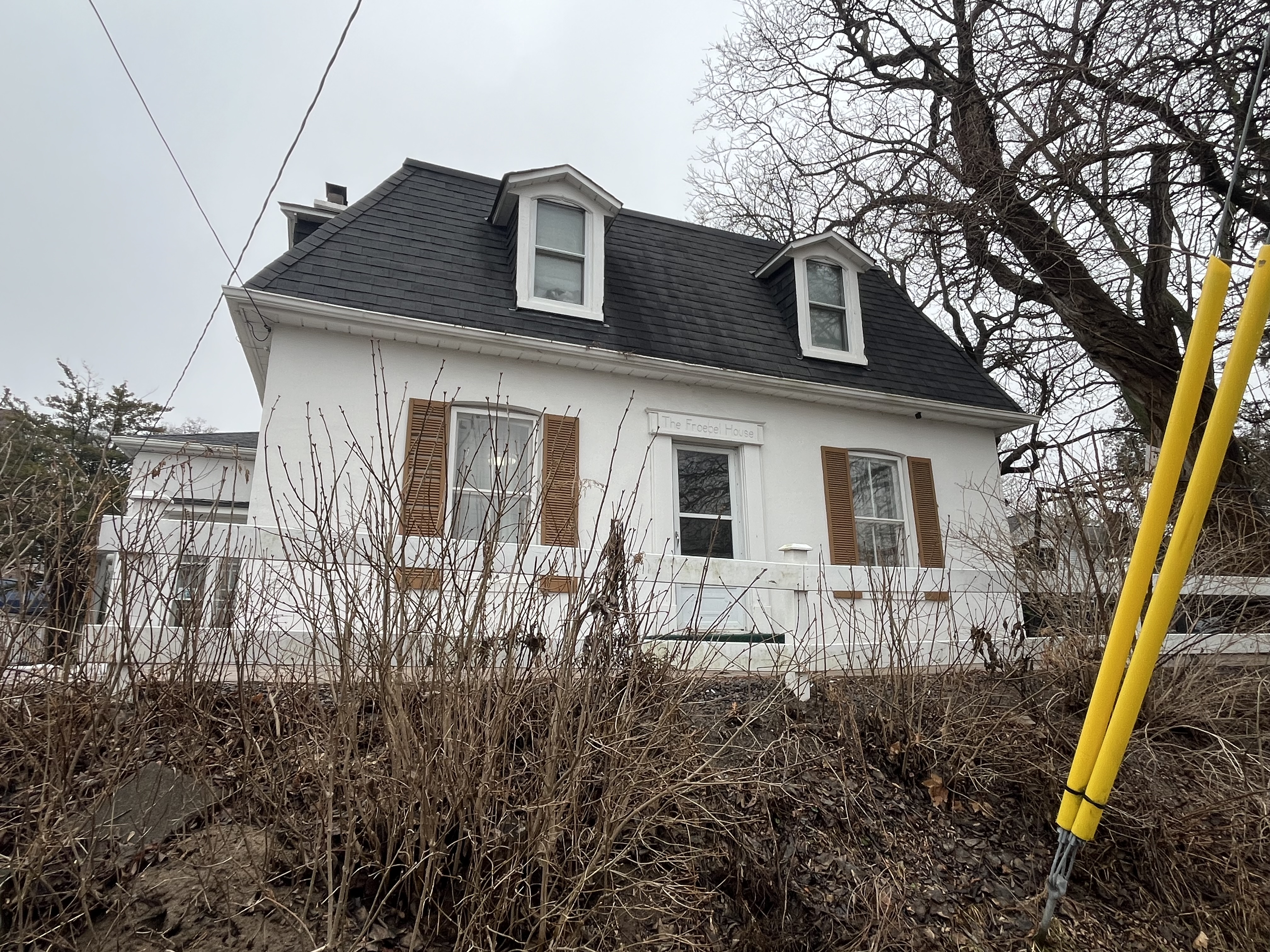
Emmerson Taylor was the owner of the Royal Exchange Hotel and also owned a saw mill, knitting mill and a fanning mill. This last structure produced furniture and grandfather clocks. He donated the land for the Methodist Church and had this house built around 1875 to 1878. The transom over the front door identifies the home as the Froebel House.

St. Peter’s Church history begins as a home church in 1825 in the home of Colonel Peter Adamson. Construction of a white frame church began in 1826 and it was consecrated in 1828. This building lasted until 1887 when it was torn down and replaced with the present stone church. The church tower was added in 1910. A basement was hewn out under the church in 1934 to be used for the church school.

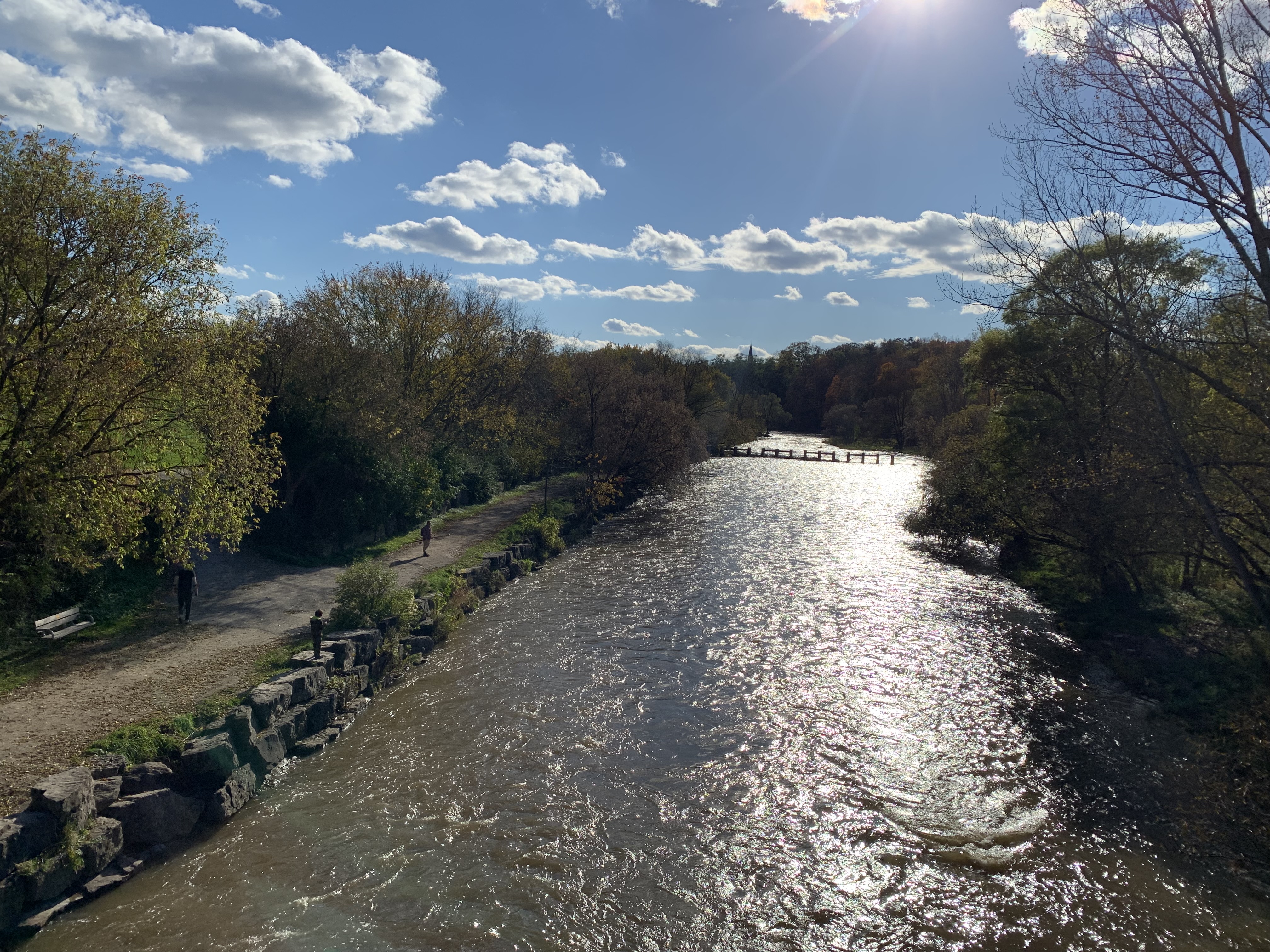
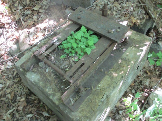
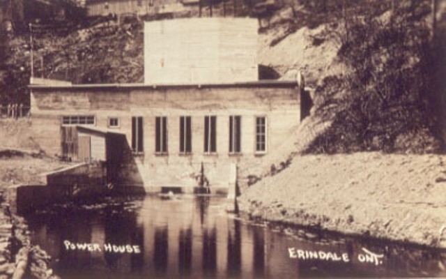
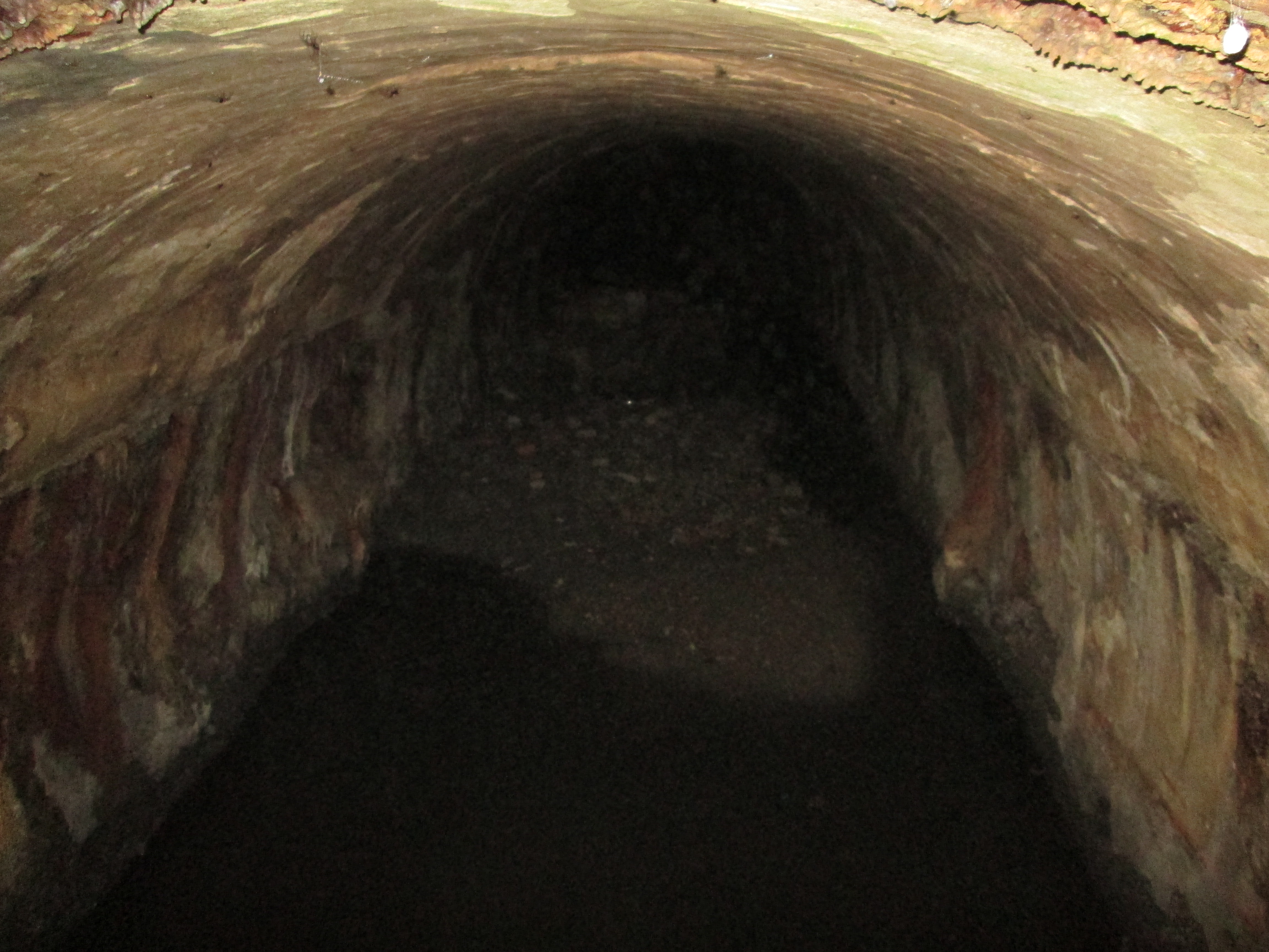
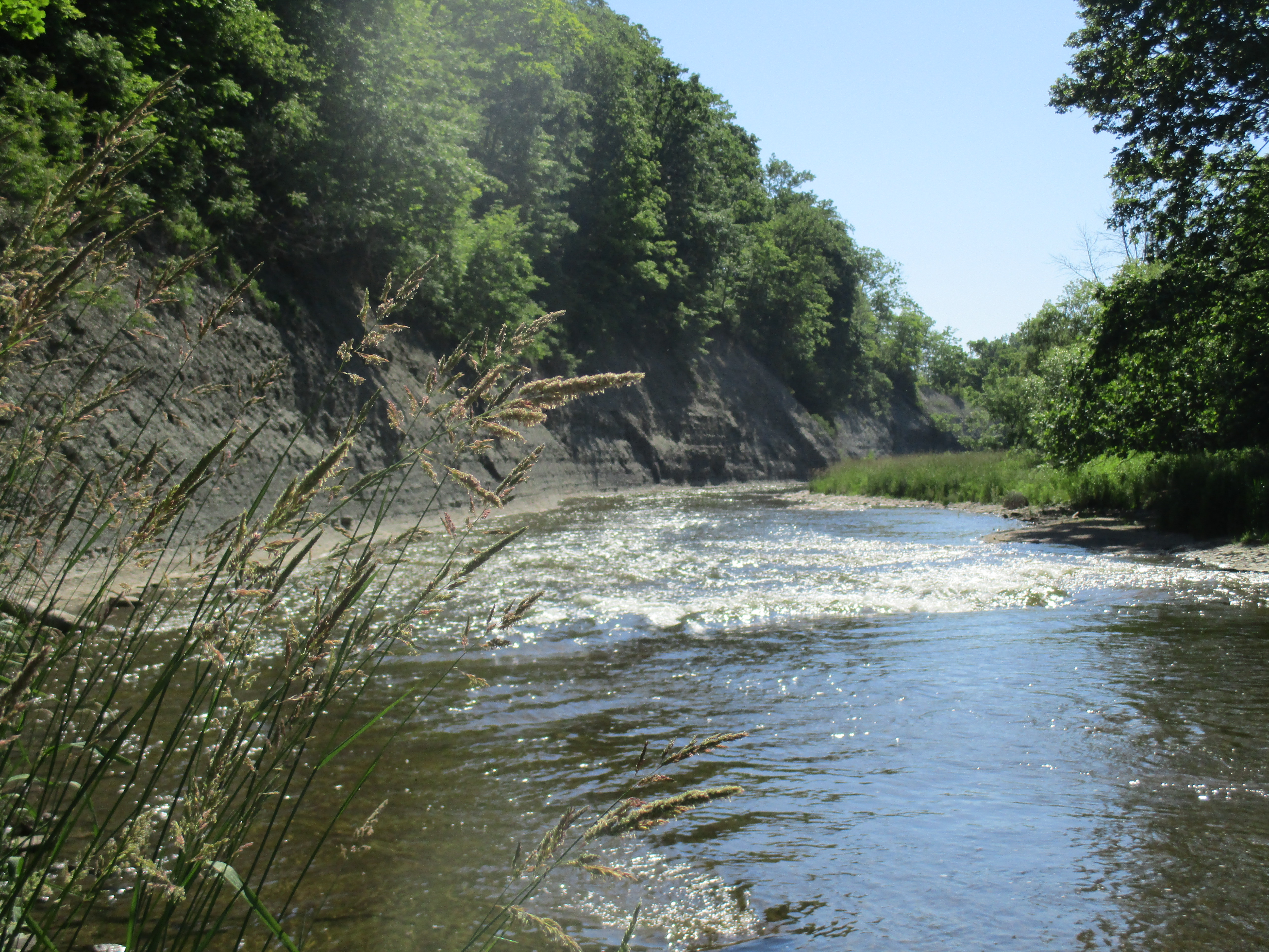
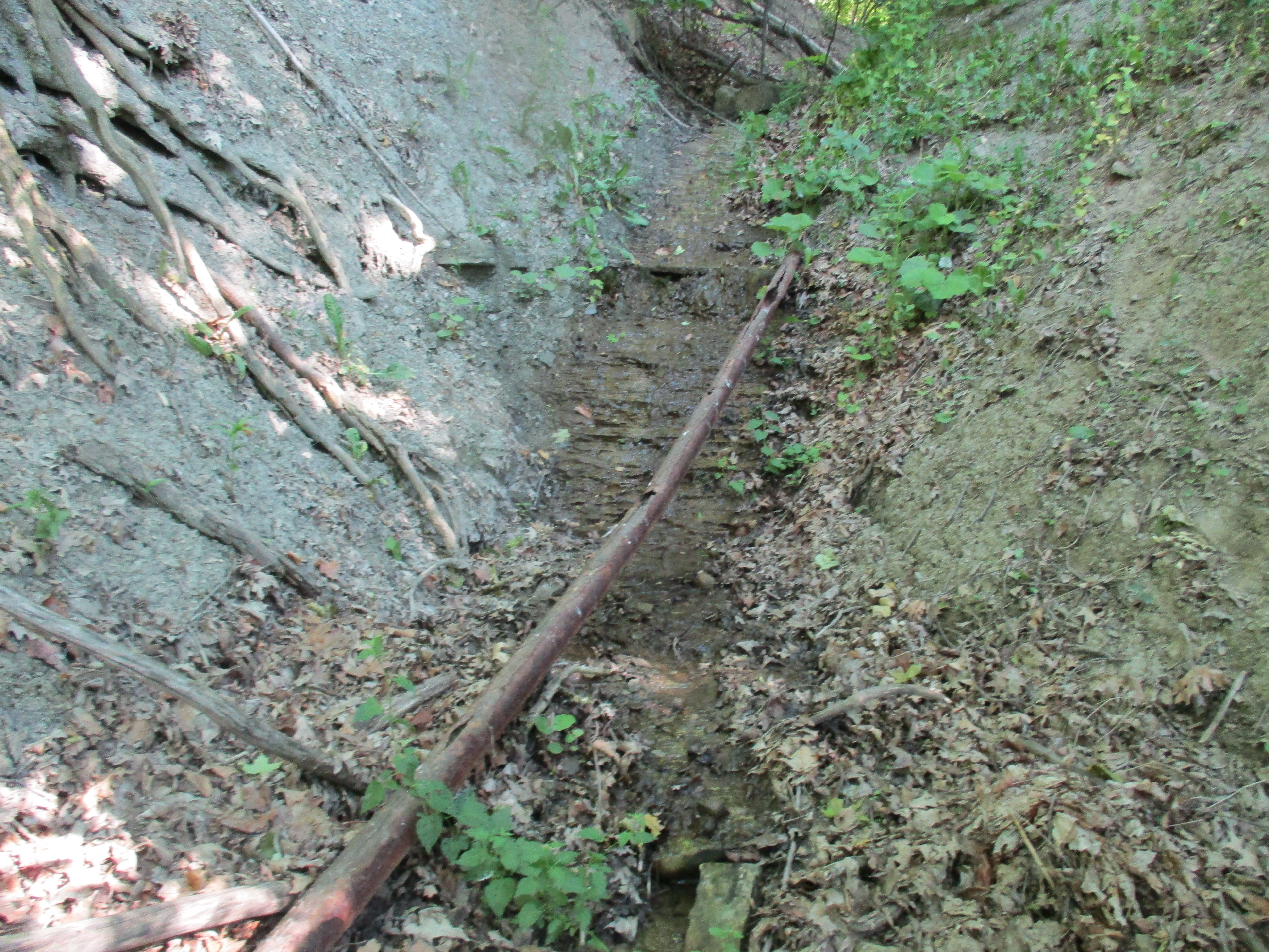
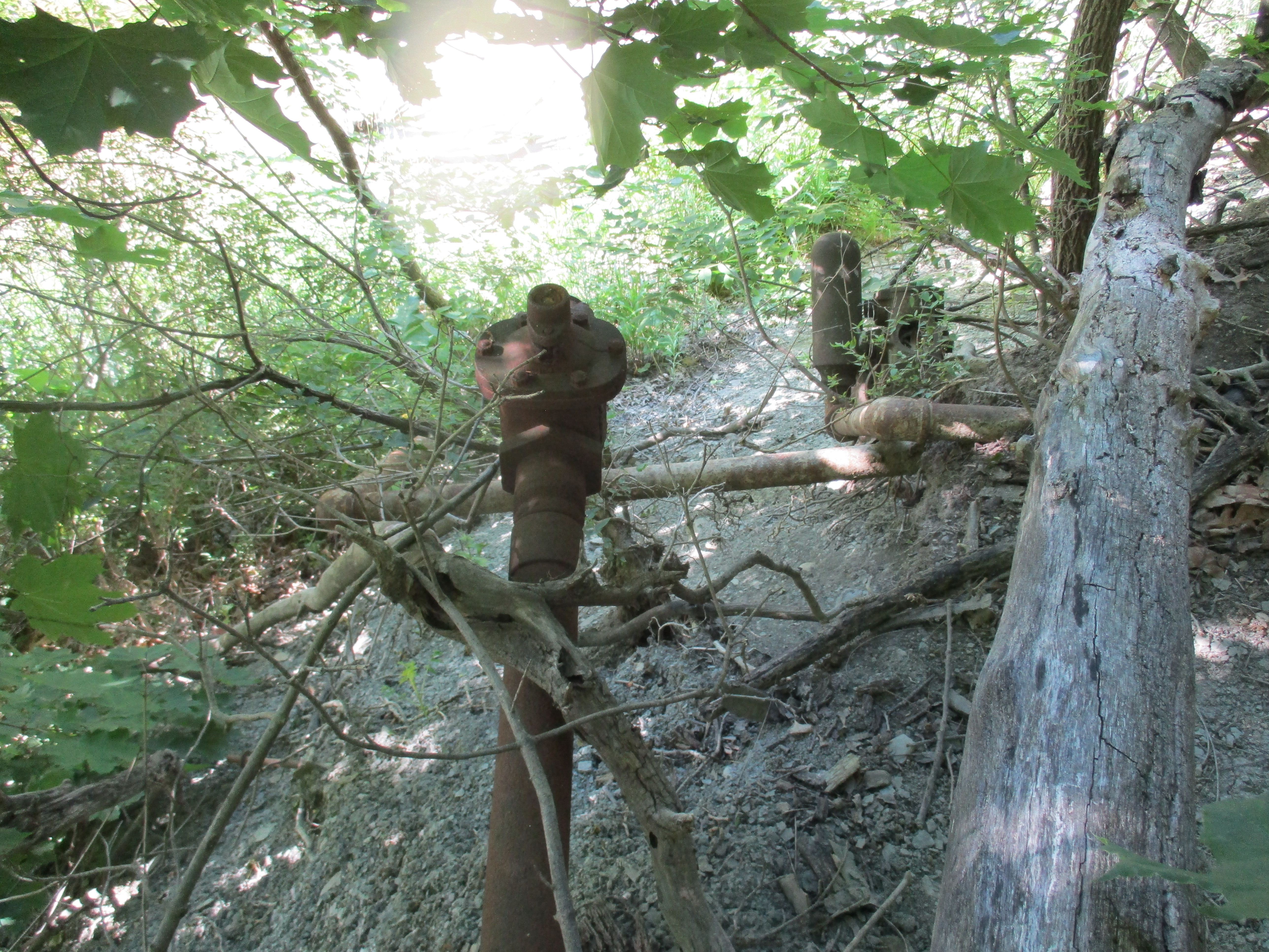
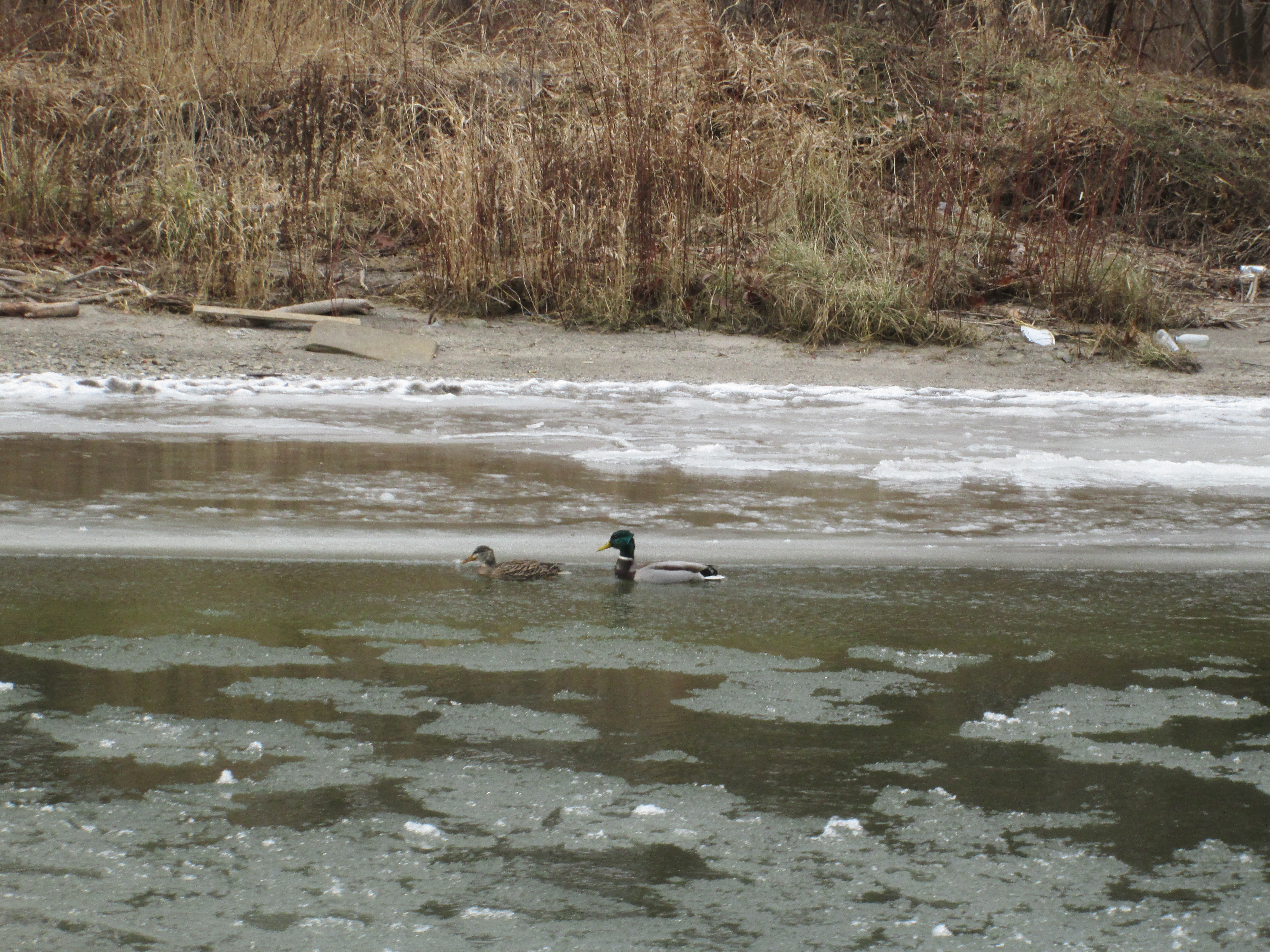
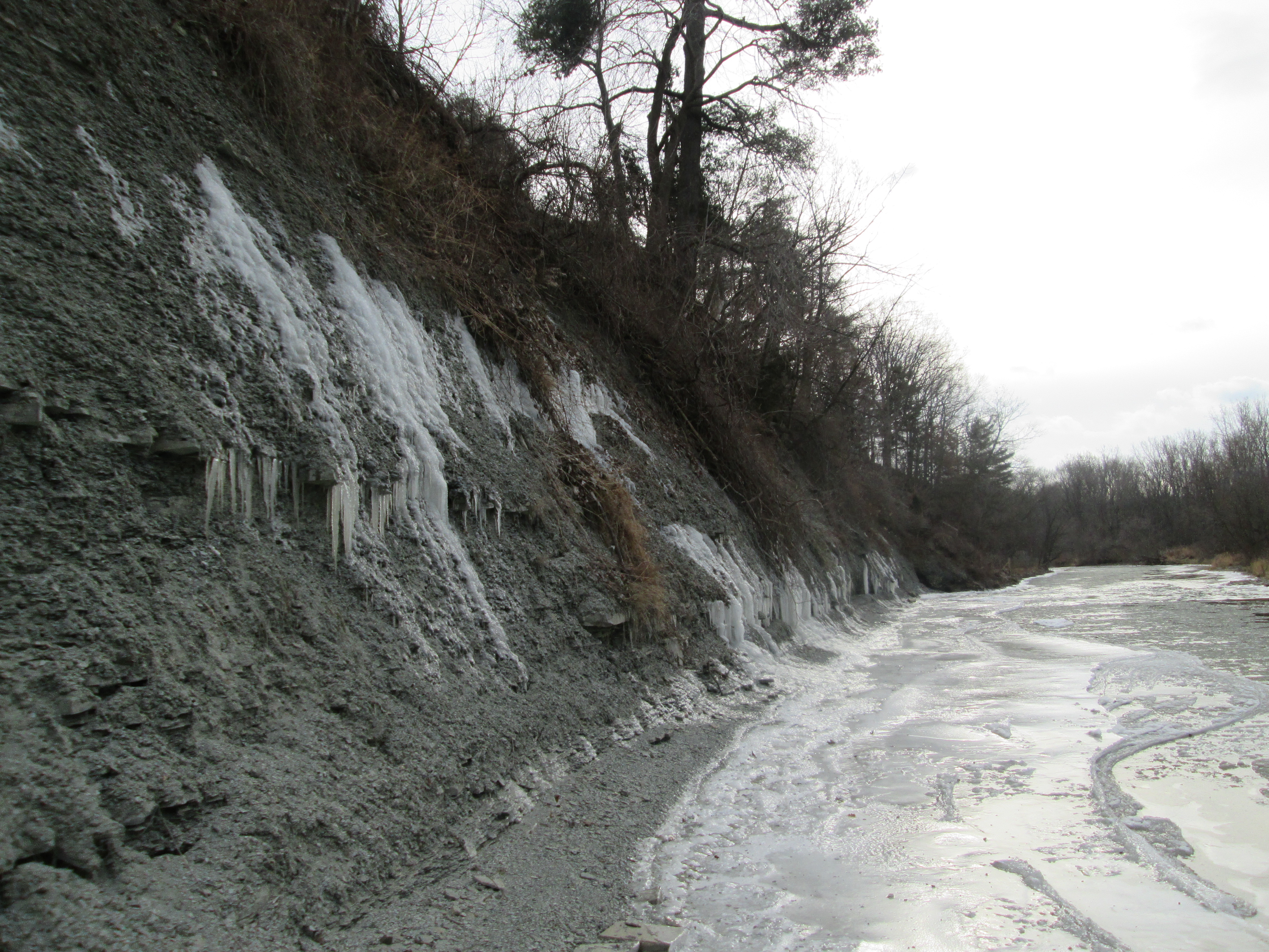
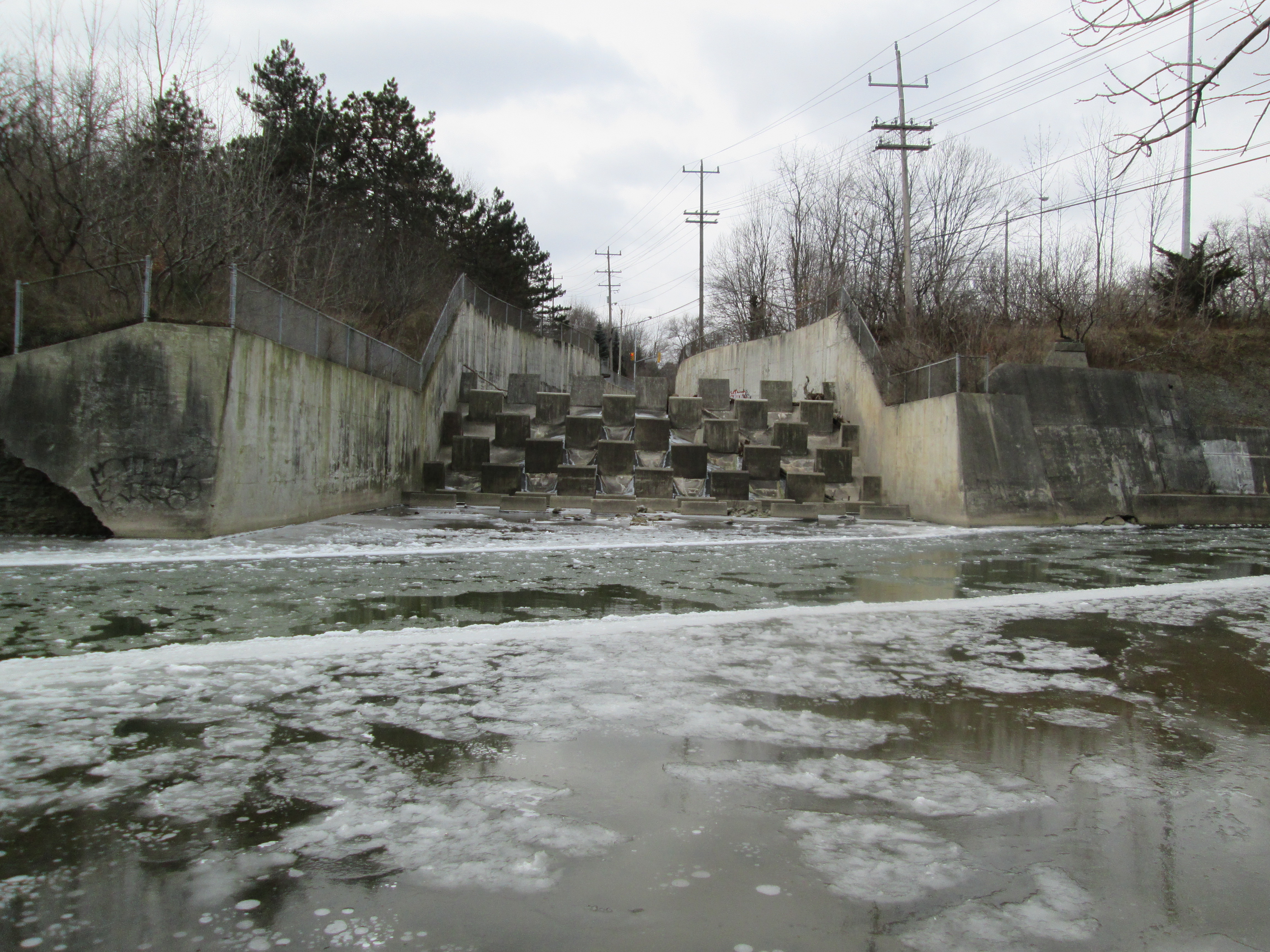
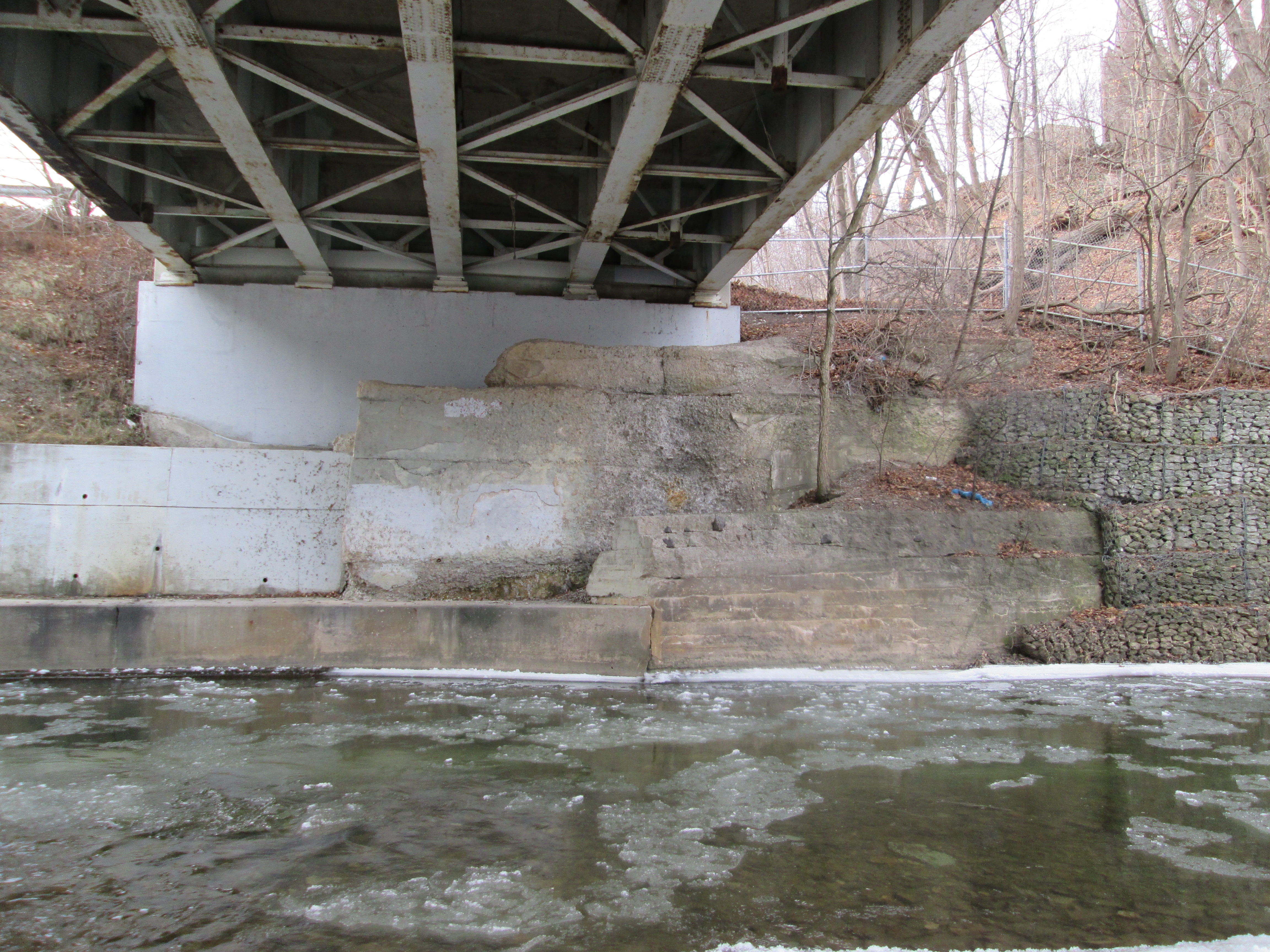
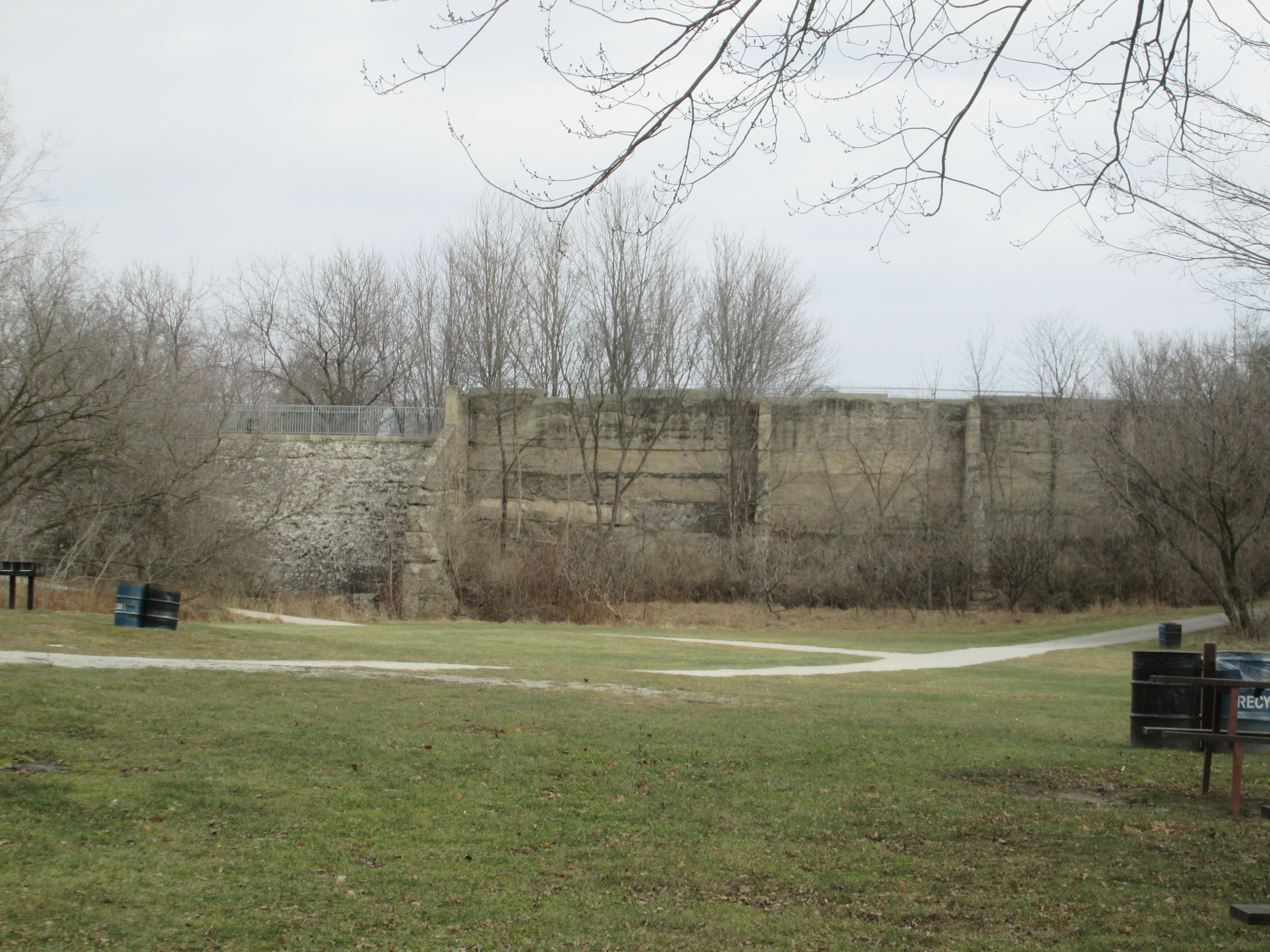
Erindale Park has a long history and at one time was known as Erindale Lake. In 1902 Erindale Light and Power Company was formed to construct an hydro electric generating plant on the Credit River at Erindale.  This large scale engineering project ran into several delays during construction and didn’t begin producing power until 1910.  A dam was constructed across the valley flooding it and creating the 125 acre Lake Erindale.  A power generating plant was built on the south end of town at the bottom of Proudfoot Street.  A tunnel was constructed to connect the two.  The power plant operated from 1910 until 1923 supplying power to Erindale and New Toronto. It was closed when Ontario Hydro began to supply the area with power from Niagara Falls.  In 1941 the lake was drained and the dam was blown up.  Between 1961 and 1965 the former lake bottom was used as a sanitary landfill.  It has since been covered over with clean soil and Erindale Park has been created.

Erindale was served by School Section #4 and has had several buildings over the years. The bell from the 1872 school has been preserved and is now housed in the 1922 replacement building. This beautiful structure was built in the Colonial Revival and Neo-Classical style of architecture. It became the Springbank Community Centre in 1957 and is now part of the University of Toronto Mississauga.

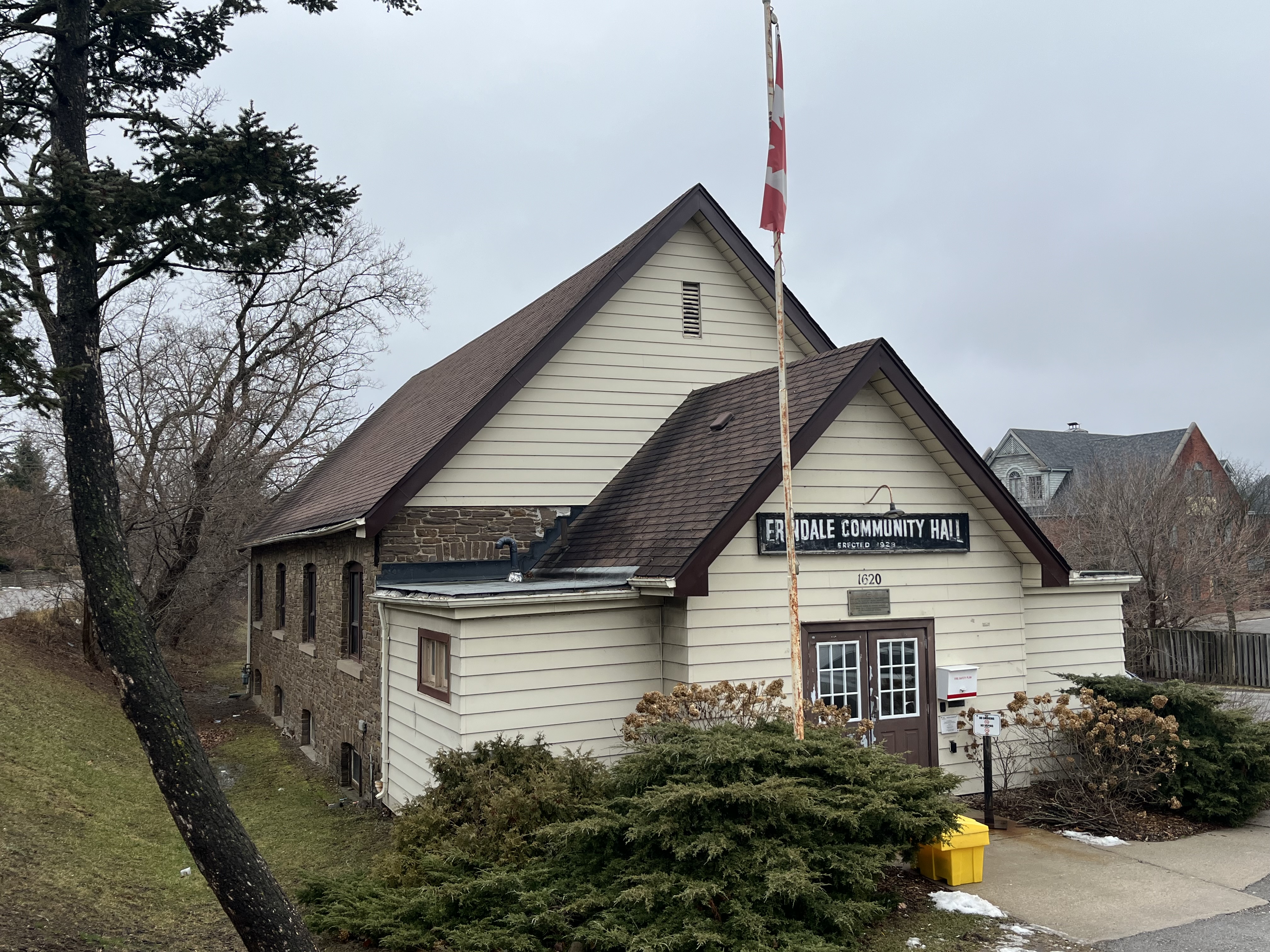
In 1919 a fire destroyed several of the older buildings on the core of the town including the Parish Hall, Post Office and the Royal Exchange Hotel. A new community Hall was constructed and has operated under a board of directors for almost 100 years. It can still be rented for private functions.

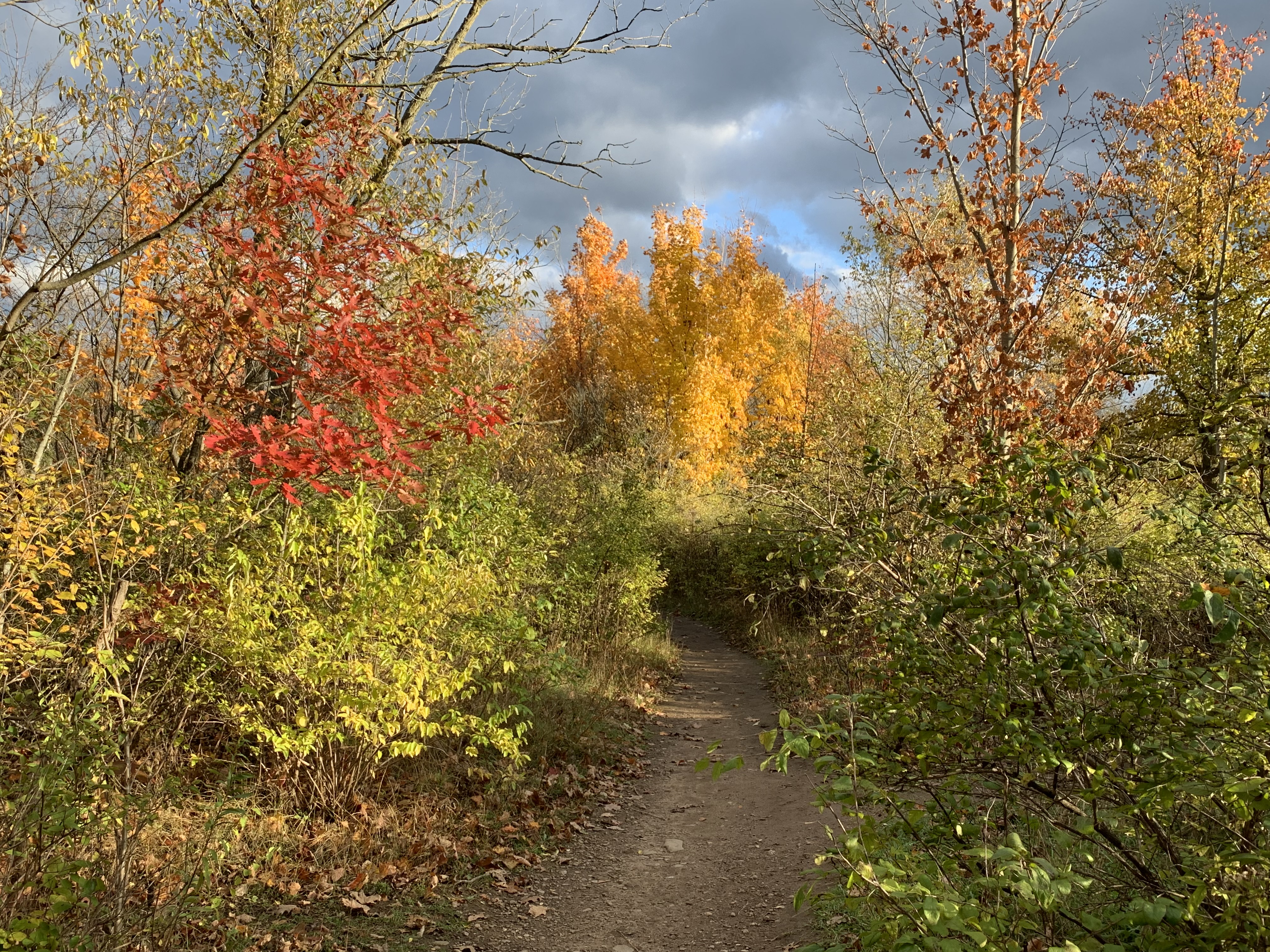
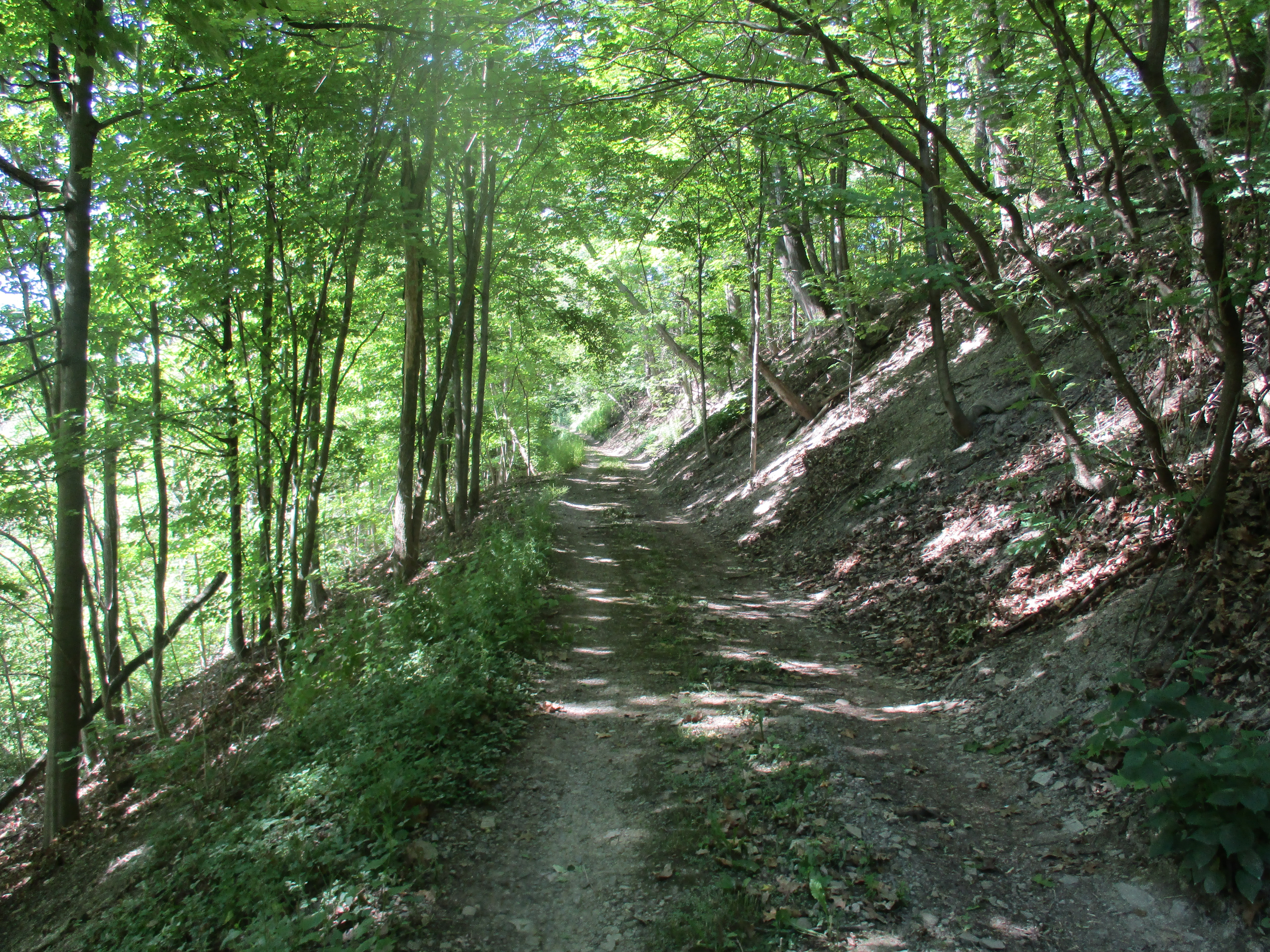
The historical community of Erindale can still be experienced via a walking tour. Heritage Mississauga has provided the details for one and a brochure can be accessed at this link: Erindale Tour. There’s a considerable amount of history in this area and you can read more in the various stories listed below.

Related stories: Winding Lane Bird Sanctuary, J. H. Pinchin Apple And Turkey Farms, Erindale Hydro Electric Dam, Erindale Powerhouse,UTM Nature Trail, Ghastly Tales Of Sawmill Valley Creek, Erindale Orchards, Credit River At Erindale

Google Maps Link: Erindale

Like us at http://www.facebook.com/hikingthegta

Follow us at http://www.hikingthegta.com

Also, look for us on Instagram

UTM Nature Trail

Sunday, November 7, 2021

In the 1960s the University of Toronto decided to expand with an additional campus on each of the east and west ends of the city. Eventually Scarborough and Mississauga each got a new university campus. The University of Toronto Mississauga (UTM) was develped on two adjacent pieces of land. The northern section was a millionaire’s estate while the southern section belonged to the Erindale Sand and Gravel Company. The old gravel pits have been redeveloped for the various buildings of the university while much of the old estate remains intact, forested and is home to the UTM Nature Trail. We set out to explore the nature trail and the local history. The 1961 aerial map below is from the Toronto Archives and shows the relative location of the mansion, the pond and the cottage going from the top of the image to the bottom.

Erindale Park was a lake when the dam was intact but is now a large park with plenty of free parking. It’s best to park there and then cross the Credit River on the footbridge. There’s a trail that goes to the right and follows the river upstream to where it climbs the ravine from the flood plain up to the table lands above.

The UTM Nature Trail begins at the top of the hill. The trail is a little less than 3.5 kilometres long and follows the edge of the ravine, providing some interesting views of the river below. Although the trail is a loop it isn’t all nature trail. Part of the loop passes through the University campus following a sidewalk route. We turned back when we got to that part.

The land that forms the northern section of the UTM property was granted to Peter Adamson in 1836 and he held it until 1854 when it was sold to Edward Shortliss. In 1869 Louise deLisle foreclosed on the mortgage and took the property away from Shortliss. Louise deLisle placed it in trust for the use of the Schreiber family. Weymouth Schreiber moved to Springdale (now Erindale) in the late 1870’s and lived there for awhile until a home was built on the northern portion of the property. Three houses were eventually built with Lislehurst being raised in 1885. The name likely pays respect to deLisle. Two other houses and a cottage were built but one of the homes was lost to a fire in 1913. The remaining home would be dismantled around 1930 and the materials used to enlarge Lislehurst when Reginald Watkins bought the property. He designed a false Tudor style home facing the river which features exposed beams and stucco. The University of Toronto acquired the 12,000 square foot home in 1968 when they bought the property to develop a western campus. Since then the home has usually been occupied by the Principal who has the luxury of 8 bedrooms and 5 bathrooms. They also enjoy the short commute down the old laneway which is now known as Principal’s Road. The house is well posted as private property but as it is clearly visible from the UTM trail it has been decorated for Halloween.

Reginald Watkins bought the property in 1930 and began to renovate it into a grand estate. One of his most endearing creations was an artificial pond with a concrete bottom. He built a stone arch bridge across the pond which is still in use by pedestrians as well as almost everyone who passes by with a camera. You can reach the pond by following the old laneway away from Lislehurst. Between the house and the pond a set of laneway curbs runs to the edge of the new growth forest. Therein lies the foundations from another of the outbuildings from the estate.

Near the pond stands a large carving called Curiosity Knowledge Wisdom. It depicts an owl, pileated woodpecker, raccoon and a fawn on the front with a male cardinal on the back. It was donated to the campus on September 29, 2013 by two members of the class of “81 and their two children.

If you follow Principal’s Road past the maintenance buildings you will find a small story and a half cottage that was built in the 1870s by the Schreiber family. At various times it has served as a groundskeepers home, a guest cottage and the gardeners house. When the Schreibers moved around 1900 they left Stanley Plumb as caretaker and he moved into the cottage. Watkins rennovated the cottage when he updated Lislehurst. When UTM bought the property they first used the cottage for the Artist in Residence. It is currently used to stage mock crime scenes for the forensic students to try and solve. While Lislehurst has a heritage designation the cottage does not.

The car that was left parked behind the cottage has been stripped of everything that could be reused. The inside of the car shows signs of having been set on fire. I think it could have been a Chrysler Sebring based on the shape.

The trails on campus were lightly used on this Sunday afternoon with the exception of a few students. The upper trails were in pretty good shape but the lower trail along the river was quite muddy.

Chiggers, or Berry Bugs, look like tiny bright red dots. The one pictured below was on a log but they commonly hang around on the tips of tall grass waiting to crawl onto people and animals that pass by. They feed on animal skin and can leave a serious bite that causes an itchy rash known as Trombiculosis.

Orange Jelly Slime grows on dead softwood trees. It isn’t poisonous but appareantly it doesn’t hold together if cooked so it needs to be eaten raw. It’s also said to be basically tasteless so perhaps if I was lost and starving…

We saw evidence that there are plenty of deer on the UTM campus where they can avoid the crowds of people who are enjoying Erindale Park. You can read about when the park was Erindale Lake in our story Erindale Hydro Electric Dam.

Google Maps Link: UTM Nature Trail

Like us at http://www.facebook.com/hikingthegta

Follow us at http://www.hikingthegta.com

Also look for us on Instagram

Erindale Powerhouse

Saturday June 18, 2016

The Erindale Powerhouse was opened in 1910 and operated until power was delivered from Niagara Falls in 1923.  The building was closed and sat abandoned until 1977 when it was demolished.  Today, the site is only accessible by water.  The archive photo below shows the powerhouse shortly after construction.

lg_k3701

Hiking the GTA visited The Erindale Hydro Electric Dam in October 2014 at which time we looked at the power structures on the north side of Dundas Street.  The intake system that drew water from Lake Erindale and brought it to the powerhouse was described along with photographs.  Water was fed through a pipe under Dundas Street to the power generation buildings on the south side of town.  The pipe, or penstock, is open on the north end and led to the question “What is on the other end?”

head

Our Credit River at Erindale post began as an attempt to follow the river south to locate the remains of the old powerhouse.  This trip was called off due to ice on the shale but a later trial was to prove that access from the west wasn’t possible.  The east end is fenced off by the Credit Valley Golf and Country Club.  It looked like access would be from the river on a nice day, if at all.  The shale cliff pictured below leads to the golf club and is on the same side of the river as the powerhouse remains.

IMG_2089

In 1902 Erindale Light and Power Company was formed to construct an hydro electric generating plant on the Credit River at Erindale.  It took 8 years to complete the construction which included a tunnel under Dundas Street.   A natural crook in the river was used to bring the water through the shortest possible tunnel.  The powerhouse was built near the end of Proudfoot Street.  Erindale and New Toronto got their power from the plant until 1923 when supply came to the area from Niagara Falls.  The 1960 aerial photograph below shows the power generating station 37 years after it went out of service.

Power

A small ravine is cut through the shale and initially it looked like a good possibility to be the tail race from the power station.  It is laid from top to bottom with old pipes that in many places are rusted through.

IMG_2032

Buried in the hillside are the remains of a pump dated July 19, 1921.  This 95 year old pump was manufactured by F. E. Meyers of Ashland Ohio who were a major manufacturer of farm equipment.  Founded in 1870 they invented the double action pump which could deliver a steady stream instead of just spurts of liquid.  In 1910 they created the pump and spray system that allowed the Panama Canal zone to be sprayed for mosquitos.  This saved thousands of people from getting malaria and allowed construction of the canal to be completed.  The pumping system and pipes run directly toward the Credit Valley Golf and Country Club.  The first 6 holes of which were developed in 1930 for W. D. Ross who was Lieutenant Governor of Ontario at the time.  In 1934 the course was leased from Ross and opened to the public.  Since then it has been expanded several times including 5 holes in 1954 on the west side of the river to bring it up to a full 18 holes.  The pumping system in the ravine predates the golf course by a decade but is contemporary with the final days of the electrical powerhouse operation in the valley.  It supplied water to the orchards that formerly stood on the golf course property.  A similar pumping system is located on Loyalist Creek as seen in the post Erindale Orchards.

IMG_2035

By 1916 the Erindale Powerhouse was in financial trouble and was bought out by the Hydro-Electric Power Commission of Ontario.  They continued to operate it until 1923 when power from Niagara Falls rendered it obsolete.  Demolished nearly 40 years ago, the woods are quickly taking over the site.

IMG_2051

There are pieces of old walls and plenty of steel left along the ravine side.  The cover photo shows one of the steel plates from the old structure.

IMG_2062

The old access road still runs along the side of the embankment.  It appears to be still maintained as there are no fallen branches on it and the tire tracks are free of plant growth.  There is a large open area at the bottom of the roadway that is being used as an amazing back yard by a home at the top of the ravine.

IMG_2071

Purple Flowering Raspberry is a member of the rose family and it blooms from early in the spring until early fall.  It is often grown for decoration because of it’s long season and bright flowers.  The fruit is made of many drupelets and is furry compared to a raspberry.  The berry is a little tart to the taste but can be eaten and is part of the diet of squirrels and birds.

IMG_2076

At the top of the access road are the old stone gate posts that marked the entrance to the facility.  Also located here is the “No Trespassing” sign that marked the beginning of the return journey.

IMG_2078

This tree has grown around these two stones and lifted them two feet off the ground.  They’ll continue to rise as the tree grows until it eventually falls and rots leaving them a couple of feet away from where they started.  It’s a good thing they have all the time in the world because it’ll take them forever to walk into town at this pace.

IMG_2087

This was an interesting trip but there is very little left of the old powerhouse.

Like us at http://www.facebook.com/hikingthegta

Follow us at http://www.hikingthegta.com

Credit River at Erindale

Thursday Jan. 1, 2015

It was minus 6 feeling like minus 14.  Realizing that I hadn’t been hiking all year, I set out to fix that.  When we had investigated the Erindale Hydro Electric Dam in October we hadn’t looked for the power plant on the south end of town.  Parking in the first lot at Erindale Park we set off for the Credit River on the east side.

We crossed Dundas Street and entered a pathway down to the river from the east end of the bridge.  There we came across a large paper wasp nest.  Paper wasps build their nests out of chewed up plant fiber that they mix with saliva to make a paper-like substance.  They secrete a chemical onto the anchor stem of the nest so that ants don’t invade.  Gardeners consider paper wasps to be beneficial because they pollinate the plants as well as eat garden pests.

IMG_1773

It may have been New Years Day but we didn’t see any people swimming in the river, doing their polar bear thing.  A pair of mallard ducks were swimming in the slushy river, feeding and enjoying the day.  Mallards form breeding pairs in the fall and perform courtship rites all winter. In the spring when the eggs are laid they separate.  The male takes no role in the raising of the ducklings but will hang out with the guys all summer.  In the fall a male duck’s fancies turn lightly to love and he leaves the boys in search of a mate.

IMG_1785

As we made our way along the eastern river bank it started to look like we wouldn’t get around the curve in the river due to the shale banks along the side.  Going up and over wasn’t an option because in places the fence along the top was already falling down the embankment.   Water seeping out between the layers of shale has created icicles that reach down to the river in places.

IMG_1774

We were able to get out to where the ice had formed in the shale layers.  Where it flows out onto the thin river ice is currently impassible.  There is a possibility of making it around here in the summer when the water level is low.

IMG_1780

We decided to try to come at the old power station site from the top of the ravine.  We hoped to find access from one of the original Erindale side streets south of Dundas.  Turning north again we came to where Sawmill Valley Creek enters the Credit River just below Dundas Street.  It has been placed into a concrete channel with a series of concrete squares which help prevent the discharge from getting frozen by accelerating the water.

IMG_1792

Dundas Street was surveyed in 1796 by Augustus Jones who also surveyed Yonge Street.  These two streets were built by the Queens Rangers under the direction of Lieutenant-Governor General Simcoe.  Roads were required for easy movement of troops should the defence of Fort York become necessary, as it did in 1812.  Dundas Street has had several bridges over the Credit from the earliest wood structures to the current 4 lane version.  The remnants of the foundations for earlier bridges can be seen below the modern one.

IMG_1799

The picture below shows Erindale in 1910 looking west toward the river.  There is a vehicle just entering the bridge where the road hooks to the left.  Also featured in in this image are the stone flower mill, blacksmith shop, Barker’s Hotel with the large veranda and Caven’s store. The community hall is on the left.  All of these buildings were destroyed by fire in May 1919.

ha0045l (1)

Passing under the bridge we made our way back to the old power dam that created Lake Erindale from 1910 until 1940.

IMG_1800

Along the side of Dundas street stands the old head race for the power generating station. Water from Lake Erindale was diverted through a tunnel under Dundas Street to the power plant south of town.  A large intake structure allowed for the controlled flow of water from the lake.

IMG_1811

We climbed the hill behind the intake and crossed Dundas Street.  Following Proudfoot Street we looked for a way to get down to the river.  Short of boldly walking across someone’s lawn there is no access anywhere along the ravine.  This older part of town contains many historical homes from the days of settlement in Erindale.  The 1855 log home on Jarvis Street wasn’t one of them though.  It was moved here in the 1970’s but is cool because of it’s collection of antique wheels and pumps that are displayed around the outside of the house.

IMG_1824

Just east of the 1928 Community Hall is this old driving shed.  The cover photo is of this building with it’s horseshoe hanging upside down.  Horse shoes are considered lucky by some.  By hanging it with the open ends facing down it was supposed to pour the luck out over the doorway preventing evil from entering the building or home.

IMG_1827

This tree has been confused by the weather and is thinking about blooming.

IMG_1848

So, no luck on finding the tail race and foundations of the power plant today.  That will have to wait perhaps for a time when we can pass below the shale cliff on the side of the river.