Tag Archives: Canadian Pacific Railway

E. T. Seton Park

Saturday, December, 8, 2018

E. T. Seton Park is named after Ernest Thomson Seton who was born in England but moved to Canada with his parents in 1866 at the age of 6.  His father was abusive and he spent much of his time in the Don Valley near the park.  He became famous as an author, painter and a founding member of The Boy Scouts of America.  The park that was named after him follows the West Don River south and features an archery range, disc golf and extensive trails.  We parked for free in the lot that is south of Eglinton accessed off of Leslie Street.  We roughly followed the orange trail on the Google Earth capture below as far as the Forks of the Don.

Seton

The north part of the park has a couple of ponds that sit in the valley below the Ontario Science Centre.  Originally the Science Centre was planned in 1961 with an opening in 1967 for the Canadian Centennial celebrations.  The three pods were designed to match the contours of the Don Valley that it was built along.  Opening was delayed until September 2, 1969.  The ice may be thin on the pond but this was no obstacle to the local coyote.

IMG_1802

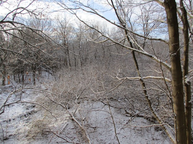
The fresh snow always looks so nice sitting on the tree branches.  As the morning progressed the brief periods of sunshine caused the snow to slide of the branches and created the occasional brief snow shower and even a nice dump of snow down the back of the neck just for laughs.

IMG_1786

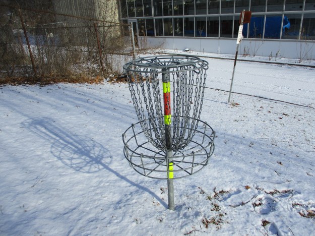
E. T. Seton Disc Golf Course is 18 holes long, each one a par 3.  The course winds along the river in both directions so that you get to walk the length of the park as you play.  There are disc golf associations that play here but the course is open to everyone who wants to try.  Local rules require a spotter on holes 9 (two-way pedestrian traffic) and 10 (near the archery range) to avoid hitting someone from a tee shot.  The first disc golf course was built 1975 in California.  Today there are over 4,000 courses around the world with there being three free ones in Toronto.  The E. T. Seton Park course opened in 2001 but there is also a course on Toronto Islands and at Centennial Park.

IMG_1816

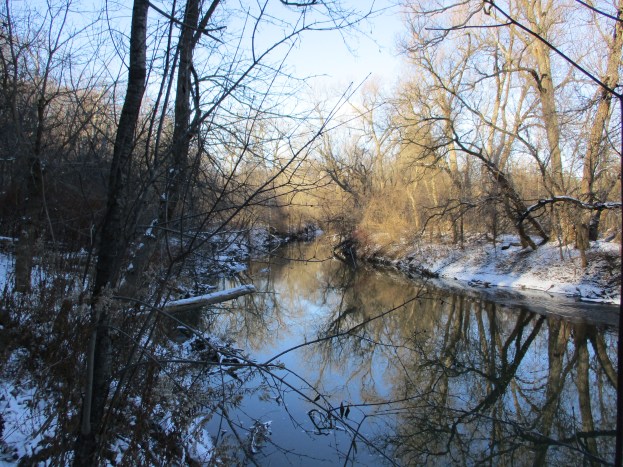
An old bridge crosses the Don River near where the Upper Mill was in the Taylor Paper making empire.  The Lower Mill was located at Todmorden.  The large parking area just north of the bridge was the site of the paper mill for over 100 years.  The main trial is paved and continues along the east side of the river while a smaller bicycle trail follows the west side of the river.  It passes under the railway tracks.

IMG_1846

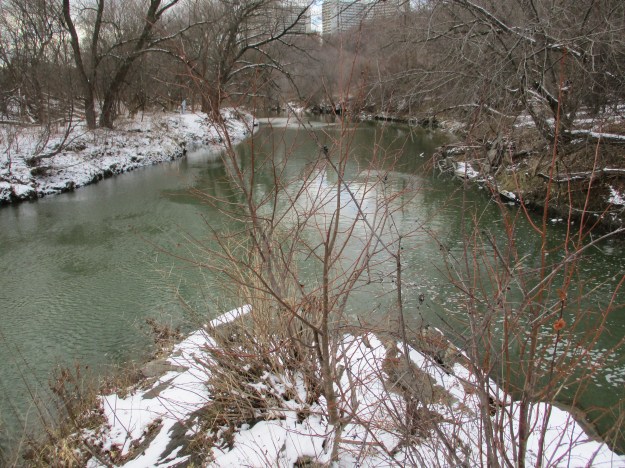
Each of the major rivers in the GTA have a split or fork in them.  The West Don River flows through the heart of the park until it reaches the point where east meets west.  The East Don River was formerly known as the Middle Don.  At that time, Taylor-Massey Creek was known as the East Don.  The Forks of the Don can be explored from either side of the river but access to the middle of the forks is only possible by trespassing on the short but active railway bridge above and so we don’t suggest that you do this.

IMG_1838

From the tracks you can see the bridge where Don Mills Road crosses the ravine with the railway in it.  Behind the road is the bridge that carried an old section of Don Mills Road that has been abandoned when the new section opened.

IMG_1842

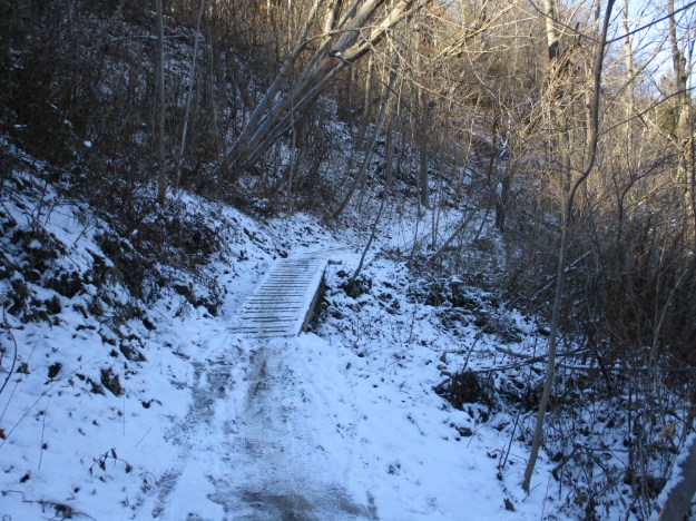
Two trails make their way up the west side of the West Don River.  The upper trail is known as Catalyst while Beaver Flats is the name of the lower one.  These trails appear to be primarily used by bicyclists and the sharp turns and sudden rises in the trail will require a sharp eye to avoid getting run over.

IMG_1871

I’m not sure if this is intended to be a piece of artwork but we do get tired of seeing tires in our parks and ravines.  They are great places for still water to sit in the summer and create breeding grounds for mosquitoes.

IMG_1877

The Canadian National Railway bridge spans the West Don River ravine in the distance.  This bridge sits on an old set of cut stone piers as well as a newer set that was made of poured concrete.

IMG_1881

The CPR bridge is seen in this 1955 photo.  Of note is the system of wires that along the poles beside the trestle.  Today there are only one or two wires and all the accessible glass insulators have been removed.

1955

The park continues to the south and links up with the Lower Don Trail as well as Taylor Creek Park.  There is plenty more to explore another day.

Google Maps Link: E. T. Seton Park

Like us at http://www.facebook.com/hikingthegta

Follow us at http://www.hikingthegta.com

Roundhouse Park

Sunday March 20, 2016

In the 1850’s the era of steam locomotives arrived in Toronto.  At that time the name “Front Street” applied to the street that ran along the water front.  Wanting access to the harbour, the railways decided to create land by in-filling, a process that continued for another 70 years until the corner of Front and John Streets was half a mile from the water. Running for two miles from Strachan Avenue to Yonge Street this new land became known as the railway lands.  The picture below shows the railway lands with Spadina Street Bridge crossing near the middle.  The Canadian National (CN) Spadina roundhouse can be seen just above it with the Canadian Pacific Railway (CPR) John Street roundhouse near the top of the picture.

IMG_0537

The first railway to enter Toronto was the Ontario, Simcoe and Huron in 1853.  They built a station near the current Union Station.  Soon the Grand Trunk Railway (GTR) and the Great Western arrived in town.  The first Union Station was built by the GTR in 1873 and served the growing needs of the railway lands.  In 1888 the CPR brought a new level of competition and they soon outgrew the Union Station.  By 1900 plans were in place for a new Union Station with construction beginning in 1915 but it didn’t open until 1927.  In 1923 the GTR went bankrupt and was merged into the CN.

IMG_0614

When the CPR was completed it passed through Leaside and over the Vale of Avoca and the Belt Line Railway ravine and bypassed downtown Toronto.  The CPR was finally granted permission to access downtown via the Don Valley and they constructed the Half-Mile Bridge. They built a station named Don Station at the corner of Queen Street in 1896.  The station remained in use until 1967 when it was closed.  From 1969 until 2008 it was housed at Todmorden Mills.  In 2008 it was moved to Roundhouse Park where it was restored and opened as a visitor’s centre.  The restored Don Station is seen in the cover photo.

Servicing and repairing trains became a major function of the rail yards and the best way to store locomotive engines was in a circular building or roundhouse.  The John Street Roundhouse was built in 1929 and had 32 bays.  Each of these was accessed by a set of tracks that linked up with the turntable.

IMG_0550

Locomotives were usually operated in one direction and the turntable was used to turn them around.  This is a twin span turntable and in this photo it is shown with the Reinhard Vinegar wood tank car on it.

IMG_0560a

The picture below from 1973 shows the CPR John Street roundhouse on the upper left. Notice that the coal towers are located east of the roundhouse, almost out of the photograph.  The coal tower has since been relocated to the west end of the roundhouse. The footings for the CN tower are just rising above grade level in the middle of the shot. On the right the CN Spadina roundhouse, built in 1928, can be seen.

1024px-CN_Tower_footings_1973

As the area around Union Station became busier the control of the signal lights and track switches became more complicated.  The GTR built five control towers lettered A to E with cabin D located just west of Bathurst Street where several tracks converged.  Switch tenders manually set the track switches according to directions broadcast from the cabin. When the other cabins were replaced with modern structures in 1931 Cabin D was left in operation.  It used this manual system until 1983 when the cabin was moved to Roundhouse Park.  Beside Cabin D is it’s tool shed as seen below.

IMG_0580

The coaling tower at the roundhouse has been relocated and is currently sheltering some of the museum’s pieces.  Coaling towers were used to elevate coal above the train so that it could be gravity fed via a chute into the steam engine tender.  The picture below shows the black Canadian National Vanderbilt cylindrical tender that was coupled with the museum’s CNR 6213 steam locomotive.  It would have been loaded with coal at a tower such as this.

IMG_0536

The Toronto, Hamilton and Buffalo (TH&B) was originally chartered in 1884 and began operations is 1892.  In 1895 the CPR and the New York  Central Railroad bought the TH&B and jointly operated it.  They never built the railway into either Toronto or Buffalo and so the name is a bit misleading.  The steel sheathed, wood sided caboose below was built in 1921.  A caboose was intended to provide a home-away-from-home for the rail crew.  The cupola on the roof was designed to allow the crew to observe the performance of the train in front of them and apply emergency brakes if required.  In the mid 1950’s it was painted yellow and black after the colours of the Hamilton Tiger Cats.  It has now been fully restored and added to the Toronto Railway Museum, a city in which it never served.

IMG_0573

One of the more unusual pieces of rolling stock that the museum has is RVLX 101 which is a rare wooden tank car.  It was originally built in 1938 and acquired by Reinhart Vinegars in Stayner in 1964.  They used it for the next 12 years to ship vinegar to Dallas, Texas.  It has been in museums since 1976.

IMG_0554

The wooden box car was the most common piece of stock used by the railways.  The CPR owned over 33,000 of them and this example was built in 1917.

IMG_0557

One of the newest operations in the roundhouse is Steam Whistle Breweries.  They occupy the first 14 bays in the roundhouse and opened for business in 2000.  The three founders were former employees of Upper Canada Brewing and have the code 3FG embossed on the bottom of their bottles as a reference to the fact that they were 3 Fired Guys.  The photo below shows the rear of the roundhouse and a number of Steam Whistle vehicles.  The former roundhouse water tower is in the background, painted in the Steam Whistle colours.  The truck in the foreground is a 1957 Chevrolet 3100 Apache.

IMG_0601

The CN Spadina roundhouse was demolished in 1986 to make room for Skydome (now Rogers Centre).  When the stadium was built they created a monument to the Chinese workers who helped build the CPR and unite the country.  Between 1880 and 1885 there were 17,000 men who came to work on the railway through the rocky mountains in Alberta and British Columbia.  Over 4,000 of the Chinese workers lost their lives and many others had no way to get back to China when the work was finished.  This memorial is in appreciation of all those people whose names have been lost to history.

IMG_0608

One of the newest tenants of Union Station is the Union Pearson Express.

IMG_0604

The John Street roundhouse was renovated in the 1990’s and opened as Roundhouse Park in 1997.

Google Maps link: Roundhouse Park

Like us at http://www.facebook.com/hikingthegta