Saturday April 30, 2016
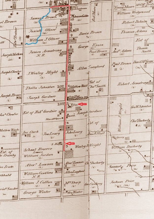
The former town of Britannia is represented by a few buildings, including a church and a one room school house. These remain tucked in among the modern buildings that line Hurontario Street near the 401. The local survey was completed in 1819 under the guidance of Timothy Street who would go on to found Streetsville. In the 1877 County Atlas below, Hurontario Street was called Centre Road and McLaughlin Road was 1st line west. There is parking on the street in the subdivision that has been built on the former property of Joseph Mathews, including on Navigator Drive. The first part of this hike follows Fletcher’s Creek (blue) through lots 9 and 10 starting with the half lot belonging to William J. Oliver whom we will return to later.
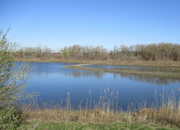
 The property of William Oliver has been flooded to create a large flood control pond that is divided into two sections. The strip of land that separates the two sections is re-enforced with interlocking stone. A large section of this near the far shore has had it’s soil washed away. Fletcher’s Creek has the reputation for being the most polluted sub-watershed in the Credit River watershed. In spite of this, both a great blue heron and a double crested cormorant were fishing here until they were disturbed.
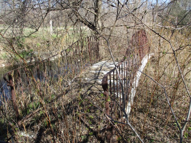
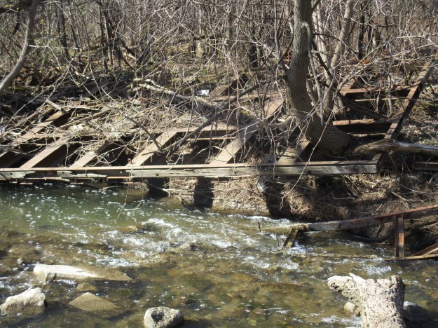
Following the creek north will bring you to the second half lot which belonged to Josiah Oliver. This property has the remnants of an old roadway and bridge on it. The picture below shows part of a road deck that has been washed onto the shore of Fletcher’s Creek. It has stayed there long enough that large trees have started to grow through the sections. The cover photo shows a foot bridge that has been placed on one side of the creek and left until it is fully overgrown.
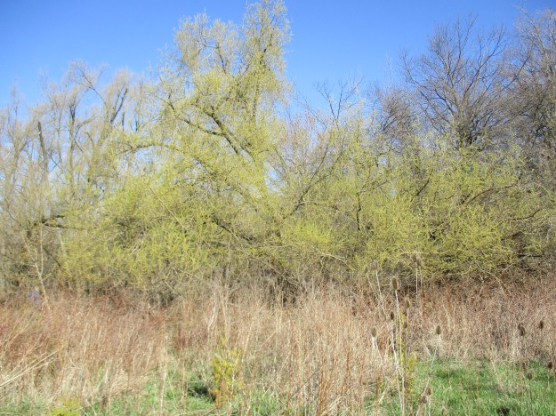
It is nice to see the trees turning green again. The undergrowth through this ravine is full of raspberry bushes. The corner of Derry Road and Hurontario Street was once home to the community of Derry West. This ghost town may be the subject of a future exploration.
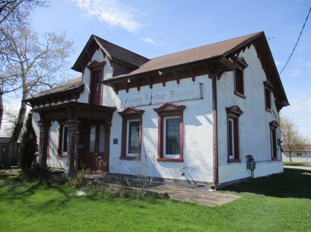
Heading south on Hurontario Street brings you toward the community of Britannia. William Oliver, on whose property this hike began, built the house pictured below around 1880. It has become known as Hansa House and is home to the German Heritage Museum.
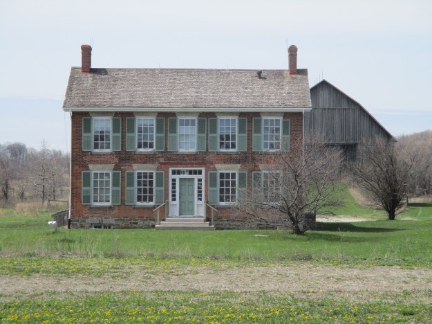
The first settlers arrived in Britannia around 1821 and named the community Gardner’s Clearing after two prominent and early families. The house in the picture below originally stood on the southwest corner of Britannia and Hurontario on the lot that is marked as the estate of Robert Gardner on the county atlas. This Georgian Style home is known as the Gardner-Dunton home and was likely built around 1840. It was moved a kilometer down the road onto the school property in 1989.
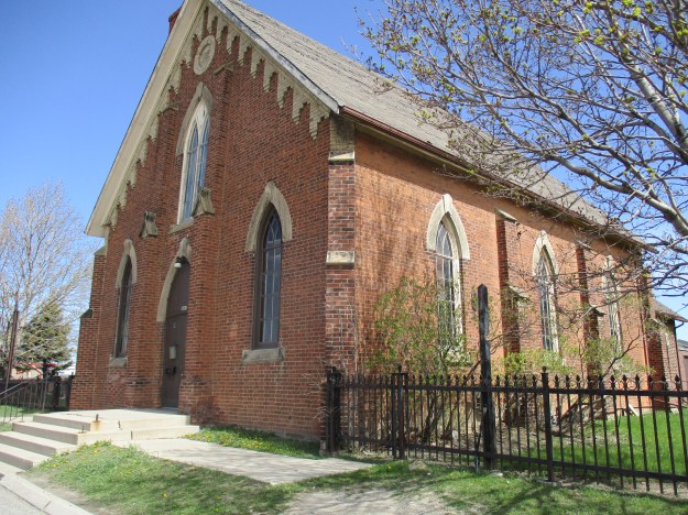
The community of Gardner’s Clearing built a log frame church the first year of the settlement. As the town grew there was a need for a larger church. Joseph Garner donated land for a church and cemetery in 1830. The new church wasn’t built until 1843 and it was made from locally made bricks. It has been modified several times over the years. By 1869 the town had grown large enough that more room was needed and the church was expanded to add a Sunday School room. In 1897 the church basement was excavated and a furnace was added. Church union occurred in 1925 and the name of the church was changed to Britannia United Church. Two years later the first electric lights were added, replacing the oil lamps in the church. Finally, in 1957 a small kitchen was added.
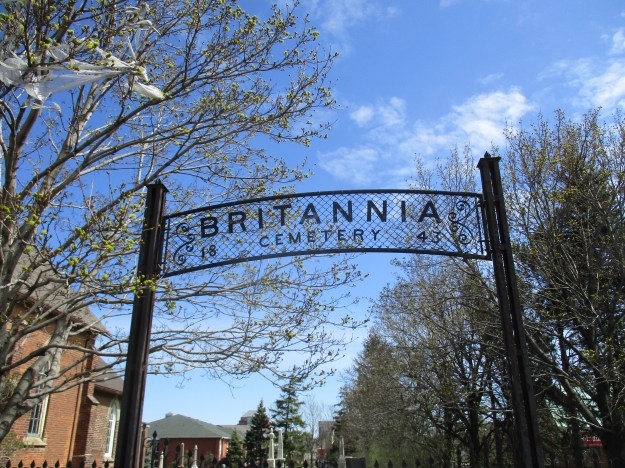
The first recorded burial in the Weslyan Methodist church cemetery took place in 1837. Joseph and Catherine Gardner lost two infant daughters, both of whom were named Catherine. The first one perished in 1837 and was buried on the corner of the family farm. Later both Joseph and his wife, Catherine, would be buried in the cemetery that surrounded the church. The gates for the cemetery read Britannia 1843 although they are clearly a later addition. The community of Gardner’s Clearing didn’t become known as Britannia until 1863 when the post office was opened.
When the post office opened in 1863 the town chose the name of Britannia to celebrate British Imperial rule. The first post master was Joseph Muir who was followed by Joseph Gardner. Prior to 1915 the local farmers used to come into the town to collect their mail from the post office. In 1915 Canada Post began rural delivery and the post office was closed down. The building was erected in 1862 and stood on the north east corner of Hurontario and Britannia. The archive picture below was taken in 1958 when the building was in service as a private residence. It has since been demolished.

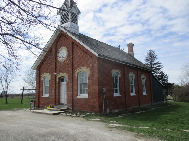
William IV was the king of England from 1830 until his death in 1837. King William IV was ahead of his time in setting aside various land grants as school reserves. Free mandatory public education for everyone wouldn’t come to Ontario until the School Act of 1871. The 1877 county atlas shows the school as sitting on lot 3 which is marked as School Reserve. This property still belongs to the Peel Board of Education. The community of Gardner’s Clearing erected a log school house which they used until 1852 when a new brick building was completed. The one room brick school was used until 1959 when it was closed. After sitting empty until 1982 it was restored and is now listed as a heritage building.
The School reserve was a full settler’s lot of land set aside for school purposes. The reserve was leased out to tenant farmers to raise money to help pay for teachers. On the county atlas above it shows that William Jordan was the lessee of the reserve. A house was built on the reserve around 1850 and it is still on site. It was restored around 1990 and belongs to the Peel Board of Education.

Britannia has more surviving buildings than many of the lost villages in Mississauga. Both Palestine and Mt. Charles are reduced to just one old house while Dixie has a house and a couple of churches.
Google Maps Link: Britannia
Like us at http://www.facebook.com/hikingthegta

Entertaining and informative. Thank you.
Pingback: Ghost Towns of Peel Region | Hiking the GTA
Pingback: One Room Schools | Hiking the GTA
Thank you for all of the great information you’ve shared. I’m particularly interested in the house circa 1850 on the school reserve site and wonder if this is where the schoolmaster/mistress would have lived. As for the construction date of the brick version of the Britannia schoolhouse I saw a date of 1852 on the “Friends…” site whereas you give a date of 1859. I’m searching for supporting documentation concerning the building date of the school along with any information about Peter McTavish and his tenure as schoolmaster.
Thank you.