Monday, September 1, 2019
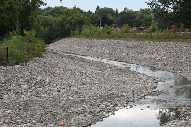
Cooksville Creek in Mississauga has its entire watercourse within the city and in fact it even flows under Square One Shopping Centre. Over the years it has come under great stress as a result of the changing nature of the watershed development. With so much of the surrounding areas now paved over and developed the flash flooding of the creek has become a serious problem leading to erosion and property damage. There are 304 buildings in the lower watershed that are subject to flooding in a 100-year event like Hurricane Hazel. The city is currently implementing new flood control measures including widening of the creek bed south of Mississauga Valley Boulevard. We found free parking at the Mississauga Valley Community Centre. From there we went to explore the construction of the flood controls on the creek.

The main flow of Cooksville Creek has been diverted into a pipe while they widen and deepen the channel.

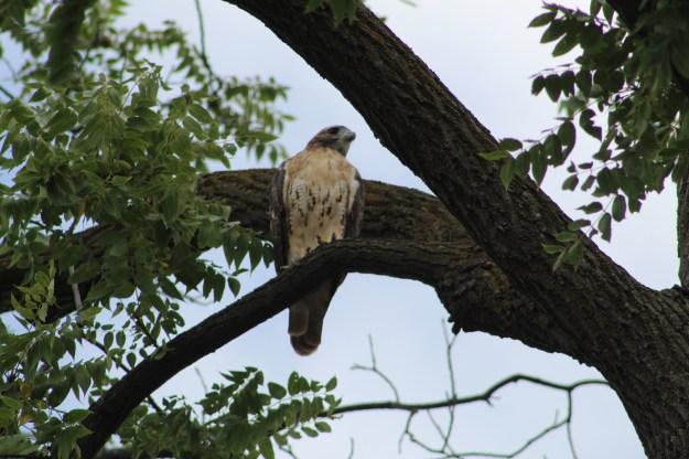
The woodlands on either side of the ravine are home to a large population of squirrels. There is a constant food supply for them in the cone and nut trees and both black and red squirrels can be seen collecting food for their winter supply. Having a good food supply for one species means that they will become a good food source for another predator. We saw this red-tailed hawk sitting in a tree keeping an eye open for breakfast.
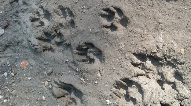
The danger exists in the air from the hawks and on the ground from the coyotes. The mud in the exposed creek bed has been crossed over many times with coyote tracks.
The river grapes are starting to ripen along the sides of the trail. The crop this year looks to be doing very well with lots of fruit for the wild animals to feed on. Coyote feces that we see along the trail seems to contain a lot of seeds and fruit husks and this isn’t unusual in the summer and fall as they supplement their diet.

The lower part of this reach was reworked a couple of years ago to increase stability of the sides and create retaining pools to hold the water during flood events.
The transition point between the section that was completed and that which has not been touched recently. Although some sections appear to be quite naturalized they have in fact all been subject to more than one repair since the creek was urbanized in the 1940’s. Of the 14.9 kilometres of creek there are only 1.2 kilometres that are natural while there are a full 35 kilometres of gabion baskets which are failing. The flood water has washed in behind them in places causing them to collapse into the creek, further diverting the flow and causing more erosion.

The mallard ducks that were born this spring have now become fully grown. We were enjoying watching them walk up the little waterfall in the creek. Over the years the repairs to the stream have reduced most of the natural pools and riffles in the watercourse. This is one of the places where the water gets oxygenated.

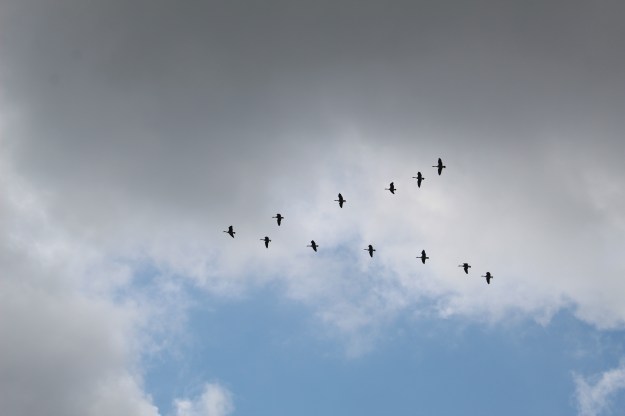
It’s the last weekend of the Canadian National Exhibition which always features the famous air show. On the way back home I would be treated to a squadron flying in formation on their way back to the airport. Just as the airshow marks the end of the CNE and the unofficial end of summer, nature’s air show marks the return of fall. We saw a gaggle of geese flying in the “V” formation that they use when flying south, The strongest birds fly in front while the weaker ones follow in their wind currents.
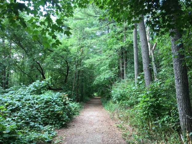
There are sections that have not been subject to heavy equipment in recent years. The undergrowth in these areas is first generation of trees. There are no large oak or maple trees that one would find in a succession forest. Where the work was completed in the past few years there are newly planted trees that may some day provide a mature forest. For now the trees are stripped back away from the edge of the creek so that there is no shade over the water. This leads to higher water temperatures and destroys the habitats. Cooksville Creek is essentially a dead creek with nothing but a few water skimmers in the upper reaches. This loss of riparian vegetation is a contributing factor to the decline of the Red-Sided Dace in the past 30 years. At one time they would have been populous in Cooksville Creek as they were in most GTA waterways.

At this time you can’t walk the entire course of Cooksville Creek due to the construction work. We went through anyway and although it was a holiday Monday there was someone on site who ignored us. Once you get south of the railway tracks there is a large green space that was formerly occupied by several homes. This is an interesting place where you can find foundations and driveways that are being overtaken by the new growth of vegetation.

This area was accessed by Given Road which we have previously described in a post that can be found at the link above.

Cooksville Creek is a real mess today and you wonder how it can ever recover. However, if you look closely, every ravine has a set of sewer access points that are dated from the 1950’s and up. These remind us that there has been heavy equipment in the ravines before and since the infrastructure below will need maintenance at some point, there will be again.
Google Maps Link: Cooksville Creek
Like us at http://www.facebook.com\hikingthegta
Follow us at http://www.hikingthegta.com

Pingback: Further reading: Cooksville Creek – Kenneth Cardenas