Tag Archives: Bufflehead duck

Pine Point Golf and Country Club

Saturday, January 9, 2021

There are currently 13 golf courses in Toronto and another 87 within 20 miles of Toronto which attests to the popularity of golf. Between 1869 and 1919 there were thirty courses opened in the city but many of them have been built over with homes. At least two of them have been turned into parks that we’ve visited. The former York Downs Golf and Country Club is now Earl Bales Park. Similarly, Pine Point Golf and Country Club is now Pine Point Park.

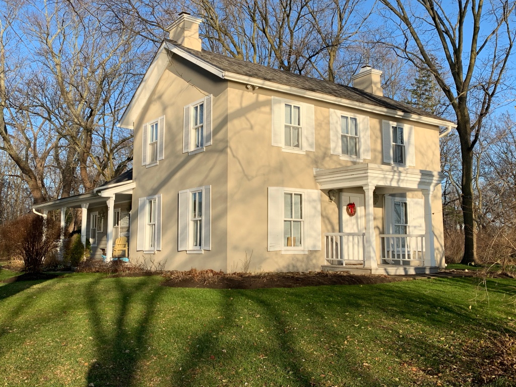
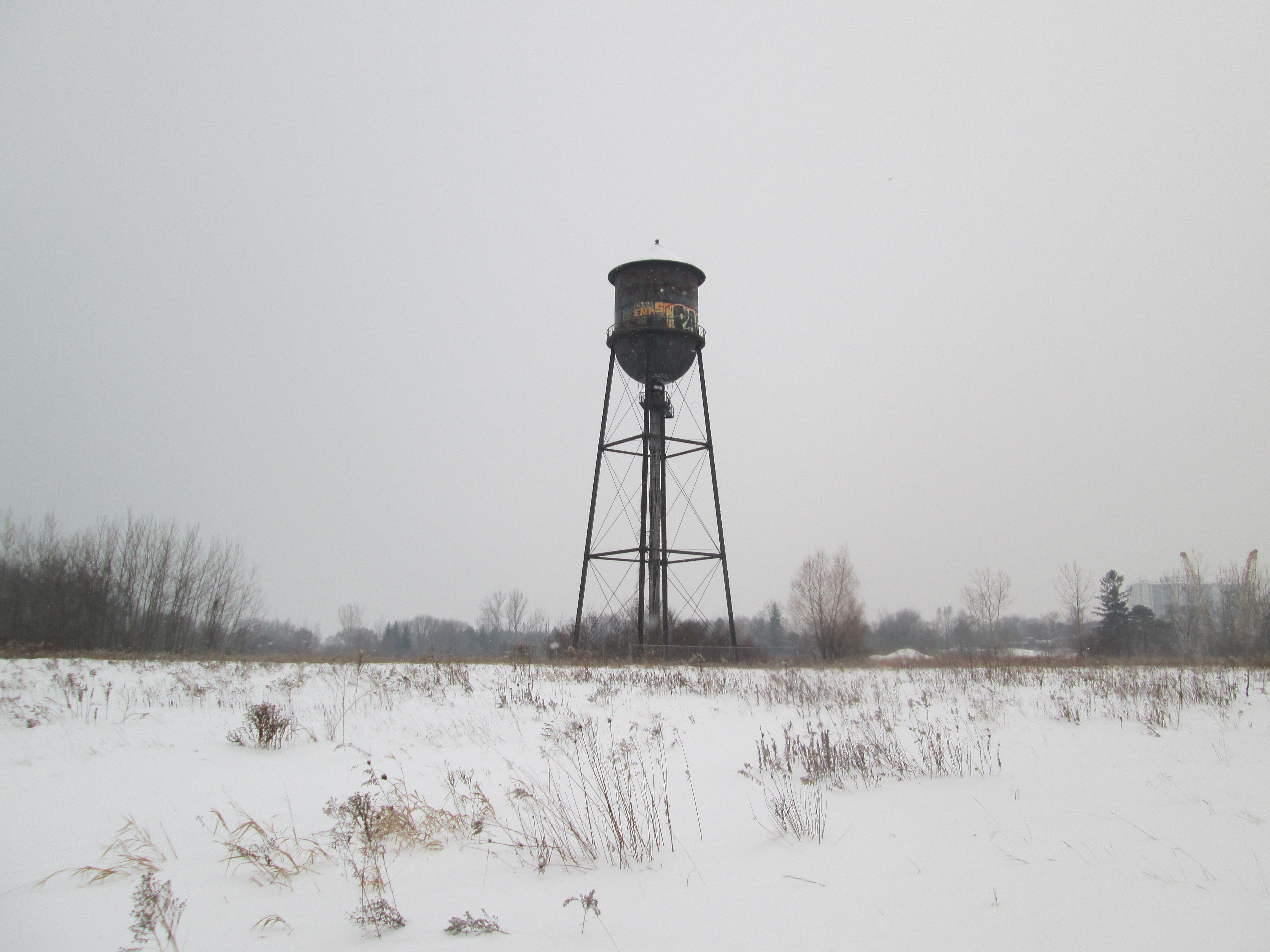
Pine Point Golf and Country Club wasn’t one of these original 30, nor is it one of the remaining 13 as it came and went between then and now. In 1925 it got its start as the Riverside Golf Course. It consisted of 225 acres and was operated by Cecil White until 1932 when he sold it to Bert and Frank Deakin. This father and son partnership rebranded it as Pine Point Golf and Country Club. They built a new club house in 1932 to replace the existing one.

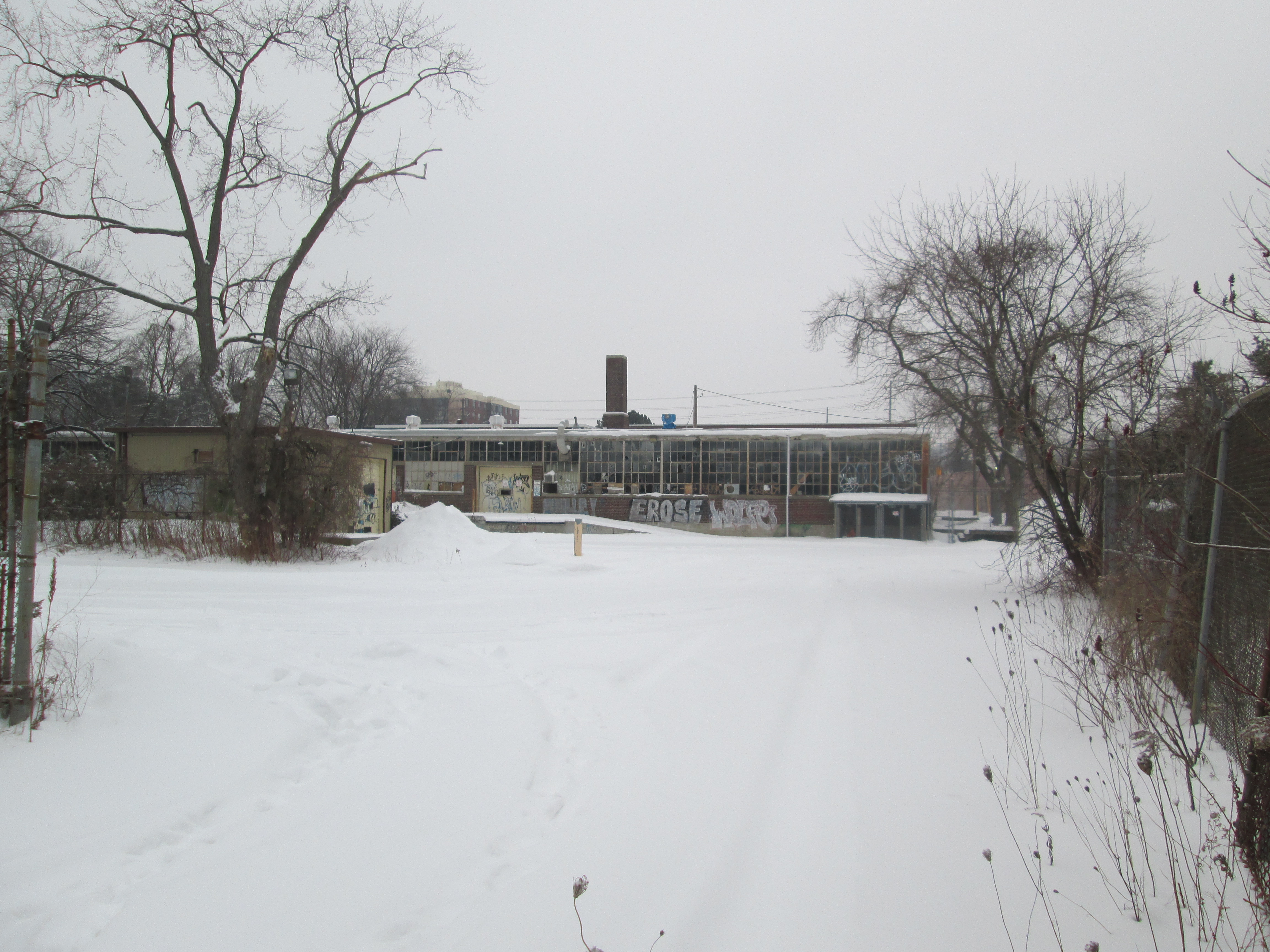
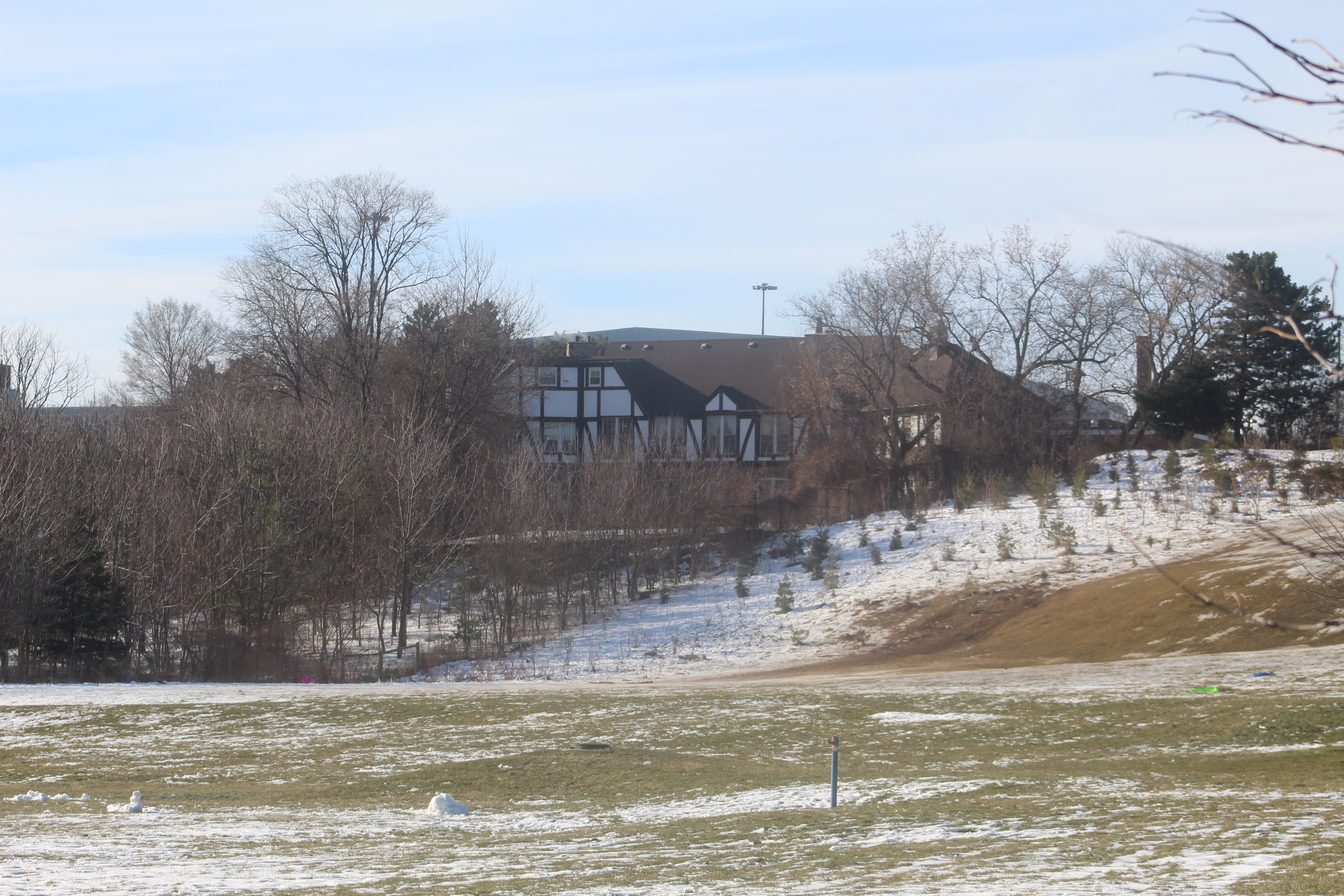
They experienced disaster on the night of August 6th, 1938. At 2:20 in the morning Frank Cech was watering the far greens on the course when he saw the glow of the blaze. The club house was completely destroyed before the Weston Volunteer Fire Brigade could put it out. As soon as the clean up was complete they set about building a new club house. Things carried on until 1950 when the government bought a strip through the middle of the golf course for construction of the 401. Another 22 acres were bought on the north side of the new highway for the creation of a new park. Pine Point Park was opened in 1957. The picture below shows the back of the club house and a bunch of newly planted trees.

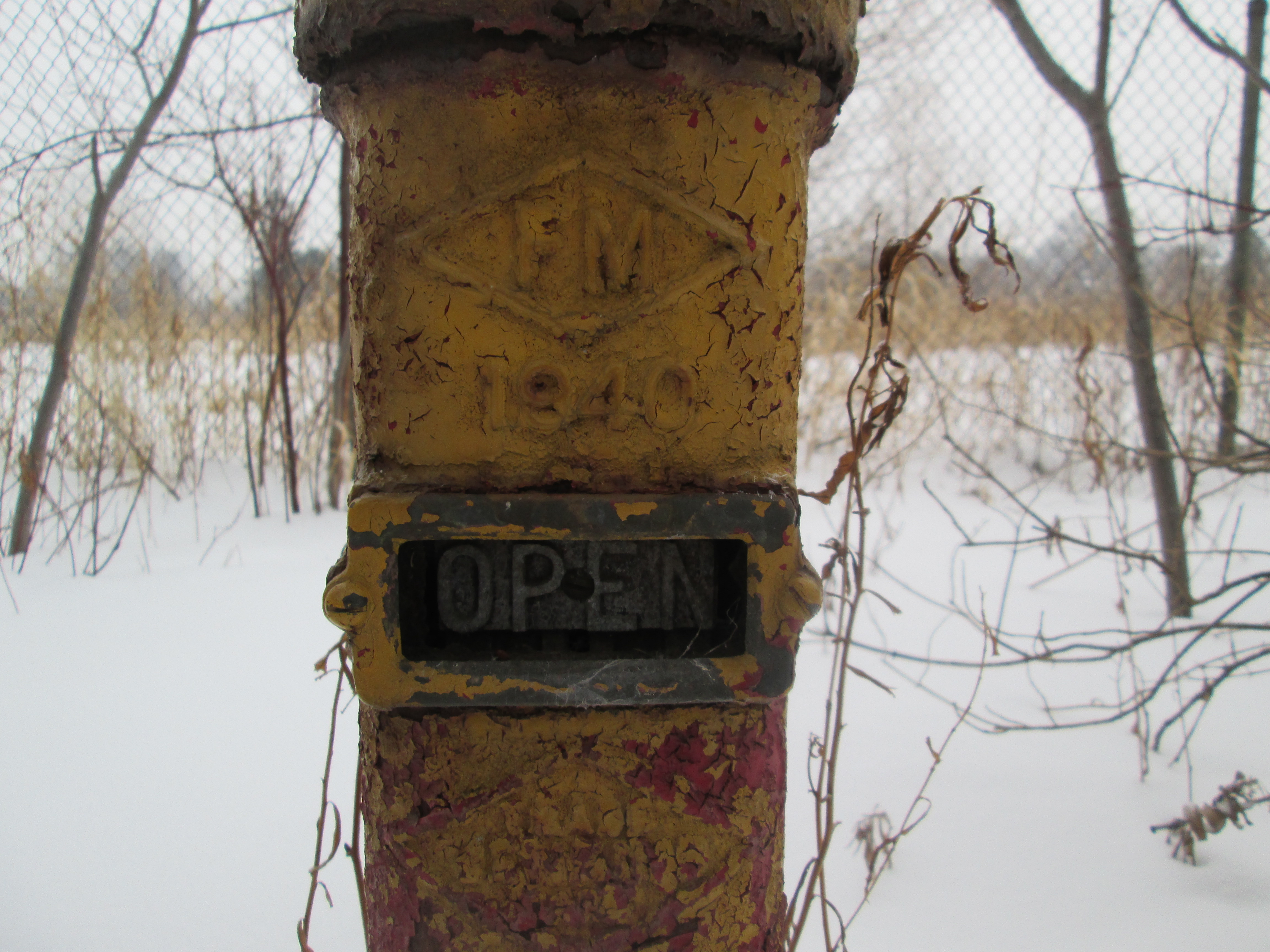
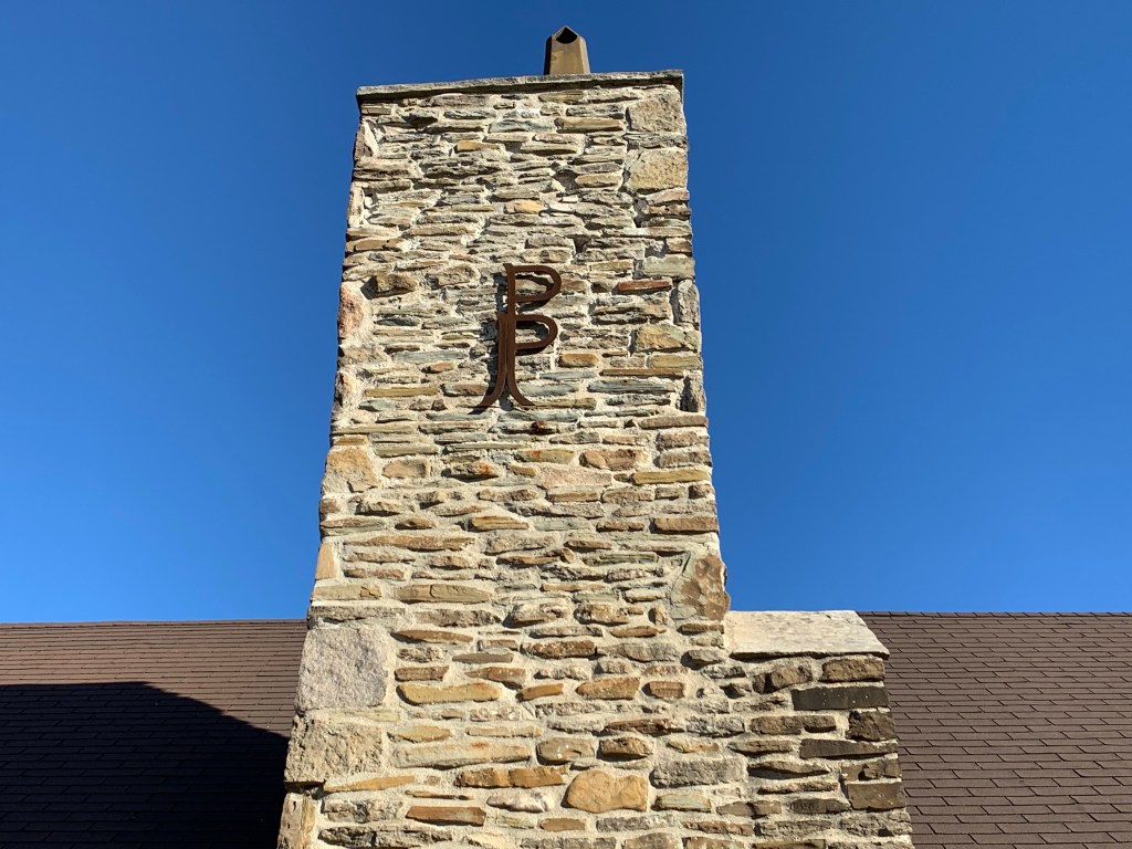
The main chimney still sports the logo from the days when golfers would congregate here before and after a round of golf.

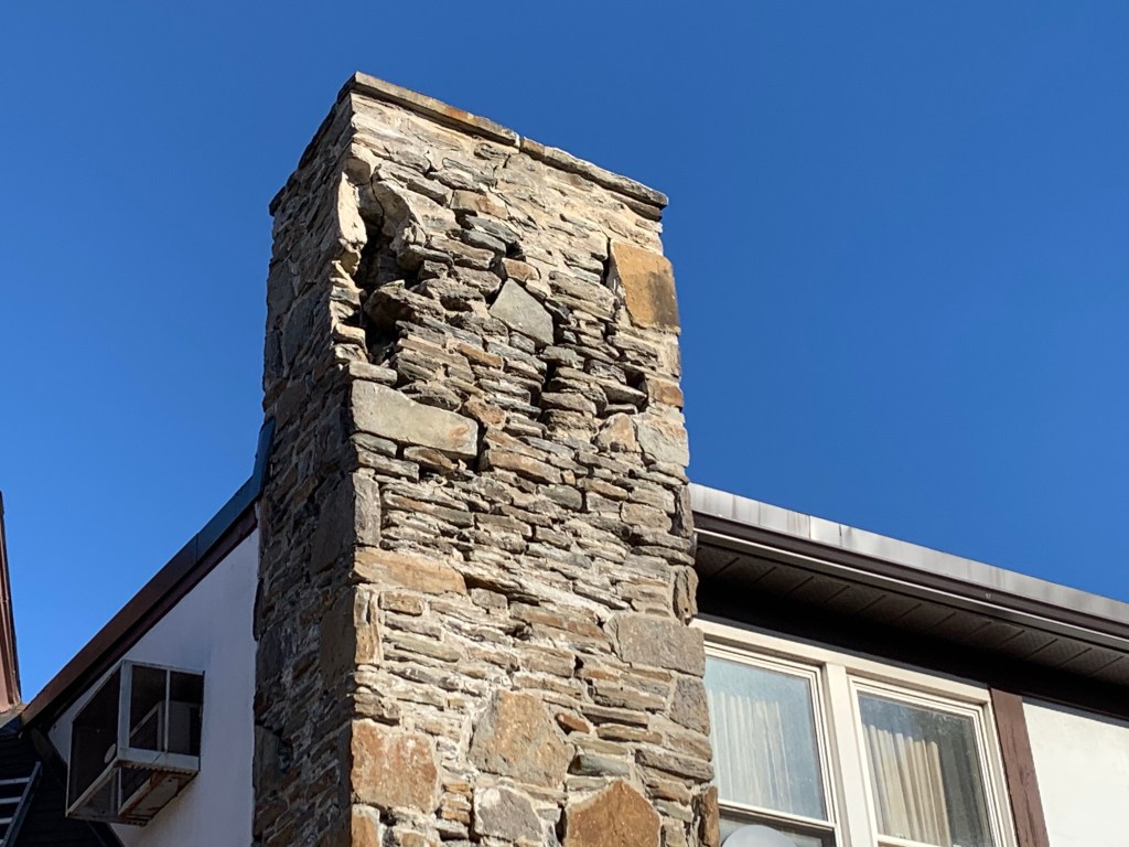
The chimney on the south side of the main door is crumbling badly and appears to be hazardous. You wouldn’t want to be walking below when one of those large stones dropped out.

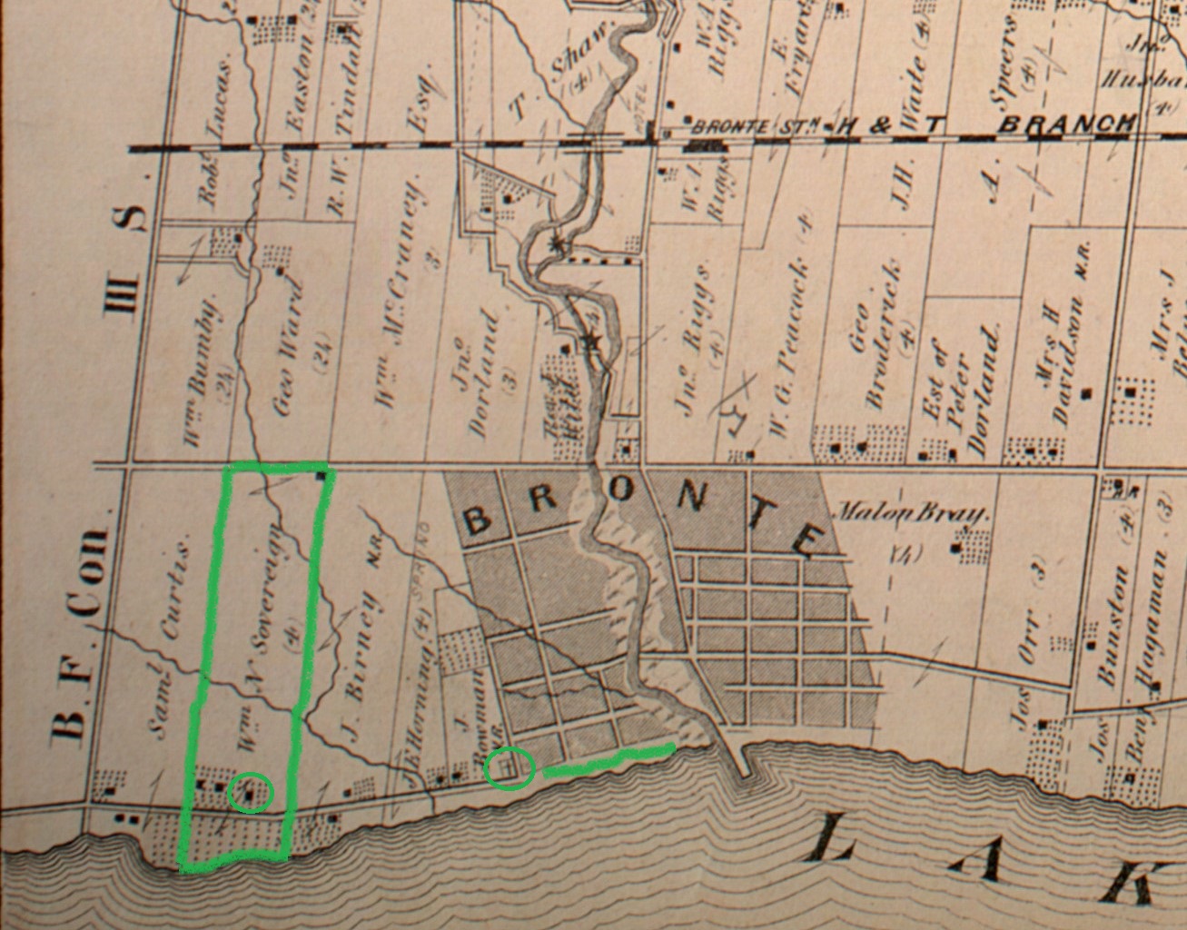
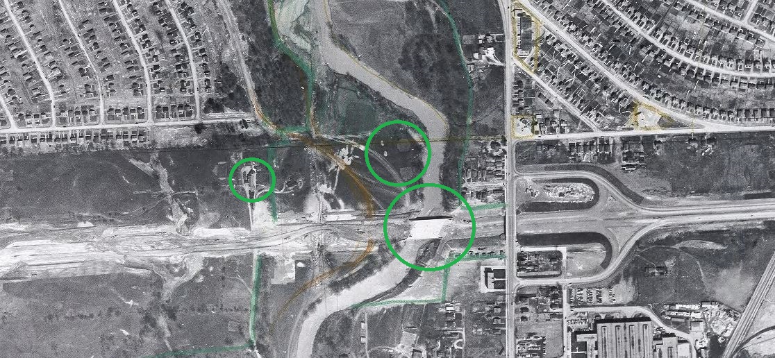
Below is a 1953 aerial photograph from the Toronto Archives. The small circle on the left is the club house featured above. Shapes of greens and sand traps can be seen in the circle at the centre of the picture while the larger circle shows the bridge over the Humber River. Meanwhile, the new highway west of the river isn’t even fully laid out yet.

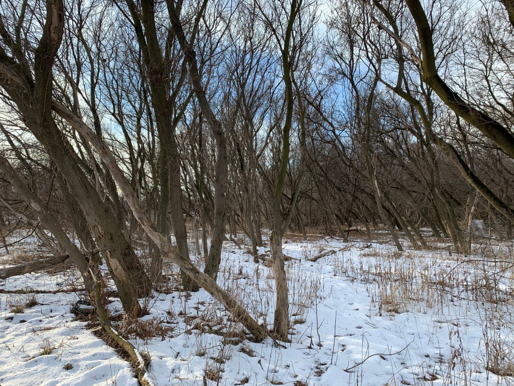
Seventy years have passed since the last game of golf was played at Pine Grove. In 1957 the city bought 22 acres of land on the north side of the 401 to create a new park. The club house was retained and the floodplain was turned into an open field of grass with a walking trail along the side of the Humber River. One large section of the park has been allowed to return to a more natural condition and second generation trees have become established. Throughout this wooded area there are several curved depressions in the ground that look suspiciously like old sand traps.

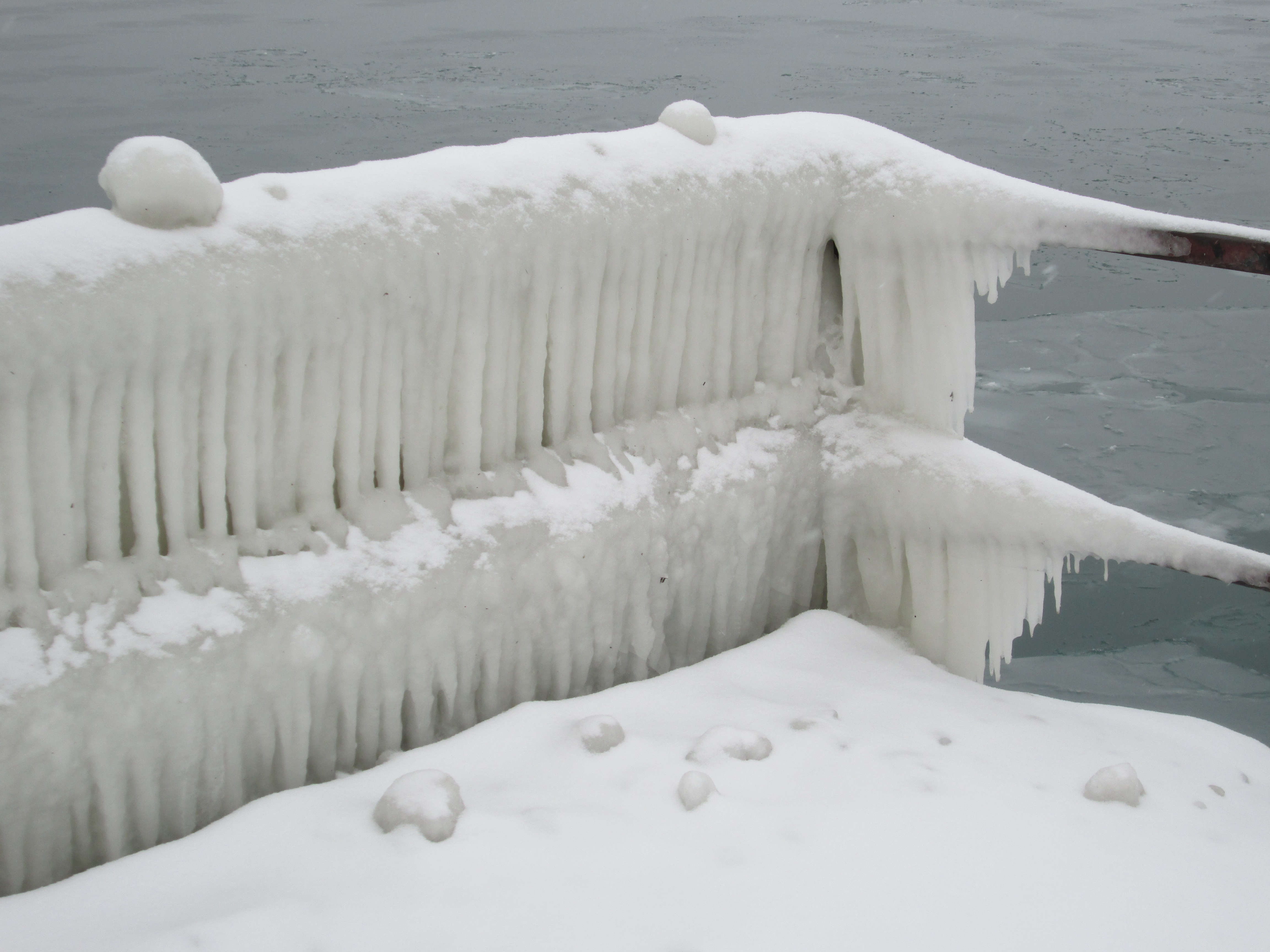
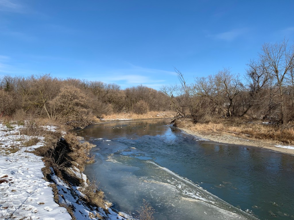
The Humber River had a thin layer of ice along the edges and a fair amount of slush floating downstream but surprisingly has not frozen over yet this season. Some years there could be large ice sheets pushed up on the banks that are several centimeters thick. This freezing and thawing could happen several times per winter.

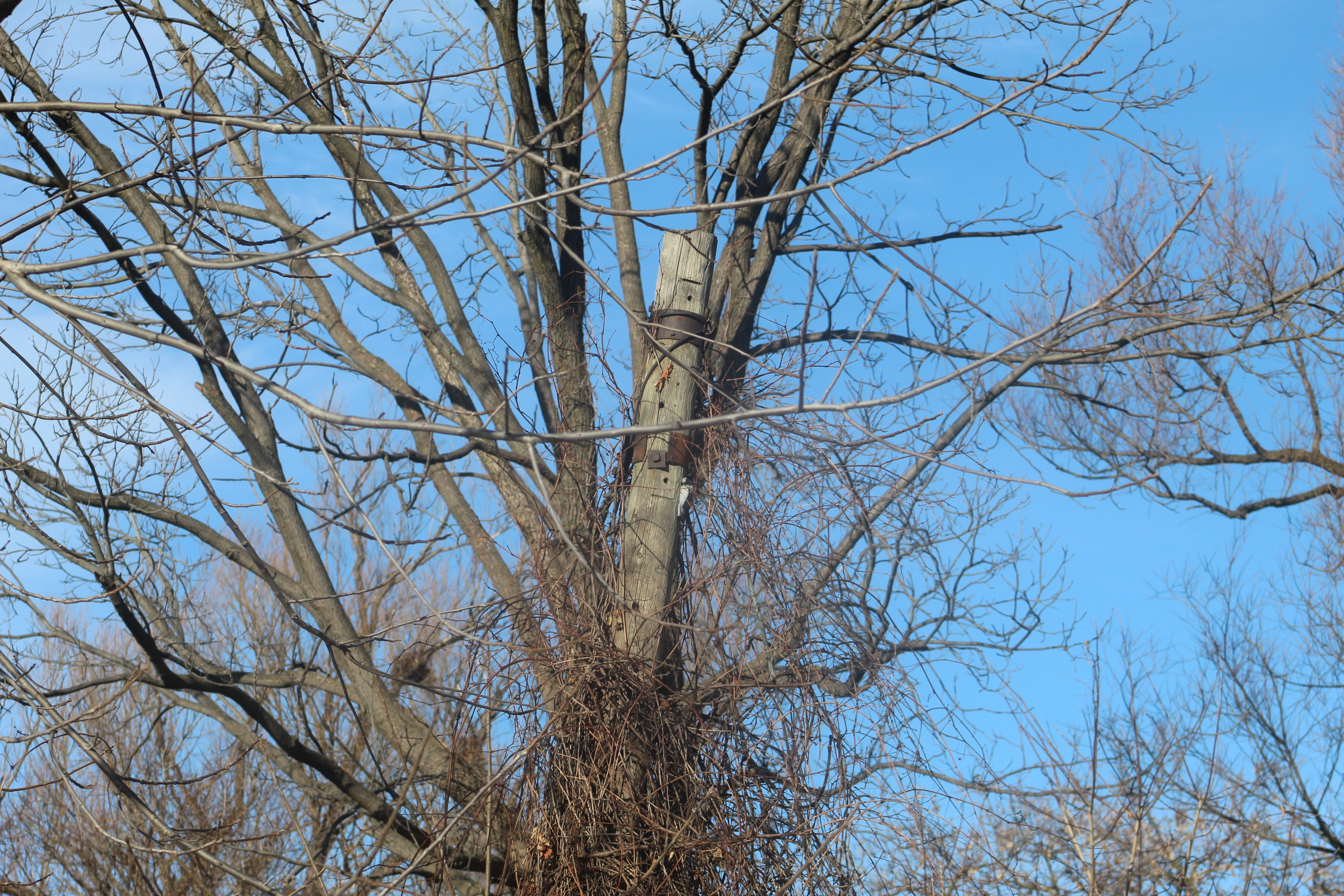
Other than the club house and the general shape of some parts of the park there isn’t very much remaining from the days of Pine Point Golf and Country Club. Near the river stands an old lamp post that is likely hidden by vines for most of the summer. Notice the two bands of steel at the top which distinguish it from the modern lighting around the parking lot.

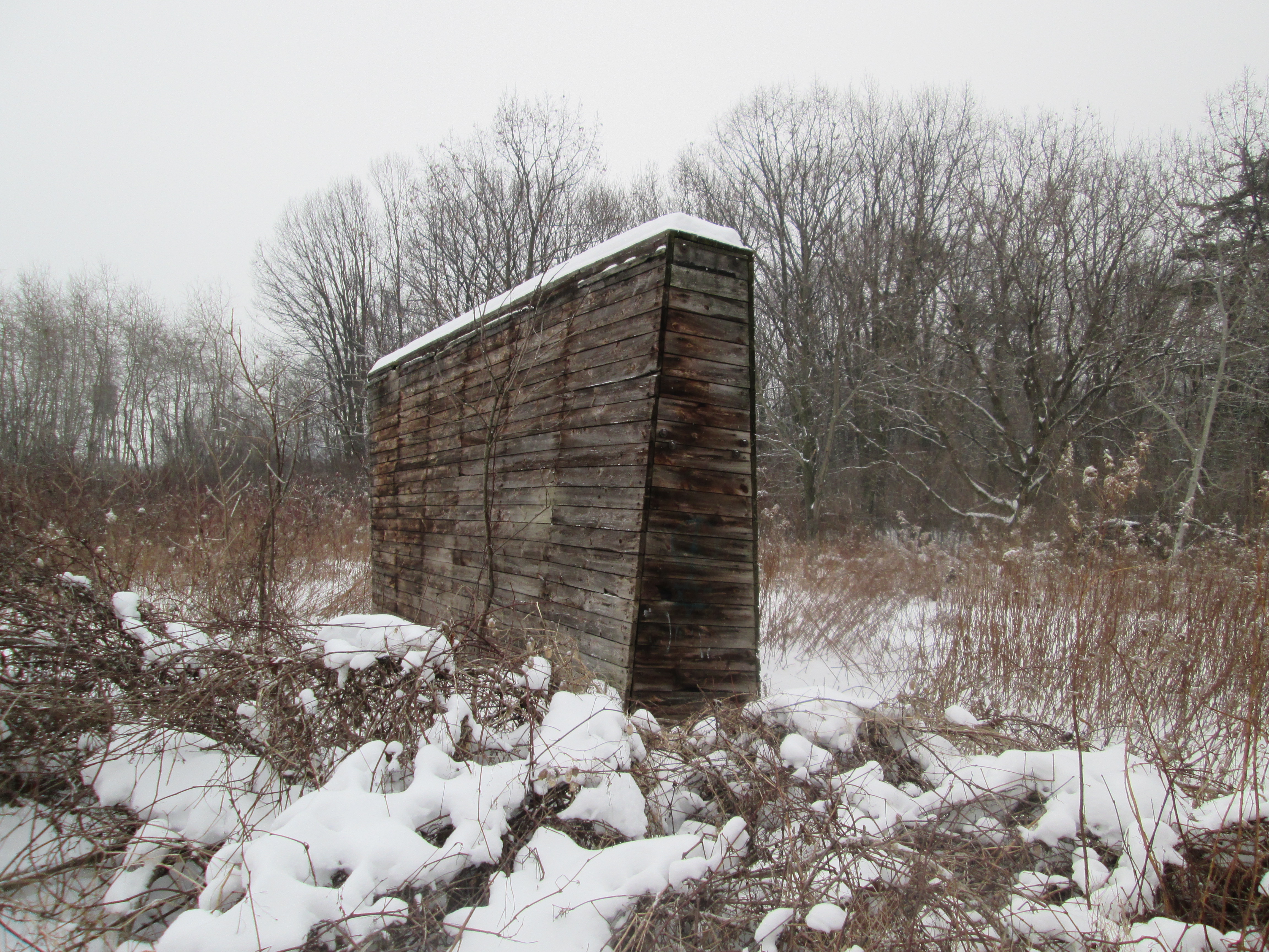
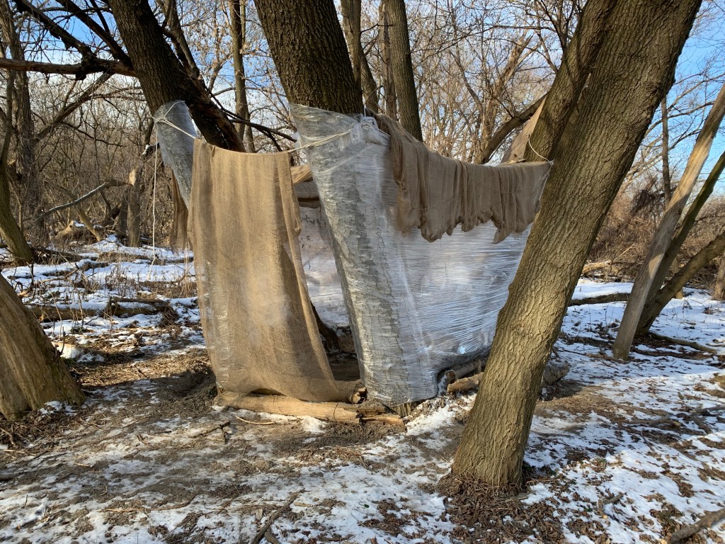
We often see tents and other temporary shelter for homeless people in the parks and this year there may be more than average as a result of the pandemic. One of the most unusual of these types of shelters is the one we found in Pine Point Park. Someone has found a group of trees which they have surrounded with industrial stretch wrap. Earth has been scooped up around the bottom to seal out the wind and water while ropes support a roof made of burlap. It’s just about the right size for a sleeping bag to be laid out inside of it. Although it seems like an environmental disaster, i give it high marks for creativity.

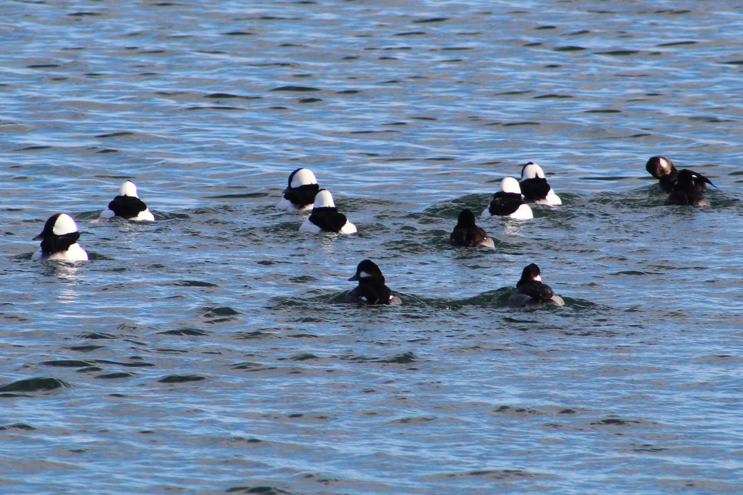
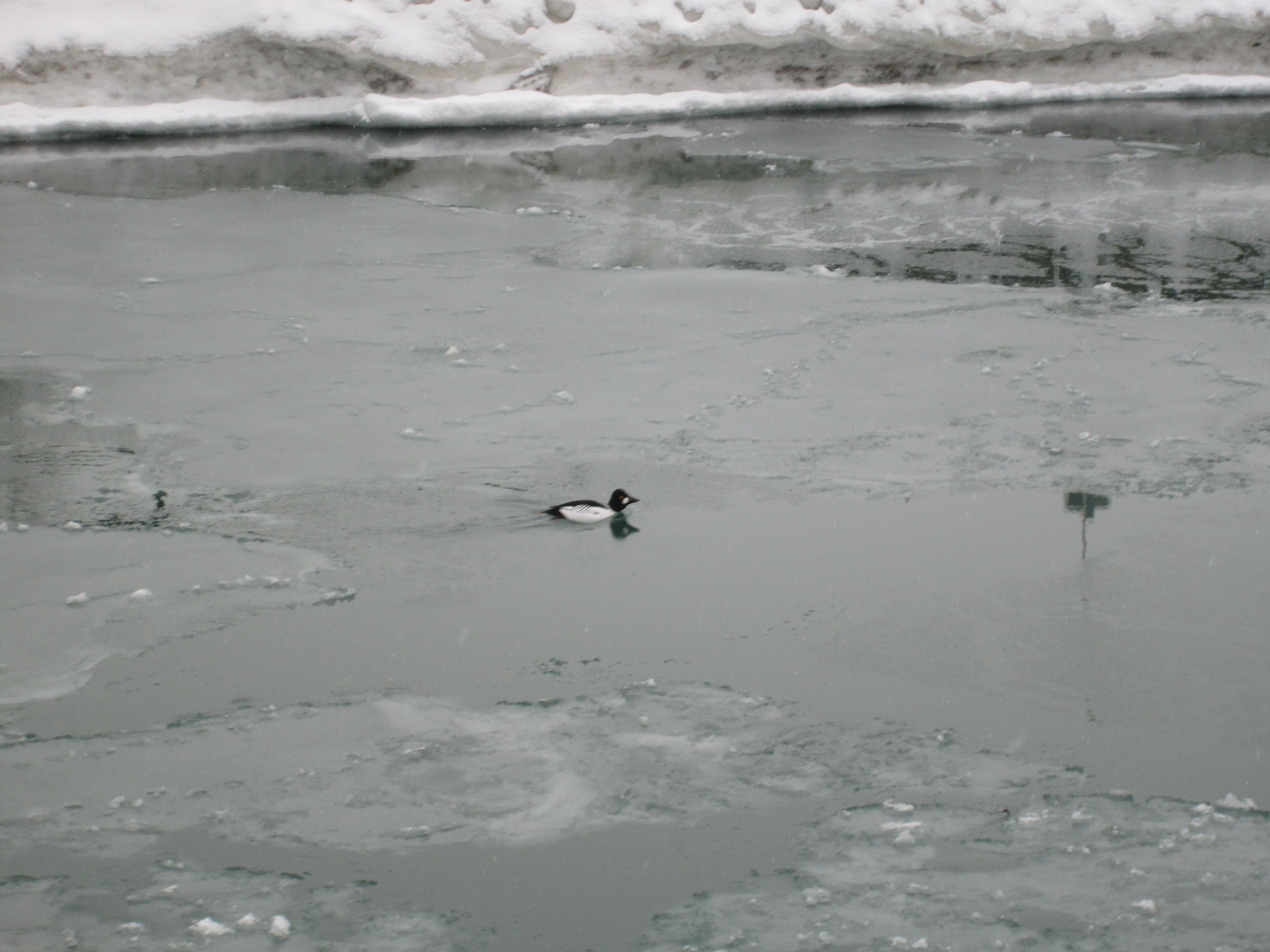
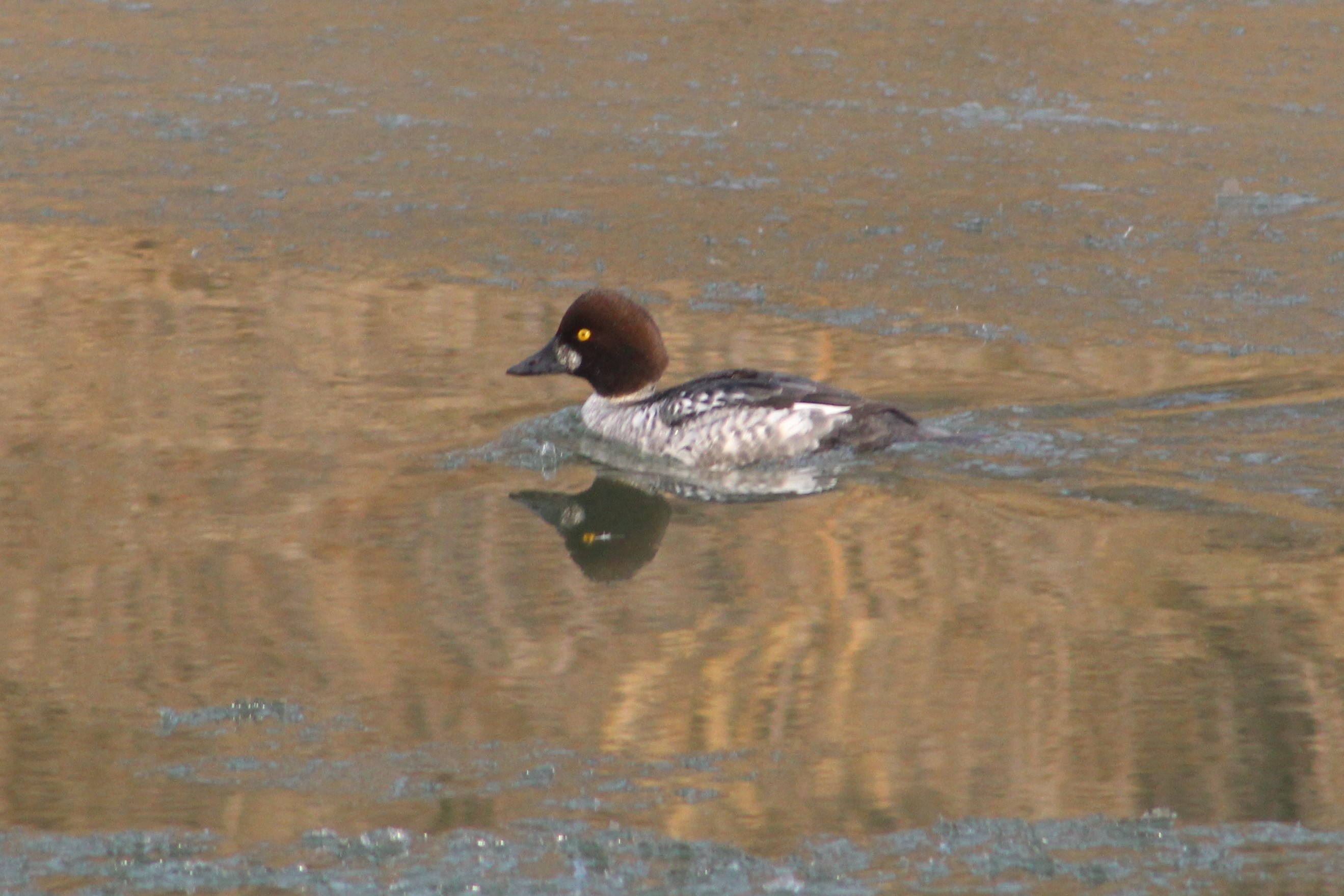
In the game of golf it is quite common to hit an errant ball that could come close to hitting another player. It might be more instinctual to yell “heads up” or “duck” but in golf the normal expression is “Fore!”. This appears to be tied to the idea that the player or caddie in danger is before, or in the foreground, of the incoming ball. Since the game of golf is no longer played here it is much more appropriate to whisper “duck” and point to the river. The Common Goldeneye pictured below is the female which has a chocolate brown head and a gray body.

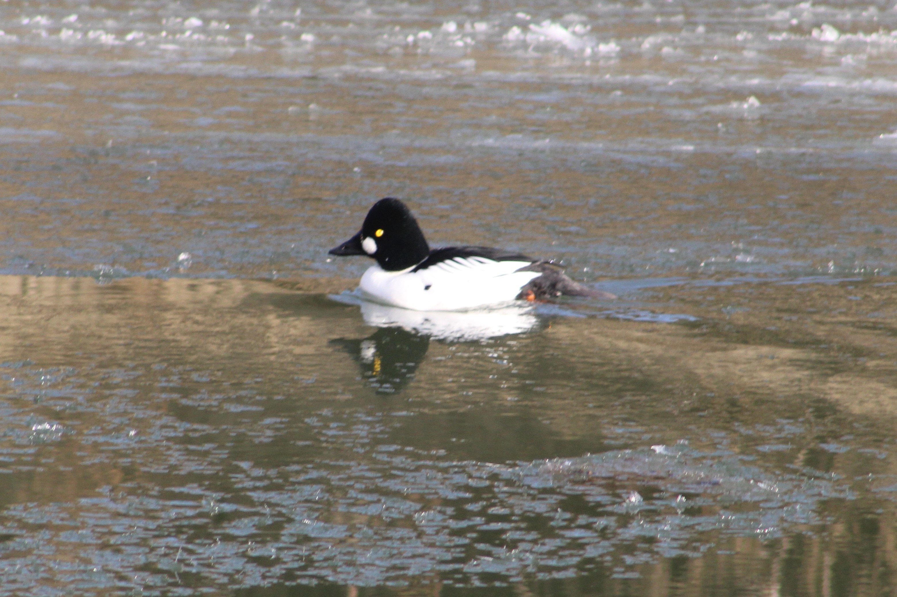
The male Common Goldeneye has an iridescent green head which frequently looks black. They have a white patch behind their bill and white wings on a mostly white body. The wings appear to have little white windows on them. Goldeneye ducks often forage in small flocks and dive together, staying under for up to 20 seconds at a time.

Common Merganser males have a mostly white body with a green head and orange bill. The female has a brown head with a white chin and an orange bill. When migrating or during winter Mergansers are known for mixing with other species of diving ducks, including Goldeneyes, other Mergansers and Buffleheads.

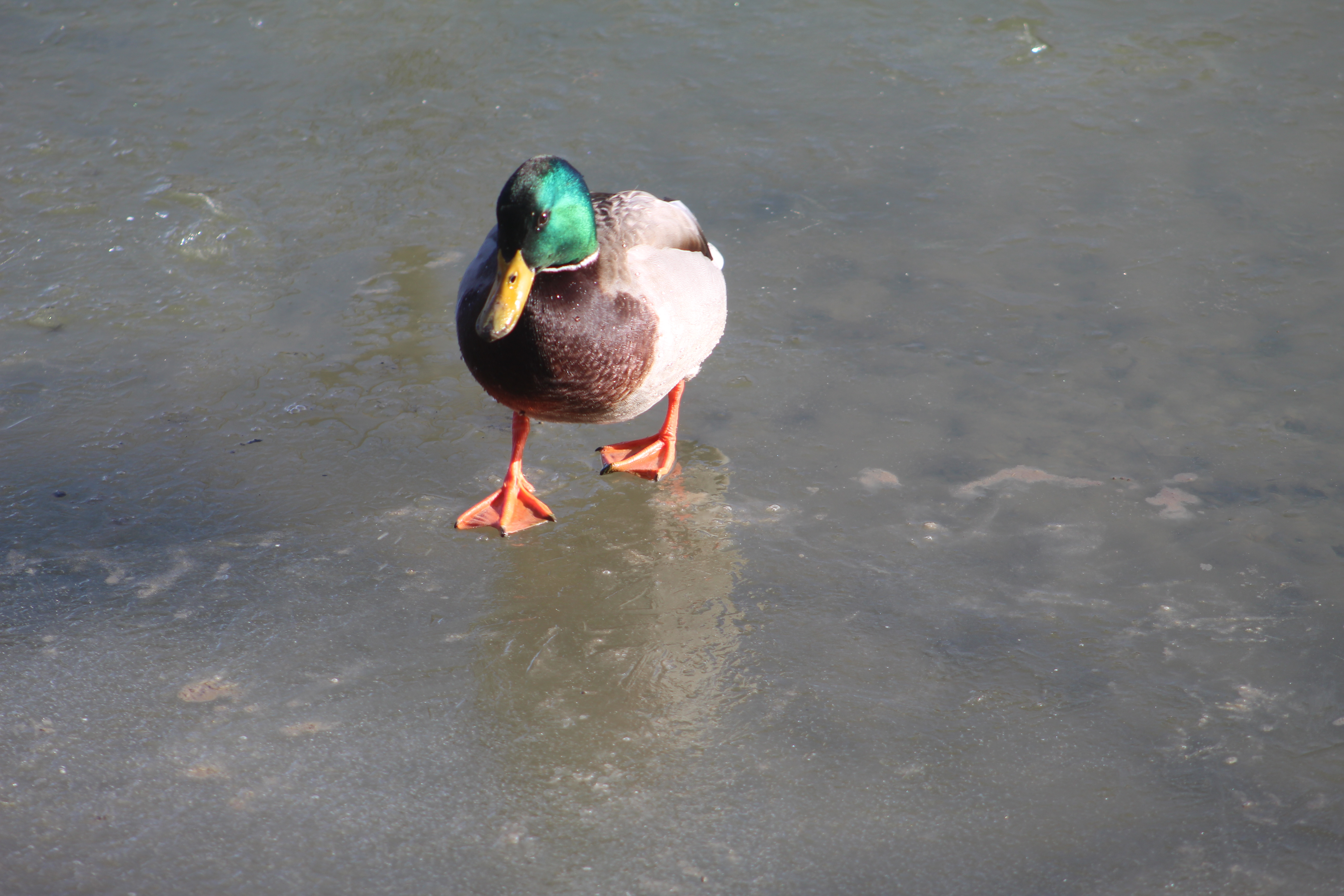
Mallard Ducks were the most common birds we sighted, except perhaps Canada Geese, and a group of them were checking out the ice skating facilities.

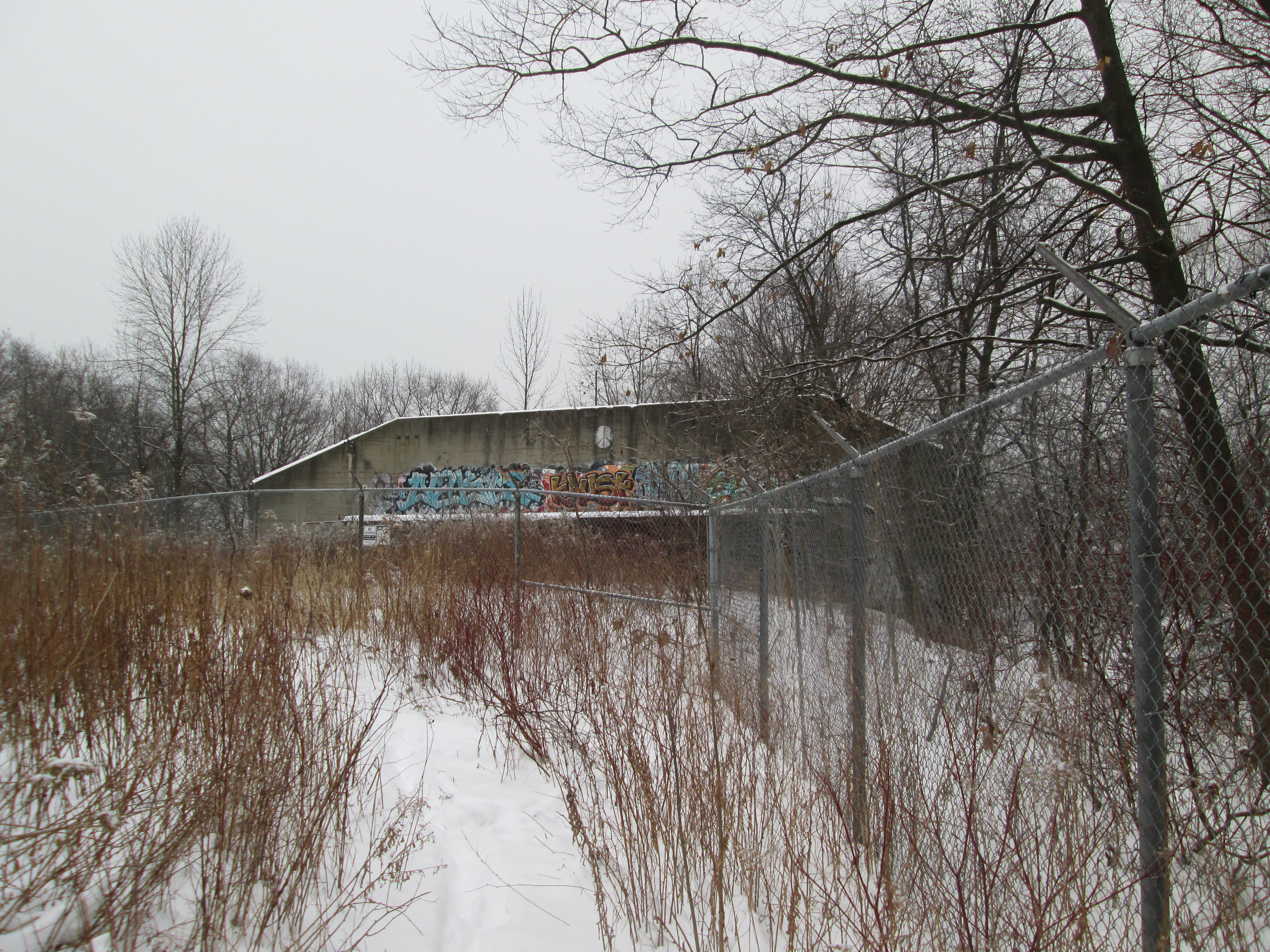
Construction of the 401 brought an end to the Pine Point Golf and Country Club and the original highway has been expanded several times creating an extensive set of bridges over the Humber River. It appears that one effective method of reducing graffiti under the bridges is to allow the creation of public art on all the available surfaces. People seem reluctant to tag over the top of some of this creative artwork. The entire length of the trail under the 401 has been covered in some very impressive artwork.

Many people walk their dogs or go jogging through Pine Point Park without ever realizing the history they are passing through.

Additional reading: Earl Bales Park,

Google Maps Link: Pine Point Park

Like us at http://www.facebook.com/hikingthegta

Follow us at http://www.hikingthegta.com

Also look for us on Instagram

Bronte Bluffs Park

Saturday, November 28, 2020

Just west of the mouth of Bronte Creek is a geological feature that dates back 13,000 years to the end of the last ice age. At that time, the lake level was about 100 feet higher than today and that version of Lake Ontario is referred to as Glacial Lake Iroquois. It is responsible for various land formations all around the lake including the Scarborough Bluffs and Iroquois Shoreline Woods Park. We decided to go and see this feature and explore the area and we used free parking in one of the lots on West River Street.

The map below shows the area as it was in 1877 including the Sovereign property which originally stretched all the way to Bronte Creek. The Sovereign House featured below is one of the three at the end of the property by the lake, possibly the one circled. Also circled is the site of the Bronte Cemetery which was on land donated by the family.

Philip Sovereign was one of the first settlers on Twelve Mile Creek, now known as Bronte Creek, when he arrived in 1814. His property on the west side of the creek mouth would be the site of the first school house in the community when he had a small log building erected the following year. His son Charles would be the teacher in the school by the time he was 17. The Sovereign family was instrumental in the early development of Bronte and their house was built in 1825. After Charles passed away in 1885 the house had several tenants the most notable being in the years 1911-1914. During this time Mazo de la Roche lived here. She was the author of the “Jalna” series of books whose 16 novels were among the most popular of the era. The house was moved on Aug. 23, 1988 to Bronte Bluffs Park where it was restored and now houses the Bronte Historical Society. Several trails run east from the house along the bluffs and lead to stairs that provide access to the beach.

Hawks are one of the few animals with colour receptors in their eyes making them incredible hunters even at great distances. Their keen eyesight also allows them to be diurnal, hunting during both the day and night hours. They can take their prey from the air as well as off the ground and can dive at speeds up to 150 miles per hour to capture it. The one sitting in a large tree outside of Sovereign House allowed me to get pretty close before pooping in my general direction and flying off. Such attitude!

There were several swans on the lake and three of them were an obvious family unit. The cygnet, or baby swan, was still grey in colour and slightly smaller than its parents. Swans are not very graceful when they take off as they need about 30 yards just to become airborne and about that much again to achieve a safe height above the land or water. The picture below shows one just as it is landing.

There was a small flock of Bufflehead ducks on the lake. These birds dive for their food and at times the entire group would disappear at the same time. The males have the large white patch that wraps around the back of the head while the females have a smaller white patch on the cheek.

While we were watching from the top of the bluffs a young couple appeared on the beach below. They both dashed into the water but she only went about knee deep. He didn’t hesitate, diving in and getting completely wet. Except for those two people there was no one else enjoying the lake on this sunny day. Even so, the Halton Police were still out on patrol, perhaps looking for those people who froze while swimming.

Chris Vokes Memorial Park is named after Major General Christopher Vokes who served Canada during the Second World War. He was from Oakville and passed away there in 1985. The war memorial in the park is dedicated to the soldiers who died in two World Wars plus the Korean War. It is actually the second war memorial to be built in Bronte, the first one being placed in 1956 at 2457 Lakeshore Road West.

Bronte harbour was home to fishermen and stone hookers who provided much of the early industry in the town. Lake Trout, Whitefish and Herring were cleaned at the docks and packed into ice for shipping to the large city markets. Up to 22 fishing boats operated out of the harbour until the 1950’s by which time most of the fish stocks had been depleted. The stone hooking industry ended after 1910 when portland cement replaced stone as a primary building material for foundations. There are several information signs around Bronte describing the local history and there is one dedicated to the fishing industry as well.

The Methodist Church sent missionaries to Upper Canada as both Primitive Methodists and Episcopal Methodists, often competing to both start a church in a community. The Episcopal church formed in Bronte and built a white structure of wood on the south side of Lakeshore. The two Methodist groups united in 1884 and a period of growth followed. By 1912 the church had outgrown its building and the next year a new brick building was opened across the street. Since this building was a gift from the Walton Family in memory of their father the church became known as Walton Memorial church. It has been part of the United Church since 1925.

Bronte Cemetery is located on land that was owned by Philip Sovereign and both he and his son Charles are buried here. A large portion of the headstones in Bronte Cemetery commemorate those who drowned working in the fishing and stone hooking industries along the lakeshore. Ironically, some of those who drowned and were later recovered and buried may be among those whose remains have subsequently been lost to the lake. Over the years about 70 feet of the cemetery has been eroded into the lake as it relentlessly beats on the shore

Philip Sovereign died in 1833 and was laid to rest in the cemetery he donated to the community.

Bronte Bluffs Park made for an interesting visit and somehow you get the feeling that you may have just scratched the surface of all that is to be seen. Hmmm…

Related blogs: Scarborough Bluffs and Iroquois Shoreline Woods Park

Google Maps link: Bronte Bluffs Park

Like us at http://www.facebook.com/hikingthegta

Follow us at http://www.hikingthegta.com

Also look for us on Instagram

The Arsenal Lands

Saturday Feb. 7, 2015

Along the Lakeshore stands an abandoned water tower, part of a WW2 small arms factory and rifle testing range.  Today we are 49 days into winter with only 42 remaining which to me means its almost over. The forecasters are calling for up to 30 cm of snow over the next couple of days.  Even so, this is the first hike of the winter where I’ve switched from hiking to winter boots.  It was minus 4 with almost no wind chill and a steady light snow. I parked in the parking lot for Marie Curtis Park on the west side of the Etobicoke Creek.

Col. Samuel Smith was granted lots 4-7 in 1806 and they remained in his family until they were sold to the Halliday’s in 1877.  They were used for mixed farming for the next few years. Following confederation in 1867 the British Government wanted the new country of Canada to assume greater responsibility for its own defense.  In 1868 the Ontario Rifle Association was formed for the training of militia.  They used the garrison common at Fort York until 1891 but the increase in the use of the CNE grounds and the addition of a passenger wharf at the foot of Dufferin Street made firing rifles at the fort increasingly unsafe.  The property on the west side of Etobicoke Creek was purchased as the Long Branch Rifle Ranges.  A militia and cadet training camp was maintained on the site until WWI when the Royal  Air Force administration offices were located here.  Canada’s first aerodrome was at Long Branch and over 130 students had graduated, at a cost of $400 each, by the time it closed in December 1916.  William Faulkner, the famous author, was stationed here while training for the Royal Canadian Air Force.

The most prominent structure remaining on the site today is the old water tower.  It was built in 1941 to serve the needs of the industry on the site.

IMG_2274

In 1935 the Department of National Defense purchased the property with the idea of creating an arms manufacturing site.  Small Arms Limited was founded as a crown corporation on August 7, 1940 to supply the Canadian Military with rifles for use in WWII.  The 1957 picture below shows the factory and several out buildings.  The large building with the lines on the top is shaped like an “L” with the black circle in the inner corner of the “L” being the water tower. The rifle range building is in the lower left and the first several baffles can be seen below it.

arsenal 3

Women played a major role in the workforce at Small Arms Limited as can be seen in the cover photo making up most of the staff by 1943.  The factory produced its first weapons in June 1941 and by the end of the year had made 7,589.  By 1943 the plant was working three shifts, using 5,500 employees to produce over 30,000 units per month.  World War Two ended in 1945 and war-time production was completed in December with over 900,000 rifles and 126,00 machine guns having been produced.  Various military parts were produced in the facility from then until it closed in 1974. At the foot of the water tower stand two yellow gas regulators that were installed at the time the Small Arms company was founded.  They are dated 1940.

IMG_2280

In 1910 Canada’s Department of Militia and Defense (renamed the Department of National Defense in 1922) acquired the property and built the wooden baffles that remain in place today. The DND built firing booths in 1940 to assist with the training of militiamen for service in WWII. The rows of baffles and concrete backstop can be seen in the centre of the 1957 aerial picture below.

arsenal 4

On the short rifle range there are 16 remaining baffles after 105 years exposed to the elements. Originally there were 30 of these which were hollow and filled with sand and soil.  They were intended to stop any stray bullets from leaving the range but also served to provide sound barriers for the adjacent small arms factory.  The picture below shows one of the few that is intact and not over grown with brush.  These wooden baffles are the last of their kind from this era in Ontario and are considered a militarily significant heritage site.

IMG_2300

At the back end of the rifle range is a fifteen foot high and thirty-five foot wide concrete backstop which was constructed around 1925.  It’s surface is dotted with the impacts of hundreds of bullets from over the years.

IMG_2302

The only manufacturing building remaining on site is building number 12.  Dating to 1939, it was used as the rifle inspection facility.  It has a double fence, each with three strands of barbed wire surrounding it.  I guess they don’t want you to go in there.

IMG_2313

The various uses of the site over the years has taken the farm land and left it with a mix of PBC’s, VOC’s, metals and radioactive waste.  Over 72,000 tonnes of contaminated soil was removed from the site between 1998 and 2002.  The consolidation mound pictured here contains low level radioactive soil that has been buried in a containment facility since 2005.  It sits inside a third barbed wire fence behind the inspection building.  I guess they really don’t want you to go in there.

IMG_2311

Circling back through the Small Arms Ltd property I noticed that someone left the door open at the top of the water tower.  Anyone want to climb up that ladder on the roof and close it?

IMG_2317

Making my way across the Lakeshore Road edge of the arsenal lands I came to Etobicoke Creek. The trail along the creek’s edge brings you to a bridge that crosses the creek to the east side. Following the disaster of Hurricane Hazel in 1954 when the creek flooded destroying the homes along 43rd street (see Middle Road Bridge) this area was taken under authority of the conservation authority and Marie Curtis Park was created.  I walked that side of the creek to where it spills into the lake.  The ice on the railing at the edge of the lake is several inches thick and, to me, resembles baleen plates like those in the mouth of a baleen whale.

IMG_2331

Bufflehead ducks suddenly disappear when they are feeding and can pop back up several metres from where they dove.  They are distinct with their white and black markings and spend the winter in sheltered bays and inlets.  I watched a few of them right in the mouth of the creek.

IMG_2346

There are likely artifacts located here that will only be visible when the snow is melted.  I guess we’ll have to see sometime.

Like us at http://www.facebook.com/hikingthegta