Sunday, July 11, 2021
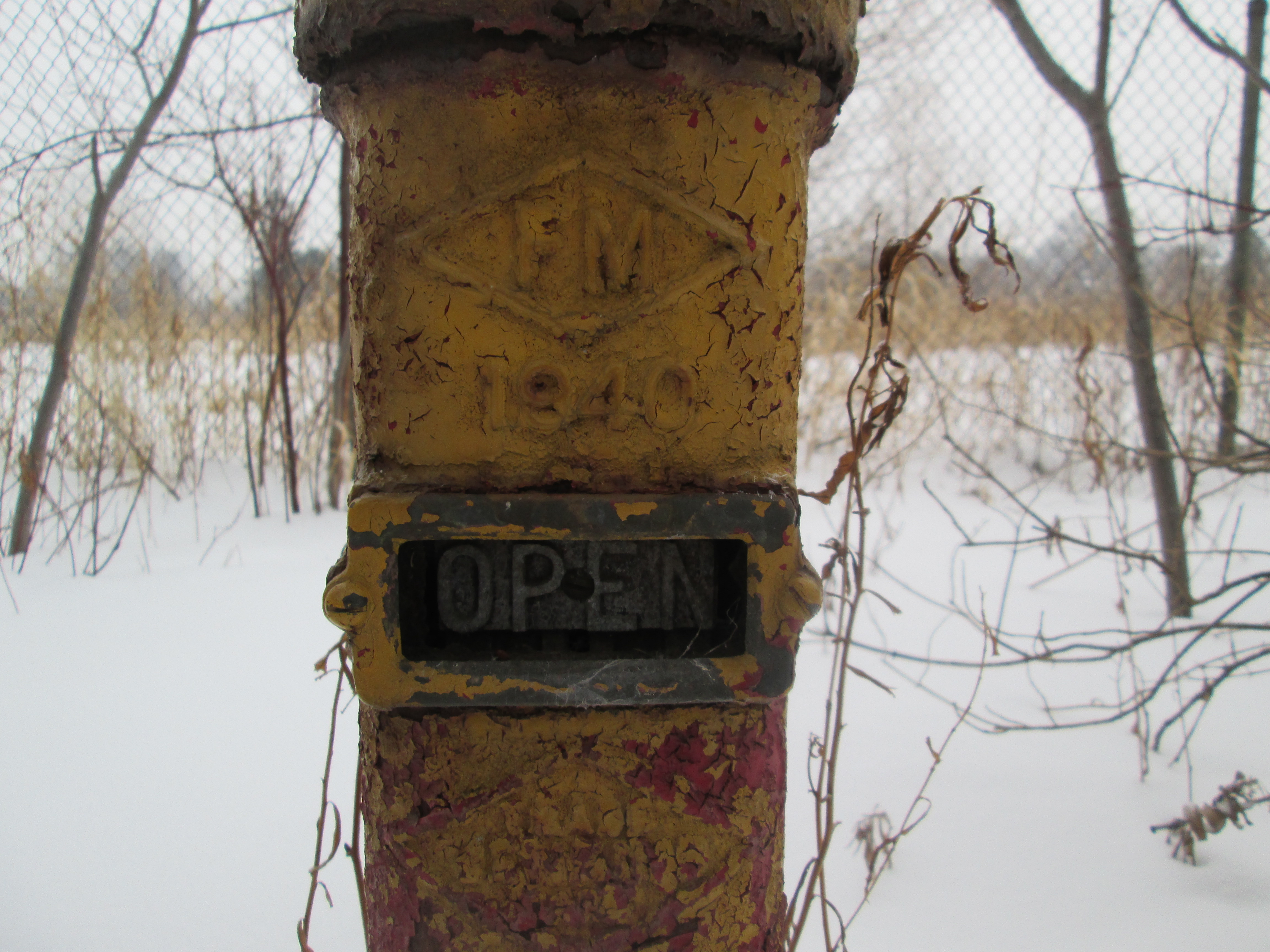
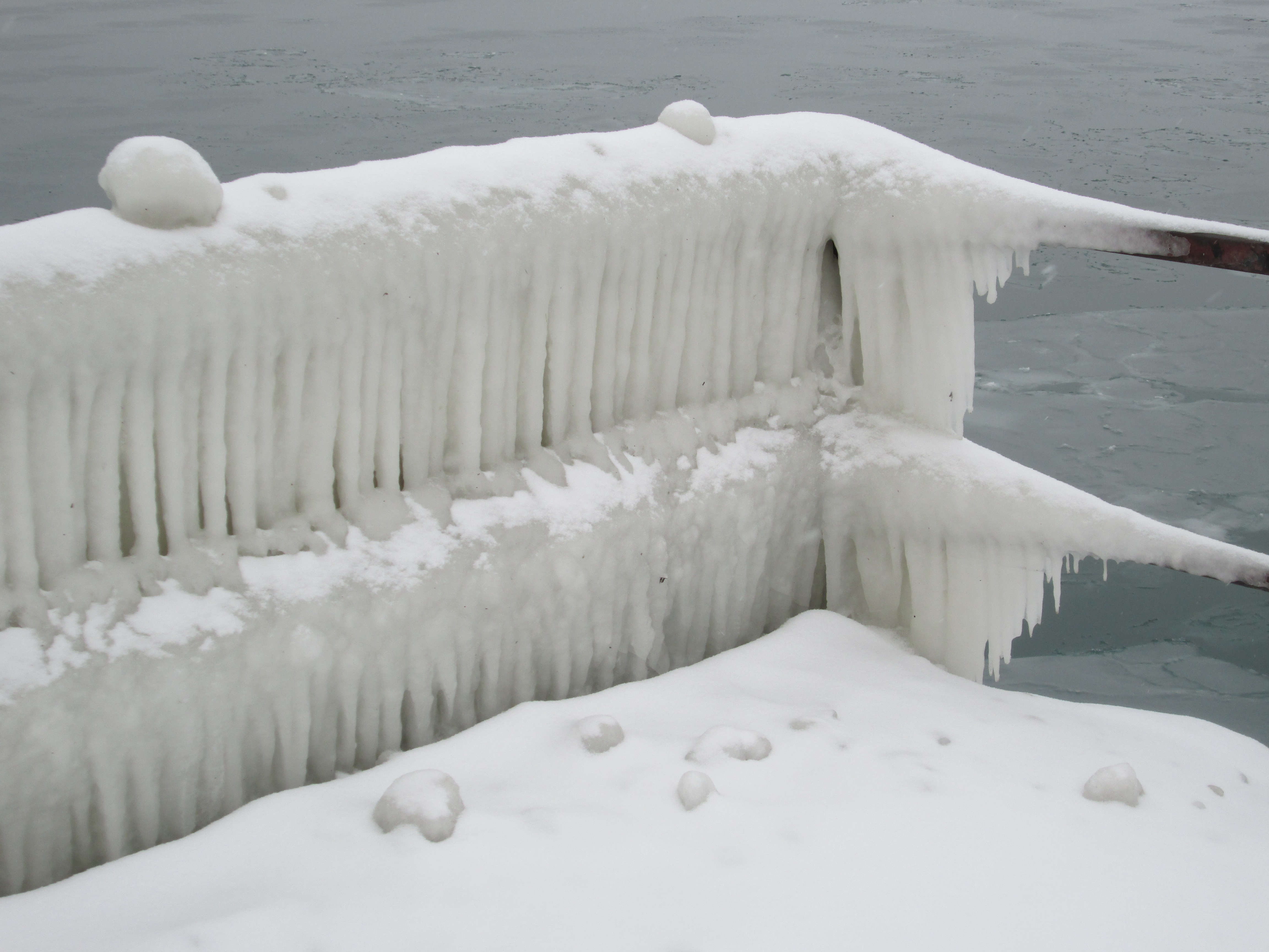
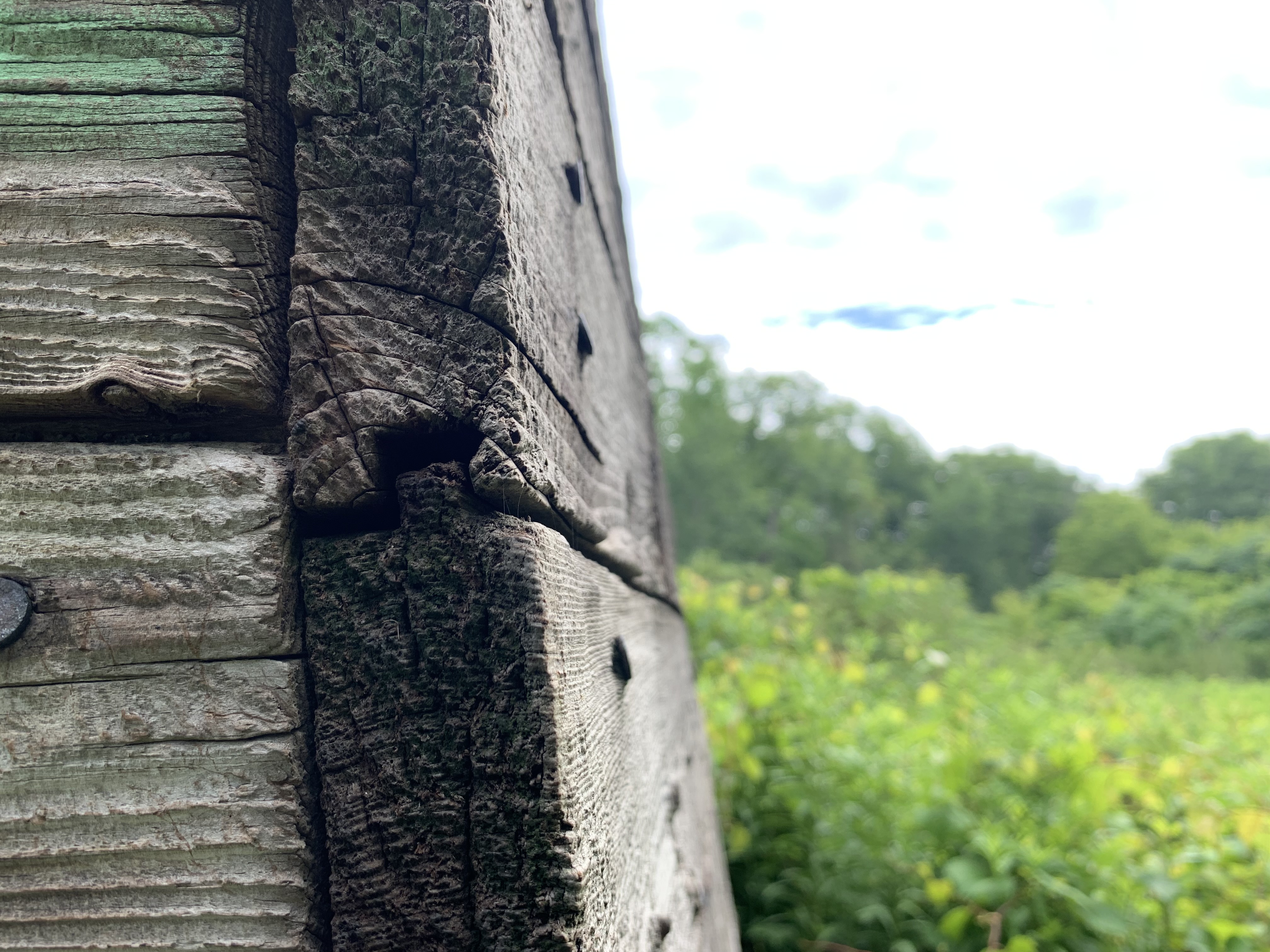
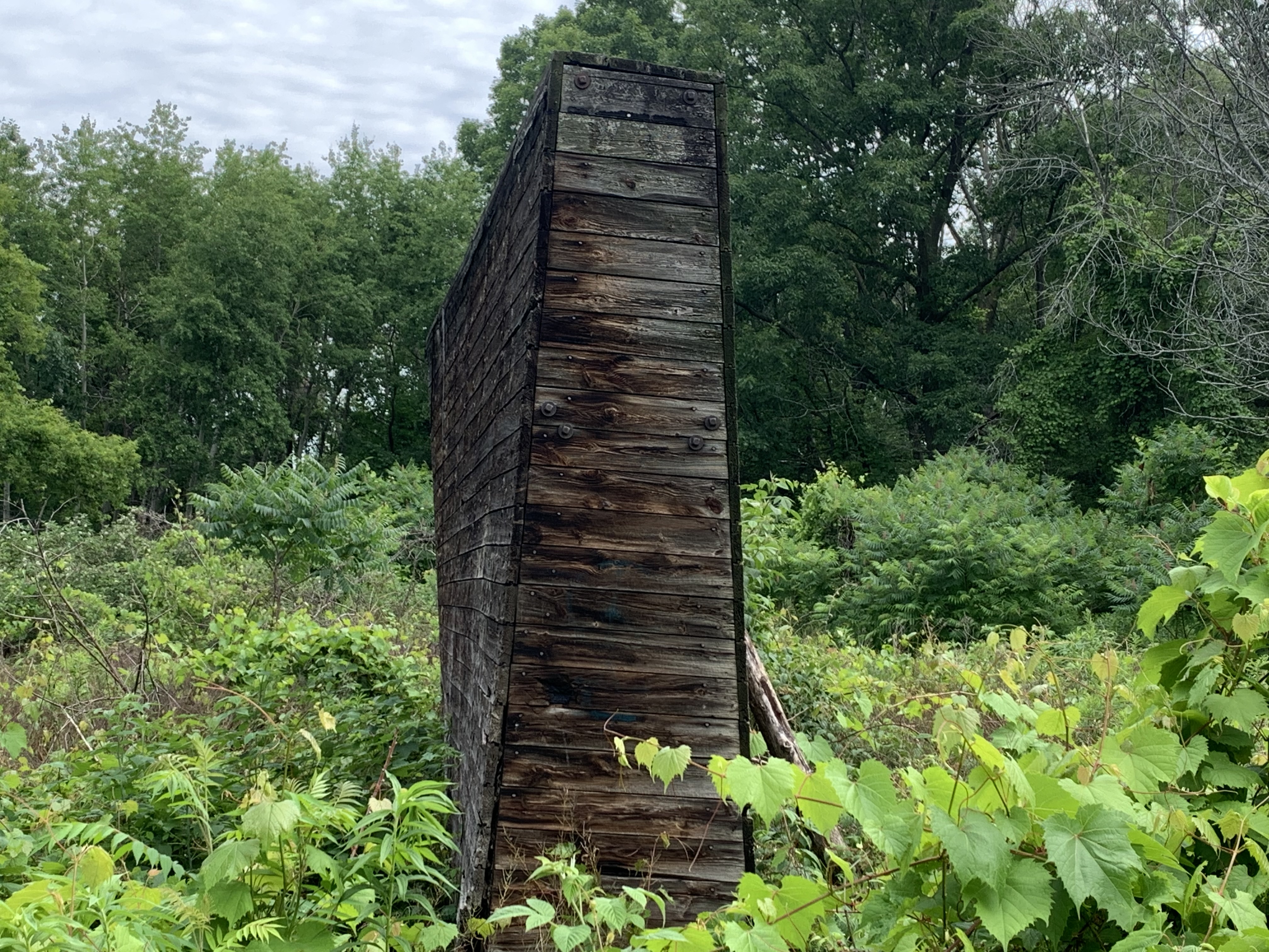
The story of the long abandoned Long Branch Rifle Range begins with Confederation in 1867. As soon as the British North America Act came into effect on July 1st, the new Dominion of Canada was charged with taking a lead role in its own defence. The following year the Militia District of Ontario established the Ontario Rifle Association. With the Garrison Common Rifle Ranges in operation in 1869 citizens were practicing at Fort York but this soon proved to be dangerous. The Industrial Exhibition (Later the C.N.E.) was bringing more people into the area and a new passenger wharf at the foot of Dufferin Street led the city to ask the militia to move. In 1891 the Federal Government bought land on the west side of Etobicoke Creek and established the Long Branch Rifle Ranges. The site was immediately important, training volunteer militiamen between 1899 and 1902 for service in the Boer War. The range was operated from 1893 to 1910 by the Ontario Rifle Association when it was bought by the Department of Militia and Defence (Renamed Department of National Defence in 1922). In 1910 they constructed thirty wooden baffles on the firing range, two of which can be seen in the picture below. The are the oldest surviving military baffles in the province.
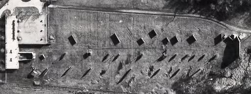
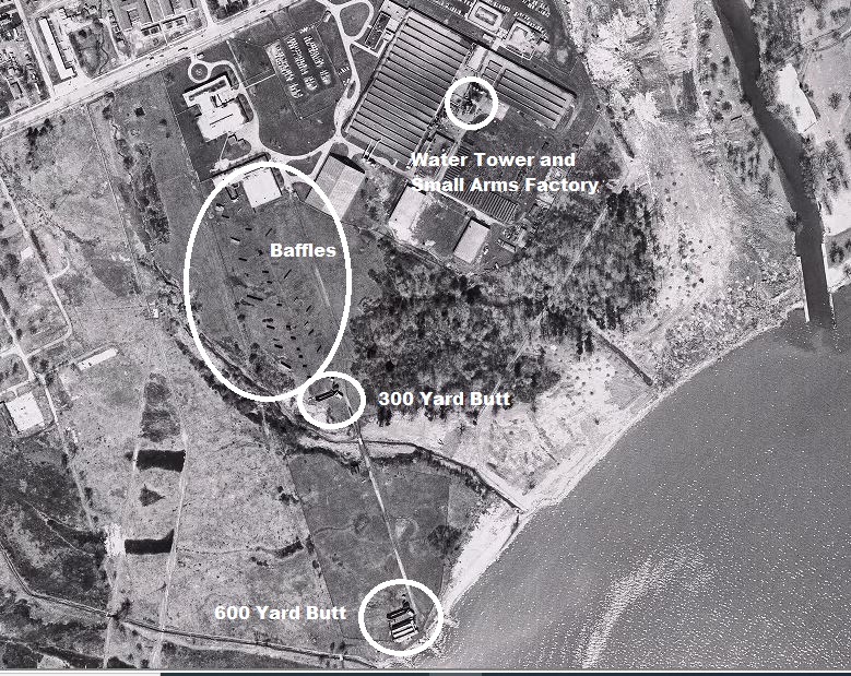
The rifle range can be seen in this 1962 aerial photograph from the Toronto Archives. Sixty years ago the grass was still kept short and there were no trees anywhere on the rifle range. Much has changed in the intervening years.
Baffles were built to dampen the sound and also to stop stray bullets from doing any damage. They varied in size from 4 to 6 feet high and were between 4 and 10 feet long.
The baffles were built with a wooden frame covered with tongue and groove boards. The tops were left open until they could be filled with sand and small stones taken from the shore of the lake.
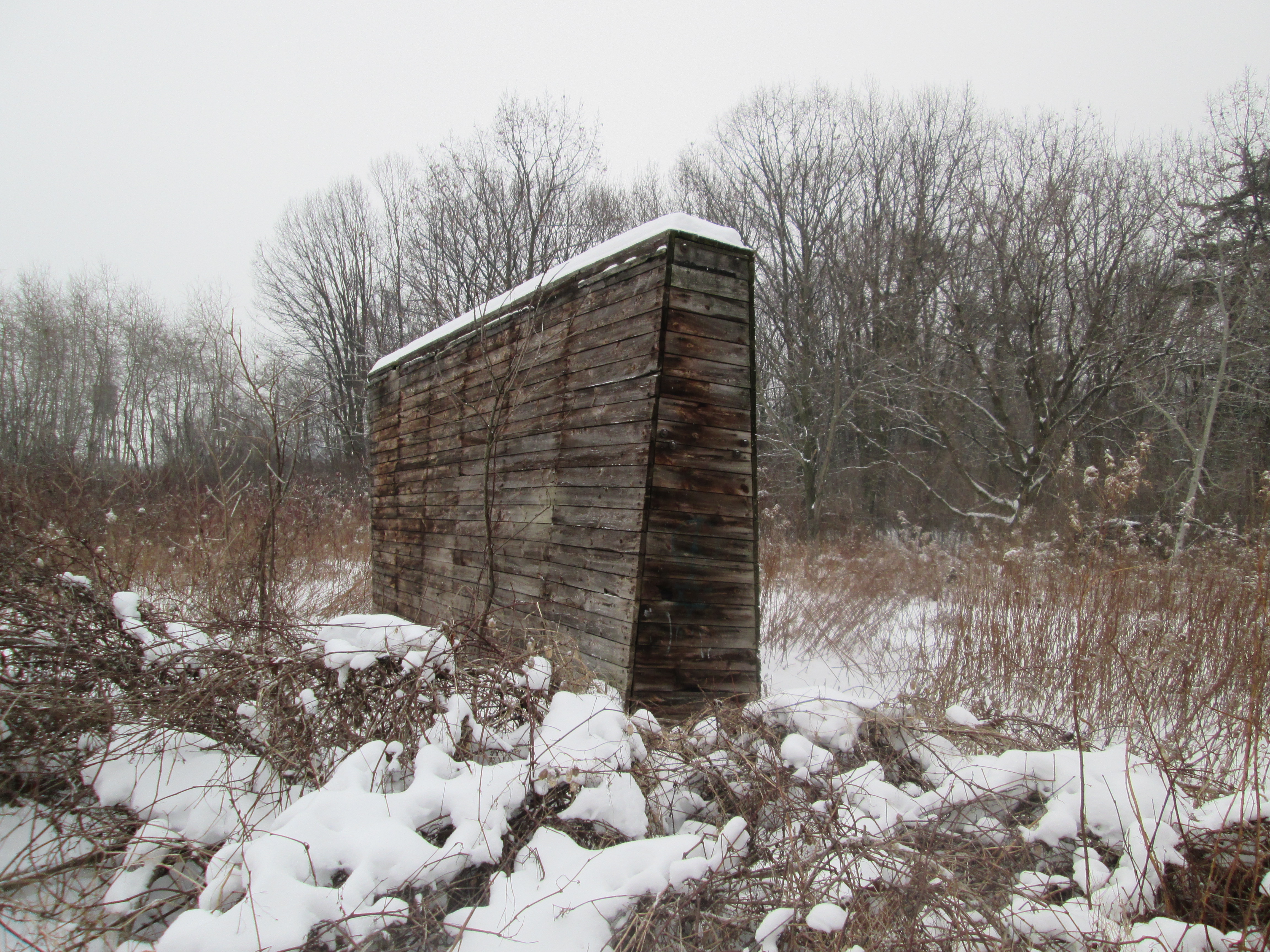
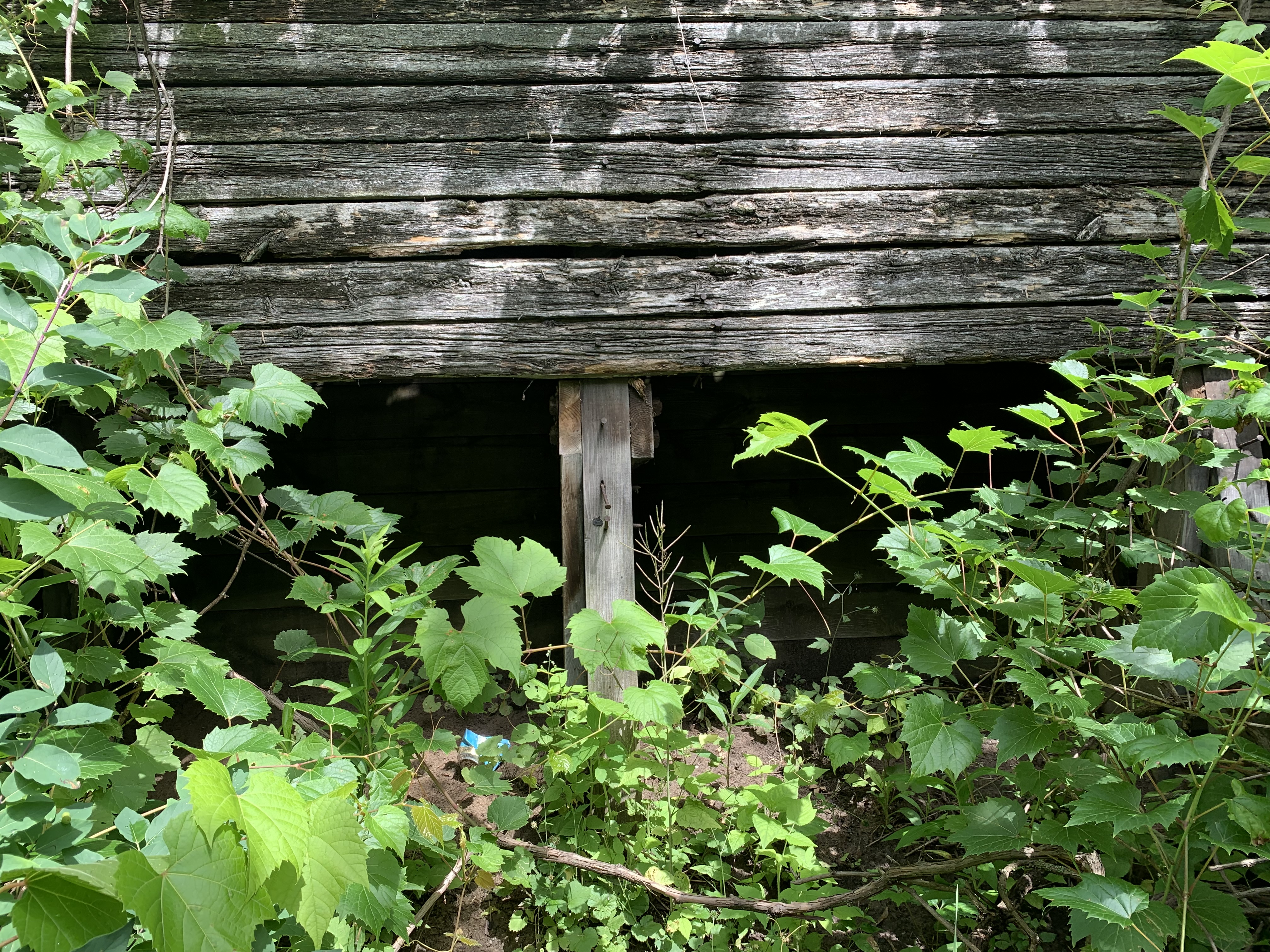
Only sixteen of the baffles remain and some of them are in poor shape.
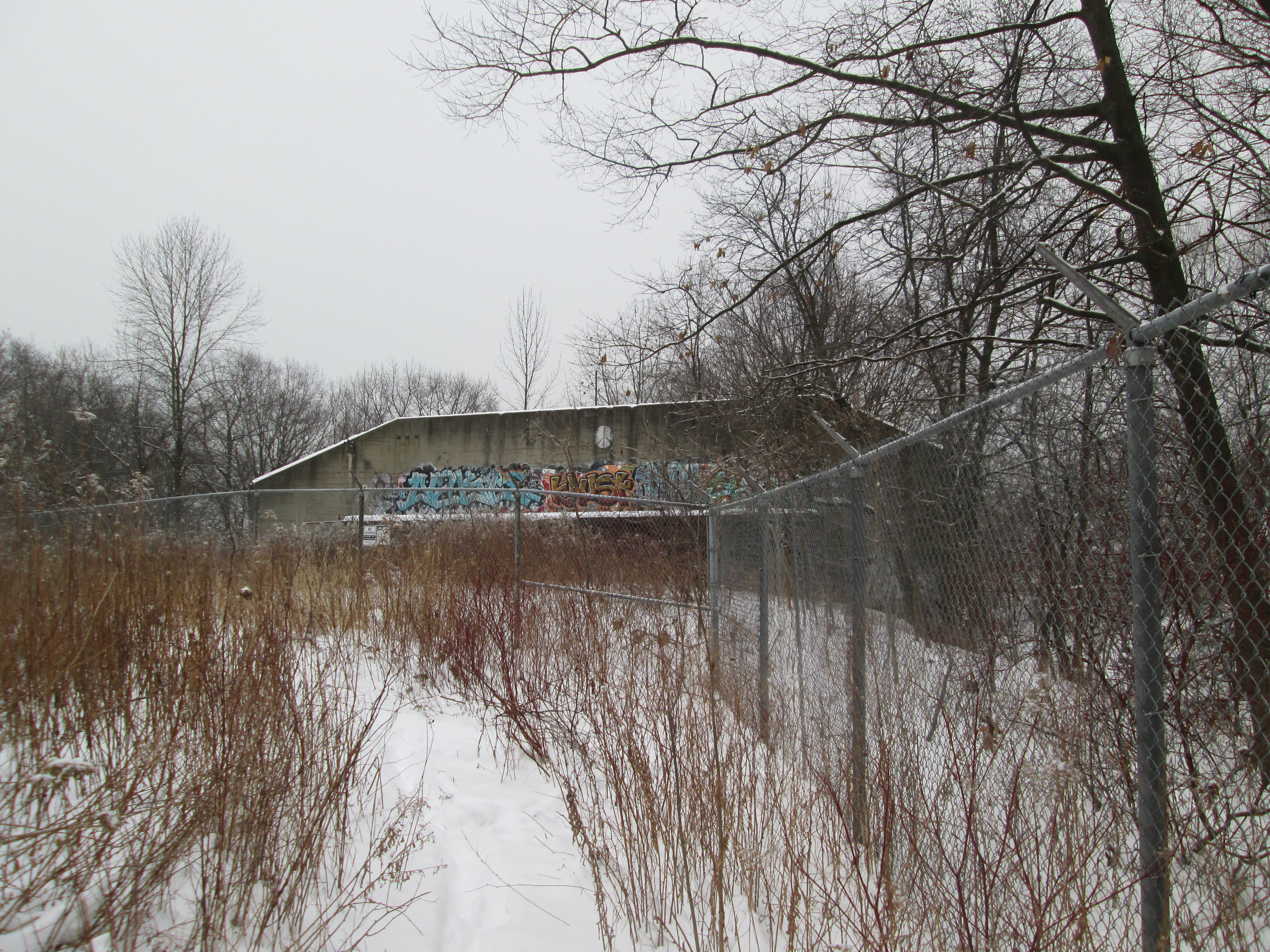
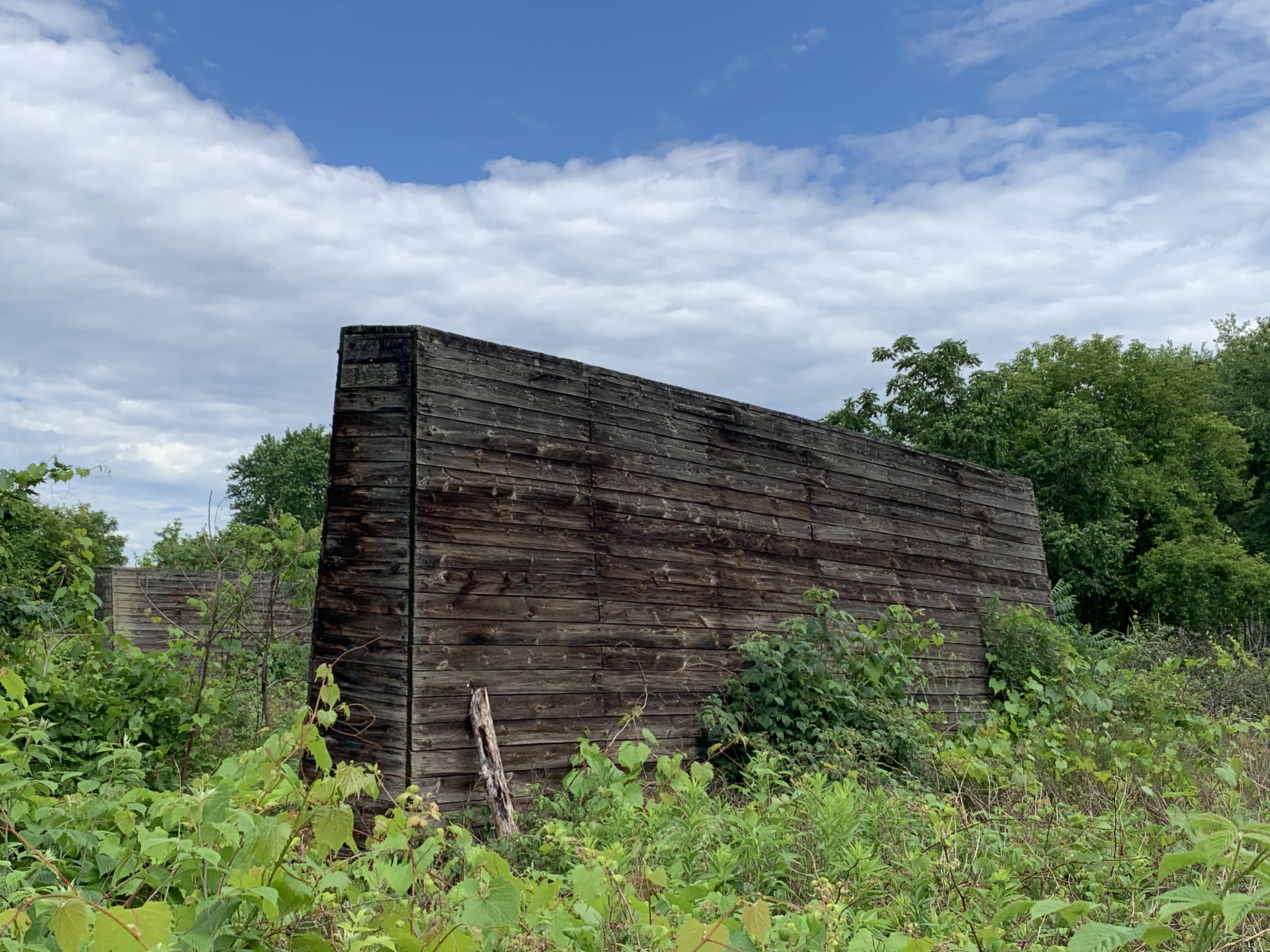
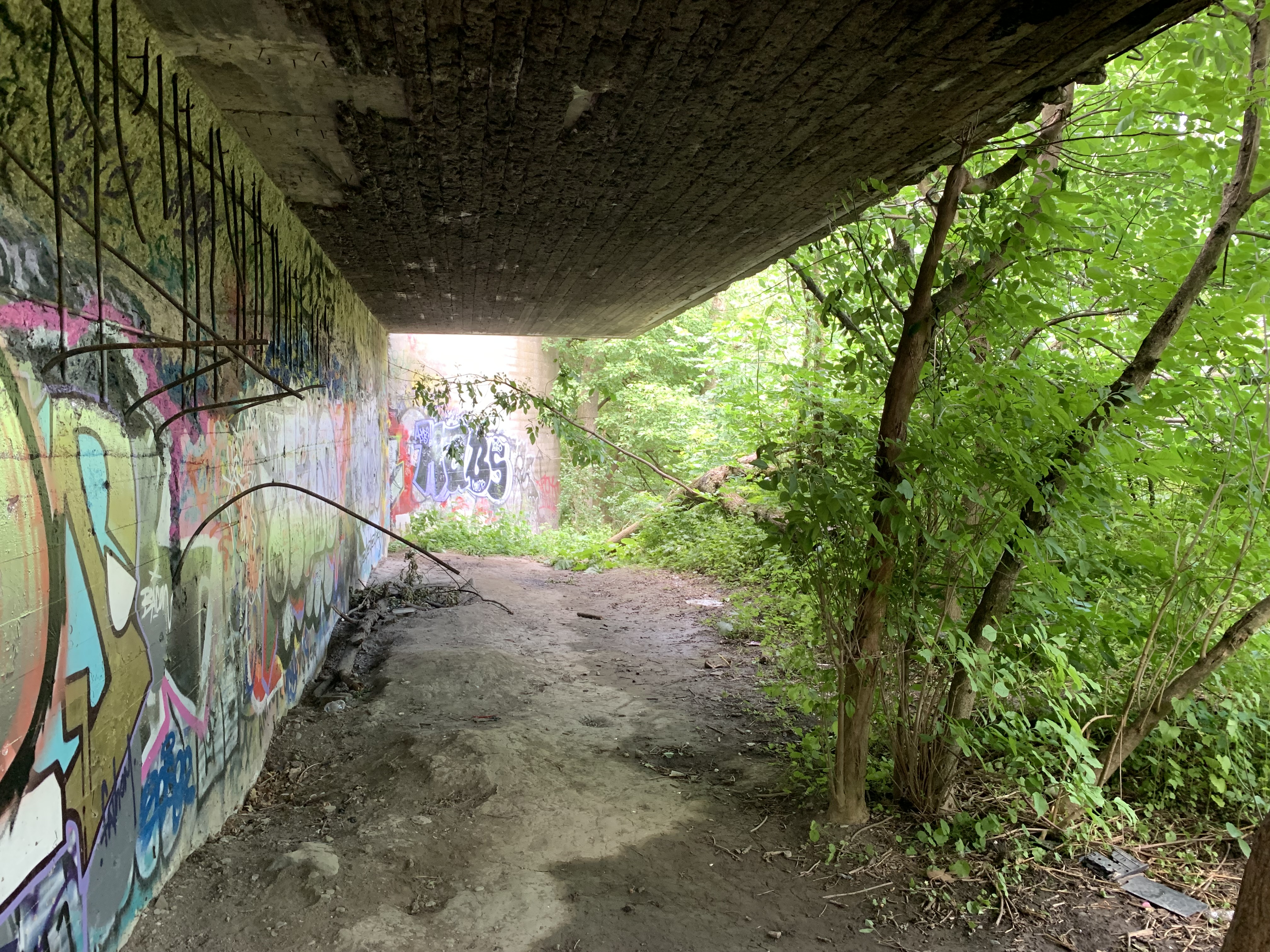
In 1925 two concrete backstops were built, each 15 feet high and 35 feet long. An archery or shooting target range is known as a butt and these two were built at 300 yards and 600 yards from the shooting gallery. The end of the 300 yard butt can be seen below as well as the concrete overhang that kept bullets from ricocheting wildly.
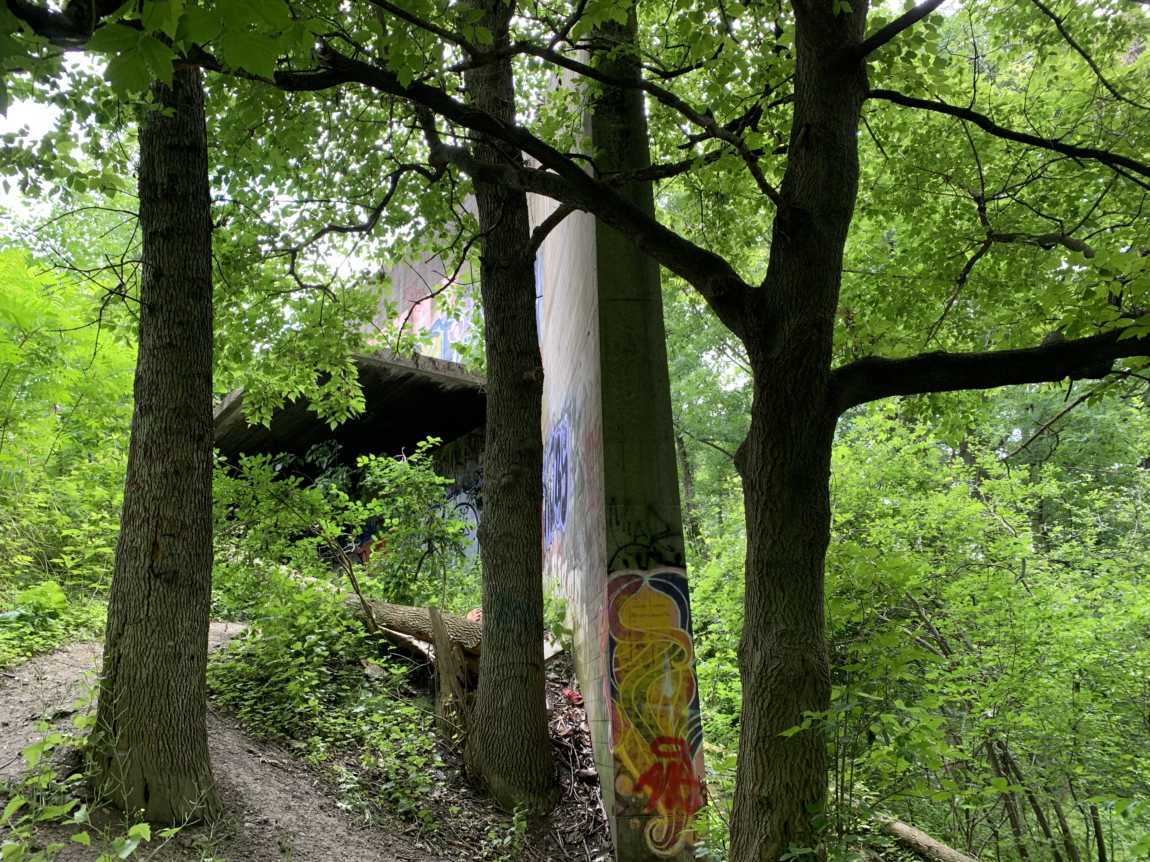
The 300 yard butt is pock marked with hundreds of bullet holes across the entire face. The vast majority of the Lee & Enfields 303 munitions that were fired at the butt were aimed at targets below the protective overhang. The concrete here is chewed away to expose the rebar inside and the wooden roof has also been blasted away.
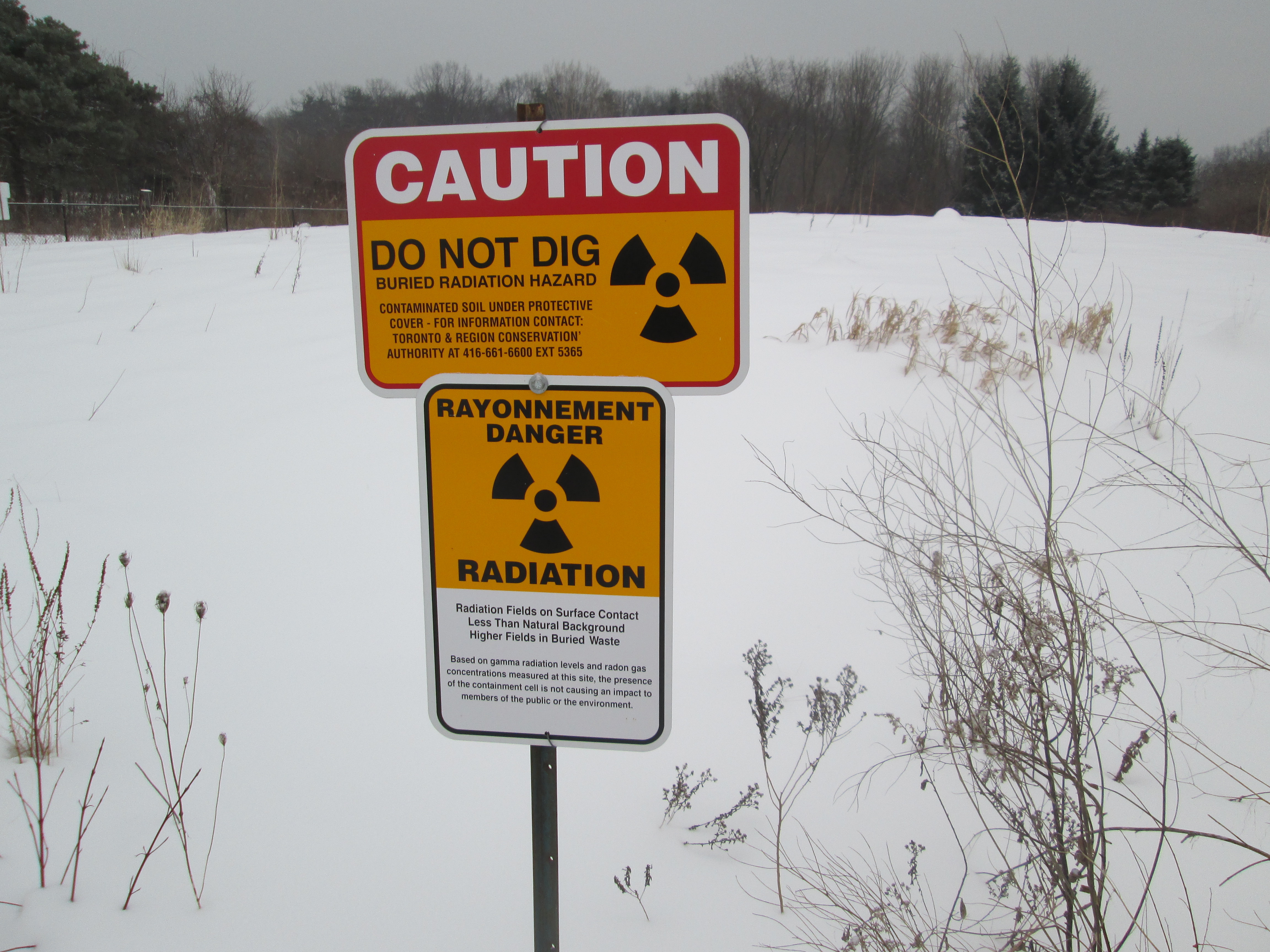
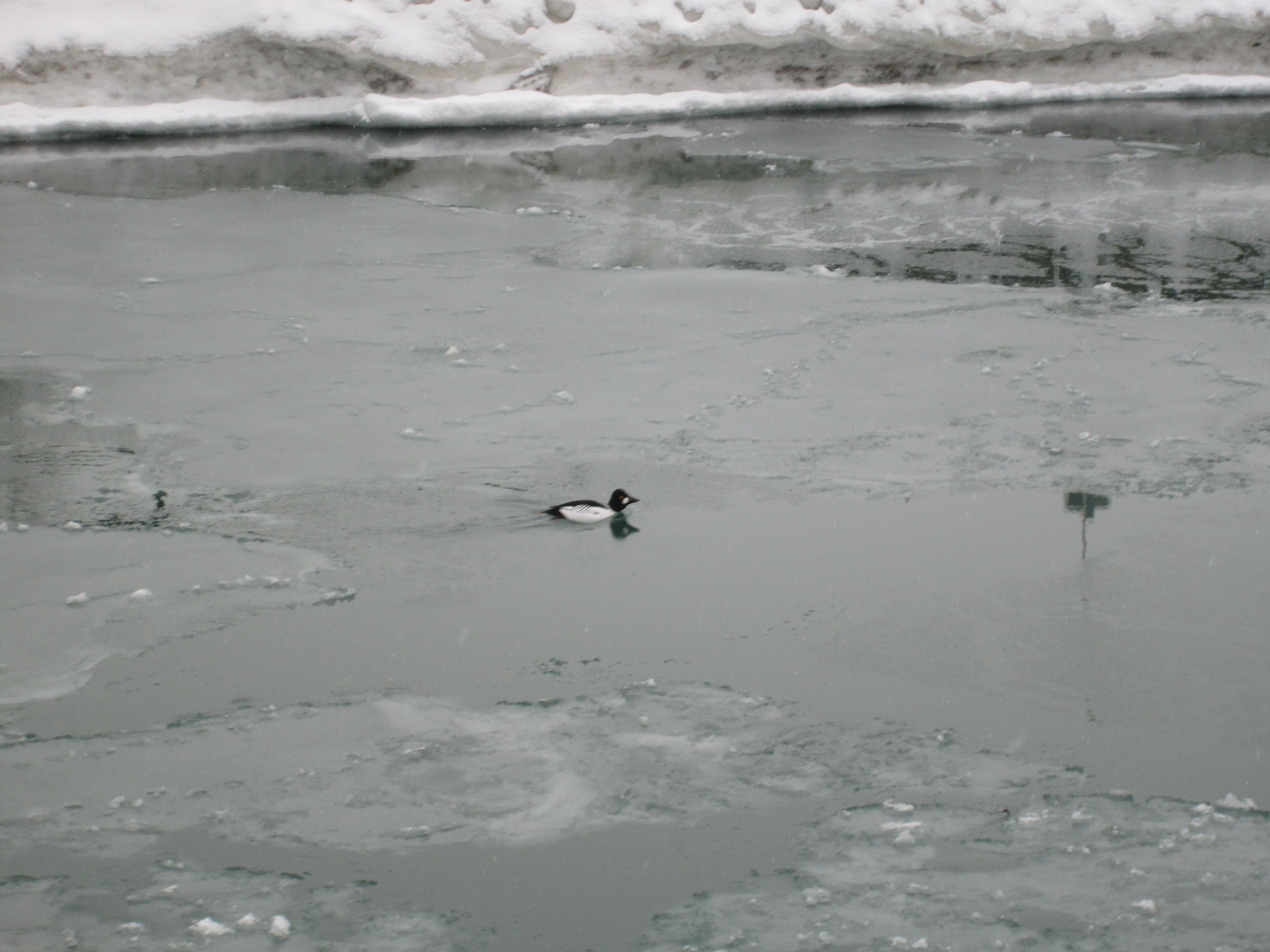
Applewood Creek flows behind the butt and separated the rifle range from Canada’s first aerodrome which was opened by the Curtis Company in 1915. The eastern section of the lot was used to train pilots until 1919 when the Royal Flying Corp discontinued using it and the buildings were demolished.
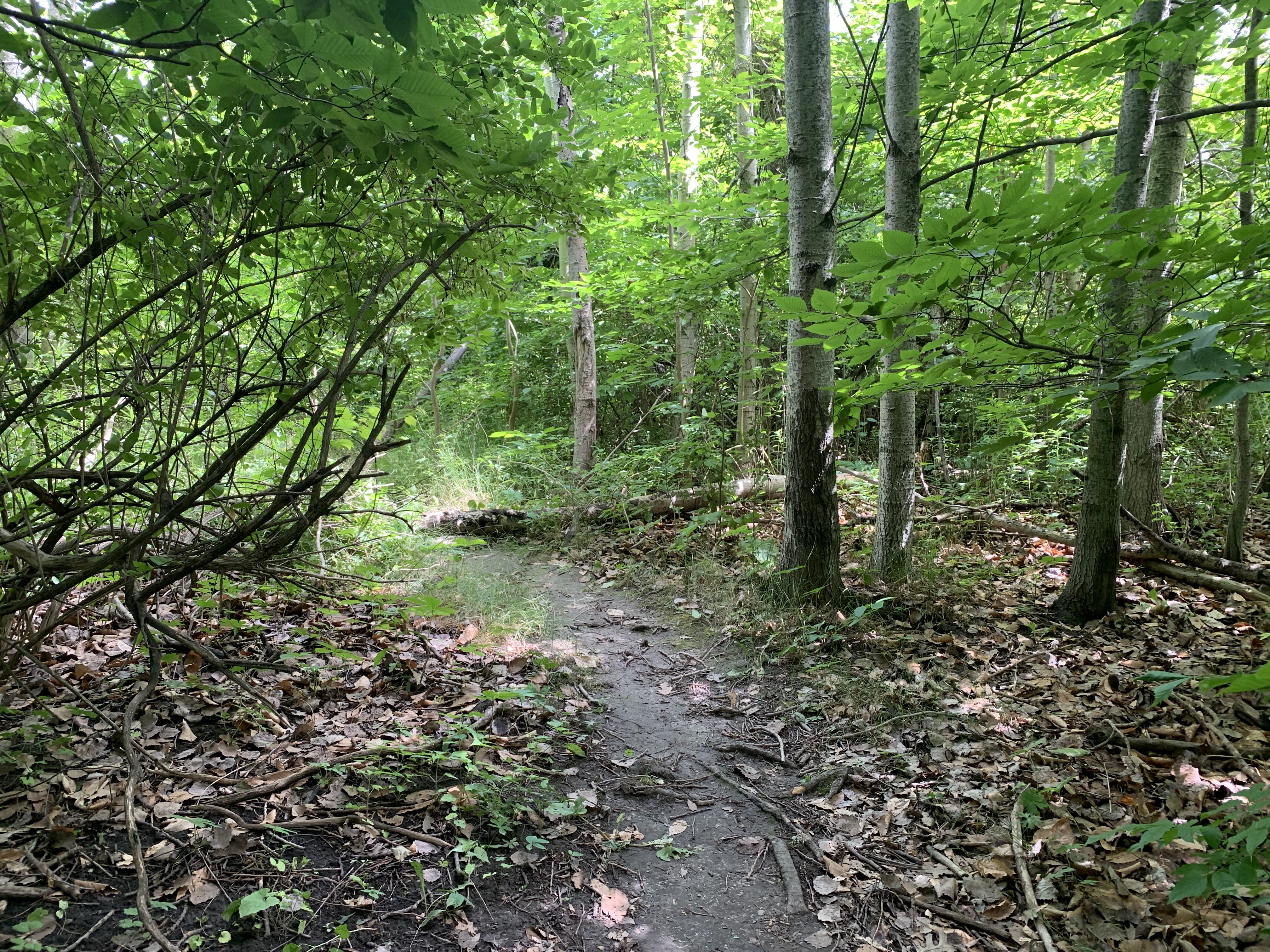
The rifle ranges were used to train soldiers for the Boer War, the Great War and the Second World War. The A-25 Small Arms School (later S-3 Canadian Small Arms School) held shooting matches here with up to 300 participants from across the country. Between 1939 and 1945 the Long Branches Rifle Ranges were used by the Department of National Defence to train infantry prior to deployment overseas. With its proud history of serving Canadas military its sad to see the baffles warped, broken and overgrown.
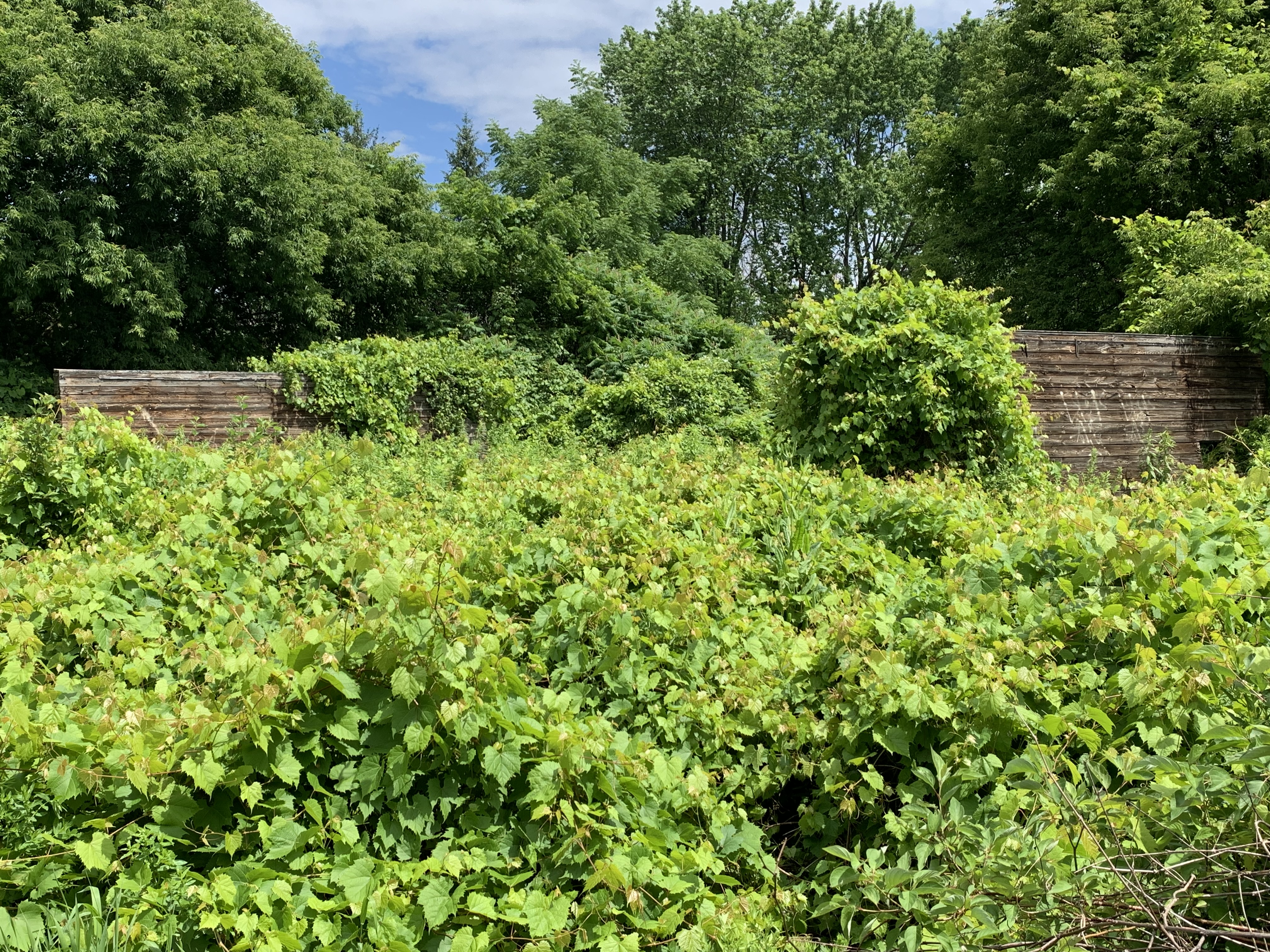
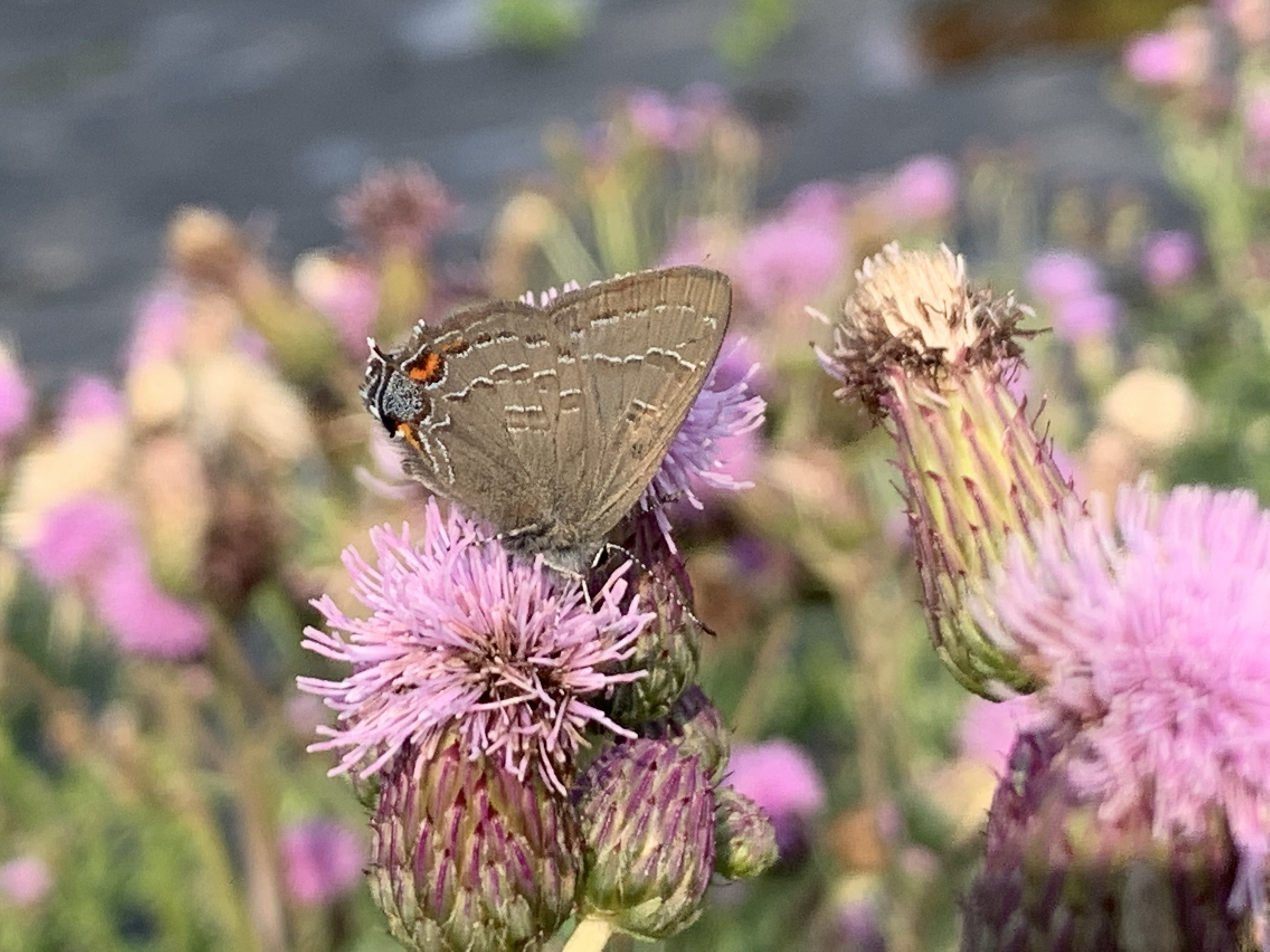
The proliferation of vegetation at the site has the benefit of providing habitat for birds, insects and various mammals. Seen below, Banded Hairstreak is one of the more common hairstreak butterflies in Ontario. They can have a fair range of variation in the pattern of the orange and silver spots on the underside of the wing but the brown bands with white borders are a defining feature. They lay their eggs on host branches where they overwinter, hatching in the spring. Banded Hairstreaks have one flight per year in late June or early July.
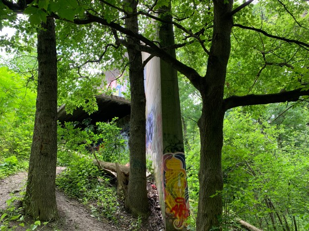
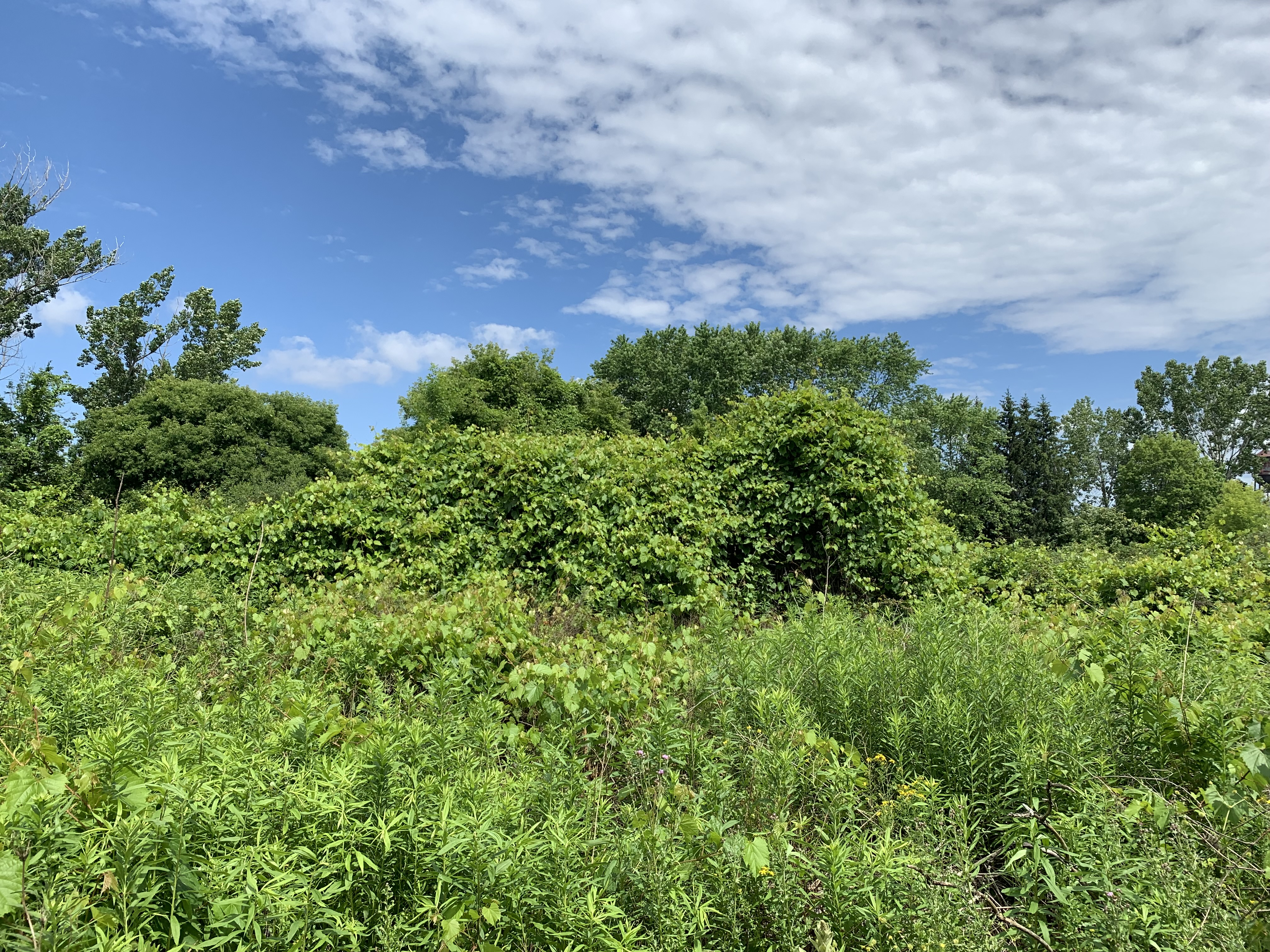
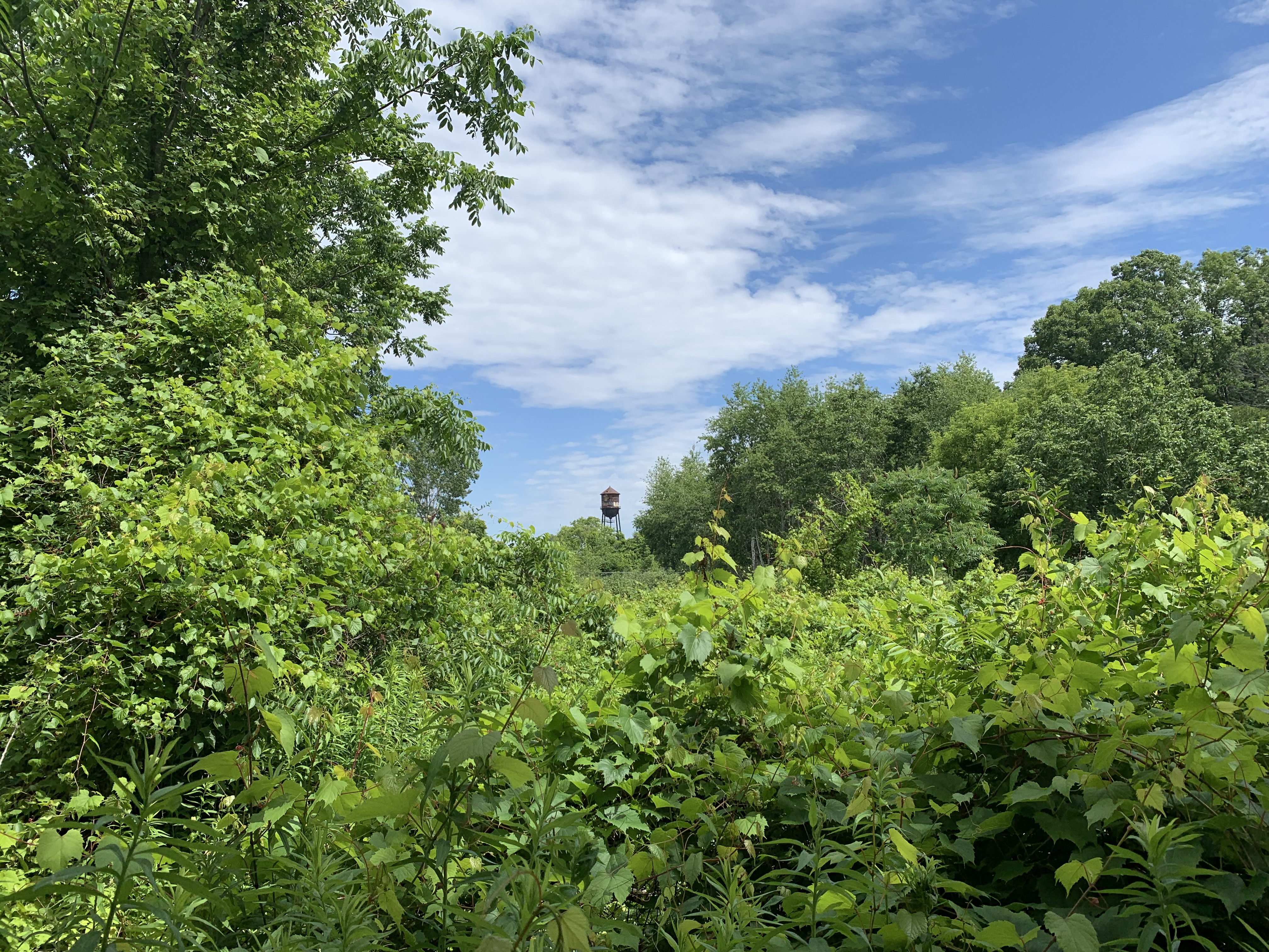
There are two baffles in the picture below but the river grapes and dog-strangling vines have run wild, engulfing everything.
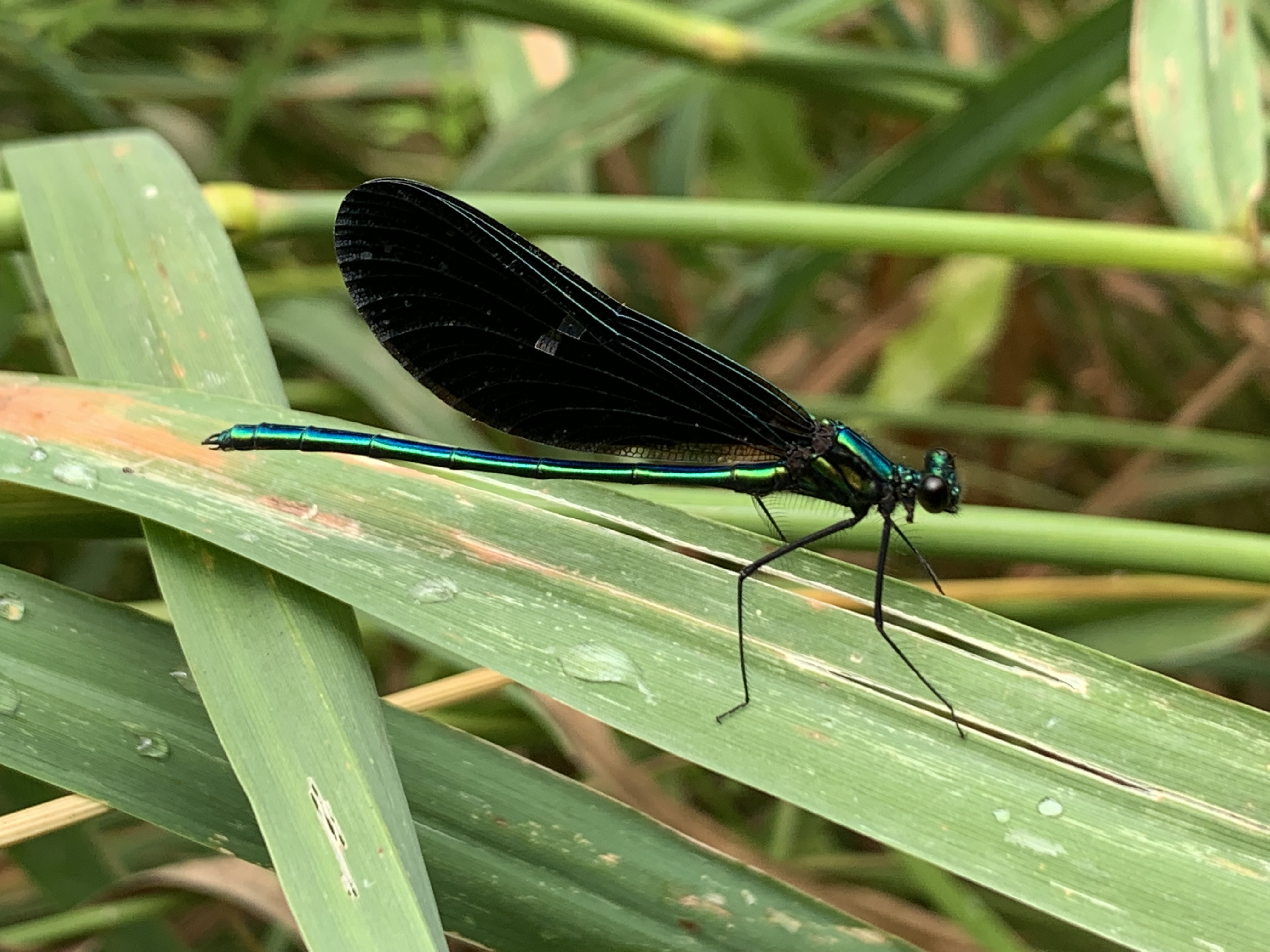
Ebony Jewelwing Damselflies were darting everywhere and a male is pictured below. He has a green body and plain black wings. They eat mosquitoes, fleas and small insects and are a welcome sight. In turn, they provide meals for turtles, frogs and fish who like to snap them out of the air.
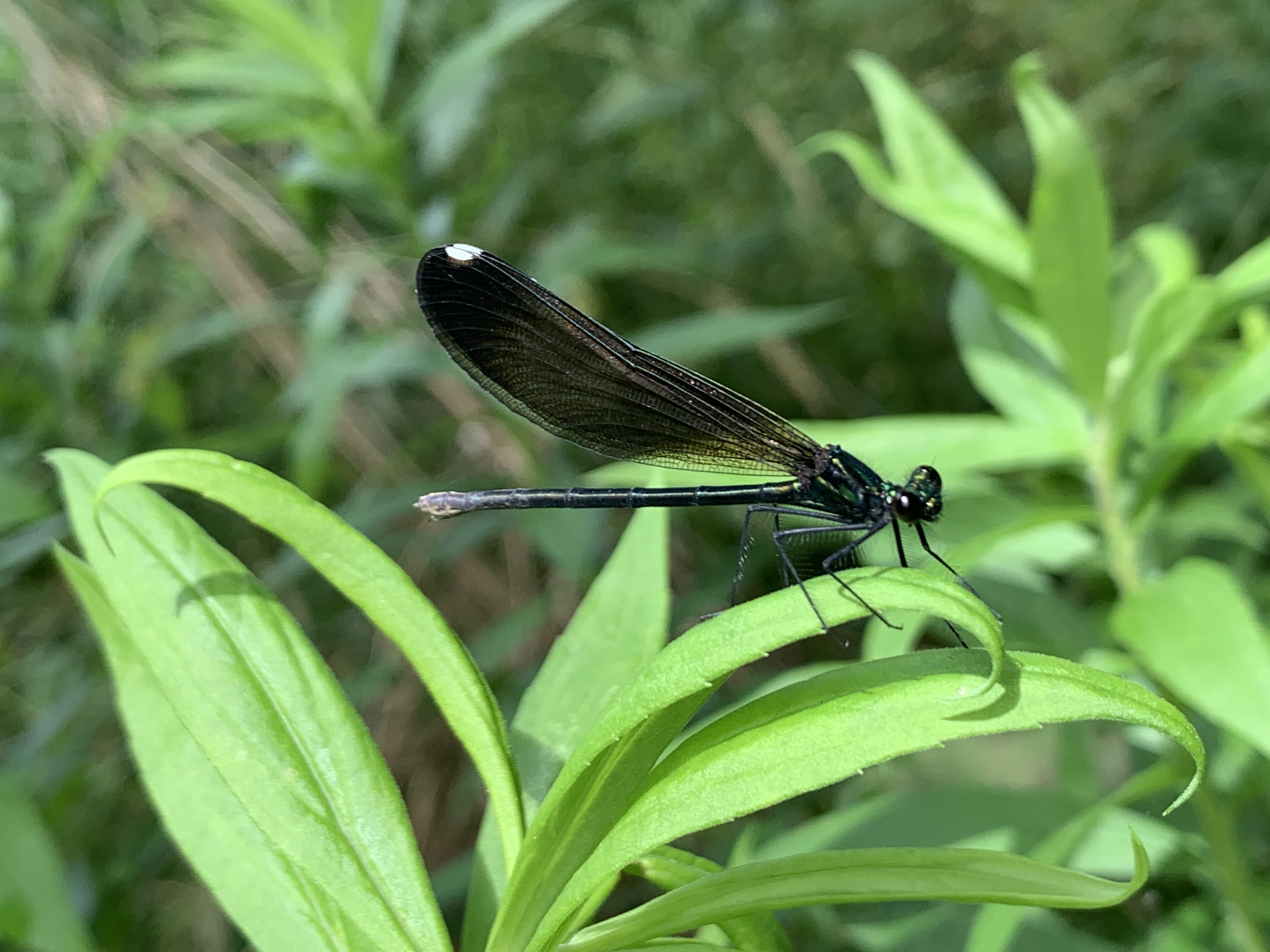
Female Ebony Jewelwings have a brownish body and smoky coloured wings. Their wings also have a small white patch at the tips. The female will mate in the early summer and lays her eggs in aquatic plants. When the naiads are hatched they eat small aquatic insects until they become fully grown. Then they crawl out of the water and molt into their adult form.
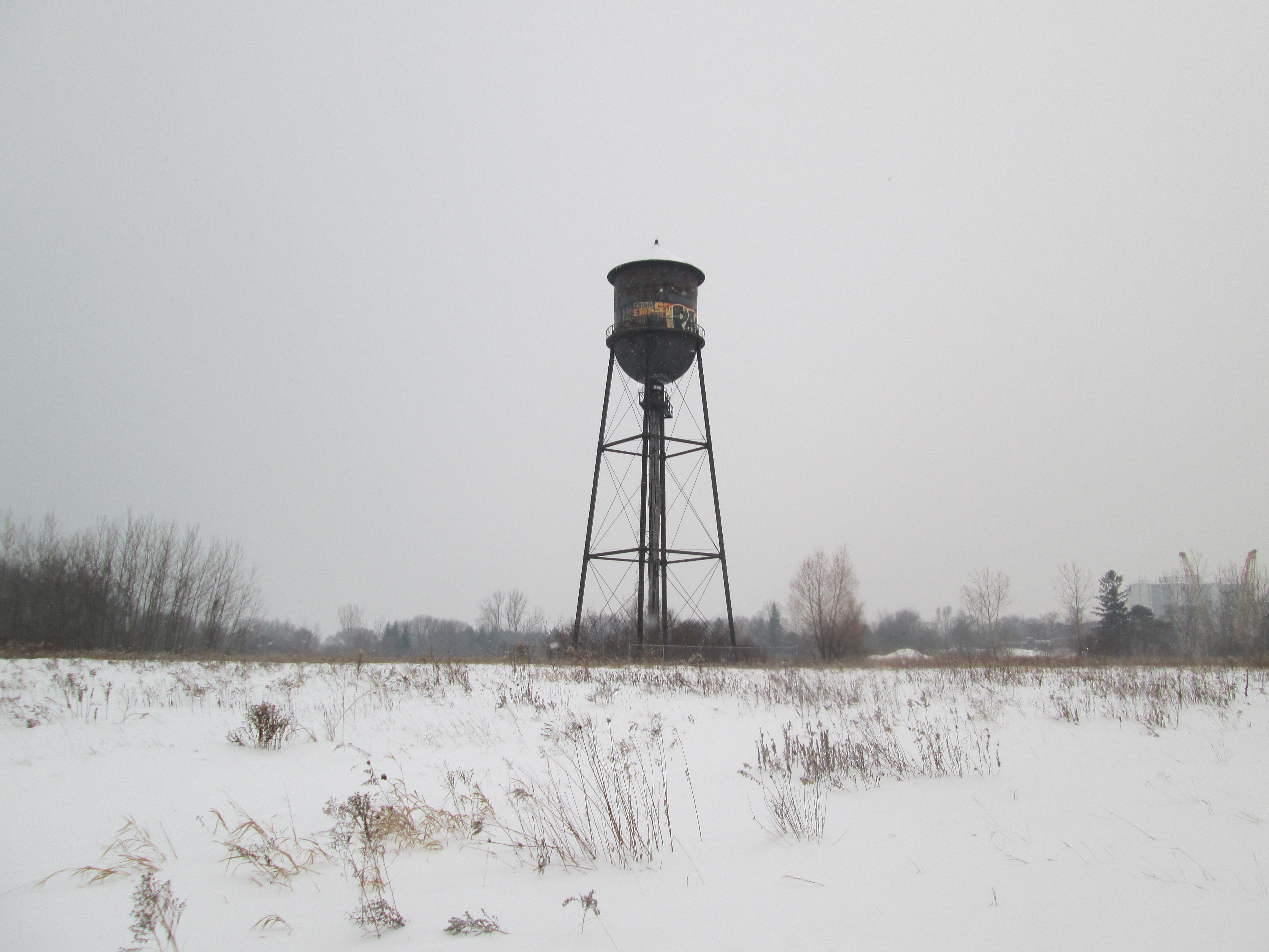
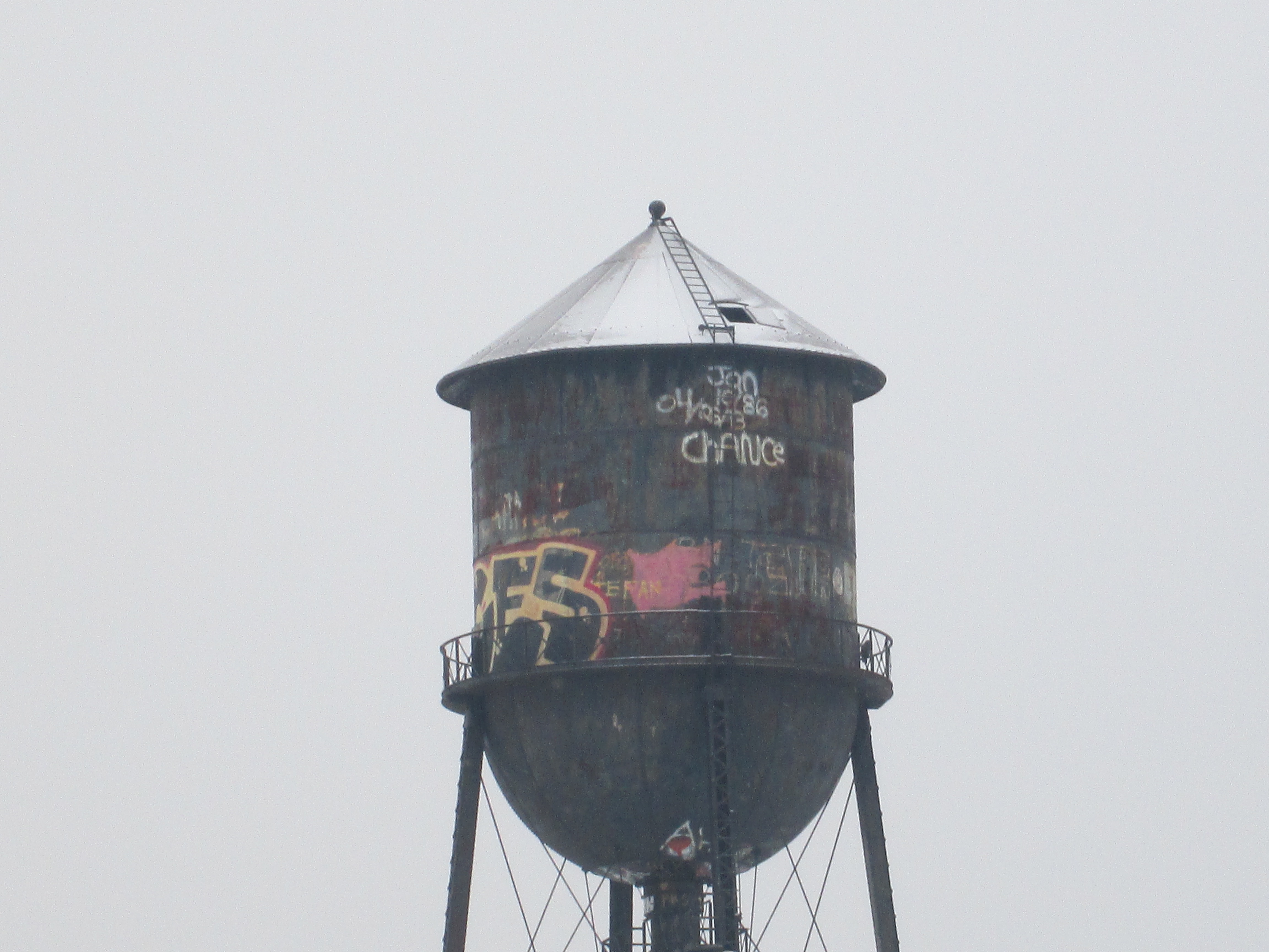
The water tower in the distance was built in 1941 to supply water for the Small Arms Manufacturing plant. At the time, it stood in the middle of the manufacturing compound and there were no trees between it and the firing range.
From closer up, the water tower can be seen to also be in a state of deterioration. When we visited here in 2016 the central water pipe was still surrounded by a wooden crib but all of this is now gone. The pipe has also become disconnected a short distance below the platform under the water tank.

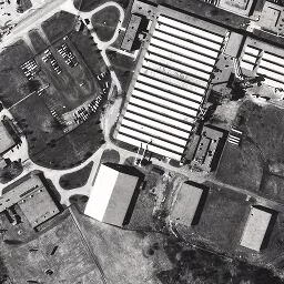
This 1957 aerial photo from the Toronto Archives shows the site when all the buildings were still intact. All that remains of the manufacturing complex is the water tower which stands alone in a field of rubble and overgrown roadways. The G. E. Booth Water Treatment plant had not yet been built and the 600 yard backstop was still in place. It was demolished in 1972 to make way for the water treatment plant. All of the original baffles are also still standing at this time.
Two small flood control ponds have been created on the old arsenal lands and the larger of them has become home to painted turtles. On this morning we found 7 of them sunning themselves on various rocks and logs. All of them were small, perhaps a few years old at most. Painted turtles can live 20 to 30 years but some have been known to reach 50 years of age.

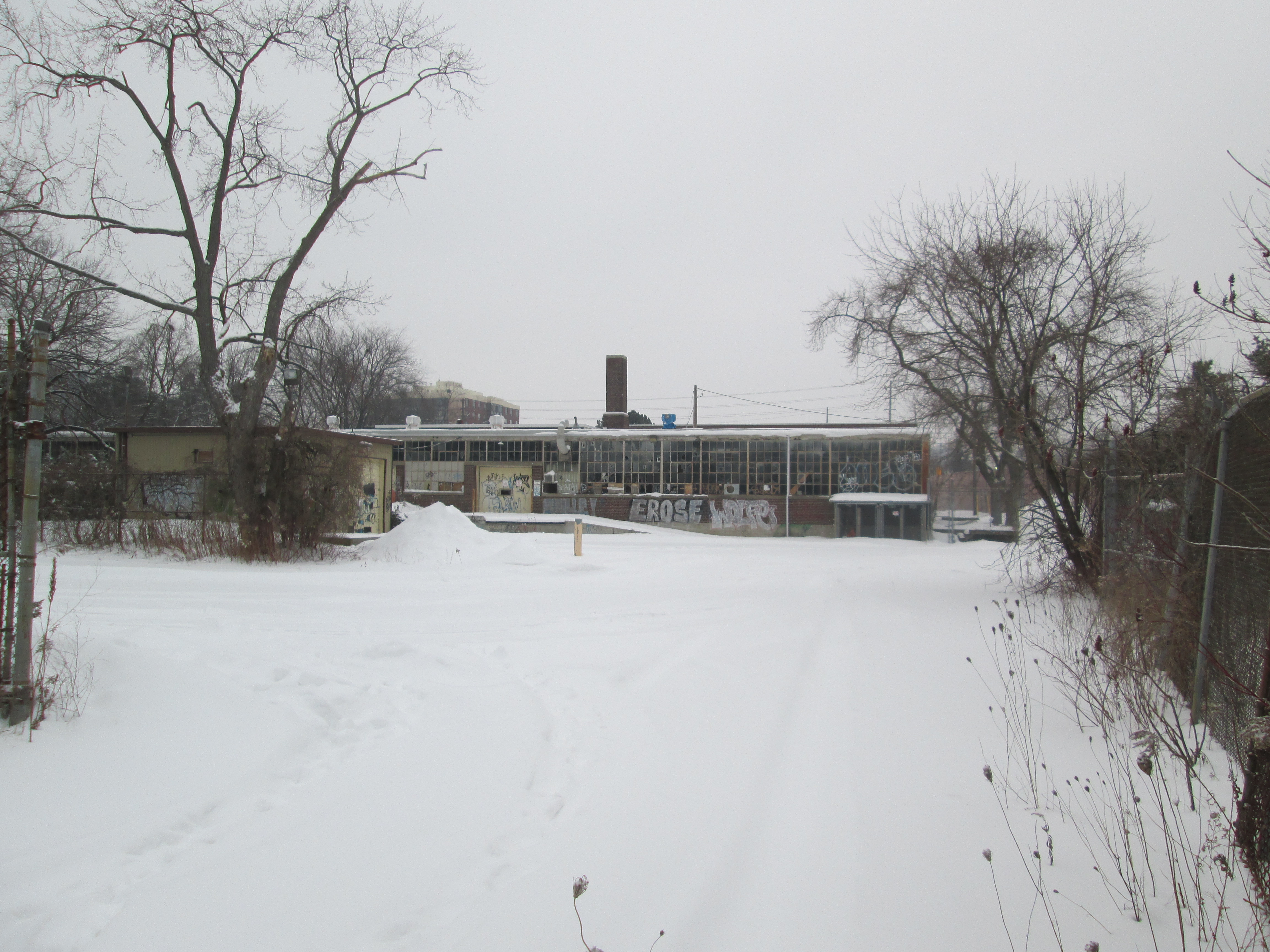
Every time I visit this site I always leave with the feeling that something should be done to bring awareness to this bit of local history and I’m even more certain now. Mississauga carried out a Cultural Heritage Assessment in September 2013 but the site has continued to deteriorate in the 8 years since then. It remains to be seen what the future holds for this overlooked bit of our military heritage.
Also see our related blogs; The Arsenal Lands, Small Arms Testing Site and Marie Curtis Park
Google Maps Link: Arsenal Lands
Like us at http://www.facebook.com/hikingthegta
Follow us at http://www.hikingthegta.com
Also look for us on Instagram