Tag Archives: Downsview Park

Downsview – Ghost Towns of the GTA

Sunday, May 26, 2019

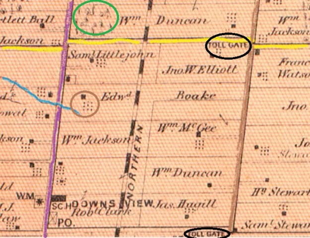
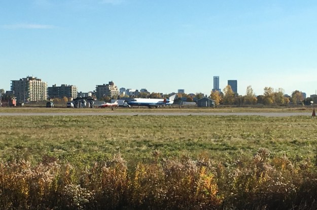
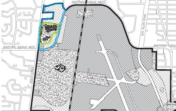
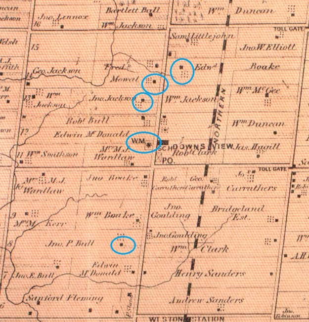
The intersection of Keele Street and Wilson Avenue was home to the community of Downsview although most of the original settlement has been erased through road widening and urban sprawl.  The name has become attached to the de Havilland Aircraft plant and later the Downsview Air Force Base that came to the northern edge of town in 1928.  The 1878 county atlas below shows the five remaining points that we set out to visit. Starting at the bottom with John Perkins Bull who named his home Downs View because it was on the high point of some flat land, leading to the name of the community.  The local flat land would attract the aircraft industry to the area.

Downsview 1878 map revised

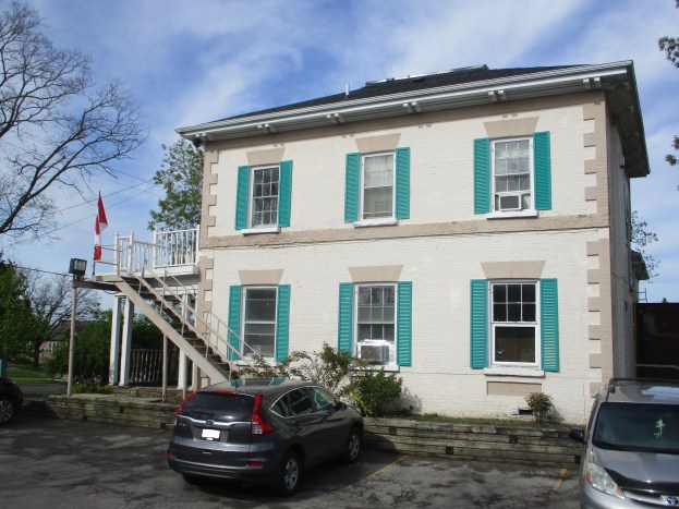
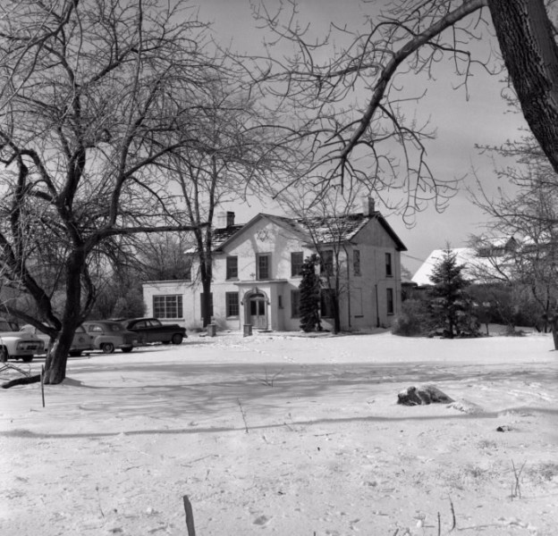
John Perkins Bull was born in Toronto on April 30, 1822 and when he turned twenty he received Lot 8, Concession 4 from his father as a coming of age gift.  He immediately started clearing some of his 200 acres and in 1844 built the house that he named Downs View.  Bull took on the nick name Squire after he served as Justice of the Peace, served as Deputy-Reeve, was prominent in promoting the agricultural welfare of the area.  He was also an active and influential member of the Wesleyan Methodist Church which originally met in his home.  Squire Bull didn’t like the commute on those early roads which were either a muddy disaster or were plank roads with tolls on them.  See the upper right corner of the map for the Dufferin and Sheppard toll gate and click on this link for more information.  Squire Bull decided to work from home and often had to lock up the guilty in the basement of the house.  He married twice and was father to three boys and three girls who grew up in this house.

IMG_3864

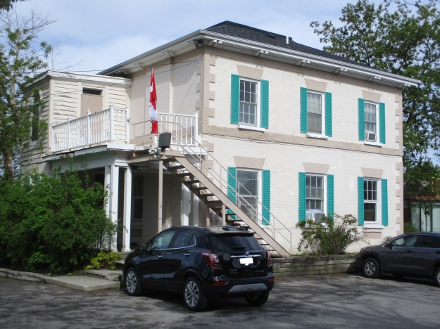
This picture of the house is from the Toronto Library and is dated 1955.  This is before rapid development took the house out of the country and planted it in the middle of a subdivision.  Before long it would become a retirement home as it remains today.

Perkins Bull House 1955

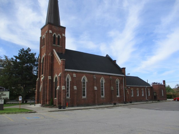
The Downsview United Church began as a Wesleyan Methodist Church around 1830.  By 1844 services were being held in the home above where they continued until the first frame church was constructed around 1850.  It was replaced with the current brick Gothic Revival church in 1870.  A small addition was made on the chancel in 1882.  From the side you can see the other major additions.  A Sunday School was added in 1937 where you can see the section with the lower roof.  A Christian Education Wing was added at the back in 1955 and the original spire was replaced after it was damaged in a storm.  The building has just completed a restoration and is the most recognizable building in the former community.

IMG_3868

The George Jackson House was built some time after 1885 when he inherited the property from his father.  The Jackson family owned the property from 1830 until 1967.  The house was briefly used as a nursing home before being converted to professional offices in 1981.

IMG_3875

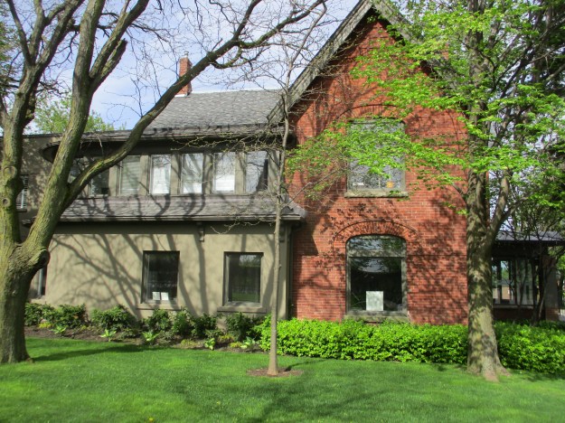
This is one of only three heritage buildings left from the community with the other two presented above.   The Jackson house was designated, in part, because of the basket weave brickwork pattern under the steep gables.  This mixing of Queen Anne with Romanesque styles was popular in the late 1880’s.

IMG_3871

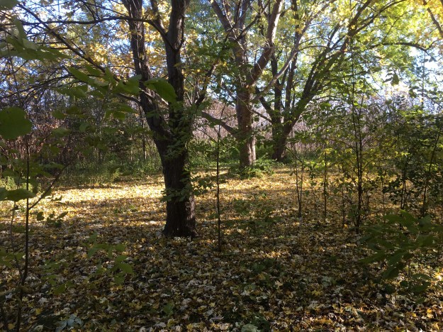
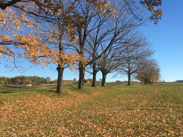
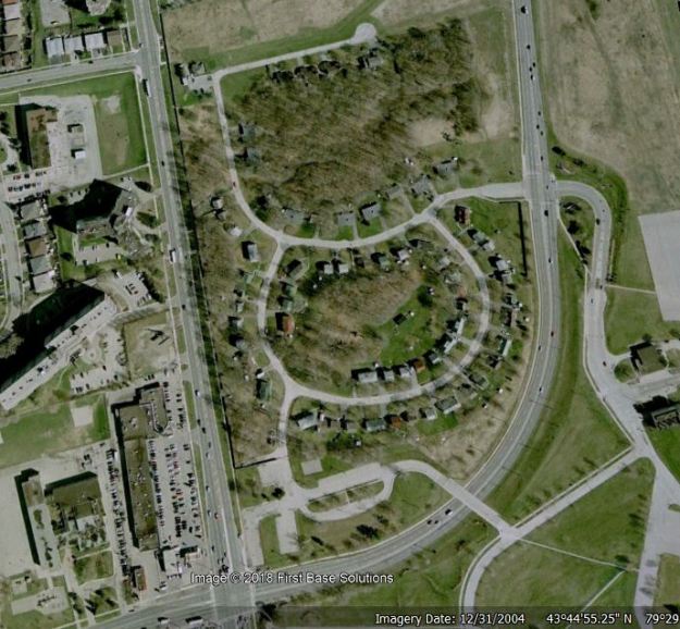
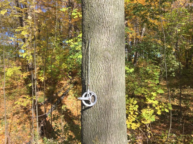
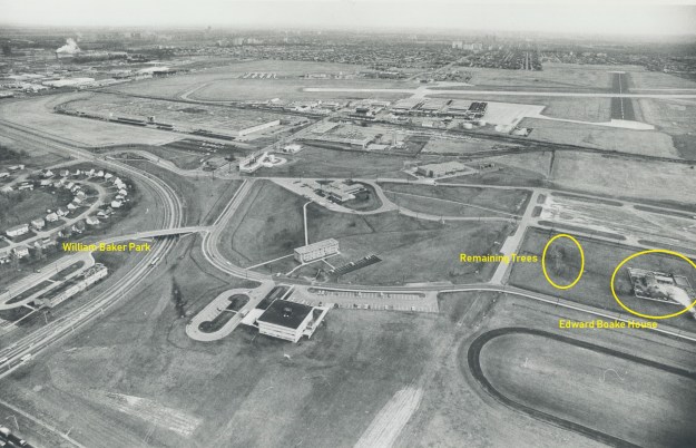
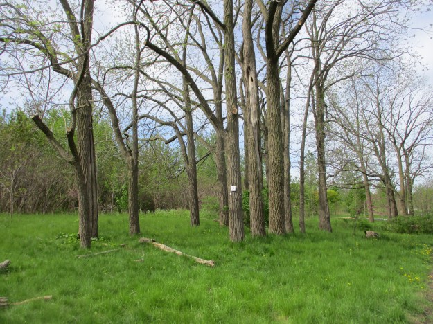
This 1976 aerial photograph of Downsview Airforce Base shows the Edward Boake House before it was demolished.  It was built in 1860 by Edward and Sarah Boakes who called it Locust Lodge.  It remained in the family for generations until it was expropriated by the Air Force who already owned the family farm surrounding it.  On the left side of the picture you can also see the officer’s housing known as William Baker Park.  It has also been demolished.  In front of the Boake house is a double row of trees which are the only mature trees in the immediate area.

Boake House

These are the trees that the Boake family looked out upon from their windows.  Today they stand in an area known as Boakes Grove where no grove has stood for 150 years.

IMG_3877

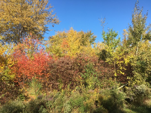
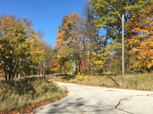
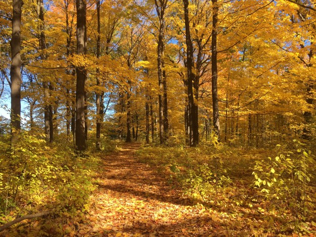
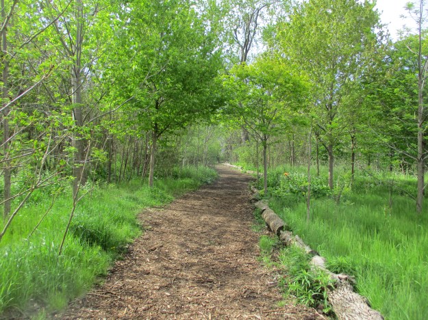
Downsview Park has done a great job of planting trees that will one day form a mature forest in this part of the park.  This trail runs roughly along the former fence line that separated the house from the fields of the family farm.  The park has also installed a new multi panel interpretive centre near this site to explain the history of the area.  Unfortunately they chose to etch the information into stainless steel plates that were quite hard to read with the sun on them.  They do contain a wealth of information that is worth the time to read on a cloudy day.

IMG_3880

In 1954 a local group decided that a synagogue and Jewish school were needed in the area and before long had a potential congregation of 200 families signed up.  The property that belonged to Fred Mowatt at the time of the county atlas had now become the Ness Estate and it was purchased for $35,000 to serve as their synagogue.  The picture below shows the home in 1956 as the Conservative Beth Am Synagogue.

Downsview synagog

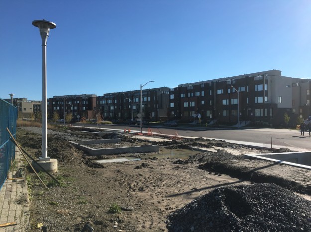
The farmhouse was integrated into a new building and the congregation made several further expansions including the large front building in 1965.  By the mid-1970’s the congregation was shrinking as the area of Bathurst Street became a larger Jewish community.  In 1977 the last 228 families decided to close the synagogue and merge with the Beth David B’nai Israel congregation on Bathurst.  The ceremonial transfer of the Torah from Beth Am Synagogue took place on January 28, 1978.  The Rameses Shriners used the building next and it appears that during 1984 or so the original house was either demolished or reduced to a single floor.  Today the building serves as a sales centre for a 12-story condo development called The Keeley that will soon replace it.  There was a brief attempt to designate the building as an example of modernist architecture, mainly because of the front entrance to the 1965 addition.  A 45-foot mural had remained across the front of the building that was specifically created for the synagogue but this was moved to the Beth David Synagogue in 2013.

IMG_3893

That effort failed and this week a sod turning ceremony was held in front of the building.  Which means that as soon as the developers get the demolition permit the building will be gone.  What I’d like to know, based on reviewing a couple dozen annual aerial photos of the site is this.  What lies behind this door and is it a Shiner addition or was it put on the original house by the synagogue?  Is there still part of the original farmhouse inside the building?  As I work close by, I hope to see for myself if I can.

IMG_3891

The former town of Downsview still has a few traces left in spite of the rapid development of the area in the 1960’s and 1970’s.

Google Maps Link: Downsview

Explore our top 20 posts with this retrospective: Back Tracks: The First 5 Years

Like us at http://www.facebook.com/hikingthegta

Follow us at http://www.hikingthegta.com


Downsview Park


Saturday, November 3, 2018

One of the GTA’s newer parks, Downsview Park is 291 acres of the former Royal Canadian Air Force Station Downsview.  Last weekend we had investigated William Baker Park where a housing community had been built by the military.  The woodlot has been preserved and can be seen as a rare original woodlot on the county atlas map below where it is circled in green.  A detailed history of the military operations at the site can be found in a link at the end of this post.  Many of the properties seen on the 1877 map were taken over for the air base including the property  which is shown as Edward Boake (spelled Roake on the atlas).  His homestead is circled in brown and shows the headwaters for the small creek that was used to form the lake in the new park.  The atlas also shows two tollgates on what would become Dufferin Road.  These tolls were levied on users of the plank road that had been built along this concession.  More on the plank road can be found in this post.  Beginning in 1995 plans were developed to turn the former air force base into a series of new residential communities and a new urban park to be called Downsview Park.

Downsview Map

Several generations of the Boakes family farmed the family homestead before having it expropriated by the military for the air force base.  The home stood until around 1962 when it was demolished.  A few lines of mature trees in the new urban forest mark the outline of the front yard of the home.

IMG_8432

Forty-five acres are planned for urban forest in the park.  The heart of this is the Boakes Grove which contains many mature trees but is not a mature forest.  Most of the area around the Boakes home was open fields with just a few trees along the lane and fence lines.  Silver Maples, Walnut and Black Locust are common here but most of the trees are very small and will mature into a nice forest over the next couple of decades.

IMG_8438

The soil in the park was heavily compacted and full of pollutants and needed remediation before planting could begin.  The soil was churned-up to a depth of 60 centimetres to loosen it up and provide aeration.  Then, a 10-centimetre layer of composted leaves was spread on top to provide nutrients for growing the urban forest.  Volunteers and community groups have planted thousands of trees in the park.   There are 45 acres of parkland set aside for the urban forest which will mature over the next 40 years becoming a dynamic biosystem.

IMG_8454

At the very heart of Downsview Park is a 9-acre lake that has been built as an integral part of the water system in the park.  The lake is the final step in a water purification system to ensure the water is clean before it is discharged into Black Creek.  The park has been graded to direct the flow of storm water and slow it down so the ground has time to naturally filter the water.  It passes through a series of bioswales and filtration ponds.  Finally it flows into the pond which is normally about 3-metres deep but which can rise and additional metre during storm events.  The lake has a circuit path that allows you to stroll around the edge as you watch for the multitude of birds that call the park home.  The lake sits on the headwaters of a tributary of Black Creek and can be seen marked in blue on the county atlas above.

IMG_8443

A row of mature maple trees in the middle of a field has a story to tell.  The lake is brand new and most of the other trees are very young.  When this was an active farm run by generations of Boakes trees didn’t grow in the middle of crop fields.  Fence lines always provided a few feet of growing room and trees that got started there were left to grow.  This particular line of trees marked the southern property line of the Boakes farm.

IMG_8461

The orchard in Downsview Park is rather recent compared to the one that is shown on the property in the county atlas.  Many of the original settlers planted orchards to help feed their families.  Many of these early orchards still exist, at least in part.  One of the better preserved ones can be found in Erindale.  The original orchard on the Boakes property was, as usual, close to the house.  The community orchard in Downsview Park was started in 2012 when 200 fruit trees were planted.  A second major planting in 2017 has brought the total to over 400 trees.  Apples, plums, apricots and pears now grow here to educate the community.  Other gardens are scattered around the pavilion including a patch of blueberries that are not very common in the GTA.

IMG_8467

The land was originally chosen by de Havilland because it was flat and therefore suitable for aircraft manufacture because it could support a runway.  Flying aircraft from the facility to their new owners is the most practical way to deliver the product to the end user.  A large mound has been made, partially with soil excavated in the construction of the lake.  An unofficial path leads up the side of the mound.

IMG_8474

Climbing the mound gives you a panoramic view of the park and the city.  Lake Ontario can be seen in the distance as you look south.  The picture below looks toward Keele Street and the man-made lake.

IMG_8475

There is plenty of wildlife in Downsview Park.  This red-tailed hawk was seen along with a Cooper’s Hawk and a dozen smaller birds as we made our way around the park.  Deer, coyote and a host of smaller mammals can be found throughout the woods and grasslands.  This picture was taken the day before and shows the industrial buildings in the south of the park.

IMG_8312

A gaggle of geese has gathered on the open field near the old central heating plant.  Most of these geese will fly south for the winter but in this era of milder winters we are seeing more birds remain behind.  Sometime they have a real struggle for food in the winter however, please don’t feed ducks and geese with bread.  They don’t digest it and it bloats in their stomachs.  This fills them up and prevents them from eating food which they can get nutrition from.

IMG_8482

For the smaller children a new playground has been added with several aviation themed toys including a small airplane.  The concrete pad around the playground has been painted to simulate a runway.  Windsocks are commonly used at airports to provide visual clues to pilots concerning wind direction and strength.  According to Transport Canada regulations the design of a windsock should cause it to perform consistently.  A wind speed of 15-knots should fully extend a windsock.  At 10-knots the sock should be about 5 degrees below horizontal, as the ones pictured below are.  If the sock is 30 degrees below horizontal it means the wind speed is 6-knots.

IMG_8508

This concludes our current series on Downsview Park.  Click on the link for the story of the officer’s housing and the William Baker Woodlot.  For the history of RCAF Downsview before the creation of the park you can click on the link above.

Google Maps Link: Downsview Park

Like us at http://www.facebook.com/hikingthegta

Follow us at http://www.hikingthegta.com

RCAF Station Downsview

Sunday, November 4, 2018

This blog looks at the former military base in Downsview and is part one of a two part story which included an exploration of our new urban park.  The site of Downsview Park has a long history including being home of the first aircraft manufacturing plant in Canada.  In April of 1929 de Haviland Aircraft of Canada purchased 70 acres of land along Sheppard Avenue and moved their operations from Mount Dennis.  The property was chosen because it was flat and sat at a high elevation. de Havilland erected a 20,000 square foot building and hired a staff of 35 to start production of airplanes.  The original building still stands at 65 Carl Hall Road.  The section of old Sheppard Avenue that runs through the base is now known as Carl Hall Road.  Many of the roads on the base were named after World War One heroes and Carl Hall served and died at the river Seine on October 10, 1916.   The original manufacturing plant is one of a collection of twelve properties on the site that are collectively being considered for historic designation.

IMG_8417

Between 1936 and 1938 de Havilland added a new main building (75 Carl Hall), paint shop and hanger.

IMG_8421

Additional land along Sheppard was purchased and production facilities were expanded during the Second World War when the facility began producing war planes.  Their staff grew to 2,400 and in 1942 they produced 550 Tiger Moths and another 362 Ansons.  That year they also developed the Mosquito fighter bomber at their Downsview plant.  When the war was over de Havilland went back to making commercial airplanes.  The Canadian Military maintained an interest in the runway at de Havilland and in 1947 bought up 270 of the surrounding properties to form RCAF Station Downsview.  The expanded runway is still in use to the east of the hanger where a small plane readies for take-off.

IMG_8425

After the war the air force moved the 400 Squadron to Downsview and reformed the 401 Squadron there.  These two Auxiliary Squadrons became the heart of a new Air Material Base.  In 1952 the Department of National Defense was given control of the lands and they granted de Havilland a long term lease on some land to the south of the base.  With de Havilland moved out, the air force soon built maintenance buildings, headquarters and housing.  They expanded the runways and in 1962 expropriated the section of Sheppard Avenue that crossed the base.  In exchange, the military granted 86 feet of land along the north end of the runway for the construction of a new Sheppard Avenue.  It is good to see that several of the maintenance buildings at 60 Carl Hall have been re-purposed and Wildlife Rescue occupies at least one of them.  The portion with the curved roof was built in 1928 as a hangar at de Havilland’s airstrip at Mount Dennis.  It features a rare wooden bow truss structure and is the oldest building on the grounds.

IMG_8411

In 1954 the RCAF built No. 1 Supply Depot.  This massive building covers 18.5 acres and was designed to survive the largest non-nuclear bomb of 1951.  It was also built with a one-million gallon storage tank beneath it.  Storm water was collected here for use as fire suppression.  It was also pumped onto the roof at times to reflect the sunshine and control the temperature inside.  Today it is 40 Carl Hall Road and among may other uses it houses a weekend flea market where one can buy some amazing shortbread cookies.

IMG_8409

Plant Complex Number 3 was built by de Havilland at 35 Carl Hall in 1952 and consists of three buildings.  The rear of the complex includes two sets of concrete ventilation towers and chambers.  These were used in the development and testing of advancements in the testing and repair of jet engines.  The building was still rented by de Havilland after they moved into their new home later in 1952.

IMG_8480

A central heating plant was used to supply heat to over 2 million square feet of buildings on the site.  The concrete construction uses fireproof cladding on the outside.  Four chimneys on the south side of the building mark the huge boilers inside.

IMG_8492

Most of the historic buildings on site have been put into service with new tenants.  A notable exception is the old fire hall at 10 Carl Hall Road.  There are several older fire halls in the city that display fine architecture and ornate styles but by the 1950’s a more utilitarian style took over and buildings became purely functional.  The 1953 fire hall at Downsview had two bays on the east side, one of which could be driven straight through and out the west end.  As a result of the style few fire halls from this period survive once they are decommissioned as it is hard to find new tenants.  This shuttered fire hall is one of the very few that remain from this era that are not still in active service.

IMG_8495

On the base the housing was divided into two sections.  At the north end of the base the Officers lived in William Baker Park where 81 detached and semi-detached houses were constructed.  The historic county atlas shows the area of William Baker as virgin trees in 1877, one of the rare spots on the map.  Today those houses have been removed and William Baker Park stands as a ghost town where the streetlights preside over empty streets and the houses have been demolished.  In the south end of the base a grouping of  barracks known as Stanley Greene were constructed for the enlisted men.  These were damaged in the Sunrise Propane Explosion on Aug. 10, 2008 and were demolished in 2009.  They have since been replaced by a great number of stacked townhouses.

IMG_8472

Although the base closed in April 1996 the military has not completely moved out.  Defense Research Development Canada operates DRDC Toronto along Sheppard Avenue near Dufferin Street.  They have a display of military equipment in front of their building including the CF-5 Freedom Fighter jet seen on the cover and in this picture.  An M113 APC is on display adjacent to the jet.  The display also incorporates two Sherman Firefly tanks, a floating pontoon bridge and several other pieces of military equipment.

IMG_8344

The pictures and story of our exploration of Downsview Park will be featured in an upcoming post.

Google Maps Link: Downsview Airforce Base

Like us at http://www.facebook.com/hikingthegta

Follow us at http://www.hikingthegta.com

William Baker Park


Saturday, October 27, 2018

In 1947, following the end of the Second World War, the Canadian Government purchased 270 properties near the De Havilland Aircraft manufacturing facility in Downsview.  That year, RCAF Station Downsview was opened north of the city.  For the next 50 years the role of the base rose and declined with the cold war as the city grew all around the base.  In 1996 it was decided to close the base and developers started thinking about all the prime land Downsview was occupying.  It amounted to one of the largest undeveloped spaces in the city.  We set out to explore the small area of former military housing at the north end of the base and perhaps Downsview Park as well.  The capture below is from Google Earth on December 31, 2004 and shows the double row of houses set around the curve of Robert Woodhead Crecent at the bottom and John Drury Drive at the top of the picture.

William

When the housing was built Sheppard Avenue was on the original alignment.  When it was realigned and widened a new bridge was built to allow easy access for personnel to get to work at the base.  At the foot of the bridge stand two larger parking lots that still retain one flag pole.  A mounting plate for a second one can be seen on the right of the sidewalk.  Perhaps the park could one day fly the Canadian and Provincial flags at the corner of Keele and Sheppard.  This little piece of grass with the flag poles was on the south side of the original alignment of Sheppard Avenue which can be seen in the background of the picture below.

Robert Woodhead Crescent and John Drury Drive are named after Canadian soldiers from World War 1.  Between them they contained 81 houses, mostly built in 1953. Eight more were added in 1971 and the last six were built in 1980-1981.  Today, the curving roads have been given benches for pedestrians to stop and relax while cyclists, joggers and feral cats pass by.

Generations of families lived in these homes, raising their children and celebrating birthdays and anniversaries.  There are still a few clues to the daily lives of the former inhabitants.  When the base closed in 1996 ownership of the three housing lots in the Downsview area was passed to the Canadian Forces Housing Authority.  In 2009 they sold the property to Canada Lands Company who are responsible for the redevelopment of the Downsview lands.  They began that year by demolishing the military housing known as Stanley Green at the south end of the base.  Some of these homes had been damaged by the Sunrise Propane explosion of August 10, 2008.  The William Baker houses fared a little better but the last of the families moved out of there in October 2012.  A clothes line that may have held a line of drying clothes on a beautiful day in October still remains nailed to a tree in the picture below.

When the government expropriated the farm lands for the base they got some prime farm land.  Farmers often left the ravines as woodlots because they were difficult to farm and provided wood for heating and fence posts.  The woodlot at William Baker was already an established climax forest and the military left it intact.  Today there are trees that are over 100 years old in the forest and it is a great place for a walk in the fall.  The 30 acre woodlot has been protected from development in the Downsview Secondary Plan of 2015.

img_8231

This private little community was featured in the 2010 Bruce Willis movie Red.  After the closure of the base, military families continued to live in the housing.  Many of them attended the military college on Wilson Road.  Today driveways are already becoming indistinct as nature takes over and grasses begin to invade the pavement.

Power lines have been removed from some of the poles but the transformers were left behind.  If these lands are redeveloped these poles will be removed but I wonder what will happen if it is left as a natural area.  Will the poles be taken out or left to fade into the forest as it takes over?

Nature has a way of using everything and switch boxes have become sheltered homes for funnel spiders.

There are some large trees in the woodlot and white tailed deer have made the former community their home.  Fields of milkweeds suggest that this will be a prime habitat for monarch butterflies in the coming years.  Many of the birds have left for warmer climates but the woods must be alive with songbirds in the summer.  It’s getting late in the season but the hardier species of mushrooms can still be found and this log has turkey tails growing around the end and all down the sides.

The sewer grates in the roads are dated 1953, 1979, 1980 and as recent as 2006.  A few houses were added at the back of John Drury Drive in the mid-1980’s but sewer upgrades were ongoing even ten years after the army closed the base.

img_8170

Here and there reminders of the recent past can be found in the woods and the power is in fact, still turned on as we noted on one of the meters.  At night, the street lights still come on to provide a measure of safety in the park.

Whats next for William Baker Park?  If the developers have their way there will be 6,700 new residents living in the 3534 new units they plan to build.  The woodlot will be saved and the rest of it would be cleared for mid-rise condominiums, capped at 15 stories.  At least that was the plan as laid out in the Downsview Secondary Plan from which the map below is taken.  However, Toronto City Council voted 43-0 to request the federal government sell the property to the city so it can be held as a city park forever.   William Baker Park is outlined in blue on the map below while the section of forest to be saved is outlined in green.  On the map the newly created Downsview Park between Keele Street and the Canadian National Railway is small in comparison to the size of the former base.  At the bottom left of the map is a section marked with little squares that was the Stanley Green housing and has already been redeveloped into townhouses.

secondary

Having wondered the quiet trails of William Baker Park I am convinced that it should remain a park.  We never made it to Downsview Park and so that waits for another week.

For other military themed posts see: Military Burying Grounds, The Battle of York, The Battle of Queenston Heights, The Rebellion of 1837 and The Arsenal Lands

Google Maps Link: William Baker Park

Like us at http://www.facebook.com/hikingthegta

Follow us at http://www.hikingthegta.com